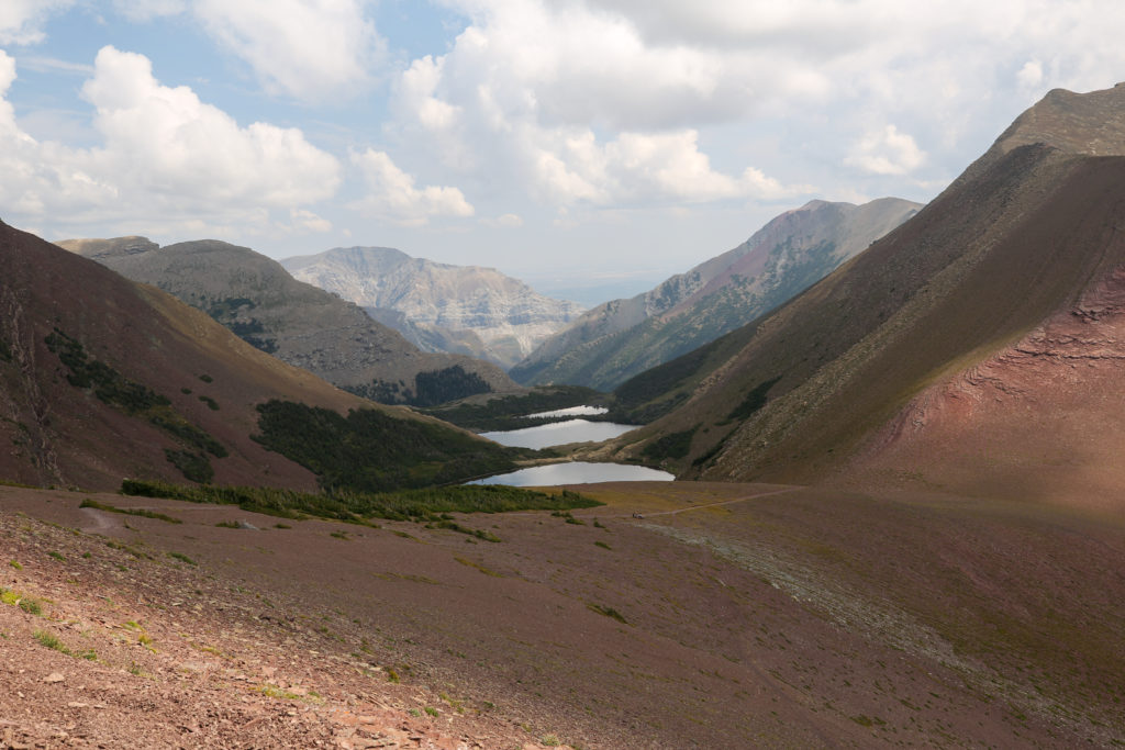
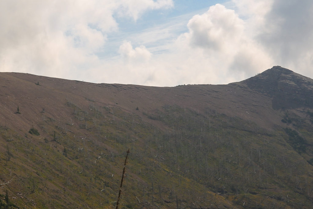
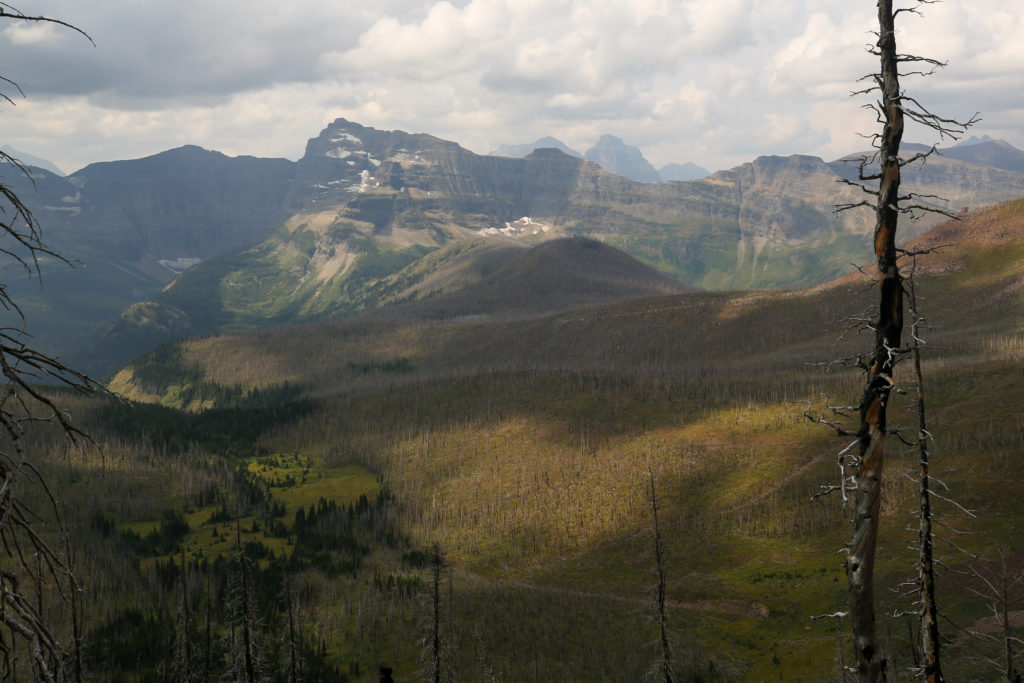
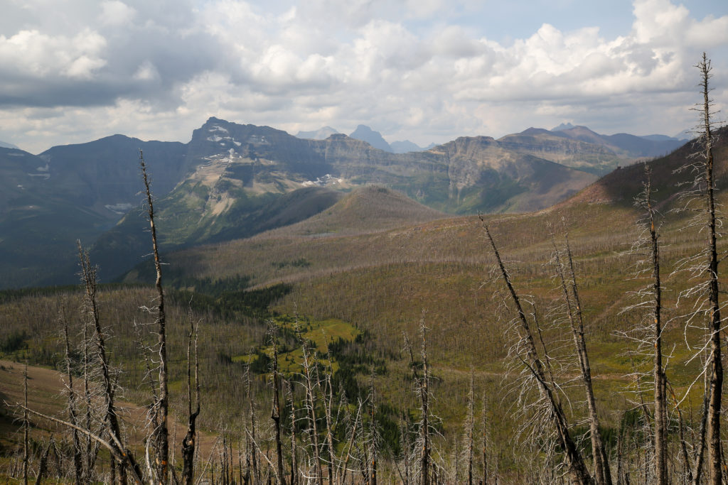
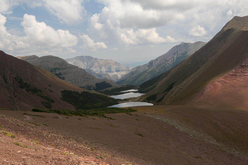
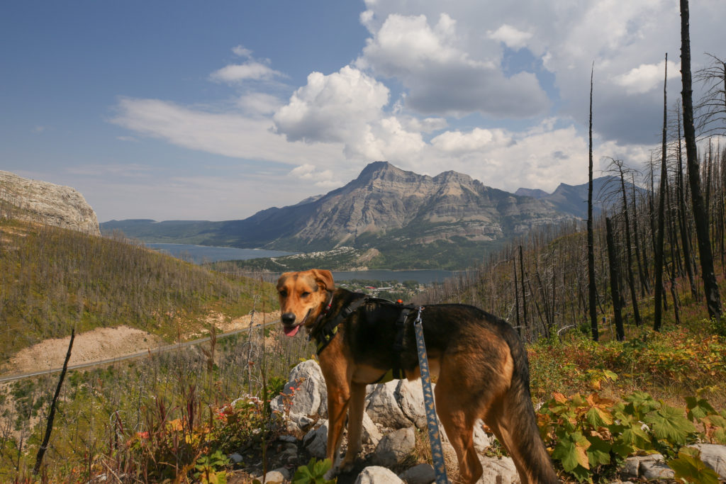
The view from Carthew Summit, the high point of the day, out to the prairies beyond Waterton NP where it was a little smokey.
August 6, 2023. Trailhead at Cameron Lake Day Use Area to Cameron Falls Trail Head Waterton Town site, 19.2 km, 771 m elevation gain, 1138 m elevation loss, 6 hrs 57 min.
I would like to acknowledge that this hike past through the ancestral and traditional territories of Indigenous Peoples. The Blackfoot Confederacy, Tsuut’ina, Stoney (Ĩyãħé) Nakoda, Cree, Ktunaxa, Cayuse, Umatilla and Walla Walla who have called the Rocky Mountains home since time immemorial. I acknowledge the many Indigenous Peoples in Canada whose footsteps have marked these lands for generations and I am grateful to be a visitor in these lands.
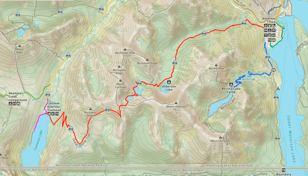
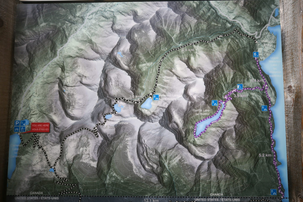
The three main hikes we did in Waterton. Carthew Alderson in red, Bertha Lake in blue and at the top right in grey Bears Hump.
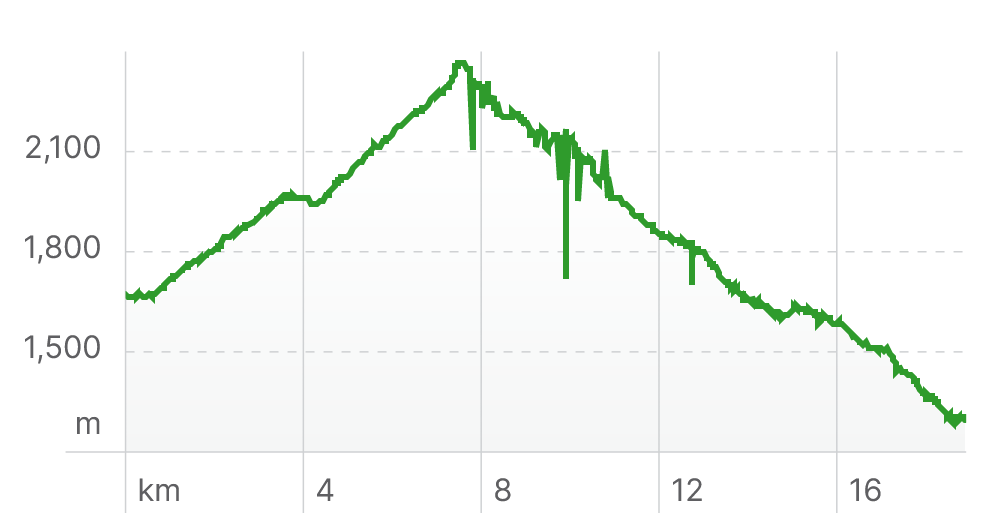
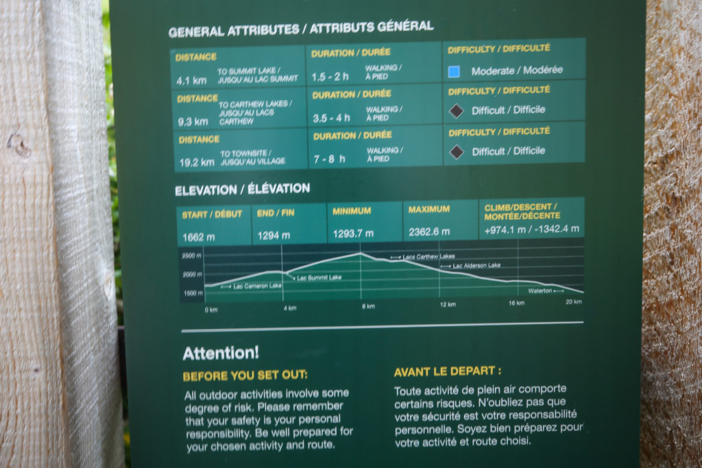
Elevation Profile. Not sure what the spikes are. There was not a lot of flat hiking. The little dip at 4 km is Summit Lake. While the elevation profile looks quite steep the trail had a very nice grade to it.
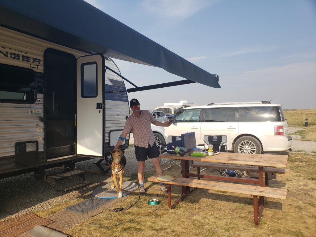
While I do not post a lot of day hikes this hike was one of our top backcountry experiences of the summer and I felt it needed to be shared. We were visiting Waterton NP for the first time and did a couple of day hikes and couple days just visiting road side pull offs and short walks. We camped in our trailer, named Thor, in a nice if somewhat utilitarian private campground just 10 minutes from Waterton NP.
So there were not a lot of trees in the campground. When talking real estate it is always location, location, location and this campground was just 10 minutes from Waterton NP.
Planning for the trip could have been better. I was still researching hikes just day before we headed out. Waterton NP is a very small park with a limited number of hikes. After scouring the internet I found a few hikes and chose Bertha Lake as a shorter half day hike as a warm up and the Carthew Alderson hike as the big hike for the weekend. Bertha Lake was a very pretty hike and well worth the time. I am very glad we set off somewhat early hitting the trail at 8:50 am as it allowed us to mostly miss the crowds. We only met one group on our way to the lake but I lost count of the number of groups we past on the return journey. Margaux was spectacular on the return journey. We past at least 12 dogs including two whose owners said they were not friendly and Margaux never had a negative reaction.
Margaux at Bertha Lake.
Panorama of Bertha Lake.
Spoiling Margaux after a great hike.
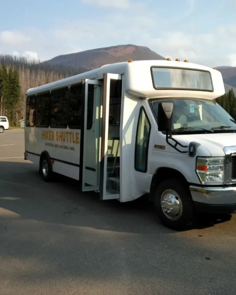
When trying to find information about hikes I came across a hike that was consistently received five star reviews the Carthew Alderson Trail. While the hike looked amazing a challenge that arose was that it was a point to point hike with one trailhead about 25 km from Waterton town site at Cameron Lake and the other trailhead in town at Cameron Falls. To complete the hike would require getting a shuttle to either the beginning or end of the hike. Luckily I came across a blog, “Hike Bike Travel” that listed the Cameron Express Hiker Shuttle offered by The Tamarak. As a bonus the shuttle was also listed as “pet friendly”. The Tamarak is a hiking/backpacking retail store operated by a family living and working in Waterton for six generations. The booking was quick and easy to do online. One issue we had was that the weather was threatening rain on the day we wanted to do the hike. I was keen to avoid any inclement weather as the Carthew Summit is exposed with nowhere to hide from the wind or the rain. I changed the booking three times to avoid the rain which in the end never did materialized. With the shuttle booked our next challenge was how would Margaux do on the shuttle.
The shuttle. It is not large and fills up quickly so book early.
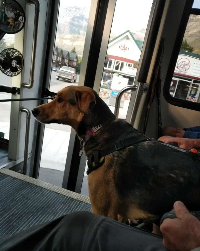
The Tamarak asks that you arrive before 8:15 am for an 8:30 am departure. We parked the car close to Cameron Falls so we would have less pavement pounding at the end of the hike. The shuttle was full and there were no other dogs on this trip. Since we were travelling with a dog we were asked to load last which gave us front row seats. While I had some trepidations prior to the shuttle ride Margaux slayed all my worries by being simply awesome..
We are on our way. Margaux looking apprehensive. Me holding holding on tight to Margaux’s leash.
At first we kept Margaux on a short lease close to us. As the ride progressed Margaux appeared to be completely at ease and just wanted to wander around the shuttle sniffing all the amazing smells that had accumulated on the floor. We got lots of questions about Margaux and everyone was amazed that she had ever been returned to the shelter as she was simply so good on the shuttle. One couple we talked to lived reasonably close to Waterton NP and did the Carthew Alderson as an annual hike. I took their repeated visits as validation we had chosen a worthy hike. We arrived at Cameron Lake just before 9 am and disembarked the shuttle after an extremely successful journey. After saying our goodbyes to all our fellow shuttle riders and giving one last thank you to our driver we headed off to check out Cameron Lake and before starting the hike.
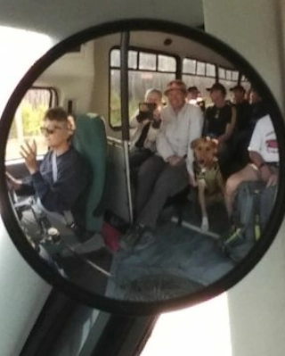
A photo Laura took with her phone into the mirror on the shuttle.
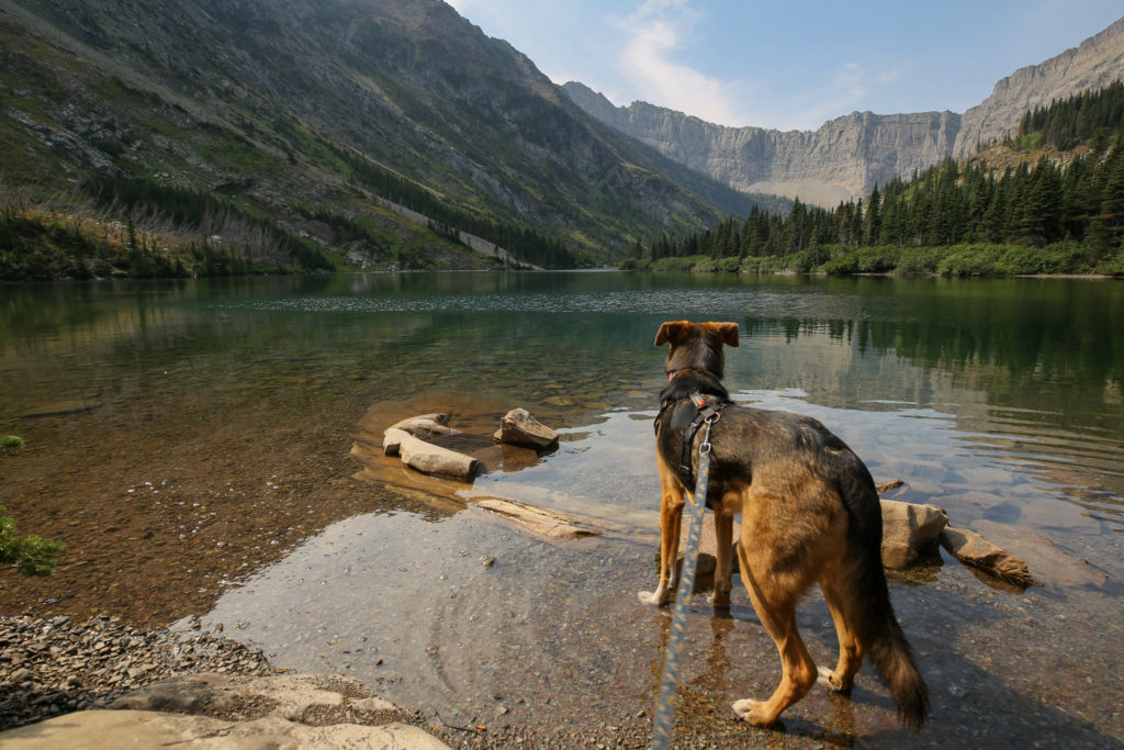
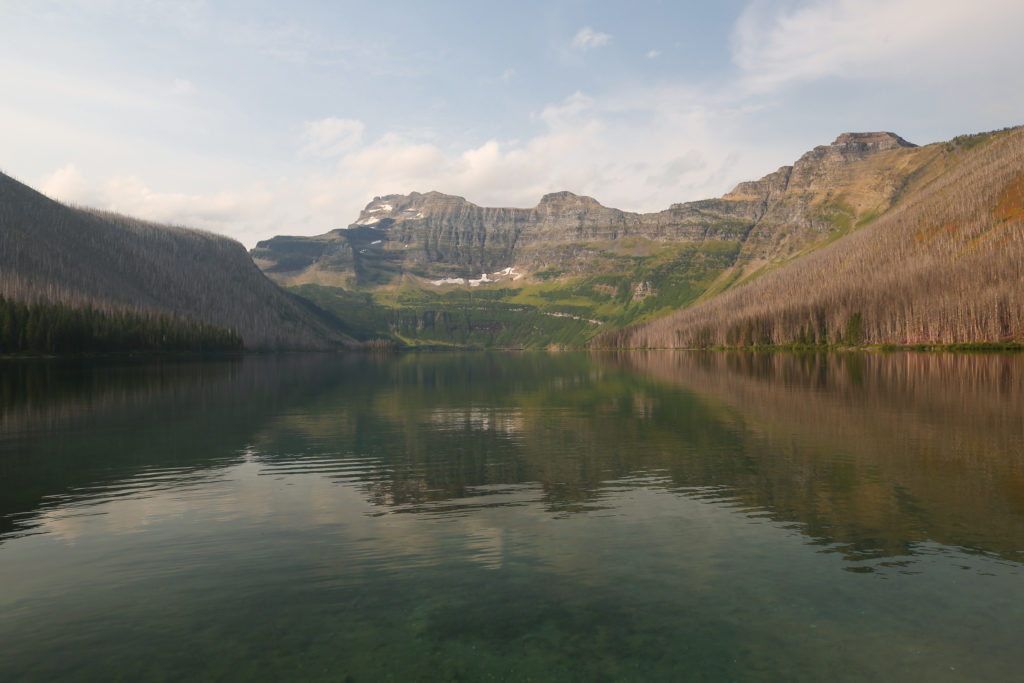
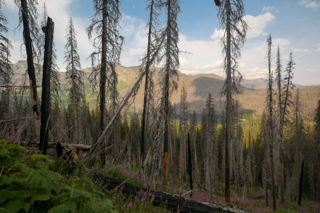
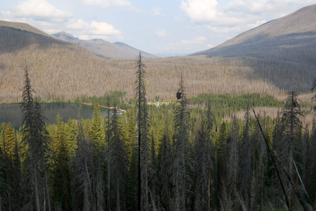
The obvious lasting effects of the 2017 Kenow Wildfire across Cameron Lake. Mt Custer (2707 m) in the background located in Glacier NP Montana, USA. The lone peak on the right is Forum Peak (2415 m).
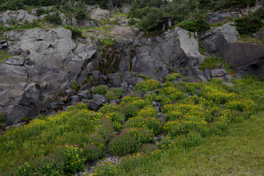
The first thing you notice walking to Cameron Lake is the lasting effects of fire. The 2017 Kenow Wildfire made national headlines and dramatically changed Waterton NP. Fire is a nature part of a forest ecosystem. Fire helps nature recycle and renew the land resulting in a healthy and thriving ecosystem. For humans the visual impact of fire can last a lifetime as the process of renewal in the alpine can be a steady but slow process. After only six years when looking out upon Cameron Lake it appeared as though the process of renewal had not yet begun. The brown dead trees killed by the fire came all the way to the edge of the lake. It was amazing that the firefighters had been able to save the area immediately surround the day use areas. The contrast between the brown dead trees and living green was stunning and sobering.
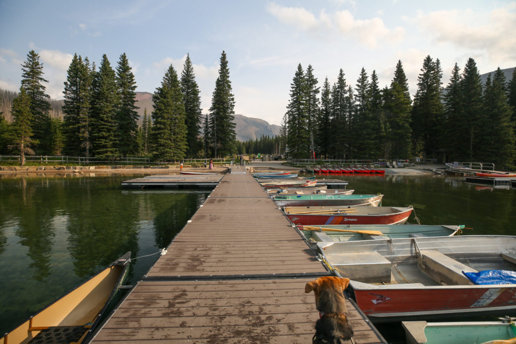
This is a floating dock. Margaux was not super happy about it and was happy to get back to solid ground as quickly as she could.
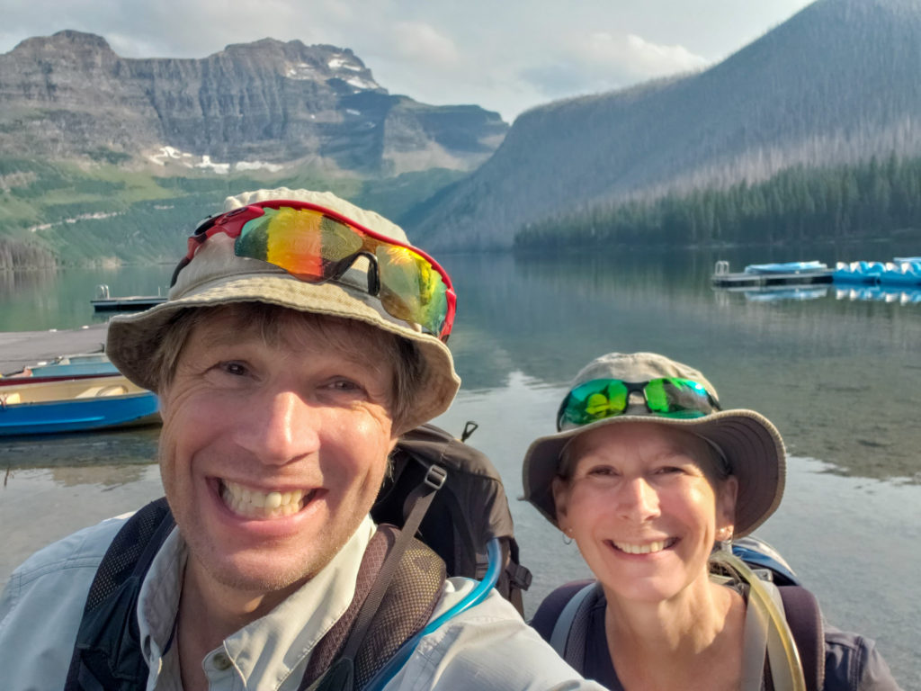
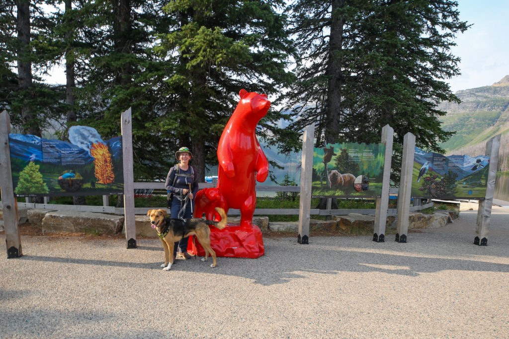
Quick selfie before departing Cameron Lake.
Hoping this is the only bear we see.
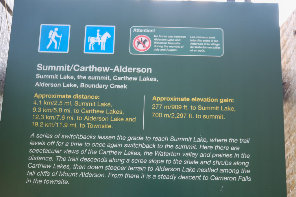
Some useful information boards at lakeside.
Our hike. Up followed by down.
Our hike in black. We would stay to the left at Summit Lake.
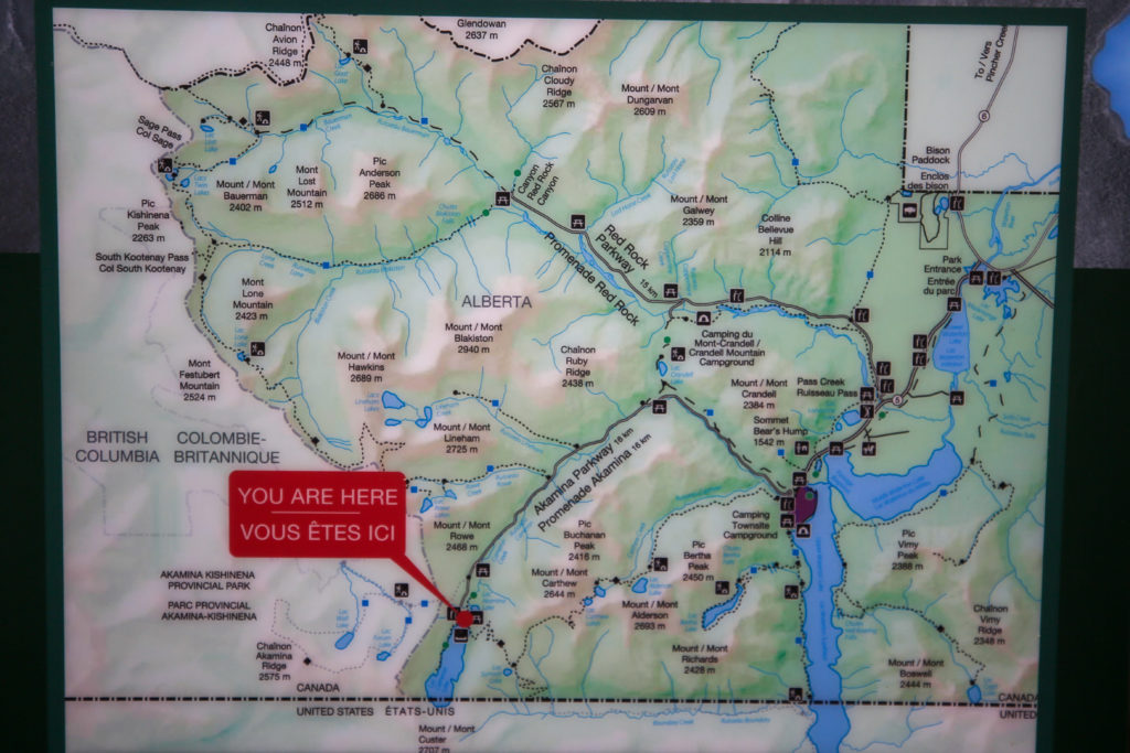
Just in case we were lost we now know where we are.
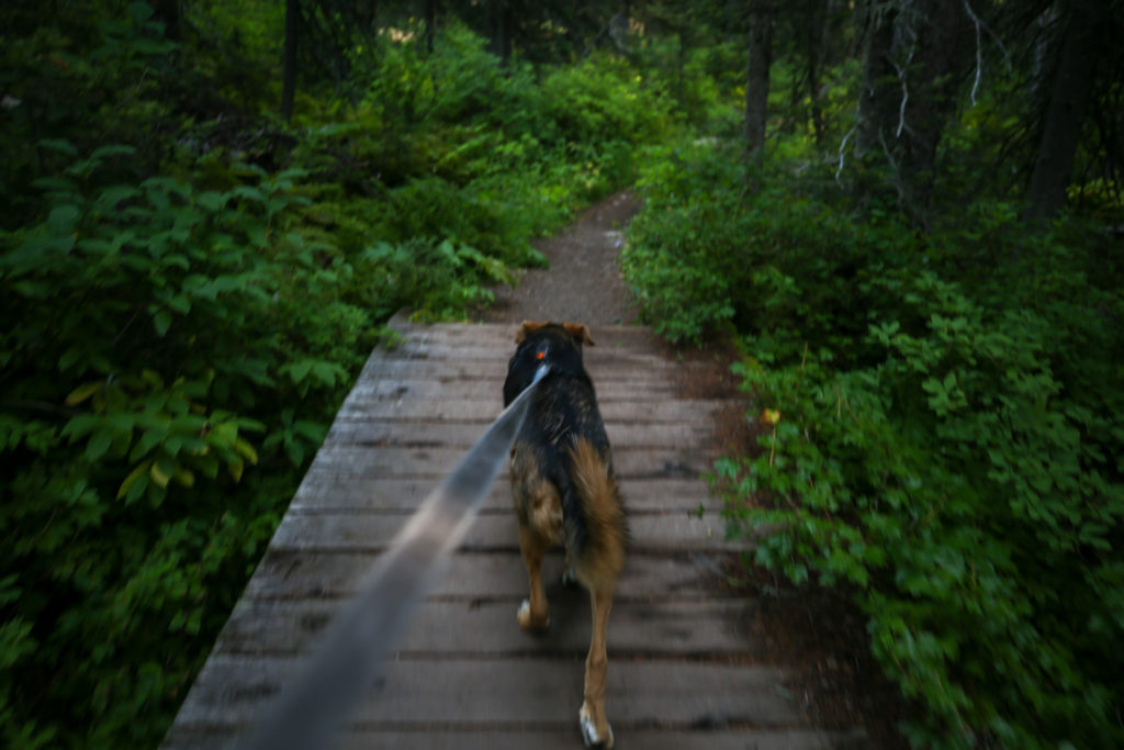
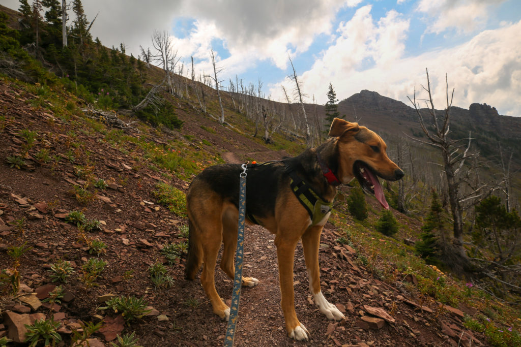
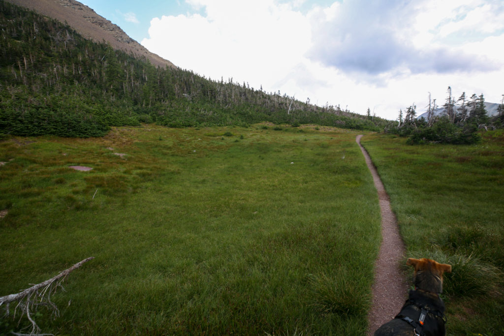
9:07 am and Margaux is off down the trail.
Of the group that was on the shuttle we were the last ones onto the trail. We did catch one couple early on but did not see anyone from the shuttle for the rest of the day. There were some people having lunch at Carthew Summit but they were not from the shuttle.
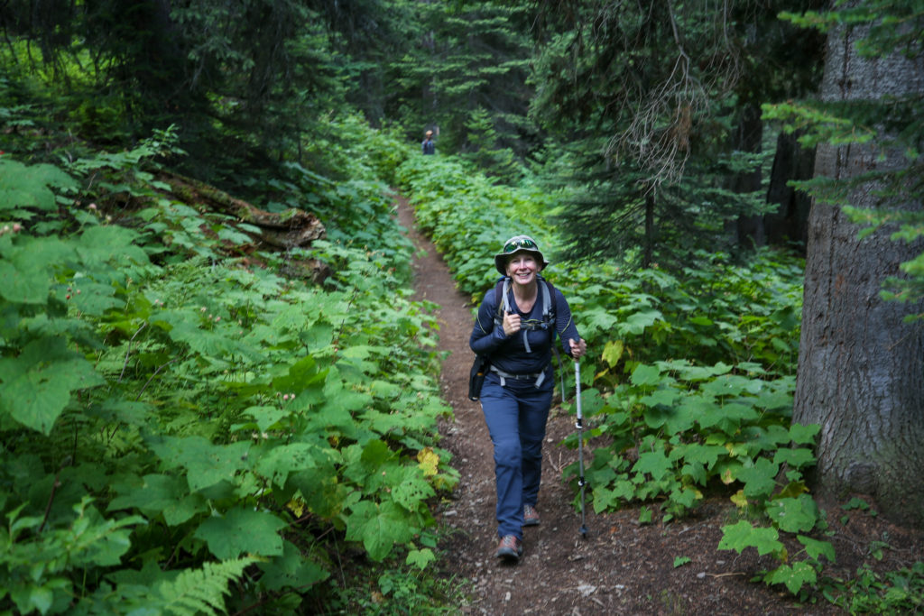
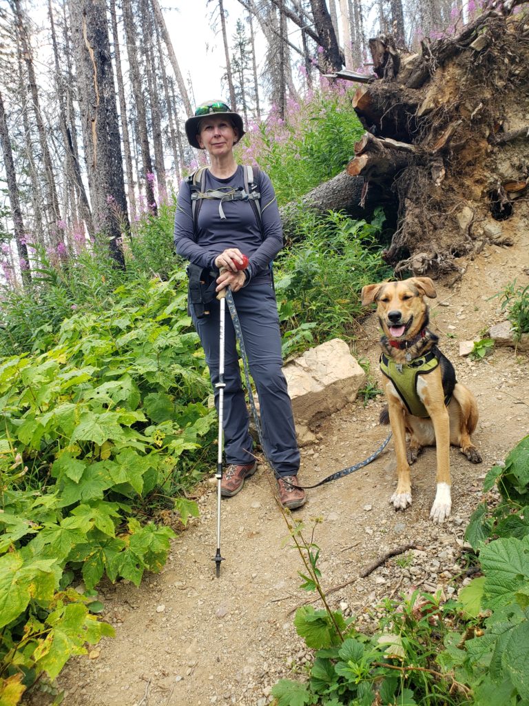
Happy Hiker Laura. So green and lush on the lower slopes.
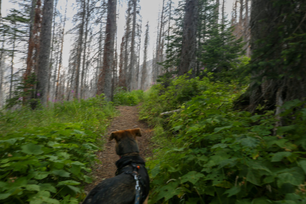
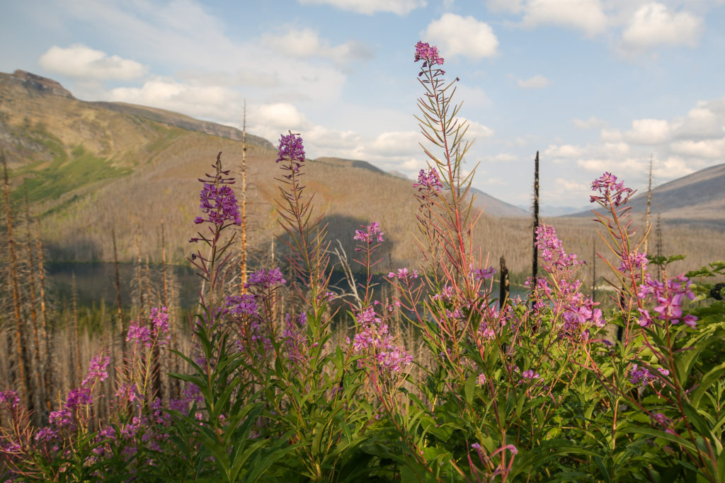
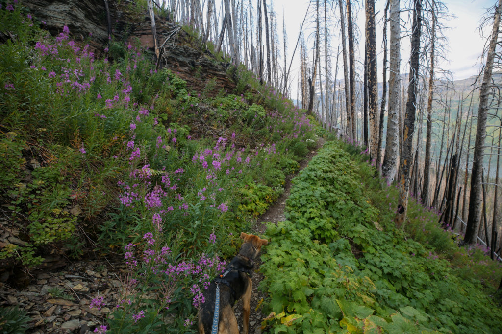
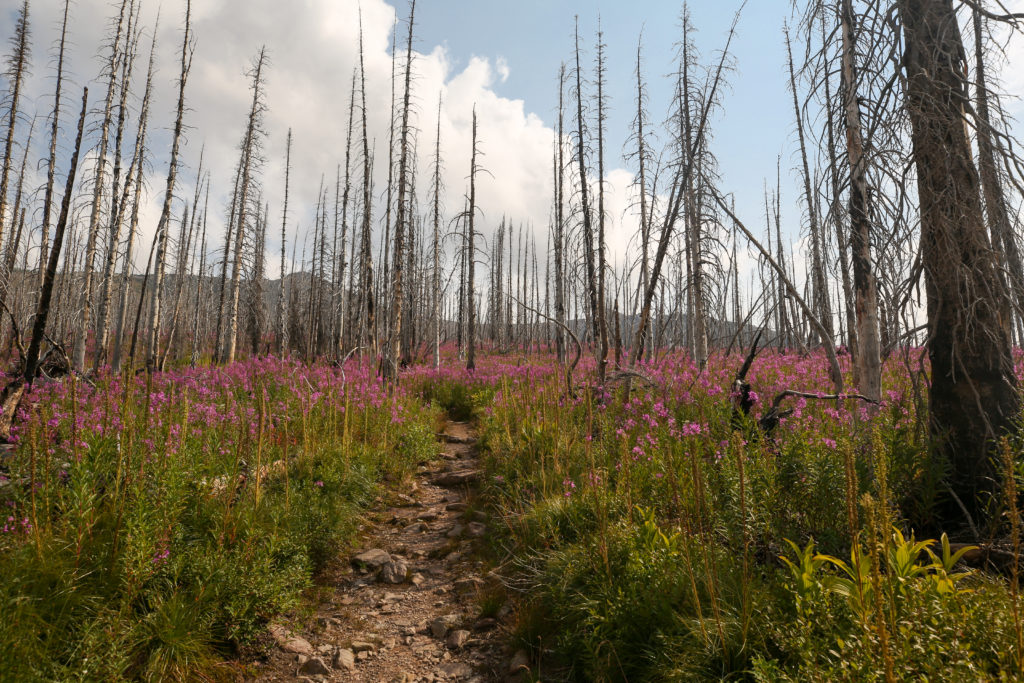
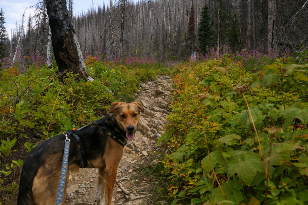
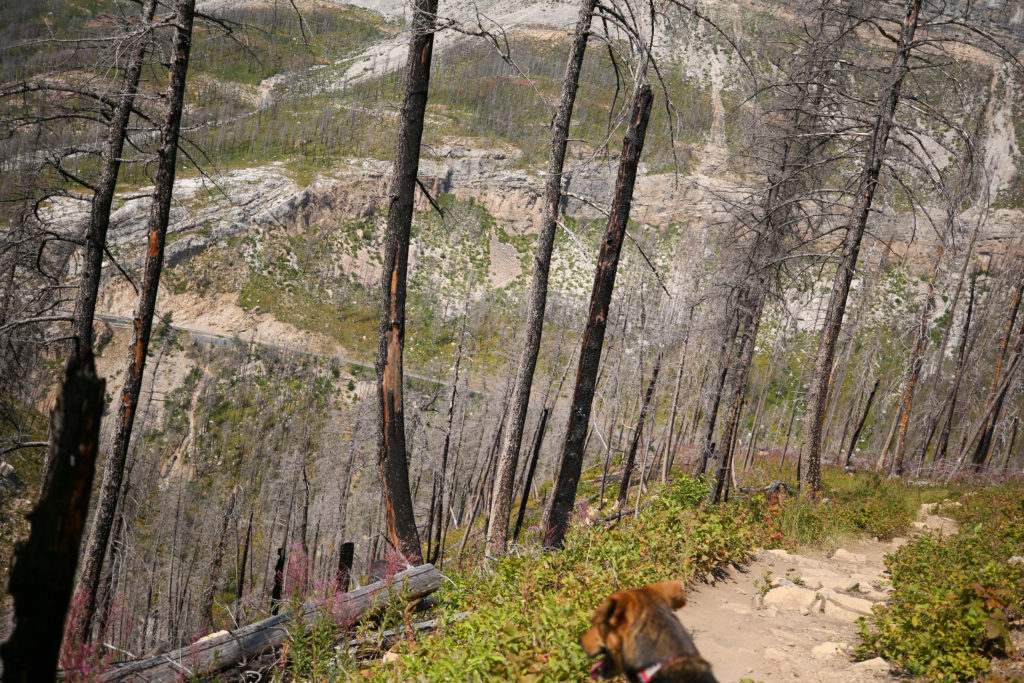
Margaux looking ahead to a burned section. Telltale signs of dead trees and pink fireweed.
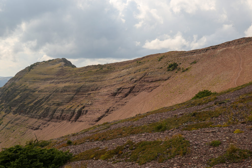
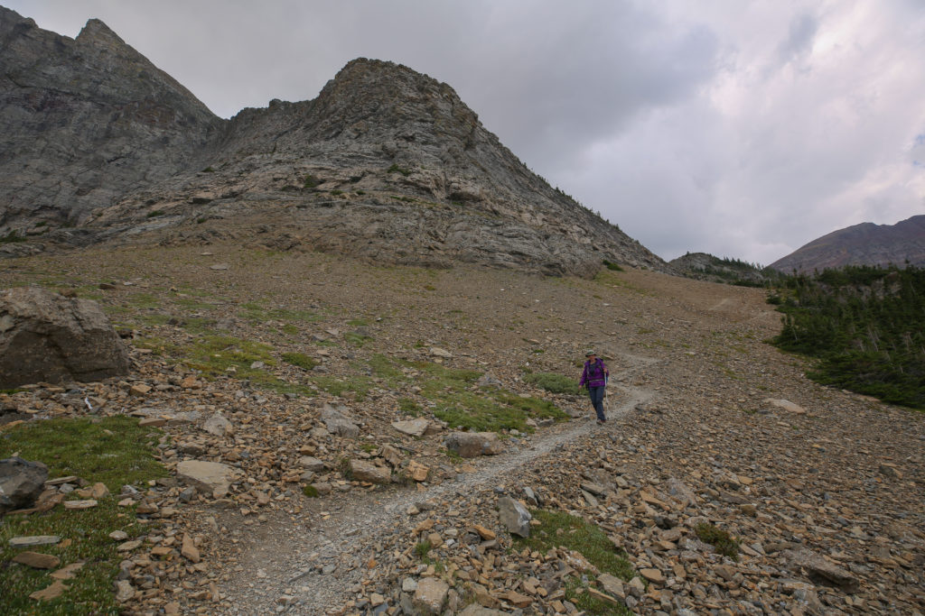
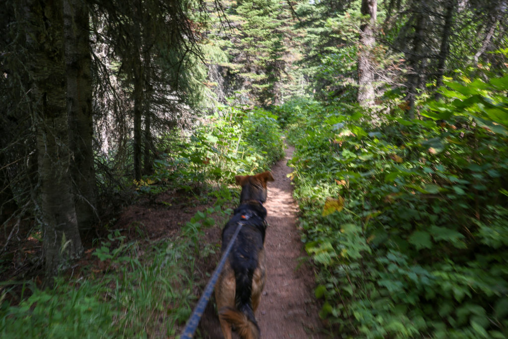
The first section of the hike switchbacks up nicely graded trail on the lower slopes of Buchanan Ridge. The trail is very lush and heavily vegetated except for just a few small areas that were burned. Climbing a west facing slope had the added benefit of keeping us in the shade on what was to be a hot day on trail.
Fireweed growing in the shadows of burnt tees. The extent of the fire can be see in the hills beyond Cameron Lake.
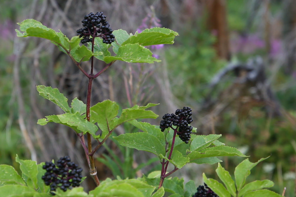
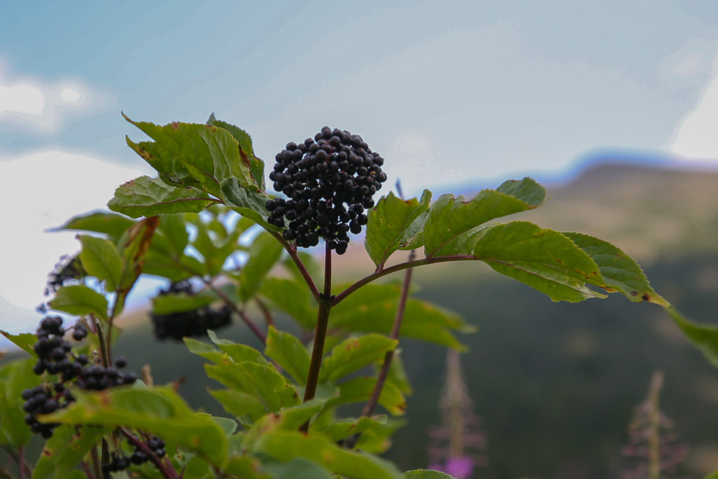
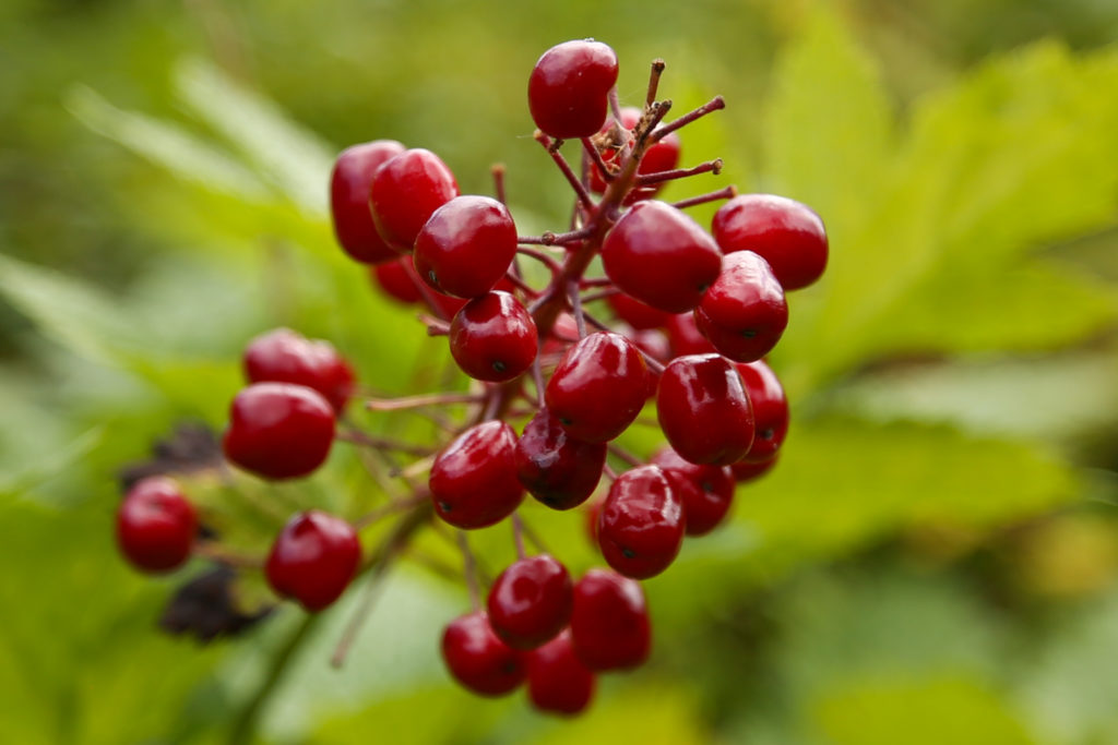
Elderberry (sambucus).
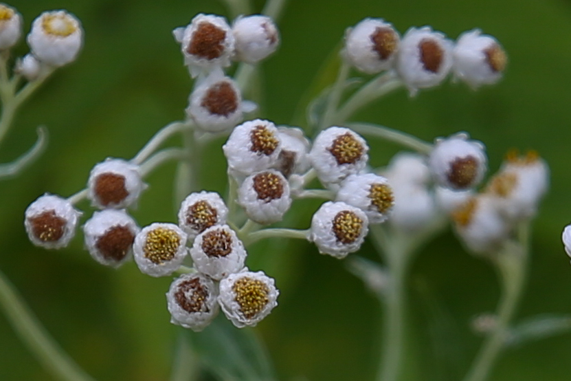
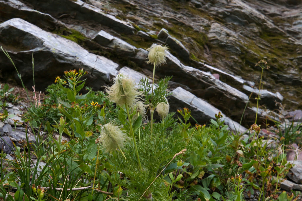
Pearly Everlasting (Anaphalis margaritacea).
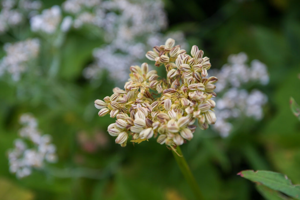
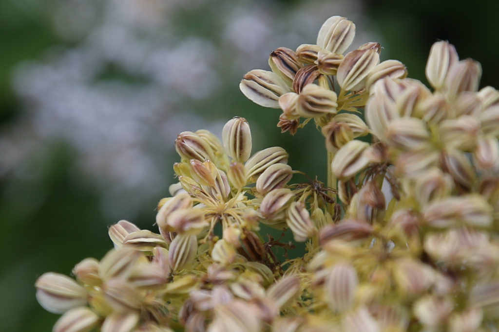
A Lyall’s Angelica (Angelica Arguta) having gone to seed.
Close up of the seeds of the Lyall’s Angelica.
A view of the docks jutting out into Cameron Lake. The effects of the fire can be seen extending off into the distance.
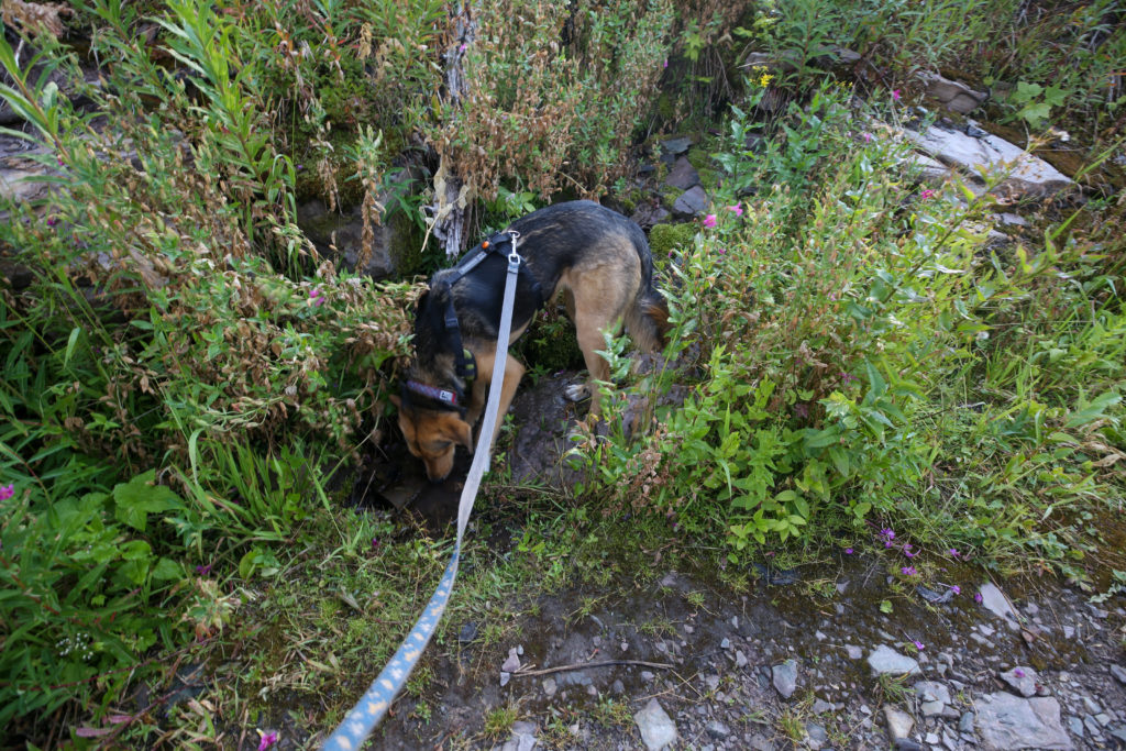
I was carrying water for Margaux but there were plenty of water sources along this section of the trail.
There was plenty of water on the initial section of trail for Margaux to drink from. Dog owners should be aware that the trail is dry from Summit Lake to Upper Carthew Lake and very exposed to the sun due to a lack of trees to provide shade all along this section of the hike.
The colour of the fireweed contrasting with the brown of the burn.
Margaux checking on where we are going as we traverse a burn section.
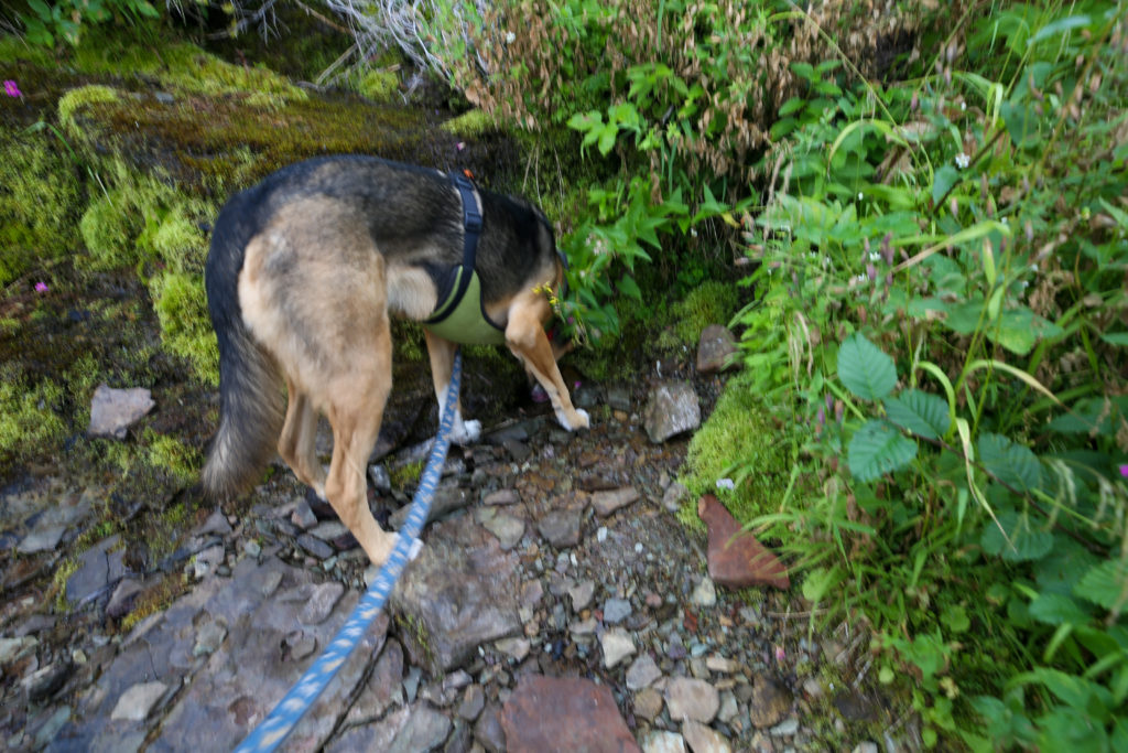
Margaux rehydrating in one of the many little trickles of water that flow across the trail.
Just after 4 km from the trailhead the trail levels off for the final approach to Summit Lake.
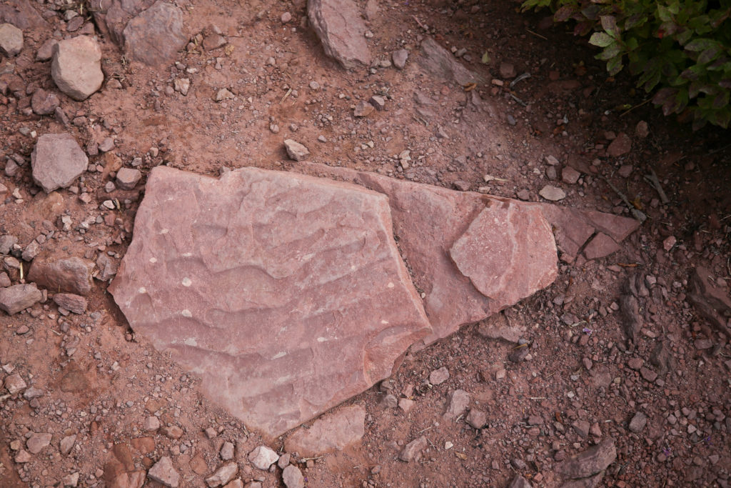
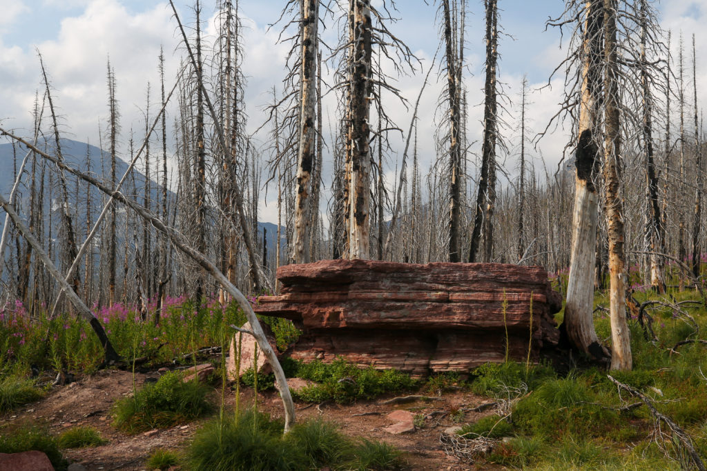
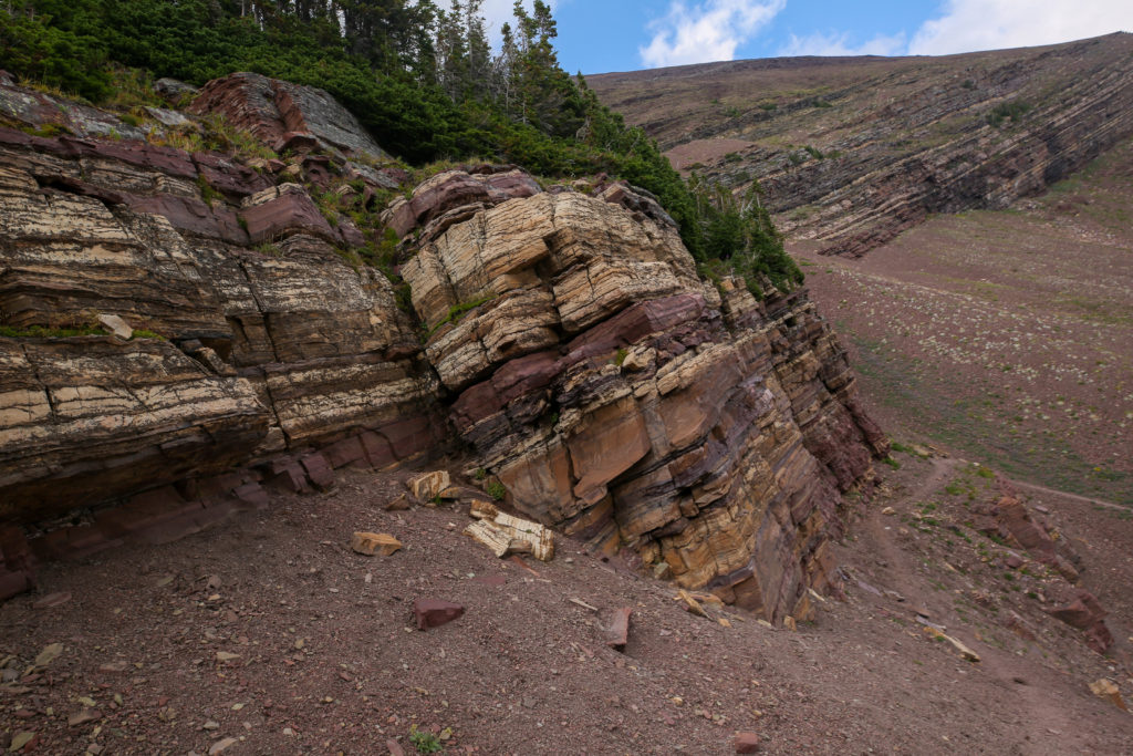
Confession, I am a rock nerd. This is sandstone and the red wavy marks in the rock are ripple marks where made by waves rolling over the shallows on a sandy beach hundreds of millions of years ago.
The trail flattens out temporarily as we approach Summit Lake.
Loved this rock. Looked like a great place for a break.
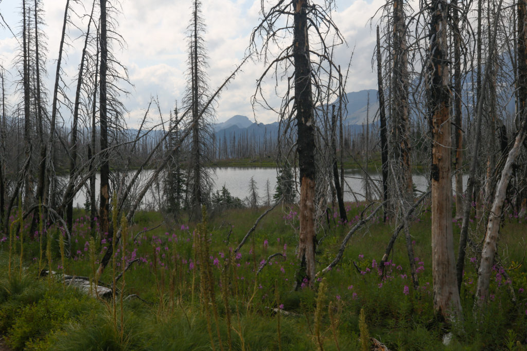
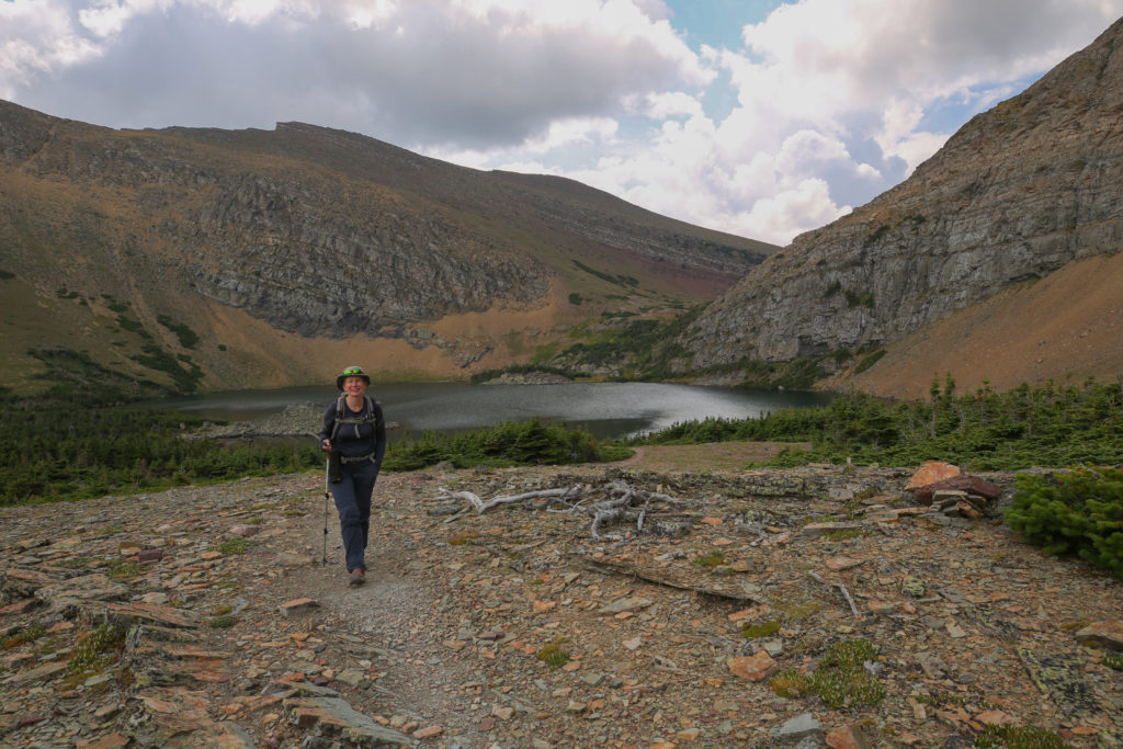
First view of Summit Lake.
We arrived at Summit Lake at 10:30 am. We had covered the uphill 4 km in just under an hour and half gaining 300 m of elevation. It was too early to stop for lunch and we had been snacking on the trail so we did not linger at Summit Lake. Margaux had quick splash in the lake followed by a drink and then we were off down the trail.
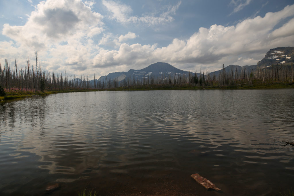
Summit Lake. Peak in the distance is Chapman Peak (2841 m)
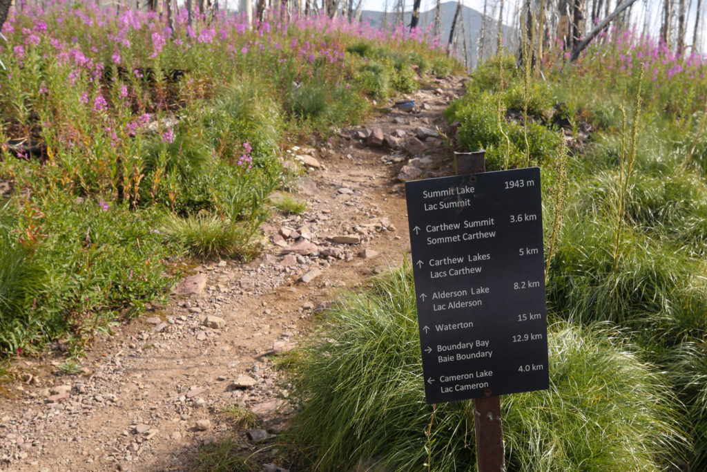
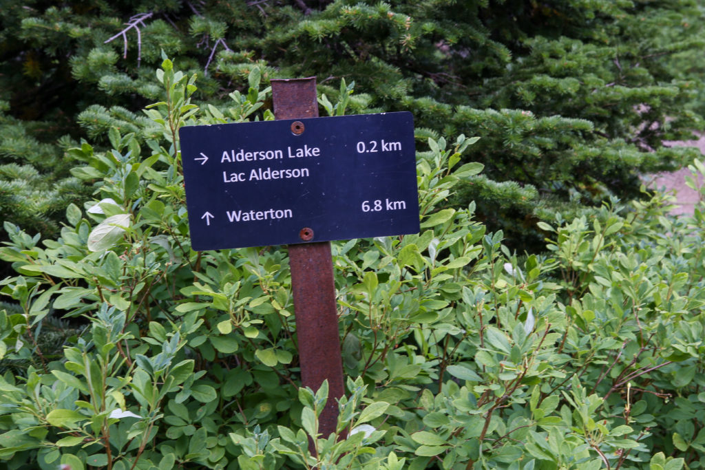
Not your typical Parks Canada backcountry sign. Summit lake is at roughly one quarter distance for the day but is at just under half the trail’s elevation.
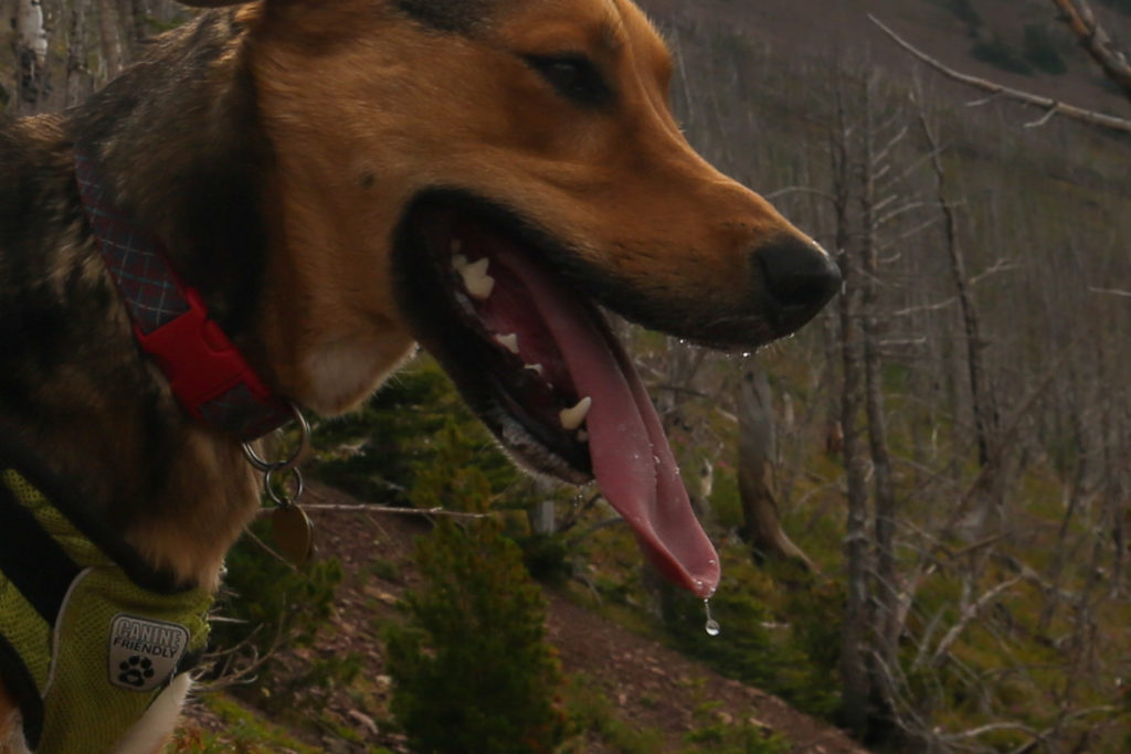
With the temperature rising I was a little eager to Carthew Summit to get the elevation behind us before the heat really hit us. I was not concerned so much about Laura and I but my concern was for Margaux. Margaux is a very slobbery hiker and I am constantly worried about her overheating or getting dehydrated. So far on this trip she had access to plenty of water but there was no shade to be seen until we got over Carthew Summit to help Margaux cool off.
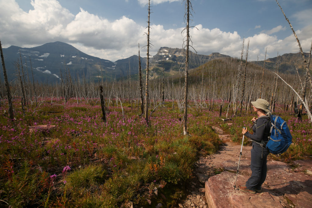
The views are great but not much shade.
Laura taking the time to take in the views.
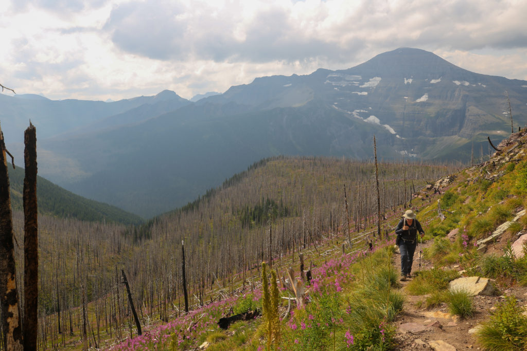
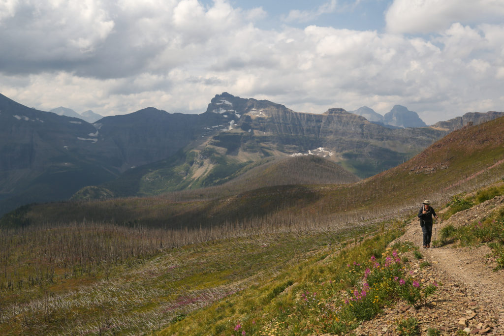
The trail goes up over a small ridge which then provided us with unobstructed views to Carthew Summit. We have about 3 km of hiking to the summit.
Cutting beside a nice rock outcrop. The geologist in me was quite excited.
Steadily gaining elevation. The haze in the air is smoke. We did not notice the smoke while hiking but it does not make for crisp photos.
There is a pretty big cloud over the summit but the skies are nice and blue.
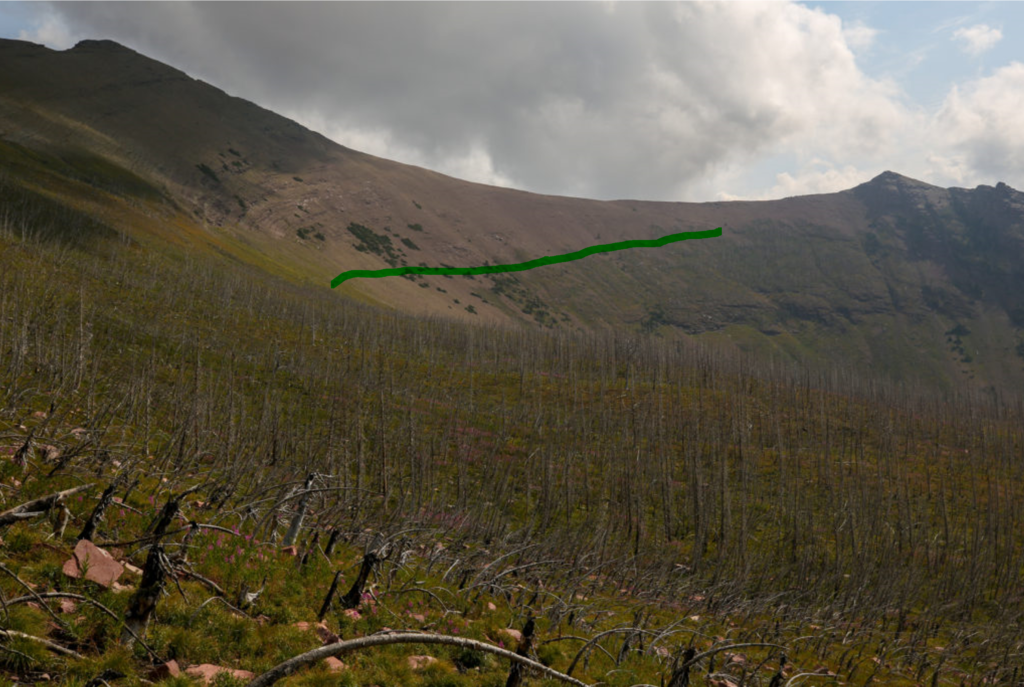
Trail highlighted in green. There are a couple little switchbacks as you approach the top.
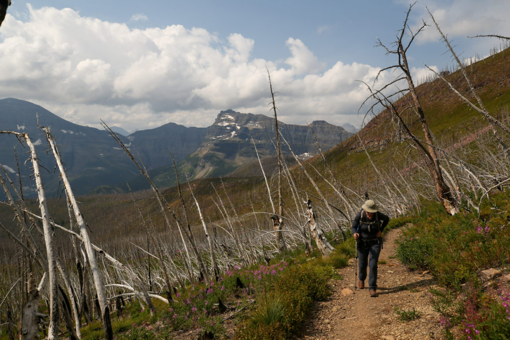
Laura head down focusing on the trail.
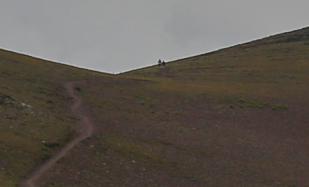
If you look closely at the photo you can see the trail. A small figure is going over the summit.
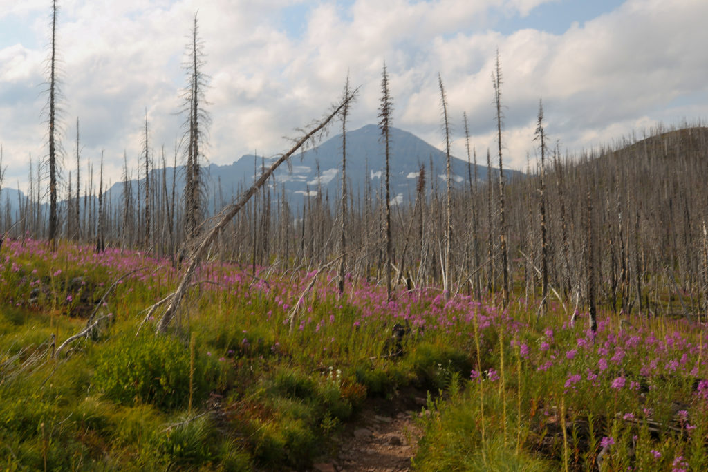
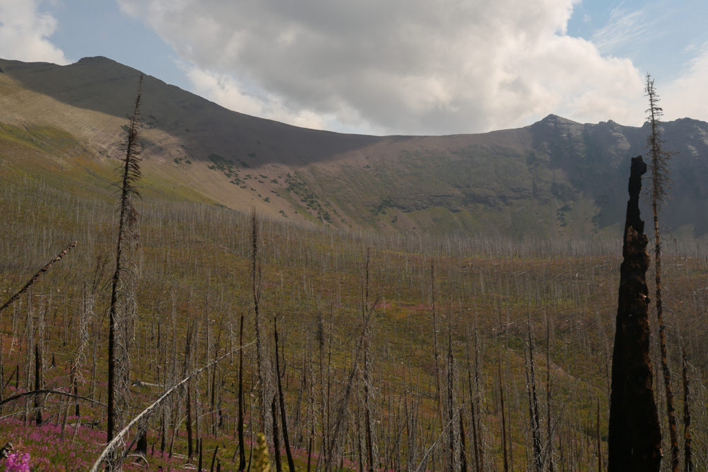
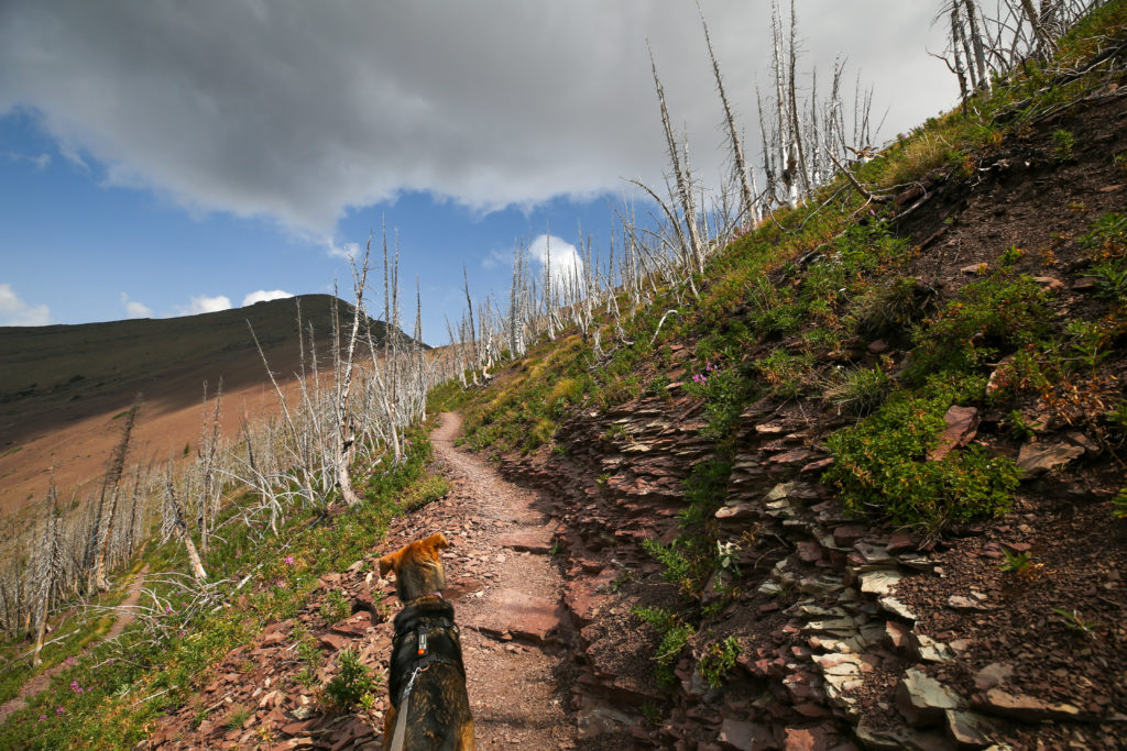
Stunning backdrop as we leave the burn and ascend up treeline.
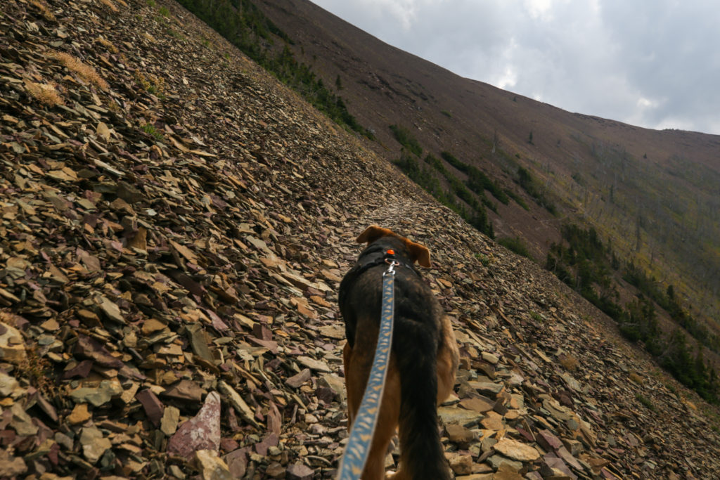
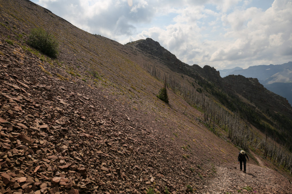
Crossing a scree slope we begin a somewhat steep side slope.
Looking back to Laura as she crosses the scree slope. This was not Laura’s favourite section of trail.
The trail passes through a small patch of grass and dead trees giving a firmer footing underneath.
Such a super star.
Slobbery gurl.
Looking back. The large mountain at centre is Mt Custer which forms the backdrop to Cameron Lake where we started just a two and half hours ago.
The summit is in sight, Margaux can see it.
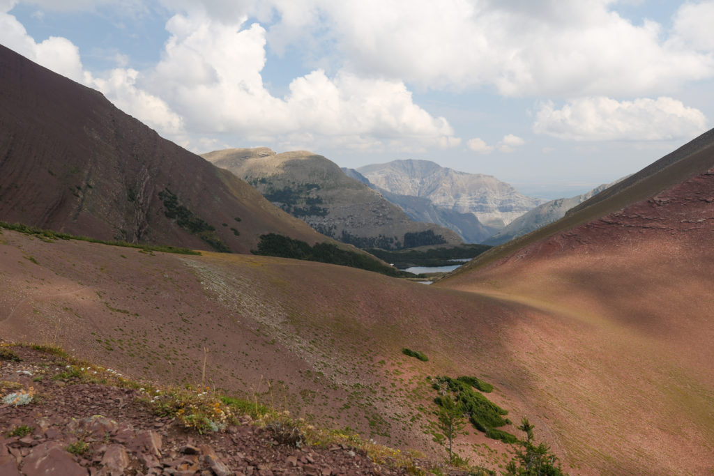
Little patch of green survived in the valley bottom, wonder why it fended off the fire. The tall peak left of centre with the snow is Mt Custer which forms the bowl for Cameron Lake where we started. We came up from Cameron Lake over the low point on the ridge on the right of the photo. You can just make out Summit Lake in a depression among the burn at centre. The two hazy peaks to the right of Mt Custer are Kintla Peak (3079 m) and Kinnerly Peak (3032 m). The peaks in the photo make up the Livingston Range.
This section was a little steep and the scree was loose underfoot making uphill progress slow.
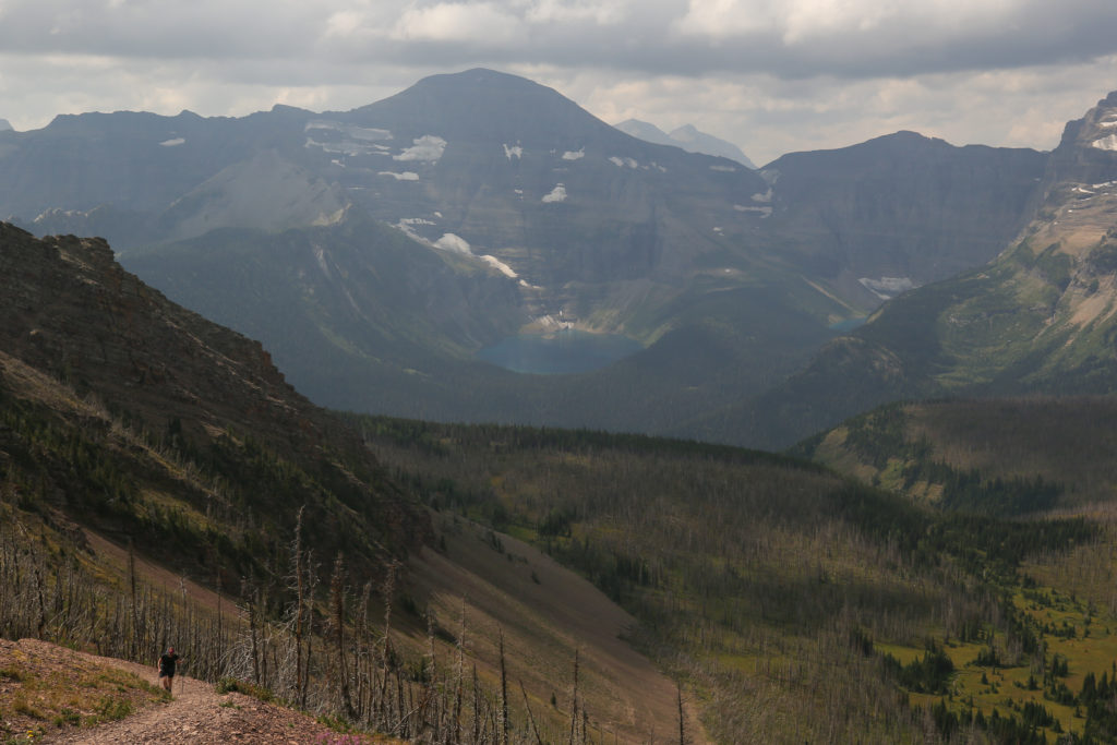
Looking out across the valley Chapman Peak (2847 m) with its tarn Lake Wurdeman nestled in the cirque at its base. Just coming into view on the right is Lake Nooney another tarn.
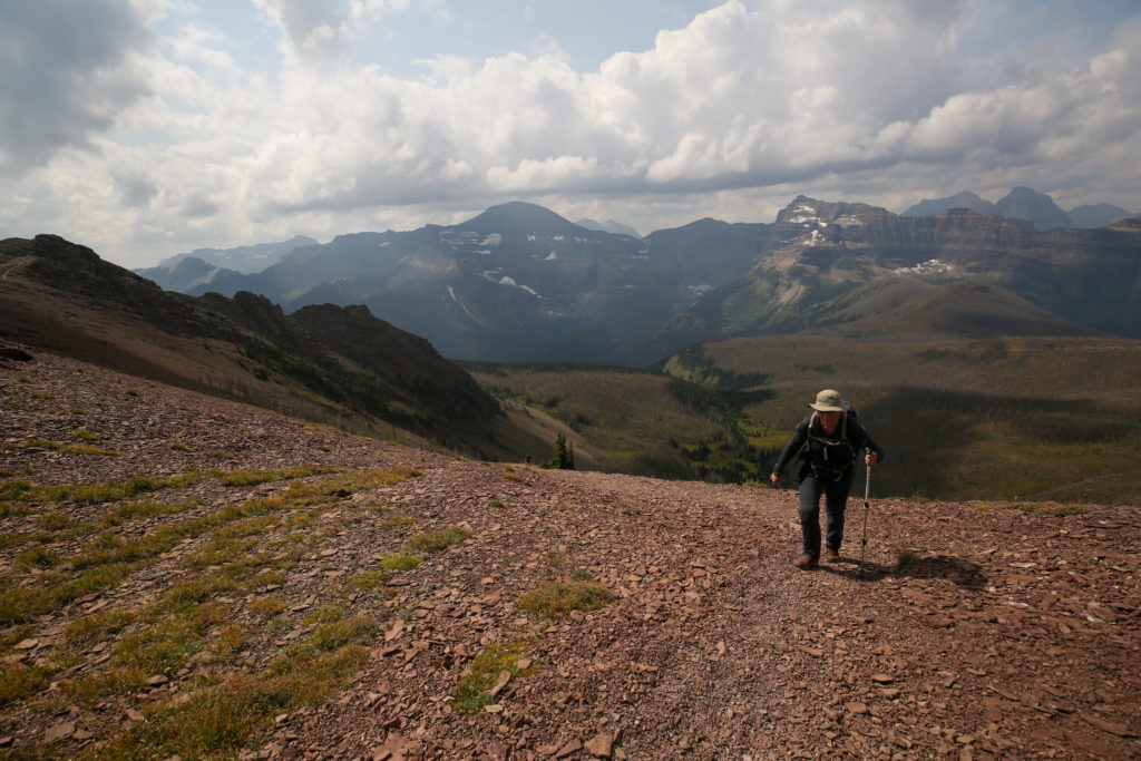
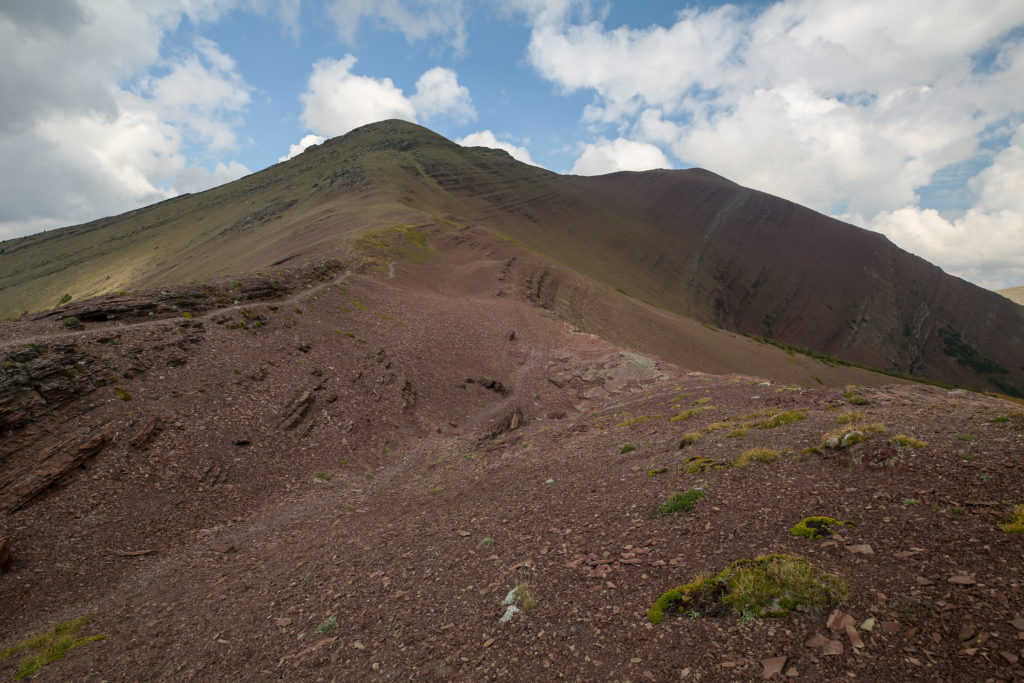
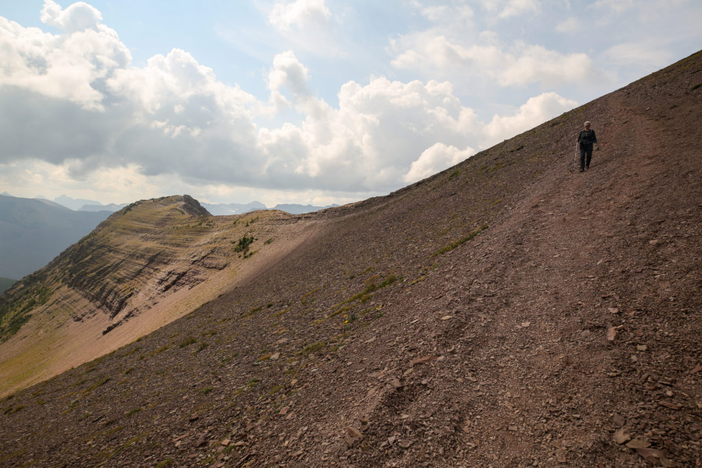
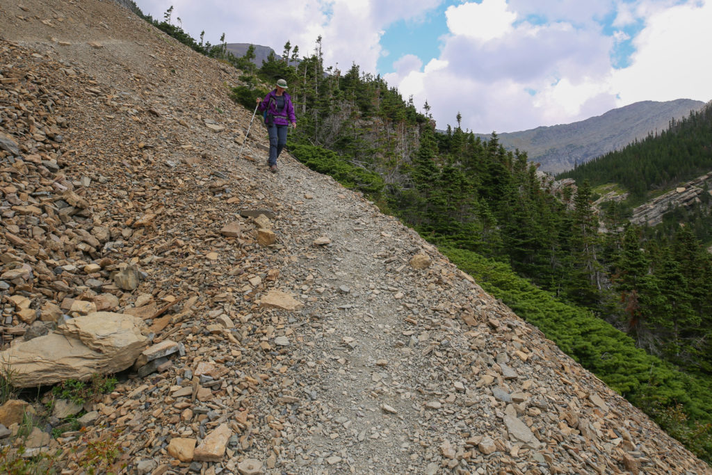
The last bit of climbing to the Carthew Summit was on soft scree. The scree made for hard work which took some of the fun out of the summit approach. A firming trail on the approach to the summit allowed for the thrill of reaching the day’s high point to to build to an appropriate crescendo.
The trail firming up and flattening out has Laura pushing for the top.
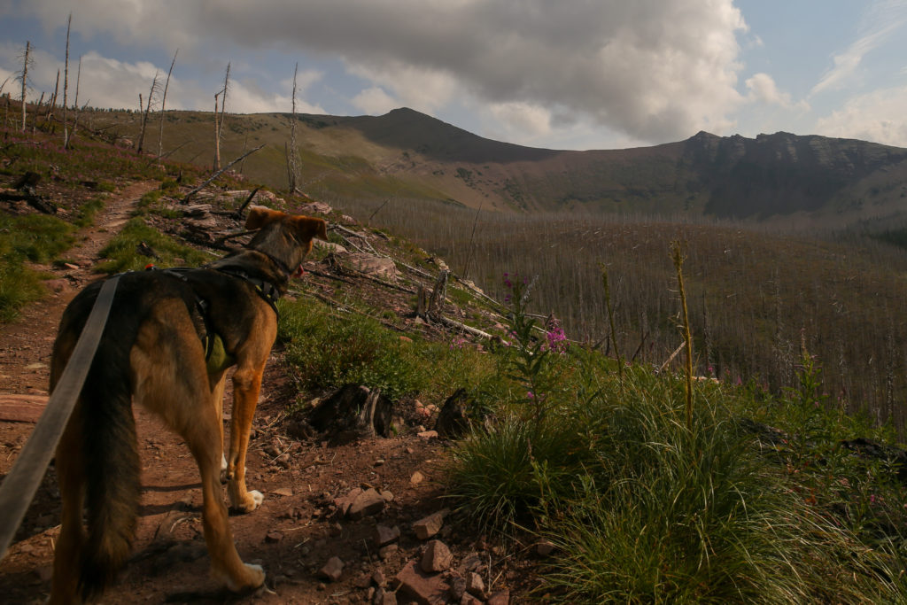
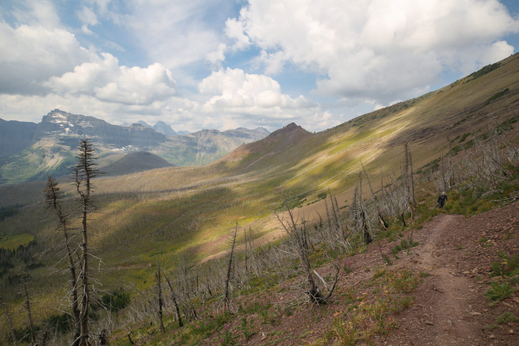
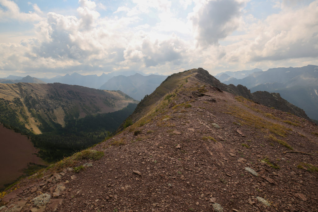
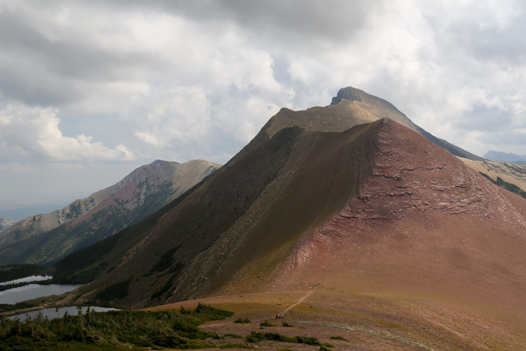
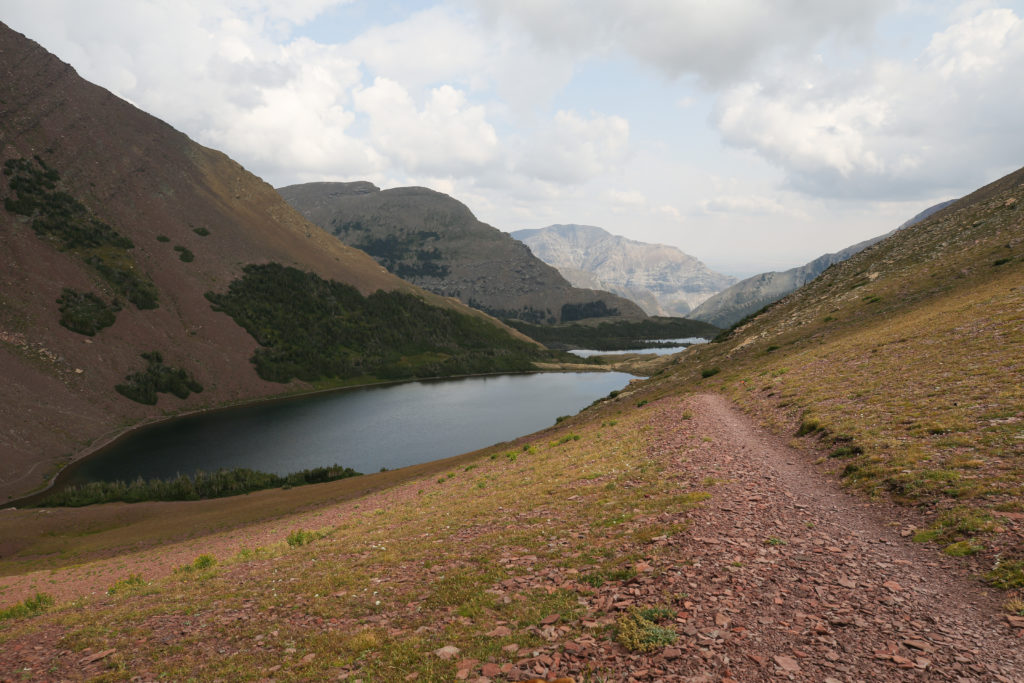
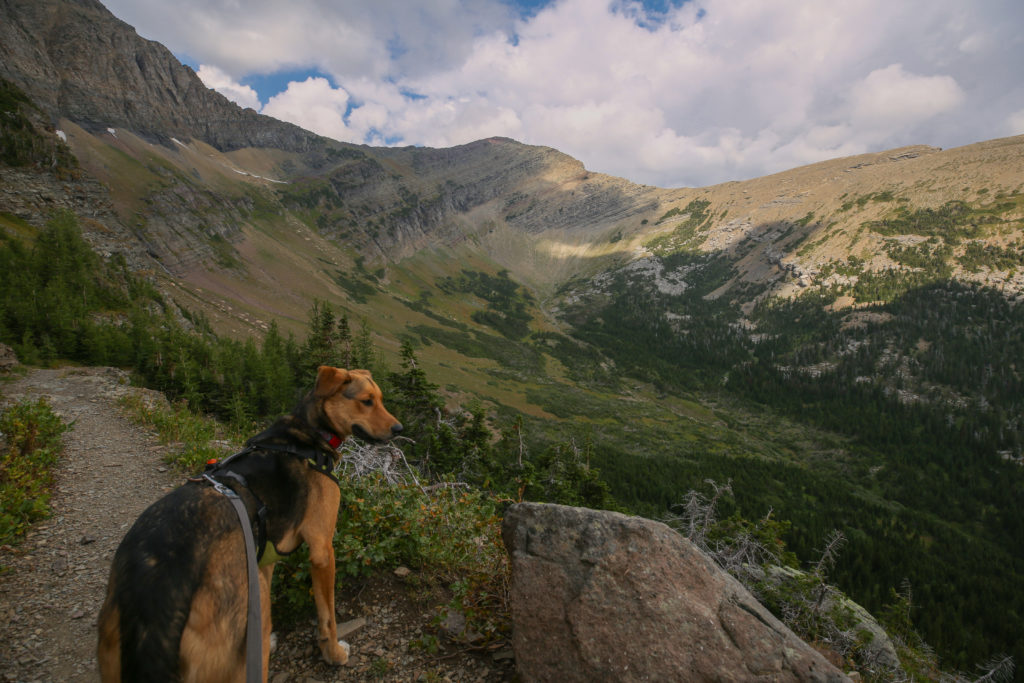
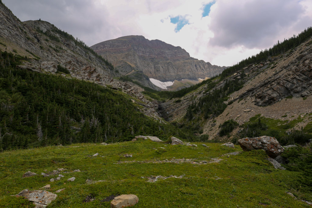
Our first peak over the other side. The valley where we will spend the rest of the afternoon. We can just make out the three Carthew Lakes with a shady Buchanan Ridge (2564 m) nestled in behind and Mt Crandell (2381 m) sunlit in the distance.
Looking south to a minor summit. Glacier NP and the peaks of Montana stretching into the distance.
Looking north to a minor peak of Mount Carthew. There is a trail all the way to the peak but we will follow the trail up to the ridge that will then take us down to the right off the saddle that forms the Carthew Summit.
It was just before noon when we reached Carthew Summit. Carthew Summit is not a summit at all. It is really the low point on a saddle connecting some minor peaks. It had taken us just under 3 hrs to hike 7.5 km and gain 732 m. The weather was a little unsettled at the summit with lots of thick clouds so we had a quick snack and pushed on with the plan of having lunch down the trail. Moving on also meant that we did not explore either of the minor summits that straddle Carthew Summit. It would be worth the trip to come back and do a little exploring.
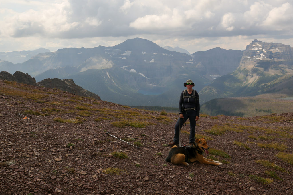
Laura and Margaux enjoying some time on the summit.
We will be following this valley for the next several hours. The trail heads over to the right along the ridge but then cuts back to the left and passes by all three lakes on the left. There is a group of three people having lunch on the ridge.
Laura beginning the descent off the summit. The soft scree did make scree skiing possible which made the initial descent easier on the knees.
View of Mount Alderson (2962 m). Small people having lunch on the trail.
The group having lunch on the trail were planning on scrambling all the way to the summit of Mount Alderson. I thought it looked like a fun trip but it was already passed noon and they had to get back down and back down the trail to Waterton. We wished them luck and headed down the trail
Looks like Margaux is eyeing up the group on the trail as a snack.
The trail we took down off the summit on the right. Can see some tiny people standing on the summit.
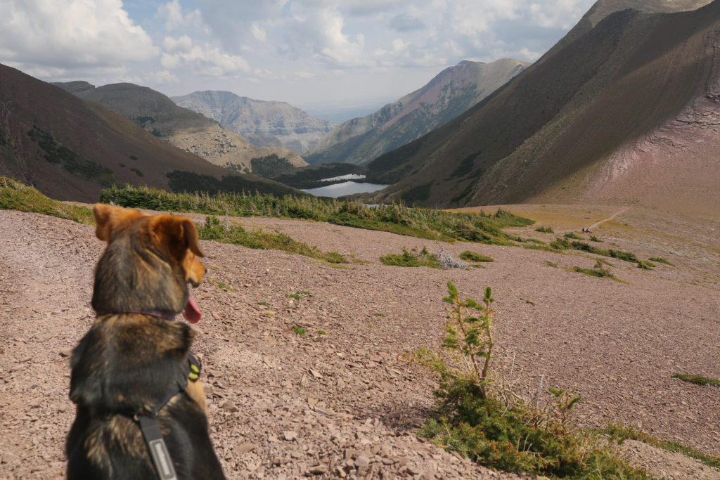
Different view of the Carthew Lakes. Once over the little rise in front of us the trail will hang a quick left and head over to the far side of the lake.
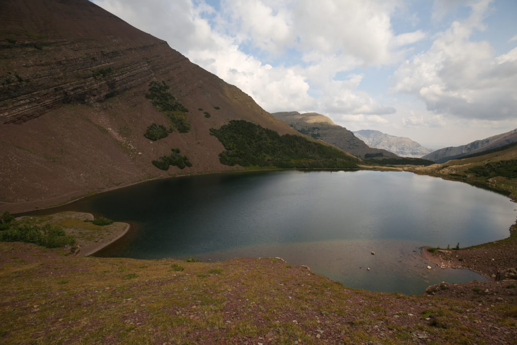
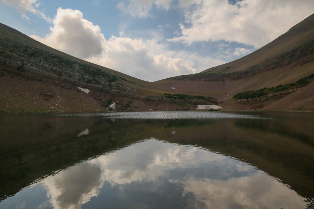
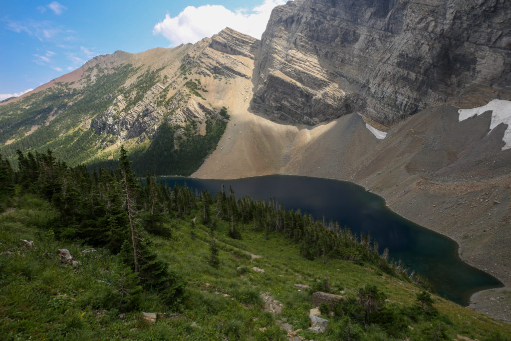
Panorama of Upper Carthew Lake. My eyes like always are attracted by the tilted rock layers of Mt Carthew. The Carthew Lakes similar to many alpine lakes have no obvious exit for water to flow out of the lake. The lakes drain through cracks in the limestone basic of the lakes. Lakes with this type of drainage are known as Karst Lakes.
The trail weaves it way through some sandstone cliffs as it makes it way to lakeside.
Amazing example alternating red sandstone and white limestone layers.
Looking back there was some snow still hiding beneath the cliffs. It is impressive to think as it is now August and it has been a hot summer but the snow is still hanging in there.
It is hard to see but there is couple hiking down the trail off the ridge. Zoomed in from another photo. They never did pass us on the trail.
A last look at Upper Carthew Lake.
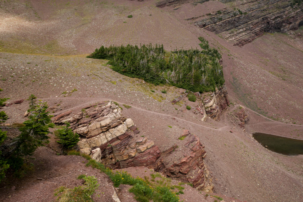
A short uphill took us though a little alpine grassland and forest. This was quite a change after having been above tree line for the last two hours. The forest would bring us to the top of a cliff overlooking the lakes.
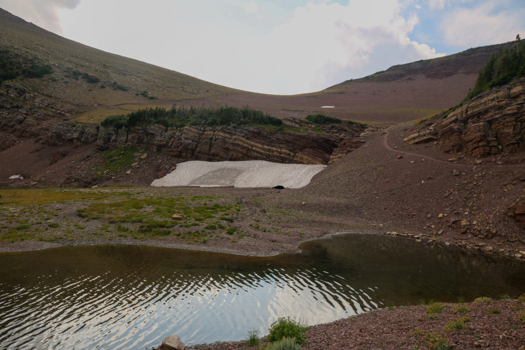
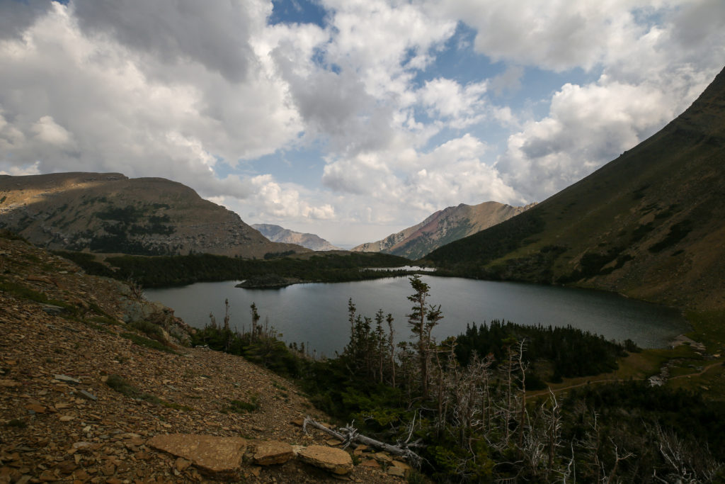
The Lower Carthew Lakes. We would stop for lunch on a rock lakeside on the right side of the photo.
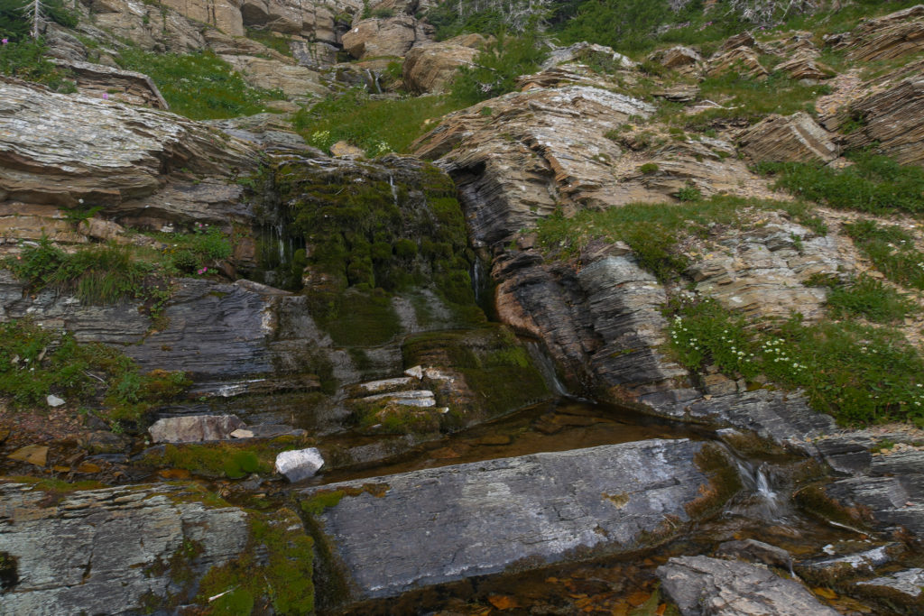
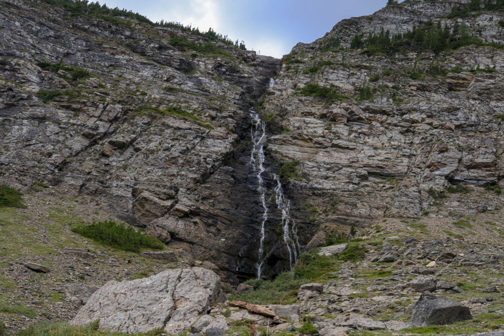
Water seeping through the cracks in the rock to form a little waterfall.
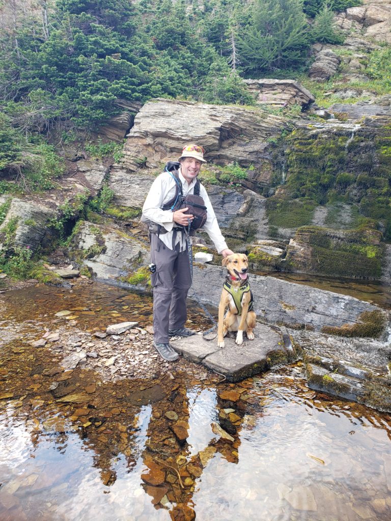
Margaux and me just before stopping for lunch.
Just before the water flows into Lower Carthew Lake there is a little marshy area that was quite pretty.
A happy Laura hikes over a small rise with Lower Carthew Lake in the background. Looking closely on the right of the photo you can make out the trail in the scree.
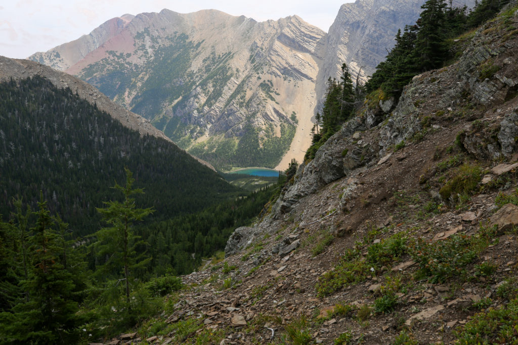
After leaving Lower Carthew Lake we hiked along the upper ledges of a cliff before we dropped through a break in the rock dropping down 240 quickly over the next 1.3 km. The trail was wide and we never felt any exposure but a few section where steep on gravelly trail making footing a little dodgy. We negotiated the trail successfully which brought us to a lovely overlook with a view of Alderson Lake.
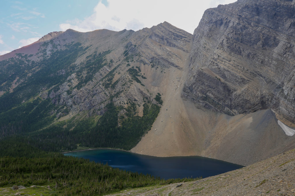
First view of Alderson Lake.
Western Anemones or better known as Hippies on a Stick.
Nice little waterfall.
Alderson Lake. There is a small backcountry campsite lakeside at the far end.
Laura putting her hiking pole to good use as she carefully makes her way down a fairly steep scree slope.
Laura just about finished the long scree section. The trail improves as we reenter a grassy area just off to the left of the photo.
The next two photos are taken from the same location. The first photo is looking west back up the valley we descended and the second photo is looking down the valley.
Looking west up the valley to Mt Carthew (2587 m).
Turning 180 degrees from the previous photo looking east down the valley to our best view of Alderson Lake.
The area around Alderson Lake escaped the fire and is very green and lush.
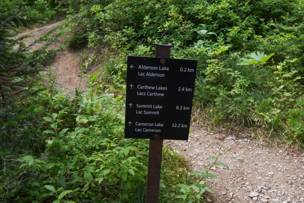
The junction to Alderson Lake has the campground just 200 m away. We decided to forgo a visit to the lake and continued our push to Waterton town site.
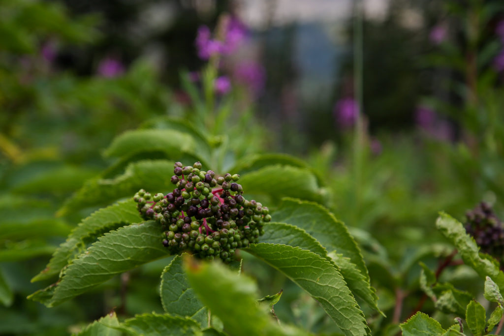
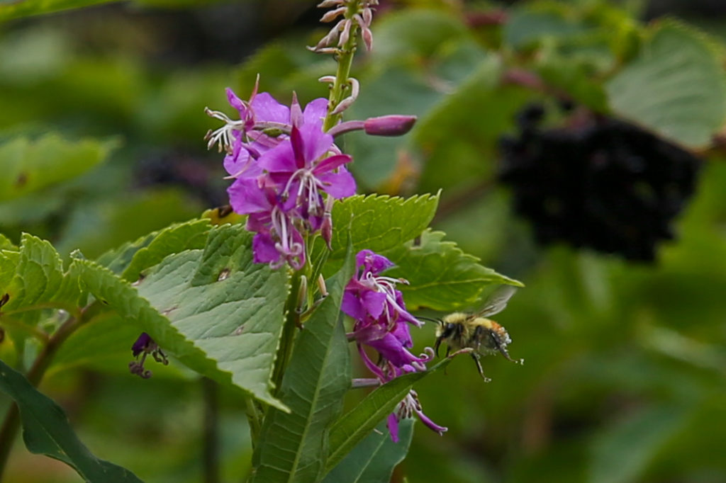
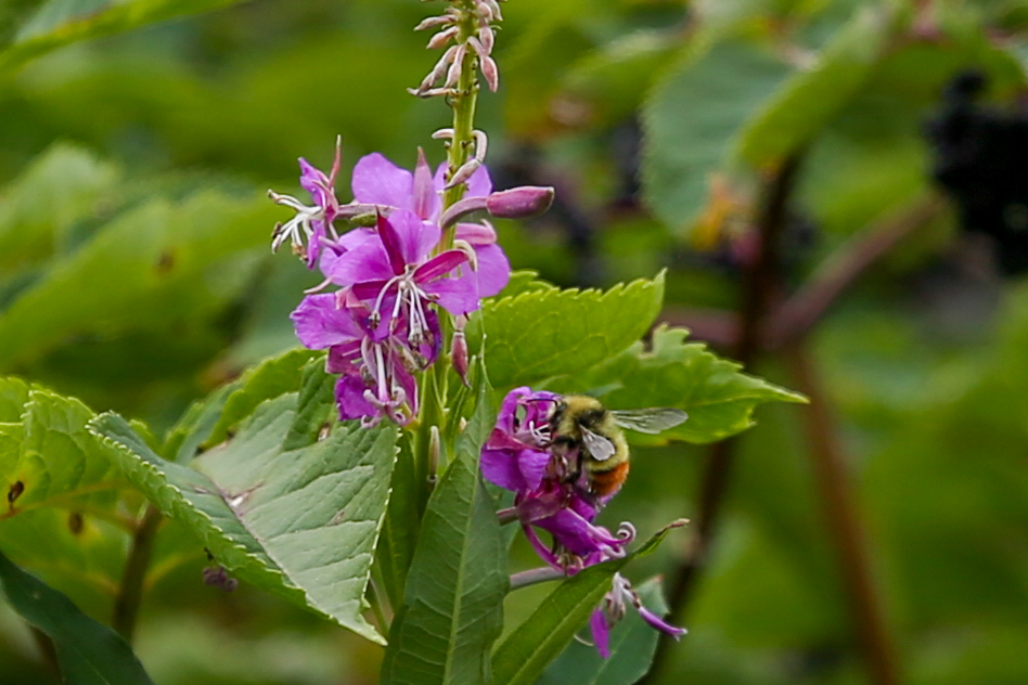
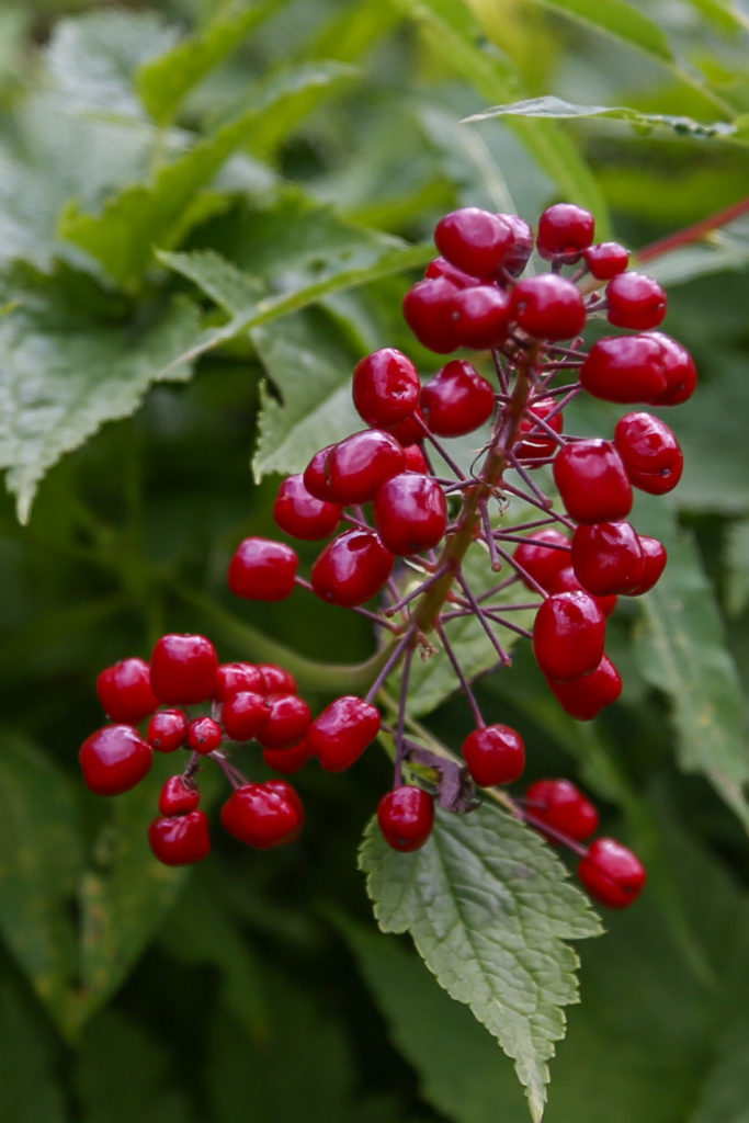
We have hiked 12. km from Cameron Lake leaving us with just 6.8 km to go to reach Waterton.Elderberry (sambucus).Bee on approach.Successful docking.
Margaux enjoying the shade on trail. Some of the leaves are already starting to change colour. The change is probably due to stress from heat and a lack of water.
Entering back into the burn. Not much relief from the sun now. We have about 5 km left.
Red Baneberry (Actaea rubra)
Red Baneberry with its distinctive leaves.
Margaux and Laura striking a pose. Margaux’s back feet are very muddy.
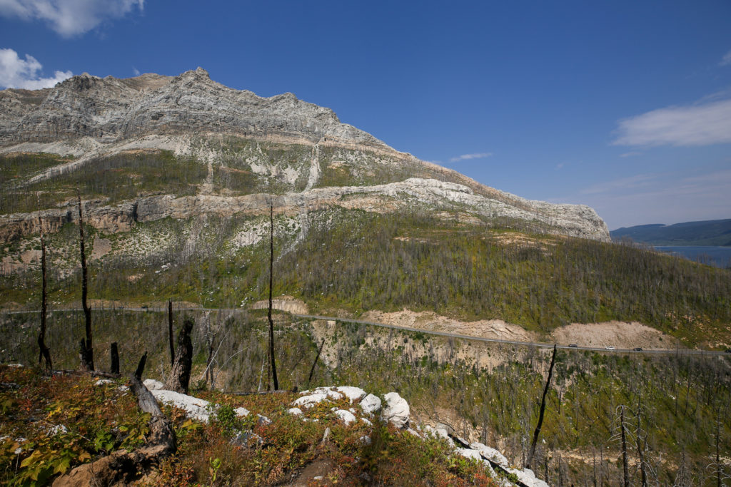
The highway we took to Cameron Lake this morning. The trail is very hot and dusty.
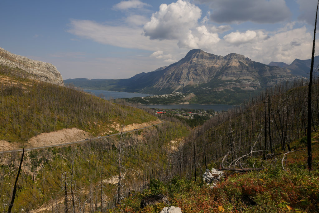
The town site of Waterton coming into view. Vimy Peak (2385 m) dominating the skyline.
View from the trail looking north to Mt Crandell (2381 m) with Bears Hump the exposed white rock on the extreme right. We hiked Bears Hump the previous evening after dinner. It is a pleasant quick little hike that offers stunning elevated views of Waterton town site and the surrounding area.
Margaux looking a little warm.
The final part of the hike through the burn was simply a matter of pushing onto the finish at Cameron Falls. The burn did provide excellent views to the soaring peaks that surrounded us but offered very little in terms of shade. We were getting quite overheated by this time of the hike and where just looking to finish. The hike does end quite nicely with a little descent into Cameron Falls. We passed a father and very young son who were on their way from camping the previous night at Alderson Lake. The boy still had lots of energy after what would have been quite a big day on the trail for such little legs.
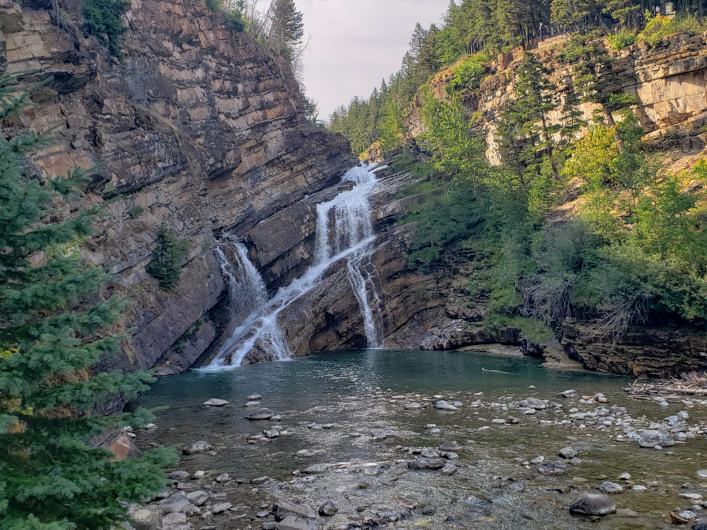
Cameron Falls. A very nice way to end a terrific day on trail.
We arrived to the crowds at Cameron Falls at 3:50 pm. The trail hiking was completed but we still had nearly 500 m left to walk back to the car. We arrived back at the car at about 4:05 pm completing the hike from Cameron Lake to the car in just under 7 hours.
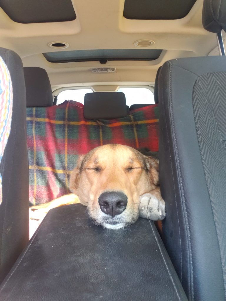
Happy sleepy gurl. Margaux fell asleep on the 15 minute drive back to the campsite.
A treat for Margaux for a job well done.
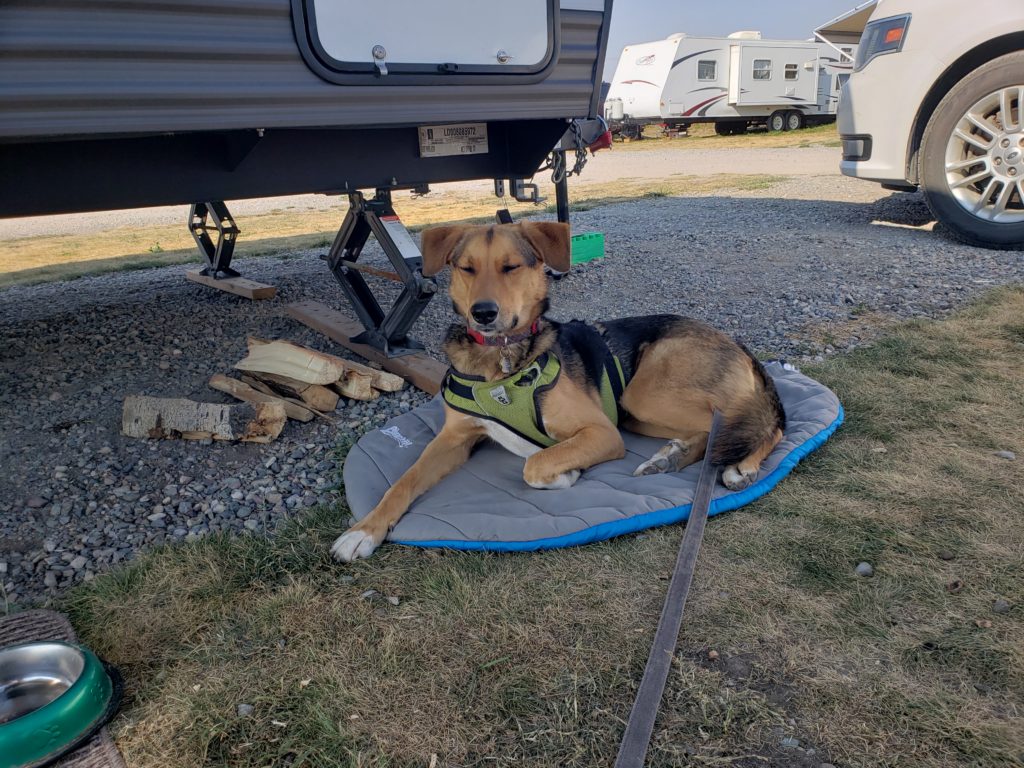
Margaux relaxing in the shade back at camp.
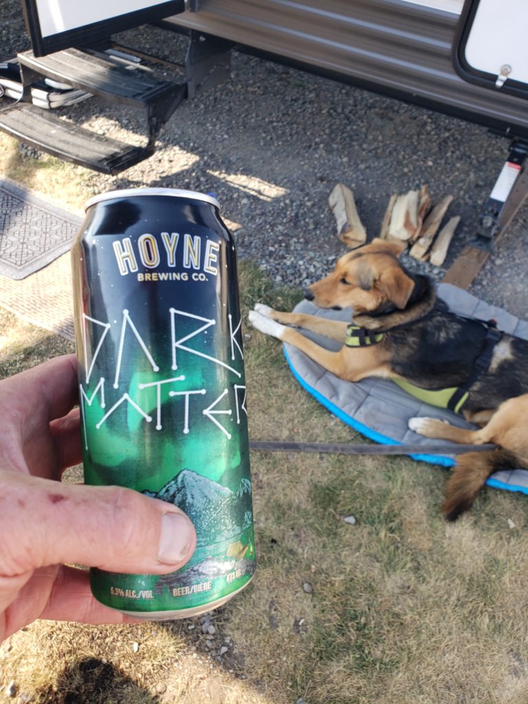
My treat for arriving successfully back at camp after a glorious day on the trail.
We had such a fantastic day out on the trail. The Alderson Carthew Trail was the feature hike of our stay in Waterton and it could not have been better. For those visiting Waterton NP I cannot recommend the hike strongly enough, you will not be disappointed.