
A bushwack up an old logging road to a spectacular ridge-line in Kananaskis.
June 17, 2018. Out and back hike from North Interlakes Parking Lot, 14.1 km, 1130 m of elevation gain/loss, 6 hrs 30 min.
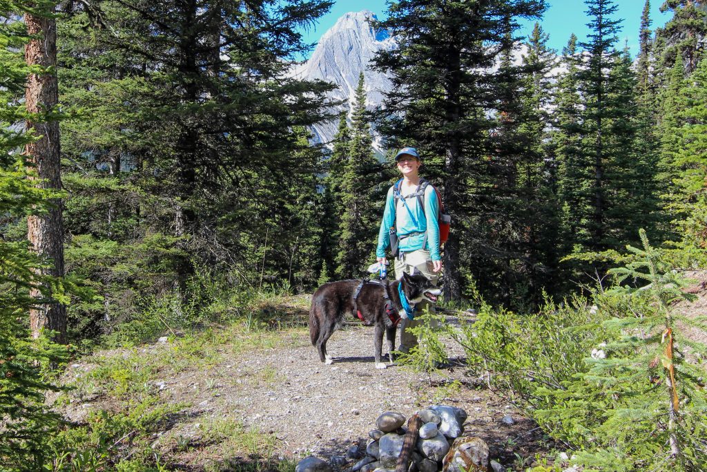
Micah and I were looking for an adventure. While reading Gillean Daffern’s Kananasksis Country Trail Guide Volume 1 we found the trail description for a hike to Mt Nomad (Hike 75 Invincible Lake, Hike 75A Mt Nomad). Part of the hike involved walking along Upper Kananaskis Lake but the route then ventures off the main trail along a disused fireroad and up a ridge. When checking the internet the route seemed a little obscure but my Viewranger App had the hike to Mt Nomad which gave us some reassurance that the route actually existed. We felt that the hike to Mt Nomad would satisfy our desire to go a little off the beaten path and do some exploring. While we never made it to Mt Nomad to quote Gillean Daffern “But despite its drawbacks, the ridge is one of the finest vantage point [sic] for Upper Kananasksis Lake and its mountains.” The hike was fun, challenging and a simply wonderful day out.
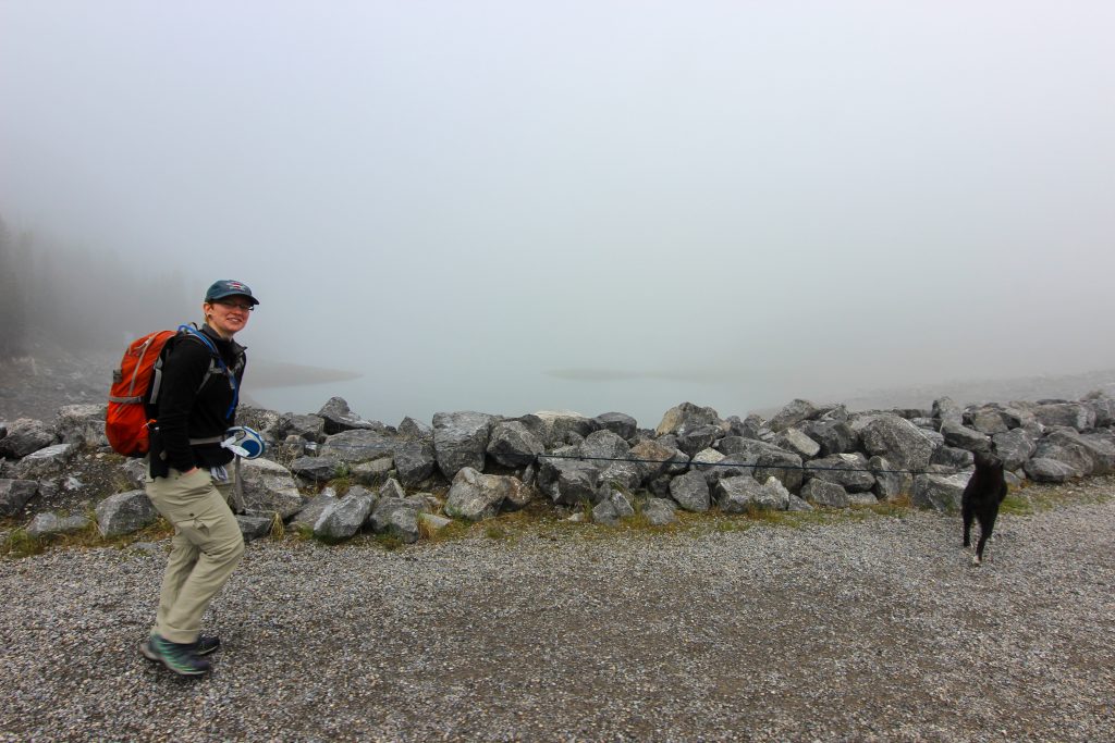
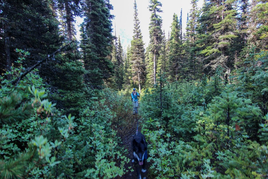
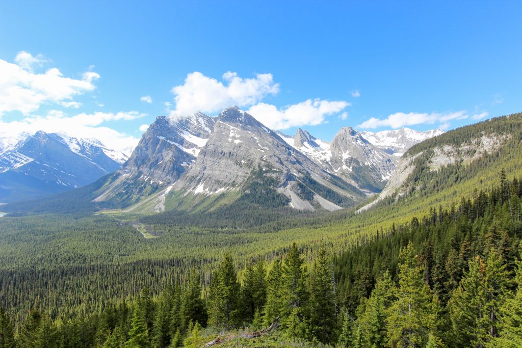
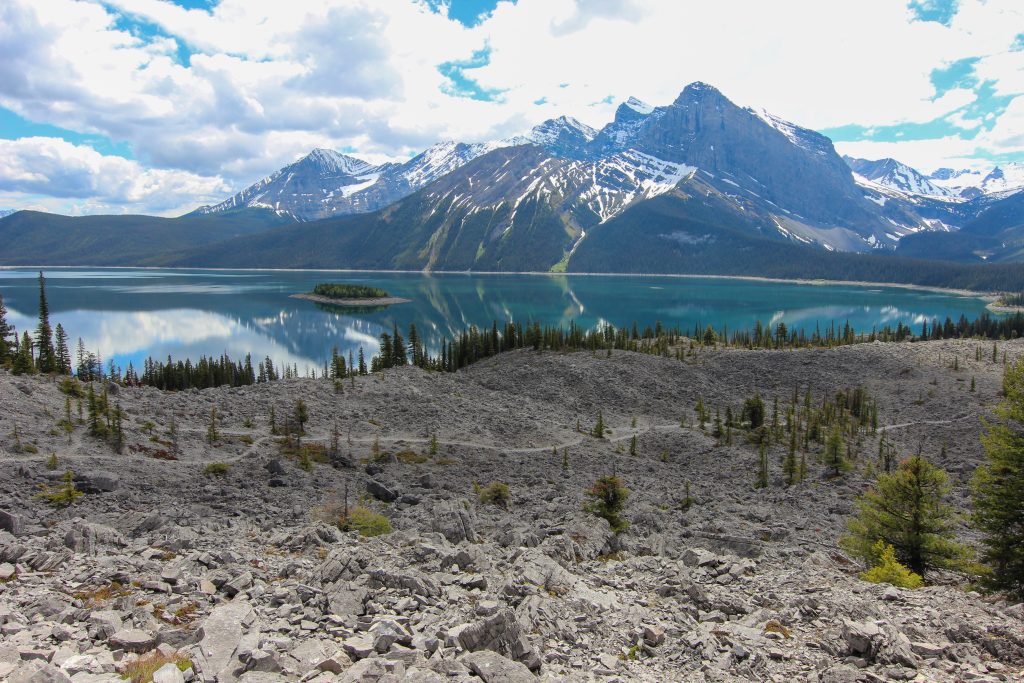
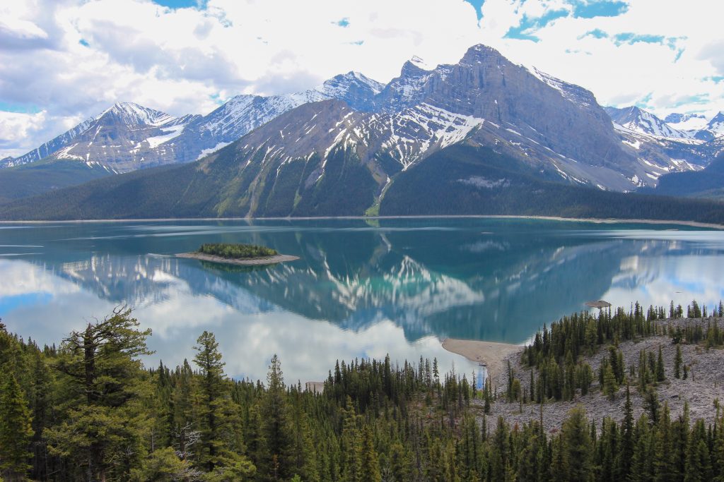
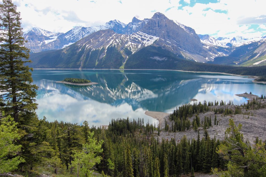
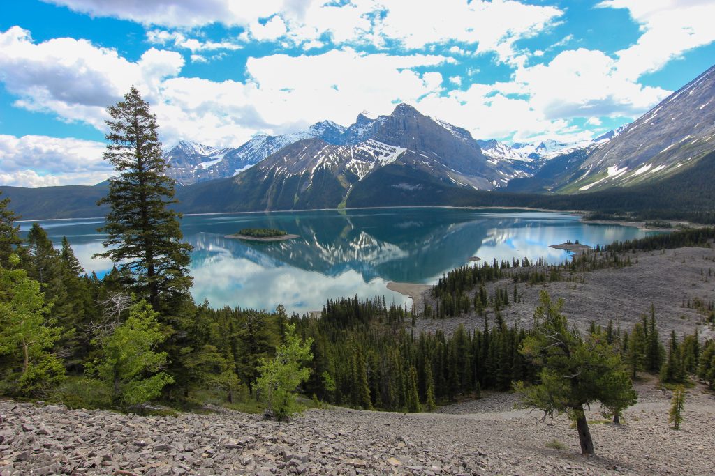
It is a little over an hours drive to the trail head at the North Interlakes Parking lot. We had our packs on and hit the trail just before 8:30 am. There was a lot of fog to start the hike and our views were limited as we crossed the dam at the head of the lake and over the intake pipe for the power station. This first part of the trip was significant in that Volcano had already hiked around Upper Kananaskis Lake the year before and could not, would not go down the metal steps as you leave the intake pipe. Volcano had been living with us for almost 10 months at this point and was much more used to stairs in general and while she descended the stairs somewhat gingerly she did go down the metal stairs unlike on her previous attempt. The first part of the hike is quite pedestrian as we followed the old fire road paralleling the lake. At the first junction at the 1 km mark we veered right and stayed on the trail upper trail. We made very good time along the lakeside trail averaging about 5 kph. The views are limited until just before the junction to Forks CG which is in the boulder field of the Palliser Slide. The boulder field is the aftermath of two large rock slides off the face of Mt Indefatigable. If you look at Mt Indefatigable you can see that the bedding planes of the rock slope downward towards the the trial meaning there will be more rock slides in the future. The fog was lifting as we left the junction it was 9:00 am and we had hiked about 2.4 km.
Still hiking on the old fireroad it took just 25 min to arrive at the junction (km 4.2) to Three Isle Lake and North Kananasksis Pass. We crossed small bridge over Invincible Creek and then left the main trail by taking a hard right and followed the bank of the creek upstream. Once the access to Mt Nomad the following the creek involves a challenging scramble so a new route was developed that involved going up and over the ridge. We quickly found the abandoned fireroad that we would follow for the next 1.2 km before heading up the ridge. It would take us 30 minutes to cover that 1.2 km!
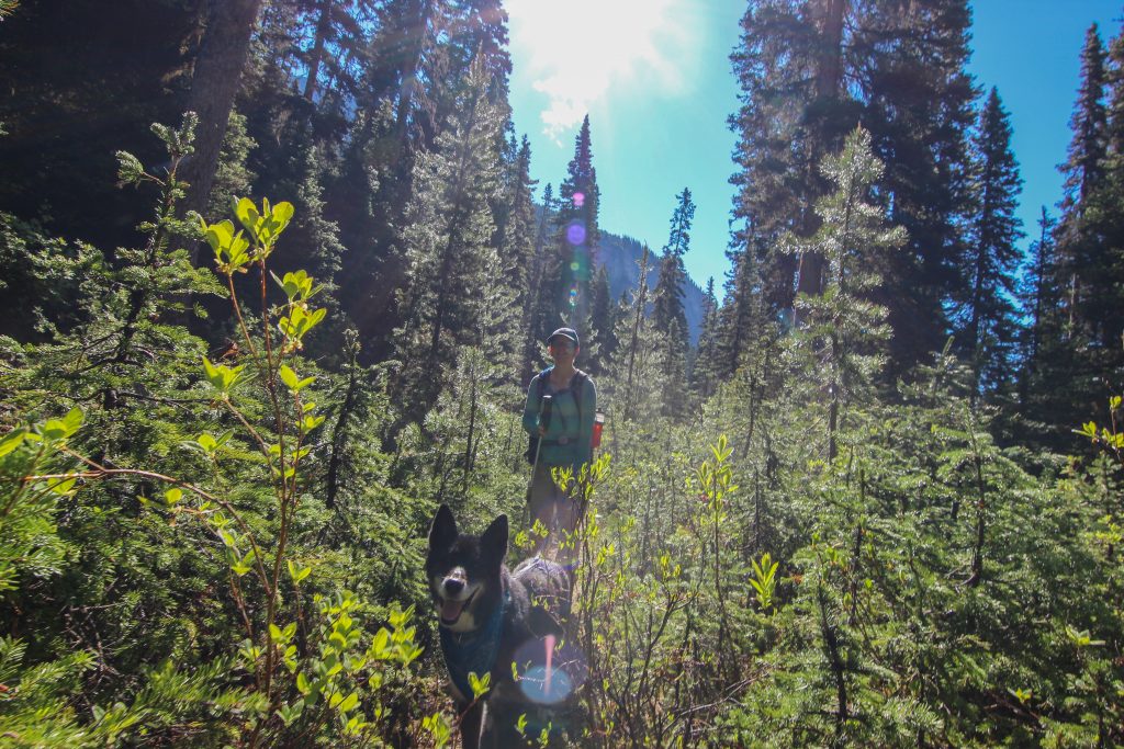
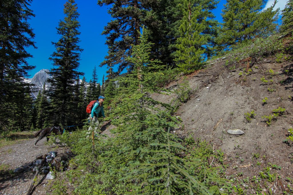
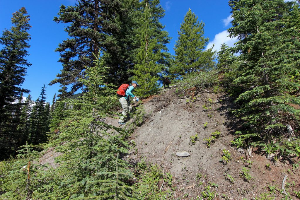
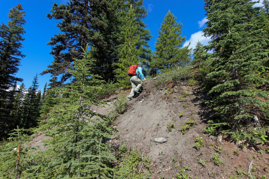
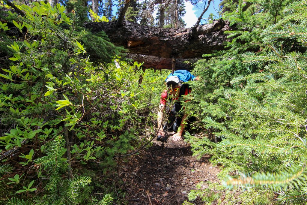
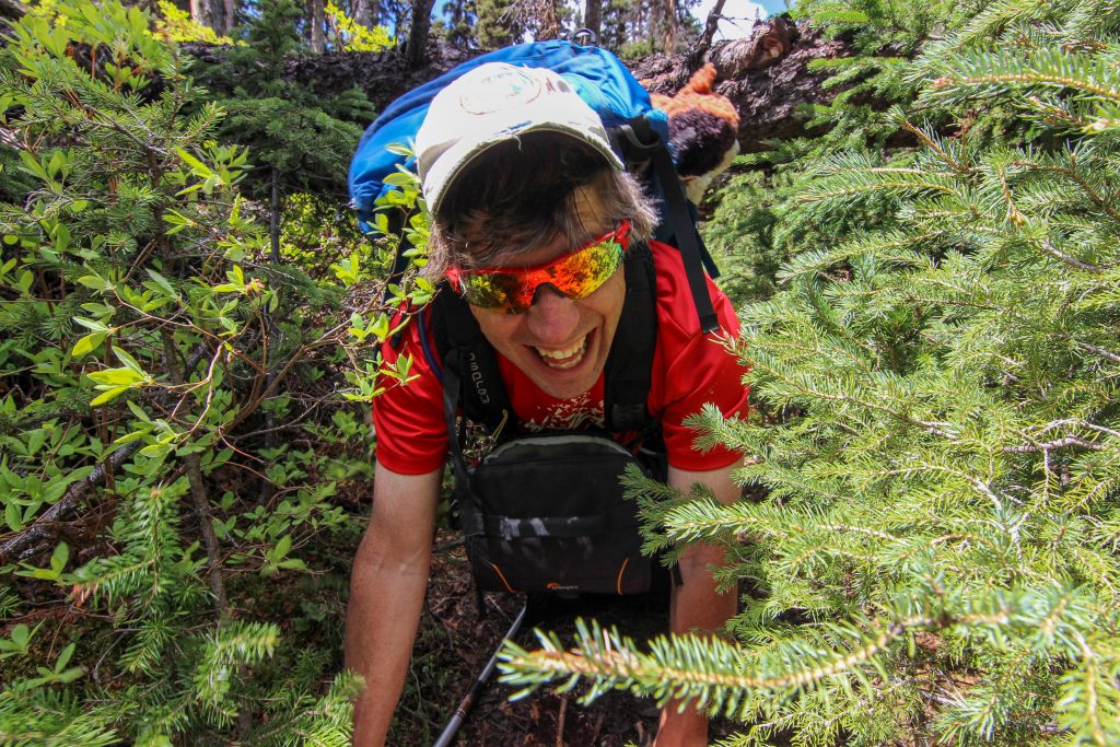
We were never in danger of losing our way on the abandoned fireroad but it is very obvious that it is neither a popular route or on the radar of Alberta Parks for maintenance. I did not take a lot of photos on the outward bound trip as we we constantly crawling under and over downed trees and frequently having to venture slightly off trail to navigate the deadfall. The trail though remained true to the marking on the Viewranger map. After a difficult section we climbed a small rise and came to an obvious pile of rocks indicating the place we would leave the fireroad and head up to the ridge. Throughout all of the scrabbling around the deadfall Volcano forged ahead with enthusiasm. Some deadfall was too high for Volcano to jump (yes some sled dogs can jump) so Micah would lift her up by her harness and place Volcano on the log where she could jump down to a clearing on the other side.
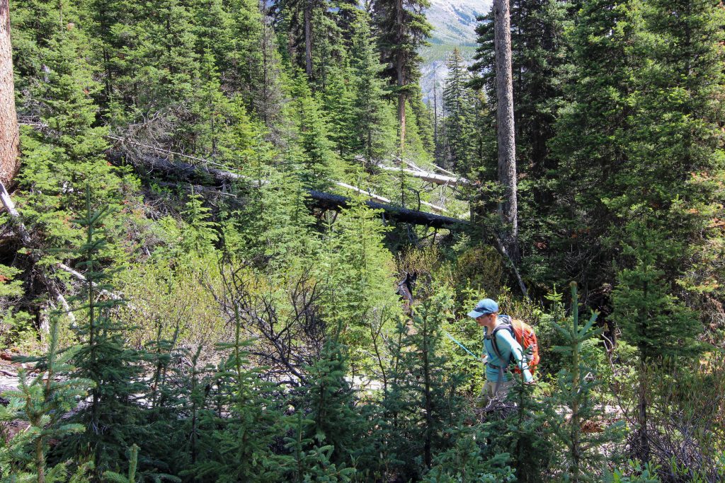
Leaving the fireroad there was a faint trail straight up the hill to the ridge. This is probably the single steepest section of trail I have ever hiked. We would gain 436 m of elevation in just 1 km of hiking.
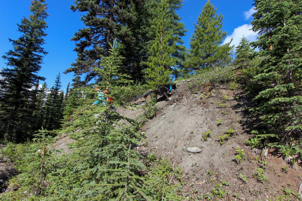
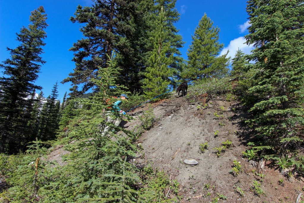
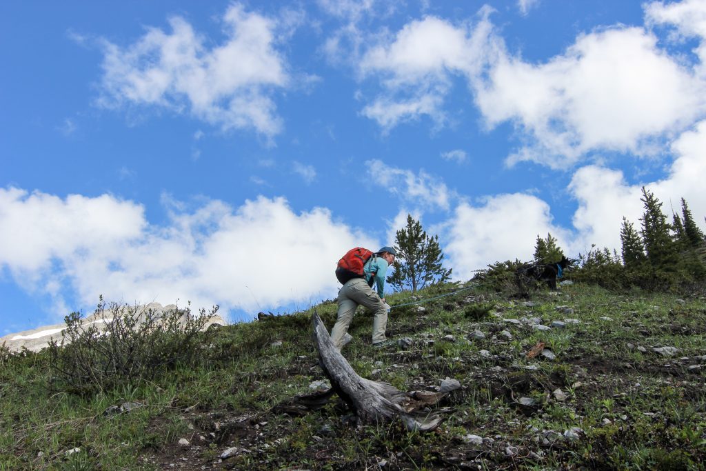
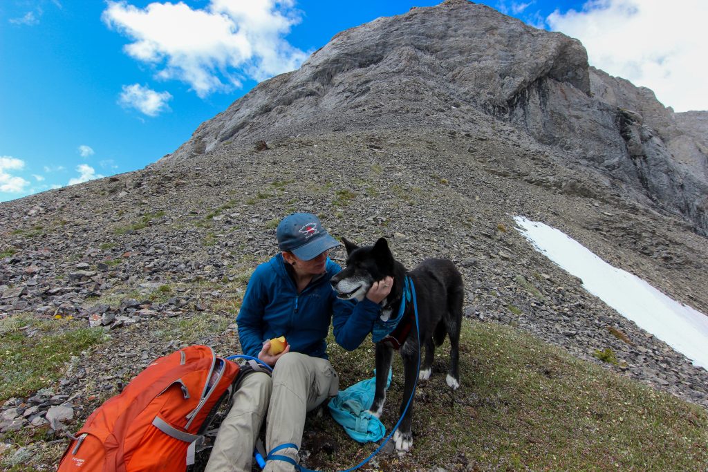
We stopped on a small plateau to take a break and give Volcano a food and break. It was 10:45 am and we had been heading up to the ridge for 45 min and had covered just half a km.

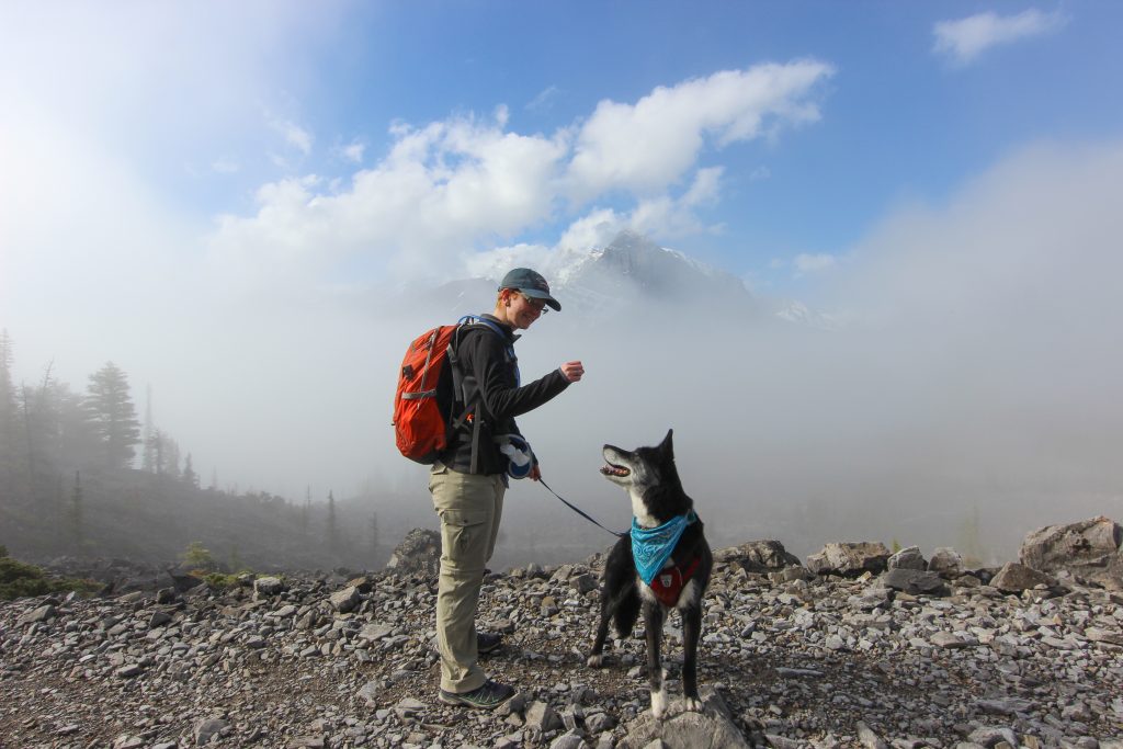
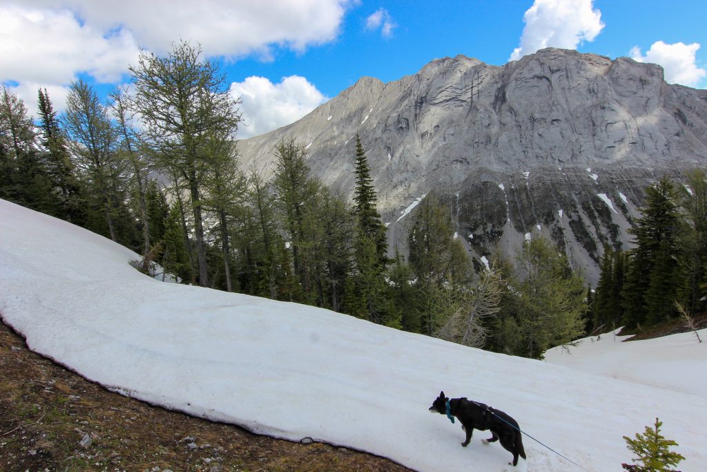
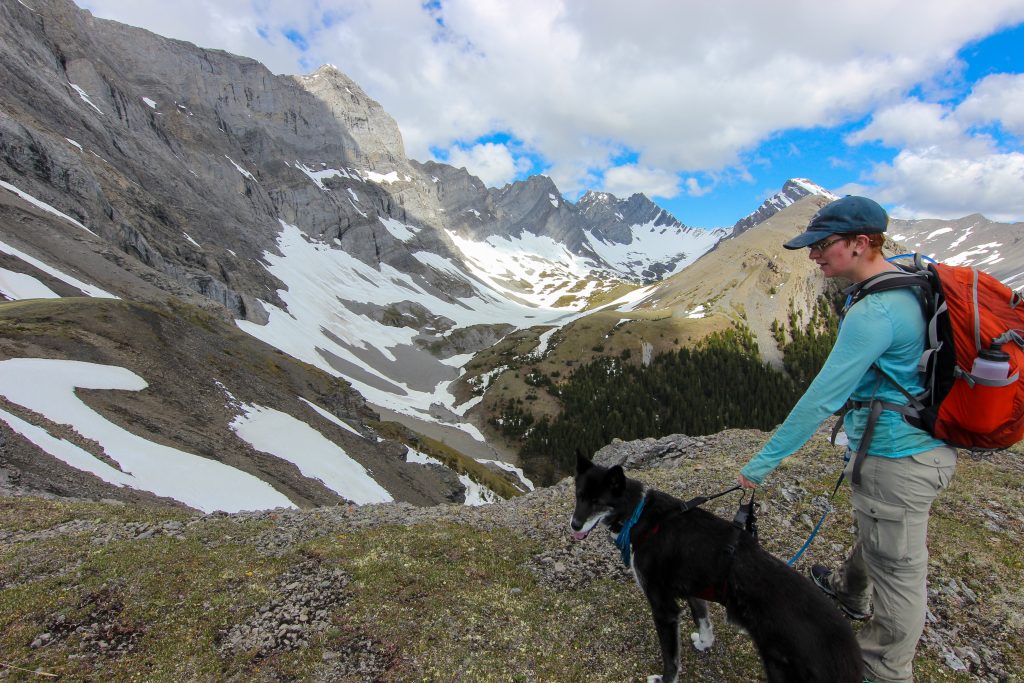
We arrived on the ridge at 11:20 am. There was still snow on the ground and Volcano immediately had to check it out.
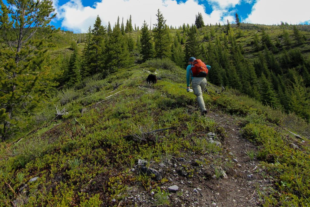
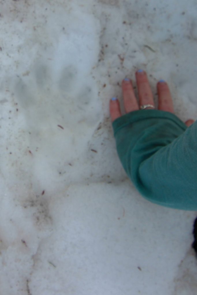
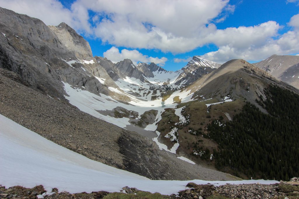
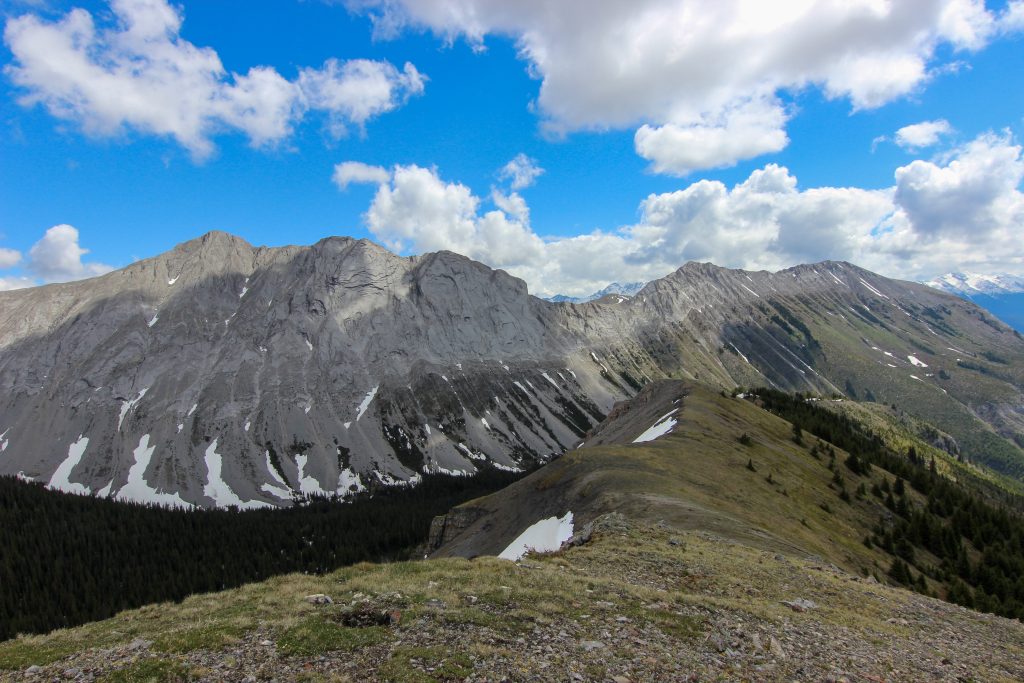
We made our way along the ridge. Initially we were traveling on snow. There were some other foot prints in the snow so someone had been here recently. To get to Mt Nomad you have to drop down off the ridge into a little valley where Mt Nomad sits in the middle. The drop down the valley was as steep as what we had just come up but was snow covered. Neither Micah or I had any gear for hiking in snow. The more I looked at the slope the less comfortable I became. One slip and it would be an express trip a few hundred metres to the bottom. We kept our eyes out scanning for a way down.
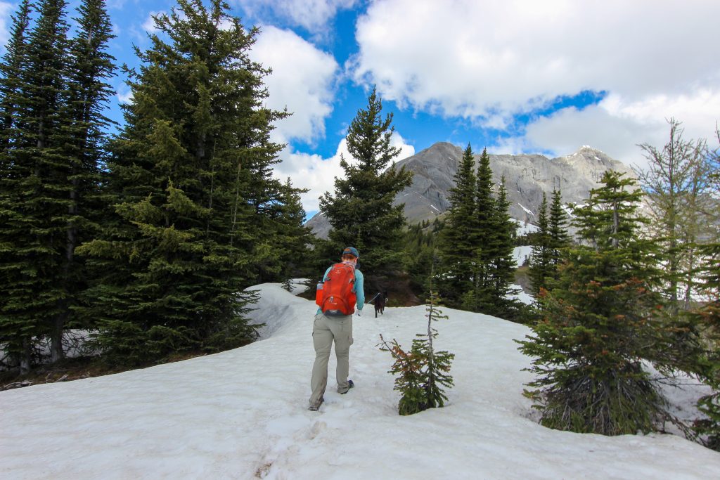
As we walked along the ridge we looked for ways to safely access the valley below. We walked past the spot on that the Viewranger map had a trail to valley marked but all we could see was snow. There was another trail marked on the map further up the ridge so we continued walking and looking.
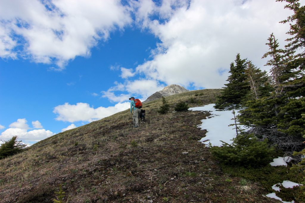
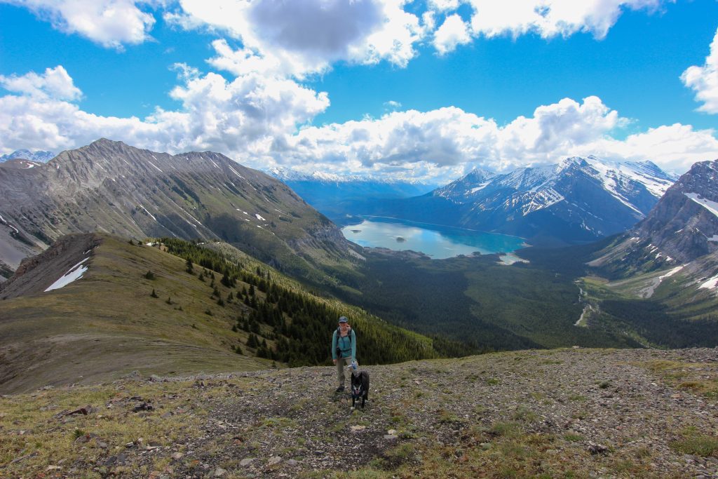
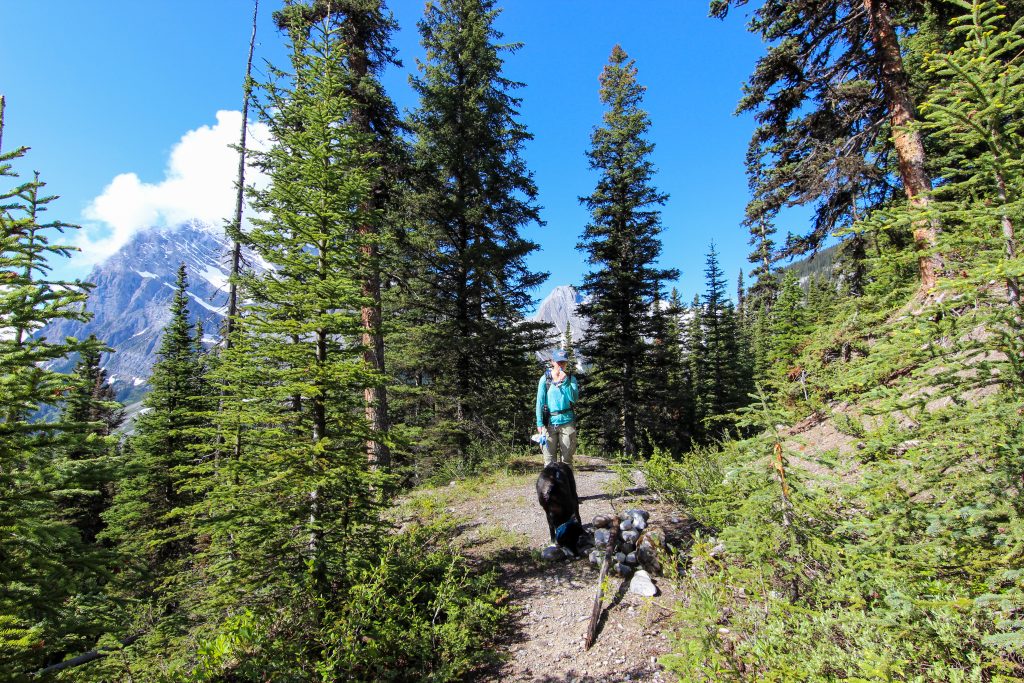
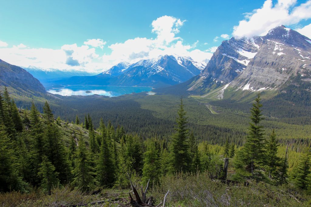
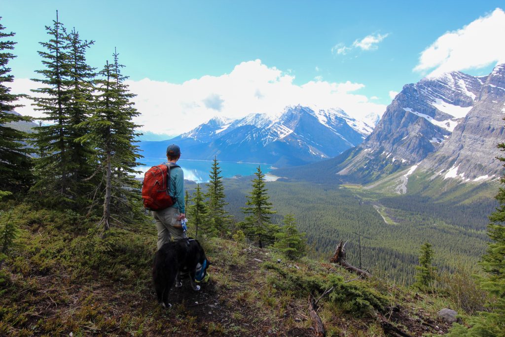
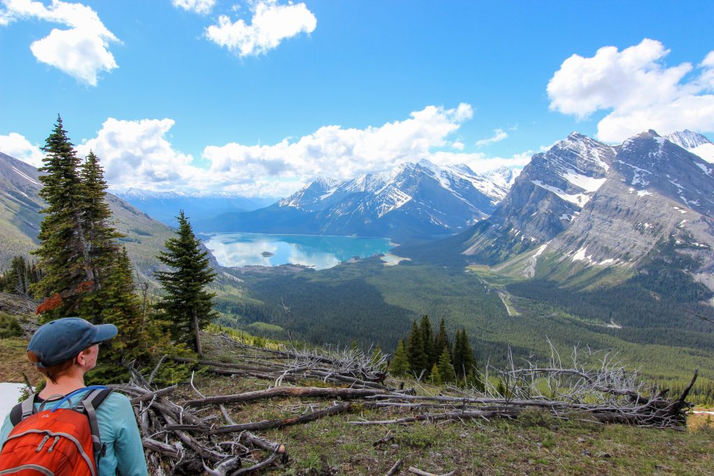
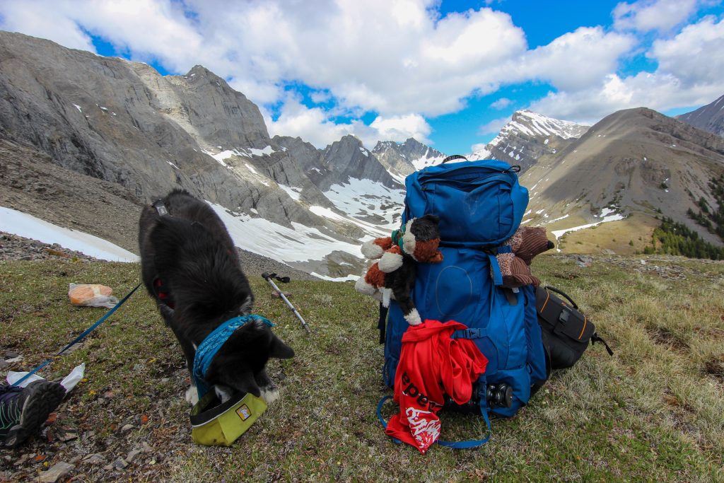
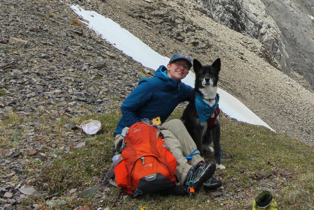
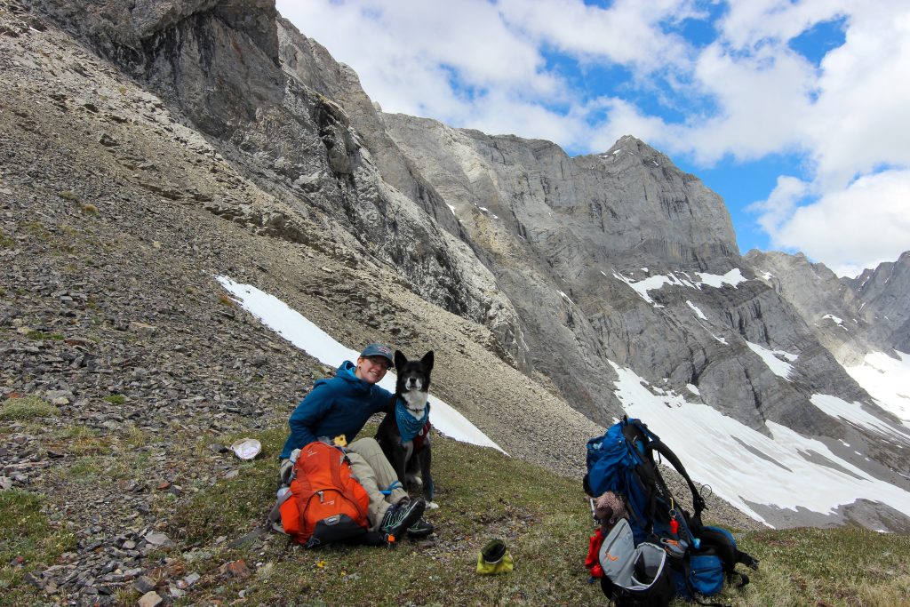
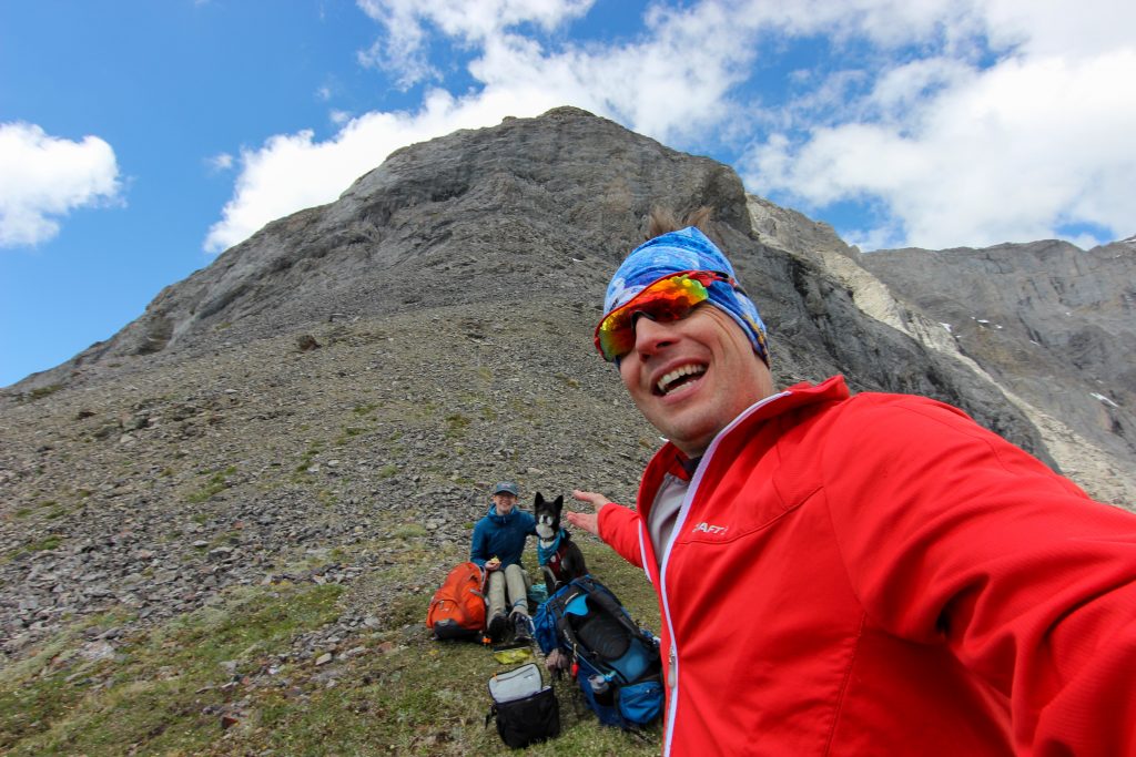
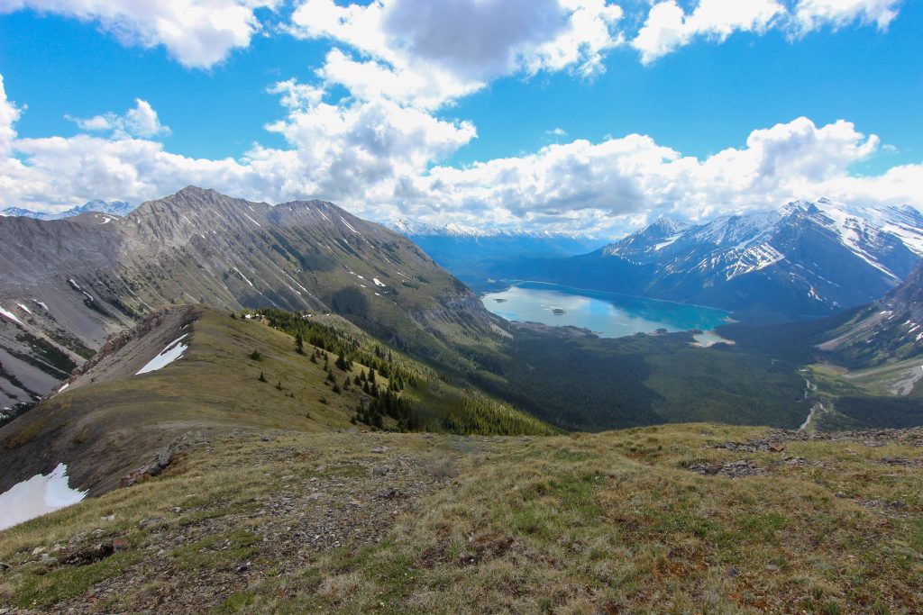
The ridge was still very steep but it came to an abrupt end at a limestone wall that forms the southern end of Hermione Peak. It took us 20 minutes to cover the last 1/2 km gaining another 80 m of elevation. We surveyed the second route down to the valley as indicated on the Viewranger map. We quickly decided that it was not feasible on this trip to make the attempt to descend to the valley so we dumped our parks and settled in to a million dollar view of Upper Kananaskis Lake.
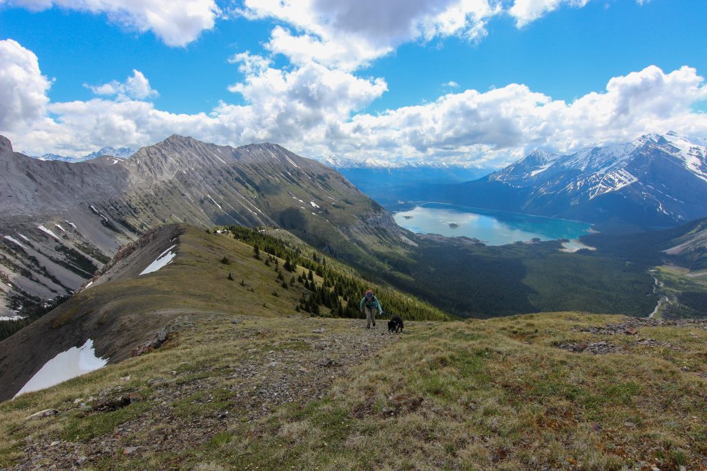
We only hung around on the ridge for 25 minutes as it was a little windy and chilly. We retraced our route down. It took only 1 hour to make our way off the ridge and back to the cairn on the fireroad. It had taken 1hr 38 minutes to hike up that same segment. Hiking the fireroad meant that we had to deal with all the deadfall. Somehow it did not seem as bad on the way back. Micah had perfected the Volcano “haul and toss” and knowing the route helped us to travel just a little quicker. We arrived back at Invincible Creek at 1:45 pm.
Surprisingly the there was very little wind we we arrived back at the boulder field offering mirror reflections of the mountains in Upper Kananasksis Lake. Micah humoured me as I delayed our return trip by 15 minutes as I scrambled up the hillside taking pictures.
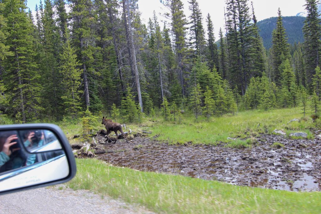
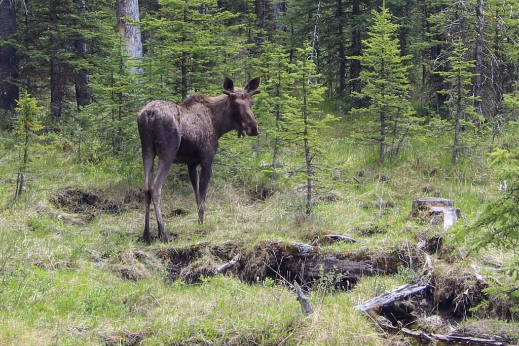
After the photography was finished it was back into the woods. It took us just 35 minutes to cover the 2 km back to the car it was 2:55pm. The fun was not over. On the drive home before getting back to Hwy 40 we spotted a moose walking through some wetlands. Micah did her best to take pictures on my camera. They turned out pretty good.
The hike to Mt Nomad (almost) was a wonderful little adventure. Setting off later in the summer would make it much more likely to be able to hike to Mt Nomad without the concern of snow travel. Even with the snow limiting our trip the ridge was worth the effort making for an entirely satisfy day out. I feel I need to revisit this trip and finish up the hike.