Skip to content
Boot Wreckers
Menu
  • Home Page
  • Hiking Day Trips
    • Angels Landing – 2015
    • Aylmer Lookout Banff NP
    • Mt Allan Traverse (Centennial Ridge)
    • Mt Nomad (almost) – Kanananaskis Country
  • Backpacking – Overnights
    • Baker Lake 2020 Banff NP
    • Exploring Waterfalls with Volcano – Yoho NP
    • Fish Lakes – Banff NP, Alberta
    • Floe Lake/Numa Creek, Kootenay NP, British Columbia
    • Floe Lake (Revisited 2019) – Kootenay NP
    • Grand Canyon Corridor Backpacking Trip
    • Hermit Trail to Hermit Meadows – Glacier NP, British Columbia
    • Howard-Douglas Lake – Banff NP (2017)
    • Leman Lake – Banff, NP
    • Mystic Lake – Banff NP
    • Ribbon Lake Kananaskis Prov. Park 2016 – Ribbon Creek Route
    • Ribbon Lake Kananaskis Prov. Park 2017 – South Buller Pass Route
    • Simpson and Healy Pass – Banff NP (2016)
    • Stenton Lake – Alberta Wildlands Prov. Park
  • Backpacking – Multi Day
    • Arizona Trail Passages 16 17
    • Brazeau Loop – Jasper National Park
    • Colorado River Float Trip 2015
    • Egypt Lake Epic – Banff NP
    • Egypt Lake Exploration 2021- Banff NP
    • Grand Canyon Hermit – South Kaibab
    • Grand Canyon – Tanner/Beamer Trail
    • GR20 – Corsica
    • Great Divide Trail Hike – Section C 2020
    • Great Divide Trail Hike – Section D 2022
    • Great Divide Trail Hike – Section E 2021
    • Green River Canoe Trip 2017
    • Iceline/Twin Falls – Yoho NP 2020
    • Kilimanjaro – Tanzania
    • Mt Assiniboine Lollipop – Banff NP
    • Rockwall North 2020 Kootenay NP
    • Rockwall 2022 – Paint Pots to Numa Creek, Kootenay NP
    • Sawback – Banff NP
  • The Team
  • Contact Us
Menu

Mt Allan Traverse (Centennial Ridge)

While many people hike Centennial Ridge as an out and back from Ribbon Creek, a challenging and inspiring hike can be made going from Dead Man’s Flats to Ribbon Creek.

June 24, 2018. From Skogan Pass Trailhead (Dead Mans Flat’s) to Ribbon Creek Day Use Area Parking Lot, Distance 20 km, Elevation Loss/Gain 1450m, time 8 hrs 5 min.

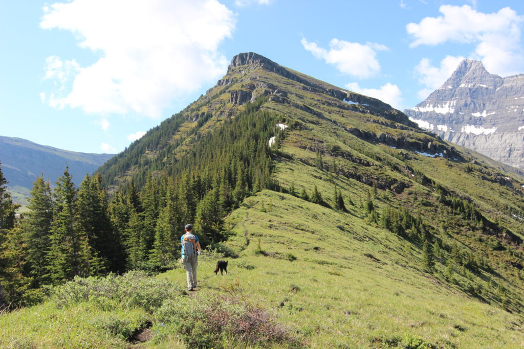
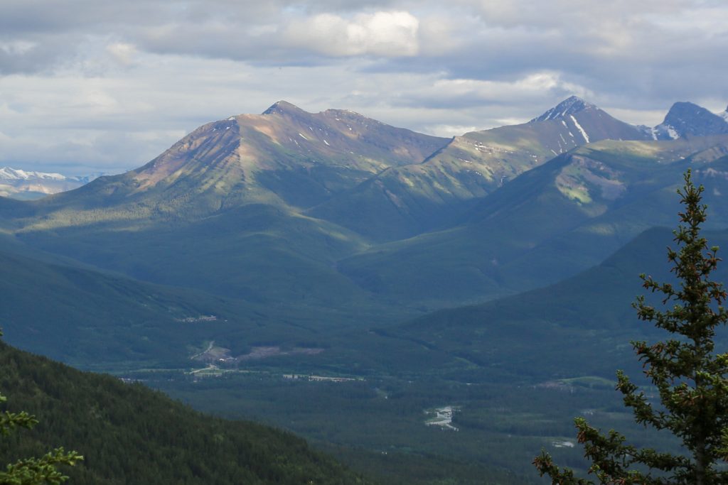
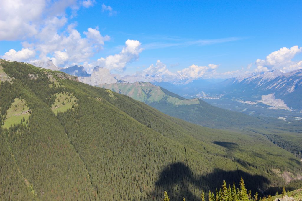
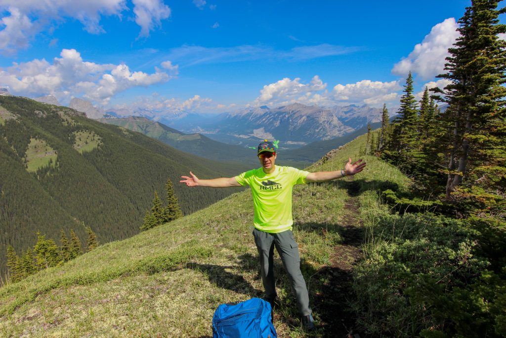
The ridge on Mt Allan is a prominent feature when looking down the Bow Valley from Canmore. The long ridge just screams out to be hiked. I found the route description for the north ridge of Mt Allan in Gillean Daffern’s Kananasksis Country Trail Guides Volume 3. The trail description for the south ridge known as Centennial Ridge is described in Gillean Daffern’s Kananasksis Trail Guide Volume 1. In our preparation for our GR20 trip coming up later in the summer Micah and I thought that it would be a good training hike to hike both ridges of Mt Allan as a point to point hike traveling north to south. The elevation of 1500 m up and down would be similar to some of the days we would have on our upcoming trip. Planning note the route up Mt Allan is closed from December 1st to June 21st for spring lambing.

The view from Mt Lady MacDonald. Skogan Pass is on the left, then Mt Collembola, then the ridge to Mt Allan starting at centre going up to the right. The last ridge in view is called No Name Ridge! In the valley between Mt Allan and No Name Ridge is the hike East Wind Pond.

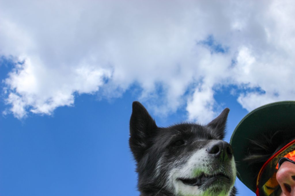
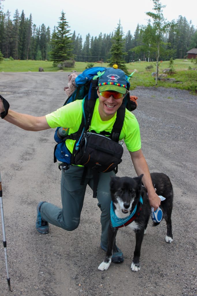
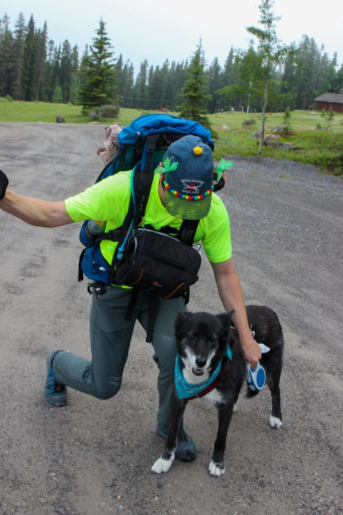
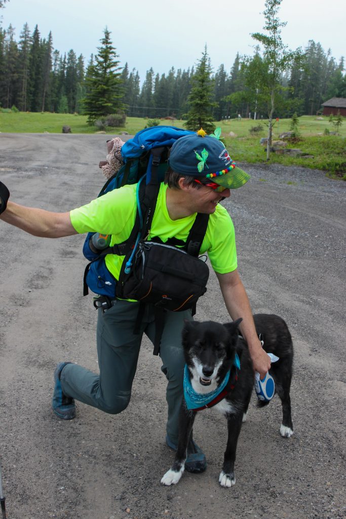
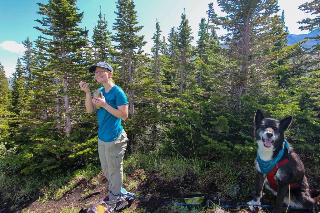
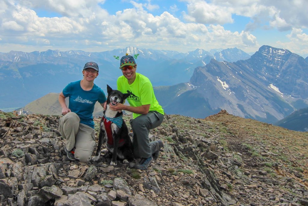
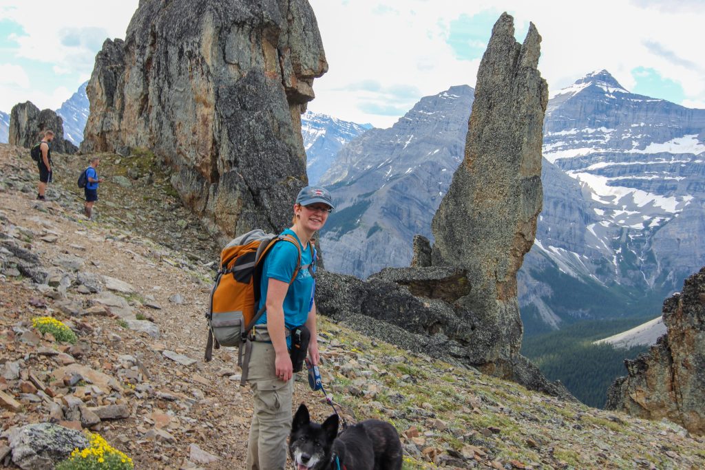
This was our first full summer with Volcano and would be her biggest hike yet. So far in any hike we had completed Volcano had been more than ready for the challenge and always had gas left in the tank looking for another adventure as soon as us humans had finished dinner later in the evening. I was sporting a new hiking hat. I had purchased new hats for Micah , Siobhan and I from Moab Brewery but Micah was annoyed that ours were the same colour. So I had a couple students at school decorate the hat for me. The hat became very popular on the trail and always garnered positive comments.

Our plan was to do a point to point which meant that we had to get a car to our finishing point. For us the easiest way to accomplish this was just to drive a car to the Ribbon Creek parking lot then drive back to the starting point at the Skogan Pass Trailhead at Dead Man’s Flats the morning of the hike. For us since we drive right by the trail head and then have to come back again the round trip to drop off the car was just short of 100 km and took about 1 hr 15 min. Even with the extra time invested we had our packs on and were ready to go at 7:55 am.

Volcano looking ready to go. Me and my new hat complete with butterflies.
Butterflies and a yellow pom pom on top.

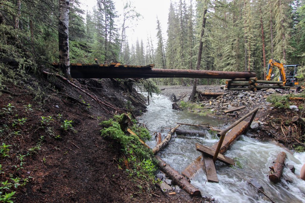
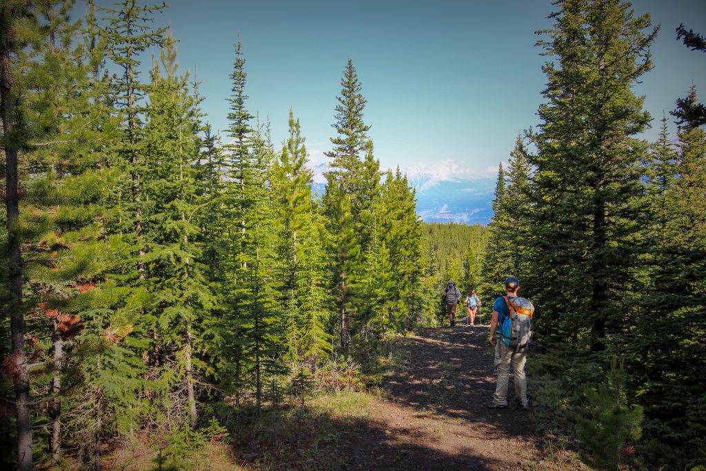
Once heading down the trail we left the Skogan Pass trail after just 300 m and ran into our first obstacle just shy of 1 km. The crossing of Pigeon Creek became a significant challenge when we came across the partial reconstruction of the bridge over the creek. Alberta Parks was obviously still repairing damage from the floods of 2013 and were constructing a new very substantial bridge over the creek. The remains of the previous bridge were still in the creek so we made our way down the bank and after a quick bit of construction to gain access to bridge remains we made our way across the creek. While I was tossing wood around in the creek a group of trail runners came up behind us but they seemed happy to let me play engineer and after we successfully crossed the creek they followed and quickly passed us.

Have to cross the bridge remains wedged in the creek. Does not look like its up to modern building code. We crossed safely.

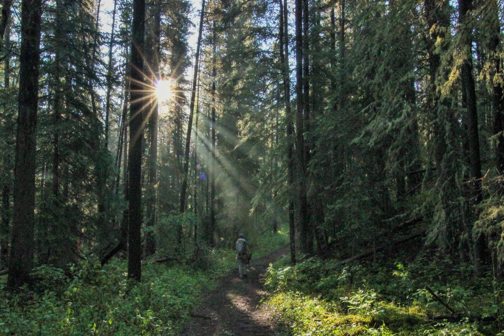
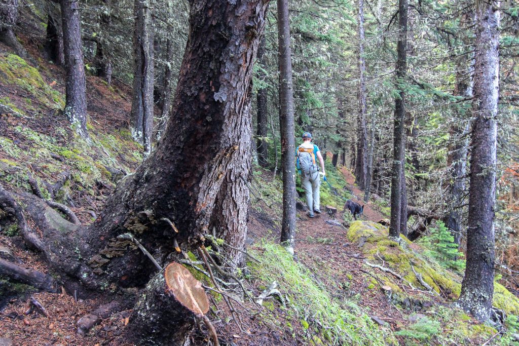
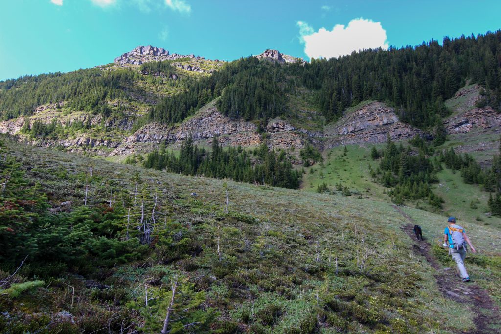
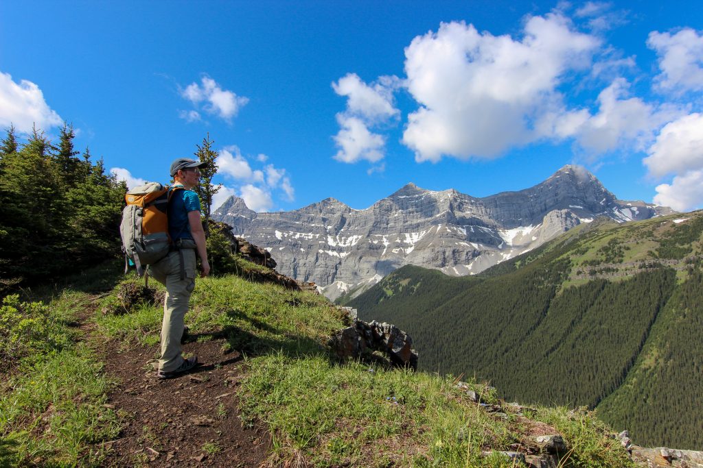
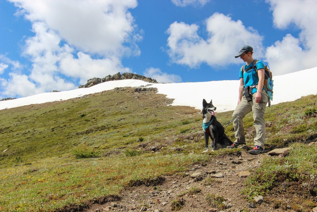
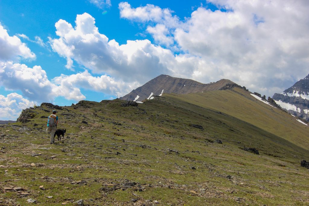
The hike was uphill right from the start but was quite a casual climb fro the first 2 km. A right turn followed by a quick left and had us following a ridge for the next 5 km gaining a stiff 650 m of elevation. There was not much to see on this first section of the hike as we were buried deep inside the trees. One thing we did notice was that whoever was holding onto Volcano’s leash was walking faster so fast it was challenging for the other person to keep up. Volcano may have been turning 11 later in the summer but she was still in incredible condition.

Nice wide trail.

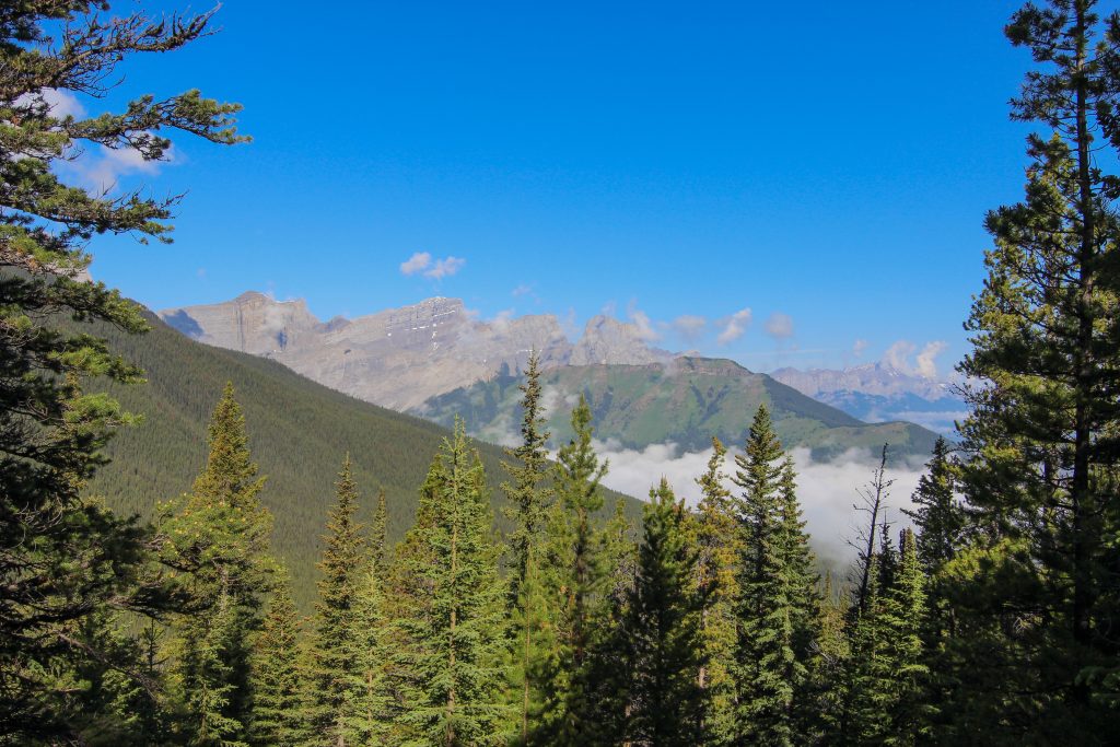
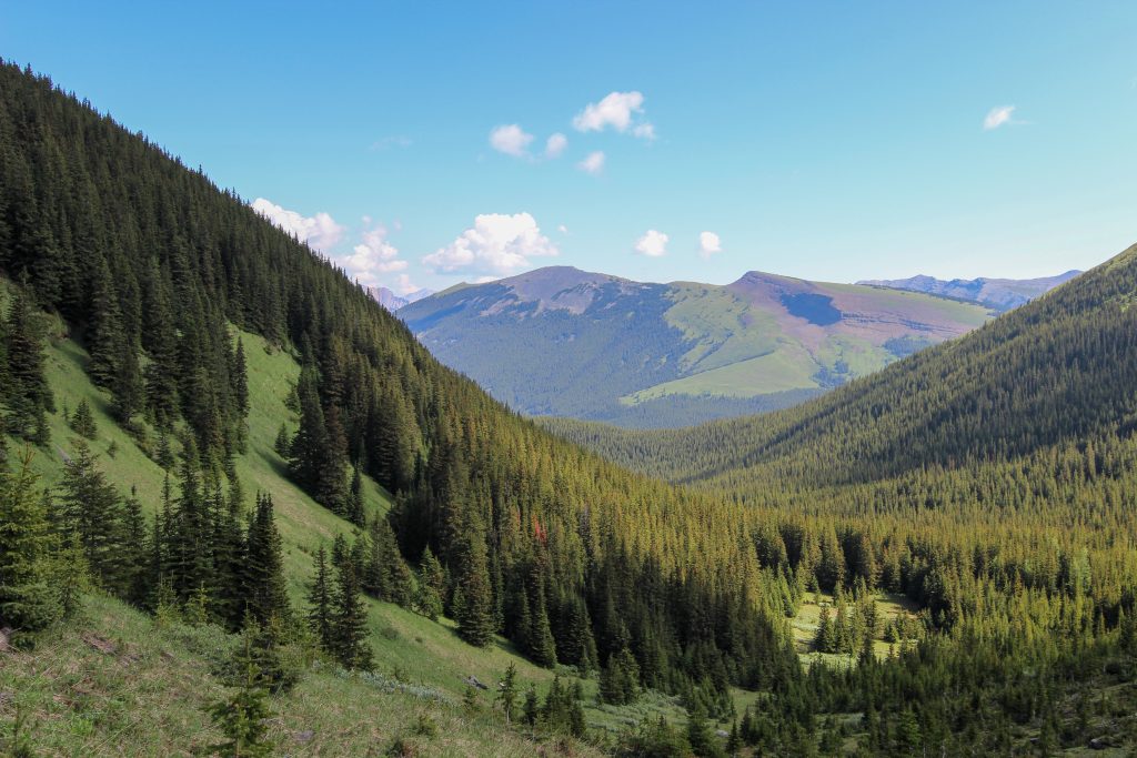
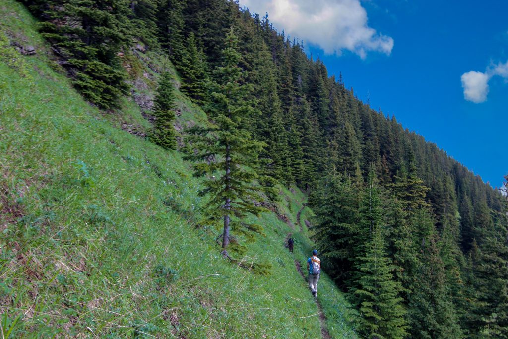
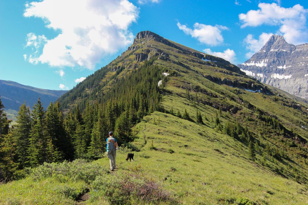
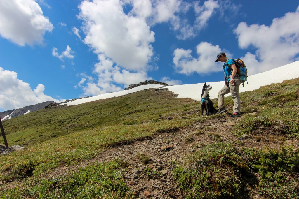
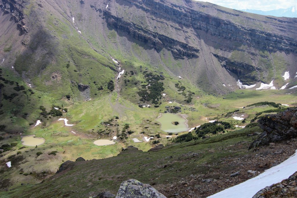
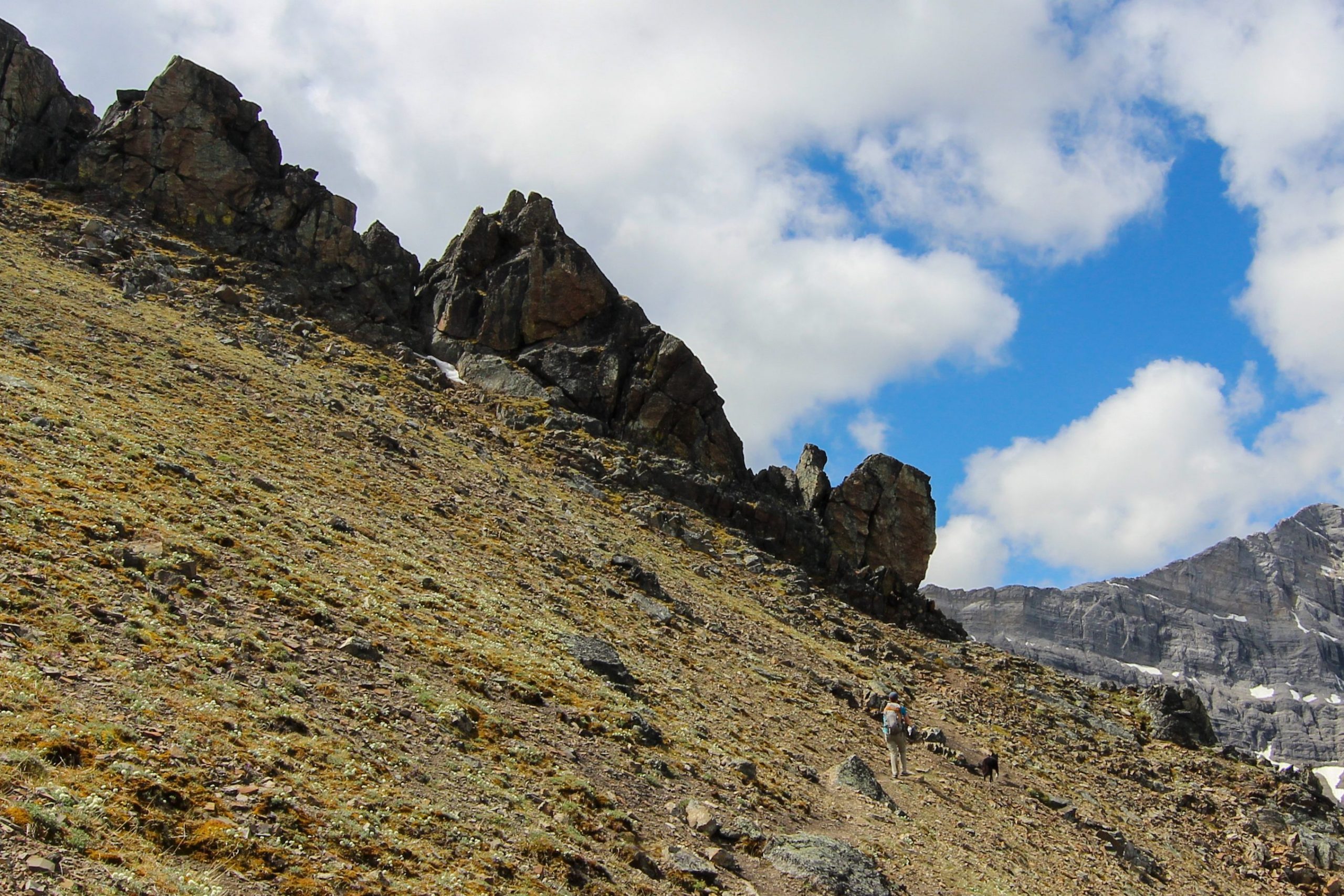
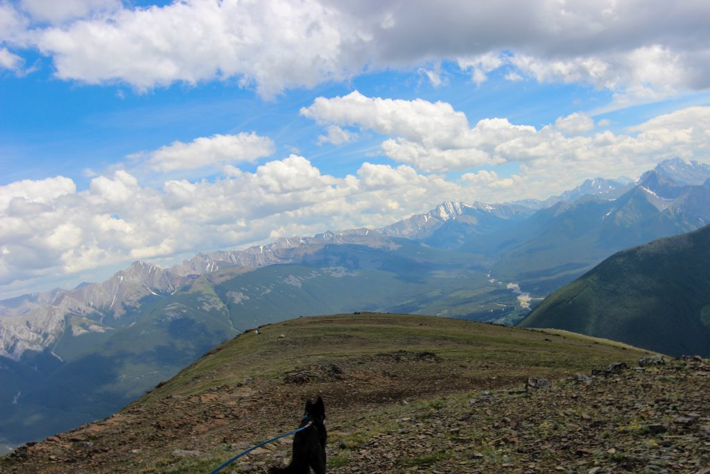
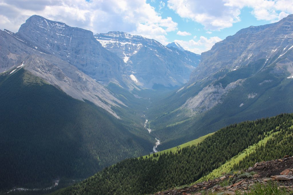
We got our first views after 1 hr 40 min of hiking as the trees started to thin out allowing us to see westward up the Bow Valley. Twenty minutes later after 6.2 km we came to the junction where the route up Mt Collembola veers off to the left and the trail for the north ridge of Mt Allan goes right. The wide trail, old road really, suddenly became a narrow twisty trail. We then had a 2 km reprieve from the relentless climbing while we traversed across the edge of the cirque between Collembola and Allan as we made our way towards the north ridge of Mt Allan. In the cirque there are two small lakes or tarns known as the Jubilee Tarns. There is a faint trail leading up to the tarns which offers a seldom used alternative to accessing the north ridge of Mt Allan up a steep grassy slope.

First views of the day. Wind Ridge with the Three Sisters in the background.
Just prior to the junction with Collembola route. Easy to see this was once a road.
Looking back towards Canmore from the same spot as the previous photo.
We are now on a true tail. Volcano charging at the front.

After crossing the cirque which was a nice meadow walk we came to a steep wall that is the north ridge up Mt Allan. To gain access to ridge we actually had to side slope down the ridge to a low point where we would begin climbing once again. We arrived on the north ridge to Mt Allan at 10:40 am two hours 45 min after leaving the trailhead a distance of 8.35 km.

Micah surveying the wall we have to get on top of.
The wall that defends the ridge from the north-east side. We would turn right and side slope across the face to gain access to the ridge.
Off again.
View back to Pigeon Mt.
Side sloping up to the ridge.
On the ridge. Looking west back to Canmore.
Micah taking in the views. The limestone cliffs of Mt Lougheed dominate the skyline.
Look how taut the leash is. Did I mention that Volcano was pulling strong all the way.
Micah and Volcano looking at something interesting, maybe Wind Creek.
Happy crew.

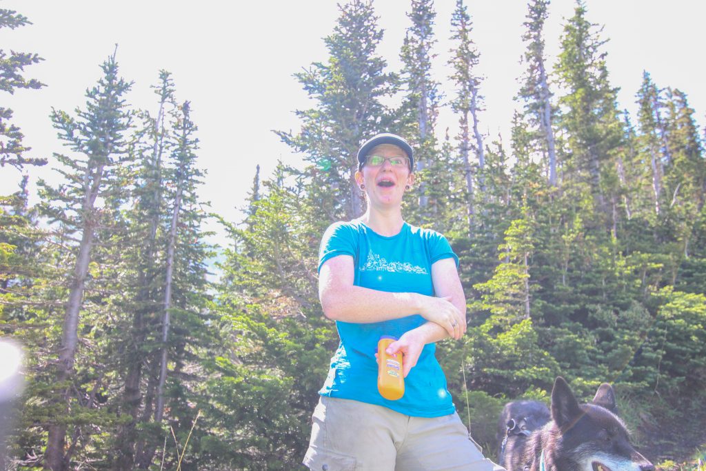
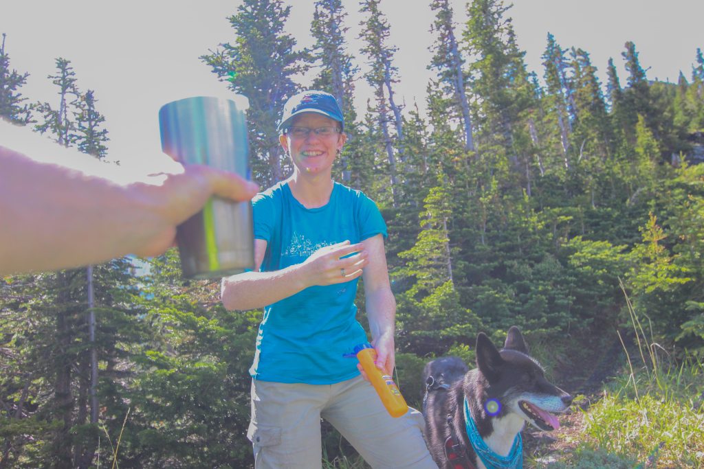
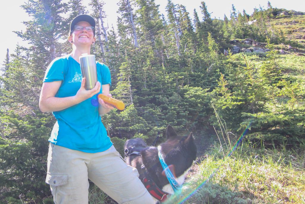
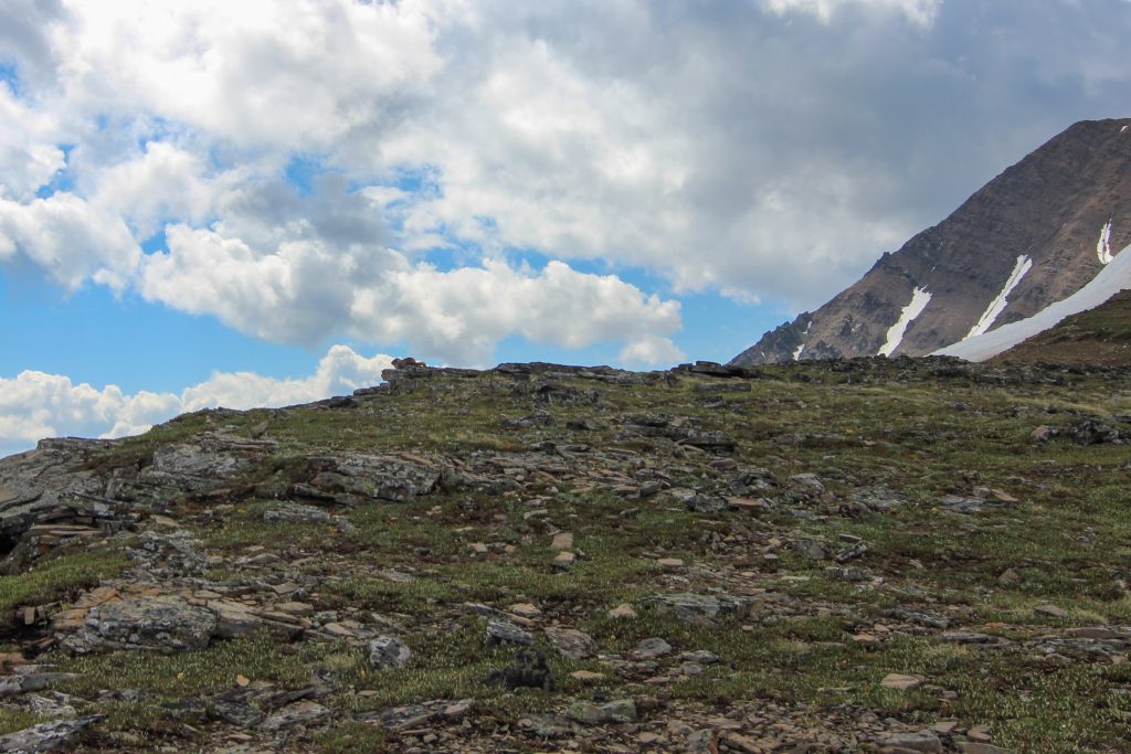
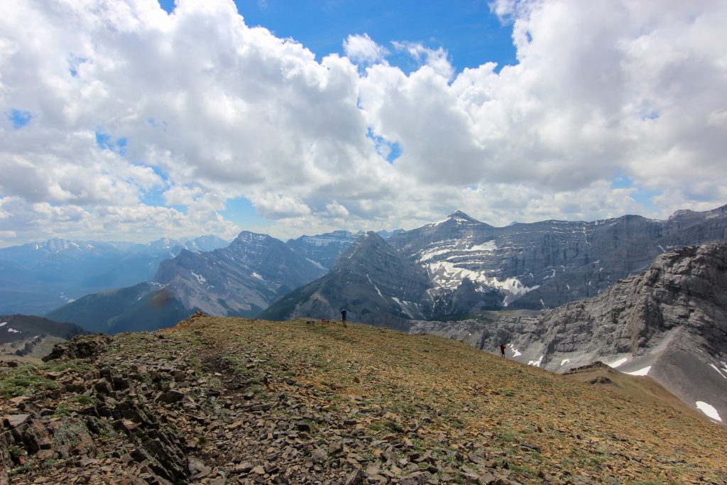
After stopping for photos we had a lovely long grassy ridge walk leading up to what looked from a distance to be an insurmountable cliff face. Part way along the grassy slope we stopped to sunscreen up and I popped out a little surprise on Micah. I had packed some ice cream into a insulated coffee go cup. Needless to say Micah was quite pleased.

Nice grassy ridge leading to an ominous cliff face.
Presentation of the ice cream.
Micah happy with their ice cream. Volcano had a bowl of water and food in her collapsible doggie bowl.
I am still on the trip.

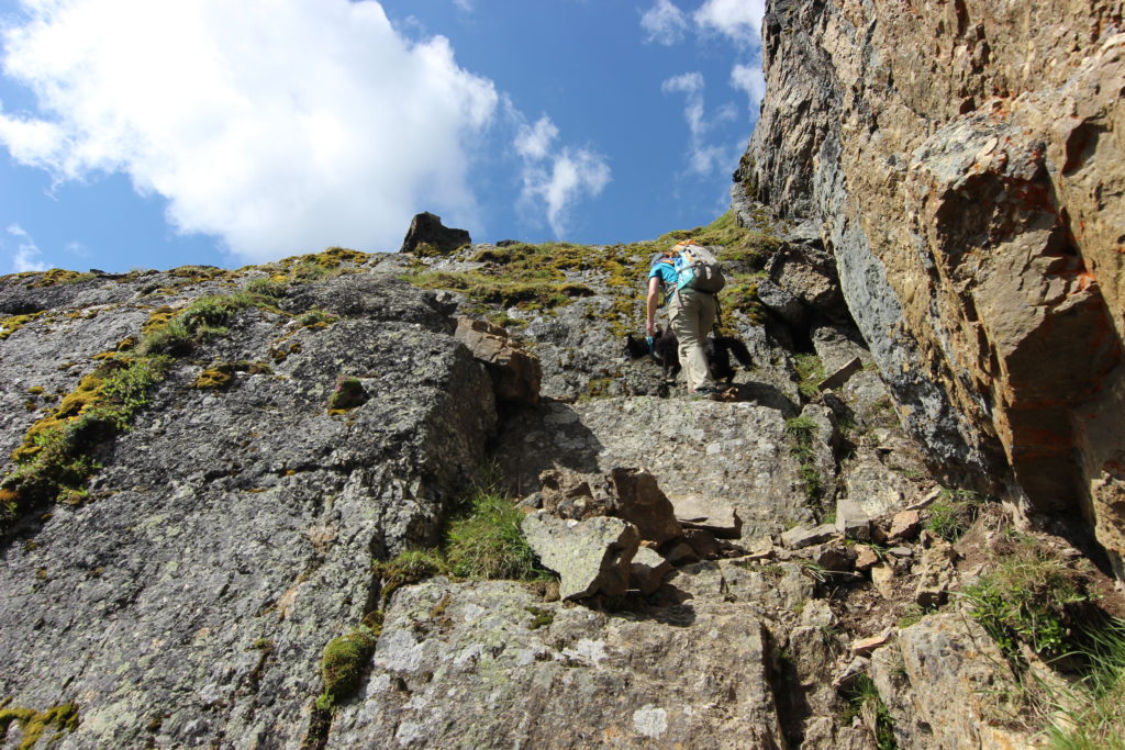
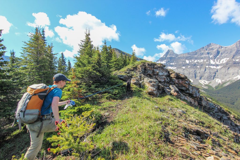
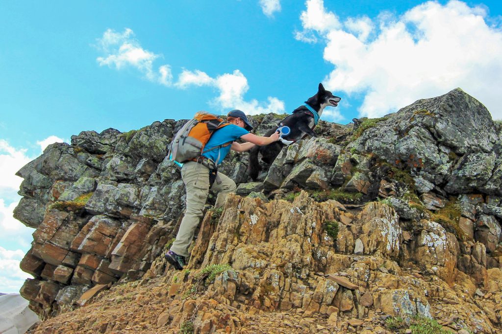
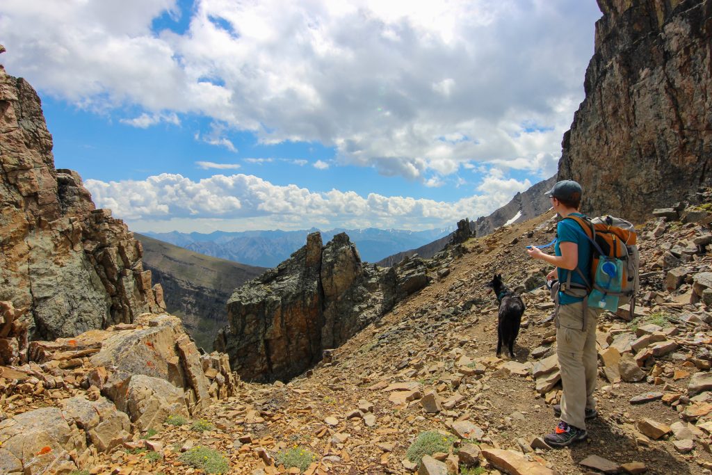
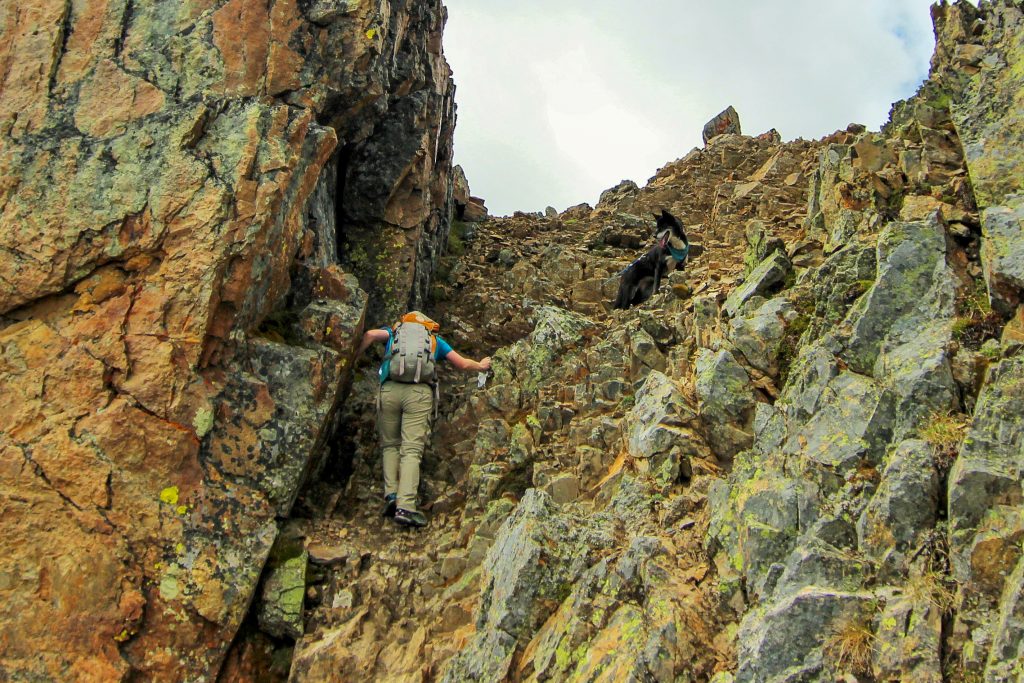
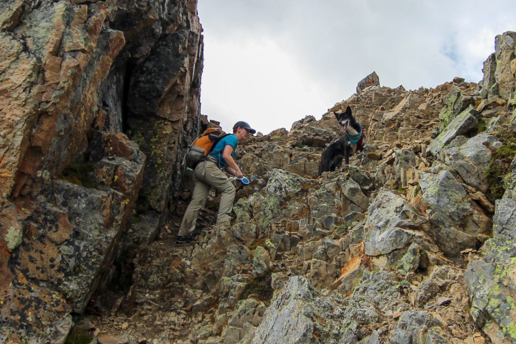
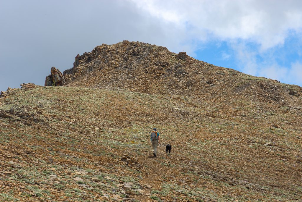
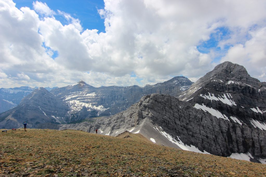
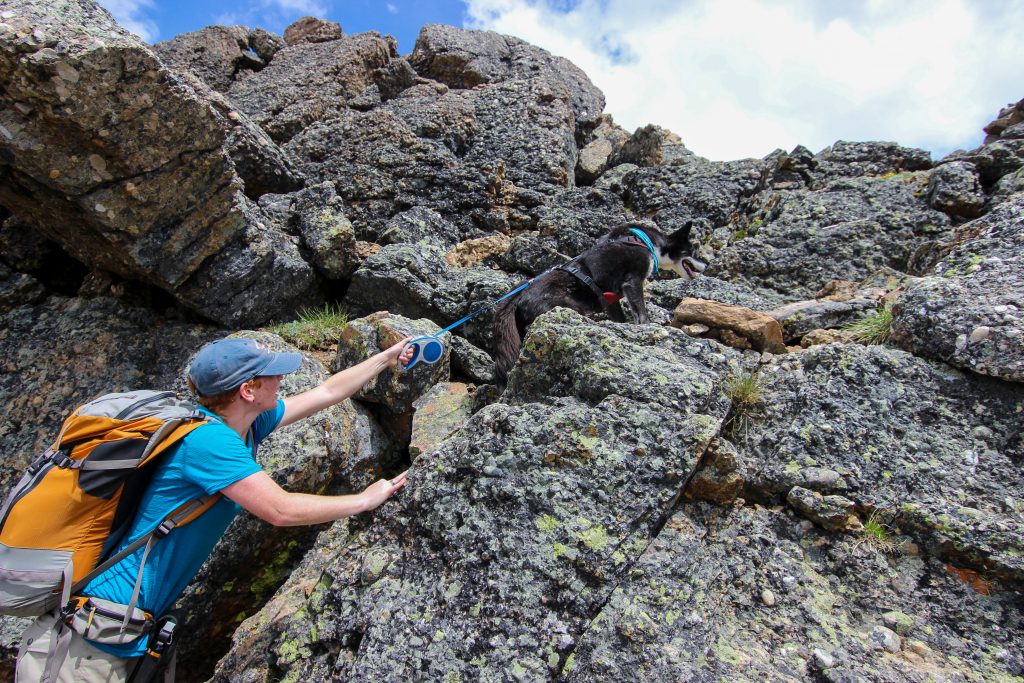
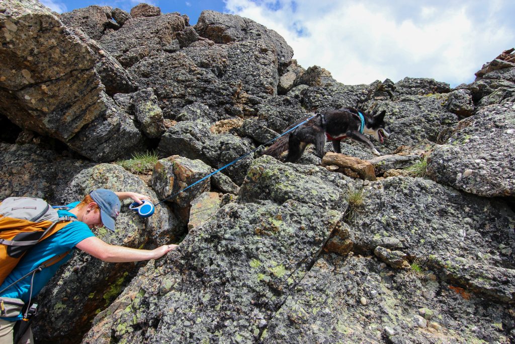
There was a couple little cliff bands to scramble over before reaching the large cliffs known as the Black Bands a distance of 9.3 km from the trailhead. Volcano did a stellar job of scrambling despite not having a lot of experience from her life a sled dog. Once arriving at the Black Bands a very obvious trail skirted around to the left following close to the cliff on quite a steep slope.

A jumble of small cliffs welcome us to the Black Bands.
Getting over another little cliff band.
The trail leads left, so the Lead Dog heads left.
Looking back can see the grassy slopes of Pigeon Mt and the power lines heading over Skogan Pass.
Making our way around the Black Bands. I said it was a steep slope.

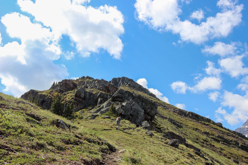
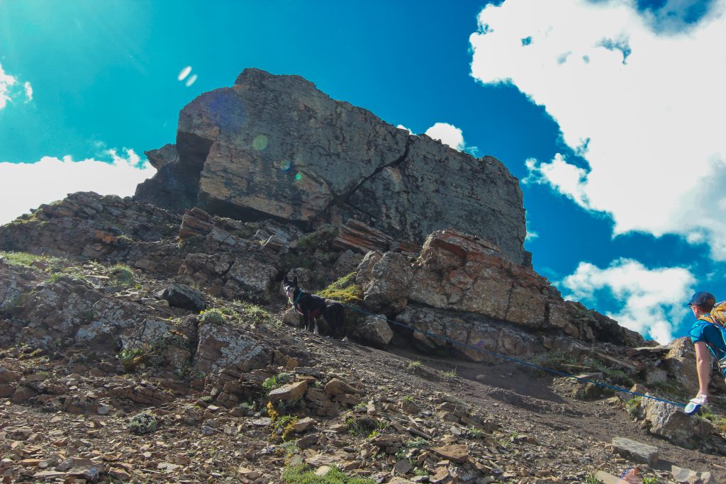
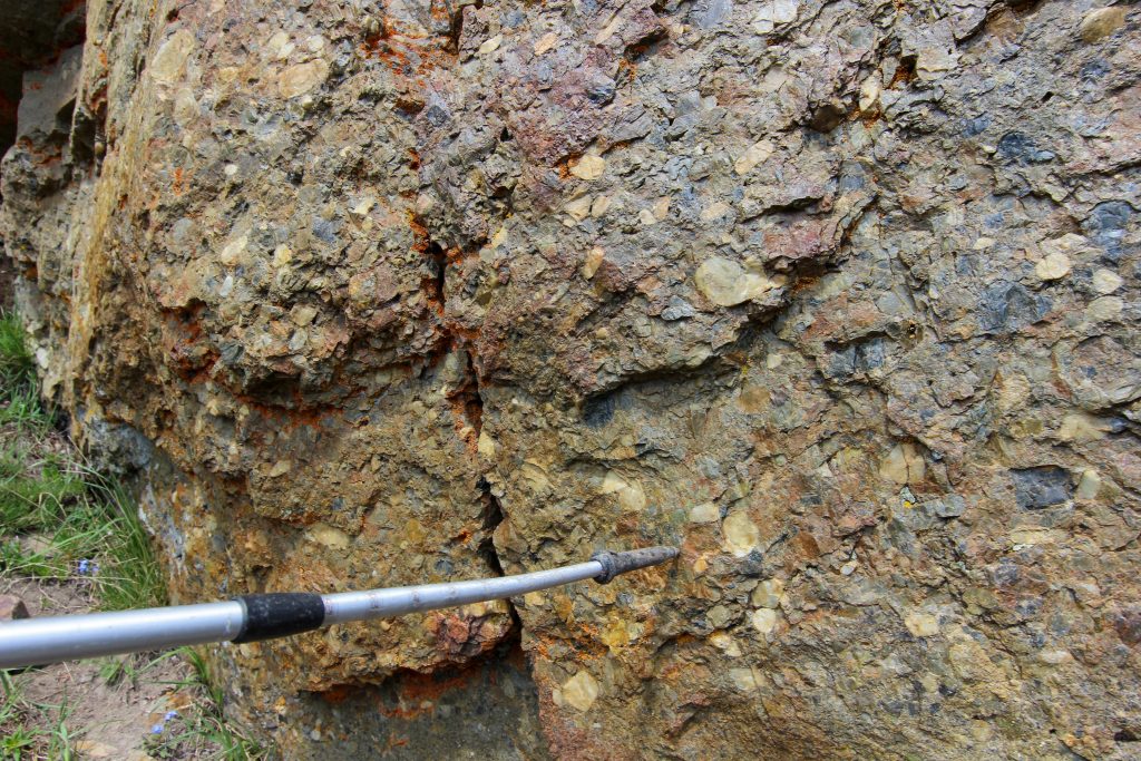
The trail came to an abrupt end at a transition from red conglomerate rock and dark grey limestone. The difference in erosion of the two types of rock gave an obvious scrambling route up. The limestone being blocky produced nice steps up that while daunting at first glance Micah and Volcano made the scramble look quite straightforward.

Micah and Volcano negotiating the Black Bands.
After all that excitement my attention was drawn to a cool conglomerate rock.
Relaxing at the top of the Black Bands.
Can just see the peak of Mt Allan off to the left. Still looks so far away.

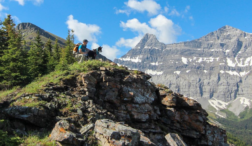
We relaxed briefly at the top of the Black Bands. It was 11:40 am or just a little under 4 hrs since we started the hike. We came to a small cliff band that we quickly made our way over. At first glance we appeared to now have an easy walk all the way to the summit. Some of the runners that we had see back at the stream crossing started to come by us heading back down after submitting Mt Allan.

Up and over another little obstacle.
Looks like a nice walk to the summit. Runner coming by. We are still over 300 m below the summit elevation.
A lovely grassy walk. The dark band in the distance will present another obstacle.
The high alpine is always guarded by marmots.
Jubilee Tarns. Not fantastic looking bodies of water. There are grassy slopes that lead down to the tarns from both ridges. In her guide book Gillean Dafferns says you can use the grassy slopes to escape lightning on the ridges. Glad we did not have try the escape route.

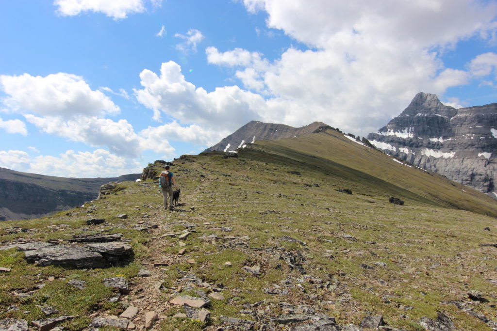
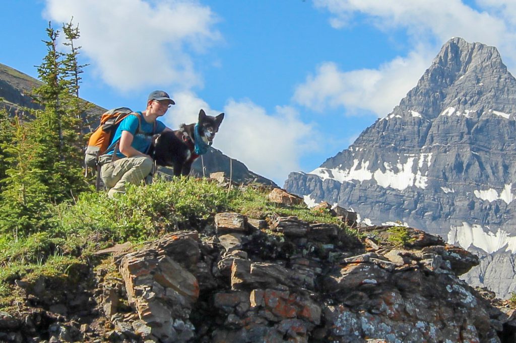
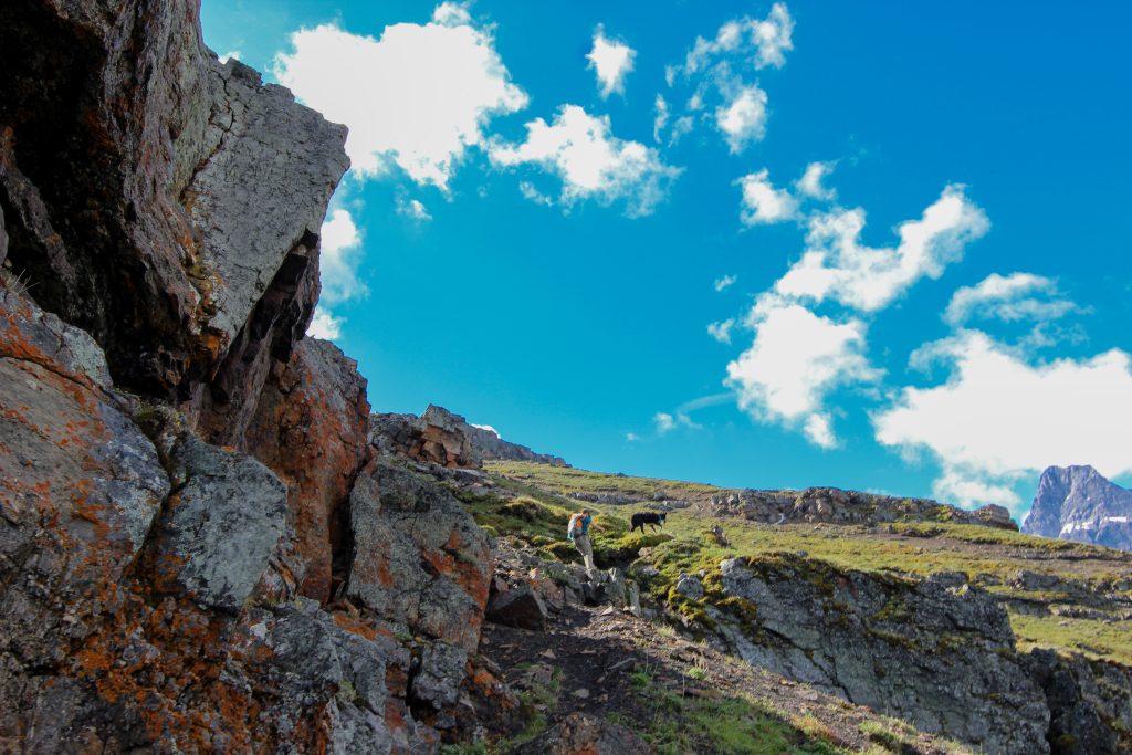
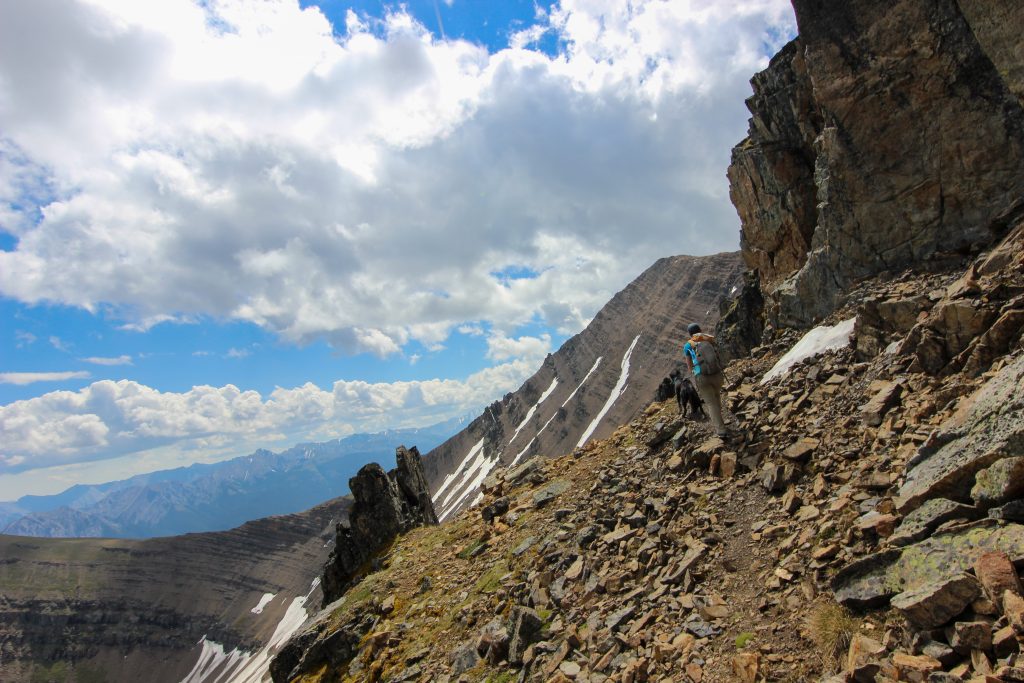
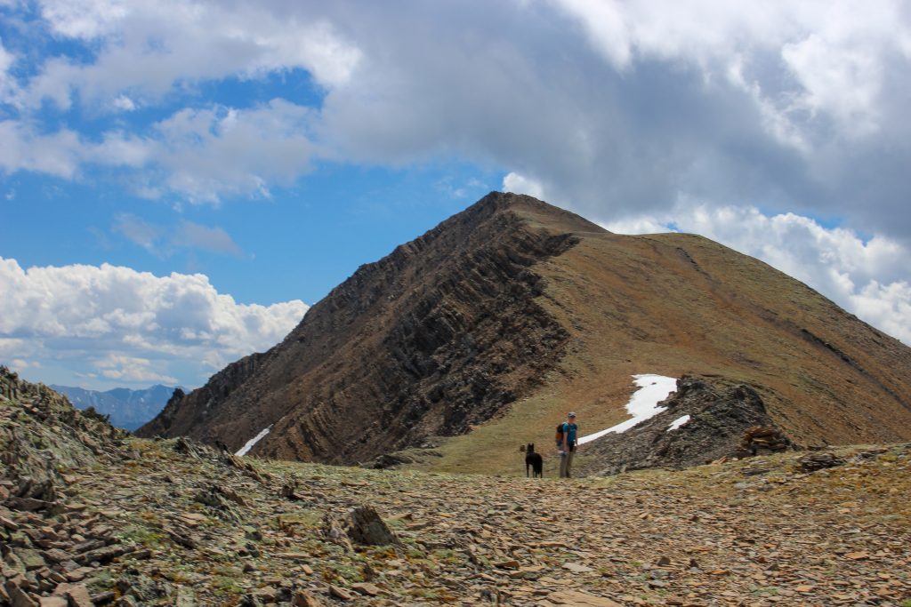
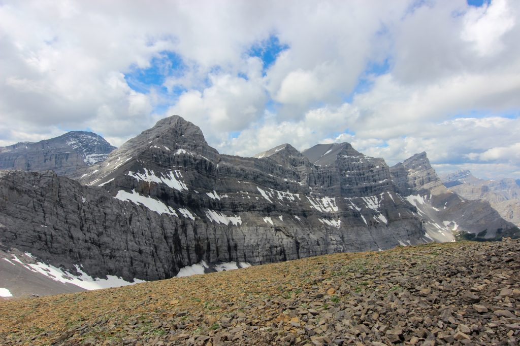
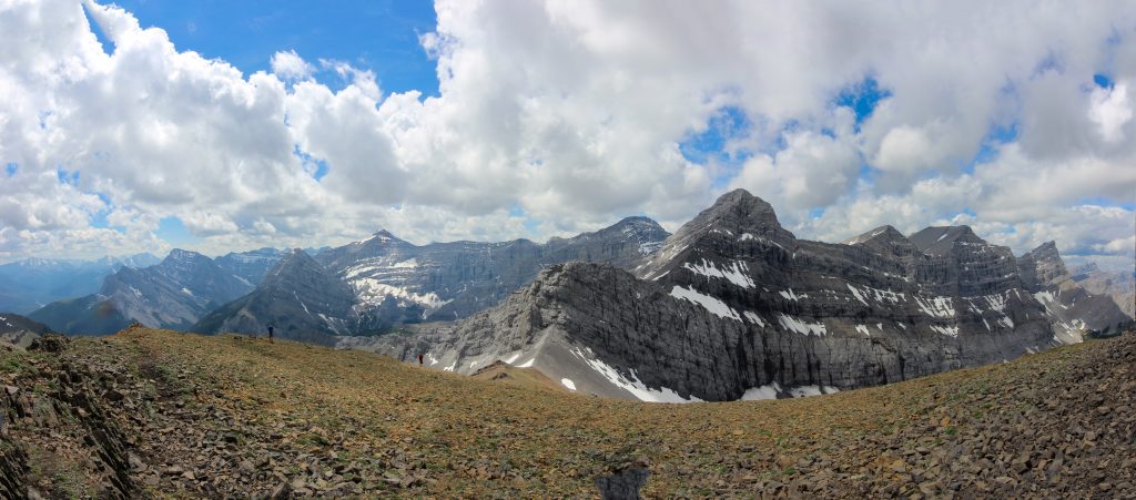
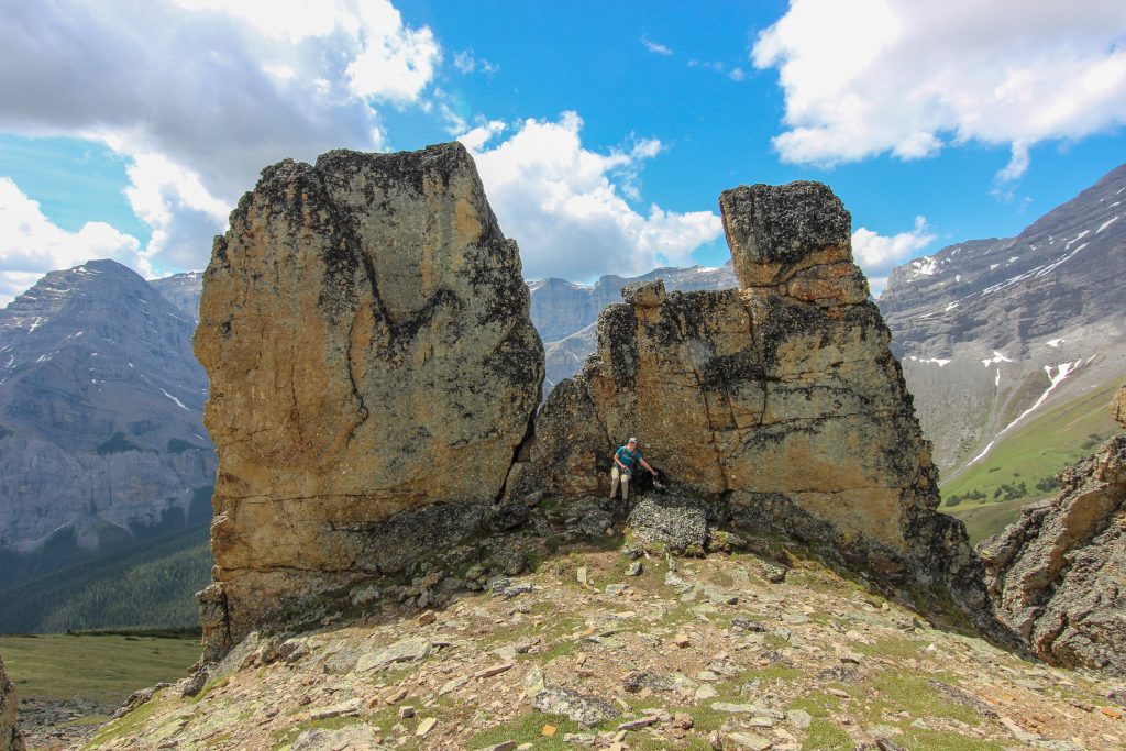
We arrived at our next obstacle a row of imposing red pinnacles 30 minutes after leaving the Black Bands. Following the trail we started on the right hand side then crossed over to the left where we were presented with another stepped wall just like back at the Black Bands. It was a steep ascent back but Volcano scrambled up like a pro with Micah hustling to keep up while holding the leash. Once at the top it was a short hike to a false summit. From the false summit there was a clear view of the true summit of Mt Allan with no further obstacles.

The red spires coming into view. The path through in on the down slope on the left just above the snow.
The rocks are looming very large but the trail is very clear.
Micah and Volcano pausing to take in the view.
Another steep side slope.
The route up was very obvious once we got close to the cliff.
With her 4WD Volcano is wondering what is taking Micah so long.
Volcano enjoying her day scrambling up cliffs.

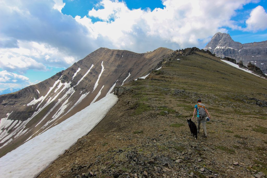
Once back on the ridge it took about 20 minutes to arrive at the false summit. It was only 600 m distance to the ture summit combined with 120 m of elevation gain. We dropped down a short way off the false summit before making the final push up to the summit of Mt Allan. It was 12:50 pm when we arrived at the summit. It had taken us 4 hrs 55 min to hike to the summit covering 11.6 km and gaining almost 1500 m of elevation. We were all smiles at the summit. It had been a thrilling hike and it was only half over.

The view from the false summit. Micah wondering what I am doing.
Love this photo. Nearing the summit. Volcano looking enthusiastic at Micah’s arrival.
Almost there.
The view down the north ridge from the summit of Mt Allan. The dark rocks are the spires and the Black Bands is at the end of the snow where the ridge drops out of sight.
A view of the valley between Mt Allan and Mt Collembola. Can see the Jubilee Tarns. Easy to see from this angle how you can use the grassy slope off of the north ridge to escape a thunder storm if necessary.
Micah enjoying their ice cream. Kananaskis Valley behind her.
The view looking south. Ribbon Peak (2880 m) at centre and Mt Kidd (2958 m) to the left.
Looking south west from the summit. Wind Mountain (3153 m) on the right. The peak in the distance left of centre is Mt Bogart (3144 m) with Ribbon Peak at far left.
The three peaks of Mt Lougheed (3107 m) with Wind Peak on the left.
Panorama of the above three photos.

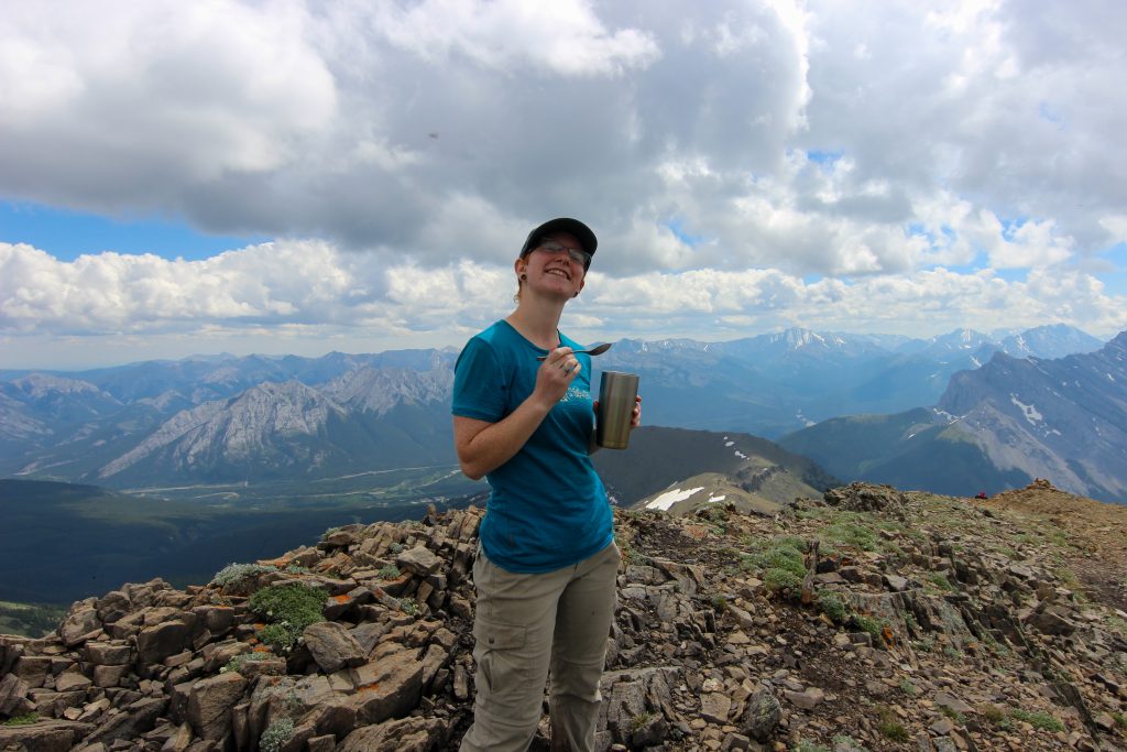
At the summit two things we had to deal with were the large number of people and flies. There were so many flies. We ate our lunch quickly and a nice hiker took our summit photo. After just 25 min at the summit we starting down the other side towards our car at Ribbon Creek.

Summit photo. My butterflies have survived.
Volcano leads us down the south ridge. At the end of the first ridge can see a black line of rocks. These would present the only obstacle on the south ridge.

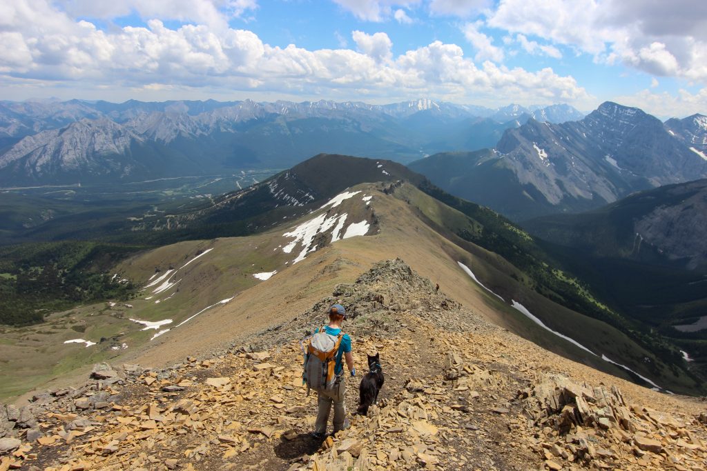
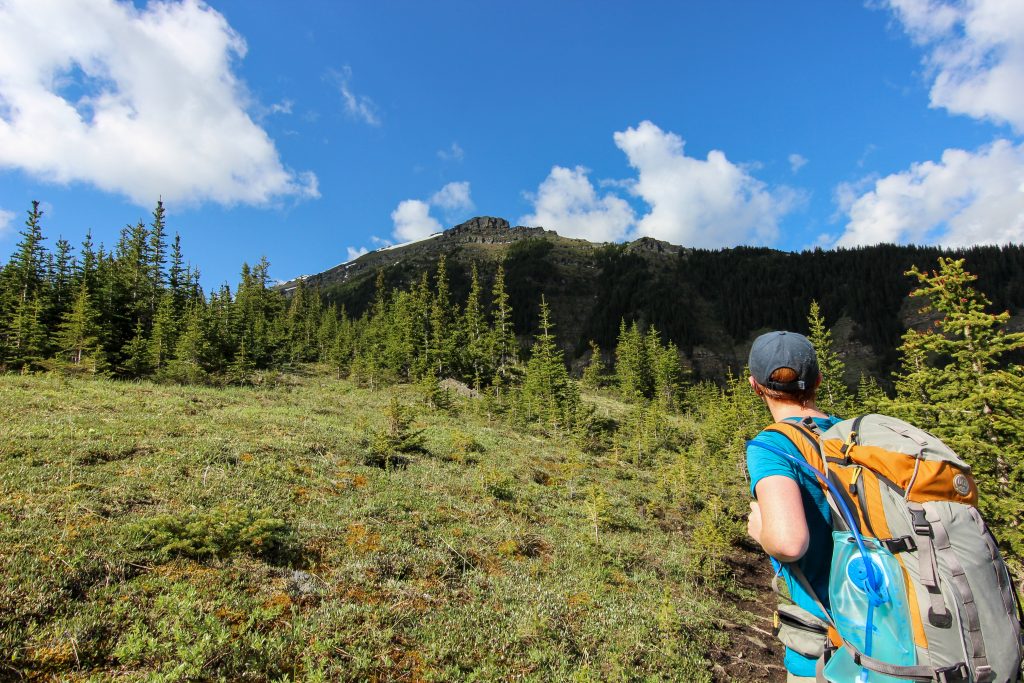
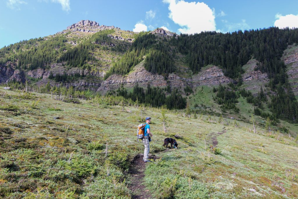
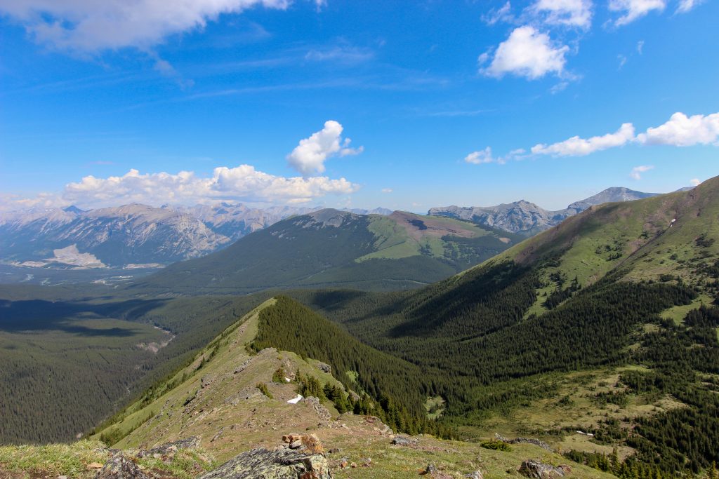
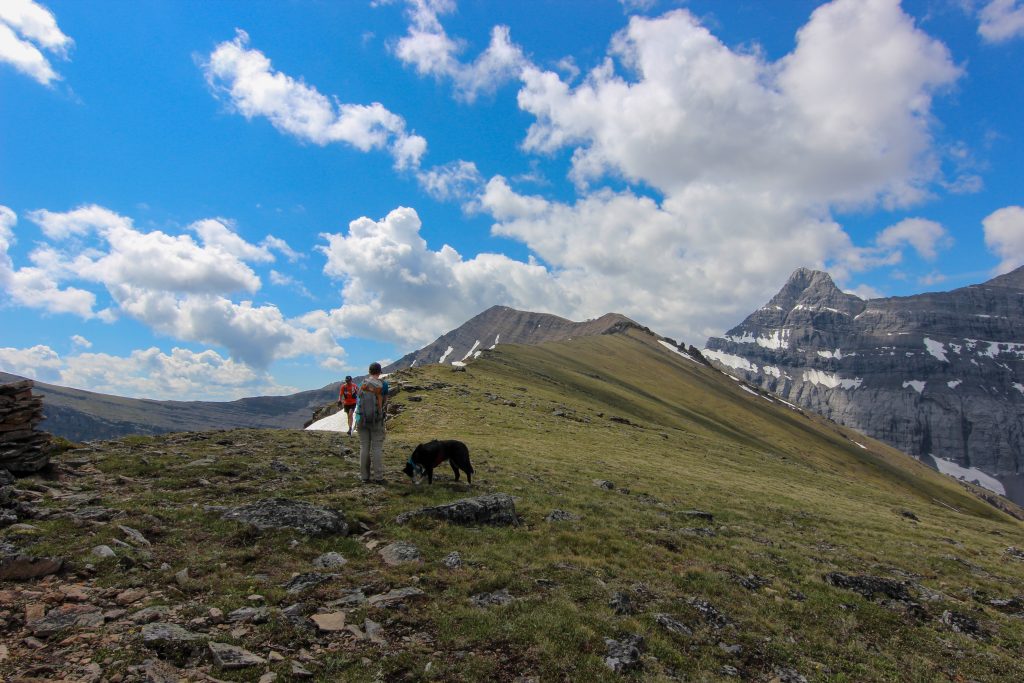
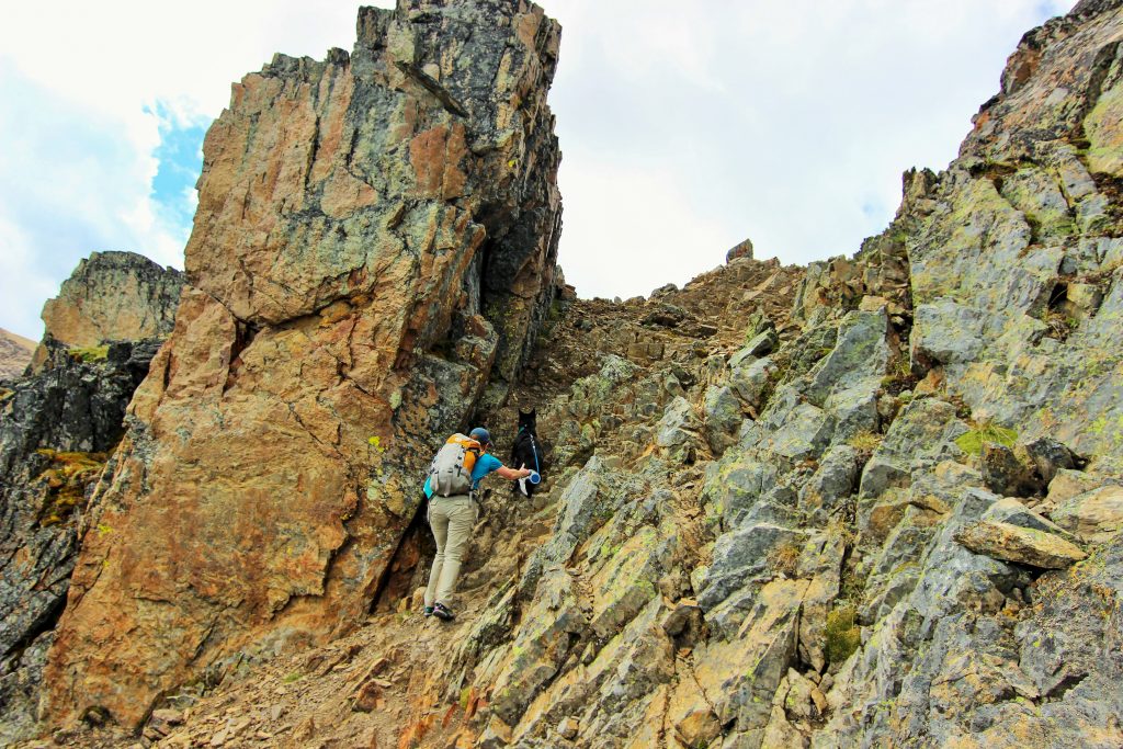
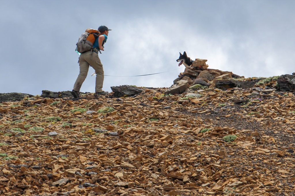
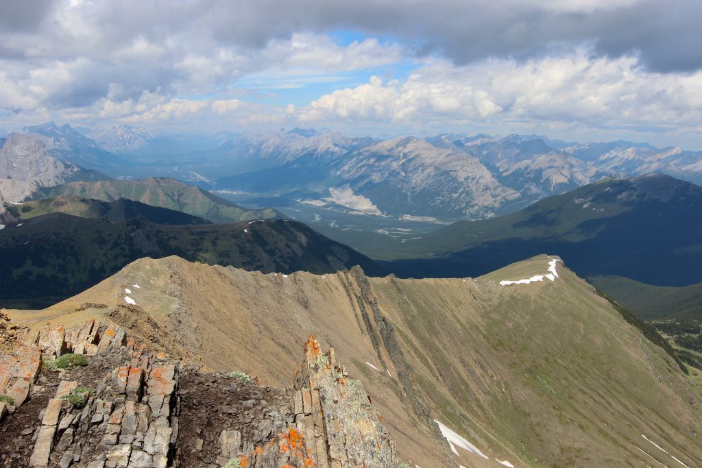
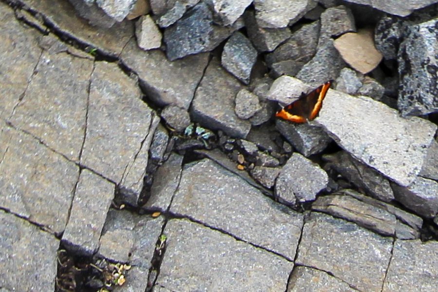
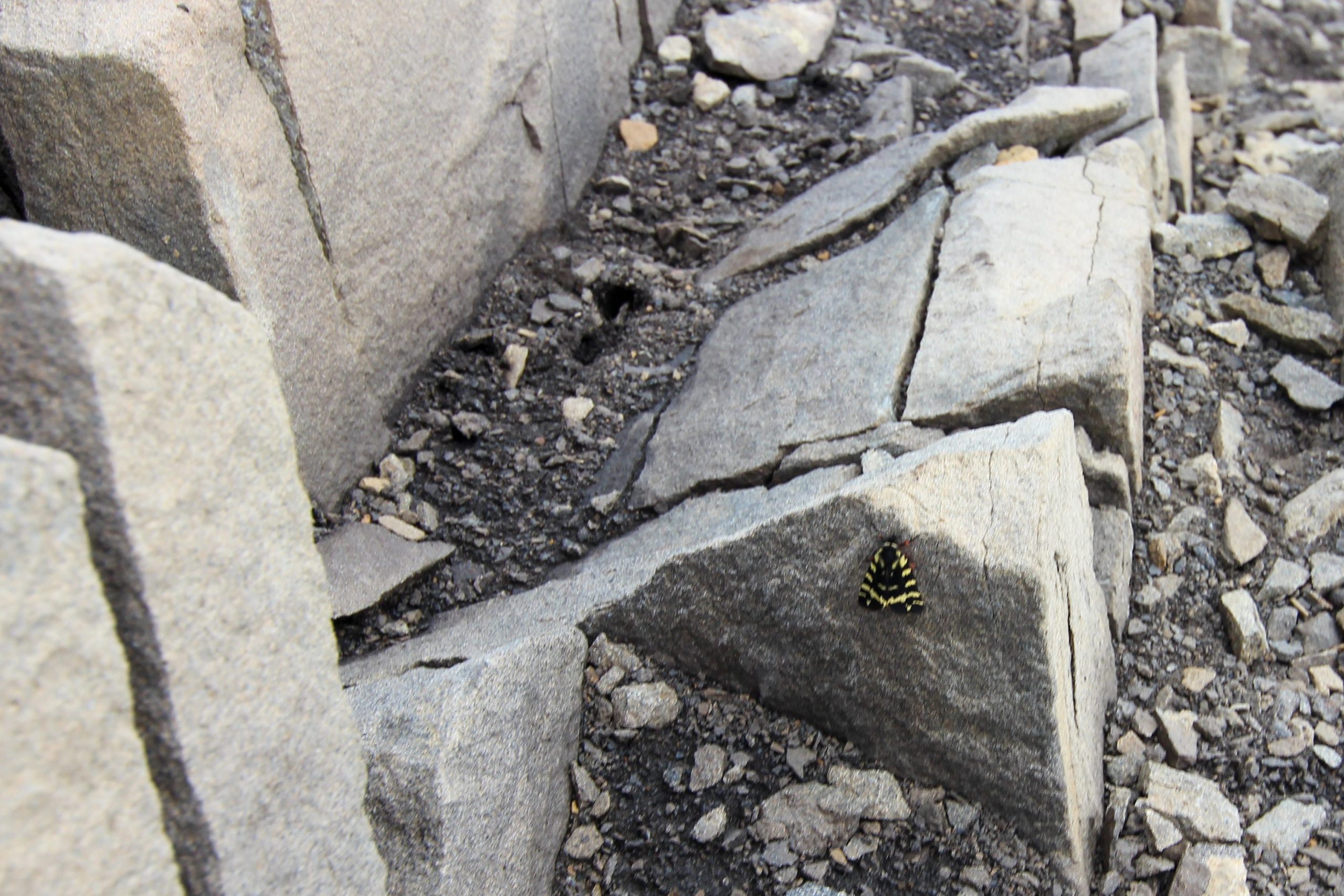
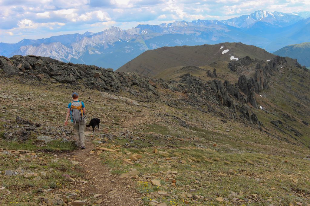
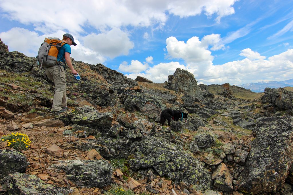
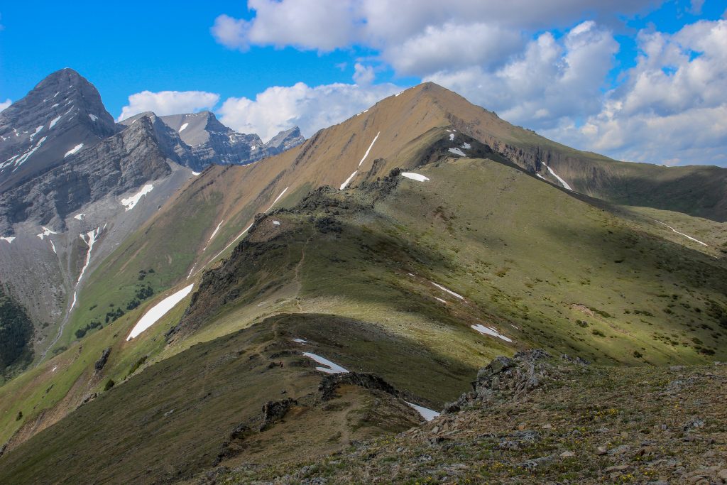
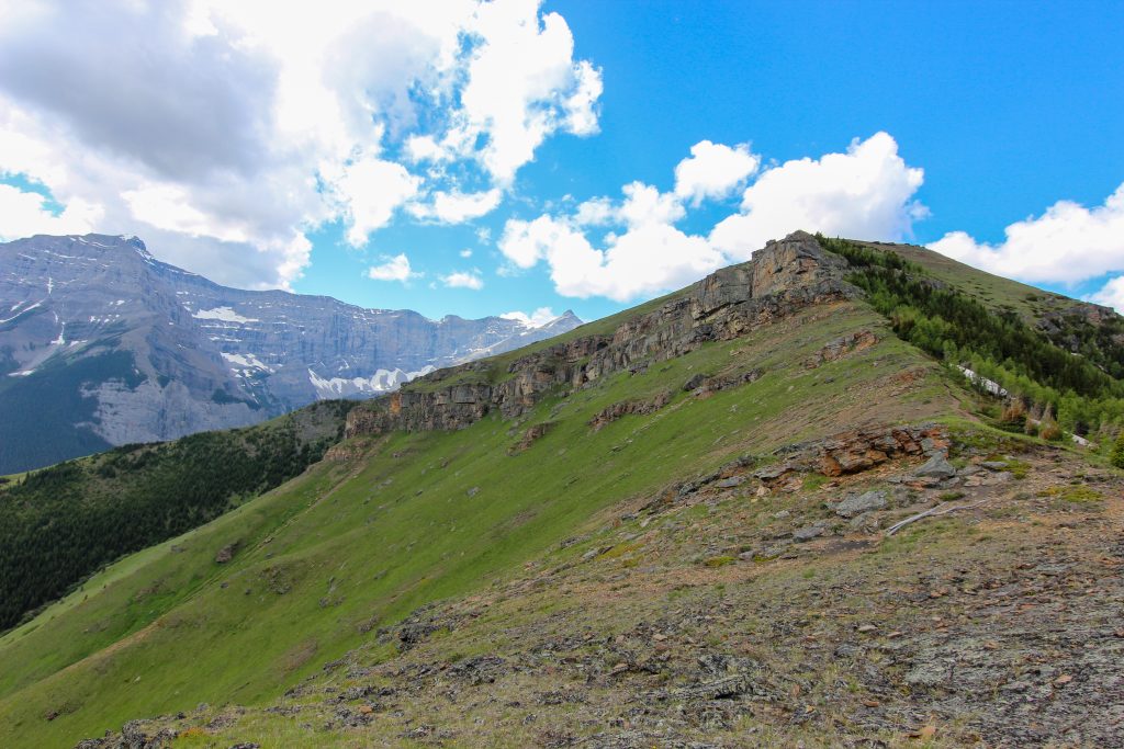
It is a shorter hike heading following the south ridge to Ribbon Creek Day Use Area and much steeper with very little scrambling. Hiking north-south allowed for a better gradient for going uphill. I have hiked partway up the south ridge and it is a very challenging hike until you get onto the ridge. The initial hike off the ridge was similar to the north ridge. The trail cut through scree covered slopes with little vegetation. A couple of butterflies caught my eye as we passed a small outcrop of rocks.

The ridge connecting Mt Collembola and Mt Allen.
Lovely little butterfly. I believe it is a Red Admiral Butterfly.
A yellow butterfly or is it a moth.

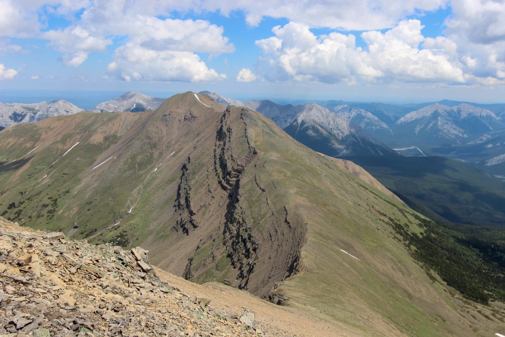
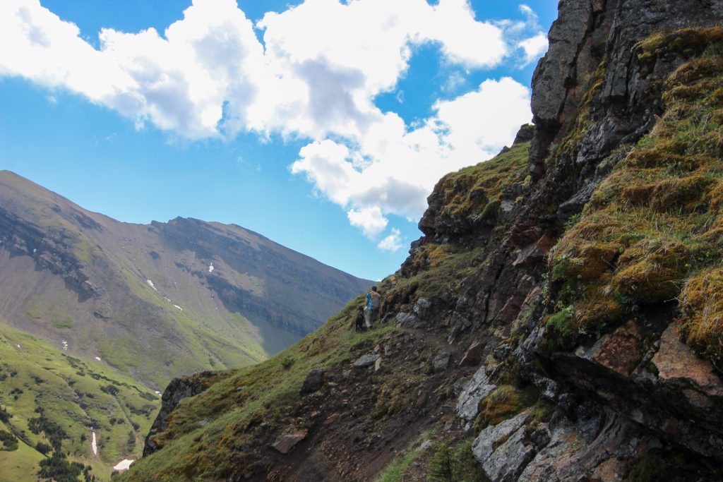
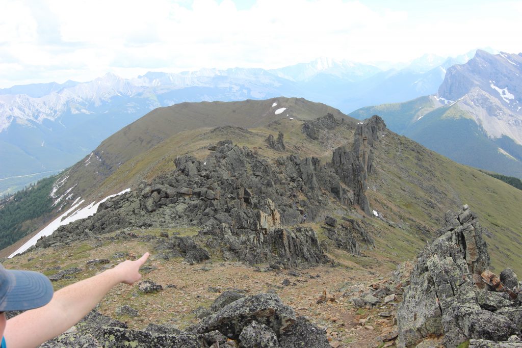
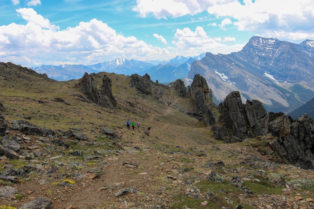
The exciting part of the south ridge came after 25 min when we came upon the rock out crop that we could see from the summit known as the Mushroom Garden. This was the only section of scrambling on the south ridge but appeared to be the most challenging for Volcano. I think it was challenging because the trail up the rocks was not as obvious. With a little direction and pushing by Micah Volcano was quickly up and over into the interior of the Mushroom Garden.

Closing in on the Mushroom Garden. More vegetation around makes the trail softer underfoot.
Micah thinks they see something interesting.
Micah muscling Volcano up the rocks.
This little slab caused all sorts of difficulties for Volcano.
Micah had to lift her onto the angle rock.
Not quite wide enough for Volcano’s back feet.
Once on the rock Volcano just powers her way up.
Volcano coming to a little flat spot, time for Micah to get climbing.
Volcano is on her way so Micah had better hurry up.
Up an over and back onto a nice trail.

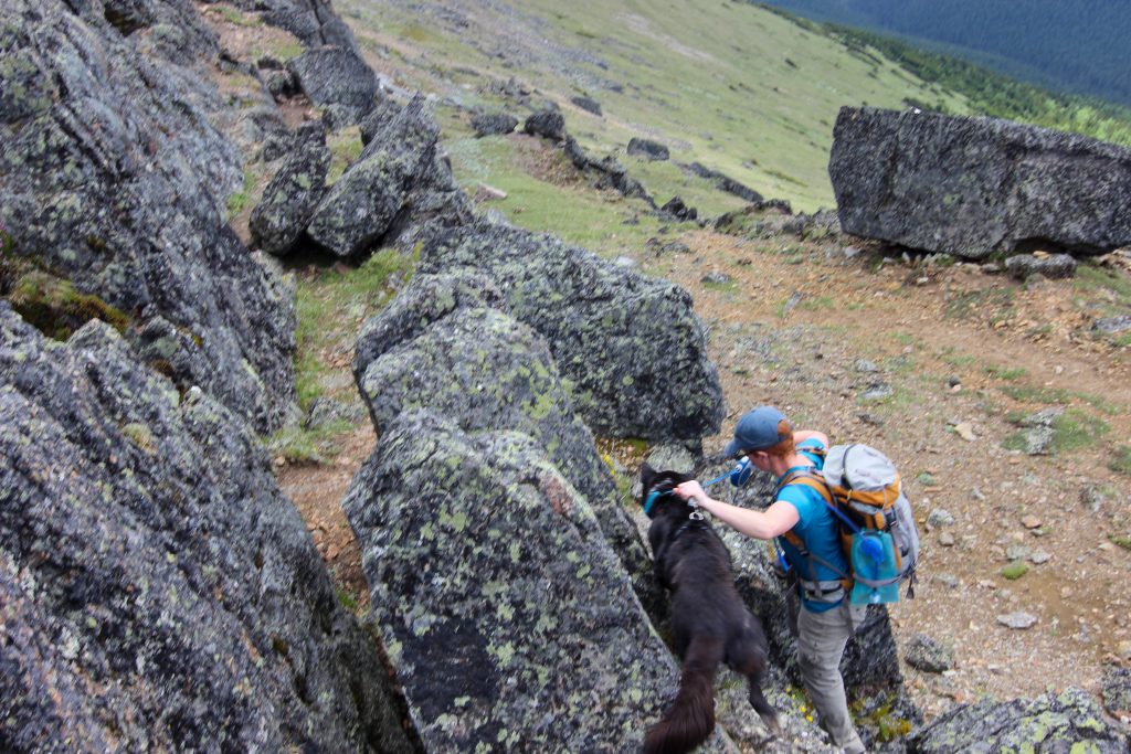
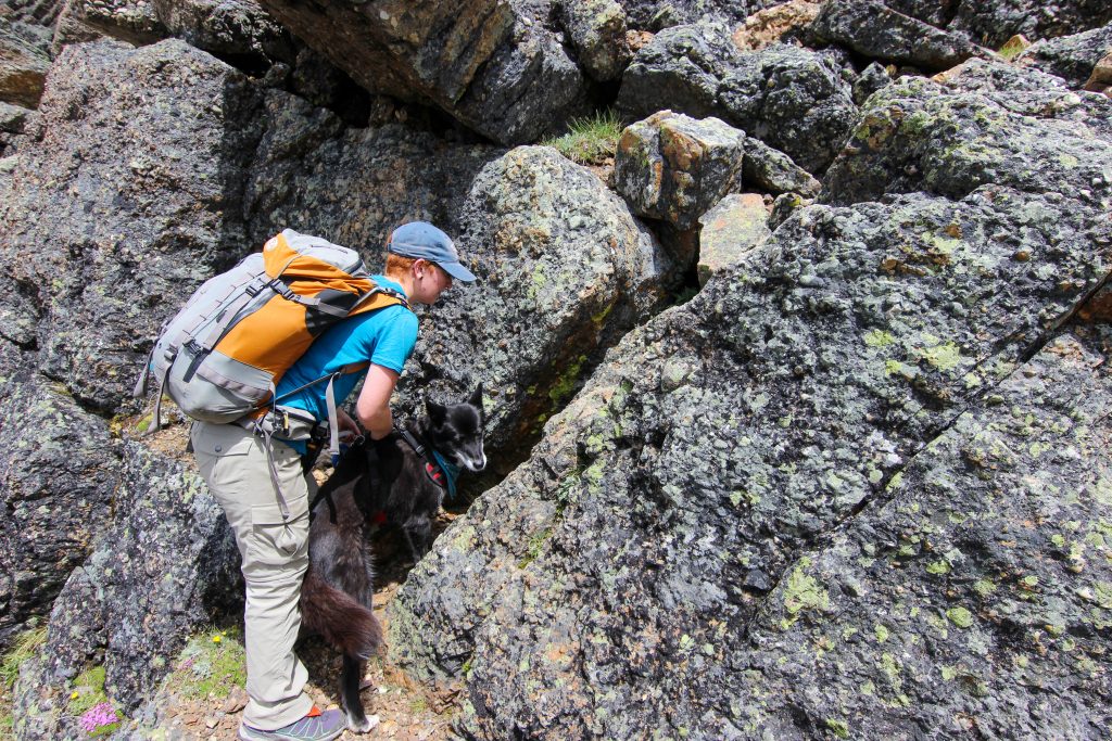
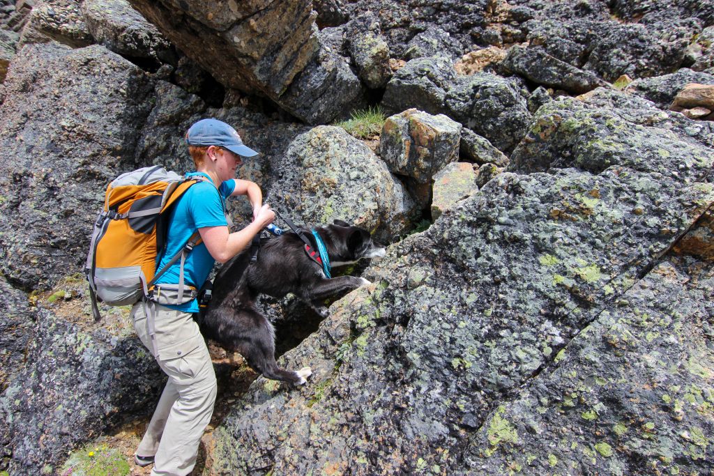
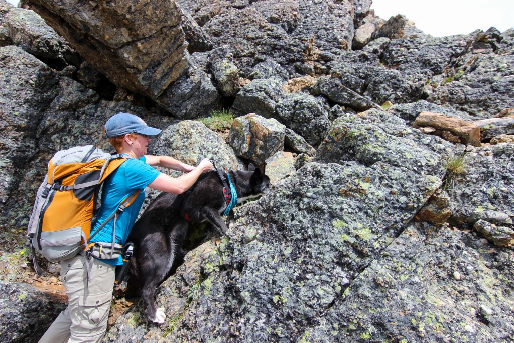
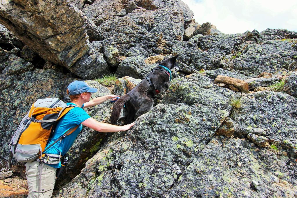
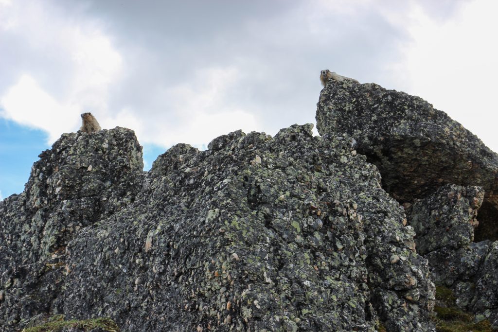
The Mushroom Garden was very interesting. Once inside you could see that the rocks had been thrust 90 degrees to almost vertical. We stopped for a few photos. Before leaving the rocks behind we passed by some marmots looking like sentries guarding their territory.

A very interesting little section.
Everyone still looking happy. The rock at centre right is known as The Claw.
Posing for the camera. Volcano never has learned to pose very well.
Marmots on duty.

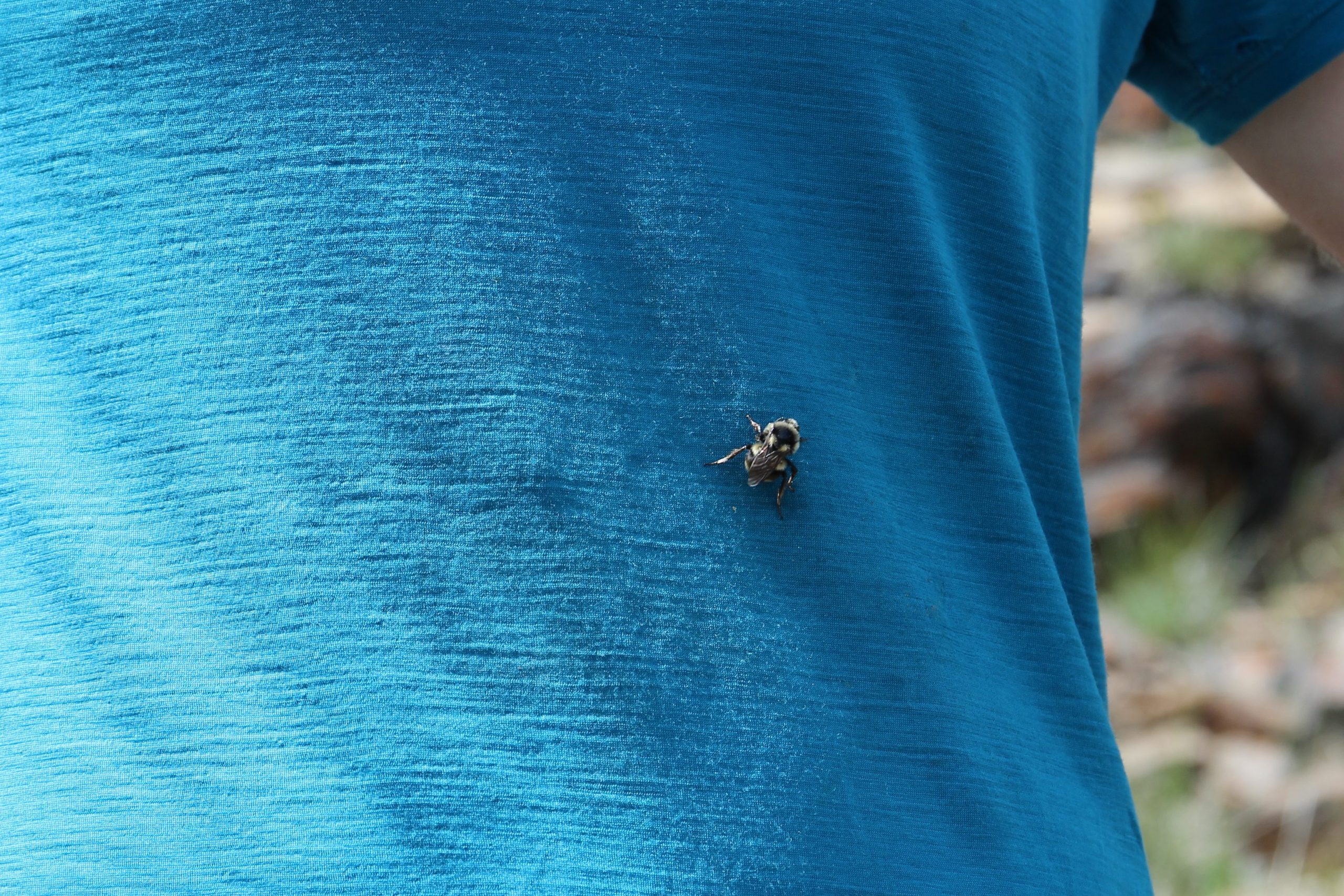
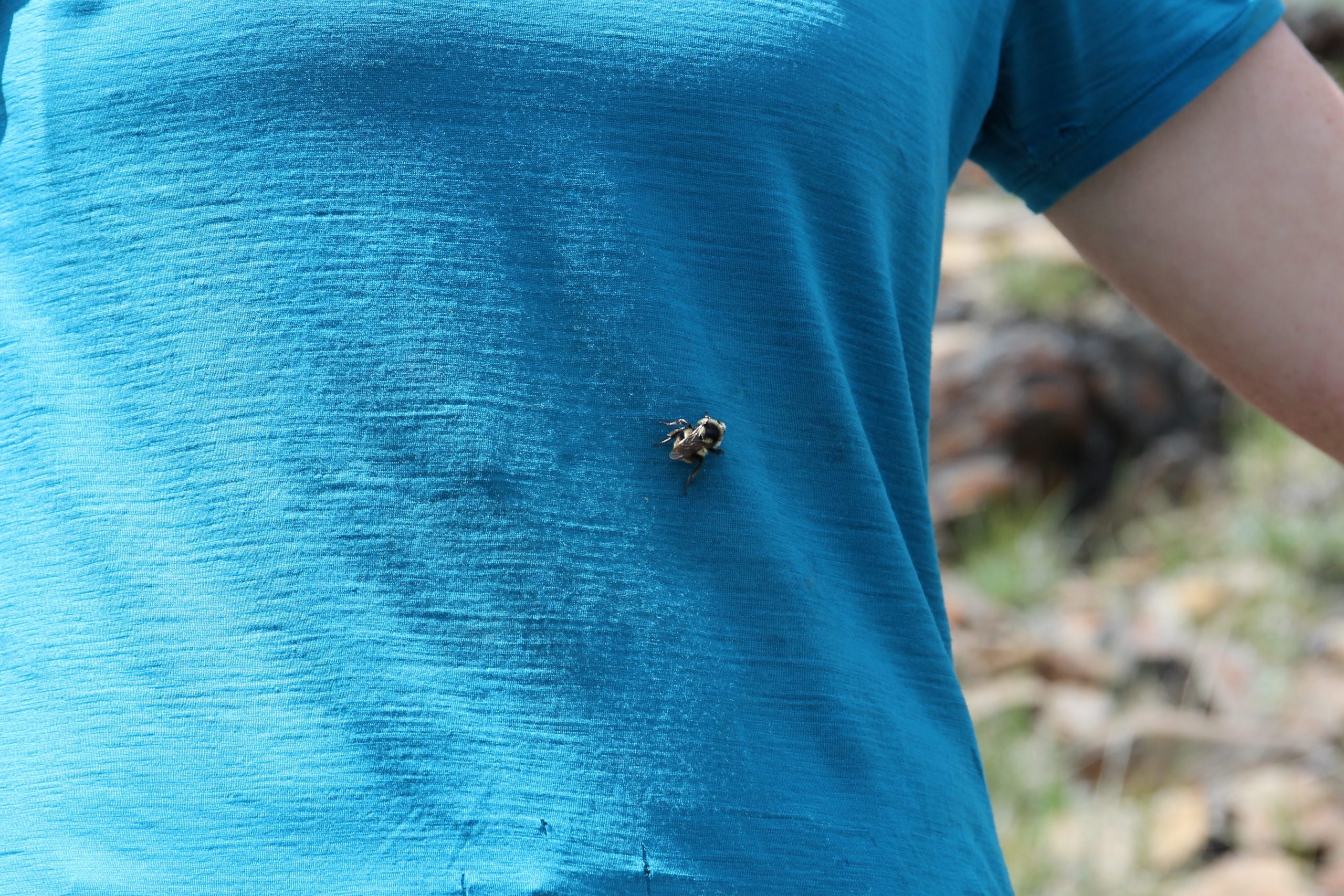
The trail stayed on the ridge for the next couple of kilometers descending a comfortable slope downhill. Micah had a fun little experience with a bee. The bee took a strong attraction to Micah’s shirt and crawled all over them. As we came to the end of the ridge we dropped down to where I had hiked previously. The trail became very steep losing 750 m of elevation over the next 3.5 km taking us quickly back to the car in under 1 hr. I do remember passing people still hiking uphill.

Looking back up to the summit. Wind Peak on the left.
Looks like we are coming to the beginning of the steep section. But there is an easy way around the cliff that is coming up.
That was the little cliff band that we were coming to in the previous picture.
The friendly bee.
Bee on the move.
A view down Ribbon Creek.

Guess I was getting tired or that there was not much to take pictures of as we headed down the last section of trail back to the car. We arrived at the car at 3:55 pm. It had been 8 hrs and 5 min since we set out from Dead Man’s Flats. While there are no photographs to commemorate our finish what I do remember is that we both thought that this was an epic hike and remains one of our favourite day hikes and of course that Volcano is Super Star Hiker.

One last photo.

Bootwreckers Home Page

bootwreckers

New trip posted, three day trip in the Rockwall in New trip posted, three day trip in the Rockwall in Kootenay NP with @sio.mellors. Introduction and Day 1 up on Bootwreckers.

Trip was suppose to be hiking Northover Ridge in Kanananaskis but smoke had us change plans at the last minute.

This would be my third multi day trip on the Rockwall but the first for Siobhan.

Managed to get two camping sites on the Rockwall and instead of smoke we had to deal with the threat of rain.

We did get wet but we had a blast.

Day 1 is from Paint Pots TH to Helmet Falls CG, with a side trip to get up close the the falls. Pretty straightforward day but visiting Helmet Falls is always special.

#parkscanada #parks #bcparks #trails #longdistancehike #longtrail #outdoors #outside #thruhike #hike #thruhiking #outside #backpacking #waterfalls #waterfall #naturephotography #naturephotography #nationalparks
The sixth and final day of our 2022 GDT Section D The sixth and final day of our 2022 GDT Section D hike is up on Bootwreckers, see link in bio.

This day took us from a random camp on the Howse Floodplain to the Mustafa Canyon parking lot. This was an adventurous day with bushwhacking, stream crossings and dead fall but a simply glorious end to a wonderful hike on the GDT. 

Again thanks  to Sara (@sd_kuz) and Lillian (@waterlilizee) for sharing this adventure with me. I am sure we will meet again on a trail someday.

Photo 1 - Morning Colors

Photo 2 - tents on the floodplain

Photo 3 - bushwhacking to start the day

Photo 4 - fields of flowers going to seed

Photo 5 - looking south down the Howse River

Photo 6 - thigh deep water crossing

Photo 7 - big views

Photo 8 - Sara crossing some dead fall

Photo 9 -Mistaya Canyon

Photo 10 - picked up a thru hiker named Roy, enjoying beverages left by Natasha and Kyle from Backpacks and Bikeracks

#greatdivide #greatdividetrail #gdt #parkscanada #parks #bcparks #trails #longdistancehike #longtrail #outdoors #outside #thruhike #hike #thruhiking #outside #backpacking #waterfalls #waterfall #naturephotography #naturephotography #nationalparks #duplex #sectionhike #sectionhiker
Day 5 of our 2022 Great Divide Trail Section D hik Day 5 of our 2022 Great Divide Trail Section D hike is posted on Bootwreckers, see link in bio.

Truly epic day on the trail. Pass through the debris of two avalanches, had lunch by a waterfall, crawled over so much dead fall and hiked on the Howse Flood Plain.

The sunset on the flood plain was one of most magical I have seen.

As always a big thanks to Sara (@sd_kuz) and Lillian (@waterlilizee) for sharing this adventure with me. The Team totally rocked the trail.

#greatdivide #greatdividetrail #gdt #parkscanada #parks #bcparks #trails #longdistancehike #longtrail #outdoors #outside #thruhike #hike #thruhiking #outside #backpacking #waterfalls #waterfall #naturephotography #naturephotography #nationalparks #duplex #sectionhike #sectionhiker
Evening light on Picketpost Mt. #aztrail #aztasso Evening light on Picketpost Mt.

#aztrail #aztassociation  #nps, #nationalparks, #slotcanyon, #hiking, #hikingadventures, #familytime, #camping, #campingadventures, #outdoors, #outside, #nature,  #FIndyourpark #landscape #landscapephotography #optoutside #nationalpark #desertphotography #grandcanyon #grandcanyonnationalpark #grandcanyonassociation #nationalparkweek #reichallenge #nationalparksweek #rightnow #nationalparktrust #goparks #aztrails
Arizona Trail Passages 14 and 15. Some photos of Arizona Trail Passages 14 and 15.

Some photos of my recent hike down a couple of Passages of the Arizona Trail. 

The trail is so diverse, rolling terrain cut by shallow washes leads to the expanse of the desert then into rugged canyons and tall peaks, all in a space of 92 km (58 miles).

Had a great time, some blisters gave me some concerns but they seem to be doing fine now that they are out of my hiking shoes.

Got lucky with Trail Magic courtesy of Condiments who drove his 4x4 deep into an unarmed wash, was really in the middle of no where, and then again at the start of Passage 15, missed the Trail Angel's name, the wind was so loud.

Like to thank my Trail Angels, Carole for driving me to Oracle to start the trip, with side trip to a Hayden Az, a real ghost town and to Edith for leaving a water cache for me at Passage 15.

Included a video of my time at the high point for Passage 15. My kid likes it when you stop and enjoy the view you earned, thought they would appreciate my effort in the face of 1000 mph winds (ok maybe thats a bit of an exaggeration).

Thanks Arizona and the AZT for providing more memories.

I will be back

#aztrail #aztassociation  #nps, #nationalparks, #slotcanyon, #hiking, #hikingadventures, #familytime, #camping, #campingadventures, #outdoors, #outside, #nature,  #FIndyourpark #landscape #landscapephotography #optoutside #nationalpark #desertphotography #grandcanyon #grandcanyonnationalpark #grandcanyonassociation #nationalparkweek #reichallenge #nationalparksweek #rightnow #nationalparktrust #goparks #aztrails
That sunset says when I wake up it will be time to That sunset says when I wake up it will be time to start my hike on the Arizona Trail, Passages 14 and 15

Love my little motel in Superior, Az, Copper Mt Motel. Has murals painted on all the buildings

Spied the Grand Canyon from the plane 

Adventure awaits 

#aztrail #aztassociation  #nps, #nationalparks, #slotcanyon, #hiking, #hikingadventures, #familytime, #camping, #campingadventures, #outdoors, #outside, #nature,  #FIndyourpark #landscape #landscapephotography #optoutside #nationalpark #desertphotography #grandcanyon #grandcanyonnationalpark #grandcanyonassociation #nationalparkweek #reichallenge #nationalparksweek #rightnow #nationalparktrust #goparks #aztrails
Frosty Paws all packed and ready for an adventure. Frosty Paws all packed and ready for an adventure.

Arizona Trail Passages 14 and 15 starting Sunday

Off weekend gooooooo!

#aztrail #aztassociation  #nps, #nationalparks, #slotcanyon, #hiking, #hikingadventures, #familytime, #camping, #campingadventures, #outdoors, #outside, #nature,  #FIndyourpark #landscape #landscapephotography #optoutside #nationalpark #desertphotography #grandcanyon #grandcanyonnationalpark #grandcanyonassociation #nationalparkweek #reichallenge #nationalparksweek #rightnow #nationalparktrust #goparks #aztrails
Last weekend before heading to Arizona for a four Last weekend before heading to Arizona for a four day adventure on the Arizona Trail.

I wonder if hiking in the 15 cm of fresh snow will be good prepared for hiking the deserts of Passages 14 and 15?

#aztrail #aztassociation  #nps, #nationalparks, #slotcanyon, #hiking, #hikingadventures, #familytime, #camping, #campingadventures, #outdoors, #outside, #nature,  #FIndyourpark #landscape #landscapephotography #optoutside #nationalpark #desertphotography #grandcanyon #grandcanyonnationalpark #grandcanyonassociation #nationalparkweek #reichallenge #nationalparksweek #rightnow #nationalparktrust #goparks #aztrails
Day 4 of our 2022 GDT Section D hike is up on the Day 4 of our 2022 GDT Section D hike is up on the website, see link in bio.

This was a truly epic day spent on the Amiskwi and Collie Creek Alternates.

The weather cooperated starting with a spectacular sunrise on the Mummery Glacier, rainbows and blue skies on the ridge.

We had a brief encounter with a little black bear who scampered quickly away. 

Finished off the day with a cold beer, Grizzly Paw Rutting Elk Red, that I had carried with me and it tasted great.

Easily one of th best days on the trail ever.

Again big thanks to Sara (@sd_kuz) and Lillian (@waterlilizee) for sharing this adventure with me. The Team totally rocked the trail.

#greatdivide #greatdividetrail #gdt #parkscanada #parks #bcparks #trails #longdistancehike #longtrail #outdoors #outside #thruhike #hike #thruhiking #outside #backpacking #waterfalls #waterfall #naturephotography #naturephotography #nationalparks #duplex #sectionhike #sectionhiker
Day 3 of our 2022 Section D hike is posted, see li Day 3 of our 2022 Section D hike is posted, see link in bio.

This was a shorter day, only about 17 km but took us from the end of the Kiwetinok Alternate up to Amiskwi Pass and then a beautiful meadow at the the base of the Amiskwi Ridge.

Photo 1 - morning sky

Photo 2 - on the Kiwetinok Alternate

Photo 3 - Kiwetinok Alternate

Photo 4 - break time at a stream crossing, Frosty Paws hanging in there

Photo 5 - Fireweed with a view down the Amiskwi Valley,

Photo 6 - fields of flowers as we approached Amiskwi Pass

Photo 7 - Yellow Columbine on the way up to Amiskwi Lodge

Photo 8 - Our camp in the meadow

Photo 9 - Setting sun

Photo 10 - one of the best adventure stories ever! True story of how three prisoners of war escaped and climbed Mt Kenya

Again big thanks to Sara (@sd_kuz) and Lillian (@waterlilizee) for sharing this adventure with me. The Team totally rocked the trail.

#greatdivide #greatdividetrail #gdt #parkscanada #parks #bcparks #trails #longdistancehike #longtrail #outdoors #outside #thruhike #hike #thruhiking #outside #backpacking #waterfalls #waterfall #naturephotography #naturephotography #nationalparks #duplex #sectionhike #sectionhiker
First two days of my 2022 Great Divide Trail Secti First two days of my 2022 Great Divide Trail Section D adventure are up on the blog, see profile for link.

Day 1 was from Burgess Pass Trail head to Yoho Lake Campground. A relatively short day but a good warm up for the rest of the trip.

Big thanks to Sara (@sd_kuz) and Lillian (@waterlilizee) for sharing this adventure with me. The Team totally rocked the trail.

Photo 1 - at Burgess Pass looking at Mt Wapta

Photo 2 - Flowers, it was a great time to hike to see all the flowers in August bloom

Photo 3 - Emerald Lake from up high

Photo 4 - at Yoho Pass, did I mention the flowers

Photo 5 - Duplex tent all set up with Frosty Paws on guard, and oh ya, more flowers

Photo 6 - the north end of Wapta Mt as seen from Yoho Lake.

Super fun little day, the opening a grand adventure.

#greatdivide #greatdividetrail #gdt #parkscanada #parks #bcparks #trails #longdistancehike #longtrail #outdoors #outside #thruhike #hike #thruhiking #outside #backpacking #waterfalls #waterfall #naturephotography #naturephotography #nationalparks #duplex #sectionhike #sectionhiker
Sound On. Video clips from my hike along th Supe Sound On. 

Video clips from my hike along th Superstion Ridgeline.

Was an epic hike, 24km from my campsite at Miners Needle to First Water Trailhead where my car was.

Wouldn't recommend doing all in one day backpacking, as the final descent down Siphon Draw Wash is brutal, but I did it in 10hrs 45min

Would love to redo th hike at some point and actaull stop and camp along the ridge.

I had enough water to stop, but I was enticed by the prospects of a beer to finish.

#teamzpacks #zpacks #zpacksduplex #aztassociation #aztrail #aztrails #hike #loveazt #desertphotography #desert #hikingadventures #hikes #backpacking #camping #getoutside #familytime #traillife #aztassociation , #hiking, #hikingadventures, #familytime, #camping, #campingadventures, #outdoors, #outside, #nature,  #FIndyourpark #landscape #landscapephotography #optoutside  #rightnow #goparks #aztrails #aztrail #loveazt  #azt #arizonatrailassociation
Day 5 and 6 of our Green River Canoe trip from 201 Day 5 and 6 of our Green River Canoe trip from 2017 is up on Bootwreckers, see link in Bio.

The day started in the dark with a hike up to the Dollhouse to watch the sunrise.

After doing an bit of exploring including a short hike out to Beehive Arch we headed back to camp to pack up and catch the jet boat ride back to Moab.

No trip to Moab is complete without a stop at the Moab Brewery, I had a tall smooth Derailleur Ale to compliment my mushroom, Swiss bacon burger.

Once back home it was time for snuggles with the little fella who waited patently for us whole we were away. Doggie snuggles for the win!

Another epic adventure in the books.

#canyonlands, #canyonlandsnationalpark, #nationalpark, #nationalparks, #turkshead, #anasazi, #anasaziruins, #utah, #exploreutah, #coloradoriver, #canoeing, #redrocks, #hikingadventures, #camping, #hikingadventures #texriverways, #floatritp #canoe #familytime❤️ #outdoors #outside #outsidethebox #earthpix  #wildernessculture  #wildernessociety  #seeutah  #igsouthwest #discoverearth #earthofficial
Just some of my favorite photos from my New Year's Just some of my favorite photos from my New Year's Arizona trip to the Superstitions

#teamzpacks #zpacks #zpacksduplex #aztassociation #aztrail #aztrails #hike #loveazt #desertphotography #desert #hikingadventures #hikes #backpacking #camping #getoutside #familytime #traillife #aztassociation , #hiking, #hikingadventures, #familytime, #camping, #campingadventures, #outdoors, #outside, #nature,  #FIndyourpark #landscape #landscapephotography #optoutside  #rightnow #goparks #aztrails #aztrail #loveazt  #azt #arizonatrailassociation
Just a few photos from my epic 3 day hike through Just a few photos from my epic 3 day hike through Superstion Mts of Arizona. 

I think it was Plan D or maybe E. Saw photos of th Grand Canyon and many of th roads there were closed, so good choice not to go.

Day 1 - First Water TH over to Ther Battleship via many stream crossings and camp near Black Top Mesa. Due to the heavy rains, water was not an issue.

Day 2 - up past Weavers Needle and over to camp below Miners Needle

Day 3 - Epic 26 km day up on down the Superstions Ridge Trail and back to the car. This was probably the second hardest day I hav e had on trail. The trail is more "route" very ill defined for the first 2/3rds of the way. Also includes numerous down climbs, I frequently tossed my poles down 3m (10ft) of more. This is not an easy trail, and the final descent down Siphon Wash is absolutely intense. After leaving camp at 7:15am (sunrise at 7:30) I arrived at the car at 5;45pm.

Needless to say I didn't do much Friday.

Will write more later.

Thanks to my adopted trail team, James, John, Kevin and Patrick. Four Med students from UofM who allowed me to tag along as the caboose for the first two days.

Now, time to fly home.....

#teamzpacks #zpacks #zpacksduplex #aztassociation #aztrail #aztrails #hike #loveazt #desertphotography #desert #hikingadventures #hikes #backpacking #camping #getoutside #familytime #traillife #aztassociation , #hiking, #hikingadventures, #familytime, #camping, #campingadventures, #outdoors, #outside, #nature,  #FIndyourpark #landscape #landscapephotography #optoutside  #rightnow #goparks #aztrails #aztrail #loveazt  #azt #arizonatrailassociation
Sound On! About that hike.....it is not going to Sound On!

About that hike.....it is not going to happen this year.

A winter storm has come through, bringing rain, risk of flash floods and near freezing temperatures. At the prospect of hiking two or even three days in the rain, I kept hearing this voice in my head "You know, I'm not having any fun" , spoken by @kbsymington on day two of a four day hike, I could totally see that thought passing through my head if I went ahead with the hike.

I did meet my Trail Angel Bev the Kelvin TH and the scenery was just spectacular! I could hear the desert calling me. It was simply beautiful, but Bev didn't try to talk me into going and did say when I come back I was to contact her, can't wait.

My motel manger told me to go up Hwy 60 towards Globe, AZ, and check out the Queen River Canyon just after the tunnel.

It was a lot of fun to do a little exploring and it actually confirmed I made the right decision,  I got so cold in the few minutes I was out taking photos.

As I got back to the motel I was happy to see a ray of light at the horizon, maybe the rain is going to go away.

I also discovered my getting old hiking shoes leak.....

Planning on a 4 day trip around th Superstitions starting the day after tomorrow. 

Happy trails.

#aztsos #teamzpacks #zpacks #zpacksduplex #aztassociation #aztrail #aztrails #hike #loveazt #desertphotography #desert #hikingadventures #hikes #backpacking #camping #getoutside #familytime #traillife #aztassociation , #hiking, #hikingadventures, #familytime, #camping, #campingadventures, #outdoors, #outside, #nature,  #FIndyourpark #landscape #landscapephotography #optoutside  #rightnow #goparks #aztrails #aztrail
Happy New Year from Superior, Arizona. Getting re Happy New Year from Superior, Arizona.

Getting ready for 5 days on the Arizona Trail, passages 14 and 15, if the weather allows (could rain, hard, in the desert eh, who knew)

Now time for some sleep

#teamzpacks #zpacks #zpacksduplex #aztassociation #aztrail #aztrails #hike #loveazt #desertphotography #desert #hikingadventures #hikes #backpacking #camping #getoutside #familytime #traillife #aztassociation , #hiking, #hikingadventures, #familytime, #camping, #campingadventures, #outdoors, #outside, #nature,  #FIndyourpark #landscape #landscapephotography #optoutside  #rightnow #goparks #aztrails #aztrail
Day 4 on the Green River was another great day exp Day 4 on the Green River was another great day exploring canyons, hiking and of course paddling. Full summary on the website, see link in bio.

We started off the day exploring Jasper Canyon, found an amazing Anasazi house.

Then we hit the river and joined the Colorado River for the last couple of miles to our final desk at Spanish Bottom.

After dinner we took a quick hike up to Doll House, which we would revisit the next morning for sunrise.

A real mix of a day which made it a whole lotta fun.

#canyonlands, #canyonlandsnationalpark, #nationalpark, #nationalparks, #turkshead, #anasazi, #anasaziruins, #utah, #exploreutah, #coloradoriver, #canoeing, #redrocks, #hikingadventures, #camping, #hikingadventures #texriverways, #floatritp #canoe #familytime❤️ #outdoors #outside #outsidethebox #earthpix  #wildernessculture  #wildernessociety  #seeutah  #igsouthwest #discoverearth #earthofficial #river
Day 3 of our 2017 Green River Canoe trip up on Boo Day 3 of our 2017 Green River Canoe trip up on Bootwreckers, see link in bio.

15 mile paddle from Cabin Bottom to Jasper Canyon. 

Checked out Anasazi Petroglyphs at Cabin Bottom. Stopped to explore Turks Head Bottom where there were two sets of Anasazi dwellings. 

After a good day on the river enjoyed a beer given to us by some friendly boaters. 

Finished off th evening taking some fun night time photos of the stars and the tent.

Was an amazing trip with still one more day on the river and one day exploring.

#canyonlands, #canyonlandsnationalpark, #nationalpark, #nationalparks, #turkshead, #anasazi, #anasaziruins, #utah, #exploreutah, #coloradoriver, #canoeing, #redrocks, #hikingadventures, #camping, #hikingadventures #texriverways, #floatritp #canoe #familytime❤️ #outdoors #outside #outsidethebox #earthpix  #wildernessculture  #wildernessociety  #seeutah  #igsouthwest #discoverearth #earthofficial #river
On the river with Day of our 2017 trip down the Gr On the river with Day of our 2017 trip down the Green River, see link in bio for full summary.

Was a fantastic day with blue skies and warmer weather. We made two stops to explore Anderson Bottom and some Anasazi granaries that were located about 30ft up a cliff!

Stopped at Cabin Bottom where I dumped dinner in the sand but rescued it and got two free beers.

Finished the day off getting up at 3 am to take pictures of th Milky Way.

#canyonlands, #canyonlandsnationalpark, #nationalpark, #nationalparks, #turkshead, #anasazi, #anasaziruins, #utah, #exploreutah, #coloradoriver, #canoeing, #redrocks, #hikingadventures, #camping, #hikingadventures #texriverways, #floatritp #canoe #familytime❤️ #outdoors #outside #outsidethebox #earthpix  #wildernessculture  #wildernessociety  #seeutah  #igsouthwest #discoverearth #earthofficial

Always a great day being out on the river.
Load More Follow on Instagram

For more photos of these and other Bootwreckers Adventures

© 2023 Boot Wreckers | Powered by Minimalist Blog WordPress Theme