Skip to content
Boot Wreckers
Menu
  • Home Page
  • Hiking Day Trips
    • Angels Landing – 2015
    • Aylmer Lookout Banff NP
    • Mt Allan Traverse (Centennial Ridge)
    • Mt Nomad (almost) – Kanananaskis Country
  • Backpacking – Overnights
    • Baker Lake 2020 Banff NP
    • Exploring Waterfalls with Volcano – Yoho NP
    • Fish Lakes – Banff NP, Alberta
    • Floe Lake/Numa Creek, Kootenay NP, British Columbia
    • Floe Lake (Revisited 2019) – Kootenay NP
    • Grand Canyon Corridor Backpacking Trip
    • Hermit Trail to Hermit Meadows – Glacier NP, British Columbia
    • Howard-Douglas Lake – Banff NP (2017)
    • Leman Lake – Banff, NP
    • Mystic Lake – Banff NP
    • Ribbon Lake Kananaskis Prov. Park 2016 – Ribbon Creek Route
    • Ribbon Lake Kananaskis Prov. Park 2017 – South Buller Pass Route
    • Simpson and Healy Pass – Banff NP (2016)
    • Stenton Lake – Alberta Wildlands Prov. Park
  • Backpacking – Multi Day
    • Arizona Trail Passages 16 17
    • Brazeau Loop – Jasper National Park
    • Colorado River Float Trip 2015
    • Egypt Lake Epic – Banff NP
    • Egypt Lake Exploration 2021- Banff NP
    • Grand Canyon Hermit – South Kaibab
    • Grand Canyon – Tanner/Beamer Trail
    • GR20 – Corsica
    • Great Divide Trail Hike – Section C 2020
    • Great Divide Trail Hike – Section D 2022
    • Great Divide Trail Hike – Section E 2021
    • Green River Canoe Trip 2017
    • Iceline/Twin Falls – Yoho NP 2020
    • Kilimanjaro – Tanzania
    • Mt Assiniboine Lollipop – Banff NP
    • Rockwall North 2020 Kootenay NP
    • Rockwall 2022 – Paint Pots to Numa Creek, Kootenay NP
    • Sawback – Banff NP
  • The Team
  • Contact Us
Menu

Day 10 GDT 2021 – Section E

Micah checking out Curator Lake. The Notch is at centre where the little crescent of snow is.

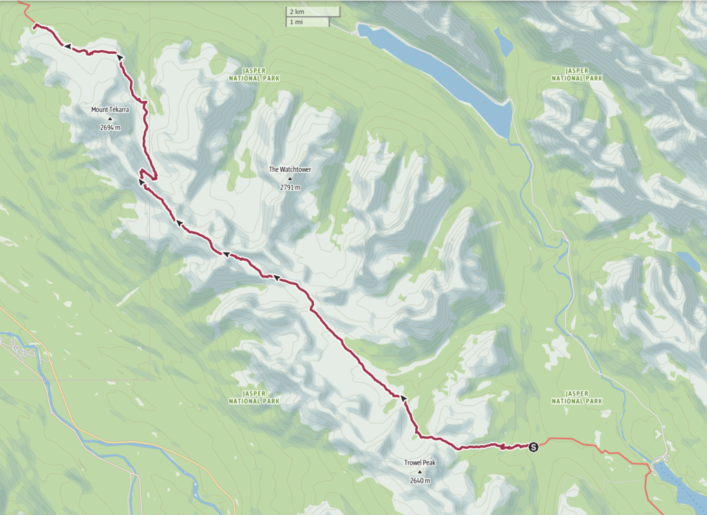
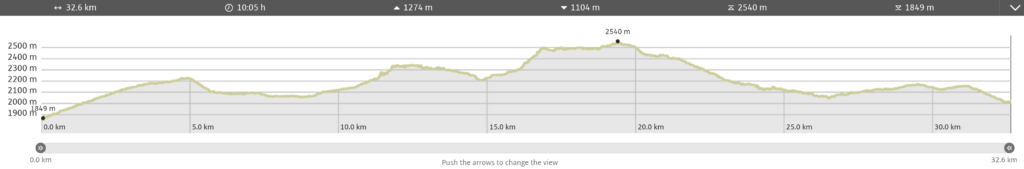
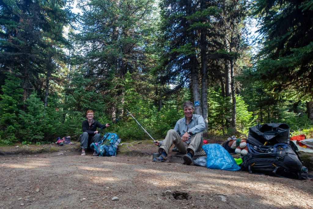
Day 10, August 20th, Evelyn Creek CG to Signal CG. 32.6 km, 1278 m elevation gain, 1120 m elevation loss, 10 hrs 5 min (Segment 28).

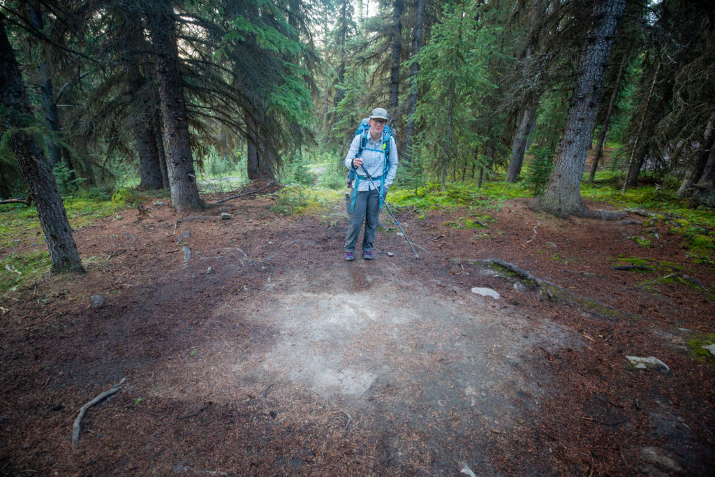
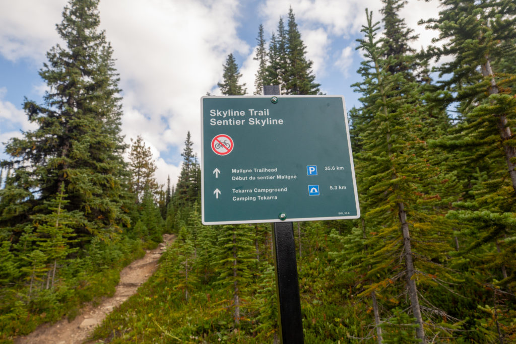
We had another big day ahead of us but we did not attempt to get up overly early like we did for our day on the Six Passes. Today’s hike would take us up and over the Skyline in Jasper. We knew that we would be on good trail all along the Skyline plus we had a favourable weather forecast so we really felt no reason to rush out of the tent. Still I did roll out of the tent just before 6 am, which is early for some, and had the water boiling for the coffee going in the dark.

Its a little dark. The Bear canister is getting quite empty.

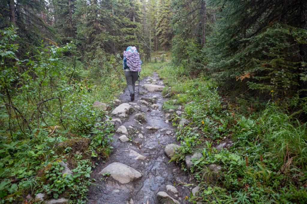
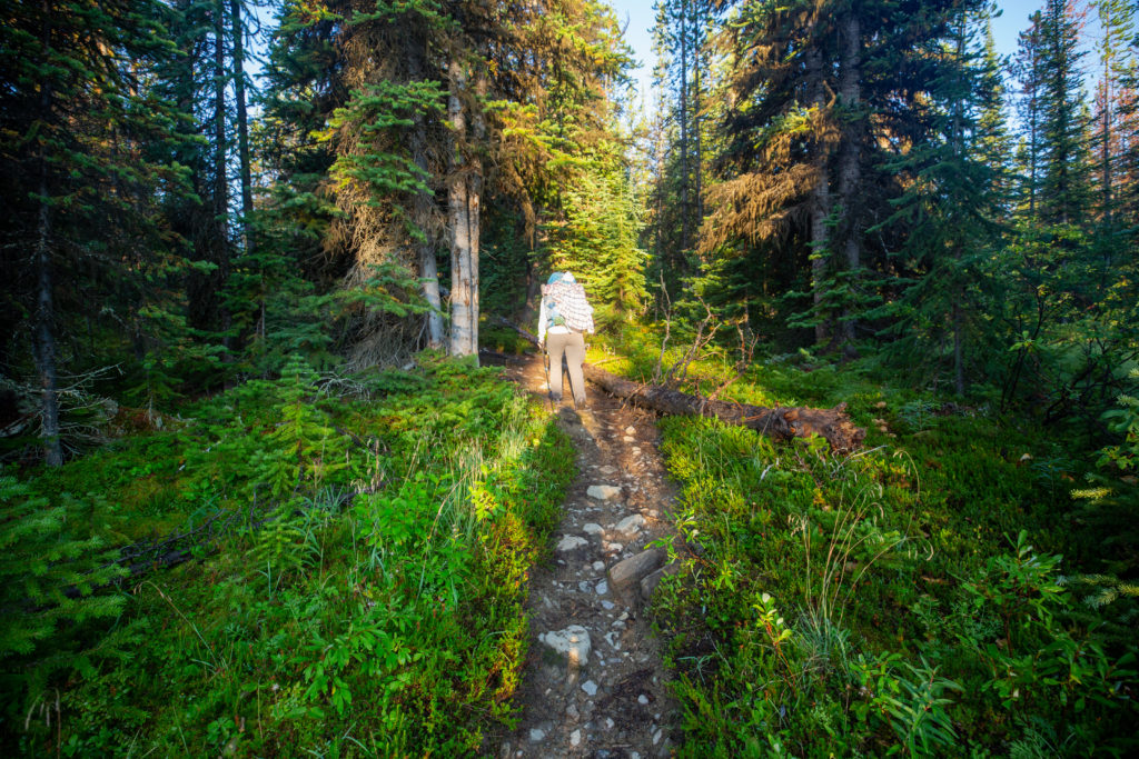
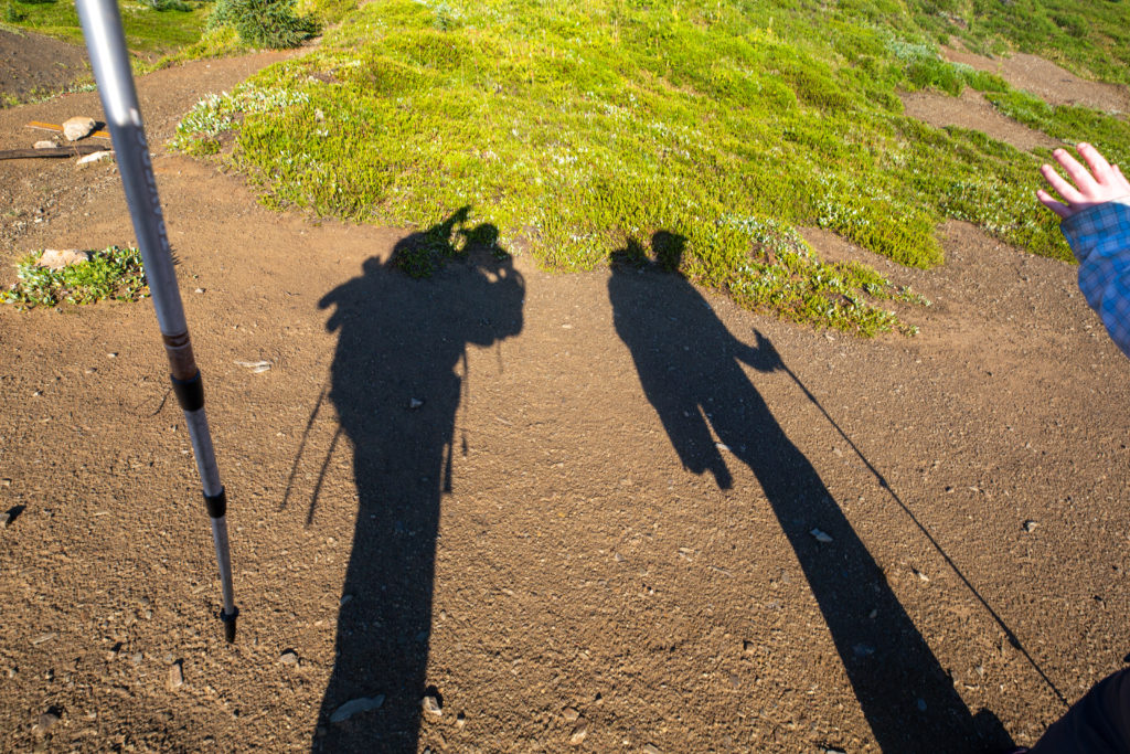
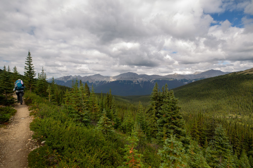
We hit the trail at 7:10 am. We were in quite a cheery mood and the conversation level was high as we headed uphill away from Evelyn CG. The rain had made the trail a little sloppy in places but with our fresh legs we made good progress.

All packed up.
This initial section of trail was the worst with the rocks and the mud. Guessing Micah’s shirt had not dried after being washed yesterday.
Sun coming out.
Good morning sun.

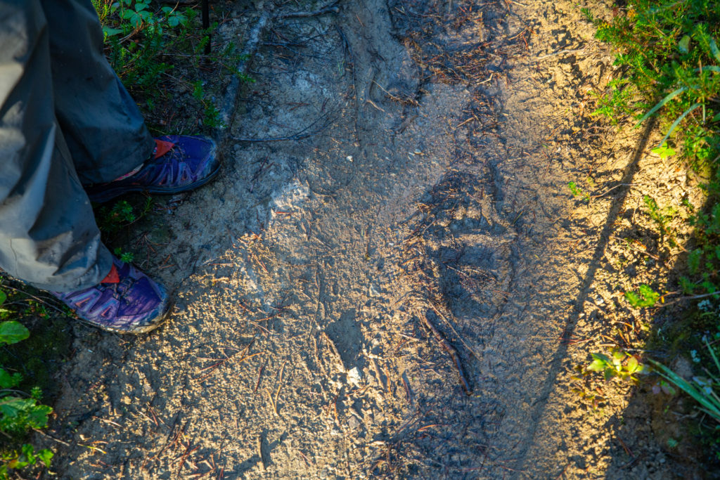
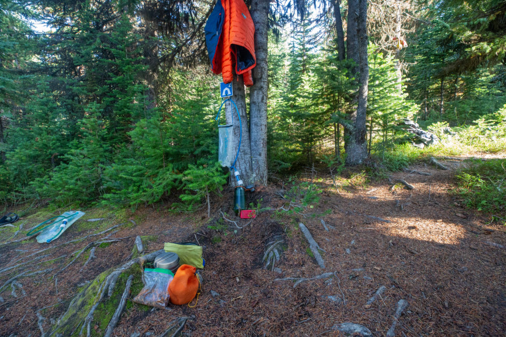
Only 20 minutes after leaving our campsite we came across some fresh bear tracks. The fact that we could still see them after the rain overnight meant that the tracks could not be too old. Just like yesterday when we saw the bear scat we never did see the bear. The track were a good reminder that we were in bear country and to be vigilant that they were around.

Bear print.

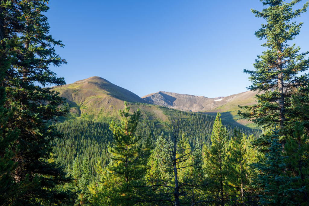
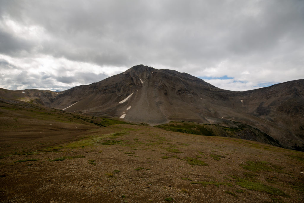
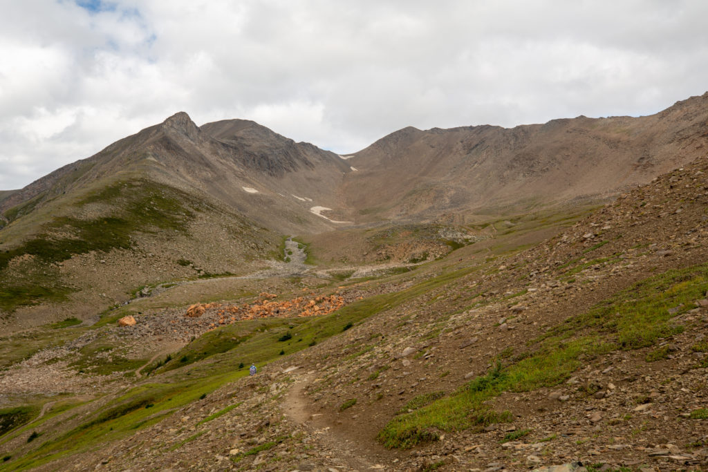
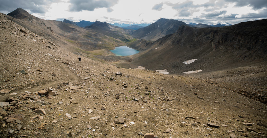
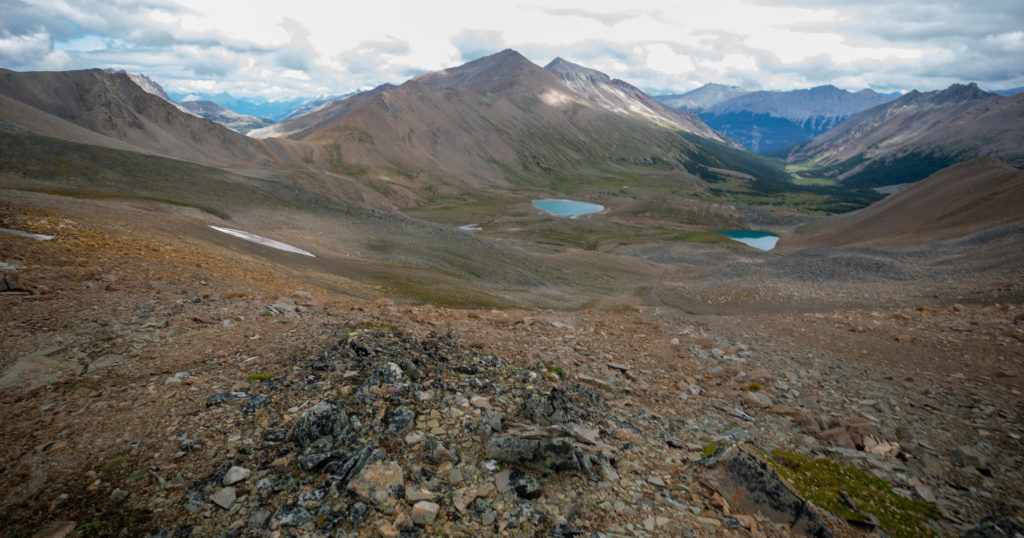
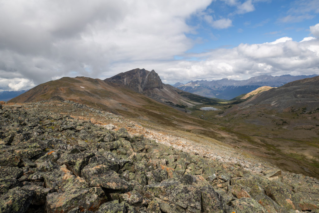
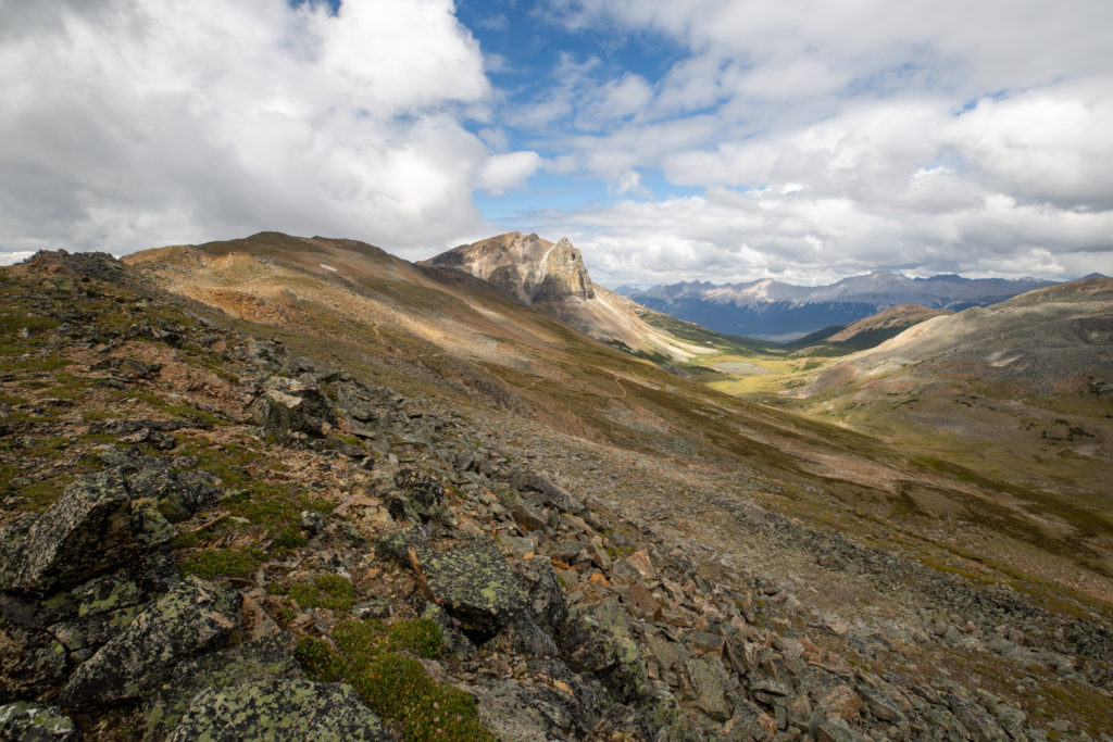
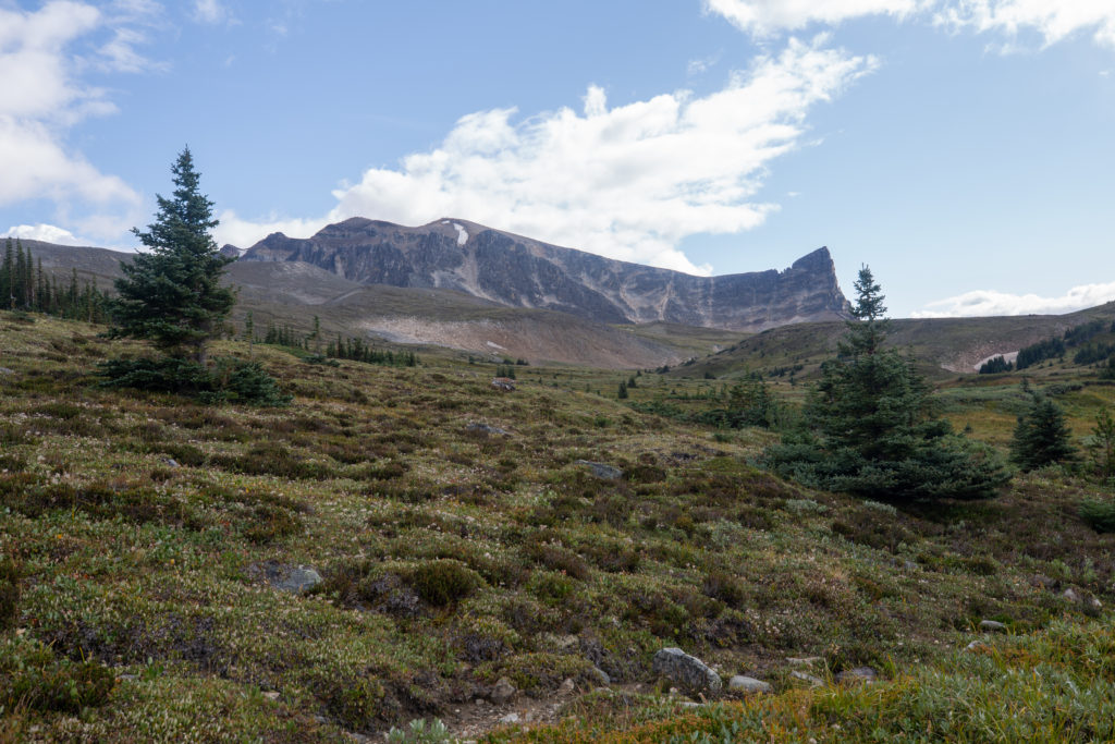
Our first views through the trees came just before 8:00 am. I thought that the view was of the Bald Hills but looking at the map we were looking at the lower slopes of Trowel Peak.

First view of the day.
Trowel Peak (2640 m) on the right.

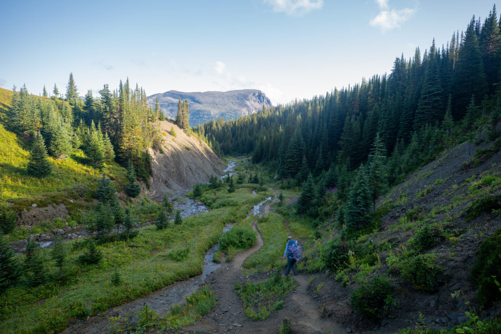
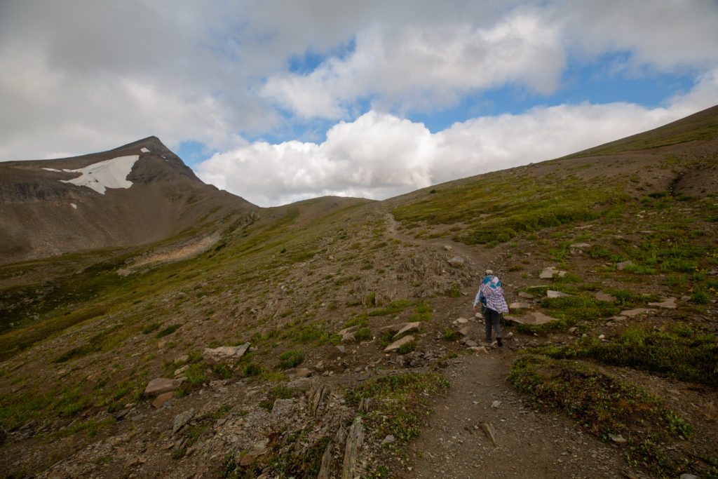
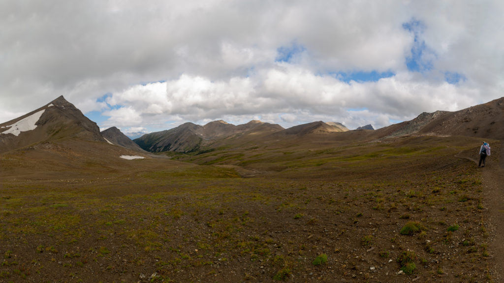
We blew past Little Shovel CG in 55 minutes. Similar to Evelyn CG Little Shovel was in the trees and split by the trail with the tent pads below the trail and the eating area just above the trail. It had been a brisk start to the day. We had gained a little over 300 m in 3.5 km which was almost a quarter of our elevation for the day completed in just the first hour. Now that it was a little later in the morning and we had past Little Shovel CG we started up yelling out “yo bear” to alert the bears of our presence. The trees thinned out dramatically shortly after leaving Little Shovel CG and we would remain above treeline for the bulk of the day.

Just like that we emerged from trees.
The happy hikers.
Approaching Little Shovel Pass.

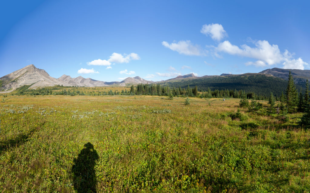
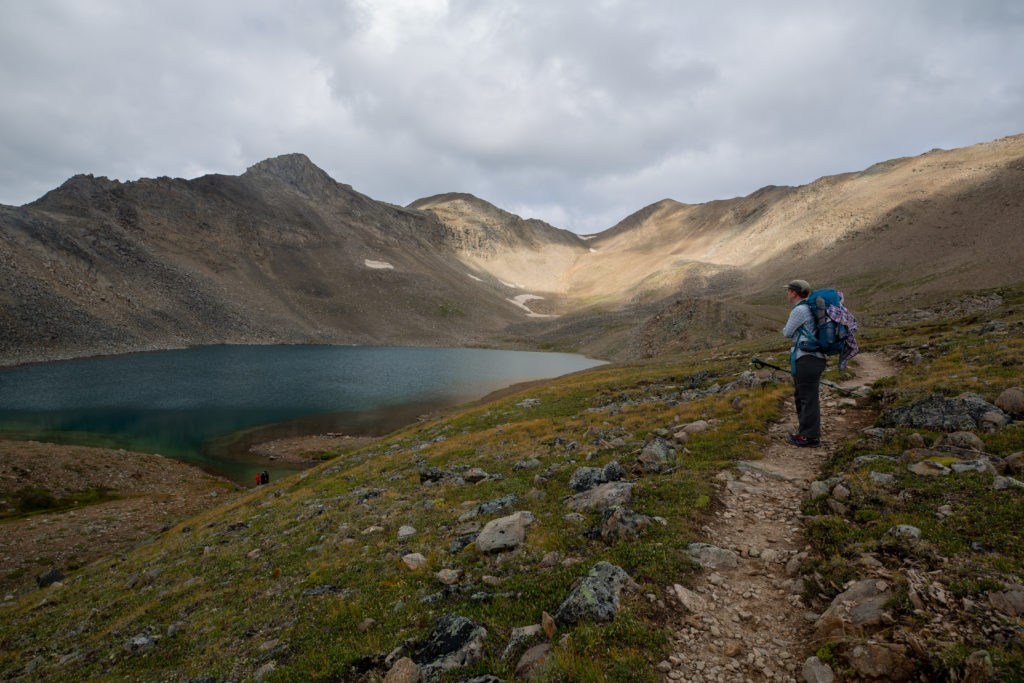
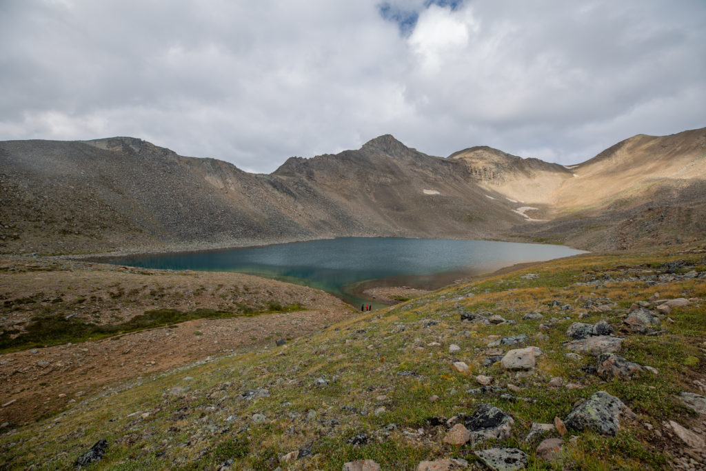
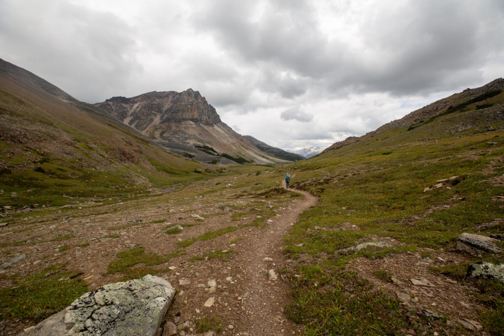
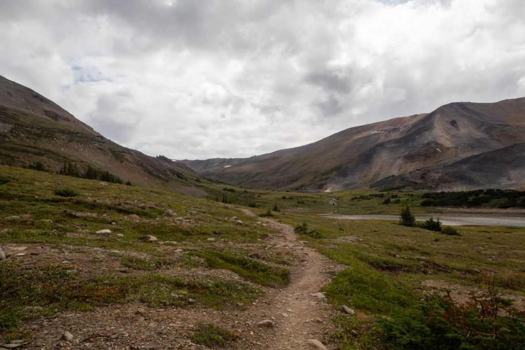
The trail flattened out as we emerged from the trees. In the cool of the morning it was a very pleasant hike in the open terrain of Little Shovel Pass. Near the pass our friendly bear prints reappeared but still no bear in sight.

Blue sky contrasting nicely with the green of the pass.
The little creek had frozen overnight.
The view looking back down the trail.
Almost at the pass.
Bear prints.

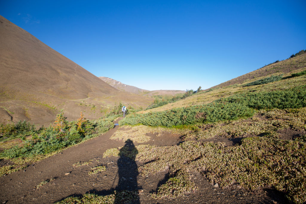
We arrived at Little Shovel Pass at 8:47 am having hiked 5.5 km and gained 420 m of elevation in 1 hr 40 min.

I really need to slow down and stop when taking pictures of signs. It is about 2 km to either Little Shovel CG or Snowbowl CG. Altitude 2240 m.
The view just a few minutes passed Little Shovel Pass.
A zoomed in view of the above photo. The purple line is Big Shovel Pass 7.6 km away our next destination.

The trail dropped steeply away from the pass. In the shade a few sections of the trail were a little slippery from the rain overnight. We soon arrived at Snowbowl CG which similar to previous two campsites was in a heavily treed area. We stopped for a moment to look around. The campground was bustling with people we did waved at at couple and then we moved on down the trail.

Dropping into a little valley.
Flowers hanging on late into the summer.
Arrival at Snowbowl CG.

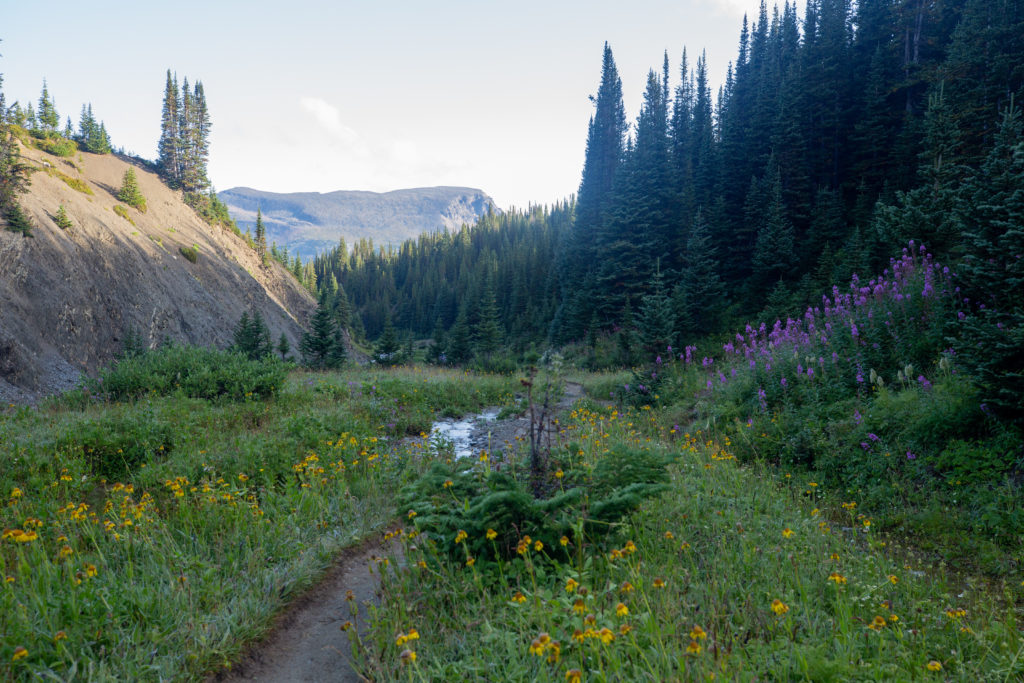
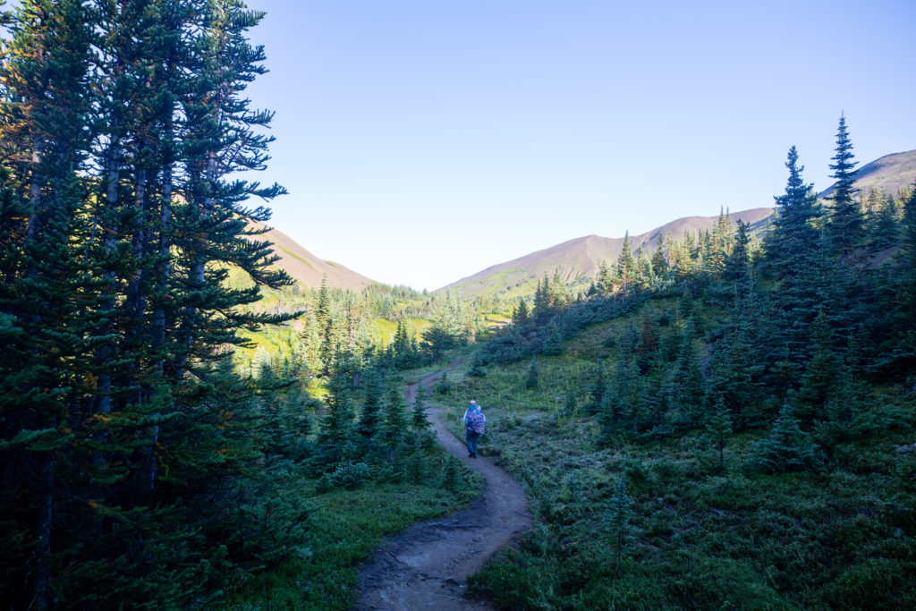
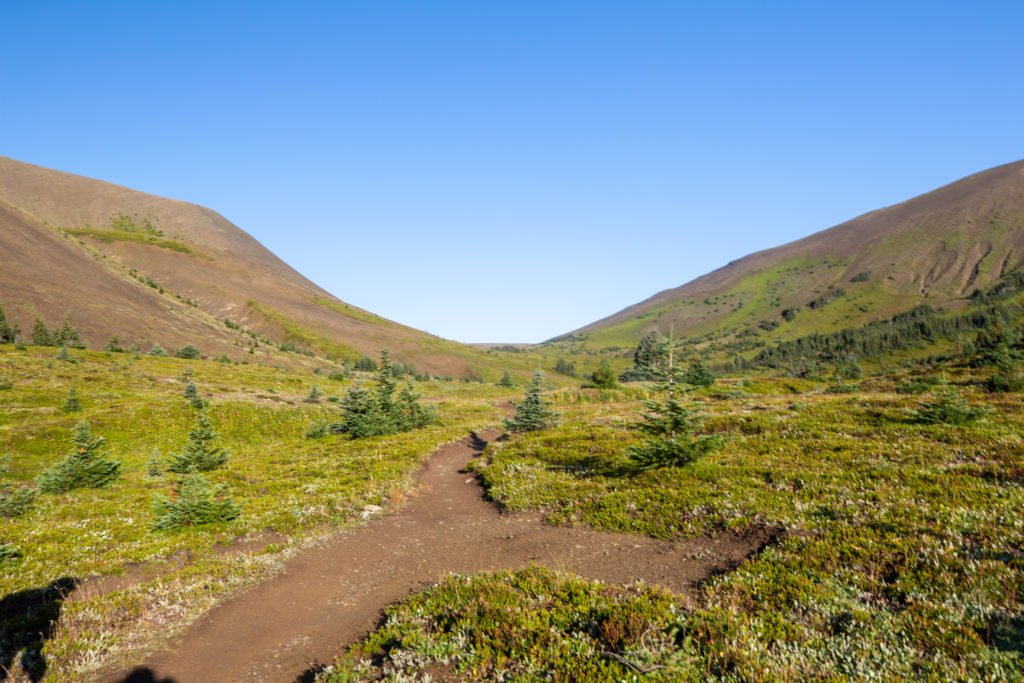
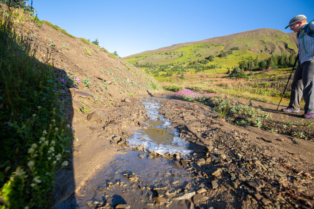
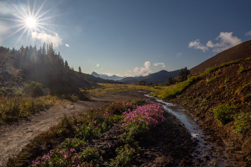
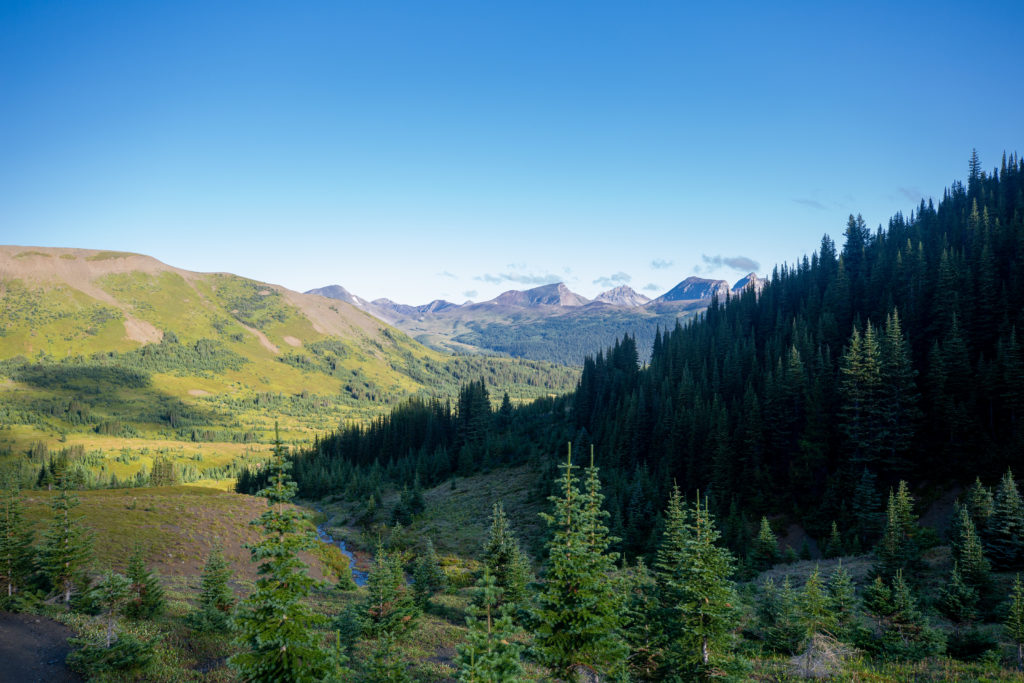
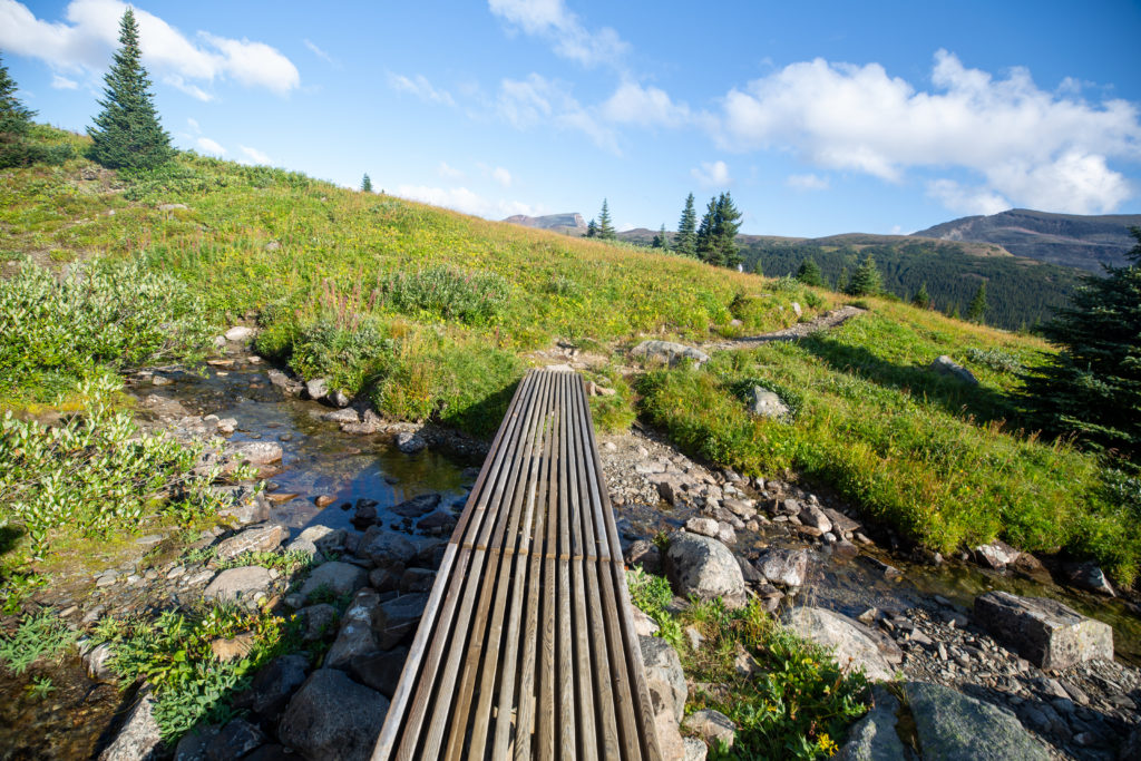
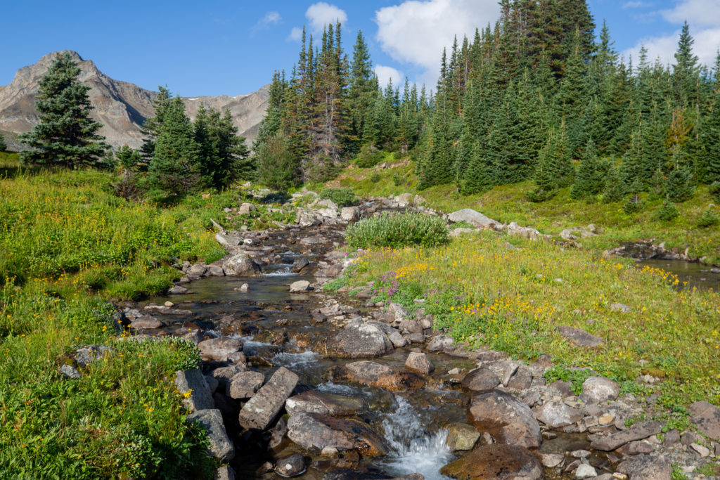
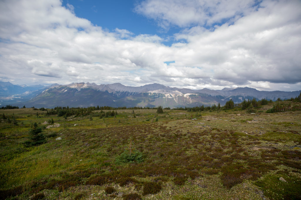
After Snowbowl CG the trail dropped moderately for another 2.3 km. The forest ended about 12 minutes after we left Snowbowl CG revealing an expansive meadow known as The Snowbowl. The trail headed slightly downhill crossing a couple of small streams both complete with simple bridges. The second small stream crossing was the low point for this section. After the stream crossing the trail headed uphill at a pleasant grade climbing steadily over the next 3.4 km to Big Shovel Pass.

Trees thinning out. Big Shovel Pass is getting closer.
The trees end quite suddenly.
The Snowbowl. Micah on trail off to the right side of photo.

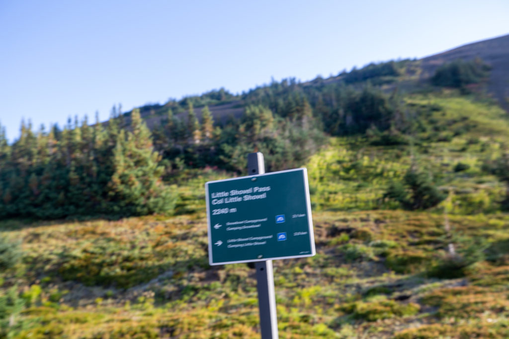
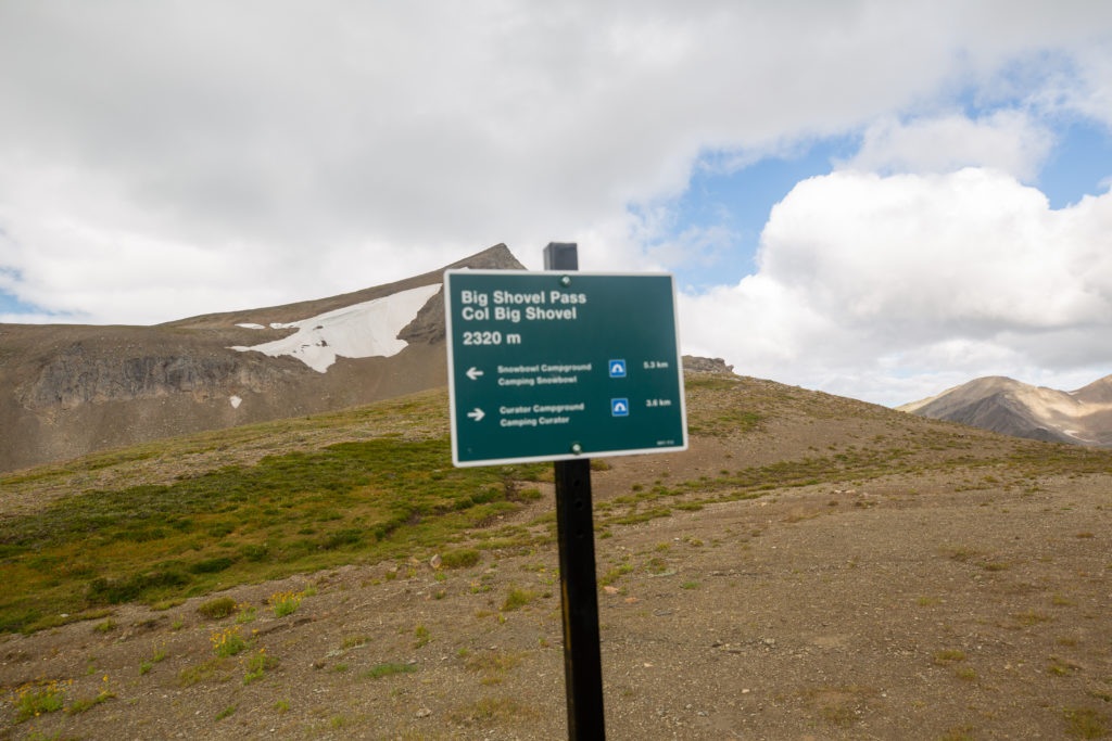
The story behind the names Big Shovel and Little Shovel Pass is quite interesting. Mary Schäffer had visited Maligne Lake area in 1908 traveling with the aid of a handrawn map by Stoney Sampson Beaver. Afterwards Mary wrote “Lake Louise is a pearl; Lake Maligne is a whole string of pearls.” Three years later during debate as to whether Maligne Lake should be included inside the national park Mary was asked to survey the lake. During Mary’s 1911 trip her guide Jack Otto had the group follow the high route of the skyline from end of the railway to Maligne Lake. Being mid June the snow was still deep across the passes so Otto had some of the men advance ahead of the group and dig a path through the snow. The men had to make their own shovels which they did out of spruce trees and after leaving the highest pass they left the shovels in the snow to be used by the following party if necessary. Upon finding the shovels Mary named the pass Shovel Pass.

Schäffer was thrilled to on the the trail again – and keen to share its wonders with her young nephew. However, not everything turned out to be as it appeared. “A mile from the summit, where the last, hard ascent began,” Schäffer wrote, “Jack rather excitedly called our attention to two tiny specks on the skyline and, though he remained sweetly non-committal and suggested the might be a horse or two, we knew he meant ‘sheep,’ and sheep they promptly became.”

The weary travellers carried on, fuelled by the anticipation of what lay ahead. At last, Schäffer continued, “we came close enough to analyse our two immovable sheep – only to find them a pair of abandoned shovels which had been hewn from a tree and, in case we needed the same, left standing conspicuously in the snow….[L]aughingly we named the pass ‘Shovel Pass’ and went on our way down the heather and snow decked slopes.” The shovels remained in place for many years, acting as sentinels to mark the top of the pass. Today they are in the Jasper museum.

Life of the Trail 4: Historic Hikes in Eastern Jasper National Park, Emerson Sanford and Janice Sanford Beck, 2009, Rocky Mountain Books, page 162
First creek crossing. Love the bridge design.
The weather is holding and the views amazing. Big Shovel Pass is the low point on the right side of the photo. The mountain with a patch of snow is Curator Mountain (2622 m)
Not a lot of wildlife on the trip but the birds were nice to see.
The second creek crossing. Now time to hike uphill to Big Shovel Pass.

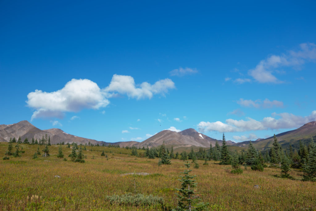
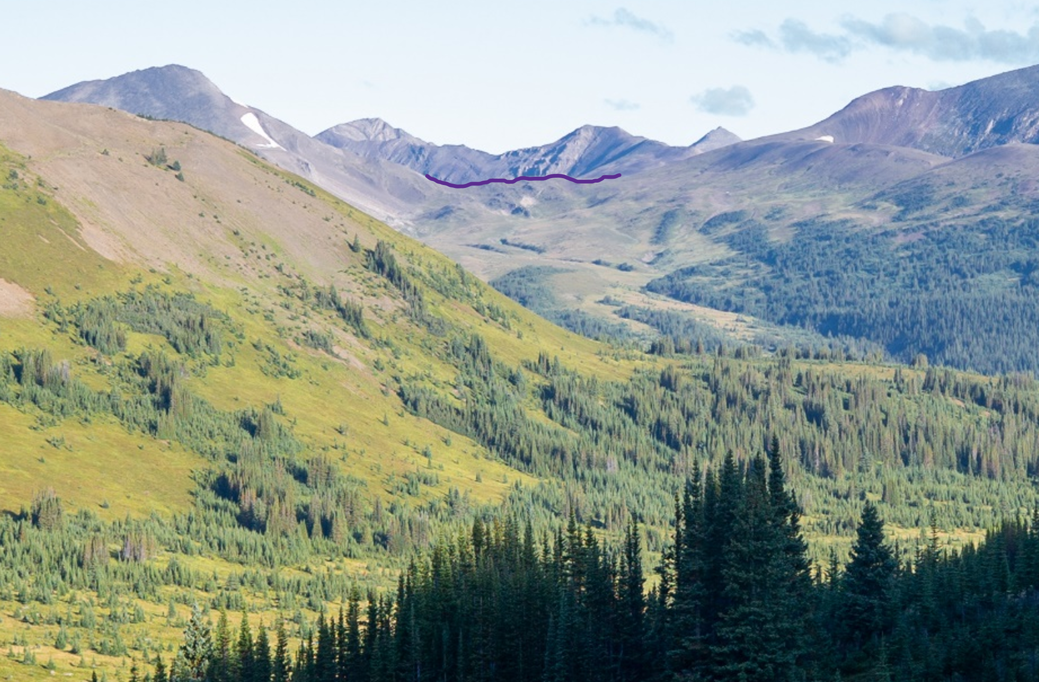
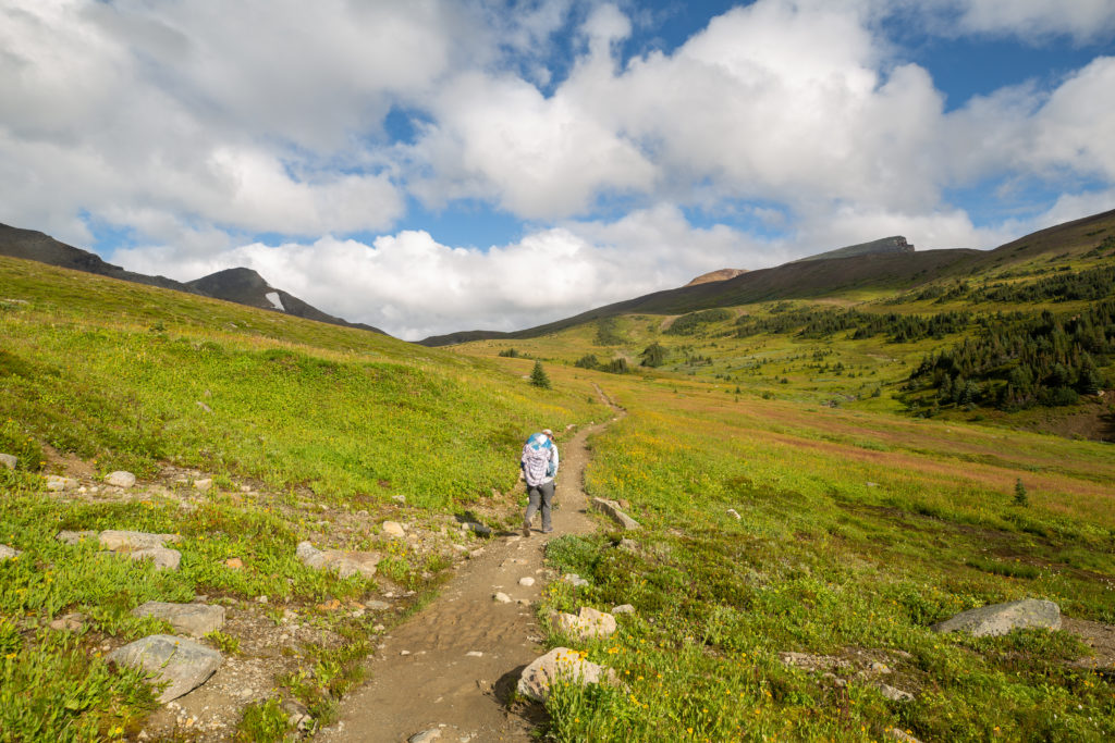
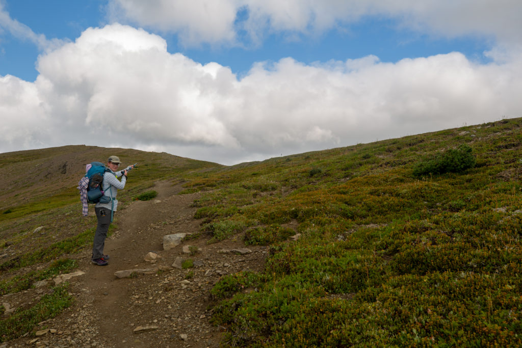
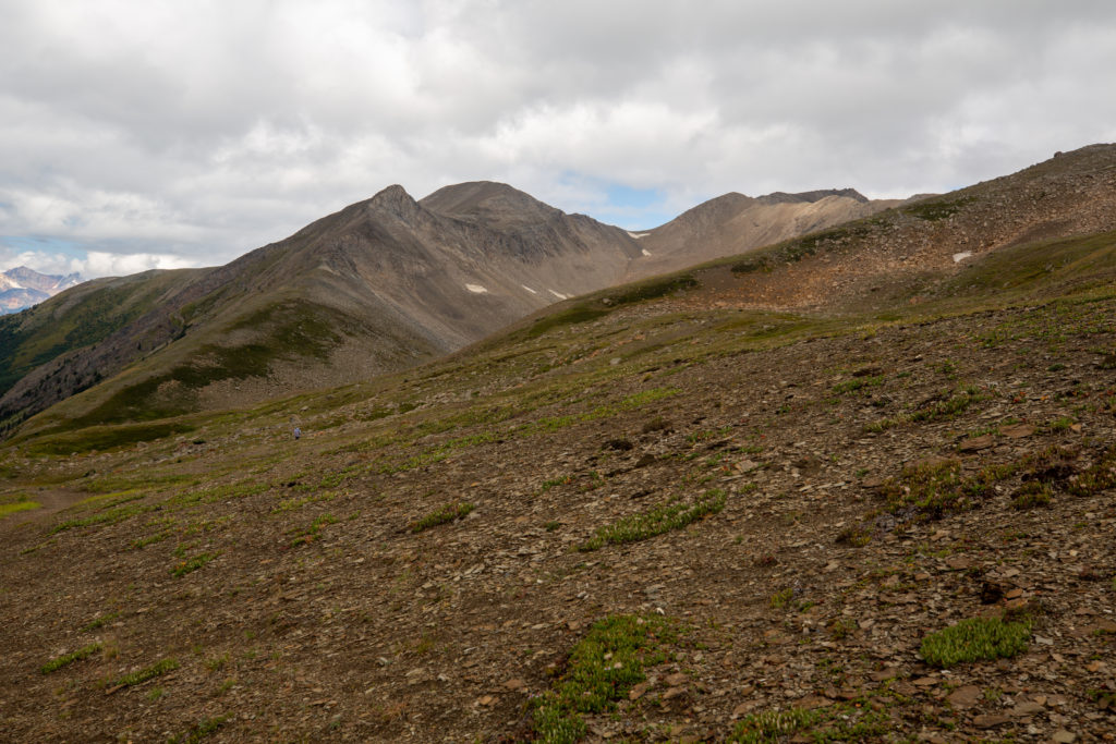
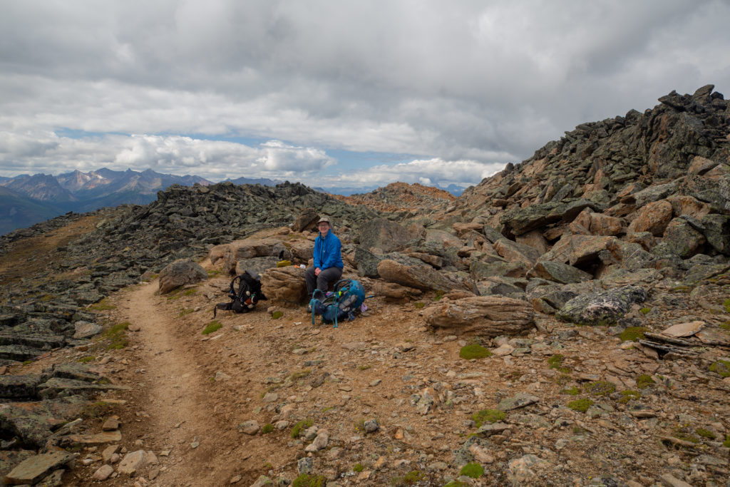
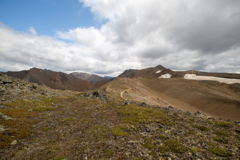
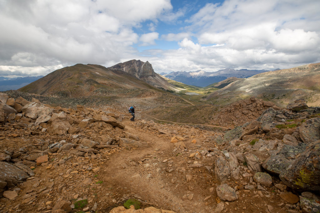
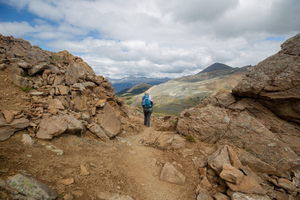
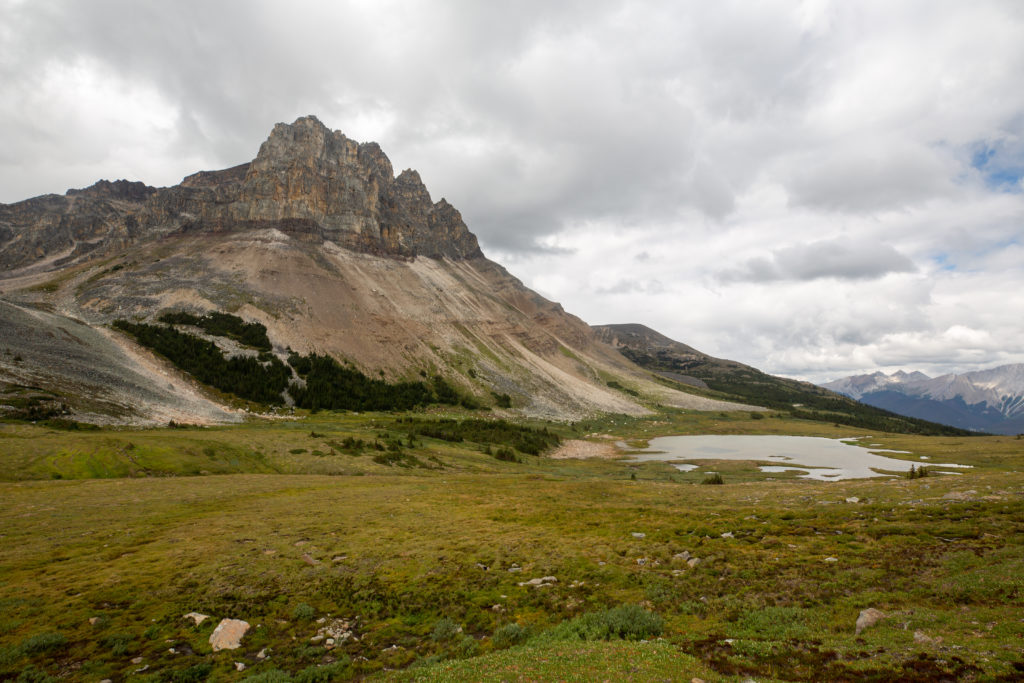
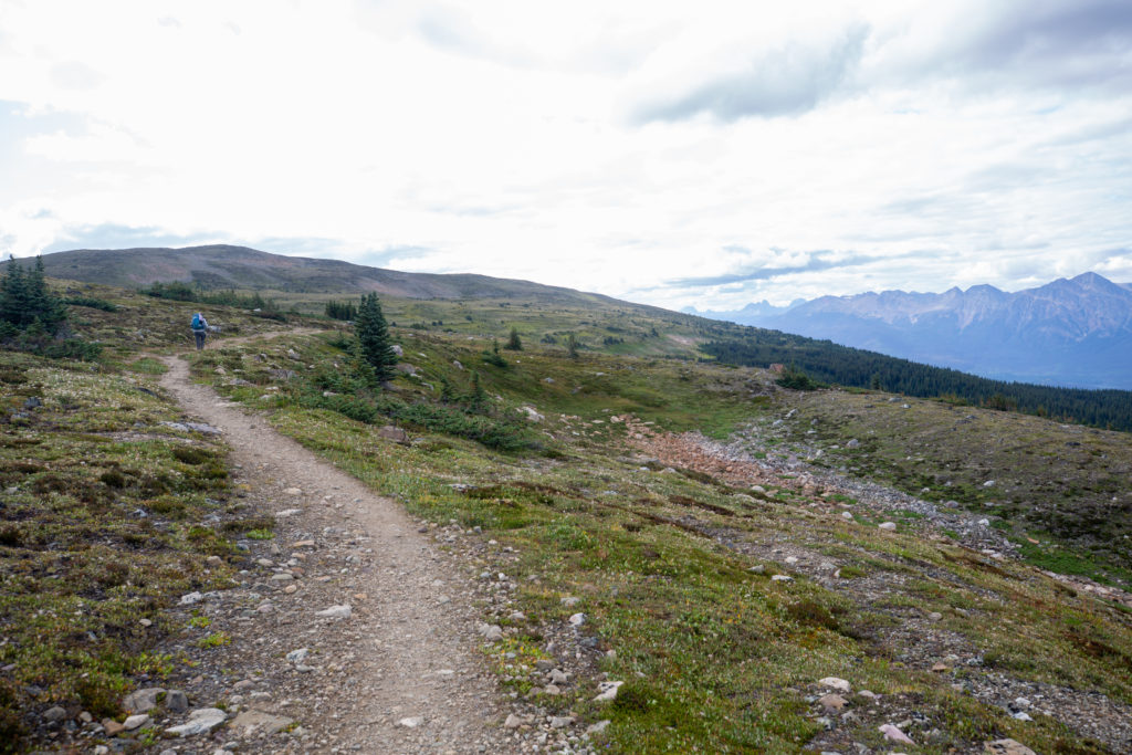
On our way up to Big Shovel Pass we met our first southbound (SOBO) trail runner of the day. The guy was tall and lanky and making amazing time down the trail. We stepped off the trail to allow him by and just like that he was gone down the trail. The hiking on this section was easy on braided trails. The trail rose steadily all the way to pass at a bit less than 100 m/km. Big Shovel Pass is about 100 m higher than Little Shovel Pass but the lack of vegetation near the top made it feel much higher. We arrived at the pass at 10:40 am 1 hr 50 min since leaving Little Shovel Pass. If you follow the pass up to the left you come to Curator Mountain. Curator Mountain is named due to its location as it acts as the guardian or “curator” of the area.

Walking is easy and pleasant.
Looking back at the Snowbowl.
Trail is a little braided as we approach the pass.
That patch of snow on Curator Mountain was visible from Little Shovel Pass. We have been aiming for it for the last couple of hours.
That’s right Micah the pass is right there.
Arrival at Big Shovel Pass. Elevation 2320 m. 5.3 km back to Snowbowl CG and 3.6 km to Curator CG.
Looking back at the Snowbowl from Big Shovel Pass. Our route follows the meadow all the way back to the little golden area just below the peak on the left. There is a little valley there that we used to descend from Little Shovel Pass.
Micah already off down the trail. The trail to the Watchtower is up the slope just to left of the small peak in the shade right of centre.

The trail descended slightly while contouring over to the junction with the trail to the Watchtower. We met some day hikers staying at the Watchtower CG who were heading southbound to explore the Snowbowl. They were very positive about the Watchtower CG which was in contrast to the family from yesterday who did not have anything good to say about the campground.

Trail up the to the Watchtower CG. The two day hikers we met are the tiny specs at the bottom.
Follow the trail. After the junction with the Watchtower Trail our trail will start to descend.
Junction is just 800 m from Big Shovel Pass. Will be a 2.5 km of descending losing about 120 m of elevation. We do not go all the way to Curator CG.

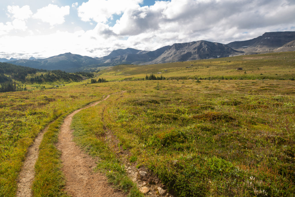
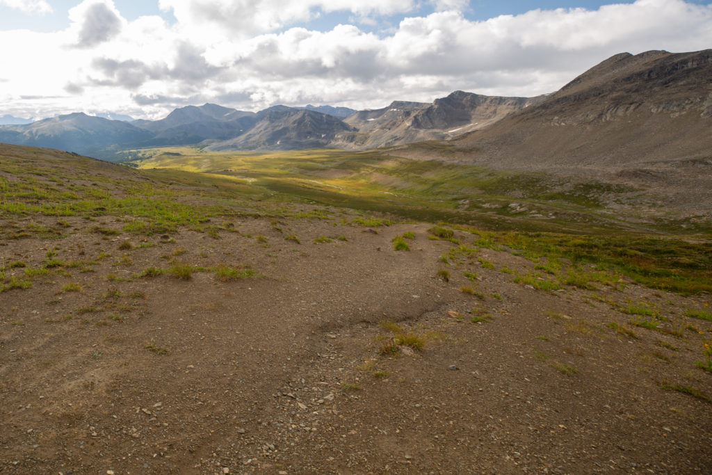
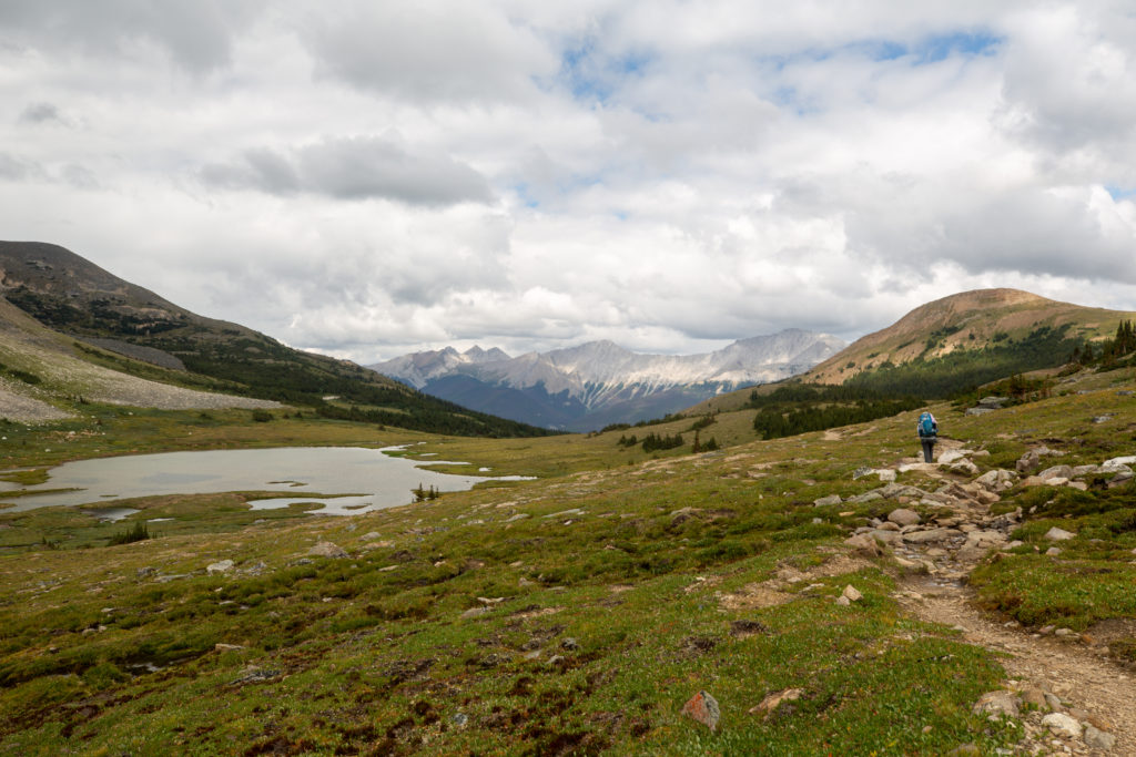
Hiking to the junction with Curator CG was really like being in a big bowl. We mainly contoured around the east side losing just 100 m of elevation on the way to the junction. We were passed by three trail runners heading northbound (NOBO) and again we stepped out of the way to let them pass. We hiked apart during this section. The hiking was very easy and aided by the slight downhill slope we arrived at the junction for Curator CG in just 35 minutes since leaving Big Shovel Pass.

Can just spot Curator Lake in the distance. The Notch is our last pass of the hike and is the low point on the ridge at the horizon at centre above Curator Lake.
Looking back to Big Shovel Pass. Clouds are rolling in.
A minor peak of Curator Mt. The campground lies in the valley to the right.
Better view of the Notch. The trail goes over the Notch to the right of the crescent of snow just below the ridge at centre.
Looking out to the valley beyond to the west.
Curator CG and Shovel Pass Lodge are located in among the trees quite a way down a slope from main trail.
Micah approaching the junction. We would take the trail leading up to the red sandstone debris. Curator CG is accessed via the trail heading down off the left of the photo.
There are many choices. We will head to the left to the Notch. The trail to the parkway can be utilized as an escape route in times of bad weather. Apparently it is a very rough 15 km.

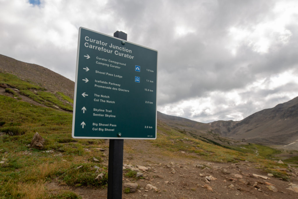
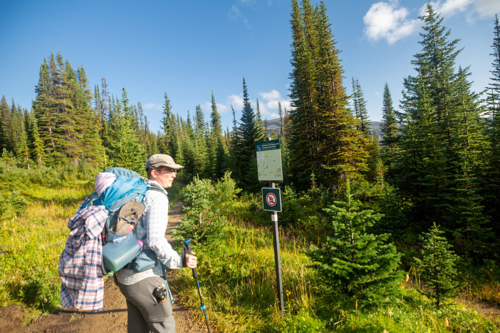
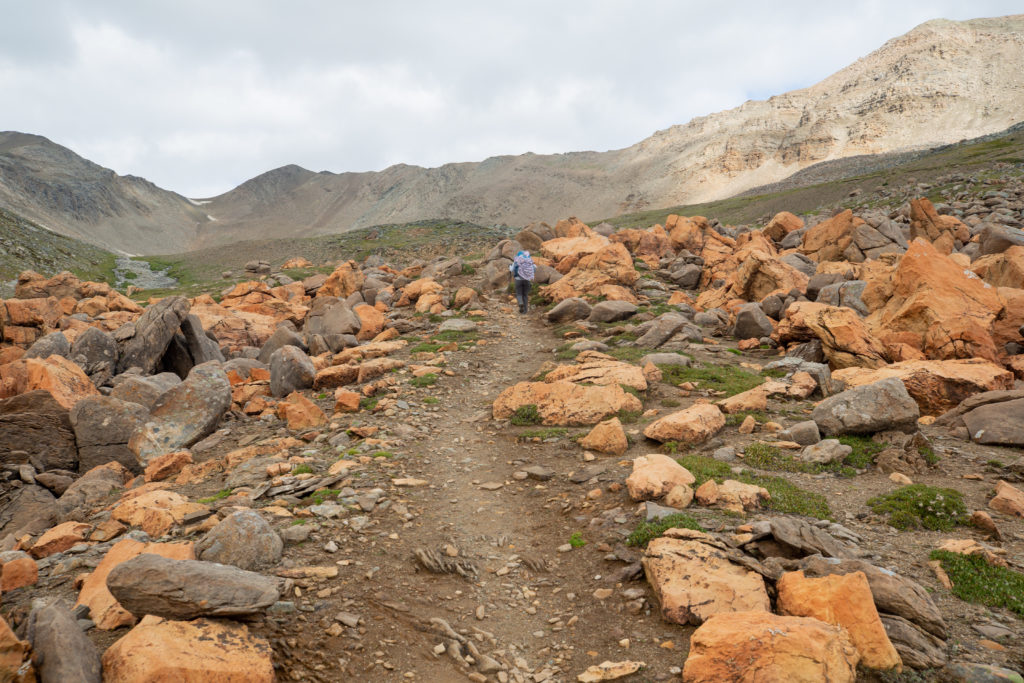
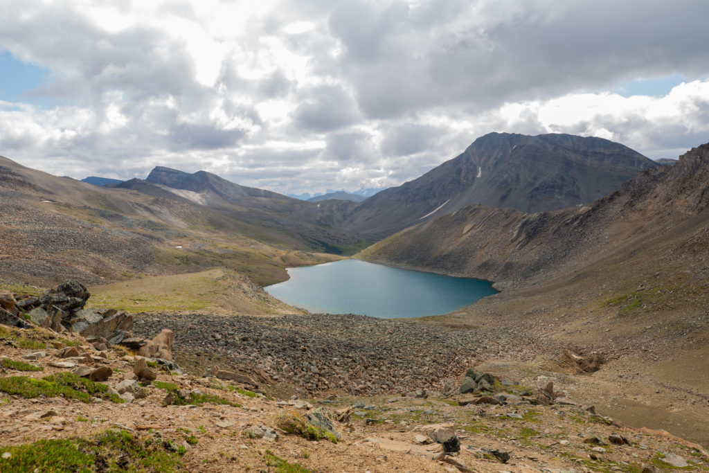
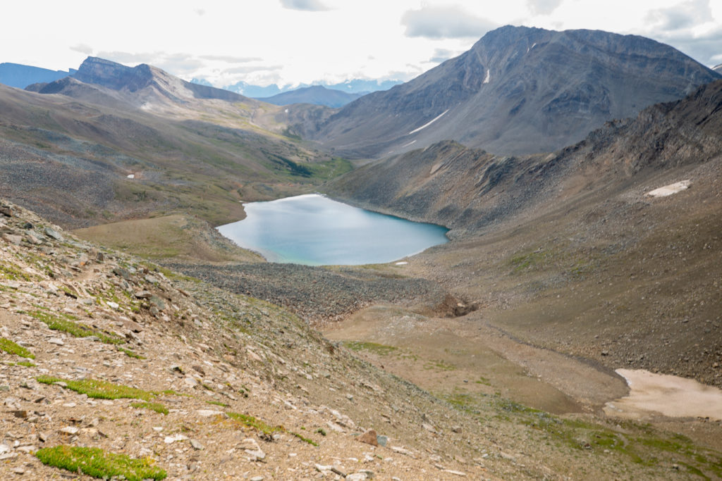
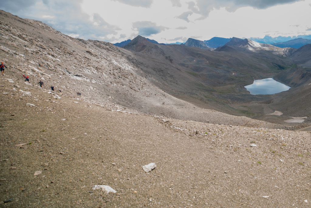
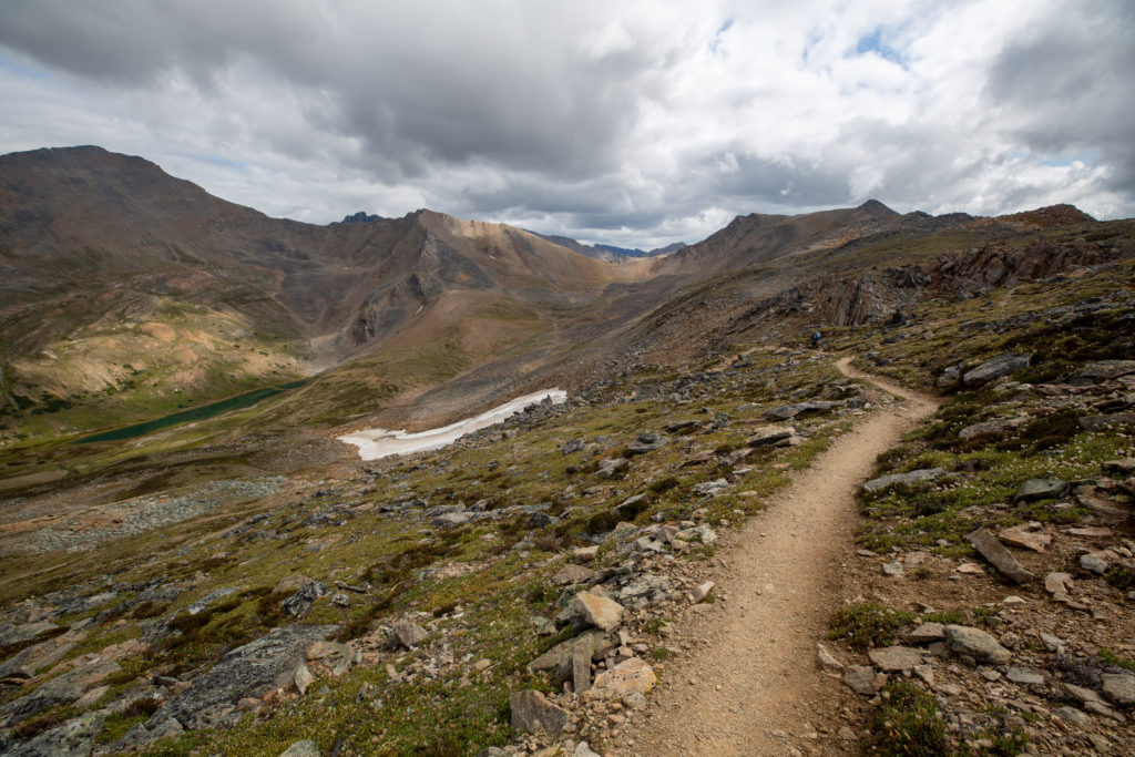
We made a right hand turn at the junction for Curator CG and headed up towards the Notch. Curator CG looked like a great place to stop. It would give a person the opportunity to scramble some of the peaks in the area and to simply do more exploring. We hiked through a short but striking section of red sandstone a very uncommon sight in the Canadian Rockies. Ten minutes after leaving the junction we arrived at Curator Lake. The trail runners who had passed us a little earlier were down at the waters edge refilling their water bottles. We stopped for a few minutes taking in the view of the lake contrasting with the surrounding rocky cliffs.

Heading onward and upwards.
The bright red sandstone was such a contrast to the greys and browns we had grown accustomed to.
Pausing to take in the view. Curator Lake.
Wider view of Curator Lake. The Notch is in the shade where the crescent snow patch lies just below the ridge.

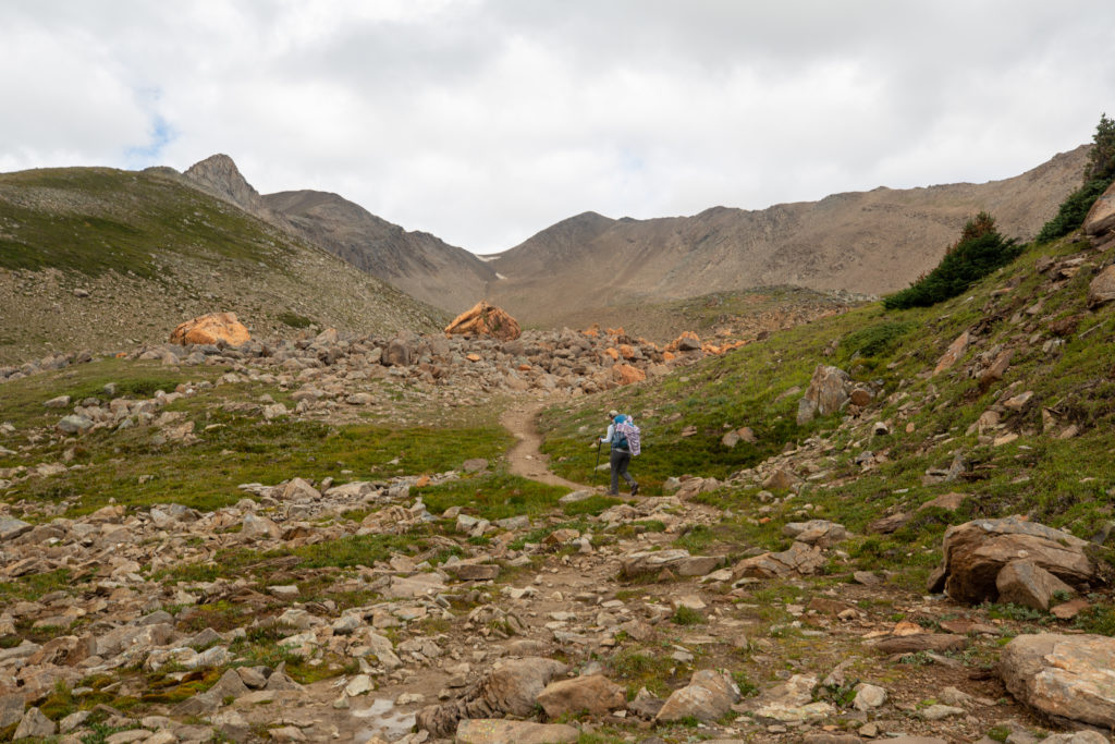
Hiking up to the Notch would be our last pass for our trip. Shortly after leaving the lake we had a bet on how long it would take to hike to the Notch. Micah said 40 minutes and I think I went longer.

Just before the trail really kicks up.

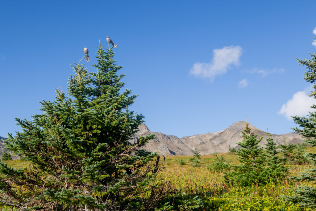
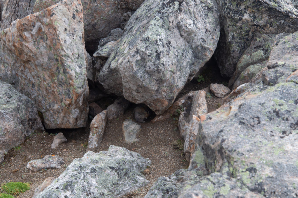
While we had seen evidence of some of the wildlife such as bears or elk we had not seen much wildlife at all on the trip. Thus we were both quite excited when a pika scurried through the rocks beside us. It may not have been a bear but it was wild and extremely cute.

Cute wildlife huddling under the rocks.

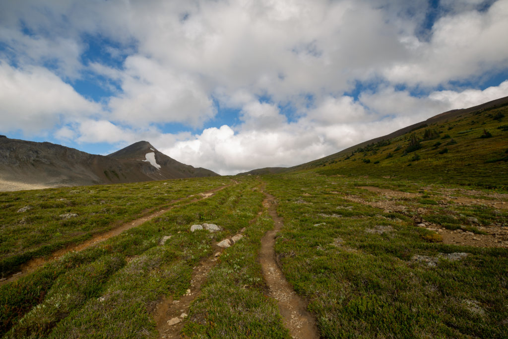
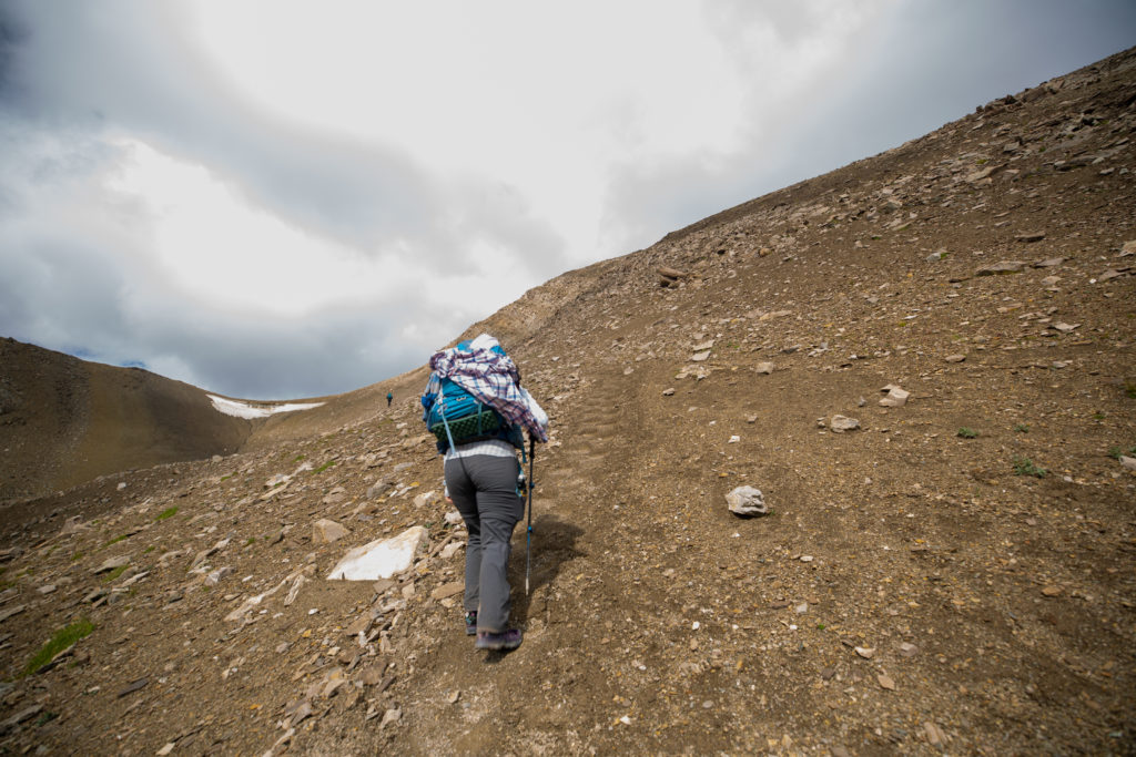
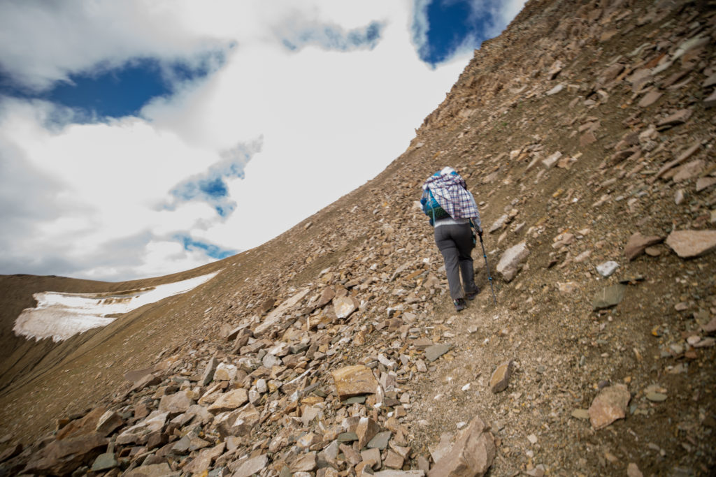
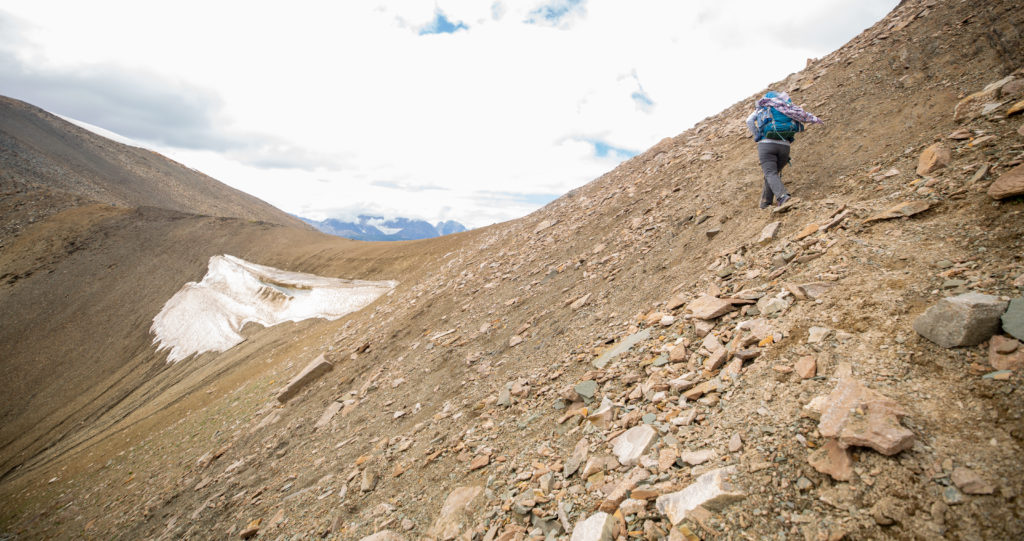
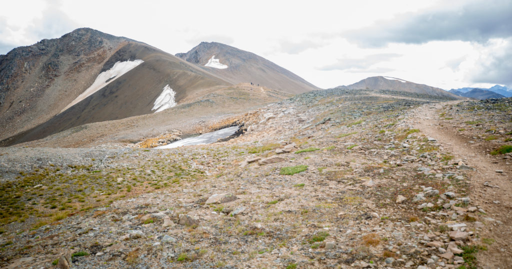
Shortly after our brush with the wild side the trail headed up in earnest. At first the slope had some vegetation and the footing was quite good. The trail then transitioned to a scree covered slope and the footing was not as firm and in places the trail was very steep.

The trail is going to really start heading up shortly.
Looking back to Curator Lake.
Trail is still firm if a little rocky.
Overexposed photo. Coming up on another group of hikers.
Steadily gaining elevation.

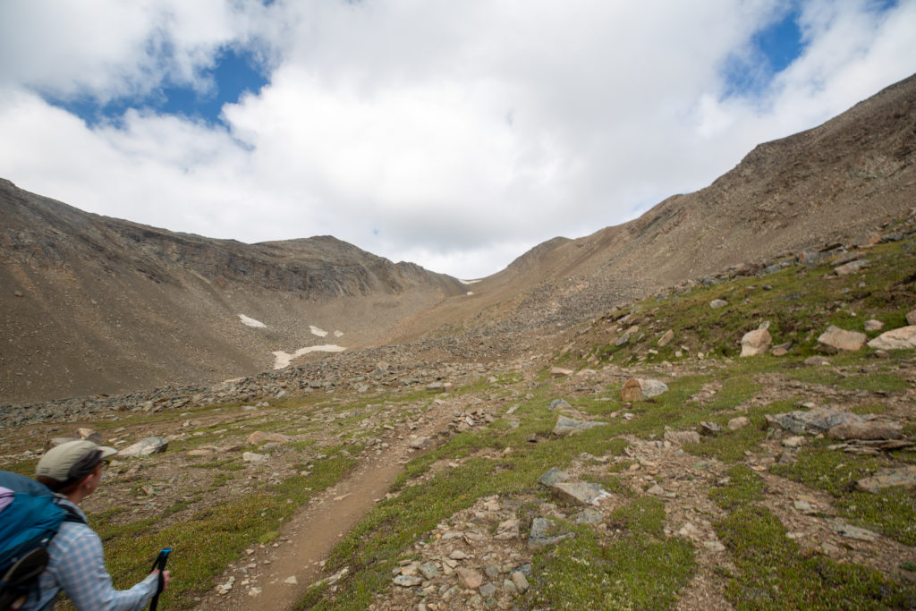
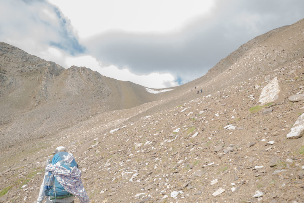
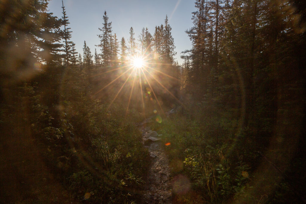
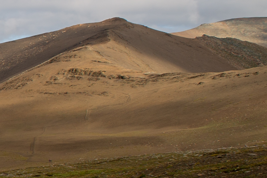
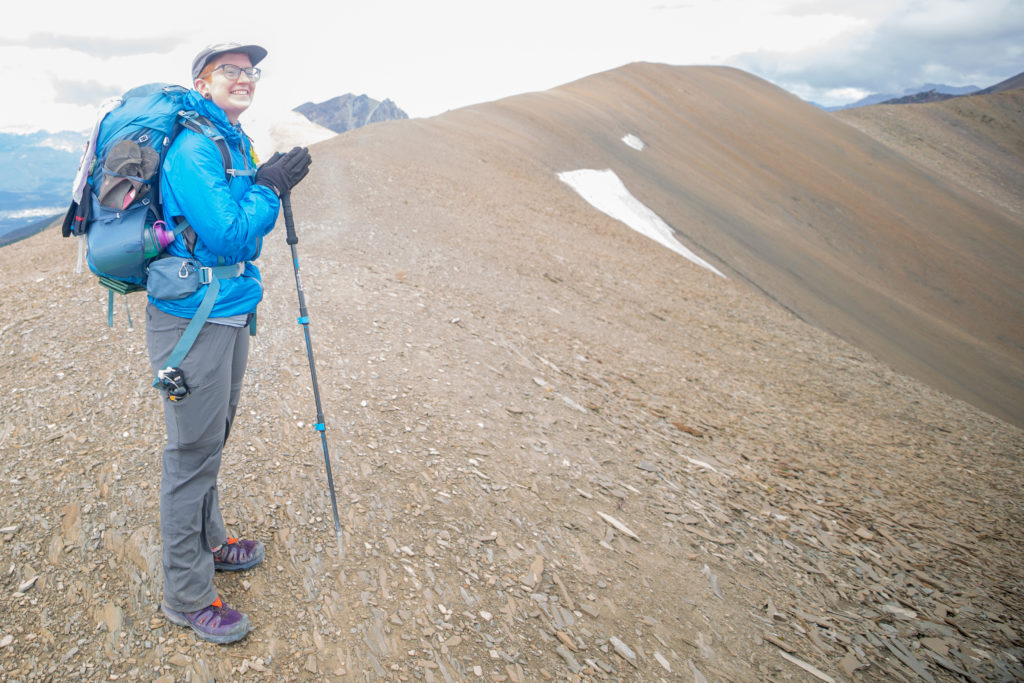
I do want to apologize about the photos on this section. I operate my camera on manual mode which means I have to pay attention to the settings especially when the light changes. The easy way to know if the settings are close is to check the histogram on the back of the camera. Unfortunately whether it was the excitement of the climb to the last pass, the extraordinary scenery or lack of attention to detail I did not check the histogram and as a consequence most of photos for this section are somewhat overexposed.

There are actually little steps tromped into the dirt. They really did make a difference. This section was quite steep.

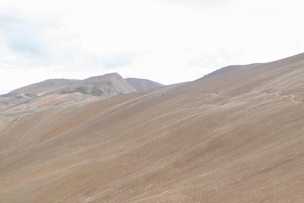
We were leading quite a group up the Notch. The three runners were behind us now walking up the steep slopes. We had past a group of four women. They had been staying at Shovel Pass Backcountry Lodge which was located at the bottom of the valley near Curator CG. We talked mostly to the youngest member of the group who was hiking with mom and her mom’s friends. They had decided to visit the lodge as it was a way for them to experience the backcountry without having to haul all their gear and camp. While they had nice day packs and a packed lunch courtesy of the lodge it was going to be a long 28 km hike back to their trailhead at Maligne Canyon. Micah was quite excited about the prospects of possibly do the trip with her mom and staying at the lodge. That was until we found out the cost to stay at Shovel Pass Backcountry Lodge is $300/night/person which is just a little or maybe a lot out of our price range.

It is quite the view looking back from the Notch.

The last few minutes up to the Notch was on very steep and open slopes. I never felt exposed but it sure was steep. We arrived at the top with big grins on our faces. It had been 35 minutes since we made the bet on how long it would take. The views were outstanding in every direction. As we looked around people started arriving at the top. At one point there was over 10 people gathered around taking in the sights. The younger women from the group of four went for a quick scramble up the western peak of the Notch. The three trail runners we had passed at the lake looked around and then headed off followed shortly by a group of four trail runners. We spent about 10 minutes at the Notch before deciding to head off. We would have stayed longer but it was quite windy.

This is quite steep both.
Final approach to the Notch.
The last couple of steps.
A very overexposed video at the top of the Notch.
Looking back to where we had come from.
Looking down into the valley to the west.

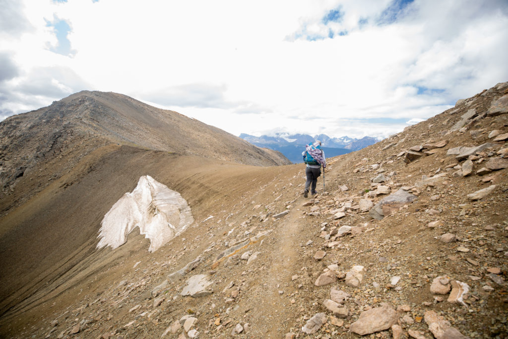
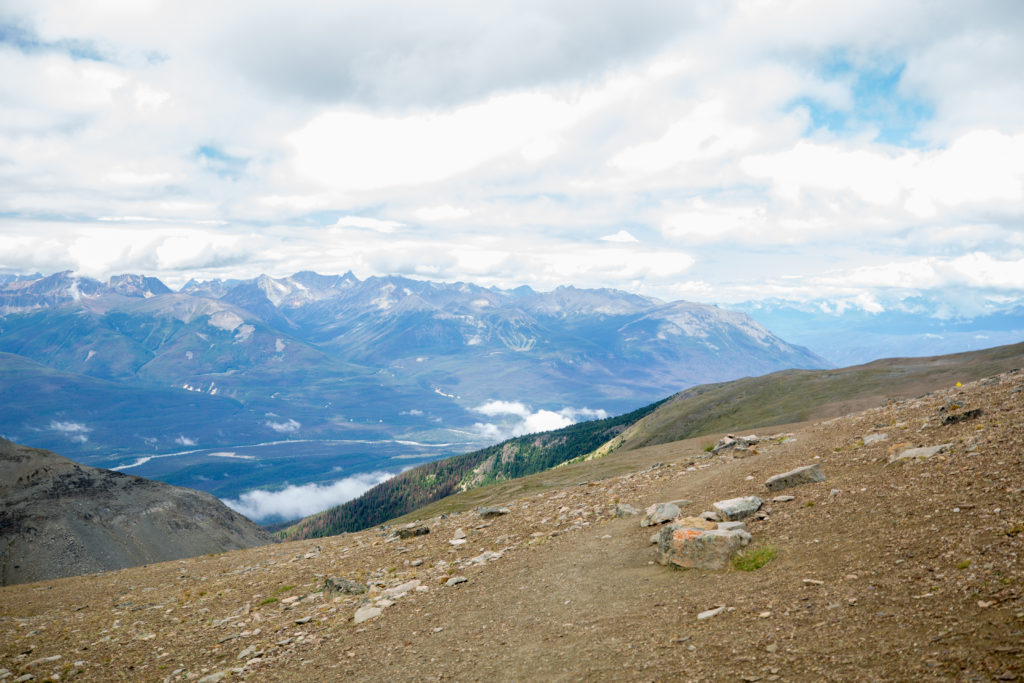
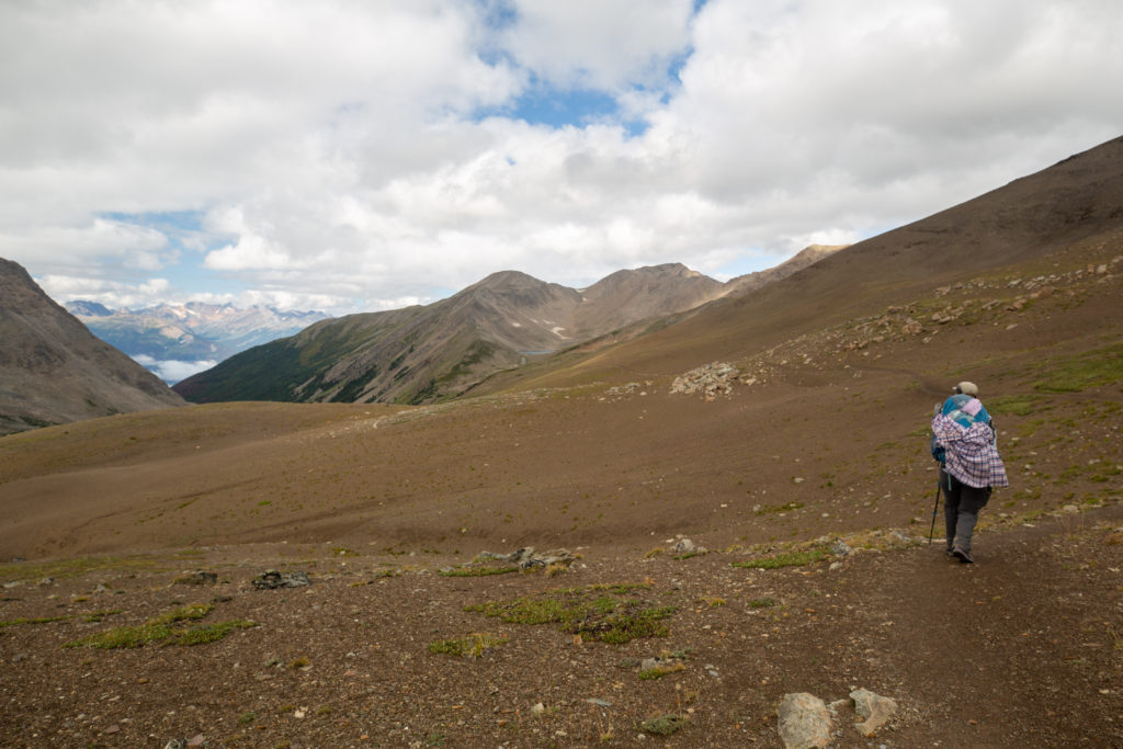
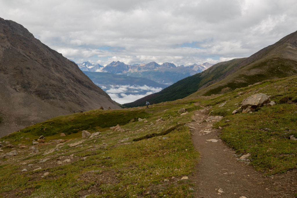
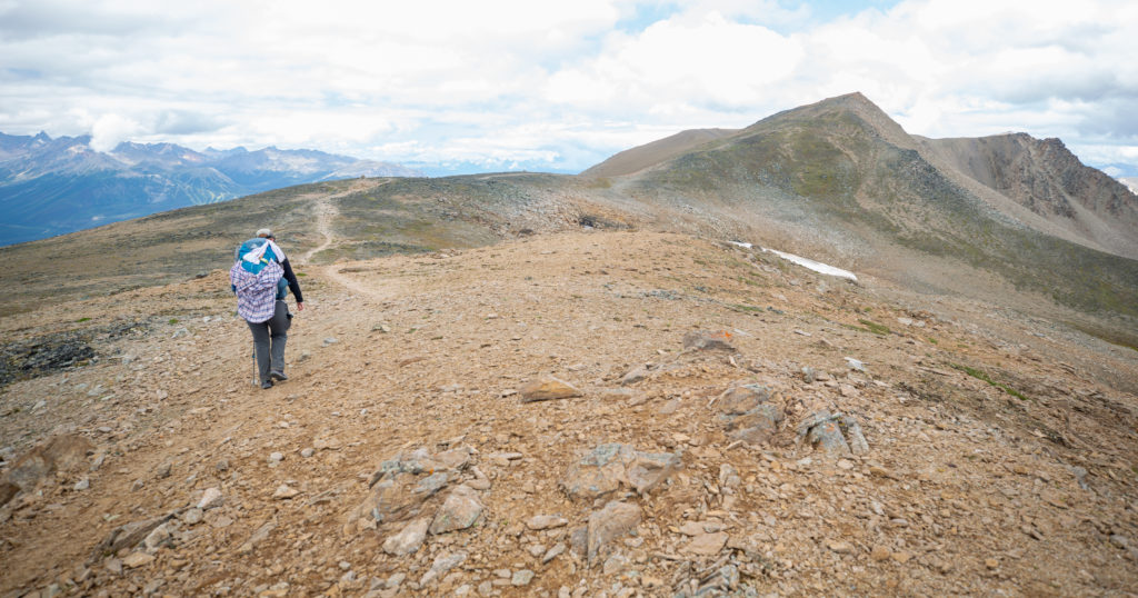
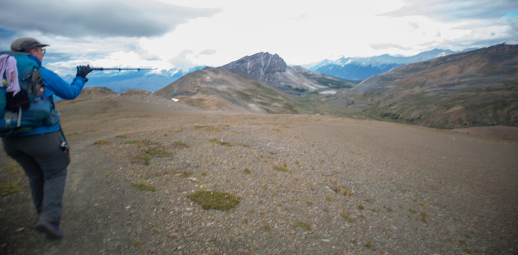
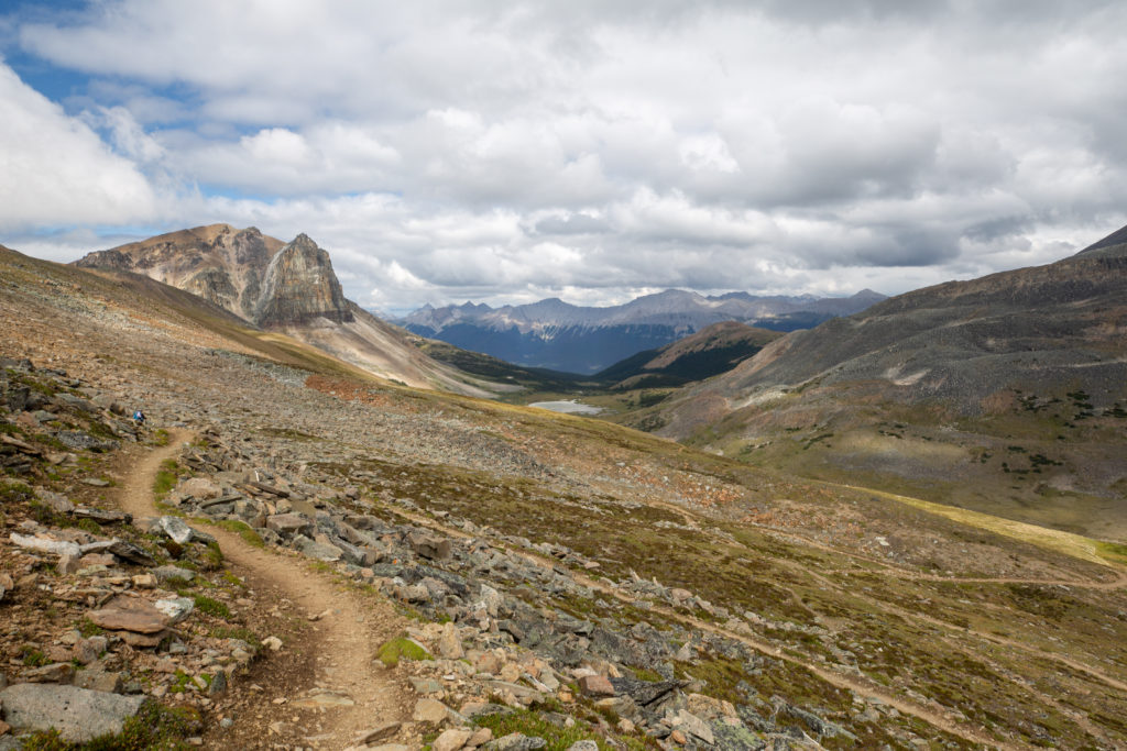
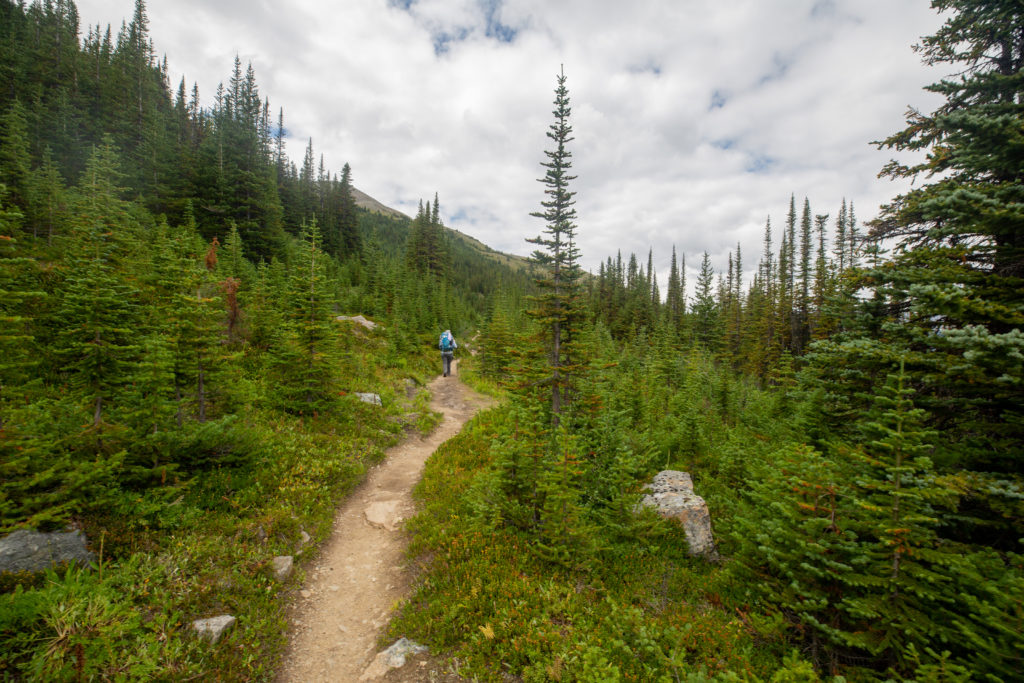
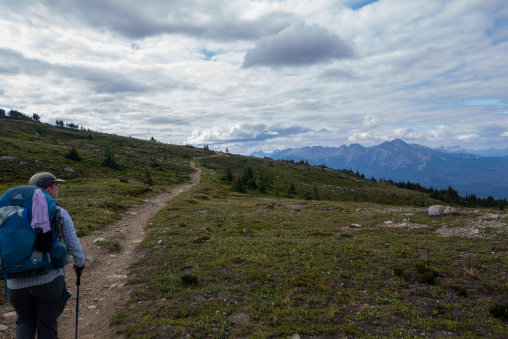
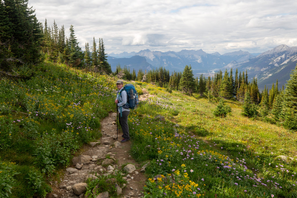
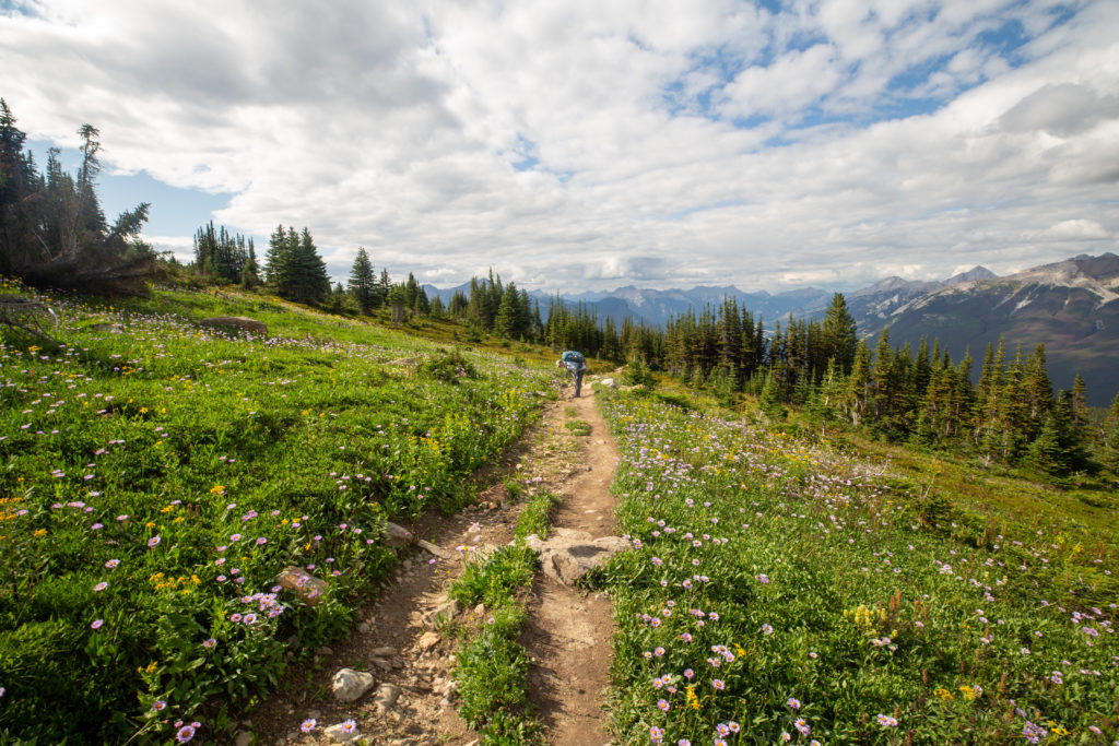
We headed off down the Skyline. The name is well chosen as it really feels like you are hiking in the sky. The initial couple of kilometres actually hikes below the ridge on the west side of so that there are no views to the east. After half an hour of walking on the ridge we found some conveniently west facing rocks that were somewhat sheltered from the wind and dropped our packs to enjoy our lunch.

Trail cutting under along the west side of ridge.
Zoomed in picture can see some small people down the trail.
View looking east. The small lakes drain through Excelsior Creek all the way to Maligne River at the end of the valley. The brown peak at centre is Centre Mountain (2700 m) the peak in behind is Excelsior Mountain (2744 m).
We have attained the ridgeline. We will have lunch at the top of the next rise.

While we were stopped for lunch Micah once again tendered to her feet. It was just before 1 pm and it was high traffic time on The Skyline. There were many trail runners going past us while we ate mostly heading NOBO. Now Micah will tell you its not a true hiking trip unless Dad meets some random person he knows in the backcountry. As we were having lunch two teachers from my school ran by. We had a quick chat before they headed off. The one teacher had spent 55 days the previous summer hiking the GDT SOBO with her children aged 5 and 7. As we got up to head back down the trail. The women we had met on our way up to the Notch were just coming into view to the south.

The four women we met on the way up to the Notch coming down the trail.
Off down the trail.
Switched sides.
Micah very happy to be on the Skyline

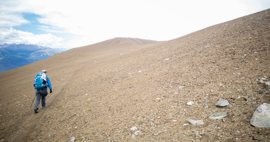
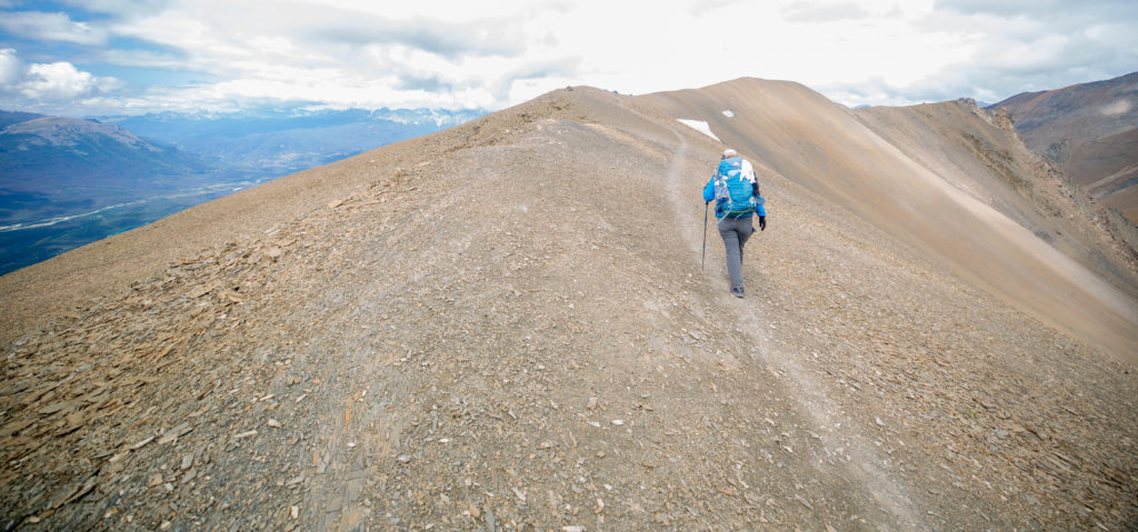
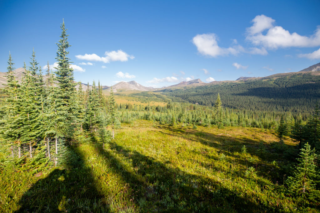
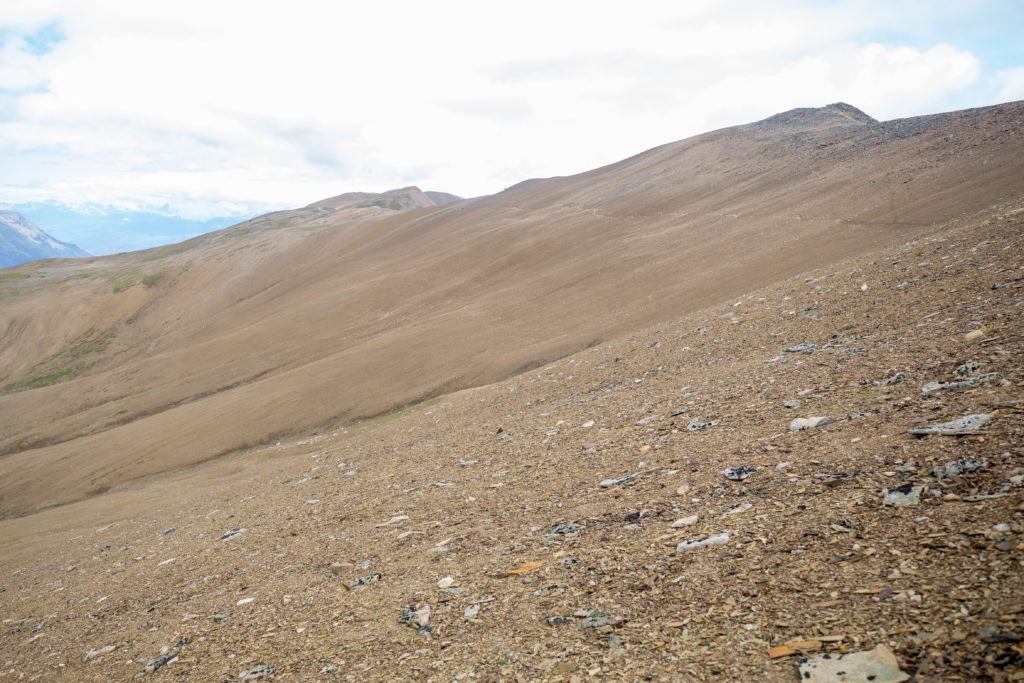
The Skyline after the Notch was more the ridge walk that I had been expecting on the Six Passes. The surface we were walking on was hard and firm and travel was easy.

Just descending off the high point for the day. Micah correctly guessing where we have to go.
Micah doing some more clapping. The Skyline was her happy place.
Finally noticed the camera settings were incorrect. Mount Tekarra (2694 m) dominated the centre of the photo. Tekarra Campground is located just a few hundred metres passed the small lake on the right side just out of view. The mountain was named for Tekarra, an Iroquois guide and hunter who accompanied James Hector during his 1859 exploration of the Athabasca River during the Palliser Expedition.
Quick stop for some more foot repairs.
Looking south along the Skyline. We have lost 100 m from our high point so the Notch is no longer visible. The brown peak on the left is Centre Mountain and the grey peak lit by sunlight in the distance is The Watchtower (2791 m).
Working our way through the sandstone. We have a little more ridge walking to do before we drop into the valley.
Can see our trail to the valley trail snaking along the slope
Leaving the Skyline.

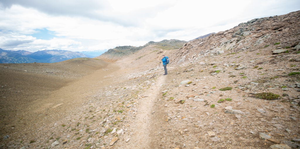
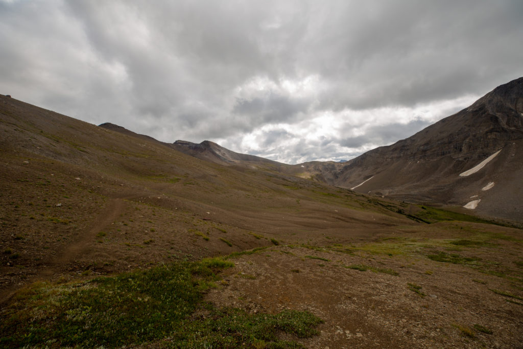
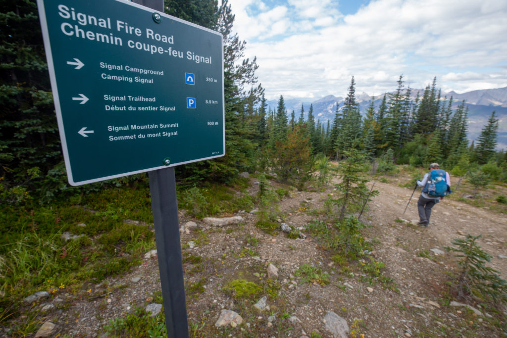
Descending off the Skyline I started to feel as though the trip was over. Even though we were still in the mountains it felt like the next objective was to get to Signal CG then the next day would only be to hike to Jasper. There were no doubts about whether we would be able to finish the hike and with the end in sight I was feeling slightly deflated as we started our descent.

Winding our way down off the Skyline. We were still surrounded by some stunning scenery.
See the trail zigzagging down the slope.

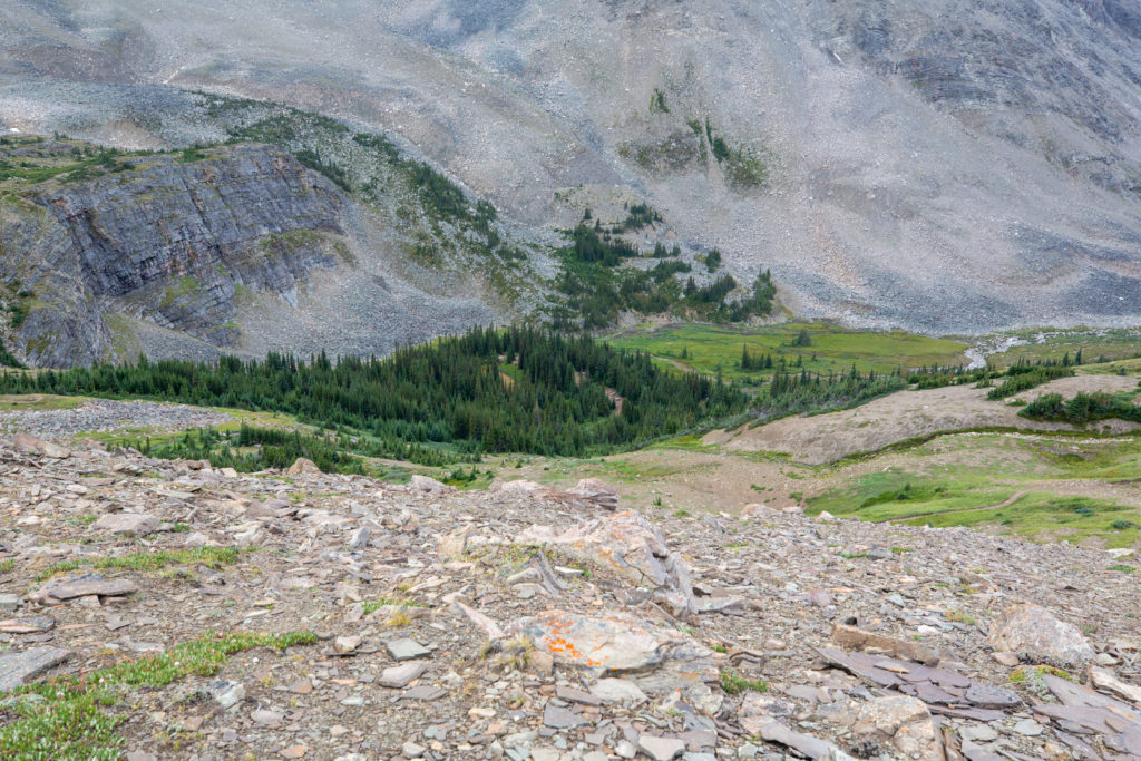
As we dropped down to the alpine bowl formed by Mt Tekarra, Centre Mt and Excelsior Mt a trail runner passed us and shouted out a comment about Frosty Paws. She quickly disappeared from view and was the last runner or hiker we would see on the trail on this day.

Easy cruising into Tekarra CG.
Mount Tekarra and a small pond in the meadow.
The treeless wonder of the alpine. Colin Range in the distance.
Guess people have wild camped in the area. Just before this sign I rammed my toe that I had cut at Pinto Lake into a rock. It really hurt.
One last look back to the Skyline.
Tekarra CG.

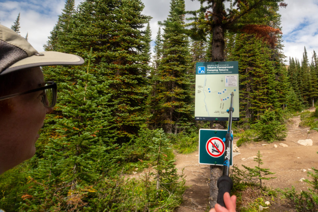
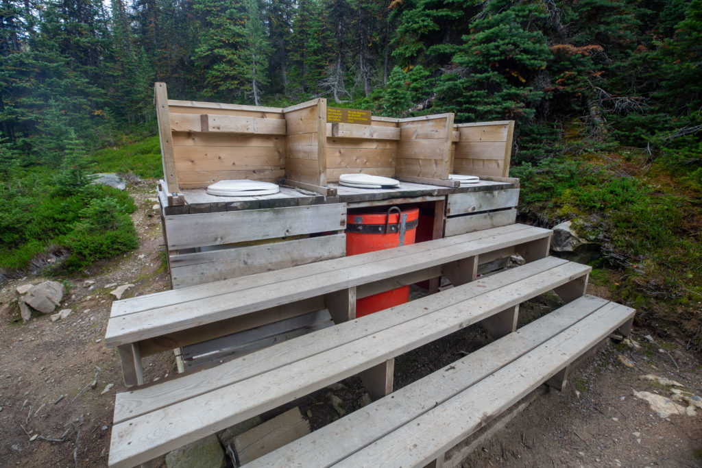
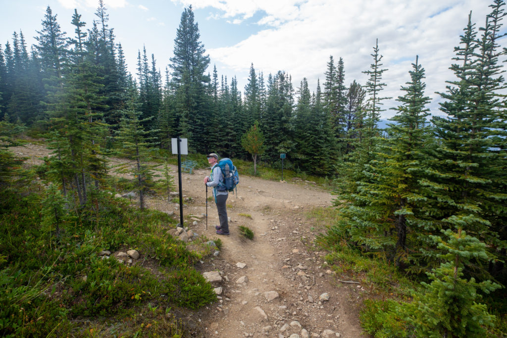
We arrived at Tekarra CG at 3:20 pm. We had been hiking for 8 hr and 10 min and had covered 26 km. The campground was set alongside a tumbling creek and at the time of our arrival there was only one campsite occupied. After using the very unique toilets Micah floated the idea of staying at Tekarra CG instead of continuing on to our campsite at Signal. I was a little unsympathetic and dismissed the idea quickly. We had a short day of 20 km for our last day and and did not want to turn it into a longer day. I was really looking forward to an easy last day. Micah had read on the Guthooks (Far Out) App that there was not a good water supply at Signal so we refilled in the stream and headed off after a 15 minute break on the final 6 km stretch for the day.

The toilets where amazing. But a little short on privacy.
Micah off down the trail.

We passed by two young men enjoying cool refreshments while sitting on rocks in the stream. The trail headed uphill but at a comfortable grade. Micah was off by herself at the front and I felt they were annoyed at continuing on. Micah dislikes hiking over 25 km and today we would be doing 32 and I figured that mentally they had checked out. After catching up to themI attempted to distract her by engaging in conversation. It took quite a while and a few failed attempts to finally get Micah engaged. I asked them about the people they had met on her travels and the conversation and stories took us all the way to our campsite at Signal CG.

Still in the trees but they are getting smaller. We will spend much of the remainder of the day above treeline.
Above treeline. Micah taking in the views as we hike.
The Colin Range. Popular scrambling route up Roche Bonhomme is the brown smudge on the left of the range. The name Roche Bonhomme means “rock fellow” as the people who named the mountain thought it had a human shape.
Cruising above tree line.
Backside of Mount Tekarra.

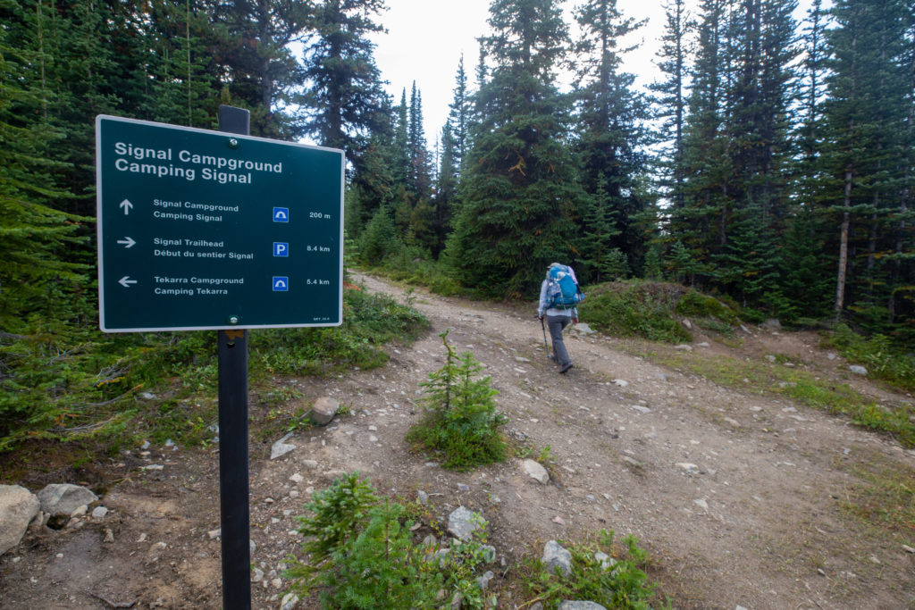
Leaving the backside of Mount Tekarra we started to lose elevation while contouring around Signal Mountain. The trail became wider and rockier as we descended. At 5:05 pm about 90 minutes after we left Tekarra CG we arrived at the junction for Signal CG.

Trail is quite rocky. A few flowers dotting the meadow.
Micah smelling the flowers.
Are we lost or found? Micah checking the sign. Going left takes you to Signal Lookout. Our campground is 250 m the the right. Note the bike rack.
Directions southbound.
We go right 50 m to a junction then turn left 200 m to the campground.
More signage. Just 200 m to go.

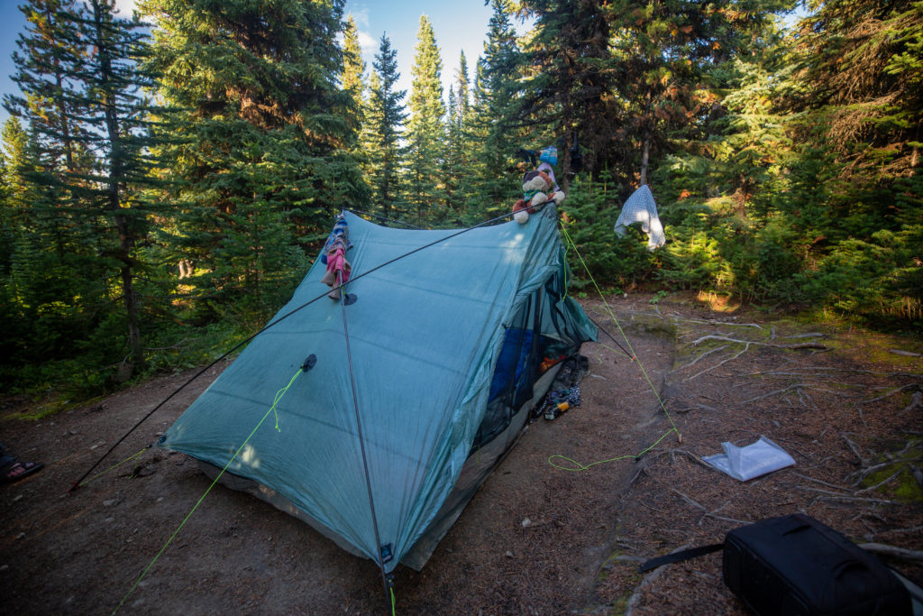
We threw our packs down at 5:10 pm. We relaxed for a few minutes before setting up camp. After the rain yesterday we had some damp items that we draped on anything we could find that still had some sunlight on it to dry.

Welcome to Signal Campground. We took the first campsite on the left. Never did find the first campsite on the right.
Happy to arrive. Already have the sandals on. It is 5:30 pm we have been in camp 20 minutes and we still have not set up the tent.
Prep for tomorrow already started. Filtering water for my Gatorade. Looking like Spinach Rotini for dinner!

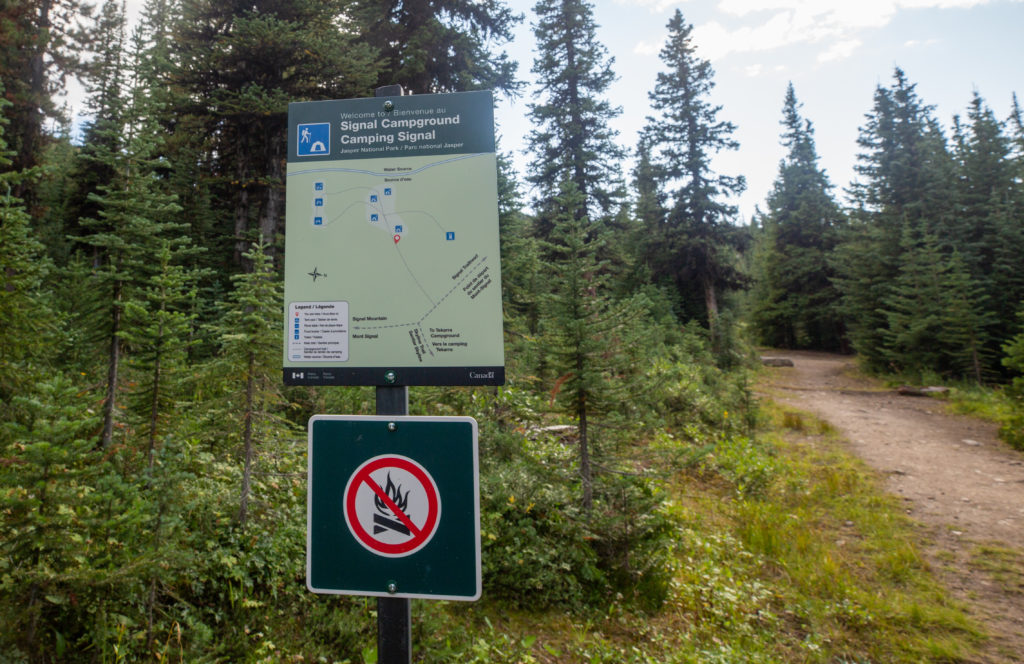
There was another group of campers already at the campground and they had me a little concerned as they were very loud. They had one permit and three tents for the five of them. They had shoehorned all three tents onto one tent pad. When we talked to them they were very pleasant. In the end I need not have worried since they had a big day on the Skyline planned for the next day and they would go to bed shortly after us.

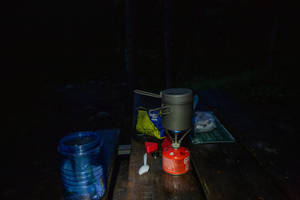
We had dinner just after 6 pm. The sun was setting fast and we snagged the only table that had any sunshine for our dinner. After dinner we got into a pleasant conversation with one of the other campers about water filters. Slowly the group started to congregate around our table. After we moved on from talking about equipment the conversation turned to different trails and hikes. Micah quickly became the star of the show. The conversation went something like:

Them “what hike did are doing”, us “the GDT, its a long trail and we are only doing a section of it”

Them “I did a long trail on Vancouver Island, can’t remember what it is called, Micah “the West Coast Trail, I did that”

Them “isn’t there a long trail in the Sierra’s”, Micah “the John Muir Trail, I did that”

Them “I did a long hike in Spain with my mom”, Micah “the El Camino, I did that with my mom as well”

Them “there is a long trail in New Zealand, don’t remember the name”, Micah “the Te Araroa, I spent 45 days hiking that”

As we talked it got darker and colder. Finally after an hour and a half we all agreed it was time to head to bed. After sitting on the picnic table for close to two hours I remember being very stiff when I got up and only then realizing how cold it had become. The campground was quiet at about 9:30 pm. We were very tired and decided on skipping our bedtime reading on this night.

Frosty guarding the wet clothes.

Day 11 GDT Section E 2021

GDT Section E 2021 (aborted Section D) Home

bootwreckers

Day 3 of my New Years adventure in Arizona up on B Day 3 of my New Years adventure in Arizona up on Bootwreckers, see link in bio.

Hiked the Superstition Ridgeline Trail, 23 km of some very rough terrain.

The views from the ridge were spectacular. The trail is more of a route, then a trail. I got off trail a half a dozen times just on the ascent to the ridge. Sprinkled in for fun where several down climbs where I had to drop my poles before climbing down a small chimney or crack.

There is camping possibilities on the ridge and I do wish I would have camped just before Syphon Draw and enjoyed the sunset. Maybe next time.

This was a very challenging 10.5 hrs on the trail, one of my hardest days ever, but worth every drop of sweat.

Till next time Arizona.

#nationalparks, #slotcanyon, #hiking, #hikingadventures, #familytime, #camping, #campingadventures, #outdoors, #outside, #nature,  #FIndyourpark #landscape #landscapephotography #optoutside #nationalpark #desertphotography #grandcanyon #grandcanyonnationalpark #grandcanyonassociation #nationalparkweek #reichallenge #nationalparksweek #rightnow #nationalparktrust #goparks #aztrails
Even in the smoke, there is nothing like hiking in Even in the smoke, there is nothing like hiking in the Canadian Rockies.

On the way to Pinto Lake, going over Sunset Pass with Tuft Peak in the distance.

#parkscanada #parks #bcparks #trails #longdistancehike #longtrail #outdoors #outside #thruhike #hike #thruhiking #outside #backpacking #waterfalls #waterfall #naturephotography #naturephotography #nationalparks #alberta, #albertaparks
Day 2 of my New Years Arizona Adventure is posted, Day 2 of my New Years Arizona Adventure is posted, see link in bio.

Fun and easy day exploring the Superstitions with my four new friends. Lots of varied terrain and lots of breaks. Will make up for that on Day 3.

I did run out of superlatives to describe the scenery, in one word it was simply spectacular!

#nationalparks, #slotcanyon, #hiking, #hikingadventures, #familytime, #camping, #campingadventures, #outdoors, #outside, #nature,  #FIndyourpark #landscape #landscapephotography #optoutside #nationalpark #desertphotography #grandcanyon #grandcanyonnationalpark #grandcanyonassociation #nationalparkweek #reichallenge #nationalparksweek #rightnow #nationalparktrust #goparks #aztrails
Day 1 of a fun two day trip out to Pinto Lake over Day 1 of a fun two day trip out to Pinto Lake over Sunset Pass.

It was a little smokey but as you can see from the first photo the views were spectacular.....

The little dot in Photo 9 is a Common Loon, and entertained us for several minutes swimming across the lake and diving for fish.

Big thanks to @kbsymington , @sio.mellors , Kylie and Charlie for making it such an awesome trip.

#parkscanada #parks #bcparks #trails #longdistancehike #longtrail #outdoors #outside #thruhike #hike #thruhiking #outside #backpacking #waterfalls #waterfall #naturephotography #naturephotography #nationalparks #alberta, #albertaparks
Day 1 of my 2023 New Years Arizona Adventure is up Day 1 of my 2023 New Years Arizona Adventure is up on Bootwreckers,  see link in bio.

Day started off rainy, see photo 2, but the clouds cleared off by 8 am and I finally got my hike started.

The day wasn't without adversity as I slipped chasing my water bottle in a stream and fell in the water. My camera got flooded and stopped working so the rest of the photos were taken on my aging BlackBerry Key 2.

Met up with a group of 4 med students and hiked with them for two days.

Despite the ruined camera was a super fun day on the trail in a new place. 

#nationalparks, #slotcanyon, #hiking, #hikingadventures, #familytime, #camping, #campingadventures, #outdoors, #outside, #nature,  #FIndyourpark #landscape #landscapephotography #optoutside #nationalpark #desertphotography #grandcanyon #grandcanyonnationalpark #grandcanyonassociation #nationalparkweek #reichallenge #nationalparksweek #rightnow #nationalparktrust #goparks #aztrails
It took a while but finally posted the intro to my It took a while but finally posted the intro to my New Years trip to Arizona, see link in bio.

I was greater in Arizona to 18C weather followed quickly by near freezing temperatures and the most rain in the Phoenix area in one day since 1906!

My trip went from Plan A, 4 days on the Arizona Trail,  through Plans B, C and Finally D.

Was a fun if sometimes frustrating adventure.

#nationalparks, #slotcanyon, #hiking, #hikingadventures, #familytime, #camping, #campingadventures, #outdoors, #outside, #nature,  #FIndyourpark #landscape #landscapephotography #optoutside #nationalpark #desertphotography #grandcanyon #grandcanyonnationalpark #grandcanyonassociation #nationalparkweek #reichallenge #nationalparksweek #rightnow #nationalparktrust #goparks #aztrails
Day 3 of Rockwall 2022 is up on Bootwreckers, see Day 3 of Rockwall 2022 is up on Bootwreckers,  see link in bio.

Sweet little day up and over Tumbling Pass with and a long view of Tumbling Glacier. 

The weather cooperated with blue skies and no threat of rain so we were able to linger at The Glacier before heading down the long descent to the car.

While a straightforward day there were still some adventures to be had, but you have to read about them on the blog.

Big thanks to my amazing hiking partner, @sio.mellors

Looking forward to our 3 day adventure this summer, which will no doubt generate more stories to tell.

#parkscanada #parks #bcparks #trails #longdistancehike #longtrail #outdoors #outside #thruhike #hike #thruhiking #outside #backpacking #waterfalls #waterfall #naturephotography #naturephotography #nationalparks
Day 2 of our Rockwall 2022 trip is posted on Bootw Day 2 of our Rockwall 2022 trip is posted on Bootwreckers, see link in bio. With @sio.mellors

This day was Helmet Falls CG to Tumbling Creek CG.

Day started off beautiful with blue skies which turned to rain after lunch. Somehow through all the rain and thunder Siobhan  never lost her smile.

The day ended with beers and Siobhan giving butt rubs to the doggies in camp.

Photo 1 Siobhan taking in the Rockwall at lunch

Photo 2 Helmet Falls at Golden hour

Photo 3 me and my morning coffee waiting for Siobhan to wake up

Photo 4 on the way up Siobhan with Limestone Peak in th background 

Photo 5 Siobhan at Rockwall Pass (can you tell?)

Photo 6 Siobhan near Wolverine Pass with Rockwall Peak shrouded in clouds

Photo 7 Tumbling Glacier through the clouds

Photo 8 setting up camp

Photo 9 Dinner time

Photo 10 butt rubs

#parkscanada #parks #bcparks #trails #longdistancehike #longtrail #outdoors #outside #thruhike #hike #thruhiking #outside #backpacking #waterfalls #waterfall #naturephotography #naturephotography #nationalparks
New trip posted, three day trip in the Rockwall in New trip posted, three day trip in the Rockwall in Kootenay NP with @sio.mellors. Introduction and Day 1 up on Bootwreckers.

Trip was suppose to be hiking Northover Ridge in Kanananaskis but smoke had us change plans at the last minute.

This would be my third multi day trip on the Rockwall but the first for Siobhan.

Managed to get two camping sites on the Rockwall and instead of smoke we had to deal with the threat of rain.

We did get wet but we had a blast.

Day 1 is from Paint Pots TH to Helmet Falls CG, with a side trip to get up close the the falls. Pretty straightforward day but visiting Helmet Falls is always special.

#parkscanada #parks #bcparks #trails #longdistancehike #longtrail #outdoors #outside #thruhike #hike #thruhiking #outside #backpacking #waterfalls #waterfall #naturephotography #naturephotography #nationalparks
The sixth and final day of our 2022 GDT Section D The sixth and final day of our 2022 GDT Section D hike is up on Bootwreckers, see link in bio.

This day took us from a random camp on the Howse Floodplain to the Mustafa Canyon parking lot. This was an adventurous day with bushwhacking, stream crossings and dead fall but a simply glorious end to a wonderful hike on the GDT. 

Again thanks  to Sara (@sd_kuz) and Lillian (@waterlilizee) for sharing this adventure with me. I am sure we will meet again on a trail someday.

Photo 1 - Morning Colors

Photo 2 - tents on the floodplain

Photo 3 - bushwhacking to start the day

Photo 4 - fields of flowers going to seed

Photo 5 - looking south down the Howse River

Photo 6 - thigh deep water crossing

Photo 7 - big views

Photo 8 - Sara crossing some dead fall

Photo 9 -Mistaya Canyon

Photo 10 - picked up a thru hiker named Roy, enjoying beverages left by Natasha and Kyle from Backpacks and Bikeracks

#greatdivide #greatdividetrail #gdt #parkscanada #parks #bcparks #trails #longdistancehike #longtrail #outdoors #outside #thruhike #hike #thruhiking #outside #backpacking #waterfalls #waterfall #naturephotography #naturephotography #nationalparks #duplex #sectionhike #sectionhiker
Day 5 of our 2022 Great Divide Trail Section D hik Day 5 of our 2022 Great Divide Trail Section D hike is posted on Bootwreckers, see link in bio.

Truly epic day on the trail. Pass through the debris of two avalanches, had lunch by a waterfall, crawled over so much dead fall and hiked on the Howse Flood Plain.

The sunset on the flood plain was one of most magical I have seen.

As always a big thanks to Sara (@sd_kuz) and Lillian (@waterlilizee) for sharing this adventure with me. The Team totally rocked the trail.

#greatdivide #greatdividetrail #gdt #parkscanada #parks #bcparks #trails #longdistancehike #longtrail #outdoors #outside #thruhike #hike #thruhiking #outside #backpacking #waterfalls #waterfall #naturephotography #naturephotography #nationalparks #duplex #sectionhike #sectionhiker
Evening light on Picketpost Mt. #aztrail #aztasso Evening light on Picketpost Mt.

#aztrail #aztassociation  #nps, #nationalparks, #slotcanyon, #hiking, #hikingadventures, #familytime, #camping, #campingadventures, #outdoors, #outside, #nature,  #FIndyourpark #landscape #landscapephotography #optoutside #nationalpark #desertphotography #grandcanyon #grandcanyonnationalpark #grandcanyonassociation #nationalparkweek #reichallenge #nationalparksweek #rightnow #nationalparktrust #goparks #aztrails
Arizona Trail Passages 14 and 15. Some photos of Arizona Trail Passages 14 and 15.

Some photos of my recent hike down a couple of Passages of the Arizona Trail. 

The trail is so diverse, rolling terrain cut by shallow washes leads to the expanse of the desert then into rugged canyons and tall peaks, all in a space of 92 km (58 miles).

Had a great time, some blisters gave me some concerns but they seem to be doing fine now that they are out of my hiking shoes.

Got lucky with Trail Magic courtesy of Condiments who drove his 4x4 deep into an unarmed wash, was really in the middle of no where, and then again at the start of Passage 15, missed the Trail Angel's name, the wind was so loud.

Like to thank my Trail Angels, Carole for driving me to Oracle to start the trip, with side trip to a Hayden Az, a real ghost town and to Edith for leaving a water cache for me at Passage 15.

Included a video of my time at the high point for Passage 15. My kid likes it when you stop and enjoy the view you earned, thought they would appreciate my effort in the face of 1000 mph winds (ok maybe thats a bit of an exaggeration).

Thanks Arizona and the AZT for providing more memories.

I will be back

#aztrail #aztassociation  #nps, #nationalparks, #slotcanyon, #hiking, #hikingadventures, #familytime, #camping, #campingadventures, #outdoors, #outside, #nature,  #FIndyourpark #landscape #landscapephotography #optoutside #nationalpark #desertphotography #grandcanyon #grandcanyonnationalpark #grandcanyonassociation #nationalparkweek #reichallenge #nationalparksweek #rightnow #nationalparktrust #goparks #aztrails
That sunset says when I wake up it will be time to That sunset says when I wake up it will be time to start my hike on the Arizona Trail, Passages 14 and 15

Love my little motel in Superior, Az, Copper Mt Motel. Has murals painted on all the buildings

Spied the Grand Canyon from the plane 

Adventure awaits 

#aztrail #aztassociation  #nps, #nationalparks, #slotcanyon, #hiking, #hikingadventures, #familytime, #camping, #campingadventures, #outdoors, #outside, #nature,  #FIndyourpark #landscape #landscapephotography #optoutside #nationalpark #desertphotography #grandcanyon #grandcanyonnationalpark #grandcanyonassociation #nationalparkweek #reichallenge #nationalparksweek #rightnow #nationalparktrust #goparks #aztrails
Frosty Paws all packed and ready for an adventure. Frosty Paws all packed and ready for an adventure.

Arizona Trail Passages 14 and 15 starting Sunday

Off weekend gooooooo!

#aztrail #aztassociation  #nps, #nationalparks, #slotcanyon, #hiking, #hikingadventures, #familytime, #camping, #campingadventures, #outdoors, #outside, #nature,  #FIndyourpark #landscape #landscapephotography #optoutside #nationalpark #desertphotography #grandcanyon #grandcanyonnationalpark #grandcanyonassociation #nationalparkweek #reichallenge #nationalparksweek #rightnow #nationalparktrust #goparks #aztrails
Last weekend before heading to Arizona for a four Last weekend before heading to Arizona for a four day adventure on the Arizona Trail.

I wonder if hiking in the 15 cm of fresh snow will be good prepared for hiking the deserts of Passages 14 and 15?

#aztrail #aztassociation  #nps, #nationalparks, #slotcanyon, #hiking, #hikingadventures, #familytime, #camping, #campingadventures, #outdoors, #outside, #nature,  #FIndyourpark #landscape #landscapephotography #optoutside #nationalpark #desertphotography #grandcanyon #grandcanyonnationalpark #grandcanyonassociation #nationalparkweek #reichallenge #nationalparksweek #rightnow #nationalparktrust #goparks #aztrails
Day 4 of our 2022 GDT Section D hike is up on the Day 4 of our 2022 GDT Section D hike is up on the website, see link in bio.

This was a truly epic day spent on the Amiskwi and Collie Creek Alternates.

The weather cooperated starting with a spectacular sunrise on the Mummery Glacier, rainbows and blue skies on the ridge.

We had a brief encounter with a little black bear who scampered quickly away. 

Finished off the day with a cold beer, Grizzly Paw Rutting Elk Red, that I had carried with me and it tasted great.

Easily one of th best days on the trail ever.

Again big thanks to Sara (@sd_kuz) and Lillian (@waterlilizee) for sharing this adventure with me. The Team totally rocked the trail.

#greatdivide #greatdividetrail #gdt #parkscanada #parks #bcparks #trails #longdistancehike #longtrail #outdoors #outside #thruhike #hike #thruhiking #outside #backpacking #waterfalls #waterfall #naturephotography #naturephotography #nationalparks #duplex #sectionhike #sectionhiker
Day 3 of our 2022 Section D hike is posted, see li Day 3 of our 2022 Section D hike is posted, see link in bio.

This was a shorter day, only about 17 km but took us from the end of the Kiwetinok Alternate up to Amiskwi Pass and then a beautiful meadow at the the base of the Amiskwi Ridge.

Photo 1 - morning sky

Photo 2 - on the Kiwetinok Alternate

Photo 3 - Kiwetinok Alternate

Photo 4 - break time at a stream crossing, Frosty Paws hanging in there

Photo 5 - Fireweed with a view down the Amiskwi Valley,

Photo 6 - fields of flowers as we approached Amiskwi Pass

Photo 7 - Yellow Columbine on the way up to Amiskwi Lodge

Photo 8 - Our camp in the meadow

Photo 9 - Setting sun

Photo 10 - one of the best adventure stories ever! True story of how three prisoners of war escaped and climbed Mt Kenya

Again big thanks to Sara (@sd_kuz) and Lillian (@waterlilizee) for sharing this adventure with me. The Team totally rocked the trail.

#greatdivide #greatdividetrail #gdt #parkscanada #parks #bcparks #trails #longdistancehike #longtrail #outdoors #outside #thruhike #hike #thruhiking #outside #backpacking #waterfalls #waterfall #naturephotography #naturephotography #nationalparks #duplex #sectionhike #sectionhiker
First two days of my 2022 Great Divide Trail Secti First two days of my 2022 Great Divide Trail Section D adventure are up on the blog, see profile for link.

Day 1 was from Burgess Pass Trail head to Yoho Lake Campground. A relatively short day but a good warm up for the rest of the trip.

Big thanks to Sara (@sd_kuz) and Lillian (@waterlilizee) for sharing this adventure with me. The Team totally rocked the trail.

Photo 1 - at Burgess Pass looking at Mt Wapta

Photo 2 - Flowers, it was a great time to hike to see all the flowers in August bloom

Photo 3 - Emerald Lake from up high

Photo 4 - at Yoho Pass, did I mention the flowers

Photo 5 - Duplex tent all set up with Frosty Paws on guard, and oh ya, more flowers

Photo 6 - the north end of Wapta Mt as seen from Yoho Lake.

Super fun little day, the opening a grand adventure.

#greatdivide #greatdividetrail #gdt #parkscanada #parks #bcparks #trails #longdistancehike #longtrail #outdoors #outside #thruhike #hike #thruhiking #outside #backpacking #waterfalls #waterfall #naturephotography #naturephotography #nationalparks #duplex #sectionhike #sectionhiker
Sound On. Video clips from my hike along th Supe Sound On. 

Video clips from my hike along th Superstion Ridgeline.

Was an epic hike, 24km from my campsite at Miners Needle to First Water Trailhead where my car was.

Wouldn't recommend doing all in one day backpacking, as the final descent down Siphon Draw Wash is brutal, but I did it in 10hrs 45min

Would love to redo th hike at some point and actaull stop and camp along the ridge.

I had enough water to stop, but I was enticed by the prospects of a beer to finish.

#teamzpacks #zpacks #zpacksduplex #aztassociation #aztrail #aztrails #hike #loveazt #desertphotography #desert #hikingadventures #hikes #backpacking #camping #getoutside #familytime #traillife #aztassociation , #hiking, #hikingadventures, #familytime, #camping, #campingadventures, #outdoors, #outside, #nature,  #FIndyourpark #landscape #landscapephotography #optoutside  #rightnow #goparks #aztrails #aztrail #loveazt  #azt #arizonatrailassociation
Load More Follow on Instagram

For more photos of these and other Bootwreckers Adventures

© 2023 Boot Wreckers | Powered by Minimalist Blog WordPress Theme