Boot Wreckers
Menu
  • Welcome to my hiking website
  • Hiking
    • Mt Allan Traverse (Centennial Ridge)
    • Mt Nomad – Kanananaskis Country
  • Backpacking – Overnights
    • Baker Lake 2020 Banff NP
    • Floe Lake/Numa Creek, Kootenay NP, British Columbia
    • Floe Lake (Revisited 2019) – Kootenay NP
    • Grand Canyon Corridor Backpacking Trip
    • Hermit Trail to Hermit Meadows – Glacier NP, British Columbia
    • Fish Lakes – Banff NP, Alberta
    • Mystic Lake – Banff NP
    • Ribbon Lake Kananaskis Prov. Park 2016 – Ribbon Creek Route
    • Ribbon Lake Kananaskis Prov. Park 2017 – South Buller Pass Route
    • Stenton Lake – Alberta Wildlands Prov. Park
  • Backpacking – Multi Day
    • Arizona Trail Passages 16/17
    • Brazeau Loop – Jasper National Park
    • Egypt Lake Epic – Banff NP
    • Grand Canyon Hermit – South Kaibab
    • Grand Canyon – Tanner/Beamer Trail
    • GR20 – Corsica
    • Kilimanjaro – Tanzania
    • Mt Assiniboine Lollipop – Banff NP
    • Rockwall North 2020 Kootenay NP
    • Sawback – Banff NP
  • The Team
  • Contact Us
Menu

Day 3 Sawback Banff NP

Pulastilla Pass, wiping away the memories of rain.

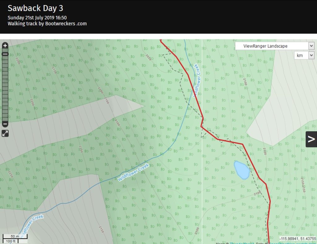
Day 3 Badger Pass Junction Campground to Baker Lake Campground, 16.3 km, 730 m Elevation Gain, 570 m Elevation Loss, 8 hrs 7 min .

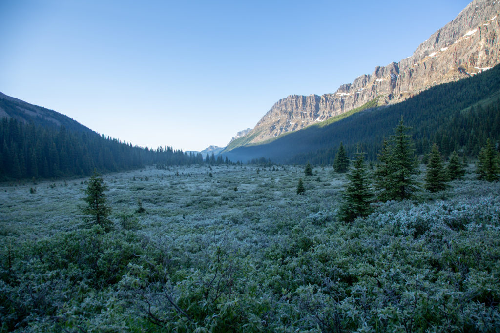
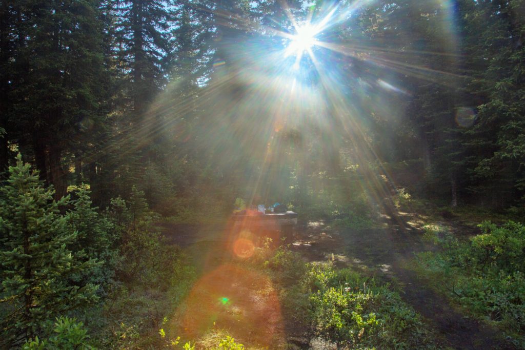
Slept well, without the sound of any rain and woke up to sunshine and blue skies. I grabbed the camera and rolled out of bed to capture some scenes of the morning skies. I was not disappointed.

Good morning sunshine.
The moon setting behind a peak.

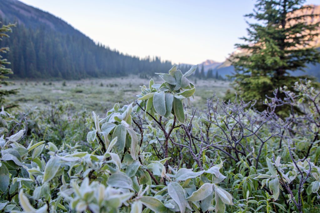
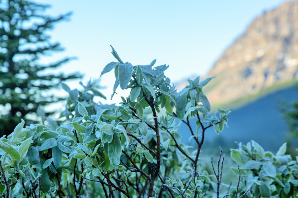
As I walked down the trail, I noticed that the mud was actually frozen, and there was a layer of frost all over.

Frozen mud.
The frozen meadow looking south.
Morning at Johnston Creek.
Pulsatilla Pass.
Frosty morning.
Frozen in the sunshine.

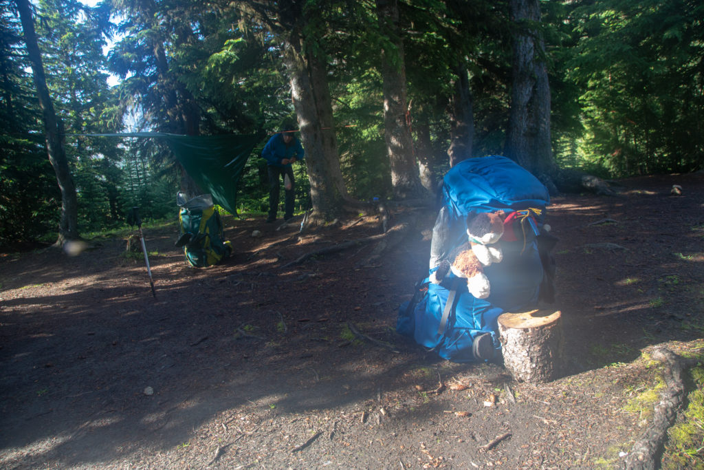
Even thought I was up at 7:10 am, we were not in a big rush to get going. We starting getting breakfast ready at just after 8:30 am.

Breakfast was better with the sunshine.
Ken digging into breakfast.
Soaking up the view, was a vast improvement from dinner last night.

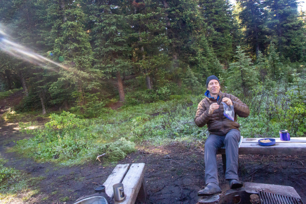
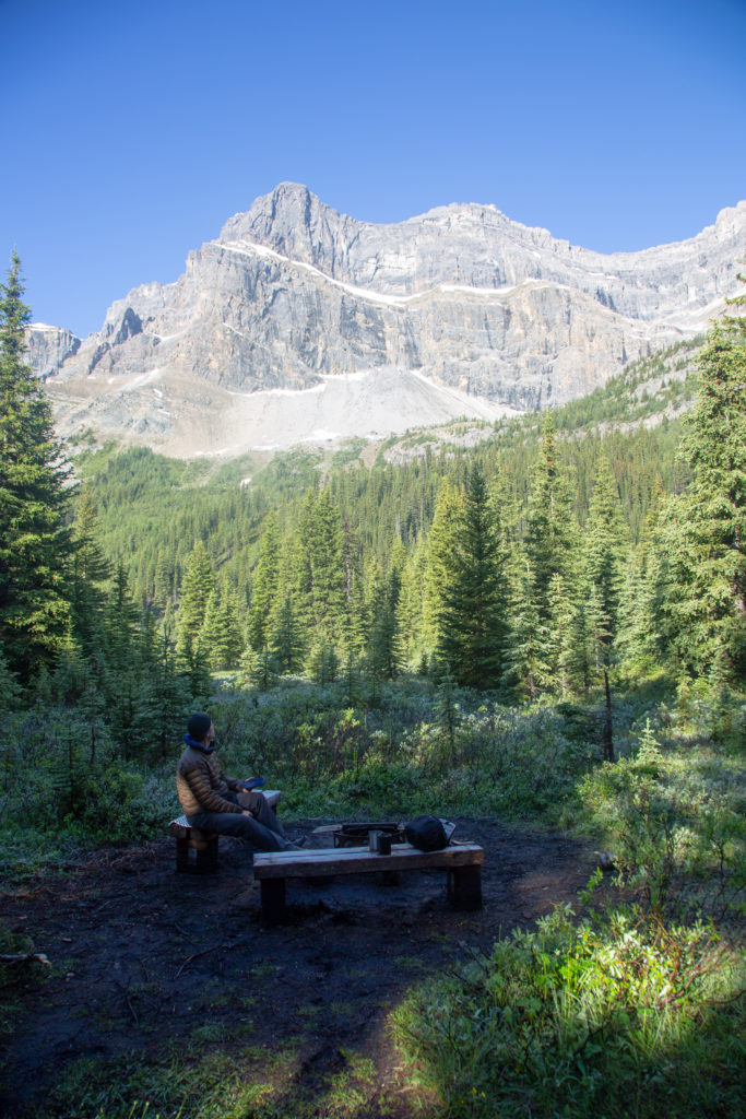
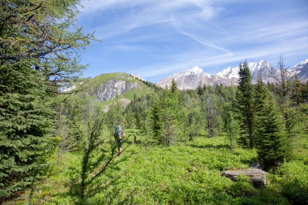
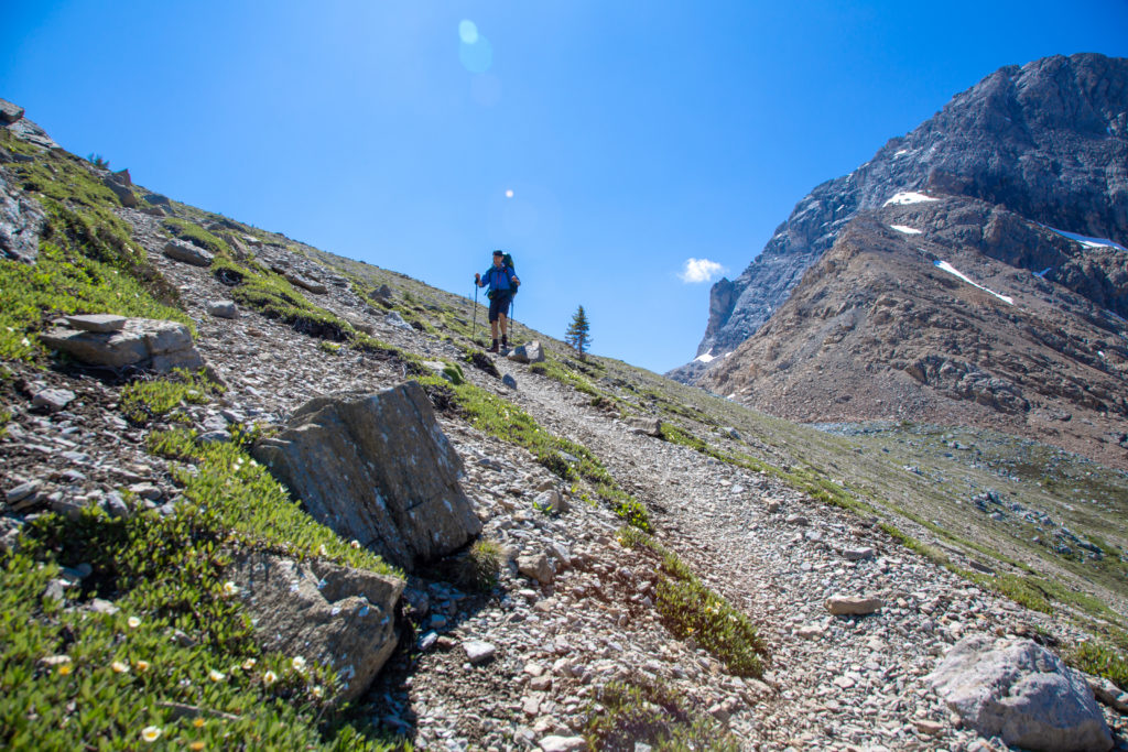
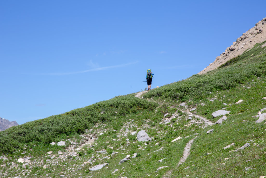
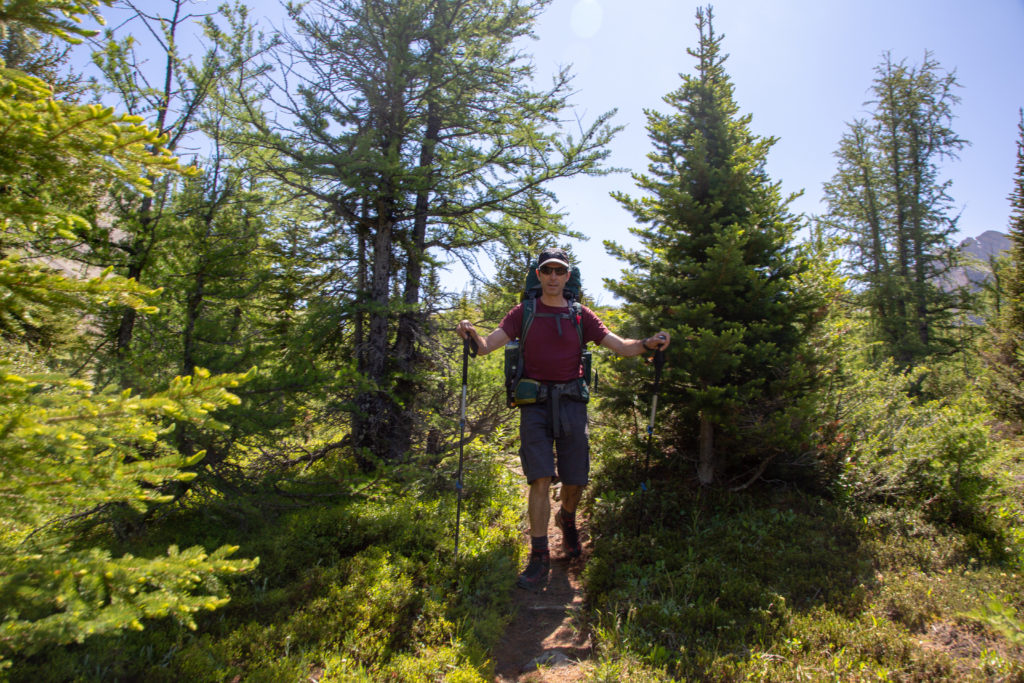
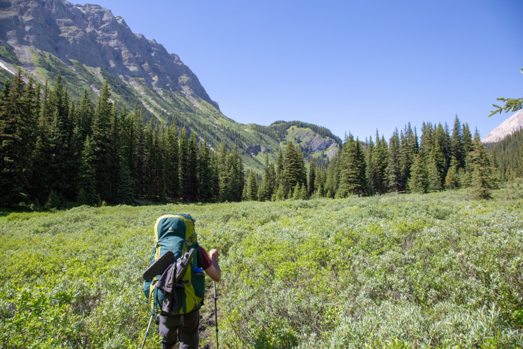
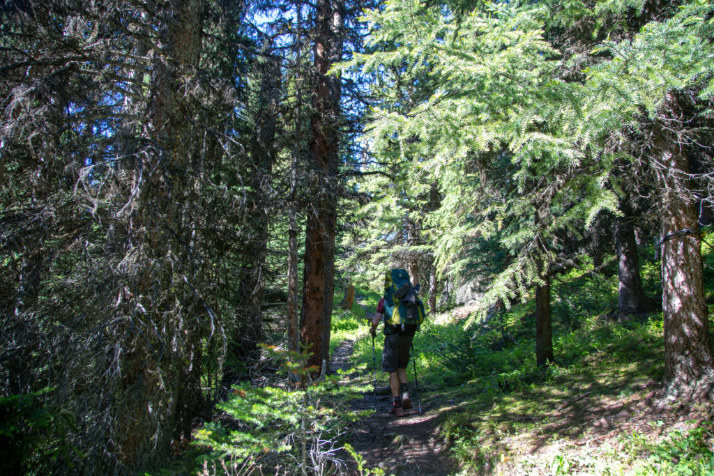
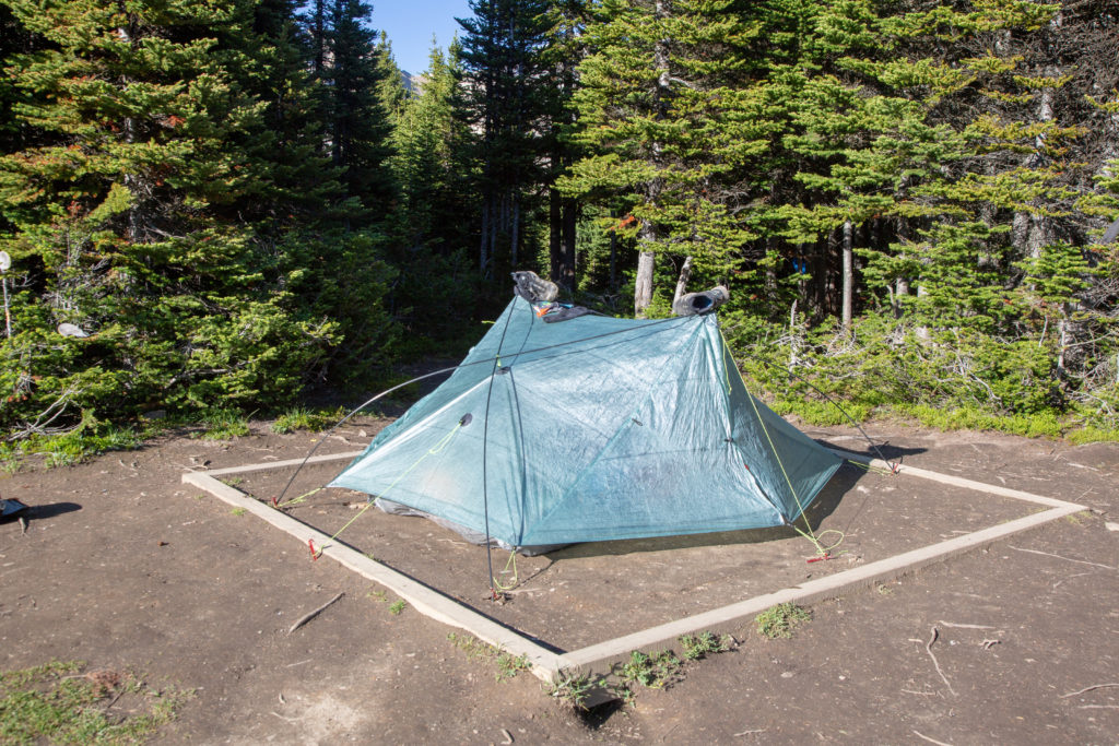
Had Frosty and my backpack ready to go by 9:40 am, and the campsite was all packed up by 9:50 am. Our day would start with a relatively easy walk across the meadow, before hiking up Pulastilla Pass, rising 300 m in 3.8 km.

Frosty ready to go for the day, no pack cover, so gets a view.
All packed up.

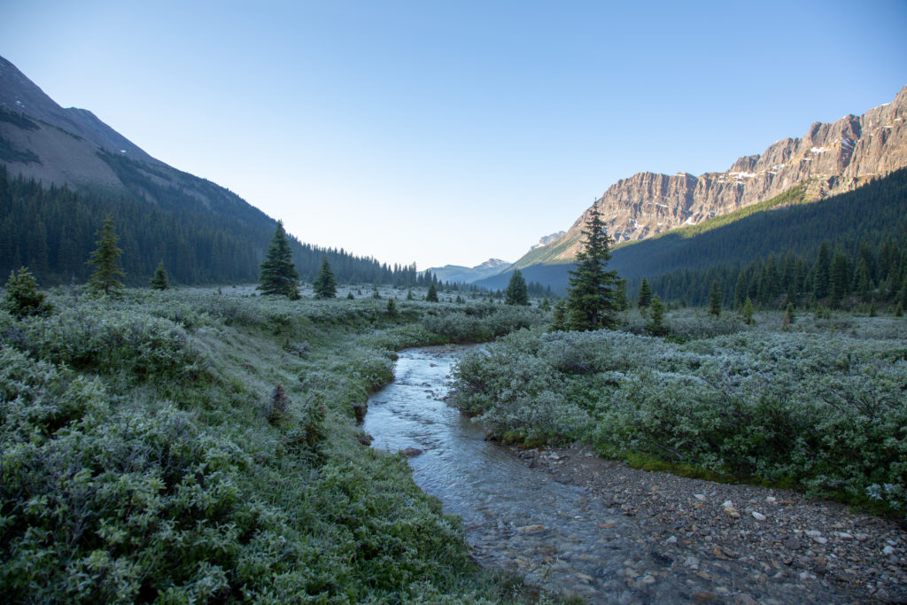
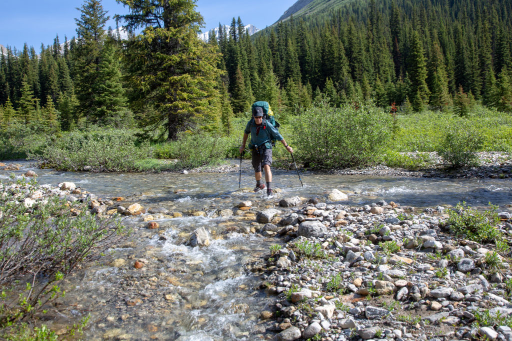
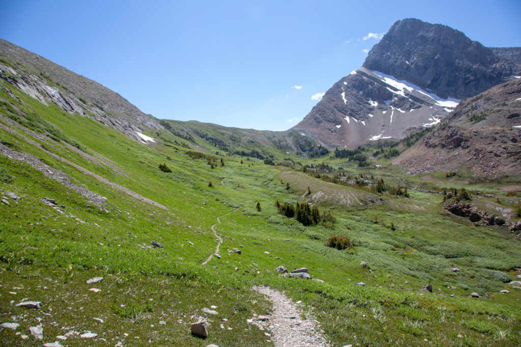
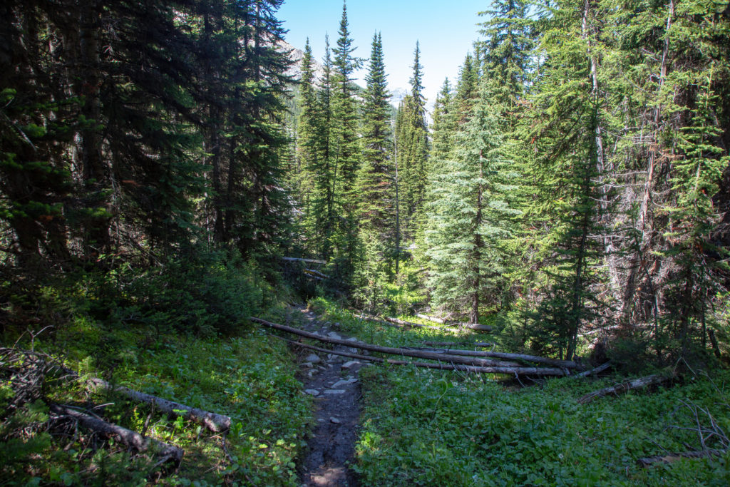
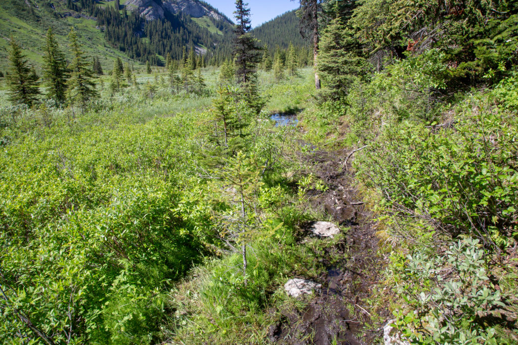
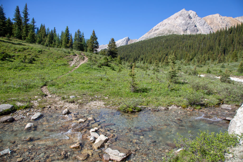
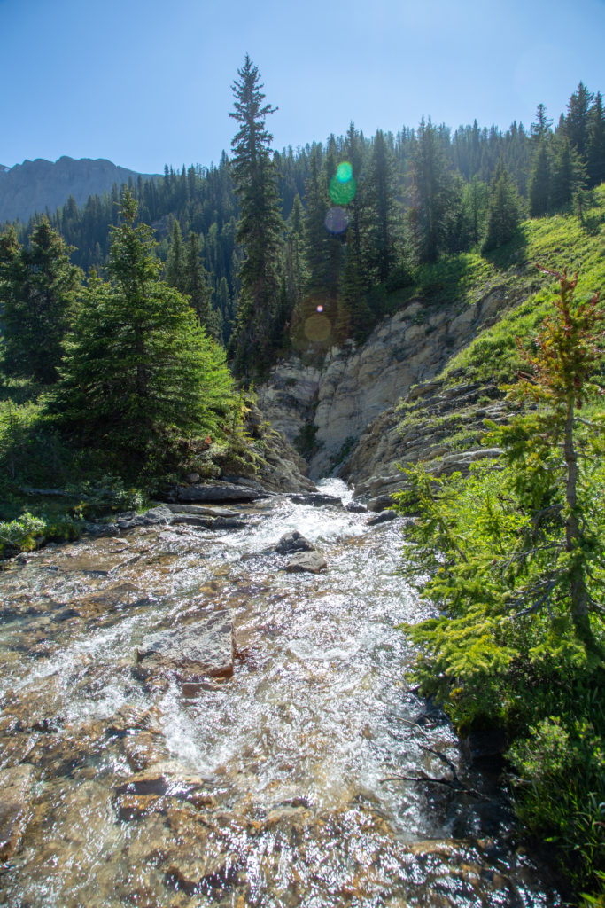
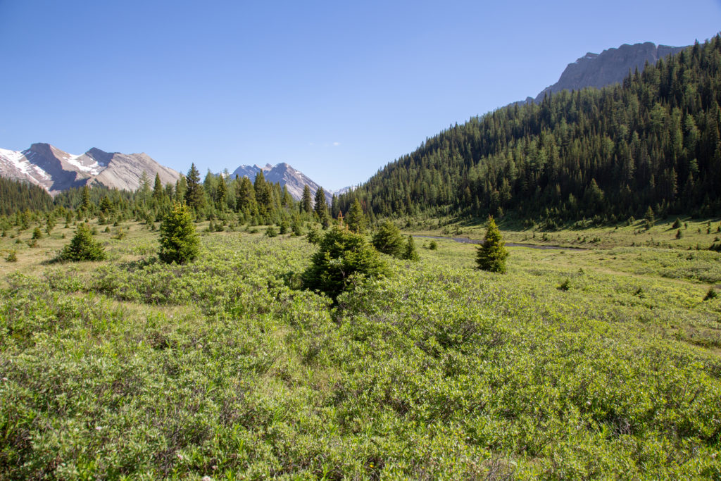
Once back to the main trail, the hiking was easy, a nice reward for the last couple of days. The trail parallels Johnston Creek for a short while. After 800 m we come to a little stream crossing. No bridge, and not much need of one now, but we searched to see if anyone has made a little rock bridge. We ended up just walking through. My feet are wet again, but maybe in the nice weather, they will dry.

Snow capped mountains, blue skies, green fields and flowers everywhere in bloom.
Our first stream crossing.

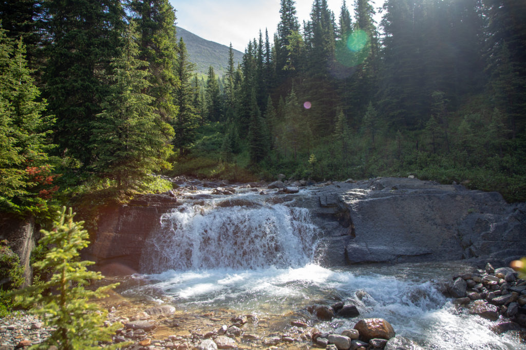
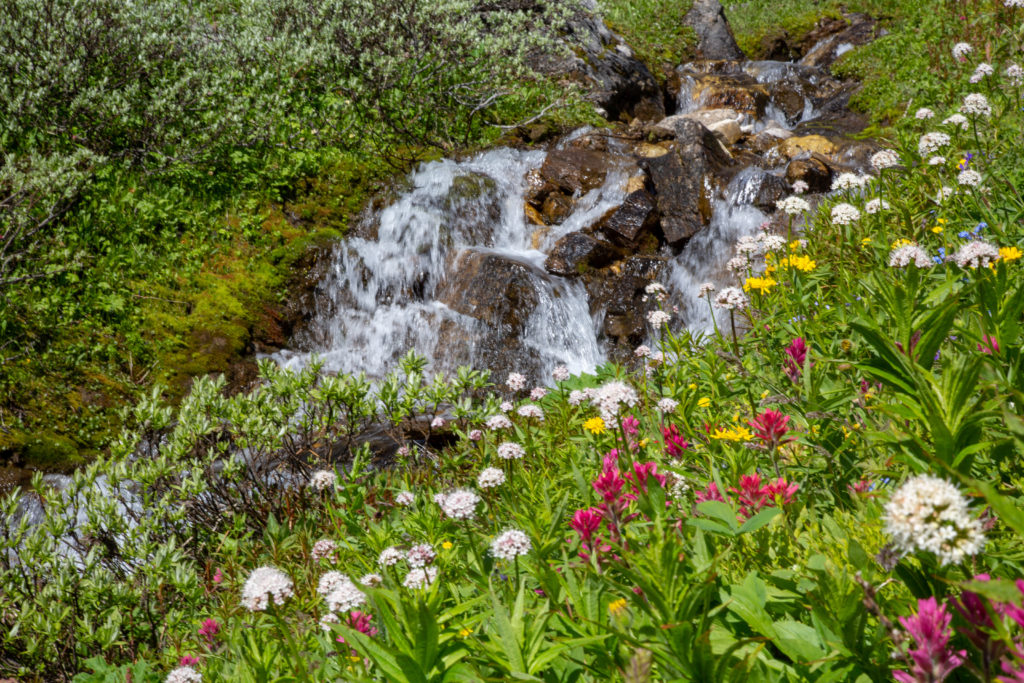
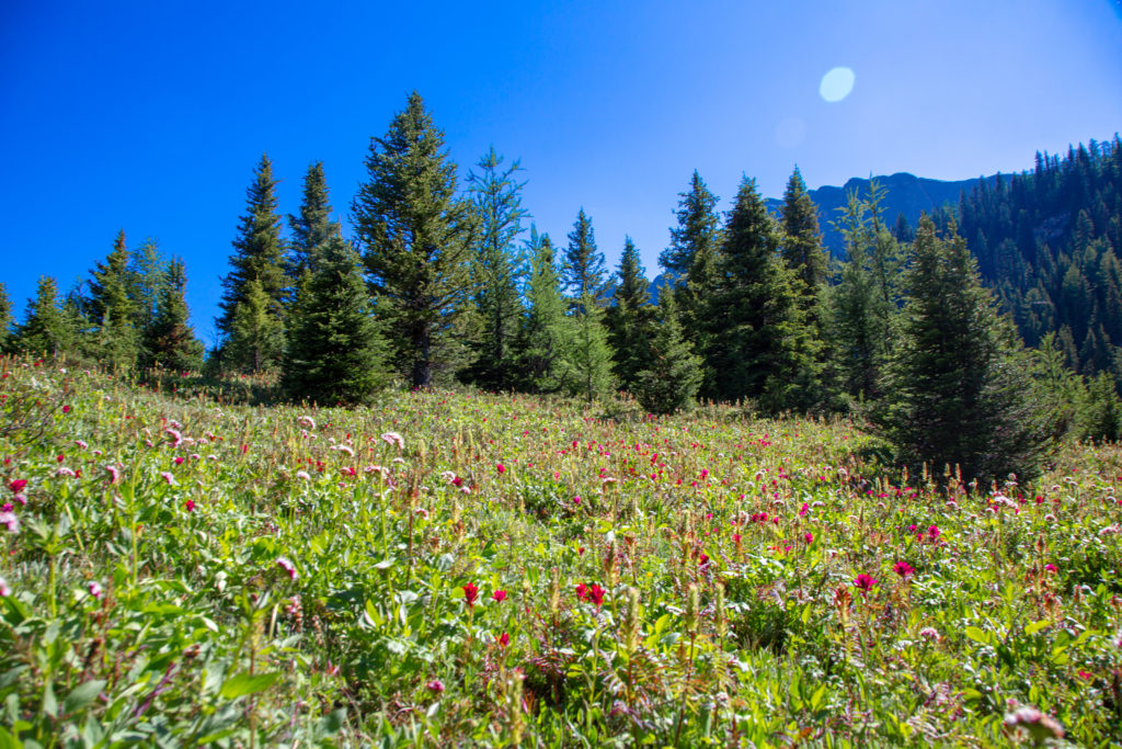
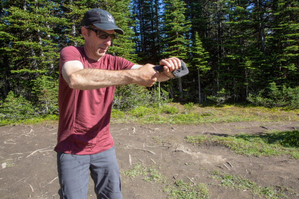
We come to a little waterfall. Ken has nicknamed me “shutterbug”, because I like to take photos. I love waterfalls, so we stopped for a few minutes. The trail then left the meadow and went up a short rise back into the trees, before coming to another flower filled field.

Pretty waterfall.
Pulsatilla Mountain
Trail is very nice, is just a little moist after all the rain.
Ken examining a field of flowers.

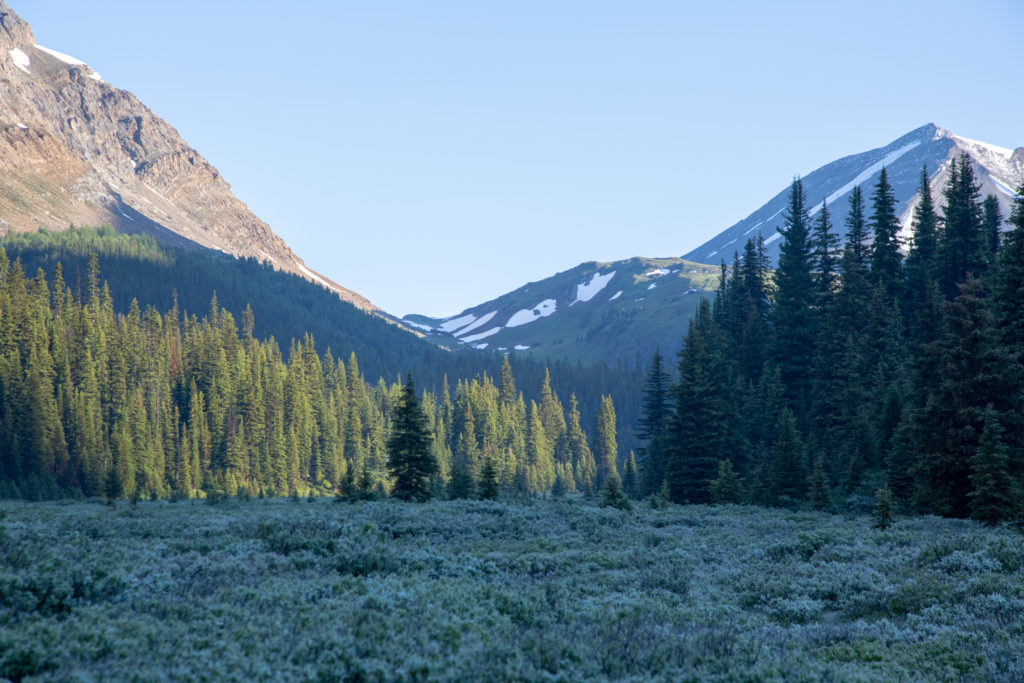
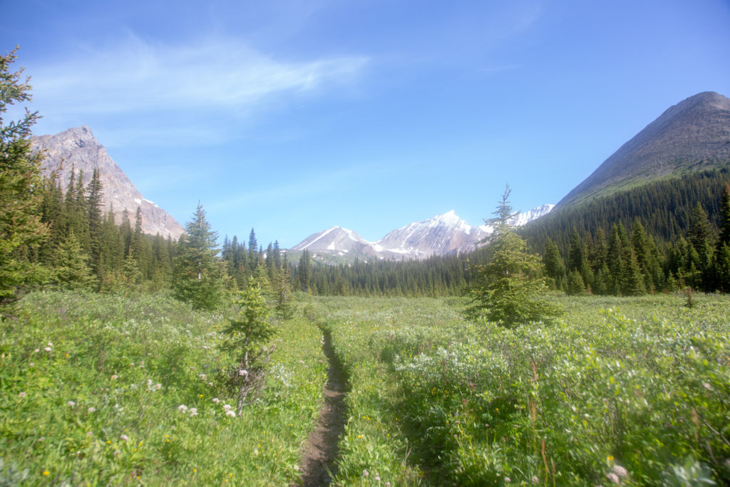
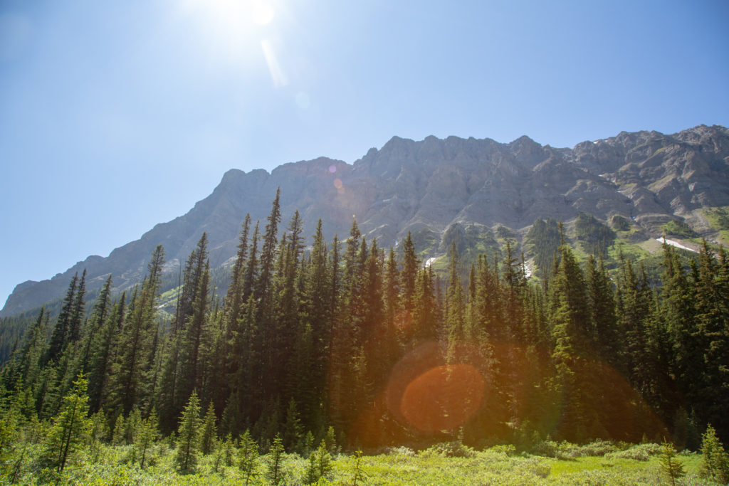
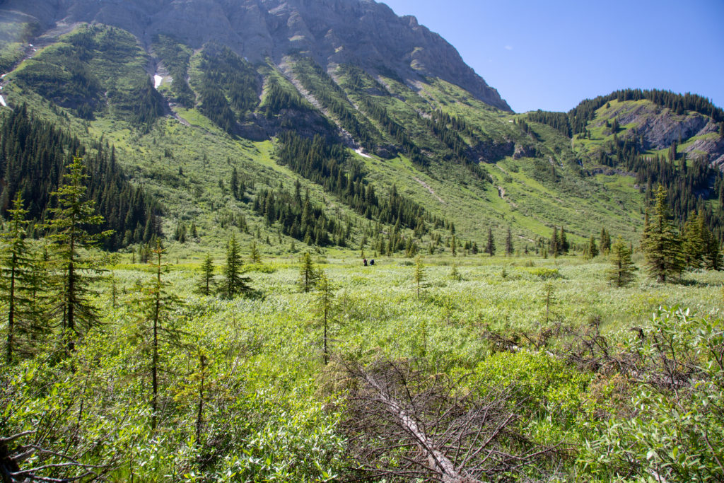
After the flowers we went up another short rise, taking us to a meadow with views in all directions.

Ken heading across the meadow, snow capped peaks in the distance.

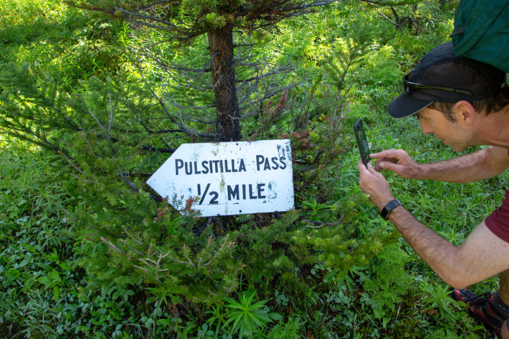
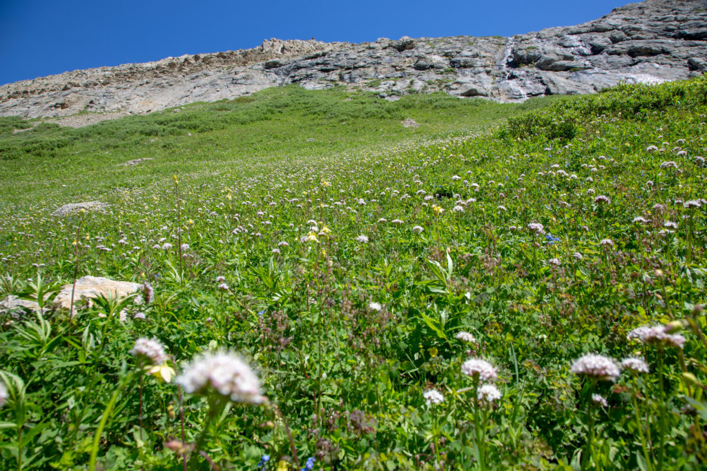
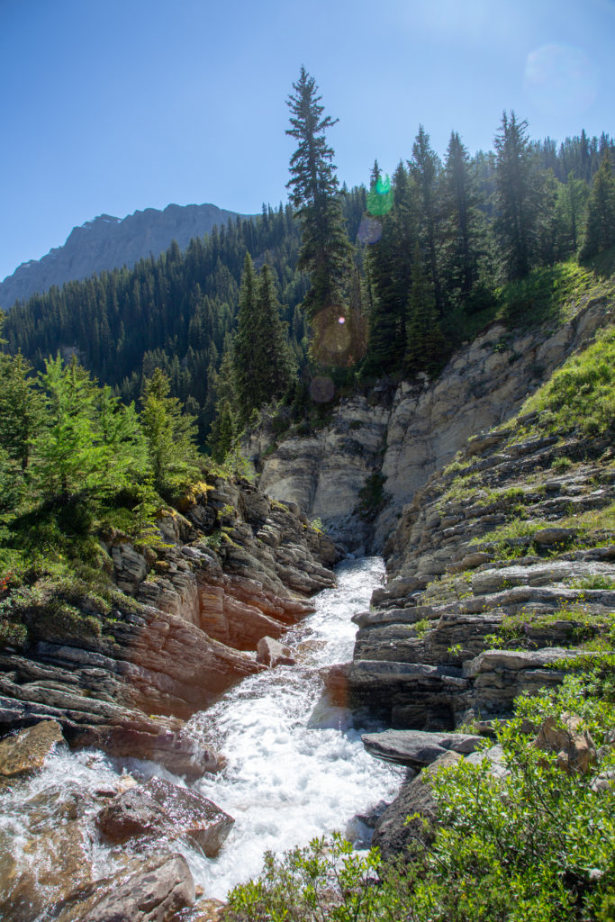
We criss-crossed the trickle that was now Johnston Creek several times. Ken spotted an old sign indicating 1/2 mile to Pulsatilla Pass. As we started to head up the pass, the creek formed a lovely cascading waterfall surrounded by a sea of wildflowers, I just had to stop.

The trickle that is Johnston Creek.
Pulsatilla Mountain
A very old sign.
Waterfall and flowers.

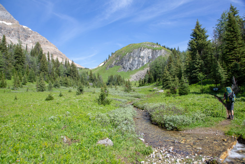
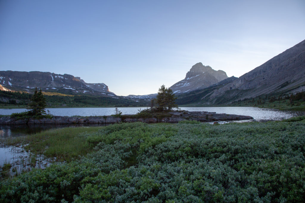
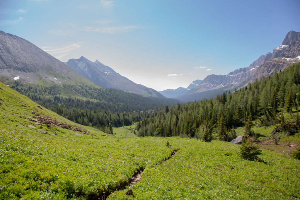
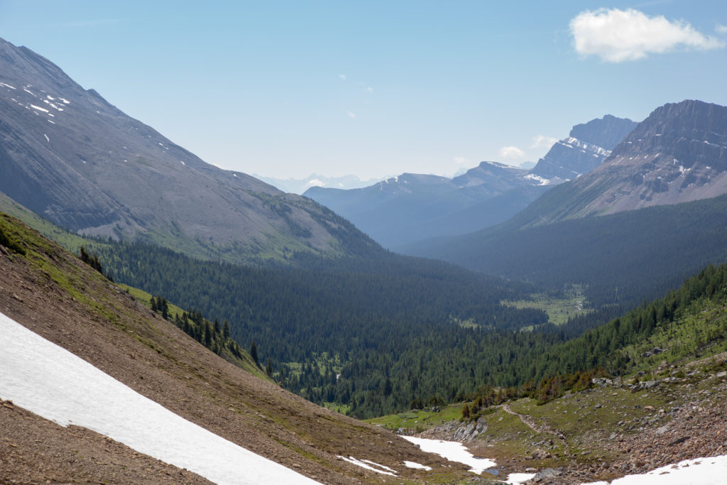
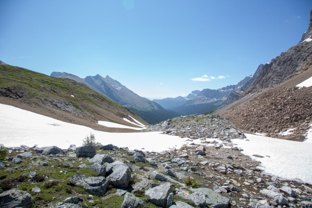
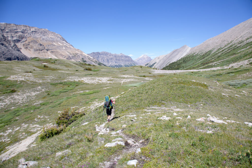
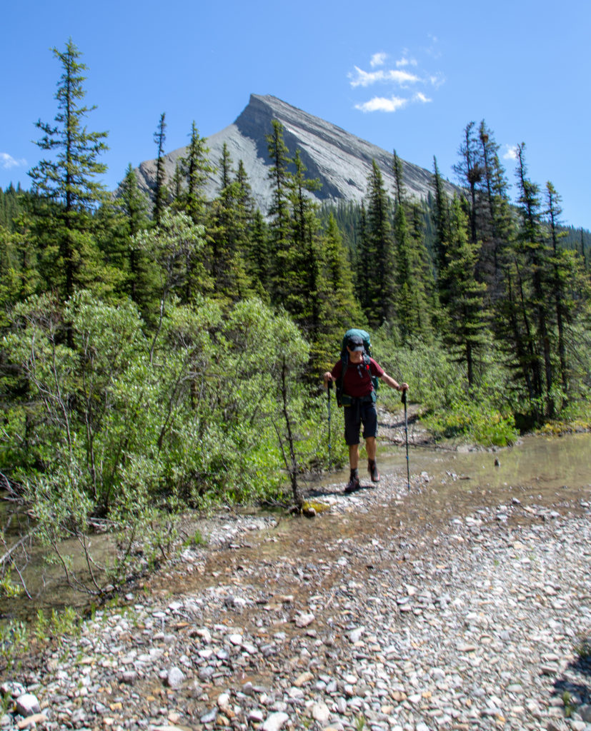
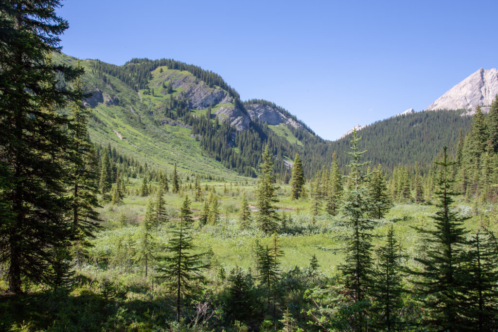
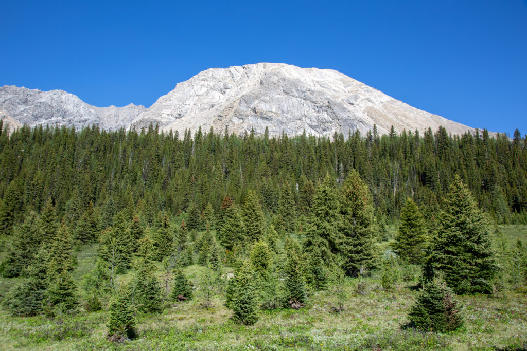
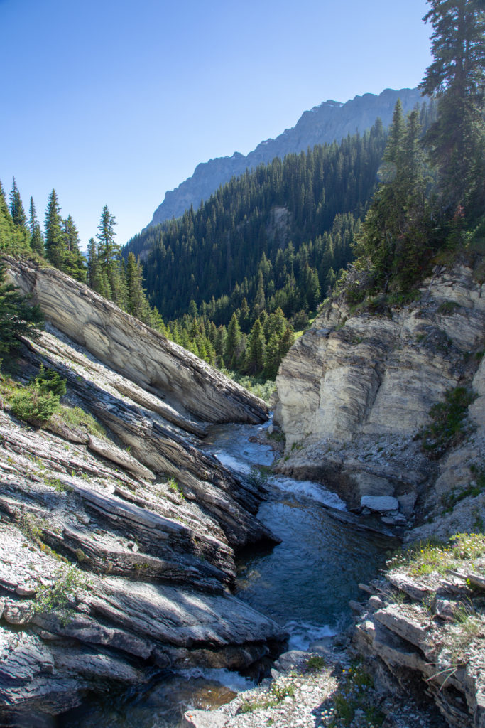
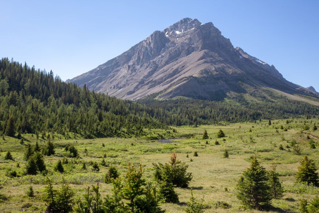
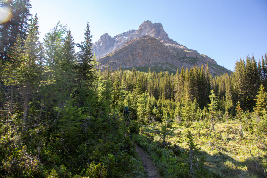
We came to a small plateau, that gave us a view back over the valley we had been hiking in for the past two day. We were coming to the headwaters of Johnston Creek, it was only about foot wide. The hill was not actually very steep, but progress was slow since we kept looking at the amazing landscape that surrounded us.

The trail leading back to the forest.
View from the little plateau.

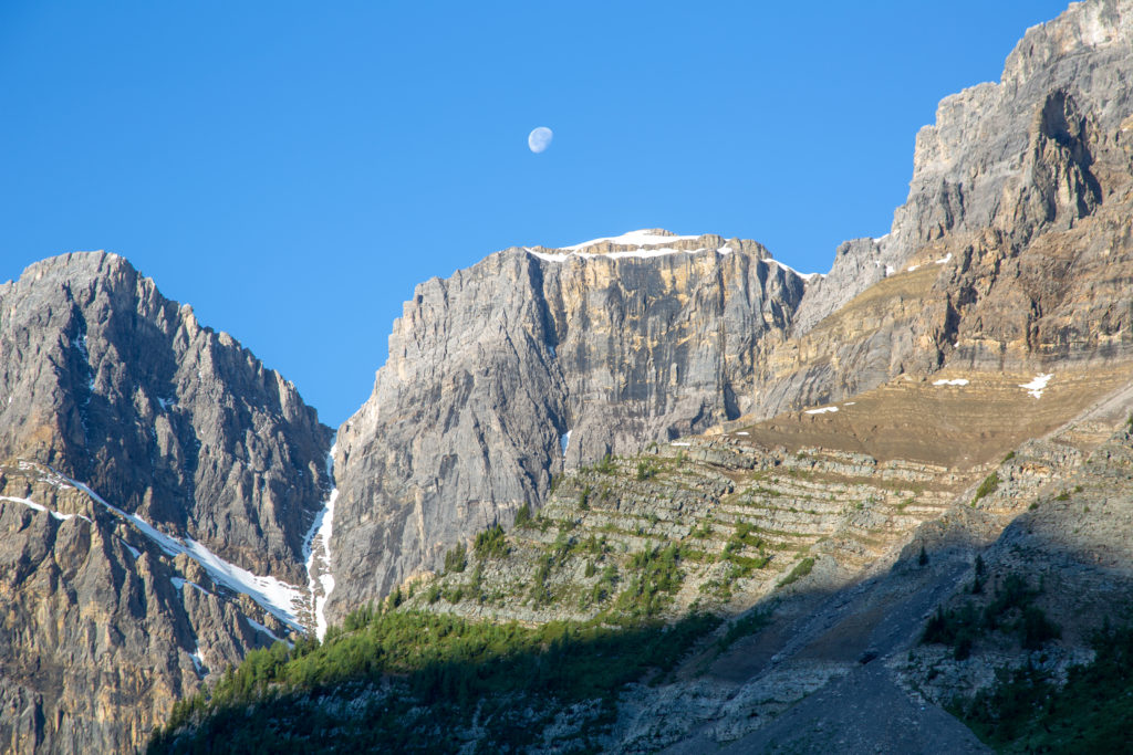
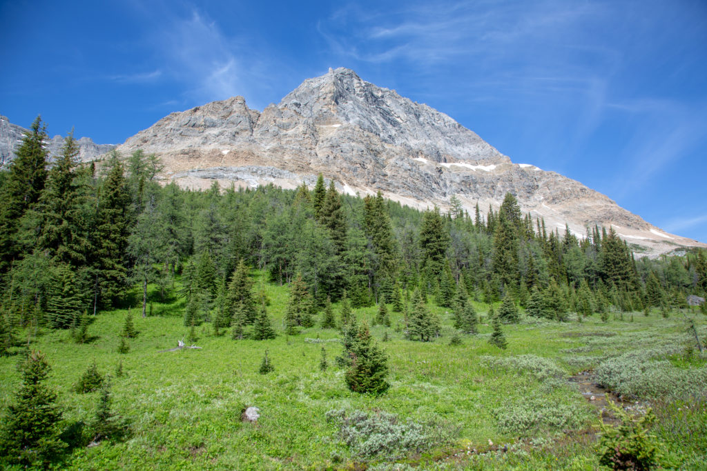
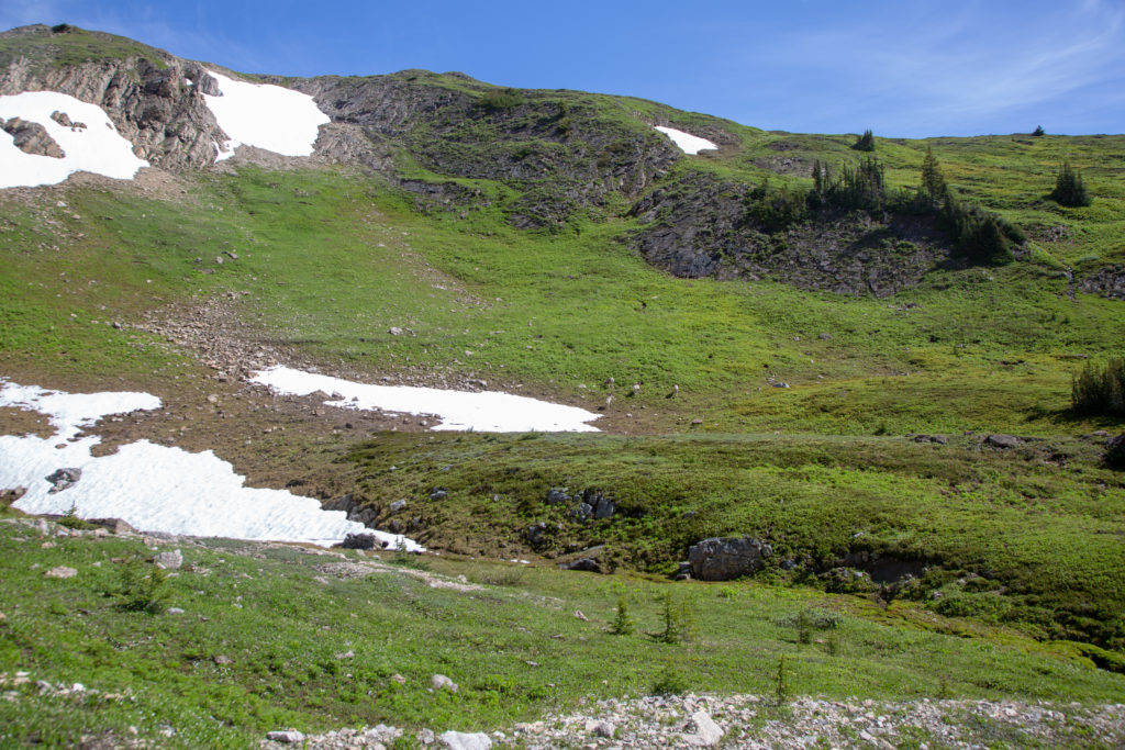
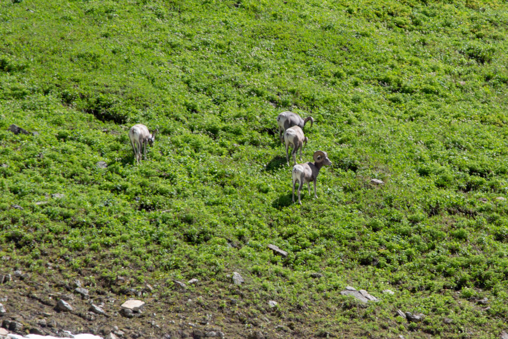
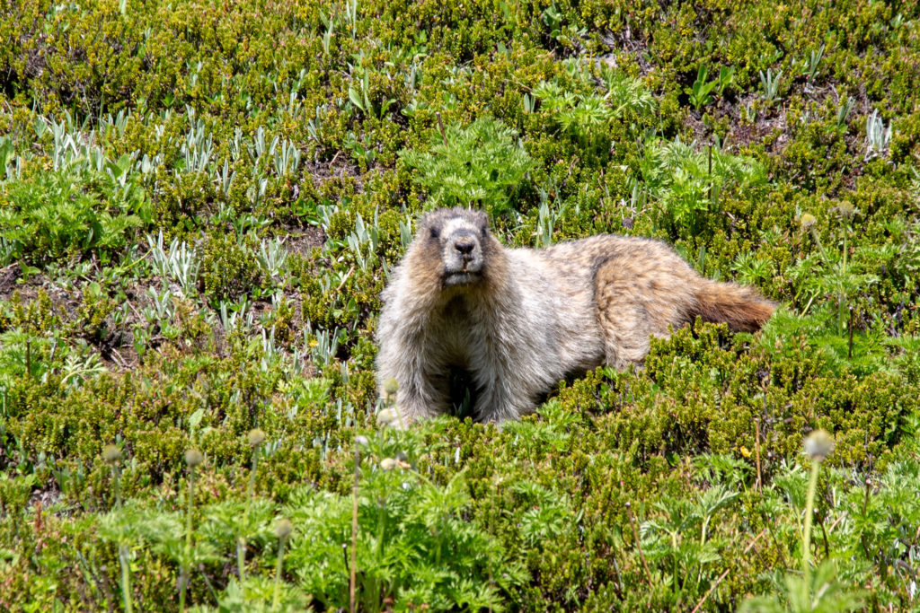
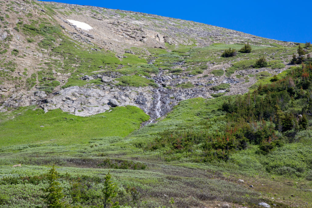
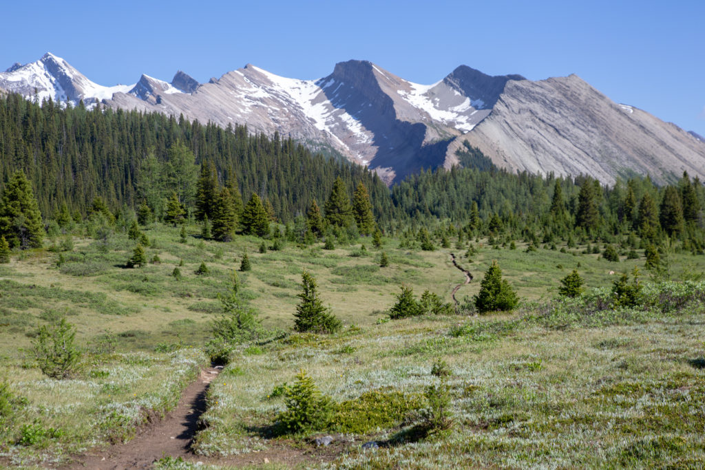
The nice soft trail disappeared along with the creek, and the footing became rocky. We spied some mountain sheep across the little valley. A brave marmot escorted us pass his territory. We came upon some snow fields, the melting water formed a little creek. After crossing the snow fields, a patch of scree marked our final approach to the pass. Time for a quick look back to where we had come from, and we pushed forward to view the north side of Pulsatilla Pass.

The mountain sheep on the far slopes.
Close up view, nice curl.
Feisty little marmot.
Ken approaching the snowfields.
Looking back to the south, where we had come from. I believe that our camp had been the trees that are bulging into the green meadow, right of centre.
One last look south.

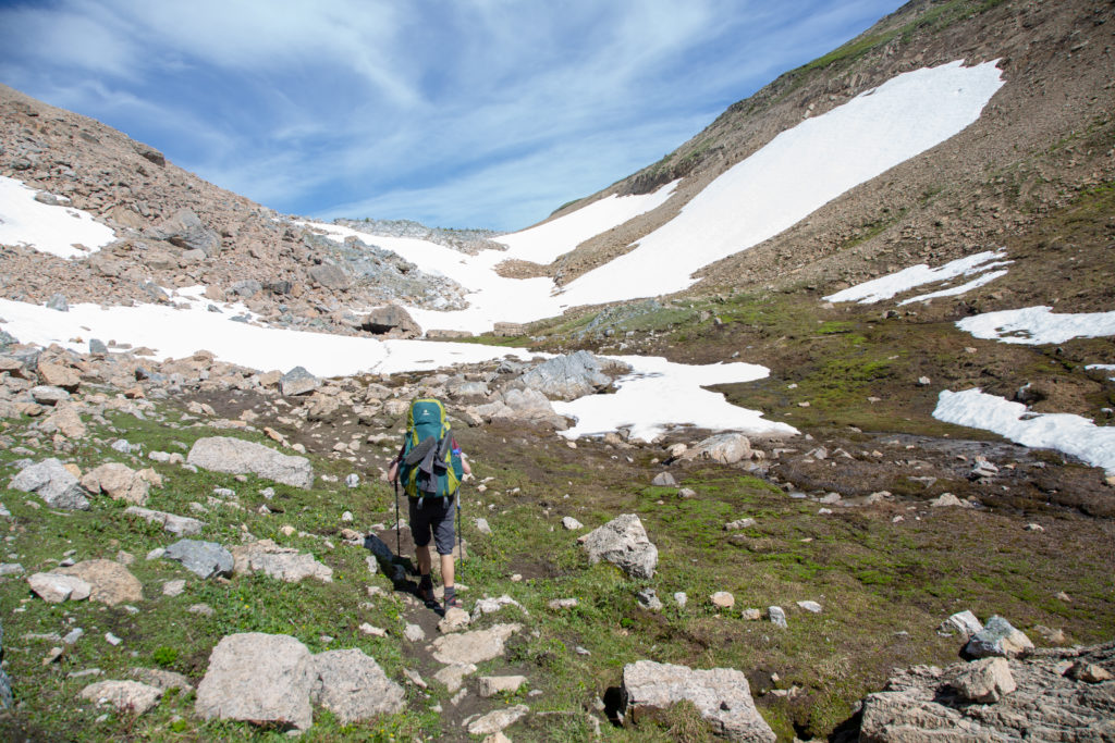
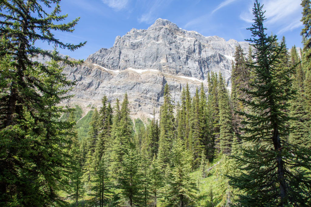
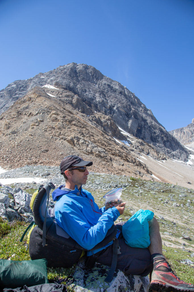
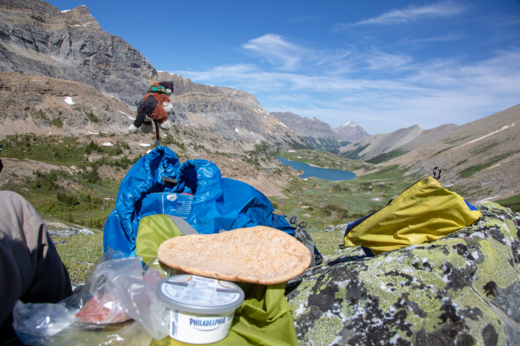
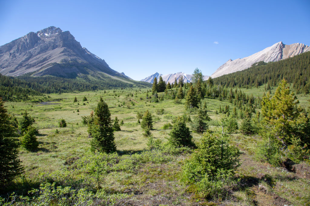
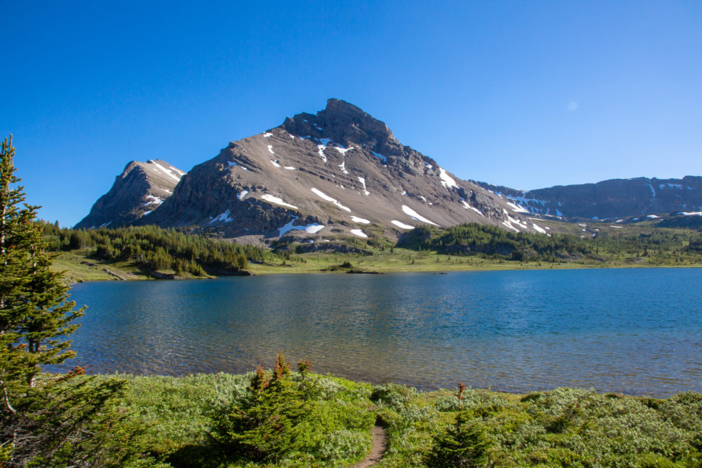
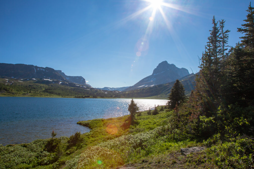
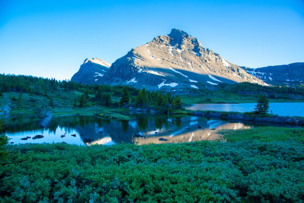
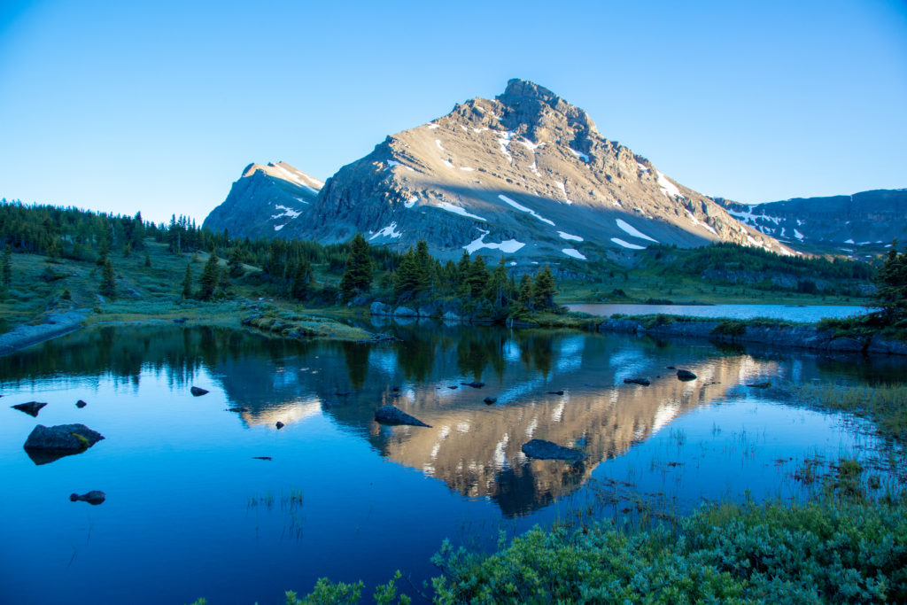
We then arrived at Pulsatilla Pass, the view was utterly breathtaking. Ken and I would end up spending nearly an hour at the top of the pass, having lunch and just taking in view. It had taken 1hr 50 minutes to hike 3.7 km and rise 300 m.

Our first view of the Pulsatilla Pass North. The mountain in the distance at centre, is Fossil Mountain, our destination for today.
Closer view of the pass and the lake, and Fossil Mountain in the distance.
Frosty Paws taking in the view.

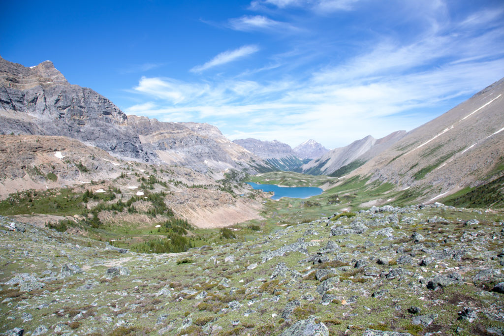
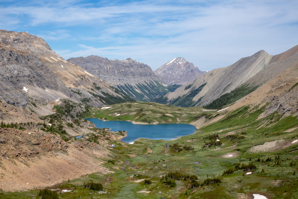
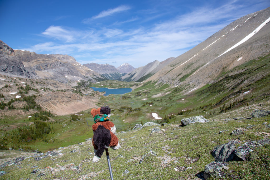
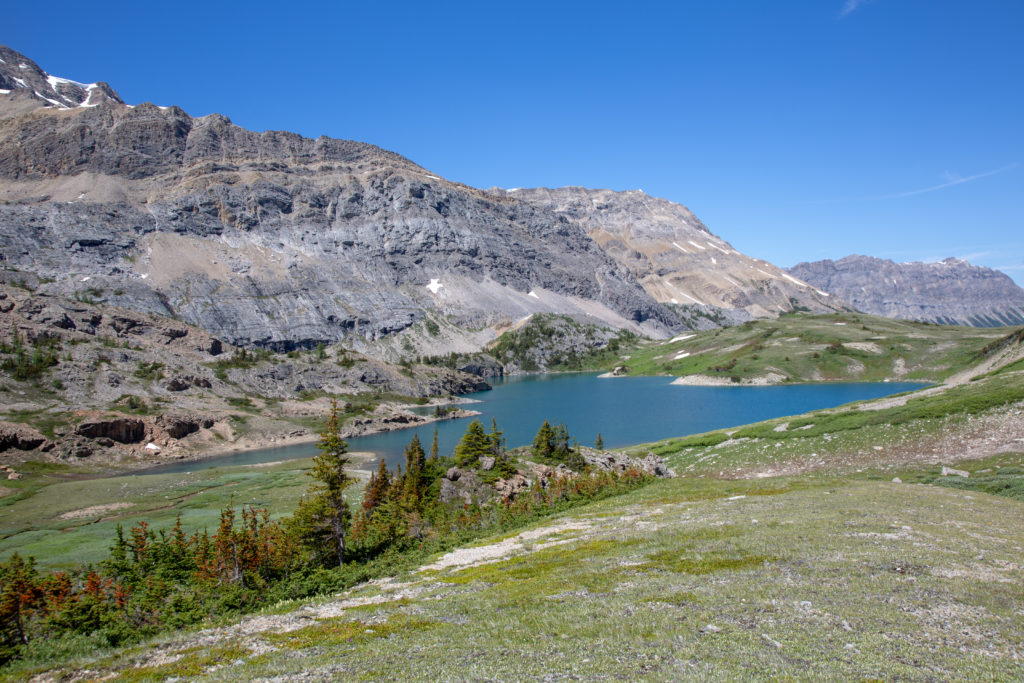
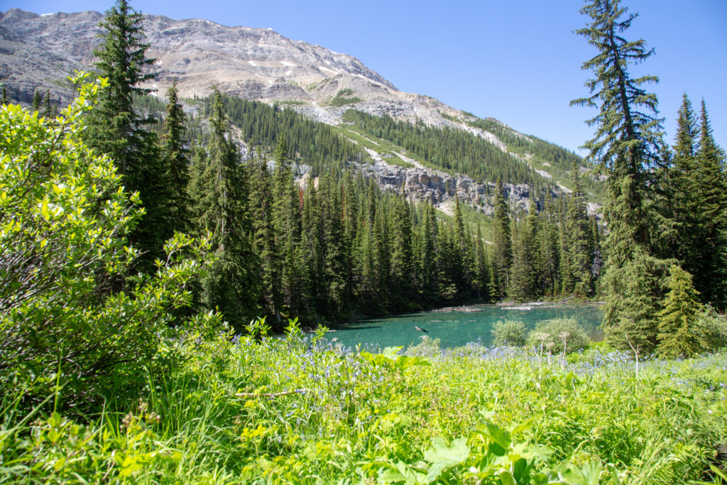
This was one of the highlights of the trip, we had trudged through two days of rain to get here so we were in no rush to leave. Even though it was early we took out our lunch and relaxed in the sunshine. The lake nestled below us is Pulsatilla Lake. It is an interesting study, as it has no visible outlet. The water drains through cracks in its limestone bed and seeps into the bedrock, known as karst topography. This type of lake is known as a sink hole, and is frequently found in limestone rocks. Rain water is slightly acidic and can dissolve limestone, over time this will form complex underground drainages.

Ken enjoying a well earned break.
My kitchen for lunchtime.

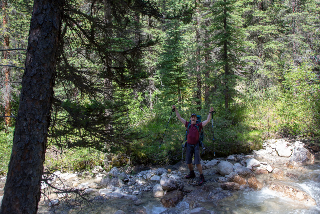
We stayed at the pass for 55 minutes, before deciding that we should get moving since we still had some distance to go.

A panorama of Pulsatilla Pass.

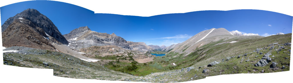
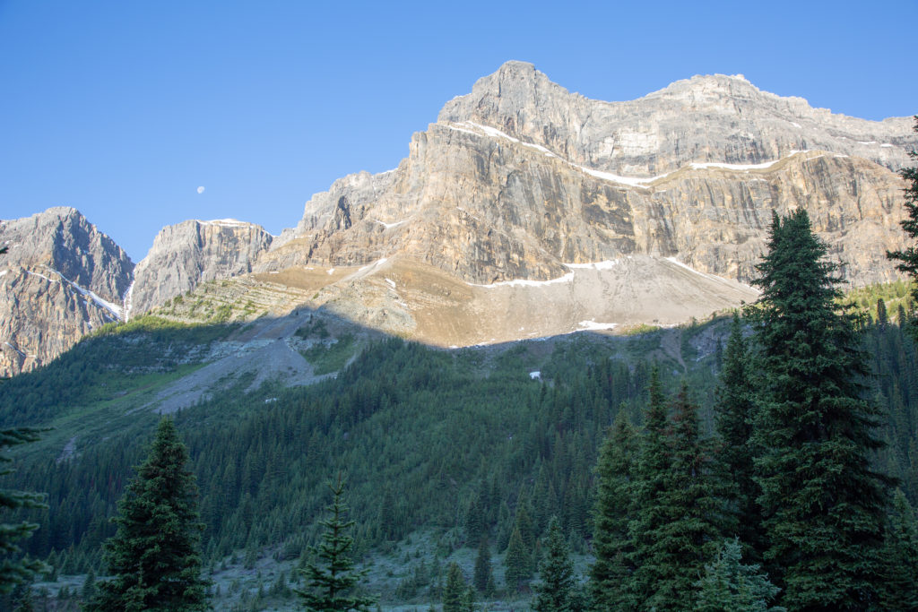
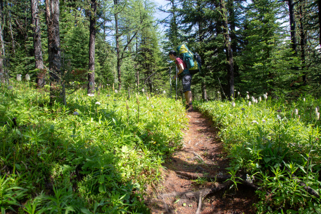
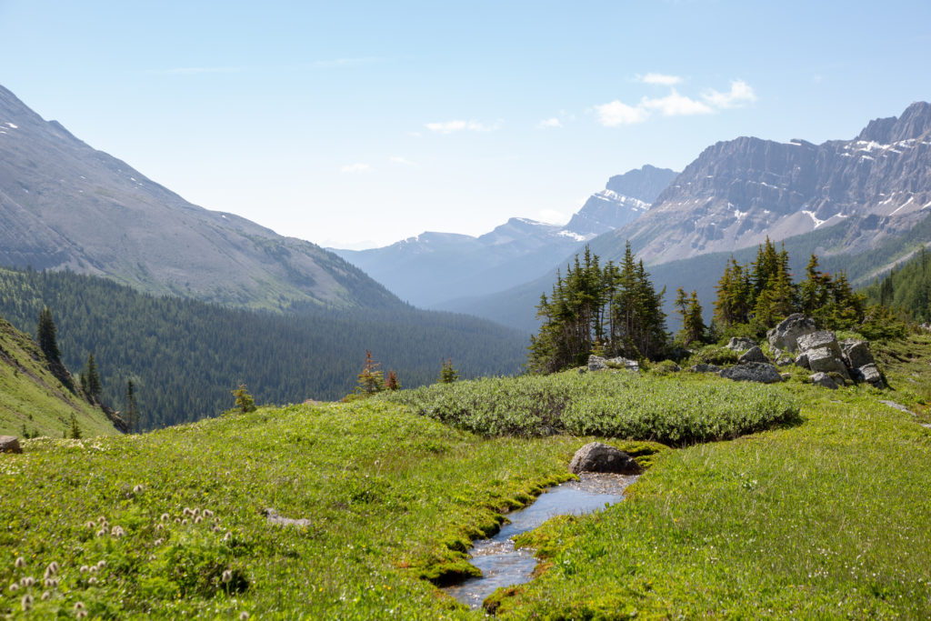
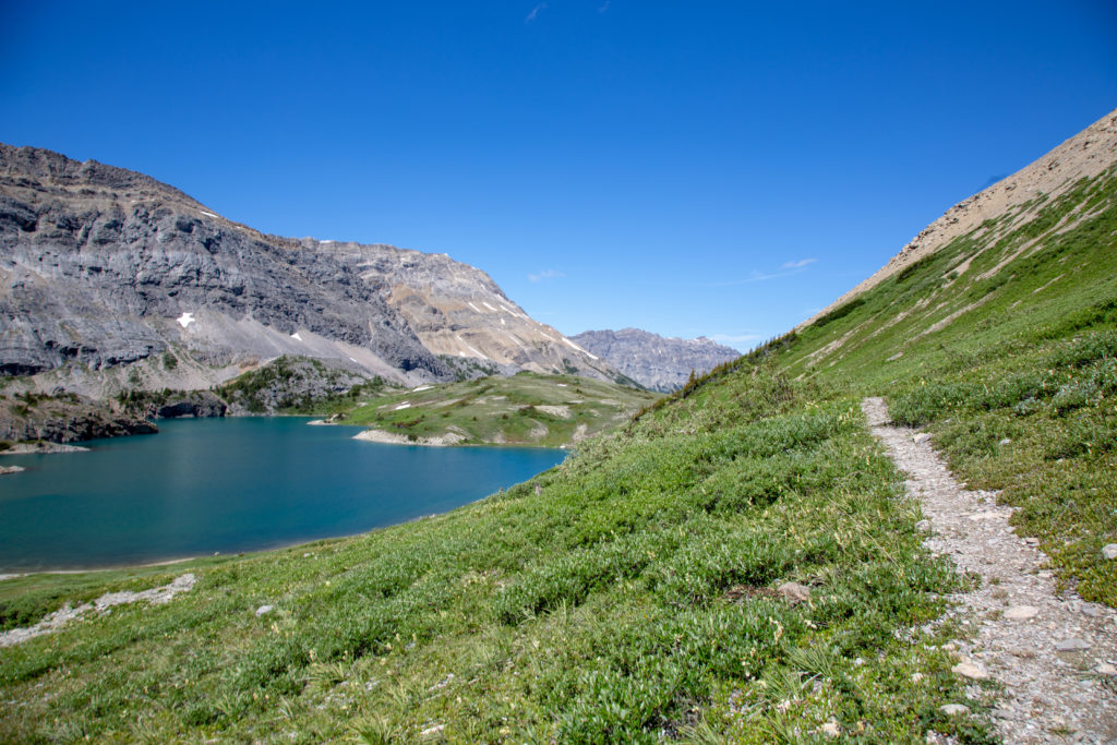
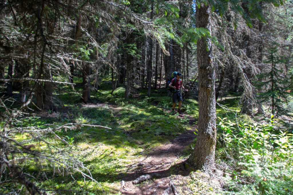
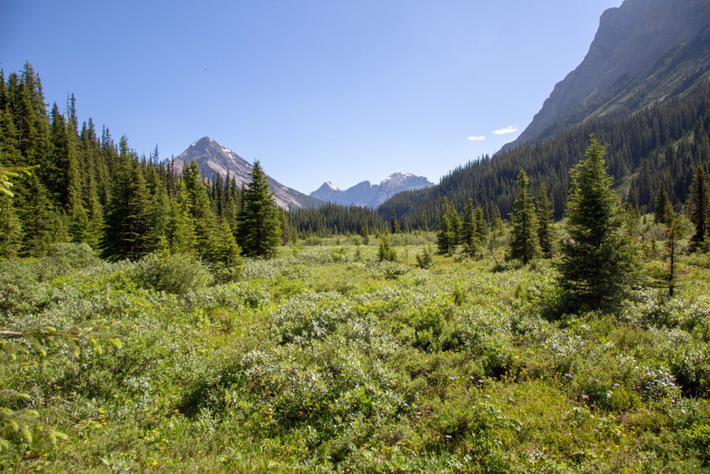
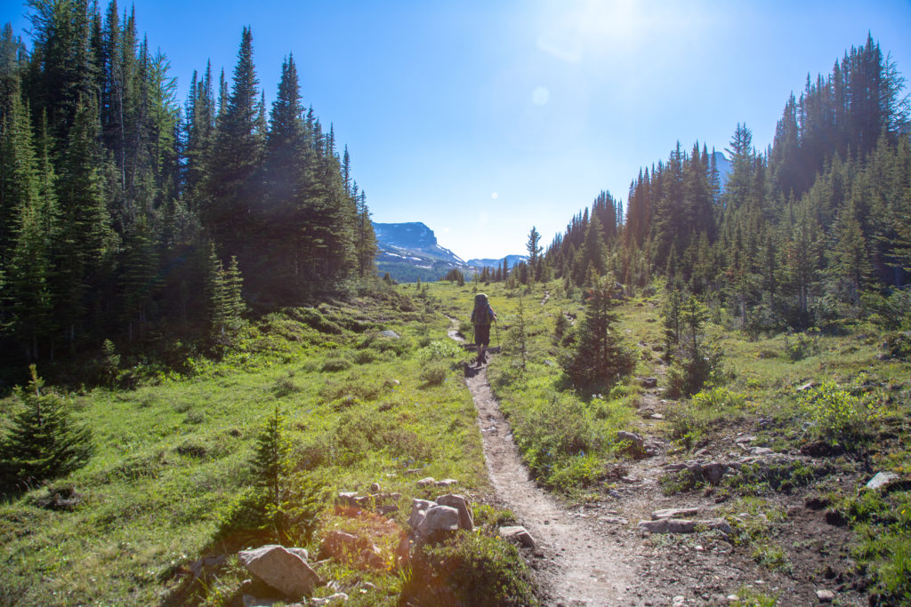
The trail sidesloped down the hill. We dropped 90 m in first 0.5 km, before leveling out for 0.5 km prior to climbing a little rise, all the while skirting the east side of the lake. We never do drop down to the lake. Several times we have to push through some vegetation crowding the trial, but for the most part the hiking was very straightforward. Wildflowers dot the hillsides, combined with the blue skies and the lake, it was a wonderful high alpine walk.

Poles are handy on the initial steep and rocky descent.
Waterfalls were everywhere on the hillsides.
Closer view of the lake, marmots patrol the trees below us.
Ken heading off over the little rise.

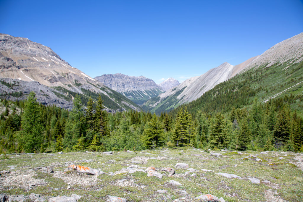
We pass along an exposed slope, about 30 m above the lake, it is pretty safe, but if you lost your concentration, you could end up in the lake. After passing the lake, we made our way quickly to treeline, the beginning of our descent into Wildflower Valley.

Trail is firm and smooth, but just ahead comes close to the lake.
Where we had come from, almost time to say goodbye to Pulstilla Pass.
Hills are alive with flowers
Leaving the lake behind us.
The beginning of the descent into Wildflower Valley.

We met a group of three young men just coming up out of Wildflower Valley. While talkative, they were not a happy bunch. Apparently it had been a difficult hike from Baker Lake, and coming up the valley was quite a slog. They had also been hiking all day with their rain pants on, so they were pretty hot. We tried to keep the conversation upbeat. They had a short climb to the top of Pulsatilla Pass, then a a 4 km downhill hike to their campsite at Badger Pass Junction CG, they have a lot to look forward to. It was 1:20 pm, we had been going for 3 hrs 25 min, and had covered just 6 km. It was time to get a move on.

Ken beginning the decent through the trees.

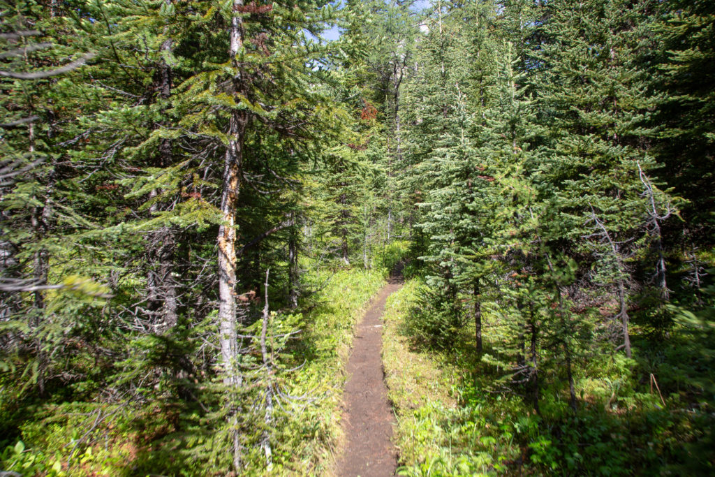
The trail was initially quite good, but steep. We would lose 270 m in only 1.7 km. I had read in the guide book and online, that this section was not maintained by Parks Canada. It only took a few minutes to experience what they meant. There were numerous trees down across the trail. With the all the rain the trail had seen, the ground was still quite muddy and slippery. I was super happy I had not had to come up this. Maybe this is why the three young men were a little grouchy.

One of many downed trees.
Small unnamed lake.
Ken working the poles descending a slippery, rooted trail.

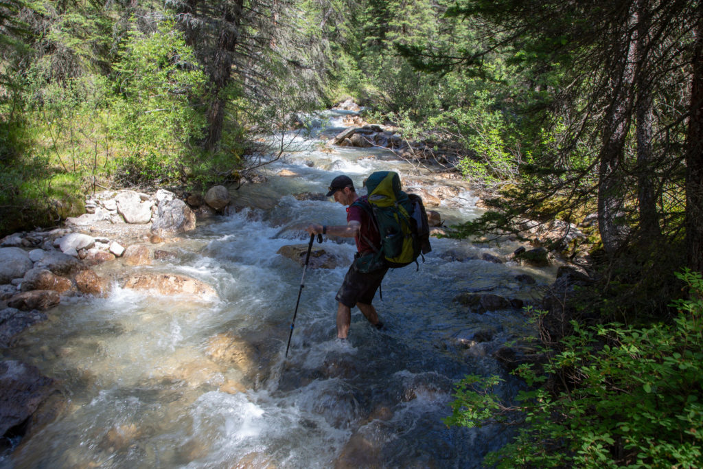
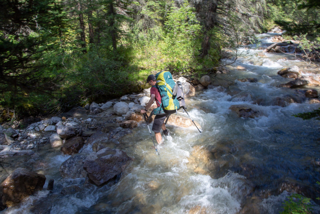
After passing the small unnamed lake, we came to a stream crossing. The main trail headed straight across the stream, but there was another trail leading downstream on our side. I thought that maybe the trail on our side might lead to a better crossing. After cutting through the woods, the side trail came back to the creek a minute or so later. The creek was deeper and faster at this point, but there was some dead fall that created a natural bridge. I thought I would try my luck and cross the bridge. I made it quite easily to the other side, but getting up onto the bank was a little tricky, my foot broke through the rotting debri, rendering me a little wet and stuck. I managed to use my pole to get myself up and onto the bank. Ken came across easily and avoided my little mishap. There was a faint trail leading back through the woods connecting up with the main trail. Looking back, I think it may have been easier to just do a wet stream crossing on the main trail. Sometimes it is safer just keep the feet on the ground, even if it means getting wet.

The small lake followed by our stream crossing.
Ken surveying the stream crossing.

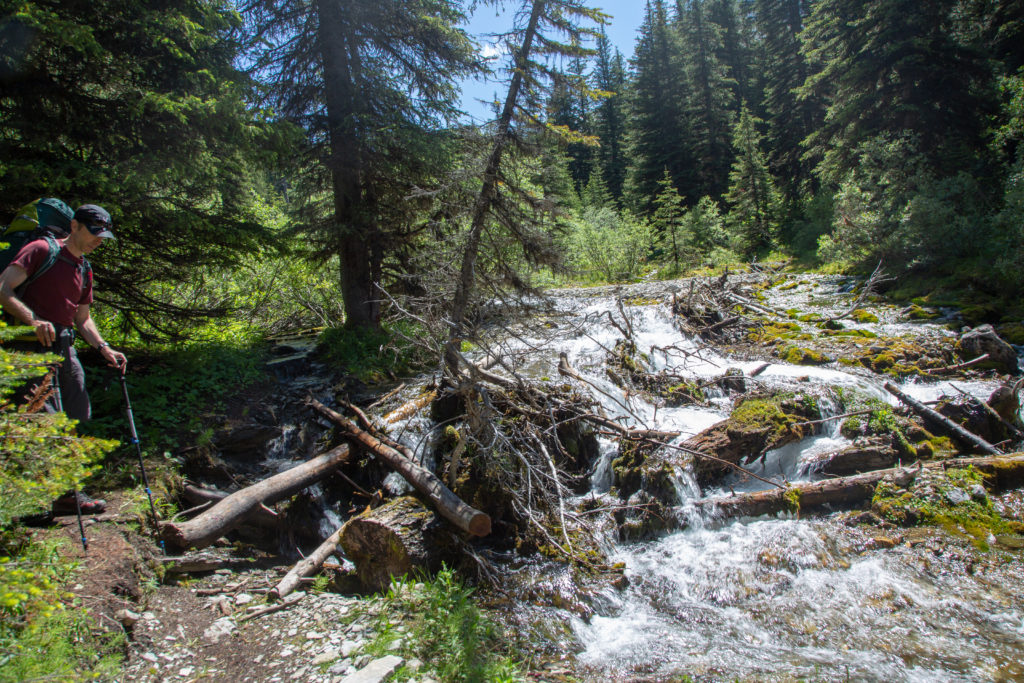
We had reached the end of major part of the descent and the trail flattened out for the next 2 km. It had been 50 minutes since we started heading downhill, a distance of 1.8km. The trail became very muddy, a sign of things to come. It was impossible to not step into muddy standing water. We then came to a small stream crossing, that was made challenging due to flood debri. The trail had been washed away by the flooding stream and covered in gravel. There were some cairns left by previous hikers that helped mark the way.

Its a muddy trail.
A bit of flood damage.

The trail crosses numerous small streams and muddy sections, gave up on keeping the feet dry. The last 600 m to Baker Creek drops a swift 90 m, bringing us to Wildflower Campground, a total distance of 10.2 km in 5 hrs 10 minutes. We have dropped from our lofty heights at Pulsatilla Pass, to an elevation equivalent to the turnoff to Luellen Lake.

Ken attempting another stream crossing.
Coming into Wildflower Campground.
Nice tent pads at Wildflower Campgound
It is 3:00 pm, and we have 5.9 km and 360 m of climbing left, time for a break.

We had not eaten since Pulsatilla Pass, so we stopped for a break. I took the break to tend to a hotspot on my foot. We had heard bad news about the bridge crossing the creek and now we could see for ourselves that the bridge had been washed away. The river was running pretty fast so we scouted up and down the bank for an ideal creek crossing. Nothing appeared any better than what was presented in front of us. Ken went first, carefully picking his way across using his poles to steady himself. I followed, I did put my camera into my backpack, and undid all my straps. This was in case I did fall in, I could get out of my pack so I would not be washed downstream. I also was successful in getting across. The water was upper calf deep and it was impressive how much pressure the water did exert on the legs.

Ken picking his way across Baker Creek.
The water is almost knee height.
A successful crossing.

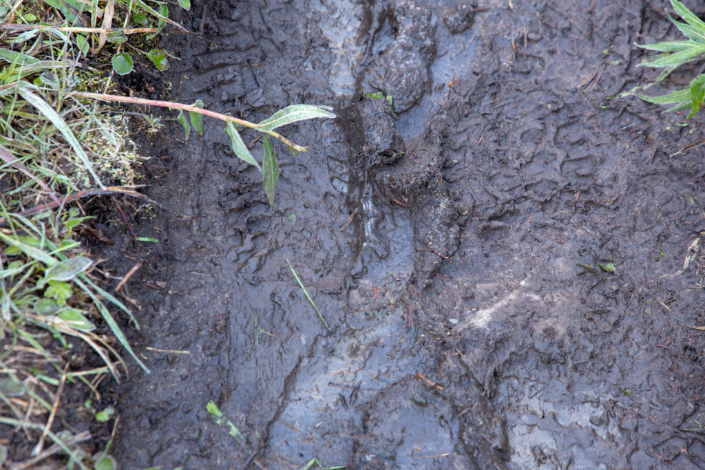
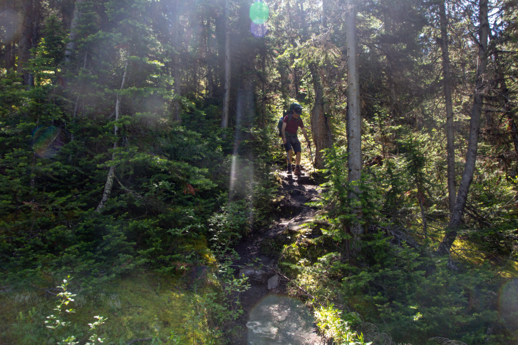
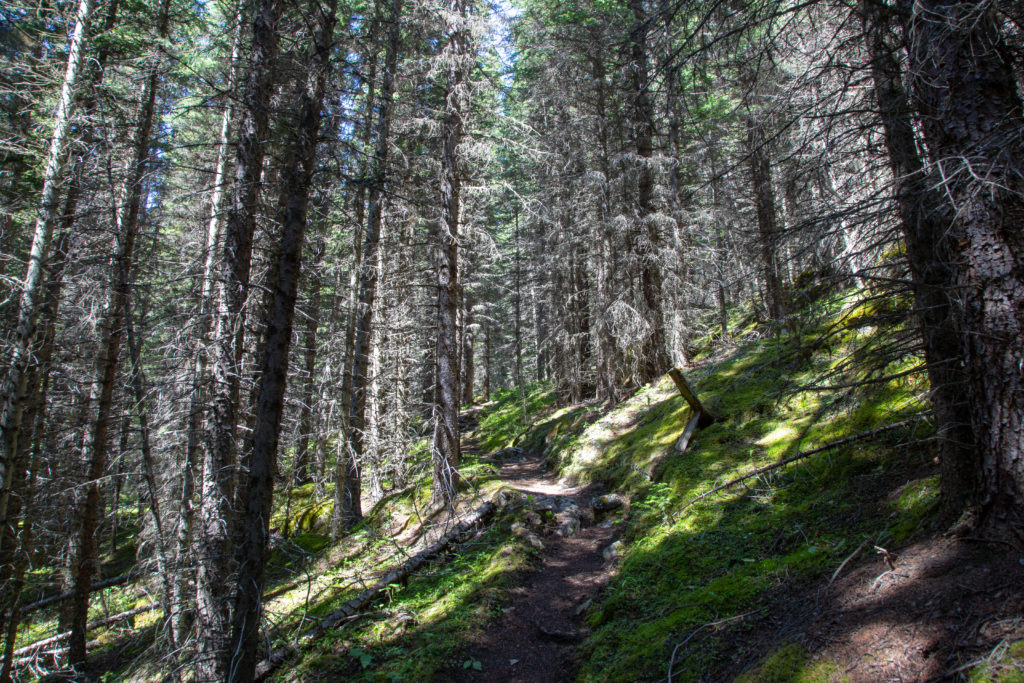
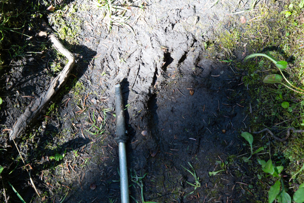
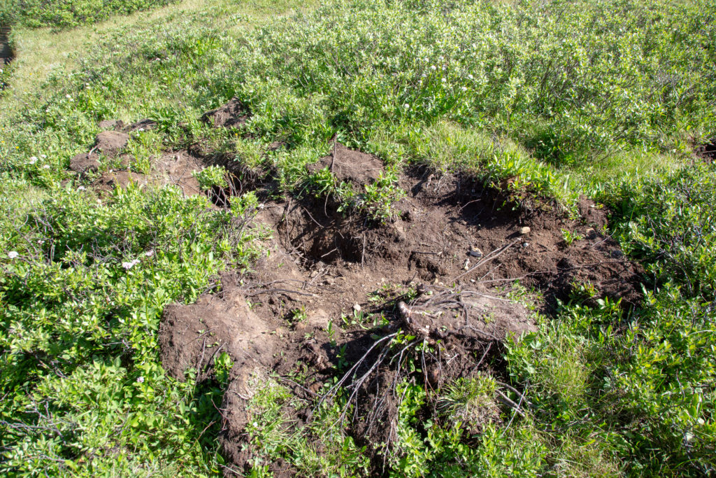
After crossing Baker Creek, the trail took us up quickly through a forest. After so much downhill for so long, I forgot what it meant to work hard. We came across some bear scat and a large print in the mud. The first signs of bears we had on the trip. After a short but hard workout, mostly buried in the trees, we came out into a large meadow.

Trail heading up into the trees.
That is a big footprint.
The meadow. It drops down a few metres as you pass through the trees at the far end, which takes you to another meadow.

The trail cut straight across the meadow. There was a little stream crossing, but with the help of some dead fall, we kept our feet dry. We came to the end of the meadow, passed through the trees and dropped down to another meadow.

Anthozoan Mountain.
Looking out across the second meadow, or is that a marsh?

The second meadow looked much like the first, but with Baker Creek running down the middle. The guide book had said to stick to the right (east) side, which is where the obvious trail was. The trail quickly becoming wet and boggy. The meadow was more of a saturated swamp than a lovely grassy field. We spied a couple hikers in the middle of the meadow, we waved them over to where we were since we had a well defined, if muddy, trail.

No hope of dry feet.
People struggling through the middle of the meadow. They chose to stay with the creek, not a good choice.
Looking back, the mountain on the left forms the west side of Wildflower Valley, the three peaks in the distance are from left to right, Armor Peak, Protection Mt and Bulwark Peak.

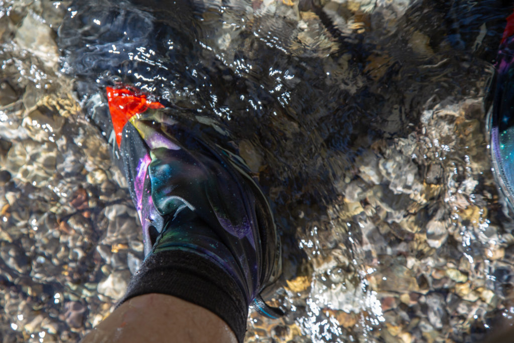
The trail became braided, we chose a trail to the right and ended up doing some bushwhacking. We knew the main trail was to our left (west), so were not overly concerned. We actually did find a wayward piece of flagging, always a good sign. I got tired of the wet muddy water and when we came to a nice clear creek I just stood in the centre watching the clear water washing away the mud on my shoes.

Washing the shoes.

Once we left the meadow, the trail headed abruptly uphill. It had only been 50 minutes since we left Baker Creek. We would gain 160 m in the next 0.6 km, the hill was short, but conversation was at a minimum. After 25 minutes, the trail flattened out and we passed by several fields covered in wildflowers. The climb ended at a small tributary of Baker Creek at the top of quite a magnificent waterfall. We obviously stopped to take photos.

It was steep, but shady.
Brachiopod Mountain.
That is a lot of colour.
The small creek, complete with a little rock bridge.
The calm before the fury.
The top of the waterfall.
Heading into the abyss.

A short rise took us away from the creek and lead to the crest of another alpine meadow. Baker creek was below us to the west. We were on the homestretch to our campsite. We had another lesson on the slight inaccuracies of our mapping apps. Both of us had a trail leading to the east marked on our apps halfway down the meadow. Mine was marked the Douglas and Lynchnis Routes. The trail did not exist. When I got home I did some investigation on the internet. What the Douglas and Lynchnis Routes are, are scrambling routes to the tops of the respective peaks, which are to the east of Baker Lake. You can read a little trip report of a hiker who submitted the peaks here. The peaks are climbed so infrequently, the trail has overgrown. While there is no evidence of the trail, you could follow the markings on the app to access the are to the east, which did include a spectacular waterfall, a worthy destination itself.

Another stunning high alpine view.
Fossil Mountain, with Baker Creek, it once looked so far away.
Looking back to the south. Baker Creek to the right will form its own waterfall as it drops to enter the meadows below.

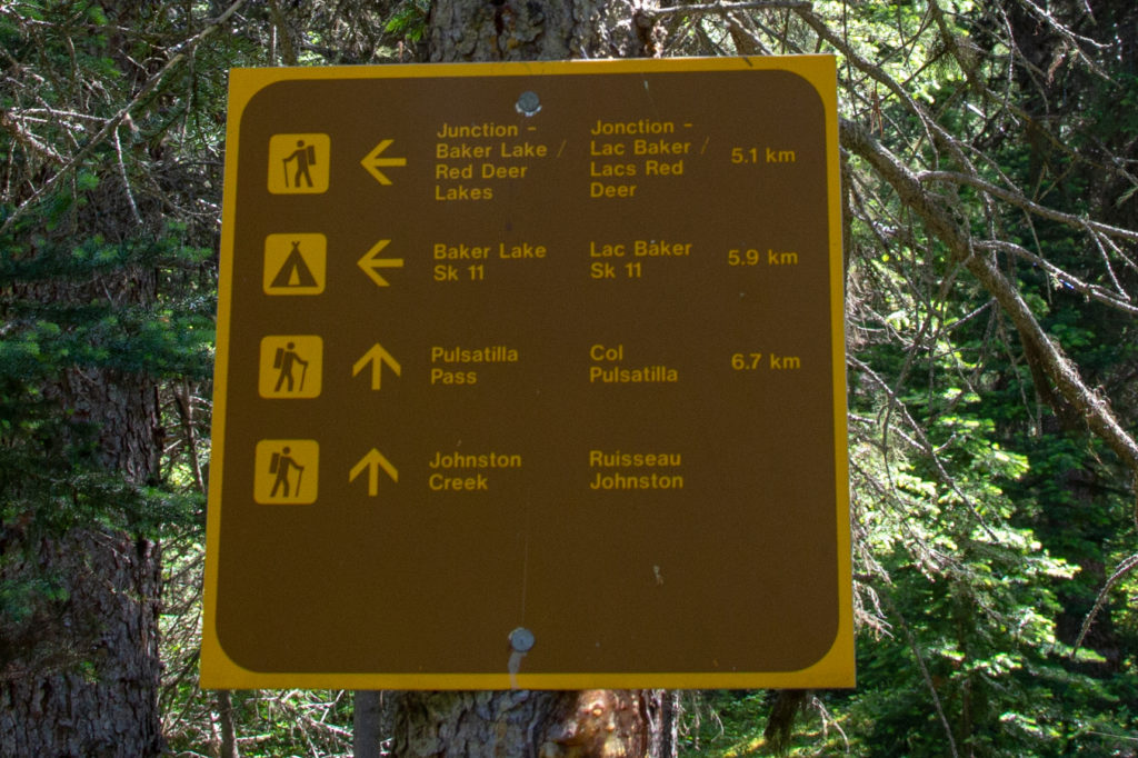
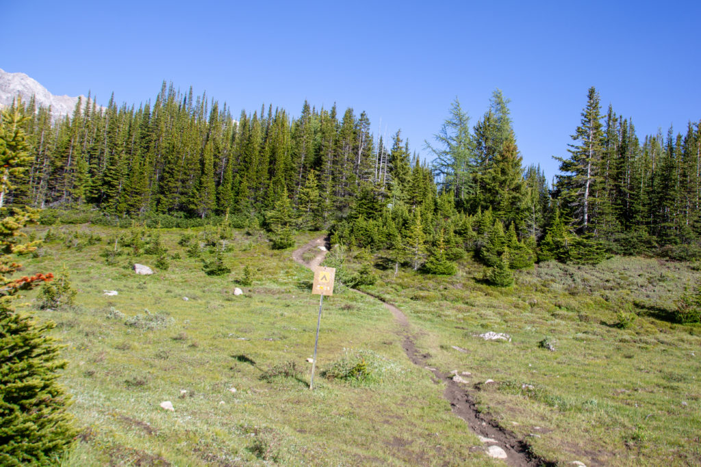
We continued across the meadow. A brave ground squirrel gave us a dressing down. We looked around at all the mountains. The day had such a variety of scenery, meadows, forests, alpine meadows, snowy peaks. It had been a first class feast for the eyes. We came to a junction, well marked by Parks Canada, and turned left to start our last 1.3 km to the campsite.

Looking back one last time.
Signage.
Hmm, I guess we are not alone.

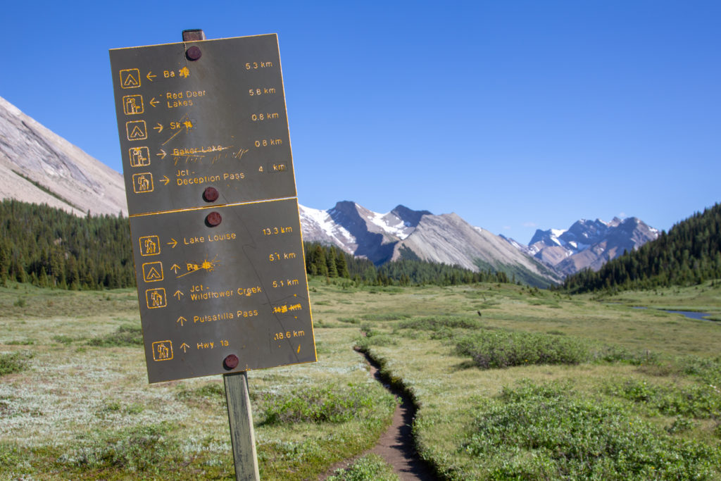
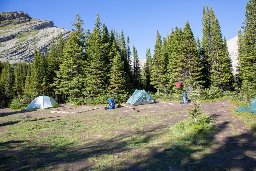
Shortly after the junction, we went up a small rise. It was only 90 m in elevation, but at the end of the day, it was a bit of a kicker. The trail flattened out, then turned sharply to the left to enter Baker Lake Campground, it was 5:55 pm. It had taken us 2 hrs 25 min to hike from Wildflower Campground a distance of roughly 6 km.

Ken heading up into the forest. Fossil Mountain dominates the sky.
A little flat before the campsite.
Junction to Baker Creek Campground, more excellent signage.

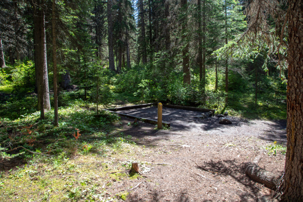
We set up camp, got our camp sandals on, and set about trying to dry our footwear. Ken has gortex boots, but even gortex has its limits when facing a steady onslaught of water. The campground was nothing special. About 10 campsites very tightly packed into a clearing. We had to keep everything off the ground, as there was a resident porcupine. We spent a few minutes checking out the campground and Baker Lake.

That is some wet socks.
Brachiopod Mountain, with Anthozoan Mountain in the background.
Baker Lake with Ptarmigan Peak in the distance.
The campsite,that is an empty spot between the two tents.

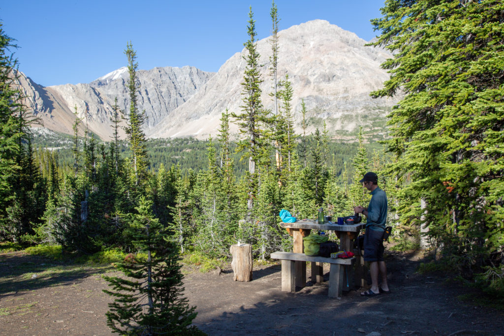
Started making dinner just after 7 pm. We struck up a conversation with a woman solo hiking. Turns out she is a guide and has worked with everyone from experienced adults to school groups. Ken and her had a grand time trading stories about outdoor trips, and the unbelievable things people do. My favourite story is one Ken told of how a bear chomped a hole in a unoccupied tent, and left with a mouthful of beef jerky. The owners denied having any more food in the tent, Ken thought he’d better look carefully, and under the sleeping pads was a corner store worth of junk food. So, the bear chomping a hole into the tent had not been enough encouragement to get all the food out. The woman loved that story and asked if she could use it.

Drying out the shoes on the tent.
Ken in the kitchen.
Visitor at dinner.

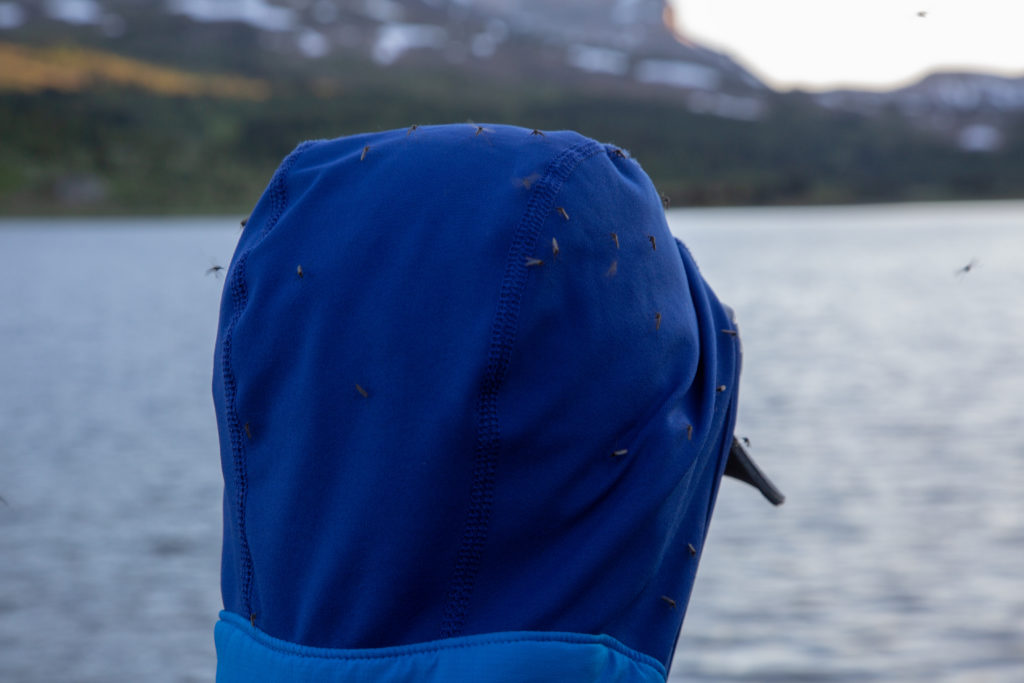
There were a wide variety of people at the campground. There was a man and his older father on a 4 day backpacking trip. There was a family of 4, who had done single overnights, and were doing their first family multi day trip. There were three loud young men an older couple who had bug net hats and another solo woman.

The outlet to Baker Lake has these lines of rock jutting up from the water. It marks the end of the Castle Mountain Thrust Fault and makes for an interesting waterway.
Reflections.
Just a few mosquitoes, maybe a bug net would not be such a bad idea.

It had a been a pretty big day. We had a nice balance of hiking and moving quickly, but taking the time to appreciate where we were. Headed to bed just after 9 pm.

Day 4 Sawback

Sawback Home

bootwreckers

View looking West over the Tonto Platform from the View looking West over the Tonto Platform from the South Kaibab Trail.

This April will be our 10 year anniversary of our first trip to the Grand Canyon.

It is truly one of my happy places, have visited five times and camped below the rim three times.

Looking to get back sometime soon, but good things are worth the wait.

#nps, #nationalparks, #slotcanyon, #hiking, #hikingadventures, #familytime, #camping, #campingadventures, #outdoors, #outside, #nature,  #FIndyourpark #landscape #landscapephotography #optoutside #nationalpark #desertphotography #grandcanyon #grandcanyonnationalpark #grandcanyonassociation #100yearsofgrand #100yearsofbeauty #100yearsofgrandcanyon
Sunday morning sunrise! There are perks for getti Sunday morning sunrise!

There are perks for getting up early on a Sunday to go grocery shopping, and the mountain sunrises are one of them.

Shot off my phone from the parking in downtown Canmore.

#sunrise #sunrisephotography #sunrise_sunset_photogroup #earth #outside #outdoors #naturephotography #nature #naturelovers #sky #skyphotography #sky_brilliance
No doubt 2020 was a prickly year, and 2021 has sta No doubt 2020 was a prickly year, and 2021 has started out a little rough.

Just like hiking, if we keep going we will see beauty in amongst the prickles, but we need to stay on the trail.

Here's to good times ahead.

From our hike last year Emily hiking among the cactii towards the feature we affectionately named the Thumb, Passage 16 on the Arizona Trail

#teamzpacks #zpacks #zpacksduplex #aztassociation #aztrail #aztrails #hike #loveazt #desertphotography #desert #hikingadventures #hikes #backpacking #camping #getoutside #familytime #traillife #aztassociation , #hiking, #hikingadventures, #familytime, #camping, #campingadventures, #outdoors, #outside, #nature,  #FIndyourpark #landscape #landscapephotography #optoutside  #rightnow #goparks #aztrails #aztrail #loveazt  #azt #arizonatrailassociation
Looking at a fun trip last summer through Yoho NP Looking at a fun trip last summer through Yoho NP with @sio.mellors 

Lots of waterfalls to see in the park, Laughing Falls is a fun and loud falls right off the main trail located surprisingly, next to Laughing Falls CG.

We stopped by on our way to Twin Falls CG after spending the day hiking the Iceline Trail

Like this photo of Siobhan getting close to the falls for her own picture. 

#friends, #alberta, #parkscanada #backpacking, #yohonationalpark #yoho #friendsofyoho #nationalpark, #nationalparks, #mountains #naturephotography #travelcolumbiavalley #travelbcp #waterfall #waterfall #waterfallphotography #waterfallsofinstagram
Haiduk Lake, Banff NP. Haiduk Lake is just beyond Haiduk Lake, Banff NP.

Haiduk Lake is just beyond Whistling Pass as you hike from Egypt Lake to Balls Pass Junction.

Very pretty Lake. We were lucky enough to pass by early in the morning as we hiked from Egypt Lake to Floe Lake during our #gdt hike this summer.

#friends, #alberta, #parkscanada #rockwall #backpacking #nationalpark, #nationalparks, #mountains #naturephotography #alpine #lifeelevated #getoutside #lifeonthetrail #britishcolumbia #gdt #greatdividetrail
#kananaskis #kananaskiscountry
Chasing th Aurora on Friday night at Lake Minnewan Chasing th Aurora on Friday night at Lake Minnewanka in Banff NP.

Sadly it did not come right out to play,  but was obviously a lot of light coming from th North East.

Always fun to be outside in a dark place to see th glory of the night sky.

#outside, #hiking #camping, #backpacking,
#adventure, #adventureoutside, #nature, #landscapephotography, #nobaddays, #adventureholiday, #hikingadventures, #astrophotography, #milkyway #kootenaylife #kootenaynationalpark #nationalpark #nationalparks
#parkscanada #northernlights #aurora #auroras #auroramax
Hiking the GDT Day 1. I was almost completely sa Hiking the GDT Day 1. 

I was almost completely satisfied with or trip on the Great Divide Trail when on Day 1 we finished the uphill to Turbine Canyon and popped out of the woods and saw this amazing alpine vista.

I remember remarking to Emily "this is why I hike"

#friends, #alberta, #parkscanada #rockwall #backpacking #nationalpark, #nationalparks, #mountains #naturephotography #alpine #lifeelevated #getoutside #lifeonthetrail #britishcolumbia #gdt #greatdividetrail
#kananaskis #kananaskiscountry
Morning from Floe Lake with Floe Peak selection of Morning from Floe Lake with Floe Peak selection off the mirror smooth waters.

Another amazing morning hiking the GDT.

Never get tired of Floe Lake, was my third visit and just a year after my previous visit.

#friends, #alberta, #parkscanada #rockwall #backpacking, #kootenaynationalpark #nationalpark, #nationalparks, #mountains #naturephotography #travelcolumbiavalley #travelbcp #flowers #getoutside #lifeonthetrail #britishcolumbia #gdt #greatdividetrail #goldenhour #goldenhourphotography #mirrorphotography #lake
Golden hour! Morning sun shining off of Tumbling Golden hour!

Morning sun shining off of Tumbling Glacier and the Rockwall. 

Waking up at Tumbling Creek Campground during my Great Divide Hike this summer. 

#friends, #alberta, #parkscanada #rockwall #backpacking, #kootenaynationalpark #nationalpark, #nationalparks, #mountains #naturephotography #travelcolumbiavalley #travelbcp #flowers #getoutside #lifeonthetrail #britishcolumbia #gdt #greatdividetrail #goldenhour #goldenhourphotography
Flower Field, Tumbling Pass, Kootenay NP. From la Flower Field, Tumbling Pass, Kootenay NP.

From last summer's Great Divide Trail hike. At th top of Tumbling Pass on the Rockwall, treated to a visual feast of colour.

Awesome day, epic hike.

#friends, #alberta, #parkscanada #rockwall #backpacking, #kootenaynationalpark #nationalpark, #nationalparks, #mountains #naturephotography #travelcolumbiavalley #travelbcp #flowers #getoutside #lifeonthetrail #britishcolumbia #gdt #greatdividetrail
As we head into winter, a shot from last spring at As we head into winter, a shot from last spring at the end of winter. The snow was just clearing from the trails, and flowers poking through to greet the warmth.

Heading out over Rockwall Pass, Kootenay NP, with @kbsymington  and @neil.real.deal .

Had some snowfields to cross, good day out on th trail

#friends, #alberta, #parkscanada #rockwall #backpacking, #kootenaynationalpark #nationalpark, #nationalparks, #mountains #naturephotography #travelcolumbiavalley #travelbcp #flowers #getoutside #lifeonthetrail #britishcolumbia
Fun photo from Twin Falls Campground in Yoho Natio Fun photo from Twin Falls Campground in Yoho National Park.

As night fell I was able to take some long exposure shots of Twin Falls Creek as it tumbles through the campground.

Fun 3 day trip with @sio.mellors.

#friends, #alberta, #parkscanada #backpacking, #yohonationalpark #yoho #friendsofyoho #nationalpark, #nationalparks, #mountains #naturephotography #travelcolumbiavalley #travelbcp #waterfall #rainbow #spectrum #hikingadventures #longexposure #longexposurephotography #river
Top of Guinns Pass, Kananaskis Country 2016 Guinn Top of Guinns Pass, Kananaskis Country 2016

Guinns Pass connects the valley with Ribbon Lake and Ribbon Creek and the valley with Lillian Lake and Galetea Creek. Stunning views in all directions from the top of the pass.

There is also a scramble up the connecting ridge to the east up to Guinns Peak and onto Mt Kidd South.

Great two days hiking with @emilysjumpinginpuddles

#hikingwithdogs, #hiking, #hikingdogsofinstagram, #outside, #kananaskiscountry, #kananaskis, #spcacanmore, #spcarescue, #snowyowlsleddogtours, #snowyowldogsledtours, #retiredsleddog, #retiredhusky, #backpacking, #tongueouttuesday, #canmore, #canmorealberta, #adventure,
Larch season is coming to an end in the Rockies, b Larch season is coming to an end in the Rockies, but last weekend we were treated to quite a display near Taylor Lake in Banff NP

#outside, #outsidethebox, #liveoutdoors, #liveoutsidethebox #naturephotography, #naturelovers,  #retiredhusky, #rescuer
#parkscanada #banffnationalpark #banffalberta #banffcanada #larches #fall #autumn
Amazing sunset over Floe Lake. An early evening s Amazing sunset over Floe Lake.

An early evening storm and the setting sun shining up and reflecting off the clouds. Completely surreal. 

August 17th

Kootenay NP

Part of a 10 day hike along the Great Divide Trail, from Upper Kananaskis Lake to Field, BC

#outside, #outsidethebox, #liveoutdoors, #liveoutsidethebox #naturephotography, #naturelovers,  #retiredhusky, #rescuer
#parkscanada #banffnationalpark #banffalberta #banffcanada
#sunstar #sun #lake #sunrise #alpin #scenery #reflectionphotography #reflections #sceneryphotography
Well, my epic 15 day hike became a totally epic 10 Well, my epic 15 day hike became a totally epic 10 day adventure.

Lots of photos, but I will start with a picture of the adult wolf I saw just outside of Egypt Lake Campground.

I was luck to see probably the entire pack, 6 wolves, they were coming out of the woods and crossing the trail to Egypt Lake, and I just happened to be there with my camera.

#friends, #alberta, #parkscanada #rockwall #backpacking, #banffnationalpark #banffalberta 
 #egyptlake #wolf #wolves #nationalpark, #nationalparks, #mountains #naturephotography #wildwolf #wildwolves #gdt #greatdividetrail
Bathtub full of gear and Frosty Paws. Must mean ad Bathtub full of gear and Frosty Paws. Must mean adventure is near.

Leaving Tuesday for 15 days on the Great Divide Trail with daughter Emily. 

Hiking from Kananaskis Lakes to Saskatchewan River Crossing. 

1st stage is 7 days to Floe Lake, looking like th backpack will be around 45lbs, with tent, food and camera.

Should be a grand adventure.

#outside #liveoutsidethebox #naturephotography, #naturelovers,  #retiredhusky, 
#parkscanada #glaciernationalpark #bctourism #earthexperience
#sunrise #alpine #scenery #reflectionphotography #reflections #sceneryphotography #alpinelake #amazingearth #morningmotivation #travelcanada #explorerockies
#travelcanada #mountainstories #explorecanada #theearthoutdoors #paradisecanada #gdt #greatdividetrail
Amazing backpacking trip through Yoho NP with Volc Amazing backpacking trip through Yoho NP with Volcano (@senioradventurepups)

Volcano is turning 13 the first week of August but still crushed the 12km from Laughing Falls CG to view Twin Falls and back to the car via the connector.

Volcano not a big fan of water falls, or me sticking the camera in her face, her expression says it all. But Twin Falls is beautiful and I caught a small rainbow at the bottom.

Had a blast with her, she is always keen to go, jst not as far as before.

#friends, #alberta, #parkscanada #backpacking, #yohonationalpark #yoho #friendsofyoho #nationalpark, #nationalparks, #mountains #naturephotography #travelcolumbiavalley #travelbcp #waterfall #rainbow #spectrum #hikingadventures #hikingwithdogs #backpackingwithdogs #retiredhusky #retiredsleddog #alaskanhusky
Milky Way over Brachiopod Mt, Baker Lake, Banff NP Milky Way over Brachiopod Mt, Baker Lake, Banff NP. Super happy to get the reflections on stars in the lake.

Amazing trip to Baker Lake. The resident porcupine chewed a small hole in the fly.

Got up at 2am to take photos of the stars. On the way back, the porcupine was guarding my tent, had to gently shoo it away.

#outside, #outsidethebox, #liveoutdoors, #liveoutsidethebox #naturephotography, #naturelovers,  #retiredhusky, #rescuer
#parkscanada #banffnationalpark #banffalberta #banffcanada
#sunstar #sun #lake #sunrise #alpin #scenery #reflectionphotography #reflections #sceneryphotography
The light favours the early risers. The low angle The light favours the early risers.

The low angle morning rays from the sun makes a rainbow on Helmet Falls, Kootenay NP

#friends, #alberta, #parkscanada #rockwall #backpacking, #kootenaynationalpark #nationalpark, #nationalparks, #mountains #naturephotography #travelcolumbiavalley #travelbcp #waterfall #rainbow #spectrum #helmetfalls
Load More... Follow on Instagram

For more photos of these and other Bootwreckers Adventures

© 2021 Boot Wreckers | Powered by Minimalist Blog WordPress Theme