Skip to content
Boot Wreckers
Menu
  • Home Page
  • Hiking Day Trips
    • Angels Landing – 2015
    • Aylmer Lookout Banff NP
    • Mt Allan Traverse (Centennial Ridge)
    • Mt Nomad (almost) – Kanananaskis Country
  • Backpacking – Overnights
    • Baker Lake 2020 Banff NP
    • Exploring Waterfalls with Volcano – Yoho NP
    • Fish Lakes – Banff NP, Alberta
    • Floe Lake/Numa Creek, Kootenay NP, British Columbia
    • Floe Lake (Revisited 2019) – Kootenay NP
    • Grand Canyon Corridor Backpacking Trip
    • Hermit Trail to Hermit Meadows – Glacier NP, British Columbia
    • Howard-Douglas Lake – Banff NP (2017)
    • Leman Lake – Banff, NP
    • Mystic Lake – Banff NP
    • Ribbon Lake Kananaskis Prov. Park 2016 – Ribbon Creek Route
    • Ribbon Lake Kananaskis Prov. Park 2017 – South Buller Pass Route
    • Simpson and Healy Pass – Banff NP (2016)
    • Stenton Lake – Alberta Wildlands Prov. Park
  • Backpacking – Multi Day
    • Arizona Trail Passages 16 17
    • Brazeau Loop – Jasper National Park
    • Colorado River Float Trip 2015
    • Egypt Lake Epic – Banff NP
    • Egypt Lake Exploration 2021- Banff NP
    • Grand Canyon Hermit – South Kaibab
    • Grand Canyon – Tanner/Beamer Trail
    • GR20 – Corsica
    • Great Divide Trail Hike – Section C 2020
    • Great Divide Trail Hike – Section D 2022
    • Great Divide Trail Hike – Section E 2021
    • Green River Canoe Trip 2017
    • Iceline/Twin Falls – Yoho NP 2020
    • Kilimanjaro – Tanzania
    • Mt Assiniboine Lollipop – Banff NP
    • Rockwall North 2020 Kootenay NP
    • Rockwall 2022 – Paint Pots to Numa Creek, Kootenay NP
    • Sawback – Banff NP
  • The Team
  • Contact Us
Menu

Day 5 GDT 2022 – Section D

The Howse Flood Plain. Easily one of the most magical places I have been.

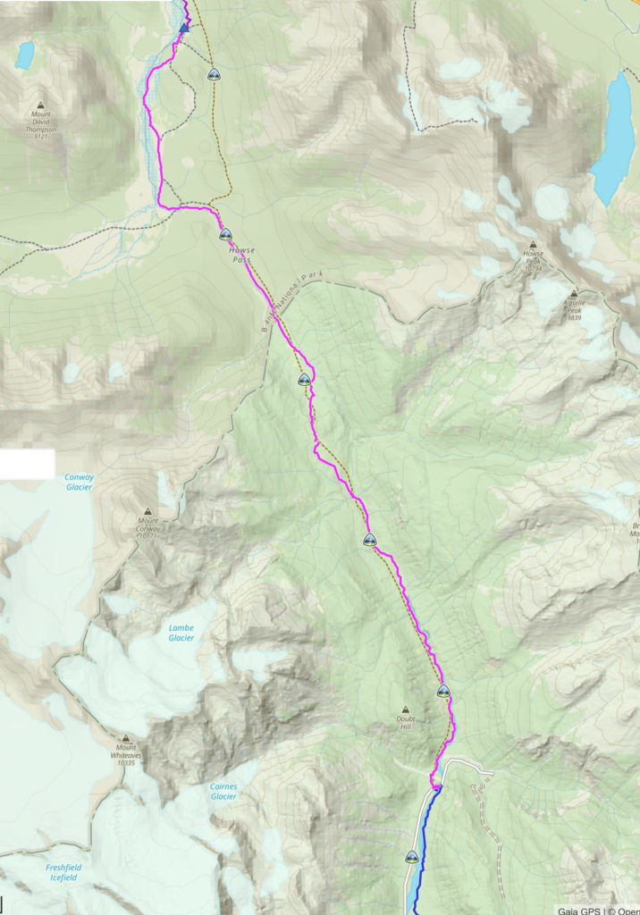
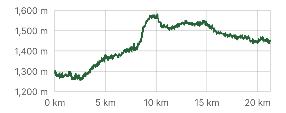
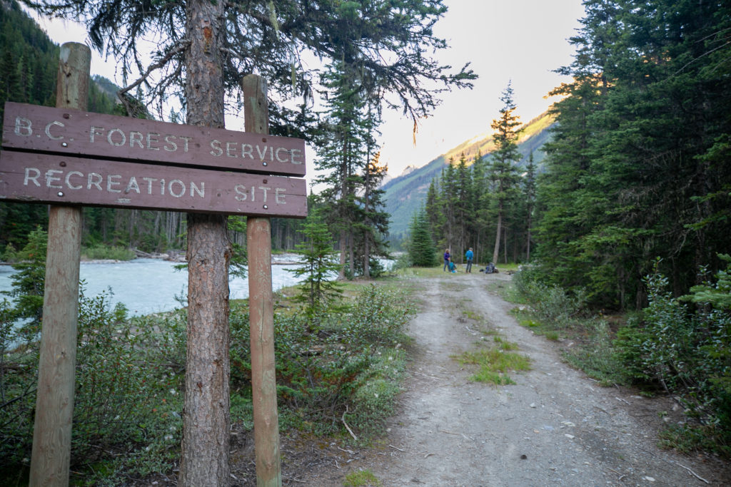
Day 5, August 12th, Cairnes Creek Rec Site David Thompson TH to Random Camp Howse Flood Plain, 21 km, 482 m elevation gain, 325 m elevation loss, 9 hrs 35 min, Segment 23.

Day 5 in pink. Ends at triangle at top.
Day 5 Elevation Profile.

My journal entry for day 5 reads “Oh what a day, hard to believe that it all happened in one day. The morning seems so long ago.“

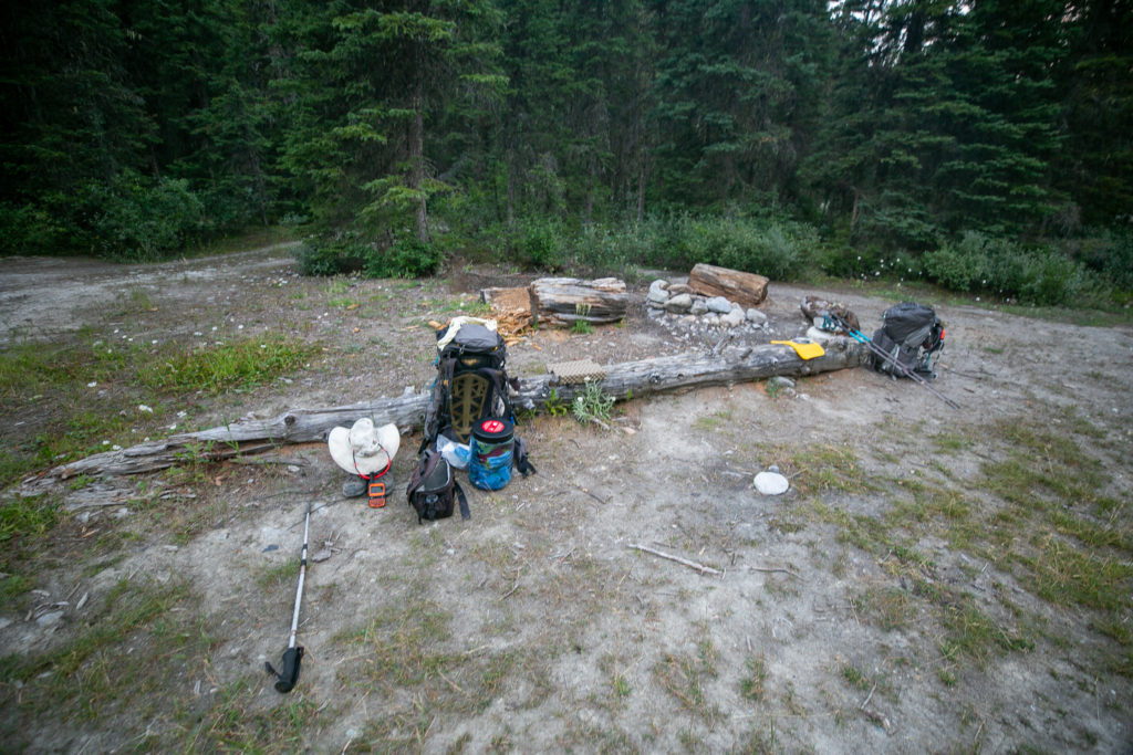
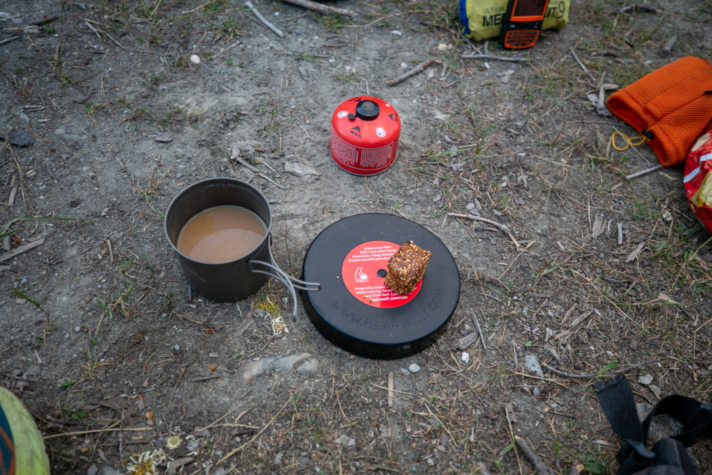
Woke up to a cool morning and damp pants. Had the tent all packed up by 6:20 am and coffee was ready by 6:45 am. I had a relaxing breakfast sitting on the log in the eating area. We rolled out of camp at 7:30 am with our first task finding some water. This was a little ironic as we were camped on the banks of the Blaeberry River but the river was extremely silty.

My very trusty Salomon boots. I keep trying to hike in shoes but the boots are the one piece of footwear that have never caused me blisters or any other issue.
The eating area.
Breakfast.

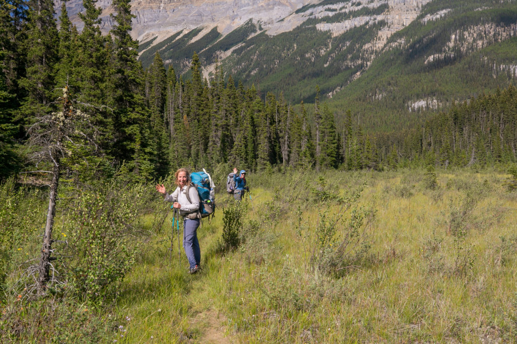
As we headed out of camp Lillian and Sara told me that they decided to hike with me all the way to Mistaya Canyon and finish their hike a day early. We decided that we would camp at Horse Camp on the Howse Flood Plain. This would be a little short of what I had planned but it ended up be a great choice. I texted Laura using my Spot X to alter my pick up time tomorrow at Mistaya Canyon to 4 pm.

The road into the the campground.
The view up Cairnes Creek. Mount Termier (2850 m) dominates the view, the Lambe Glacier is nestled in behind and out of sight. You can just see some snow/ice in the col on the left.

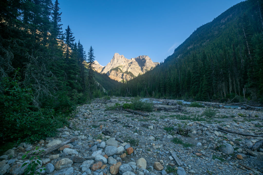
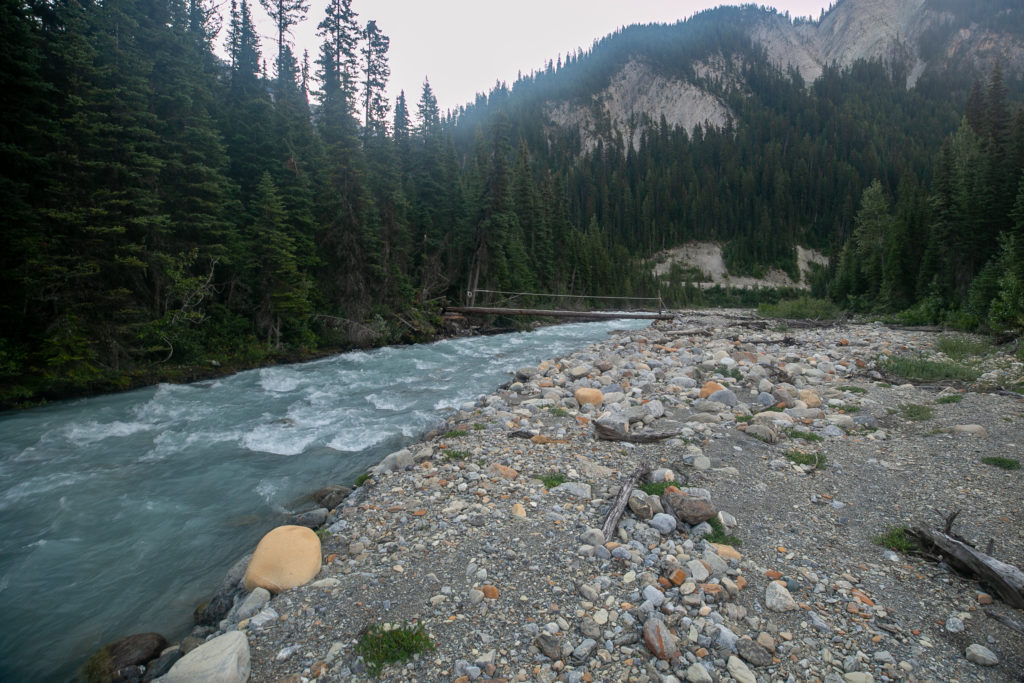
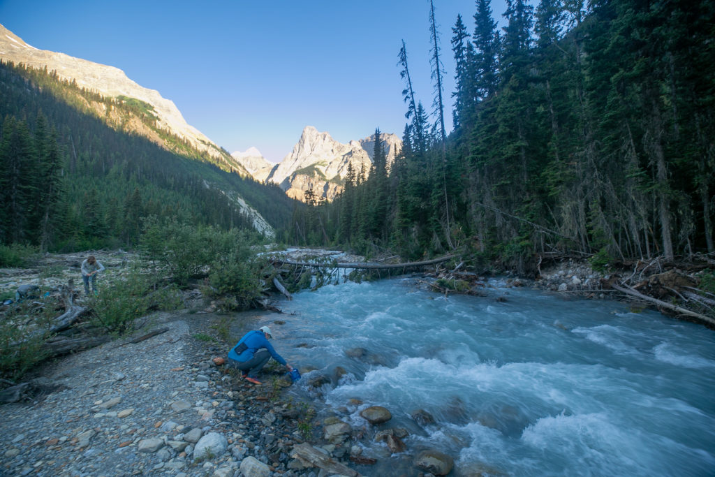
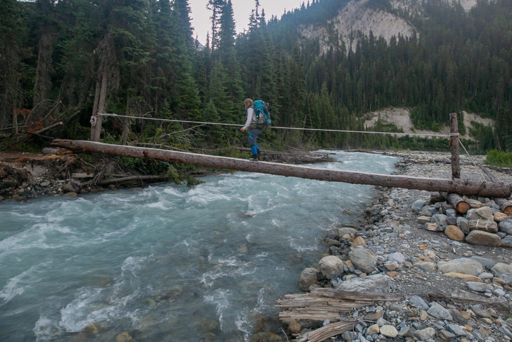
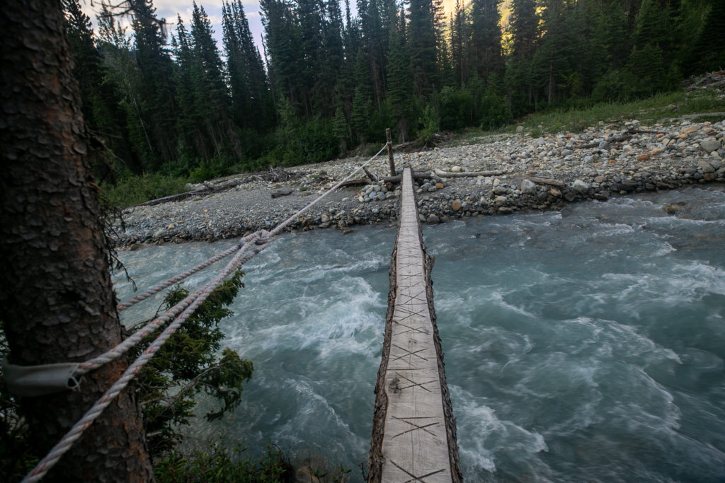
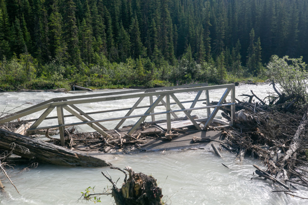
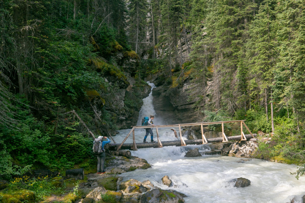
We quickly arrived at Cairnes Creek where we all filled up with water. The water in the creek was very clear. The creek was running in a small channel and was completely impassable. Lucky for us the GDT Association had built a bridge across Cairnes Creek similar to the one we used yesterday to cross Collie Creek.

The bridge across Cairnes Creek.
Lillian filling up with water. Guess if you were desperate you could have crossed the creek on the fallen tree. Not sure that would be a great option.
Sara crossing the bridge.
Like the little cross cuts for traction. The installers took the time to add a protective wrap on the rope to preserve the bark on the tree.
Still following Toe Shoe Guy.

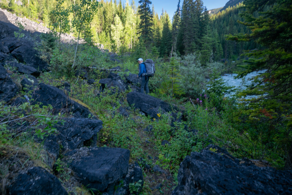
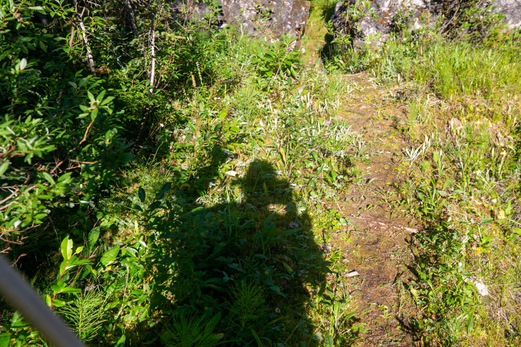
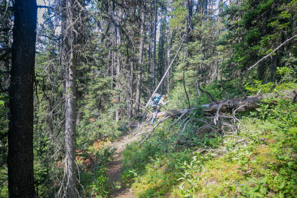
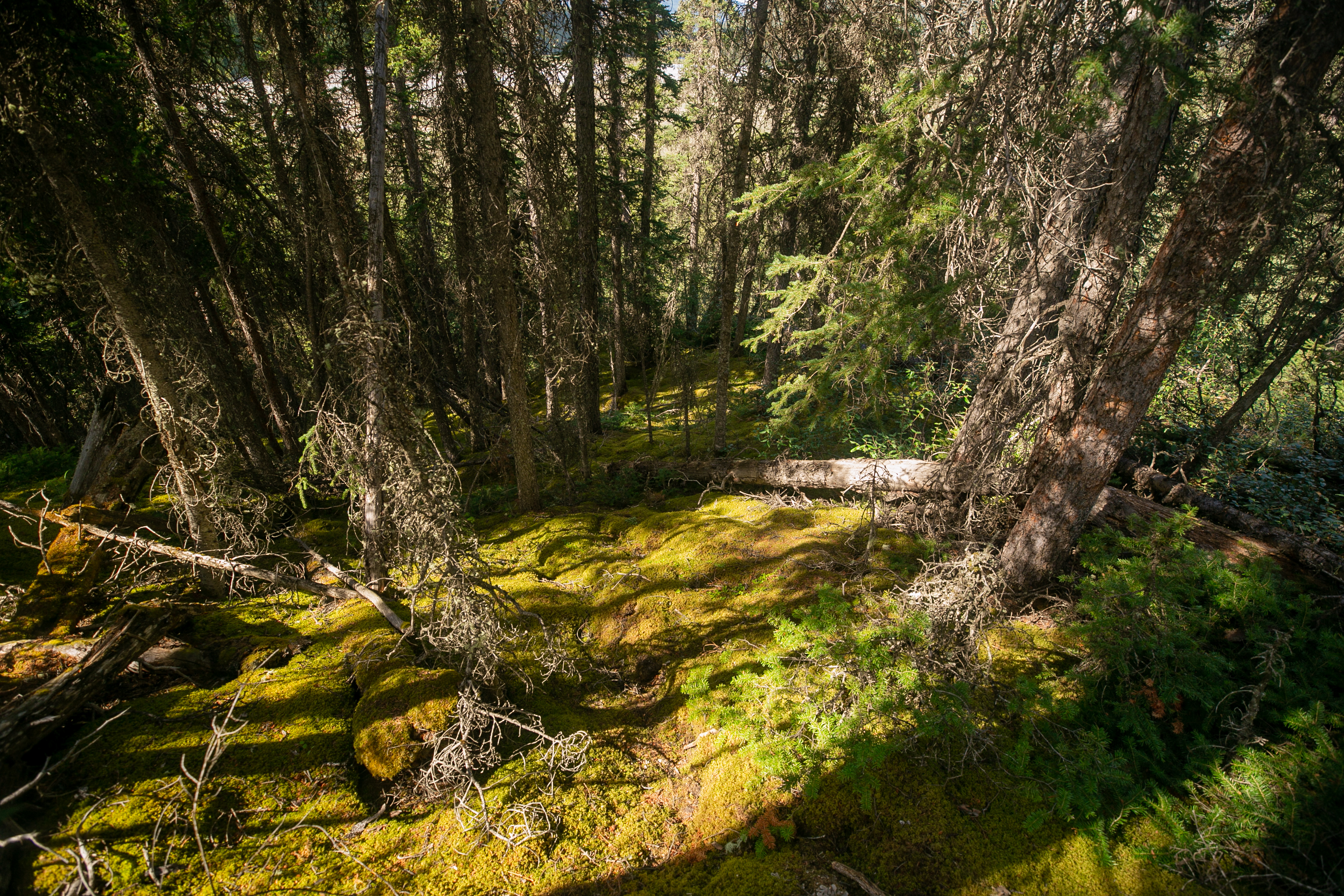
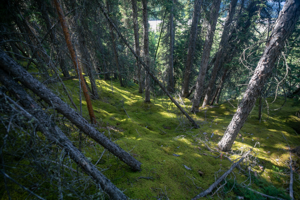
It was a quick and easy 1.5 km from the creek to the first of the avalanche debris slides. Some of the suggestions online were to hike above the debris and then cross. After bushwhacking up the side there appeared to be a decent path across. Crossing the debris path reminded me a lot of crossing the forestry cut blocks from Day 4.

It begins. Lillian crawling under some avalanche debris, crawling is never easy with a full pack on.
Sara making her way up the slope on what has become quite a well worn trail.
The view down slope.
Heading across. Just looks like a cut block.

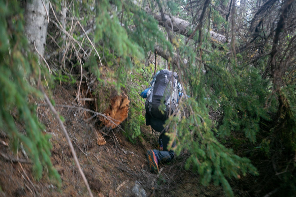
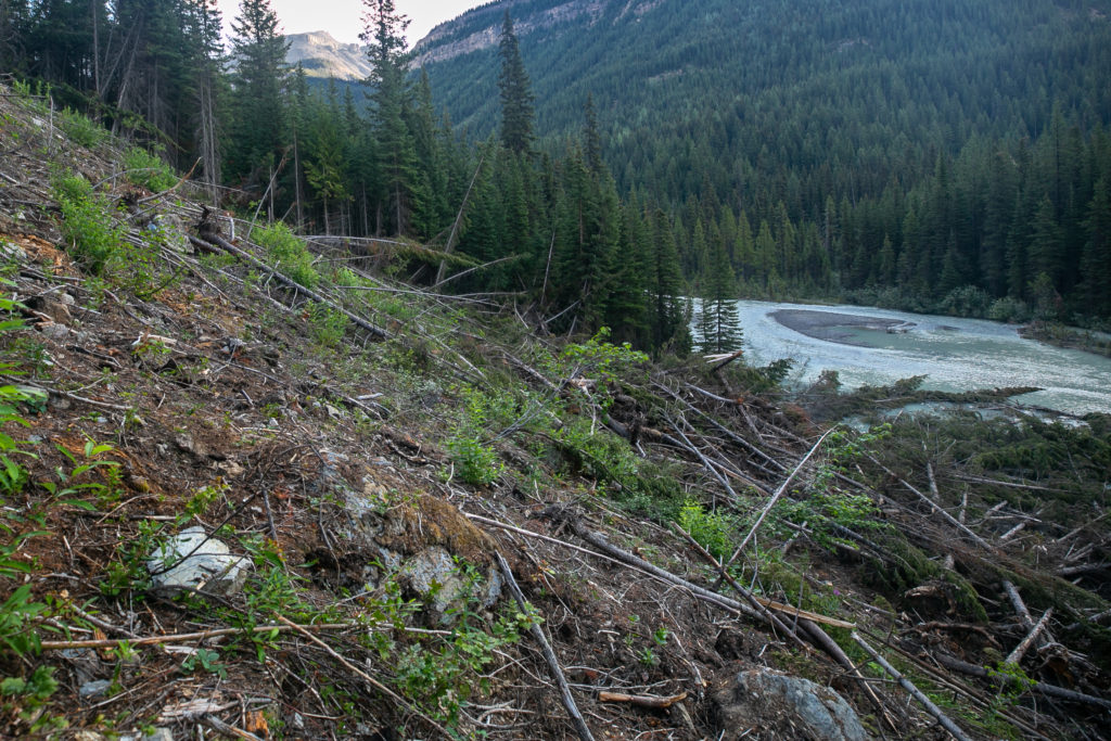
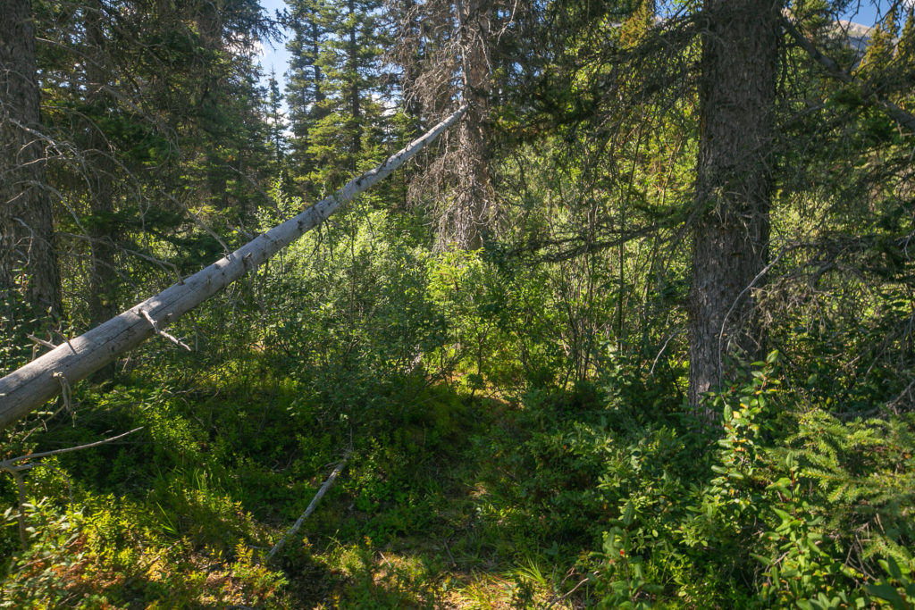
The first avalanche path had been quite easy to negotiate, not so much the second avalanche. Initially it was a struggle just to get onto the second avalanche path due to the debris guarding the side of the slope. Lillian and Sara proceeded to go high while I chose a mid level route across a mess of tangled but stable trees. Once across to the other side it was a another difficult bushwhack down back to the trail by the river.

Lillian and Sara crossing above the majority of the debris.
What I had to cross just to get onto the slope.

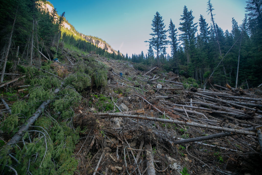
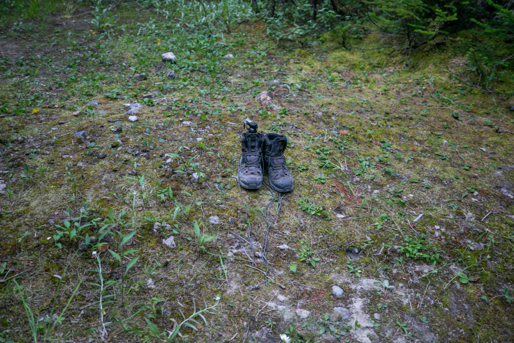
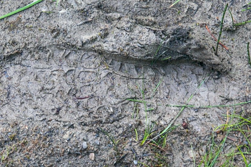
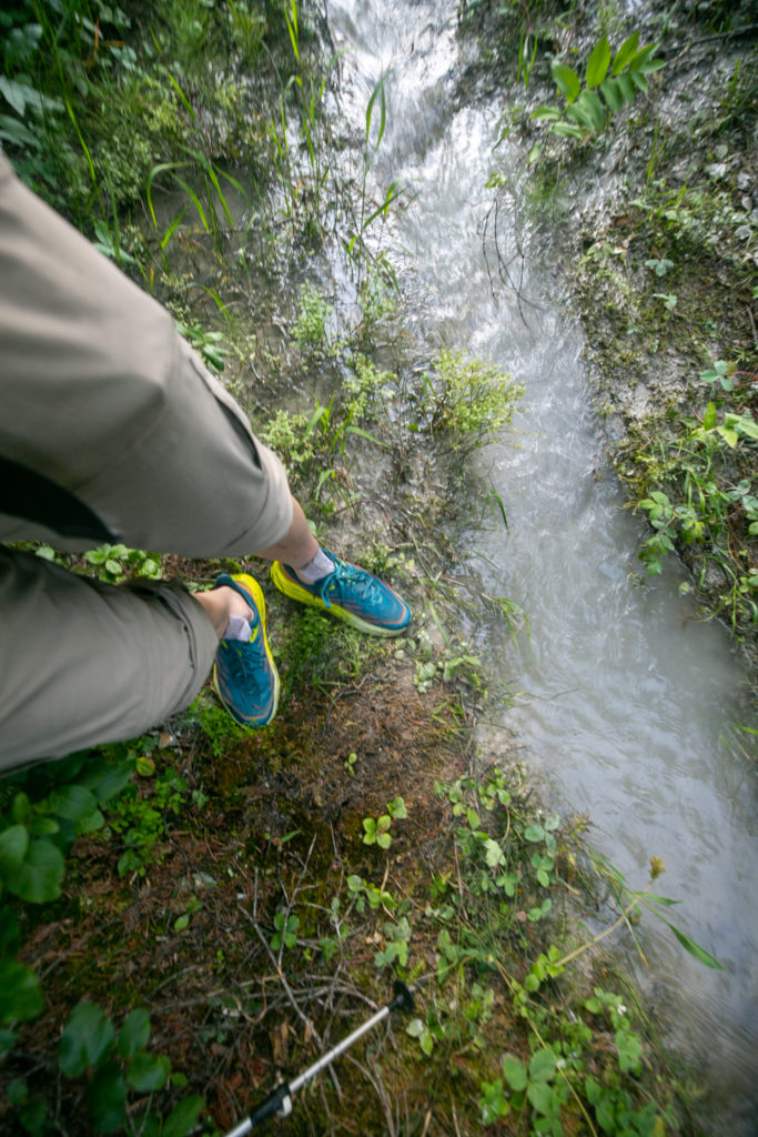
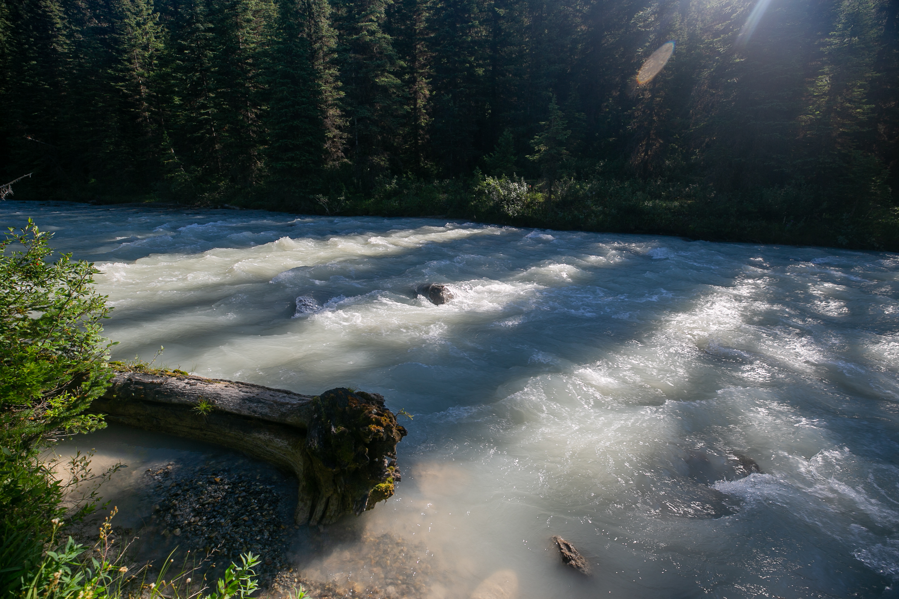
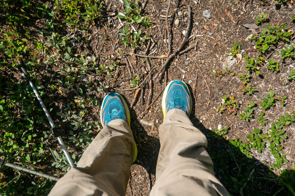
Once down and back onto the trail we were faced with some more avalanche related fun. As the avalanches slid down the slope they pushed their way a fair distance into the path of the river. This created a partial blockage that dammed the river and flooded the low lying ground near the river where the GDT just happened to be. With the trail flooded by water I switched to my running shoes to keep my boots dry and proceeded to carefully make my way through the milky water using my pole as a probe. The water was so very cold that my feet started to hurt after just 15 – 20 seconds in the water. After a few short minutes we found the trail and rejoined the GDT. It had taken us a little over one hour to pass by the avalanche debris covering only probably a half a kilometre of trail.

Rocking the shoes to wade through the water.
Video of us walking through the water.

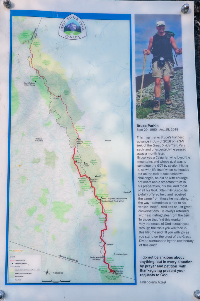
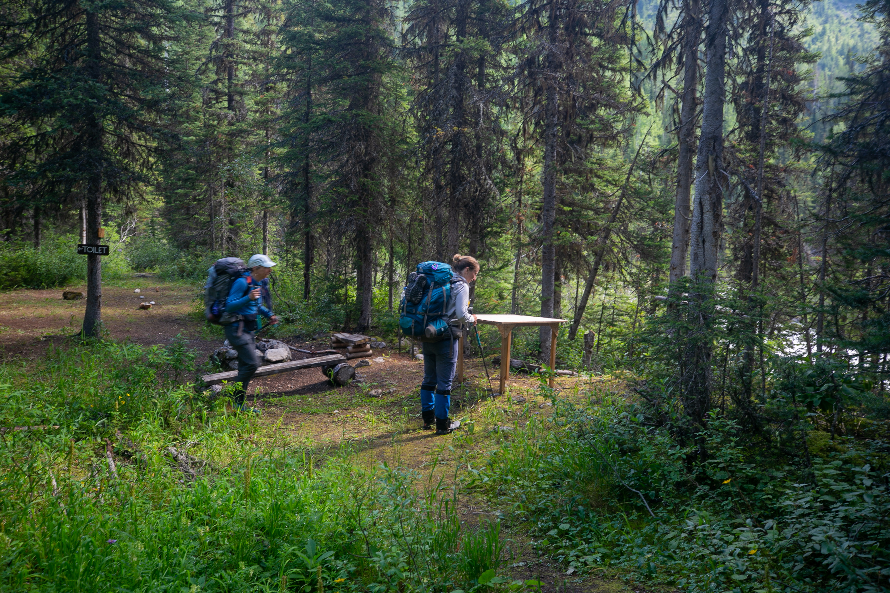
After we got back on the GDT I hiked for a little while in my shoes before switching back to my boots. The hiking was quite good up to Lambe Creek. There was a lovely but sad tribute to a GDT hiker at an rockfall who had to leave the trail and passed away a month later. It was 11:15 am when we arrived at the Lambe Creek Campground we had covered about 9 km.

Not a well traveled path.
An old rockfall.
Tribute.
Someone has been busy
I am on the trail.
I liked the lines the shadows and sunlight created on the river.
Lillian and Sara taking in the sunshine and waiting for me to catch up.
Sara contemplating having to get her feet wet.
There were some nice views along the way but much of the trail was in the woods.
A very nice bridge to nowhere.
Keeping our feet dry.
Lambe Creek and a very nice bridge.
Like many GDT bridges only a handrail on the one side.
It is a staircase falls. You can see another falls deep in the woods.
There was a little eating area. We had a short lunch break.
Some long exposure photos of Lambe Falls.

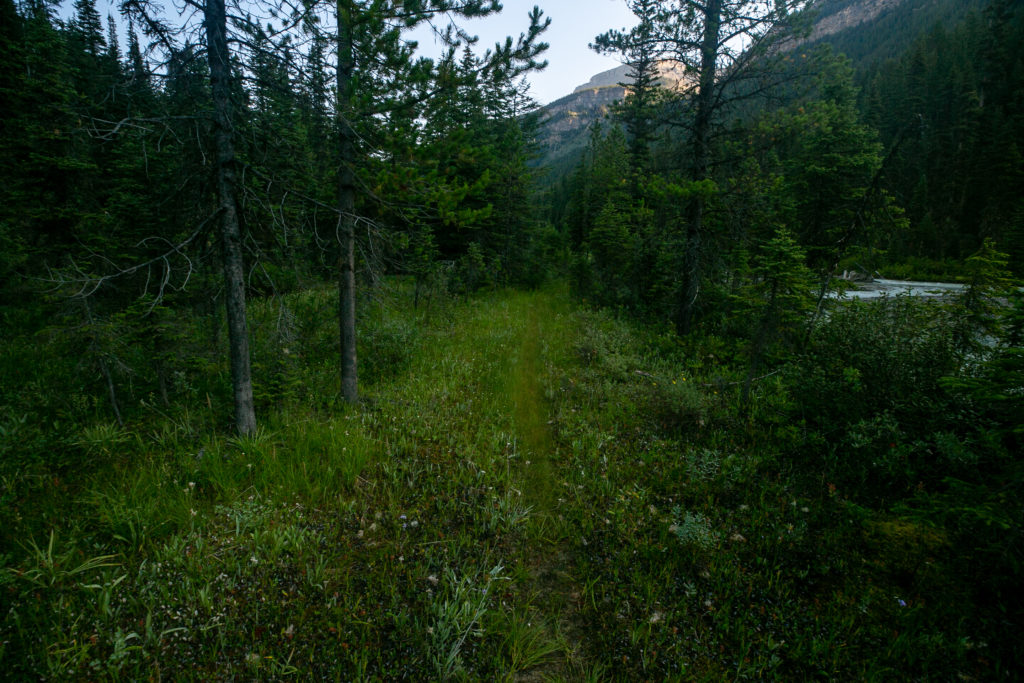
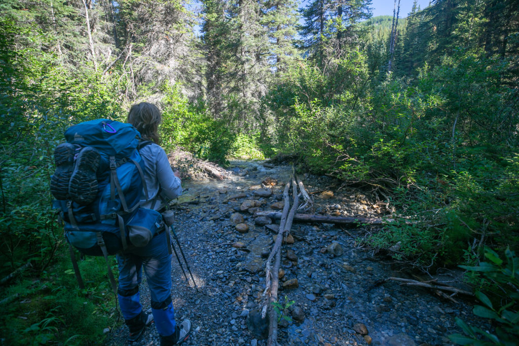
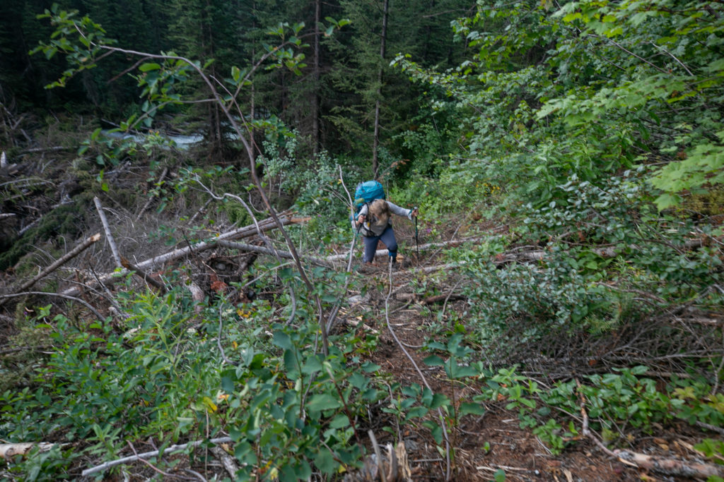
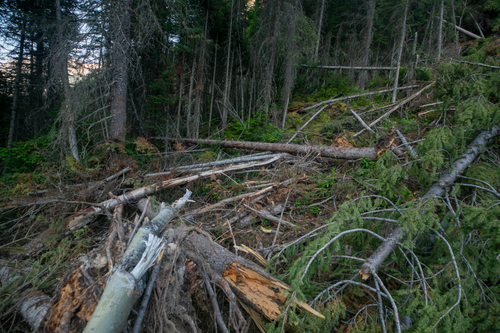
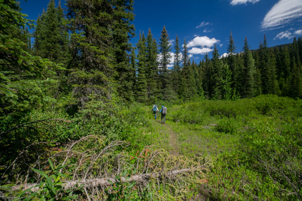
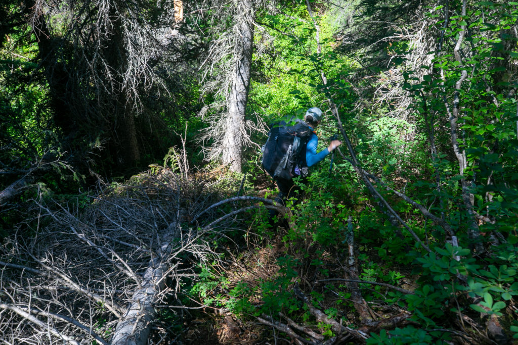
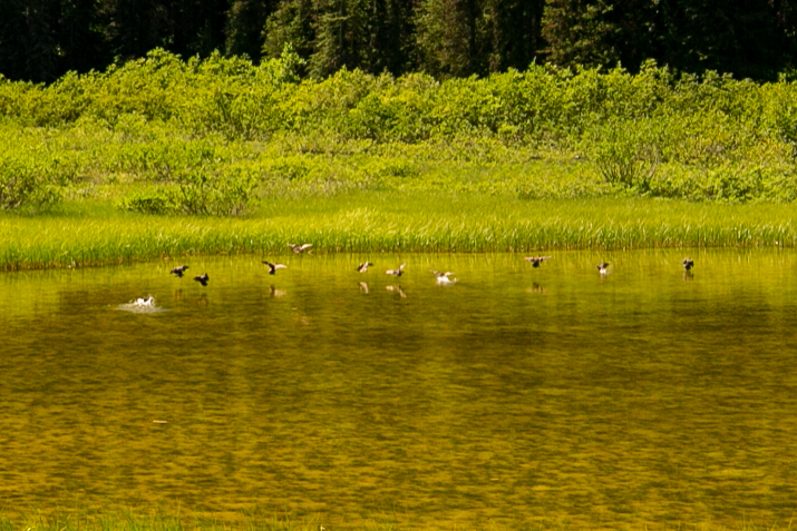
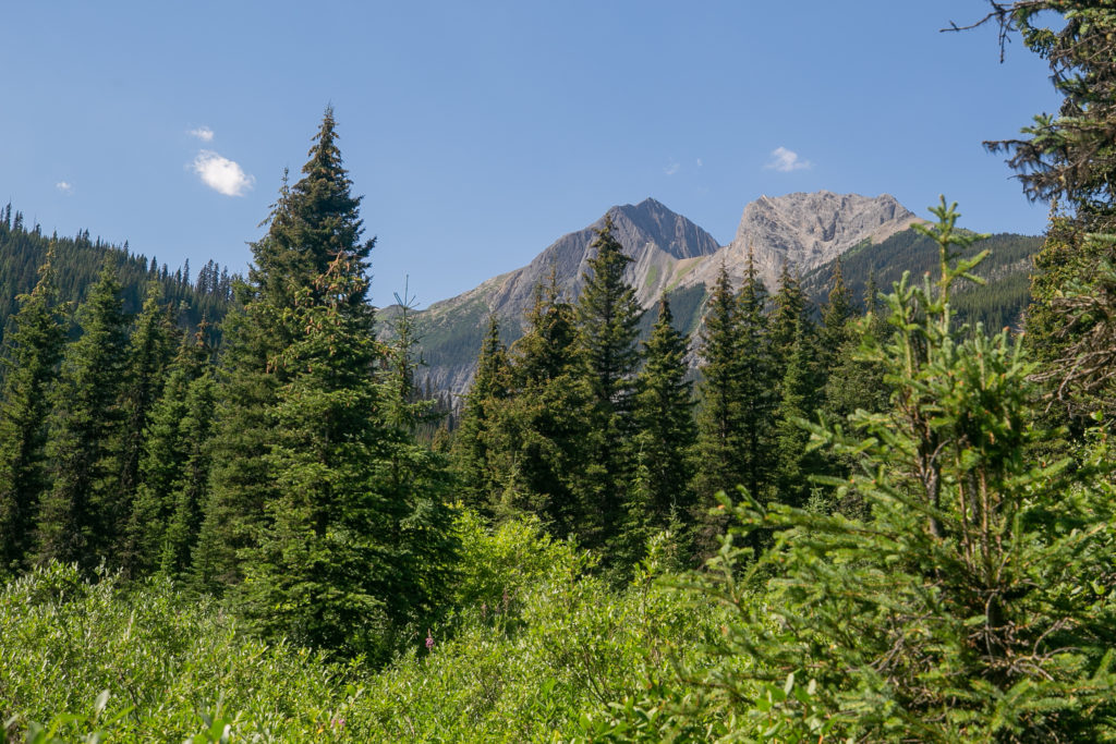
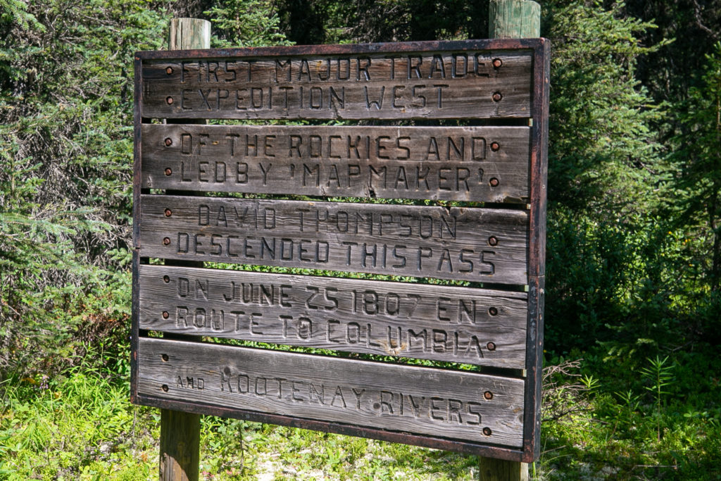
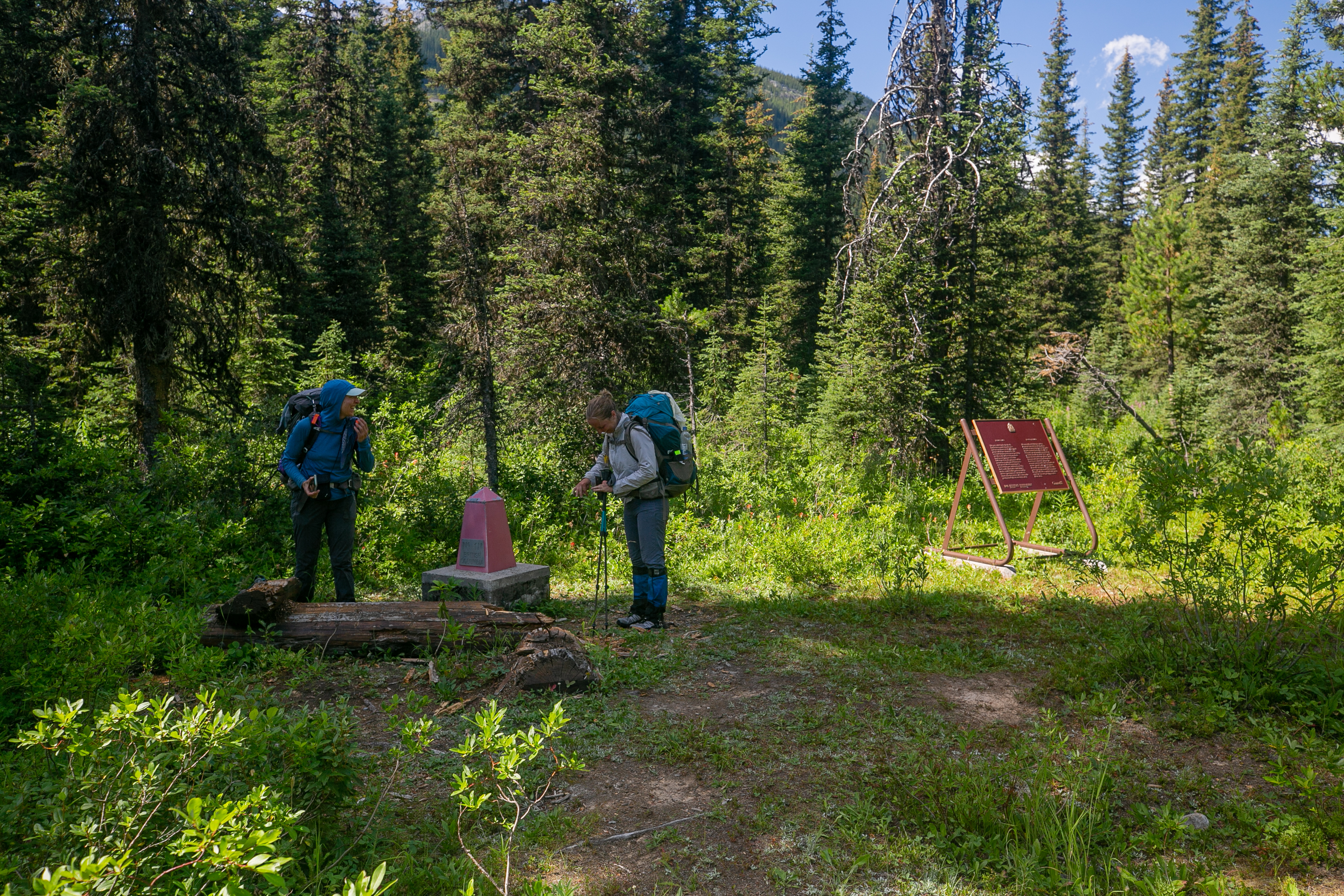
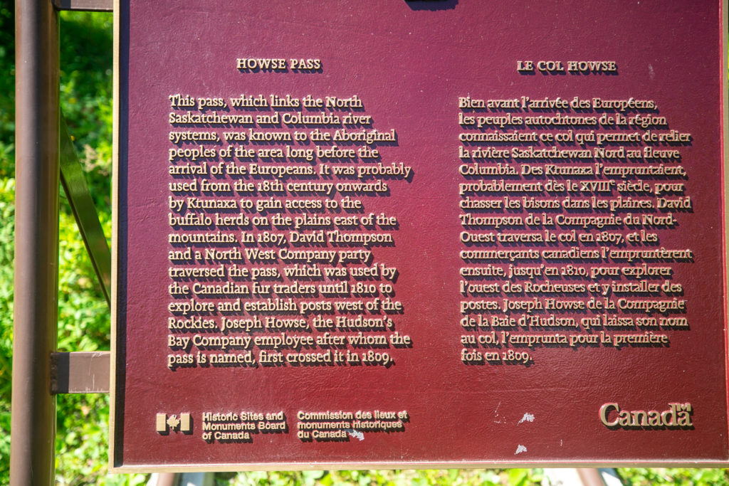
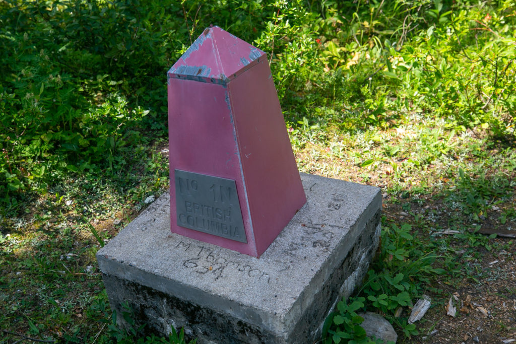
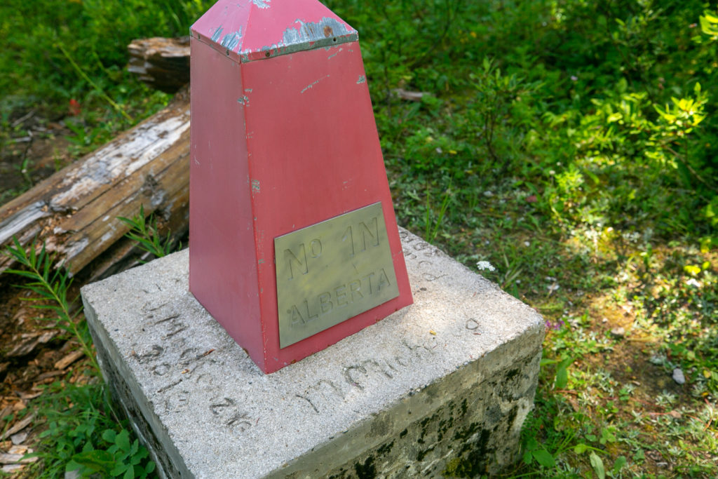
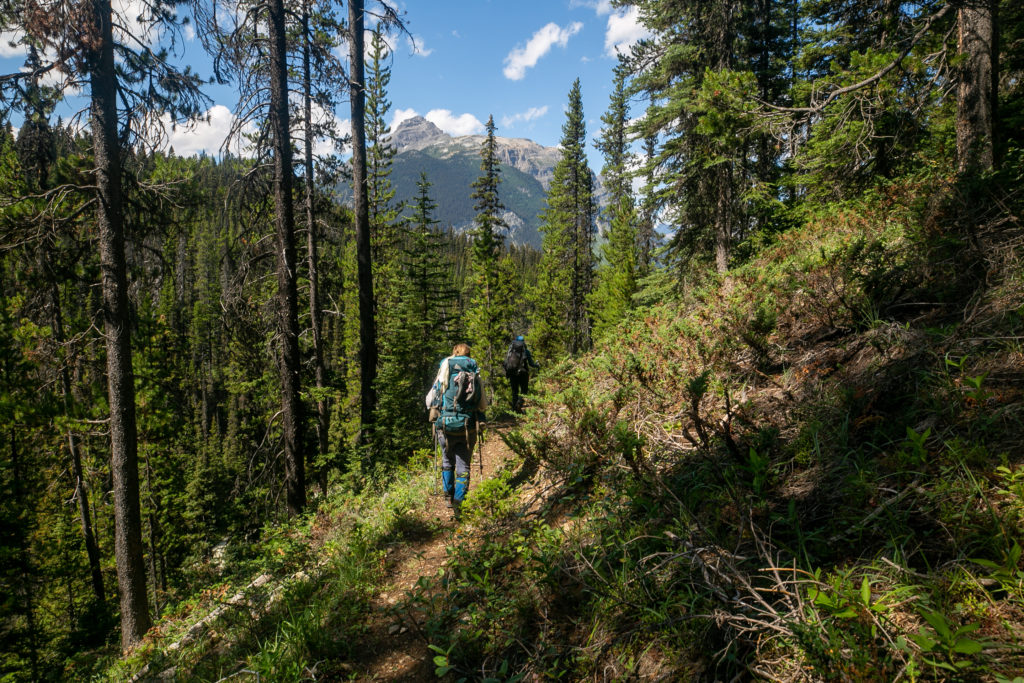
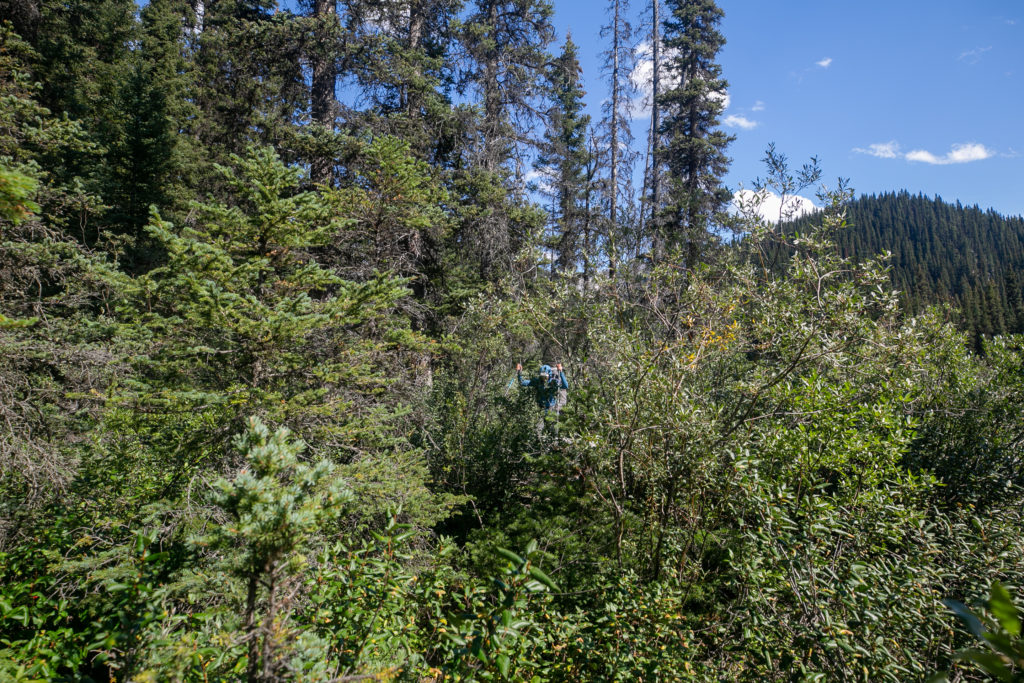
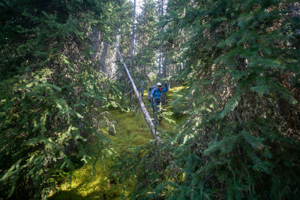
We left the campground at Lambe Creek just before noon. Progress was initially quick but then the deadfall started. So much deadfall. We worked our way carefully around the trees. For some trees we had to make our way up steep slopes to find a spot that was low enough to straddle over the tree. After what seemed like a long time we cleared the deadfall and the last 45 minutes to Howse Pass was through gently rolling grass and marshlands. I only ate half a lunch at Lambe Creek and I was starting to lag as we made our to Howse Pass. We watched a squadron of ducks circle a small lake and make a water landing in formation. We arrived at Howse Pass at 1:30 pm, about 90 minutes and 3.5 km after leaving Lambe Creek. Howse Pass was a very nondescript place.

Easy traveling after lunch.
Deadfall. Lillian negotiating her way down to the trail.
The final approach to Howse Pass is quite flat with lots of little ponds and marshes.
We are still on the GDT.
Duck Pond. Unnamed pond surrounded by minor unnamed peaks.
Ducks coming in hot for landing.
There is a trail through the vegetation.
Going to seed.
The very tall peak in the background is Mt Conway (3183 m)
Howse Pass.
Lillian and Sara checking out the B.C./Alberta border.
Nice plaque.
British Columbia on the left and Alberta to the right.
Welcome to Banff National Park. Sort of an afterthought.
Some more deadfall as we leave Howse Pass.
For the most part the trail was good walking.
Mt Forbes (3747 m)

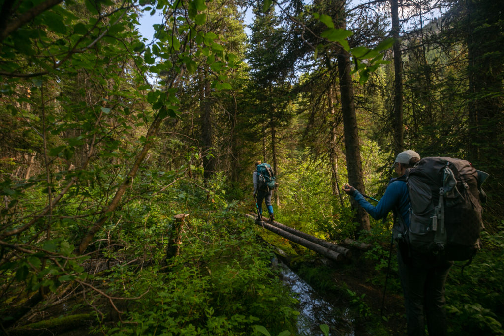
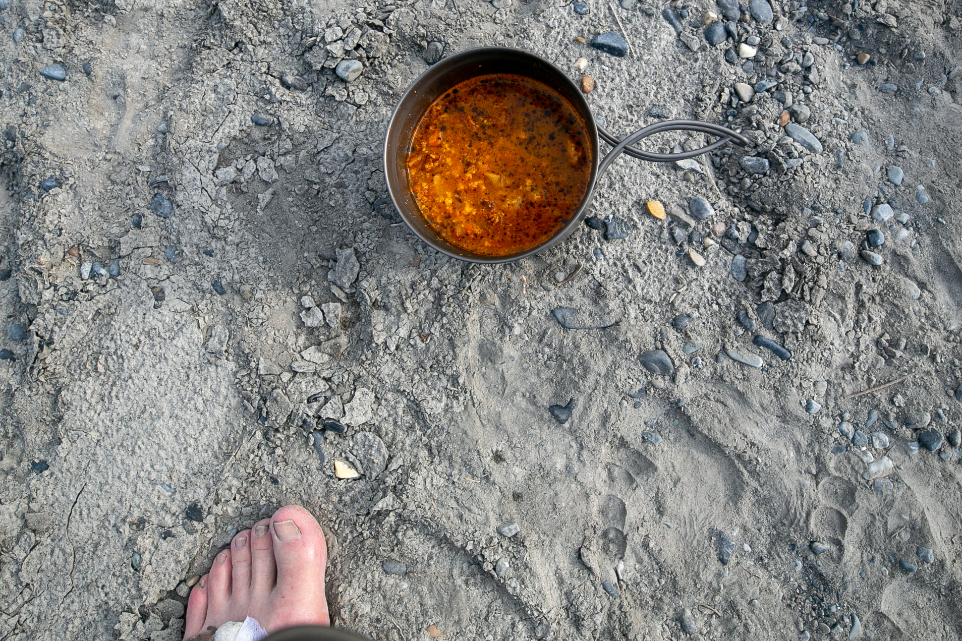
We had a 45 minute break at Conway Creek. There was a dicey little log crossing across the creek to the open area that can be used for camping. The camping here would definitely be less than ideal with a lack of flat spots for a tent but it did have access to clear water. I took the opportunity with our extended break to do a foot soak and have a second lunch.

Crossing Conway Creek.
After our break at Conway Creek. Switched to my shoes thinking my feet may get wet as we make our way along the Howse Flood Plain.
Shoes.

It was just after 3 pm when we headed out from Conway Creek. I tripped and stumbled a few times as we made our way down the trail. Had to bear down and focus on what I was doing.

Lillian leading Sara as we made our way long the Howse River.

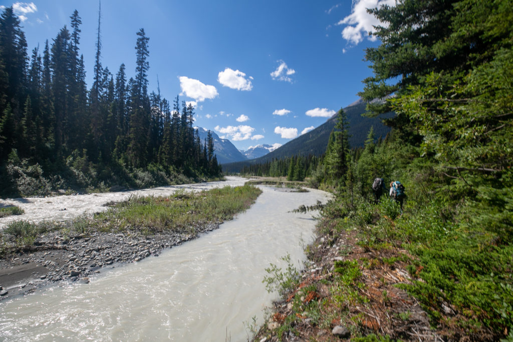
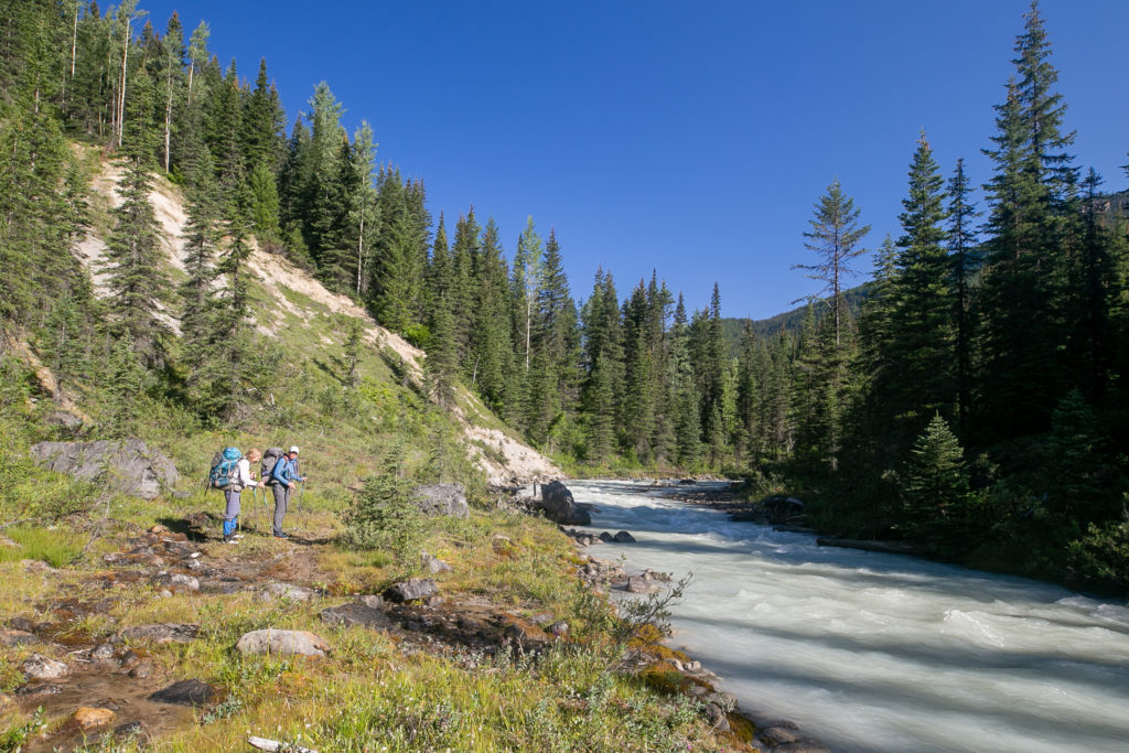
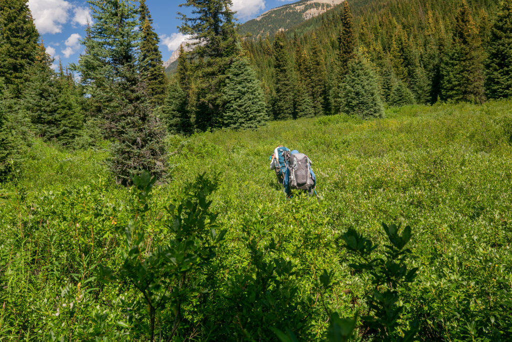
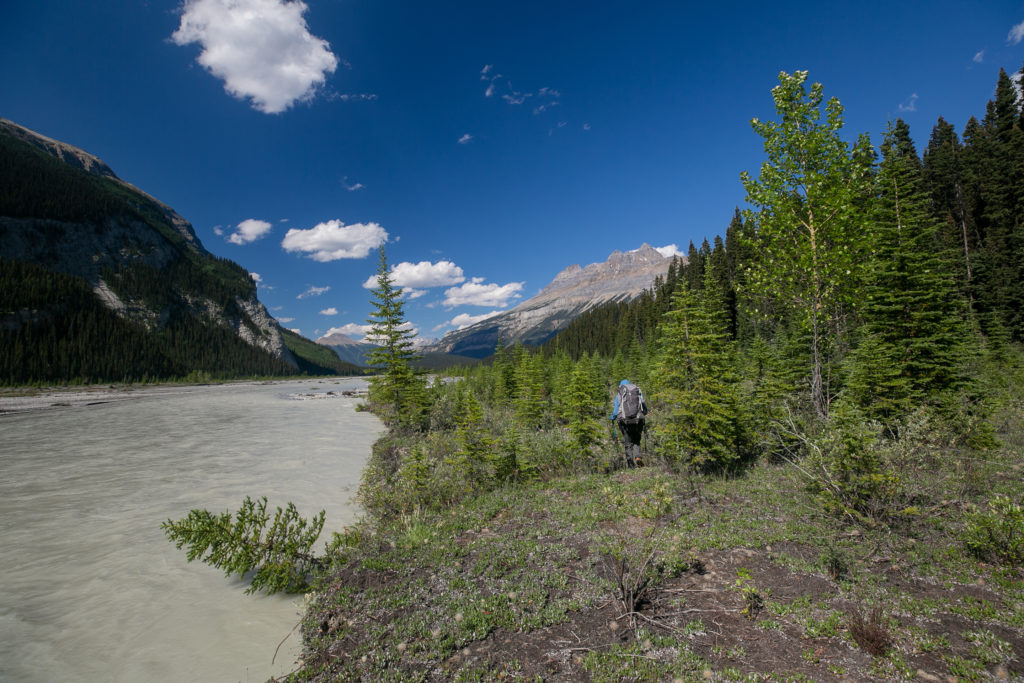
As we made our way along the Howse River the trail meandered from the riverbank into the forest and back to the riverbank. After about 15 minutes the trail disappeared altogether. When the bushwhacking started I went to the front and barged my way through the trees and brush. There were intermittent signs of a trail and the river was always close by so it was nearly impossible to get lost. One casualty of the bushwhacking was that the trees pulled my water bottle off of my pack. I was pretty annoyed at myself for losing the bottle and littering.

Sara taking in the view. Mt David Thompson (2780 m) in the distance. The Howse river bends to right as we approach Mt David Thompson and our path will follow the river.
Looking south to where we had come from, the peak at centre with the snow on it is Howse Peak (3290 m)
The trail goes through there, somewhere.
Lillian plowing through the brush.

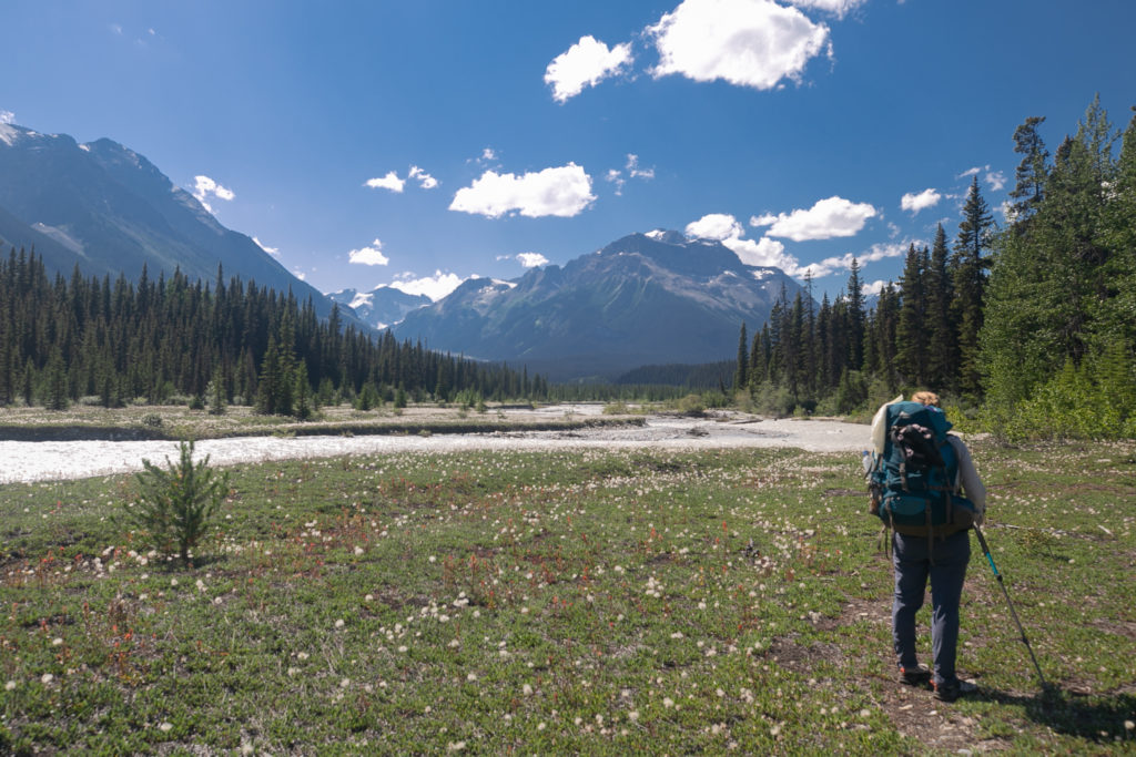
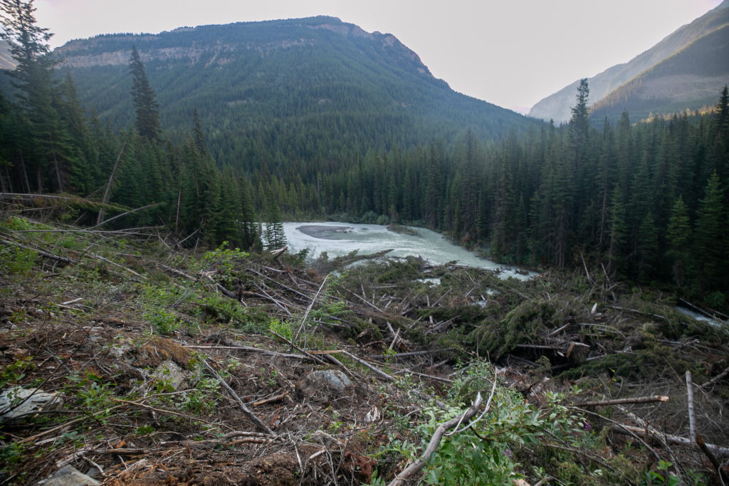
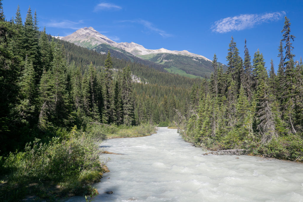
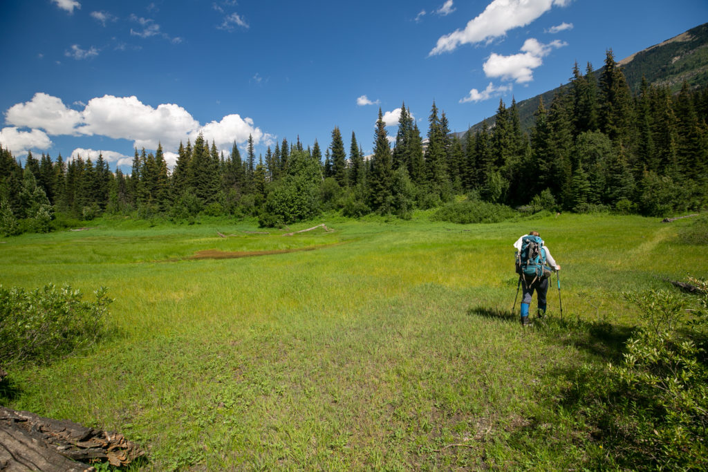
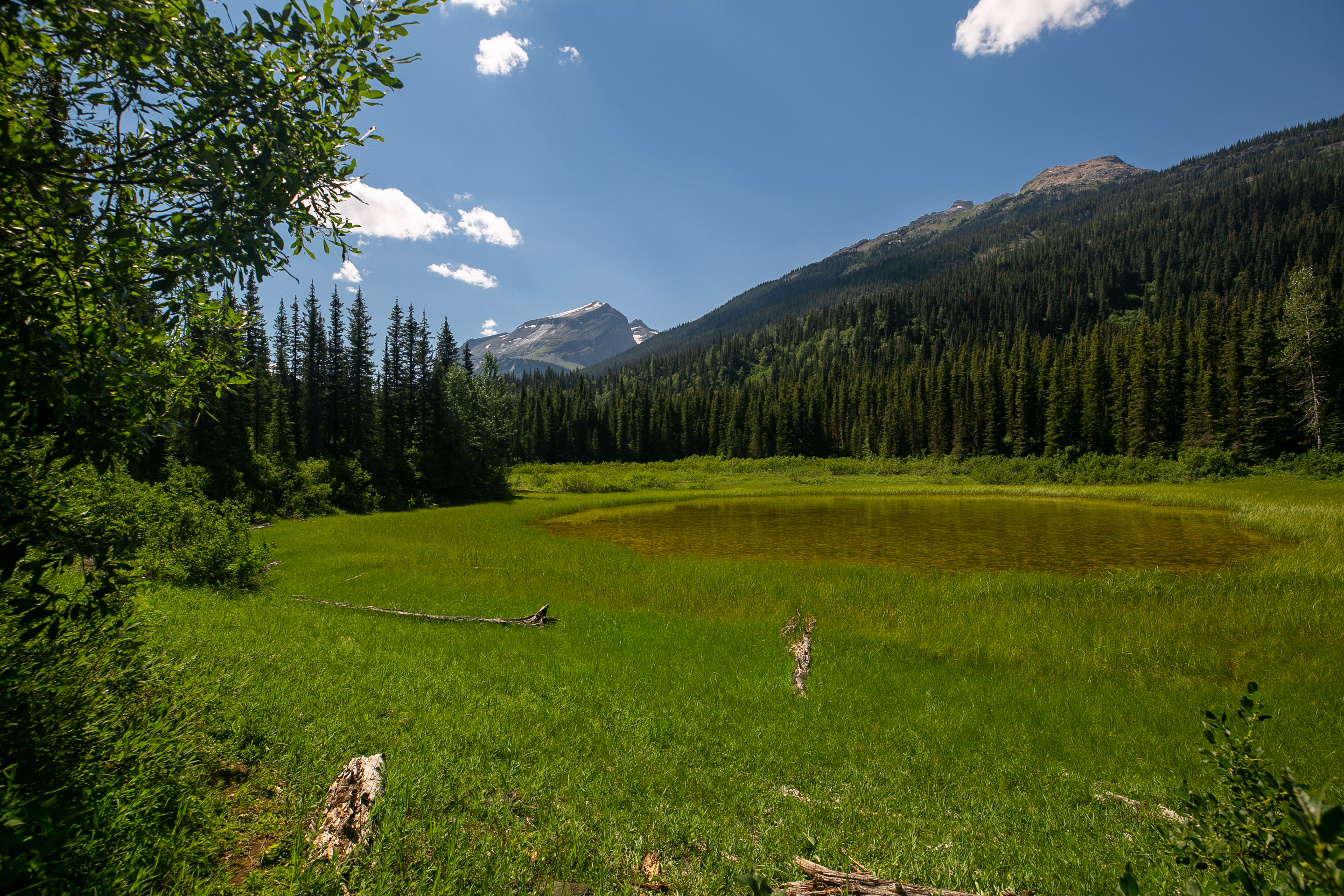
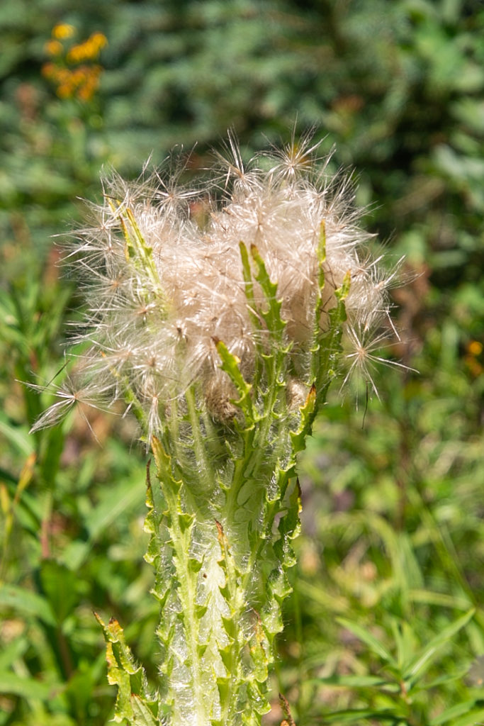
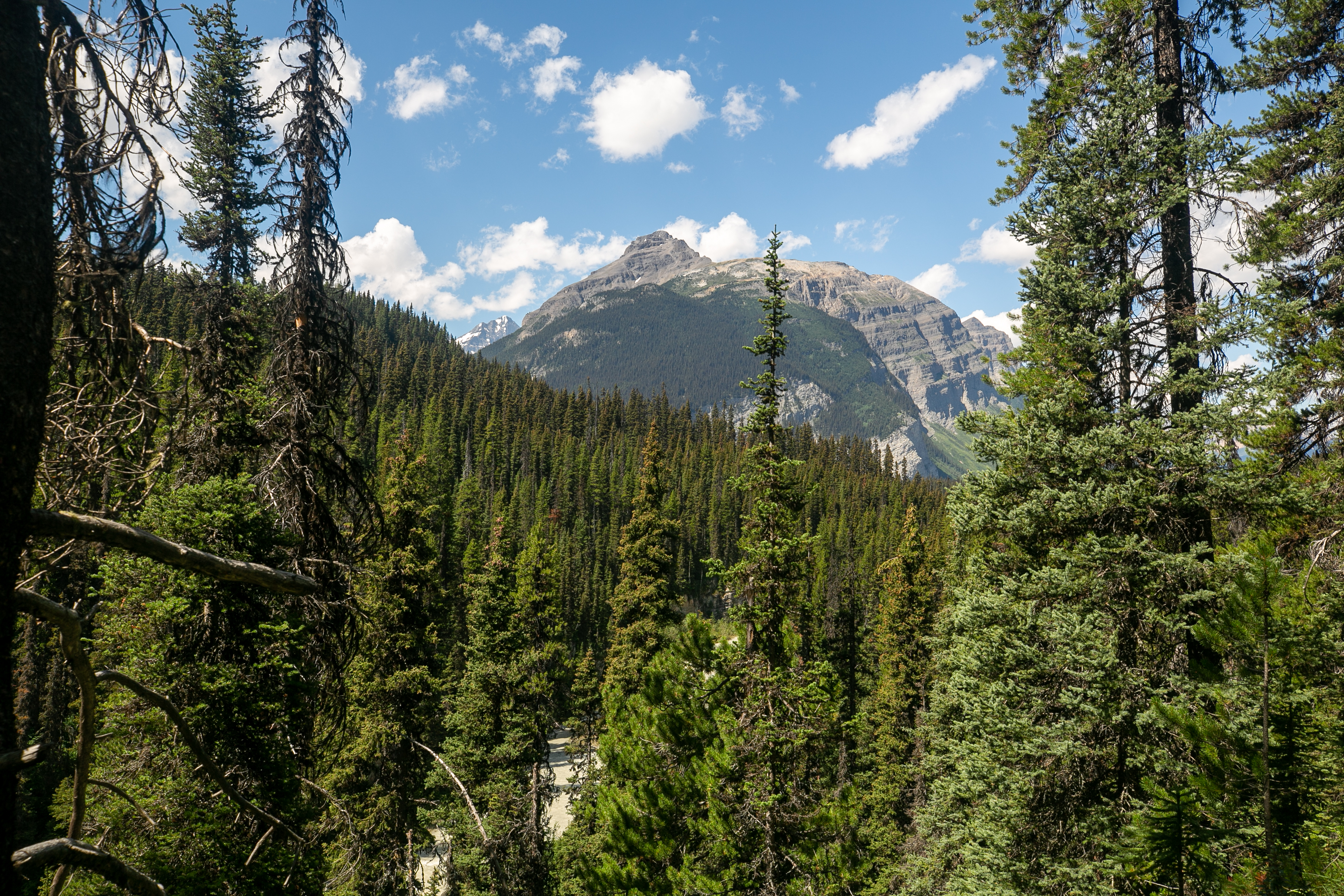
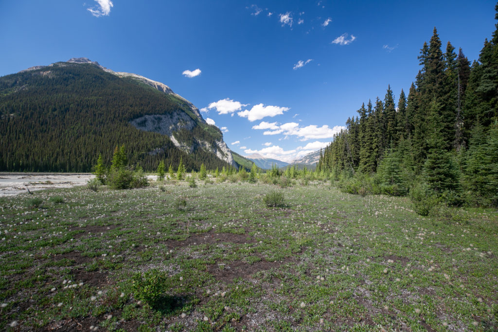
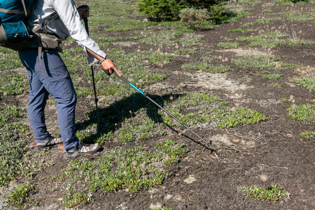
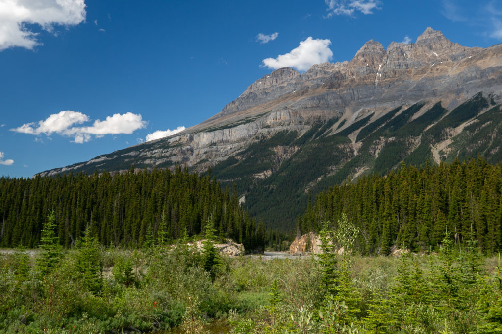
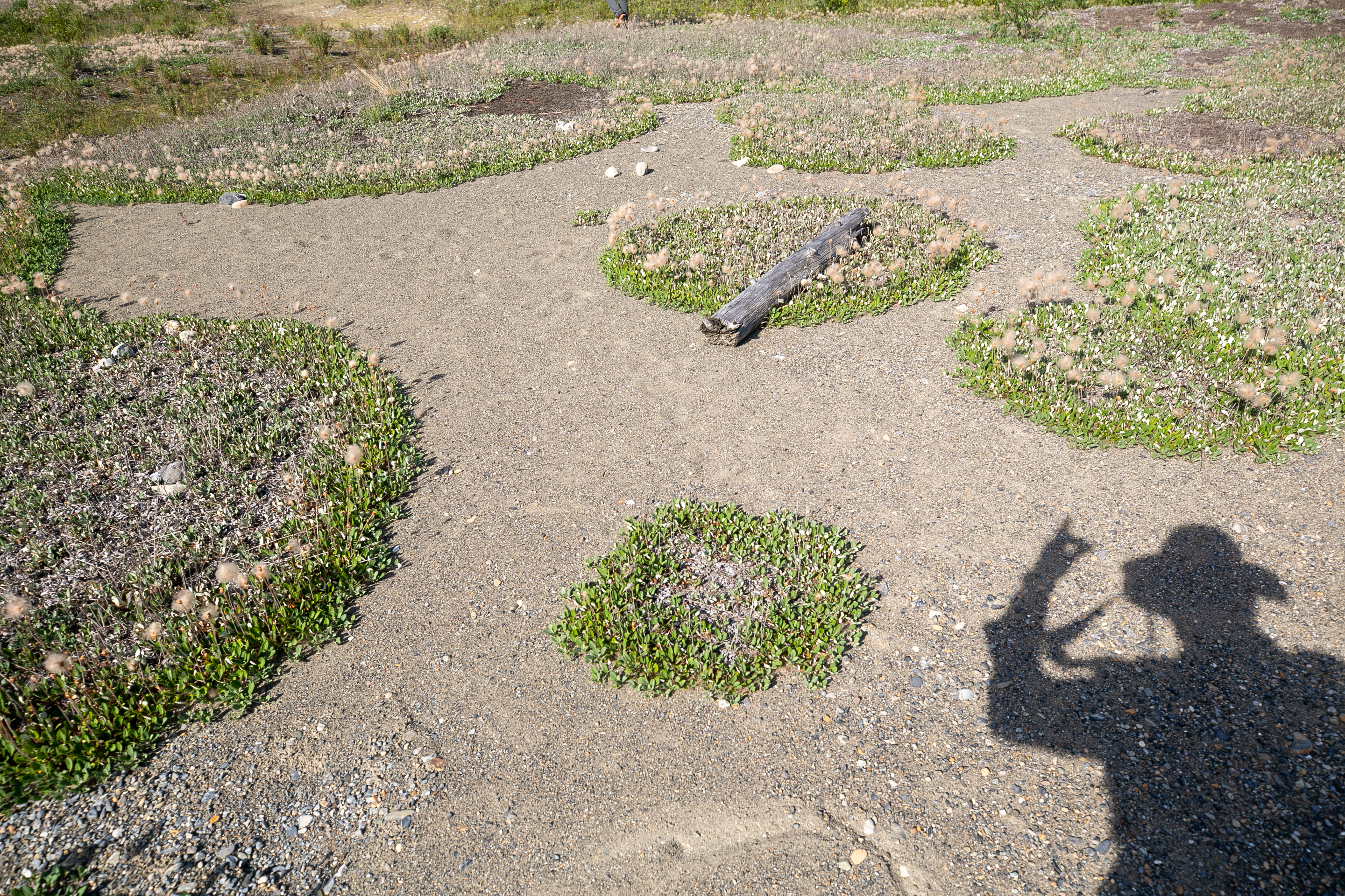
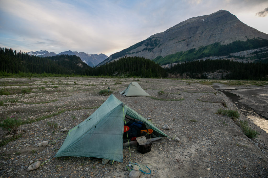
Once we broke through to the flood plain at the base of Mt David Thompson we had a couple of kilometres of easy walking. As we made our way along the flood plain Sarah showed me a dryas mat. A dryas is a tree that grows underground and then the flowers pop out and are the stems that we see above the ground.

No trail but the walking is easy.
Walking along the Howse River.
The views are so big and we are so small.
Sara describing what a dryas is.
On the right Epaulette Mt (3094 m) overlooking our progress.
The trees in the distance provide a momentary obstacle that required more bushwhacking.
Into the forest we go.
Very soft and mossy on the descent.
Lillian making her way down.
The view on the other side. We would cut to the right past the treed mound at centre.
The river has cut a small canyon. We will continue to right through a meadow and never have to make our way through the trees.
4:50 pm, spirits are high camp should be close by.
Wildlife.
Alien Invasion!?
Just long forgotten Environment Canada equipment.
My shadow and a bunny shadow.

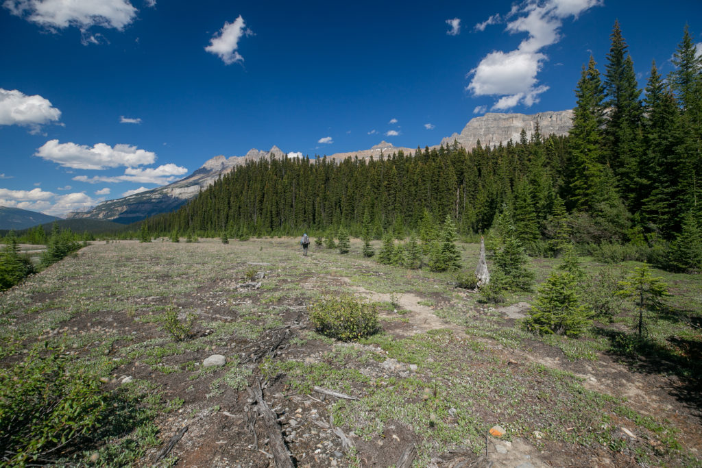
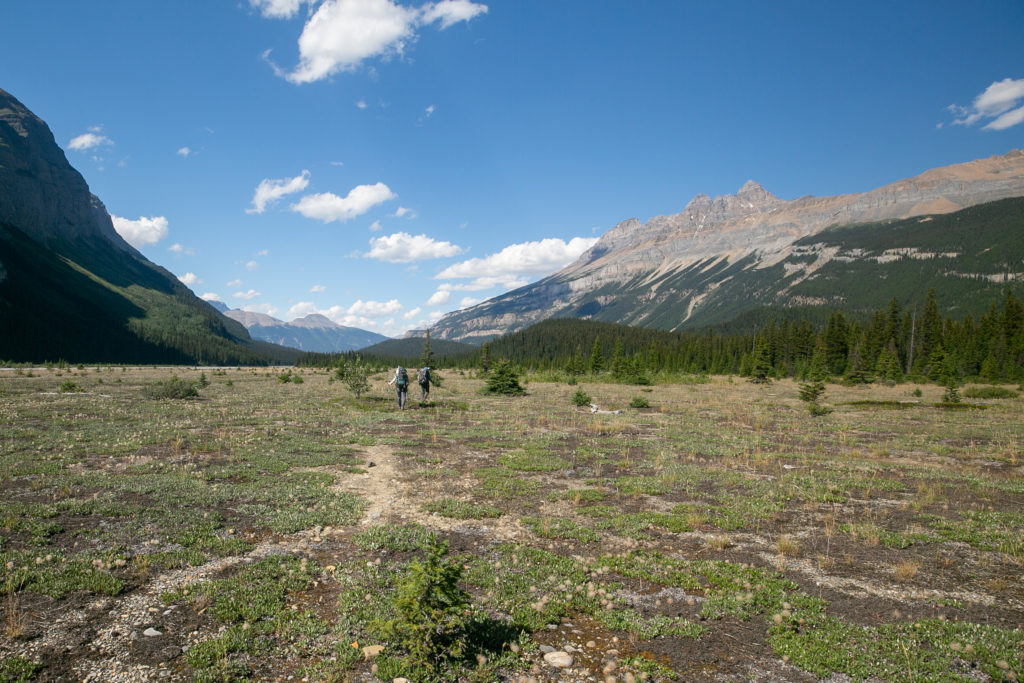
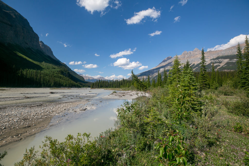
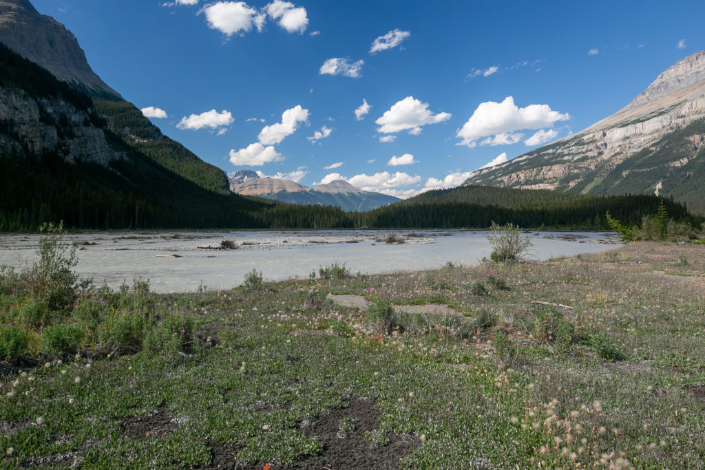
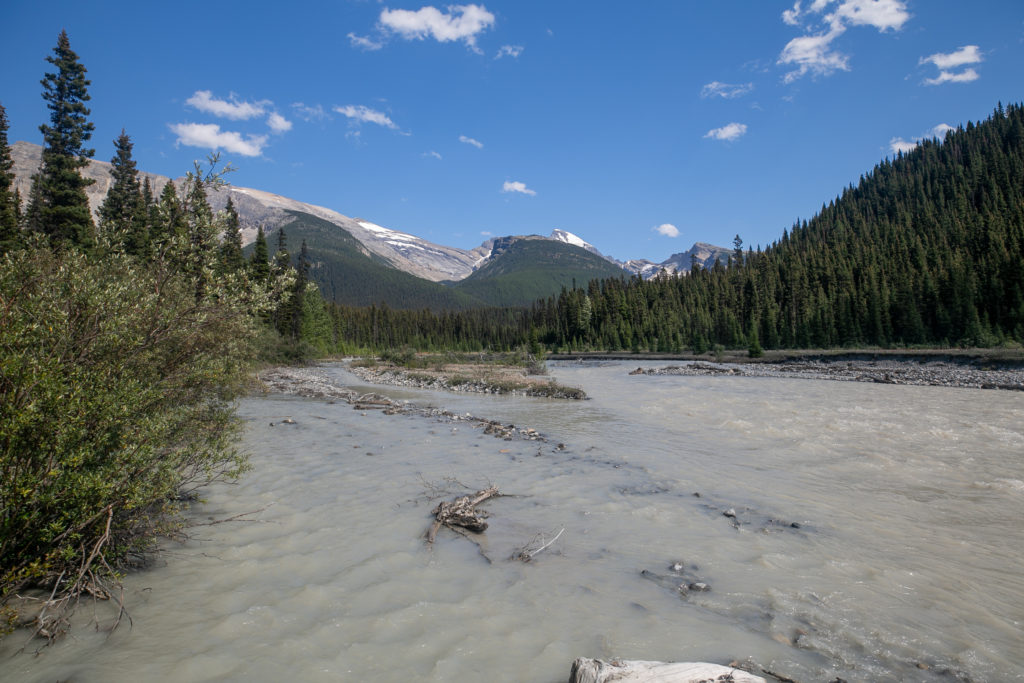
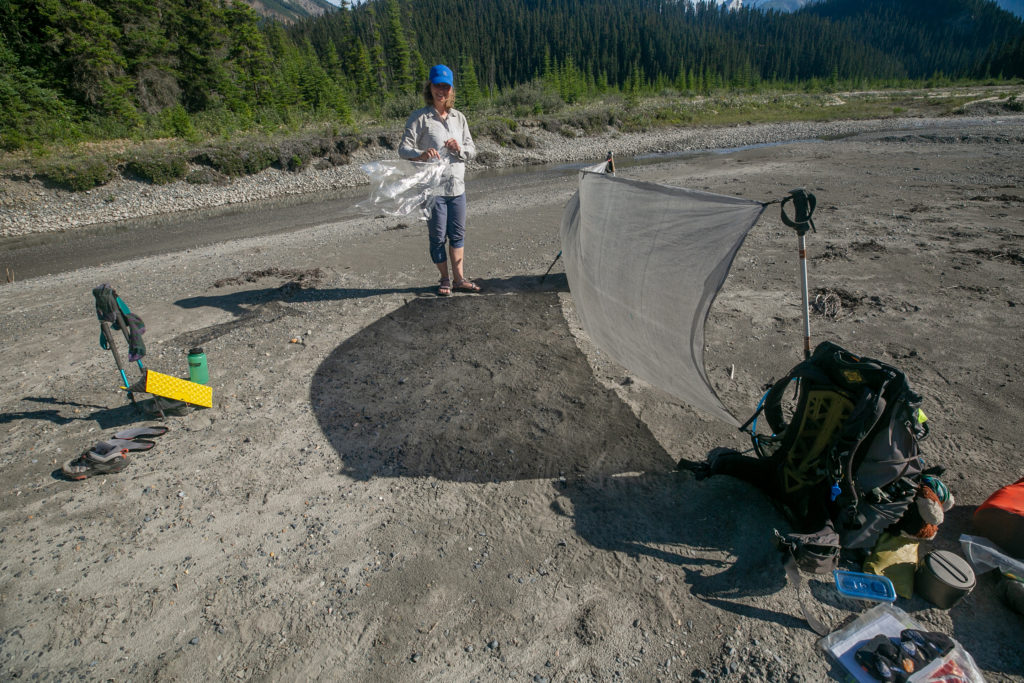
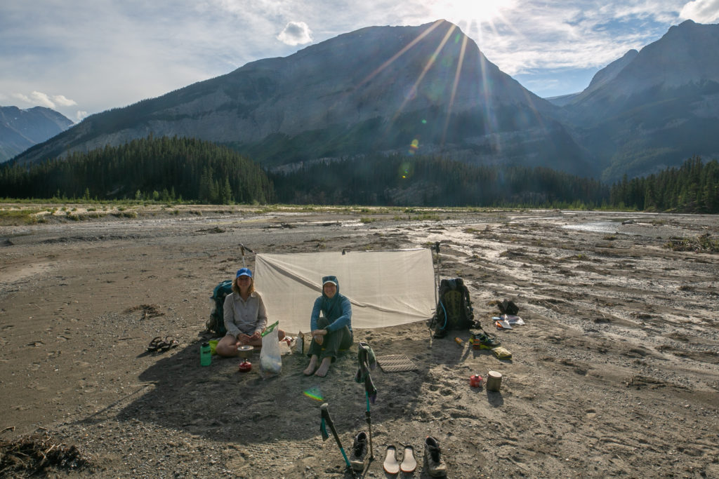
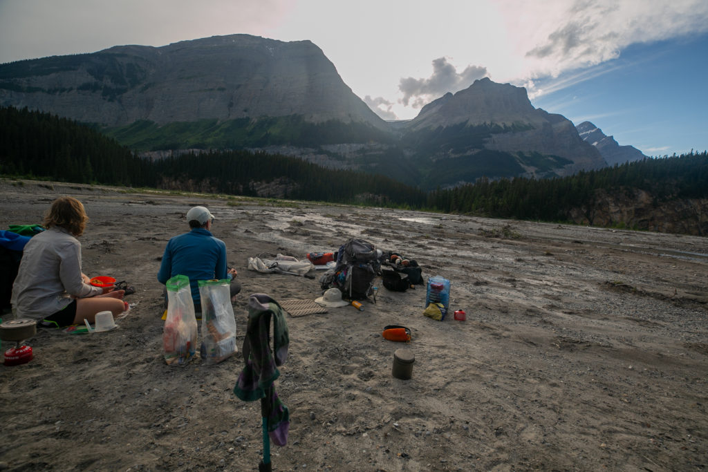
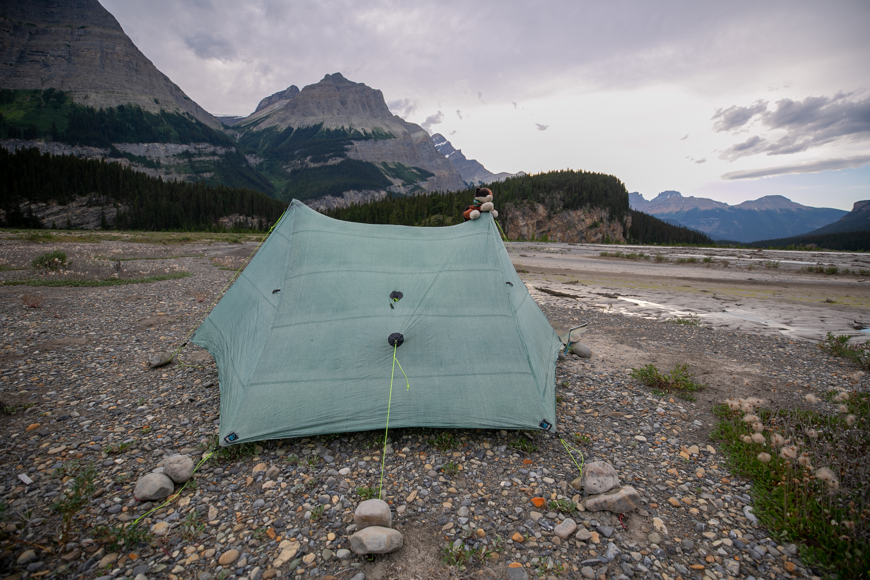
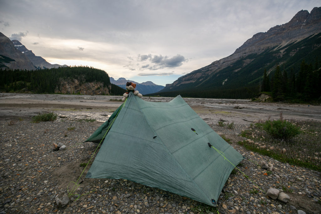
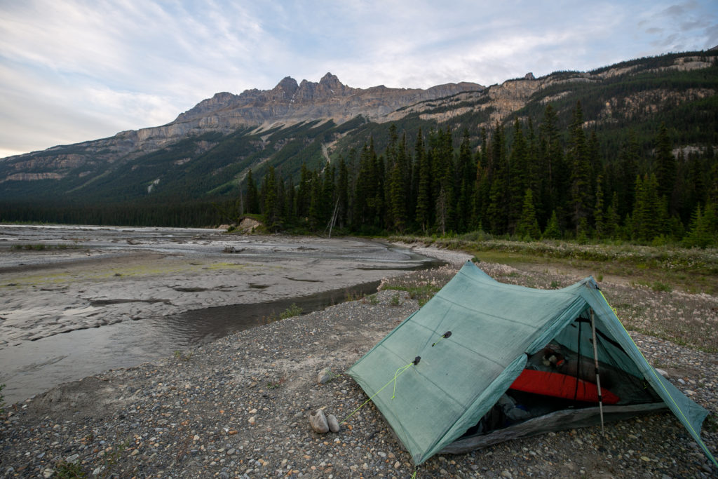
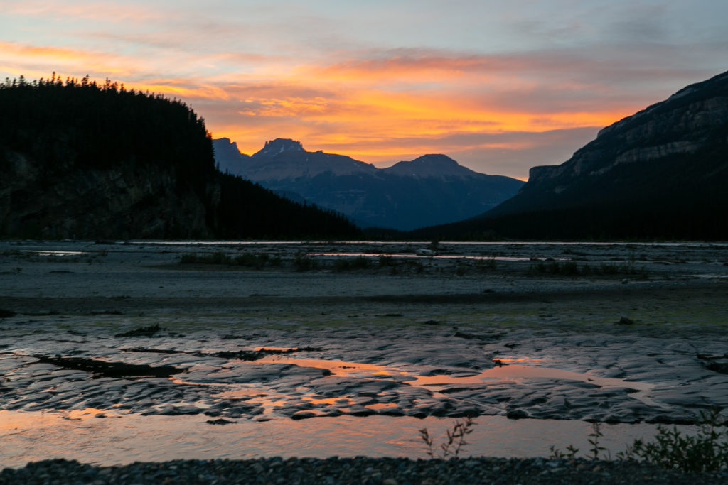
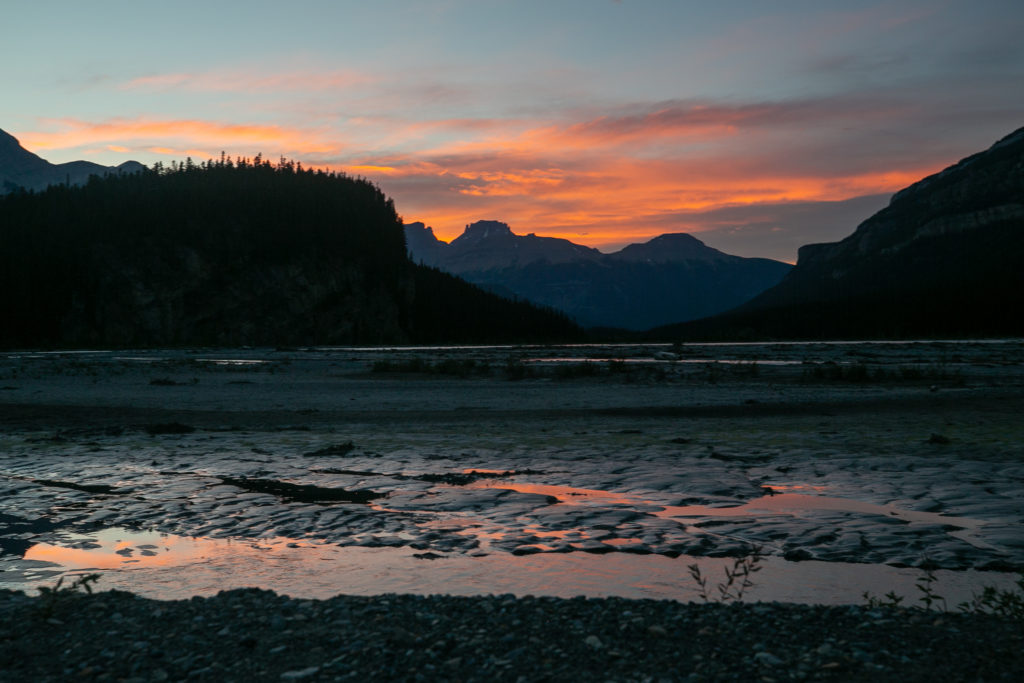
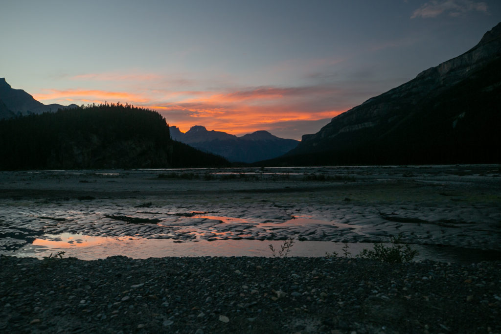
We arrived at horse camp just after 5pm. None of us were impressed by Horse Camp. It was just not an welcoming or engaging spot. We headed back to the trail and continued for just a few minutes. We stopped where the trail headed back into the forest and set up our camp for the evening on a sand bar. It was 5:10 pm when I dropped my pack about 10 hours since we left our camp on the side of the Blaeberry River. The sand bar was a great place to sit and relax but there was little shade and a lot of wind. We rigged up a sun shade/wind block using my ground sheet and poles and had a lovely evening on the sand bar. There were a couple of deep pools of water close by so Lillian and Sara decided to have a “spa day” in the refreshing and quite crisp water.

Sara and the sunshade.
Sara and Lillian enjoying the sandbar.

As we were relaxing on our sandbar a solo SOBO female hiker came out of the woods. She waded right through the water without a care. She barely broke stride to talk to us as her goal for the evening was to camp at Conway Creek which even at the pace she was hiking at would still be over an hour and it was getting late into the evening.

Sun is setting time to enjoy the view.
Dinner time. Looks like some homemade pasta.
Dinner and a view. Looking at my tent in on the ground makes me think I had already tried to set up the tent but the soft sand was not cooperating. Bear Canister doing double duty as a table.
Om nom nom.

It was very odd but as the evening progressed the water level around the sand bar appeared to be rising. I understand the increased melt in the afternoon sun would promote a higher streamflow in glacial feed streams and rivers. I would have thought as the sun was going down the peak flow should have abated but this did not seem to be the case. We were all pretty sure that the sandbar would not flood but we were not 100% sure and no one really wanted to wake up in the middle of the night with the river flowing through their tent. So after dinner we moved off the sandbar onto the shore but I still had trouble staking the tent. I had to place rocks on the stakes to keep them in. This is one of those times when I wished I had my additional poles for my Duplex tent to make it free standing. As we were setting up our tents a family of three came by and the smallest member of the family was just a baby! They stopped to talk for a couple of minutes. They had attempted to thru hike last summer, 2021, but had to abandon on Section D due to Covid 19. So they were finishing up this summer. They have a blog of their adventures, Backpacks and Bike Racks. When checking out their blog I found a reference to the three of us:

“And then we reached the beautiful relief of the floodplain again and to my delight, there were a couple tents pitched! And other hikers! A group of three that decided to do Section D as a section hike for some reason.”

They continued their hike and camped closer to Horse Camp but still on the river bank as we had done. I could see their tent in the distance was a Zpacks Duplex like mine but peach coloured. As a bonus for GDT hikers they had left drinks, mixture of pop and beer, under their car back at the Mistaya Canyon parking lot and told us to help ourselves.

Tent all pitched. Lots of rocks trying to keep the stakes in place. It did not work.
Another view of Frosty and the tent.
Our two tents. In the distance you can just make out the small peach coloured tent of the family.
The sandbar we spent the day on was just in front of the little rock outcrop in the distance.
The view from my tent, 7:45pm.
Pictures of the flood plain in the evening light.
Sunset.

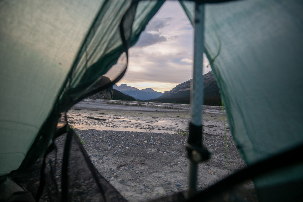
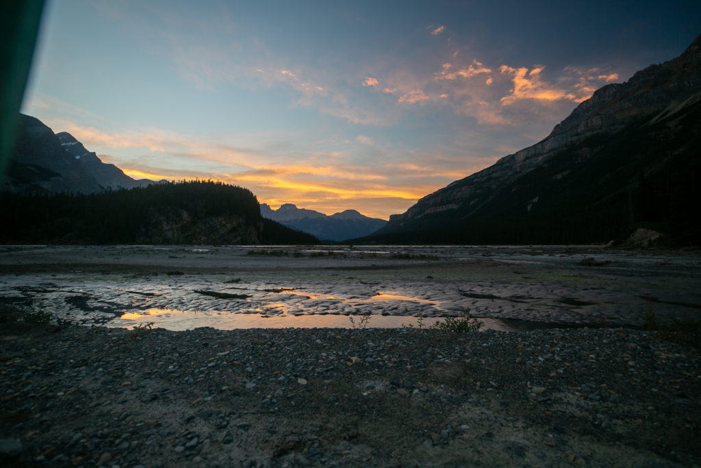
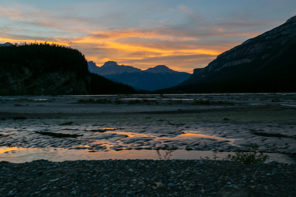
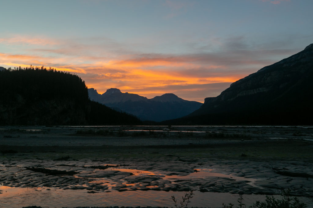
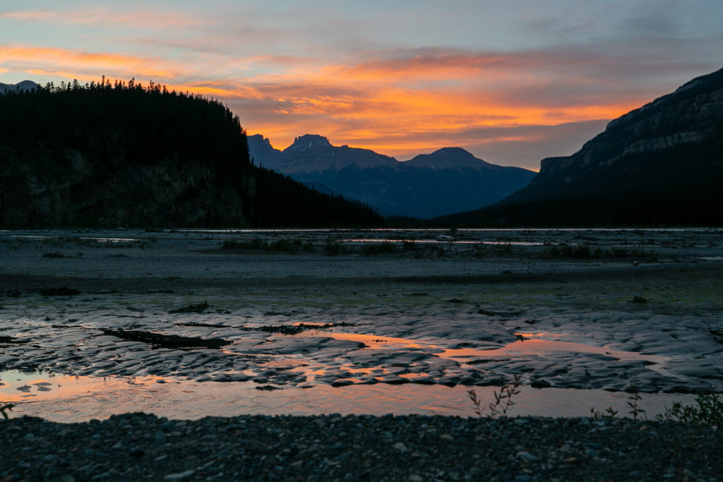
I spent quite some time taking photos of the night sky over the flood plain. At 8:10pm the sky really started to light up. As I was taking photos I heard Lillian ask Sara what she was doing. Sara said she heard Ian “Shutterbugging” (Shutterbug is my trail name) so she was looking out the tent to see what I was taking photos of. They were plenty of ohhs and ahhs from their tent as they took in the night sky. I found it amusing that my trail name had become a verb.

The glory of the flood plain.

I cannot believe with all the doubts that had swirled through my head that I am going to finish Section D. It has been an absolutely amazing and wonderful trip and I am going to be sad when it ends tomorrow.

Good night from the magical Howse Flood Plain

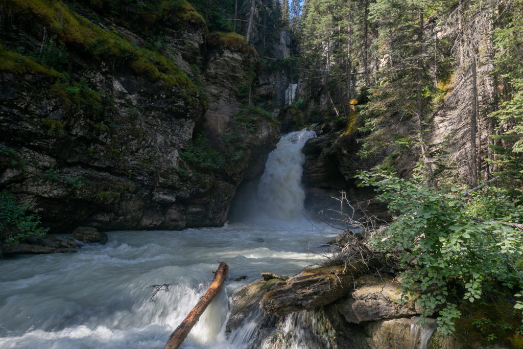
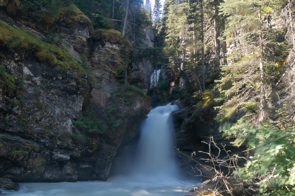
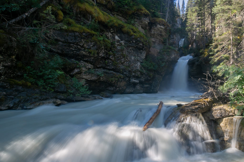
Today was day of many days. There was the avalanche slopes, walking through the river, the pleasant trail along the river, snacks by a waterfall, deadfall, the pass, the bushwhacking and the flood plain. Just one more sleep until I see Laura and Margaux. Good night from the Howse Flood Plain.

GDT Section 2022 Section D Day 6

GDT Section 2022 Section D Home

bootwreckers

Day 3 of my New Years adventure in Arizona up on B Day 3 of my New Years adventure in Arizona up on Bootwreckers, see link in bio.

Hiked the Superstition Ridgeline Trail, 23 km of some very rough terrain.

The views from the ridge were spectacular. The trail is more of a route, then a trail. I got off trail a half a dozen times just on the ascent to the ridge. Sprinkled in for fun where several down climbs where I had to drop my poles before climbing down a small chimney or crack.

There is camping possibilities on the ridge and I do wish I would have camped just before Syphon Draw and enjoyed the sunset. Maybe next time.

This was a very challenging 10.5 hrs on the trail, one of my hardest days ever, but worth every drop of sweat.

Till next time Arizona.

#nationalparks, #slotcanyon, #hiking, #hikingadventures, #familytime, #camping, #campingadventures, #outdoors, #outside, #nature,  #FIndyourpark #landscape #landscapephotography #optoutside #nationalpark #desertphotography #grandcanyon #grandcanyonnationalpark #grandcanyonassociation #nationalparkweek #reichallenge #nationalparksweek #rightnow #nationalparktrust #goparks #aztrails
Even in the smoke, there is nothing like hiking in Even in the smoke, there is nothing like hiking in the Canadian Rockies.

On the way to Pinto Lake, going over Sunset Pass with Tuft Peak in the distance.

#parkscanada #parks #bcparks #trails #longdistancehike #longtrail #outdoors #outside #thruhike #hike #thruhiking #outside #backpacking #waterfalls #waterfall #naturephotography #naturephotography #nationalparks #alberta, #albertaparks
Day 2 of my New Years Arizona Adventure is posted, Day 2 of my New Years Arizona Adventure is posted, see link in bio.

Fun and easy day exploring the Superstitions with my four new friends. Lots of varied terrain and lots of breaks. Will make up for that on Day 3.

I did run out of superlatives to describe the scenery, in one word it was simply spectacular!

#nationalparks, #slotcanyon, #hiking, #hikingadventures, #familytime, #camping, #campingadventures, #outdoors, #outside, #nature,  #FIndyourpark #landscape #landscapephotography #optoutside #nationalpark #desertphotography #grandcanyon #grandcanyonnationalpark #grandcanyonassociation #nationalparkweek #reichallenge #nationalparksweek #rightnow #nationalparktrust #goparks #aztrails
Day 1 of a fun two day trip out to Pinto Lake over Day 1 of a fun two day trip out to Pinto Lake over Sunset Pass.

It was a little smokey but as you can see from the first photo the views were spectacular.....

The little dot in Photo 9 is a Common Loon, and entertained us for several minutes swimming across the lake and diving for fish.

Big thanks to @kbsymington , @sio.mellors , Kylie and Charlie for making it such an awesome trip.

#parkscanada #parks #bcparks #trails #longdistancehike #longtrail #outdoors #outside #thruhike #hike #thruhiking #outside #backpacking #waterfalls #waterfall #naturephotography #naturephotography #nationalparks #alberta, #albertaparks
Day 1 of my 2023 New Years Arizona Adventure is up Day 1 of my 2023 New Years Arizona Adventure is up on Bootwreckers,  see link in bio.

Day started off rainy, see photo 2, but the clouds cleared off by 8 am and I finally got my hike started.

The day wasn't without adversity as I slipped chasing my water bottle in a stream and fell in the water. My camera got flooded and stopped working so the rest of the photos were taken on my aging BlackBerry Key 2.

Met up with a group of 4 med students and hiked with them for two days.

Despite the ruined camera was a super fun day on the trail in a new place. 

#nationalparks, #slotcanyon, #hiking, #hikingadventures, #familytime, #camping, #campingadventures, #outdoors, #outside, #nature,  #FIndyourpark #landscape #landscapephotography #optoutside #nationalpark #desertphotography #grandcanyon #grandcanyonnationalpark #grandcanyonassociation #nationalparkweek #reichallenge #nationalparksweek #rightnow #nationalparktrust #goparks #aztrails
It took a while but finally posted the intro to my It took a while but finally posted the intro to my New Years trip to Arizona, see link in bio.

I was greater in Arizona to 18C weather followed quickly by near freezing temperatures and the most rain in the Phoenix area in one day since 1906!

My trip went from Plan A, 4 days on the Arizona Trail,  through Plans B, C and Finally D.

Was a fun if sometimes frustrating adventure.

#nationalparks, #slotcanyon, #hiking, #hikingadventures, #familytime, #camping, #campingadventures, #outdoors, #outside, #nature,  #FIndyourpark #landscape #landscapephotography #optoutside #nationalpark #desertphotography #grandcanyon #grandcanyonnationalpark #grandcanyonassociation #nationalparkweek #reichallenge #nationalparksweek #rightnow #nationalparktrust #goparks #aztrails
Day 3 of Rockwall 2022 is up on Bootwreckers, see Day 3 of Rockwall 2022 is up on Bootwreckers,  see link in bio.

Sweet little day up and over Tumbling Pass with and a long view of Tumbling Glacier. 

The weather cooperated with blue skies and no threat of rain so we were able to linger at The Glacier before heading down the long descent to the car.

While a straightforward day there were still some adventures to be had, but you have to read about them on the blog.

Big thanks to my amazing hiking partner, @sio.mellors

Looking forward to our 3 day adventure this summer, which will no doubt generate more stories to tell.

#parkscanada #parks #bcparks #trails #longdistancehike #longtrail #outdoors #outside #thruhike #hike #thruhiking #outside #backpacking #waterfalls #waterfall #naturephotography #naturephotography #nationalparks
Day 2 of our Rockwall 2022 trip is posted on Bootw Day 2 of our Rockwall 2022 trip is posted on Bootwreckers, see link in bio. With @sio.mellors

This day was Helmet Falls CG to Tumbling Creek CG.

Day started off beautiful with blue skies which turned to rain after lunch. Somehow through all the rain and thunder Siobhan  never lost her smile.

The day ended with beers and Siobhan giving butt rubs to the doggies in camp.

Photo 1 Siobhan taking in the Rockwall at lunch

Photo 2 Helmet Falls at Golden hour

Photo 3 me and my morning coffee waiting for Siobhan to wake up

Photo 4 on the way up Siobhan with Limestone Peak in th background 

Photo 5 Siobhan at Rockwall Pass (can you tell?)

Photo 6 Siobhan near Wolverine Pass with Rockwall Peak shrouded in clouds

Photo 7 Tumbling Glacier through the clouds

Photo 8 setting up camp

Photo 9 Dinner time

Photo 10 butt rubs

#parkscanada #parks #bcparks #trails #longdistancehike #longtrail #outdoors #outside #thruhike #hike #thruhiking #outside #backpacking #waterfalls #waterfall #naturephotography #naturephotography #nationalparks
New trip posted, three day trip in the Rockwall in New trip posted, three day trip in the Rockwall in Kootenay NP with @sio.mellors. Introduction and Day 1 up on Bootwreckers.

Trip was suppose to be hiking Northover Ridge in Kanananaskis but smoke had us change plans at the last minute.

This would be my third multi day trip on the Rockwall but the first for Siobhan.

Managed to get two camping sites on the Rockwall and instead of smoke we had to deal with the threat of rain.

We did get wet but we had a blast.

Day 1 is from Paint Pots TH to Helmet Falls CG, with a side trip to get up close the the falls. Pretty straightforward day but visiting Helmet Falls is always special.

#parkscanada #parks #bcparks #trails #longdistancehike #longtrail #outdoors #outside #thruhike #hike #thruhiking #outside #backpacking #waterfalls #waterfall #naturephotography #naturephotography #nationalparks
The sixth and final day of our 2022 GDT Section D The sixth and final day of our 2022 GDT Section D hike is up on Bootwreckers, see link in bio.

This day took us from a random camp on the Howse Floodplain to the Mustafa Canyon parking lot. This was an adventurous day with bushwhacking, stream crossings and dead fall but a simply glorious end to a wonderful hike on the GDT. 

Again thanks  to Sara (@sd_kuz) and Lillian (@waterlilizee) for sharing this adventure with me. I am sure we will meet again on a trail someday.

Photo 1 - Morning Colors

Photo 2 - tents on the floodplain

Photo 3 - bushwhacking to start the day

Photo 4 - fields of flowers going to seed

Photo 5 - looking south down the Howse River

Photo 6 - thigh deep water crossing

Photo 7 - big views

Photo 8 - Sara crossing some dead fall

Photo 9 -Mistaya Canyon

Photo 10 - picked up a thru hiker named Roy, enjoying beverages left by Natasha and Kyle from Backpacks and Bikeracks

#greatdivide #greatdividetrail #gdt #parkscanada #parks #bcparks #trails #longdistancehike #longtrail #outdoors #outside #thruhike #hike #thruhiking #outside #backpacking #waterfalls #waterfall #naturephotography #naturephotography #nationalparks #duplex #sectionhike #sectionhiker
Day 5 of our 2022 Great Divide Trail Section D hik Day 5 of our 2022 Great Divide Trail Section D hike is posted on Bootwreckers, see link in bio.

Truly epic day on the trail. Pass through the debris of two avalanches, had lunch by a waterfall, crawled over so much dead fall and hiked on the Howse Flood Plain.

The sunset on the flood plain was one of most magical I have seen.

As always a big thanks to Sara (@sd_kuz) and Lillian (@waterlilizee) for sharing this adventure with me. The Team totally rocked the trail.

#greatdivide #greatdividetrail #gdt #parkscanada #parks #bcparks #trails #longdistancehike #longtrail #outdoors #outside #thruhike #hike #thruhiking #outside #backpacking #waterfalls #waterfall #naturephotography #naturephotography #nationalparks #duplex #sectionhike #sectionhiker
Evening light on Picketpost Mt. #aztrail #aztasso Evening light on Picketpost Mt.

#aztrail #aztassociation  #nps, #nationalparks, #slotcanyon, #hiking, #hikingadventures, #familytime, #camping, #campingadventures, #outdoors, #outside, #nature,  #FIndyourpark #landscape #landscapephotography #optoutside #nationalpark #desertphotography #grandcanyon #grandcanyonnationalpark #grandcanyonassociation #nationalparkweek #reichallenge #nationalparksweek #rightnow #nationalparktrust #goparks #aztrails
Arizona Trail Passages 14 and 15. Some photos of Arizona Trail Passages 14 and 15.

Some photos of my recent hike down a couple of Passages of the Arizona Trail. 

The trail is so diverse, rolling terrain cut by shallow washes leads to the expanse of the desert then into rugged canyons and tall peaks, all in a space of 92 km (58 miles).

Had a great time, some blisters gave me some concerns but they seem to be doing fine now that they are out of my hiking shoes.

Got lucky with Trail Magic courtesy of Condiments who drove his 4x4 deep into an unarmed wash, was really in the middle of no where, and then again at the start of Passage 15, missed the Trail Angel's name, the wind was so loud.

Like to thank my Trail Angels, Carole for driving me to Oracle to start the trip, with side trip to a Hayden Az, a real ghost town and to Edith for leaving a water cache for me at Passage 15.

Included a video of my time at the high point for Passage 15. My kid likes it when you stop and enjoy the view you earned, thought they would appreciate my effort in the face of 1000 mph winds (ok maybe thats a bit of an exaggeration).

Thanks Arizona and the AZT for providing more memories.

I will be back

#aztrail #aztassociation  #nps, #nationalparks, #slotcanyon, #hiking, #hikingadventures, #familytime, #camping, #campingadventures, #outdoors, #outside, #nature,  #FIndyourpark #landscape #landscapephotography #optoutside #nationalpark #desertphotography #grandcanyon #grandcanyonnationalpark #grandcanyonassociation #nationalparkweek #reichallenge #nationalparksweek #rightnow #nationalparktrust #goparks #aztrails
That sunset says when I wake up it will be time to That sunset says when I wake up it will be time to start my hike on the Arizona Trail, Passages 14 and 15

Love my little motel in Superior, Az, Copper Mt Motel. Has murals painted on all the buildings

Spied the Grand Canyon from the plane 

Adventure awaits 

#aztrail #aztassociation  #nps, #nationalparks, #slotcanyon, #hiking, #hikingadventures, #familytime, #camping, #campingadventures, #outdoors, #outside, #nature,  #FIndyourpark #landscape #landscapephotography #optoutside #nationalpark #desertphotography #grandcanyon #grandcanyonnationalpark #grandcanyonassociation #nationalparkweek #reichallenge #nationalparksweek #rightnow #nationalparktrust #goparks #aztrails
Frosty Paws all packed and ready for an adventure. Frosty Paws all packed and ready for an adventure.

Arizona Trail Passages 14 and 15 starting Sunday

Off weekend gooooooo!

#aztrail #aztassociation  #nps, #nationalparks, #slotcanyon, #hiking, #hikingadventures, #familytime, #camping, #campingadventures, #outdoors, #outside, #nature,  #FIndyourpark #landscape #landscapephotography #optoutside #nationalpark #desertphotography #grandcanyon #grandcanyonnationalpark #grandcanyonassociation #nationalparkweek #reichallenge #nationalparksweek #rightnow #nationalparktrust #goparks #aztrails
Last weekend before heading to Arizona for a four Last weekend before heading to Arizona for a four day adventure on the Arizona Trail.

I wonder if hiking in the 15 cm of fresh snow will be good prepared for hiking the deserts of Passages 14 and 15?

#aztrail #aztassociation  #nps, #nationalparks, #slotcanyon, #hiking, #hikingadventures, #familytime, #camping, #campingadventures, #outdoors, #outside, #nature,  #FIndyourpark #landscape #landscapephotography #optoutside #nationalpark #desertphotography #grandcanyon #grandcanyonnationalpark #grandcanyonassociation #nationalparkweek #reichallenge #nationalparksweek #rightnow #nationalparktrust #goparks #aztrails
Day 4 of our 2022 GDT Section D hike is up on the Day 4 of our 2022 GDT Section D hike is up on the website, see link in bio.

This was a truly epic day spent on the Amiskwi and Collie Creek Alternates.

The weather cooperated starting with a spectacular sunrise on the Mummery Glacier, rainbows and blue skies on the ridge.

We had a brief encounter with a little black bear who scampered quickly away. 

Finished off the day with a cold beer, Grizzly Paw Rutting Elk Red, that I had carried with me and it tasted great.

Easily one of th best days on the trail ever.

Again big thanks to Sara (@sd_kuz) and Lillian (@waterlilizee) for sharing this adventure with me. The Team totally rocked the trail.

#greatdivide #greatdividetrail #gdt #parkscanada #parks #bcparks #trails #longdistancehike #longtrail #outdoors #outside #thruhike #hike #thruhiking #outside #backpacking #waterfalls #waterfall #naturephotography #naturephotography #nationalparks #duplex #sectionhike #sectionhiker
Day 3 of our 2022 Section D hike is posted, see li Day 3 of our 2022 Section D hike is posted, see link in bio.

This was a shorter day, only about 17 km but took us from the end of the Kiwetinok Alternate up to Amiskwi Pass and then a beautiful meadow at the the base of the Amiskwi Ridge.

Photo 1 - morning sky

Photo 2 - on the Kiwetinok Alternate

Photo 3 - Kiwetinok Alternate

Photo 4 - break time at a stream crossing, Frosty Paws hanging in there

Photo 5 - Fireweed with a view down the Amiskwi Valley,

Photo 6 - fields of flowers as we approached Amiskwi Pass

Photo 7 - Yellow Columbine on the way up to Amiskwi Lodge

Photo 8 - Our camp in the meadow

Photo 9 - Setting sun

Photo 10 - one of the best adventure stories ever! True story of how three prisoners of war escaped and climbed Mt Kenya

Again big thanks to Sara (@sd_kuz) and Lillian (@waterlilizee) for sharing this adventure with me. The Team totally rocked the trail.

#greatdivide #greatdividetrail #gdt #parkscanada #parks #bcparks #trails #longdistancehike #longtrail #outdoors #outside #thruhike #hike #thruhiking #outside #backpacking #waterfalls #waterfall #naturephotography #naturephotography #nationalparks #duplex #sectionhike #sectionhiker
First two days of my 2022 Great Divide Trail Secti First two days of my 2022 Great Divide Trail Section D adventure are up on the blog, see profile for link.

Day 1 was from Burgess Pass Trail head to Yoho Lake Campground. A relatively short day but a good warm up for the rest of the trip.

Big thanks to Sara (@sd_kuz) and Lillian (@waterlilizee) for sharing this adventure with me. The Team totally rocked the trail.

Photo 1 - at Burgess Pass looking at Mt Wapta

Photo 2 - Flowers, it was a great time to hike to see all the flowers in August bloom

Photo 3 - Emerald Lake from up high

Photo 4 - at Yoho Pass, did I mention the flowers

Photo 5 - Duplex tent all set up with Frosty Paws on guard, and oh ya, more flowers

Photo 6 - the north end of Wapta Mt as seen from Yoho Lake.

Super fun little day, the opening a grand adventure.

#greatdivide #greatdividetrail #gdt #parkscanada #parks #bcparks #trails #longdistancehike #longtrail #outdoors #outside #thruhike #hike #thruhiking #outside #backpacking #waterfalls #waterfall #naturephotography #naturephotography #nationalparks #duplex #sectionhike #sectionhiker
Sound On. Video clips from my hike along th Supe Sound On. 

Video clips from my hike along th Superstion Ridgeline.

Was an epic hike, 24km from my campsite at Miners Needle to First Water Trailhead where my car was.

Wouldn't recommend doing all in one day backpacking, as the final descent down Siphon Draw Wash is brutal, but I did it in 10hrs 45min

Would love to redo th hike at some point and actaull stop and camp along the ridge.

I had enough water to stop, but I was enticed by the prospects of a beer to finish.

#teamzpacks #zpacks #zpacksduplex #aztassociation #aztrail #aztrails #hike #loveazt #desertphotography #desert #hikingadventures #hikes #backpacking #camping #getoutside #familytime #traillife #aztassociation , #hiking, #hikingadventures, #familytime, #camping, #campingadventures, #outdoors, #outside, #nature,  #FIndyourpark #landscape #landscapephotography #optoutside  #rightnow #goparks #aztrails #aztrail #loveazt  #azt #arizonatrailassociation
Load More Follow on Instagram

For more photos of these and other Bootwreckers Adventures

© 2023 Boot Wreckers | Powered by Minimalist Blog WordPress Theme