Skip to content
Boot Wreckers
Menu
  • Home Page
  • Hiking Day Trips
    • Angels Landing – 2015
    • Aylmer Lookout Banff NP
    • Mt Allan Traverse (Centennial Ridge)
    • Mt Nomad (almost) – Kanananaskis Country
  • Backpacking – Overnights
    • Baker Lake 2020 Banff NP
    • Exploring Waterfalls with Volcano – Yoho NP
    • Fish Lakes – Banff NP, Alberta
    • Floe Lake/Numa Creek, Kootenay NP, British Columbia
    • Floe Lake (Revisited 2019) – Kootenay NP
    • Grand Canyon Corridor Backpacking Trip
    • Hermit Trail to Hermit Meadows – Glacier NP, British Columbia
    • Howard-Douglas Lake – Banff NP (2017)
    • Leman Lake – Banff, NP
    • Mystic Lake – Banff NP
    • Ribbon Lake Kananaskis Prov. Park 2016 – Ribbon Creek Route
    • Ribbon Lake Kananaskis Prov. Park 2017 – South Buller Pass Route
    • Simpson and Healy Pass – Banff NP (2016)
    • Stenton Lake – Alberta Wildlands Prov. Park
  • Backpacking – Multi Day
    • Arizona New Years Adventure 2023
    • Arizona Trail Passages 16 17
    • Arizona Trail Passages 14 15 2023
    • Brazeau Loop – Jasper National Park
    • Colorado River Float Trip 2015
    • Egypt Lake Epic – Banff NP
    • Egypt Lake Exploration 2021- Banff NP
    • Grand Canyon Hermit – South Kaibab
    • Grand Canyon – Tanner/Beamer Trail
    • GR20 – Corsica
    • Great Divide Trail Hike – Section C 2020
    • Great Divide Trail Hike – Section D 2022
    • Great Divide Trail Hike – Section E 2021
    • Green River Canoe Trip 2017
    • Iceline/Twin Falls – Yoho NP 2020
    • Kilimanjaro – Tanzania
    • Mt Assiniboine Lollipop – Banff NP
    • Rockwall North 2020 Kootenay NP
    • Rockwall 2022 – Paint Pots to Numa Creek, Kootenay NP
    • Sawback – Banff NP
  • The Team
  • Contact Us
Menu

Day 8 GDT 2021 – Section E

Looking back at the sunrise from the 2nd pass.

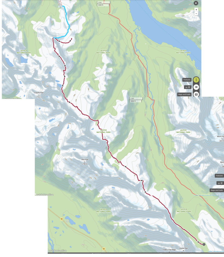
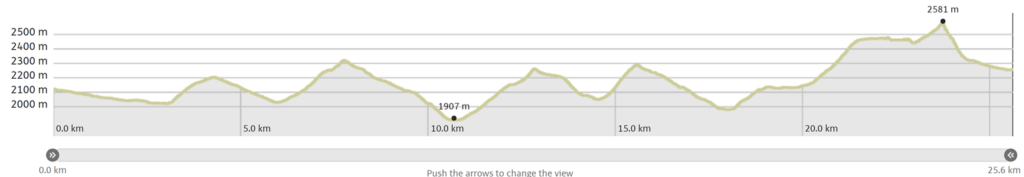
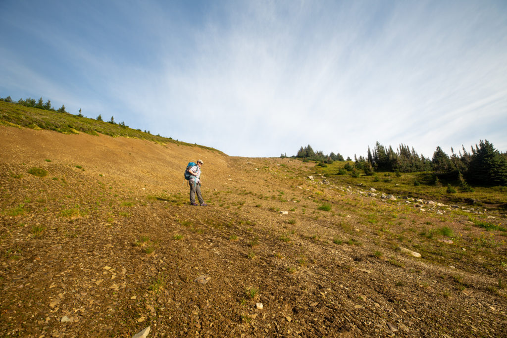
Day 8, August 18th, First Valley Six Passes to Random Camp Bald Hills. 26 km, 1600 m elevation gain, 1450 m elevation loss, 12 hrs 20 min (Segment 27 Six Passes Alternate).

Our hike Day 8. Blue line at top of map is Six Passes Alternative and where it joins the Parks Canada Trails. We deviated from the trail during the scramble off the ridge and random camped on the Bald Hills.
Little video of our hike

The sky was clear overnight and the temperature dropped steadily through the night. I started off quite comfortable in my -9 C down Marmot sleeping bag but at some point during the night I started to feel cold. I ended up pulling my down jacket inside my sleeping bag and sleeping with like a mini blanket. I was warm enough and slept well for the rest of the night but I am quite concerned about my sleeping set up as the temperature overnight did fall below freezing but it was not close to -9 C. Waking up and looking out of the tent in predawn light I could see frost on the ground sheet.

Frost on the ground sheet. It was a chilly morning.

I was out of the tent at about 5:30 am and set off to retrieve the bear canisters and get the coffee ready. It may have been an early start and we had a long way to go but we still needed to start the day with a hot soothing coffee. We had the tent all packed up and were on our way by 6:20 am. Our spirits where very high. I am not sure if we were not just a little naive of what lay ahead of us after successfully completing just one pass.

Frost on the ground. Pretty pink sky. Can see the small hummocks that litter the valley floor.
Micah with gloves on and their Buff on under their hat. Shackle Peak (2867 m).
Pass #2 in the distance. Looks pretty straightforward from here.
Frost collecting on my shoes. I believe I am hiking with my jammie bottoms under my pants for early day warmth.

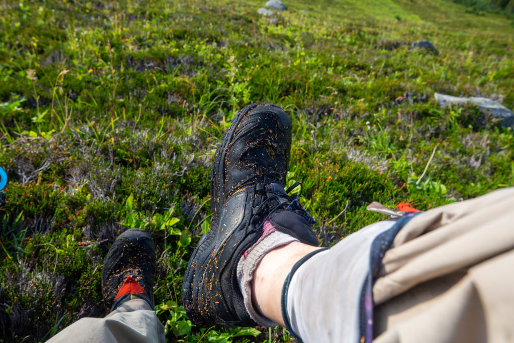
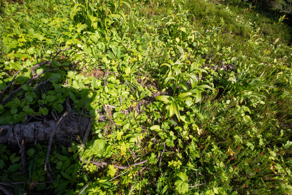
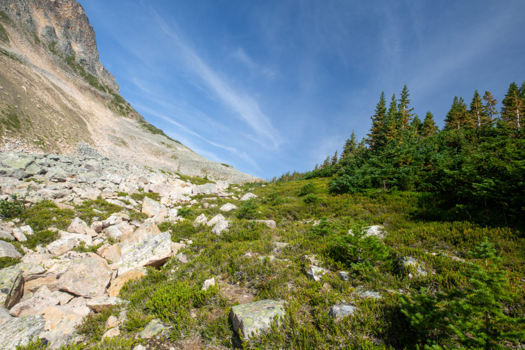
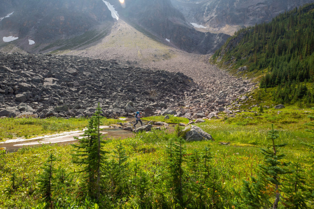
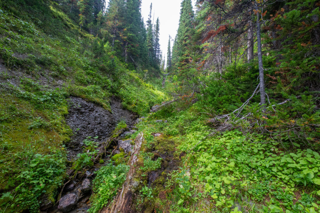
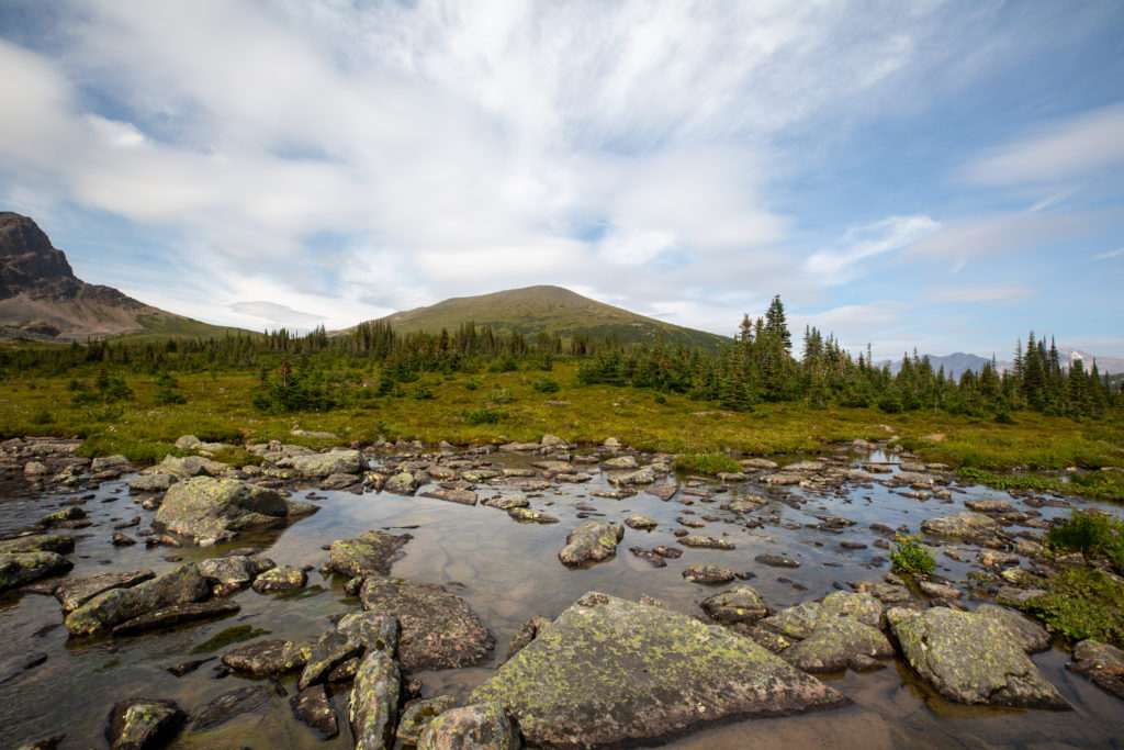
It was about a 3 km hike to the base of the 2nd pass. Where the creek draining the valley flows under the 2nd pass the ground flattened out creating a marshy area. It appeared that we would have another day with wet feet.

First stream crossing for the day.
Looking back to the valley. Great shot of the hummocks that we had to walk across.
There is a thin layer of ice on the water.

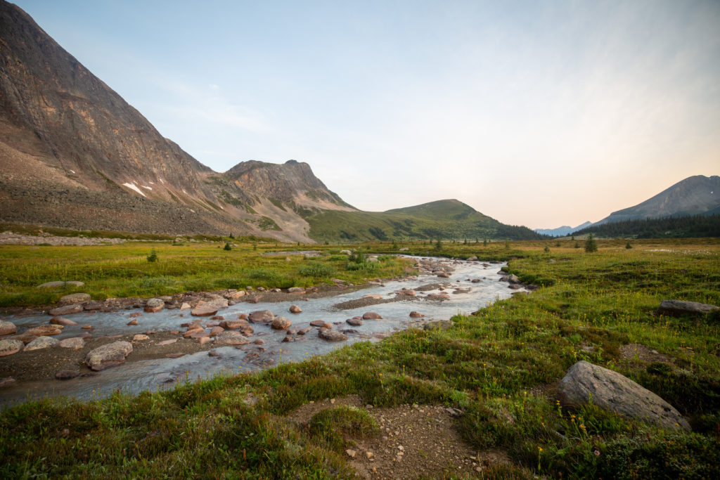
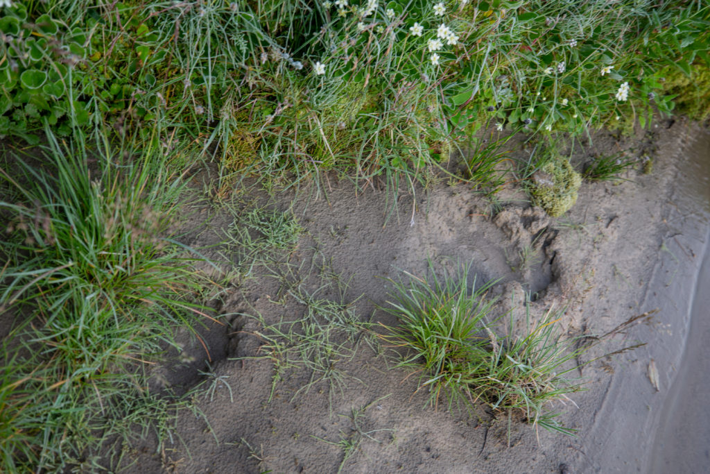
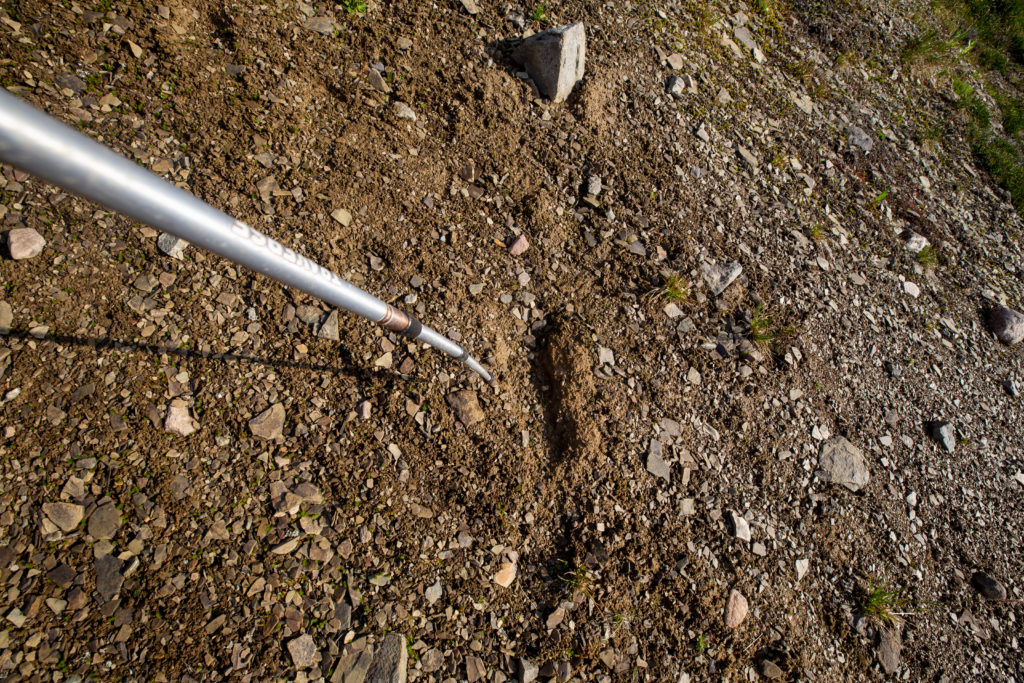
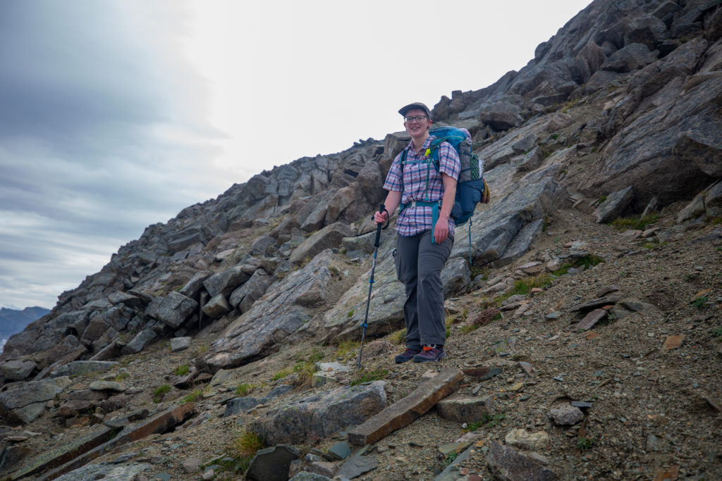
To avoid the marshy ground we cut to the left and walked across a small boulder field to the base of the pass. Just as we started up the pass we spied a bear print in the mud. We knew that there are bears around but we never did see one.

We hiked across the rocks to keep our feet dry.
Couple of bear prints.

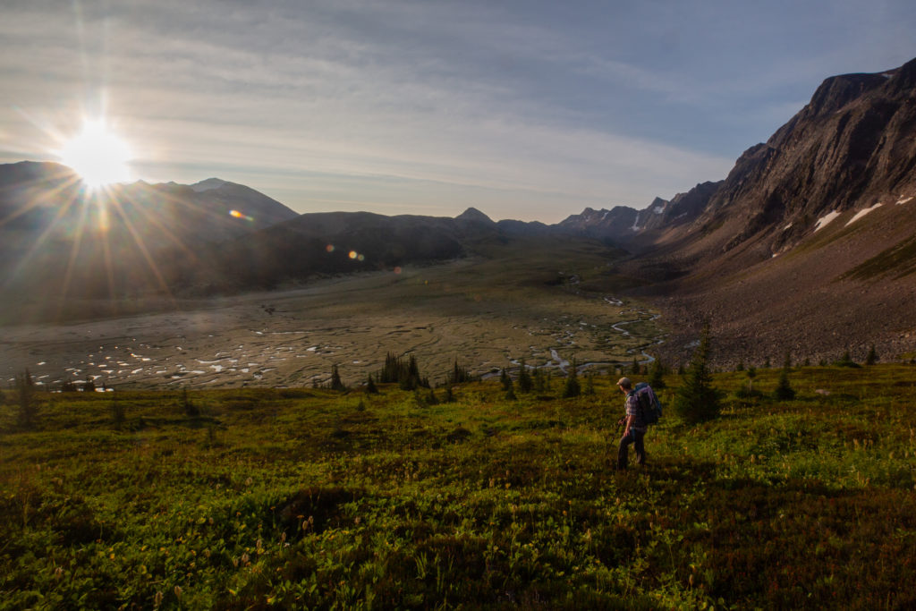
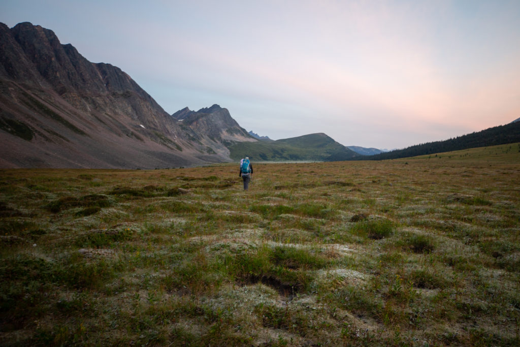
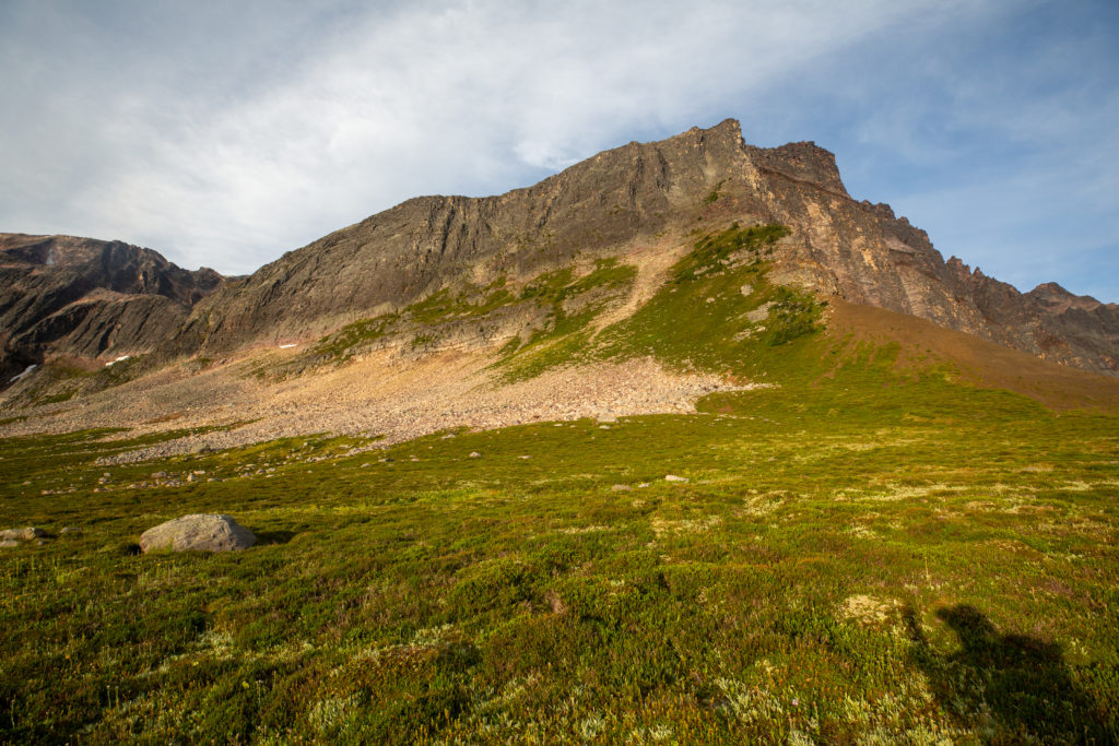
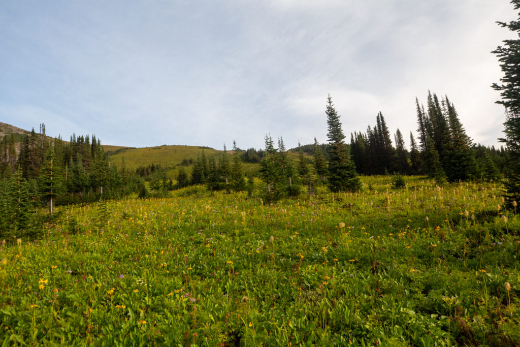
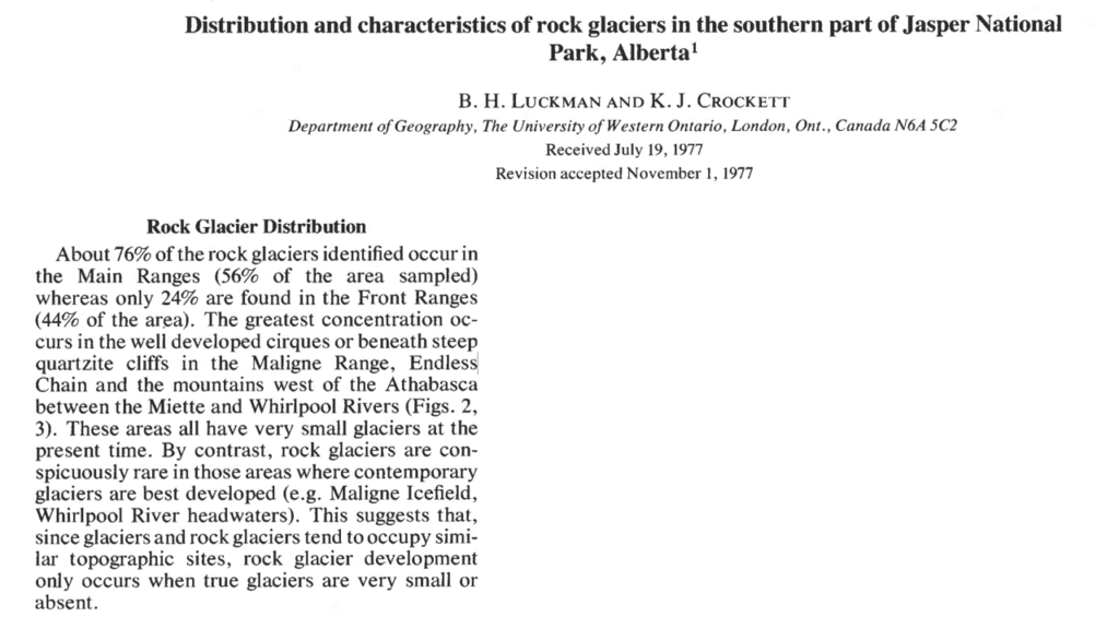
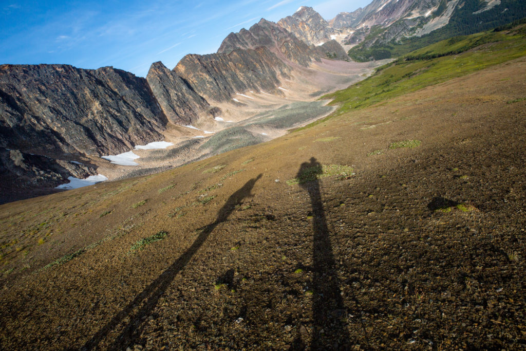
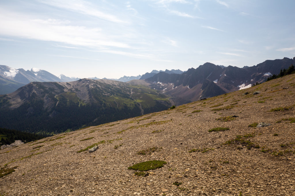
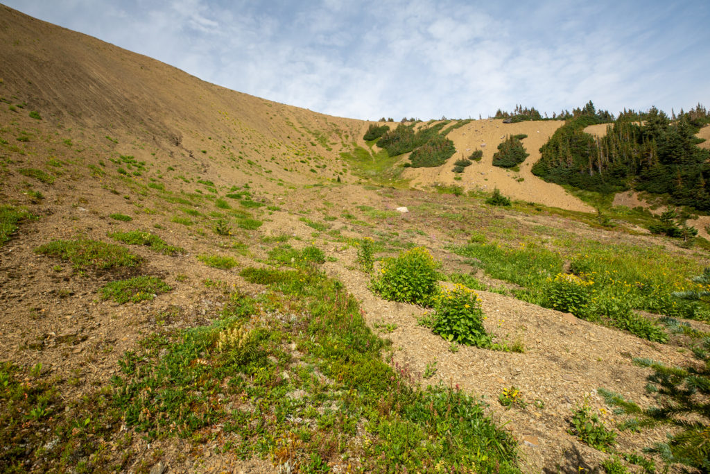
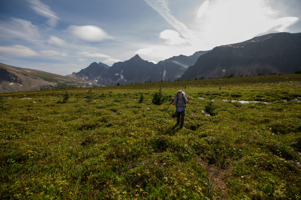
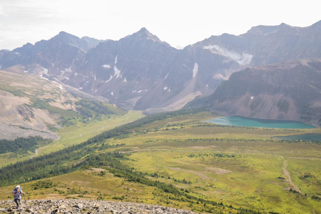
From the base of the pass it looked like a pretty straightforward hike up a grassy slope. The pass rose 120 m over 1 km. We headed up the pass zigzagging back and forth creating our own switchbacks. Halfway up we were treated to an spectacular sunrise. We both stopped to take in the view. It was a truly awesome way start to the morning.

The slope up the 2nd pass.
Sun is coming up as we pick our own routes up the slope.
Micah pausing to take in the sunrise.

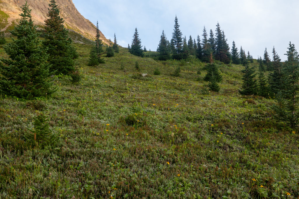
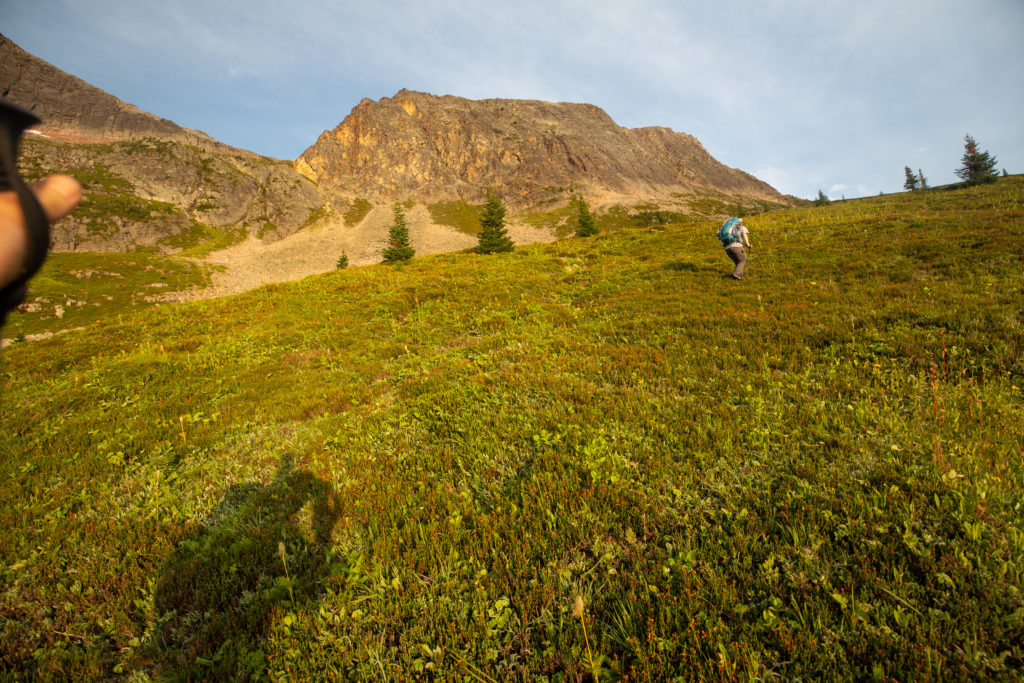
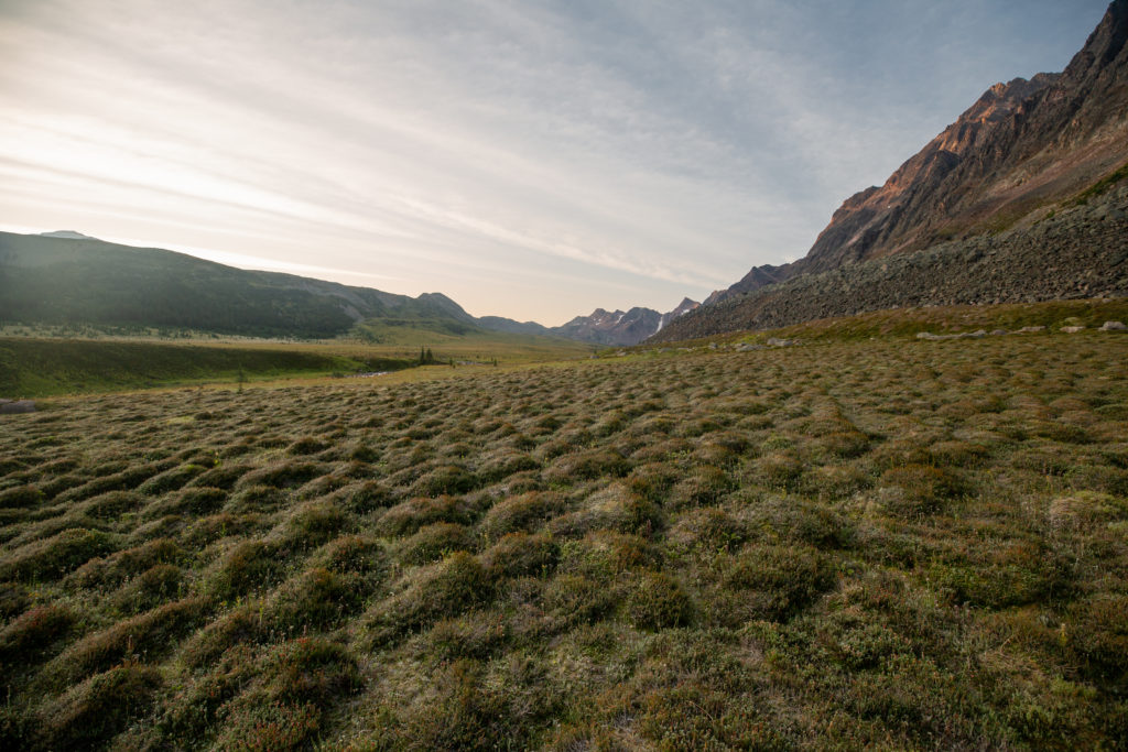
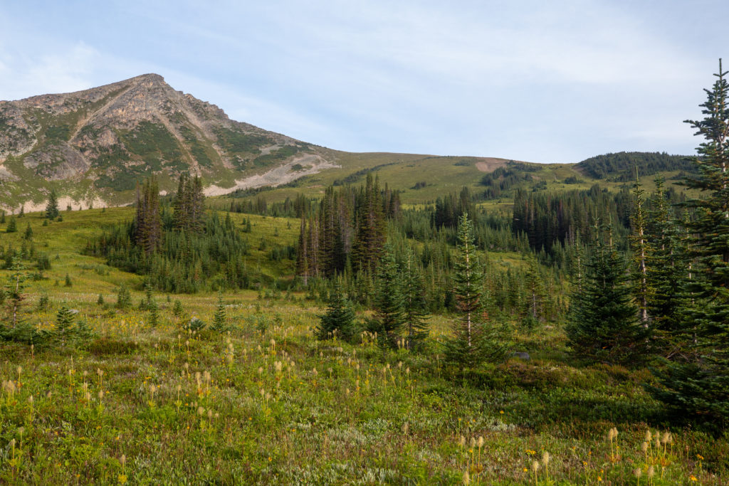
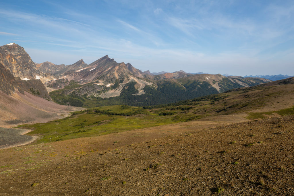
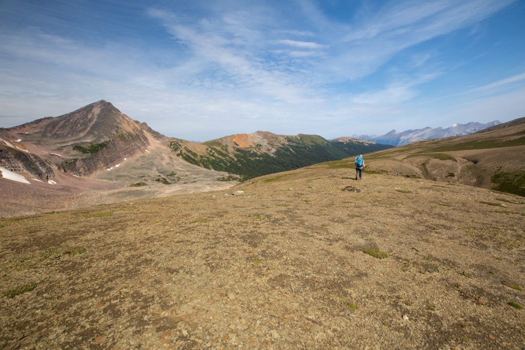
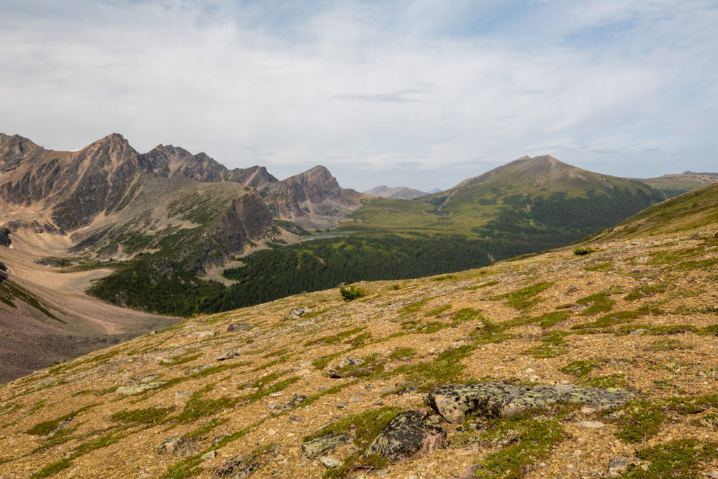
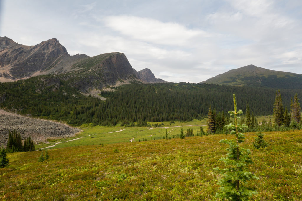
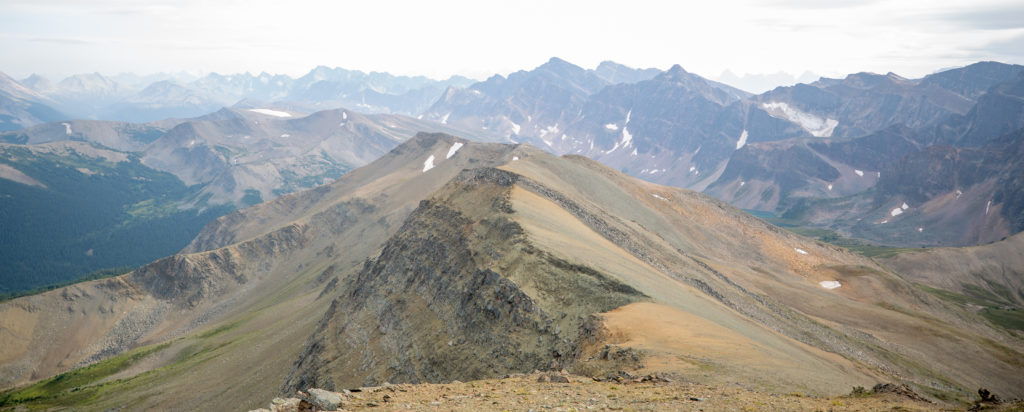
We arrived at the top of the grassy pass after just 40 minutes of relatively easy hiking. We had a clear view of the 3rd pass which appeared to be another grassy walk. We we feeling very good with two of the six passes down and the prospects of another easy ascent for the 3rd pass.

One last look back to the first valley and the 1st pass in the distance. Can clearly see how wet the ground is at the base of the pass. Good that we stayed near the base of the cliffs.
Arrival at the top of the 2nd pass.
First view of the 3rd pass. Our plan was to hike up around the left end of the trees at the base of the pass then hike diagonally up the pass aiming first for the dirt drainage and then to the lowest point on the ridge.
The stunning cliffs of the Endless Chain Ridge.
Our first view of Maligne Lake

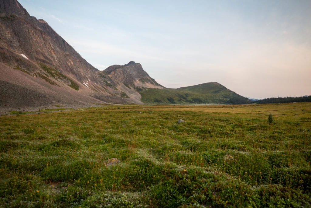
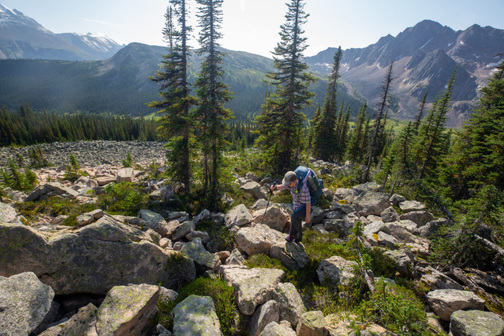
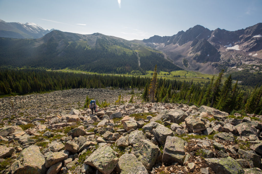
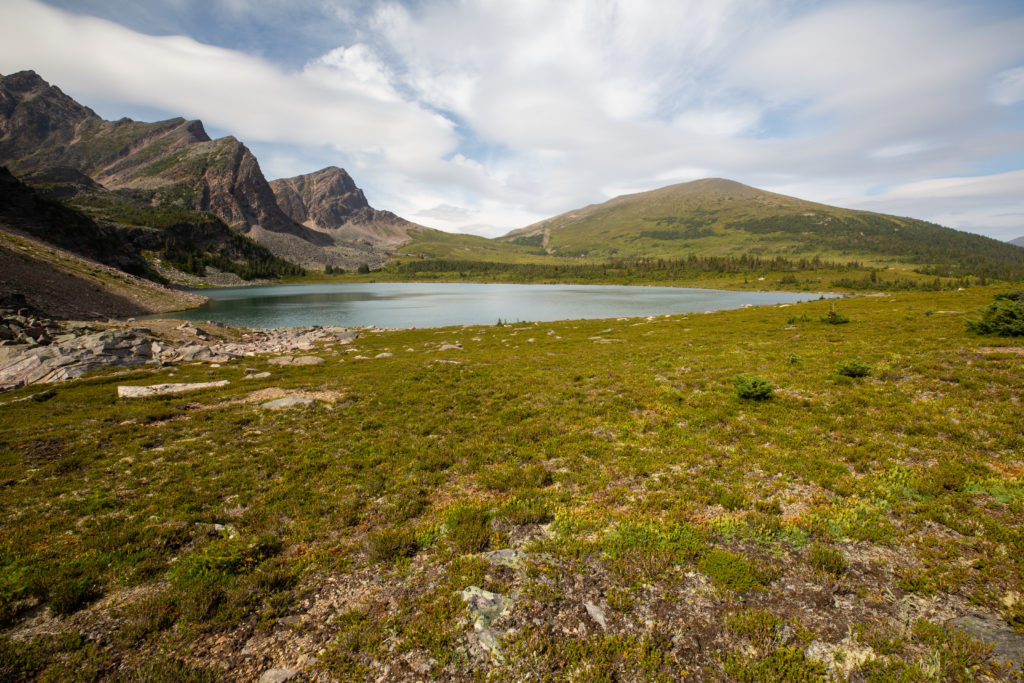
As we made our way down the first pass of the day we had a boulder field on our left. I kept wondering if it made sense to attempt to cut across boulder field to have a more direct path to the bottom. When we got onto the 3rd pass and looked back it was evident that that the best route down the 2nd pass is just to hike to the right (east) and stay on the grassy slope and head to the bottom of the valley. Near the valley floor the ground got quite soggy and it was impossible to keep our feet dry. The best strategy was just to accept the wet feet and march forward. We arrived at the bottom of the valley about 30 minutes after the top of the 2nd pass pass. It was now it was time to head up pass number three.

We would hike in the little space between the boulder field and the trees at centre. It may have been easier to walk on the green slope on the right than squeezing between the trees and the rocks and a creek we could not see.
Its a very sudden division between the rocks and vegetation.
At the valley bottom. There we had another little stream crossing then just headed uphill.
Micah taking a moment to look back.
Flower season appears to be over but there is still a little colour.

After about 25 minutes of heading uphill we stopped for a break and for Micah to tend to their feet. Micah had a couple of hot spots but quick treatment prevented their from getting any blisters. The walking was no more challenging for the 3rd pass than it was for the previous pass. At 280 m of elevation gain the 3rd pass did rise over twice what the 2nd pass did and I feel it made the pass more mentally challenging as the top did not get closer very quickly.

My feet are so wet. I wondered if my shoes will ever be dry again.
Micah putting our blister tape to work.
Micah disappearing over a small ridge.
Footprints. People have gone before us.
This is steeper than it looks. We made our own switchbacks to gain the top.
The ghost behind the camera.
Looking back to the 2nd pass from near the top of the 3rd pass.

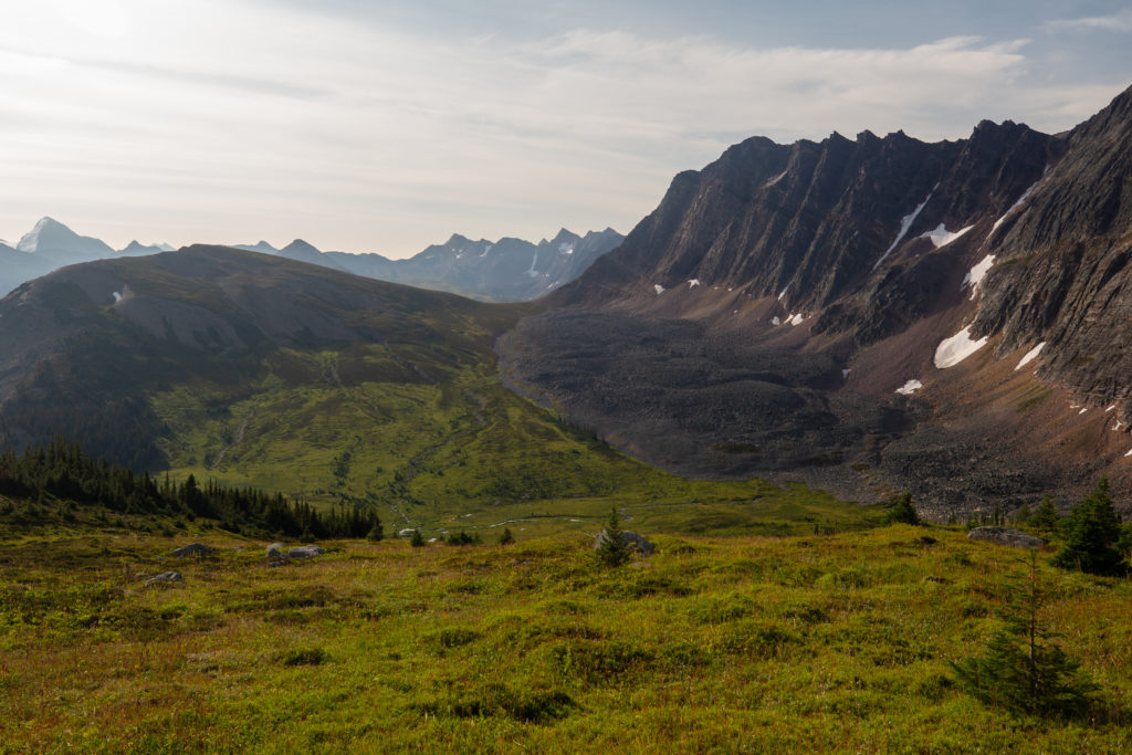
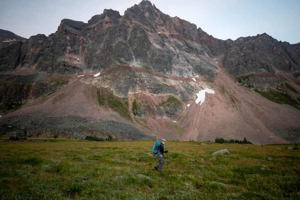
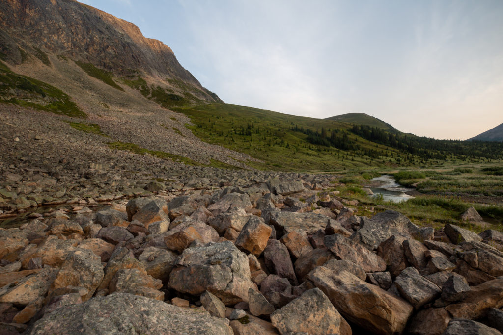
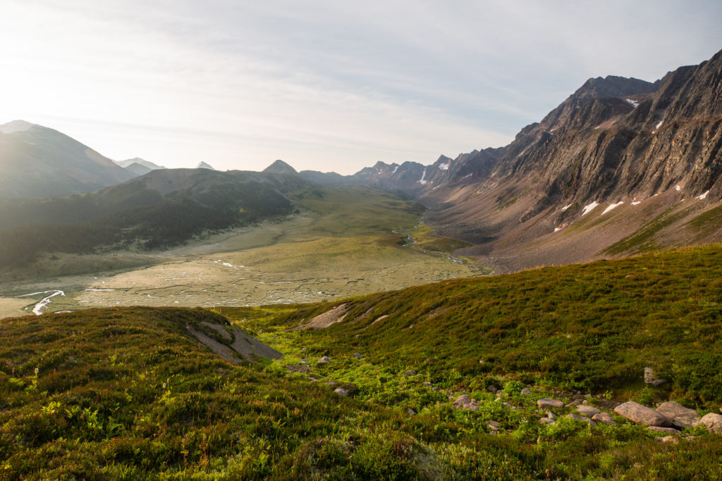
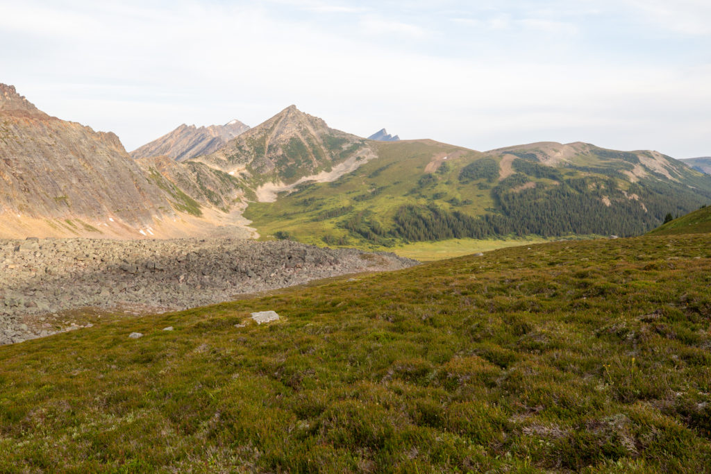
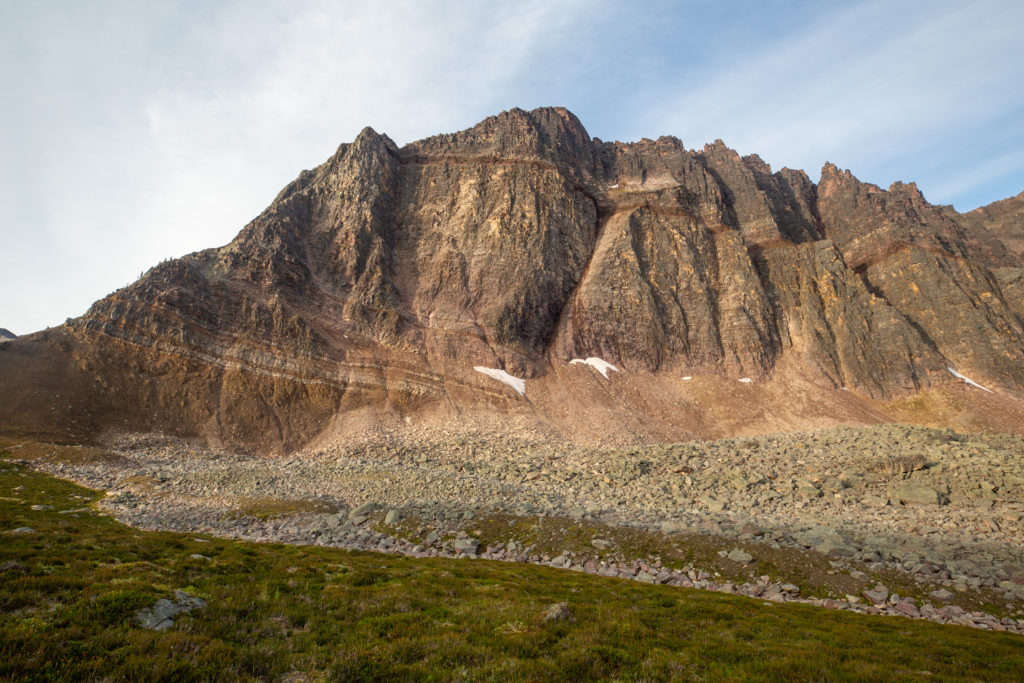
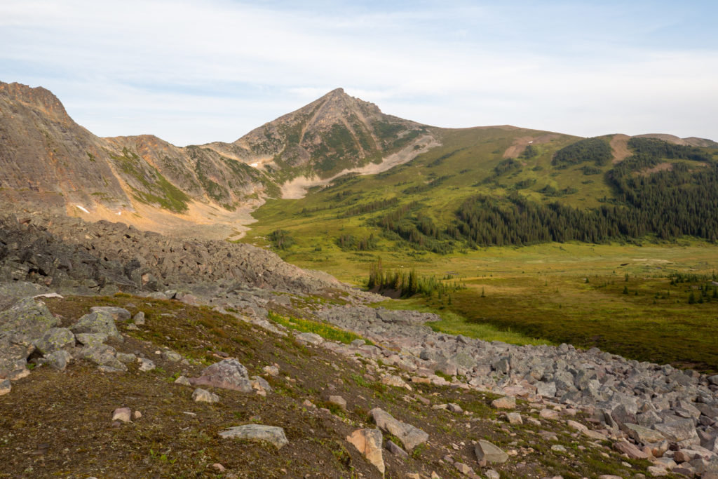
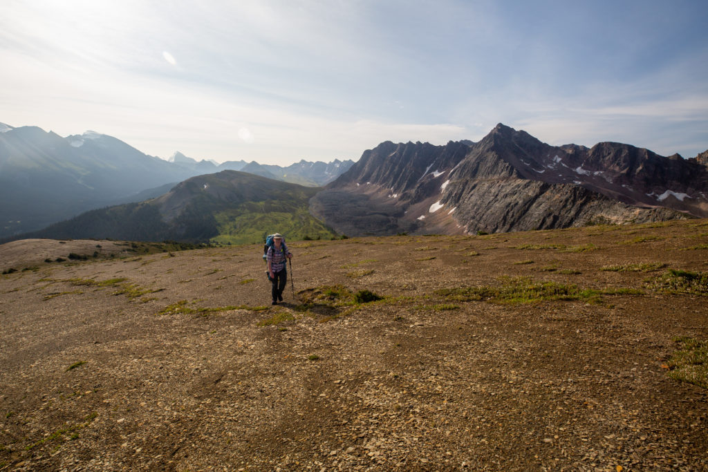
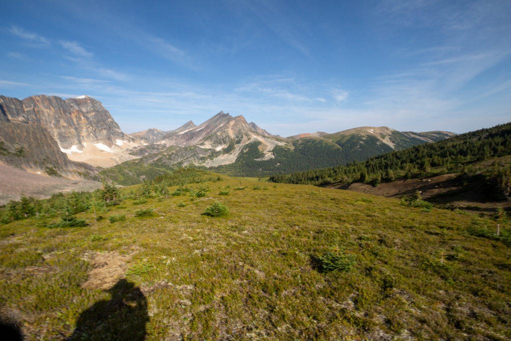
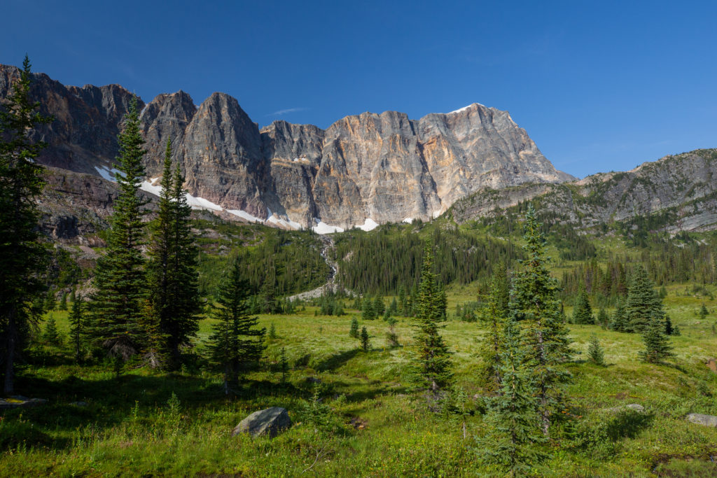
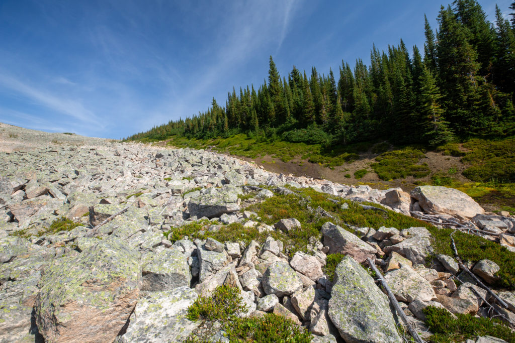
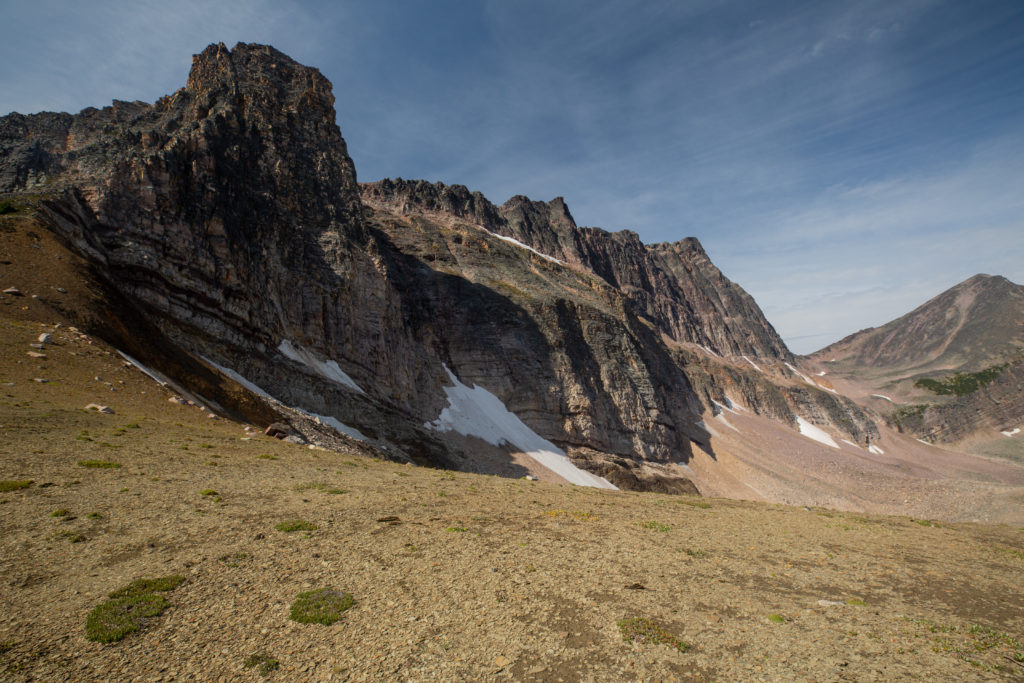
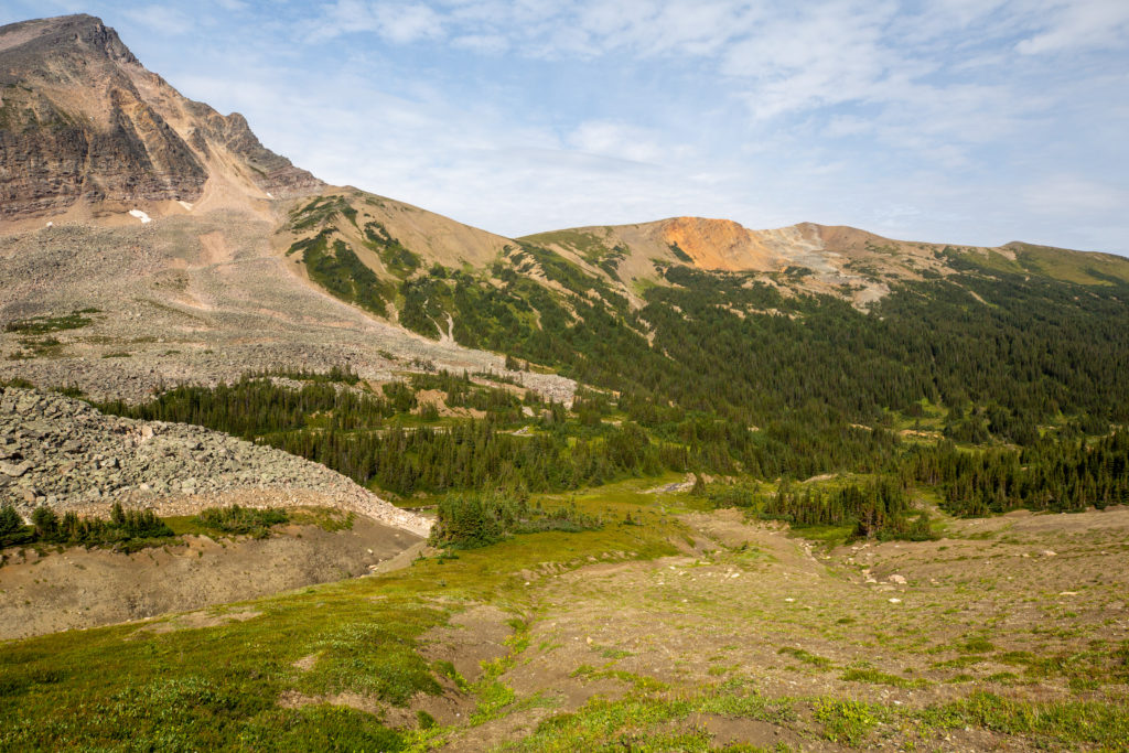
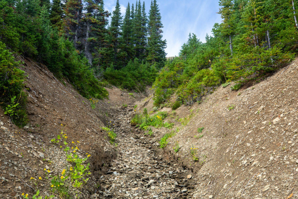
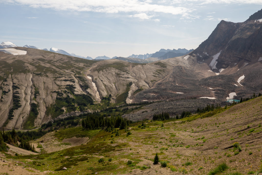
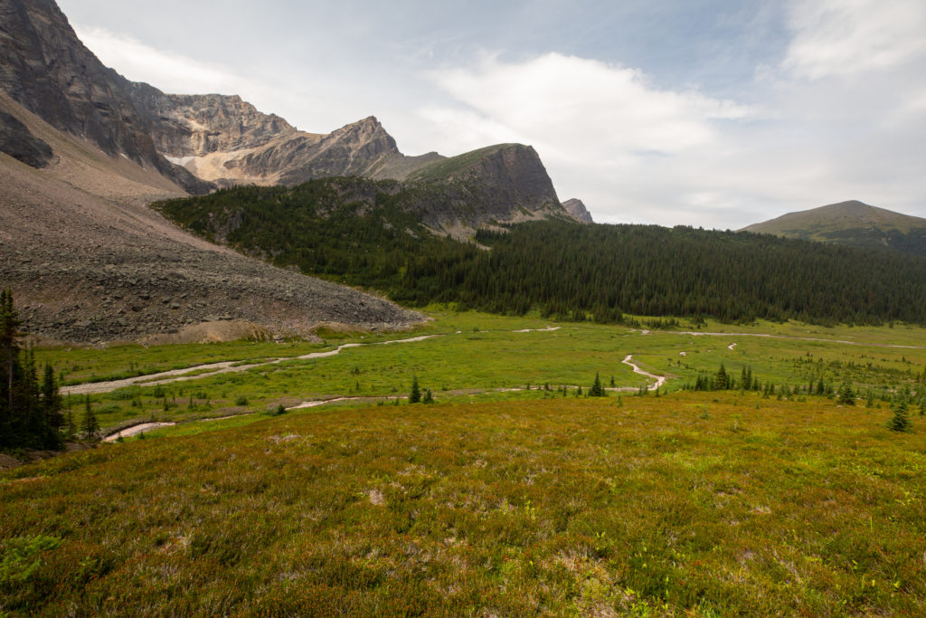
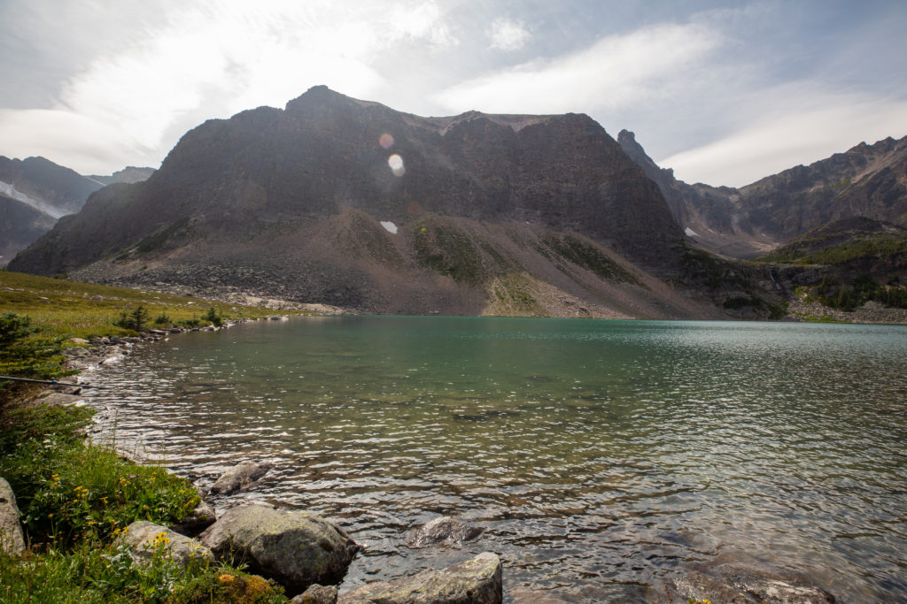
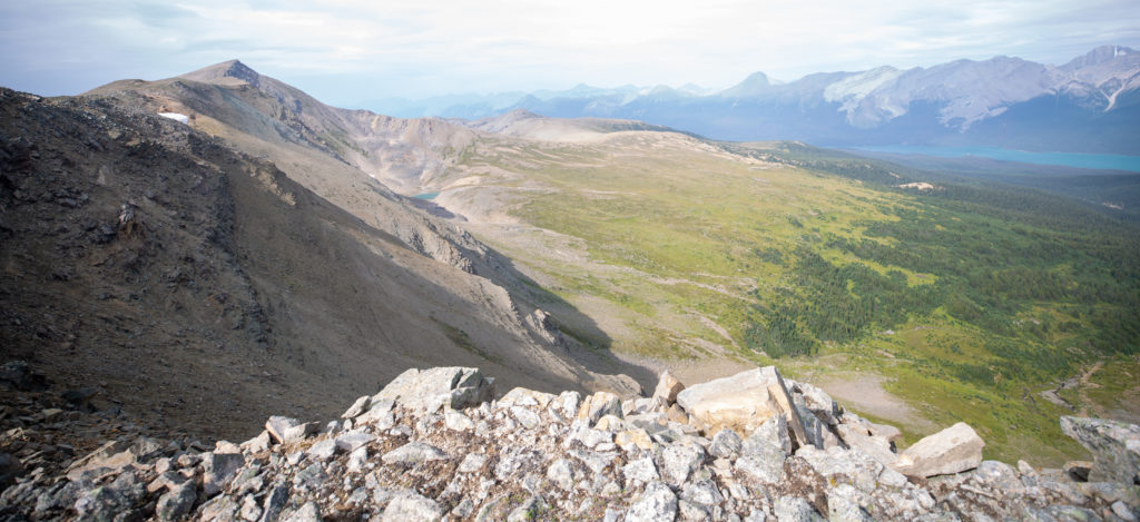
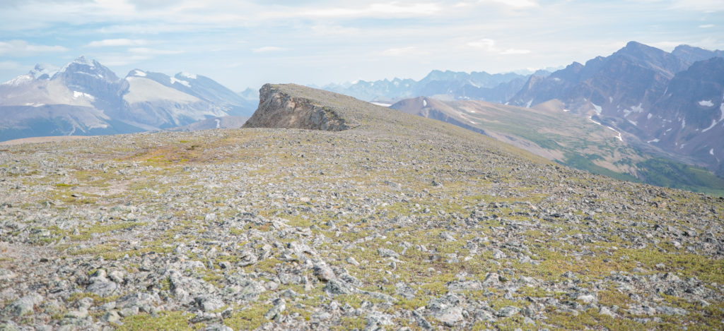
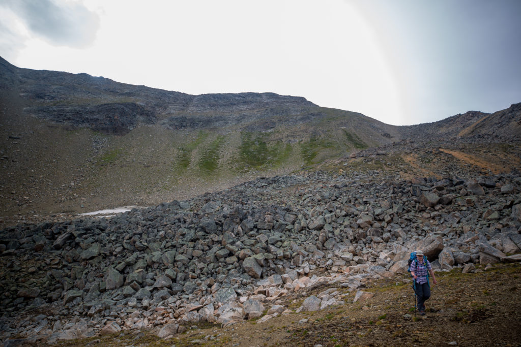
When looking back from the top of the 3rd pass the boulder dominates the down side of the 2nd pass. The boulder field is actually a rock glacier. A rock glacier is a mass of rocks that may lie on top of snow and ice or be mixed in with the snow and ice. A rock glacier flows downhill just like a typical ice glacier. The boulder field on the north sides of the 3rd and 4th passes are also a rock glaciers. My research on rock glaciers was from a paper I reviewed on rock glaciers in Jasper published in 1977.

Research paper on rock glaciers and the excerpt that references the Endless Chain.
Micah approaching the top of the 3rd pass.

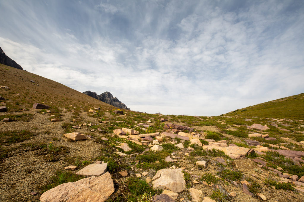
The grass covered slope that covered most of the pass gave way to a firm rocky base that allowed for an easy arrival at the top. It had taken us exactly 1 hour, including the break, to hike from the valley floor to the top of the 3rd pass covering a distance of 1.7 km.

Looking over to pass number 4. The route is not so obvious.
Roughly the route up the 4th pass.
Heading down. The wall created by the Endless Chain Ridge is truly impressive.
Easy walking. It won’t last.
The initial descent is down a pleasant grassy slope.

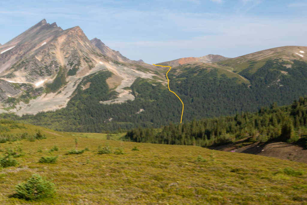
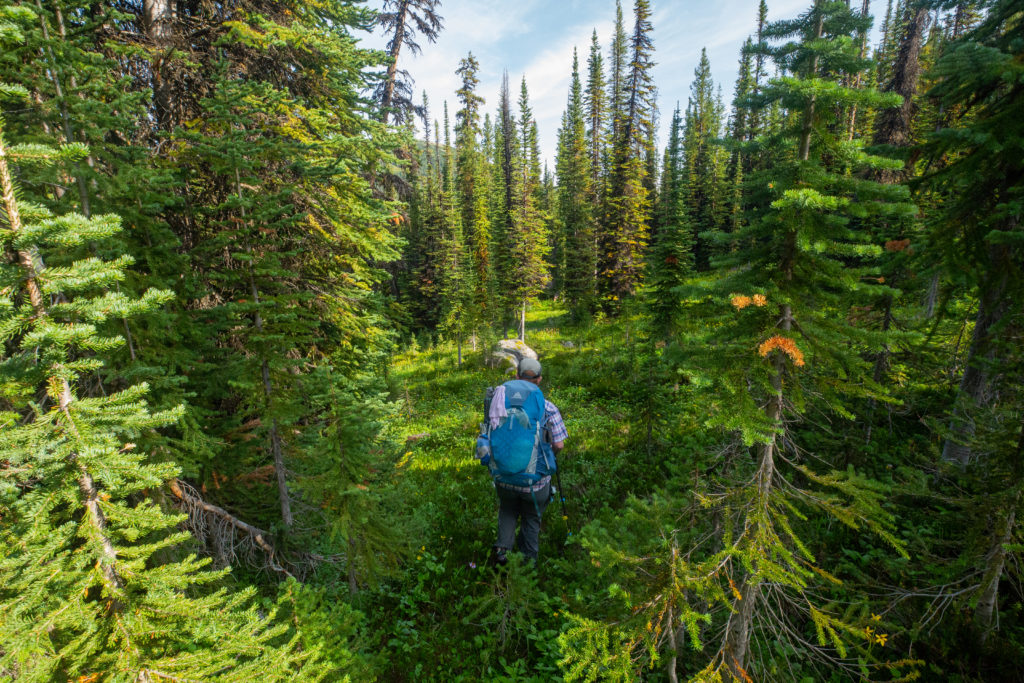
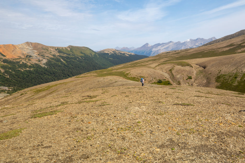
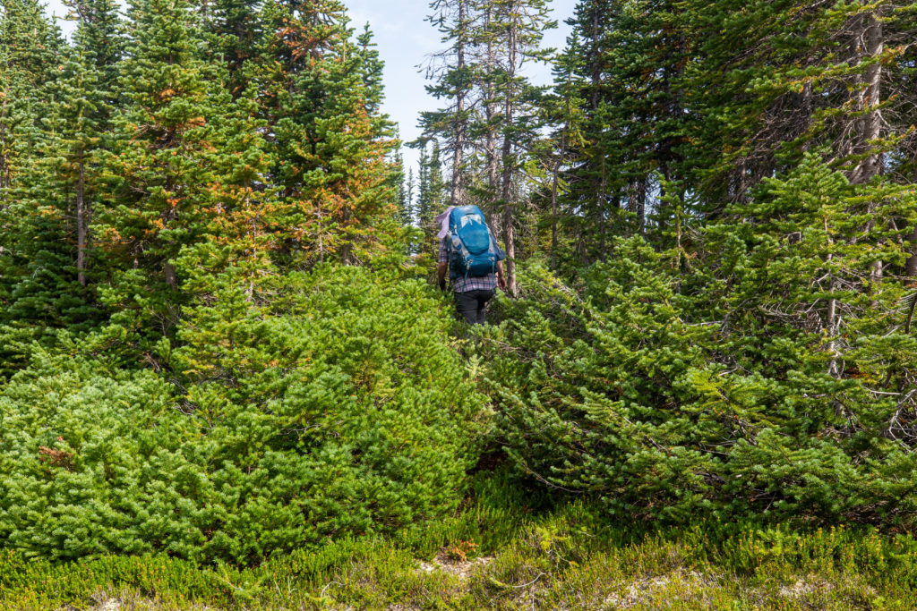
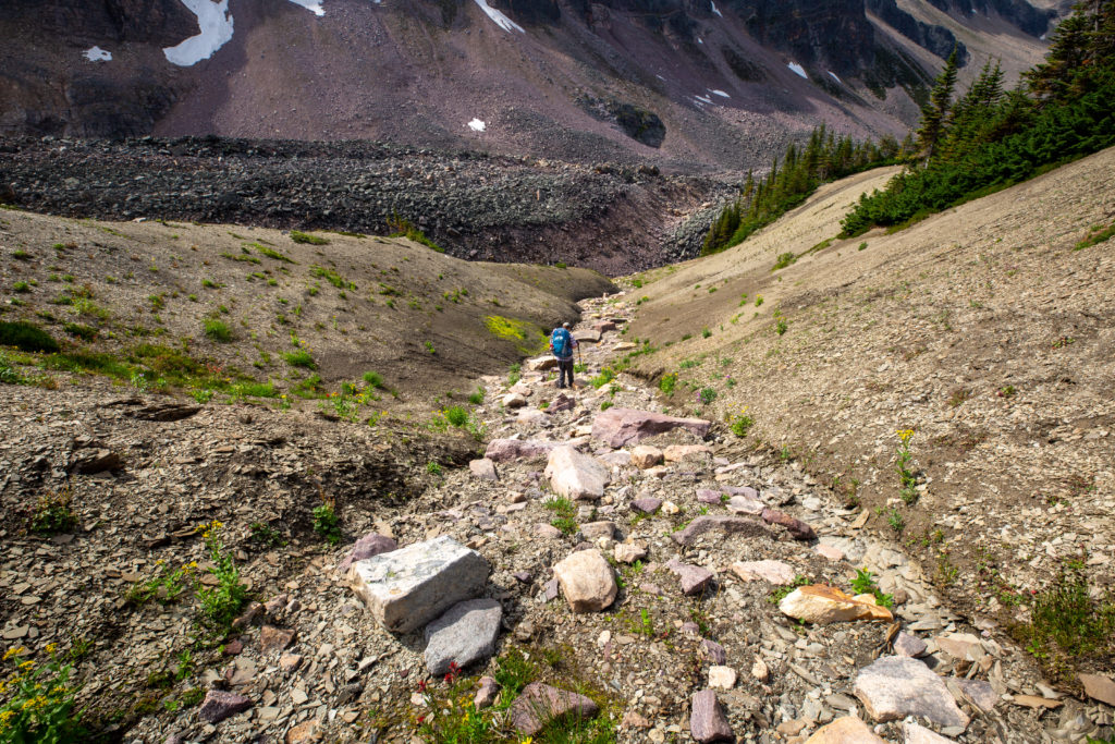
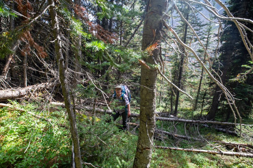
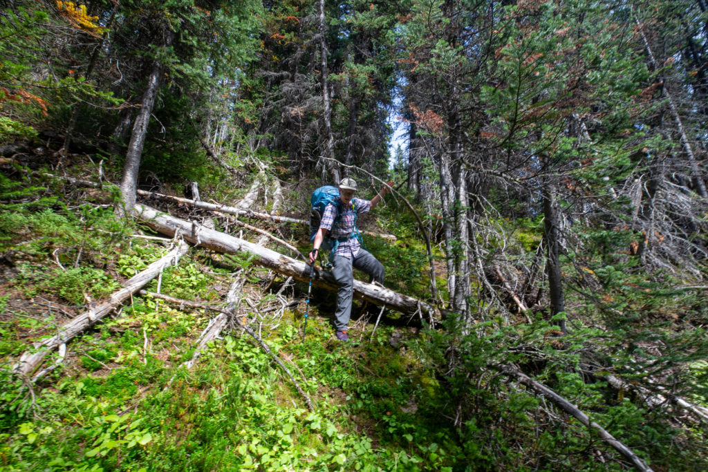
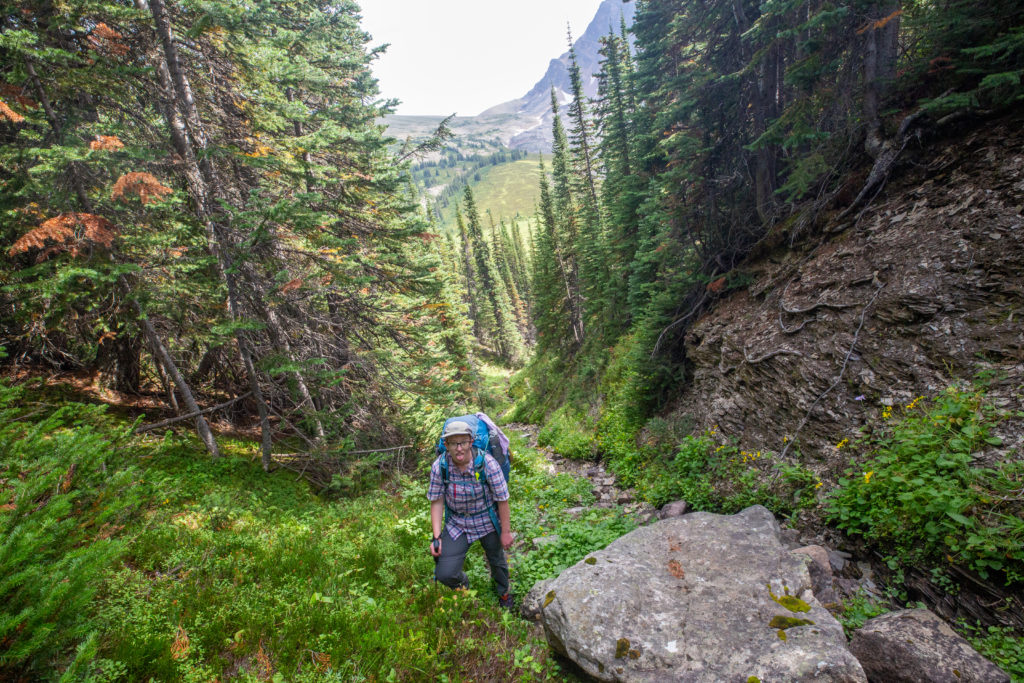
The descent off the top of the 3rd pass was initially very easy. I was somewhat concerned at what lay ahead for us. The route up the passes so far had been very obvious but looking at the 4th pass in the distance we were now faced with a heavily tree covered slope with no obvious route up. The biggest lesson we had learned while hiking the Six Passes was to find the top of a pass you need to “follow the drainage”. This became our mantra for much of the day. When one of us asked how do we get to the top the other would answer “follow the drainage”. Drainages tend to be very straight so following them may not be the easiest way to the top but they were definitely effective. After about 20 minutes of downhilling we left the open slopes and started our first true session of bushwhack through the trees. What made negotiating the trees a little more difficult was that there were many little streams running down the hill so you had to be careful where you stepped or your foot could fall much further than you expected which could lead to a twisted ankle or other small but annoying injury.

On the way down and the bushwhacking begins.
Micah route finding.
One of the hazards. The small fir trees hide deep holes usually besides rocks.

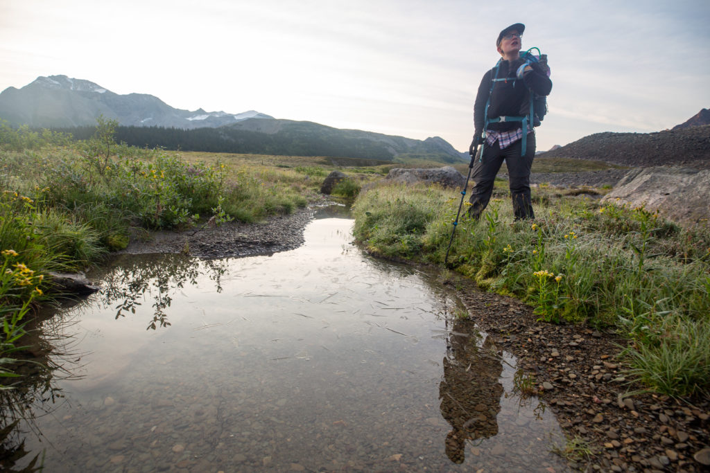
It took us just under an hour to arrive at the valley bottom a distance of 3 km and elevation loss of 400m from the top of the 3rd pass. For comparison it took me 42 minutes to descend 420 m off the top of Michelle Pass covering 2.2 km. After a very short walk across the meadow at the bottom of the valley and another small stream crossing we headed uphill into the trees. It was 10:35 am and we had hiked 10.7 km in 4 hrs 10 min.

The bottom of the valley between the 2nd and 3rd passes. Could definitely camp here but not today.
There is no obvious route up.

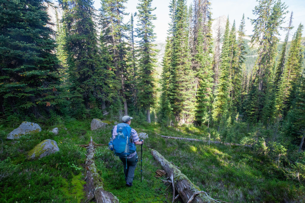
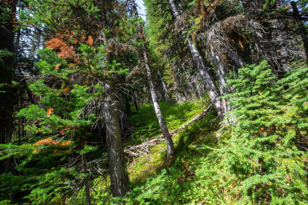
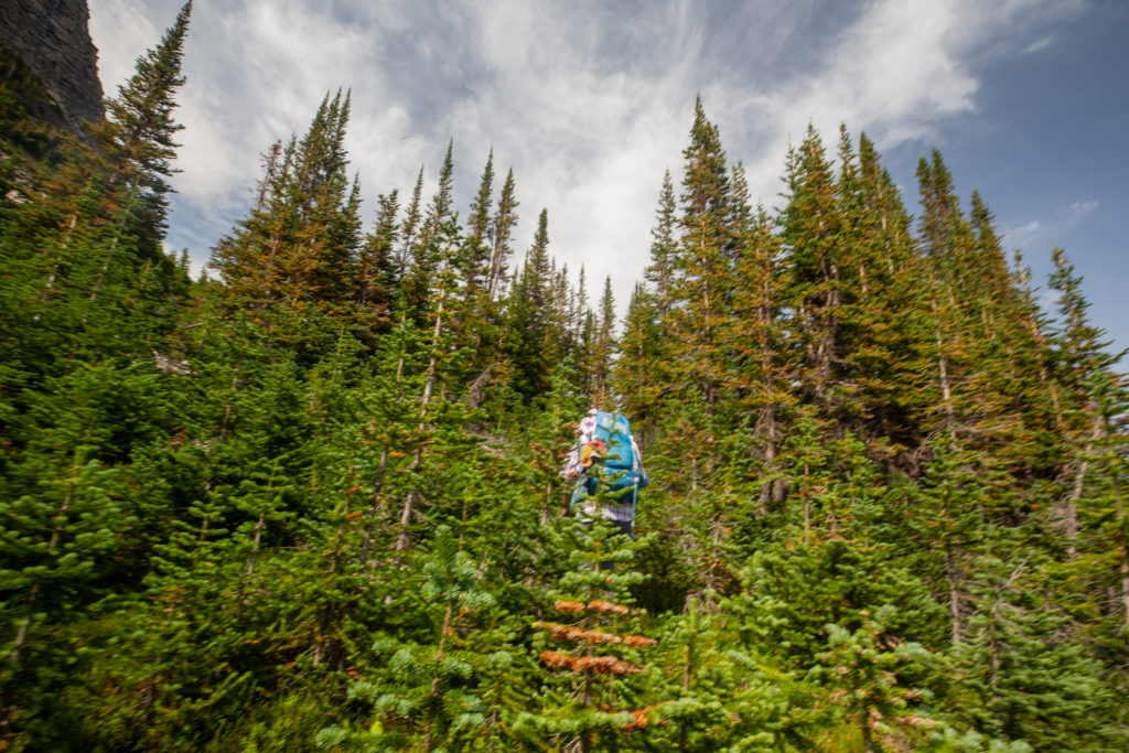
The trees were very thick as we worked our way up the 4th pass. Our plan when moving through the tress was to look uphill and look for the where the light was, which became another one of our mantras. Where there was light coming through the trees meant that that route would be less densely vegetated as opposed to a route where we could not see any light coming through the trees. Looking for the light in conjunction with the Guthooks (Far Out) app allowed us to make our way through the heavily treed section in a fairly direct route uphill. Very soon we emerged from the trees and out onto more open slopes. I think that the lack of photos during the bushwhacking is an indication of how difficult it was. I was more focused on forward progress than taking photos.

It took me a while to remember why this photo was significant. The log on the ground has been broken and crushed and displays signs of human traffic. I felt reassured that other people had come this way.
Leaving the trees and onto boulder strewn slopes.

It had taken us 40 minutes to clear the trees. The boulder field offered more visibility but it was much slower hiking as we really had to watch our footing going from rock to rock. After about 10 minutes we came to a small gully which was rock free. It was still hard going in the gully since it was straight up hill but the footing was much more secure than it had been on the rocks.

Micah making their way up the rocky slope. With the sun rising in the sky it was now starting to get warm on the south facing slopes
DIRT! Never been happy to see solid dirt. The gully that rescued us from the rocks.
It is up and it is steep but the footing is solid.

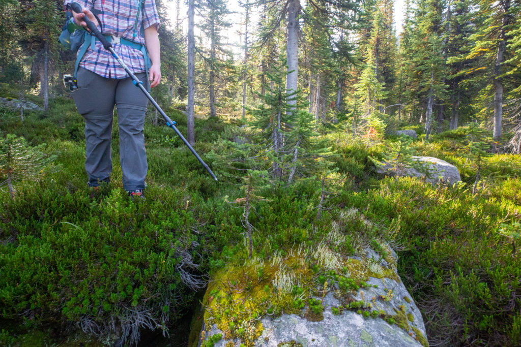
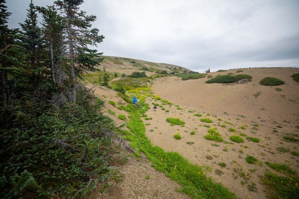
The dirt section of the gully started to disappear so we cut to right over a small ridge to another drainage. Micah called time out on our ascent to apply some sunscreen and have a little break. We had been climbing up for about an hour and we had the top in sight so a break was a great idea.

The rocks are hard to hike on but they make great seats.

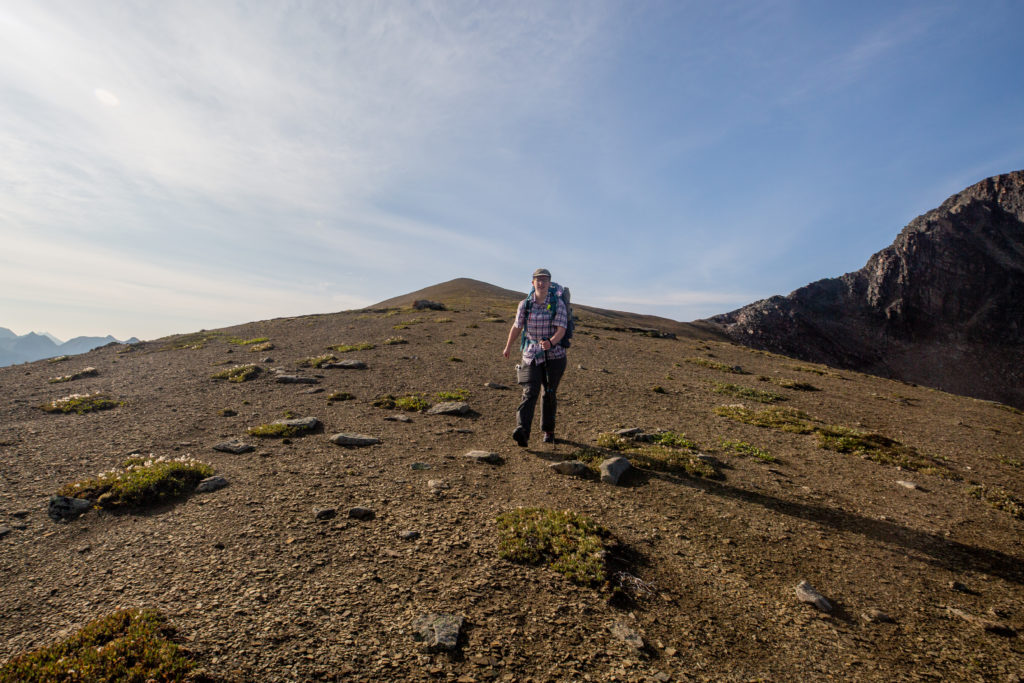
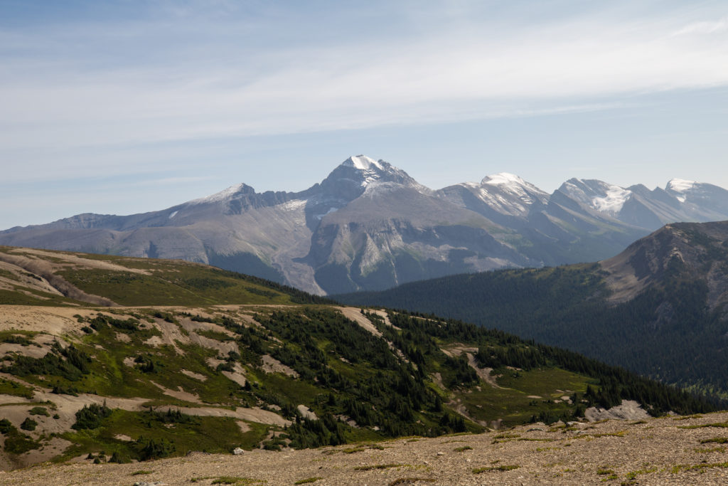
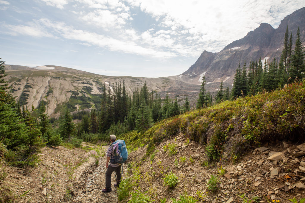
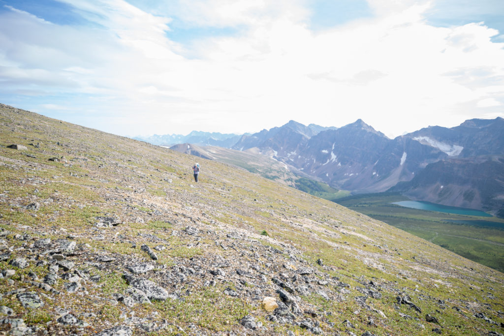
Similar to the previous pass the top of the 4th pass was on hard packed gravel. We arrived at the top of the pass just 10 minutes after finishing our break. It had taken us 1 hr 26 min to hike 2.1 km from the valley floor gaining 330 m of elevation to the top of the 4th pass. We went right over the pass without stopping and followed a ridge down to the right. We had tremendous views of in every direction and with the hard packed rocks under our feet we could easily take in the views as we walked. What I could see of the 5th pass in the distance was telling me we had more of what we had just completed.

Micah heading down off the 4th pass. Can make out the slopes of the 5th pass in the distance?
Sympathy Peak (2780 m). It does not look very sympathetic.
Looking back the way we had come. The hiking on the top of the ridge was very pleasant.
Monkhead Mt (3211 m) sits at the south end of Maligne Lake. In behind out of view is a glaciated ice field.
The lowest part of the pass is at a drainage which we could have followed from our rest point.

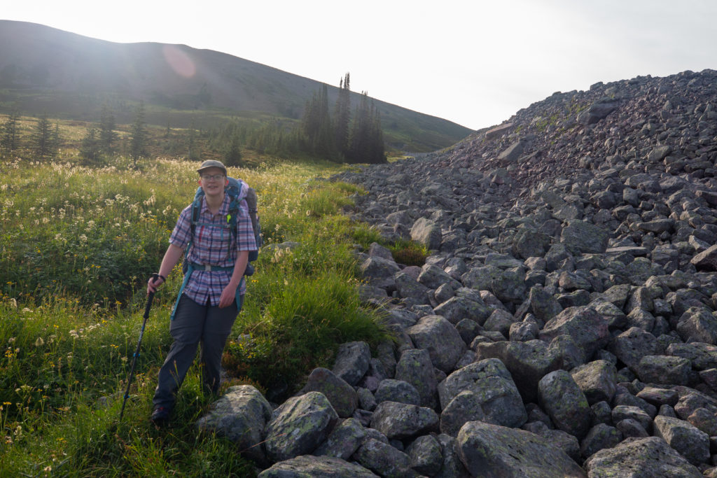
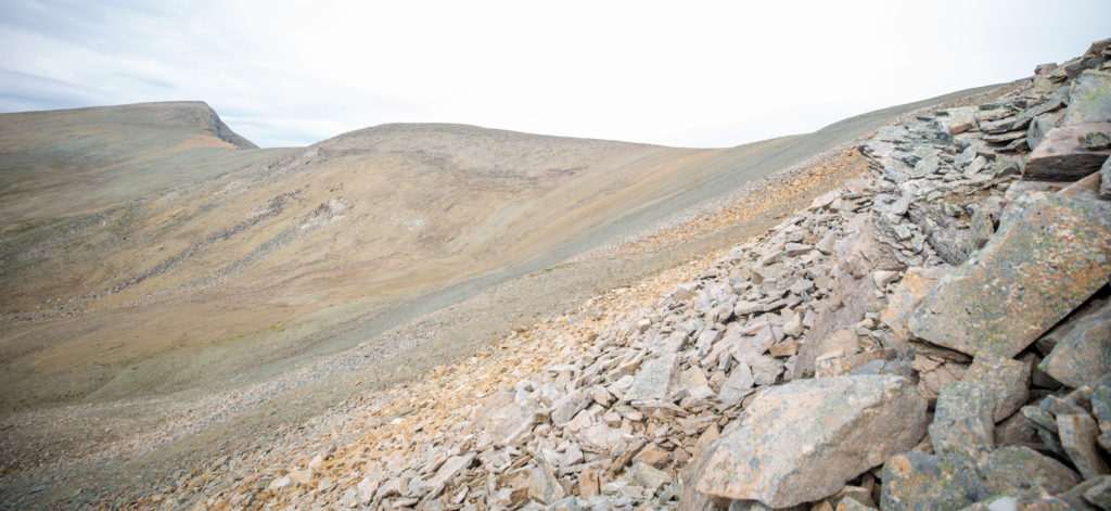
The descent off the top of the 4th pass was quick on packed ground. Similar to the 2nd pass there was a rock glacier below the cliffs but this time we stayed well to the right and did not waste time trying to find a short cut.

Good view of the 5th pass.

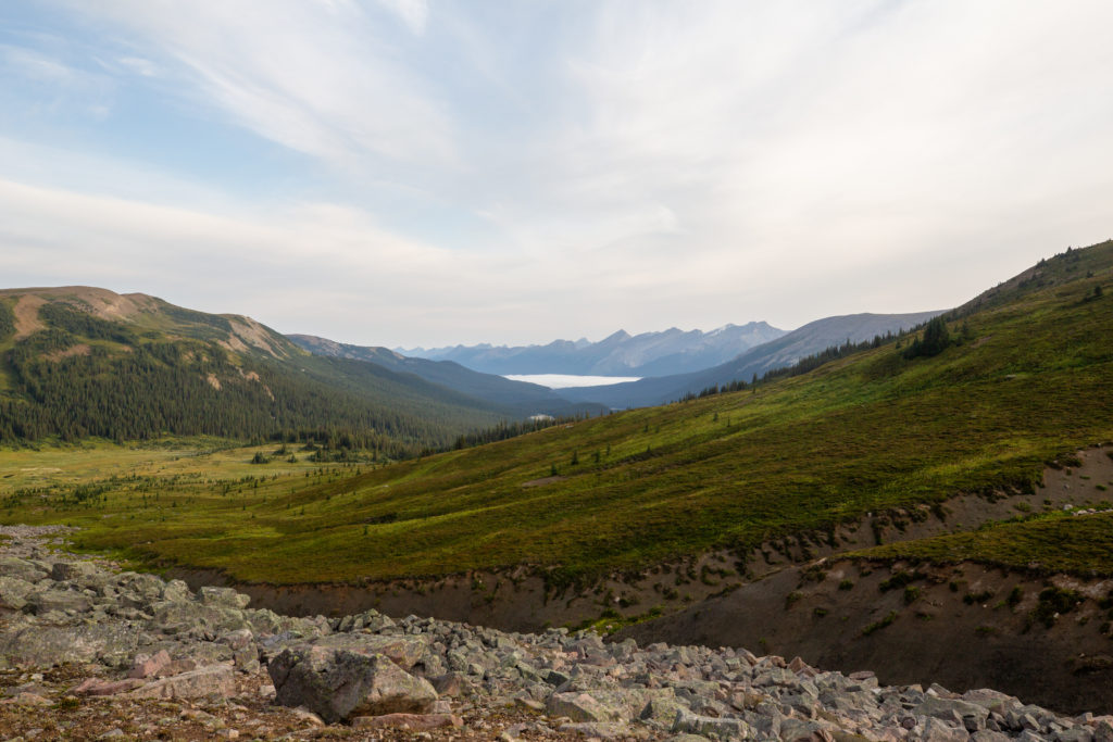
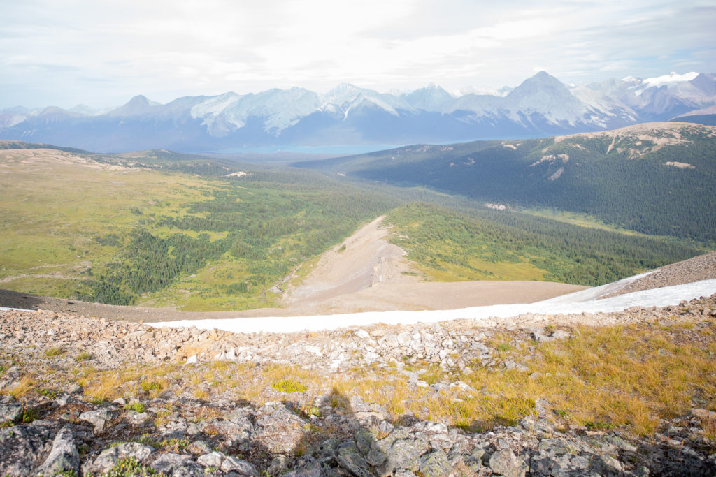
It took us only 32 minutes to descend 180 m over 1.5 km from the top of the 4th pass to the valley floor. It was 12:30 pm as we prepared to ascend the 5th pass. We had been hiking for 6 hrs 15 min, gained close to a 700 m of elevation and had covered 12.7 km. We did not know it at this time but this would be approximately halfway for the day in terms of distance, elevation gain and time. After another creek crossing we were face with a wall of trees. Not seeing anything obvious Micah decided that the direct route would be best and plowed their way into the trees. With a little help from the Guthooks (Far Out) App we quickly found a drainage that would take us the majority of the way up the pass.

Heading into the thick of things.
Our friendly drainage.

The drainage was fairly steep in places and I was certainly glad I had my hiking pole to help push me up and over small steps that were frequently in our way. It was hard work going uphill and the conversation level dropped dramatically. After 20 minutes of hiking we started to climb out of the trees and had a better idea of the route ahead.

Breaking tree line. Taking a small break to look around.
Looking back at the 4th pass. Found the footing to be slightly better out of the drainage.
Same location as the previous photo. What lay ahead. What we can see is not the top of the pass.

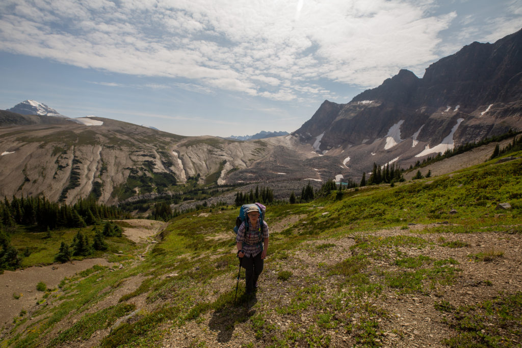
Once we climbed out of the drainage it was a straight walk up to the top of the pass. It had taken us just 45 minutes to climb 240 m over 1.2 km to the top of the 5th pass. The 5th pass was not as tough as I had feared but the wear and tear of each pass was beginning to take a toil physically on us.

Looking back to the 4th pass from the top of the drainage. The small turquoise lake on the right is an indication that there is glacier erosion taking place. The glacier is hidden under the rocks, hence a rock glacier.
The top is straight up there.
Quite flat at the top of the pass. A short stretch of easy horizontal hiking.

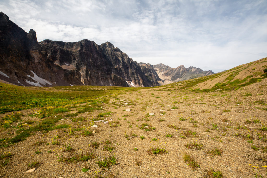
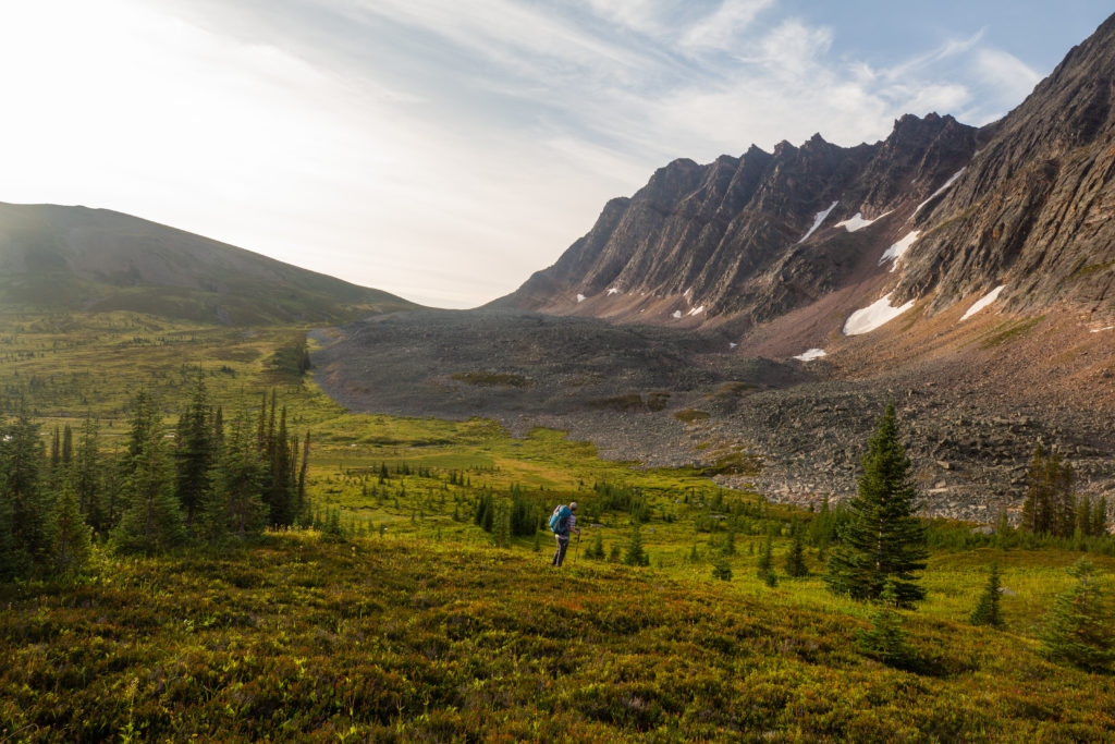
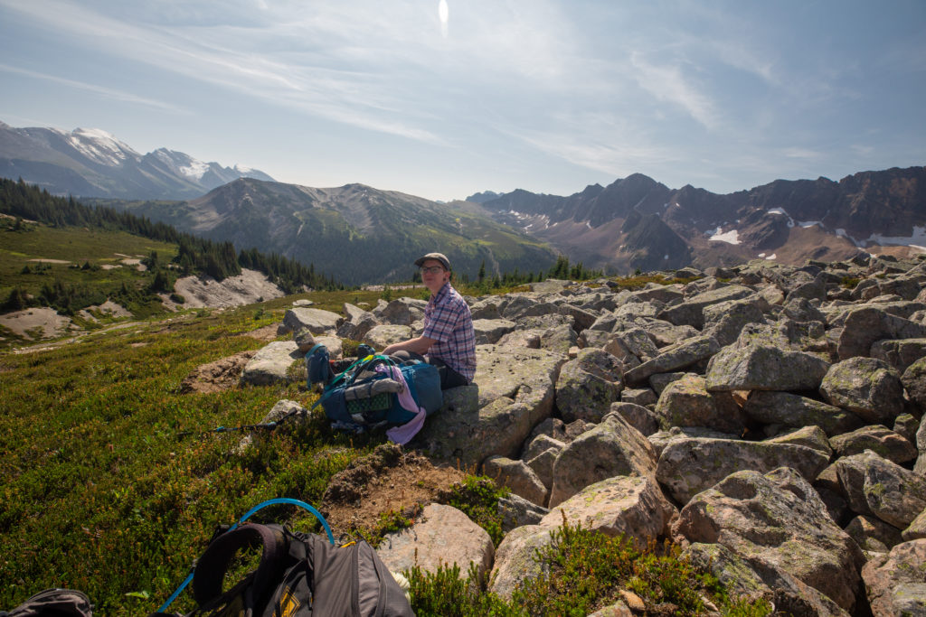
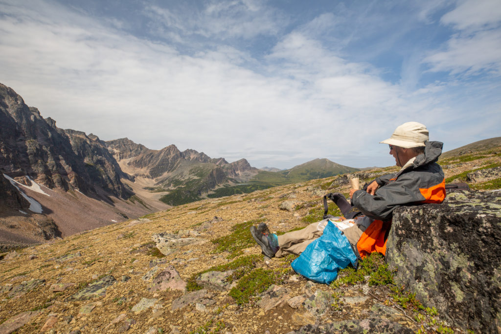
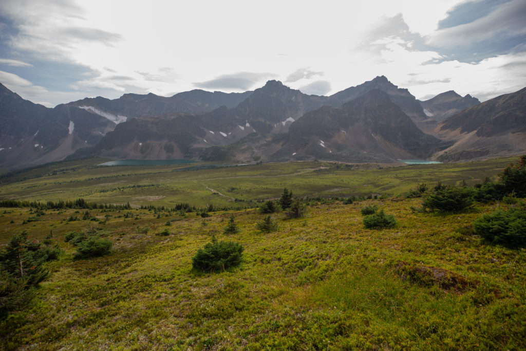
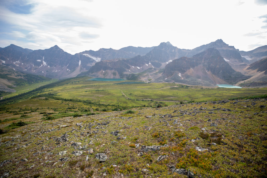
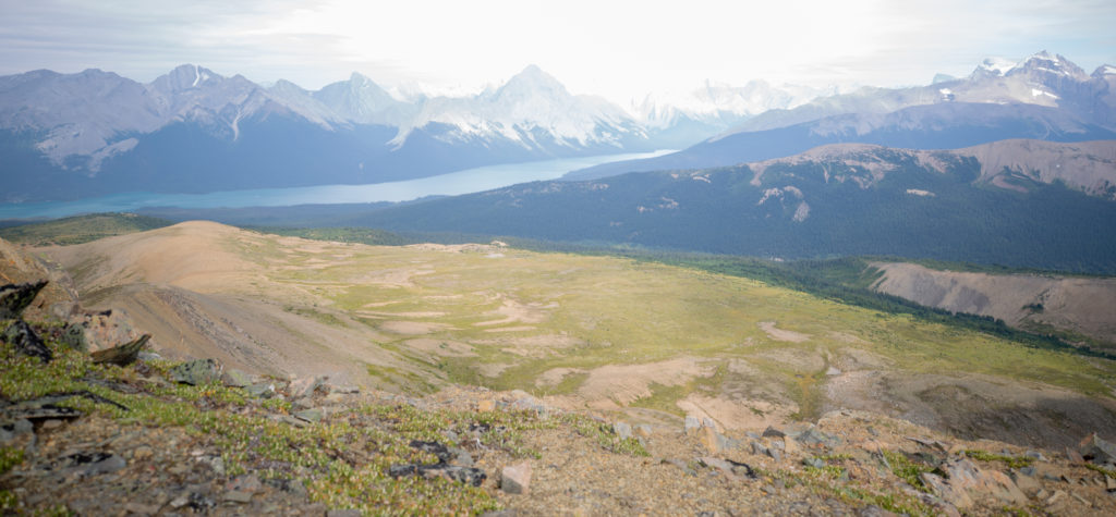
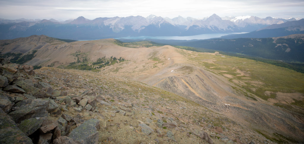
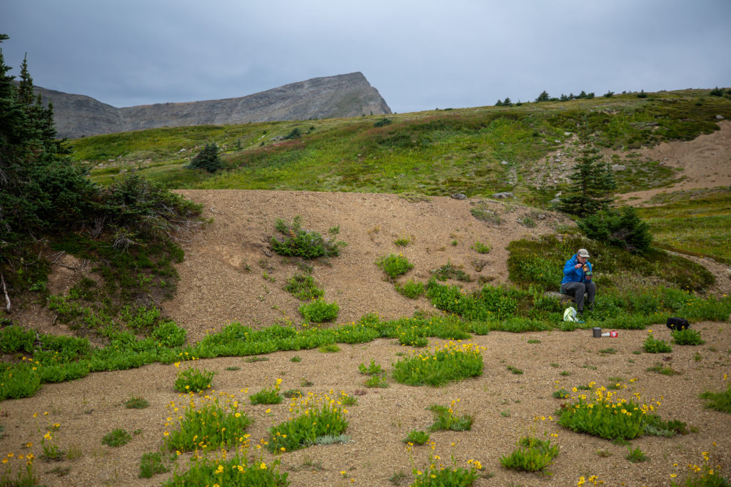
Just a few minutes after crossing the top of the pass we found a nice little ledge to serve as a back rest and stopped for a well deserved lunch. Our lunch spot had an amazing view of the rather diminutive 6th pass and the daunting climb and ridge that would finish off the hike. It was during lunch we got a weather update from Laura that said there was a 80% chance of rain overnight only dropping to 60% in the morning. We decided to complete the ridge and scramble on this day to avoid potentially down climbing in the rain. We were both a little underestimating how challenging the ridge would be. I know in my mind I was envisioning a nice Kananaskis Ridge walk on solid footing. Much to my disappointment this would not be the case.

Looking back up to the 5th pass.
A view to the 6th pass, the twin tarns and the final ridge on the right.
Was a little windy at lunch.
Just drying out their feet. I see the first aid kit near Micah probably applying more tape. Socks drying on the rocks.

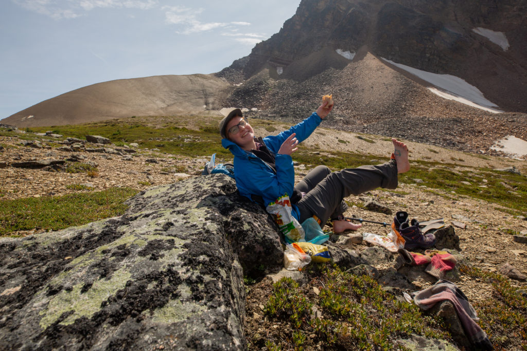
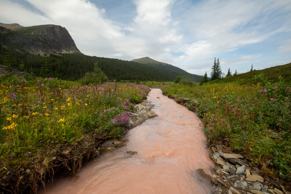
We had a solid 40 minute break for lunch. I was quite happy to start heading downhill after lunch as it was a great way to get the legs going again after a long rest. I find it unpleasant to get up after a break and head uphill at maximum effort. Always nice to have a little warm up. Our way down off the ridge followed a drainage, what a surprise. The valley between passes 5 and 6 was the widest valley we had on the Six Passes and the creek running through it was the deep brown colour of a rich dark hot chocolate.

Descending down a drainage.
The 6th pass is very short but has a lot of trees.
One of the wider valleys. Looking like another wet crossing.
With the flowers it is a pretty little creek. Looks like chocolate milk but I don’t think I will sample it.
Small drainage heading into the trees. I think we will follow it.
Micah crossing the creek utilizing well placed rocks to keep their feet dry.

We gathered ourselves up for one last serious bushwhack. It was 2:45 pm and we had hiked 18 km in 8 hrs 20 min. The going uphill was very rough at first. There were lots of downed trees which made our progress very slow. Checking the Guthooks (Far Out) app the route was a little to our left. What a difference just 20 feet made. The app was following a drainage and it would prove to be a big improvement over hiking through the forest. Scrambling down the slope to the drainage was a little exciting.

The going was a little rough.
There were scuff marks on the log so other people had come this way. This is actually pretty good for bushwhacking the trees are not too closely packed together.
Micah making their way down to the drainage.
It was not easy. But it would be better than going through the trees.
Micah displaying how they are feeling. This section was short but tough.
This is only 4 minutes after the last photo. The first section of trail we have seen since Maligne Pass.

After finding a very short section of trail we stayed in the trees utilizing our “follow the light” philosophy. Guthook (Far Out) displayed the route about 20 m – 30 m to our left. This would have put us right under the cliff face hiking on rocks which we opted to not do. Only 35 minutes after we first pushed into the trees we arrived at the twin tarns. The 6th pass was only 1.2 km long and had the lowest elevation gain at just 145 m. It was 3:20 pm we had been hiking 9 hrs 5 min and had covered 19.3 km.

Micah disappearing into the trees. You can see from the cliff to our left that we are almost done. The twin tarns are at the base of the cliff.
The first tarn. The ridge looming large in the background. Our route would be hiking up the grassy slope to attain the ridge working back and forth hiking our own switchbacks.
View from the first tarn.
First Tarn.

If we had been able to stop at the twin tarns the day would have been easily a 15/10 day hiking. The hike had been exhilarating, challenging and spectacular. Unfortunately for us we felt we had to finish the ridge and the scramble while we had good weather or risk scrambling in the rain. Since we were planning on random camping on the Bald Hills and could see no obvious water sources on our map we filled our water bladders with enough water for the remaining hike, dinner and coffee in the morning. After a pleasant 15 min break we heaved our packs onto our backs and headed for the ridge. We avoided the heavily forested area at the base of the south end of the ridge and decided to aim for the grassy slopes and work our way up to the ridgeline.

Crossing the outflow of the tarn.
Easy walk across the meadow before the work starts climbing the ridge.

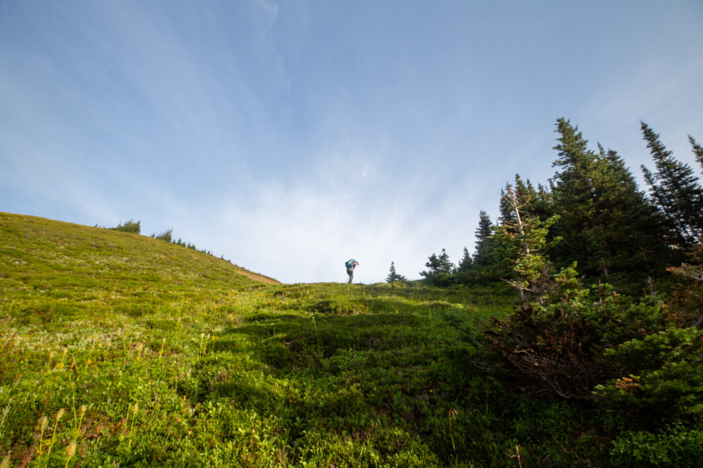
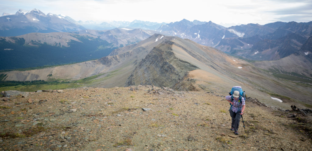
We worked our way across the meadow at the base of the ridge before heading up. We were walking apart in silence. We both knew what we had to do but the energy level was definitely not what it had been earlier in the day. I lead the way up the slope making several small switchbacks before contouring over to the ridgeline. It took us about 30 minutes to arrive on the ridge and we found ourselves on top of the ridge after 1 hour after leaving the the twin tarns. We found the top of the ridge to quite exposed and the footing very crumbly. We followed the Guthooks (Far Out) app and which had us hiking just below the top of the ridge.

Trying to keep the mood light.
It was a pleasant walk to the base of the ridge.
It’s the land of many lakes.
Getting a little rocky.
Working our way up the ridge.

The first section of the ridge was quite good and we made good time. We had amazing 360 degree views but for the most part we were just focused on our feet and walking. After an 30 minutes of ridge walking we came to a series of very rocky crossings. The large rocks were quite unstable so we descended slightly away from the ridge where we felt a little safer.

The hiking was still good on solid footing.
Looking over to the Balk Hills and Maligne Lake.
Looking ahead along the ridge.
The hiking was still good, it is 4:50 pm.
This was where it got hard.

After skirting passed the crumbly rocks we ascended back to the ridge for the final push to the summit. On paper the climb to the final summit rises just 70 m over 1/2 kilometer. This minor climb would take us a punishing 15 minutes. Much like the first pass the ground was very soft and every push wasted some energy as the ground gave way under our feet. Both of us were in agreement afterwards that this was the hardest section of hiking we have done.

The view from the ridge. The plateau is called the Bald Hills.
The final grind. Just 7 minutes from the top.

During the ridge walk I was super nervous and constantly looking at the sky. The sky was a little cloudy but in no way was it threatening but I kept looking to the west every few minutes to check on the incoming weather. We had a bad experience on a ridge when we hiked the GR20 in 2018 and ever since I am not happy when exposed at altitude in anything but perfect weather. We had blue skies and some cloud and I was sure it was not going to rain but I could not relax until we were off the ridge.

The view down the ridge. It really was quite stunning.
The view from just before the summit.

I arrived at the summit first. It was 5:40 pm and we had been hiking for 11 hrs 15 minutes and had covered 23 km. I had a few moments of concern as I looked over the edge at what awaited us on the descent. In my research I had read that it was an easy scramble off the summit. It looked incredibly steep to me and I was not at all happy about having to make our way down what I saw but I knew in the back of my mind that we had little choice. Micah was very tired as they approached the summit and the quickly voiced their very strong displeasure at the idea of scrambling down off the summit. I recall Micah saying something to the effect of “I’m not doing that!”. Interestingly Micah’s reaction helped focus me as I had already had my “holy crap” moment and had come to terms that there was no option. I could see from the top that the first ledge just a few feet below us had boot prints in the dirt. This reassured me that people had done this before. I quickly hopped down to start the descent and to demonstrate to Micah that it was possible. After arriving at the first ledge I shuffled over to my left and then had to bum scooch down a small slab. My shoes did not have Vibram soles so I did not have great grip on rocks so bum scooching while not very elegant was a safe way down the slab. When Micah descended the slab they just walked down without any hesitation. The steepest part of the scramble lasted only about 5 minutes. The change in the slope was not a lot but it was noticeable and it made a big difference to us mentally. The Six Passes Route follows the ridge onto the Bald Hills. We could see that there was another crumbly boulder crossing on the ridge like the ones that we had crossed on the main ridge earlier. So we had a little team meeting and decided to leave the ridge and hike straight down and onto the Bald Hills. There was still a boulder field to cross but crossing at the bottom took away the risk of falling and was just mentally easier. The rest of the descent was actually quite easy. The limestone formation making up the cliff was broken nicely into a series of steps. The slope was still very steep a small slip would have a person falling a long way. We slowly and carefully worked our way day shouting encouragement to each other and reminders to be careful. It took us 35 minutes of careful descending to drop 200 m to arrive on moderately flat ground.

This was taken after just 3 minutes of descending. While still steep we had grown in confidence that the scramble was not quite as bad as it had first appeared. We still had to be careful and after such a long tough day we moved slowly and methodically as we descended.
One last boulder field and we were on firm ground. Now it was time to find a campsite. The boulder field extends to the ridge and is why we decided to abandon the ridge.

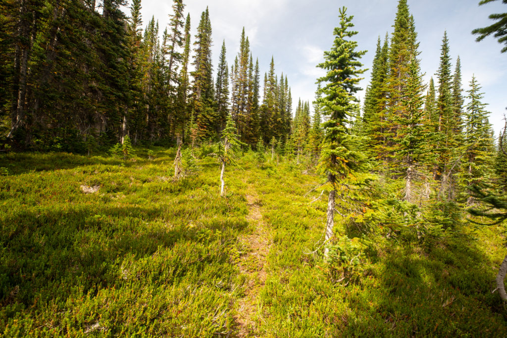
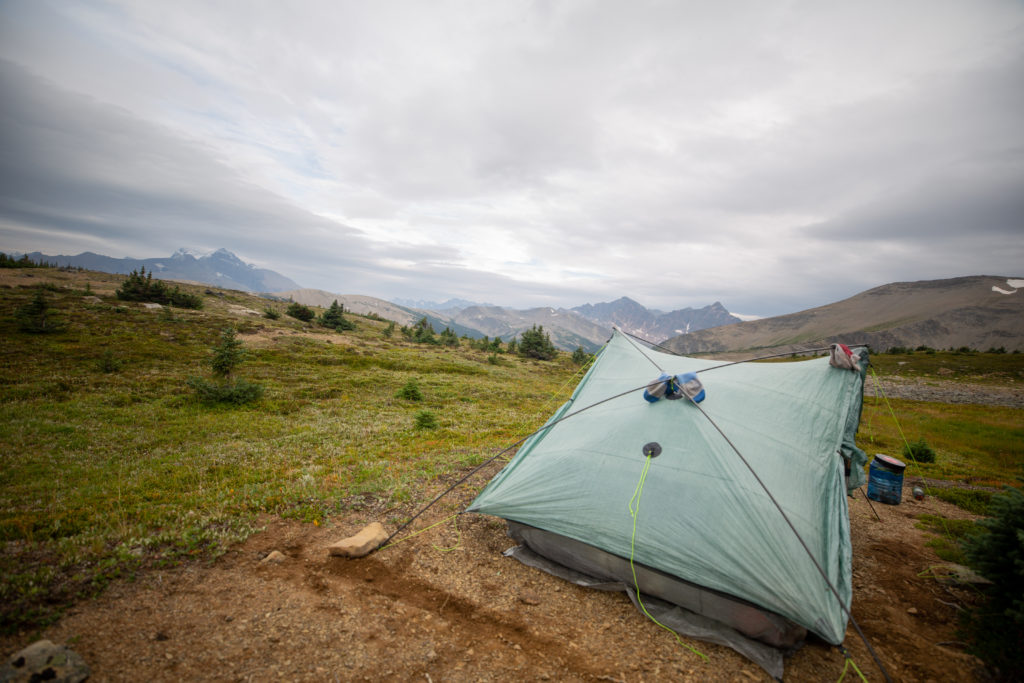
We walked easily across the Bald Hills the smooth level ground a welcome relief from the ridge. While very tired our spirits were high as we had completed the Six Passes, tomorrow would be a short day and it would soon be dinner time. We wanted to find a small stand of trees to act as wind block to the west. After 35 minutes of walking we settled on a nice spot that did have access to fresh water. It was 6:35 pm and after hiking for 12 hrs and 20 minutes covering 25.5 km we were done for the day!

Tent all set up. A very happy Micah.

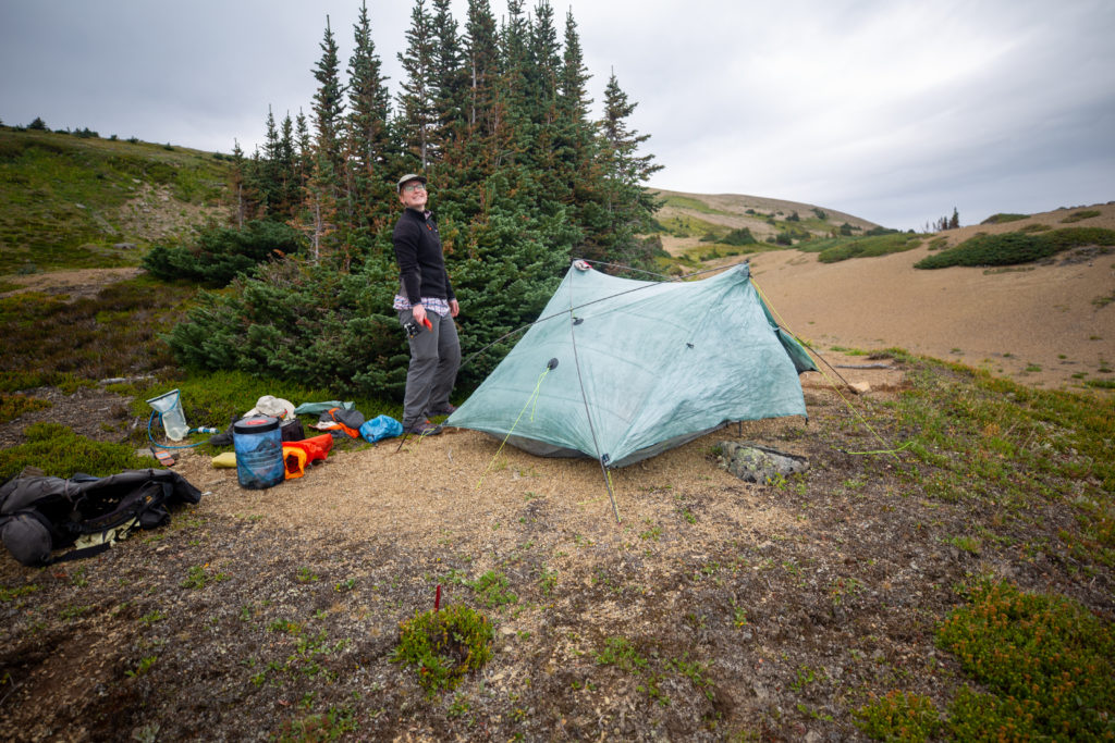
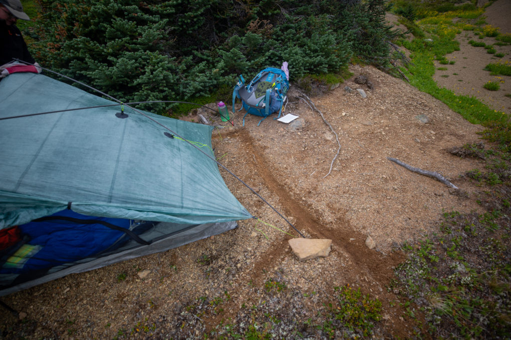
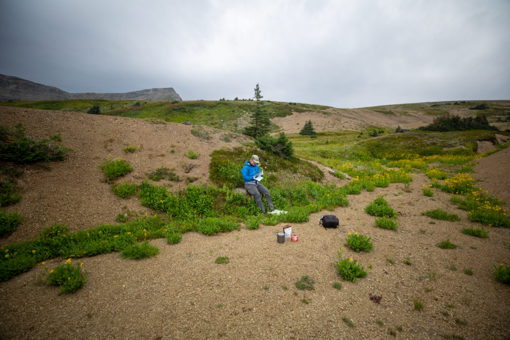
To highlight how tough a day it was after dropping our packs Micah called for a team hug. This does not happen so it made the moment all the more special. After quickly setting up the tent we realized that we were on a bit of slope so we made some channels to funnel any rain water away from the tent. We would thoroughly brush the area the following morning to remove any trace of our campsite. We set up our kitchen in a small ephemeral stream bed a little away from camp. Micah reread the guide book and its description of the Six Passes now that we had knowledge of the route.

Our attempt at building some canals around the tent.
Micah reading about the guidebook’s description of our day and about what is in store for us tomorrow.
Putting the tent to use drying out the socks.
The Six Passes Route is just up on the ridge in the distance.
The tall peak left of centre is Samson Peak (3081 m) and the glacier in the distance identifies Maligne Mountain (3192 m)
Good view of the summit of the ridge. It was only a couple of hours ago that we were on the summit.
Summary of the day.

Good night from the Bald Hills.

Day 9 GDT Section E 2021

GDT Section E 2021 (aborted Section D) Home

bootwreckers

With my trip ending a little early I spent the las With my trip ending a little early I spent the last couple of days doing Trail Magic, full story up on Bootwreckers, see link in bio.

I stayed the night utilizing the primitive camping area at Picketpost Mt. Arizona sunsets are amazing. 

I did two days of Trail Magic. I purchased 14 pops (known locally as sodas) and bags of chips each day and hung out at two different trailheads for the AZT. The thru hikers coming by were always appreciative of the extra calories with flavour.

After I headed back to Phoenix to begin my trip home.

I love traveling and hiking in Arizona, not sure when I will get back but I will go back soon(ish).

#trailmagic #aztassociation #nationalparks, #slotcanyon, #hiking, #hikingadventures, #familytime, #camping, #campingadventures, #outdoors, #outside, #nature,  #FIndyourpark #landscape #landscapephotography #optoutside #nationalpark #desertphotography #grandcanyon #grandcanyonnationalpark #grandcanyonassociation #nationalparkweek #reichallenge #nationalparksweek #rightnow #nationalparktrust #goparks #aztrails
Day 3 (and final day) of my hike on the Arizona Tr Day 3 (and final day) of my hike on the Arizona Trail finishing Passage 15, see link in bio.

Had just under 20 miles to hike. Was a great day on trail. After finishing hiking the high desert reentered canyon country which was followed by a quick climb for amazing views from the high point.

The hike ended with what can only be described as a cacophony of flowers. A simply amazing way to finish the hike. 

Now I have to figure out which Passages I can hike next and when....good problem to have.

#nationalparks, #slotcanyon, #hiking, #hikingadventures, #familytime, #camping, #campingadventures, #outdoors, #outside, #nature,  #FIndyourpark #landscape #landscapephotography #optoutside #nationalpark #desertphotography #grandcanyon #grandcanyonnationalpark #grandcanyonassociation #nationalparkweek #reichallenge #nationalparksweek #rightnow #nationalparktrust #goparks #aztrails
Just the aurora dancing in the northern skies take Just the aurora dancing in the northern skies taken from my balcony. 

I never tire of seeing the Northern Lights

#northernlights #aurora #auroraborealis #canmore
Day 2 of my Arizona Trail Passages 14 15 hike is u Day 2 of my Arizona Trail Passages 14 15 hike is up on Bootwreckers. 

Big day, 36 km's, but was super fun over varied terrain and some more Trail Magic when I arrived at the beginning of Passage 15 at Freeman Road.

Hiked almost until sundown, but managed to find a slightly sheltered spot to block some of the very fierce desert wind.

Love hiking in Arizona,  next time I will make sure I tape up my heels before I start.

Enjoy.

#nationalparks, #slotcanyon, #hiking, #hikingadventures, #familytime, #camping, #campingadventures, #outdoors, #outside, #nature,  #FIndyourpark #landscape #landscapephotography #optoutside #nationalpark #desertphotography #grandcanyon #grandcanyonnationalpark #grandcanyonassociation #nationalparkweek #reichallenge #nationalparksweek #rightnow #nationalparktrust #goparks #aztrails
Arizona Trail Passages 14 15 travel day and Day 1 Arizona Trail Passages 14 15 travel day and Day 1 up on Bootwreckers, see link in bio.

Was a fantastic trip south to hike Passages 14 and 15 of thr Arizona Trail.

Met lots of great people, enjoyed some Trail Magic and experience the raw beauty of the desert. 

Trip didn't go quite as planned but I am still planning on heading back thr AZT for more adventures.

The last photo is my training partner, Margaux,  and what I was hiking in just the week before the trip. Not so much snow in the desert. 

#nationalparks, #slotcanyon, #hiking, #hikingadventures, #familytime, #camping, #campingadventures, #outdoors, #outside, #nature,  #FIndyourpark #landscape #landscapephotography #optoutside #nationalpark #desertphotography #grandcanyon #grandcanyonnationalpark #grandcanyonassociation #nationalparkweek #reichallenge #nationalparksweek #rightnow #nationalparktrust #goparks #aztrails
Day 3 of my New Years adventure in Arizona up on B Day 3 of my New Years adventure in Arizona up on Bootwreckers, see link in bio.

Hiked the Superstition Ridgeline Trail, 23 km of some very rough terrain.

The views from the ridge were spectacular. The trail is more of a route, then a trail. I got off trail a half a dozen times just on the ascent to the ridge. Sprinkled in for fun where several down climbs where I had to drop my poles before climbing down a small chimney or crack.

There is camping possibilities on the ridge and I do wish I would have camped just before Syphon Draw and enjoyed the sunset. Maybe next time.

This was a very challenging 10.5 hrs on the trail, one of my hardest days ever, but worth every drop of sweat.

Till next time Arizona.

#nationalparks, #slotcanyon, #hiking, #hikingadventures, #familytime, #camping, #campingadventures, #outdoors, #outside, #nature,  #FIndyourpark #landscape #landscapephotography #optoutside #nationalpark #desertphotography #grandcanyon #grandcanyonnationalpark #grandcanyonassociation #nationalparkweek #reichallenge #nationalparksweek #rightnow #nationalparktrust #goparks #aztrails
Even in the smoke, there is nothing like hiking in Even in the smoke, there is nothing like hiking in the Canadian Rockies.

On the way to Pinto Lake, going over Sunset Pass with Tuft Peak in the distance.

#parkscanada #parks #bcparks #trails #longdistancehike #longtrail #outdoors #outside #thruhike #hike #thruhiking #outside #backpacking #waterfalls #waterfall #naturephotography #naturephotography #nationalparks #alberta, #albertaparks
Day 2 of my New Years Arizona Adventure is posted, Day 2 of my New Years Arizona Adventure is posted, see link in bio.

Fun and easy day exploring the Superstitions with my four new friends. Lots of varied terrain and lots of breaks. Will make up for that on Day 3.

I did run out of superlatives to describe the scenery, in one word it was simply spectacular!

#nationalparks, #slotcanyon, #hiking, #hikingadventures, #familytime, #camping, #campingadventures, #outdoors, #outside, #nature,  #FIndyourpark #landscape #landscapephotography #optoutside #nationalpark #desertphotography #grandcanyon #grandcanyonnationalpark #grandcanyonassociation #nationalparkweek #reichallenge #nationalparksweek #rightnow #nationalparktrust #goparks #aztrails
Day 1 of a fun two day trip out to Pinto Lake over Day 1 of a fun two day trip out to Pinto Lake over Sunset Pass.

It was a little smokey but as you can see from the first photo the views were spectacular.....

The little dot in Photo 9 is a Common Loon, and entertained us for several minutes swimming across the lake and diving for fish.

Big thanks to @kbsymington , @sio.mellors , Kylie and Charlie for making it such an awesome trip.

#parkscanada #parks #bcparks #trails #longdistancehike #longtrail #outdoors #outside #thruhike #hike #thruhiking #outside #backpacking #waterfalls #waterfall #naturephotography #naturephotography #nationalparks #alberta, #albertaparks
Day 1 of my 2023 New Years Arizona Adventure is up Day 1 of my 2023 New Years Arizona Adventure is up on Bootwreckers,  see link in bio.

Day started off rainy, see photo 2, but the clouds cleared off by 8 am and I finally got my hike started.

The day wasn't without adversity as I slipped chasing my water bottle in a stream and fell in the water. My camera got flooded and stopped working so the rest of the photos were taken on my aging BlackBerry Key 2.

Met up with a group of 4 med students and hiked with them for two days.

Despite the ruined camera was a super fun day on the trail in a new place. 

#nationalparks, #slotcanyon, #hiking, #hikingadventures, #familytime, #camping, #campingadventures, #outdoors, #outside, #nature,  #FIndyourpark #landscape #landscapephotography #optoutside #nationalpark #desertphotography #grandcanyon #grandcanyonnationalpark #grandcanyonassociation #nationalparkweek #reichallenge #nationalparksweek #rightnow #nationalparktrust #goparks #aztrails
It took a while but finally posted the intro to my It took a while but finally posted the intro to my New Years trip to Arizona, see link in bio.

I was greater in Arizona to 18C weather followed quickly by near freezing temperatures and the most rain in the Phoenix area in one day since 1906!

My trip went from Plan A, 4 days on the Arizona Trail,  through Plans B, C and Finally D.

Was a fun if sometimes frustrating adventure.

#nationalparks, #slotcanyon, #hiking, #hikingadventures, #familytime, #camping, #campingadventures, #outdoors, #outside, #nature,  #FIndyourpark #landscape #landscapephotography #optoutside #nationalpark #desertphotography #grandcanyon #grandcanyonnationalpark #grandcanyonassociation #nationalparkweek #reichallenge #nationalparksweek #rightnow #nationalparktrust #goparks #aztrails
Day 3 of Rockwall 2022 is up on Bootwreckers, see Day 3 of Rockwall 2022 is up on Bootwreckers,  see link in bio.

Sweet little day up and over Tumbling Pass with and a long view of Tumbling Glacier. 

The weather cooperated with blue skies and no threat of rain so we were able to linger at The Glacier before heading down the long descent to the car.

While a straightforward day there were still some adventures to be had, but you have to read about them on the blog.

Big thanks to my amazing hiking partner, @sio.mellors

Looking forward to our 3 day adventure this summer, which will no doubt generate more stories to tell.

#parkscanada #parks #bcparks #trails #longdistancehike #longtrail #outdoors #outside #thruhike #hike #thruhiking #outside #backpacking #waterfalls #waterfall #naturephotography #naturephotography #nationalparks
Day 2 of our Rockwall 2022 trip is posted on Bootw Day 2 of our Rockwall 2022 trip is posted on Bootwreckers, see link in bio. With @sio.mellors

This day was Helmet Falls CG to Tumbling Creek CG.

Day started off beautiful with blue skies which turned to rain after lunch. Somehow through all the rain and thunder Siobhan  never lost her smile.

The day ended with beers and Siobhan giving butt rubs to the doggies in camp.

Photo 1 Siobhan taking in the Rockwall at lunch

Photo 2 Helmet Falls at Golden hour

Photo 3 me and my morning coffee waiting for Siobhan to wake up

Photo 4 on the way up Siobhan with Limestone Peak in th background 

Photo 5 Siobhan at Rockwall Pass (can you tell?)

Photo 6 Siobhan near Wolverine Pass with Rockwall Peak shrouded in clouds

Photo 7 Tumbling Glacier through the clouds

Photo 8 setting up camp

Photo 9 Dinner time

Photo 10 butt rubs

#parkscanada #parks #bcparks #trails #longdistancehike #longtrail #outdoors #outside #thruhike #hike #thruhiking #outside #backpacking #waterfalls #waterfall #naturephotography #naturephotography #nationalparks
New trip posted, three day trip in the Rockwall in New trip posted, three day trip in the Rockwall in Kootenay NP with @sio.mellors. Introduction and Day 1 up on Bootwreckers.

Trip was suppose to be hiking Northover Ridge in Kanananaskis but smoke had us change plans at the last minute.

This would be my third multi day trip on the Rockwall but the first for Siobhan.

Managed to get two camping sites on the Rockwall and instead of smoke we had to deal with the threat of rain.

We did get wet but we had a blast.

Day 1 is from Paint Pots TH to Helmet Falls CG, with a side trip to get up close the the falls. Pretty straightforward day but visiting Helmet Falls is always special.

#parkscanada #parks #bcparks #trails #longdistancehike #longtrail #outdoors #outside #thruhike #hike #thruhiking #outside #backpacking #waterfalls #waterfall #naturephotography #naturephotography #nationalparks
The sixth and final day of our 2022 GDT Section D The sixth and final day of our 2022 GDT Section D hike is up on Bootwreckers, see link in bio.

This day took us from a random camp on the Howse Floodplain to the Mustafa Canyon parking lot. This was an adventurous day with bushwhacking, stream crossings and dead fall but a simply glorious end to a wonderful hike on the GDT. 

Again thanks  to Sara (@sd_kuz) and Lillian (@waterlilizee) for sharing this adventure with me. I am sure we will meet again on a trail someday.

Photo 1 - Morning Colors

Photo 2 - tents on the floodplain

Photo 3 - bushwhacking to start the day

Photo 4 - fields of flowers going to seed

Photo 5 - looking south down the Howse River

Photo 6 - thigh deep water crossing

Photo 7 - big views

Photo 8 - Sara crossing some dead fall

Photo 9 -Mistaya Canyon

Photo 10 - picked up a thru hiker named Roy, enjoying beverages left by Natasha and Kyle from Backpacks and Bikeracks

#greatdivide #greatdividetrail #gdt #parkscanada #parks #bcparks #trails #longdistancehike #longtrail #outdoors #outside #thruhike #hike #thruhiking #outside #backpacking #waterfalls #waterfall #naturephotography #naturephotography #nationalparks #duplex #sectionhike #sectionhiker
Day 5 of our 2022 Great Divide Trail Section D hik Day 5 of our 2022 Great Divide Trail Section D hike is posted on Bootwreckers, see link in bio.

Truly epic day on the trail. Pass through the debris of two avalanches, had lunch by a waterfall, crawled over so much dead fall and hiked on the Howse Flood Plain.

The sunset on the flood plain was one of most magical I have seen.

As always a big thanks to Sara (@sd_kuz) and Lillian (@waterlilizee) for sharing this adventure with me. The Team totally rocked the trail.

#greatdivide #greatdividetrail #gdt #parkscanada #parks #bcparks #trails #longdistancehike #longtrail #outdoors #outside #thruhike #hike #thruhiking #outside #backpacking #waterfalls #waterfall #naturephotography #naturephotography #nationalparks #duplex #sectionhike #sectionhiker
Evening light on Picketpost Mt. #aztrail #aztasso Evening light on Picketpost Mt.

#aztrail #aztassociation  #nps, #nationalparks, #slotcanyon, #hiking, #hikingadventures, #familytime, #camping, #campingadventures, #outdoors, #outside, #nature,  #FIndyourpark #landscape #landscapephotography #optoutside #nationalpark #desertphotography #grandcanyon #grandcanyonnationalpark #grandcanyonassociation #nationalparkweek #reichallenge #nationalparksweek #rightnow #nationalparktrust #goparks #aztrails
Arizona Trail Passages 14 and 15. Some photos of Arizona Trail Passages 14 and 15.

Some photos of my recent hike down a couple of Passages of the Arizona Trail. 

The trail is so diverse, rolling terrain cut by shallow washes leads to the expanse of the desert then into rugged canyons and tall peaks, all in a space of 92 km (58 miles).

Had a great time, some blisters gave me some concerns but they seem to be doing fine now that they are out of my hiking shoes.

Got lucky with Trail Magic courtesy of Condiments who drove his 4x4 deep into an unarmed wash, was really in the middle of no where, and then again at the start of Passage 15, missed the Trail Angel's name, the wind was so loud.

Like to thank my Trail Angels, Carole for driving me to Oracle to start the trip, with side trip to a Hayden Az, a real ghost town and to Edith for leaving a water cache for me at Passage 15.

Included a video of my time at the high point for Passage 15. My kid likes it when you stop and enjoy the view you earned, thought they would appreciate my effort in the face of 1000 mph winds (ok maybe thats a bit of an exaggeration).

Thanks Arizona and the AZT for providing more memories.

I will be back

#aztrail #aztassociation  #nps, #nationalparks, #slotcanyon, #hiking, #hikingadventures, #familytime, #camping, #campingadventures, #outdoors, #outside, #nature,  #FIndyourpark #landscape #landscapephotography #optoutside #nationalpark #desertphotography #grandcanyon #grandcanyonnationalpark #grandcanyonassociation #nationalparkweek #reichallenge #nationalparksweek #rightnow #nationalparktrust #goparks #aztrails
That sunset says when I wake up it will be time to That sunset says when I wake up it will be time to start my hike on the Arizona Trail, Passages 14 and 15

Love my little motel in Superior, Az, Copper Mt Motel. Has murals painted on all the buildings

Spied the Grand Canyon from the plane 

Adventure awaits 

#aztrail #aztassociation  #nps, #nationalparks, #slotcanyon, #hiking, #hikingadventures, #familytime, #camping, #campingadventures, #outdoors, #outside, #nature,  #FIndyourpark #landscape #landscapephotography #optoutside #nationalpark #desertphotography #grandcanyon #grandcanyonnationalpark #grandcanyonassociation #nationalparkweek #reichallenge #nationalparksweek #rightnow #nationalparktrust #goparks #aztrails
Frosty Paws all packed and ready for an adventure. Frosty Paws all packed and ready for an adventure.

Arizona Trail Passages 14 and 15 starting Sunday

Off weekend gooooooo!

#aztrail #aztassociation  #nps, #nationalparks, #slotcanyon, #hiking, #hikingadventures, #familytime, #camping, #campingadventures, #outdoors, #outside, #nature,  #FIndyourpark #landscape #landscapephotography #optoutside #nationalpark #desertphotography #grandcanyon #grandcanyonnationalpark #grandcanyonassociation #nationalparkweek #reichallenge #nationalparksweek #rightnow #nationalparktrust #goparks #aztrails
Load More Follow on Instagram

For more photos of these and other Bootwreckers Adventures

© 2023 Boot Wreckers | Powered by Minimalist Blog WordPress Theme