
Down to the river to sleep in an enchanted forest.
Day 2 February 16, 2025, Redwall Overlook to camp at Palisades Creek, 12.2 km, 81 m ascent, 959 m descent, 5 hrs 35 min.
I endured a long and chilly night. The wind really picked up during the night, howling fiercely into the canyon. The tent buffeted all night in the stiff wind. I was sleeping on the wind side of the tent and there was a continual flow of cool air over me all night. The tent being a single walled tent allows ventilation over the lip of the floor and it was this pathway that had the air flowing over me. I was a little annoyed as my sleeping bag is rated to -9 C. Being fair to the bag, I am not sure of its wind resistance. Normally you do not need to be concerned about the wind when sleeping.
I had previously purchased a camping pillow after just not having much luck over the years using a stuff sack as pillow. With my back acting up I was advised to sleep on my side. As a lifelong back sleeper this was a bit of a challenge. I did have good luck on this trip using my pillow to cushion my knees while sleeping on my side and just dealt with the stuff sack as a pillow. Upon returning home I purchased a second pillow so I would have a pillow for my both knees and my head.
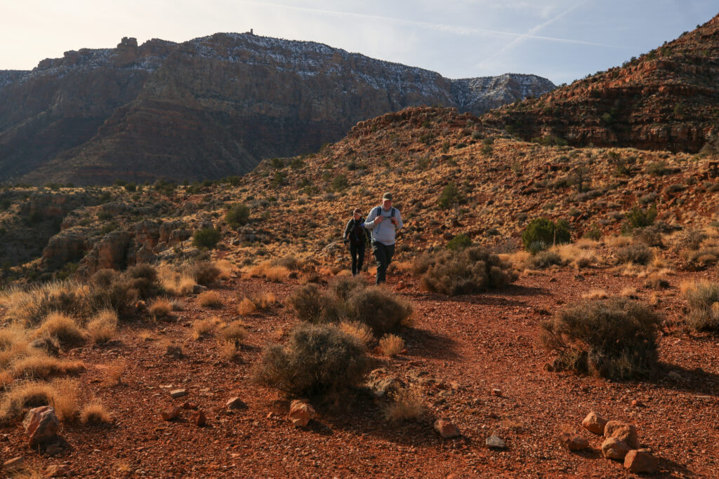
Despite the lousy sleep, I was so happy to wake up at the Redwall Overlook. It had been a dream of mine for years, and now it was a reality. Getting outside tent in the morning at our campsite the view was simply glorious.
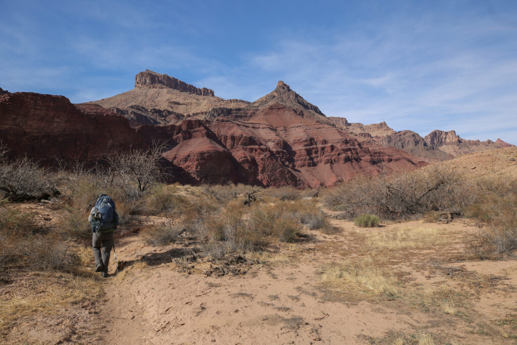
Making it to the Redwall Overlook was one of the primary goals I had for this trip. With my back acting up, one of the options we had discussed was just to hike to the overlook then hike back out. With the way I was feeling after getting out of the tent it looked like we were going to make a push for the confluence.
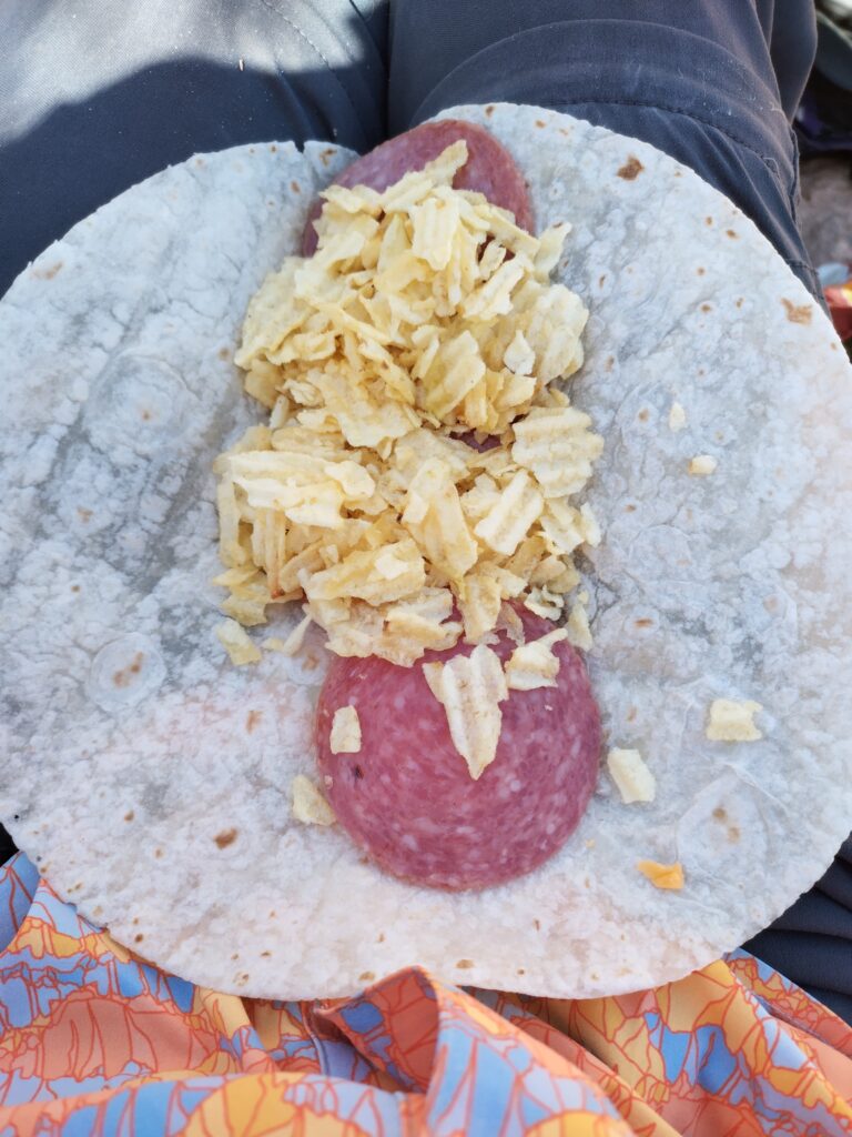
We only had 12 km to hike on this day which would be around 4 – 5 hours of actual hiking. This gave us the luxury of enjoying a very relaxing morning.
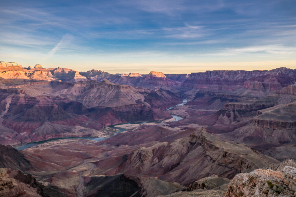
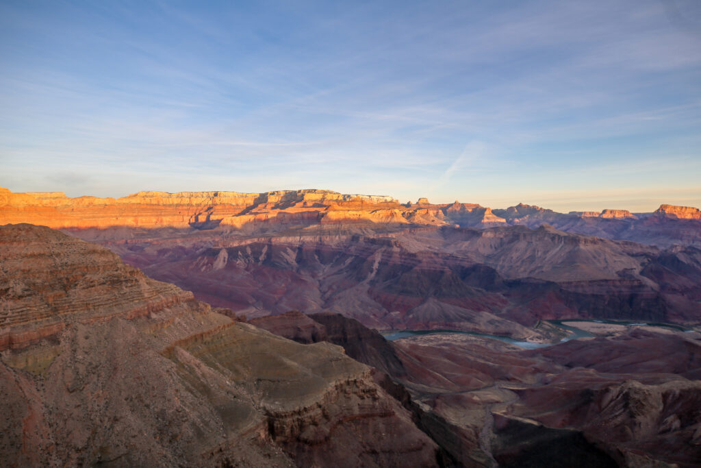
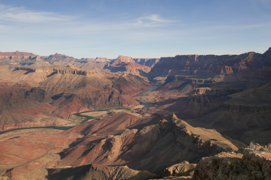
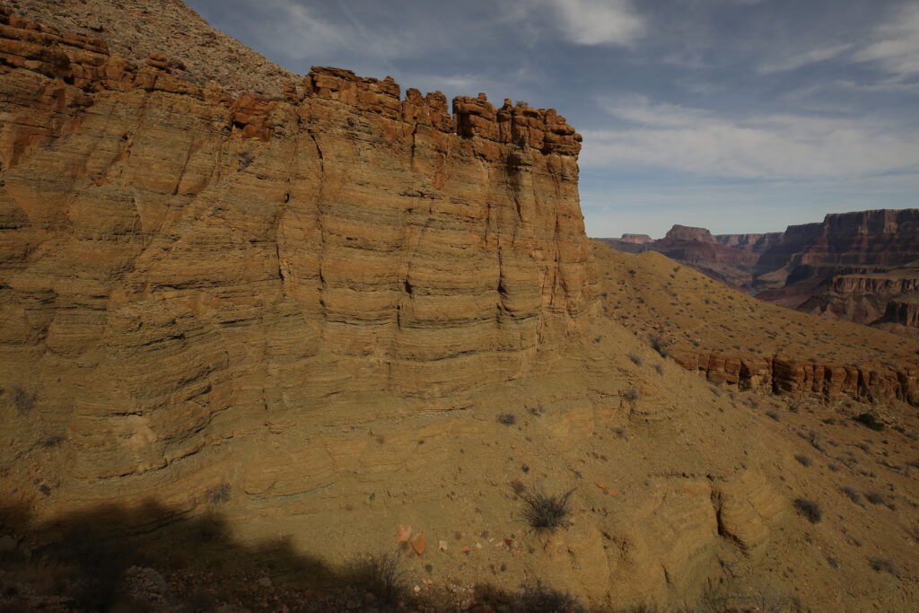
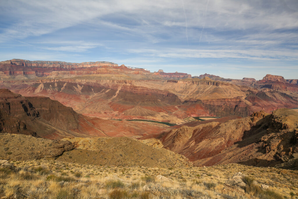
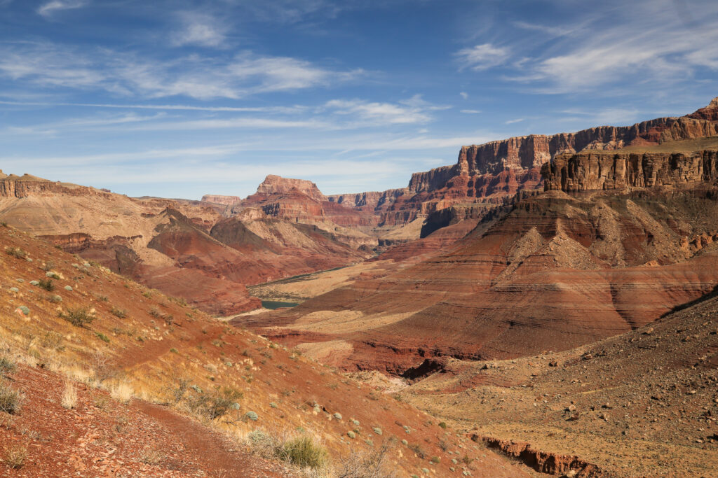
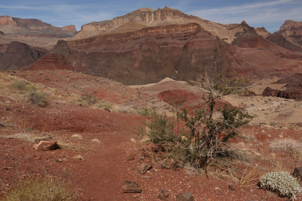
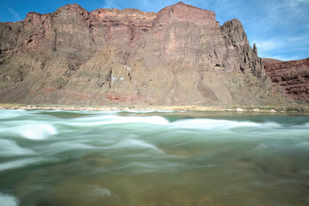
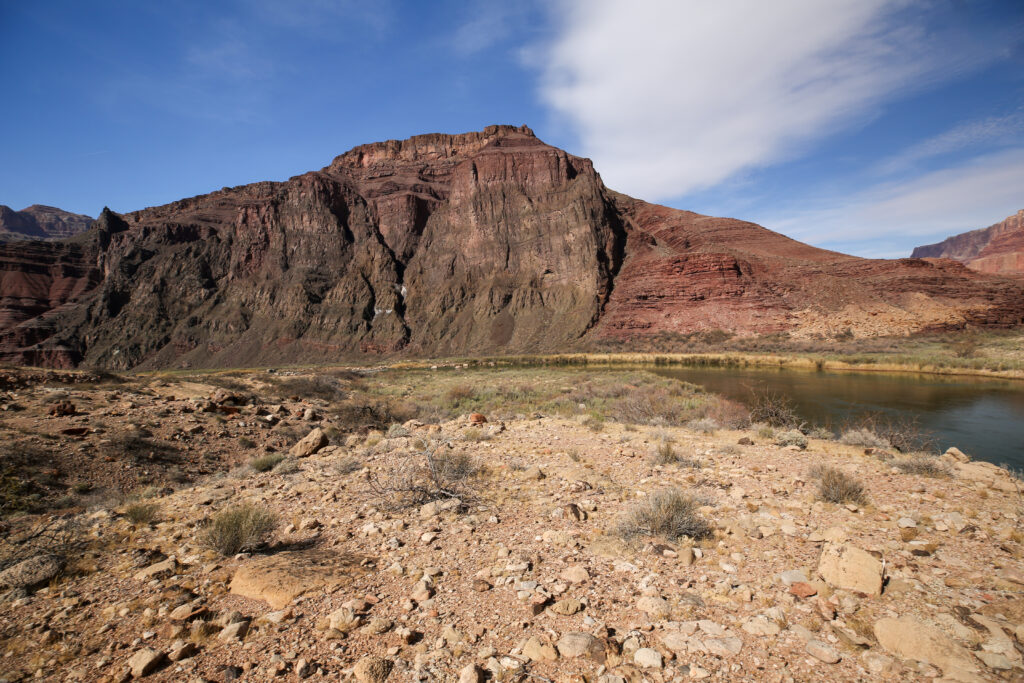
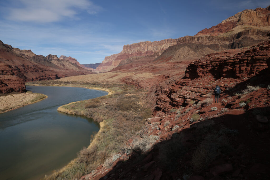
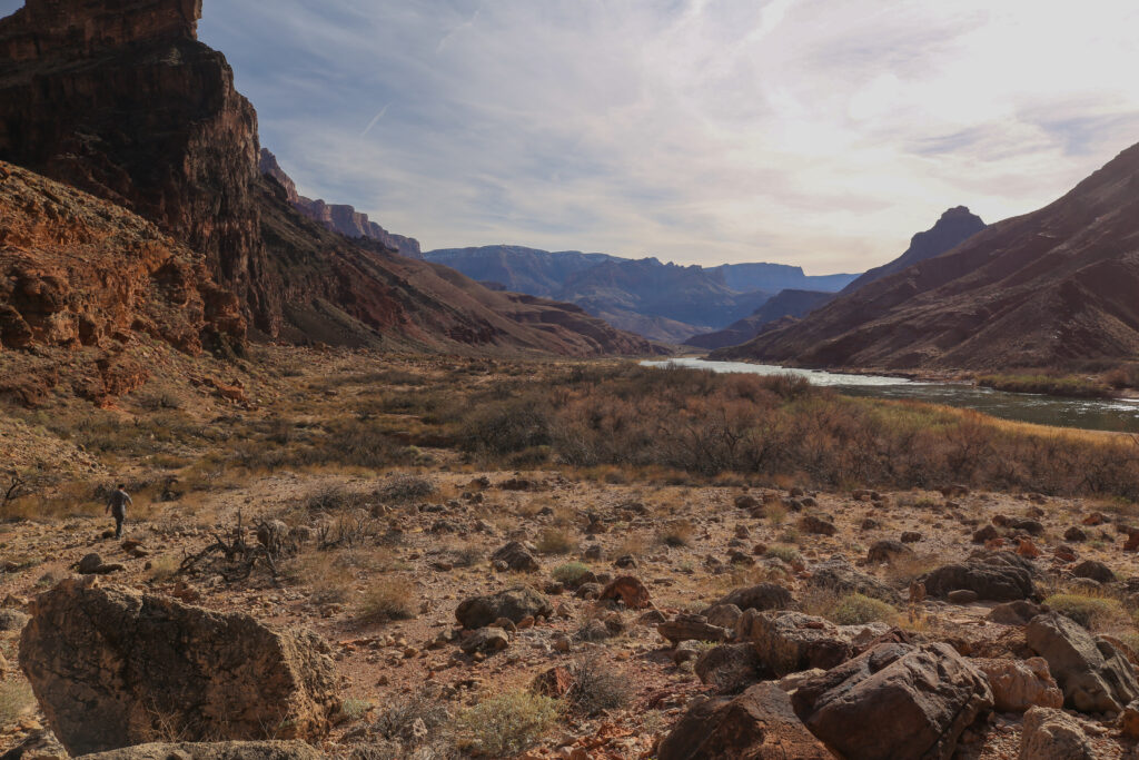
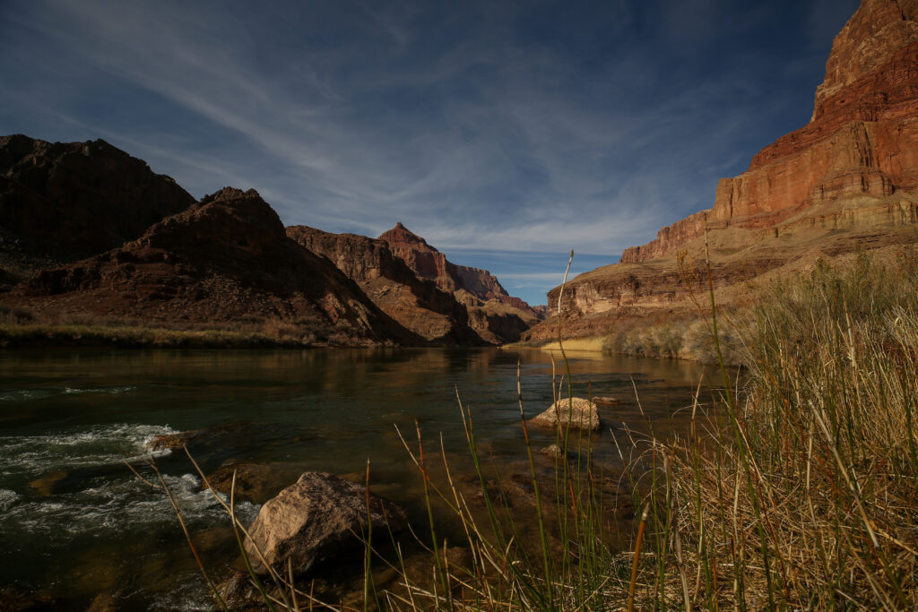
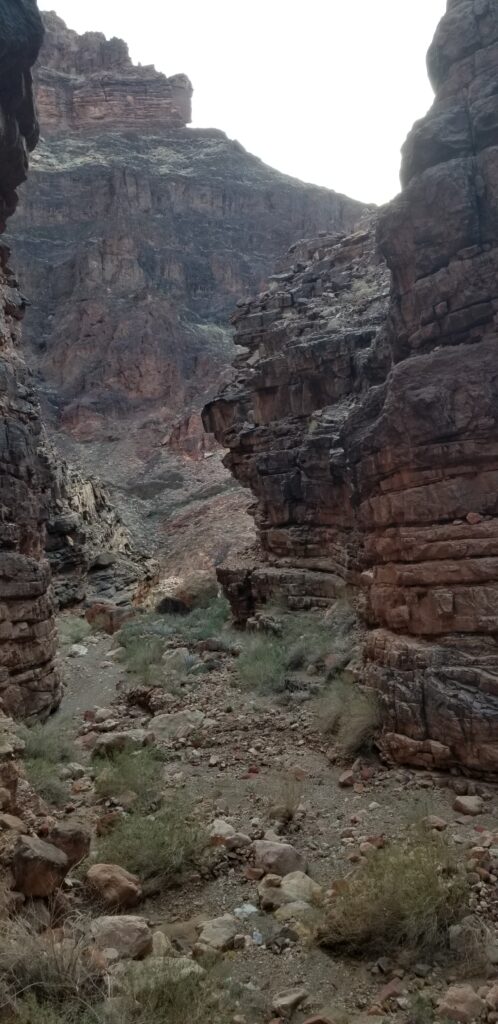
The photo above is an excellent example of the Grand Canyon Supergroup rock formation and how it is unique in the Grand Canyon. Most of the literature for the Grand Canyon highlights the rocks of the Paleozoic, 500 M years to 250 M years, which form horizontal layers visible throughout the Grand Canyon area. In the eastern part Grand Canyon there are rock layers that are not horizontal. Looking at the layers at the centre of the photo, the Nankoweap Formation, at first they appear to be horizontal. If you trace the Nankoweap rocks back up the photo to the left they actually form an angle with the rock layer above. It is this angle that indicates that the rock layers that make up the Nankoweap are actually tilted and are part of the Grand Canyon Super Group. The rocks of the Grand Canyon Supergroup were deposited between 1200 M years and 800 M years ago. While the Paleozoic rock layers are all horizontal, the rocks of the Grand Canyon Supergroup are identifiable by their distinctive 15 degree north-eastward tilt. This 15 degree difference in the interface between the two layers of rock is known as an angular unconformity.
I must admit the mood in camp was pretty good. The weather was perfect. The scenery was spectacular and my back seemed to be holding together. I always had a nagging little voice in the back of my head during the trip. Will I make it? What do we do if I have a back meltdown? At this point in time the voice was very, very quiet.
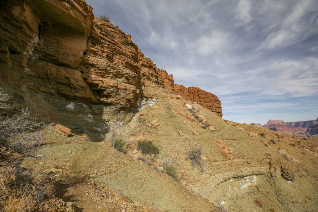
How the National Parks Service describes the descent of the Redwall Limestone:
The Redwall descent is nasty—steep and loose. A thin coating of gravel makes some slipping and sliding inevitable and a serious fall is a real possibility, so take your time.
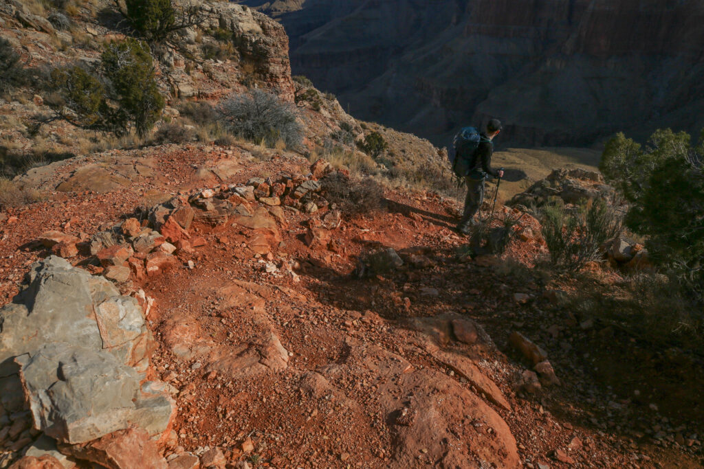
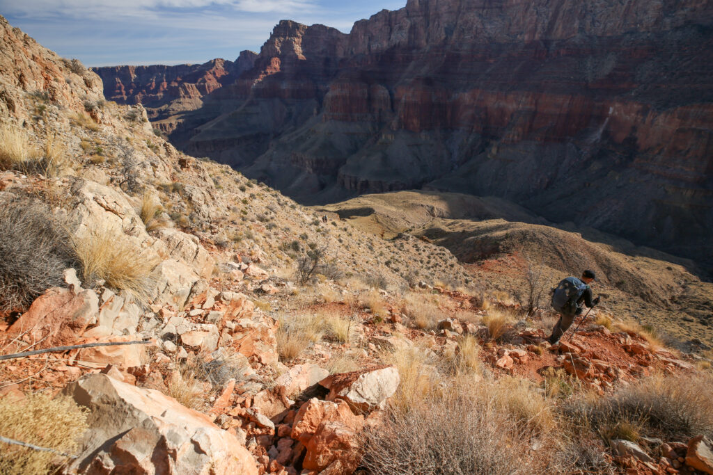
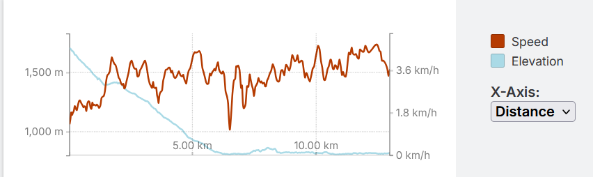
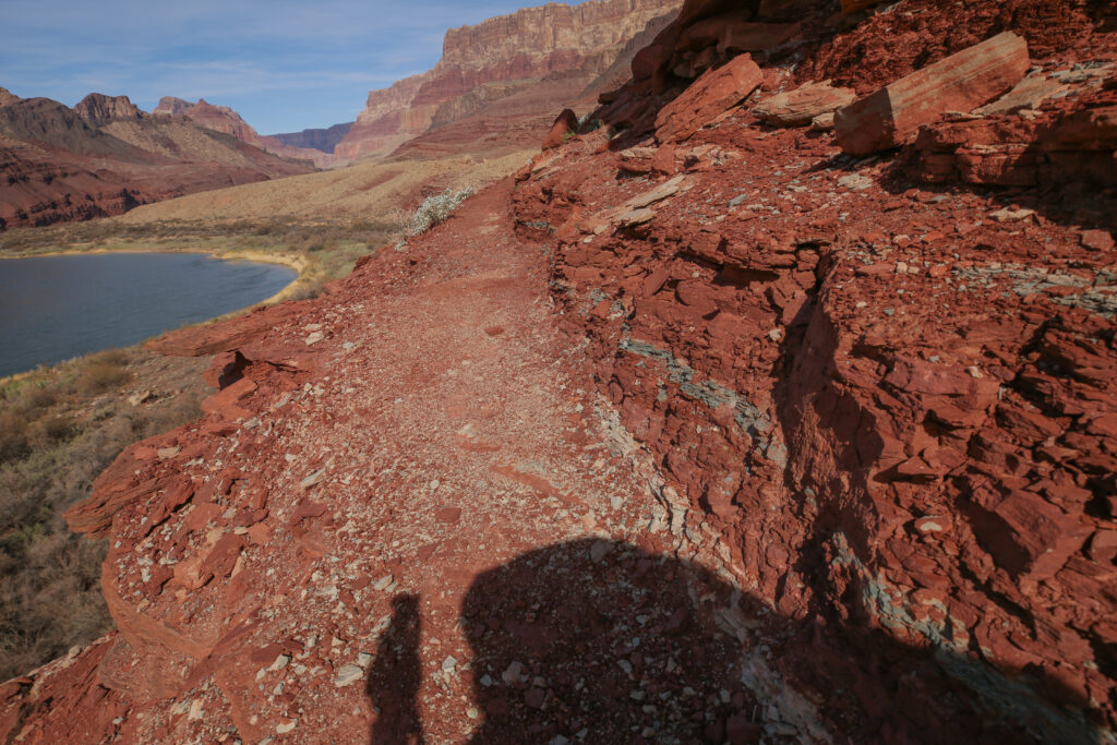
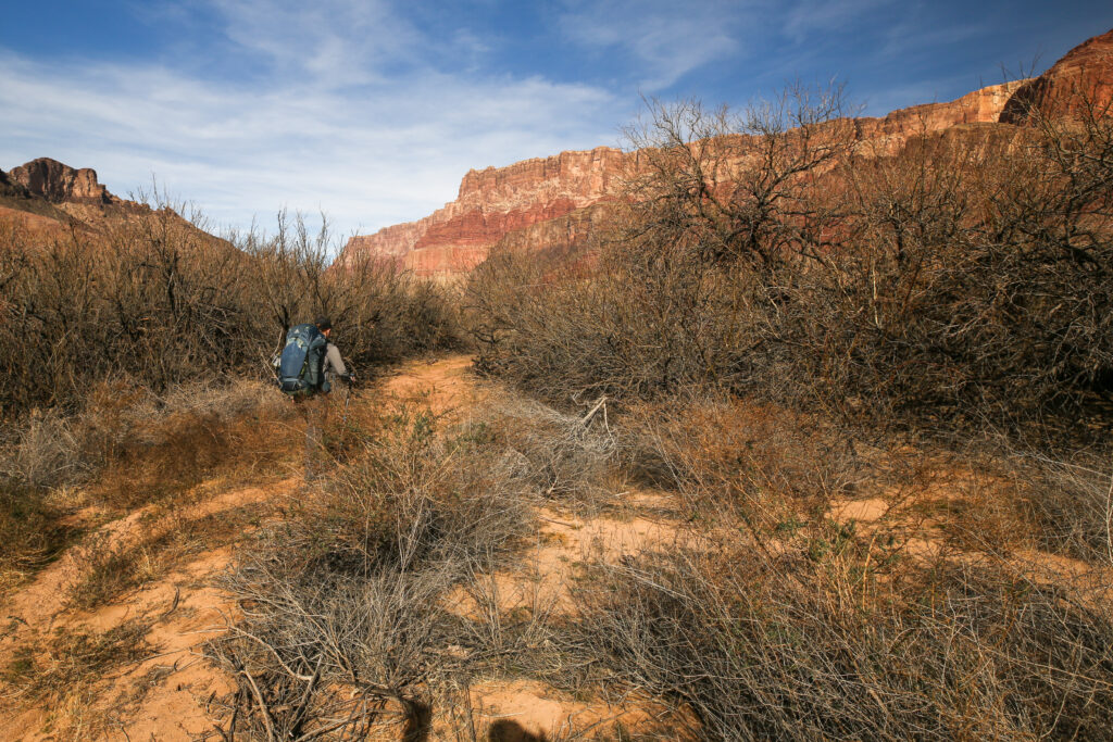
For the second time on the Tanner trail our speed drops to near 2 km/h on a descent. On most trails descents are places where you can make up time, but the Tanner is not any trail.
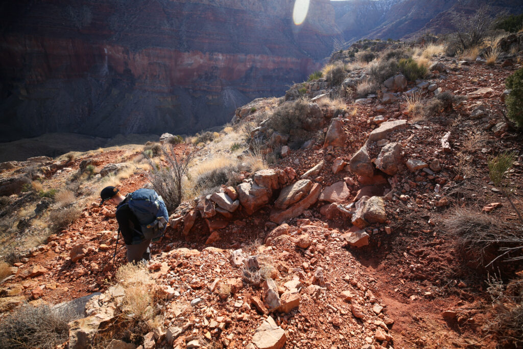
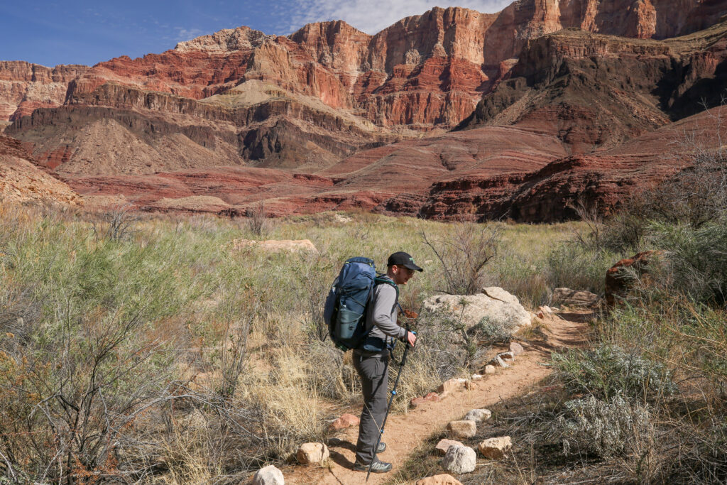
After descending the Redwall Limestone the trail traverses on another slope forming rock layer the Bright Angel Shale. The Bright Angel Shale is the rock layer that the Tonto Trail follows for most of its length through the Grand Canyon.
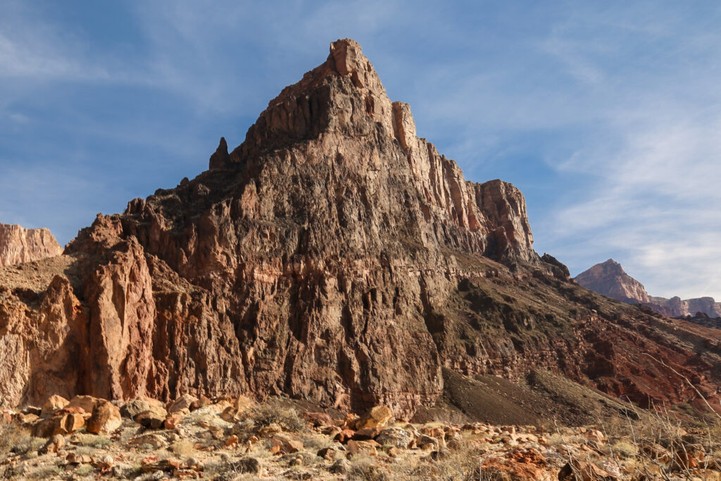
We passed underneath massive sandstone cliffs of the Tapeats Sandstone. The Tapeats Sandstone is the lowest member of the Paleozoic rocks making it the oldest rocks in the Paleozoic group of rocks at approximately 508 million years old.
The last major obstacle for our descent was getting through the Tapeats Sandstone. The trail followed the rim of a small canyon downhill then turned sharply and sidesloped back into the canyon. As the trail reached the end of the canyon it dropped into the bottom of its drainage, which lead us to the base of the cliffs of the Tapeats Sandstone. Once we were hiking along the bottom of the sandstone we were walking on our first layer of the Grand Canyon Supergroup. The layer is known as the Dox Formation and is made up of multiple members. The top member is the Comanche Point Member. A slope-forming member laid down approximately 1million years ago. Soft, sloped rocks are good trail-walking rocks.
The colour of the rock is all due to chemistry. Iron in the oxidized, or ferric (Fe3+), state combines with oxygen to form minerals like hematite, which yields a reddish-brown colour. Conversely, iron in the reduced, or ferrous (Fe2+), state is responsible for producing blue or green colours.
Red and brown shales indicate highly oxidizing, or oxygen-rich, environments. In these settings, typically found in terrestrial river channels or floodplains, oxygen was plentiful enough to react with iron, causing it to rust into ferric iron oxides before the sediment was buried. The presence of these bright colours confirms that the sediment was exposed to the atmosphere or to well-oxygenated groundwater during deposition.
Green shales suggest a mildly reducing environment, where oxygen levels were low. This condition often occurs in marine settings where the water is more stagnant or there is rotting of plant life producing reduced iron compounds, like ferrous iron, creating green-hued minerals.
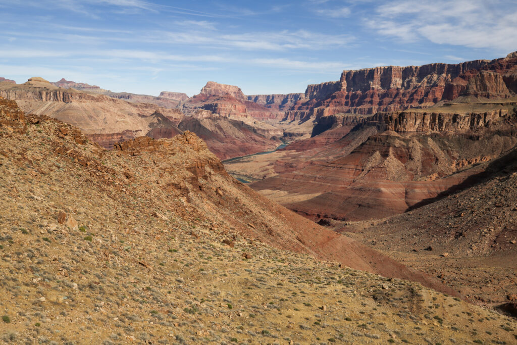
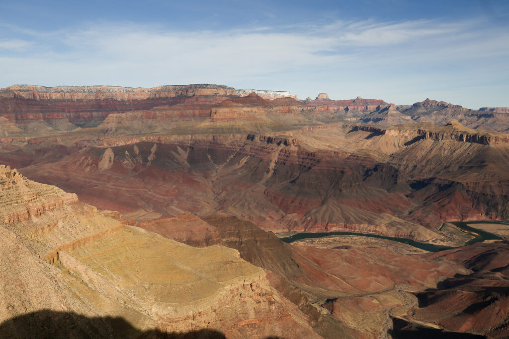
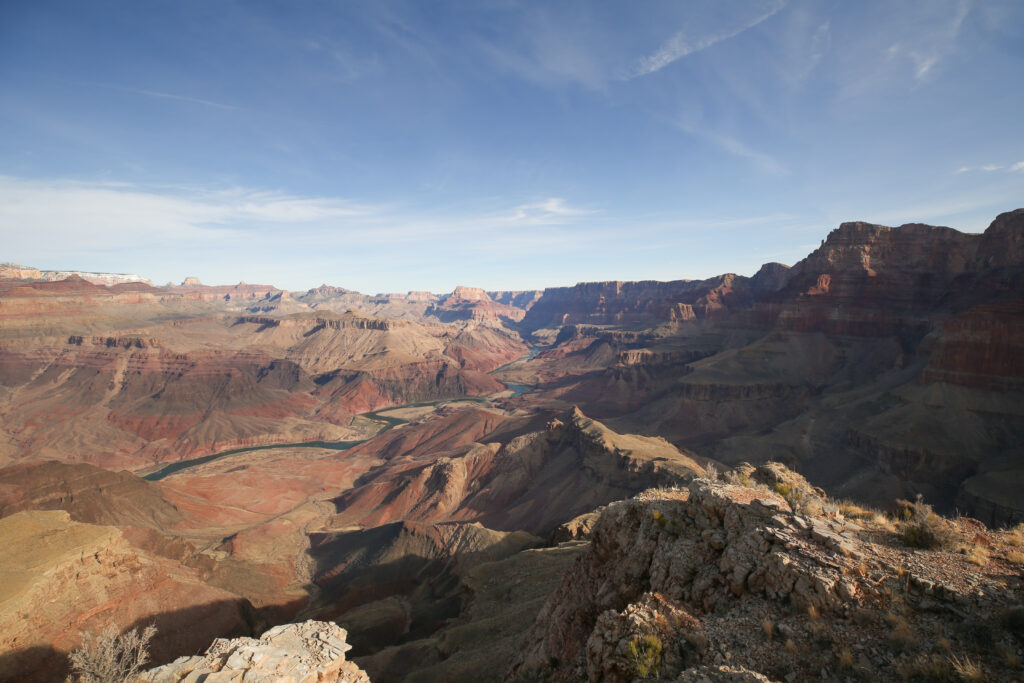
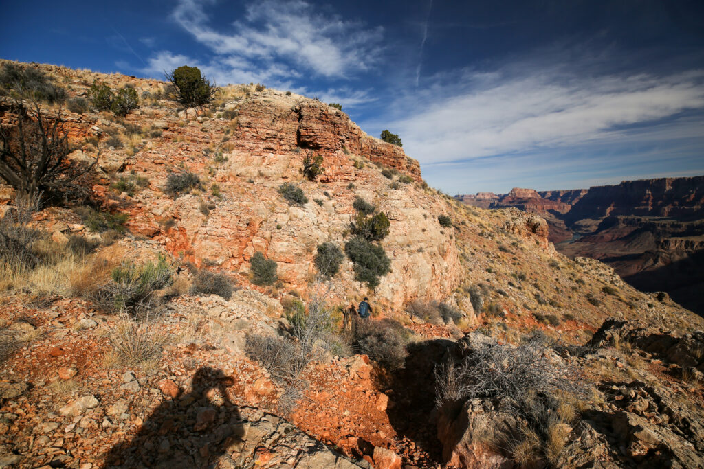
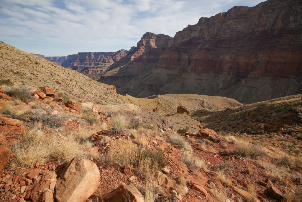
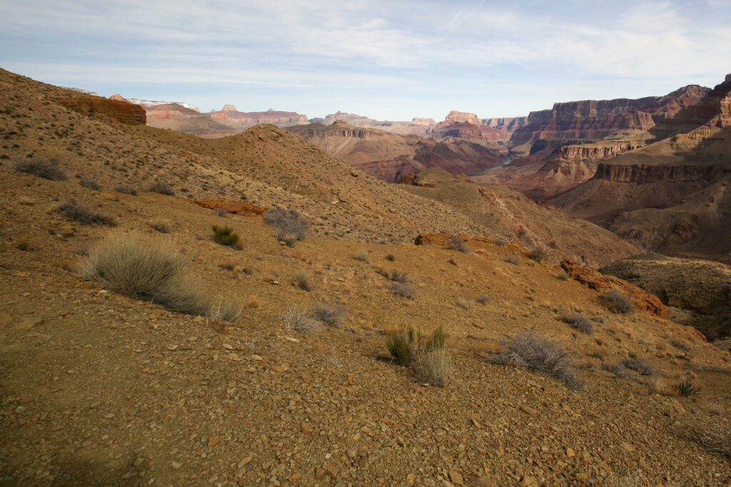
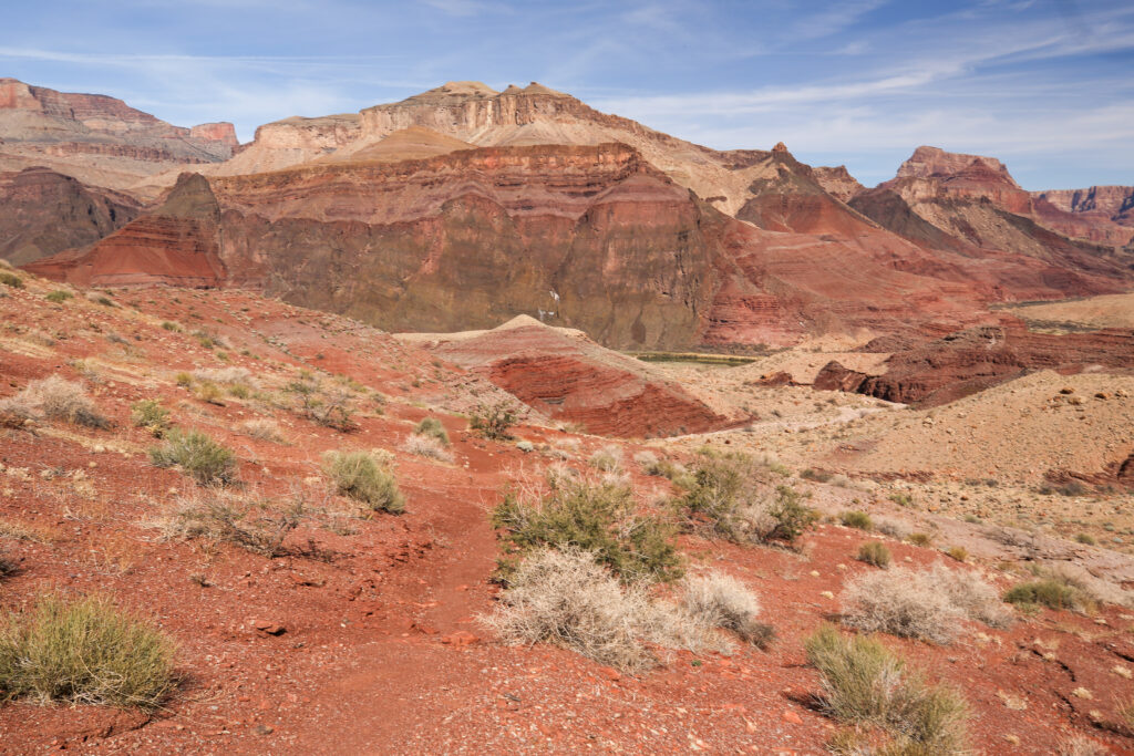
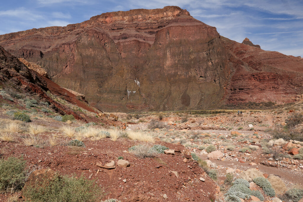
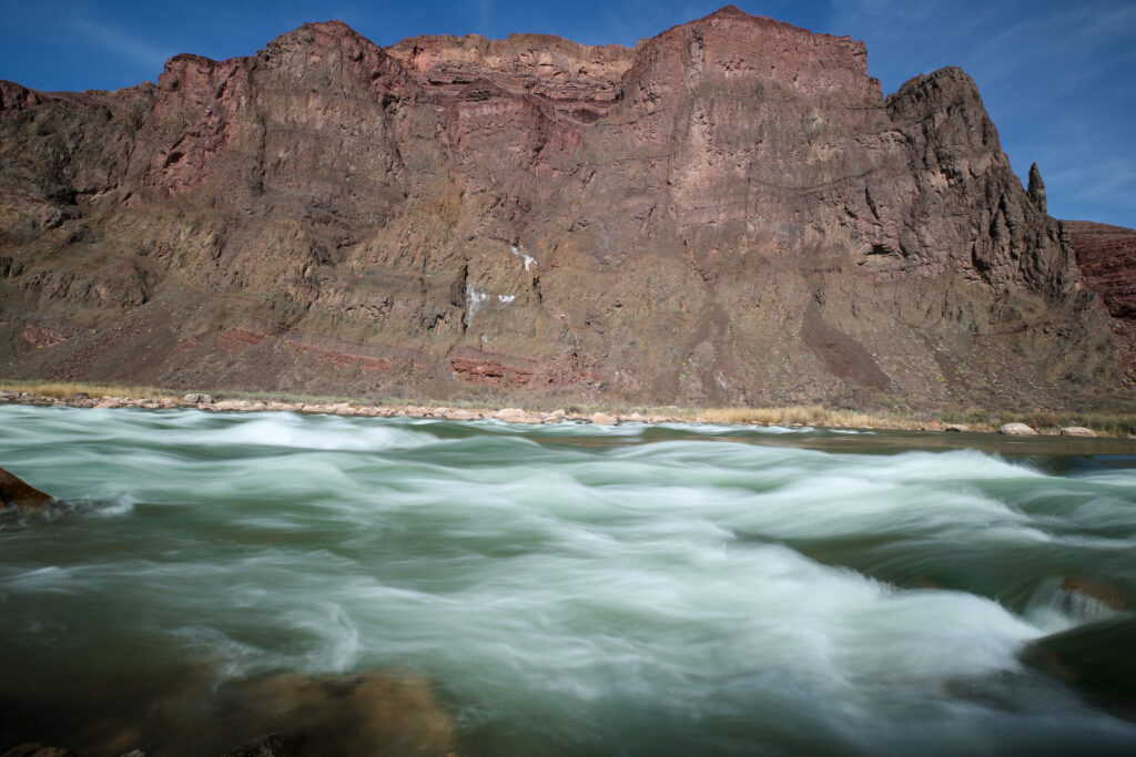
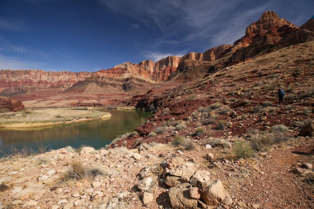
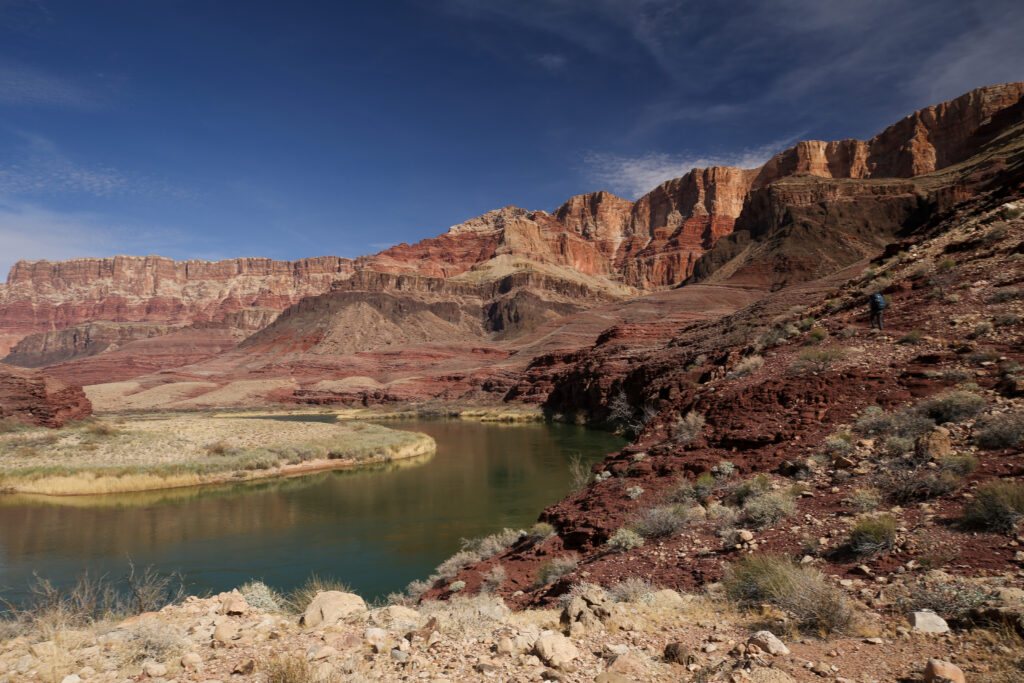
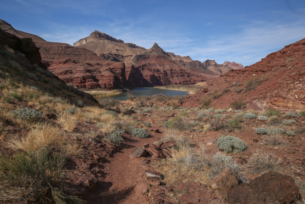
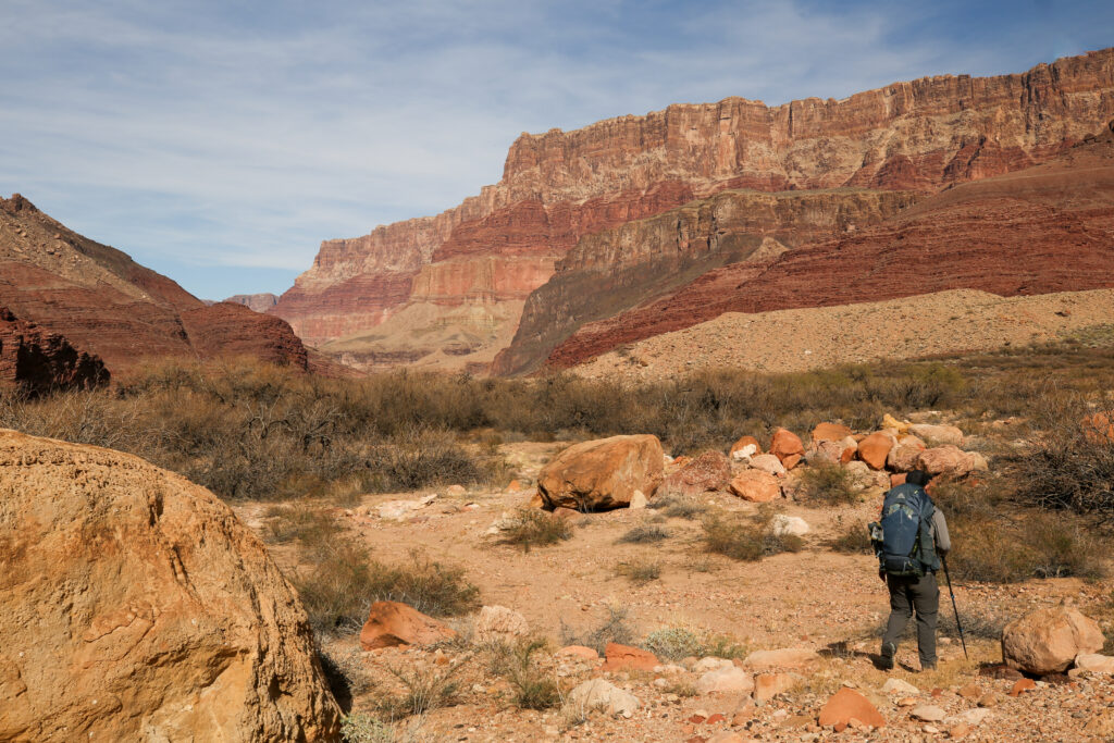
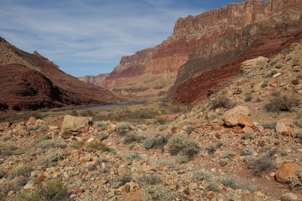
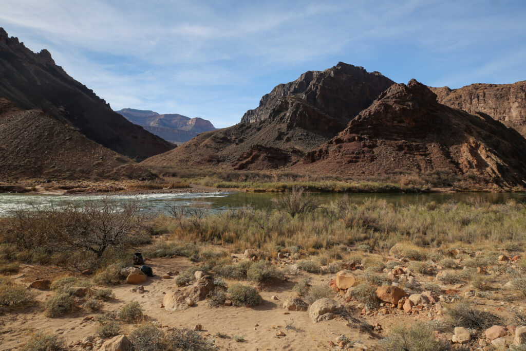
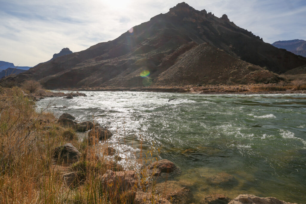
The photo above highlights some significant geological features of the Grand Canyon. If you look at the centre of the photo and up a little, you can see that the rock slope comes right down to the rivers edge when looking eastward. As you follow the river into the upper centre of the photo, cliffs suddenly line both sides of the river. Interestingly, these cliffs are Tapeats Sandstone. From where this photo is taken the Tapeats Sandstone on the Tanner Trail is behind us and up a little. The Tapeats Sandstone in the distance being at river level must be significantly lower than the cliffs behind us. The elevation of at the Tapeats on the Tanner Trail is 1300 m. The elevation in the distance, where our camp will be at Palisades Creek, the top of the cliffs are at approximately 975 m. The offset in the Tapeats is about 325 m or almost 1100 ft. The cause of the offset is a fault that runs along Palisades Creek, the aptly named Palisades Fault. The Palisades Fault is a break in the rock and the east side has dropped down by 325 m compared to the west side of the creek, creating the offset we can see from this point.
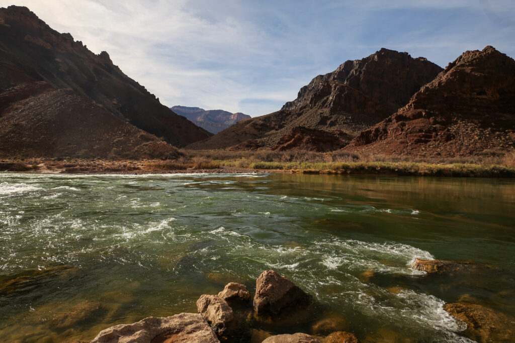
The Tanner Grabben is evidence that points to the stretching of the rock in the Grand Canyon. Simplistically, a grabben occurs when rock is stretched apart and separates, leaving a gap which allows younger rock from above to fall and fill the space. The Tanner Grabben has identical sandstone on each end that was separated by stretching which occurred with the break up of the supercontinent Rodinia about 900 million years ago. The separation of the sandstone rocks allowed the Tanner Grabben, which is mostly volcanic basalt, to slide down and fill the void.
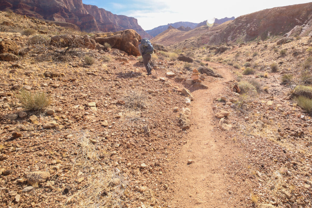
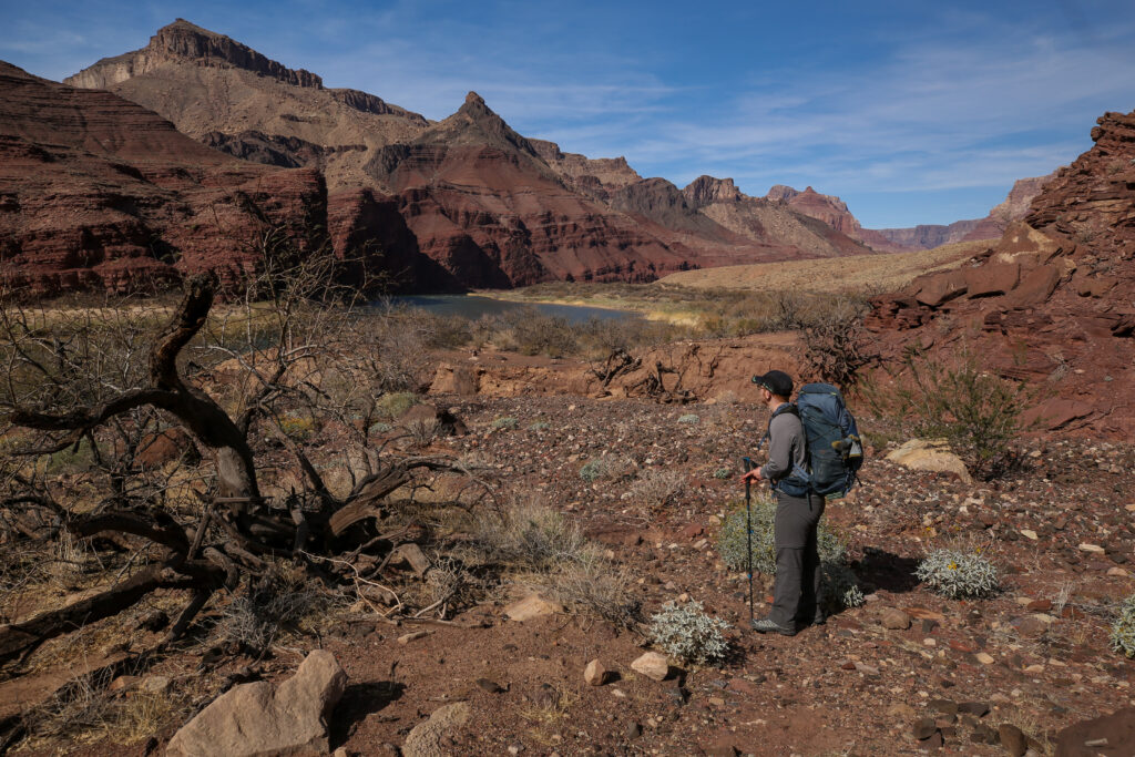
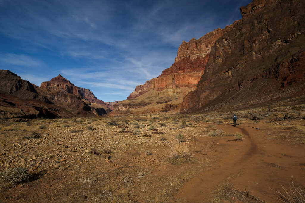
It took us about 2 hrs 25 min to hike the 6 km down from the Redwall Overlook to the Tanner Rapids. We arrived spot on at 12 noon, perfect timing for lunch.
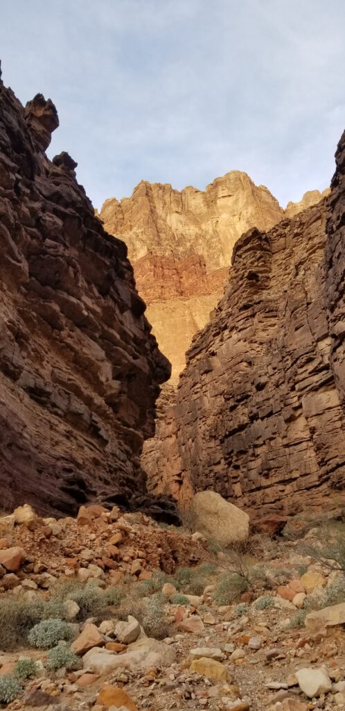
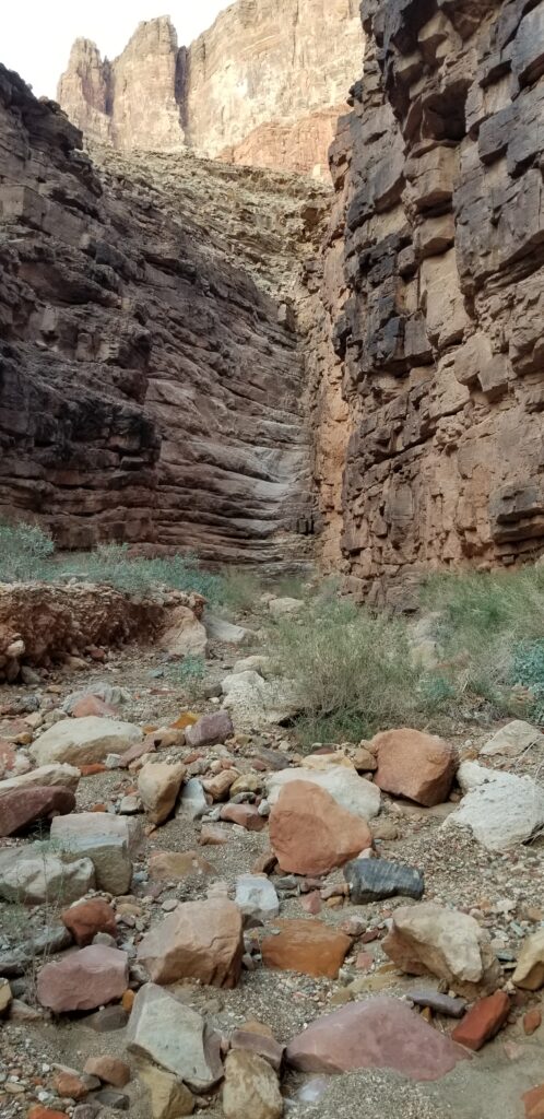
We hung out at the Tanner Rapids for almost an hour and a half. Even leaving when we did at 1:35 pm it gave us lots of time to make our way along an almost flat 6.3 km to our camp spot at Palisades Creek. Of course, nothing in the Grand Canyon is ever that straightforward. Our hike on the Beamer Trail began by hiking back up the Tanner Wash a little way followed by a little bit of scrambling over the bright red cliffs of the Solomon Temple Member. The scrambling was very easy and fun but if you messed up you could end up in the river.
History of the Beamer Trail from the National Parks Service:
The Little Colorado River joins the main stem of the Colorado at river mile 61.5. Since Powell’s voyage of exploration in 1869 this confluence has marked the end of Marble Canyon and the formal commencement of Grand Canyon proper – the threshold of Powell’s “Great Unknown”. The setting is remarkable. When unstained by floodwater, the Little Colorado is the color of the sky. Huge unbroken sweeps of vibrant vertical stone range 4000 feet up to the rim as two monumental canyon systems merge into one. The Grand Canyon is a place where the extraordinary is routine, but even here, the Beamer Trail to the mouth of the Little Colorado River represents choice canyon décor.
The Beamer Trail was named for Ben Beamer, pioneer, farmer, and miner active in eastern Grand Canyon during the early 1890s. Beamer tried, unsuccessfully, to grow crops and live near the mouth of the Little Colorado.
As we walked through the sand we spotted a family of four sitting off to our left in the trees. They had some clothes hanging on some tree branches but other than that just appeared to be sitting with no evidence of a camp or backpacks. They did not signal to us for any assistance so we kept moving down the trail.
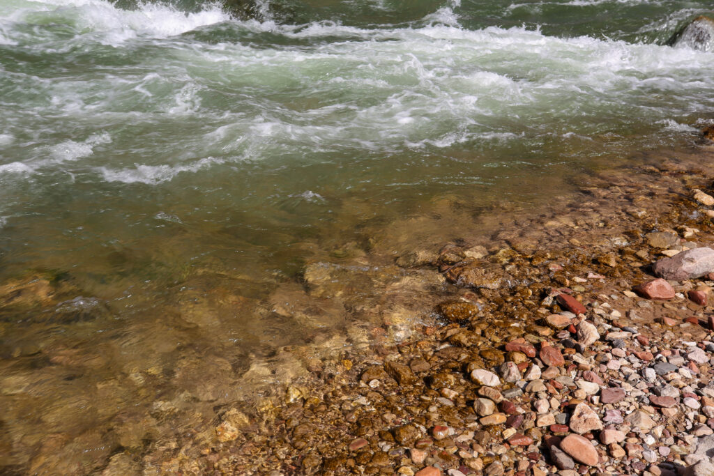
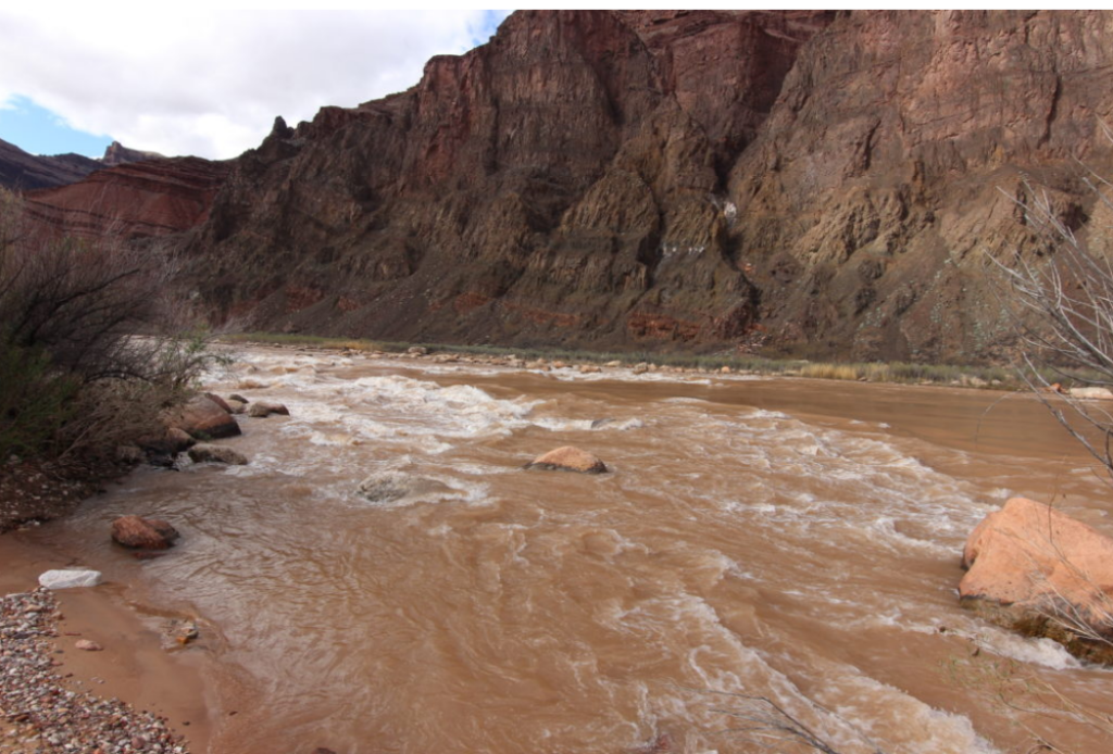
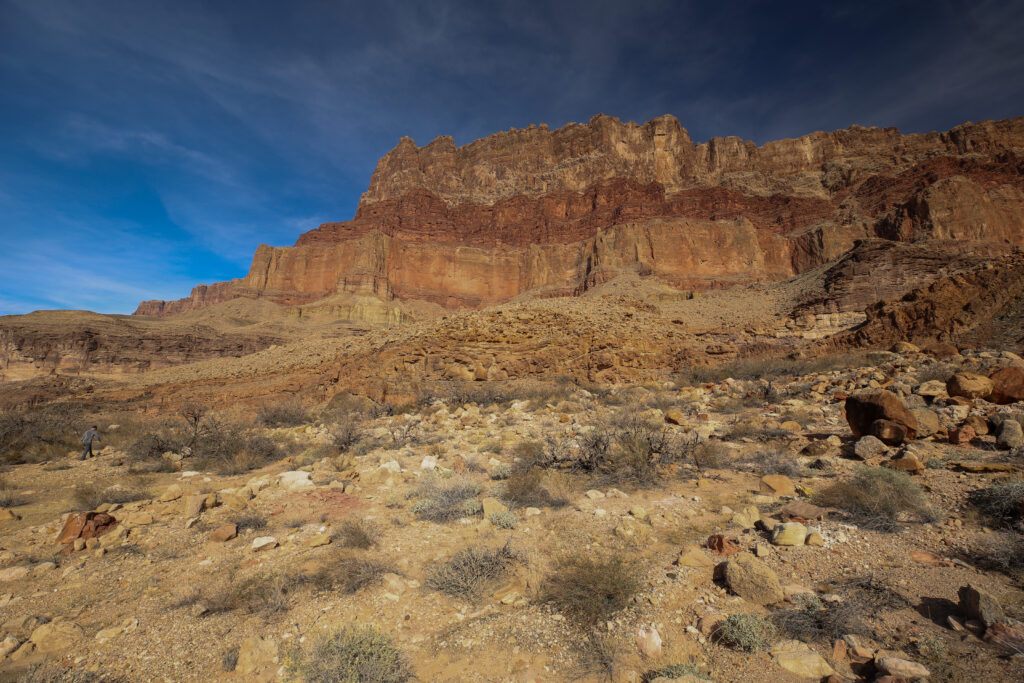
The vast quantities of sand on the trail are the results of past floods of the Colorado River. In years past, and definitely before the dam at Page, AZ, the Colorado River would frequently flood, dropping the silt that it carried as thick layers of sandy mud in the flooded areas. The more controlled water flow from the dam has reduced flooding to being a rare occurrence. This was an unintended consequence of the dam at Page. With the creation of Lake Powell behind the dam, the flowing Colorado River slows down as it enters the Lake Powell and drops all the silt that it had been carrying. The silt is thus prevented from flowing downstream into the Grand Canyon and possibly being deposited in the flood plains. There are huge sand dunes at Tanner Rapids and the National Park Service has made them off limits to camping in an effort to preserve the dunes since they are not being replenished by the annual floods.
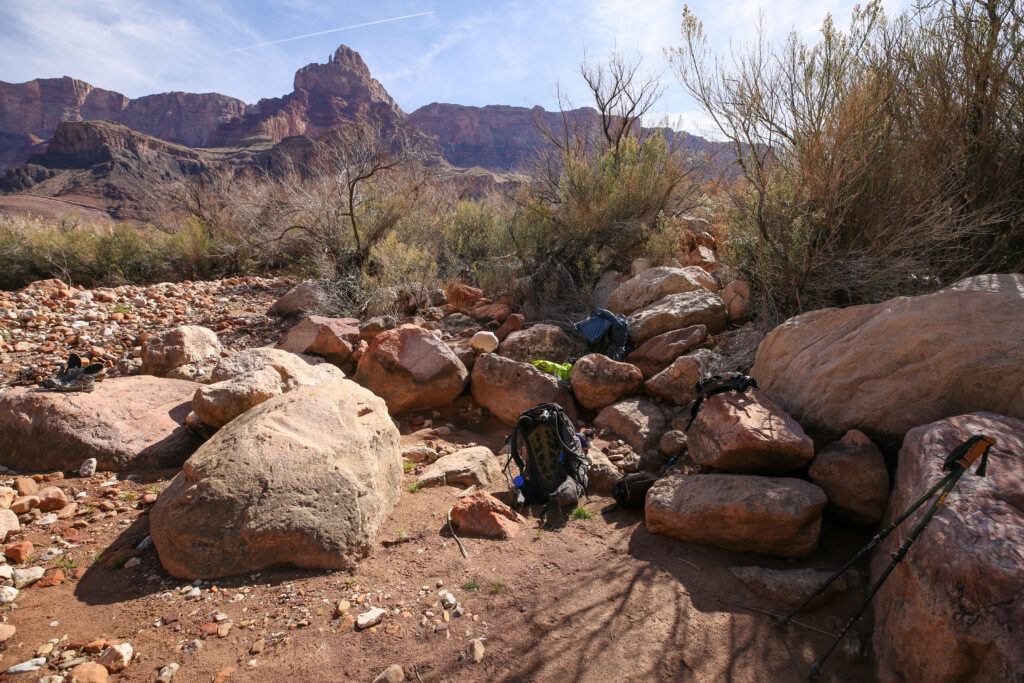
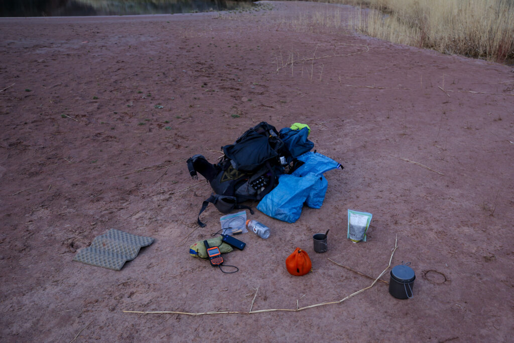
We dumped our packs at 3:10 pm. It had taken us just 1 hr 40 minutes to hike the 6.2 km from Tanner Rapids. We had chosen an area that definitely appeared to have used for camping before. We then went off exploring to see what other camping locations were on offer.
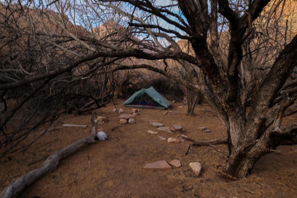
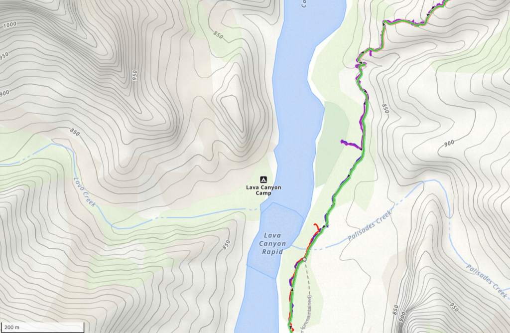
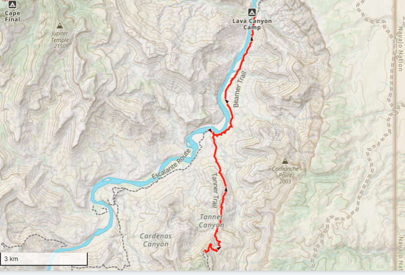
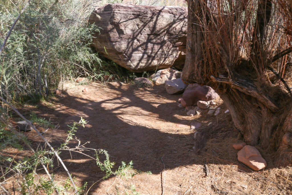
The small red line on the above photo is where we ended our day hiking from the Redwall Overlook. This was the location where we dropped our packs below the small tree in a previous photo. The purple line on the photo is where we started hiking to the confluence from our camp in the Enchanted Forest. So we moved our camp about 200 m after discovering the forest location.
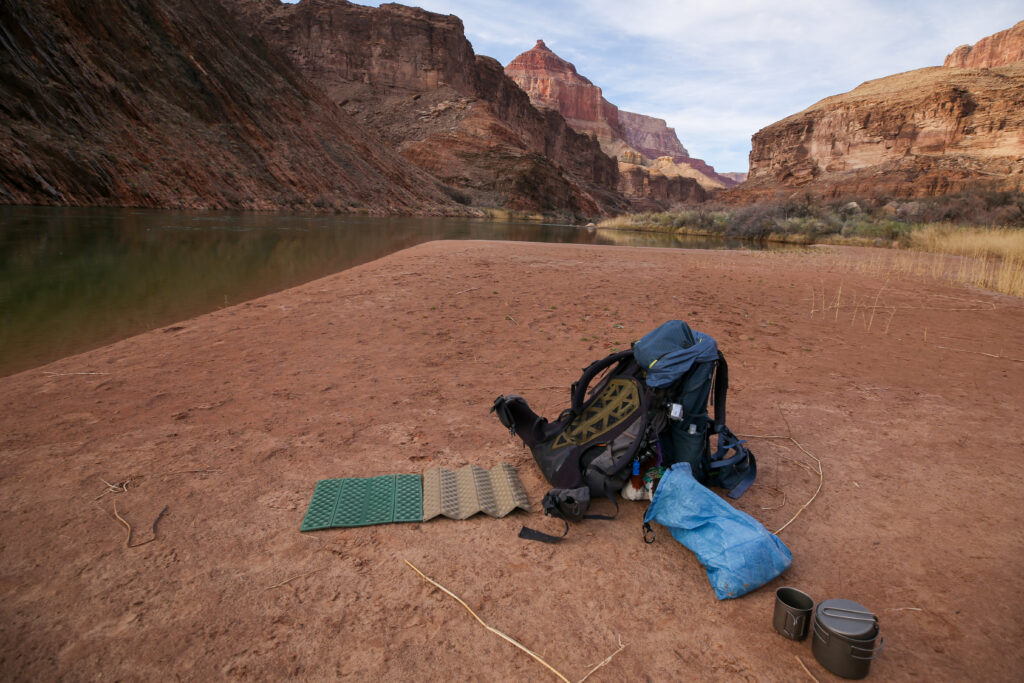
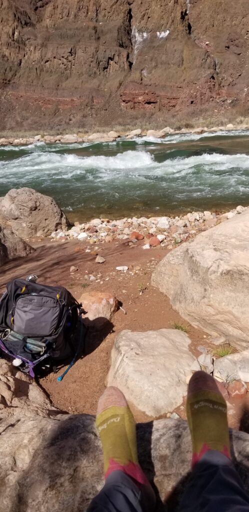
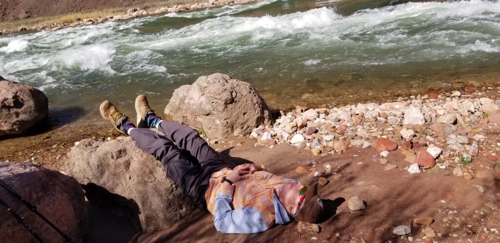
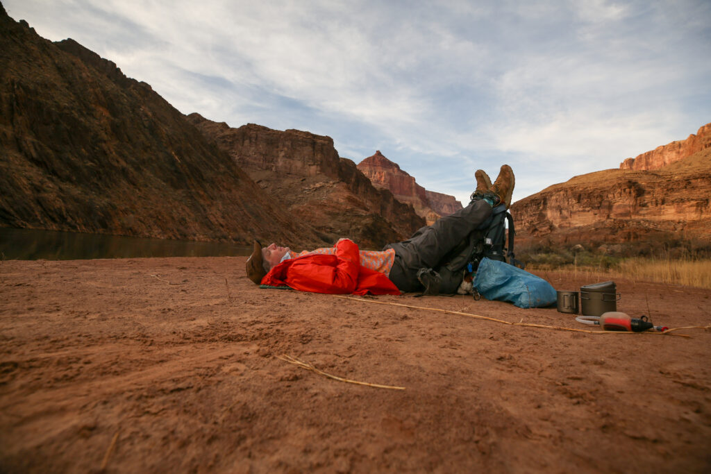
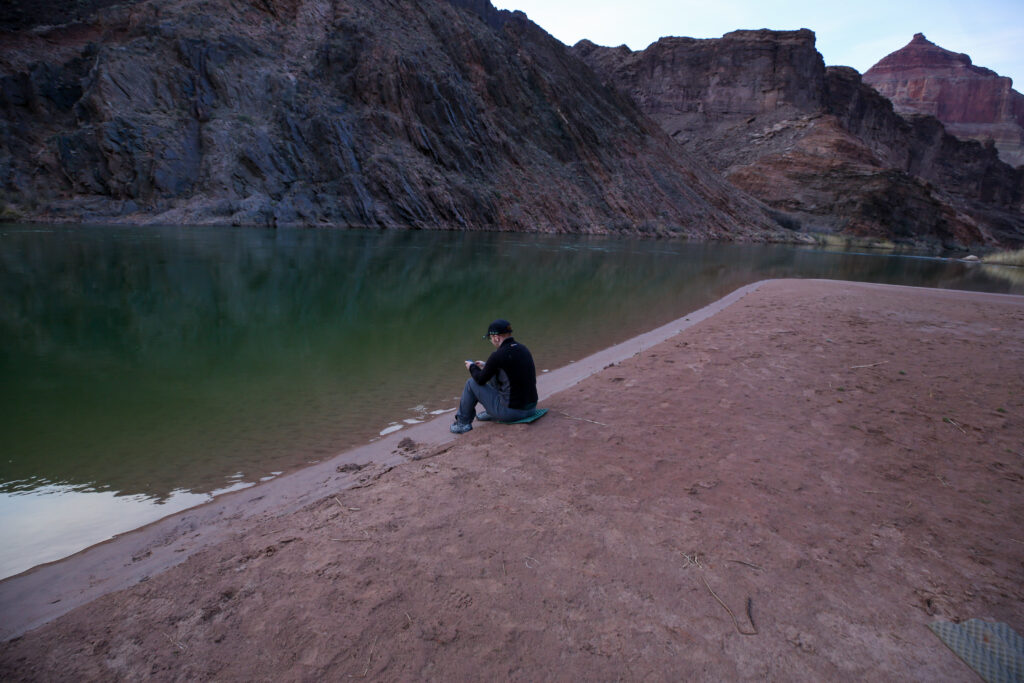
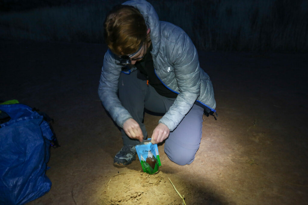
After setting up in the Enchanted Forest Micah and I did a little exploring. We discovered a fairly well beaten trail that led to our own private beach on the Colorado River. Micah decided to go exploring up Palisades Creek before dinner, leaving me to just relax on the beach. I would have loved to have joined Micah, but the goal of the trip was the confluence and I was still feeling good. I did not want to risk that good feeling.
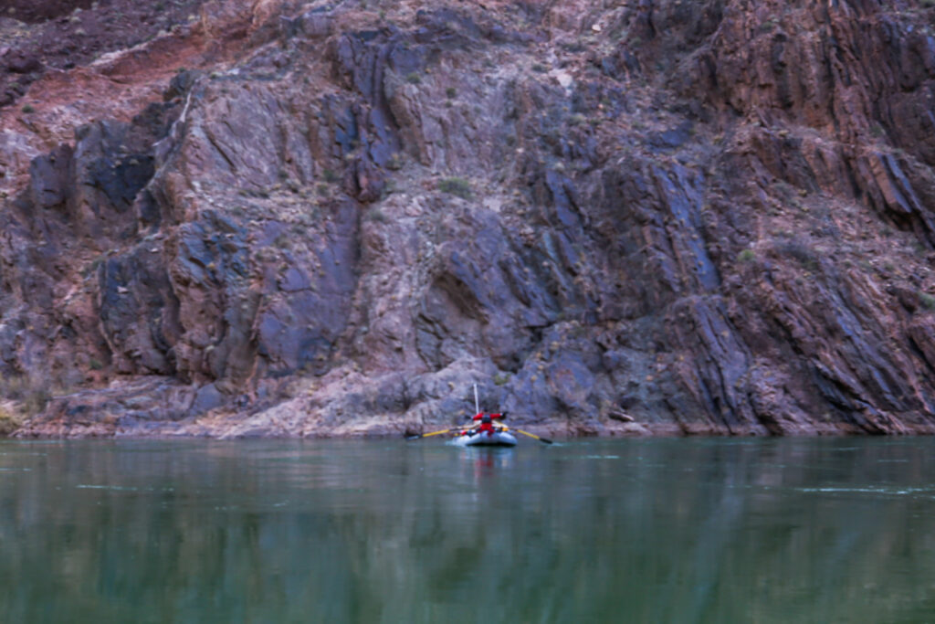
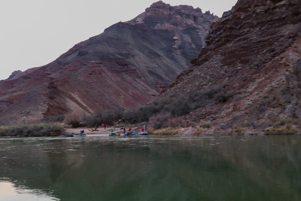
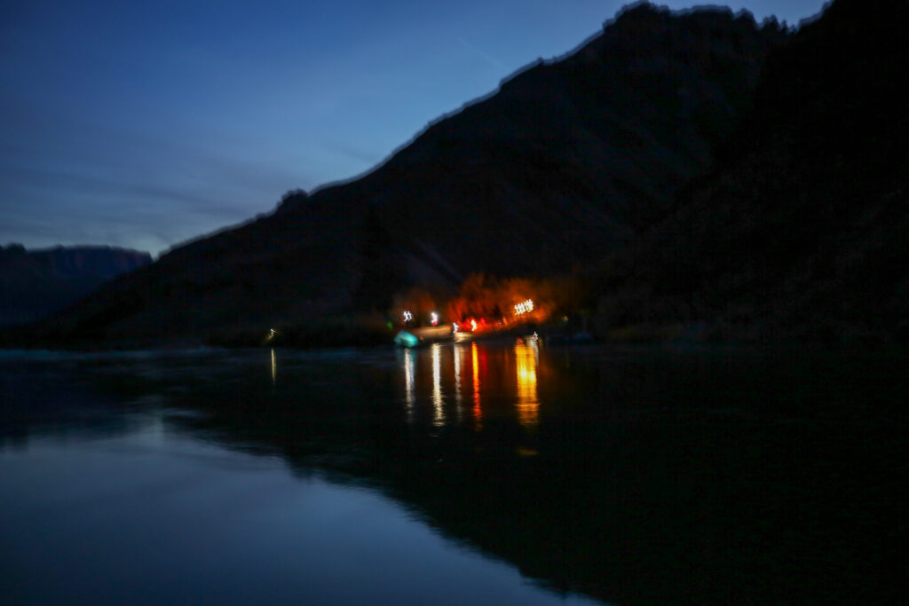
As we relaxed by the river before making dinner some river rafters came by. They started landing at Lava Campground on the other side of the river. One of the rafts made a detour and came over to see us on our beach. A guy, I’m guessing he was one of the river guides, asked if we were OK and if we needed anything. I answered cheerfully in that everything was fine and we had all we needed. Afterwards I thought I should have asked if they had a spare beer or two. Seeming satisfied with our response, they gave a friendly wave goodbye and headed down river and across to their camp. I have only been on the Beamer Trail twice but both times a river guide has come to check on me. Back in 2017 they even offered us a float ride back to Tanner Rapids. It had been a big mistake declining the offer on that trip, but this time we really were doing just fine.
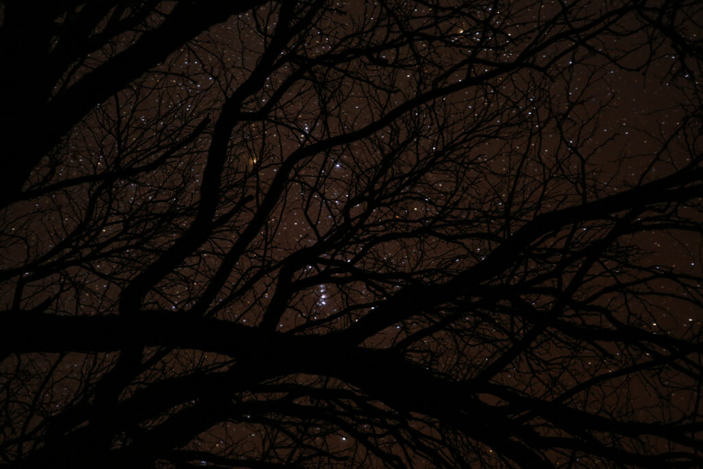
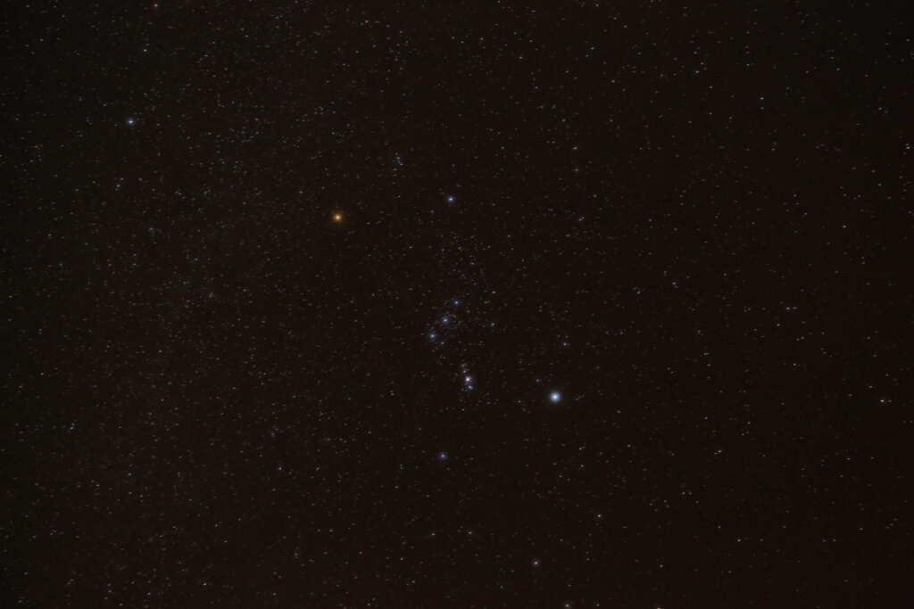
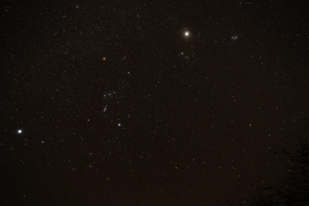
It was dark but we were not overly sleepy. So I got my camera out and put it on my little Gorrila Pod tripod and took pictures of the night sky through the canopy above out tent. We provided ourselves with quite a bit of entertainment before heading into the tent just before 9 pm. We were planning on getting up early tomorrow as we had a big day and wanted as much flexibility with the day as could.
The end of a fantastic second day in the Grand Canyon. I was feeling pretty confident that tomorrow was going to be a good day.