Day 3 – Part I – The Confluence – Grand Canyon NP – 2025
Canyon magic.
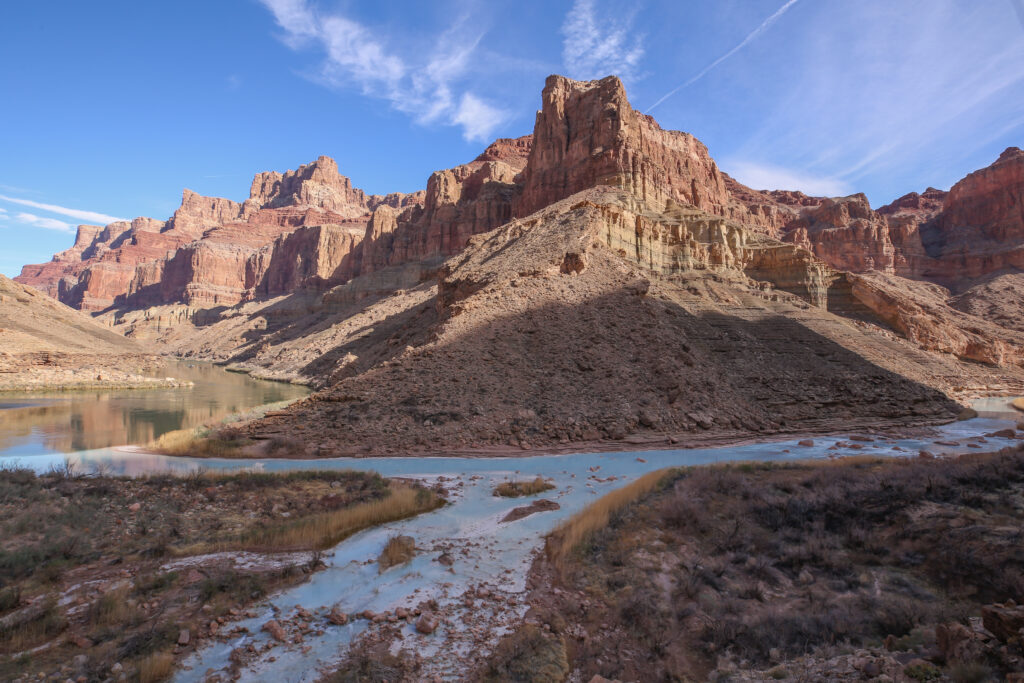
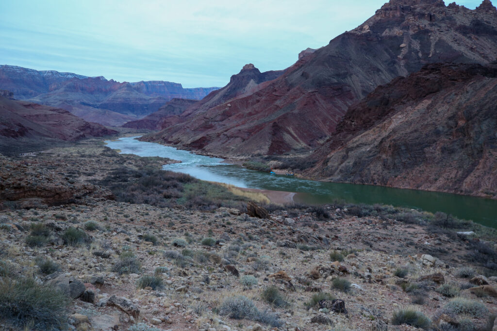
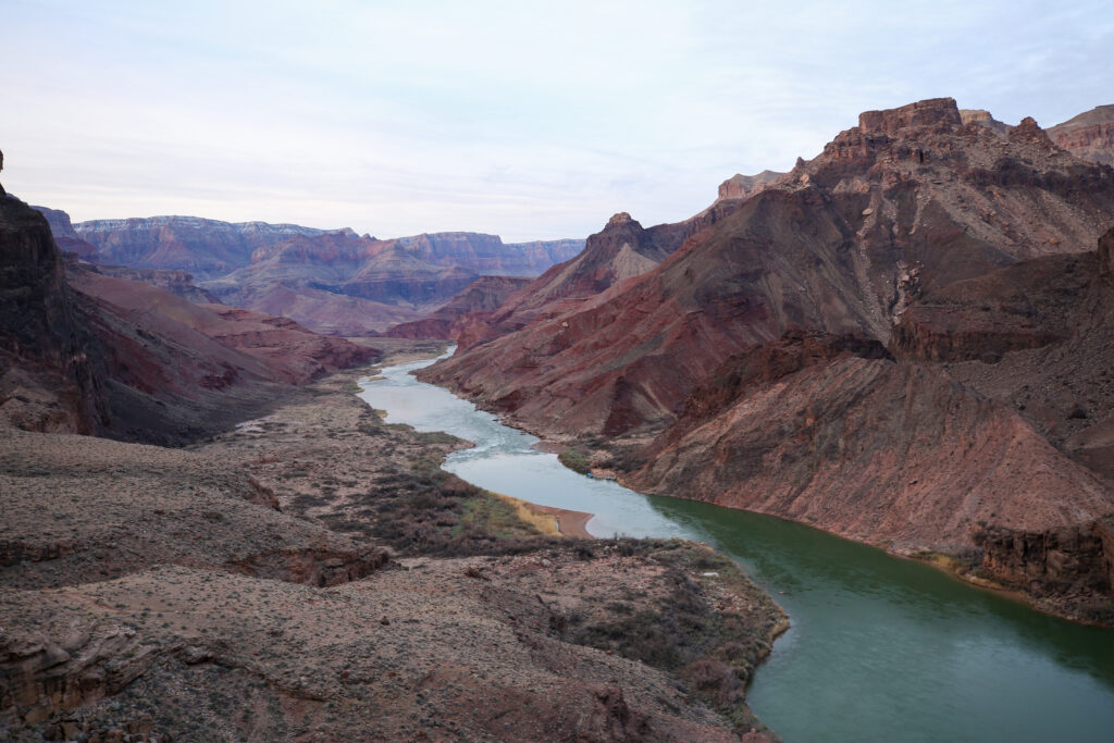
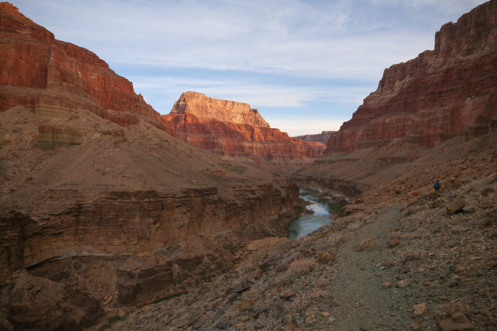
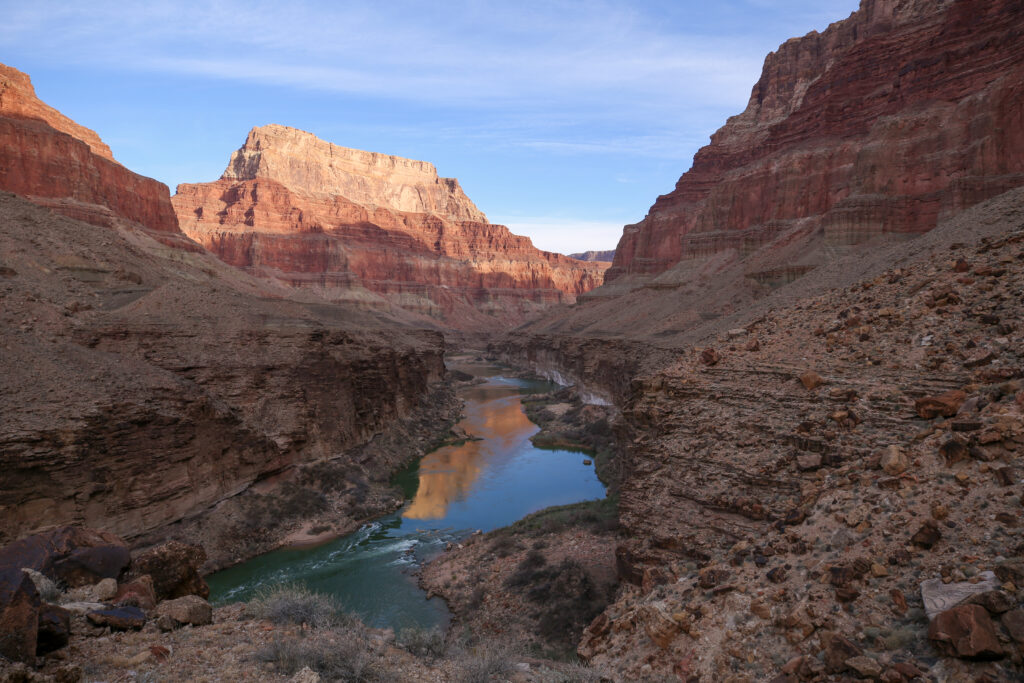
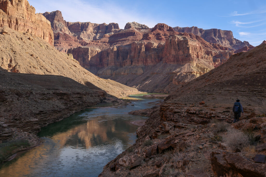
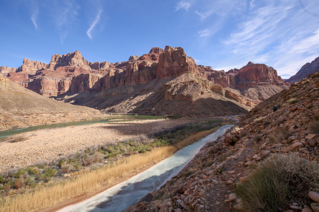
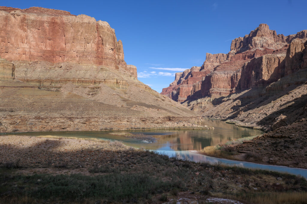
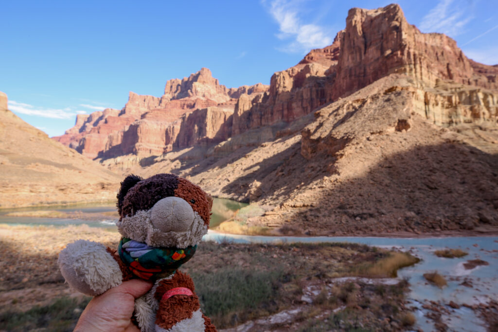
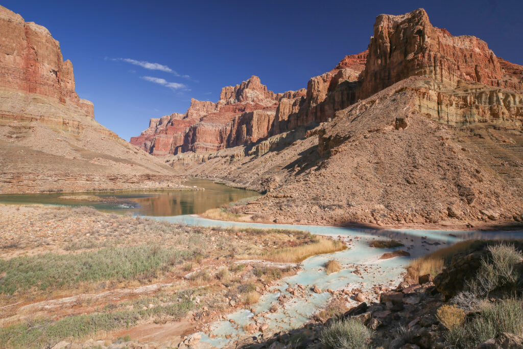
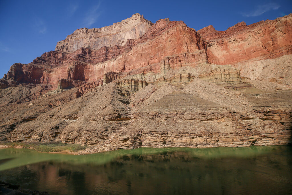
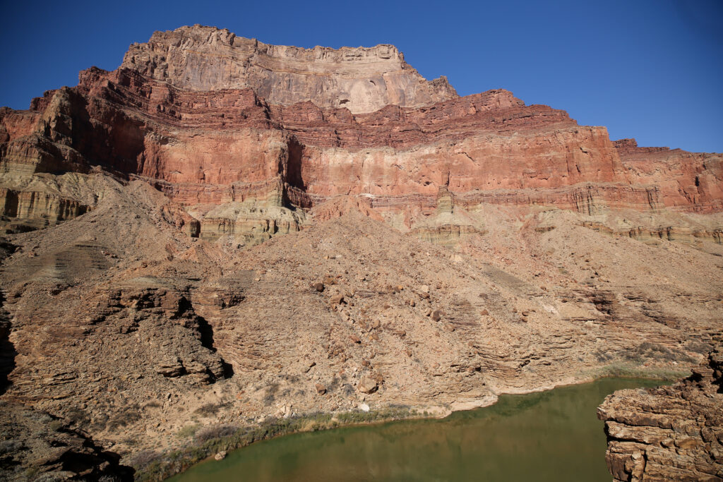
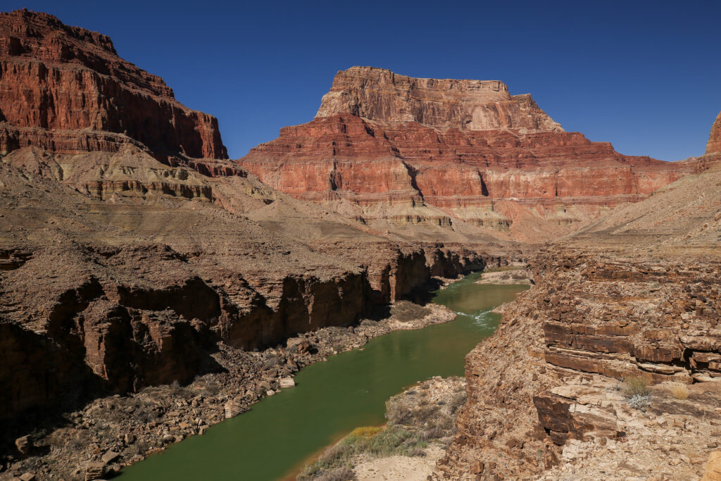
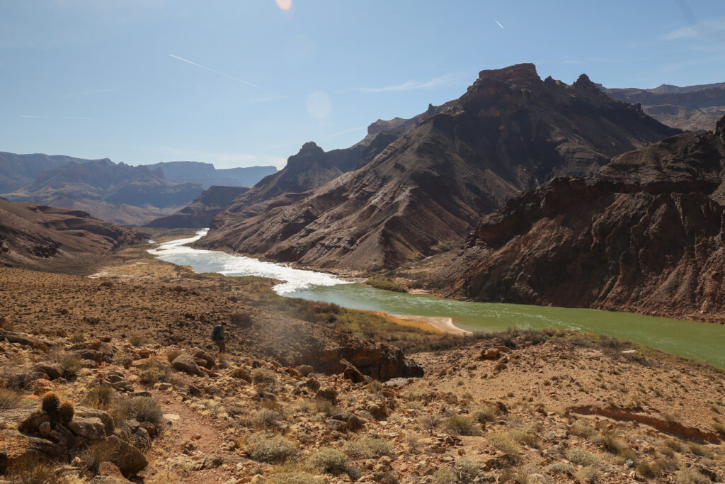
The confluence of the Colorado River (left) and the Little Colorado River (right).
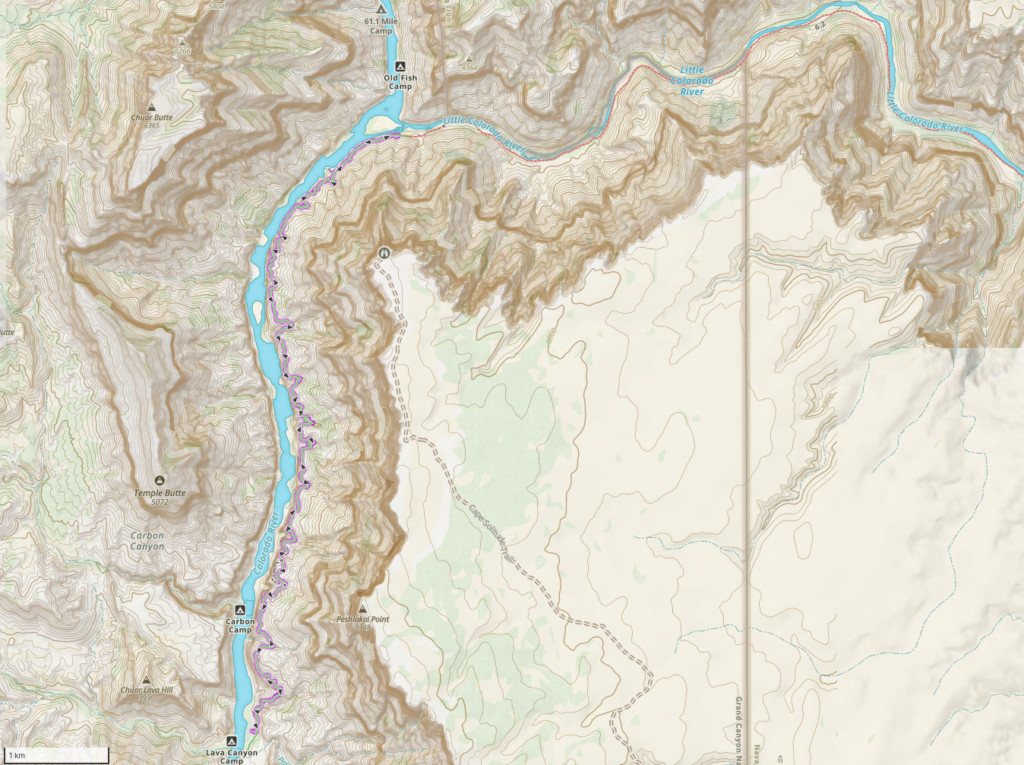
Day 3 Part I February 17, 2025, Palisades Creek out and back to the Confluence, 18.8 km, 420 m ascent/descent, 7 hrs 20 min.
Out and back hike to the confluence in purple.
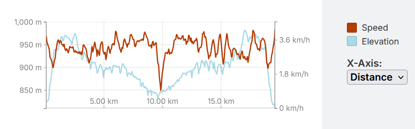
Speed and elevation graph for the trip out and back to the confluence. Our stay at the confluence was about 40 minutes. The elevation profile looks a little rough at first but it was only a 150 m climb.
Our day was to be a tail of two different hikes. Part I was an out and back to the confluence carrying only what we needed on rough trail. Part II would be hiking back to camp at Tanner Rapids carrying all of our supplies on mostly easygoing flat trail. For Part I we were able to leave some of our food in camp since I had purchased a chain mail Rat Sack many years before for food storage in the Grand Canyon plus our extra clothes, sleeping gear and tent.
We had about 26 km in total to hike on this day with the majority on what we were expecting to be challenging trail. We planned to wake up early and get ready in the dark. The first couple of kilometres involved hiking up a slope to gain the top of he cliffs and we were comfortable in doing that in the dark or semi dusk. Leaving early had another benefit that we were not aware of and that was to limit our time in the afternoon sun. For February it was to get very hot in the afternoon.
Our round trip time for Part 1 was 7.5 hours but we did linger at the confluence for about 40 minutes. On trail we only took one small break on the return leg. Other than the one break we were moving down the trail all day and looking at the speed graph above I am pretty happy with us maintaining an average close to 3 km/h down the Beamer Trail.
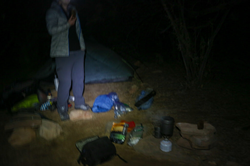
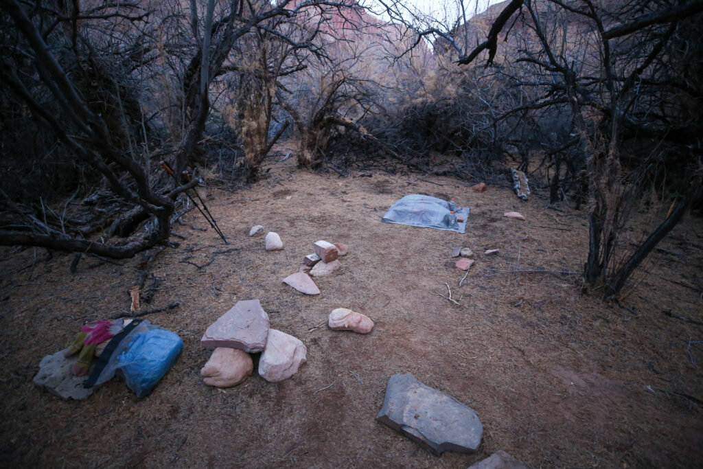
6:15 am looks like a bit of a messy camp but the coffee water is heating up so we have something to look forward to.
Camp as we left it for the trip out to the Confluence. Under the ground sheet would be the tent, our sleeping equipment and extra clothes. We have our food in a blue stuff sack inside the rat sack at the bottom left of the photo. Micah also has left a pair of socks out to dry on a rock. I guess we were thinking the smell of the socks would repel any animals from investigating our stuff.
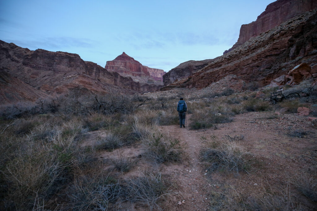
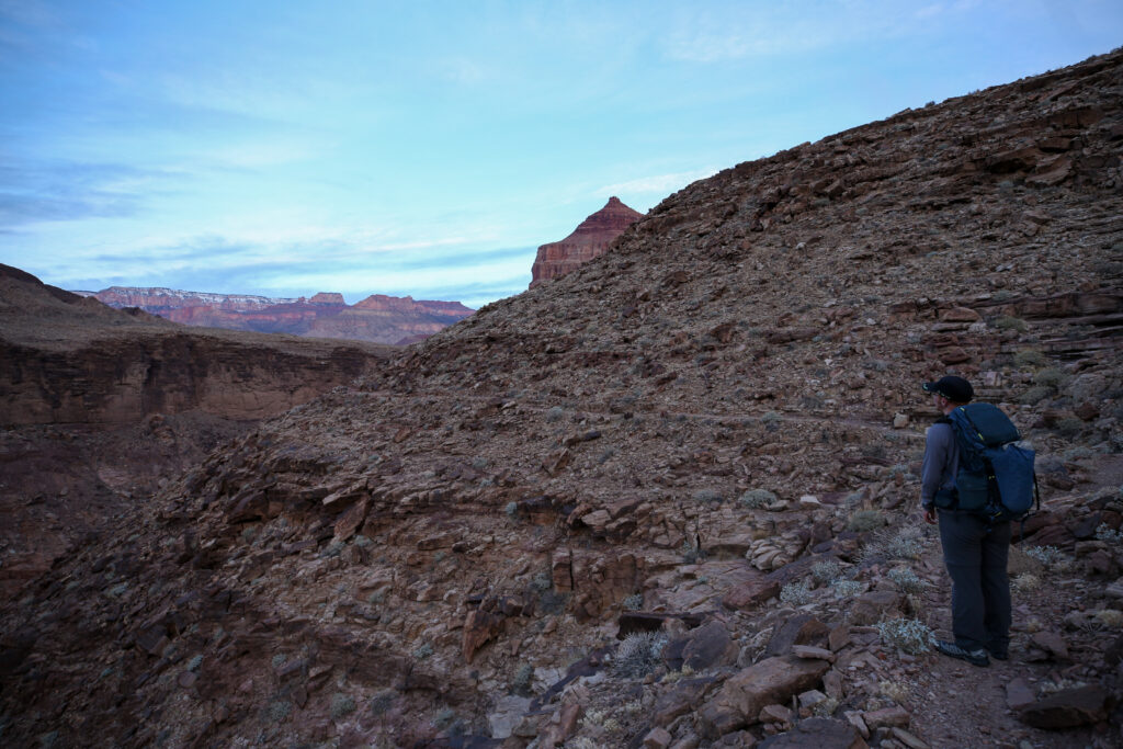
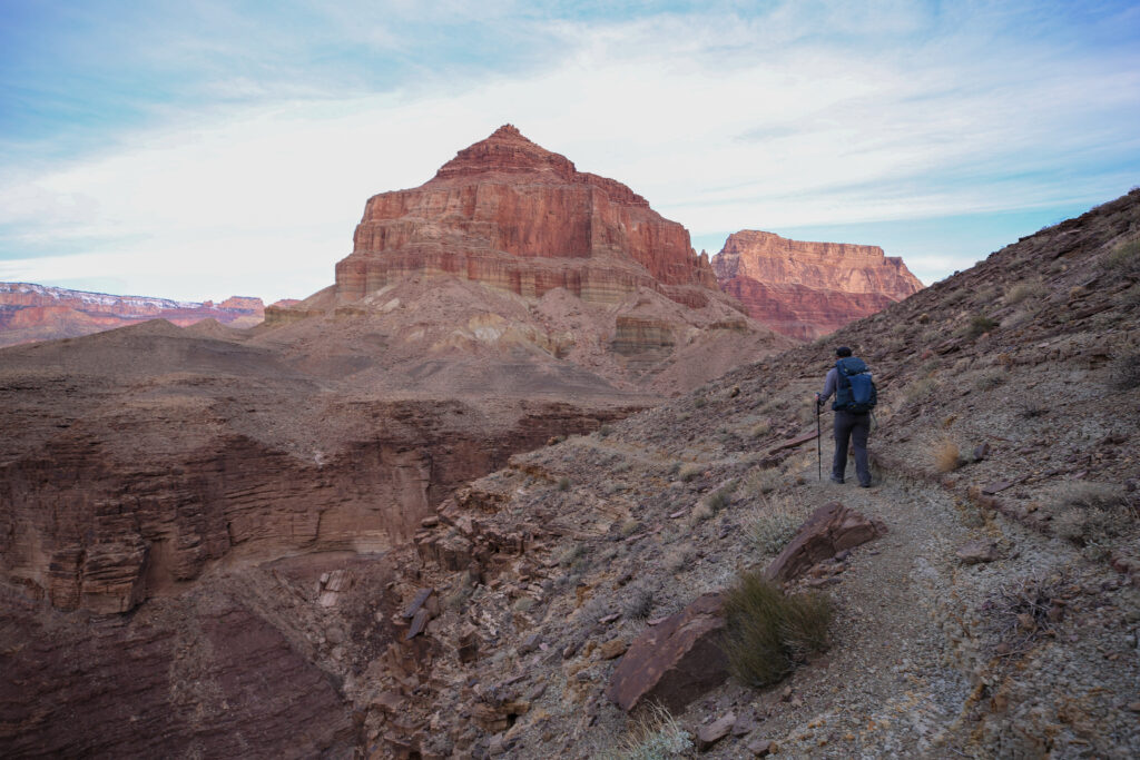
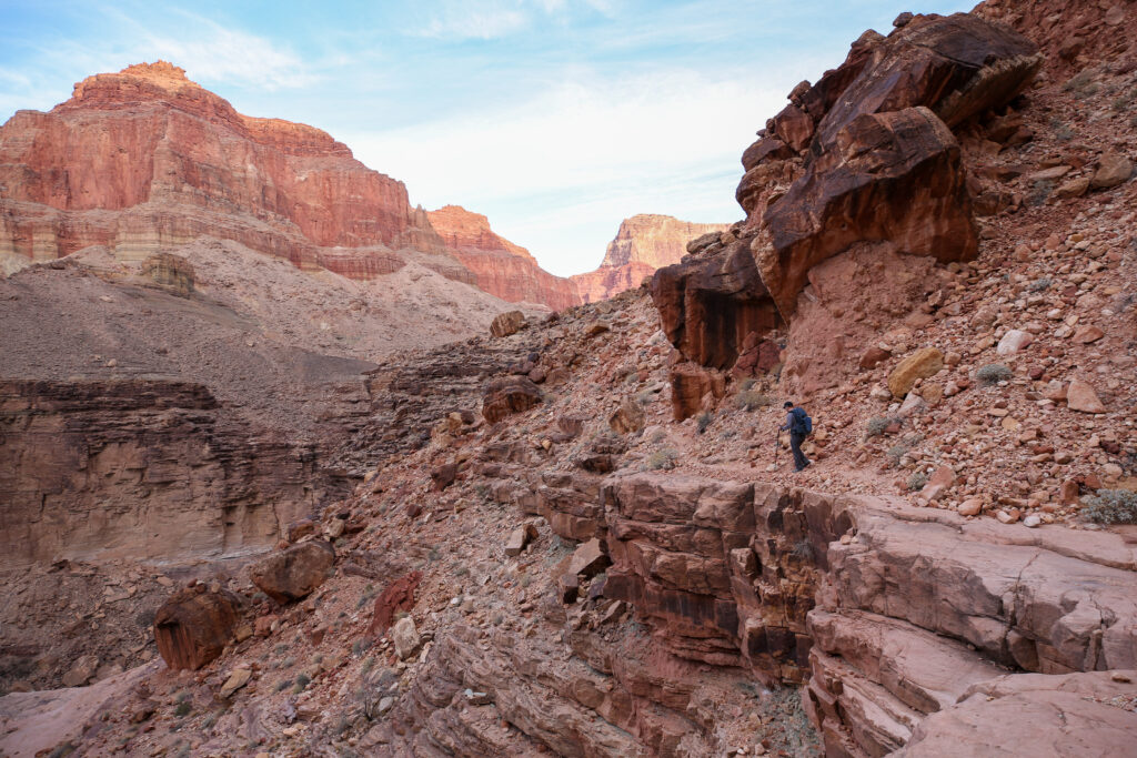
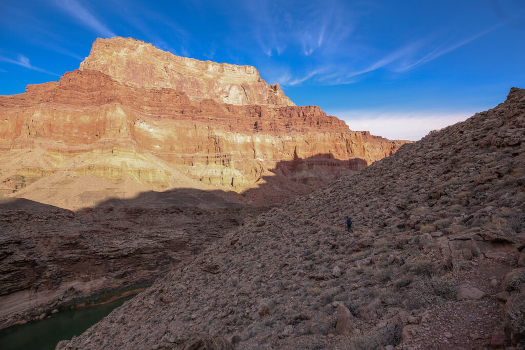
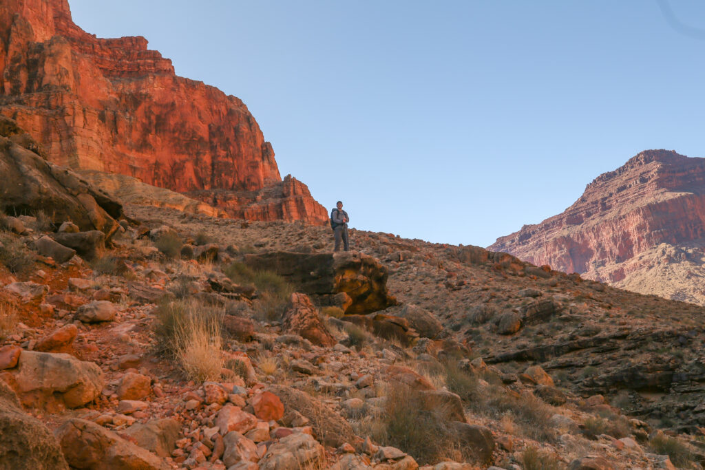
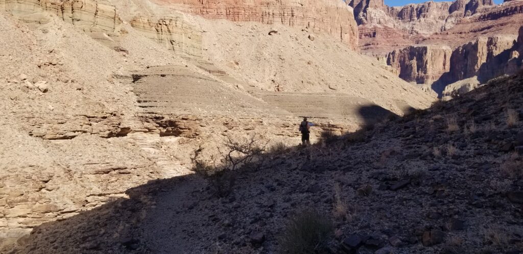
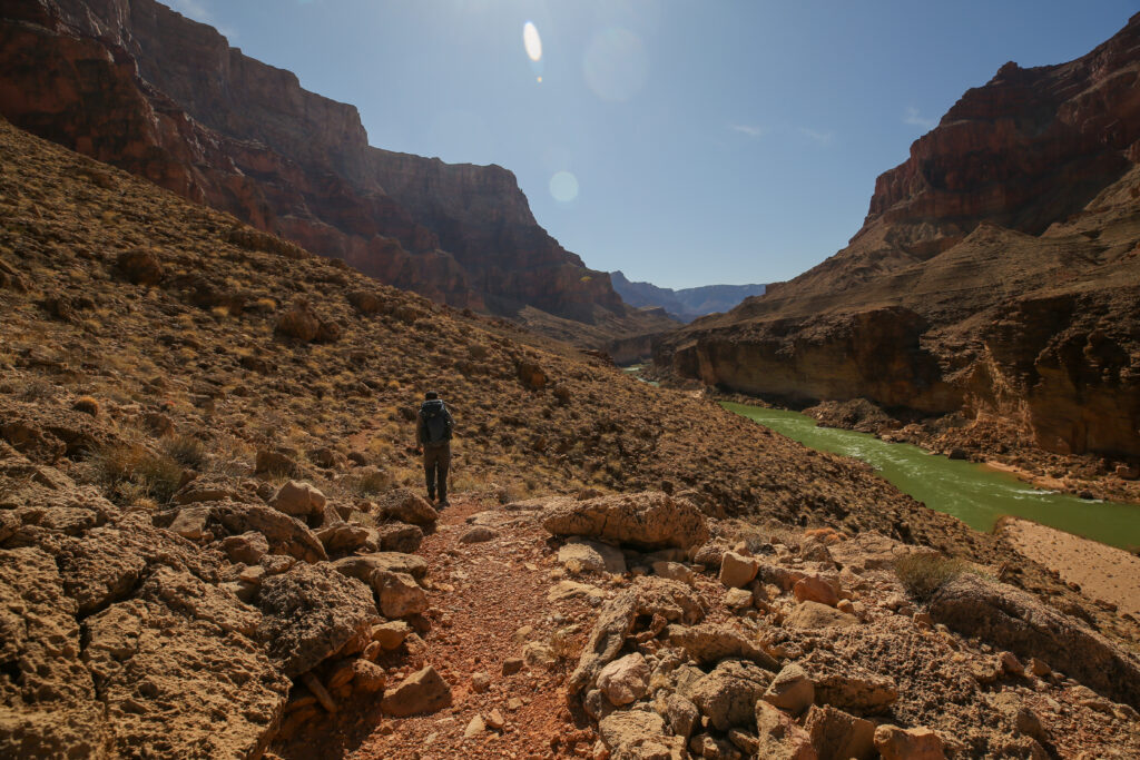
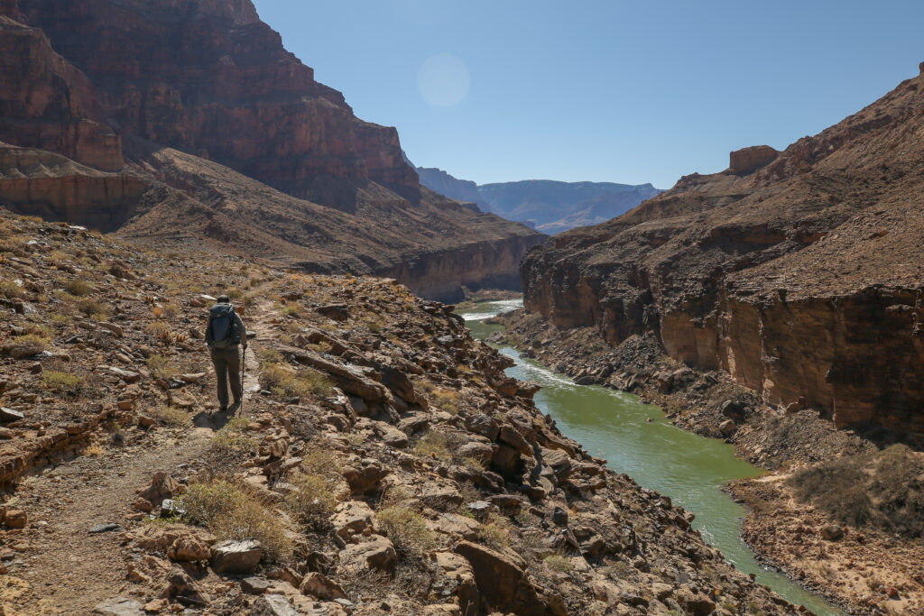
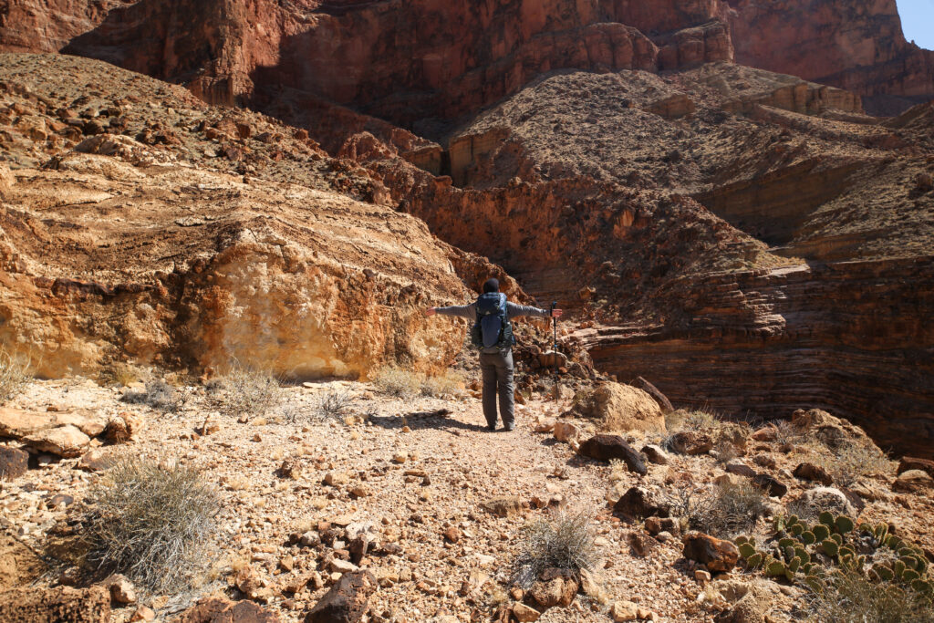
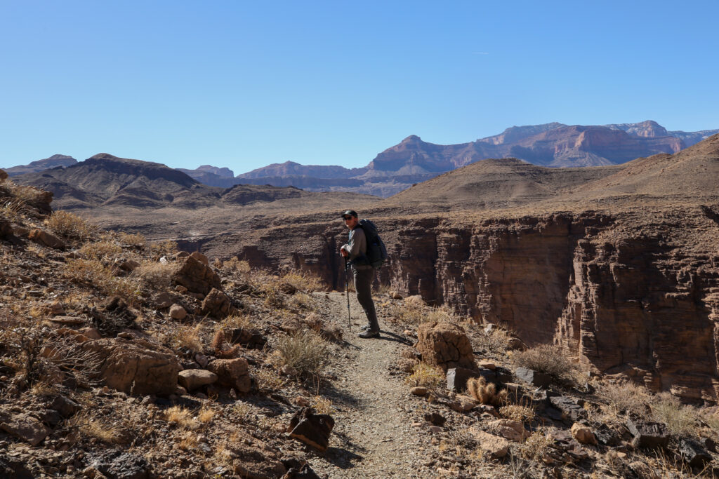
Out on the trail. We have to get on top of the cliff jut to the right of centre. There was a good trail up the cliff.
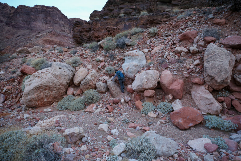
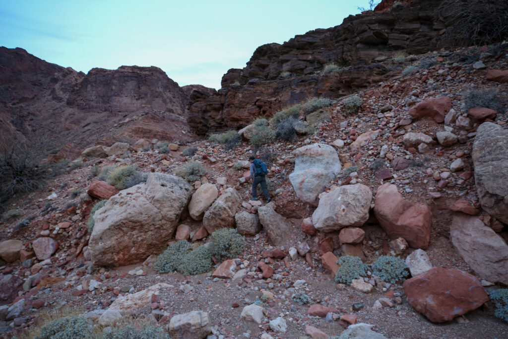
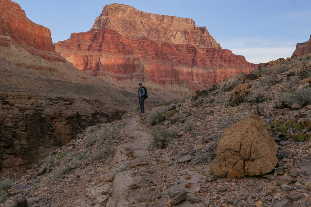
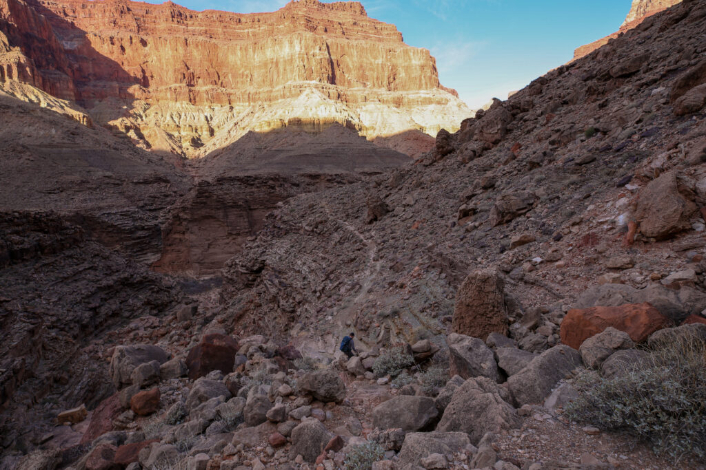
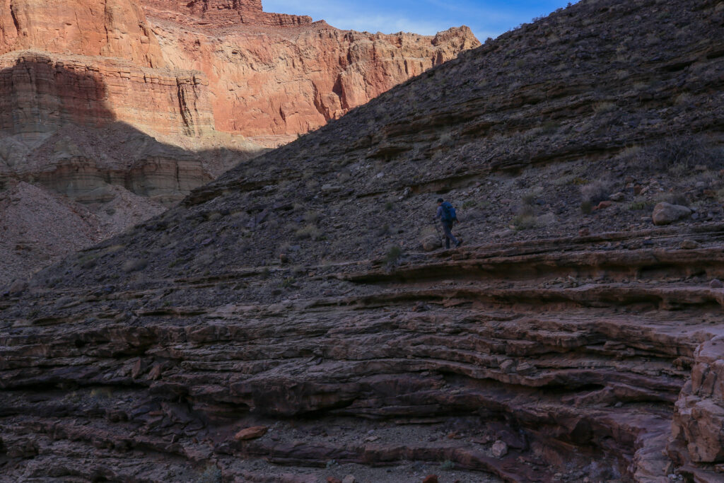
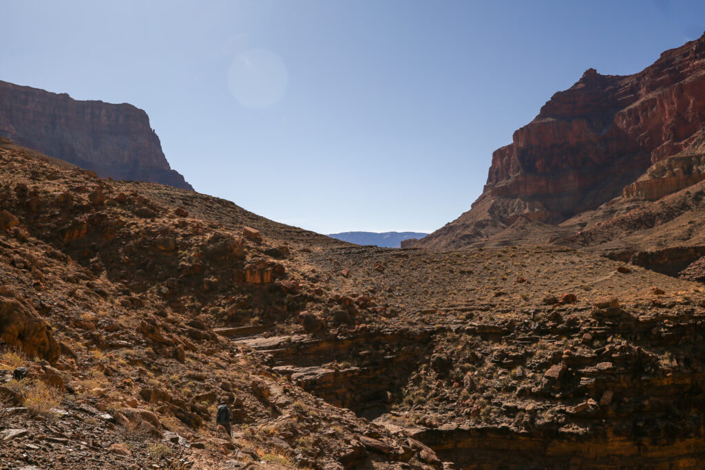
This is a quick example of what faces a hiker on the Beamer Trail. The trail is not that hard to follow but we will constantly be having to get over boulders or up small cliffs all of which will slow our progress down the trail. This was only 5 minutes into the hike.
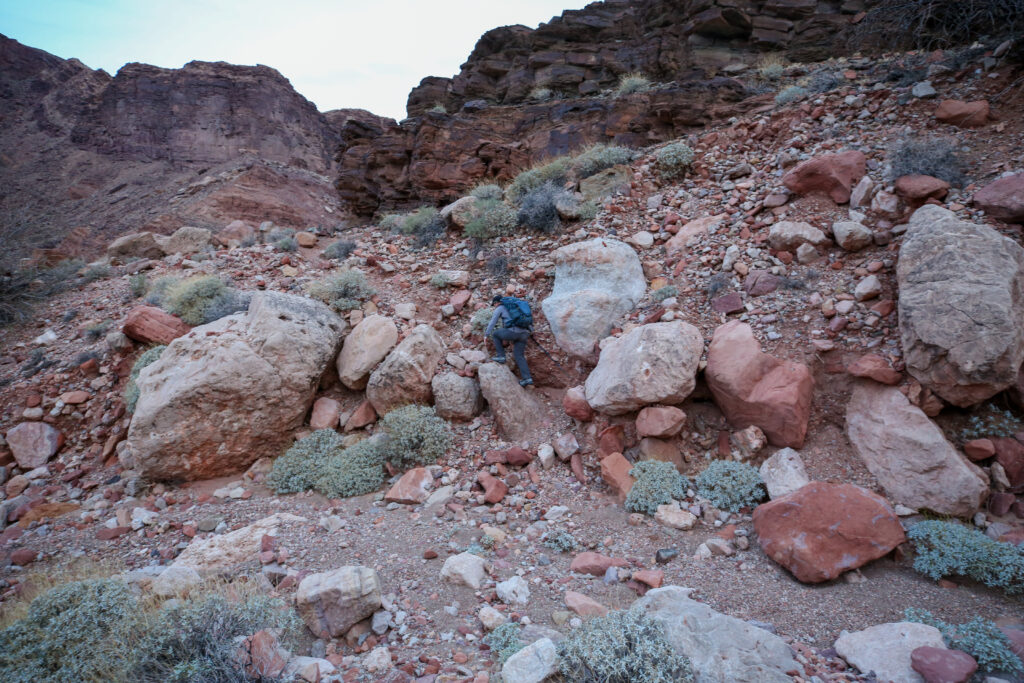
Some little cliffs band to hike over. Micah is heading back to the river. We are only 15 minutes into our hike and are almost at the top of the first set of cliffs.
Looking back down to our camp and where we began our day. Our camp was in the trees at the bottom of the slope and our private beach is just to the right of centre. The light blue spec across the river is one of the rafts from the rafting group that arrived last night. Guessing the rafters have not left camp yet.
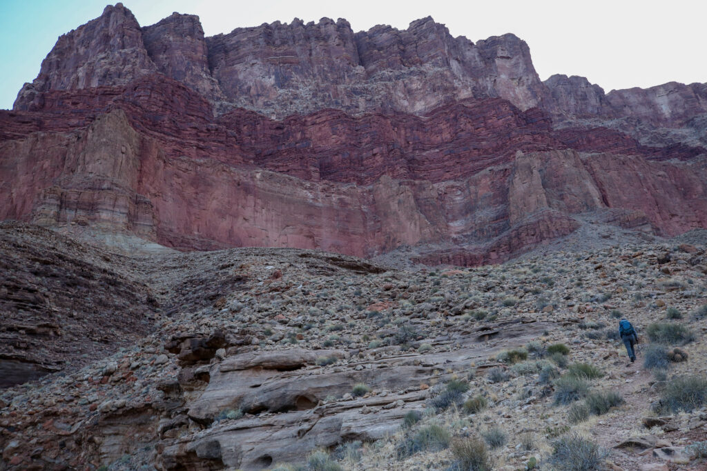
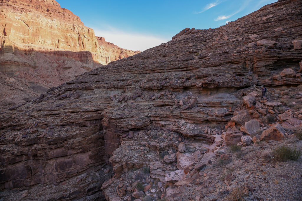
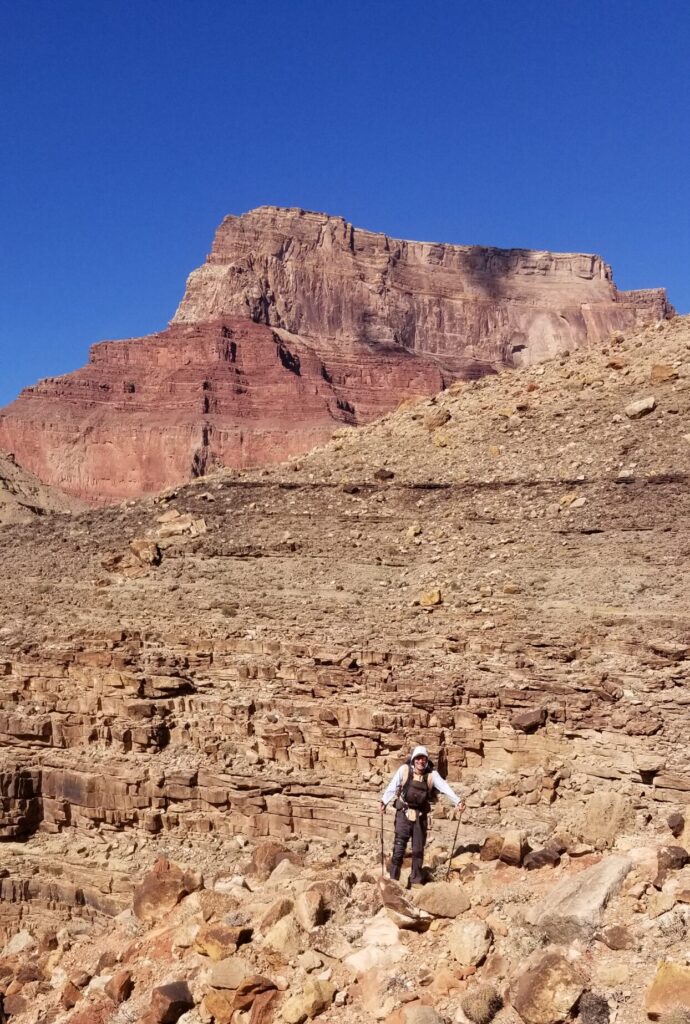
The cliffs rise almost 1 km above where we are hiking. Big views are commonplace in the Grand Canyon, they never though become ordinary.
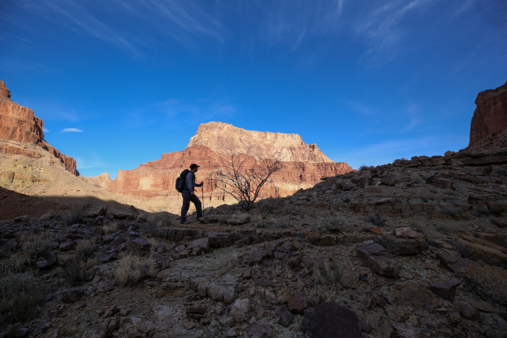
Micah pausing to take in the view to the North Rim.
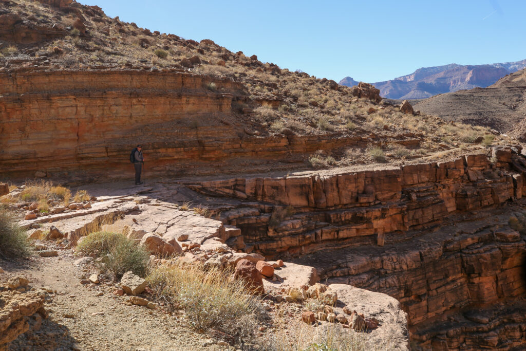
One last look back to where we have been. From here we can still see the sandstone cliffs riverside that we had to walk along yesterday at the beginning of the Beamer Trail by the Tanner Rapids.
The cliff’s edge is never far away. In this photo the edge is actually quite close but the trail is good and I was not feeling any stress. The north rim in the distance.
I distinctly remember that there was just one section of trail on the way to the confluence where I felt uneasy. On the way back Micah and I took a break before the sketchy section then reminded each other to focus before we set out to walk the section. To our surprise we never came across the section that seemed sketchy on the outward leg. I guess you just start to get used to the heights and the conditions.
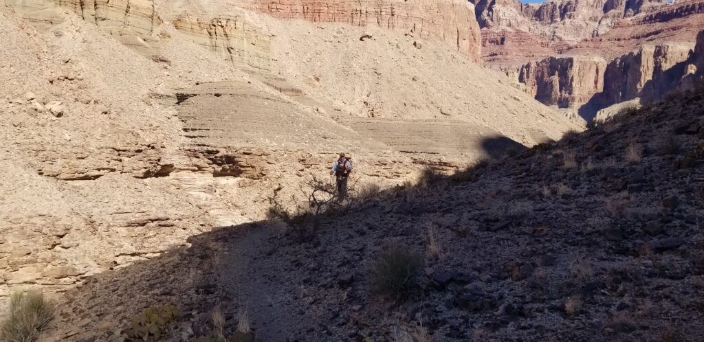
The trail is constantly weaving in and out of little and big canyons. Micah pausing for a photo before heading back to the river.
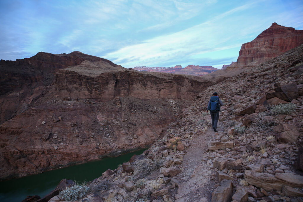
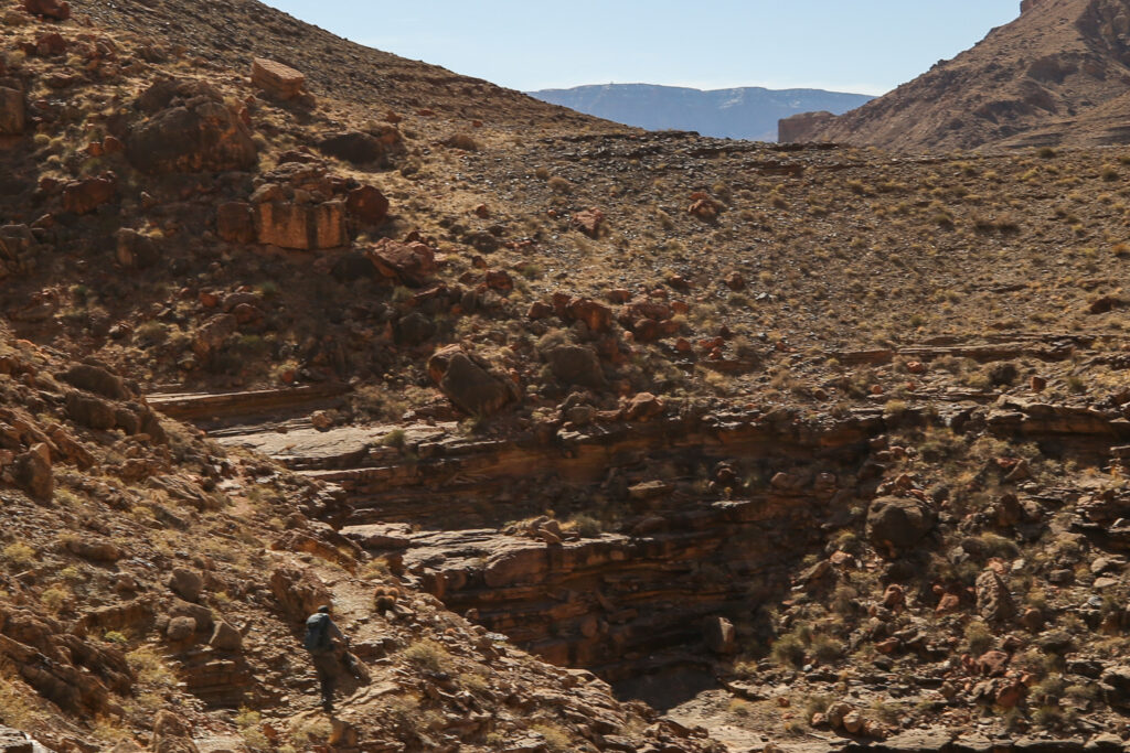
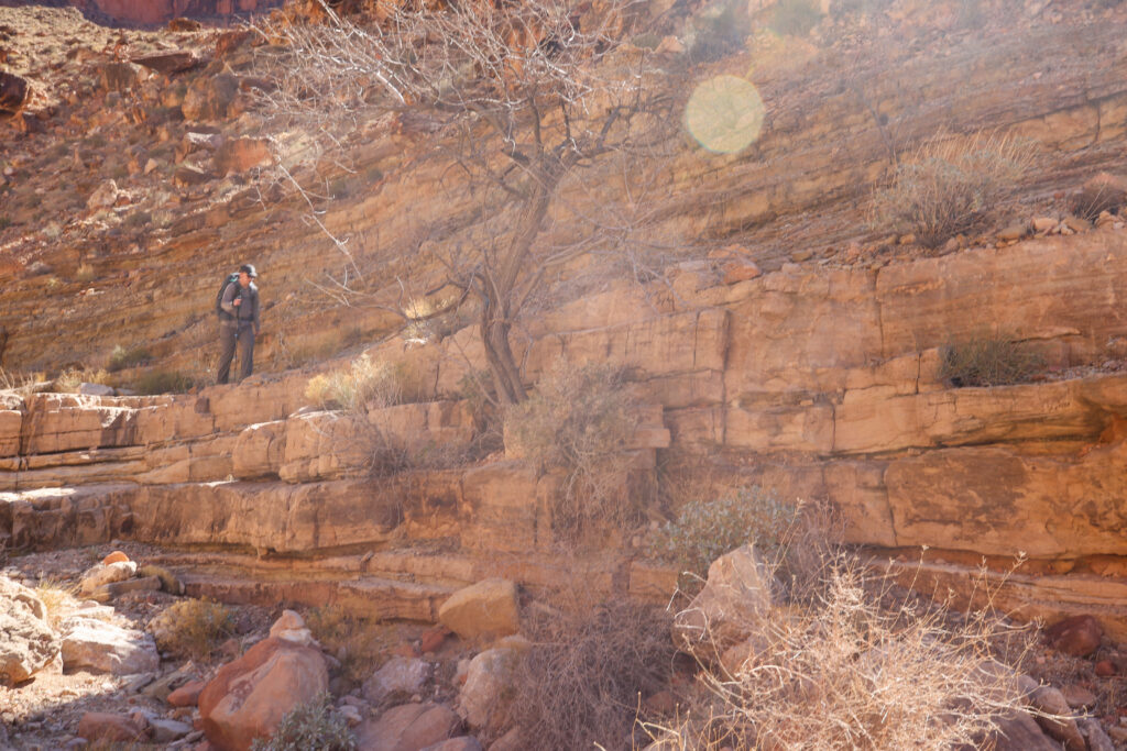
Micah exiting yet another side canyon. Up on the cliff the trail is good as we walk on the green Bright Angel Shale. The rough parts of the trail are when you enter the side canyons.
Vertigo anyone?
Looking down river.
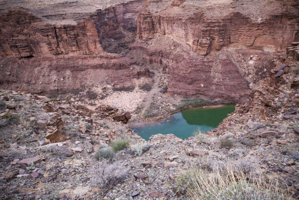
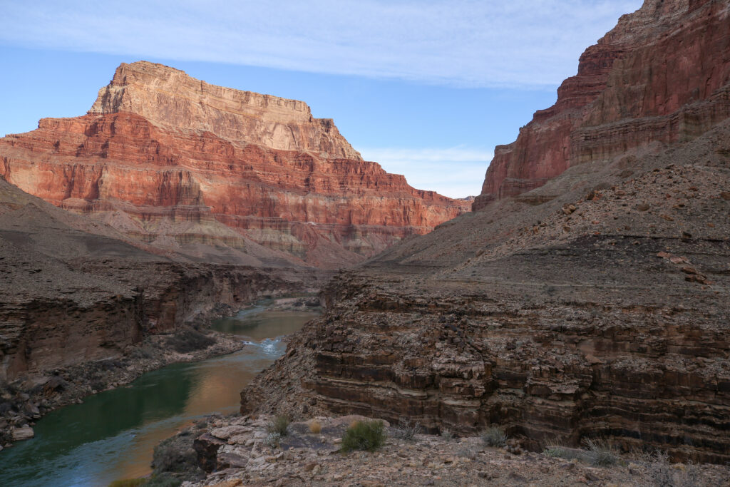
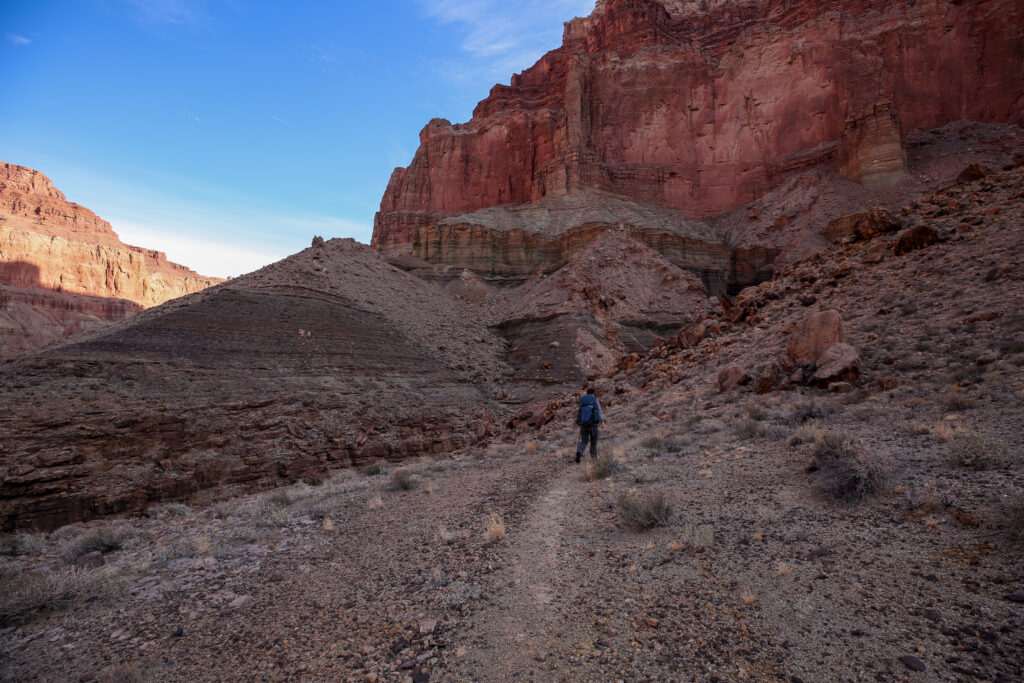
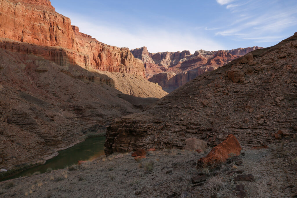
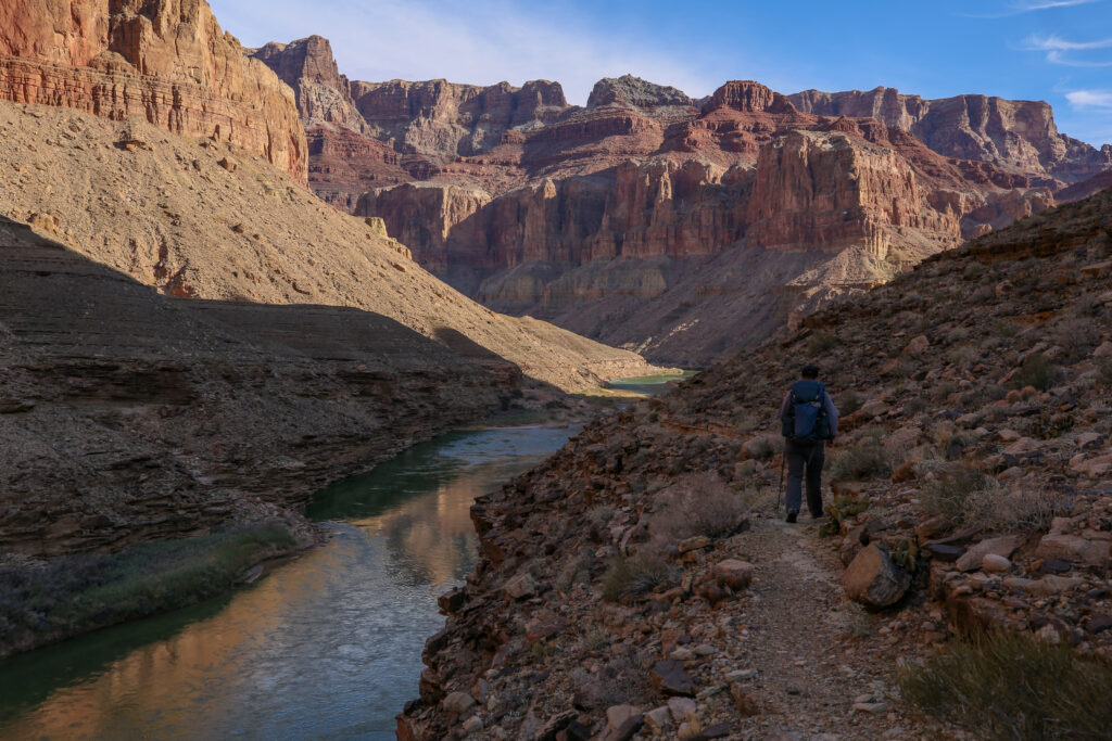
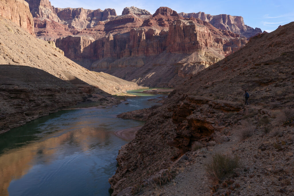
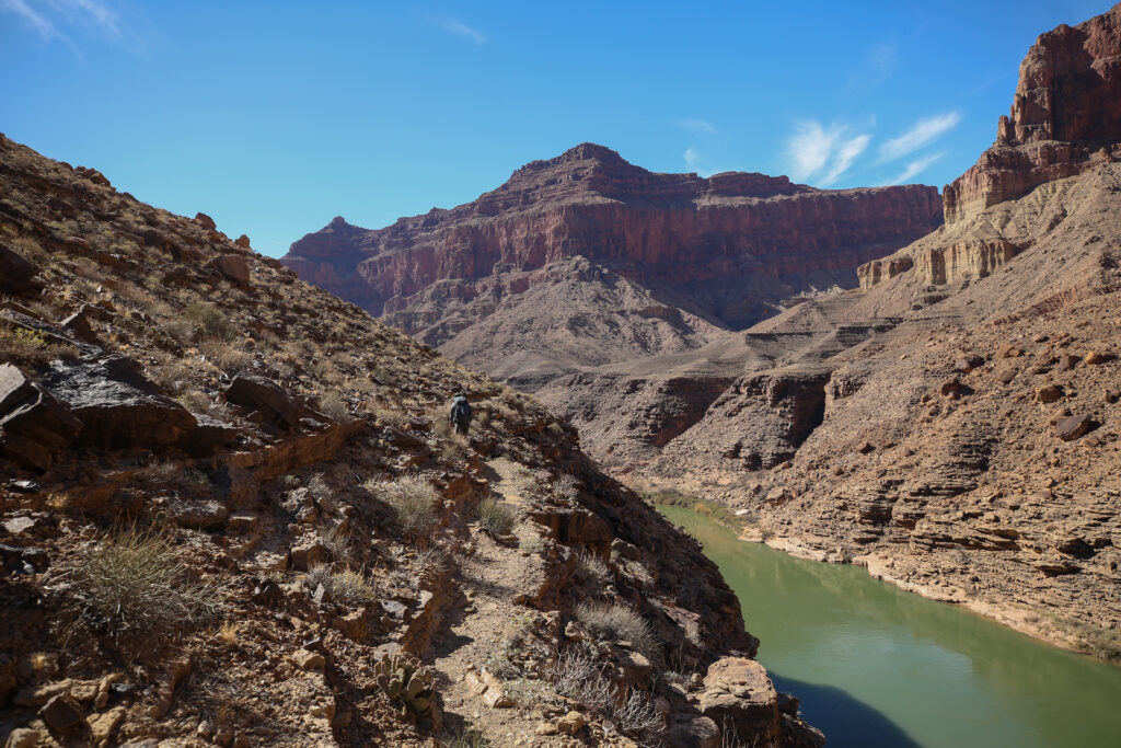
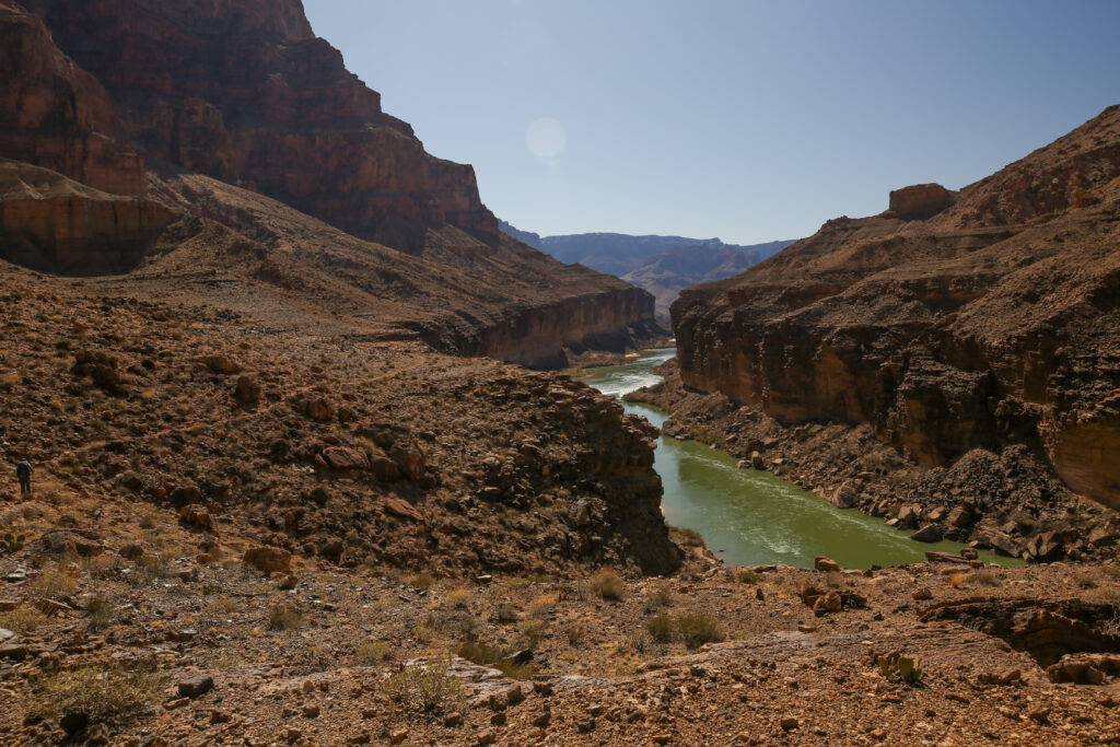
If you follow the cliffs on the left side of the river the confluence is at the end of the cliffs. This looks like a bit of a messy canyon coming up. The trail we want is straight across from where I am standing.
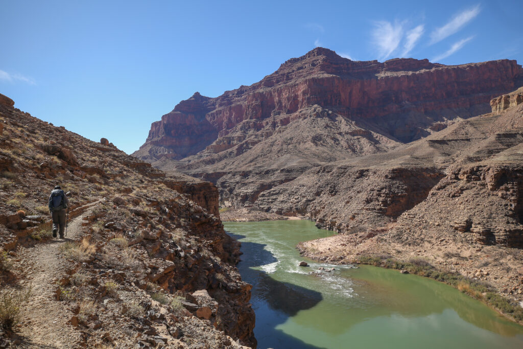
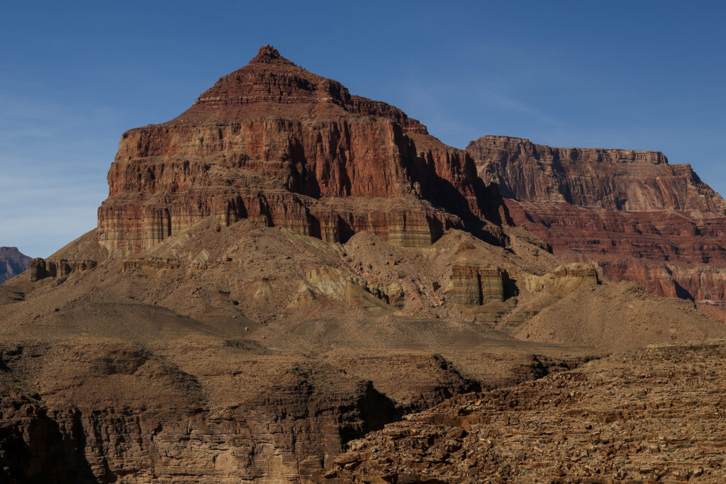
The lovely red and brown cliffs in the distance are Chuar Butte. Not a lot of space between the trail and the edge of the cliff.
When I was first researching the trip I had hoped to hike part way down this section of the Beamer Trail, between Palisades Creek and the confluence, and camp. Having the ability to camp on the Beamer Trail past Palisades Creek would had greatly increased the flexibility in the planning process providing for more options for camping. Searching online I found very few trip reports about hiking the Beamer Trail. I did find one on a blog that has since been taken down that was a recent review of the Beamer Trail. I contacted the writer of the blog and they said there really was not any place to camp on the Beamer Trail. After hiking the Beamer Trail I found that to be a true statement. There really is not even emergency places you could camp. When planning to hike the Beamer Trail past Palisades Creek it is imperative that the plan involves being about to hike to confluence and back to Palisades Creek in one day. There is no back up plan to camp on the trail. Compounding the challenges is that the National Park Service has forbidden camping within 1 mile of the confluence out of respect for the First Nations people who view the confluence as a spiritual site.
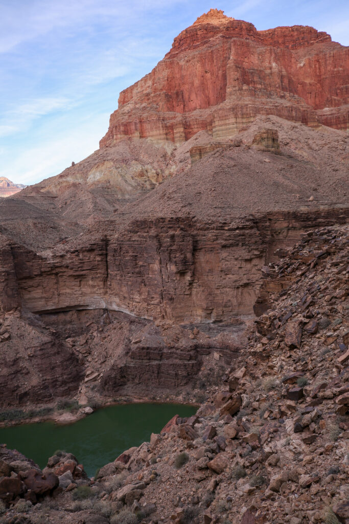
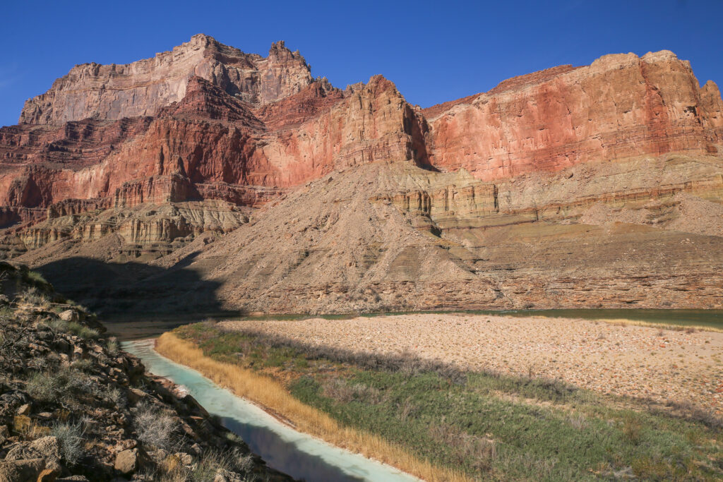
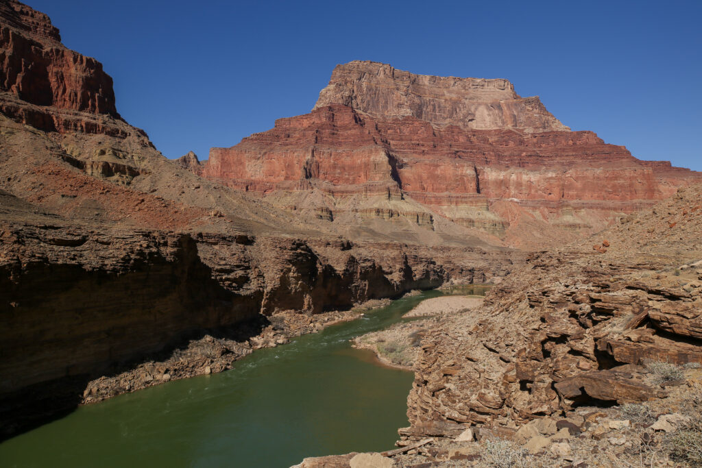
Looking across to Temple Butte.
A little rubbly.
Unlike anything we hike back home. You have to get use to cliff hiking on the Beamer Trail.
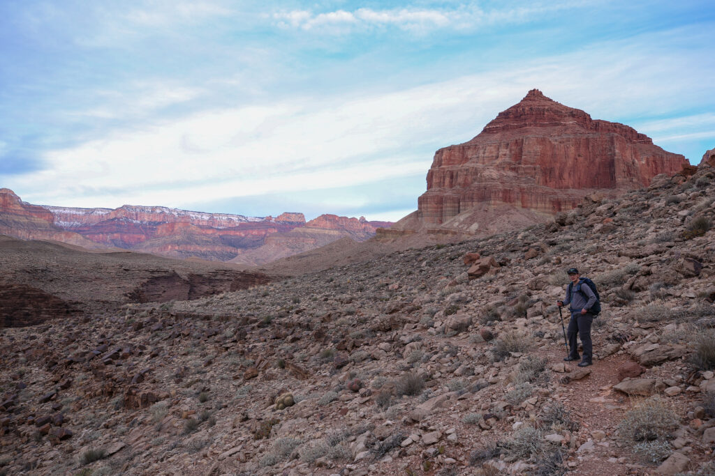
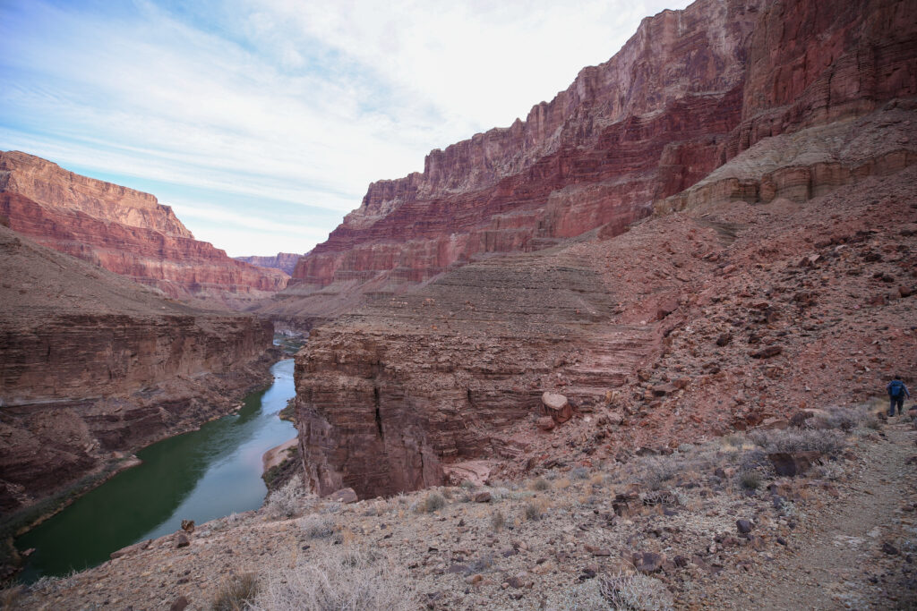
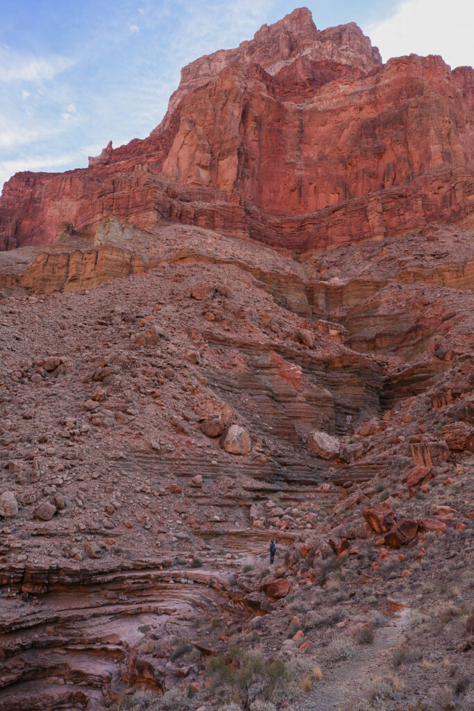
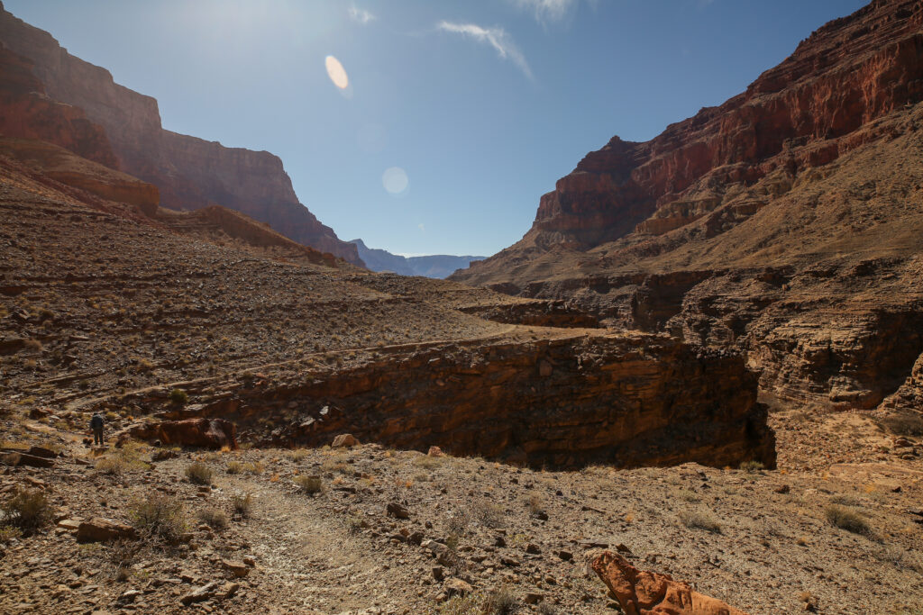
Looking off to a bend in the river. The bend is at about the 7.5 km mark. The cliffs is definitely trending lower as we hike. We have already lost 1/3 of the height gained in our initial climb. The does finish at river level.
Micah on the Beamer Trail.
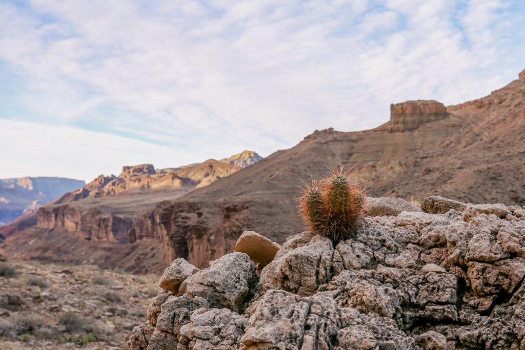
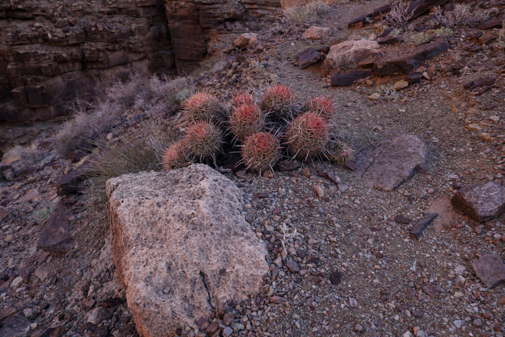
I love this little cactus. No one told it you couldn’t grow on a rock so it did.
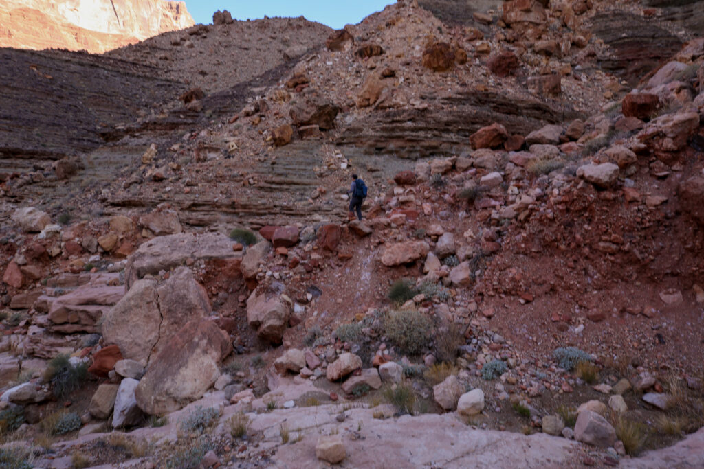
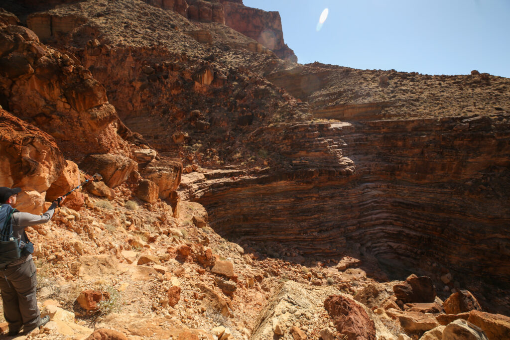
This looks like a rather large side canyon. The trail is clearly evident on the other side.
Looking like a particularly rough section. Micah down climbing just to go back up the slope.
Nice shadow shot of Micah. It is 9:05 am, we have just over an hour to go.
There was not a lot of story to tell during this part of the hike. Micah did a great job of setting a manageable pace, took care of the route finding when it came up and just kept us making good steady progress down the trail. For the most part we hiked separately which was fine by me. I was able to just focus on myself and stay in the moment and enjoy where we were.
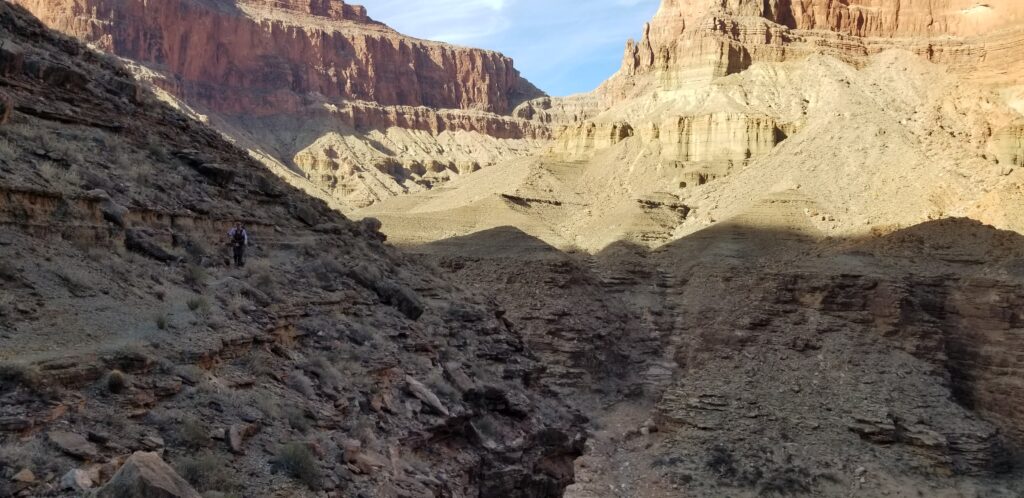
Heading into another side canyon.
Guessing the only way I was going to join Micah was that there was a bit of scrambling in my future.
We are but little beings on a vast landscape.
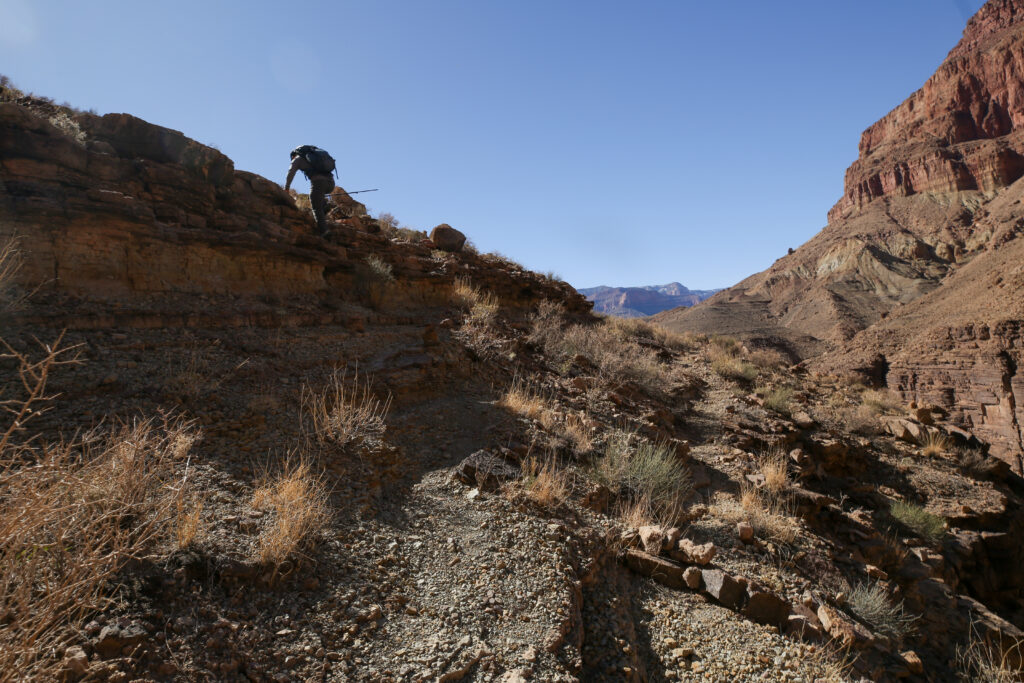
The trail snaking its way up out of yet another side canyon.
Where is the tiny human.
It’s me, I am on the trip.
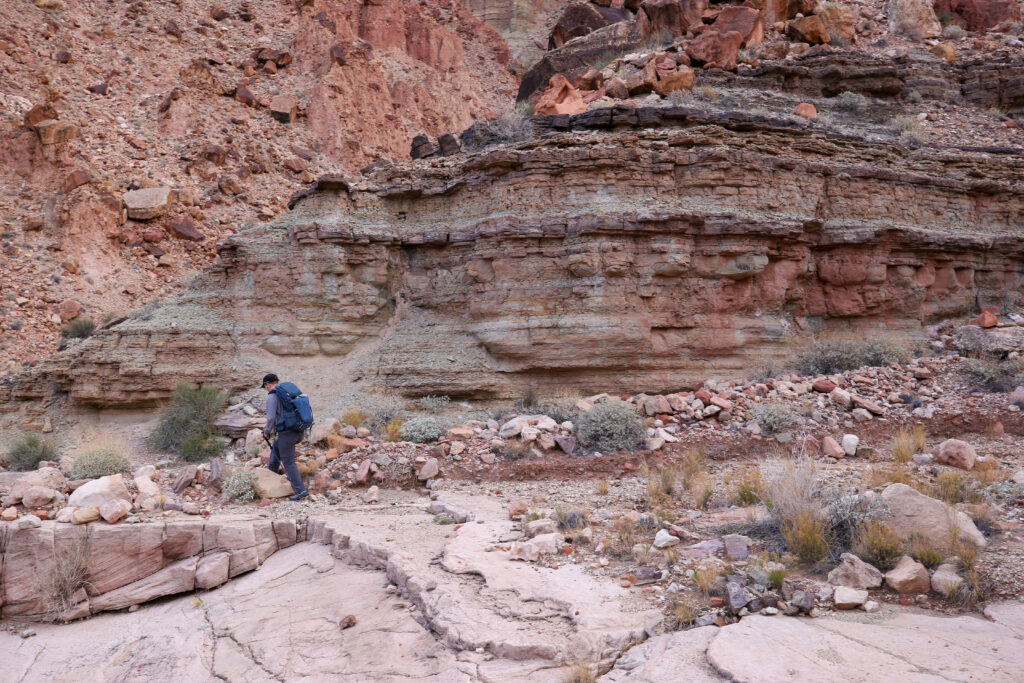
We are both hiking in runners. In the Grand Canyon do not venture off trail or down the trail without keeping a close eye on where you are going to be putting your feet.
More cliff hiking. I feel we must of been getting used to it by this point.
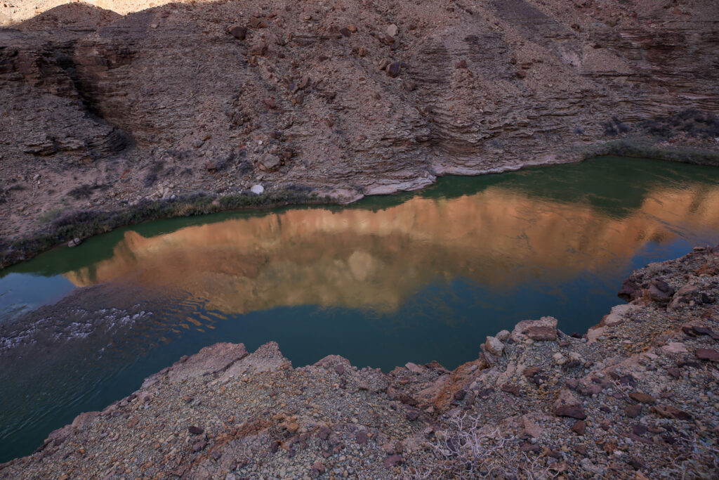
Reflection of Chuar Butte in the Colorado River.
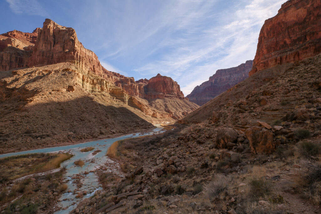
We can just about see the confluence. It is 10:35 am, still another 25 minutes to go.
Will this be the last side canyon?
We must be professional cliff hikers by now.
Looking like this could be the homestretch.
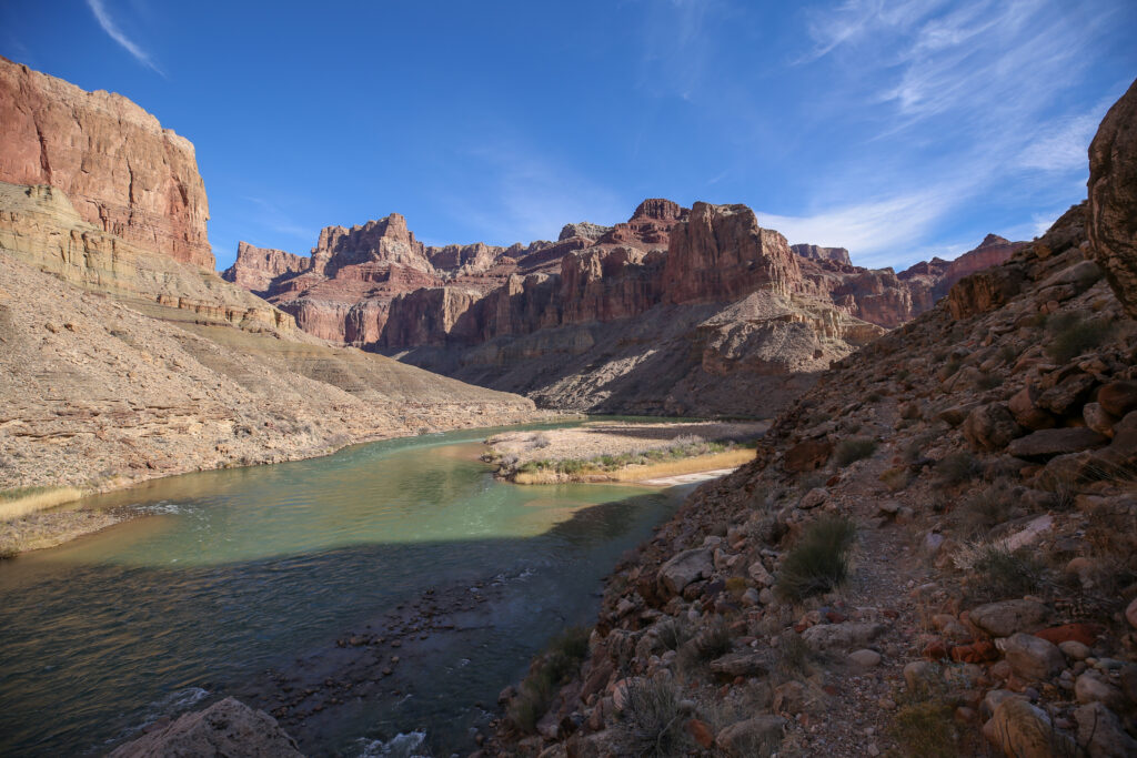
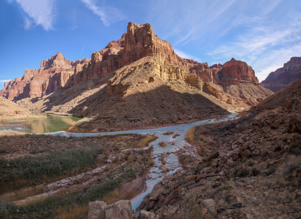
The first time we are able to see the Little Colorado River.
The Colorado River on the left and the Little Colorado River on the right. What is up with that colour?
It is impossible not to notice the striking colour of the Little Colorado River. The milky white colour is a result of tavertine springs a few kilometres upstream on the Little Colorado River. The the water flowing out of the springs has a high mineral content dominated by limestone, hence the white colour. A professional geologist, John Willsey produced an excellent Youtube video describing the springs and the geology that I quite enjoyed can be viewed via this link.
ARRIVED!
We arrived at the confluence at 10:15 am, 3 hours and 10 minutes after leaving camp covering 9.3 km. I was very happy to have finally made it to the confluence after so many attempts. I did not feel a weight off my shoulders or a big feeling of relief. The goal of getting to the confluence while it took five tries was not a life quest. It just became a family odyssey as the number of attempts mounted. It was a very cool place to visit and well worth the effort. Being able to share the adventure with Micah is something that truly does make the hike special. Hiking to the confluence is not easy but for the backpacker with canyon experience and some basic route finding skills it is a very enjoyable hike and the confluence is a worthy destination.
Looking up the Little Colorado. It is a pretty small river.
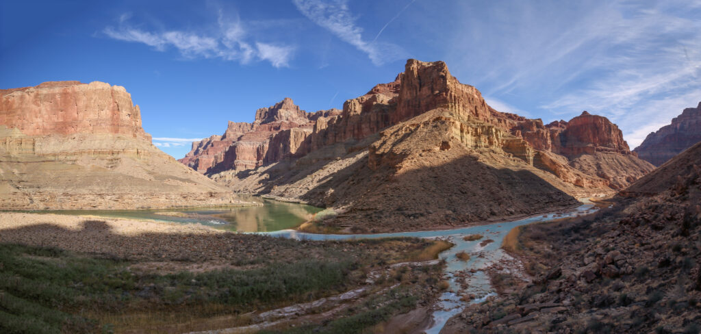
Panorama of the confluence.
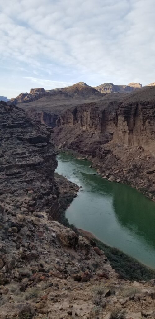
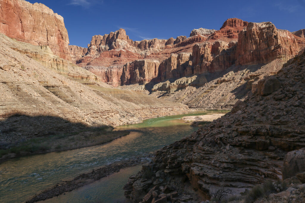
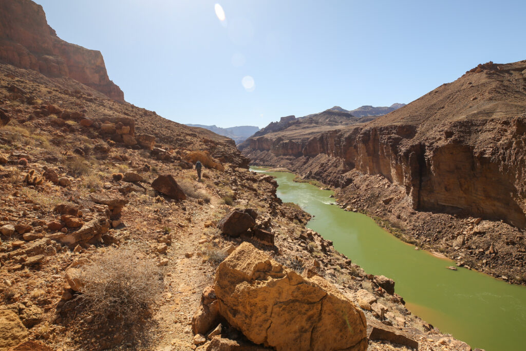
Looking up the Colorado River into Marble Canyon.
Can you have too many photos at the confluence? That is a very milky white river with a little touch of blue.
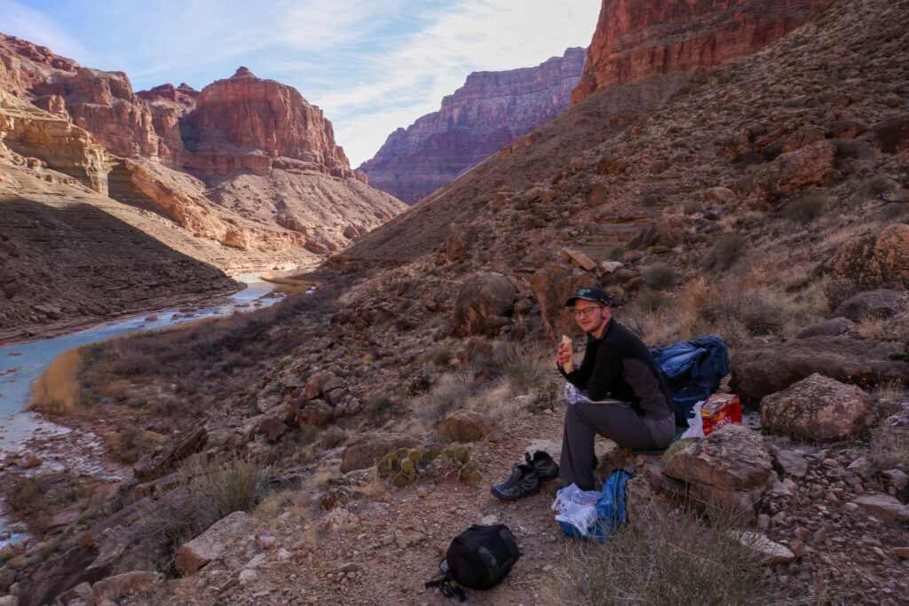
Micah enjoying a well earned lunch and the view. 10:30 am.
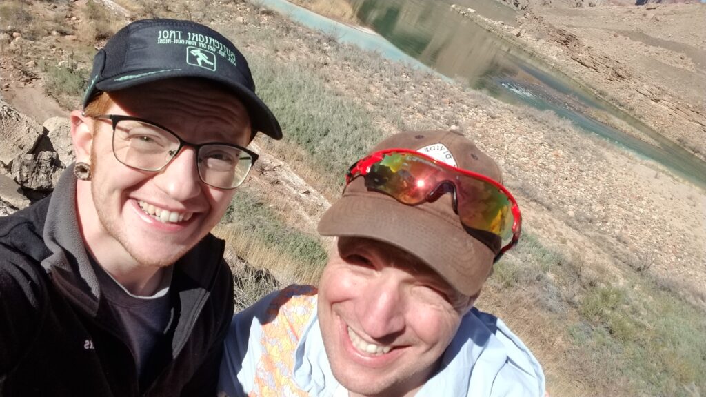
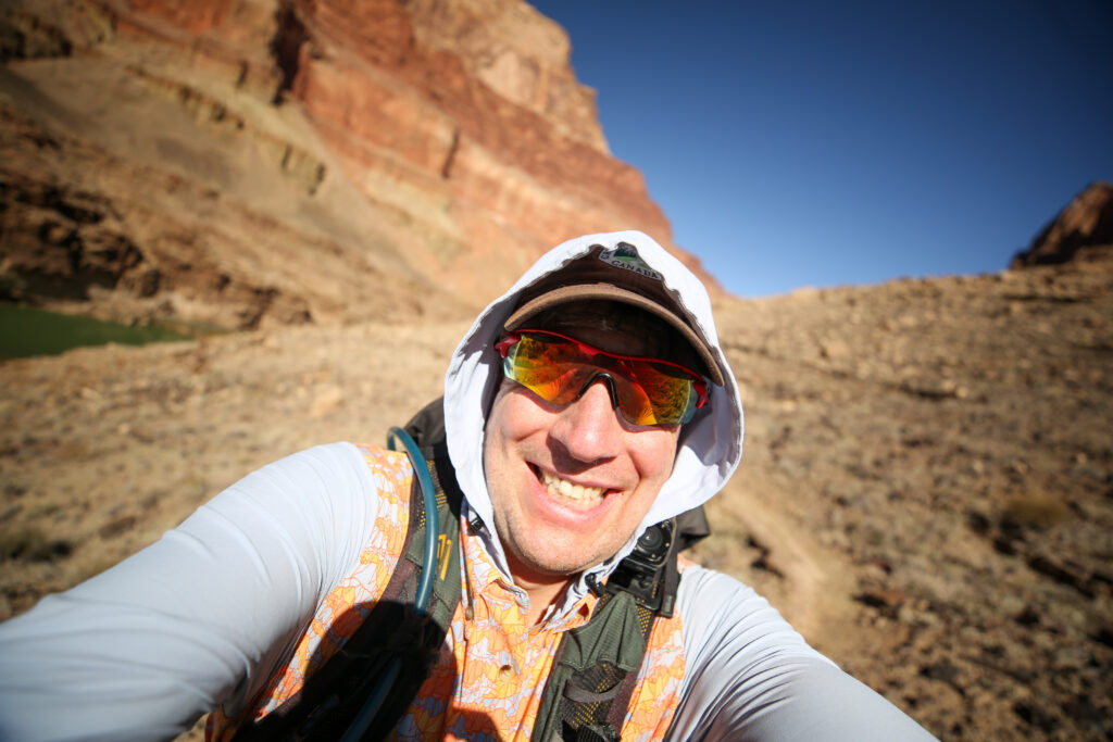
A squinty selfie.
While the above photos clearly demonstrate that we are not pro-selfie takers it also foreshadows our afternoon. The sun is coming over the canyon and unlike the morning where we hiked the entire time in the shade for the return journey we will be hiking into the sun and it was going to get warm.
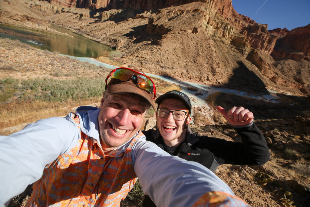
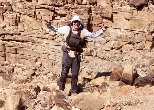
A slightly better selfie. We appear to be in good spirits.
Frosty has made it to the confluence. Wonder how many other stuffies had suffered through the trip to make it successfully to the confluence.
The confluence fully in the sunshine.
I never did descend all the way to the river. If we had more time or I was more confident in my fitness I probably would have gone down to the river. But on this trip I was trying to be cautious since this was only the half way point of the trip. We now had to hike back to the car which included going back up to the rim so clearly the tougher half.
Just starting our return journey. 11:00 am.
One last look back.
Micah has found a good platform to pause for a moment to take in the view.
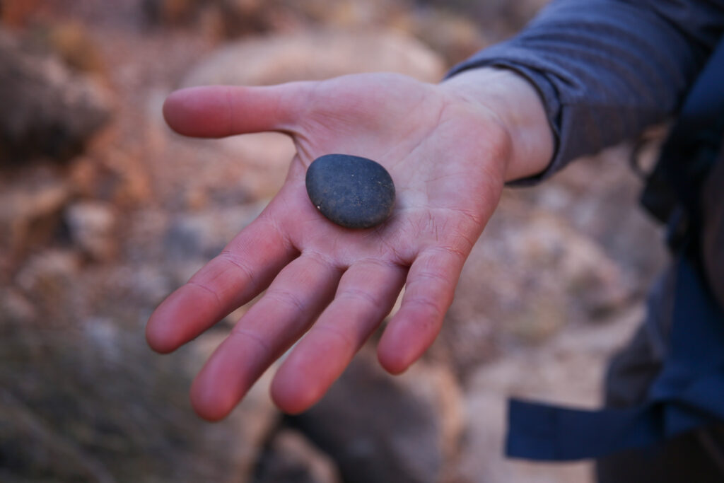
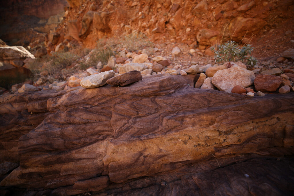
This rock asks a lot of questions. Rounded rocks occur when rocks spend time in flowing water. So how did a water worn rock get a couple hundred metres above the river?
River reflections.
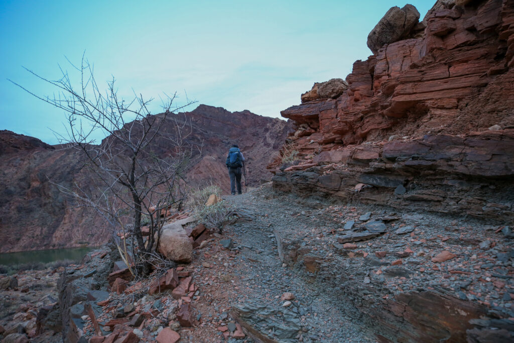
The trail under foot is actually pretty good. It is just that it gets close to the cliffs. When hiking you have be constantly aware of where you are.
Zoom in on the left and Micah caught me looking backwards taking a photo.
More cliffside walking.
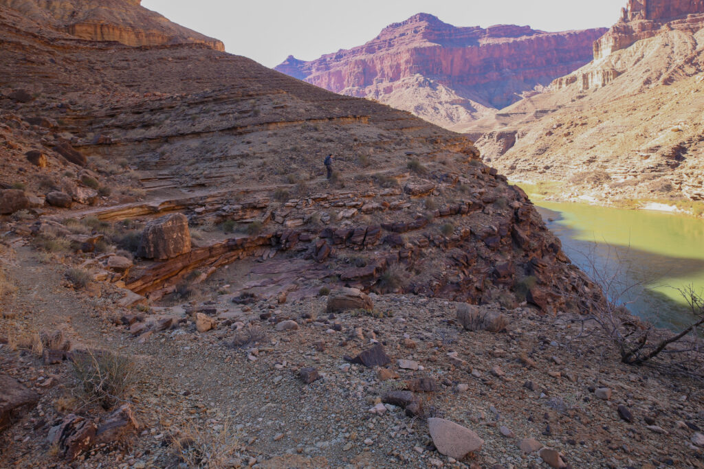
The only break from being cliffside is when we go into sidecanyons where we encounter different challenges.
Chuar Butte looks magnificent in the sunshine.
Great view of the trail. We will cut into the small side canyon then we will make our way across some slabs. There will be a little scramble to make our way back to the trail. Then once out on top the trail is nice until the next canyon.
The landscape looks completely different in the sunshine.
This looks like a pretty descent section of trail.
The picture feels hot. No shelter from the sun.
Rockin the hooded sun shirt.
Wavey ripples. Indicates that there was an earthquake and shook the layers before they had lithified into rock.
Chuar Butte.
Micah’s shadow is behind them indicating that they are walking directly into the sun.
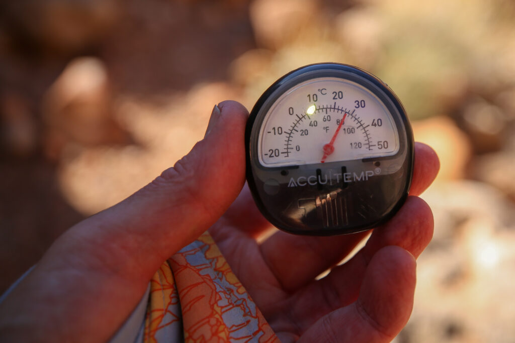
It is very warm for February. 26 C (80 F). Just last week it was – 28 C back home. I am not ready for these temperatures.
We have a ways to go but I can see the end of the cliff in the distance. It is just after 12 noon we have actually only been hiking for 1 hour since leaving the confluence and we are 1/3 of the way back to camp.
Micah in action doing a wall walk.
It’s the liability on trail. Looking pretty happy
I had forgotten until looking at this photo that I wore my knee brace on the hike. Something I had not done in about a decade.
A bright canyon is amazing to look at but it was a tad warm out.
The brightly coloured rock is efficient at reflecting the heat making for some hot hikers.
Micah trying to absorb some of the grandeur.
Micah pointing out where we have to go. There will be some minor scrambling involved in this canyon.
There is some shade here. I believe we did stop for a minutes. It is 2:10 pm. We are about 2/3 the way back to camp.
It is a very short scramble but Micah has their hands down.
It is a great place for a quick picture. North rim is once again visible.
Temple Butte directly across the river with Chuar Butte in the distance.
Micah already on the descent into camp. No rafts on the other side of the river. 2 pm
As we crested over a hill and saw our camp all the energy just left my body. We had hiked to the confluence and we were now descending off the cliff down to our camp. I knew that later today we still had an easy walk to the Tanner Rapids followed by a simple, but arduous, climb back up to Lipan Point tomorrow. The difficult and sketchy part of the trail was behind us. All of a sudden I was acutely aware of how tired I was. As Micah kept a steady pace back to camp I began to fall behind and even stumbled a few times losing my focus on the relatively easy descent. From this point it was still almost 30 minutes back to camp. We arrived back at camp at 2:30 pm having completed the return journey from the confluence in 3 1/2 hours which was just slightly slower than the outward leg.
Once back at camp we set up inside the enchanted forest. I had about a 45 minute nap utilizing the position I had used last night on the beach lying on my back with my feet over top of my backpack. Micah came and woke me to say it was time to head back to Tanner Rapids if we wanted to arrive in the daylight.