Boot Wreckers
Menu
  • Welcome to my hiking website
  • Hiking
    • Mt Allan Traverse (Centennial Ridge)
    • Mt Nomad – Kanananaskis Country
  • Backpacking – Overnights
    • Baker Lake 2020 Banff NP
    • Floe Lake/Numa Creek, Kootenay NP, British Columbia
    • Floe Lake (Revisited 2019) – Kootenay NP
    • Grand Canyon Corridor Backpacking Trip
    • Hermit Trail to Hermit Meadows – Glacier NP, British Columbia
    • Fish Lakes – Banff NP, Alberta
    • Mystic Lake – Banff NP
    • Ribbon Lake Kananaskis Prov. Park 2016 – Ribbon Creek Route
    • Ribbon Lake Kananaskis Prov. Park 2017 – South Buller Pass Route
    • Stenton Lake – Alberta Wildlands Prov. Park
  • Backpacking – Multi Day
    • Arizona Trail Passages 16/17
    • Brazeau Loop – Jasper National Park
    • Egypt Lake Epic – Banff NP
    • Grand Canyon Hermit – South Kaibab
    • Grand Canyon – Tanner/Beamer Trail
    • GR20 – Corsica
    • Kilimanjaro – Tanzania
    • Mt Assiniboine Lollipop – Banff NP
    • Rockwall North 2020 Kootenay NP
    • Sawback – Banff NP
  • The Team
  • Contact Us
Menu

Day 1 Sawback Banff NP

Rainy day Luellen Lake

Day 1 Moose Meadows Parking Lot to Luellen Lake Campground, 17.4 km, 600 m Elevation Gain, 110 m Elevation Loss, 5 hrs 28 min.

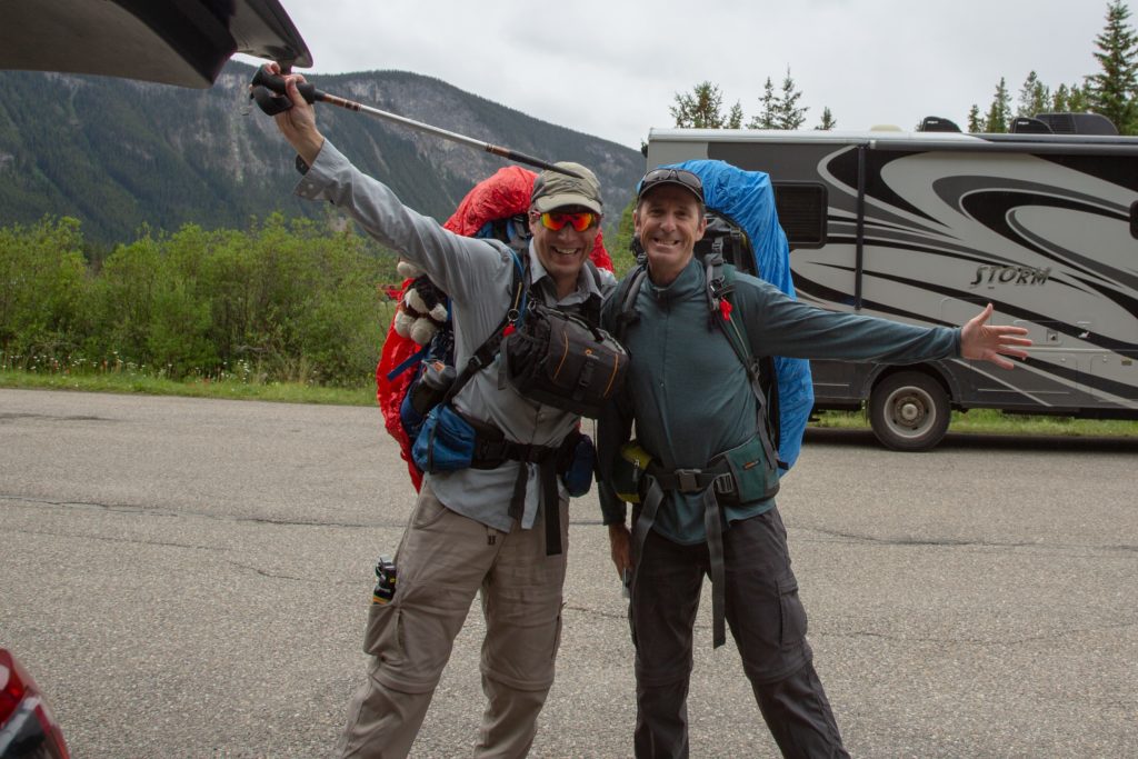
Note, I forgot to turn off the Viewranger, so it kept tracking while we were in camp, time for the hike was as stated above.

The hike started on the last day I was teaching summer school, all the students finished their exams early, so Ken was able to pick me up at 1:30 pm, and we were able to hit the trail at 2:00 pm, under very threatening skies.

Spirits where high as we set off, pack covers are already on.

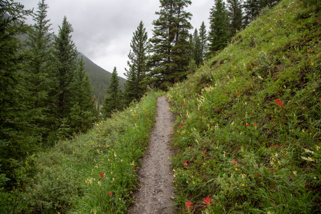
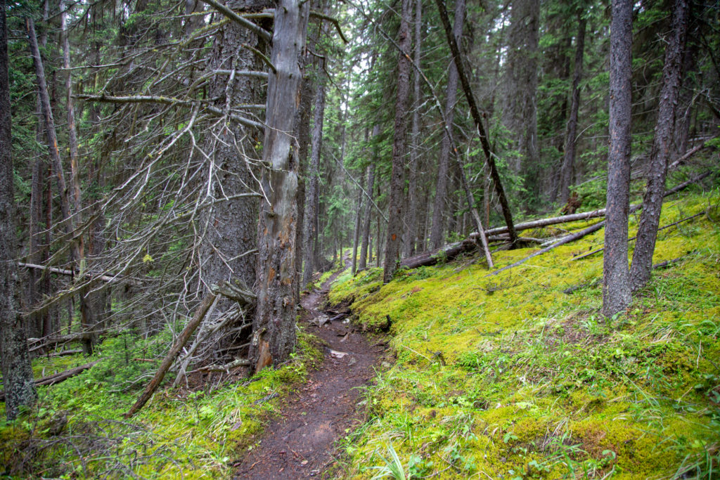
We headed up the Moose Meadows trail, it is 6 km to the Ink Pots, a popular Banff NP destination. For most of the journey, the trail is very wide, and lightly trafficked. Most people will be hiking the very pretty Johnston Canyon trail. We have both been up Johnston Canyon numerous times, so it was more important to travel quickly and avoid the summer hiking crowds, than take in the pretty views. The Moose Meadows trail is very good and solid except for a short section where it cuts through a swamp. We arrived at the junction with the Johnston Canyon trail after 3 km, 150 m of elevation gain and 50 minutes of hiking.

Ken avoid the mud, not raining yet.

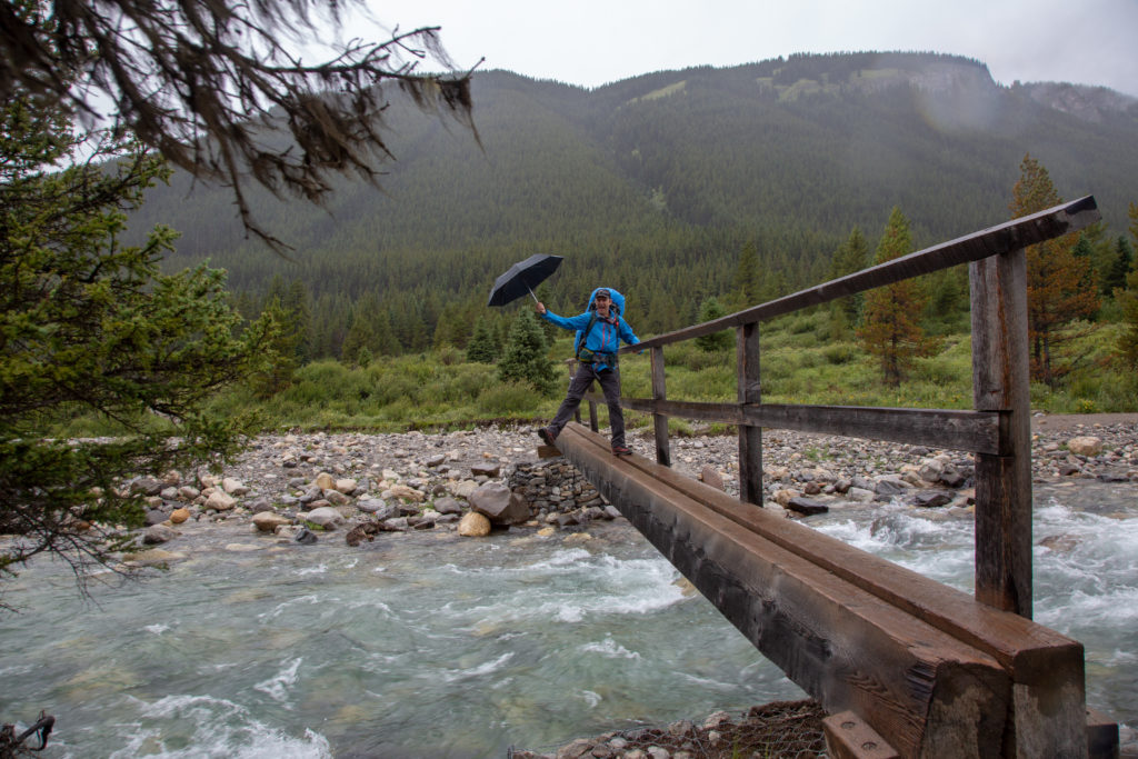
The trail becomes wide and the hiking is smooth as we ascended quickly up the steepest section for the day. We arrived 20 minutes later at the top, 310 m above the parking lot, before descending 100 m over the next 1.5 km to the Ink Pots. It was on the downhill section to the Ink Pots, that we had to stop and put on our rain gear. We passed many people hiking the other way, heading back to their cars trying to escape the rain.

A muddy decent, my umbrella is keeping the rain off for now.

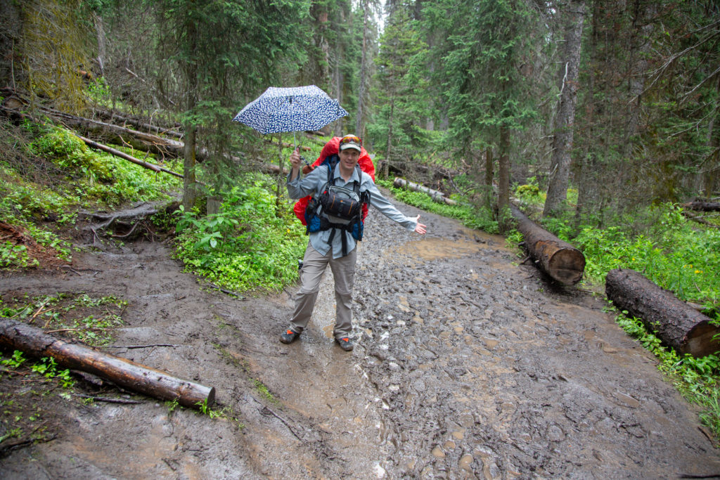
We arrived at the Ink Pots 1 hr 35 min after leaving the parking lot. Due to the rain, what was normally a busy area was very deserted but there were a few brave people who had stayed. We sped by the Ink Pots, as this was only about 1/3 distance we had to travel and the rain was coming down a bit harder.

Ken with his umbrella taking a quick peek at the Ink Pots
Bridge at the end of the meadow, it may be raining, but we can still have some fun.

Shortly after crossing the bridge at the end of the meadow, we passed two women and their dog heading towards the parking lot. They had just competed the hike we were starting, but in the opposite direction. After hiking for three days in the rain and snow, they had decided to skip staying at Larry’s Camp Campground, and head for Banff for “burgers and beer”. They were very upbeat despite the difficult conditions that they had faced, maybe it was the prospect of beer, but I was a little put off by the prospect of snow.

The trail is wet, but not muddy, all the rain during the summer has been good to the flowers.

We arrived at Larry’s Camp Campground at 4:25 pm, a distance of 7.4 km, 2hrs and 25 min after we left the parking lot. There were people staying in the campground. We met a couple from North Carolina, who were headed for Johnston Creek Campground. We would see them again tomorrow.

Trail heading out of Larry’s Camp, it did not stay like this for long.

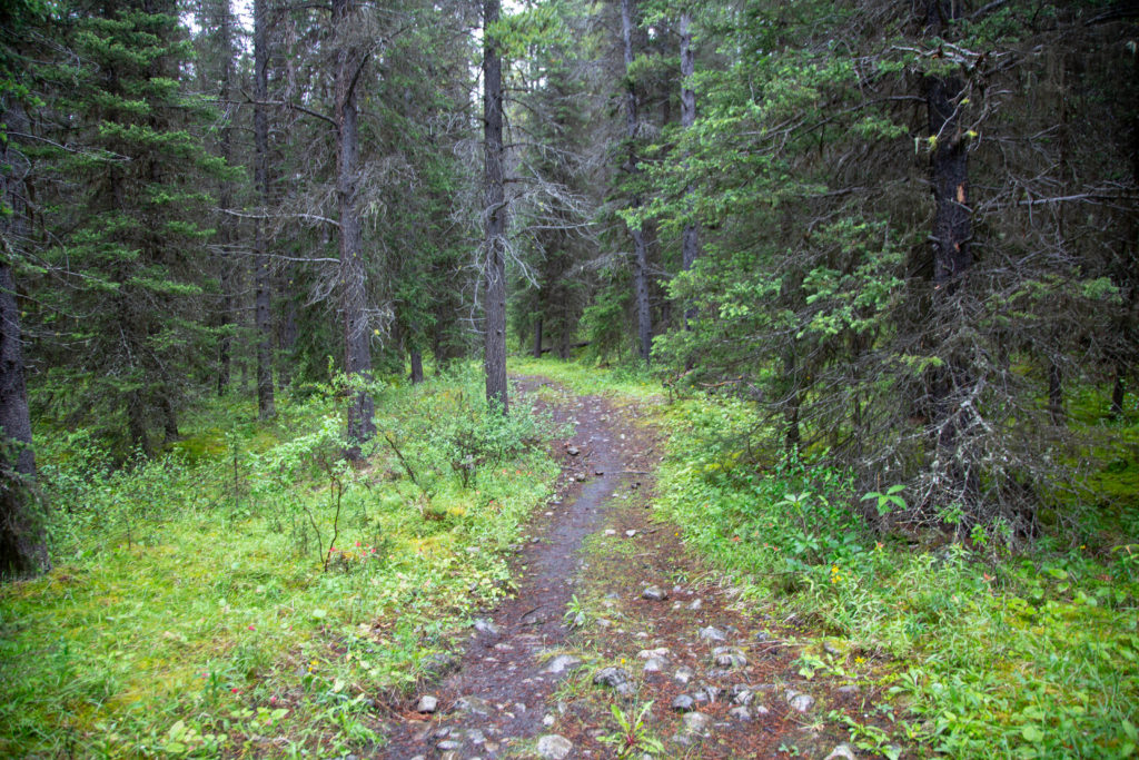
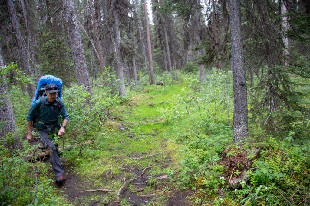
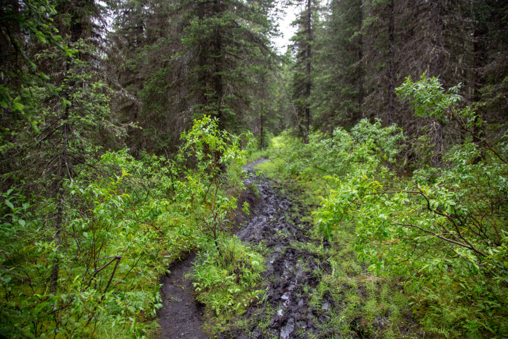
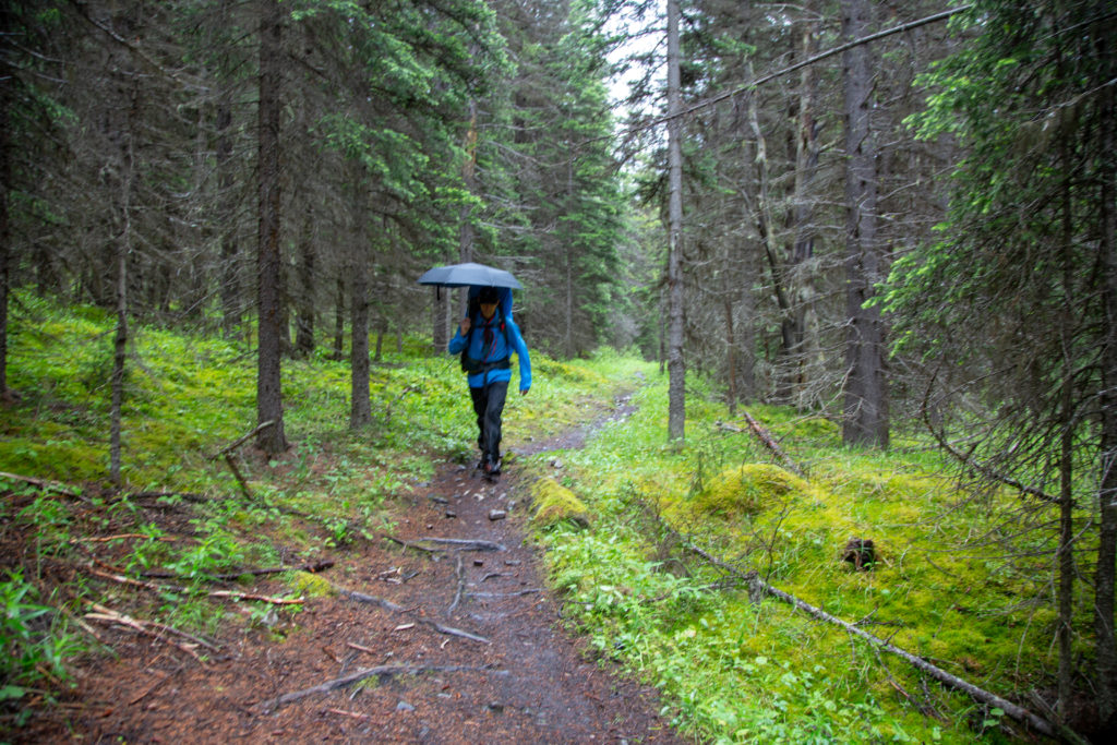
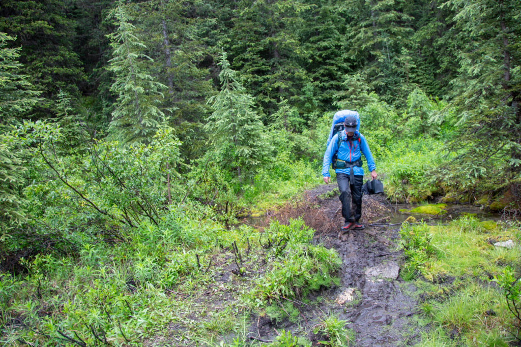
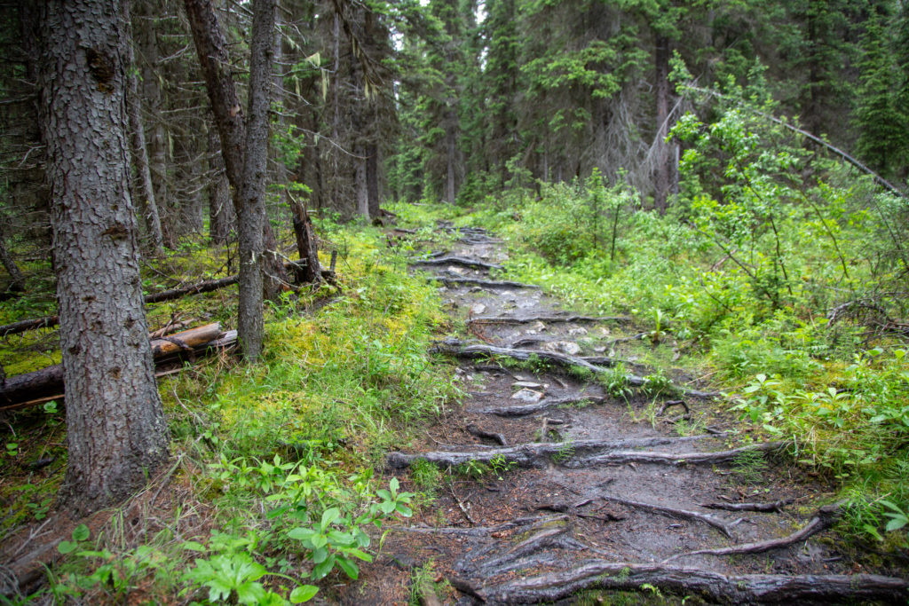
The trail deteriorated quickly as we left the campground. The trail became deep, narrow and muddy. With all the rain this year the vegetation was thick and lush, in places the grasses and shrubs were over hanging the trail. Pushing through the wet vegetation had a way of helping to soak you even worse than the rain. I have heard other hikers to describe this as hiking through a “car wash”

Ken negotiating the car wash.

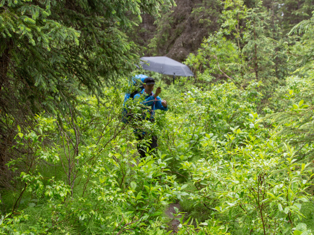
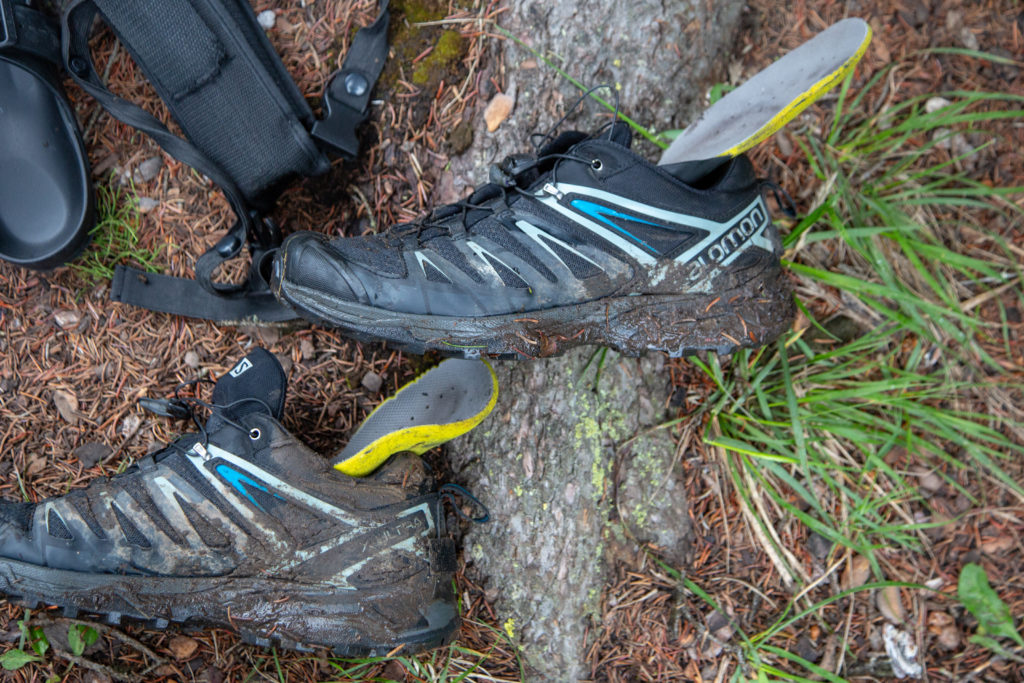
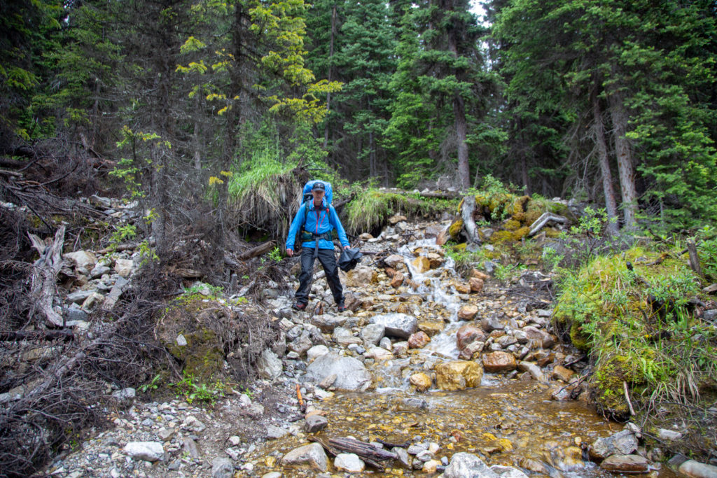
I was beginning to wonder about my choice of footwear. I was hiking in non waterproof hiking shoes. The theory being that I have never had ankle issues when carrying large loads, so why do I need the extra support and weight of boots. Not being water proof, means if the shoes get wet, they will dry quicker. Once water proof boots get wet, they can take forever to dry. As I hiked through the mud and the water, I was wondering if my feet would ever be dry on this trip.

Looks like it is going be hard to keep the feet dry.

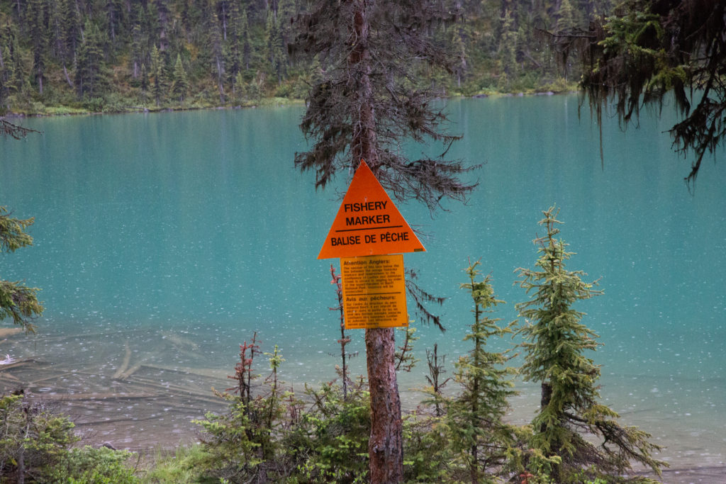
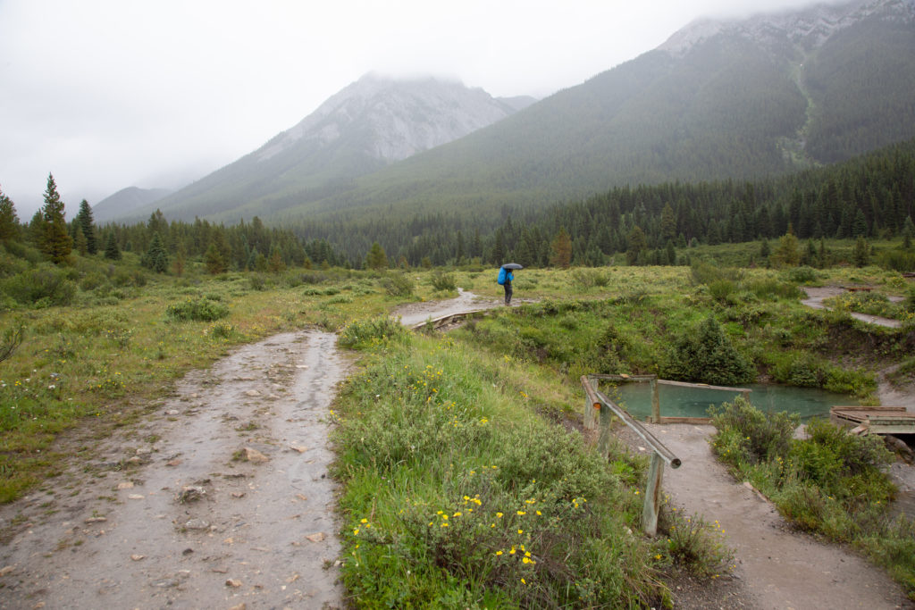
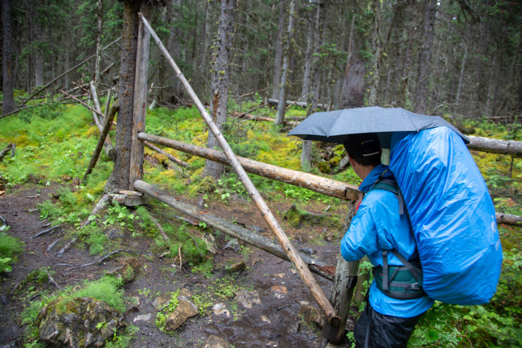
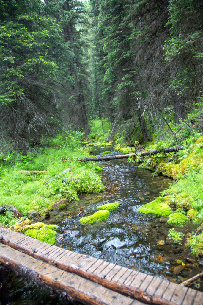
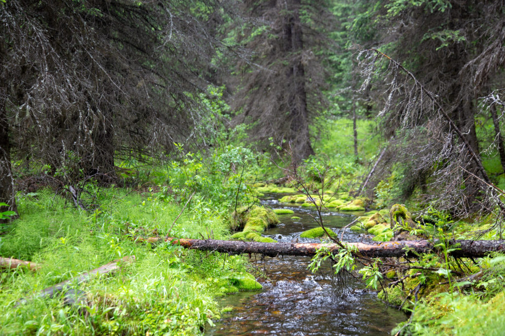
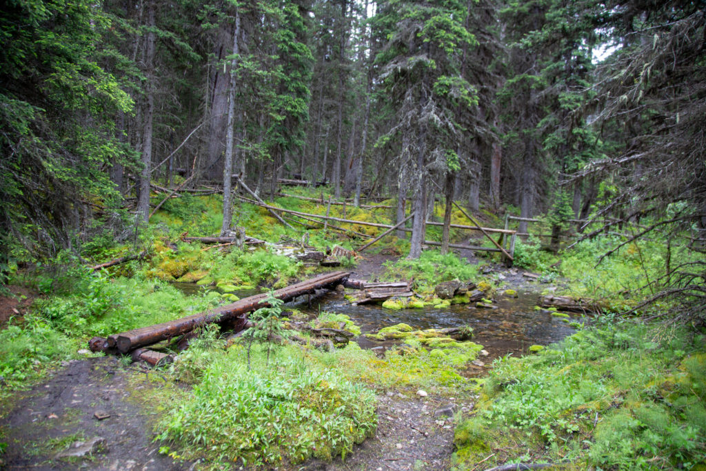
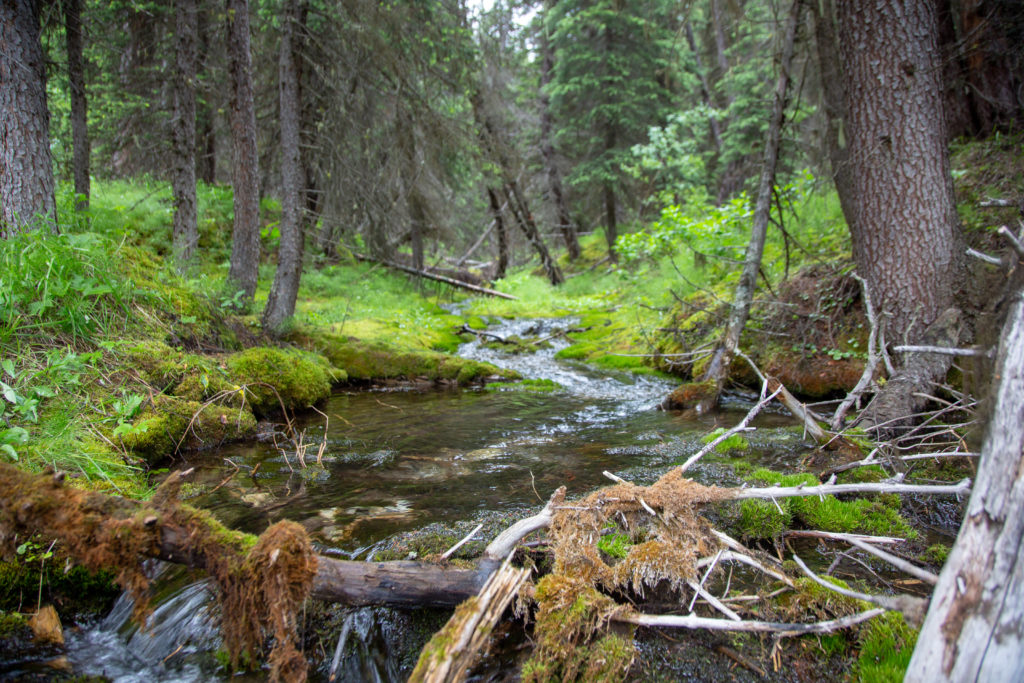
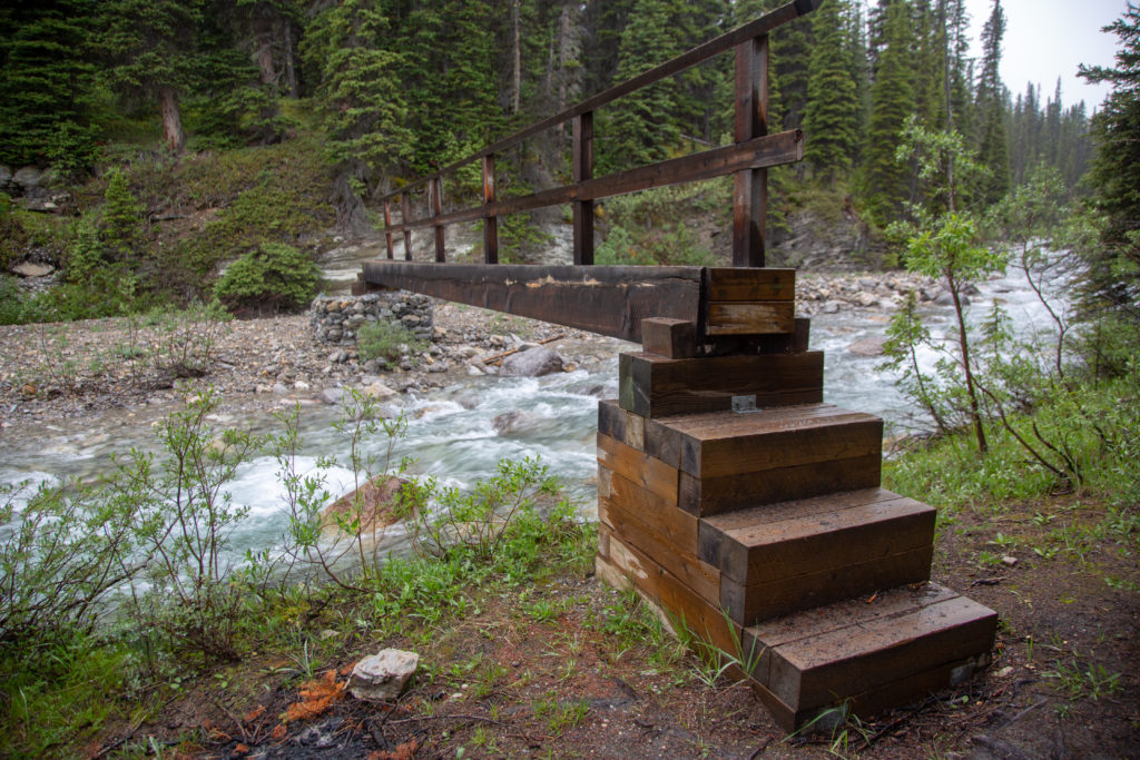
We came to a gate across the trail, you are asked to close it after you pass through. The gate is for horses, one of the reasons why the trail is a bit rough. Parks Canada Wardens use horses in the backcountry and apparently there is a Warden Patrol Cabin nearby. There was a nice creek on the other side of the gate, so despite the rain I stopped and took pictures. I think the rain was relatively light at this time.

Ken opening the gate.
The nice log bridge over a little creek.
Looking up the creek.
The gate and the bridge.

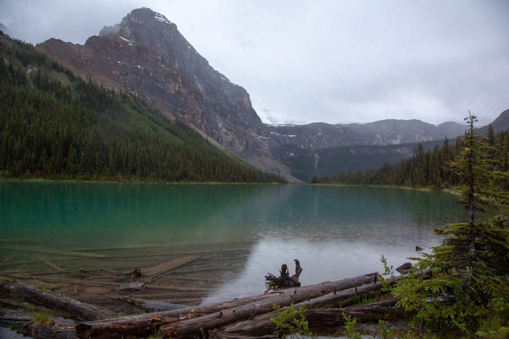
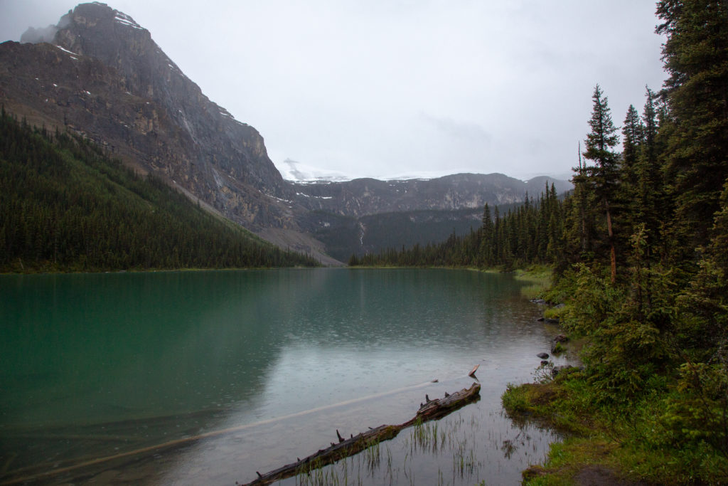
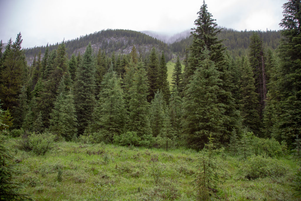
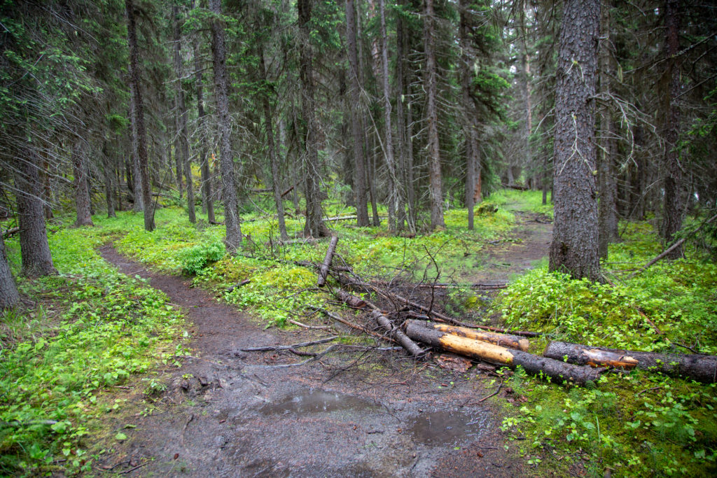
The light drizzle stayed with us, as the clouds rose a little to reveal some of the surrounding mountains. The trail was wide and in good shape and we made good time. Then suddenly, at about the 10.5 km point, there was a sign directing us away from the main trail, to a newly constructed trail higher up the slope. There is obviously some serious damage to the main trail, probably caused by flooding and instead of repairing the damage, Parks Canada had rerouted the trail.

The limited views we had of the mountains.
Ken keeping dry and making good progress on a mostly flat trail.
Time to make a sharp turn off the main trail.

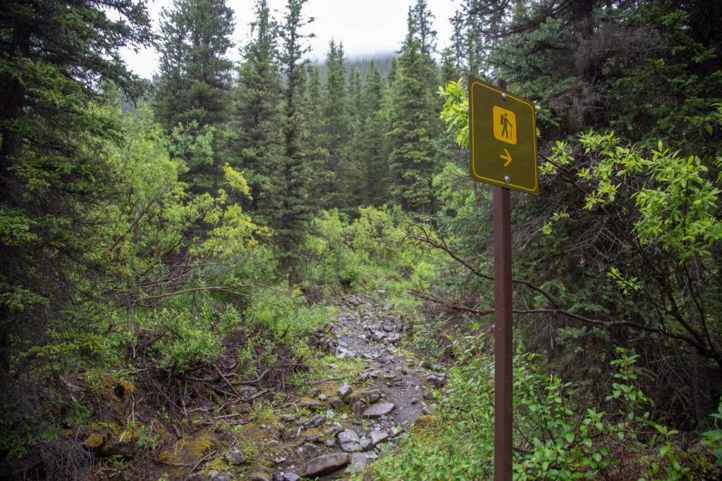
The new trail was narrow, on soft dirt, and had many short ups and downs. I did slip coming down a short drop, definitely needed to pay more attention than on the main trail. Looking back when we rejoined the main trail, we were not able to see any reason for the diversion, but Parks Canada had made it quite obvious you were not suppose to use the original trail. The diversion off the main trail took about 20 minutes.

The new trail cutting along the slope.
View from the end of the detour, there is no sign, but it is obvious that you are expected to take the left branch

The trail conditions deteriorated somewhat over the next several kilometers, with plenty of rocks and roots mixed in with the mud, and a very washed out stream.

Ken negotiating the muddy trail.
There were some pretty views along the way.
Wet, rocky and rooty.
Ken working his way threw the stream damage

I was beginning to wonder when we would come to the intersection for the Luellen Lake Campground. I checked Viewranger on my tablet and noticed that we had apparently passed the intersection. I did not panic, and think we had missed it, as I had run into this before. Sometimes the trails marked on the app are not 100% accurate, intersections and campgrounds can be incorrectly marked by up to 1 km. This does not defeat the purpose of using a tracking app, as I have found the GPS coordinates displayed by the Viewranger app to 100% accurate when checked to a map.

You can see the path we followed, the red line, continues on about 300 m passed where the map shows the junction to the Luellen Lake Campground.

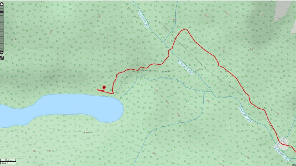
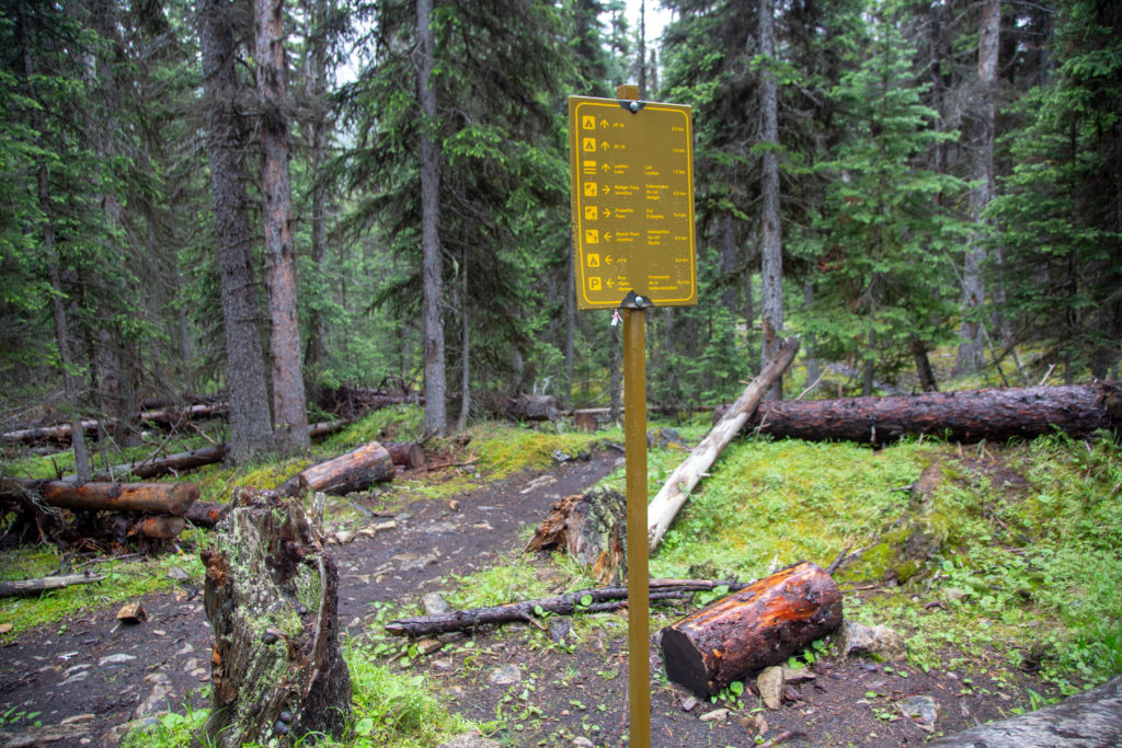
Ken had a new hiking app on his phone, and was quite keen on it. I asked him to check his app and see how far it was to the junction. Ken was shocked when his app also showed that we had passed the junction. We both agreed that there was no way we missed the junction, so I suggested that we give it 5 minutes before considering backtracking. I was pretty confident that we had not missed the junction. It was less than a minute later we came to the well marked (thanks Parks Canada) junction to Luellen Lake . It had been 5 hrs 10 minutes since we left the car, a distance of 16.4 km.

Excellent trail signage by Parks Canada

A short hike brought us to a bridge over Johnston Creek, it was then another 1 km and 90 m of elevation brought us up to Luellen Lake. We passed by Johnston Creek Campsite, it was off in the woods, so we did not stop to investigate it. We arrived at Luellen Lake at 7:28 pm.

Solid bridge over Johnston Creek.
First view of Luellen Lake.

The campground only had a few spots left, we took one at the far edge, near some trees so that Ken could rig up some tarps. Ken is the King of Tarps, always a good thing when its raining. Once we had the tarps set up, we laid a groundsheet (thanks Ken) and quickly set up the tent. Was now time for dinner. We went and made dinner and stored our food in the newly erected bear lockers. It was late, there was not much else to do but go to bed. At some point I told Ken, that I would be keen to hike to Badger Pass Junction Campground in the morning, a distance of about 7 km, but if it was raining on the morning of day 3, I would be walking back to Moose Meadows. I was not overly excited about spending the entire trip hiking in the rain.

King Ken and his tarp.
Ken inspecting the dining area.

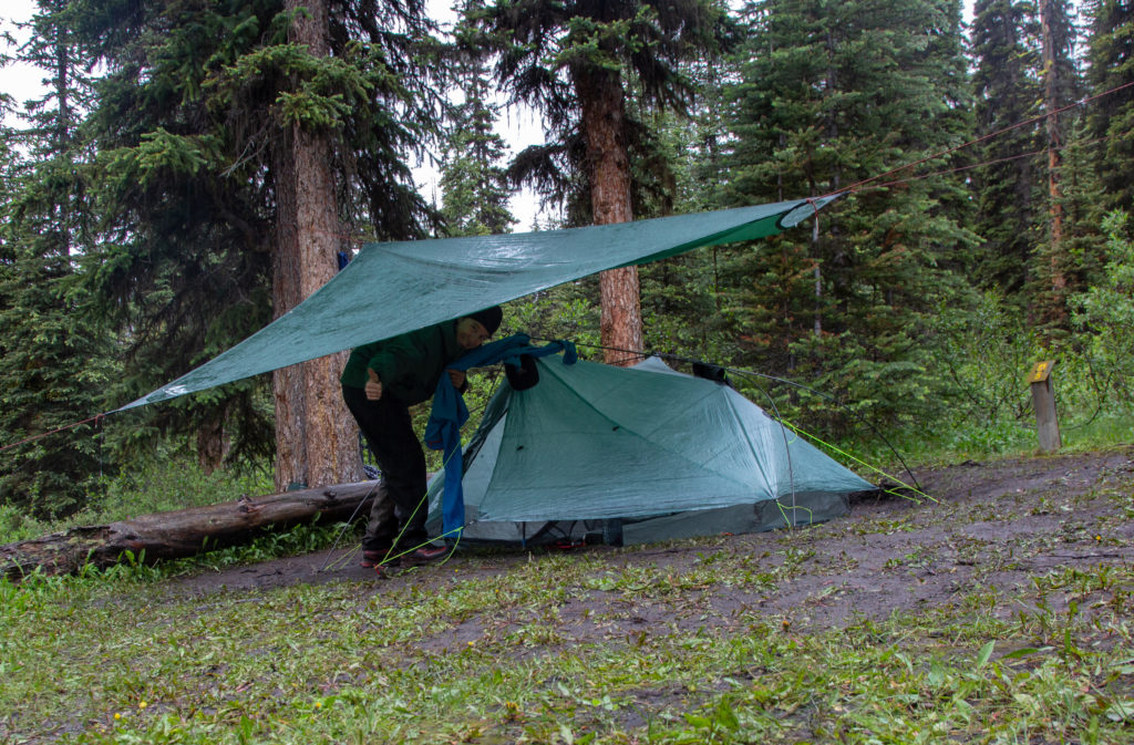
I vainly put my shoes outside to dry. We took advantage of every hanging position possible under the tarp to place our wet rain gear in the hope that it would dry overnight. I was so happy to take off my wet socks and get into dry socks. Once into my -9 C sleeping bag, I was toasty and warm, and slept a solid night to relaxing sound of rain landing on the tarp. Here’s hoping tomorrow would be drier.

Shoes a little worse for wear.
Fishing restrictions at the lake.
Light rain falling on the lake, still an impressive view.

Day 2 Sawback

Sawback Home

bootwreckers

View looking West over the Tonto Platform from the View looking West over the Tonto Platform from the South Kaibab Trail.

This April will be our 10 year anniversary of our first trip to the Grand Canyon.

It is truly one of my happy places, have visited five times and camped below the rim three times.

Looking to get back sometime soon, but good things are worth the wait.

#nps, #nationalparks, #slotcanyon, #hiking, #hikingadventures, #familytime, #camping, #campingadventures, #outdoors, #outside, #nature,  #FIndyourpark #landscape #landscapephotography #optoutside #nationalpark #desertphotography #grandcanyon #grandcanyonnationalpark #grandcanyonassociation #100yearsofgrand #100yearsofbeauty #100yearsofgrandcanyon
Sunday morning sunrise! There are perks for getti Sunday morning sunrise!

There are perks for getting up early on a Sunday to go grocery shopping, and the mountain sunrises are one of them.

Shot off my phone from the parking in downtown Canmore.

#sunrise #sunrisephotography #sunrise_sunset_photogroup #earth #outside #outdoors #naturephotography #nature #naturelovers #sky #skyphotography #sky_brilliance
No doubt 2020 was a prickly year, and 2021 has sta No doubt 2020 was a prickly year, and 2021 has started out a little rough.

Just like hiking, if we keep going we will see beauty in amongst the prickles, but we need to stay on the trail.

Here's to good times ahead.

From our hike last year Emily hiking among the cactii towards the feature we affectionately named the Thumb, Passage 16 on the Arizona Trail

#teamzpacks #zpacks #zpacksduplex #aztassociation #aztrail #aztrails #hike #loveazt #desertphotography #desert #hikingadventures #hikes #backpacking #camping #getoutside #familytime #traillife #aztassociation , #hiking, #hikingadventures, #familytime, #camping, #campingadventures, #outdoors, #outside, #nature,  #FIndyourpark #landscape #landscapephotography #optoutside  #rightnow #goparks #aztrails #aztrail #loveazt  #azt #arizonatrailassociation
Looking at a fun trip last summer through Yoho NP Looking at a fun trip last summer through Yoho NP with @sio.mellors 

Lots of waterfalls to see in the park, Laughing Falls is a fun and loud falls right off the main trail located surprisingly, next to Laughing Falls CG.

We stopped by on our way to Twin Falls CG after spending the day hiking the Iceline Trail

Like this photo of Siobhan getting close to the falls for her own picture. 

#friends, #alberta, #parkscanada #backpacking, #yohonationalpark #yoho #friendsofyoho #nationalpark, #nationalparks, #mountains #naturephotography #travelcolumbiavalley #travelbcp #waterfall #waterfall #waterfallphotography #waterfallsofinstagram
Haiduk Lake, Banff NP. Haiduk Lake is just beyond Haiduk Lake, Banff NP.

Haiduk Lake is just beyond Whistling Pass as you hike from Egypt Lake to Balls Pass Junction.

Very pretty Lake. We were lucky enough to pass by early in the morning as we hiked from Egypt Lake to Floe Lake during our #gdt hike this summer.

#friends, #alberta, #parkscanada #rockwall #backpacking #nationalpark, #nationalparks, #mountains #naturephotography #alpine #lifeelevated #getoutside #lifeonthetrail #britishcolumbia #gdt #greatdividetrail
#kananaskis #kananaskiscountry
Chasing th Aurora on Friday night at Lake Minnewan Chasing th Aurora on Friday night at Lake Minnewanka in Banff NP.

Sadly it did not come right out to play,  but was obviously a lot of light coming from th North East.

Always fun to be outside in a dark place to see th glory of the night sky.

#outside, #hiking #camping, #backpacking,
#adventure, #adventureoutside, #nature, #landscapephotography, #nobaddays, #adventureholiday, #hikingadventures, #astrophotography, #milkyway #kootenaylife #kootenaynationalpark #nationalpark #nationalparks
#parkscanada #northernlights #aurora #auroras #auroramax
Hiking the GDT Day 1. I was almost completely sa Hiking the GDT Day 1. 

I was almost completely satisfied with or trip on the Great Divide Trail when on Day 1 we finished the uphill to Turbine Canyon and popped out of the woods and saw this amazing alpine vista.

I remember remarking to Emily "this is why I hike"

#friends, #alberta, #parkscanada #rockwall #backpacking #nationalpark, #nationalparks, #mountains #naturephotography #alpine #lifeelevated #getoutside #lifeonthetrail #britishcolumbia #gdt #greatdividetrail
#kananaskis #kananaskiscountry
Morning from Floe Lake with Floe Peak selection of Morning from Floe Lake with Floe Peak selection off the mirror smooth waters.

Another amazing morning hiking the GDT.

Never get tired of Floe Lake, was my third visit and just a year after my previous visit.

#friends, #alberta, #parkscanada #rockwall #backpacking, #kootenaynationalpark #nationalpark, #nationalparks, #mountains #naturephotography #travelcolumbiavalley #travelbcp #flowers #getoutside #lifeonthetrail #britishcolumbia #gdt #greatdividetrail #goldenhour #goldenhourphotography #mirrorphotography #lake
Golden hour! Morning sun shining off of Tumbling Golden hour!

Morning sun shining off of Tumbling Glacier and the Rockwall. 

Waking up at Tumbling Creek Campground during my Great Divide Hike this summer. 

#friends, #alberta, #parkscanada #rockwall #backpacking, #kootenaynationalpark #nationalpark, #nationalparks, #mountains #naturephotography #travelcolumbiavalley #travelbcp #flowers #getoutside #lifeonthetrail #britishcolumbia #gdt #greatdividetrail #goldenhour #goldenhourphotography
Flower Field, Tumbling Pass, Kootenay NP. From la Flower Field, Tumbling Pass, Kootenay NP.

From last summer's Great Divide Trail hike. At th top of Tumbling Pass on the Rockwall, treated to a visual feast of colour.

Awesome day, epic hike.

#friends, #alberta, #parkscanada #rockwall #backpacking, #kootenaynationalpark #nationalpark, #nationalparks, #mountains #naturephotography #travelcolumbiavalley #travelbcp #flowers #getoutside #lifeonthetrail #britishcolumbia #gdt #greatdividetrail
As we head into winter, a shot from last spring at As we head into winter, a shot from last spring at the end of winter. The snow was just clearing from the trails, and flowers poking through to greet the warmth.

Heading out over Rockwall Pass, Kootenay NP, with @kbsymington  and @neil.real.deal .

Had some snowfields to cross, good day out on th trail

#friends, #alberta, #parkscanada #rockwall #backpacking, #kootenaynationalpark #nationalpark, #nationalparks, #mountains #naturephotography #travelcolumbiavalley #travelbcp #flowers #getoutside #lifeonthetrail #britishcolumbia
Fun photo from Twin Falls Campground in Yoho Natio Fun photo from Twin Falls Campground in Yoho National Park.

As night fell I was able to take some long exposure shots of Twin Falls Creek as it tumbles through the campground.

Fun 3 day trip with @sio.mellors.

#friends, #alberta, #parkscanada #backpacking, #yohonationalpark #yoho #friendsofyoho #nationalpark, #nationalparks, #mountains #naturephotography #travelcolumbiavalley #travelbcp #waterfall #rainbow #spectrum #hikingadventures #longexposure #longexposurephotography #river
Top of Guinns Pass, Kananaskis Country 2016 Guinn Top of Guinns Pass, Kananaskis Country 2016

Guinns Pass connects the valley with Ribbon Lake and Ribbon Creek and the valley with Lillian Lake and Galetea Creek. Stunning views in all directions from the top of the pass.

There is also a scramble up the connecting ridge to the east up to Guinns Peak and onto Mt Kidd South.

Great two days hiking with @emilysjumpinginpuddles

#hikingwithdogs, #hiking, #hikingdogsofinstagram, #outside, #kananaskiscountry, #kananaskis, #spcacanmore, #spcarescue, #snowyowlsleddogtours, #snowyowldogsledtours, #retiredsleddog, #retiredhusky, #backpacking, #tongueouttuesday, #canmore, #canmorealberta, #adventure,
Larch season is coming to an end in the Rockies, b Larch season is coming to an end in the Rockies, but last weekend we were treated to quite a display near Taylor Lake in Banff NP

#outside, #outsidethebox, #liveoutdoors, #liveoutsidethebox #naturephotography, #naturelovers,  #retiredhusky, #rescuer
#parkscanada #banffnationalpark #banffalberta #banffcanada #larches #fall #autumn
Amazing sunset over Floe Lake. An early evening s Amazing sunset over Floe Lake.

An early evening storm and the setting sun shining up and reflecting off the clouds. Completely surreal. 

August 17th

Kootenay NP

Part of a 10 day hike along the Great Divide Trail, from Upper Kananaskis Lake to Field, BC

#outside, #outsidethebox, #liveoutdoors, #liveoutsidethebox #naturephotography, #naturelovers,  #retiredhusky, #rescuer
#parkscanada #banffnationalpark #banffalberta #banffcanada
#sunstar #sun #lake #sunrise #alpin #scenery #reflectionphotography #reflections #sceneryphotography
Well, my epic 15 day hike became a totally epic 10 Well, my epic 15 day hike became a totally epic 10 day adventure.

Lots of photos, but I will start with a picture of the adult wolf I saw just outside of Egypt Lake Campground.

I was luck to see probably the entire pack, 6 wolves, they were coming out of the woods and crossing the trail to Egypt Lake, and I just happened to be there with my camera.

#friends, #alberta, #parkscanada #rockwall #backpacking, #banffnationalpark #banffalberta 
 #egyptlake #wolf #wolves #nationalpark, #nationalparks, #mountains #naturephotography #wildwolf #wildwolves #gdt #greatdividetrail
Bathtub full of gear and Frosty Paws. Must mean ad Bathtub full of gear and Frosty Paws. Must mean adventure is near.

Leaving Tuesday for 15 days on the Great Divide Trail with daughter Emily. 

Hiking from Kananaskis Lakes to Saskatchewan River Crossing. 

1st stage is 7 days to Floe Lake, looking like th backpack will be around 45lbs, with tent, food and camera.

Should be a grand adventure.

#outside #liveoutsidethebox #naturephotography, #naturelovers,  #retiredhusky, 
#parkscanada #glaciernationalpark #bctourism #earthexperience
#sunrise #alpine #scenery #reflectionphotography #reflections #sceneryphotography #alpinelake #amazingearth #morningmotivation #travelcanada #explorerockies
#travelcanada #mountainstories #explorecanada #theearthoutdoors #paradisecanada #gdt #greatdividetrail
Amazing backpacking trip through Yoho NP with Volc Amazing backpacking trip through Yoho NP with Volcano (@senioradventurepups)

Volcano is turning 13 the first week of August but still crushed the 12km from Laughing Falls CG to view Twin Falls and back to the car via the connector.

Volcano not a big fan of water falls, or me sticking the camera in her face, her expression says it all. But Twin Falls is beautiful and I caught a small rainbow at the bottom.

Had a blast with her, she is always keen to go, jst not as far as before.

#friends, #alberta, #parkscanada #backpacking, #yohonationalpark #yoho #friendsofyoho #nationalpark, #nationalparks, #mountains #naturephotography #travelcolumbiavalley #travelbcp #waterfall #rainbow #spectrum #hikingadventures #hikingwithdogs #backpackingwithdogs #retiredhusky #retiredsleddog #alaskanhusky
Milky Way over Brachiopod Mt, Baker Lake, Banff NP Milky Way over Brachiopod Mt, Baker Lake, Banff NP. Super happy to get the reflections on stars in the lake.

Amazing trip to Baker Lake. The resident porcupine chewed a small hole in the fly.

Got up at 2am to take photos of the stars. On the way back, the porcupine was guarding my tent, had to gently shoo it away.

#outside, #outsidethebox, #liveoutdoors, #liveoutsidethebox #naturephotography, #naturelovers,  #retiredhusky, #rescuer
#parkscanada #banffnationalpark #banffalberta #banffcanada
#sunstar #sun #lake #sunrise #alpin #scenery #reflectionphotography #reflections #sceneryphotography
The light favours the early risers. The low angle The light favours the early risers.

The low angle morning rays from the sun makes a rainbow on Helmet Falls, Kootenay NP

#friends, #alberta, #parkscanada #rockwall #backpacking, #kootenaynationalpark #nationalpark, #nationalparks, #mountains #naturephotography #travelcolumbiavalley #travelbcp #waterfall #rainbow #spectrum #helmetfalls
Load More... Follow on Instagram

For more photos of these and other Bootwreckers Adventures

© 2021 Boot Wreckers | Powered by Minimalist Blog WordPress Theme