Boot Wreckers
Menu
  • Welcome to my hiking website
  • Hiking
    • Mt Allan Traverse (Centennial Ridge)
    • Mt Nomad – Kanananaskis Country
  • Backpacking – Overnights
    • Baker Lake 2020 Banff NP
    • Fish Lakes – Banff NP, Alberta
    • Floe Lake/Numa Creek, Kootenay NP, British Columbia
    • Floe Lake (Revisited 2019) – Kootenay NP
    • Grand Canyon Corridor Backpacking Trip
    • Hermit Trail to Hermit Meadows – Glacier NP, British Columbia
    • Exploring Waterfalls with Volcano – Yoho NP
    • Mystic Lake – Banff NP
    • Ribbon Lake Kananaskis Prov. Park 2016 – Ribbon Creek Route
    • Ribbon Lake Kananaskis Prov. Park 2017 – South Buller Pass Route
    • Stenton Lake – Alberta Wildlands Prov. Park
  • Backpacking – Multi Day
    • Arizona Trail Passages 16/17
    • Brazeau Loop – Jasper National Park
    • Egypt Lake Epic – Banff NP
    • Grand Canyon Hermit – South Kaibab
    • Grand Canyon – Tanner/Beamer Trail
    • GR20 – Corsica
    • Great Divide Trail Hike – Section C 2020
    • Iceline/Twin Falls – Yoho NP
    • Kilimanjaro – Tanzania
    • Mt Assiniboine Lollipop – Banff NP
    • Rockwall North 2020 Kootenay NP
    • Sawback – Banff NP
  • The Team
  • Contact Us
Menu

Day 1 Stenton Lake, Alberta Wildlands Prov. Park

High altitude trip route right outside our front door.

Day 1 Front Door to Stenton Lake, 18.5 km, 1319 m Elevation Gain, 385 m Elevation Loss, 8 hrs 20 min.

Volcano was a very keen hiker and had got excited when she recognized my backpack. I felt that the hike would not be appropriate for Volcano, too rough and too much elevation. I tried to fool Volcano by putting my backpack into the garage. When Emily arrived we left through the garage not wearing any backpacks. Laura told me when I got home the next day that Volcano was not fooled. She stared at the garage door for a long time waiting for me.
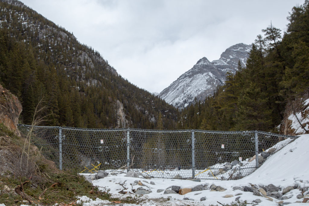
I cooked Emily and I both up a good breakfast of eggs, toast and fruit and after giving the dogs a quick walk we headed on our way. We left the house at about 9:13 am and headed up the street. It is just over of walking on the sidewalk to reach the parking lot at Cougar Creek. It was another km of walking on relatively good trail that brought us the Cougar Creek Debri fence. The fence was constructed after the flood of 2013. One of the causes of the flood was the large amounts of rock and gravel that the creek brought down and filled in the creek bed causing the water to overflow. The fence is designed to hold the debri (rocks) back and prevent the infilling of the creek.

The debris fence. It is about 20 feet high. Currently being replaced by a more permanent engineered that will be 34 m tall. Link to Town of Canmore video Cougar Creek Debris Retention Structure.

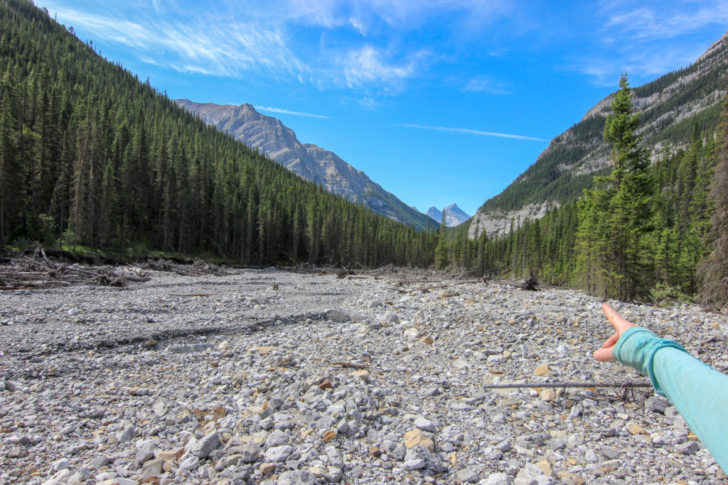
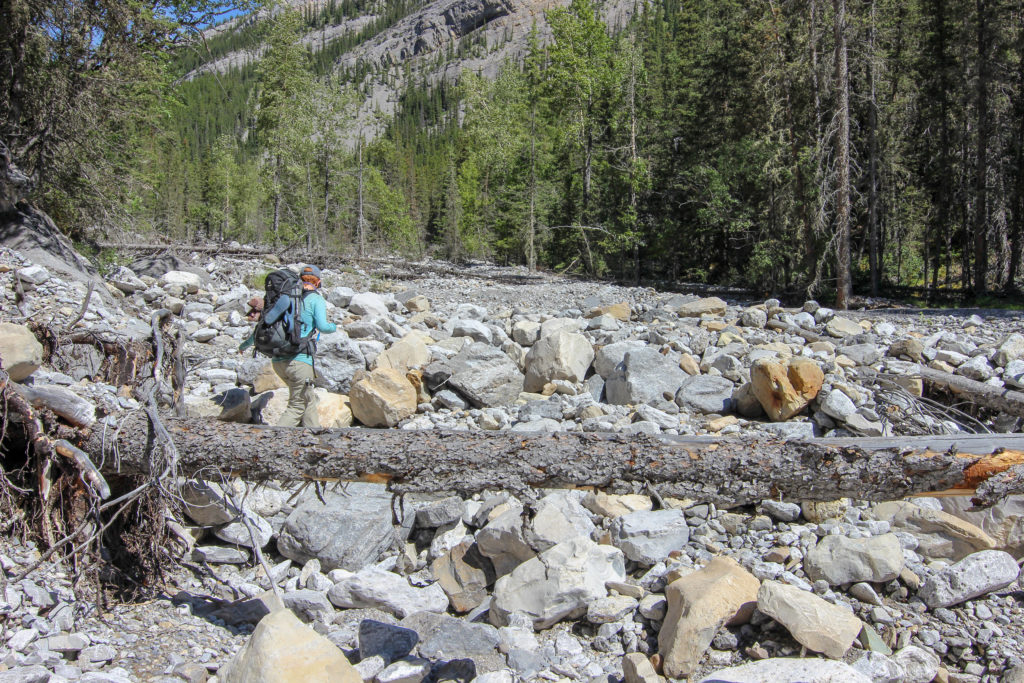
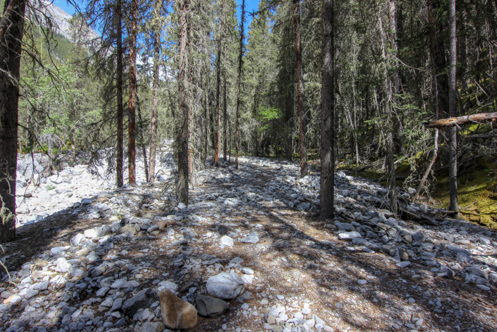
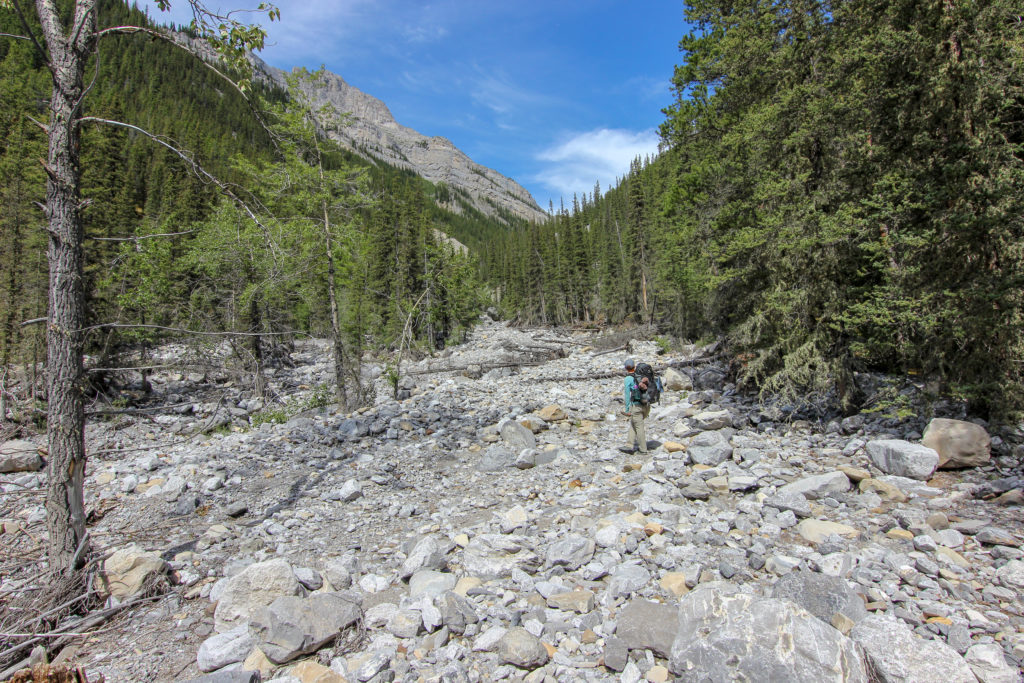
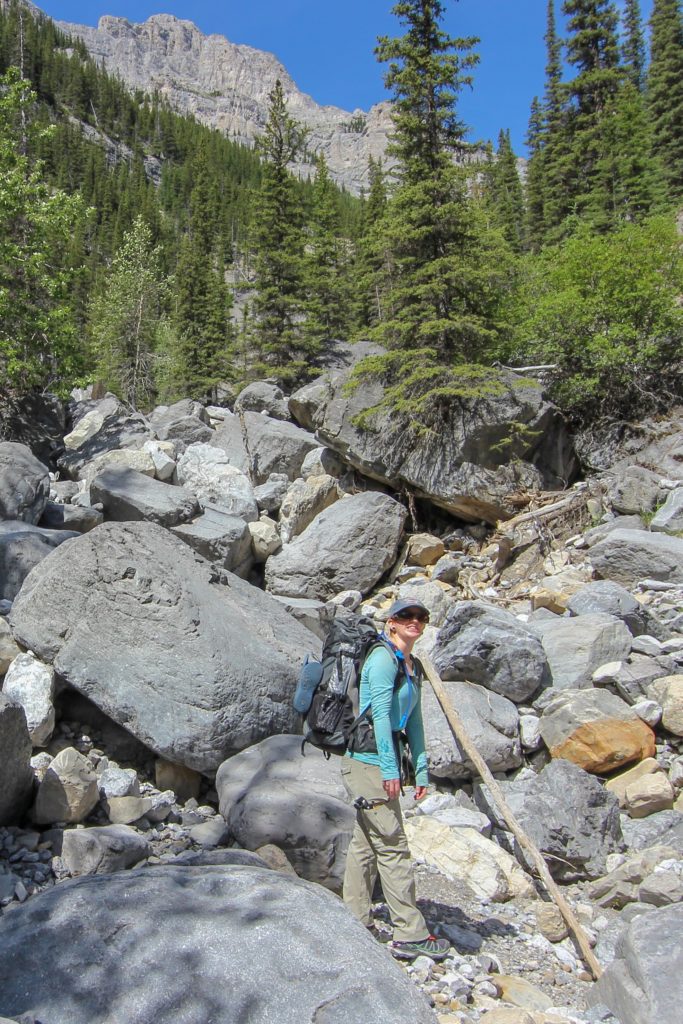
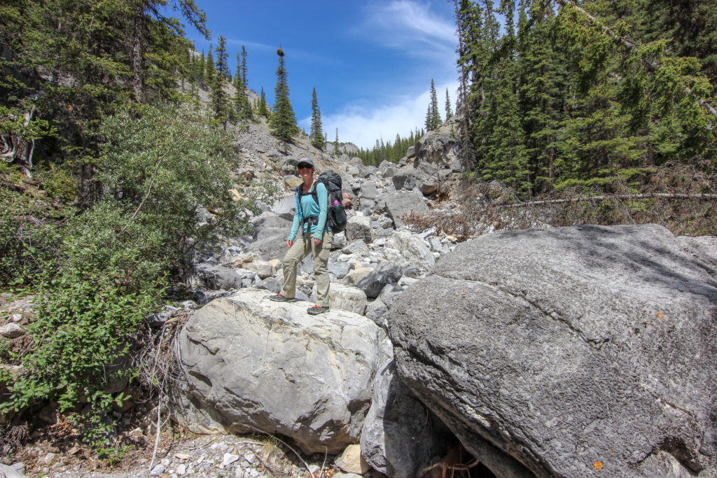
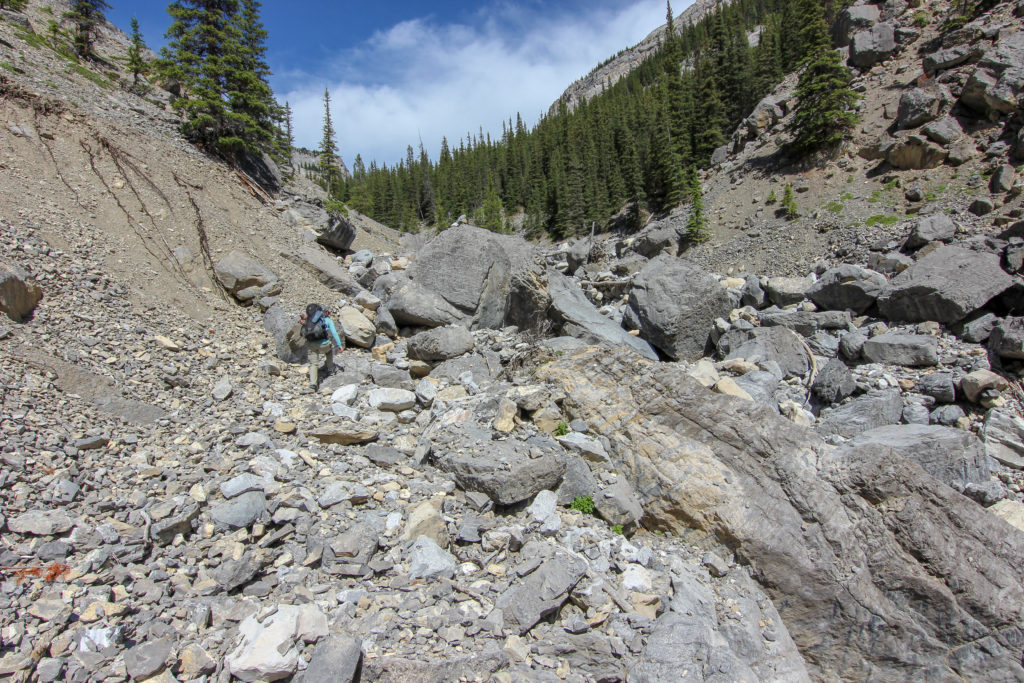
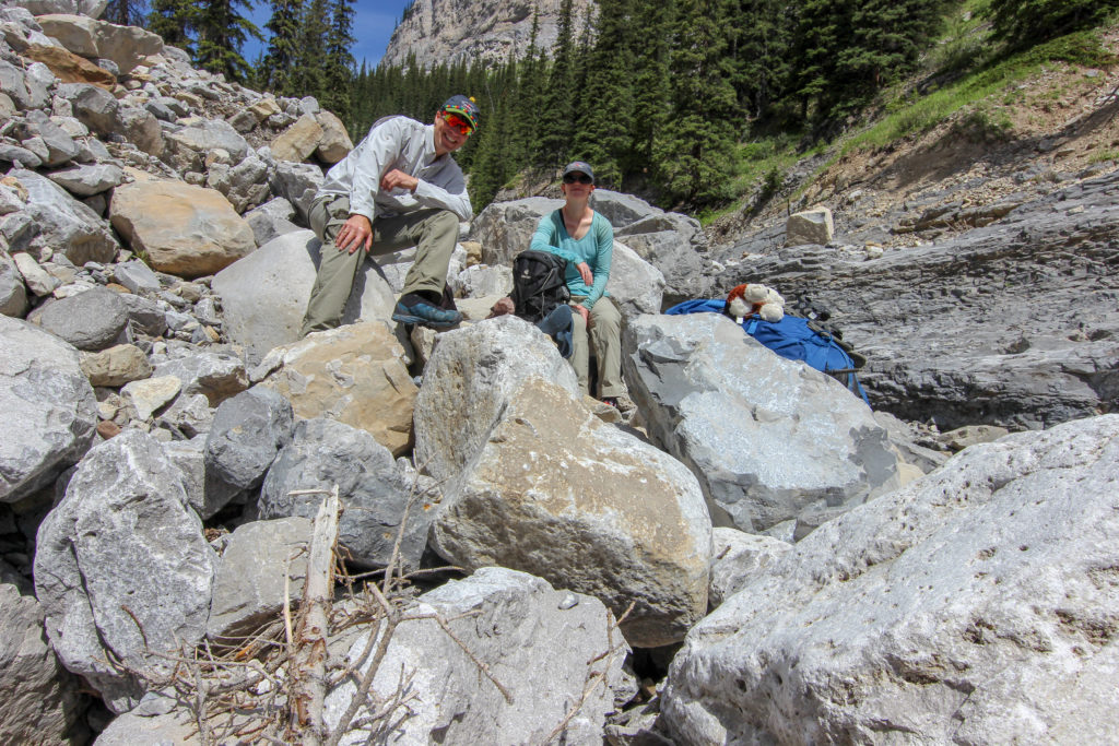
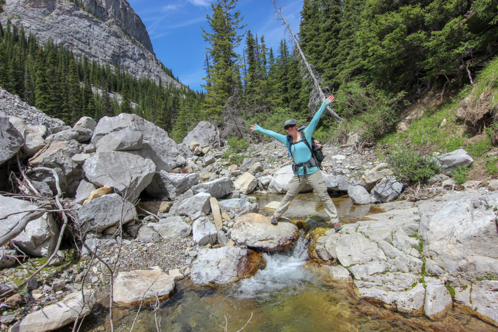
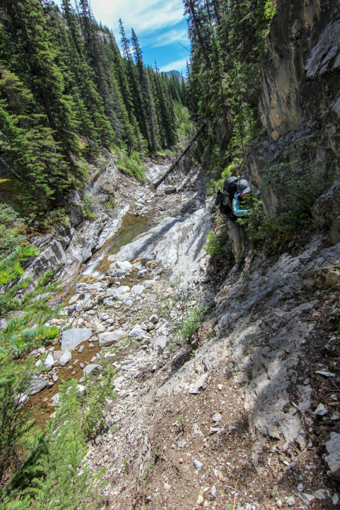
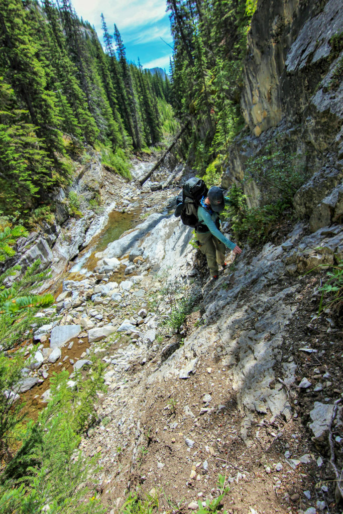
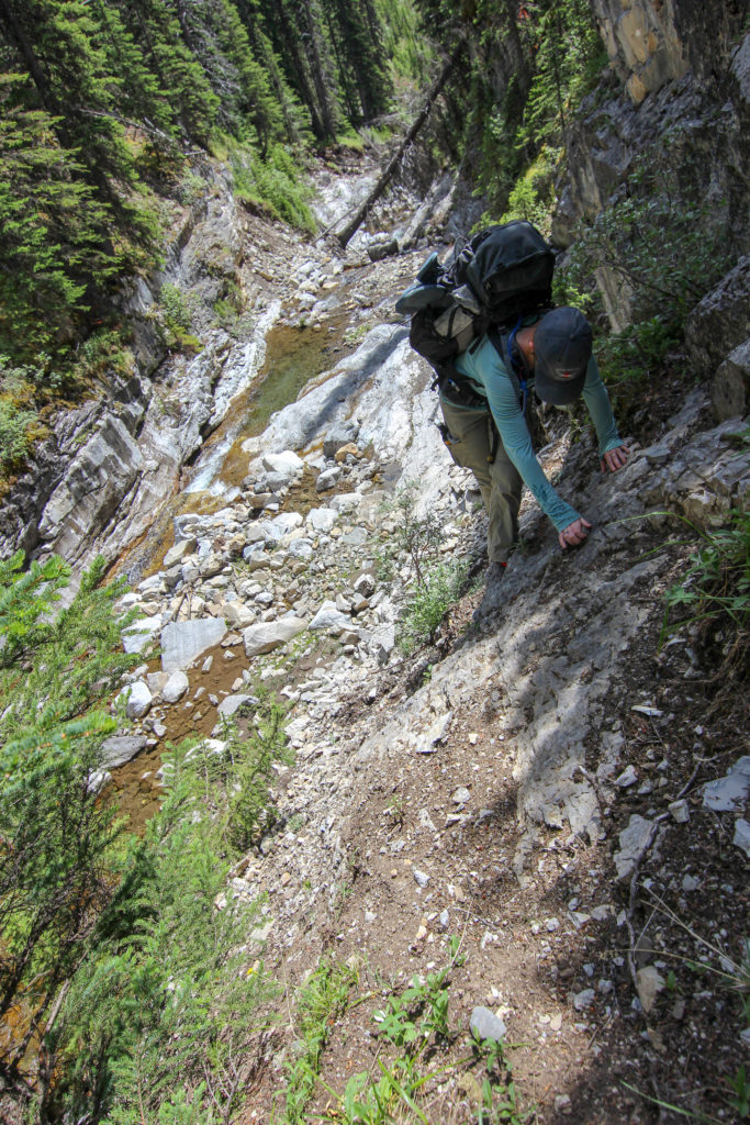
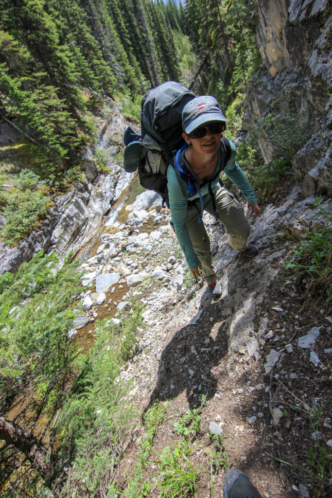
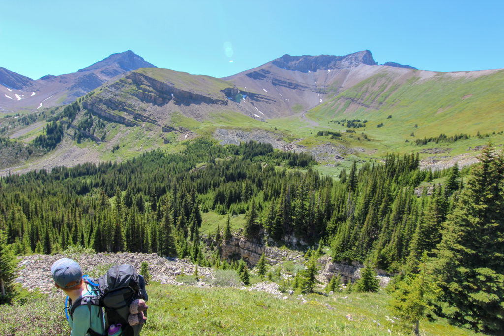
Once past the fence we would spend the next 2 hrs 15 min walking about 7.3 km Cougar Creek. There was no trail just a gravelly rocky creek bed. For the first little while we past climbers on the canyon walls but very soon we would be on our own.

Inside the canyon. the walking is good.
A weeping wall. In the winter there are thick beautiful columns of ice on the wall.

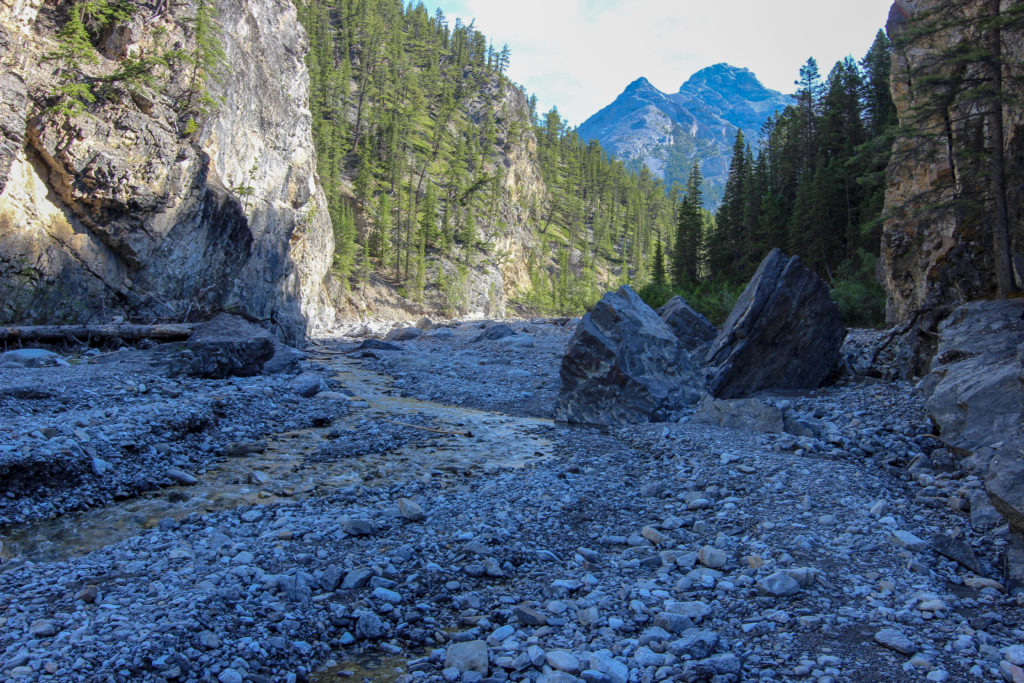
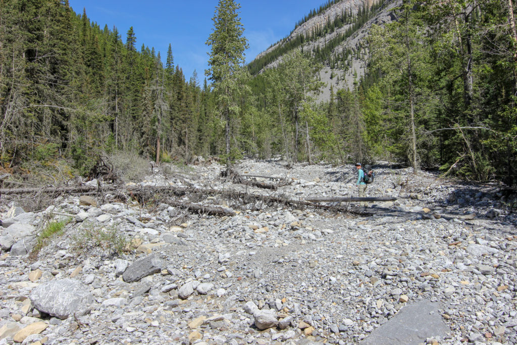
It took an 1 hr 10 min to reach Canada Forks, a junction of two creeks, we followed the left fork. The creek got progressively more rugged and the boulders larger.

Emily heading upstream. There are small pools of water in some of the depressions.
More flood debris.
The creek is very constricted in this section. Can you find the little hiker among the giant boulders?

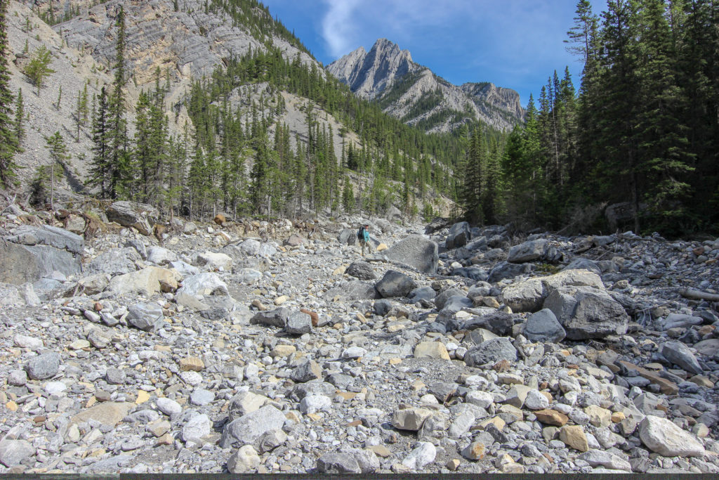
The valley soon widened and the creek became a wide gravel bed. Walking is straightforward but good ankle flexibility on the rocks helped.

Small islands of trees survived the effects of the flood.
Emily pointing the valley rocky ridge that indicates the valley we want to turn up.
Something else has caught Emily’s attention.
On the east bank there was a small remnant of a path that once ran along Cougar Creek. It may have been washed away in the flood of 2013 or another time of high water.

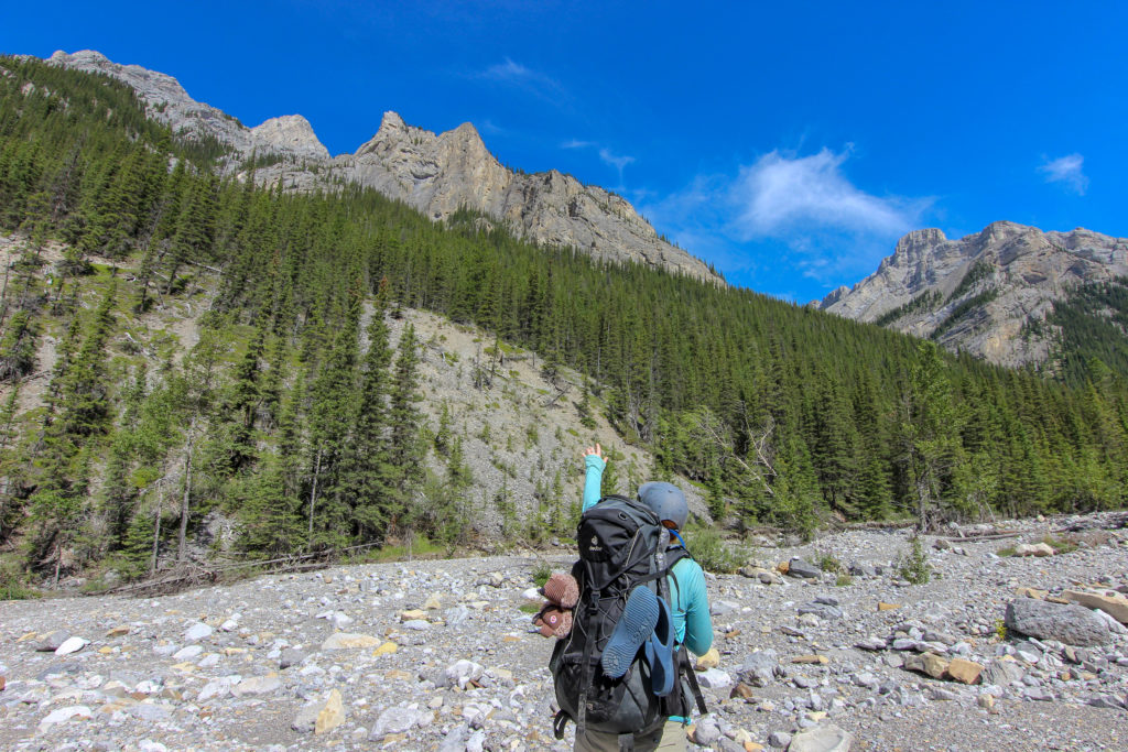
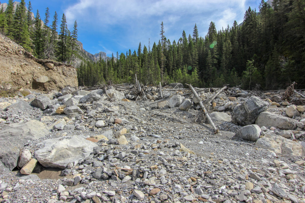
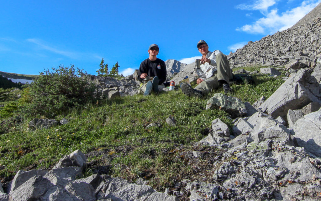
Once we found the junction with the valley we needed to hike up we found a shade spot in some trees and took a 20 minute break. We had been hiking for 2 hrs 15 min and covered approximately 9.5 km. We did not know it but our hiking pace was to drastically slow down.

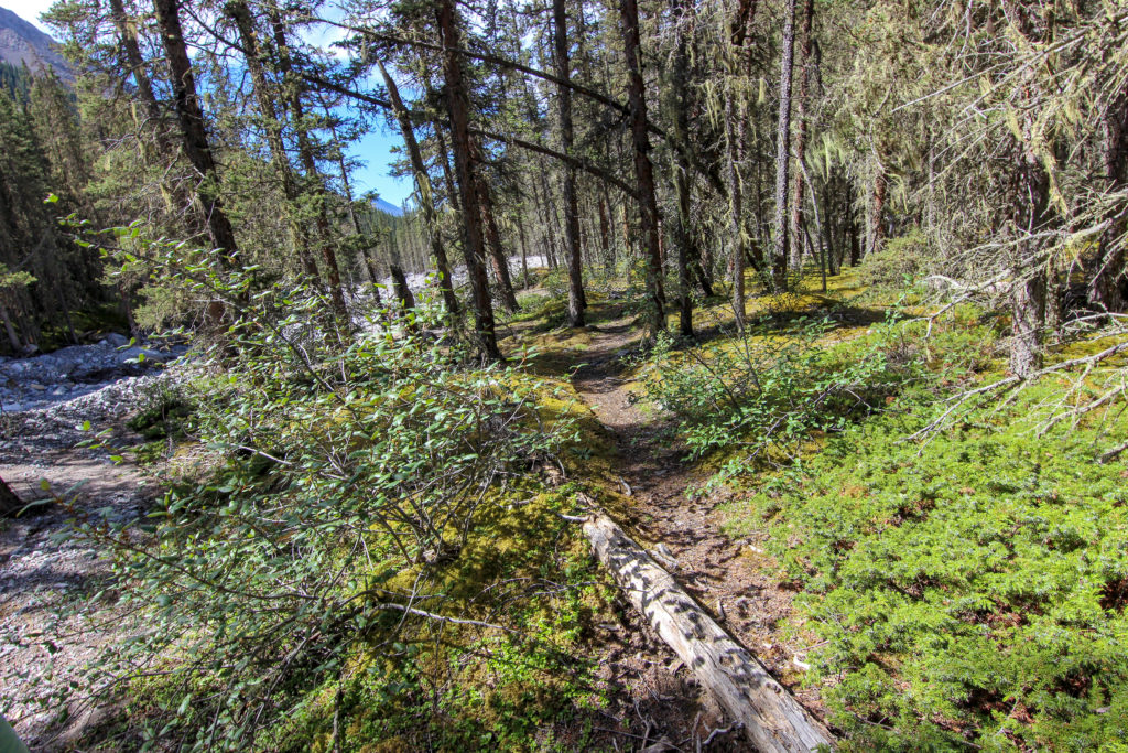
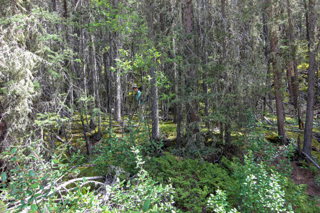
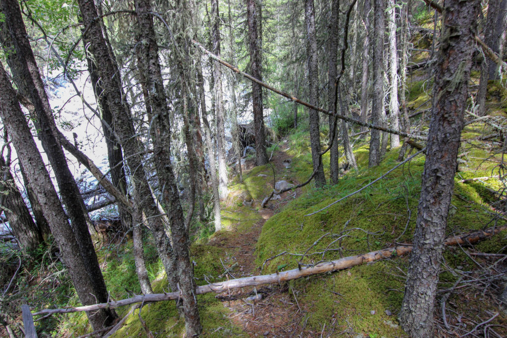
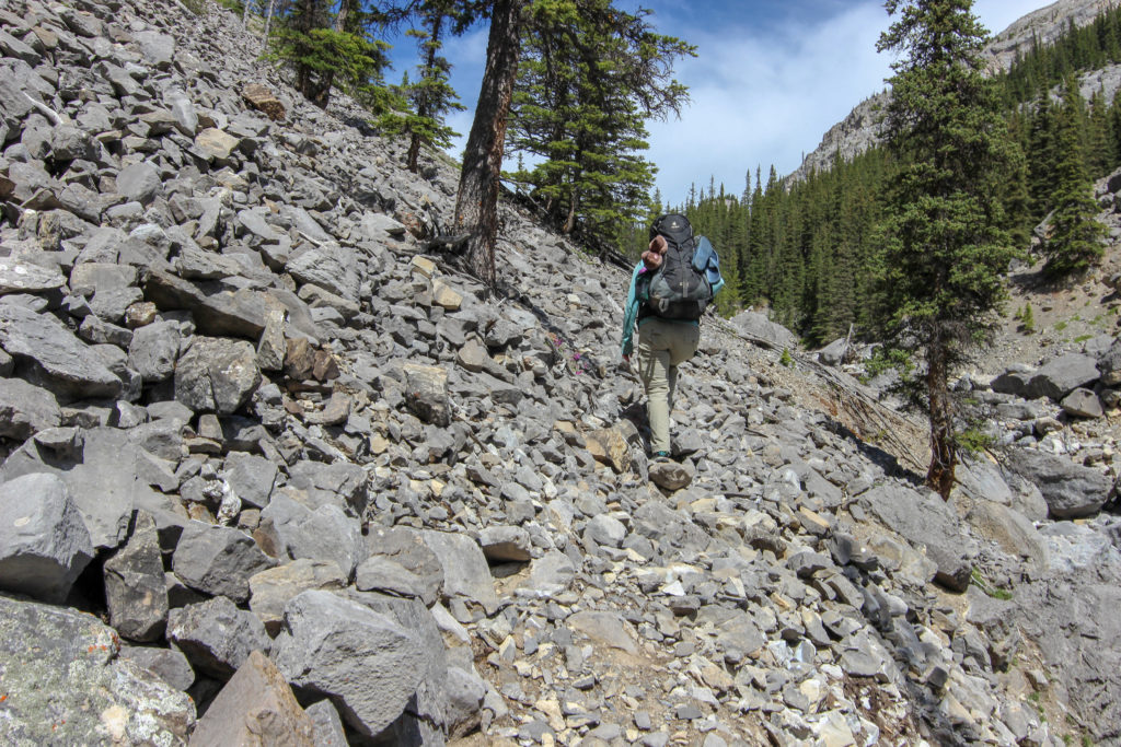
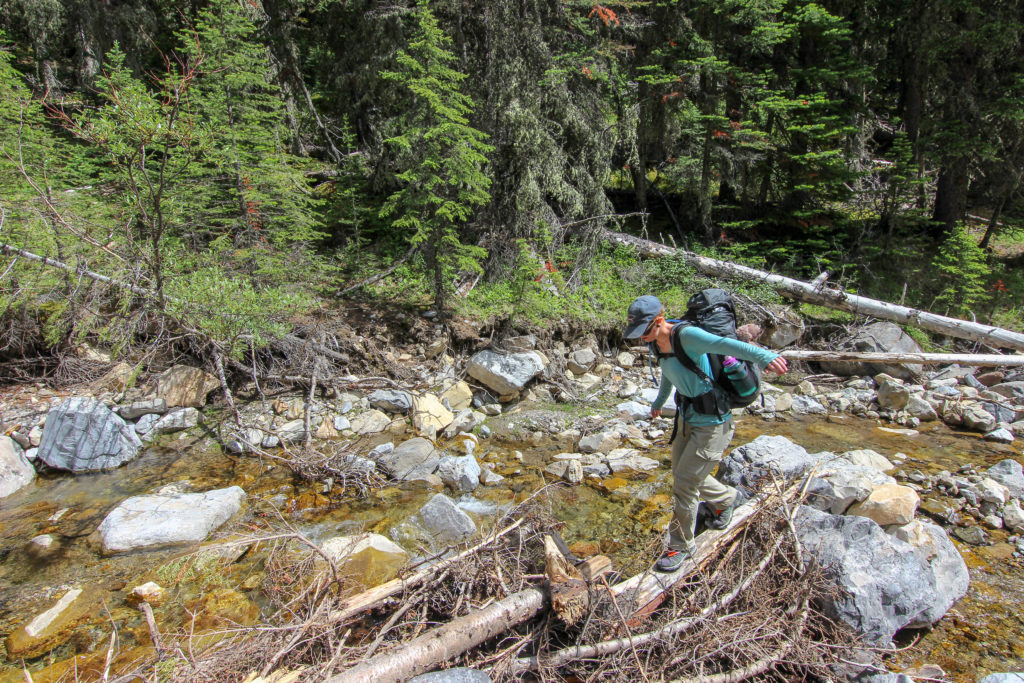
We able to follow a path through the trees away from the main stem of Cougar Creek for a short time before being forced back the stream bed. We thought it was rough before but the initial part of the side stream was even rougher.

Emily off heading up the side stream. This nice trail would not last long.
Back into a very jumbly stream bed.
The walking was tough but hard to get lost.

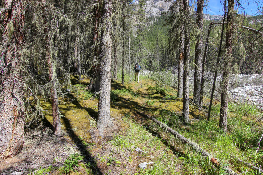
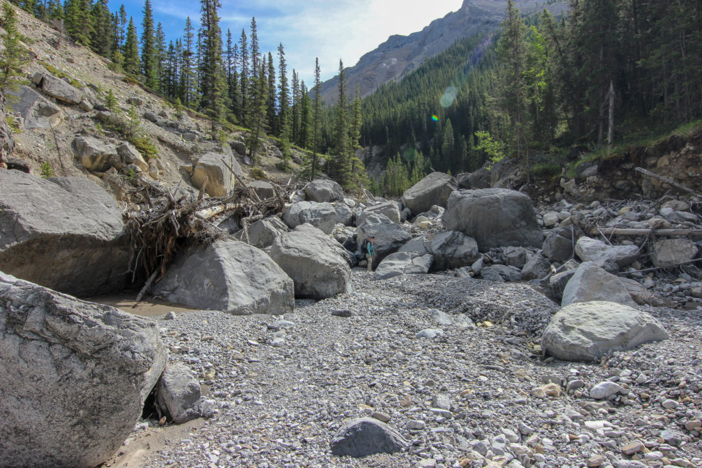
By carefully scouting the sides of the stream we were able to find some of the original trail. As time went on we got better at finding sections of trail which made the hiking much easier than in the stream bed.

A little more packed where the flood debris entered the forest.
Emily found a trail.
The trail while softer did have lots of dead fall.
Back to the creek.

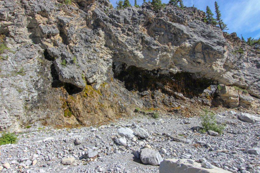
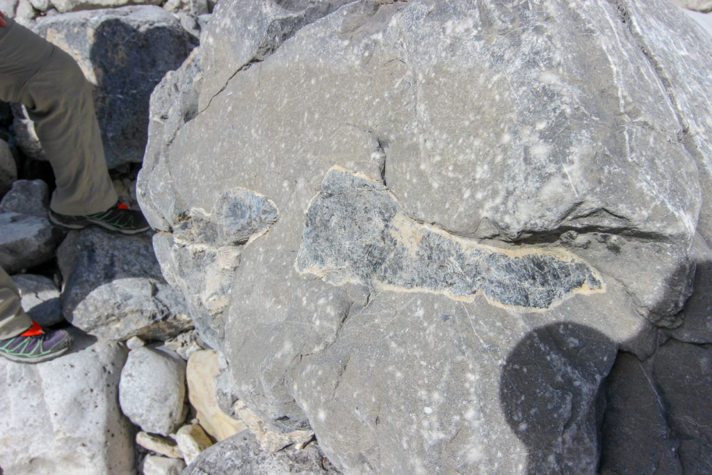
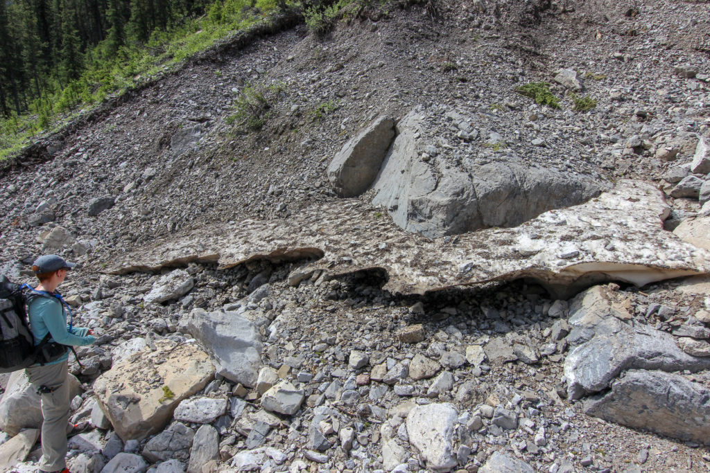
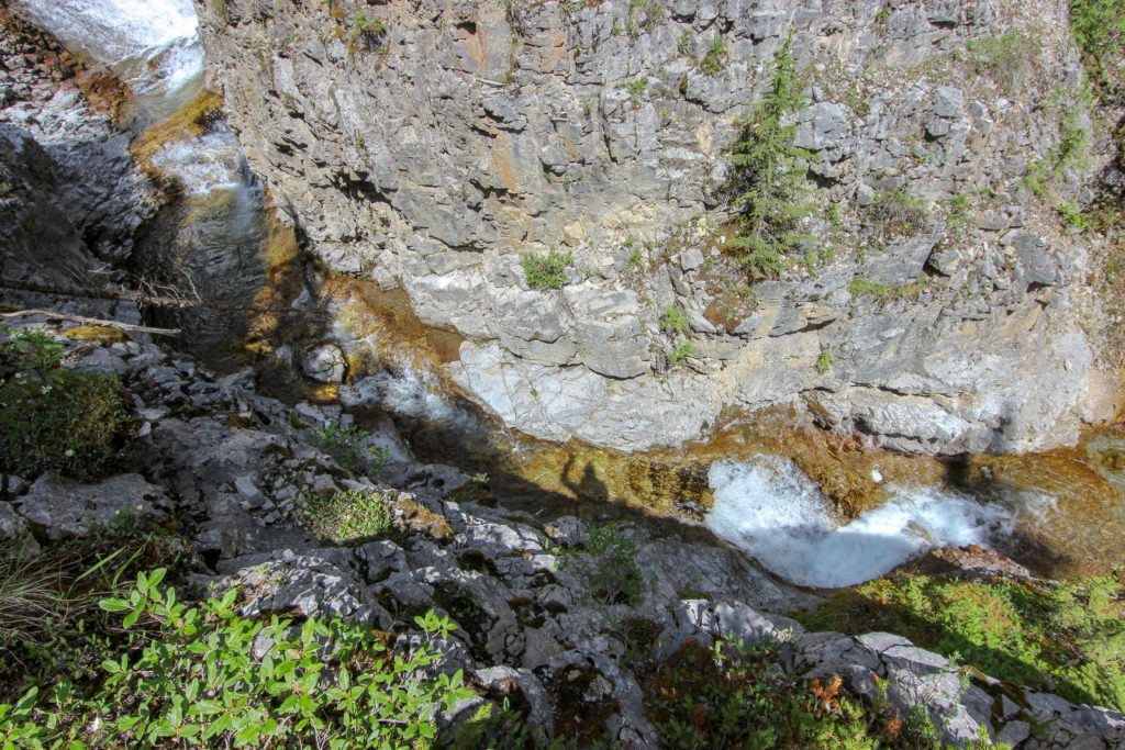
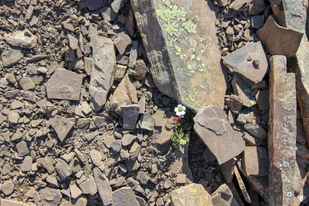
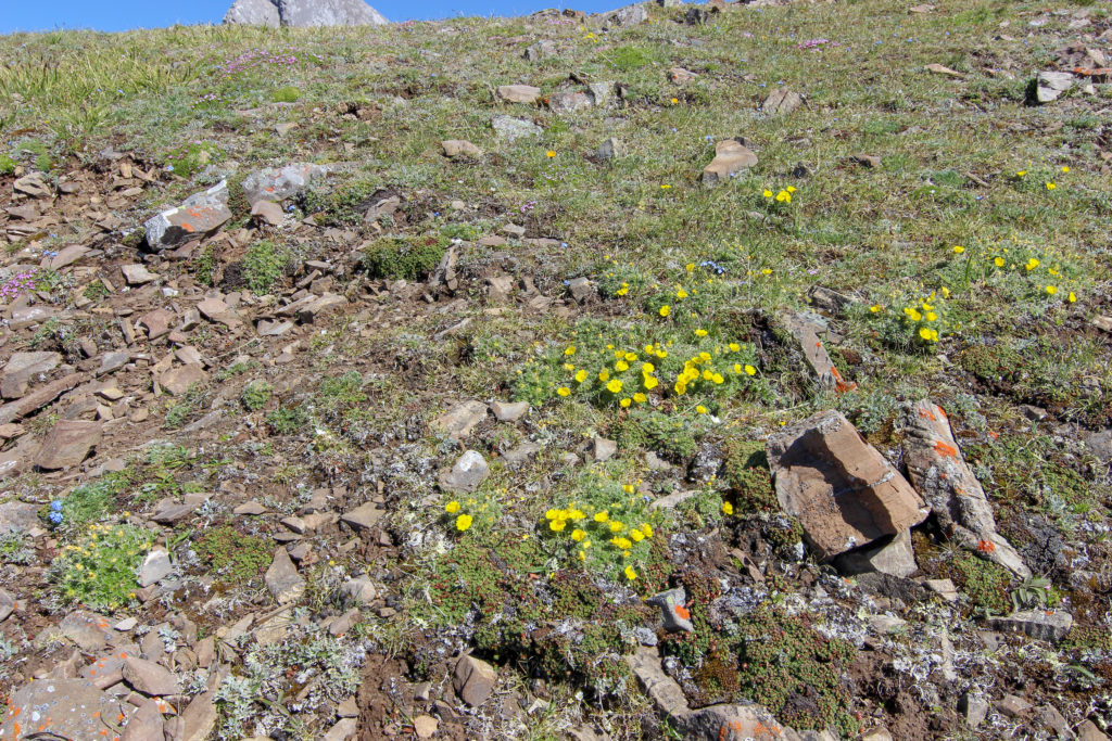
My interest in geology always creeps in while hiking. Cannot help but wonder what causes some the features in the rock.

Large boulder in the stream bed. What are the dark intrusions?
Emily putting on her best face. This section was super tough.
Boulders that we have had to clamber over.
A sidesloping gravel path is preferable to the creek bed.
The thrust fault mountains of the front ranges of the Canadian Rockies in full display in Cougar Peak. We have been hiking 30 minutes since lunch and traveled 0.8 km.
Up and over we go.
Catching some shade on a dirt trail.
Snow!! In July.

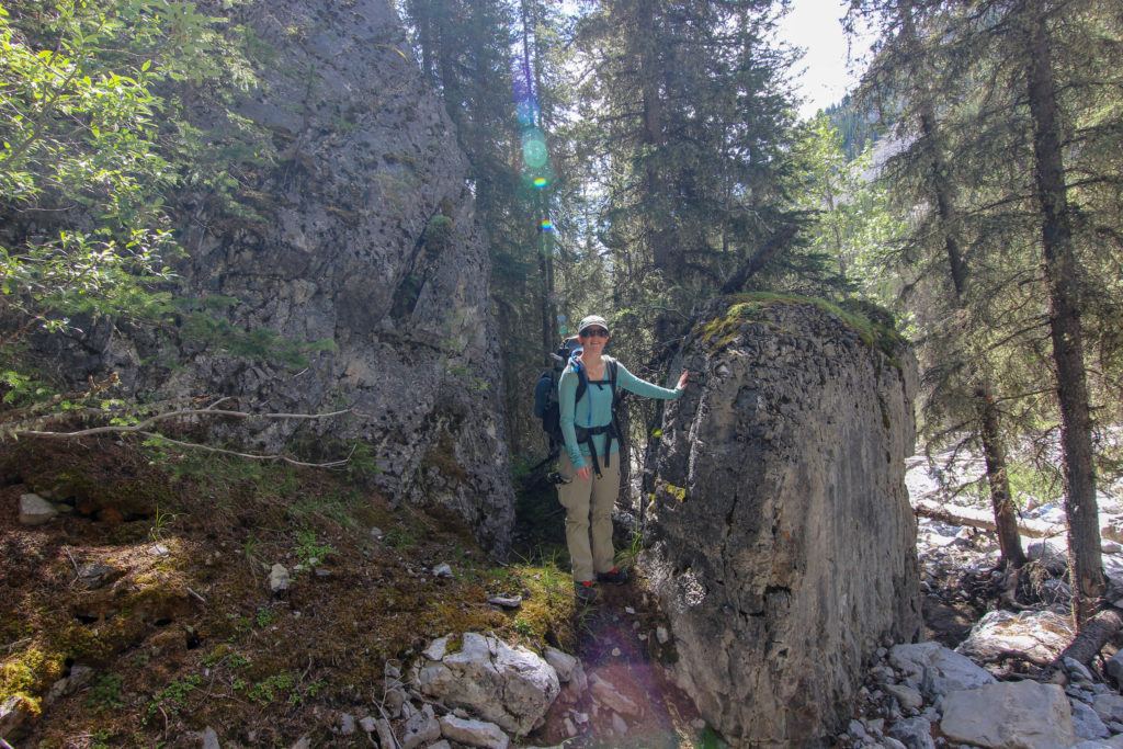
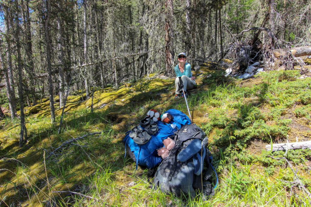
We hiked up to to a limestone tower that was a way point in Gillian Dafferin’s book. We took a rest beside small freshwater pool. We had covered 1.5 km in just under an hour.

Water is flowing.
It has been hard but fun.
The limestone tower

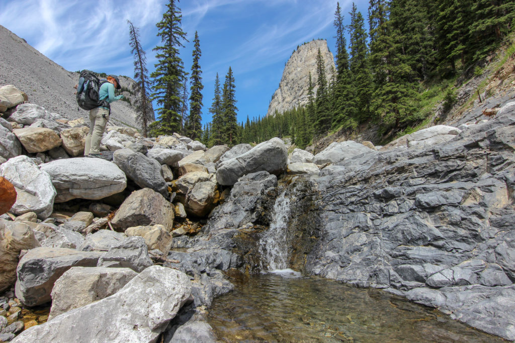
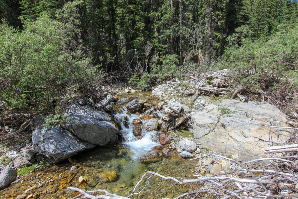
After a 15 minute break we headed back up the creek. The large rocks and boulders disappeared as we hiked up but the creek was now full of water making for numerous water crossings.

Emily looking for a way forward.
A grassy path.
Water crossings.
Traded boulders for water and logs.
Emily trying to avoid getting her feet wet.

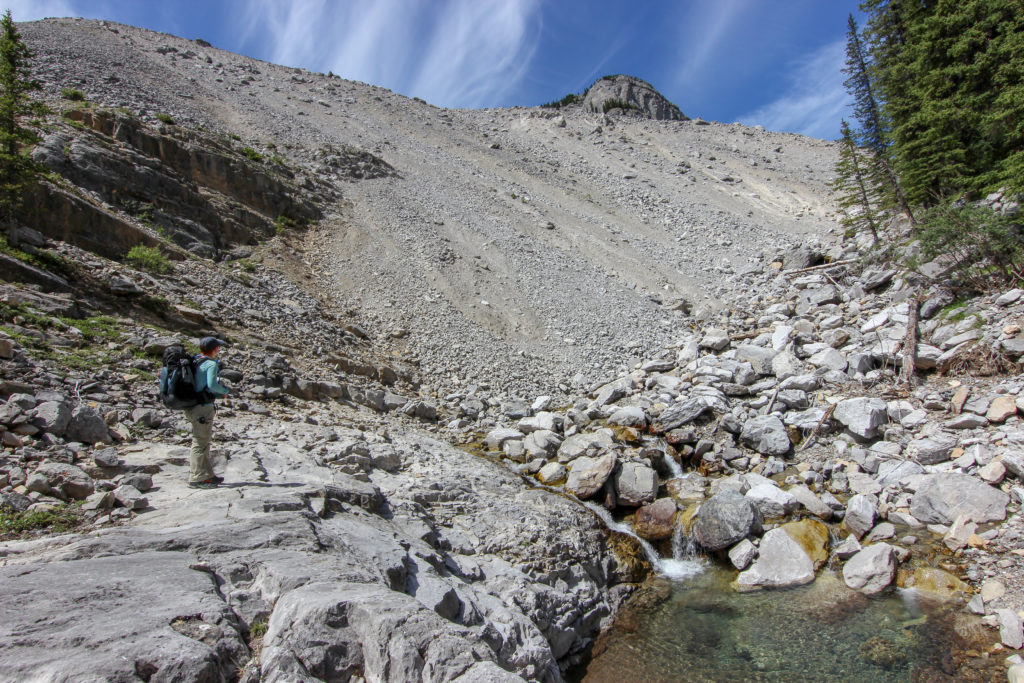
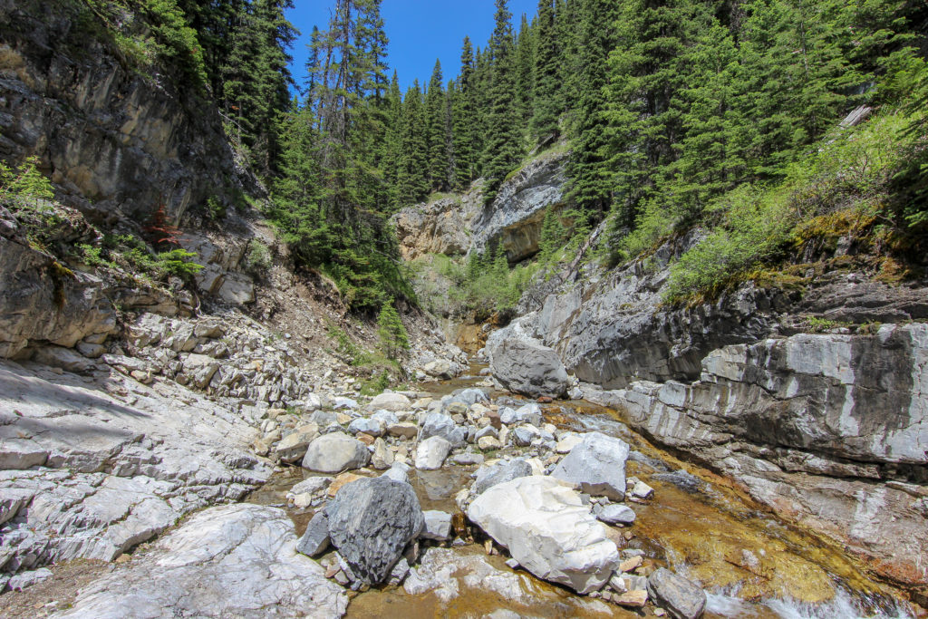
One of the passages we read in Gillian Dafferin’s book was that we will be faced with obstacles but when approached they will “resolve themselves”. We came across a waterfall and a steep sided canyon. A faint trail led up a steep slope requiring some scrambling. I went first.

The canyon is squeezing in on us.
Scaling the wall.
Now what. We are running out of options.

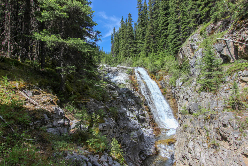
Ten minutes after this waterfall we become hopelessly stuck. We had come to a junction with a smaller creek flowing from the south. Continuing to go upstream was impossible due to vegetation crowding the creek. We could see no way to continue to follow the creek so we hiked straight uphill to gain a better view of our situation. As we climbed directly up the slope the ridge that we believed we were trying to get to came into view. As we gained more elevation the trees thinned out somewhat and we decided we would attempt to follow the direction of the creek but hiking through the trees. We used our view of the ridgeline and the Viewranger App to keep ourselves heading in the right direction. We stopped for a 10 minute break for snacks in a small clearing.

Emily working her way across the slope. Cougar Peak in the distance.
You can see the creek we were following to the right of Emily and a creek flowing from the valley between Mount Charles Stewart South (high peak on the right) and Mount Charles Stewart SE2.
After our break. We have risen above tree line. The creek we had been following has turned up slope and has cut a canyon into the hillside. On the way back we will follow the canyon which is were the trail is.
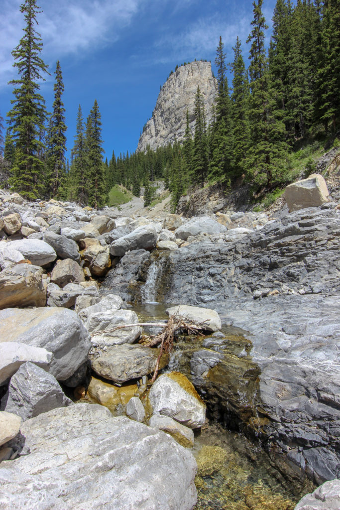
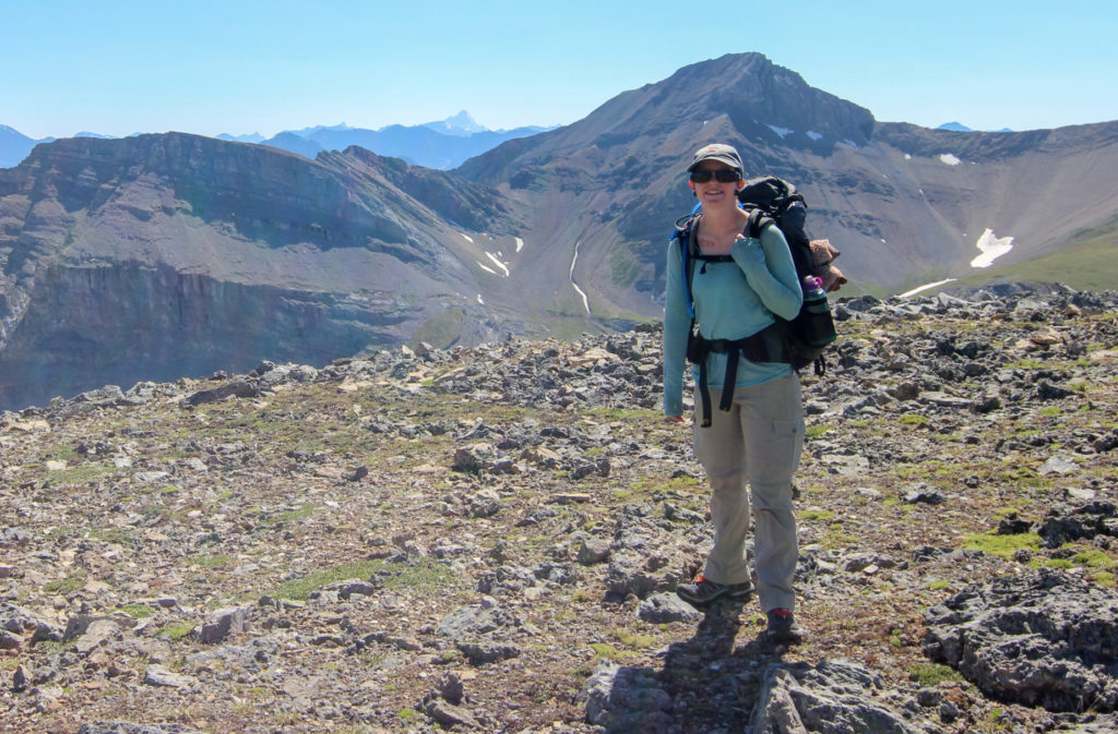
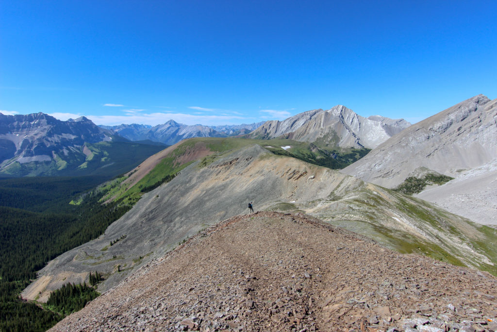
View of Mount Charles Stewart on the right and the glorious ridge leading up to it.

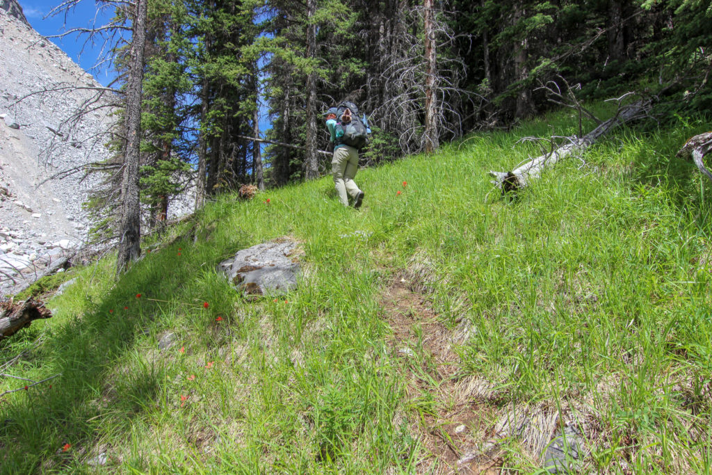
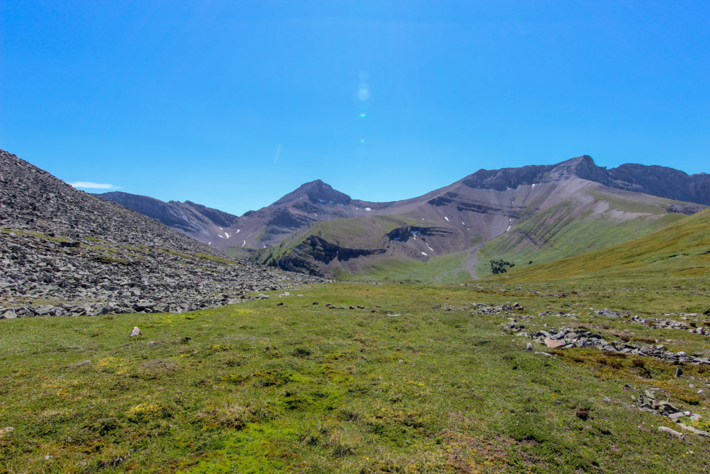
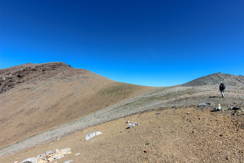
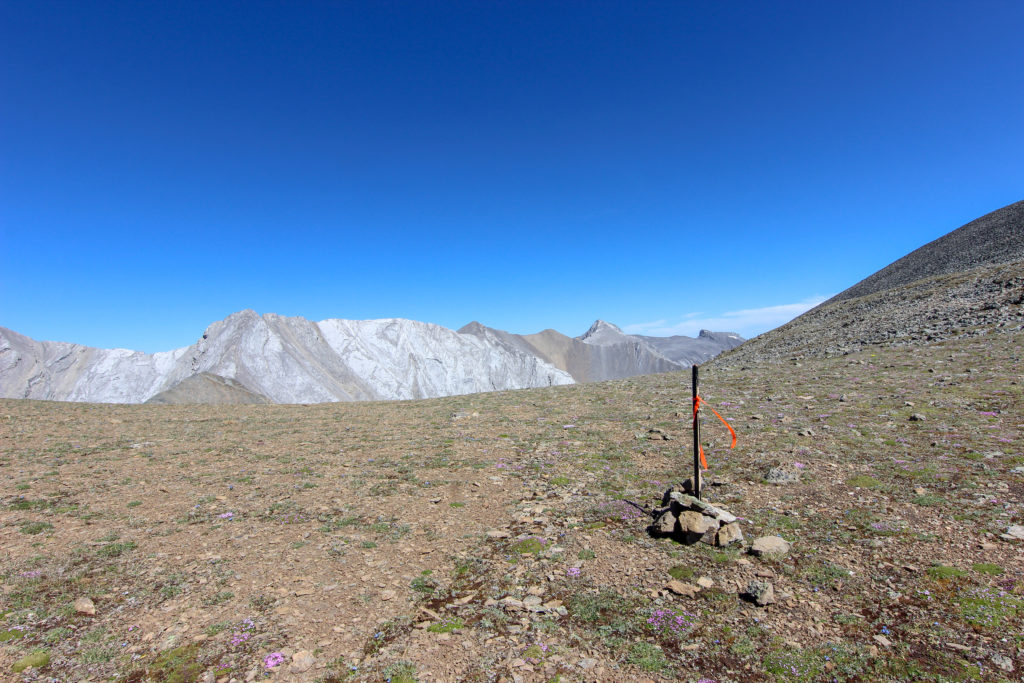
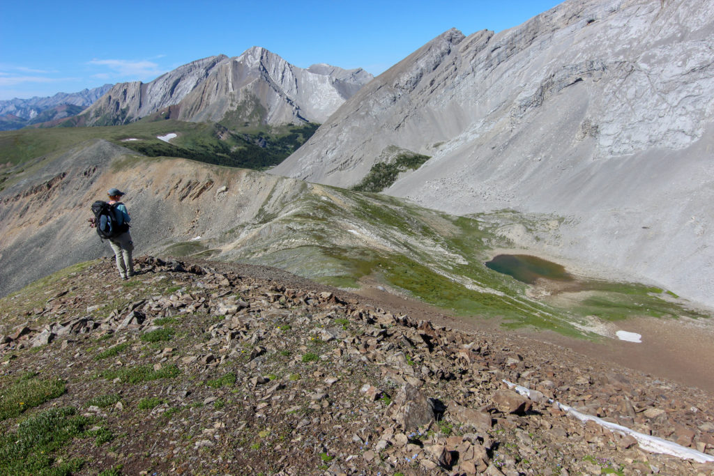
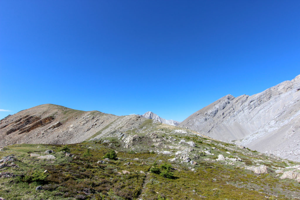
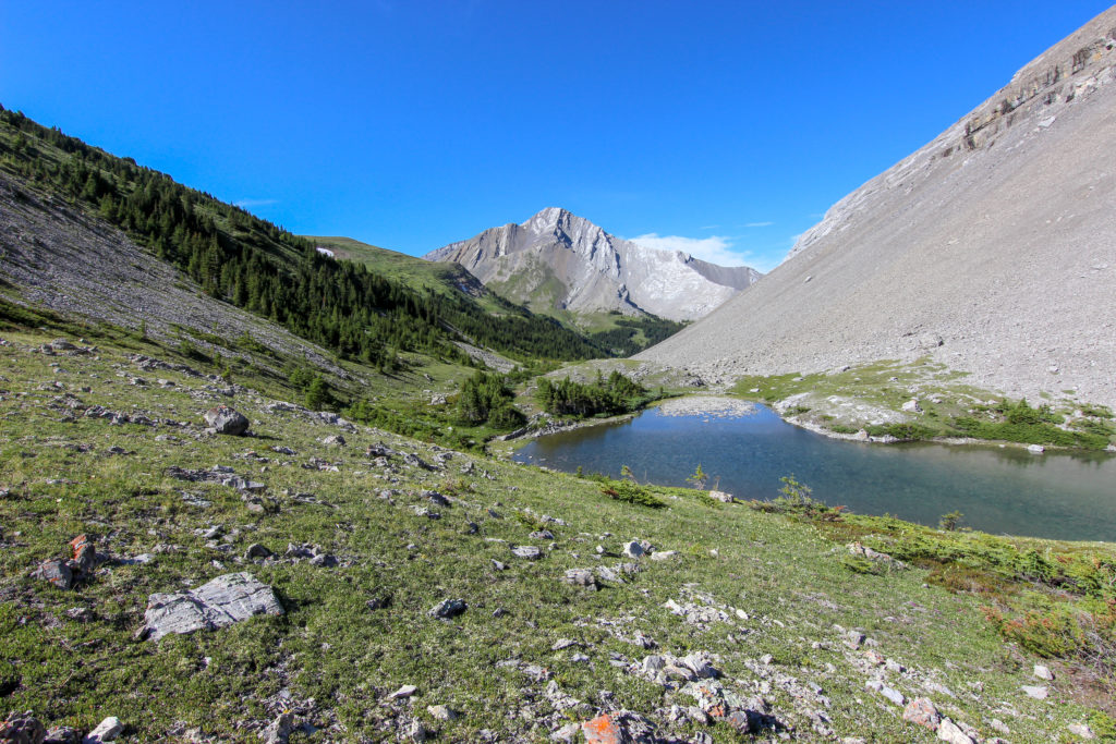
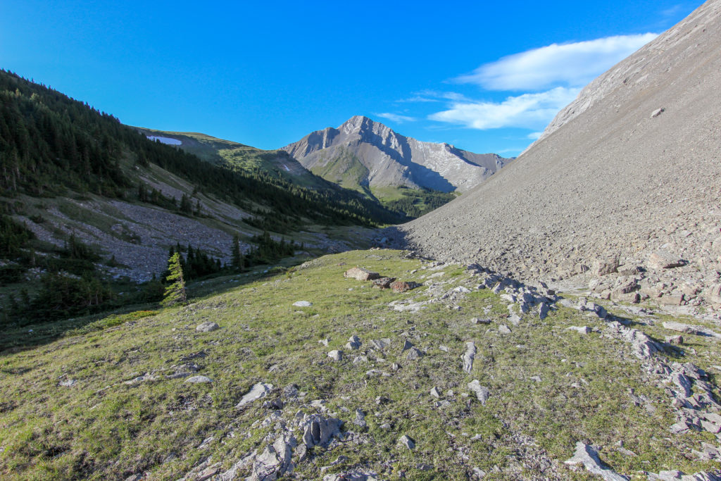
After clearing the trees we followed the drainage straight up the hill to Cougar Col. Our stream that we had been following had dried up. We arrived at Cougar Col at 3:20 pm, 6 hrs and a distance of 14.7 km. To think we had completed the first 9.4 km in just 2 hrs 15 min. It had taken us 3 hrs 45 min to hike just 5.3 km. Being high on Cougar Col was spectacular and was only a taste of the views that we would be getting as we followed the ridge up over the high point and onto Stenton Lake.

Looking up to Cougar Col, almost there
Looking east from Cougar Col.
The valley looking across to the ridge that hides Stenton Lake. Stenton Lake is behind the ridge at centre.

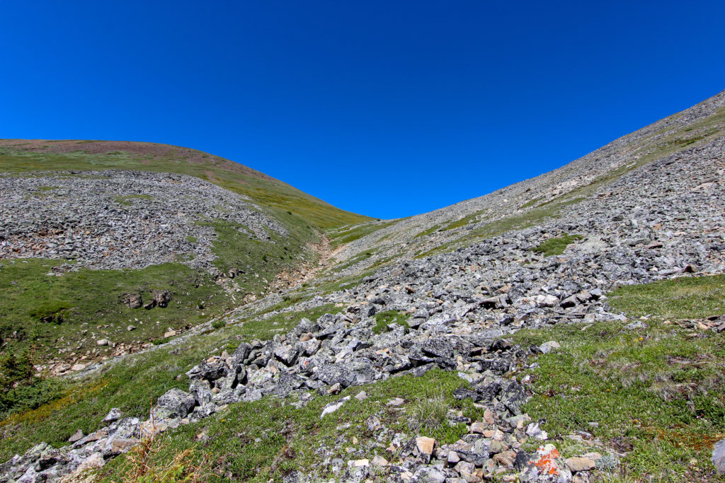
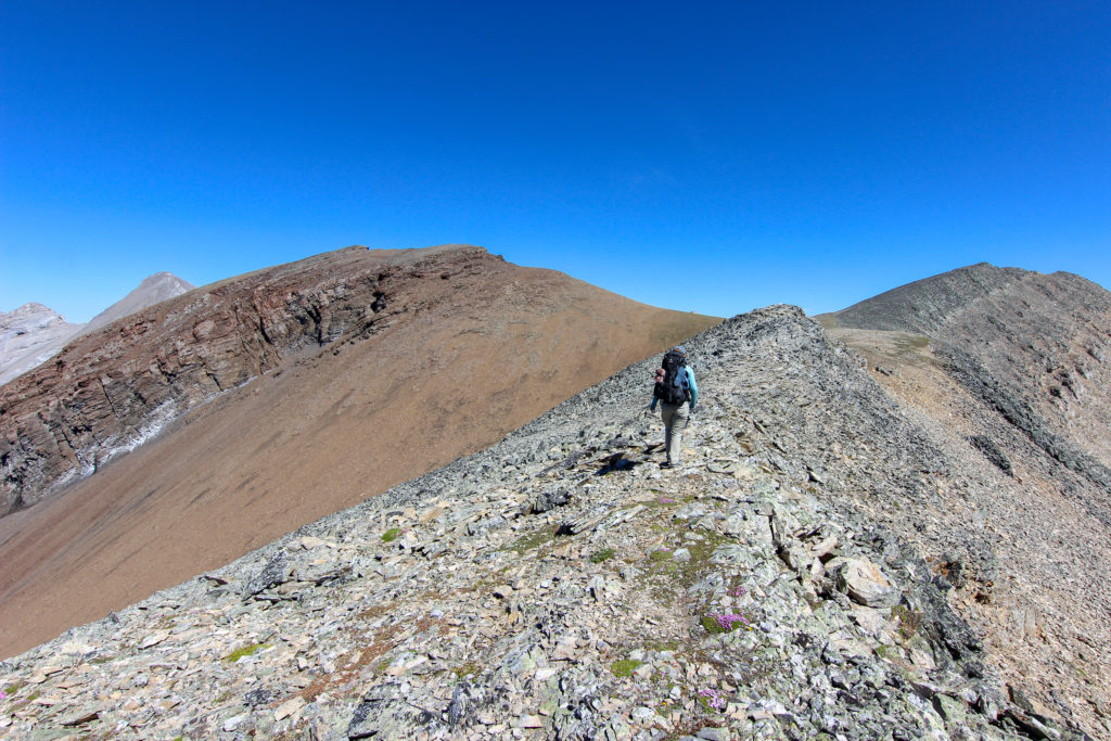
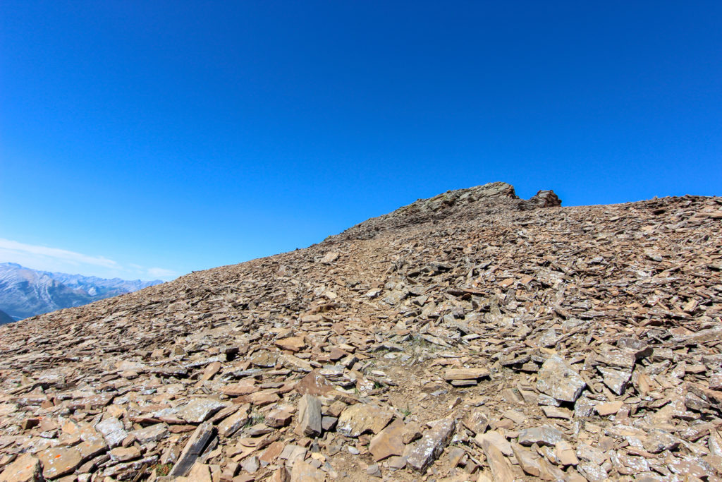
There was no distinct trail up the ridge. So we just started heading up. After about 20 minutes a faint trail appeared where there was a discolouration in the rocks and the lichen.

Heading up that way to the high point on the brown cliff.
A faint trail in appeared in the rocks.

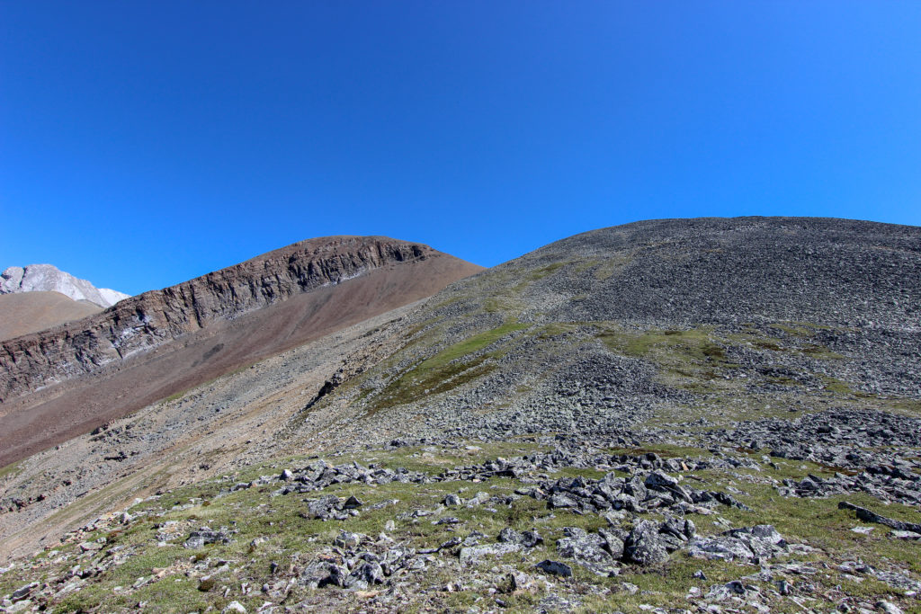
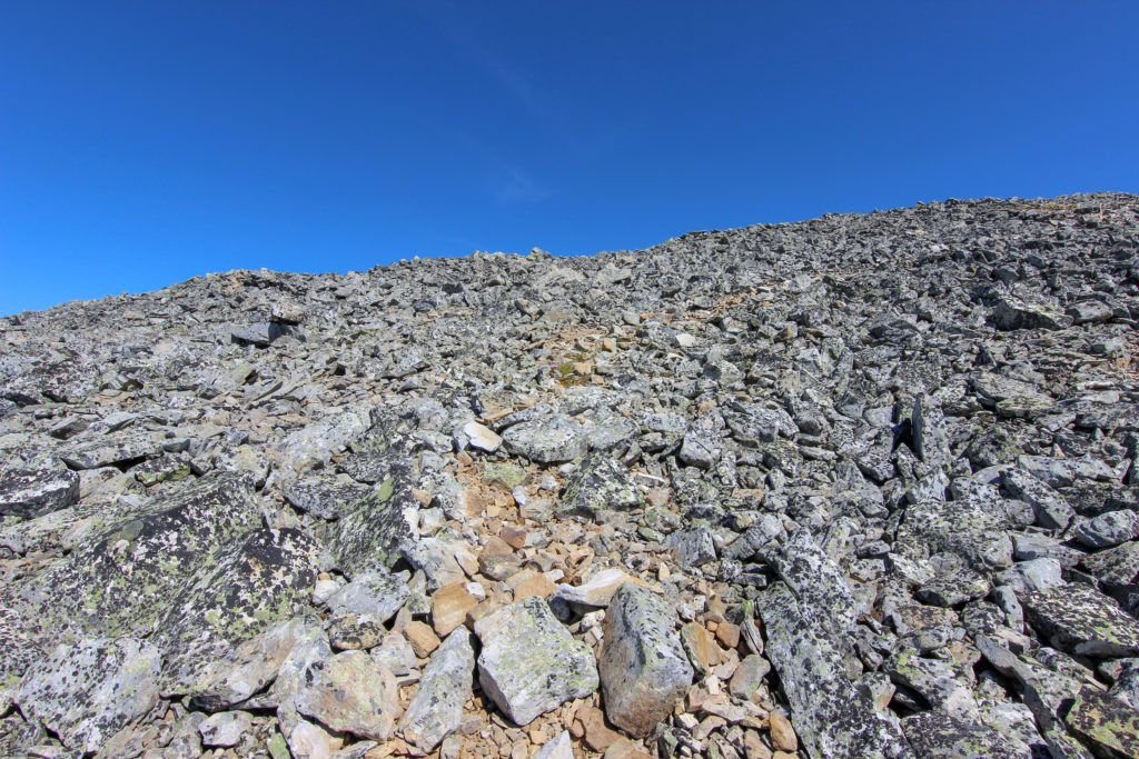
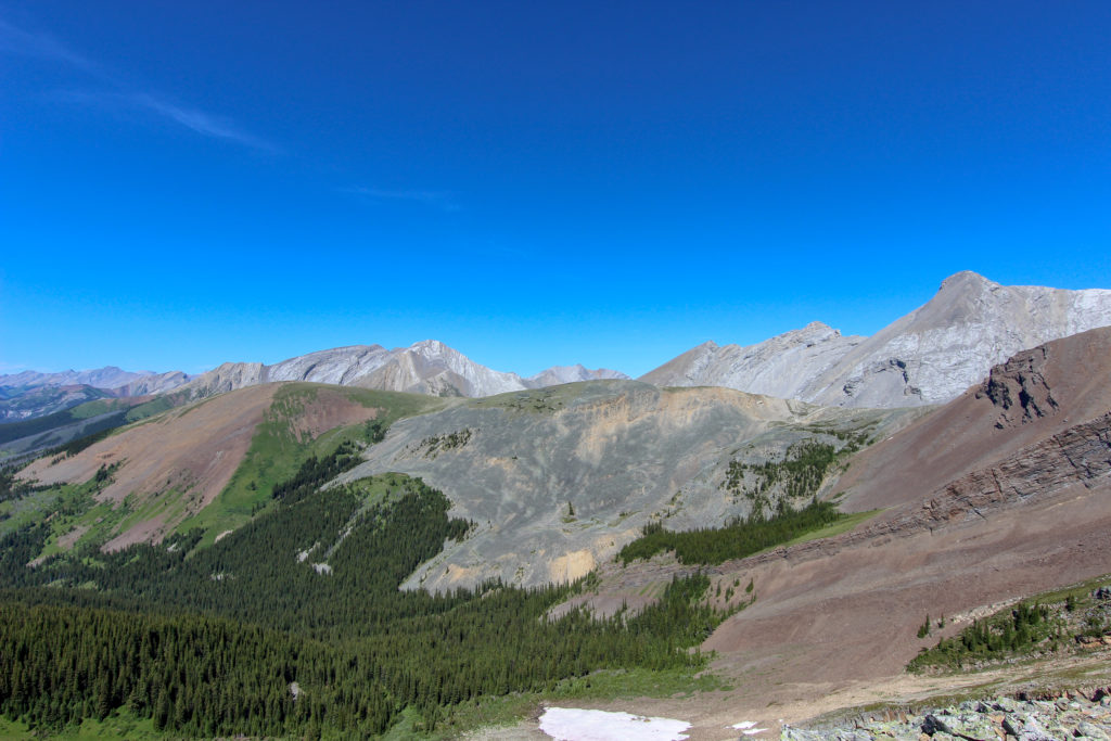
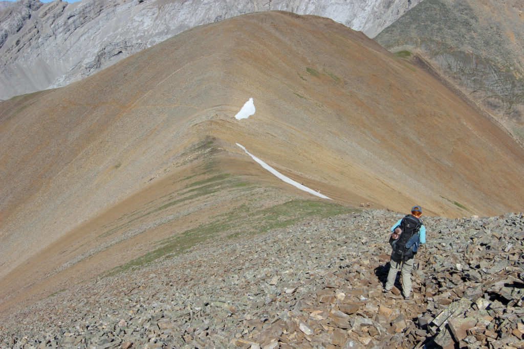
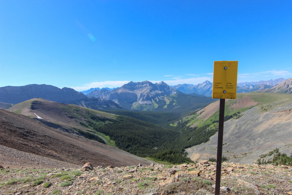
It was an amazing walk up the ridge. The footing was somewhat unstable but we made good time. Just prior to the high point we came across a marker indicating the boundary of Banff NP. As we rose up and over the 2600 m (8600 ft) elevation level, we gained views far and wide that to the South-East includes Mt Assiniboine. The expansive views that were on offer in all directions made all the memories of all hard work melt away.

Alpine views. Endless views of mountain tops.
Emily on he way up. Looking past Emily leads you into Banff NP.
The ridge became more solid and the walking easier.
View to Mount Charles Douglas SE2 and the valley we walked up.
Underfoot the trail has become a gravel like surface.
Just a few minutes from the high point of the day. You can see Mt Assiniboine through the gap left of Emily.

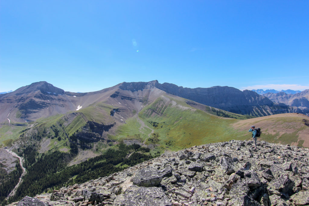
We did not actually go over the peak but once passing over the flat area where two ridges met we cut across to the left of the peak.

A lonely marker on the trail.
Will head up for just another minute before heading off the the left of the peak. The trail goes up the centre of the photo.

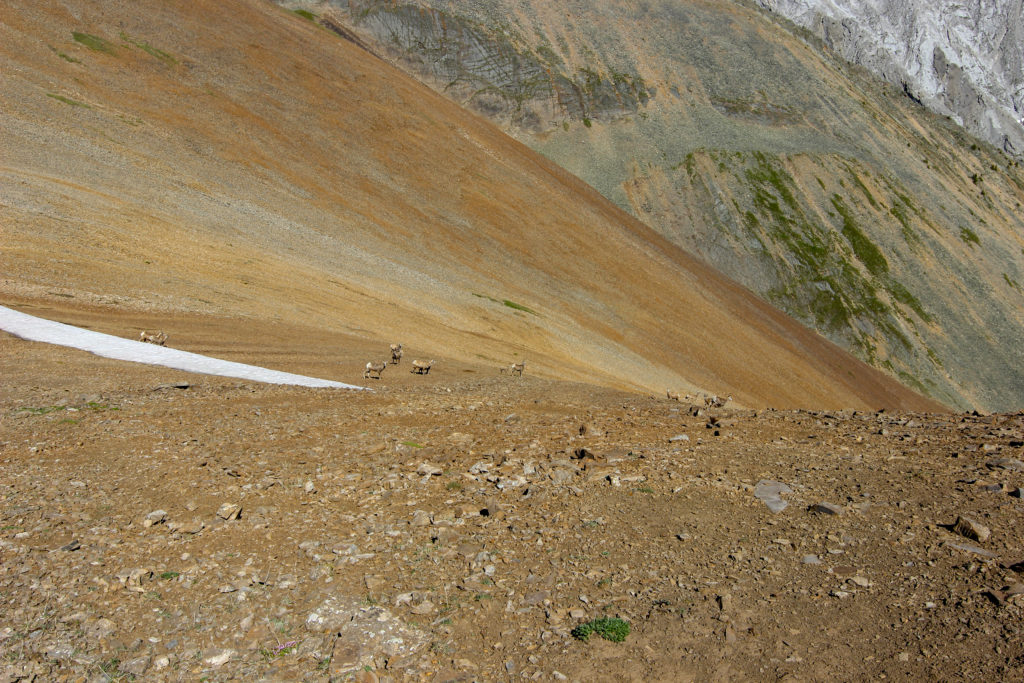
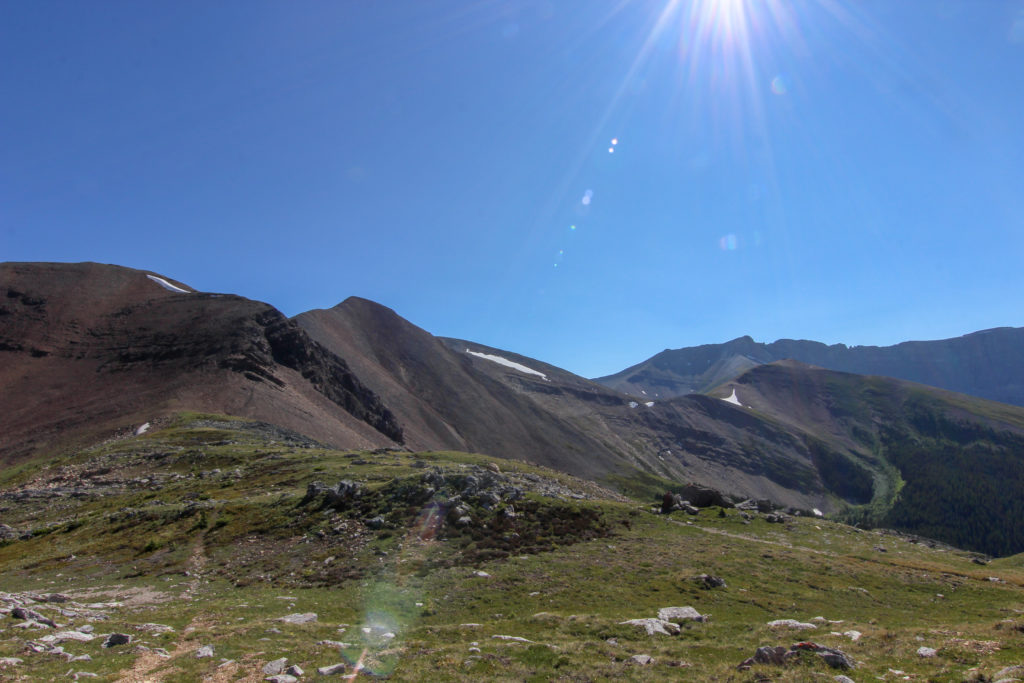
We went over the high point for the day, 2645 m (8815 ft) and side slopped through a break in the cliff. I had not done much high elevation hiking or scrambling in many years and remember being quite nervous about the down slope that lead to a cliff below us. On the way back the next I walked this section with no issues. There really was not a great deal of risk or exposure but we sure were a long way up. As we started to head down the ridge on the far side we came across a group of mountain sheep grazing on the meager vegetation growing between the rocks.\

Pretty straightforward from here, follow the ridge line and then drop down to Stenton Lake. The tall peak on the right is Stenton Peak.
Even among the rocks, life survives.
Follow the ridge and just at the second snowfield there is a path leading across the slope on the left which we will follow.
Herd of sheep on the hillside.
This is looking east to the upper reach of the Cougar Creek Watershed. The mountains form a T and create a barrier directing all the water to head down to Cougar Creek. the other side of the mountains on the left is the valley with Exshaw Creek.
Banff Park Boundary sign located just before we begin the side slope. The valley below is what I had been planning to cross and very glad we did not try to do that. The tiny snow field on the left is at Cougar Col where we were just an hour previous.
We have to negotiate a small cliff band below us. Then walk along the ridge before descending to Stenton Lake. Stenton like is below the brown/grey ridge. The far grassy section at the end of the ridge is beyond the lake.
Colour reappears as we drop in elevation.
We were both intrigued by the steeply dipping rock layers.
The name and types of the different rock layers along with the ages in millions of years.
West end of Mt Rundle.

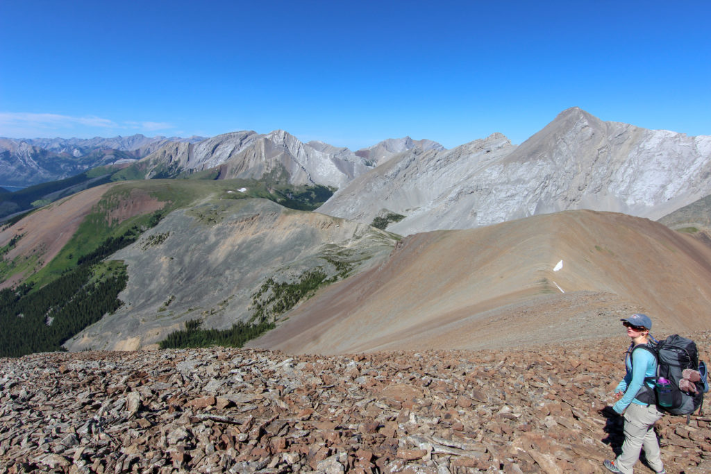
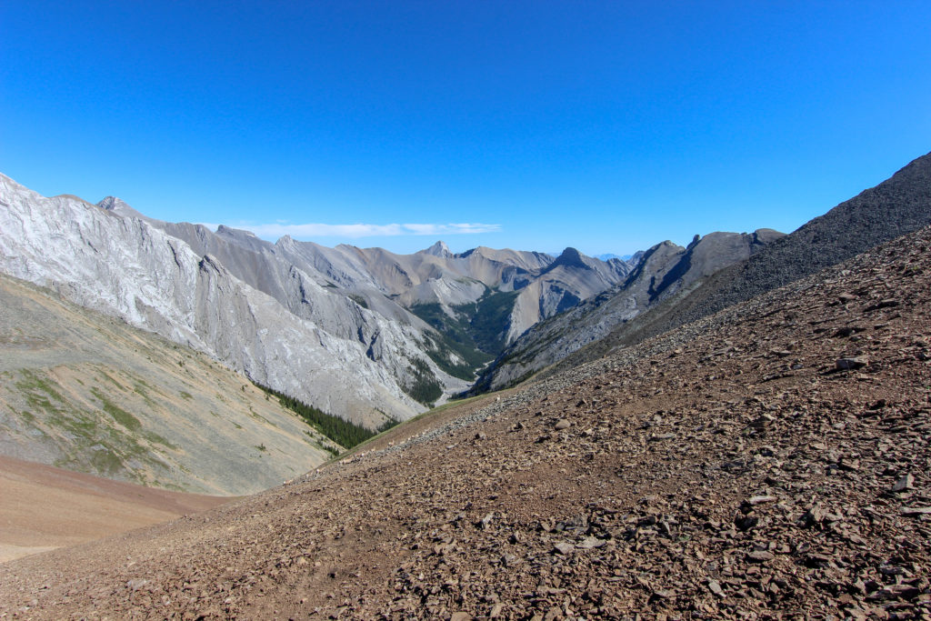
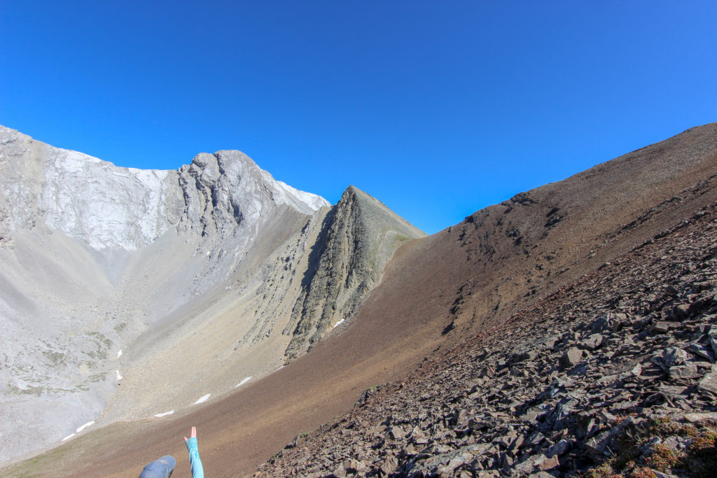
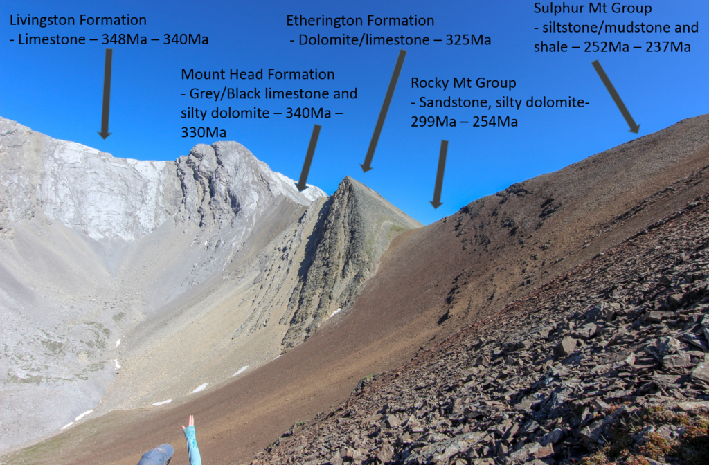
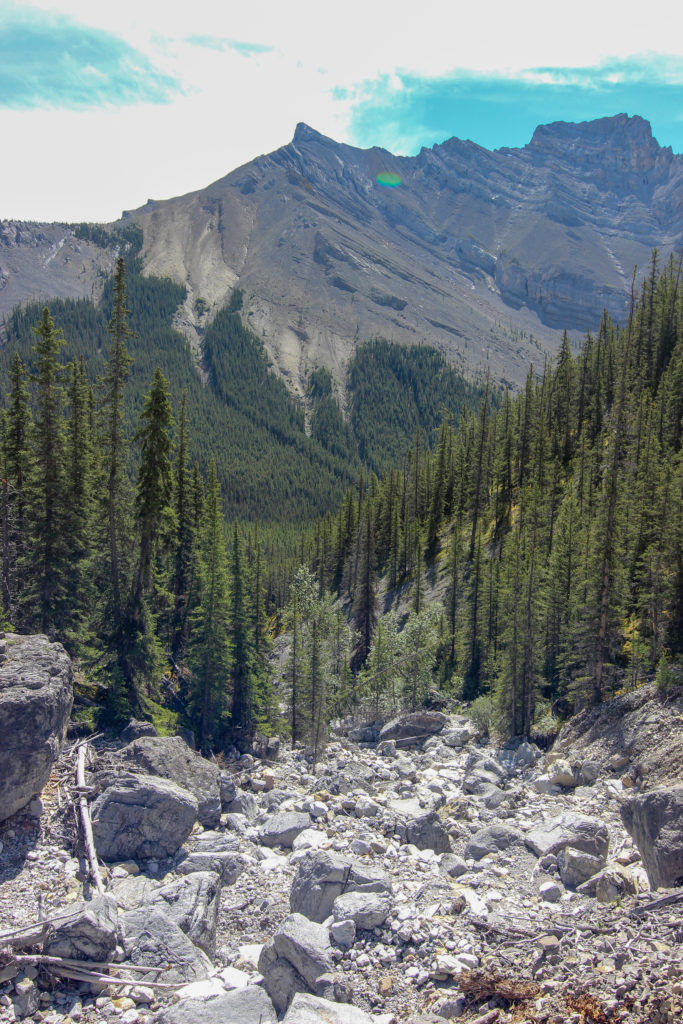
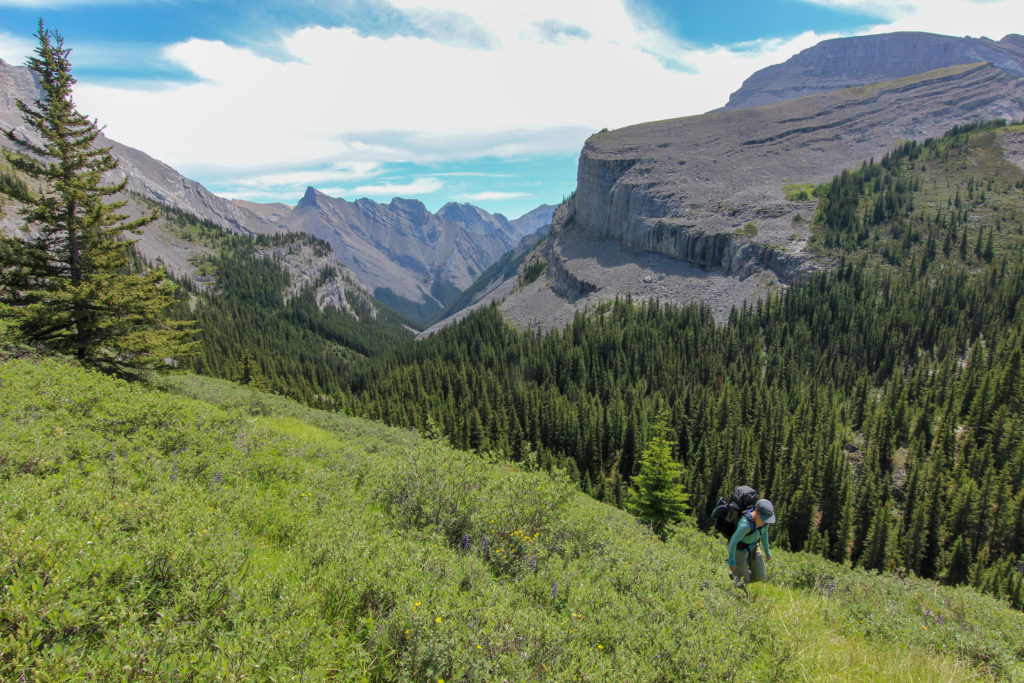
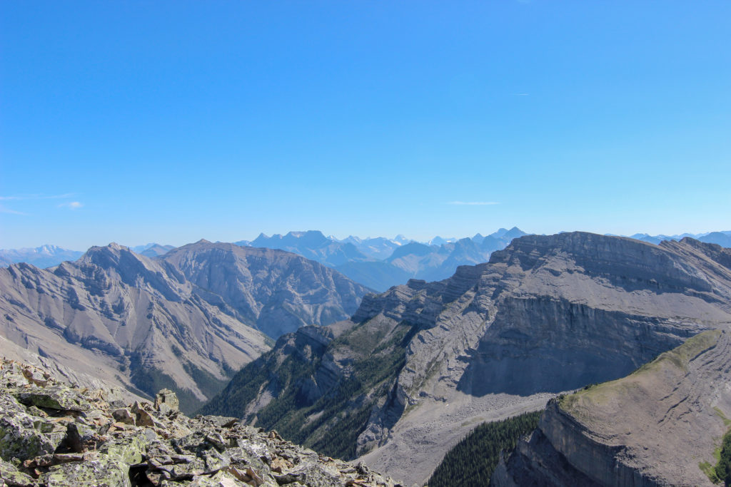
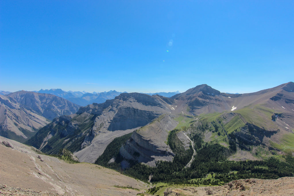
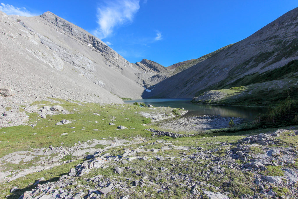
Many people have seen pictures of Mt Rundle, a mountain that runs 18 km from Canmore to Banff. An interesting exercise is to compare the rock layers of Mt Rundle to those in the picture above on our way to Stenton Lake. On Mt Rundle the Livingston Formation is the topmost layer forming vertical cliffs, with the Exshaw and Banff Formations forming the slopes below and the Palliser Formation making the lower cliffs. The youngest rock layer is on top, so the Livingston Formation is the youngest layer on Mt Rundle. In our hike to Stenton Lake, the Livingston was the oldest rock layer (see picture above). So all those rock layers in the photo above on the way to to Stenton Lake have been eroded off of Mt Rundle. Another thing to think about is those layers that are at such elevation on Mt Rundle, all lie below on feet on the way to Stenton Lake.

For those familiar with the Three Sisters in Canmore. Big Sister is topped by Livingston (younger) while both Middle and Little Sister are topped by Palliser (older).
On a geological map our route in white over the different rock formations to Stenton Lake.

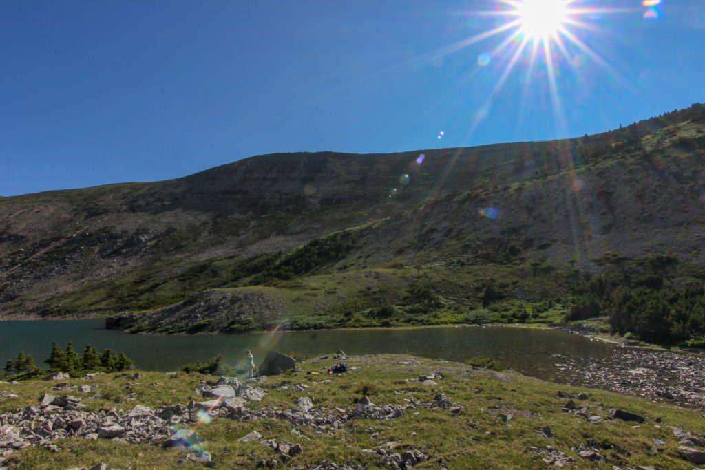
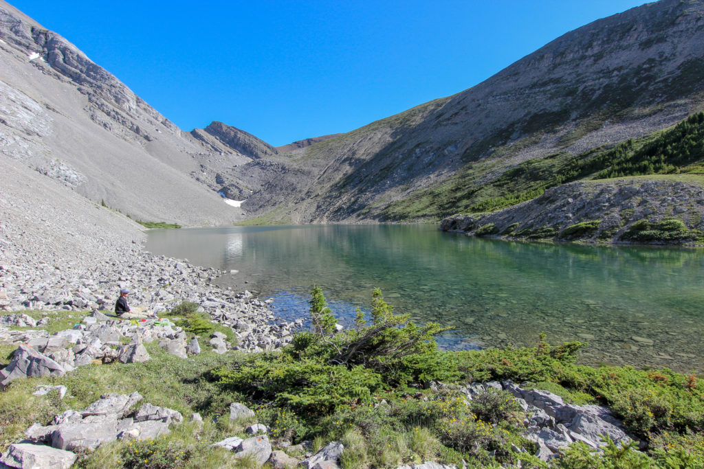
The trail was quite steep heading down to the little ridge that would take us to Stenton Lake. There was a cliff band to negotiate but an obvious trail had been well worn into the cliff. We hiked long the ridge and came to our first views of Stenton Lake, it was 4:55 pm.

Making our way down
Path leading up along the ridge.
Looking back the way we have come. Cougar Col is above the snowfield on the very right. We did come down the cliff band at centre left.
First view of Stenton Lake, Camping is at the west end. The mountain in the background is Carrol Peak. There is a trail that runs off to the right of Carrot Peak (east) that leads to the South Ghost River.

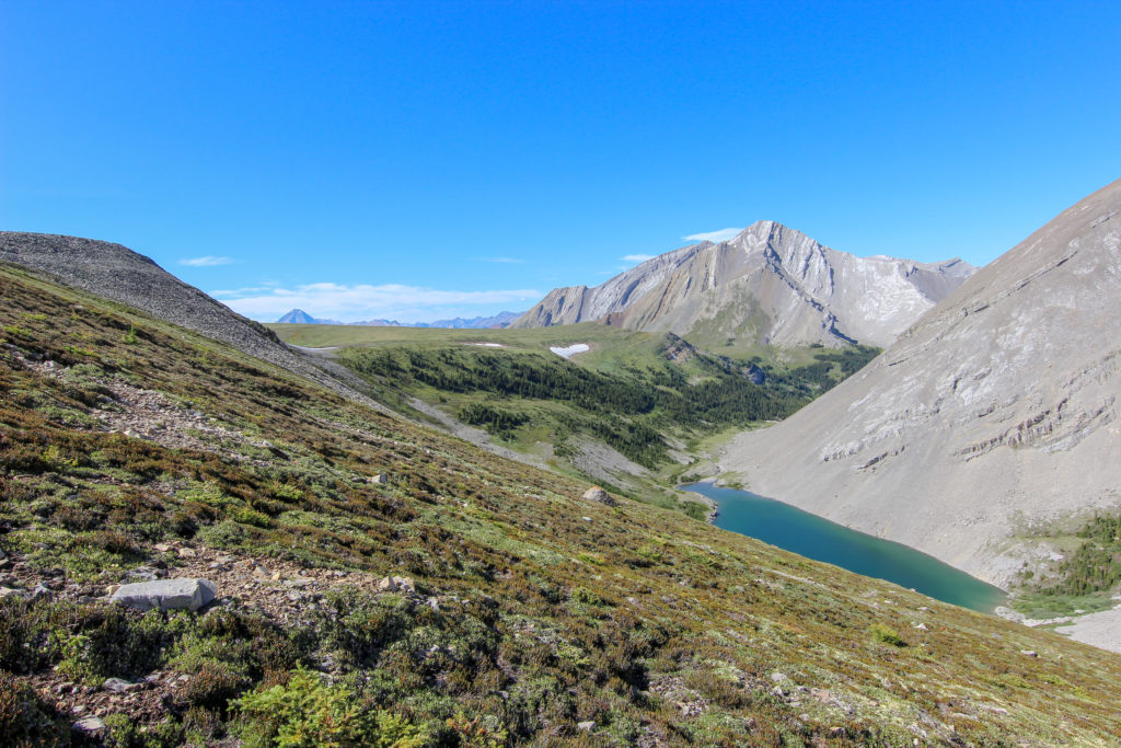
The trail started to head uphill towards a little peak on the ridge above the lake. Emily and I decided that we did not want to hike uphill anymore with the lake just there below us so we headed down towards the lake picking our way through the boulder field. It was quite steep but fun.

Super star hiker on the boulder field.
Two happy hikers. We have made it down to the grassy slope and are now almost done.
Just have to walk around the end of the lake. We would set up the tent by a large rock on grassy area near the gravel on the other side.

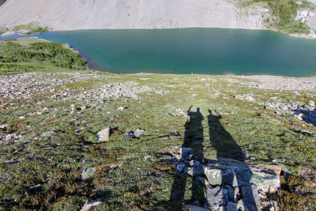
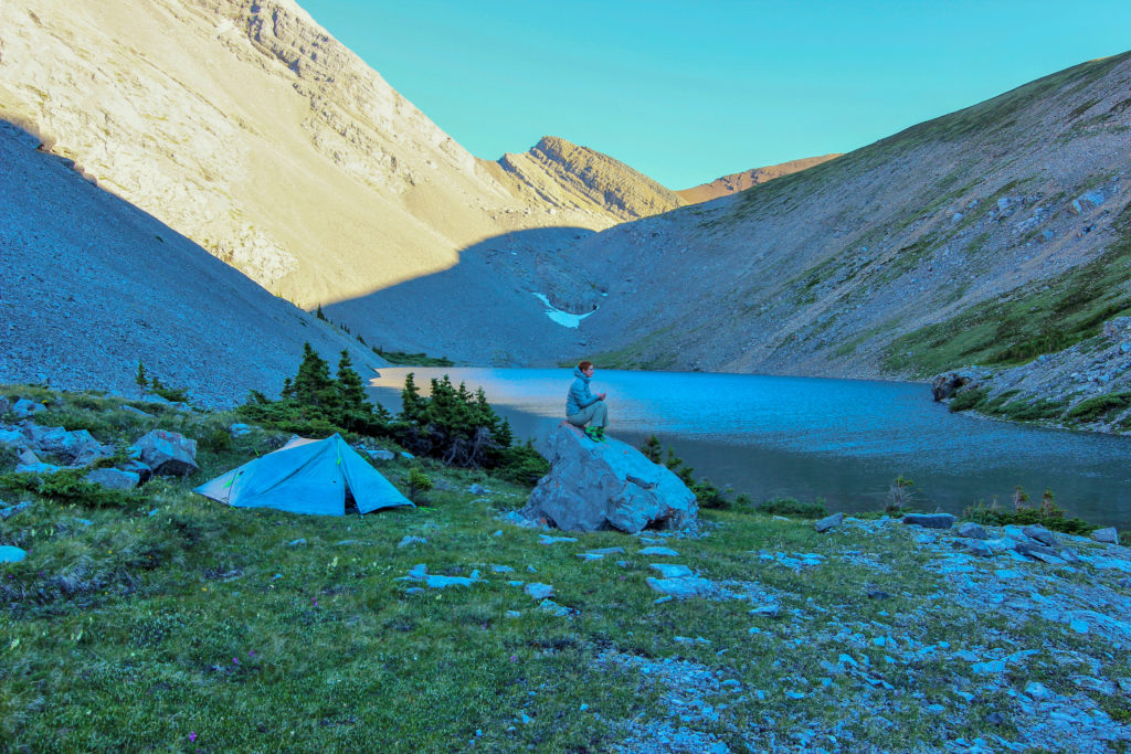
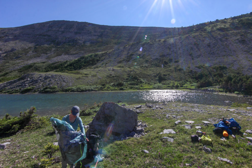
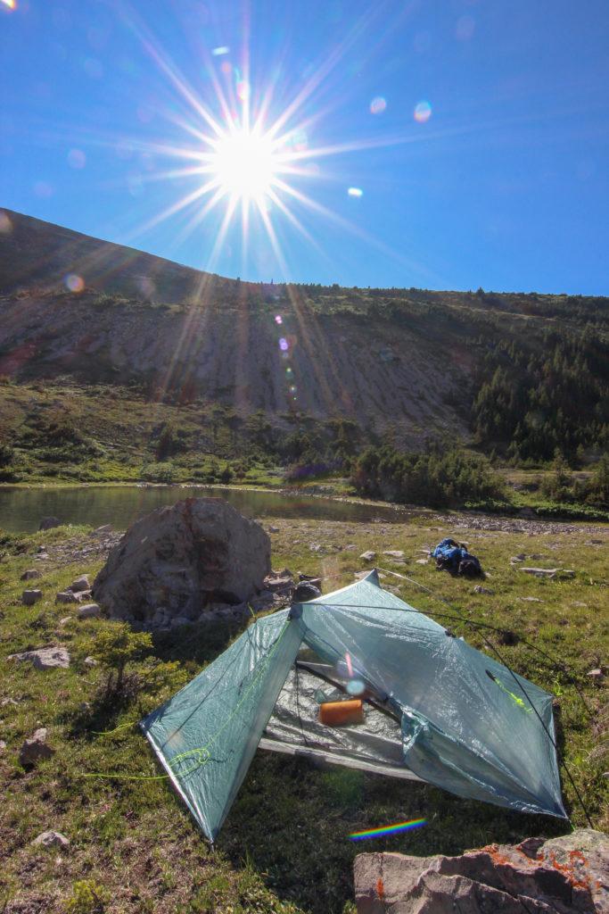
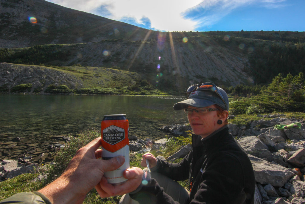
Once off the rocks and onto the vegetated slope it was just over 10 minutes to walk around the end of the lake and to where would set up the tent. It was just after 5:30 pm when we dropped our packs, 8hrs 20 min since we set off. Emily set up the tent while I took photos. Then we filled our air mattresses and got the inside of the tent set up. We started on dinner about 6:15 pm. We sat in the warmth of the setting sun drinking a cold refreshing beer that I had a brought to celebrate our adventure.

Emily setting up the tent.
The sun shining brilliantly onto our campsite.
All set up. Zpacks Duplex self standing 2lb tent.
A view east down the lake.
Emily in the kitchen.
Our reward for a great day on the trail.
Happy campers.

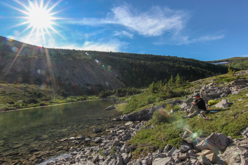
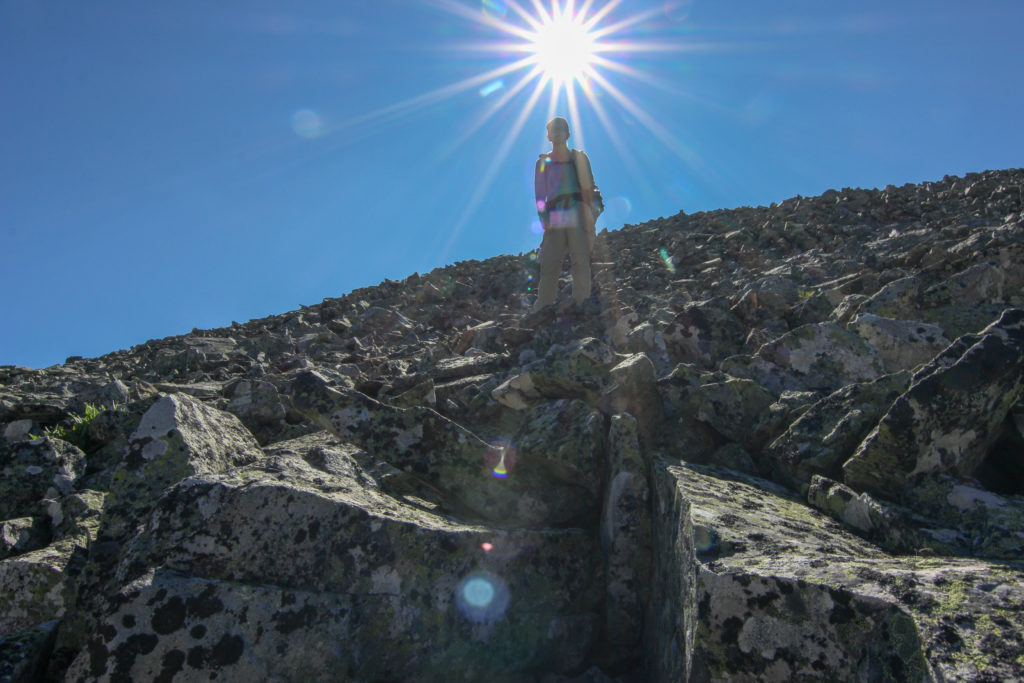
After dinner we went and explored around the lake. You can continue to hike west to join up with a trail that will take you east to the South Ghost River or west to Carrot Creek and Lake Minnewanka. We made a desperate attempt to do a bear hang. Unfortunately we could not find a tree more than about 10 ft high. While our food would not have been safe from a bear at least it was quite a ways away from us. If I was to go back to Stenton Lake I would be taking a Bear Canister with me. Once back at camp we took some personal time to reflect. Emily journalled while sitting on a rock and snapped one of my favourite photos of her.

View went towards Carrot Peak.
The long view of the lake.

The skies were very clear when we headed to bed at about 8:30 pm. The plan was to get up around 2 am and look at the stars. I was not overly hopeful of good skies since Canmore and Banff are sources of light pollution that are nearby but never hurts to get up and check out the night sky.

Good night from Stenton Lake.

Stenton Lake Nighttime

Stenton Lake Home

bootwreckers

Pondering the pleasures of the hike. Mt Assiniboin Pondering the pleasures of the hike. Mt Assiniboine and Lake Magog.

The first 3 days of my 10 hike on the Great Divide Trail, Section C, with Emily are summarized and up our my website, see link in Bio.

Fun addition to the summary is that we have included some of Emily's thoughts in the summary. Fun to see how she sees life on the trail.

Hope you the enjoy the summary nearly as much as we enjoyed th hike.

#greatdivide #greatdividetrail #gdt #parkscanada #parks #bcparks #trails #longdistancehike #longtrail #outdoors #outside #thruhike #hike #thruhiking #canada
My second trip to Yoho NP last year was a 3 day tr My second trip to Yoho NP last year was a 3 day trip featuring the Iceline and Twin Falls with @sio.mellors 

Great weather, great company, great adventure. 

Full trip report on my website, link in Bio.

#friends, #alberta, #parkscanada #rockwall #backpacking, #yohonationalpark #yoho #nationalpark, #nationalparks, #mountains #naturephotography #travelbcp #snow #waterfall #waterfalls #waterfallphotography
New hike posted to Bootwreckers, see link in Bio. New hike posted to Bootwreckers, see link in Bio.

Three day hike along the Rockwall in Kootenay NP early July, 2021. Camped at Helmet Falls and Tumbling Creek Campgrounds.

With a @neil.real.deal and @kbsymington 

Photo - crossing snowfield at Tumbling Pass, with Mount Gray at centre and Tumbling Peak and it's glacier in the distance.

Great early season three day hike.

#friends, #alberta, #parkscanada #rockwall #backpacking, #kootenaynationalpark #nationalpark, #nationalparks, #mountains #naturephotography #travelcolumbiavalley #travelbcp #snow
I wrote an article about not judging other hikers I wrote an article about not judging other hikers on the trail and it got published.

It is my first ever article. Was a fun little project.

See link in bio
Takakkaw Falls from th Incline Trail, Yoho NP. Ph Takakkaw Falls from th Incline Trail, Yoho NP.

Photos of Takakkaw Falls taken from the Iceline Trail.

1) 1.6 second exposure of the falls

2) view of the falls and the Daly Glacier that feeds the water to th falls

The Iceline Trail was a nice way to get a more unique view of the falls and with fewer people.

Morning of day 2 of amazing trip last summer with @sio.mellors 

Yoho NP

#friends, #alberta, #parkscanada #backpacking, #yohonationalpark #yoho #friendsofyoho #nationalpark, #nationalparks, #mountains #naturephotography #travelcolumbiavalley #travelbcp #falls #waterfallphotography #waterfall #waterfallsofinstagram
Going through some photos from summer 2020. I lik Going through some photos from summer 2020.

I liked this photo, captured the early morning at Yoho Lake CG on my trip with @sio.mellors 

Loved how the water grabbed th orange reflection off the bottom of the clouds as the sun just crested the horizon.

I enjoy getting up early when camping. Not only do I get to enjoy the peace and quiet of camp, but the light of the sun presents fleeting visual displays that are gone in moments.

Yoho NP

#friends, #alberta, #parkscanada #backpacking, #yohonationalpark #yoho #friendsofyoho #nationalpark, #nationalparks, #mountains #naturephotography #travelcolumbiavalley #travelbcp #sunrise #morning #sunrisephotography  #lake #reflection #reflections
View looking West over the Tonto Platform from the View looking West over the Tonto Platform from the South Kaibab Trail.

This April will be our 10 year anniversary of our first trip to the Grand Canyon.

It is truly one of my happy places, have visited five times and camped below the rim three times.

Looking to get back sometime soon, but good things are worth the wait.

#nps, #nationalparks, #slotcanyon, #hiking, #hikingadventures, #familytime, #camping, #campingadventures, #outdoors, #outside, #nature,  #FIndyourpark #landscape #landscapephotography #optoutside #nationalpark #desertphotography #grandcanyon #grandcanyonnationalpark #grandcanyonassociation #100yearsofgrand #100yearsofbeauty #100yearsofgrandcanyon
Sunday morning sunrise! There are perks for getti Sunday morning sunrise!

There are perks for getting up early on a Sunday to go grocery shopping, and the mountain sunrises are one of them.

Shot off my phone from the parking in downtown Canmore.

#sunrise #sunrisephotography #sunrise_sunset_photogroup #earth #outside #outdoors #naturephotography #nature #naturelovers #sky #skyphotography #sky_brilliance
No doubt 2020 was a prickly year, and 2021 has sta No doubt 2020 was a prickly year, and 2021 has started out a little rough.

Just like hiking, if we keep going we will see beauty in amongst the prickles, but we need to stay on the trail.

Here's to good times ahead.

From our hike last year Emily hiking among the cactii towards the feature we affectionately named the Thumb, Passage 16 on the Arizona Trail

#teamzpacks #zpacks #zpacksduplex #aztassociation #aztrail #aztrails #hike #loveazt #desertphotography #desert #hikingadventures #hikes #backpacking #camping #getoutside #familytime #traillife #aztassociation , #hiking, #hikingadventures, #familytime, #camping, #campingadventures, #outdoors, #outside, #nature,  #FIndyourpark #landscape #landscapephotography #optoutside  #rightnow #goparks #aztrails #aztrail #loveazt  #azt #arizonatrailassociation
Looking at a fun trip last summer through Yoho NP Looking at a fun trip last summer through Yoho NP with @sio.mellors 

Lots of waterfalls to see in the park, Laughing Falls is a fun and loud falls right off the main trail located surprisingly, next to Laughing Falls CG.

We stopped by on our way to Twin Falls CG after spending the day hiking the Iceline Trail

Like this photo of Siobhan getting close to the falls for her own picture. 

#friends, #alberta, #parkscanada #backpacking, #yohonationalpark #yoho #friendsofyoho #nationalpark, #nationalparks, #mountains #naturephotography #travelcolumbiavalley #travelbcp #waterfall #waterfall #waterfallphotography #waterfallsofinstagram
Haiduk Lake, Banff NP. Haiduk Lake is just beyond Haiduk Lake, Banff NP.

Haiduk Lake is just beyond Whistling Pass as you hike from Egypt Lake to Balls Pass Junction.

Very pretty Lake. We were lucky enough to pass by early in the morning as we hiked from Egypt Lake to Floe Lake during our #gdt hike this summer.

#friends, #alberta, #parkscanada #rockwall #backpacking #nationalpark, #nationalparks, #mountains #naturephotography #alpine #lifeelevated #getoutside #lifeonthetrail #britishcolumbia #gdt #greatdividetrail
#kananaskis #kananaskiscountry
Chasing th Aurora on Friday night at Lake Minnewan Chasing th Aurora on Friday night at Lake Minnewanka in Banff NP.

Sadly it did not come right out to play,  but was obviously a lot of light coming from th North East.

Always fun to be outside in a dark place to see th glory of the night sky.

#outside, #hiking #camping, #backpacking,
#adventure, #adventureoutside, #nature, #landscapephotography, #nobaddays, #adventureholiday, #hikingadventures, #astrophotography, #milkyway #kootenaylife #kootenaynationalpark #nationalpark #nationalparks
#parkscanada #northernlights #aurora #auroras #auroramax
Hiking the GDT Day 1. I was almost completely sa Hiking the GDT Day 1. 

I was almost completely satisfied with or trip on the Great Divide Trail when on Day 1 we finished the uphill to Turbine Canyon and popped out of the woods and saw this amazing alpine vista.

I remember remarking to Emily "this is why I hike"

#friends, #alberta, #parkscanada #rockwall #backpacking #nationalpark, #nationalparks, #mountains #naturephotography #alpine #lifeelevated #getoutside #lifeonthetrail #britishcolumbia #gdt #greatdividetrail
#kananaskis #kananaskiscountry
Morning from Floe Lake with Floe Peak selection of Morning from Floe Lake with Floe Peak selection off the mirror smooth waters.

Another amazing morning hiking the GDT.

Never get tired of Floe Lake, was my third visit and just a year after my previous visit.

#friends, #alberta, #parkscanada #rockwall #backpacking, #kootenaynationalpark #nationalpark, #nationalparks, #mountains #naturephotography #travelcolumbiavalley #travelbcp #flowers #getoutside #lifeonthetrail #britishcolumbia #gdt #greatdividetrail #goldenhour #goldenhourphotography #mirrorphotography #lake
Golden hour! Morning sun shining off of Tumbling Golden hour!

Morning sun shining off of Tumbling Glacier and the Rockwall. 

Waking up at Tumbling Creek Campground during my Great Divide Hike this summer. 

#friends, #alberta, #parkscanada #rockwall #backpacking, #kootenaynationalpark #nationalpark, #nationalparks, #mountains #naturephotography #travelcolumbiavalley #travelbcp #flowers #getoutside #lifeonthetrail #britishcolumbia #gdt #greatdividetrail #goldenhour #goldenhourphotography
Flower Field, Tumbling Pass, Kootenay NP. From la Flower Field, Tumbling Pass, Kootenay NP.

From last summer's Great Divide Trail hike. At th top of Tumbling Pass on the Rockwall, treated to a visual feast of colour.

Awesome day, epic hike.

#friends, #alberta, #parkscanada #rockwall #backpacking, #kootenaynationalpark #nationalpark, #nationalparks, #mountains #naturephotography #travelcolumbiavalley #travelbcp #flowers #getoutside #lifeonthetrail #britishcolumbia #gdt #greatdividetrail
As we head into winter, a shot from last spring at As we head into winter, a shot from last spring at the end of winter. The snow was just clearing from the trails, and flowers poking through to greet the warmth.

Heading out over Rockwall Pass, Kootenay NP, with @kbsymington  and @neil.real.deal .

Had some snowfields to cross, good day out on th trail

#friends, #alberta, #parkscanada #rockwall #backpacking, #kootenaynationalpark #nationalpark, #nationalparks, #mountains #naturephotography #travelcolumbiavalley #travelbcp #flowers #getoutside #lifeonthetrail #britishcolumbia
Fun photo from Twin Falls Campground in Yoho Natio Fun photo from Twin Falls Campground in Yoho National Park.

As night fell I was able to take some long exposure shots of Twin Falls Creek as it tumbles through the campground.

Fun 3 day trip with @sio.mellors.

#friends, #alberta, #parkscanada #backpacking, #yohonationalpark #yoho #friendsofyoho #nationalpark, #nationalparks, #mountains #naturephotography #travelcolumbiavalley #travelbcp #waterfall #rainbow #spectrum #hikingadventures #longexposure #longexposurephotography #river
Top of Guinns Pass, Kananaskis Country 2016 Guinn Top of Guinns Pass, Kananaskis Country 2016

Guinns Pass connects the valley with Ribbon Lake and Ribbon Creek and the valley with Lillian Lake and Galetea Creek. Stunning views in all directions from the top of the pass.

There is also a scramble up the connecting ridge to the east up to Guinns Peak and onto Mt Kidd South.

Great two days hiking with @emilysjumpinginpuddles

#hikingwithdogs, #hiking, #hikingdogsofinstagram, #outside, #kananaskiscountry, #kananaskis, #spcacanmore, #spcarescue, #snowyowlsleddogtours, #snowyowldogsledtours, #retiredsleddog, #retiredhusky, #backpacking, #tongueouttuesday, #canmore, #canmorealberta, #adventure,
Larch season is coming to an end in the Rockies, b Larch season is coming to an end in the Rockies, but last weekend we were treated to quite a display near Taylor Lake in Banff NP

#outside, #outsidethebox, #liveoutdoors, #liveoutsidethebox #naturephotography, #naturelovers,  #retiredhusky, #rescuer
#parkscanada #banffnationalpark #banffalberta #banffcanada #larches #fall #autumn
Load More... Follow on Instagram

For more photos of these and other Bootwreckers Adventures

© 2021 Boot Wreckers | Powered by Minimalist Blog WordPress Theme