Boot Wreckers
Menu
  • Welcome to my hiking website
  • Hiking
    • Mt Allan Traverse (Centennial Ridge)
    • Mt Nomad – Kanananaskis Country
  • Backpacking – Overnights
    • Baker Lake 2020 Banff NP
    • Fish Lakes – Banff NP, Alberta
    • Floe Lake/Numa Creek, Kootenay NP, British Columbia
    • Floe Lake (Revisited 2019) – Kootenay NP
    • Grand Canyon Corridor Backpacking Trip
    • Hermit Trail to Hermit Meadows – Glacier NP, British Columbia
    • Exploring Waterfalls with Volcano – Yoho NP
    • Mystic Lake – Banff NP
    • Ribbon Lake Kananaskis Prov. Park 2016 – Ribbon Creek Route
    • Ribbon Lake Kananaskis Prov. Park 2017 – South Buller Pass Route
    • Stenton Lake – Alberta Wildlands Prov. Park
  • Backpacking – Multi Day
    • Arizona Trail Passages 16/17
    • Brazeau Loop – Jasper National Park
    • Egypt Lake Epic – Banff NP
    • Grand Canyon Hermit – South Kaibab
    • Grand Canyon – Tanner/Beamer Trail
    • GR20 – Corsica
    • Great Divide Trail Hike – Section C 2020
    • Iceline/Twin Falls – Yoho NP
    • Kilimanjaro – Tanzania
    • Mt Assiniboine Lollipop – Banff NP
    • Rockwall North 2020 Kootenay NP
    • Sawback – Banff NP
  • The Team
  • Contact Us
Menu

Day 2 GDT Section C – 2020

Zeke’s Peak (2990 m) Spray River Valley.

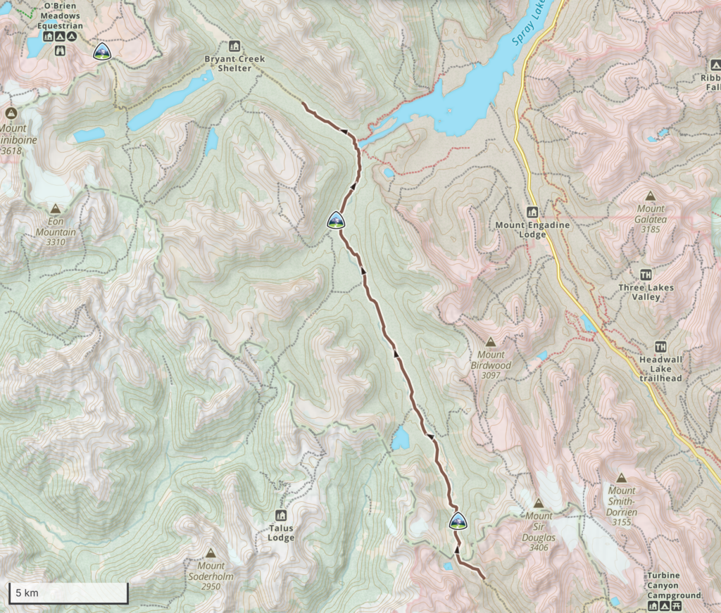
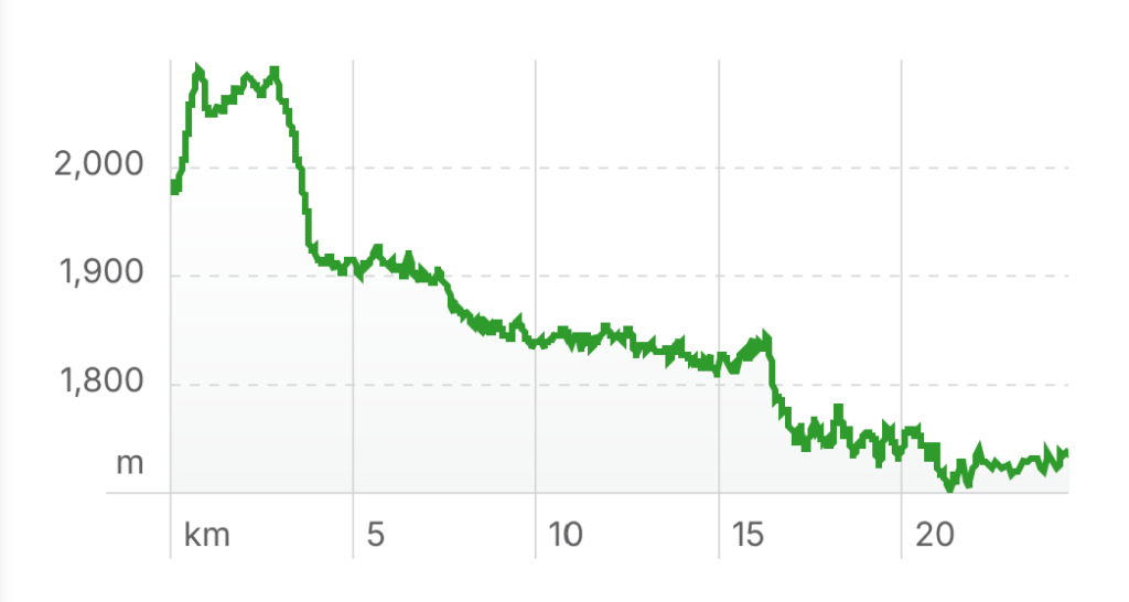
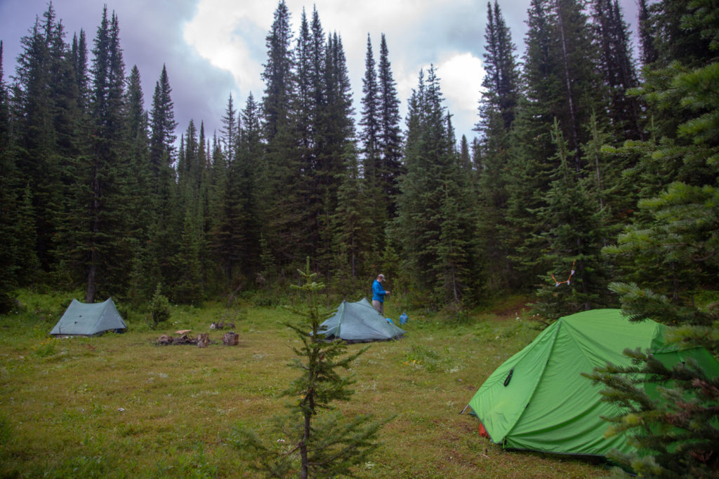
August 12th, Palliser Pass Wild Camp to Big Springs CG, 26 (+13) km, 150 m elevation gain, 540 m elevation loss (all distances and elevation are as per the guide book, Viewranger App will vary), Section C Segment 15 and start of 16.

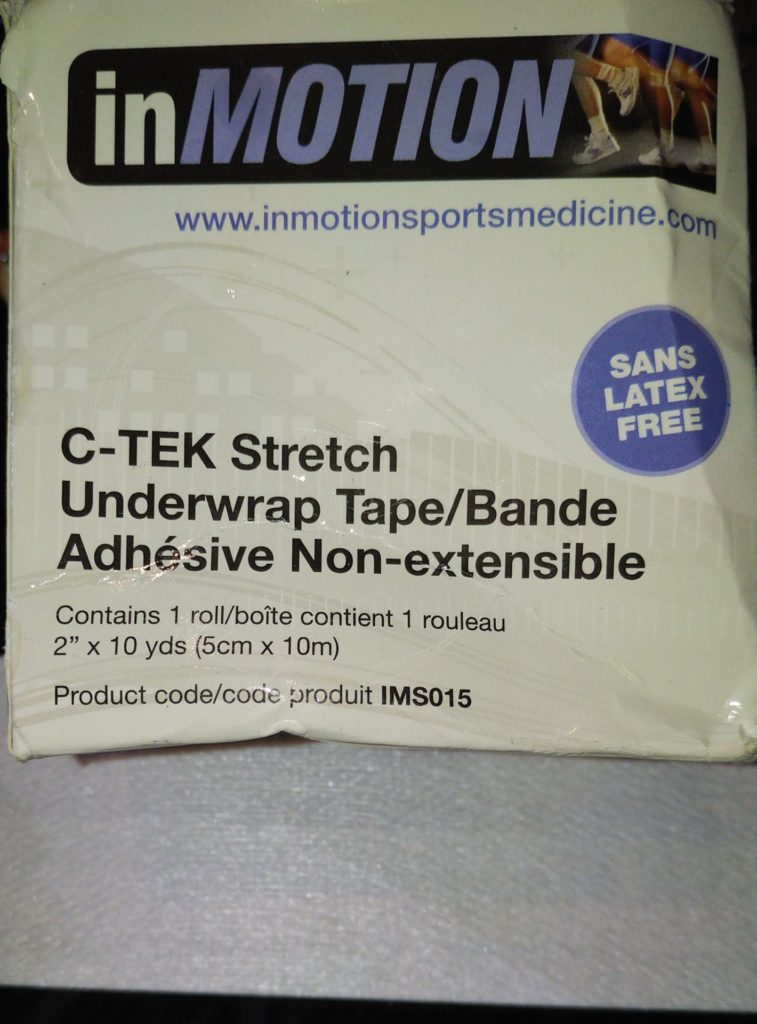
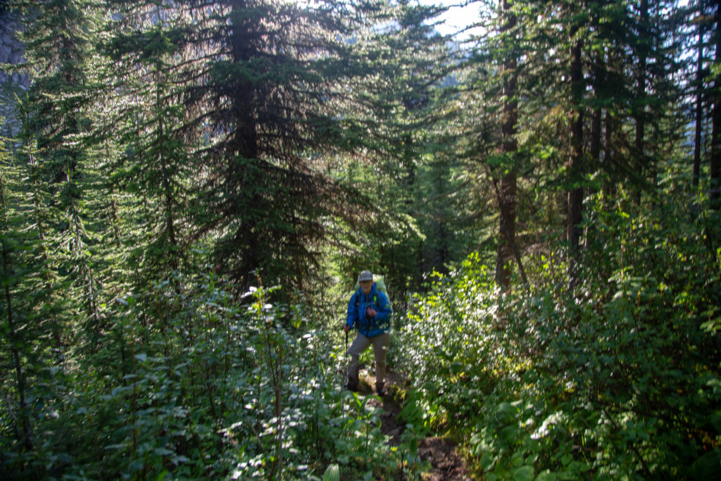
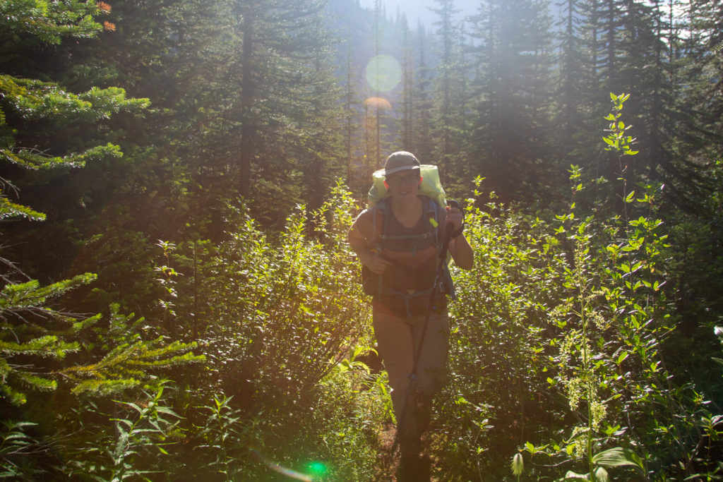
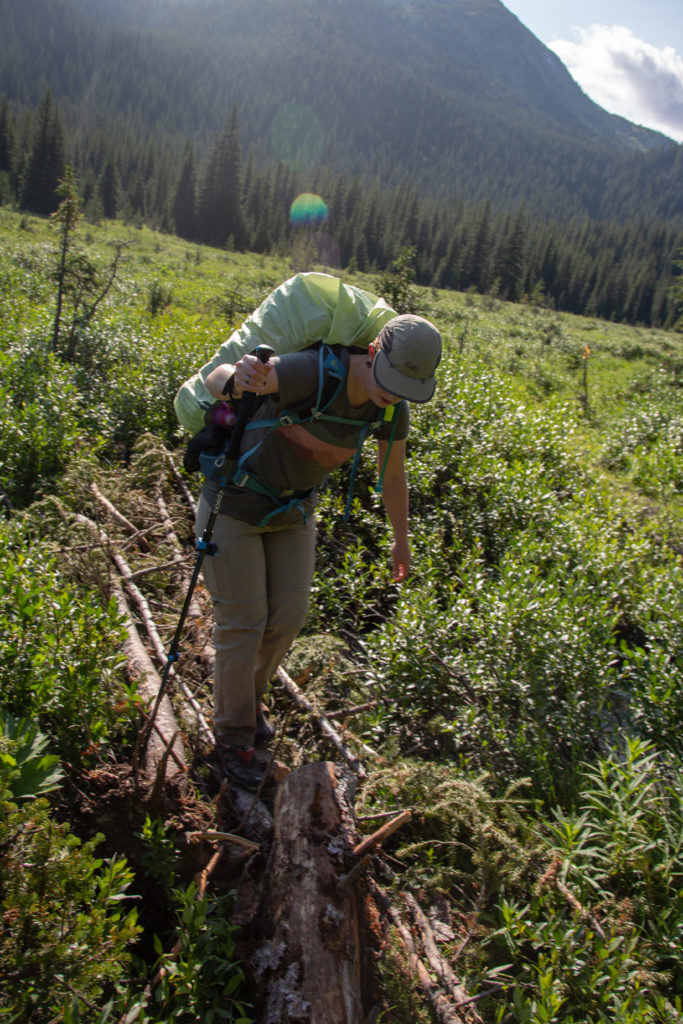
It rained heavily overnight and a couple of thunderstorms rolled through the campsite. We were up and out of the tent getting coffee going by 7 am. This meant rescuing our food from our bear hangs which took a few minutes. Emily’s feet had got very beat up yesterday so she took a few minutes to wrap her feet in our go-to blister prevention tape. Unfortunately for my planning instead of bringing the entire roll of tape I had only brought about 8 strips of tape. After Emily had done her feet we were all out of tape and it was only day 2! My feet were sore too—not that bad, but there was no tape left. I should have put some moleskin on anyway. I carry moleskin although I find it comes off when my feet get sweaty.

Our favourite blister tape. Is somewhat abrasive so not appropriate between toes.

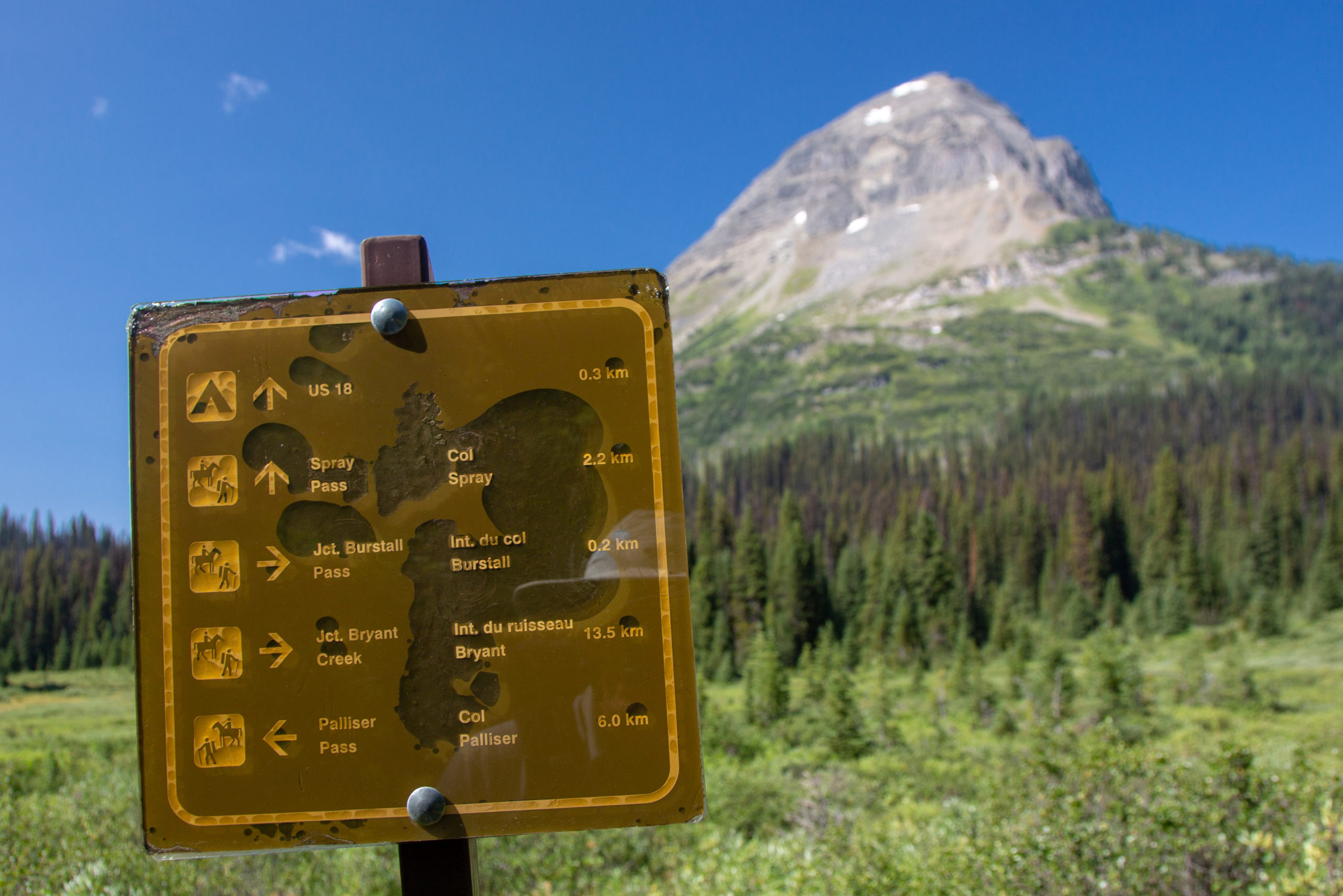
Since we both had sore feet we decided to put the SPOT X to use and text home and ask for emergency resupplies for our blisters. I sent a spot to Laura and Kathleen outlining our issues from the campsite. I proposed a plan where we would hike to the junction with the GDT trail and the trail to Mt Shark Parking Lot. Then I would hike to the parking lot to pick up the supplies, about a 13 km round trip, with 4 pm the designated meeting time at the parking lot. After sending the message we decided that we would hike up to the Palliser Pass to check for a reply, which could take 15 minutes. No point sitting around camp.

Campsite. Lots of clouds remaining from the storms overnight.
The small pond by the campsite with Mt Back (3009 m)

We left camp just after 8:30 am. A nice comfortable start to what would be a big day for me. After a flat walk over a meadow adjacent to the campsite we quickly headed uphill through dense brush heavy with water from the rains last night. We gained the 95 m to our high point of the day in about 22 minutes covering 0.8 km.

Pain make us feel a little crazy for day 2.
Mt Back and its reflection.
The flat start over a meadow.
Emily with her rain jacket on to protect against the wet brush. You can tell the trail is steep by how low she is compared to me.
Sun coming out and warming us up.
Palliser Lake

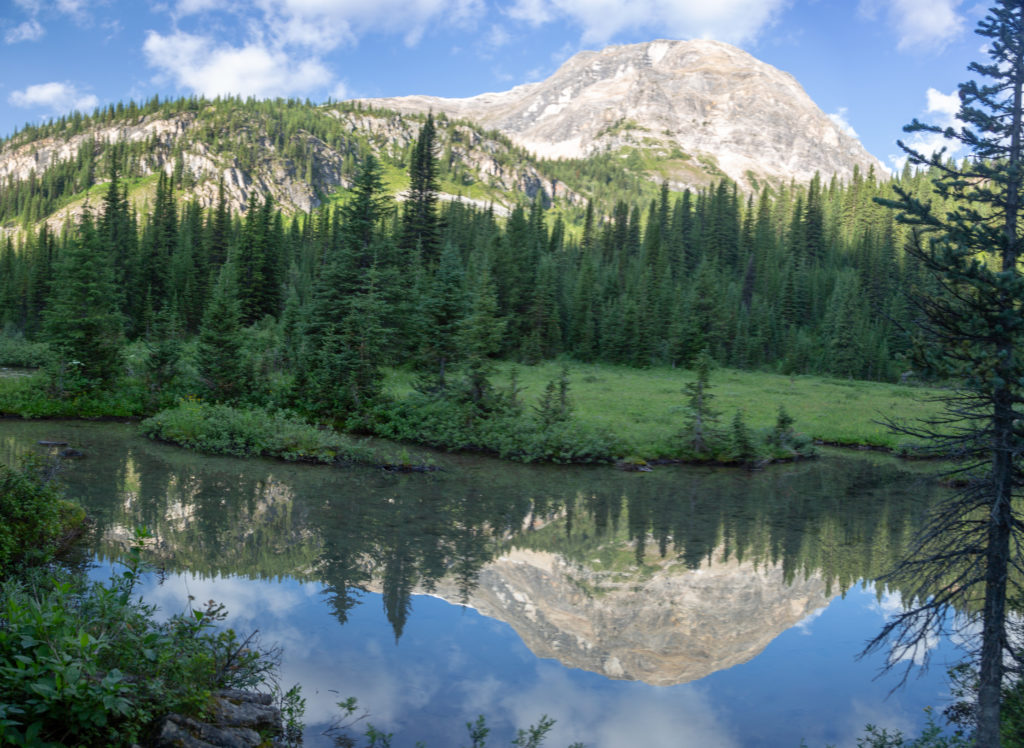
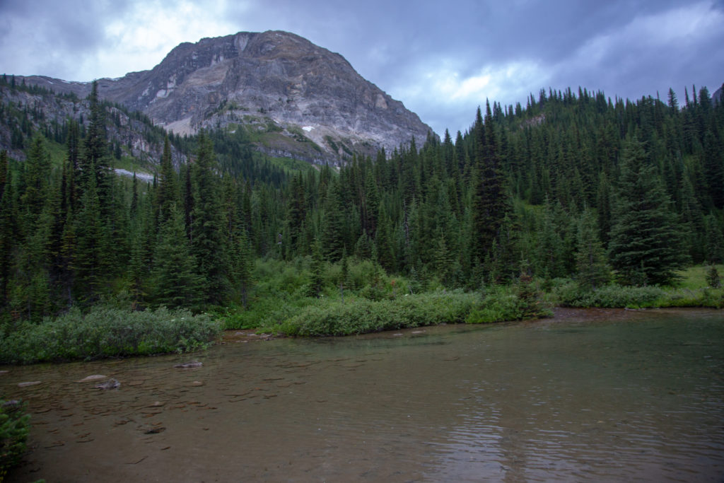
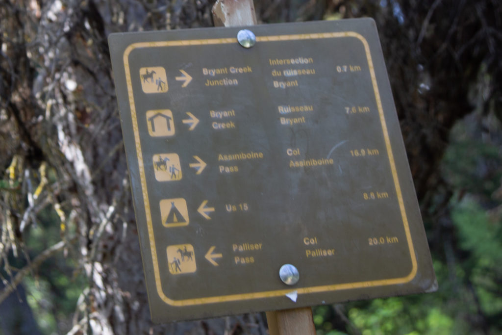
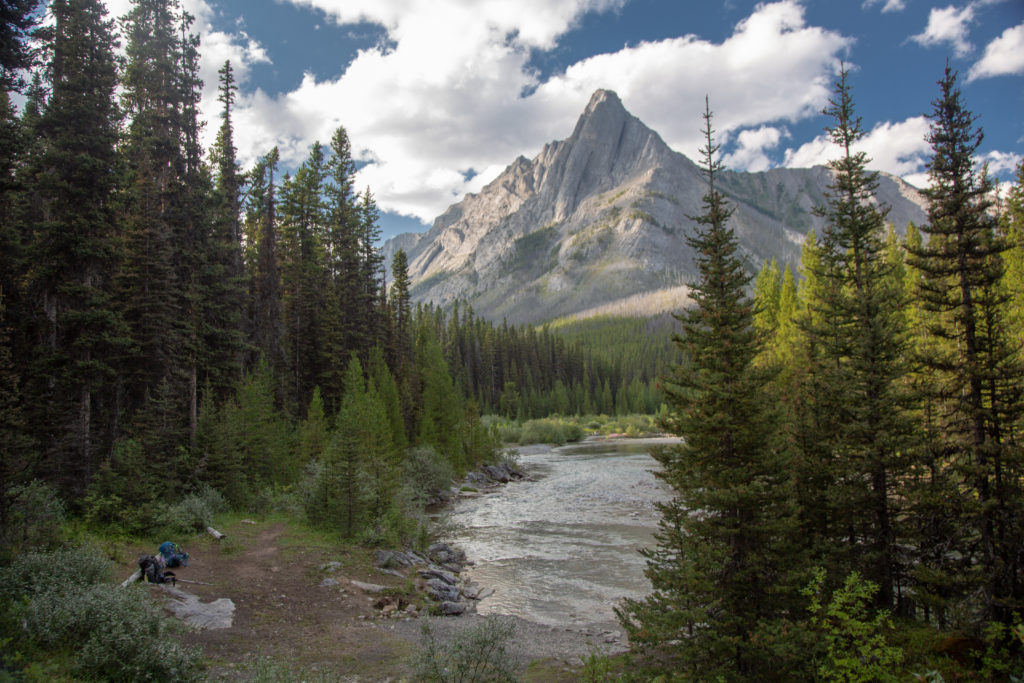
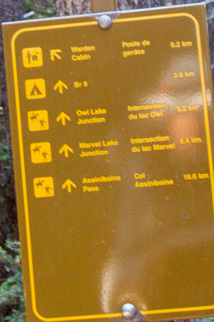
We passed by a couple of small ponds and arrived at the top of Palliser Pass, the entry to Banff NP, at 9:10 am. I pulled out the SPOT X and I had received replies from both Laura and Kathleen. The confirmed plan was for Kathleen to get our blister supplies from Laura and for Kathleen to drive to the parking lot at Mt Shark for 4 pm. This is where I made my second blunder of the trip. After asking for the blister tape I did not ask for my Salomon hiking shoes. We’ll never know for sure, but switching back to my regular shoes may have saved my trip. The confirmation of the 4pm meeting gave us a hard deadline for our hike. In my mind I recalled it being around 6 km from where we would join the trail from Mt Shark back to the parking lot. The goal was to arrive at 3 pm at the junction. So we had 20 km to cover in under 6 hours and needed to stop for lunch. This was not unreasonable as once we descended from the pass the trail was almost flat as it followed the Spray River down to the Spray Lakes Reservoir.

Arrival at Palliser Pass. The little concrete pylon on the left is Parks Canada’s way of designating significant locations.

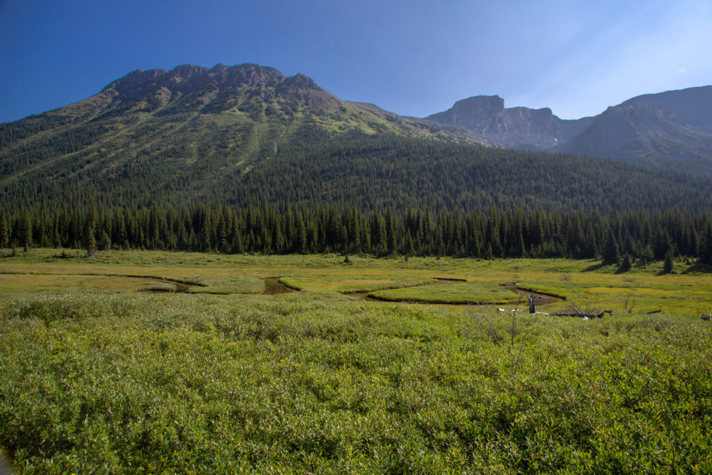
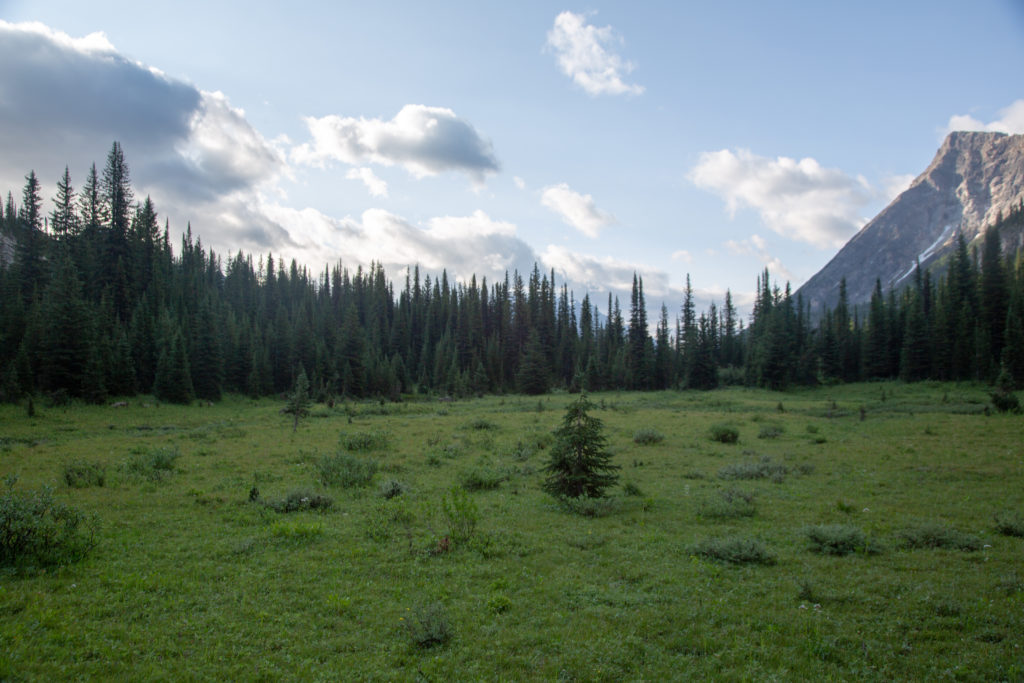
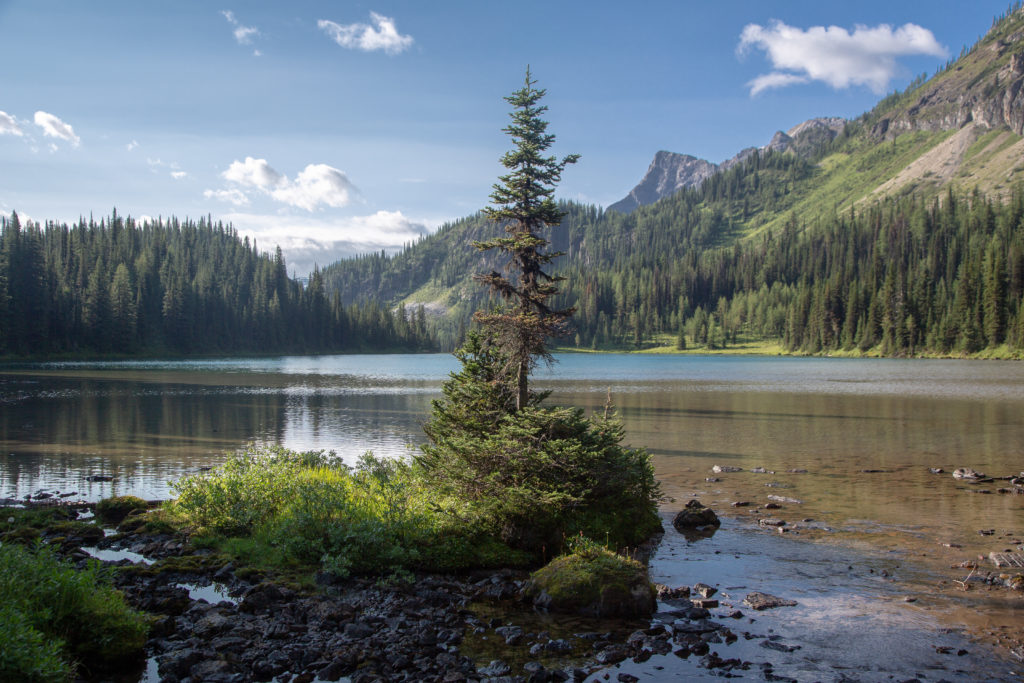
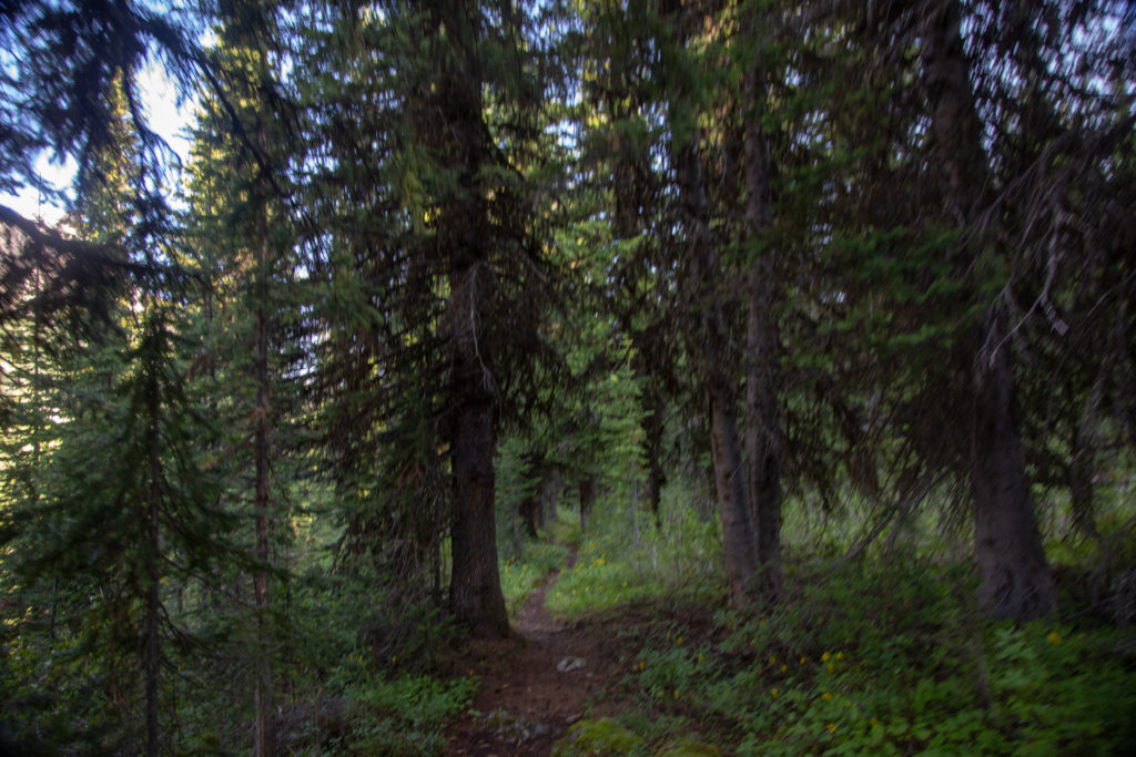
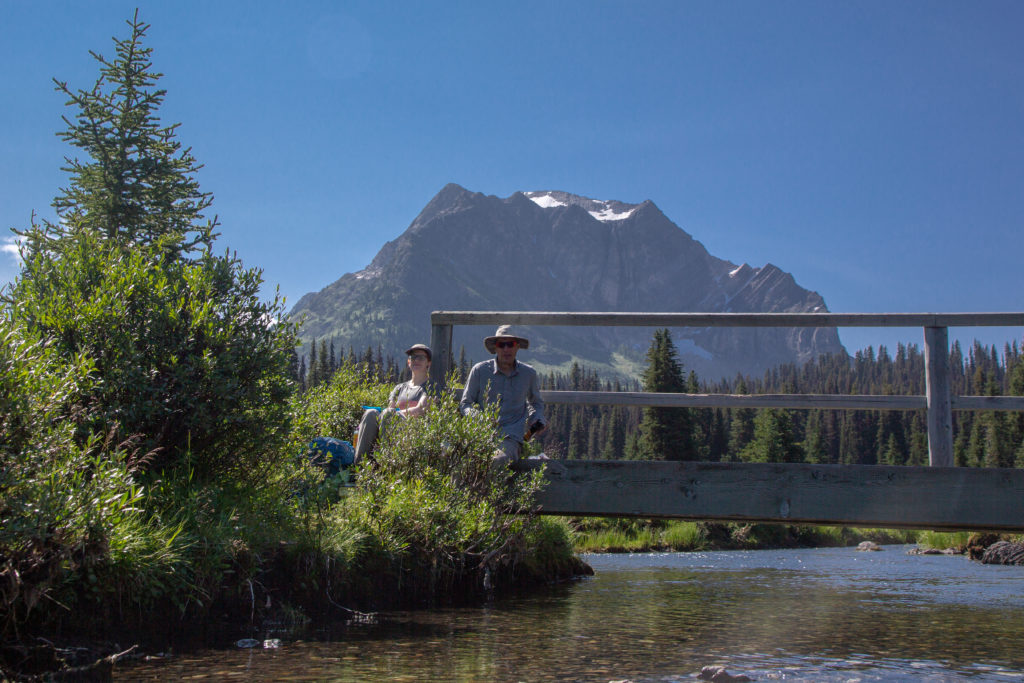
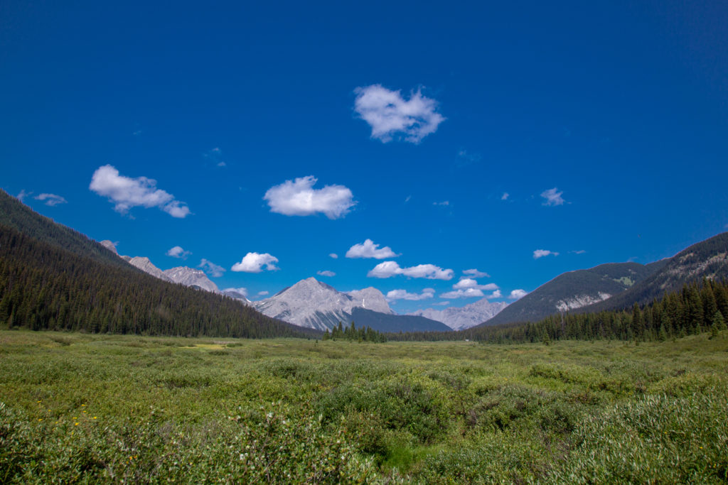
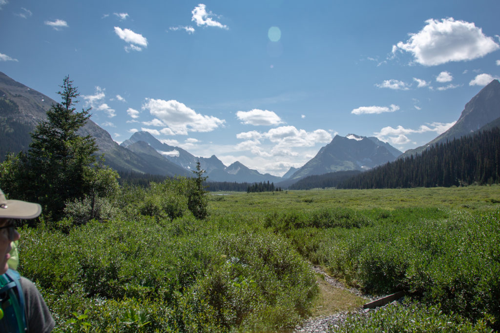
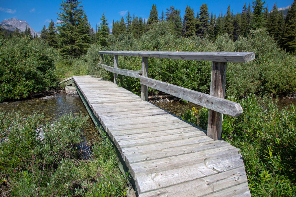
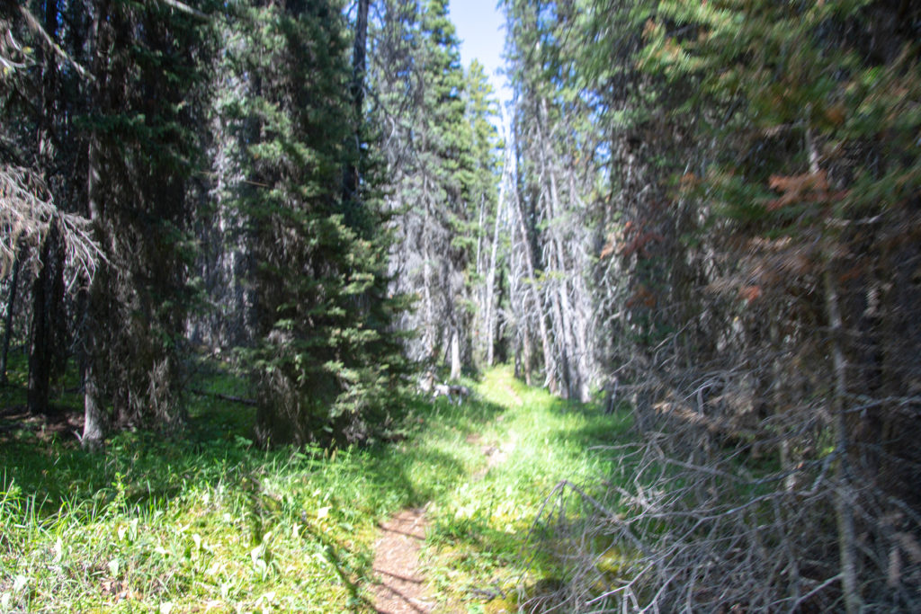
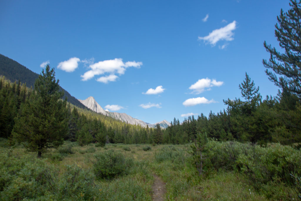
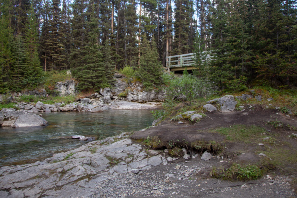
The clouds of the morning had cleared off, leaving us with blue skies overhead. After leaving the pass we quickly dropped 180 m in 1.6 km along a heavily forested trail. Once we cleared the forest we found ourselves in the Spray River Valley. We would have about 4 1/2 hours of easy hiking in the valley bottom. We stopped for snacks at 10:30 am and the father/daughter duo who we’d shared the campsite last night with hiked passed us. At 11:30 am we stopped for lunch just off the main trail on a little bridge leading to Leman Lake Campground. I knew about the bridge because I had been to Leman Lake CG with Laura back in 2018. I chose the spot because I thought sitting by the stream would be a relaxing stop on what was a hectic day.

Leaving Palliser Pass.
Mt Queen Elizabeth (2950 m). Hard to see but there is a small lake at the base, Belgium Lake.
Descending through the trees.
Small hiker made bridge over a side stream. Emily carefully negotiating the bridge. I fell through.
Emily walking through the meadow in the valley bottom. You can see the tree covered slope of the decent from Palliser Pass.
Father/Daughter duo with Snow Peak (2789 m) in the background forming the north side of Burstall Pass.
We have done 6 km with 13.5 km to go to the Junction at Bryant Creek. Mt Leman (2730 m) in the background.
Lunch 11:30 am. Mount Williams (2730 m)

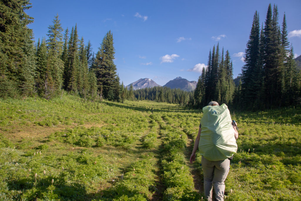
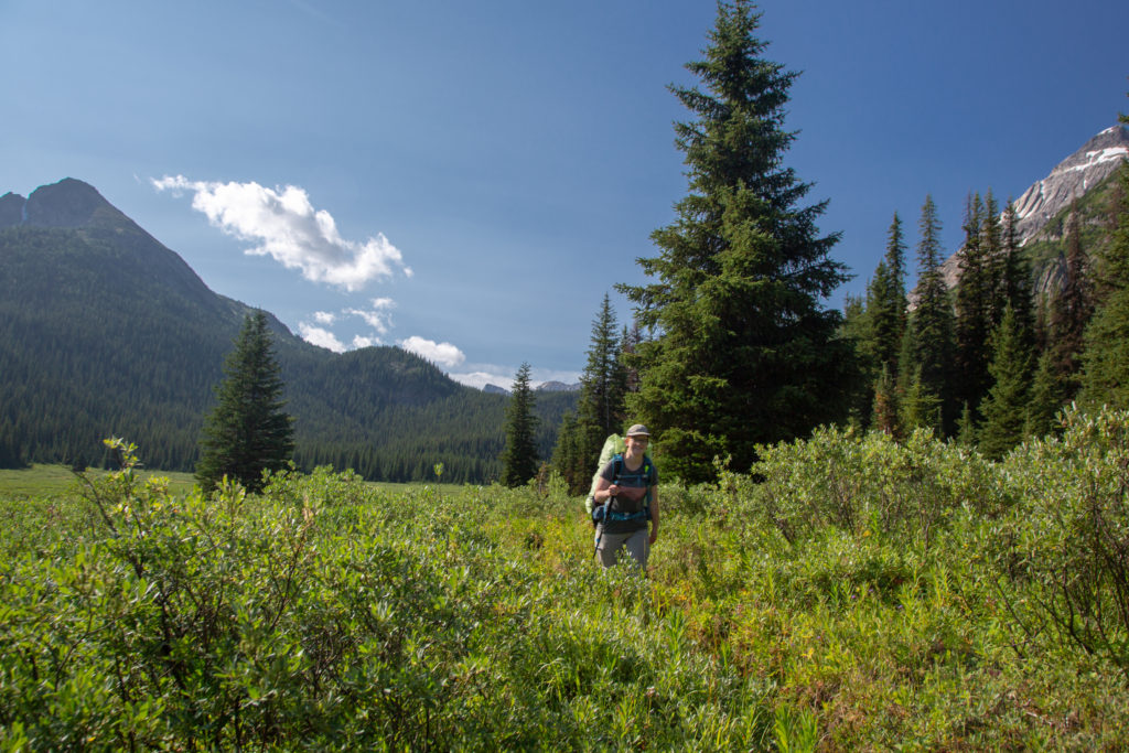
We had a nice relaxing 40 minute lunch break. Upon leaving I was feeling a deep sense of urgency at the distance we had to travel to arrive at Mt Shark parking lot by 4 pm. The distance to the junction was still about 14km, and then I had to add another 6ish to the parking lot. We had under 4 hrs to make the trip, necessitating a speed of a little over 5 kph. The trail was very flat and easy going but the 5 kph average was going to be a big ask and raised my stress level throughout the afternoon.

Emily’s note: And to think he initially wanted to put 3pm as our meeting time! Good thing I talked him out of that one. It was a hell of day even with needing to get there by 4.

The valley is wide and flat. The small white dot right of centre is the Warden Cabin located adjacent to Birdwood CG. The twin peaks at centre are Mt Morrison (2896 m) and Mt Turner (2813 m). The mountain we were aiming for was Cone Mt (2910 m) centre right which was at the head of Spray Lakes.
Looking back from where had been. Mt Leman on the right where we had our lunch.
Very handy bridge over a small creek.

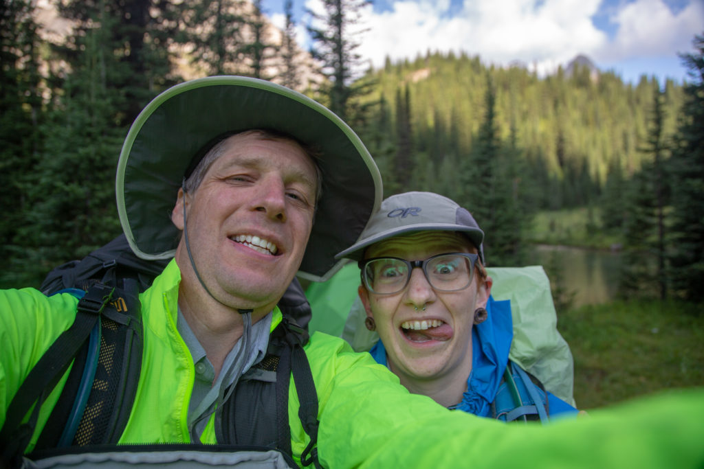
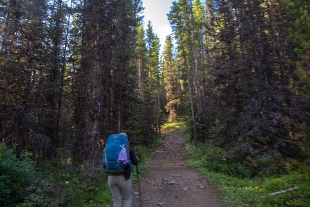
We past the father/daughter duo at Birdwood CG. They were enjoying their lunch while drying out their tent. Zpacks tents are very light but being single walled tents, no fly, they often have condensation buildup on the inside of the tent. We had quick drying cloths that we used to wipe down the inside of our tent that we also used to clean ourselves. Many people when hiking with a single walled tent will pull it out during a break to dry it, although we never did. We discovered the daughter was dealing with a severe case of blisters. They had started their hike the day before we had and had stayed at Forks CG for their first night. Despite using the same shoes as she did on the PCT the daughter had loonie sized blisters on her heels. They had planned to hike through to the Rockwall in Kootenay NP but did end up leaving at the trail at Sunshine Village. We pushed on as the hope of being on time at Mt Shark was quickly slipping away. This was one of the few times during the trip that I lead. I probably pushed the pace a bit high on the flats as Emily would later remark that the day was a bit of a death march.

Emily’s note: I felt a little vindicated that the other pair we were hiking alongside had blister issues—if seasoned PCTers could get blisters on that section, then maybe the fact that dad and I had painful feet was at least in part due to the fact that it was tough terrain. Our footwear choices certainly hadn’t helped, though. As for the death march comment? I have short legs. I’ll blame the genetics.

There is a barb wire fence to the left.
This bridge is not as robust as the last one we crossed.

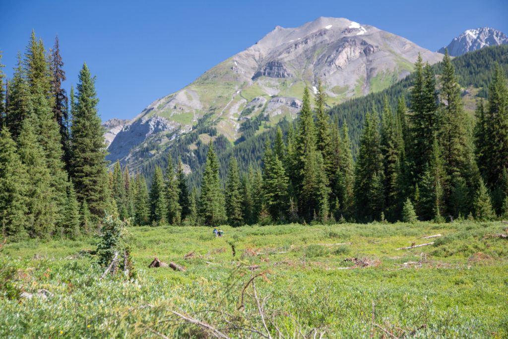
Once passing Birdwood CG we left the open meadow behind and spent the rest of the afternoon hiking in the woods. According the ViewRanger App we did keep an average speed of close to 5 kph. Pushing on just after 3:30 pm we arrived at junction with the trail back to Mt Shark parking lot.

Nice robust bridge over the Spray River.
The trail really appears to follow an old road with such a wide path cut through the forest.
Briefly out from the trees.
Our junction. It is approximately 20 km to Palliser Pass and we have arrived at 3:30 pm. Including breaks and lunch took us 6 hrs.

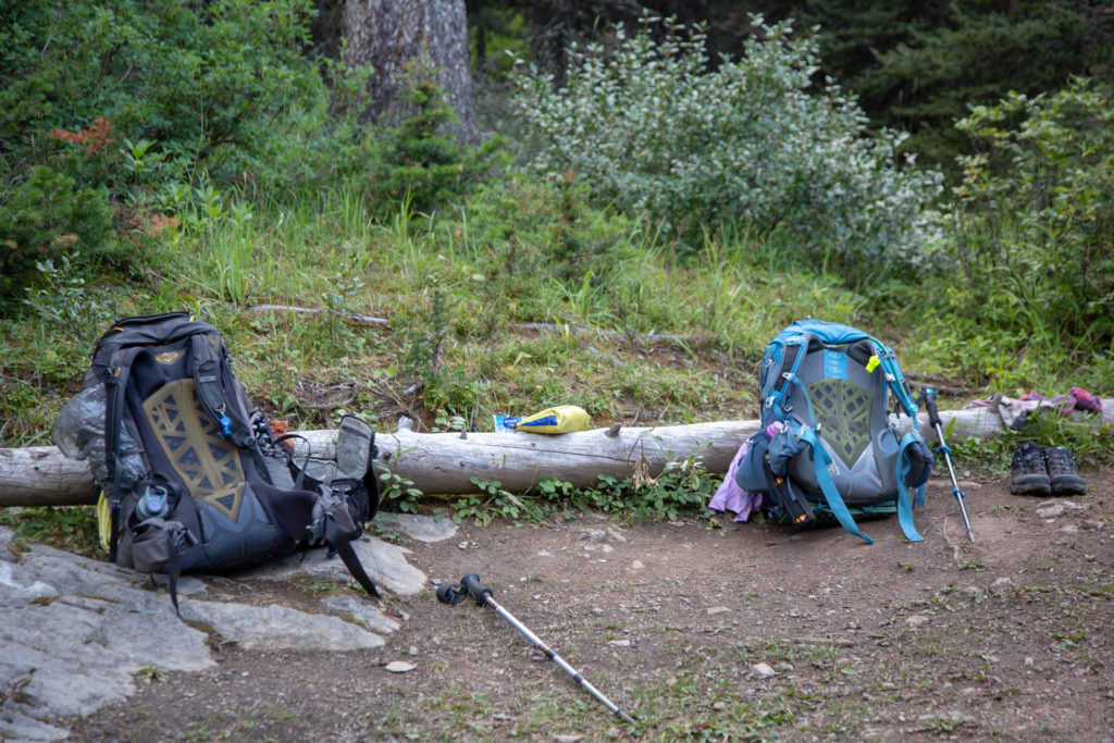
Upon arriving at the junction to our trail we set up a temporary camp at a little spot where the Spray River flowed into the Spray Lakes Reservoir. The plan was that Emily would stay with the packs and prepare dinner while I would hike to pick up the supplies. The Gregory backpacks that we both used on the hike utilize the water bladder pocket as a light day pack. We both carry our water bladders on the outside of the packs. Emily took to using her mini pack for her personal items that she wanted in the tent. I mostly ignored my bladder carrier but did use it to go pick up our supplies. My feet were incredibly sore by this point. I grabbed some snacks and some water as I figured the best I could hope for would be somewhere around one hour each way. I thinking was that fresh and with no blisters I can jog 6 km (the approximate one way distance to the parking lot) in around 50 minutes. So with a bit of walk/running maybe I could be close to the hour mark. We still had about an hour of hiking to get to our campsite at Big Springs once I returned.

Emily’s home for a few hours.
The bridge leading back to Mt Shark.
View from the bridge. This is beginning of Spray Lakes Reservoir. Baker Creek flows into the lake at centre. Cone Mt (2910 m) stands watch.

Despite our best efforts we were running about 45 minutes behind schedule by the time I hit the trail back to the parking lot. I ran/shuffled off down the trail. There was a bit of a hill I had to get over near the beginning. After hitting the flats over the top of the hill I was really feeling the cumulative effort from the days hike. I moved as quick as could down the trail. I have hiked the trail a few times and it was a little further than I remembered. I arrived at the parking lot in 1hr and 3 min. Kathleen, who is a nurse, bandaged up my blisters which really made a difference on the return trip. Kathleen had also brought some treats. I had a pop in the parking lot and carried a pop back to Emily along with some homemade cookies.

Once my feet were all bandaged up I headed back down the trail and resumed my run/shuffle style. I was making good time until I ran into a former student of mine (from when I was a student teacher in 2002) hiking back from a couple days in at Assiniboine. She was hiking in sandals as she had blistered up her feet badly on the trip. It is always great to meet a former student and catch up but on this occasion I had to keep the greetings short as I felt the need to keep moving. I had no worries about Emily being by herself. Emily has spent weeks hiking solo so she would be fine for a few hours by herself. My bigger concern was with Emily’s level of apprehension if I took too long to arrive back. Even with the added time of talking to my student I arrived back in 1 hr and 5 min after leaving the parking lot. I was well inside the 3 hour approximation we had set. My dinner was already prepared when I arrived. Dinner on day 2 was one of our homemade meals. I ate and relaxed while Emily tended to her feet. We had about 4 km to go to Big Springs and set off around 6:50 pm and arrived at Big Springs CG at 7:40 pm; alas, no time for beer.

Emily’s note: While dad was on his epic round trip to the parking lot, my job was a lot less exciting; I took pictures, wrote in my journal, and cooked dinner when I decided the timing was right. It kinda sucks to be the one left behind while someone else does the hard work, but it made a lot more sense than both of us carrying heavy packs all the way back to the parking lot, and anyway, it was a nice break for me. Dad was exhausted by the end of the day. We were definitely not moving fast those last 4km to the campground.

The small canyon the Spray Rive flows through upstream of the bridge.
The trails here are in excellent condition.
We are aiming for Br 9, it is 7:02 pm and we have 2.8 km to go.

On most of our trips we read a book in the evening after a day on the trail. For this trip I had purchaseded the book Massive by Ian Sample. It was a retelling of the search for the Higgs Boson. To save carrying the book I had scanned the first 150 pages into a PDF document and loaded it onto my tablet. For the second night in a row we were too tired by the time we went to bed to do any reading. My feet were throbbing all night and I do not remember sleeping very well.

Our nighttime reading. It was a great story.

Day 3 GDT Section C 2020

GDT Section C 2020 Home

bootwreckers

Takakkaw Falls from th Incline Trail, Yoho NP. Ph Takakkaw Falls from th Incline Trail, Yoho NP.

Photos of Takakkaw Falls taken from the Iceline Trail.

1) 1.6 second exposure of the falls

2) view of the falls and the Daly Glacier that feeds the water to th falls

The Iceline Trail was a nice way to get a more unique view of the falls and with fewer people.

Morning of day 2 of amazing trip last summer with @sio.mellors 

Yoho NP

#friends, #alberta, #parkscanada #backpacking, #yohonationalpark #yoho #friendsofyoho #nationalpark, #nationalparks, #mountains #naturephotography #travelcolumbiavalley #travelbcp #falls #waterfallphotography #waterfall #waterfallsofinstagram
Going through some photos from summer 2020. I lik Going through some photos from summer 2020.

I liked this photo, captured the early morning at Yoho Lake CG on my trip with @sio.mellors 

Loved how the water grabbed th orange reflection off the bottom of the clouds as the sun just crested the horizon.

I enjoy getting up early when camping. Not only do I get to enjoy the peace and quiet of camp, but the light of the sun presents fleeting visual displays that are gone in moments.

Yoho NP

#friends, #alberta, #parkscanada #backpacking, #yohonationalpark #yoho #friendsofyoho #nationalpark, #nationalparks, #mountains #naturephotography #travelcolumbiavalley #travelbcp #sunrise #morning #sunrisephotography  #lake #reflection #reflections
View looking West over the Tonto Platform from the View looking West over the Tonto Platform from the South Kaibab Trail.

This April will be our 10 year anniversary of our first trip to the Grand Canyon.

It is truly one of my happy places, have visited five times and camped below the rim three times.

Looking to get back sometime soon, but good things are worth the wait.

#nps, #nationalparks, #slotcanyon, #hiking, #hikingadventures, #familytime, #camping, #campingadventures, #outdoors, #outside, #nature,  #FIndyourpark #landscape #landscapephotography #optoutside #nationalpark #desertphotography #grandcanyon #grandcanyonnationalpark #grandcanyonassociation #100yearsofgrand #100yearsofbeauty #100yearsofgrandcanyon
Sunday morning sunrise! There are perks for getti Sunday morning sunrise!

There are perks for getting up early on a Sunday to go grocery shopping, and the mountain sunrises are one of them.

Shot off my phone from the parking in downtown Canmore.

#sunrise #sunrisephotography #sunrise_sunset_photogroup #earth #outside #outdoors #naturephotography #nature #naturelovers #sky #skyphotography #sky_brilliance
No doubt 2020 was a prickly year, and 2021 has sta No doubt 2020 was a prickly year, and 2021 has started out a little rough.

Just like hiking, if we keep going we will see beauty in amongst the prickles, but we need to stay on the trail.

Here's to good times ahead.

From our hike last year Emily hiking among the cactii towards the feature we affectionately named the Thumb, Passage 16 on the Arizona Trail

#teamzpacks #zpacks #zpacksduplex #aztassociation #aztrail #aztrails #hike #loveazt #desertphotography #desert #hikingadventures #hikes #backpacking #camping #getoutside #familytime #traillife #aztassociation , #hiking, #hikingadventures, #familytime, #camping, #campingadventures, #outdoors, #outside, #nature,  #FIndyourpark #landscape #landscapephotography #optoutside  #rightnow #goparks #aztrails #aztrail #loveazt  #azt #arizonatrailassociation
Looking at a fun trip last summer through Yoho NP Looking at a fun trip last summer through Yoho NP with @sio.mellors 

Lots of waterfalls to see in the park, Laughing Falls is a fun and loud falls right off the main trail located surprisingly, next to Laughing Falls CG.

We stopped by on our way to Twin Falls CG after spending the day hiking the Iceline Trail

Like this photo of Siobhan getting close to the falls for her own picture. 

#friends, #alberta, #parkscanada #backpacking, #yohonationalpark #yoho #friendsofyoho #nationalpark, #nationalparks, #mountains #naturephotography #travelcolumbiavalley #travelbcp #waterfall #waterfall #waterfallphotography #waterfallsofinstagram
Haiduk Lake, Banff NP. Haiduk Lake is just beyond Haiduk Lake, Banff NP.

Haiduk Lake is just beyond Whistling Pass as you hike from Egypt Lake to Balls Pass Junction.

Very pretty Lake. We were lucky enough to pass by early in the morning as we hiked from Egypt Lake to Floe Lake during our #gdt hike this summer.

#friends, #alberta, #parkscanada #rockwall #backpacking #nationalpark, #nationalparks, #mountains #naturephotography #alpine #lifeelevated #getoutside #lifeonthetrail #britishcolumbia #gdt #greatdividetrail
#kananaskis #kananaskiscountry
Chasing th Aurora on Friday night at Lake Minnewan Chasing th Aurora on Friday night at Lake Minnewanka in Banff NP.

Sadly it did not come right out to play,  but was obviously a lot of light coming from th North East.

Always fun to be outside in a dark place to see th glory of the night sky.

#outside, #hiking #camping, #backpacking,
#adventure, #adventureoutside, #nature, #landscapephotography, #nobaddays, #adventureholiday, #hikingadventures, #astrophotography, #milkyway #kootenaylife #kootenaynationalpark #nationalpark #nationalparks
#parkscanada #northernlights #aurora #auroras #auroramax
Hiking the GDT Day 1. I was almost completely sa Hiking the GDT Day 1. 

I was almost completely satisfied with or trip on the Great Divide Trail when on Day 1 we finished the uphill to Turbine Canyon and popped out of the woods and saw this amazing alpine vista.

I remember remarking to Emily "this is why I hike"

#friends, #alberta, #parkscanada #rockwall #backpacking #nationalpark, #nationalparks, #mountains #naturephotography #alpine #lifeelevated #getoutside #lifeonthetrail #britishcolumbia #gdt #greatdividetrail
#kananaskis #kananaskiscountry
Morning from Floe Lake with Floe Peak selection of Morning from Floe Lake with Floe Peak selection off the mirror smooth waters.

Another amazing morning hiking the GDT.

Never get tired of Floe Lake, was my third visit and just a year after my previous visit.

#friends, #alberta, #parkscanada #rockwall #backpacking, #kootenaynationalpark #nationalpark, #nationalparks, #mountains #naturephotography #travelcolumbiavalley #travelbcp #flowers #getoutside #lifeonthetrail #britishcolumbia #gdt #greatdividetrail #goldenhour #goldenhourphotography #mirrorphotography #lake
Golden hour! Morning sun shining off of Tumbling Golden hour!

Morning sun shining off of Tumbling Glacier and the Rockwall. 

Waking up at Tumbling Creek Campground during my Great Divide Hike this summer. 

#friends, #alberta, #parkscanada #rockwall #backpacking, #kootenaynationalpark #nationalpark, #nationalparks, #mountains #naturephotography #travelcolumbiavalley #travelbcp #flowers #getoutside #lifeonthetrail #britishcolumbia #gdt #greatdividetrail #goldenhour #goldenhourphotography
Flower Field, Tumbling Pass, Kootenay NP. From la Flower Field, Tumbling Pass, Kootenay NP.

From last summer's Great Divide Trail hike. At th top of Tumbling Pass on the Rockwall, treated to a visual feast of colour.

Awesome day, epic hike.

#friends, #alberta, #parkscanada #rockwall #backpacking, #kootenaynationalpark #nationalpark, #nationalparks, #mountains #naturephotography #travelcolumbiavalley #travelbcp #flowers #getoutside #lifeonthetrail #britishcolumbia #gdt #greatdividetrail
As we head into winter, a shot from last spring at As we head into winter, a shot from last spring at the end of winter. The snow was just clearing from the trails, and flowers poking through to greet the warmth.

Heading out over Rockwall Pass, Kootenay NP, with @kbsymington  and @neil.real.deal .

Had some snowfields to cross, good day out on th trail

#friends, #alberta, #parkscanada #rockwall #backpacking, #kootenaynationalpark #nationalpark, #nationalparks, #mountains #naturephotography #travelcolumbiavalley #travelbcp #flowers #getoutside #lifeonthetrail #britishcolumbia
Fun photo from Twin Falls Campground in Yoho Natio Fun photo from Twin Falls Campground in Yoho National Park.

As night fell I was able to take some long exposure shots of Twin Falls Creek as it tumbles through the campground.

Fun 3 day trip with @sio.mellors.

#friends, #alberta, #parkscanada #backpacking, #yohonationalpark #yoho #friendsofyoho #nationalpark, #nationalparks, #mountains #naturephotography #travelcolumbiavalley #travelbcp #waterfall #rainbow #spectrum #hikingadventures #longexposure #longexposurephotography #river
Top of Guinns Pass, Kananaskis Country 2016 Guinn Top of Guinns Pass, Kananaskis Country 2016

Guinns Pass connects the valley with Ribbon Lake and Ribbon Creek and the valley with Lillian Lake and Galetea Creek. Stunning views in all directions from the top of the pass.

There is also a scramble up the connecting ridge to the east up to Guinns Peak and onto Mt Kidd South.

Great two days hiking with @emilysjumpinginpuddles

#hikingwithdogs, #hiking, #hikingdogsofinstagram, #outside, #kananaskiscountry, #kananaskis, #spcacanmore, #spcarescue, #snowyowlsleddogtours, #snowyowldogsledtours, #retiredsleddog, #retiredhusky, #backpacking, #tongueouttuesday, #canmore, #canmorealberta, #adventure,
Larch season is coming to an end in the Rockies, b Larch season is coming to an end in the Rockies, but last weekend we were treated to quite a display near Taylor Lake in Banff NP

#outside, #outsidethebox, #liveoutdoors, #liveoutsidethebox #naturephotography, #naturelovers,  #retiredhusky, #rescuer
#parkscanada #banffnationalpark #banffalberta #banffcanada #larches #fall #autumn
Amazing sunset over Floe Lake. An early evening s Amazing sunset over Floe Lake.

An early evening storm and the setting sun shining up and reflecting off the clouds. Completely surreal. 

August 17th

Kootenay NP

Part of a 10 day hike along the Great Divide Trail, from Upper Kananaskis Lake to Field, BC

#outside, #outsidethebox, #liveoutdoors, #liveoutsidethebox #naturephotography, #naturelovers,  #retiredhusky, #rescuer
#parkscanada #banffnationalpark #banffalberta #banffcanada
#sunstar #sun #lake #sunrise #alpin #scenery #reflectionphotography #reflections #sceneryphotography
Well, my epic 15 day hike became a totally epic 10 Well, my epic 15 day hike became a totally epic 10 day adventure.

Lots of photos, but I will start with a picture of the adult wolf I saw just outside of Egypt Lake Campground.

I was luck to see probably the entire pack, 6 wolves, they were coming out of the woods and crossing the trail to Egypt Lake, and I just happened to be there with my camera.

#friends, #alberta, #parkscanada #rockwall #backpacking, #banffnationalpark #banffalberta 
 #egyptlake #wolf #wolves #nationalpark, #nationalparks, #mountains #naturephotography #wildwolf #wildwolves #gdt #greatdividetrail
Bathtub full of gear and Frosty Paws. Must mean ad Bathtub full of gear and Frosty Paws. Must mean adventure is near.

Leaving Tuesday for 15 days on the Great Divide Trail with daughter Emily. 

Hiking from Kananaskis Lakes to Saskatchewan River Crossing. 

1st stage is 7 days to Floe Lake, looking like th backpack will be around 45lbs, with tent, food and camera.

Should be a grand adventure.

#outside #liveoutsidethebox #naturephotography, #naturelovers,  #retiredhusky, 
#parkscanada #glaciernationalpark #bctourism #earthexperience
#sunrise #alpine #scenery #reflectionphotography #reflections #sceneryphotography #alpinelake #amazingearth #morningmotivation #travelcanada #explorerockies
#travelcanada #mountainstories #explorecanada #theearthoutdoors #paradisecanada #gdt #greatdividetrail
Amazing backpacking trip through Yoho NP with Volc Amazing backpacking trip through Yoho NP with Volcano (@senioradventurepups)

Volcano is turning 13 the first week of August but still crushed the 12km from Laughing Falls CG to view Twin Falls and back to the car via the connector.

Volcano not a big fan of water falls, or me sticking the camera in her face, her expression says it all. But Twin Falls is beautiful and I caught a small rainbow at the bottom.

Had a blast with her, she is always keen to go, jst not as far as before.

#friends, #alberta, #parkscanada #backpacking, #yohonationalpark #yoho #friendsofyoho #nationalpark, #nationalparks, #mountains #naturephotography #travelcolumbiavalley #travelbcp #waterfall #rainbow #spectrum #hikingadventures #hikingwithdogs #backpackingwithdogs #retiredhusky #retiredsleddog #alaskanhusky
Load More... Follow on Instagram

For more photos of these and other Bootwreckers Adventures

© 2021 Boot Wreckers | Powered by Minimalist Blog WordPress Theme