
Flowers and ash.
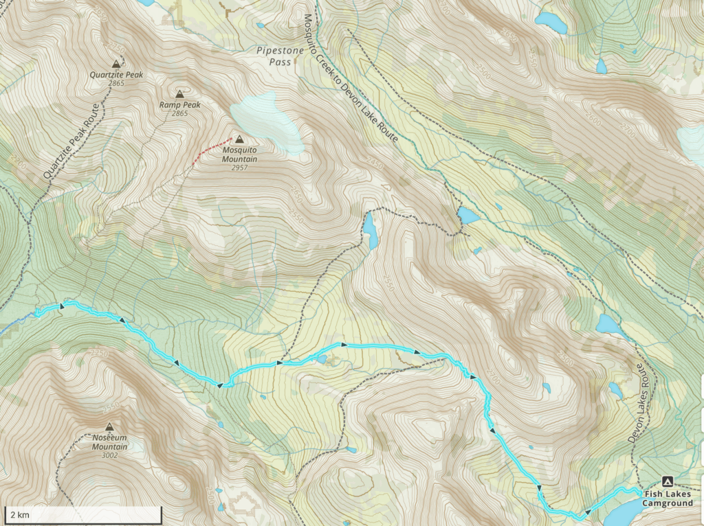
Mosquito Creek CG to Fish Lakes CG over North Molar Pass, 10.4 km, 595 m elevation gain, 358 m elevation loss, 4 hrs 40 min.


It was a very slow and relaxing start to the day. We had just a little over 10 km to hike and great weather so no one was suggesting we hustle up and hit the trail. I was up a little a before 7 am and happy to get some fun photos of the morning sun through the trees. Micah was up next. We had a pleasant time talking while we drank our coffee and ate our Logan Bread. We drifted away from the eating area close to 8:30 am to pack up our tents and prepare for the day ahead. No one else was up yet. When we woke Jordan and Bent up neither could believe that they had slept for so long.


Talking to the old couple while we waited to start the day they had no idea of the closure of Jasper NP. They had to drive home to Edmonton that day knowing that Hwy 93 north would be closed they planned to take the back roads from Rocky Mt House back to home.


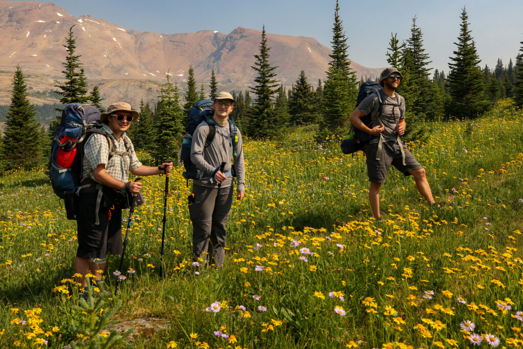
We charged off down the trail. Despite being a short day at just 10 km the pace was pretty stiff. Both Micah and myself have been to Fish Lakes CG, me in 2016 with Laura and Links, but this would be new trail for the other three. I had to walk double time just to keep up while still taking moments to grab some photos. Just as we got going another group came into camp. They would tail close behind us for the first part of the day. At the first junction we would take the left fork to North Molar Pass while they would head right to the less frequented Molar Pass.


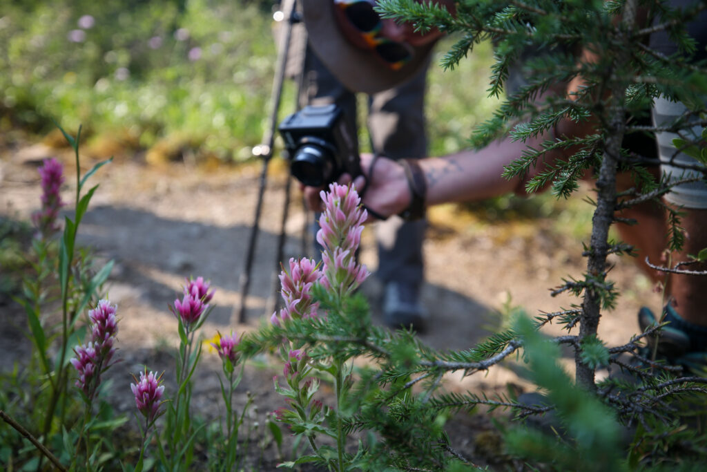


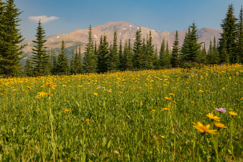
Following there are lots of photos of flowers. I am not going to apologize as this section of the hike was simply breathtaking.


Apparently Watermelon Peak got its name when a member of the first party to ascend it carried a watermelon to the summit. Unfortunately the Geographical Names Board of Canada does not officially recognize the name.

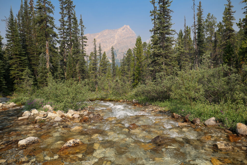
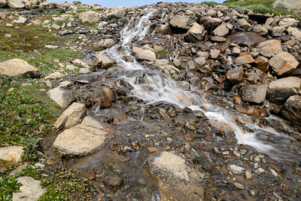
As we leave the meadow and the flowers the trail flattened out taking us over a small rise before dropping slightly to cross the drainage from a large unnamed lake at the base of the peak that separates North and Molar Pass.


As we approached an easy water crossing of Mosquito Creek I noticed Anfin was looking downstream attentively into a small canyon. The object of their attention was a marmot feeding along the bank. I stopped to watch and suddenly the marmot demonstrated an athletic feet we were not not expected for such a lumpy little animal. The marmot sprang upwards soaring over the water to land on a little island. We both gasped in amazement.

We then watched for the next few minutes as the marmot explored and nibbled on the little island hoping to see repeat of the previous performance. Alas the marmot appeared to have used it up daily allotment of athleticism and just scuttled around the the little island nibbling on the grass. Pleased with what we had seen we moved on to keep up with the group who had decided to set up camp beside the small alpine lake for lunch.
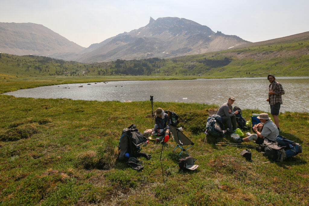

It was just after 10:50 am when we stopped for lunch/snack. It was not really a full lunch break. We had only been hiking a little over 2 1/2 hrs but the lake provided a beautiful backdrop. The spirits of the group was high with quite a bit of chatter during lunch. The weather was perfect for hiking but there just a hint of haze in the air reminding us of what was going on outside our happy little bubble.
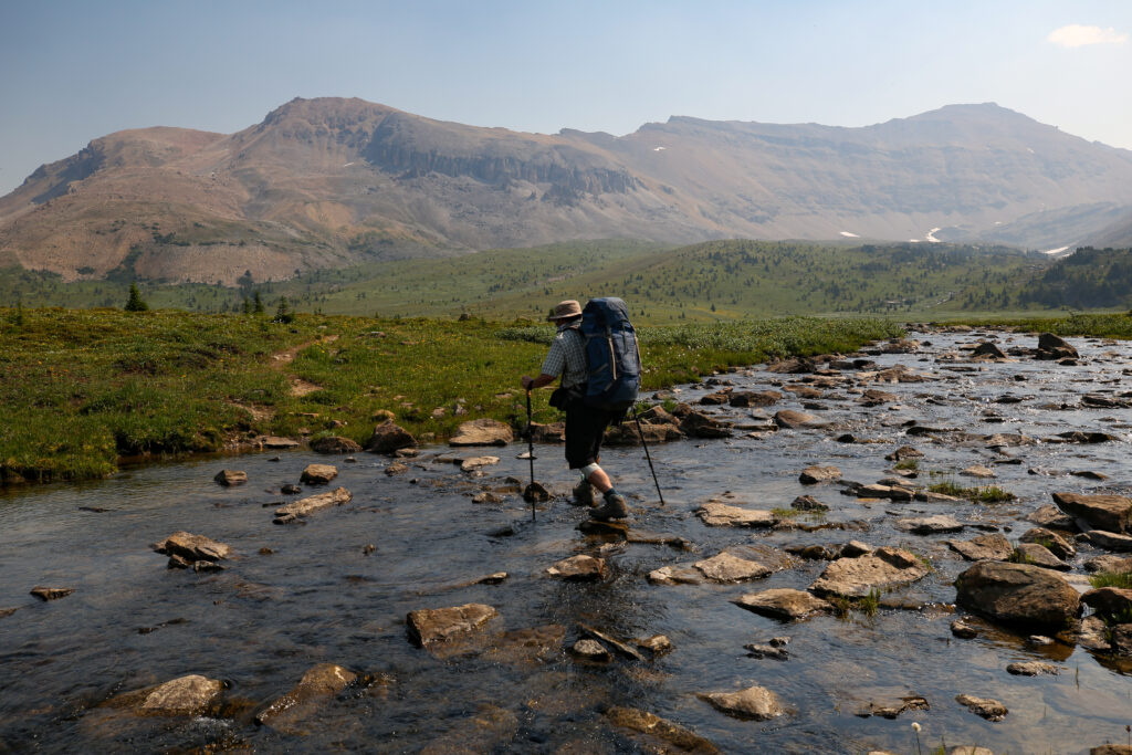
Once back on the trail we had to hike 2 km and gain a little under 300 m of elevation to reach North Molar Pass.


Shortly after we got back on the trail after lunch we were soon passed by two groups of hikers heading back to the trailhead after spending the night at Fish Lakes CG. They seemed to be a very good mood but said that they were suppose to spend a couple of days at the campground but the bugs were too ferocious. Not exactly what we wanted to hear but not totally unexpected. Micah and I had both been to Fish Lakes CG before and the bugs are legendary. But the lake is very open so if there is any wind it will help keep the bugs at bay plus we were only staying one night.


At a height of 2586 m North Molar Pass will be our high point for the trip.


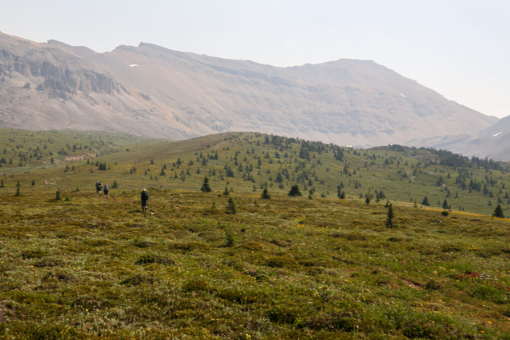
We all got a little spread out over the trail and any conversation evaporated. It was a bit of a hot slog to the pass.


It had taken just a little over an hour to make our way to the pass after leaving our lunch lake. No one was in much of a rush to continue but happy to take in the views. I took the opportunity to tend to a hot spot on my foot. Early intervention is always the key but when hiking in a group it can be tough to ask people to stop.

The downside of the pass was a lower quality trail than the upside. Lots of little steep sections on loose rocks. It was thought a quick decent to the meadow.


As we made our way to Fish Lakes both Micah and I were surprised how long the hike was. We were quite sure that Fish Lakes was only a short hike after pass. Our memories were wrong.


The hike from the pass to the campground covered about 3 km on well defined trail. The trails become quite deep and braided as we descended through the meadow but the hiking was always very easy. The clouds were staying away and there was only a little haze in the air making for a very pleasant hike to finish off the day.


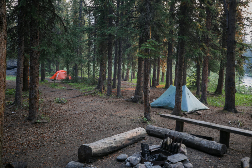
I hiked the last segment from the bridge to the campground with Anfin. We ambled along enjoying the walk. It was still early afternoon and there was no reason to rush to camp. We rolled into camp at 1:50 pm with what we hoped was a long relaxing afternoon ahead of us.

I dumped my pack with everyone then immediately left to scout where we had to go tomorrow. I found the trail leaving the campground that soon arrived at a junction for either the Pipestone River or Pass. Back at camp Anfin and I looked at the map on my phone and we decided we wanted Pipestone Pass. Micah also chimed confirming that JJ in the video went over Pipestone Pass. Later we got confirmation from a guy that had just arrived in camp that we wanted to head for Pipestone Pass.
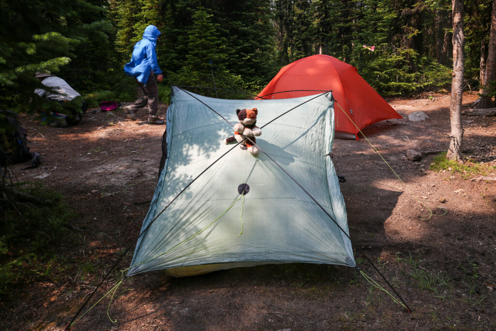
There are no tent pads at Fish Lakes so you are left to wander around and try and find a relatively flat patch of ground to pitch your tent on. I ended setting up much closer to Micah and Anfin than you would usually plan for but that was where the ground was flat or mostly flat. There is only suppose to be 5 sites at the campground but there ended up being 7 or 8 tents set up by the time we went to bed.

With the tents set up before 4 pm we headed down to the lake to relax in the sunshine and enjoy the views. Among the many converstations we had I remember chatty with Bent about two of my favourite hiking books, “High Rockies Summer” by Chris Townsned, about his journey on an infant Great Divide Trail and “No Picnic on Mt Kenya” by Felice Benuzzi, a recounting of how three escaped POW’s attempted to summit Mt Kenya during World War II.


A bit before 6 pm we headed to the eating area to make dinner. Hanging out by the lake was great with the wind keeping the mosquitos away. The eating area is nicely sheltered from the elements allowing the mosquitos to seek their revenge. Remember the two guys we passed who had bailed on a second night at camp because of the mosquitos well they had a point. Bent was very stylish and smug as they only person with a bug net to protect his head. Coming in at just a few grams in weight I think it should will be a new addition to my packing list.


The mood got a little gloomy after dinner with the smoke rolling in. The weather forecast for tomorrow was 30% chance of rain which could help keep the smoke to a minimum.

There were a few groups that arrived during the night. Given that one group left early there was way too many people in camp. Luckily for the late comers with the lack of tent pads it was just find a flattish spot and throw down your tent.


We had a longer day coming up at around 21 km so we headed to bed and agreed to get up early and meet before breakfast at and talk about our options given the smoke and possible rain. Jordan suggested just getting out of camp and finding a spot down the trail to have breakfast and coffee to escape the bugs. The bugs were very bad but I had very few bites for which I was quite thankful for. There ended up being at least 10 tents set up in a camp with only 5 designated tent sites. I wonder what a Warden would have done had they stumbled into camp.
As I lay in bed I kept asking myself why I had no:
- map
- guidebook
- photos of a route description
- and had not downloaded JJ’s video onto my phone
I was feeling woefully unprepared. The rest of the trip was all new trail and I was the only one with any info on my phone.
Good night from the mosquitos at Fish Lakes Campground.
Day 3 Molar-Pipestone-Dolomite Circuit 2024