Skip to content
Boot Wreckers
Menu
  • Home Page
  • Hiking Day Trips
    • Angels Landing – 2015
    • Aylmer Lookout Banff NP
    • Mt Allan Traverse (Centennial Ridge)
    • Mt Nomad (almost) – Kanananaskis Country
  • Backpacking – Overnights
    • Baker Lake 2020 Banff NP
    • Exploring Waterfalls with Volcano – Yoho NP
    • Fish Lakes – Banff NP, Alberta
    • Floe Lake/Numa Creek, Kootenay NP, British Columbia
    • Floe Lake (Revisited 2019) – Kootenay NP
    • Grand Canyon Corridor Backpacking Trip
    • Hermit Trail to Hermit Meadows – Glacier NP, British Columbia
    • Howard-Douglas Lake – Banff NP (2017)
    • Leman Lake – Banff, NP
    • Mystic Lake – Banff NP
    • Ribbon Lake Kananaskis Prov. Park 2016 – Ribbon Creek Route
    • Ribbon Lake Kananaskis Prov. Park 2017 – South Buller Pass Route
    • Simpson and Healy Pass – Banff NP (2016)
    • Stenton Lake – Alberta Wildlands Prov. Park
  • Backpacking – Multi Day
    • Arizona Trail Passages 16 17
    • Brazeau Loop – Jasper National Park
    • Colorado River Float Trip 2015
    • Egypt Lake Epic – Banff NP
    • Egypt Lake Exploration 2021- Banff NP
    • Grand Canyon Hermit – South Kaibab
    • Grand Canyon – Tanner/Beamer Trail
    • GR20 – Corsica
    • Great Divide Trail Hike – Section C 2020
    • Great Divide Trail Hike – Section D 2022
    • Great Divide Trail Hike – Section E 2021
    • Green River Canoe Trip 2017
    • Iceline/Twin Falls – Yoho NP 2020
    • Kilimanjaro – Tanzania
    • Mt Assiniboine Lollipop – Banff NP
    • Rockwall North 2020 Kootenay NP
    • Rockwall 2022 – Paint Pots to Numa Creek, Kootenay NP
    • Sawback – Banff NP
  • The Team
  • Contact Us
Menu

Day 2 Rockwall North – To Tumbling Creek CG – Kootenay NP

Ken crossing the snowfield going over Rockwall Pass.

Helmet Falls CG to Tumbling Creek CG, 14.5 km, 900 m Elevation Gain, 750 m Elevation Loss, 7 hrs 40 min.

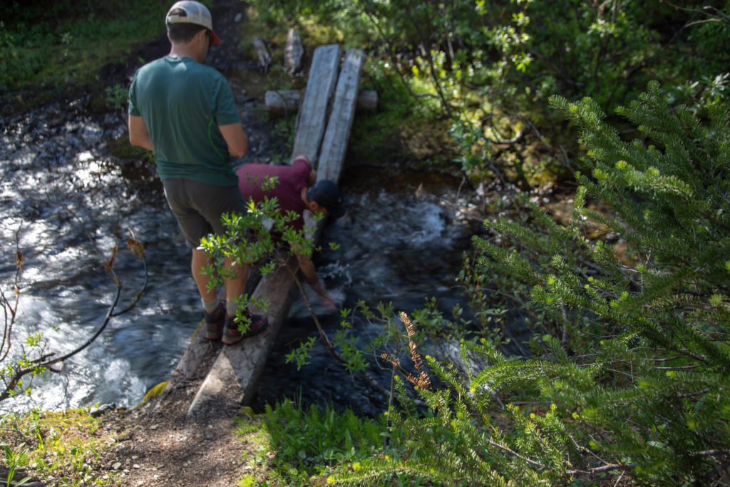
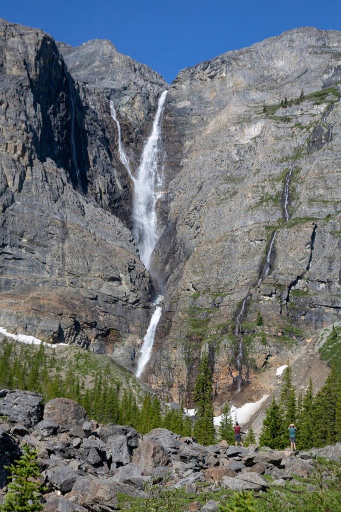
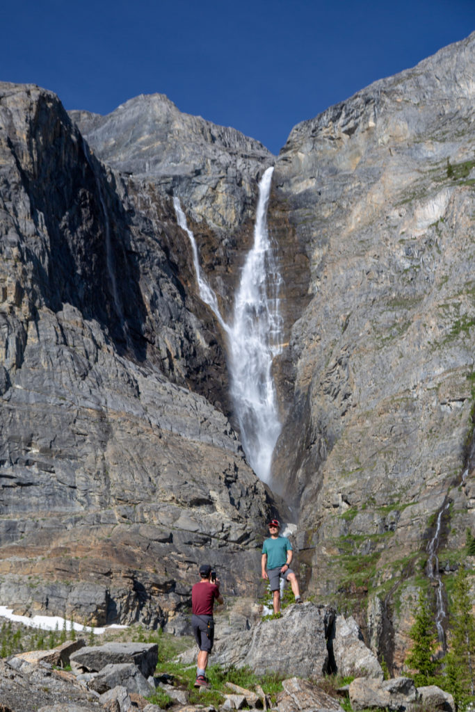
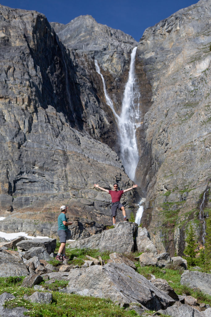
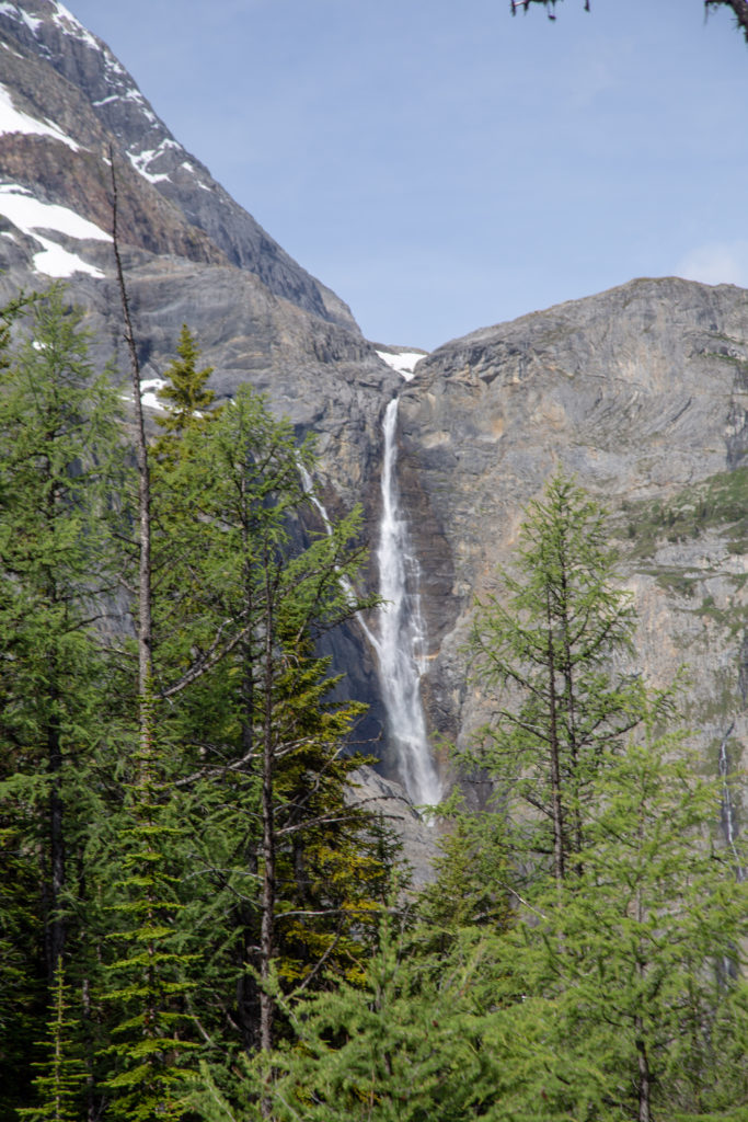
I arrived back at camp at 8 am an hour after I had first set out to find Niel and Ken just making their breakfast. It was only a 12 km day so there was no rush. We headed out of camp at 9 and the first stop was a detour back to Helmet Falls. Ken and Neil dropped their packs by the broken bridge and headed for a closer look at the falls.

Leaving camp. Can see the moon over Helmet Falls. The snow covered peaks of Helmet Mt (3142 m) part of the Washmawapta Icefield is the source of water for the falls.
Filling up with water. Neil and Ken are 1 L water bottle type of hikers. I carry a water bladder.

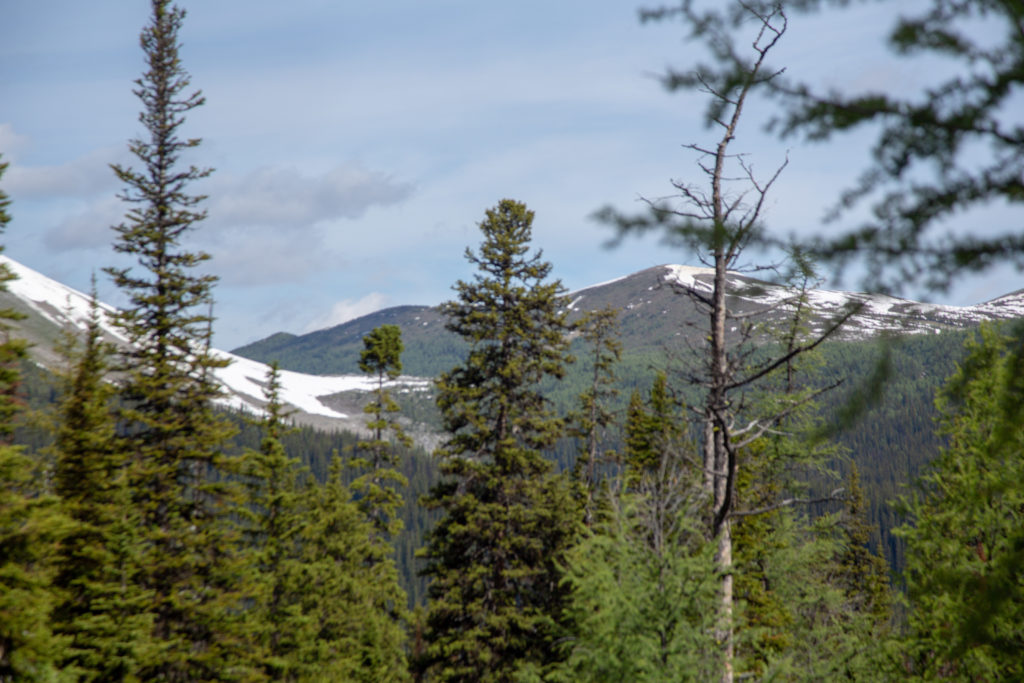
The side trip to Helmet Falls took about 30 minutes. With the sun high in the sky there was no rainbow effect but the sight of the water tumbling for over 350 m (1000ft) is a awe inspiriting and an excellent example of the wonders of the natural world and one of the reasons I go hiking.

People to give a scale as to the size of the falls.
Neil getting his obligatory photos with the falls.
Ken looking somewhat pleased.

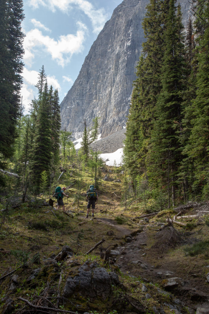
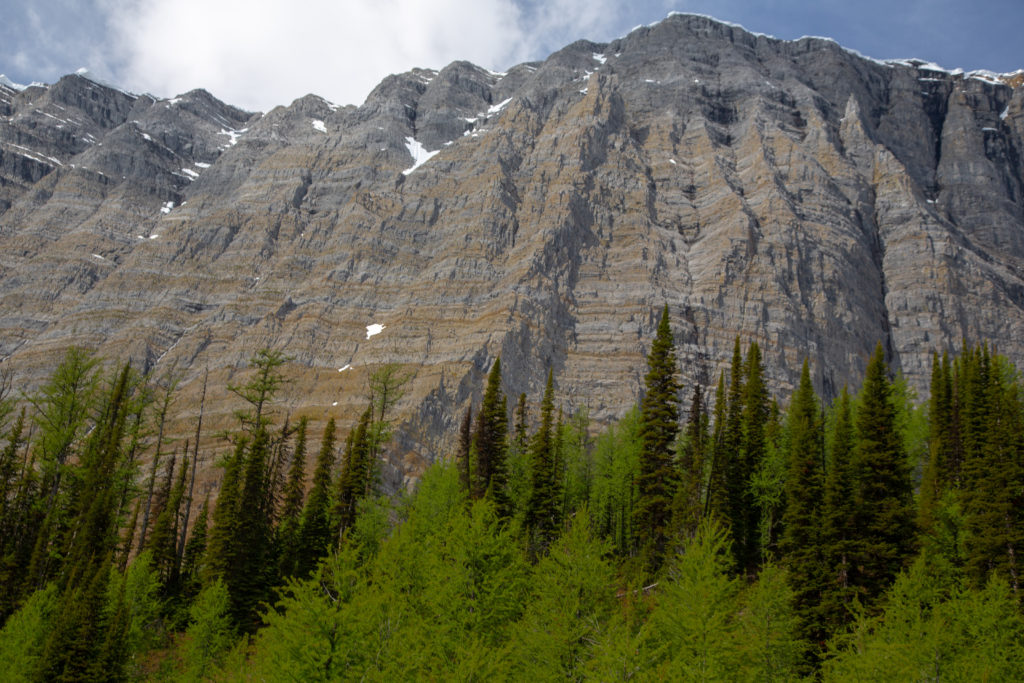
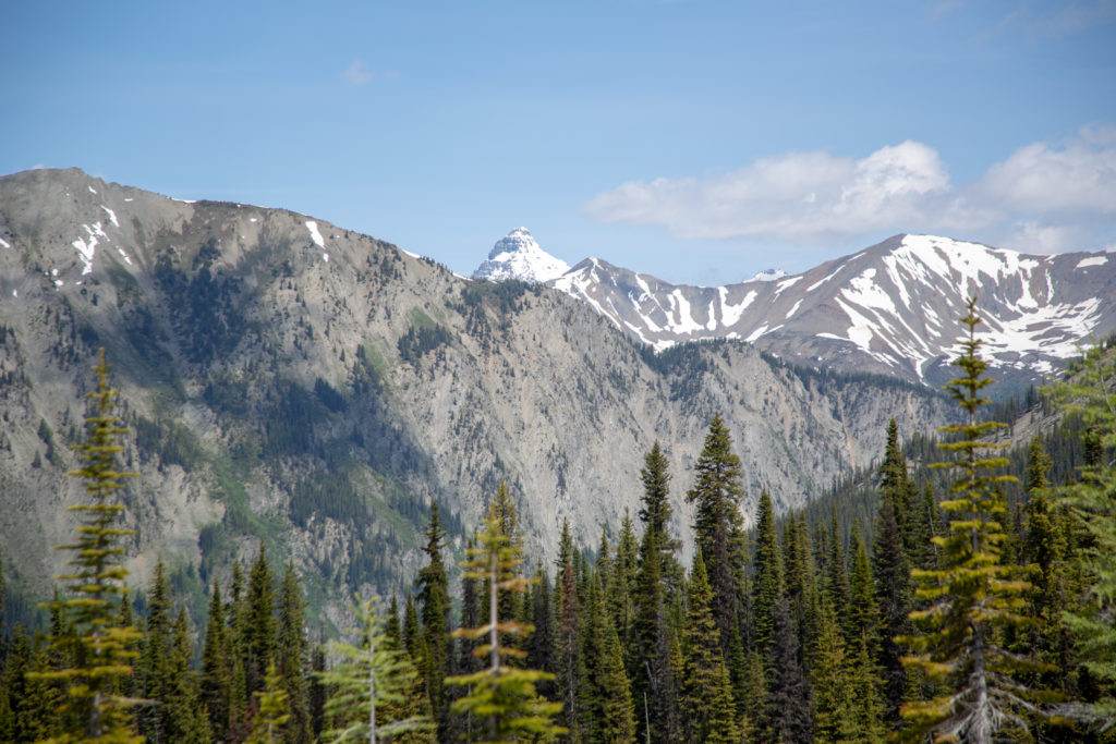
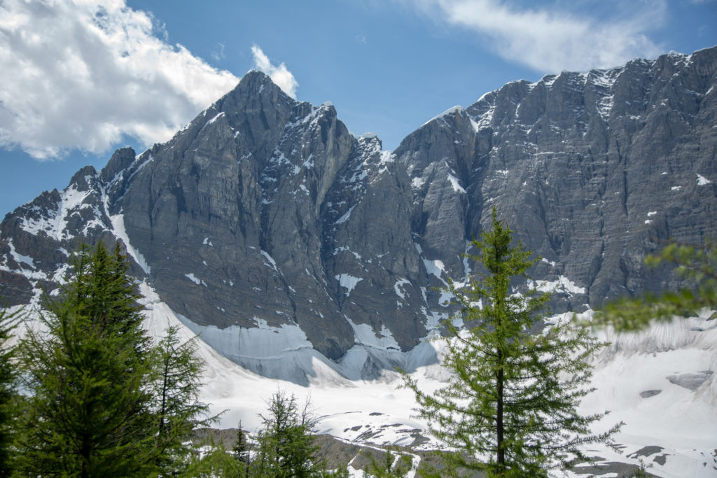
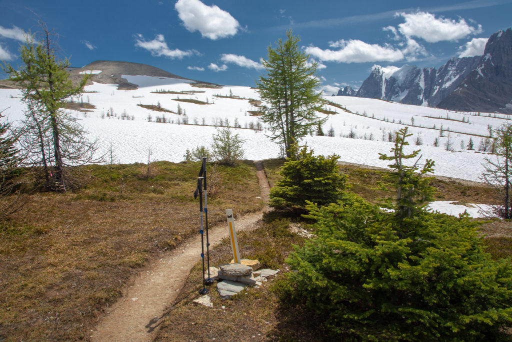
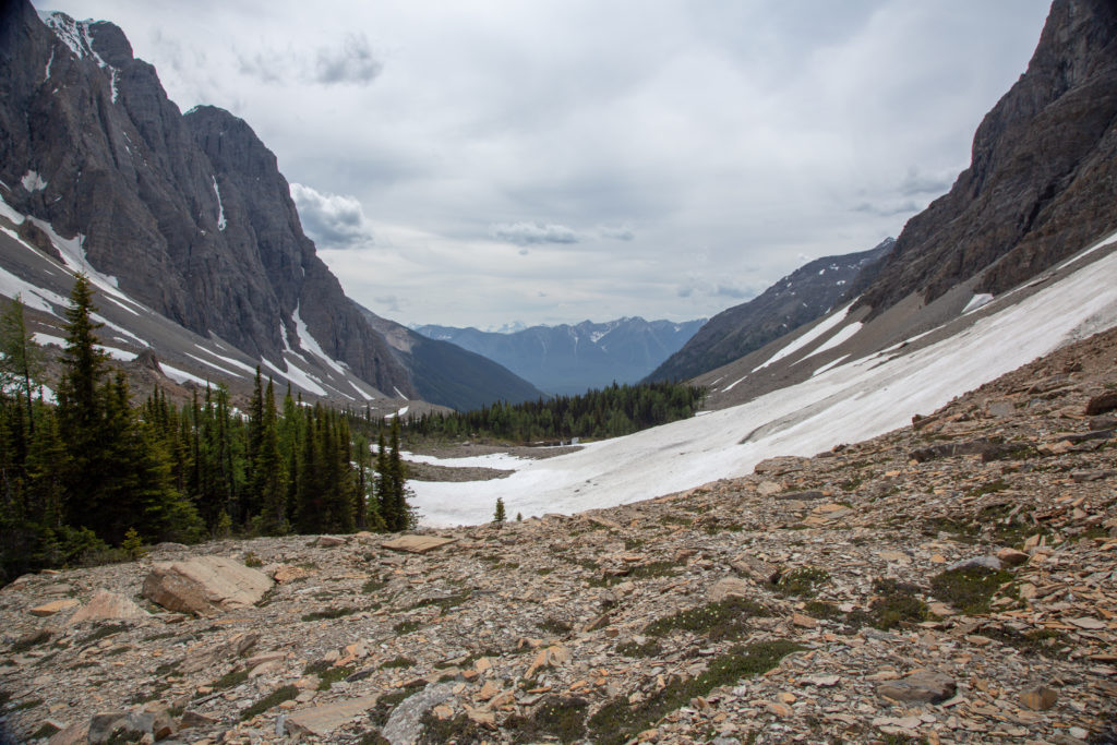
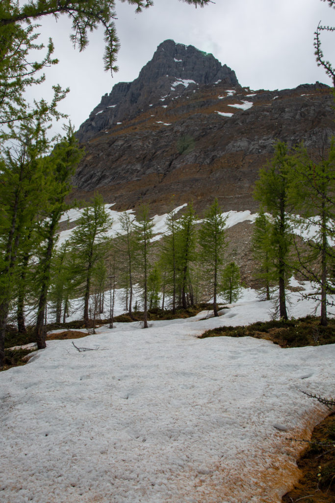
We headed back to pick up the packs and to begin the hike to Tumbling Creek CG. The day would involve hiking over two passes and crossing a snow field. The first pass is a 4 m hike up 405 m of elevation to Limestone Summit. The view from Limestone Summit provides an excellent view of the Rockwall. A quick 300 m descent is then followed by a 376 m climb over 4 km will bring us to Rockwall Pass before we finish the hike by dropping 360 m to Tumbling Creek CG.

Off we go Neil leading the way, 9:40 am.

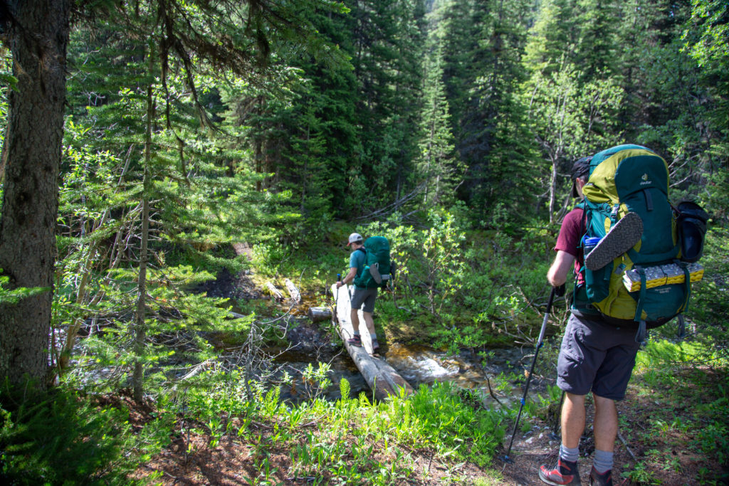
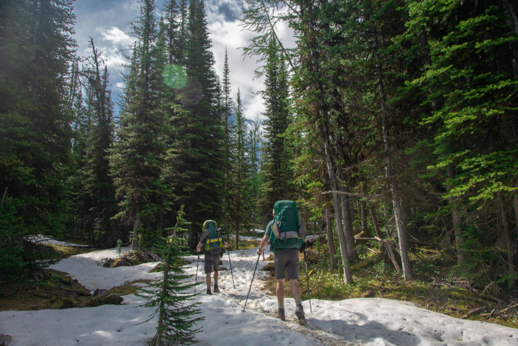
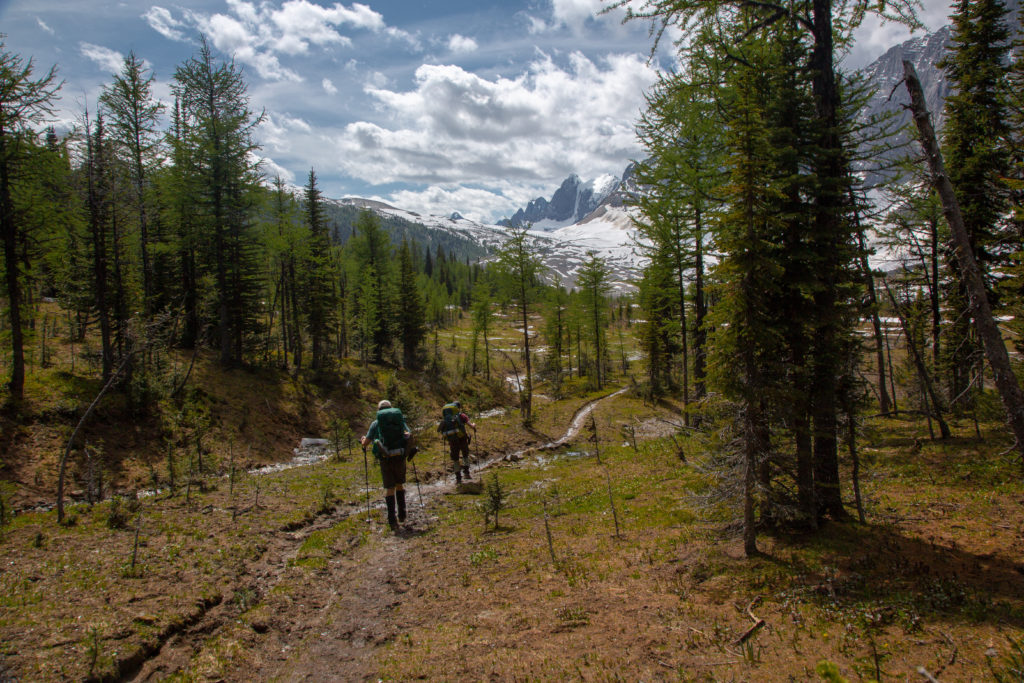
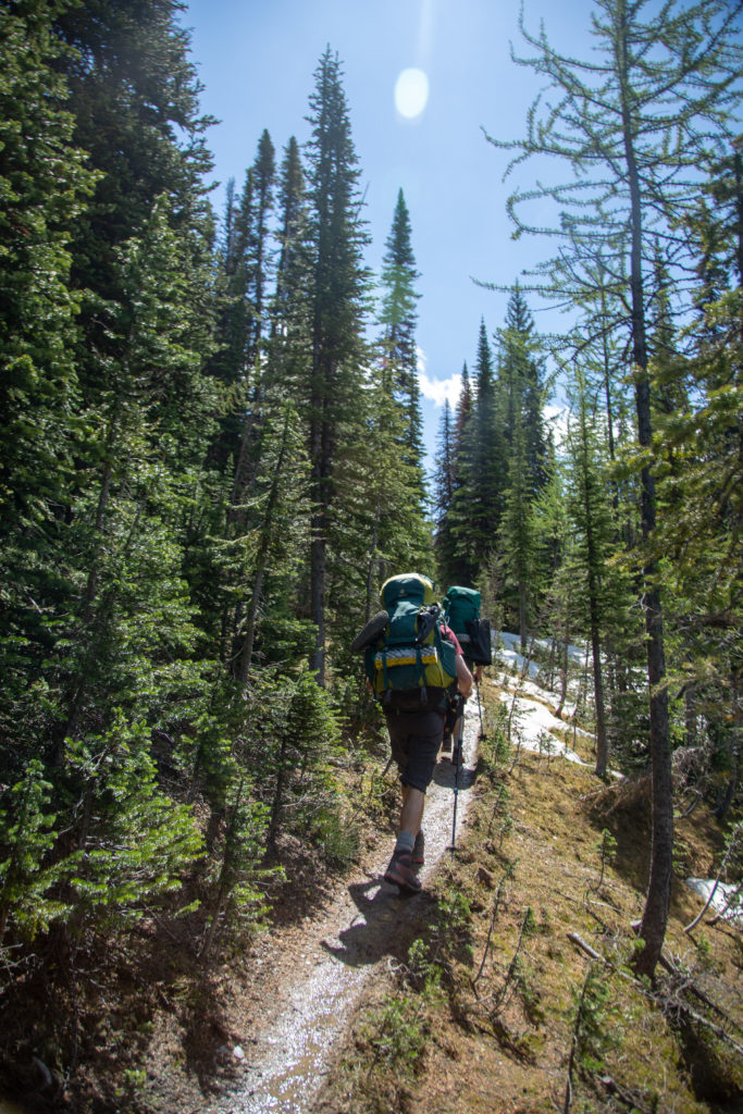
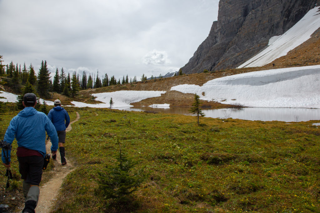
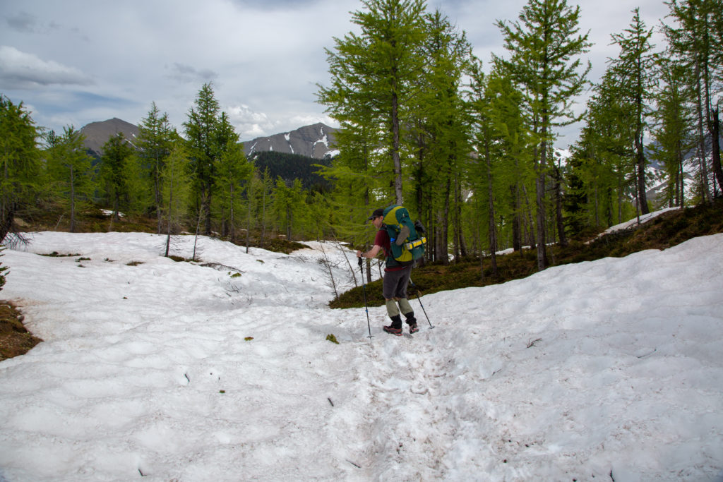
Soon after the little stream crossing the trail headed uphill through a series of switchbacks. The gradient of the trail was never too steep as we steadily gained elevation. Neil took up position at the head of the group where he would spend the majority of the trip. I acted as the caboose so I guess that makes Ken the coal car!

Trail cuts up through old growth. Was steep so glad for the switchbacks.
An extreme close up. Yellow Columbine.
Always make time to check out the flowers. White globeflower.

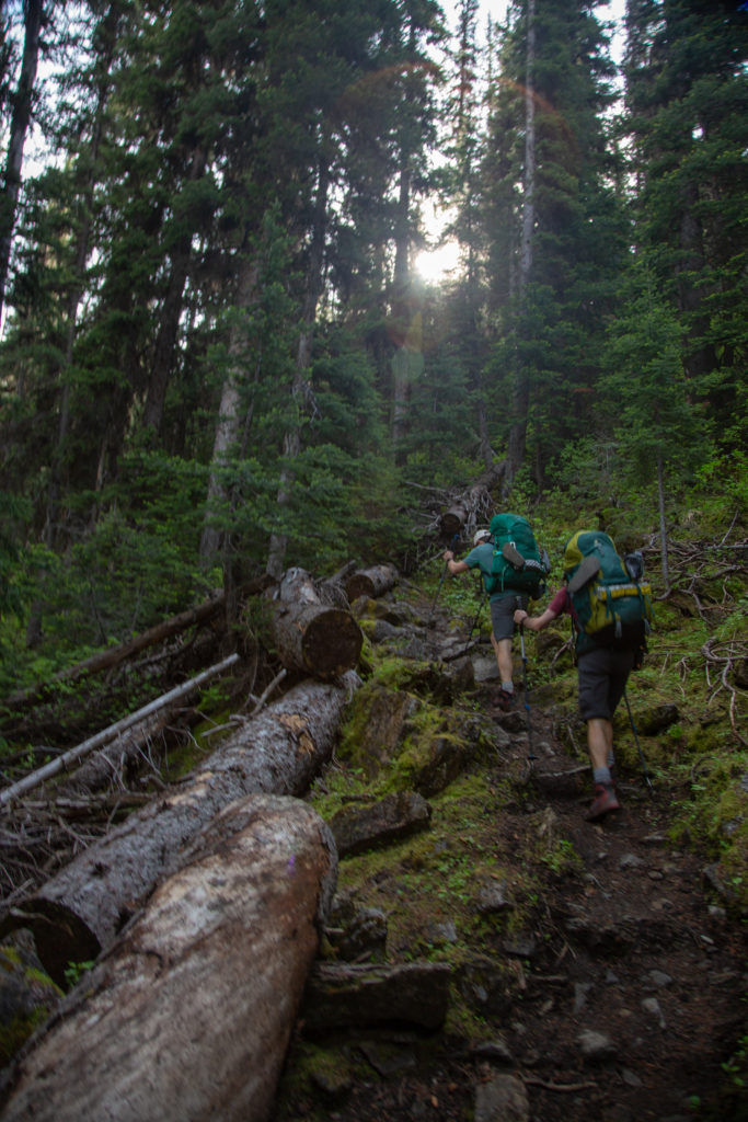
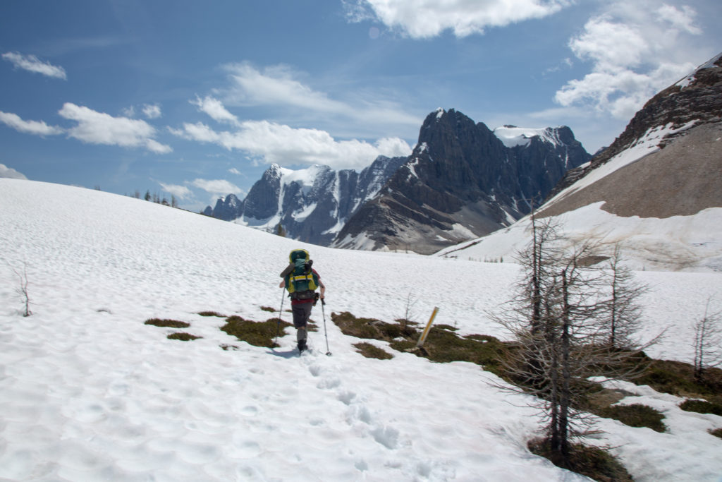
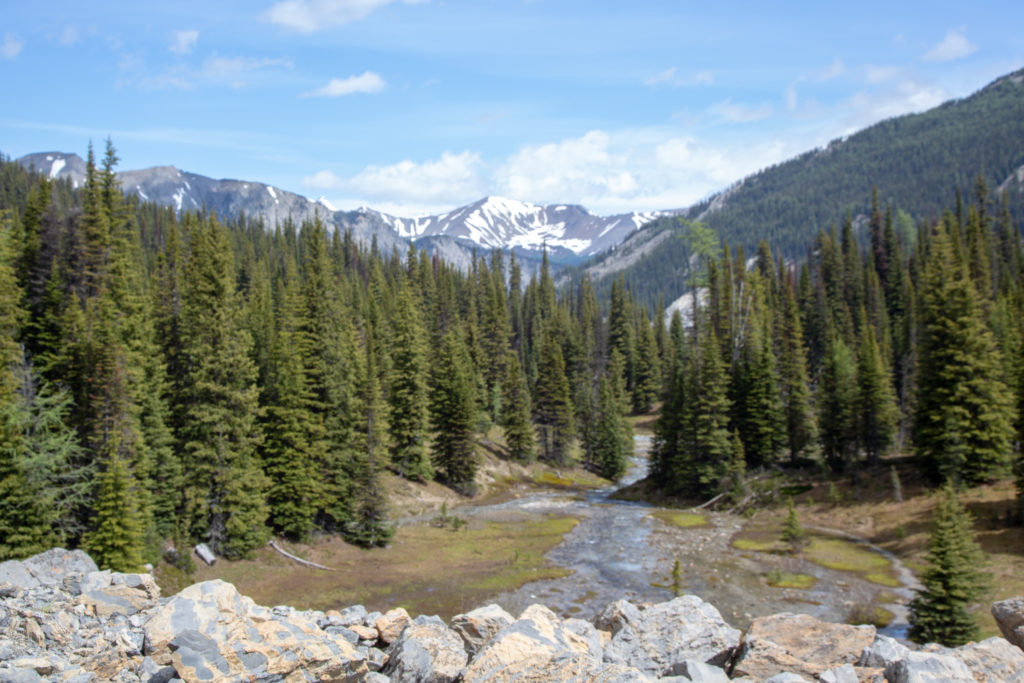
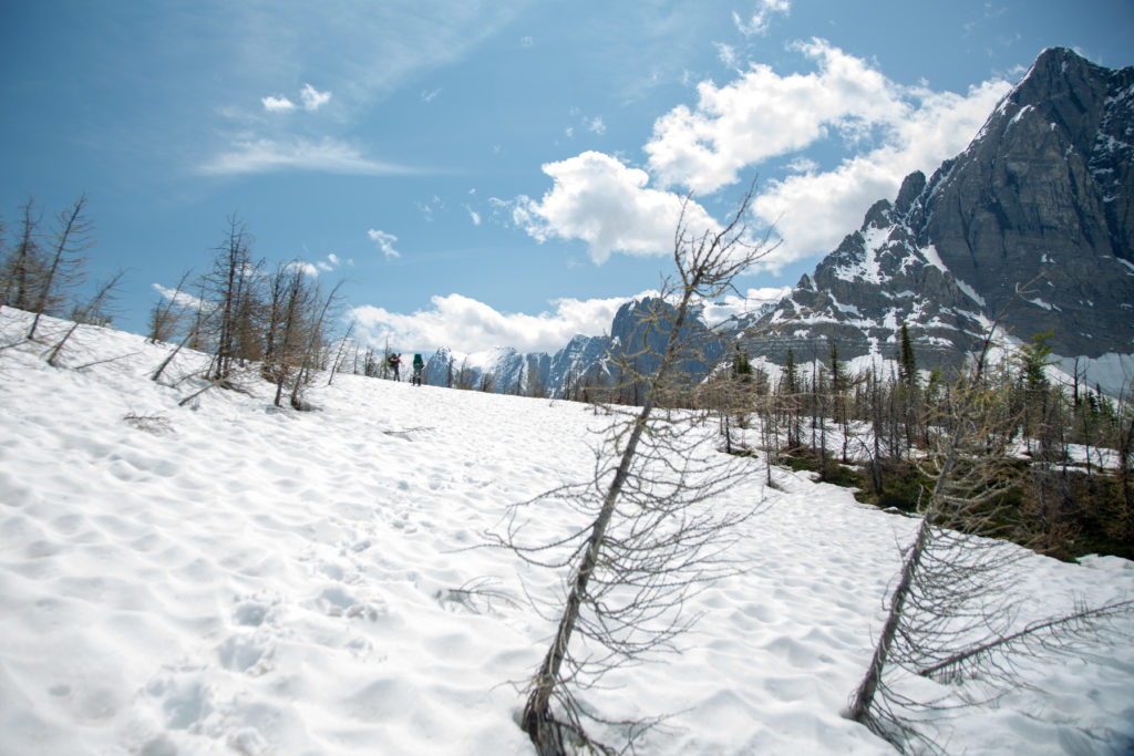
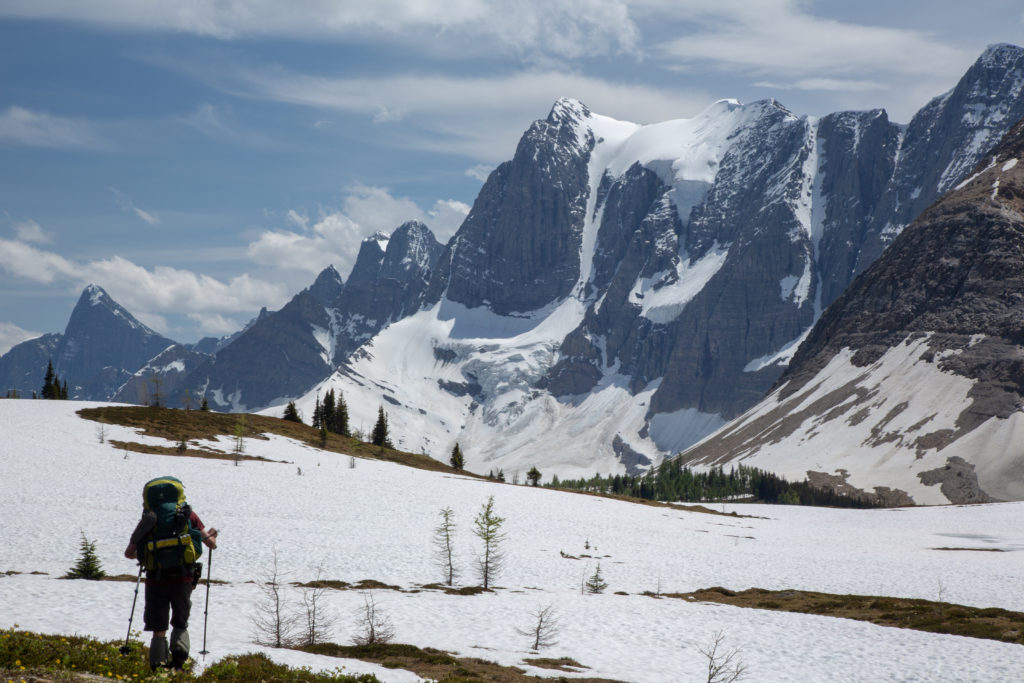
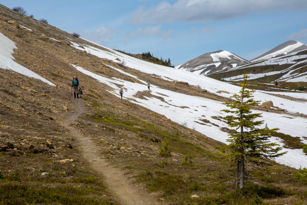
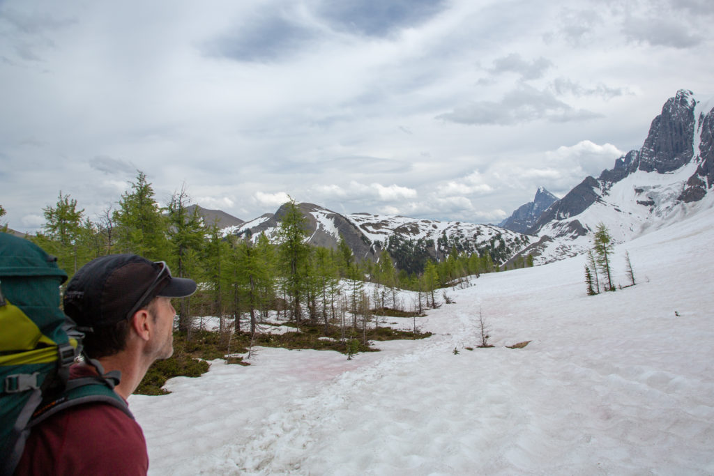
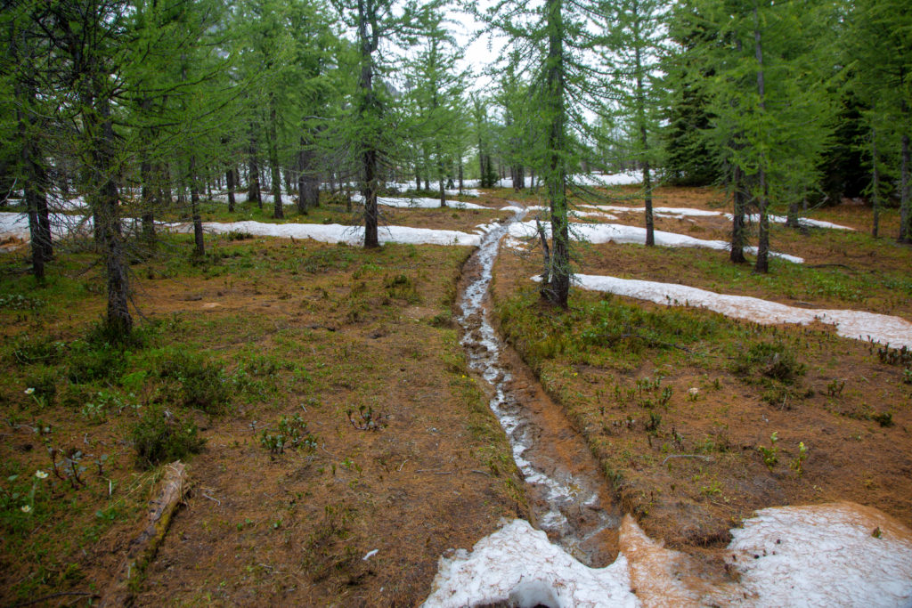
We came to an open areas on the side of short hill and had our last look at Helmet Falls. The trail then plunged into the forest to take us around the end of Limestone Peak. There was some snow on the trail and plenty of muddy sections along the trail. We stopped for a break after 1 hr 15 min having covered 3.1 km.

Last look at Helmet Falls.
Coming around the end of Limestone Peak.
Goodsir Pass. I will be hiking over that in about 5 weeks.
Working through some snow!
Hard to remember that this is July 11th with all the snow.

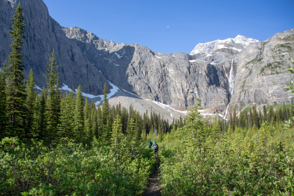
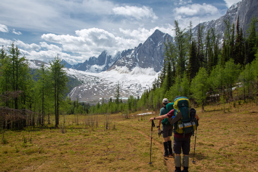
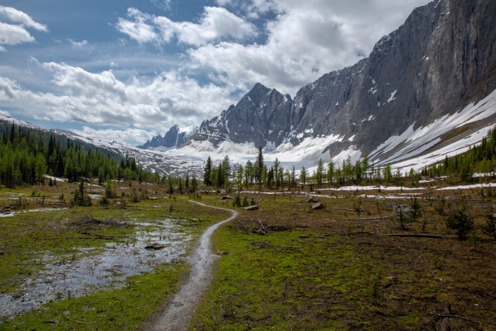
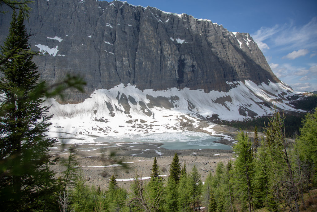
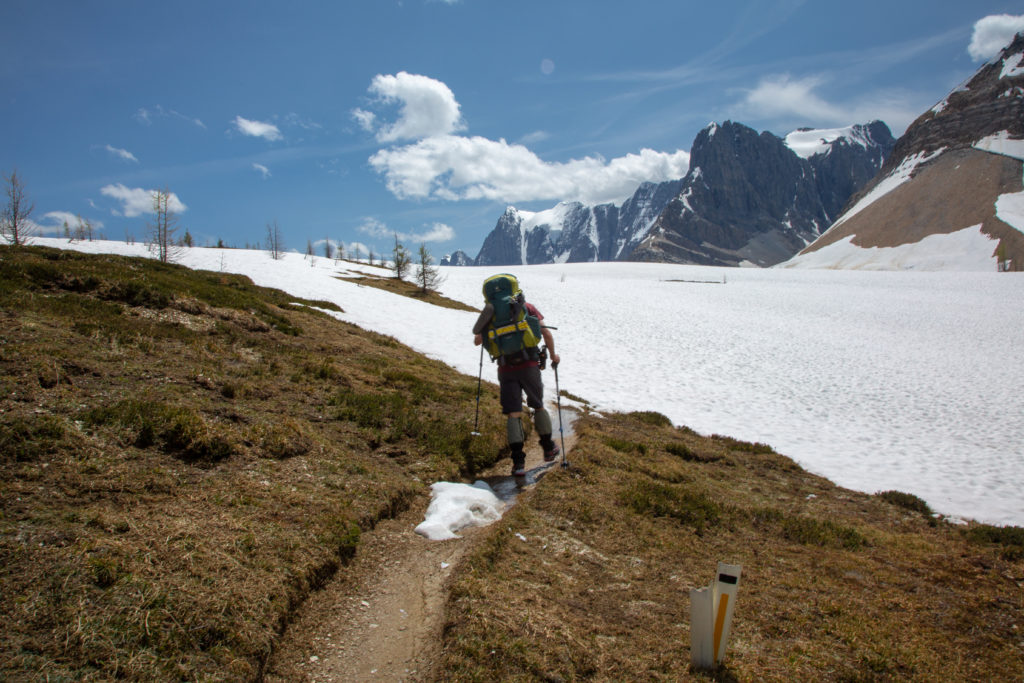
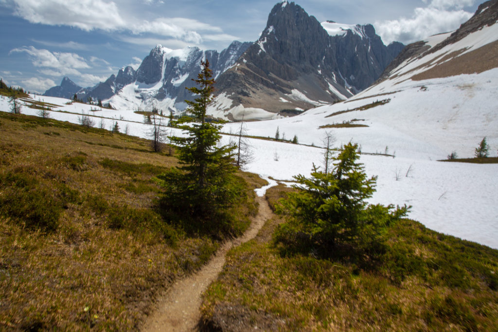
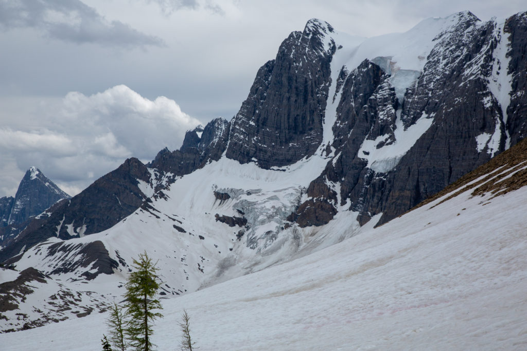
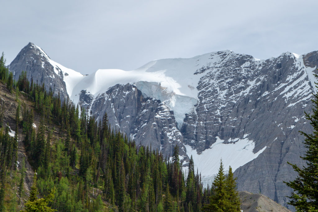
We came out of the woods onto a fairly flat stretch of trail and made a quick right hand turn onto a grassy meadow and the Rockwall came into full view all the way to Wolverine Pass!

View from Limestone Summit. Snow covered Rockwall Pass in the distance. The peak in the trees is Mt Drysdale (2932 m), the peak at centre is Tumbling Peak (3121 m) in the far distance is Mt Foster (3204 m) which overlooks Floe Lake. A straight line distance of 16 km.

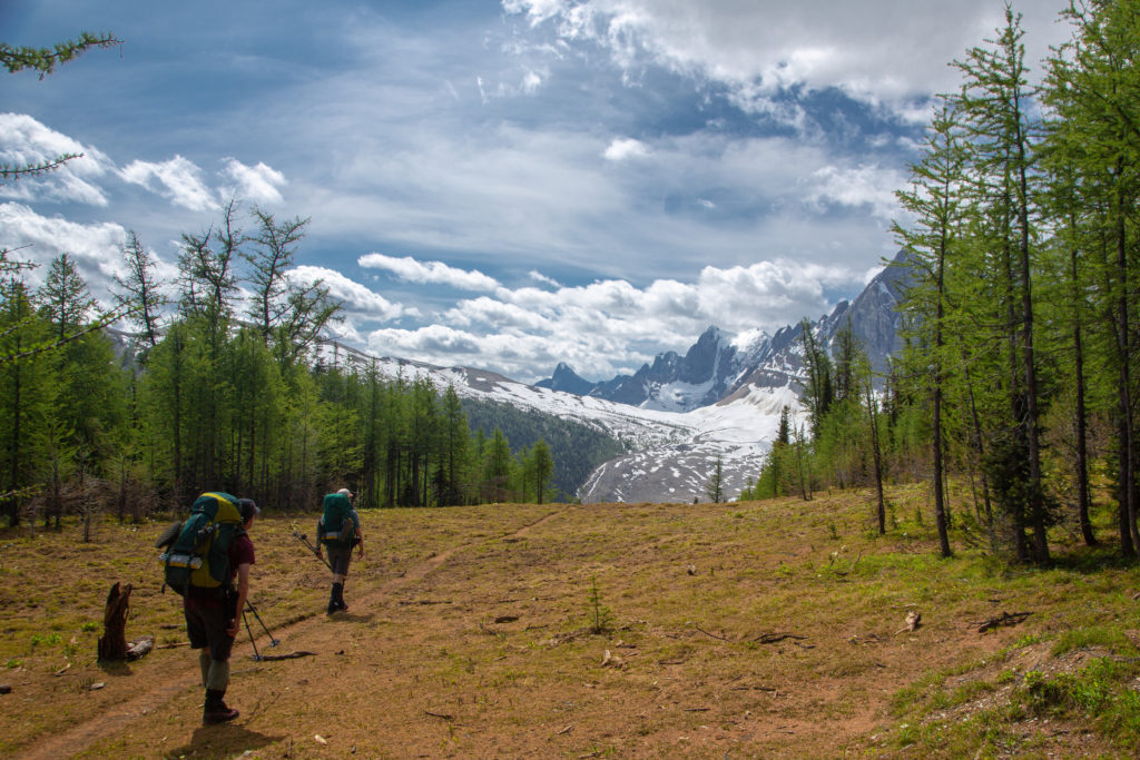
The view from the grassy meadow of Limestone Summit was so stunning it took us 5 minutes to walk just 130 m. We stopped looked at the view, took photos, and just tried to absorb the scenery that we had traveled to see. The young ladies from last night arrived just as we were starting to head off. The “oohs” and “ahhs” and exclamations of awe must have mimicked what we had sounded like.

Just standing and looking at the view. A worthwhile way to spend a few minutes.
Flowers working hard in what is spring in the sub alpine. White Globeflower.
Brotherly advice on how best to frame the photo.

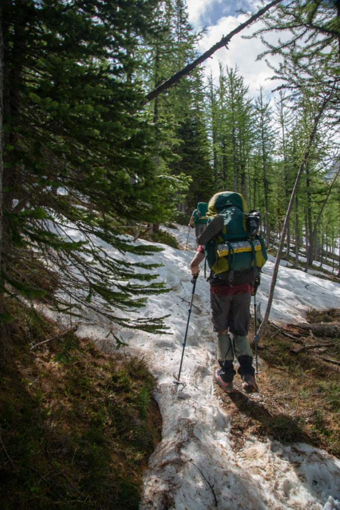
We quickly lost all the elevation we had gained dropping 220 m in 1.5 km. The ground was very wet at the low point and you could just imagine how wet this must have been only a week or so ago as the last of the snow melted. For the most part the trail was dry was still some wet sections that kept us paying attention to where we put our feet.

I am intrigued by the brown bands of rock in the cliffs below Limestone Peak.
Following the trail down. Was pretty hard to get lost.
Despite the moisture not a lot of trees at the bottom. Can see the land rising to Rockwall Pass in the distance. Trail is a little soggy.
Pano of the Rockwall.
A minor stream crossing. Through the trees you can see that we will begin to go back up shortly.

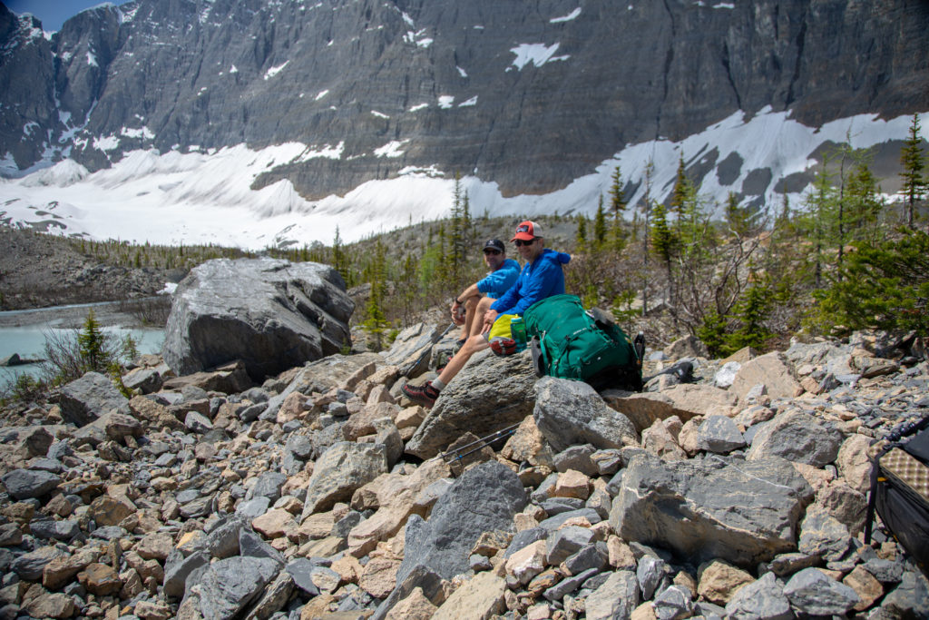
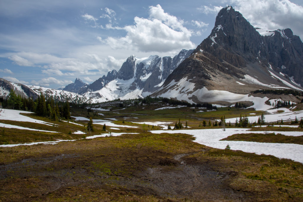
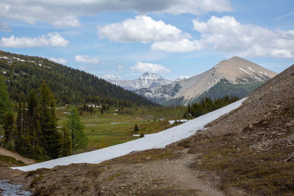
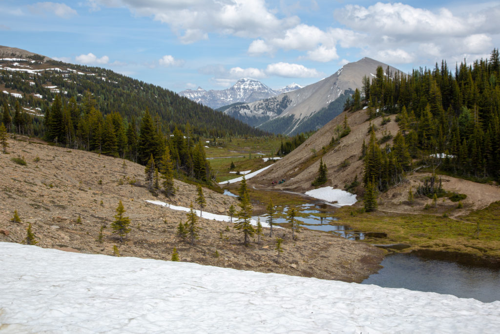
As we started heading uphill towards Rockwall pass we decided it would be good time to stop for lunch. We setttled on a nice little turquoise pond with a view south to Rockwall Pass.

More colourful flowers.
Looking at the drainage flowing from Rockwall Pass. The water will flow into Helmet Creek. You could follow the creek all the way to the trail from yesterday. The mountains in the distance are at the back of Lake Louise.
Lunchtime!

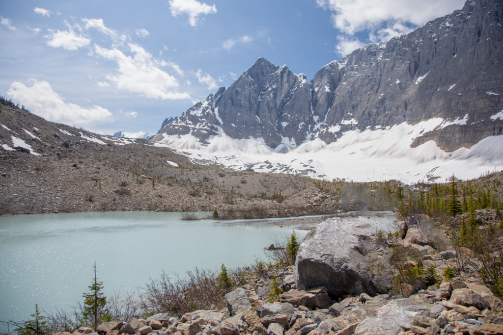
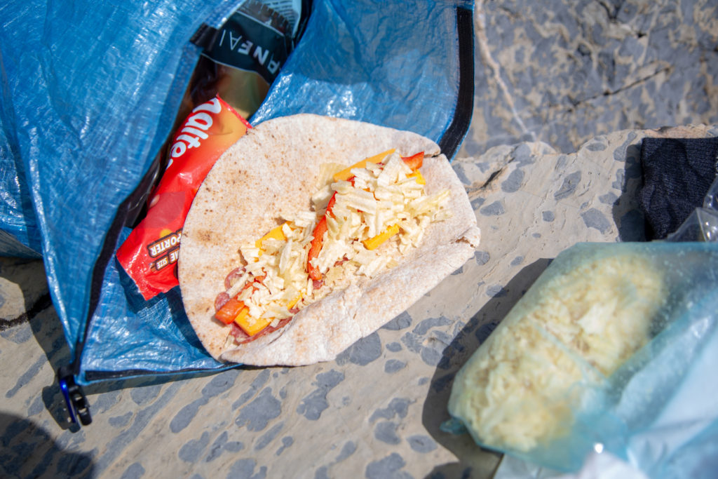
We relaxed by the pond while eating our lunch for about 35 minutes. Across the pond a couple of hikers took advantage of a large rock and stretched out to relax in the sun. My lunch was my typical hiking lunch. Whole wheat wraps with pepperoni and crushed potato chips. Since this was a short trip I had the luxury of fresh red peppers to add some sweetness to the meal. I finished off the lunch with a little bit of chocolate.

Lunch. I ate two wraps. Maltesers are a favourite treat on the trail.
Neil and Ken relaxing before we tackle the next pass.
Looking almost due north. The tall peak is Deltaform Mt (3424 m or 11234 ft). Deltaform Mt is at the back or Moraine Lake in the Lake Louise area and is only 120 m shorter than Mt Temple.

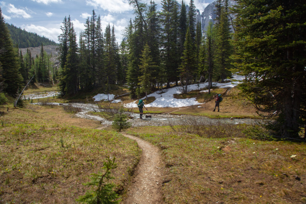
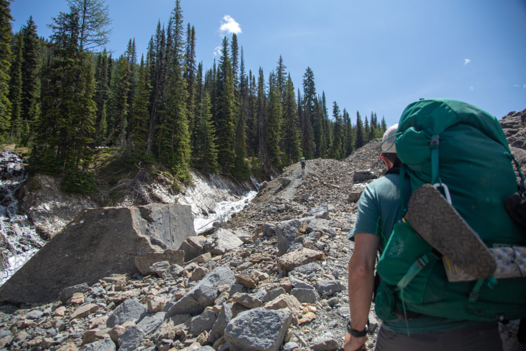
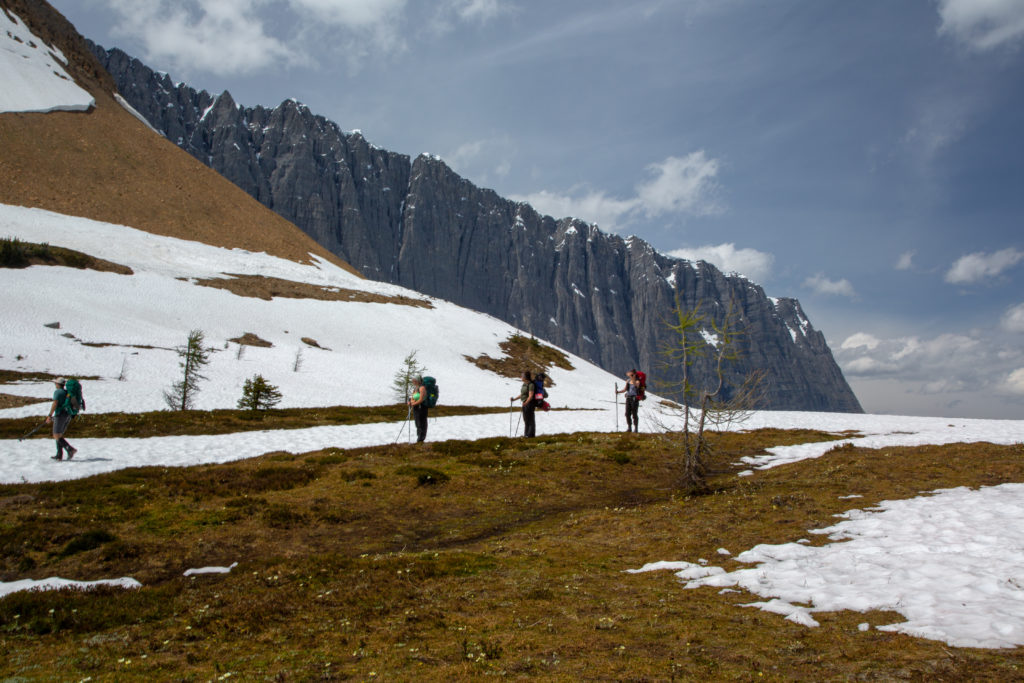
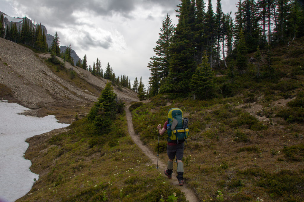
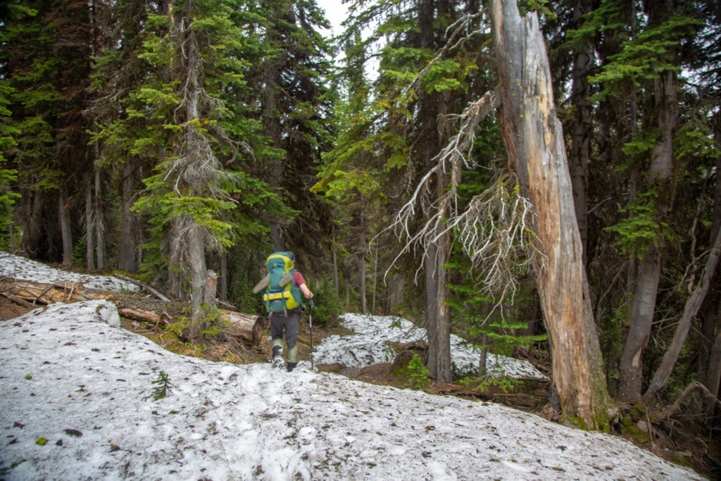
We packed up and headed off after a good break. Ken stopped to fill up his water in a stream that drained the snowfields on Rockwall Pass as the pond we had lunch at was quite silty. We crossed a small bridge over the stream and headed into a lightly forested hillside where we would spend the next 35 minutes gaining most of the elevation to Rockwall Pass. The forest ended abruptly at a small drainage presenting before us the remnants of the winter’s snowfield. Crossing the snowfield would take us up and over Rockwall Pass and lead us to Wolverine Pass. Wolverine Pass is not strictly on the Rockwall Trail. It is pass though the Rockwall heading to the wes, the only break along the length of the Rockwall.

Ken already heading up the hill. Neil has lot of danglies on his backpack.
Artistic attempt at a side stream.
Trail is steep but mostly clear of snow.
A small pond forming at a terminal moraine. We ate just below the moraine.
Mt Drysdale (2932 m)

As I looked across the snowfield I was a little surprised that there was no well defined trail through the snow. We stood and watched a couple pass by and head into the snowfield. The veered off to the left which was up the slope. When we walked out onto the snow there were footprints fanning out in all directions it appeared that no one knew where the trail actually went.

Frosty Paws enjoying some snow in July.
The gang. The couple of hikers who passed us. They veered off to the left and up the slope. We stayed to the right on the lower slopes.

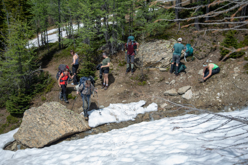
While we were putting out traction aids on the young ladies arrived and prepared to cross the snowfield. They had no GPS devices and had only the PDF camping map of Kootenay NP to us as a map. As we crossed the snowfield they trailed behind but never let us get too far ahead. It was quiet apparent they were utilizing us as their guides.

Neil leading Ken across the snowfield.

After a bit of debating about the route I pulled out my tablet and pulled up my Viewranger App that I had running. I used the tablet to guide us as we went across the snowfield to stay on the trail. I was vindicated by the app when we came to a dry patch of ground and found we were right on the trail. Ken uses a different app and followed his with equal success.

Ken and Neil discussing the route.
Right on the trial. The white/yellow plastic stakes marked the trail. Not sure why they are used as any amount of snow would bury them.
Trail and trail marker has on on course as Ken heads back into the snow.
Neil making his way across the snow.
Snow, ice and towering walls of limestone highlight the Rockwall in July.
Wolverine Pass at centre right with the towering peak of Mount Grey (3000 m) to the south.

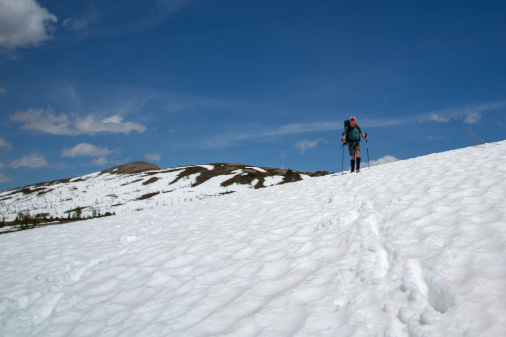
It took us about 50 minutes to cross the 2.0 km of the snowfield. As we passed under the slopes of Mt Drysdale heading to the junction with Wolverine Pass Neil had us go one at a time as there was a small risk of avalanche from the slope.

We have finished crossing the snowfield. Just a few isolated patches of snow left.
The gang has gotten a little bigger.
Back onto hard trail, but only temporarily.
Ken leading the way to Wolverine Pass.
The view north east from the entrance to Wolverine Pass. Stanley Peak (3155 m) in the distance at centre.
Wolverine Pass is right at that ridge.

Our group had become 6 with the ladies joining up when we had finished crossing the snowfield. The group decided to spend a few minutes checking out the view from Wolverine Pass. Neil drawing on his experience as a former guide takes every opportunity to either sit down and relax or remove his pack. Before heading over to Wolverine Pass Neil took off his pack and everyone followed suit except me. I considered this hike as training for my Great Divide Trail hike later in the summer so I kept my pack on.

Off to check out Wolverine Pass. No packs but Ken has his bear spray.
Looking over Wolverine Pass.
Looking back can just make out the backpacks at centre on the green slope.

I was pretty unimpressed with Wolverine Pass. The view on the other side was a long uninspiring valley topped by an angry sky. Looking back to the east where we had come from there were blue skies, snowy peaks and a sub alpine vista. What made the side trip to Wolverine Pass memorable was the three hikers we met. The trio had come up from the other side and were enjoying a beer while they got ready to head back and were quite talkative. One of the hikers had a tattoo of Marvin the Paranoid Android from Hitchhiker’s Guide to the Galaxy. The guy was super cool and even let me take a photograph of Marvin. Anyone with a Marvin tattoo is someone worth getting to know.

Marvin the Paranoid Android

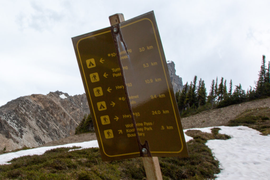
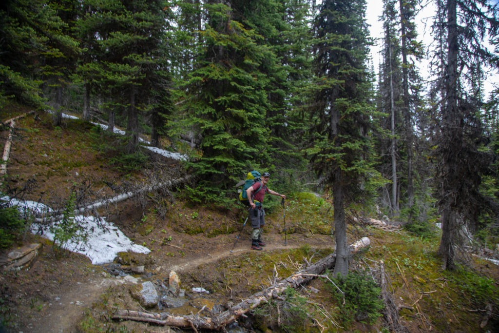
We said goodby to Marvin and headed back to retrieve the packs and make our way to Tumbling Creek CG. The side trip to Wolverine Pass too a little under 30 minutes. We passed a beat up Parks Canada sign that said 3.0 km to the campground and 10.9 km to Hwy 93. My Viewranger App had the distance to the campground as 3.5 km with a further 11.1 km to the Parking lot at the Paint Pots. I think the sign needs to be updated. It would take us 1hr 12 min to get to Tumbling Creek CG dropping a stiff 292 m in the process.

A sign in need of updating and repair.

We followed the trail south from Wolverine Pass. We had to cross a small snowfield Neil and Ken lead the way. Part way along my left foot slipped and I came down and pressed my right foot right up to my bum. Due to deterioration of my right knee under normal circumstances I cannot get my foot to withing 20 cm of my bum, so slamming all the way down created an intense shot of pain through my knee. As I sat in the snow I was quite worried that I may have done something serious to my knee. Getting up gingerly with the help of my poles I was quite relieved after a few steps nothing seemed to be amiss.

Ken taking in the view before heading off across the snow.
Tumbling Glacier.

We were presented with a couple of well defined trails through the snow. We picked the trail to the left which was lower down the slope. The trail took us to a drainage that appeared to head towards the valley where the campground would be. Quickly the trail became less defined and we got a bit uneasy about our choice. After about 5 minutes I checked my Viewranger and we were not on the main trail! The trail we should have chosen was the one on the right that stayed a little higher. We just cut straight up the hill out of the drainage and quickly located the main trial.

Ken heading left to the lower trail.
Just had to make our way up this small rise to the correct trail.

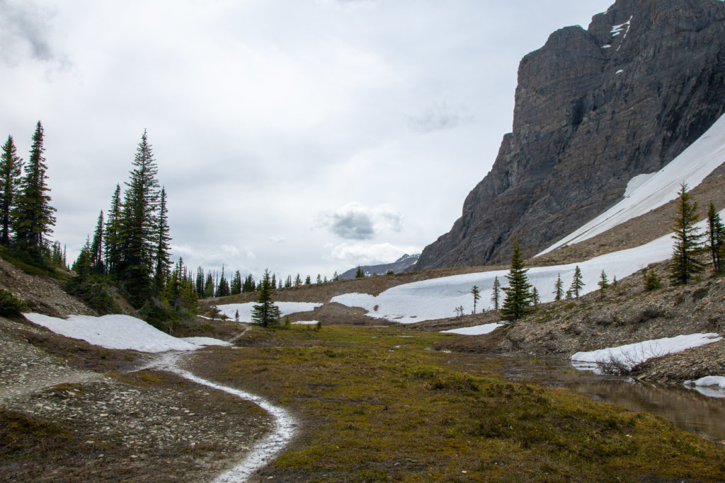
The rest of the hike to the campground was pretty uneventful. It was surprising how long the snow lasted on the trail. I kept thinking that we had crossed the last little snow patch when another one would appear. The trail was only snow free for the last 1.5 km. The drop into the campground was short but steep. I kept thinking about how I would have to hike up this in 5 weeks.

Trail is a little sloppy.
More snow crossings.
Ken looking pleased, is this the end of the snow?
Tumbling Pass.
Dry trail.

Just mere metres before arriving at the campground we had one more obstacle to cross. A small stream was covered in snow and since we could hear the water running under the snow the concern with the crossing was falling through a snow bridge into the water. I am a little surprised I do not have any photos but a snap shot of the Viewranger tracking shows our wandering around and how far out of our way we went to find what appeared to be a safe crossing. It was a successful crossing and no one got wet.

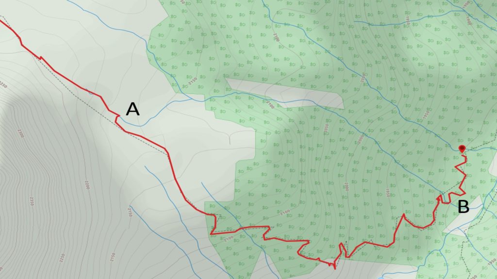
The above screen shot from my Viewranger had some interesting information. At point “A” is where we cut up from the lower drainage back to the trail. It looks like had we stayed in the drainage we would have ended up following a small stream ending up at “B”. We have no idea what obstacles we would have had to negotiate so it was a good choice to get back to the main trail. Point “B” is where we had difficulty crossing the snow. We went a fair way out of our way to cross the little creek.

We arrived at the campground and chose some campsites near the bottom. The time was 4:38 pm it had taken us a comfortable 7hrs 10 min to hike from Helmet Falls CG. Had the tent set up and clothes drying by 5:15 pm.

Tent set up. Neil and Ken are in the behemoth tent just above. I would take their spot when I came back on the GDT hike. The trail to the right leads to a little stream.
Cooling a well earned beverage.

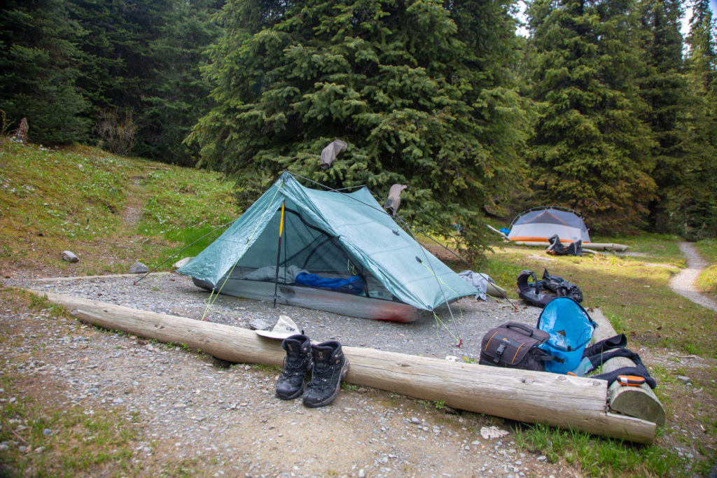
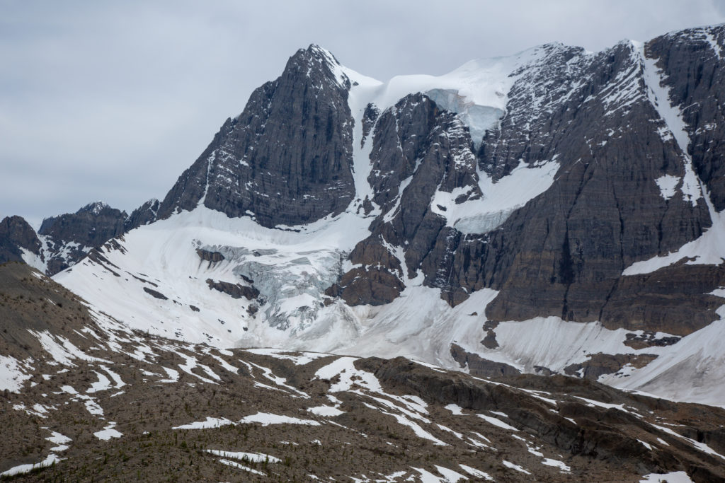
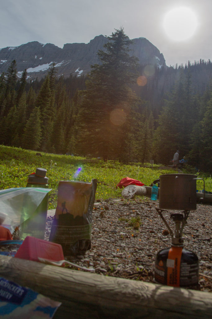
Got around to cooking dinner at 6:15 pm. It was quite a party atmosphere with our group of six. The dining area was in a beautiful meadow with a glorious view of the Rockwall and the Tumbling Glacier. At one point Neil was waxing poetically about the virtue of stiff hiking boots. The ladies being new to hiking where keen on learning insights about backpacking. I completely disagree with Neil. I am prefer hiking shoes and have carried loads over 70 lbs comfortably. I did have boots on this trip as Ken had recommended boots for the snow crossings but I would have just as happy in shoes and gators. I chose not say anything as I was happy to sit an observe the flow of the conversation without really partaking in it.

My little kitchen.
The evening light on Tumbling Peak and Tumbling Glacier.

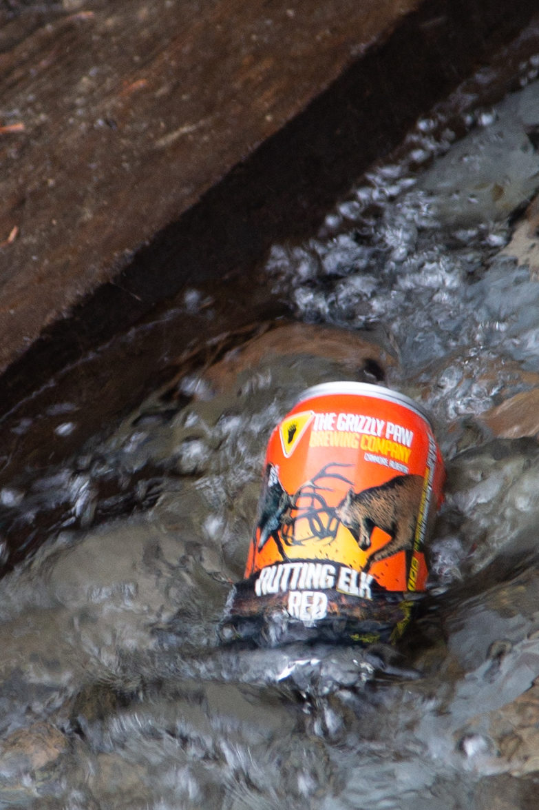
During dinner I had my beer and of course drank some more wine. Ken tried to share his whisky with the group but did not get many takers. Think it is because it is more an “Old Guy” drink. Headed to bed just after 8 pm. I was living large in my Zpack Duplex 2 person tent. Going solo it gave me a ton of space. I read for a little while but I am never very successful reading in a tent and was quickly turning out the lights on a fantastic day on the Rockwall.

Rockwall North Day 3 – To Paint Pots

Rockwall North Home

bootwreckers

New trip posted, three day trip in the Rockwall in New trip posted, three day trip in the Rockwall in Kootenay NP with @sio.mellors. Introduction and Day 1 up on Bootwreckers.

Trip was suppose to be hiking Northover Ridge in Kanananaskis but smoke had us change plans at the last minute.

This would be my third multi day trip on the Rockwall but the first for Siobhan.

Managed to get two camping sites on the Rockwall and instead of smoke we had to deal with the threat of rain.

We did get wet but we had a blast.

Day 1 is from Paint Pots TH to Helmet Falls CG, with a side trip to get up close the the falls. Pretty straightforward day but visiting Helmet Falls is always special.

#parkscanada #parks #bcparks #trails #longdistancehike #longtrail #outdoors #outside #thruhike #hike #thruhiking #outside #backpacking #waterfalls #waterfall #naturephotography #naturephotography #nationalparks
The sixth and final day of our 2022 GDT Section D The sixth and final day of our 2022 GDT Section D hike is up on Bootwreckers, see link in bio.

This day took us from a random camp on the Howse Floodplain to the Mustafa Canyon parking lot. This was an adventurous day with bushwhacking, stream crossings and dead fall but a simply glorious end to a wonderful hike on the GDT. 

Again thanks  to Sara (@sd_kuz) and Lillian (@waterlilizee) for sharing this adventure with me. I am sure we will meet again on a trail someday.

Photo 1 - Morning Colors

Photo 2 - tents on the floodplain

Photo 3 - bushwhacking to start the day

Photo 4 - fields of flowers going to seed

Photo 5 - looking south down the Howse River

Photo 6 - thigh deep water crossing

Photo 7 - big views

Photo 8 - Sara crossing some dead fall

Photo 9 -Mistaya Canyon

Photo 10 - picked up a thru hiker named Roy, enjoying beverages left by Natasha and Kyle from Backpacks and Bikeracks

#greatdivide #greatdividetrail #gdt #parkscanada #parks #bcparks #trails #longdistancehike #longtrail #outdoors #outside #thruhike #hike #thruhiking #outside #backpacking #waterfalls #waterfall #naturephotography #naturephotography #nationalparks #duplex #sectionhike #sectionhiker
Day 5 of our 2022 Great Divide Trail Section D hik Day 5 of our 2022 Great Divide Trail Section D hike is posted on Bootwreckers, see link in bio.

Truly epic day on the trail. Pass through the debris of two avalanches, had lunch by a waterfall, crawled over so much dead fall and hiked on the Howse Flood Plain.

The sunset on the flood plain was one of most magical I have seen.

As always a big thanks to Sara (@sd_kuz) and Lillian (@waterlilizee) for sharing this adventure with me. The Team totally rocked the trail.

#greatdivide #greatdividetrail #gdt #parkscanada #parks #bcparks #trails #longdistancehike #longtrail #outdoors #outside #thruhike #hike #thruhiking #outside #backpacking #waterfalls #waterfall #naturephotography #naturephotography #nationalparks #duplex #sectionhike #sectionhiker
Evening light on Picketpost Mt. #aztrail #aztasso Evening light on Picketpost Mt.

#aztrail #aztassociation  #nps, #nationalparks, #slotcanyon, #hiking, #hikingadventures, #familytime, #camping, #campingadventures, #outdoors, #outside, #nature,  #FIndyourpark #landscape #landscapephotography #optoutside #nationalpark #desertphotography #grandcanyon #grandcanyonnationalpark #grandcanyonassociation #nationalparkweek #reichallenge #nationalparksweek #rightnow #nationalparktrust #goparks #aztrails
Arizona Trail Passages 14 and 15. Some photos of Arizona Trail Passages 14 and 15.

Some photos of my recent hike down a couple of Passages of the Arizona Trail. 

The trail is so diverse, rolling terrain cut by shallow washes leads to the expanse of the desert then into rugged canyons and tall peaks, all in a space of 92 km (58 miles).

Had a great time, some blisters gave me some concerns but they seem to be doing fine now that they are out of my hiking shoes.

Got lucky with Trail Magic courtesy of Condiments who drove his 4x4 deep into an unarmed wash, was really in the middle of no where, and then again at the start of Passage 15, missed the Trail Angel's name, the wind was so loud.

Like to thank my Trail Angels, Carole for driving me to Oracle to start the trip, with side trip to a Hayden Az, a real ghost town and to Edith for leaving a water cache for me at Passage 15.

Included a video of my time at the high point for Passage 15. My kid likes it when you stop and enjoy the view you earned, thought they would appreciate my effort in the face of 1000 mph winds (ok maybe thats a bit of an exaggeration).

Thanks Arizona and the AZT for providing more memories.

I will be back

#aztrail #aztassociation  #nps, #nationalparks, #slotcanyon, #hiking, #hikingadventures, #familytime, #camping, #campingadventures, #outdoors, #outside, #nature,  #FIndyourpark #landscape #landscapephotography #optoutside #nationalpark #desertphotography #grandcanyon #grandcanyonnationalpark #grandcanyonassociation #nationalparkweek #reichallenge #nationalparksweek #rightnow #nationalparktrust #goparks #aztrails
That sunset says when I wake up it will be time to That sunset says when I wake up it will be time to start my hike on the Arizona Trail, Passages 14 and 15

Love my little motel in Superior, Az, Copper Mt Motel. Has murals painted on all the buildings

Spied the Grand Canyon from the plane 

Adventure awaits 

#aztrail #aztassociation  #nps, #nationalparks, #slotcanyon, #hiking, #hikingadventures, #familytime, #camping, #campingadventures, #outdoors, #outside, #nature,  #FIndyourpark #landscape #landscapephotography #optoutside #nationalpark #desertphotography #grandcanyon #grandcanyonnationalpark #grandcanyonassociation #nationalparkweek #reichallenge #nationalparksweek #rightnow #nationalparktrust #goparks #aztrails
Frosty Paws all packed and ready for an adventure. Frosty Paws all packed and ready for an adventure.

Arizona Trail Passages 14 and 15 starting Sunday

Off weekend gooooooo!

#aztrail #aztassociation  #nps, #nationalparks, #slotcanyon, #hiking, #hikingadventures, #familytime, #camping, #campingadventures, #outdoors, #outside, #nature,  #FIndyourpark #landscape #landscapephotography #optoutside #nationalpark #desertphotography #grandcanyon #grandcanyonnationalpark #grandcanyonassociation #nationalparkweek #reichallenge #nationalparksweek #rightnow #nationalparktrust #goparks #aztrails
Last weekend before heading to Arizona for a four Last weekend before heading to Arizona for a four day adventure on the Arizona Trail.

I wonder if hiking in the 15 cm of fresh snow will be good prepared for hiking the deserts of Passages 14 and 15?

#aztrail #aztassociation  #nps, #nationalparks, #slotcanyon, #hiking, #hikingadventures, #familytime, #camping, #campingadventures, #outdoors, #outside, #nature,  #FIndyourpark #landscape #landscapephotography #optoutside #nationalpark #desertphotography #grandcanyon #grandcanyonnationalpark #grandcanyonassociation #nationalparkweek #reichallenge #nationalparksweek #rightnow #nationalparktrust #goparks #aztrails
Day 4 of our 2022 GDT Section D hike is up on the Day 4 of our 2022 GDT Section D hike is up on the website, see link in bio.

This was a truly epic day spent on the Amiskwi and Collie Creek Alternates.

The weather cooperated starting with a spectacular sunrise on the Mummery Glacier, rainbows and blue skies on the ridge.

We had a brief encounter with a little black bear who scampered quickly away. 

Finished off the day with a cold beer, Grizzly Paw Rutting Elk Red, that I had carried with me and it tasted great.

Easily one of th best days on the trail ever.

Again big thanks to Sara (@sd_kuz) and Lillian (@waterlilizee) for sharing this adventure with me. The Team totally rocked the trail.

#greatdivide #greatdividetrail #gdt #parkscanada #parks #bcparks #trails #longdistancehike #longtrail #outdoors #outside #thruhike #hike #thruhiking #outside #backpacking #waterfalls #waterfall #naturephotography #naturephotography #nationalparks #duplex #sectionhike #sectionhiker
Day 3 of our 2022 Section D hike is posted, see li Day 3 of our 2022 Section D hike is posted, see link in bio.

This was a shorter day, only about 17 km but took us from the end of the Kiwetinok Alternate up to Amiskwi Pass and then a beautiful meadow at the the base of the Amiskwi Ridge.

Photo 1 - morning sky

Photo 2 - on the Kiwetinok Alternate

Photo 3 - Kiwetinok Alternate

Photo 4 - break time at a stream crossing, Frosty Paws hanging in there

Photo 5 - Fireweed with a view down the Amiskwi Valley,

Photo 6 - fields of flowers as we approached Amiskwi Pass

Photo 7 - Yellow Columbine on the way up to Amiskwi Lodge

Photo 8 - Our camp in the meadow

Photo 9 - Setting sun

Photo 10 - one of the best adventure stories ever! True story of how three prisoners of war escaped and climbed Mt Kenya

Again big thanks to Sara (@sd_kuz) and Lillian (@waterlilizee) for sharing this adventure with me. The Team totally rocked the trail.

#greatdivide #greatdividetrail #gdt #parkscanada #parks #bcparks #trails #longdistancehike #longtrail #outdoors #outside #thruhike #hike #thruhiking #outside #backpacking #waterfalls #waterfall #naturephotography #naturephotography #nationalparks #duplex #sectionhike #sectionhiker
First two days of my 2022 Great Divide Trail Secti First two days of my 2022 Great Divide Trail Section D adventure are up on the blog, see profile for link.

Day 1 was from Burgess Pass Trail head to Yoho Lake Campground. A relatively short day but a good warm up for the rest of the trip.

Big thanks to Sara (@sd_kuz) and Lillian (@waterlilizee) for sharing this adventure with me. The Team totally rocked the trail.

Photo 1 - at Burgess Pass looking at Mt Wapta

Photo 2 - Flowers, it was a great time to hike to see all the flowers in August bloom

Photo 3 - Emerald Lake from up high

Photo 4 - at Yoho Pass, did I mention the flowers

Photo 5 - Duplex tent all set up with Frosty Paws on guard, and oh ya, more flowers

Photo 6 - the north end of Wapta Mt as seen from Yoho Lake.

Super fun little day, the opening a grand adventure.

#greatdivide #greatdividetrail #gdt #parkscanada #parks #bcparks #trails #longdistancehike #longtrail #outdoors #outside #thruhike #hike #thruhiking #outside #backpacking #waterfalls #waterfall #naturephotography #naturephotography #nationalparks #duplex #sectionhike #sectionhiker
Sound On. Video clips from my hike along th Supe Sound On. 

Video clips from my hike along th Superstion Ridgeline.

Was an epic hike, 24km from my campsite at Miners Needle to First Water Trailhead where my car was.

Wouldn't recommend doing all in one day backpacking, as the final descent down Siphon Draw Wash is brutal, but I did it in 10hrs 45min

Would love to redo th hike at some point and actaull stop and camp along the ridge.

I had enough water to stop, but I was enticed by the prospects of a beer to finish.

#teamzpacks #zpacks #zpacksduplex #aztassociation #aztrail #aztrails #hike #loveazt #desertphotography #desert #hikingadventures #hikes #backpacking #camping #getoutside #familytime #traillife #aztassociation , #hiking, #hikingadventures, #familytime, #camping, #campingadventures, #outdoors, #outside, #nature,  #FIndyourpark #landscape #landscapephotography #optoutside  #rightnow #goparks #aztrails #aztrail #loveazt  #azt #arizonatrailassociation
Day 5 and 6 of our Green River Canoe trip from 201 Day 5 and 6 of our Green River Canoe trip from 2017 is up on Bootwreckers, see link in Bio.

The day started in the dark with a hike up to the Dollhouse to watch the sunrise.

After doing an bit of exploring including a short hike out to Beehive Arch we headed back to camp to pack up and catch the jet boat ride back to Moab.

No trip to Moab is complete without a stop at the Moab Brewery, I had a tall smooth Derailleur Ale to compliment my mushroom, Swiss bacon burger.

Once back home it was time for snuggles with the little fella who waited patently for us whole we were away. Doggie snuggles for the win!

Another epic adventure in the books.

#canyonlands, #canyonlandsnationalpark, #nationalpark, #nationalparks, #turkshead, #anasazi, #anasaziruins, #utah, #exploreutah, #coloradoriver, #canoeing, #redrocks, #hikingadventures, #camping, #hikingadventures #texriverways, #floatritp #canoe #familytime❤️ #outdoors #outside #outsidethebox #earthpix  #wildernessculture  #wildernessociety  #seeutah  #igsouthwest #discoverearth #earthofficial
Just some of my favorite photos from my New Year's Just some of my favorite photos from my New Year's Arizona trip to the Superstitions

#teamzpacks #zpacks #zpacksduplex #aztassociation #aztrail #aztrails #hike #loveazt #desertphotography #desert #hikingadventures #hikes #backpacking #camping #getoutside #familytime #traillife #aztassociation , #hiking, #hikingadventures, #familytime, #camping, #campingadventures, #outdoors, #outside, #nature,  #FIndyourpark #landscape #landscapephotography #optoutside  #rightnow #goparks #aztrails #aztrail #loveazt  #azt #arizonatrailassociation
Just a few photos from my epic 3 day hike through Just a few photos from my epic 3 day hike through Superstion Mts of Arizona. 

I think it was Plan D or maybe E. Saw photos of th Grand Canyon and many of th roads there were closed, so good choice not to go.

Day 1 - First Water TH over to Ther Battleship via many stream crossings and camp near Black Top Mesa. Due to the heavy rains, water was not an issue.

Day 2 - up past Weavers Needle and over to camp below Miners Needle

Day 3 - Epic 26 km day up on down the Superstions Ridge Trail and back to the car. This was probably the second hardest day I hav e had on trail. The trail is more "route" very ill defined for the first 2/3rds of the way. Also includes numerous down climbs, I frequently tossed my poles down 3m (10ft) of more. This is not an easy trail, and the final descent down Siphon Wash is absolutely intense. After leaving camp at 7:15am (sunrise at 7:30) I arrived at the car at 5;45pm.

Needless to say I didn't do much Friday.

Will write more later.

Thanks to my adopted trail team, James, John, Kevin and Patrick. Four Med students from UofM who allowed me to tag along as the caboose for the first two days.

Now, time to fly home.....

#teamzpacks #zpacks #zpacksduplex #aztassociation #aztrail #aztrails #hike #loveazt #desertphotography #desert #hikingadventures #hikes #backpacking #camping #getoutside #familytime #traillife #aztassociation , #hiking, #hikingadventures, #familytime, #camping, #campingadventures, #outdoors, #outside, #nature,  #FIndyourpark #landscape #landscapephotography #optoutside  #rightnow #goparks #aztrails #aztrail #loveazt  #azt #arizonatrailassociation
Sound On! About that hike.....it is not going to Sound On!

About that hike.....it is not going to happen this year.

A winter storm has come through, bringing rain, risk of flash floods and near freezing temperatures. At the prospect of hiking two or even three days in the rain, I kept hearing this voice in my head "You know, I'm not having any fun" , spoken by @kbsymington on day two of a four day hike, I could totally see that thought passing through my head if I went ahead with the hike.

I did meet my Trail Angel Bev the Kelvin TH and the scenery was just spectacular! I could hear the desert calling me. It was simply beautiful, but Bev didn't try to talk me into going and did say when I come back I was to contact her, can't wait.

My motel manger told me to go up Hwy 60 towards Globe, AZ, and check out the Queen River Canyon just after the tunnel.

It was a lot of fun to do a little exploring and it actually confirmed I made the right decision,  I got so cold in the few minutes I was out taking photos.

As I got back to the motel I was happy to see a ray of light at the horizon, maybe the rain is going to go away.

I also discovered my getting old hiking shoes leak.....

Planning on a 4 day trip around th Superstitions starting the day after tomorrow. 

Happy trails.

#aztsos #teamzpacks #zpacks #zpacksduplex #aztassociation #aztrail #aztrails #hike #loveazt #desertphotography #desert #hikingadventures #hikes #backpacking #camping #getoutside #familytime #traillife #aztassociation , #hiking, #hikingadventures, #familytime, #camping, #campingadventures, #outdoors, #outside, #nature,  #FIndyourpark #landscape #landscapephotography #optoutside  #rightnow #goparks #aztrails #aztrail
Happy New Year from Superior, Arizona. Getting re Happy New Year from Superior, Arizona.

Getting ready for 5 days on the Arizona Trail, passages 14 and 15, if the weather allows (could rain, hard, in the desert eh, who knew)

Now time for some sleep

#teamzpacks #zpacks #zpacksduplex #aztassociation #aztrail #aztrails #hike #loveazt #desertphotography #desert #hikingadventures #hikes #backpacking #camping #getoutside #familytime #traillife #aztassociation , #hiking, #hikingadventures, #familytime, #camping, #campingadventures, #outdoors, #outside, #nature,  #FIndyourpark #landscape #landscapephotography #optoutside  #rightnow #goparks #aztrails #aztrail
Day 4 on the Green River was another great day exp Day 4 on the Green River was another great day exploring canyons, hiking and of course paddling. Full summary on the website, see link in bio.

We started off the day exploring Jasper Canyon, found an amazing Anasazi house.

Then we hit the river and joined the Colorado River for the last couple of miles to our final desk at Spanish Bottom.

After dinner we took a quick hike up to Doll House, which we would revisit the next morning for sunrise.

A real mix of a day which made it a whole lotta fun.

#canyonlands, #canyonlandsnationalpark, #nationalpark, #nationalparks, #turkshead, #anasazi, #anasaziruins, #utah, #exploreutah, #coloradoriver, #canoeing, #redrocks, #hikingadventures, #camping, #hikingadventures #texriverways, #floatritp #canoe #familytime❤️ #outdoors #outside #outsidethebox #earthpix  #wildernessculture  #wildernessociety  #seeutah  #igsouthwest #discoverearth #earthofficial #river
Day 3 of our 2017 Green River Canoe trip up on Boo Day 3 of our 2017 Green River Canoe trip up on Bootwreckers, see link in bio.

15 mile paddle from Cabin Bottom to Jasper Canyon. 

Checked out Anasazi Petroglyphs at Cabin Bottom. Stopped to explore Turks Head Bottom where there were two sets of Anasazi dwellings. 

After a good day on the river enjoyed a beer given to us by some friendly boaters. 

Finished off th evening taking some fun night time photos of the stars and the tent.

Was an amazing trip with still one more day on the river and one day exploring.

#canyonlands, #canyonlandsnationalpark, #nationalpark, #nationalparks, #turkshead, #anasazi, #anasaziruins, #utah, #exploreutah, #coloradoriver, #canoeing, #redrocks, #hikingadventures, #camping, #hikingadventures #texriverways, #floatritp #canoe #familytime❤️ #outdoors #outside #outsidethebox #earthpix  #wildernessculture  #wildernessociety  #seeutah  #igsouthwest #discoverearth #earthofficial #river
On the river with Day of our 2017 trip down the Gr On the river with Day of our 2017 trip down the Green River, see link in bio for full summary.

Was a fantastic day with blue skies and warmer weather. We made two stops to explore Anderson Bottom and some Anasazi granaries that were located about 30ft up a cliff!

Stopped at Cabin Bottom where I dumped dinner in the sand but rescued it and got two free beers.

Finished the day off getting up at 3 am to take pictures of th Milky Way.

#canyonlands, #canyonlandsnationalpark, #nationalpark, #nationalparks, #turkshead, #anasazi, #anasaziruins, #utah, #exploreutah, #coloradoriver, #canoeing, #redrocks, #hikingadventures, #camping, #hikingadventures #texriverways, #floatritp #canoe #familytime❤️ #outdoors #outside #outsidethebox #earthpix  #wildernessculture  #wildernessociety  #seeutah  #igsouthwest #discoverearth #earthofficial

Always a great day being out on the river.
Load More Follow on Instagram

For more photos of these and other Bootwreckers Adventures

© 2023 Boot Wreckers | Powered by Minimalist Blog WordPress Theme