Skip to content
Boot Wreckers
Menu
  • Home Page
  • Hiking Day Trips
    • Angels Landing – 2015
    • Aylmer Lookout Banff NP
    • Mt Allan Traverse (Centennial Ridge)
    • Mt Nomad (almost) – Kanananaskis Country
  • Backpacking – Overnights
    • Baker Lake 2020 Banff NP
    • Exploring Waterfalls with Volcano – Yoho NP
    • Fish Lakes – Banff NP, Alberta
    • Floe Lake/Numa Creek, Kootenay NP, British Columbia
    • Floe Lake (Revisited 2019) – Kootenay NP
    • Grand Canyon Corridor Backpacking Trip
    • Hermit Trail to Hermit Meadows – Glacier NP, British Columbia
    • Howard-Douglas Lake – Banff NP (2017)
    • Leman Lake – Banff, NP
    • Mystic Lake – Banff NP
    • Ribbon Lake Kananaskis Prov. Park 2016 – Ribbon Creek Route
    • Ribbon Lake Kananaskis Prov. Park 2017 – South Buller Pass Route
    • Simpson and Healy Pass – Banff NP (2016)
    • Stenton Lake – Alberta Wildlands Prov. Park
  • Backpacking – Multi Day
    • Arizona Trail Passages 16/17
    • Brazeau Loop – Jasper National Park
    • Colorado River Float Trip 2015
    • Egypt Lake Epic – Banff NP
    • Egypt Lake Exploration 2021- Banff NP
    • Grand Canyon Hermit – South Kaibab
    • Grand Canyon – Tanner/Beamer Trail
    • GR20 – Corsica
    • Great Divide Trail Hike – Section C 2020
    • Great Divide Trail Hike – Section E 2021
    • Green River Canoe Trip 2017
    • Iceline/Twin Falls – Yoho NP
    • Kilimanjaro – Tanzania
    • Mt Assiniboine Lollipop – Banff NP
    • Rockwall North 2020 Kootenay NP
    • Sawback – Banff NP
  • The Team
  • Contact Us
Menu

Day 3 – Green River Canoe Trip 2017

Turks Head with Anasazi house in the rocks.

Day 3 Cabin Bottom (Tower Park) to Jasper Canyon, 15.5 miles, 6 hours 40 minutes.

Even after the late night I was out of the tent and snapping photos by 7:25 am. The morning sun was glorious as it reflected off the red cliffs.

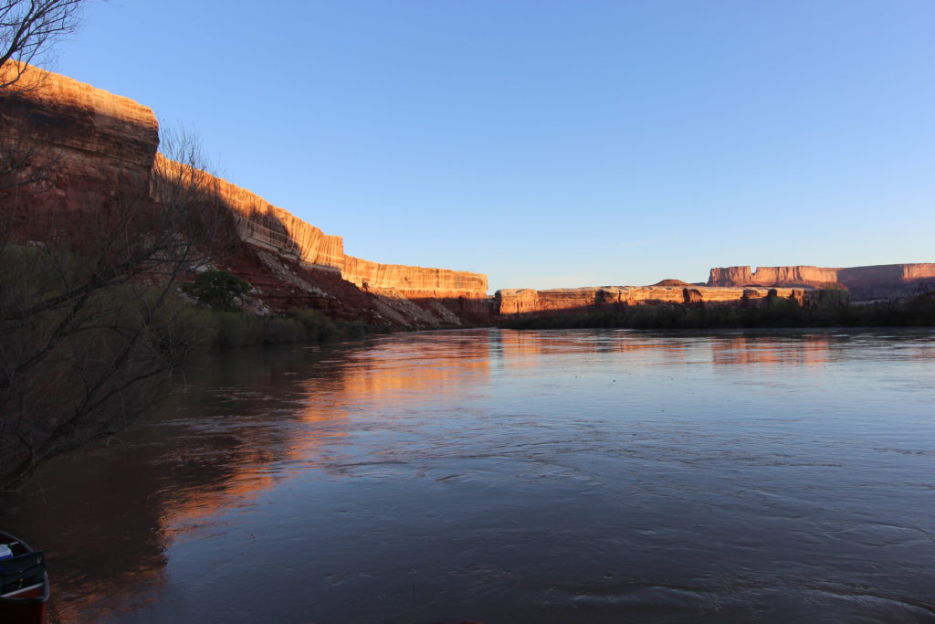
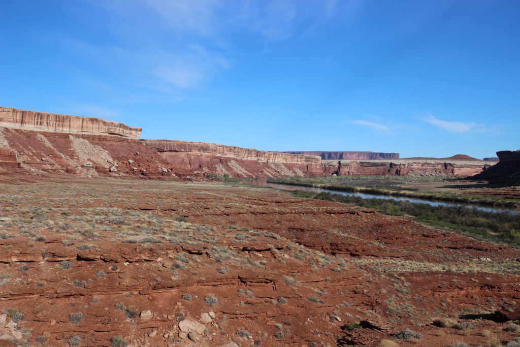
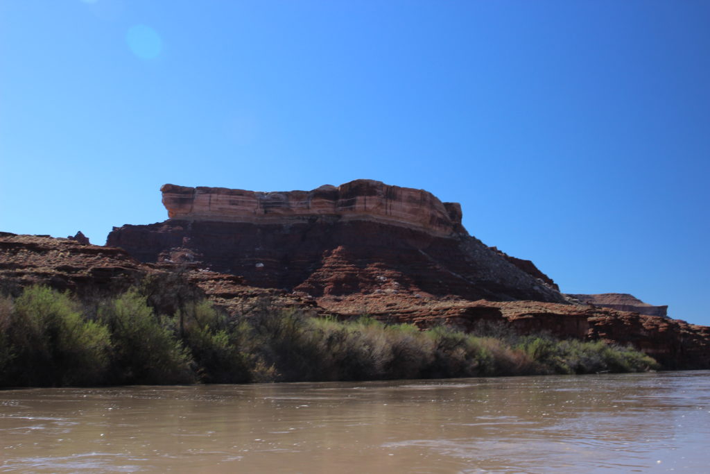
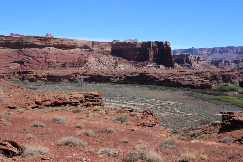
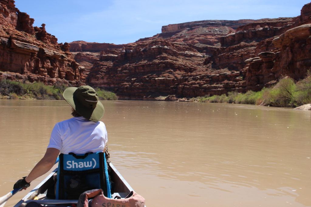
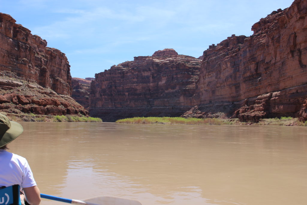
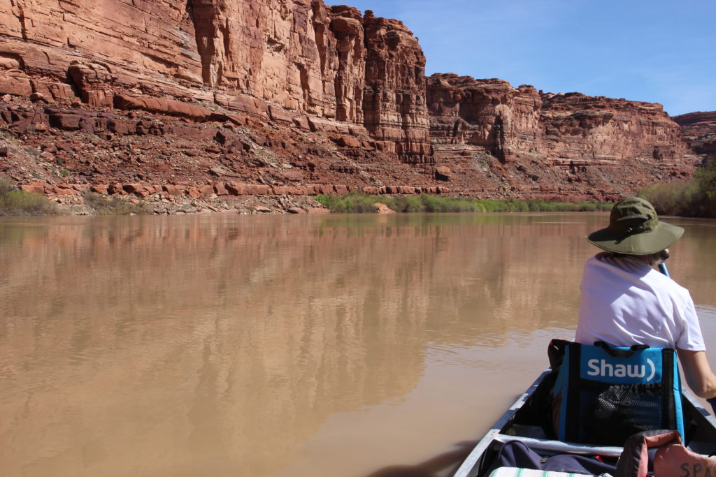
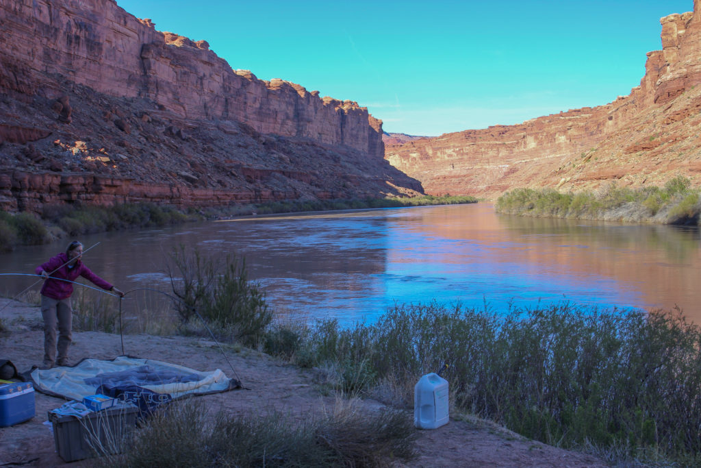
Morning on the river.
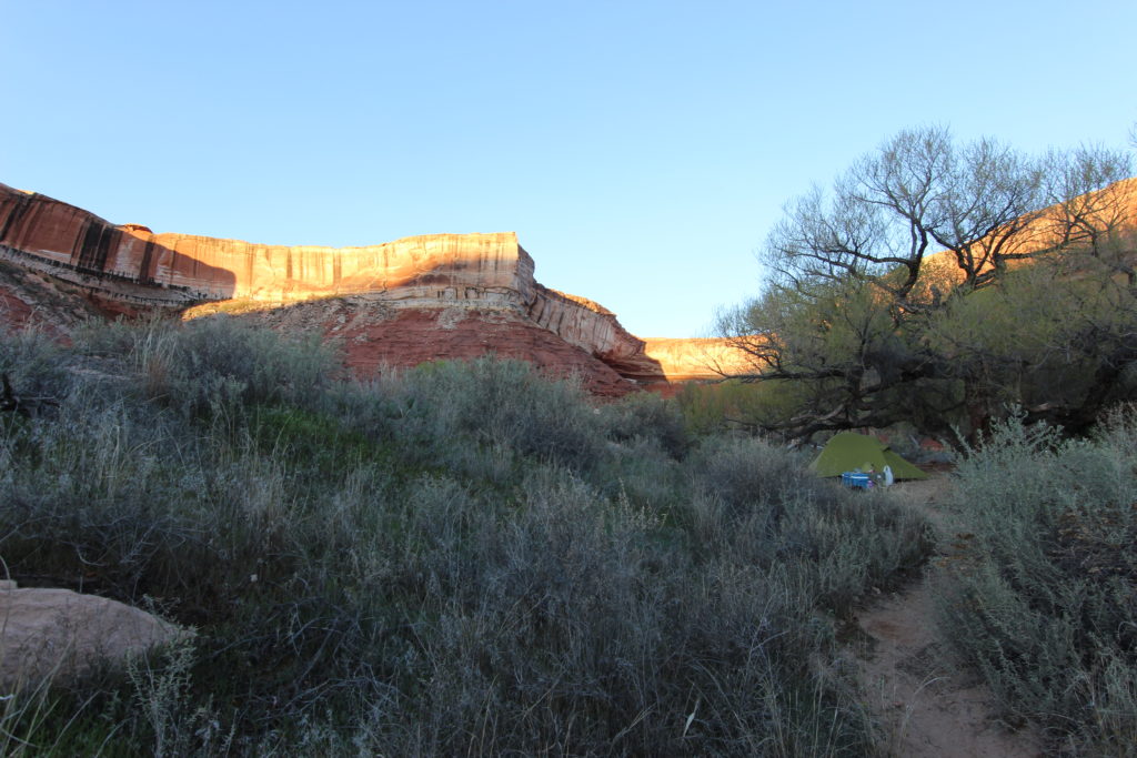
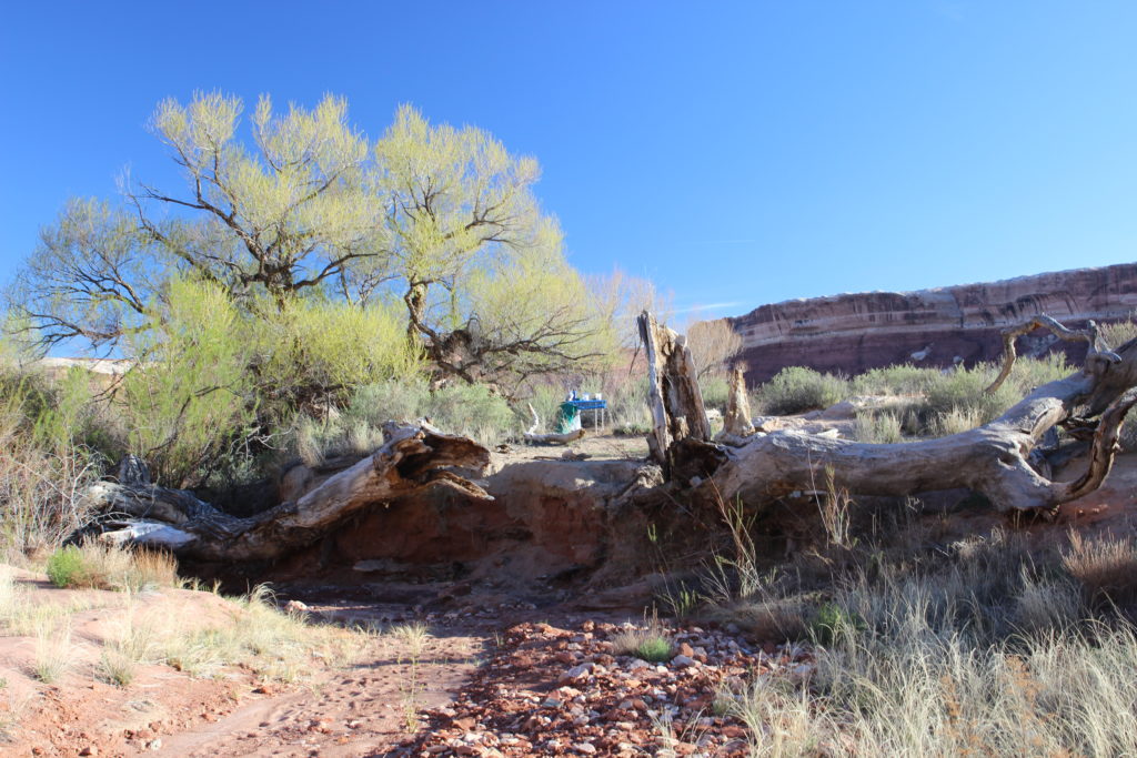
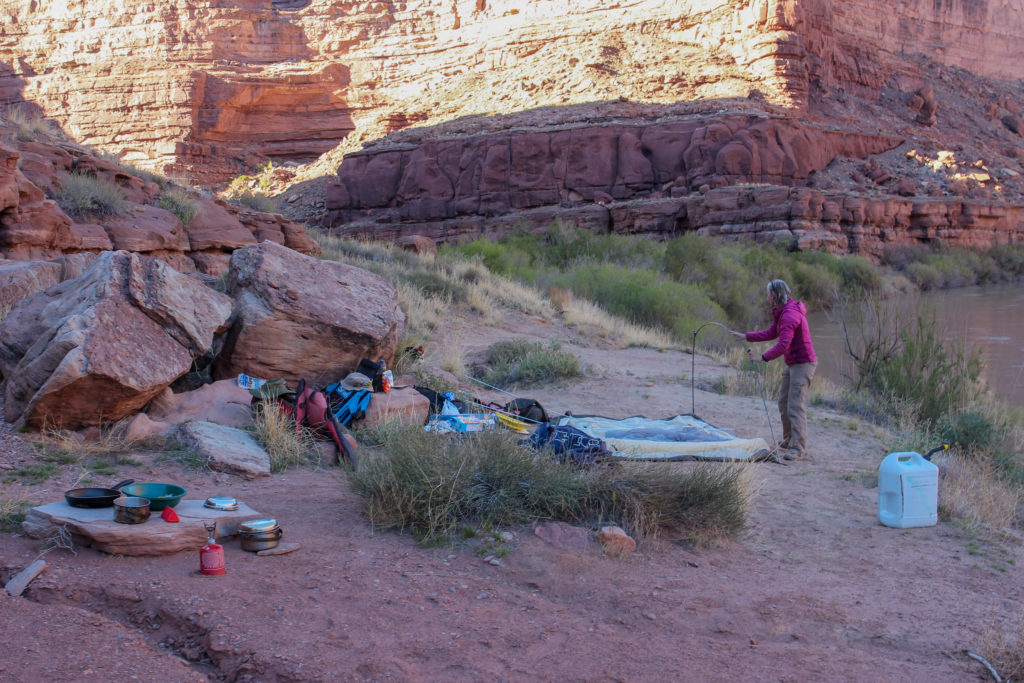
Our campsite.
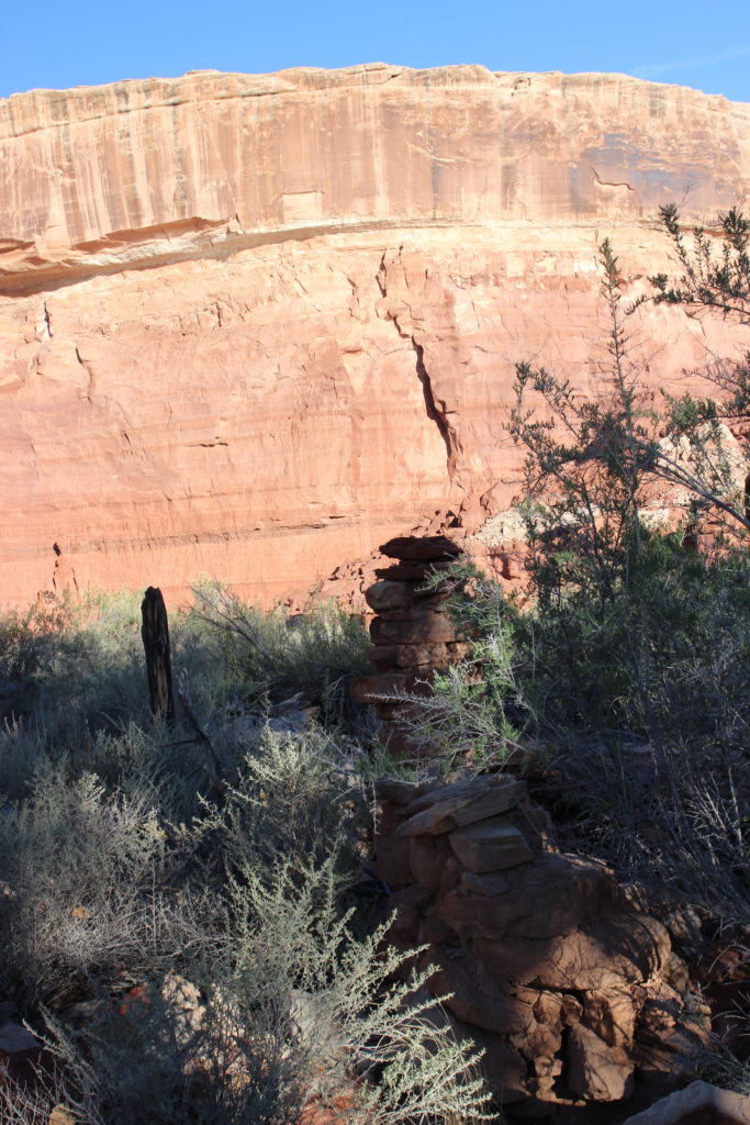
The remains of the cabin are behind the tree.
A wall and roof support.
Not much left of the cabin, just the stone walls.
Our neighbours and their table.

Overnight while I was taking pictures of the night sky I thought I could smell propane. Our neighbours discovered that they had not turned the stove off correctly and consequently all their propane had leaked out. Luckily they were experienced and brought their backpacking stove and fuel as back up. We had our breakfast and coffee and then set off to explore the area with the goal of seeing the petroglyphs at the far end of the bottom. According to the guidebook petroglyphs are always found on trails and near good camping areas used by the Anasazi. We headed off on our morning adventure at 8:30 am.

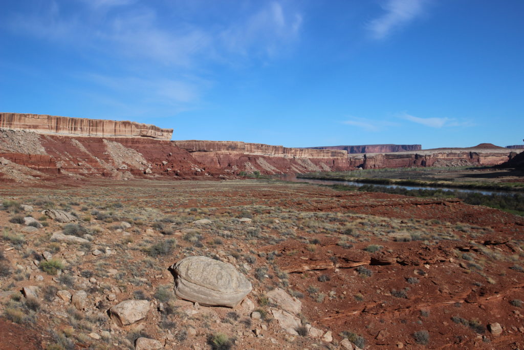
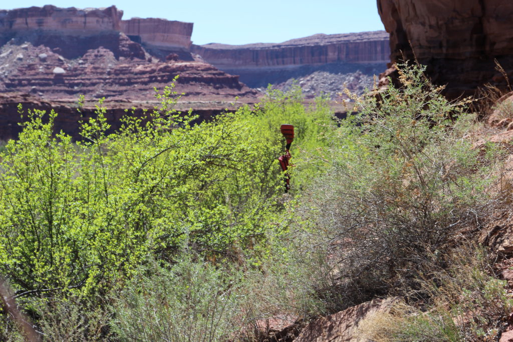
Heading down Cabin Bottom. There were many trails through the grass which made the walking was quite easy.
The backside of Turks Head, where we will be in 2 1/2 hours.
Looking back from the small climb to the petroglyphs.

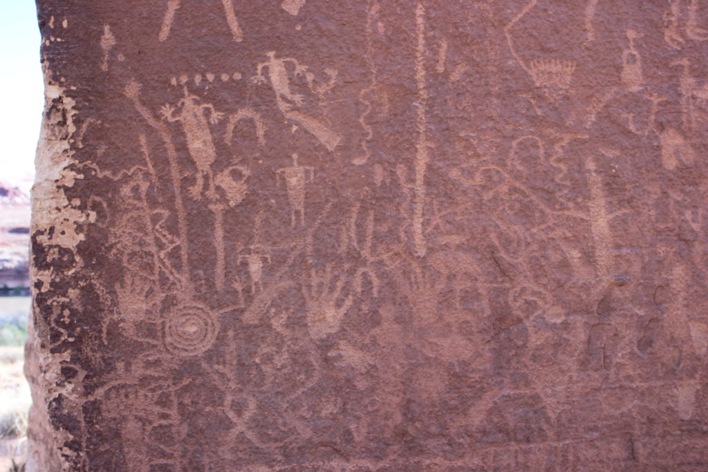
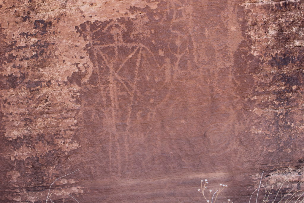
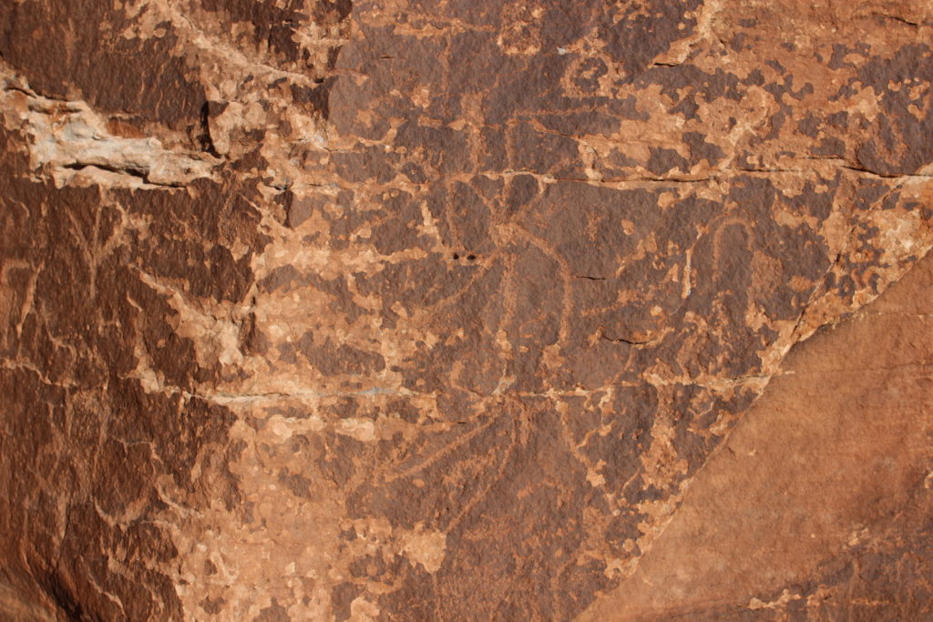
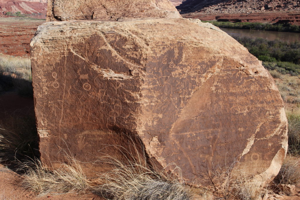
It was a 2 km walk to the petroglyphs. There were many trails initially through the grassy area. As we got closer to our destination the trails all funneled into one trail and it was quite easy to find our way. We arrived at the art panels at 9 am. It was well worth the walk.
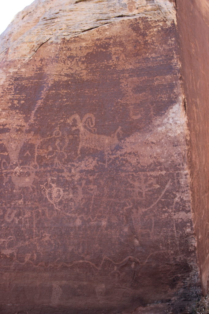
The first panel.
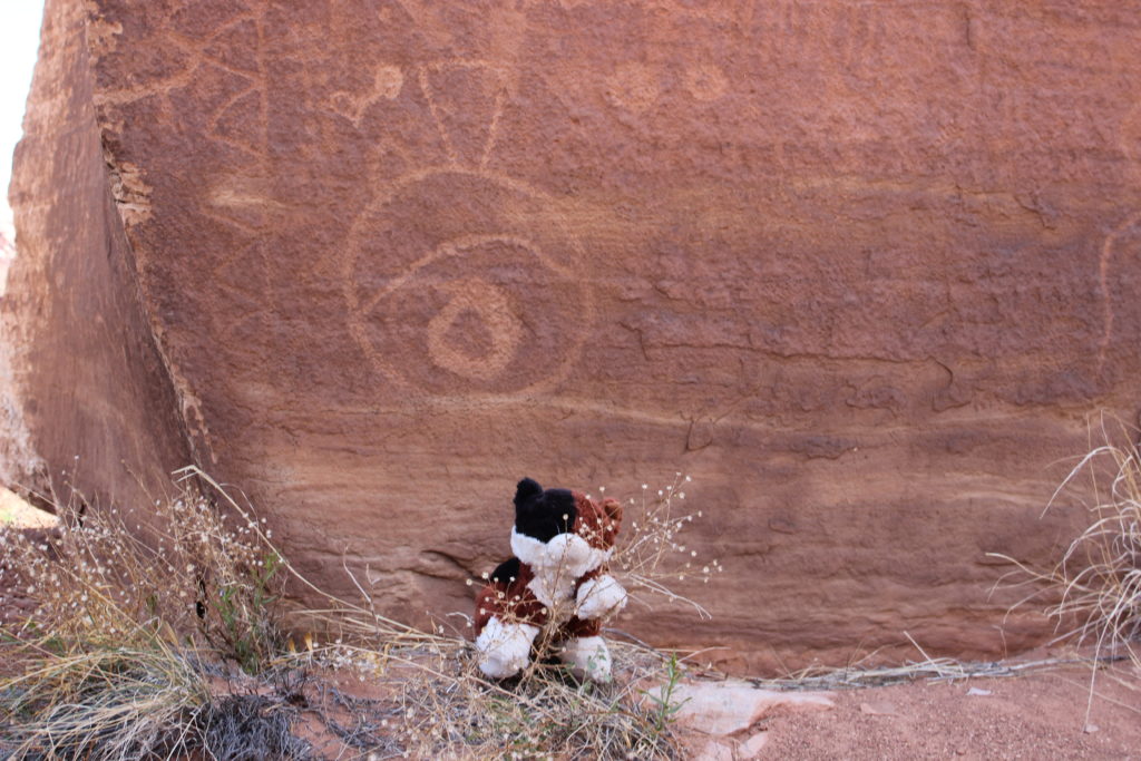
Frosty enjoying themselves.
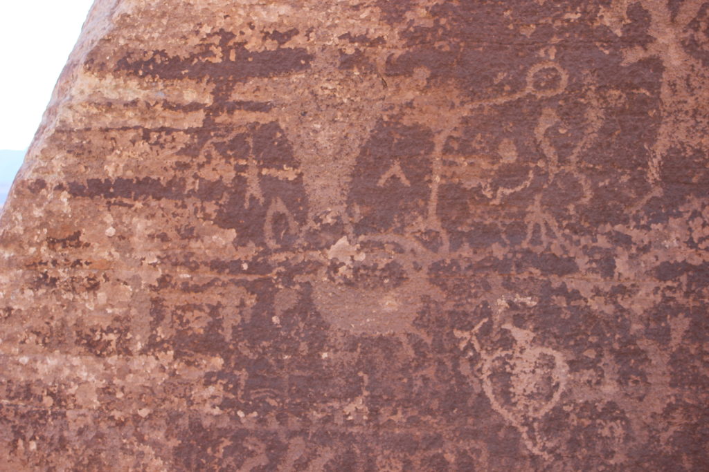
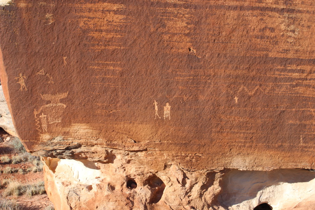
A very busy panel.
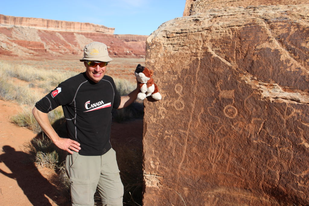
Frosty and I are all smiles.
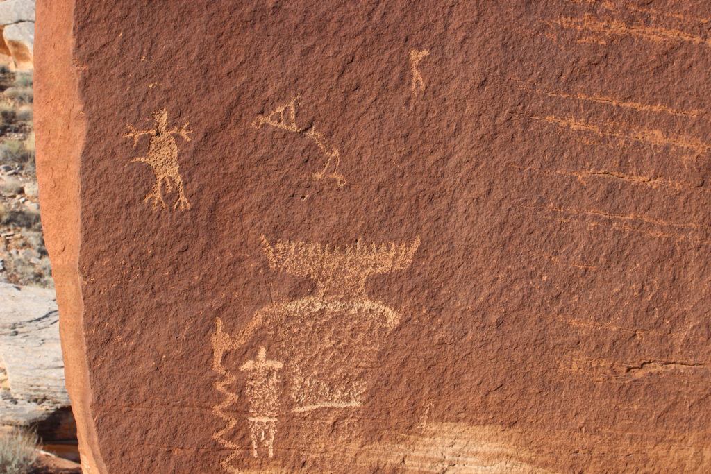
It is amazing to think someone around a thousand years ago took to time to etch their thoughts into the rock and now we can look on it in wonder.
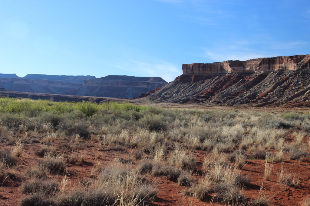
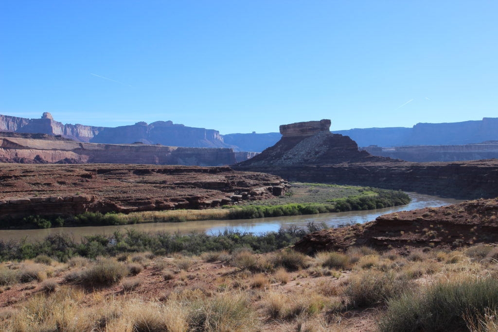
View from Cabin Bottom of Turks Head. The cliff in the shade to the left of Turks Head is Willow Flat and to right is Grand View Point.
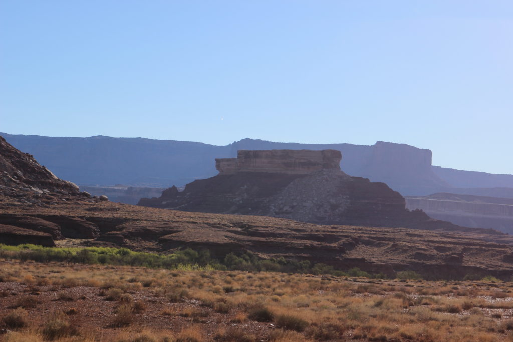
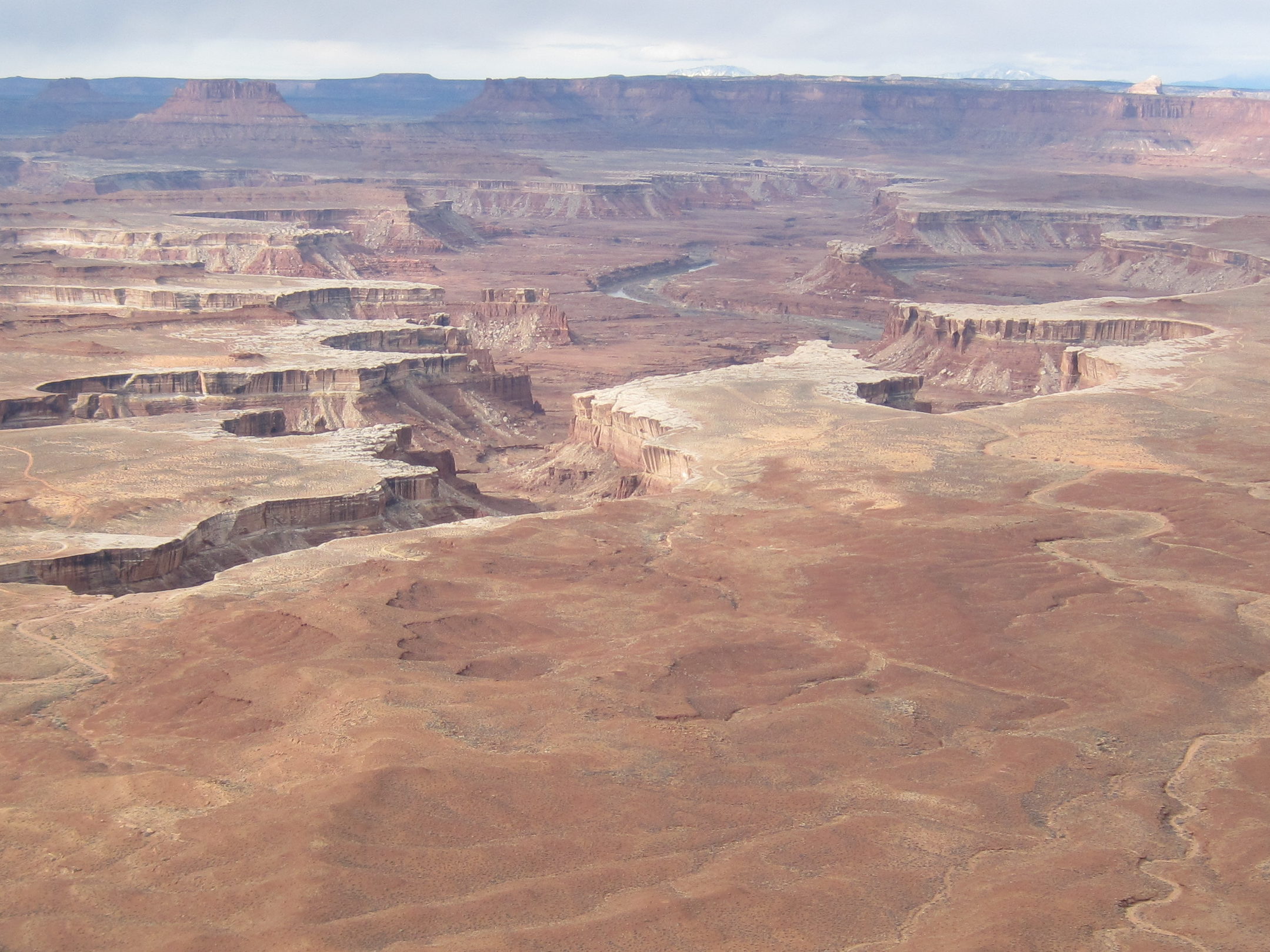
A photo that I took in 2013 of the view from Willow Flat lookout in Islands in the Sky of the Turks Head area.
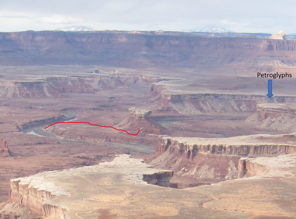
Close up view of the above photo showing where the petroglyphs are on Cabin Bottom and our route to find the Anasazi Ruins on Turks Head.
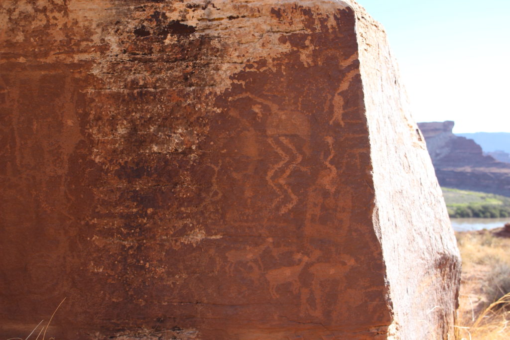
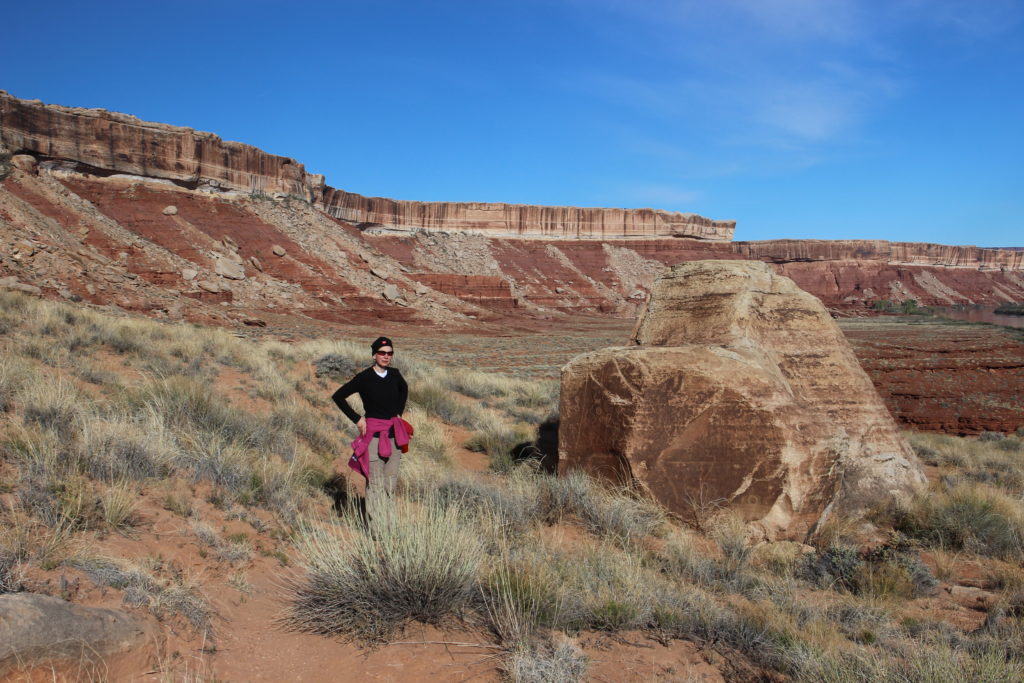
Laura with one of the panels of petroglyphs. It is a warm day.
The backside of the rock with Turks head. The spire on the very left is Candlestick Tower.
Close up of the photo above.
It is a beautiful day for a walk. Looking back to our campsite at the north end of Cabin Bottom.
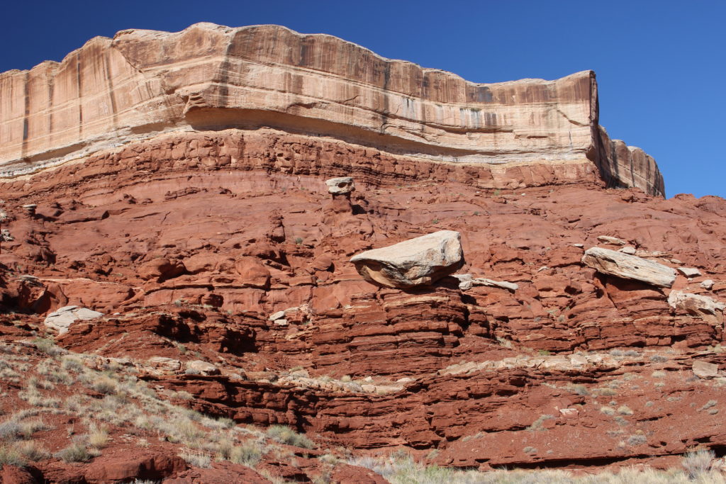
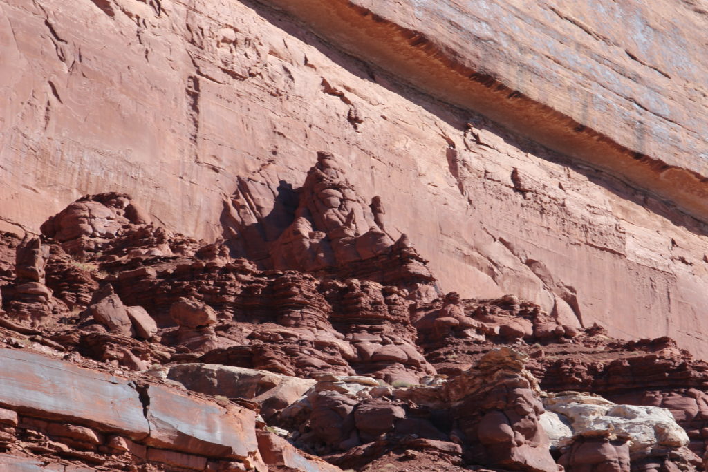
Just a fun cliff. The slope of the Organ Shale is below the steep cliffs of the White Rim Sandstone.
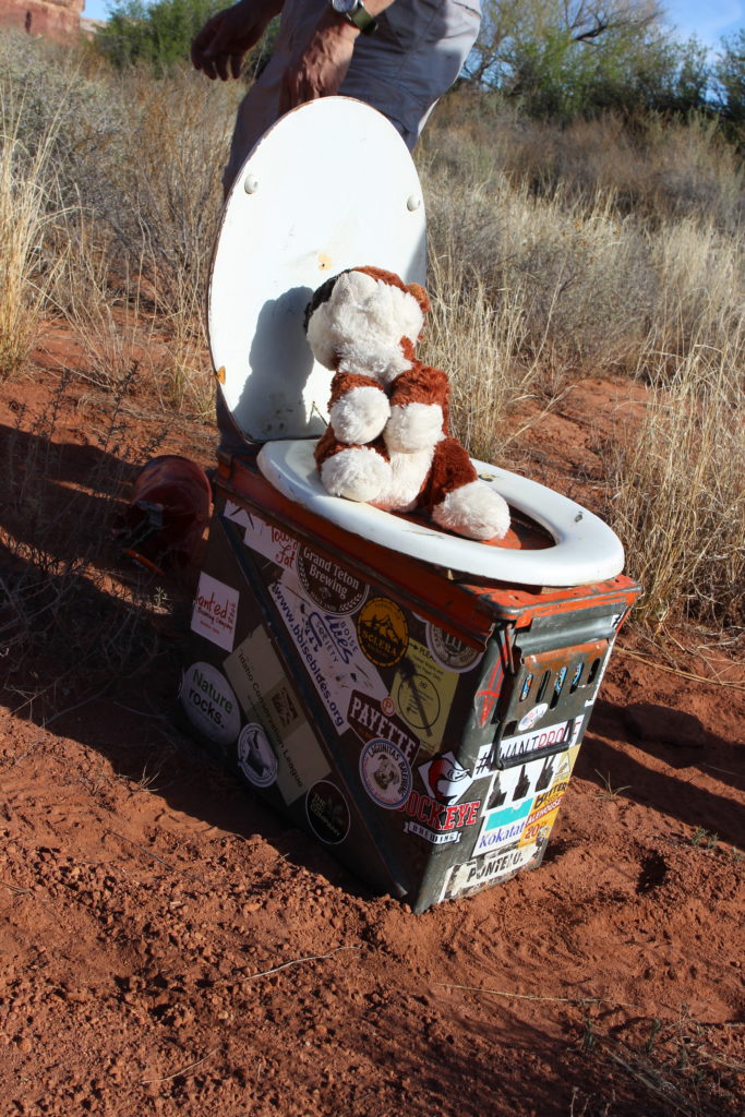
Frosty taking the King’s advice to always relieve oneself when provided the opportunity.

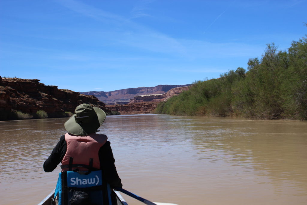
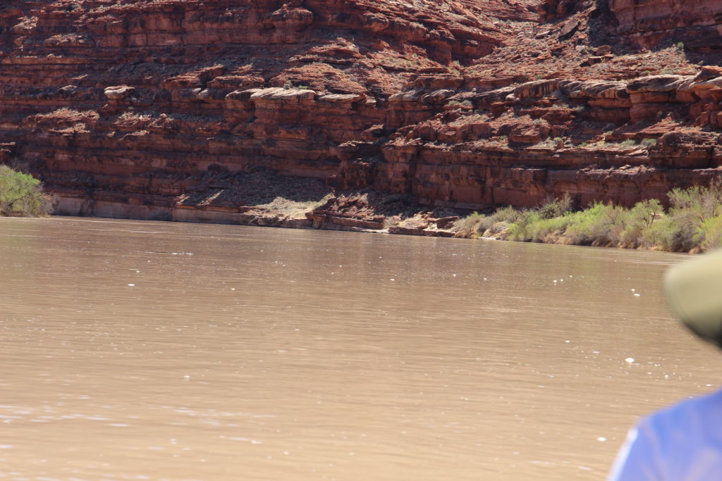
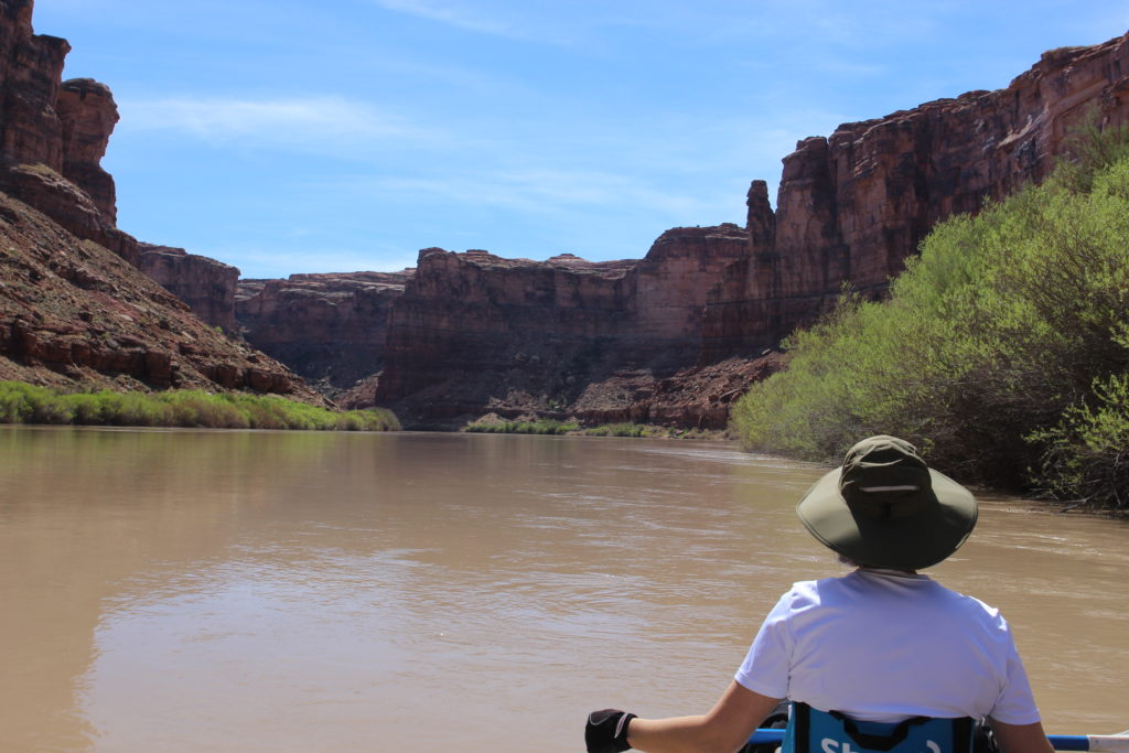
We were back at camp by 9:40 am. Efficient packing had on the river at 10 am. It was approximately a 4 mile trip to the far side of Turks Head Bottom where we going to attempt to access the bottom. While it was getting warm when we were on our little hike it is always a few degrees cooler on the river so we were both bundled up once back in the canoe.

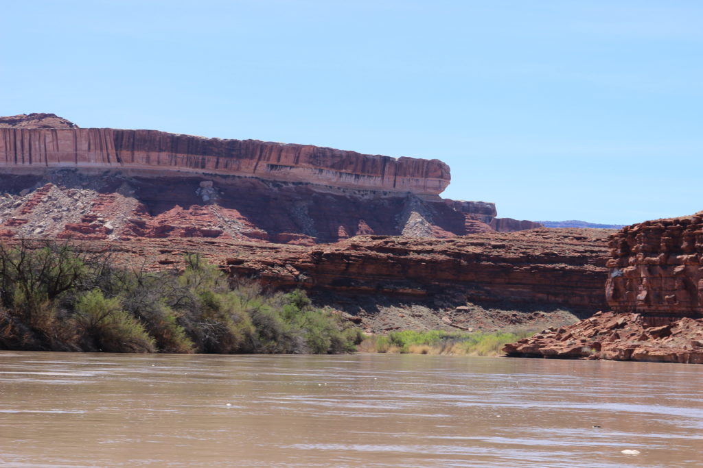
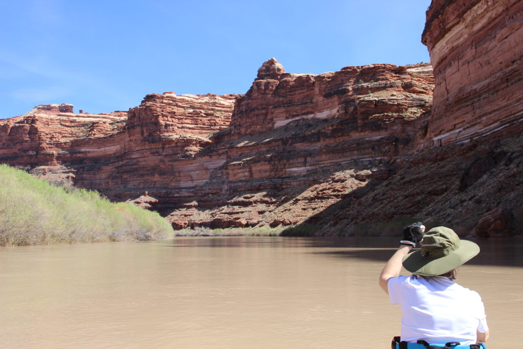
Heading into the first bend that would take us around Turks Head. The green to the left is Tuxedo Bottom. With a name like “Tuxedo” you would think that the bottom had an interesting history. Not really. It was named after a can of tobacco found there left by some miners, Tuxedo Tobacco.
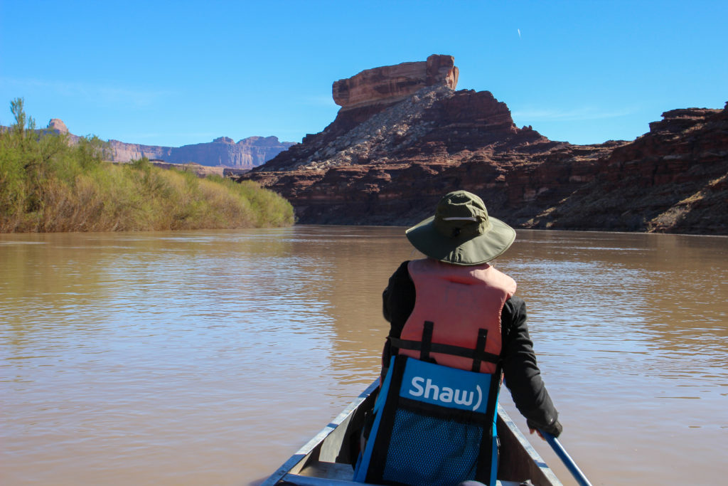
Looking at the west side of Turks Head.
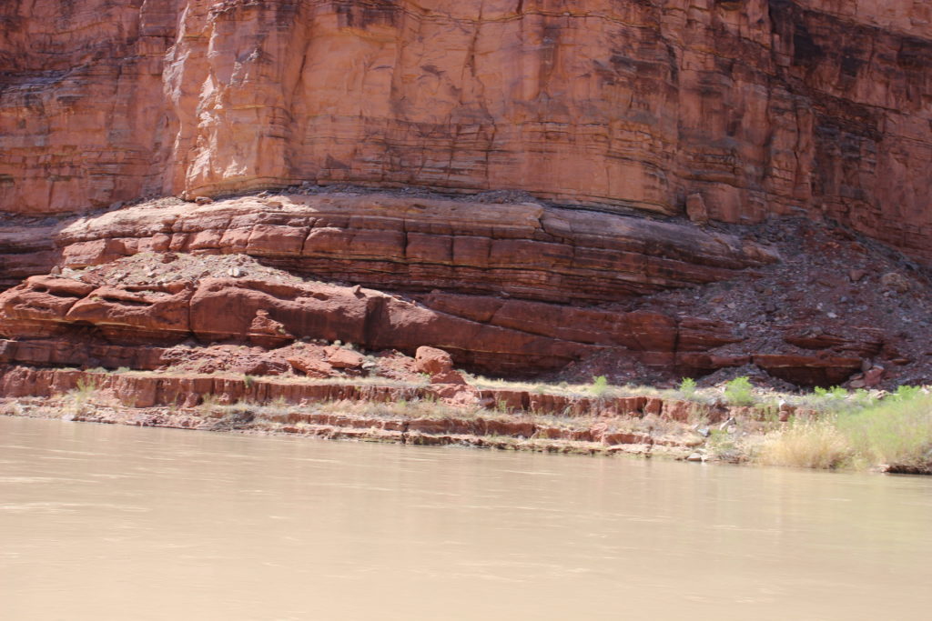
Very interesting rock formations in the Organ Shale.

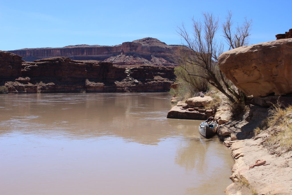
I thought I saw a landing spot as we rounded the bend to the north-west of Turks Head. We we able to land and tie up the canoe. We spent several minutes battling the tamarisks before heading back to the canoe to look for a better landing spot. The guidebook did clearly state that the best landing sites were where the cliffs came right down to the river at the south end of Turks Head Bottom.
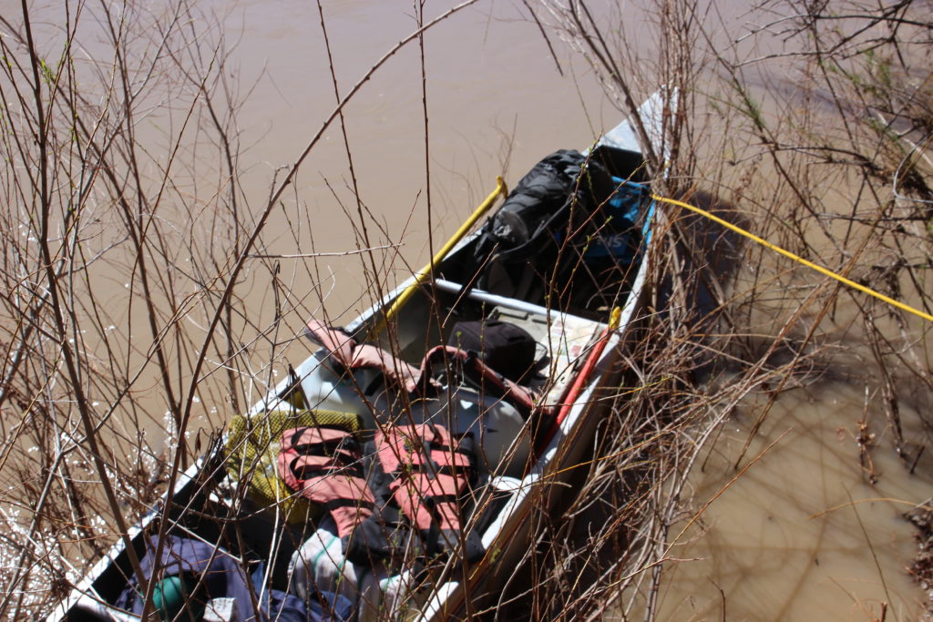
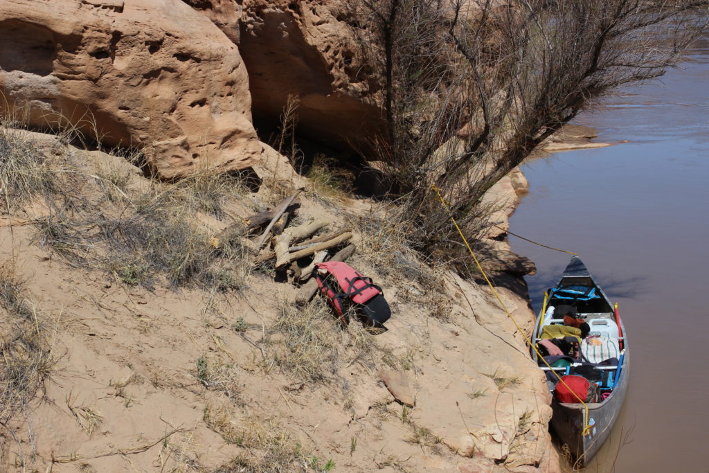
All tied in.
A very small beach for landing on. It was very dense brush.

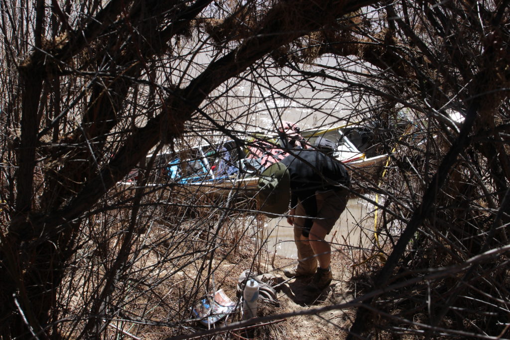
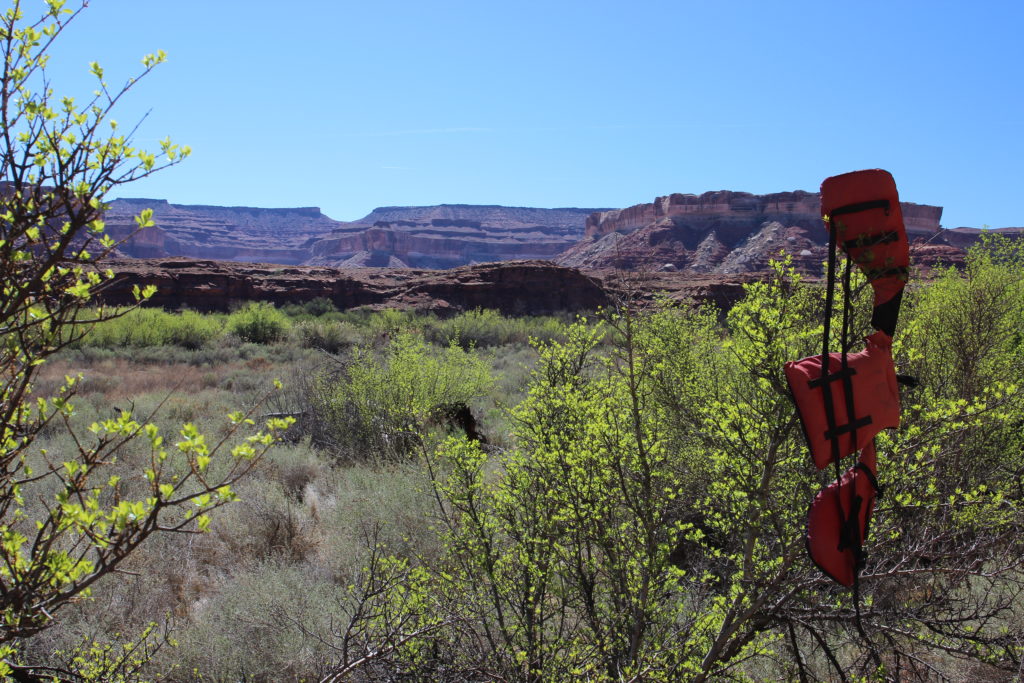
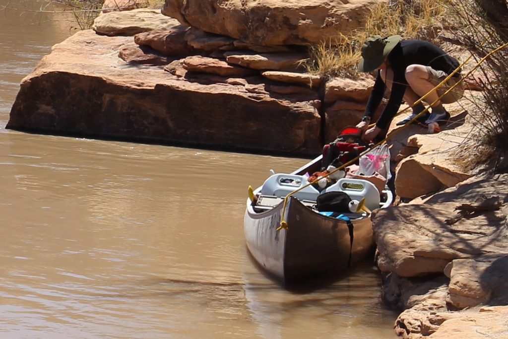
Once back on the river it took us another 30 minutes to find a good landing spot, right where the guidebook said to go. We were on land and walking just after 11:30 am. There was good trail through the brush. Once we emerged from the brush into the open fields I was a little worried about finding our way back to the canoe. I hung one of our bright orange life jackets in a tree to identify where the trail back to the canoe was.

Impromptu trail marker.
Looking out across to Soda Springs Canyon. There is no easy way up onto the plateau.
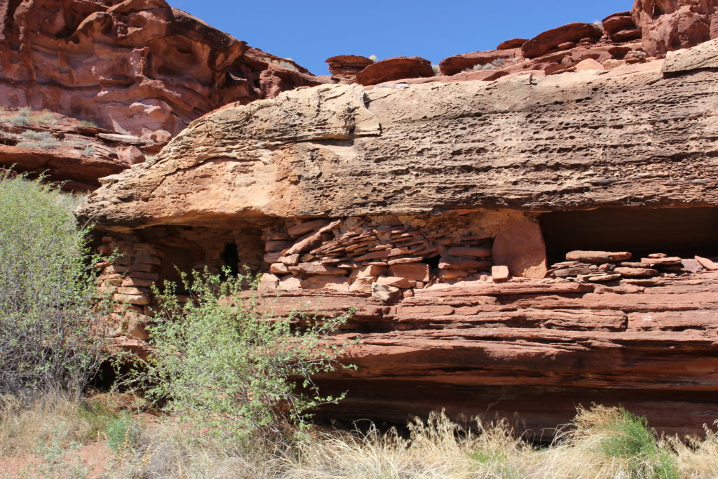
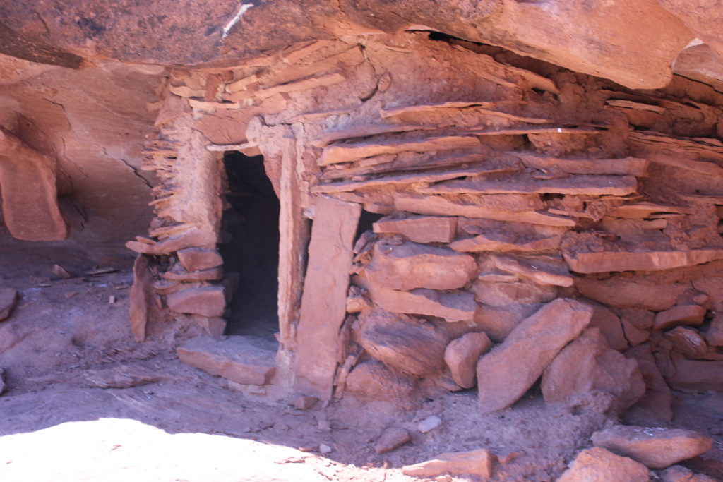
There was well defined trail along the cliffs to the lower set of Anasazi structures. It took us about 10 min to walk from where I left the life-jacket to the first structure.
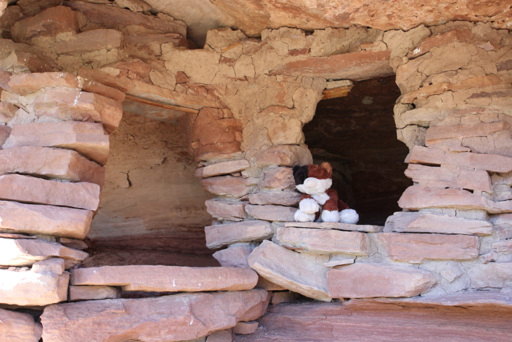
Frosty enjoying the view.
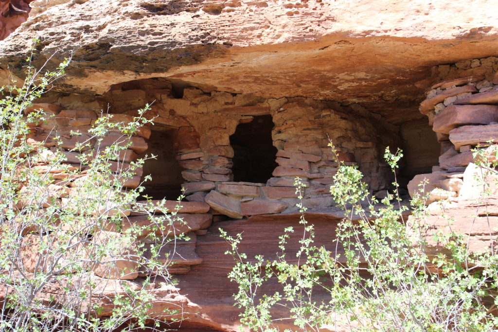
Amazing to think that hundreds of years ago people lived here in these structures.
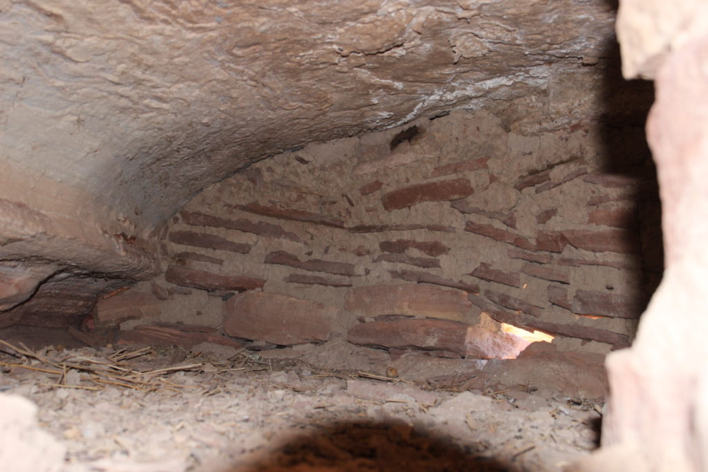
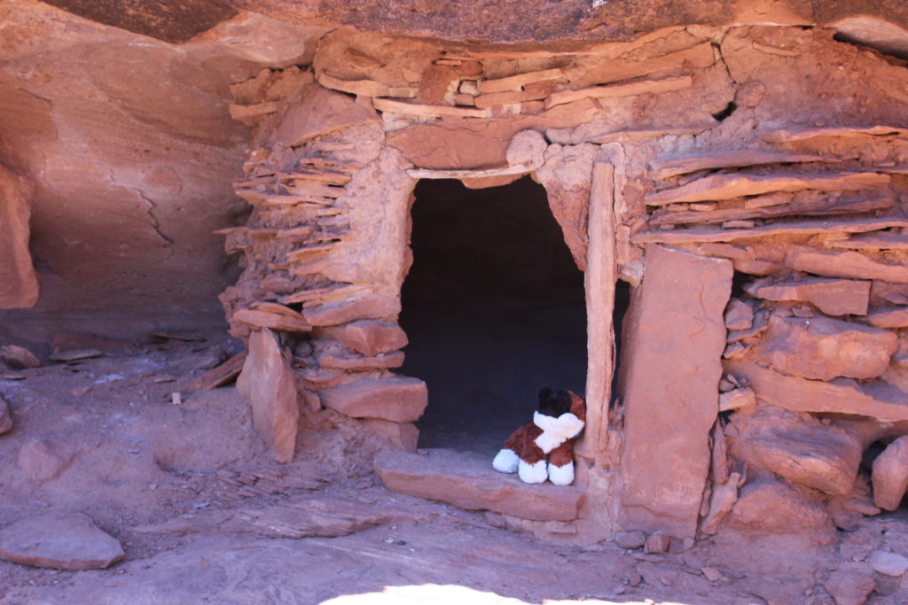
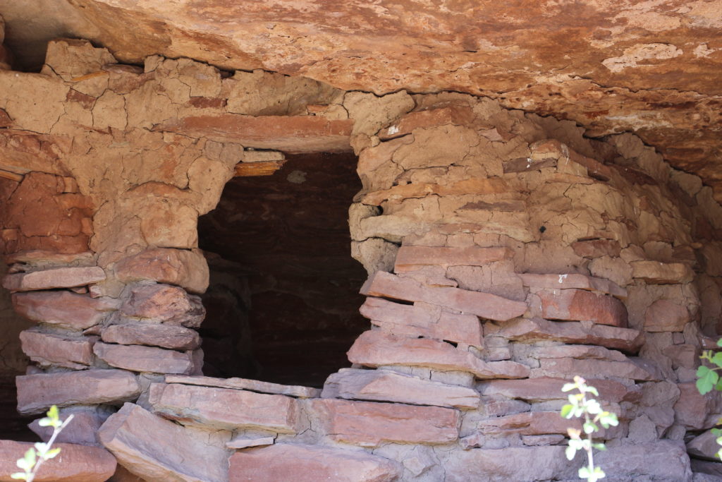
Excellent masonry work.
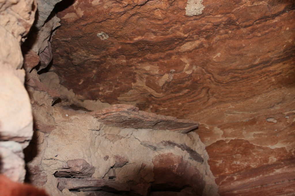
What caught my eye was the folds in the layers in the roof.
Well built, do not think my house will look this good after several centuries of use.
One last look.
Laura scrambling up the through the cliffs. Did need some hand holds to pull yourself up but the scrambling was very safe.
View from the bench east across to Soda Springs Canyon on the right.
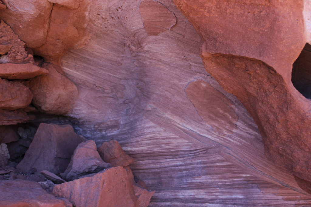
Some very interesting weathering patterns on the rocks.
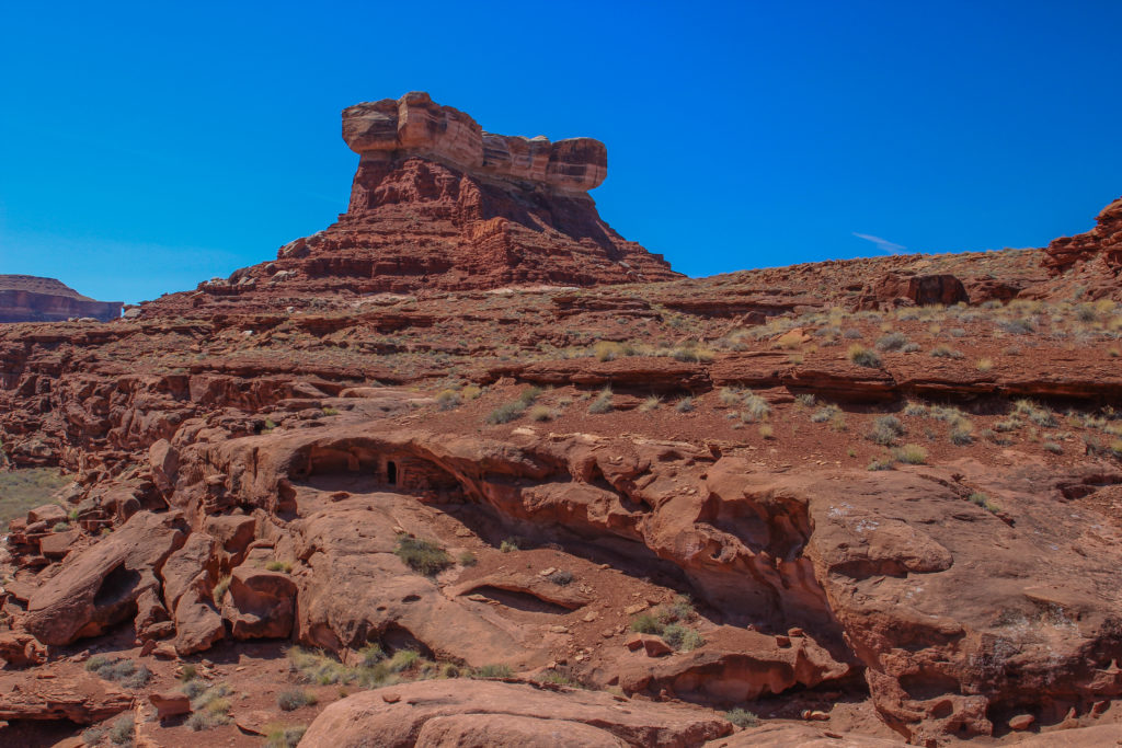
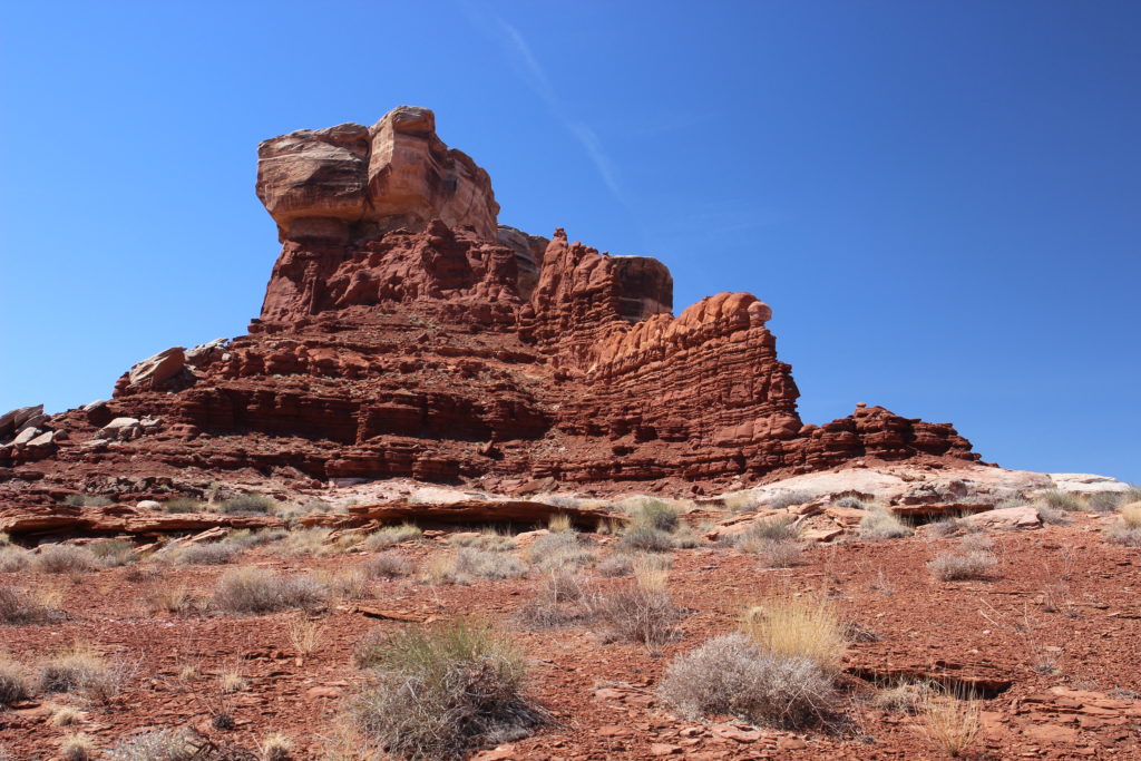
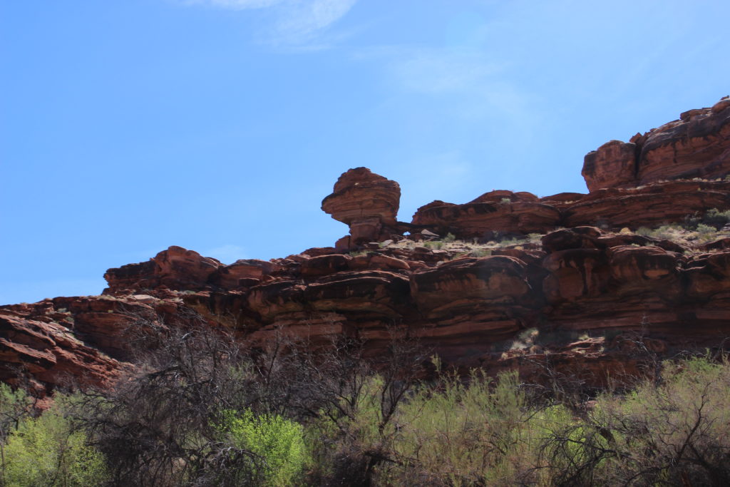
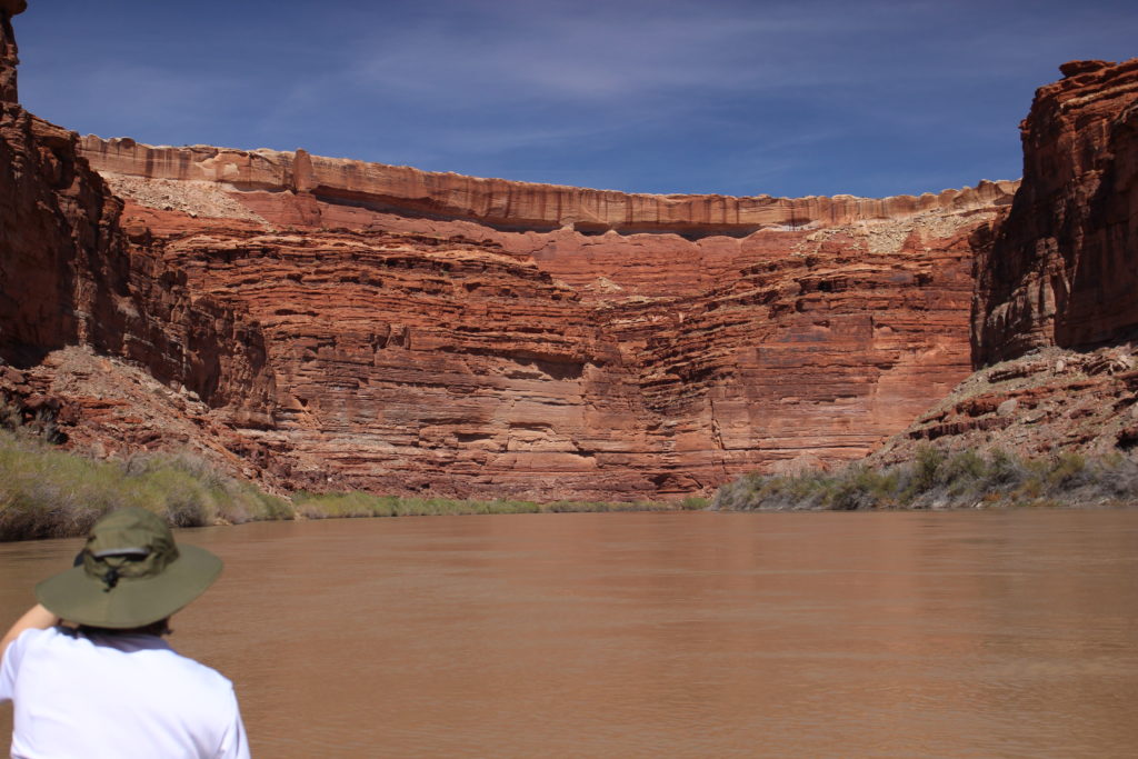
Looking up at Turk Head. The weaker Organ Rock Shale is eroding under the much harder White Rim Sandstone forms the shape of Turks Head.
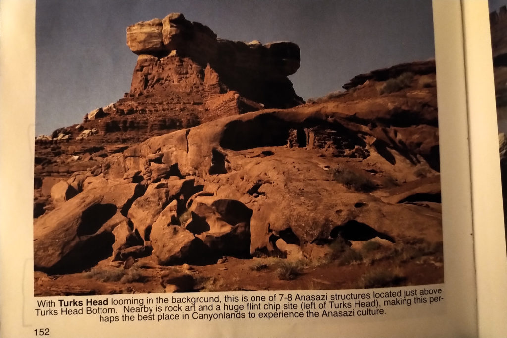
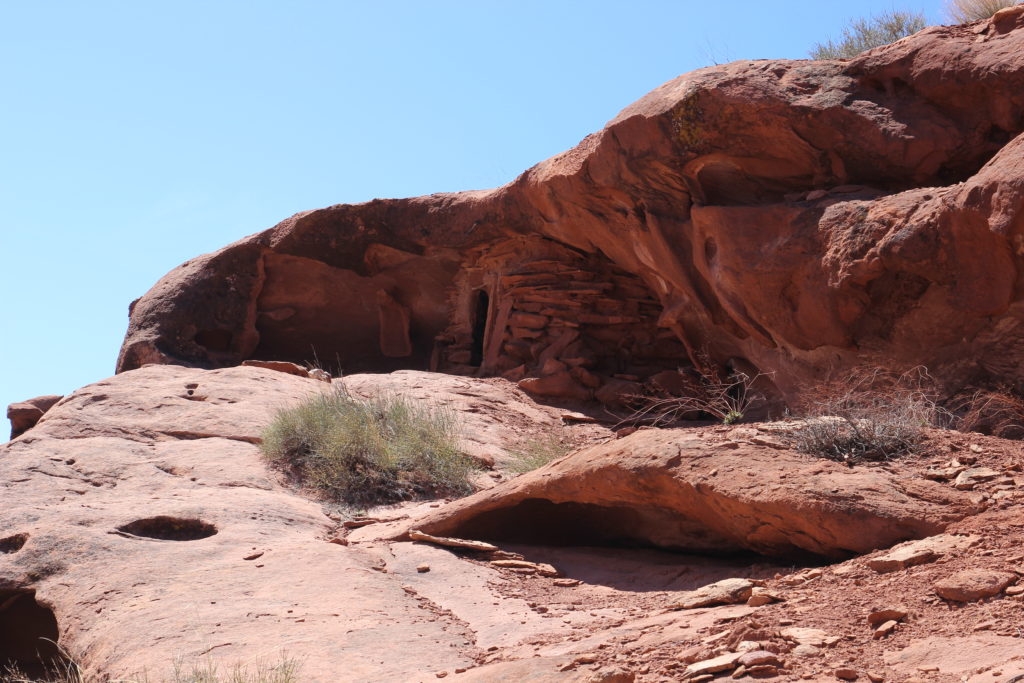
I had great difficulty finding the Anasazi houses below Turks Head. There is a lot of red rocks. I am quite sure that Laura was getting near the end of her patience as I wandered around the plateau looking somewhat lost. In desperation I used the picture from the guidebook to match up with what I saw until I was able to get in the right spot to see the structures which were in the shade (picture is lightened up).
Frosty grabbing some shade.
The crossbedding in the sandstone indicates sand dune migration.
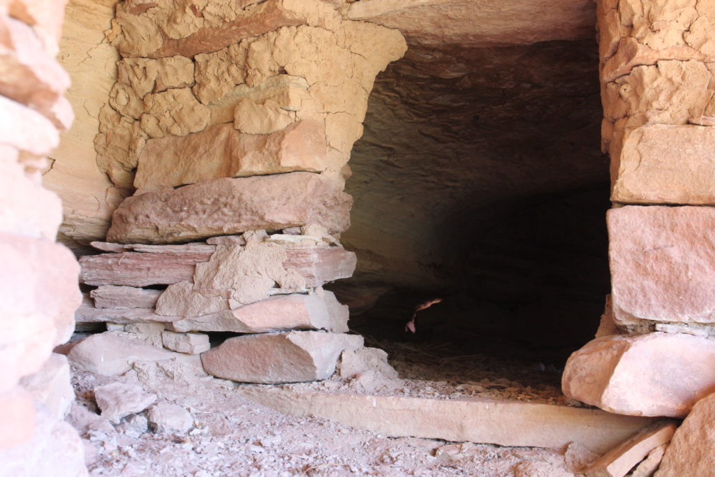
Solid construction.
The structures are quite sheltered and have lasted very well.
Have some mortar holding the rocks in place.
Catching some rays with Frosty. Still got my paddling gloves on.
Found the life jacket and the trail back to the canoe.
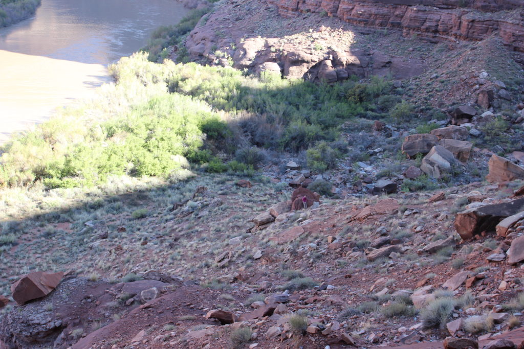
Laura making her way back across the field.

We spent almost 90 minutes exploring Turks Head Bottom. It was 1 pm when we were back on the river. We only paddled about 1 mile before pulling in at a natural dock to have lunch. We had a lovely tamarisk free view of the river.

Almost like a natural dock.
Everything is securely tied up.
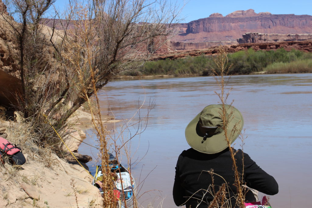
Laura taking in the view while we relaxed and had our lunch.
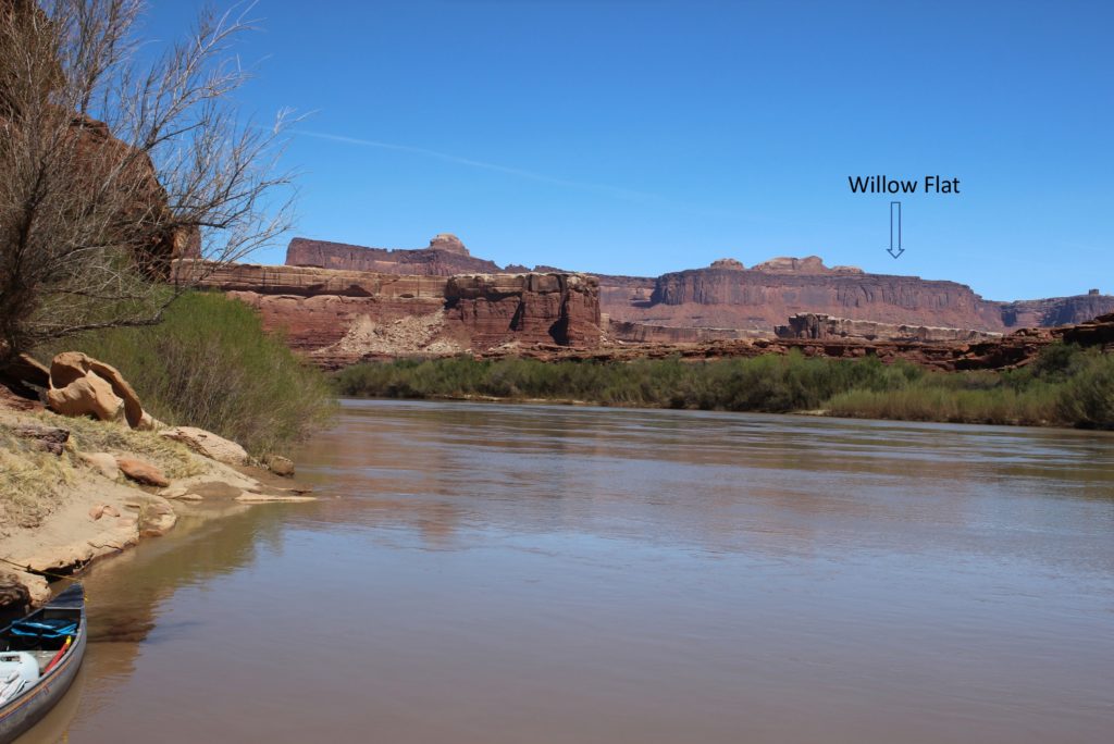
View up Soda Springs Canyon to Willow Flat were I had taken the photos on our trip back in 2013. Candlestick Tower is just peaking around the end of the trees on the left.
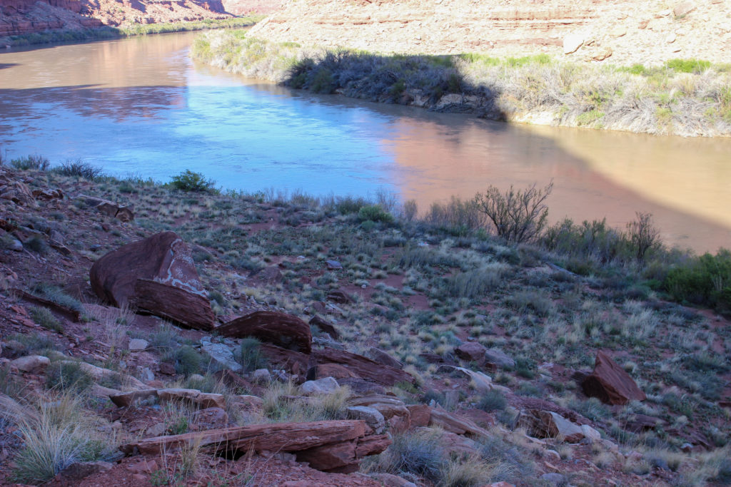
View looking downstream of our picnic area.
Getting ready to head back out on the river.
Laura looking ahead to Deadhorse Canyon as we pass by Arla Bottom on our right.

The rock of our little lunch spot divide Turks Head Bottom from Arla Bottom named for the wife of a rancher. Arla Bottom is the last named green space beside the river as they become smaller and less frequent. There is a panel of petroglyphs a short hike up Deadhorse Canyon but we decided that we would stay on the river as we still had 12 miles to go before our planned camp at Jasper Canyon. It was 1:45 pm and we had only actually traveled about 4 miles on the river.

The light green on the right marks the entrance to Deadhorse Canyon.
I just thought this looked like a cool rock.
Really, another Canada Goose.
A small canyon offering a rare long view up to the rim.
The river fundamentally changes after this point as the cliff forming Cedar Mesa sandstone rises from the depths. The cliffs become steeper and higher and the canyon much narrower.
Laura has her long sleeves off. So much to look at.
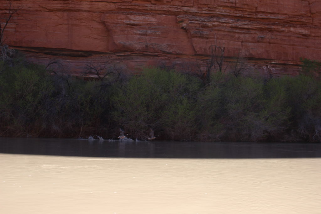
More Canadian Geese in flight.
They maybe just Canada Geese, but any bird in flight is majestic.
The red cliffs are closing in on us.
The mouth of Horse Canyon. Camping spots available but our plan was to put in another 4.5 miles.
This is looking back up river. Horse Canyon is to the left. Horse Canyon offers the rare opportunity to hike out to the White Rim Road. The canyon is blocked by a dry fall so access is actually back up the river at about mile 16 a short steep canyon that offers a route onto a bench of the Cedar Mesa Sandstone. Following the elevated bench would allow a hiker to bypass the rock fall and access Horse Canyon. The hike to rim would require a two day backpacking trip to come back to the river.
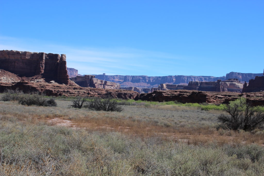
There is quite a large green area to our left but no camping spots where indicated in the guidebook.
The walls of the canyon have become very steep. You can see the thick slab of White Rim Sandstone on the top protecting the softer layers below. This is coming up on mile 12 before the confluence and just 2 1/2 miles to Jasper Canyon.
Hard to see but on the water in the distance to the left of Laura’s hat are people in a red canoe. One of the few boaters we saw on the river.
Jasper Canyon is jut past the protruding cliff at centre to left. Almost home for the evening.

If I remember correctly arriving at Jasper Canyon was a bit hectic. The group we had camped beside the previous night where already at Jasper Canyon and had taken the obvious place to dock. Being on the outside of the river the water was flowing quite fast and we had to work hard to get the canoe onto the shore and we may have bumped the other canoes a little. Needless to say with a little help we go the canoe stopped and secured. Once on land there were many choices for camping at Jasper Canyon so we picked a place that would provide some privacy for both ourselves and the other group. In fact I do not remember seeing them for the rest of the evening and they left quite early the next morning. It was about 3:45 pm when we made landfall. We had traveled another 15.5 miles down the river and had some fun little hikes along the way. Only 13 miles left for tomorrow to Spanish Bottom.

Looking back up river from Jasper Canyon.
Looking across the river, the moon is out.
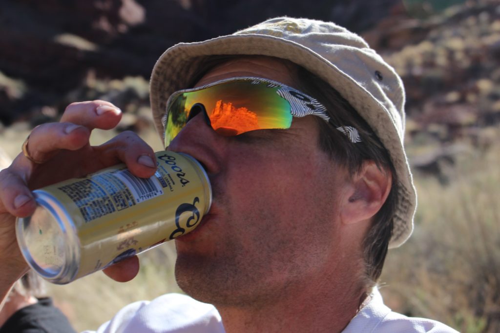
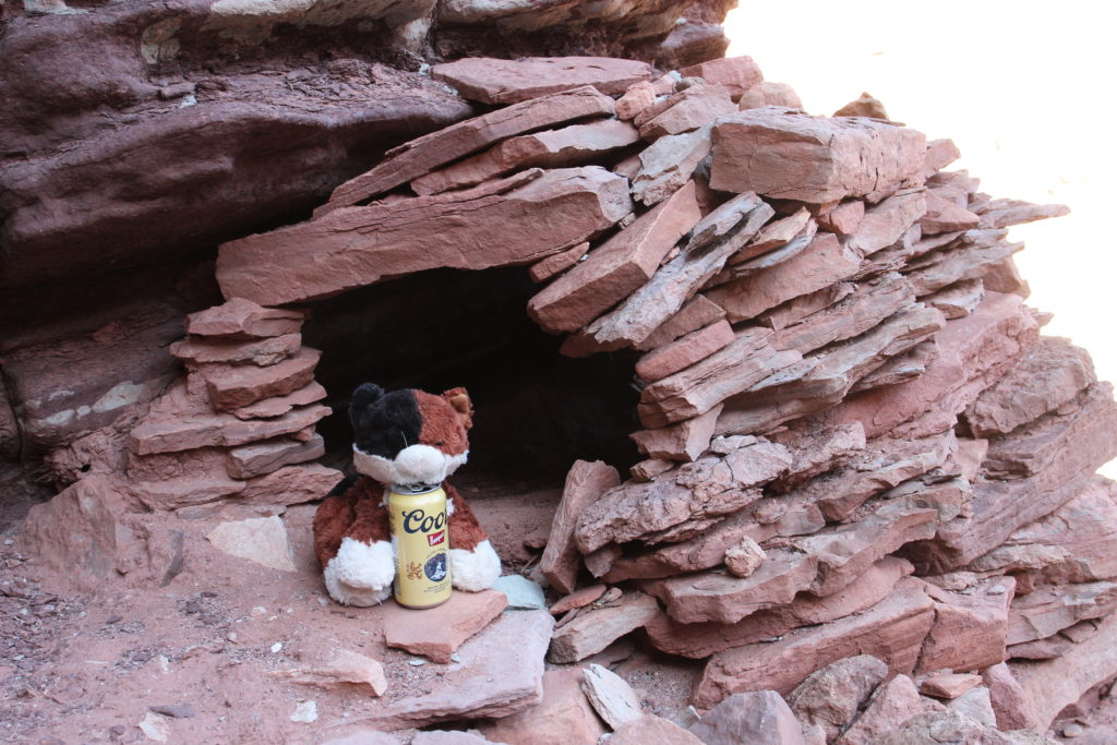
Ahhhh, cold beer! The fun group from the day before gave us a couple of beers. We saved them for the end of this day and I was so glad. Never has a beer tasted so good.
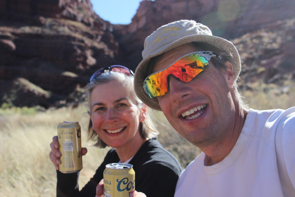
Happy campers. Next time need to bring more beer.
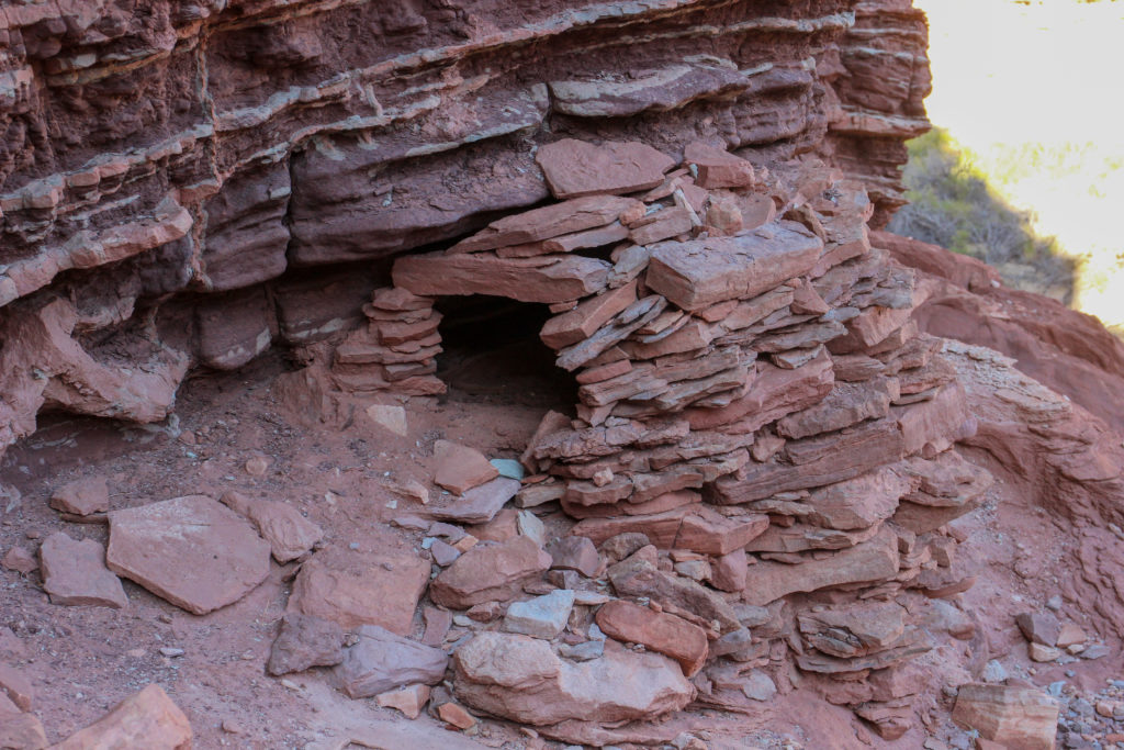
There is a lonely structure up on the the upper bench.
Close up of the ruins.
Was a little scramble to get up to the ruins.
Frosty enjoying a cool one and the view after a long day on the water.
Looking down at where Laura stayed. The sun is setting behind the cliffs and it is now cool enough that Laura wants her jacket on.
Looking back up river.
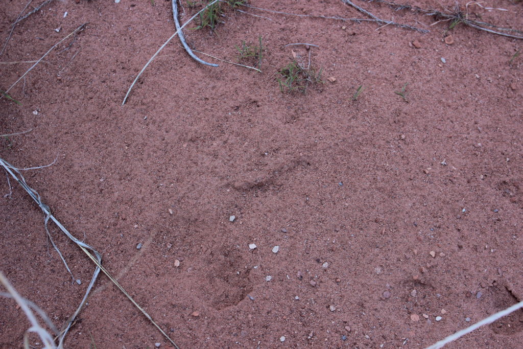
Paw prints. Coyote I suspect.
Laura taking a long look at the river as she finishes off her beer.
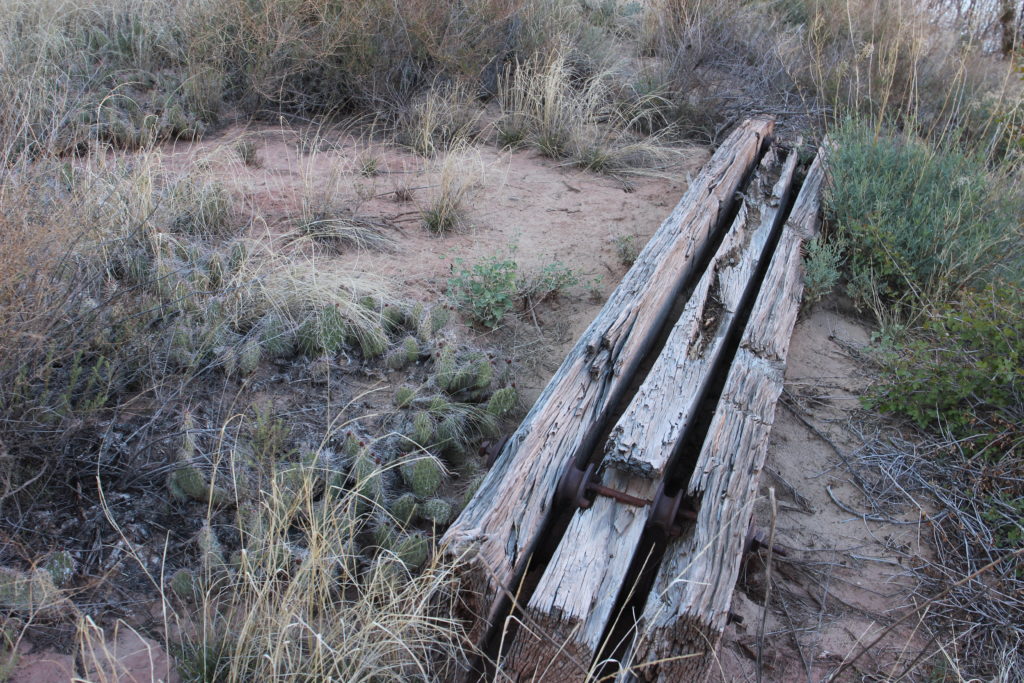
Someone must have tried to make a dock or mining structure.
Almost 6 pm. Time to set up camp and make dinner.
Laura getting to work erecting our portable three person chateau.
Million dollar view.
Pasta! Seems to be a theme on this trip.

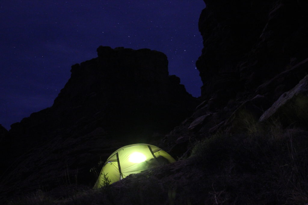
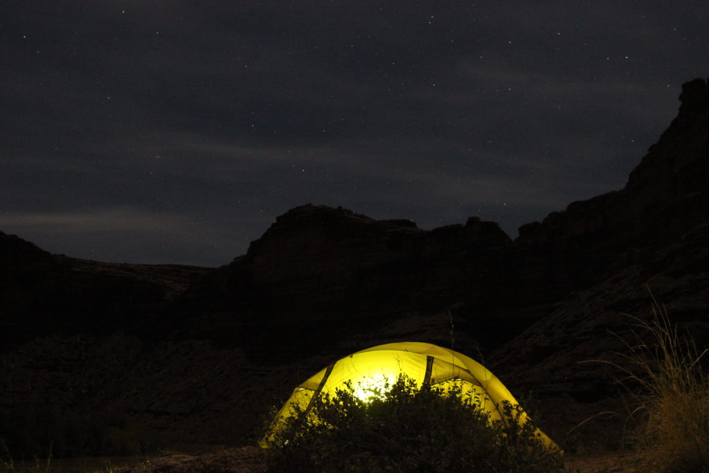
We had a fairly late dinner eating at 6:45 pm. With the higher and narrower canyon darkness came quicker on this night. Unlike the past two evenings we did not do any exploring after dinner. We would save the exploring for the morning. We went to bed a little earlier than on previous nights. Just after 9 pm I got out of the tent and took some nighttime shots of the sky and had Laura light up the tent with a headlamp. The effects worked out pretty good.

9 pm and it is quite dark.
Good night from Jasper Canyon.

Green River Canoe Trip Day 4

Green River Canoe Trip Home

bootwreckers

Day 5 and 6 of our Green River Canoe trip from 201 Day 5 and 6 of our Green River Canoe trip from 2017 is up on Bootwreckers, see link in Bio.

The day started in the dark with a hike up to the Dollhouse to watch the sunrise.

After doing an bit of exploring including a short hike out to Beehive Arch we headed back to camp to pack up and catch the jet boat ride back to Moab.

No trip to Moab is complete without a stop at the Moab Brewery, I had a tall smooth Derailleur Ale to compliment my mushroom, Swiss bacon burger.

Once back home it was time for snuggles with the little fella who waited patently for us whole we were away. Doggie snuggles for the win!

Another epic adventure in the books.

#canyonlands, #canyonlandsnationalpark, #nationalpark, #nationalparks, #turkshead, #anasazi, #anasaziruins, #utah, #exploreutah, #coloradoriver, #canoeing, #redrocks, #hikingadventures, #camping, #hikingadventures #texriverways, #floatritp #canoe #familytime❤️ #outdoors #outside #outsidethebox #earthpix  #wildernessculture  #wildernessociety  #seeutah  #igsouthwest #discoverearth #earthofficial
Instagram post 18017713981489587 Instagram post 18017713981489587
Just a few photos from my epic 3 day hike through Just a few photos from my epic 3 day hike through Superstion Mts of Arizona. 

I think it was Plan D or maybe E. Saw photos of th Grand Canyon and many of th roads there were closed, so good choice not to go.

Day 1 - First Water TH over to Ther Battleship via many stream crossings and camp near Black Top Mesa. Due to the heavy rains, water was not an issue.

Day 2 - up past Weavers Needle and over to camp below Miners Needle

Day 3 - Epic 26 km day up on down the Superstions Ridge Trail and back to the car. This was probably the second hardest day I hav e had on trail. The trail is more "route" very ill defined for the first 2/3rds of the way. Also includes numerous down climbs, I frequently tossed my poles down 3m (10ft) of more. This is not an easy trail, and the final descent down Siphon Wash is absolutely intense. After leaving camp at 7:15am (sunrise at 7:30) I arrived at the car at 5;45pm.

Needless to say I didn't do much Friday.

Will write more later.

Thanks to my adopted trail team, James, John, Kevin and Patrick. Four Med students from UofM who allowed me to tag along as the caboose for the first two days.

Now, time to fly home.....

#teamzpacks #zpacks #zpacksduplex #aztassociation #aztrail #aztrails #hike #loveazt #desertphotography #desert #hikingadventures #hikes #backpacking #camping #getoutside #familytime #traillife #aztassociation , #hiking, #hikingadventures, #familytime, #camping, #campingadventures, #outdoors, #outside, #nature,  #FIndyourpark #landscape #landscapephotography #optoutside  #rightnow #goparks #aztrails #aztrail #loveazt  #azt #arizonatrailassociation
Sound On! About that hike.....it is not going to Sound On!

About that hike.....it is not going to happen this year.

A winter storm has come through, bringing rain, risk of flash floods and near freezing temperatures. At the prospect of hiking two or even three days in the rain, I kept hearing this voice in my head "You know, I'm not having any fun" , spoken by @kbsymington on day two of a four day hike, I could totally see that thought passing through my head if I went ahead with the hike.

I did meet my Trail Angel Bev the Kelvin TH and the scenery was just spectacular! I could hear the desert calling me. It was simply beautiful, but Bev didn't try to talk me into going and did say when I come back I was to contact her, can't wait.

My motel manger told me to go up Hwy 60 towards Globe, AZ, and check out the Queen River Canyon just after the tunnel.

It was a lot of fun to do a little exploring and it actually confirmed I made the right decision,  I got so cold in the few minutes I was out taking photos.

As I got back to the motel I was happy to see a ray of light at the horizon, maybe the rain is going to go away.

I also discovered my getting old hiking shoes leak.....

Planning on a 4 day trip around th Superstitions starting the day after tomorrow. 

Happy trails.

#aztsos #teamzpacks #zpacks #zpacksduplex #aztassociation #aztrail #aztrails #hike #loveazt #desertphotography #desert #hikingadventures #hikes #backpacking #camping #getoutside #familytime #traillife #aztassociation , #hiking, #hikingadventures, #familytime, #camping, #campingadventures, #outdoors, #outside, #nature,  #FIndyourpark #landscape #landscapephotography #optoutside  #rightnow #goparks #aztrails #aztrail
Happy New Year from Superior, Arizona. Getting re Happy New Year from Superior, Arizona.

Getting ready for 5 days on the Arizona Trail, passages 14 and 15, if the weather allows (could rain, hard, in the desert eh, who knew)

Now time for some sleep

#teamzpacks #zpacks #zpacksduplex #aztassociation #aztrail #aztrails #hike #loveazt #desertphotography #desert #hikingadventures #hikes #backpacking #camping #getoutside #familytime #traillife #aztassociation , #hiking, #hikingadventures, #familytime, #camping, #campingadventures, #outdoors, #outside, #nature,  #FIndyourpark #landscape #landscapephotography #optoutside  #rightnow #goparks #aztrails #aztrail
Day 4 on the Green River was another great day exp Day 4 on the Green River was another great day exploring canyons, hiking and of course paddling. Full summary on the website, see link in bio.

We started off the day exploring Jasper Canyon, found an amazing Anasazi house.

Then we hit the river and joined the Colorado River for the last couple of miles to our final desk at Spanish Bottom.

After dinner we took a quick hike up to Doll House, which we would revisit the next morning for sunrise.

A real mix of a day which made it a whole lotta fun.

#canyonlands, #canyonlandsnationalpark, #nationalpark, #nationalparks, #turkshead, #anasazi, #anasaziruins, #utah, #exploreutah, #coloradoriver, #canoeing, #redrocks, #hikingadventures, #camping, #hikingadventures #texriverways, #floatritp #canoe #familytime❤️ #outdoors #outside #outsidethebox #earthpix  #wildernessculture  #wildernessociety  #seeutah  #igsouthwest #discoverearth #earthofficial #river
Day 3 of our 2017 Green River Canoe trip up on Boo Day 3 of our 2017 Green River Canoe trip up on Bootwreckers, see link in bio.

15 mile paddle from Cabin Bottom to Jasper Canyon. 

Checked out Anasazi Petroglyphs at Cabin Bottom. Stopped to explore Turks Head Bottom where there were two sets of Anasazi dwellings. 

After a good day on the river enjoyed a beer given to us by some friendly boaters. 

Finished off th evening taking some fun night time photos of the stars and the tent.

Was an amazing trip with still one more day on the river and one day exploring.

#canyonlands, #canyonlandsnationalpark, #nationalpark, #nationalparks, #turkshead, #anasazi, #anasaziruins, #utah, #exploreutah, #coloradoriver, #canoeing, #redrocks, #hikingadventures, #camping, #hikingadventures #texriverways, #floatritp #canoe #familytime❤️ #outdoors #outside #outsidethebox #earthpix  #wildernessculture  #wildernessociety  #seeutah  #igsouthwest #discoverearth #earthofficial #river
On the river with Day of our 2017 trip down the Gr On the river with Day of our 2017 trip down the Green River, see link in bio for full summary.

Was a fantastic day with blue skies and warmer weather. We made two stops to explore Anderson Bottom and some Anasazi granaries that were located about 30ft up a cliff!

Stopped at Cabin Bottom where I dumped dinner in the sand but rescued it and got two free beers.

Finished the day off getting up at 3 am to take pictures of th Milky Way.

#canyonlands, #canyonlandsnationalpark, #nationalpark, #nationalparks, #turkshead, #anasazi, #anasaziruins, #utah, #exploreutah, #coloradoriver, #canoeing, #redrocks, #hikingadventures, #camping, #hikingadventures #texriverways, #floatritp #canoe #familytime❤️ #outdoors #outside #outsidethebox #earthpix  #wildernessculture  #wildernessociety  #seeutah  #igsouthwest #discoverearth #earthofficial

Always a great day being out on the river.
New post on the blog, background and Day 1 of our New post on the blog, background and Day 1 of our 2017 canoe trip down the Green River in Utah. See link in bio to our blog and full summary of the trip.

After doing the Colorado River in 2015 with my kids, this time it was just Laura and myself.

Owe spent a day in Salt Lake City before driving down to Moab. On the way we explored Wild Horse Canyon, our first slot Canyon hike.

We hit the river just after 11am the next day and while it was a little brisk we had a great day on the river with lunch and a short hike in Horsetheif  Canyon.

We camp at a place called Fort Bottom, where there was an old Anasazi structure and a house built by a would be cattle rancher.

Was a fantastic first day of a five day adventure. 

Photo 1 - Laura explore Wild Horse Canyon

Photo 2 - getting ready to start our river trip

Photo 3 - cliffs and arches

Photo 4 - canoe all tied up at Horsetheif Canyon

Photo 5 - Anasazi Petroglyphs

Photo 6 - Butte

Photo 7 - back on the river

Photo 8 - 1100 ft wall and Walker Cabin

Photo 9 - looking downstream

Photo 10 - Anasazi structure

Super fun adventure. More to come....

#canyonlands, #canyonlandsnationalpark, #nationalpark, #nationalparks, #turkshead, #anasazi, #anasaziruins, #utah, #exploreutah, #coloradoriver, #canoeing, #redrocks, #hikingadventures, #camping, #hikingadventures #texriverways, #floatritp #canoe #familytime❤️ #outdoors #outside #outsidethebox #earthpix  #wildernessculture  #wildernessociety  #seeutah  #igsouthwest #discoverearth #earthofficial
From my Great Divide Trail Section D hike this sum From my Great Divide Trail Section D hike this summer, a selection of flower photos from the first three days.

Burgess Pass Trailhead to Amiskwi Pass.

#greatdivide #greatdividetrail #gdt #parkscanada #parks #bcparks #trails #longdistancehike #longtrail #outdoors #outside #thruhike #hike #thruhiking #outside #backpacking #waterfalls #waterfall #naturephotography #naturephotography #nationalparks #duplex #sectionhike #sectionhiker
Angels Landing, Zion NP Hike 2015, trip summary up Angels Landing, Zion NP Hike 2015, trip summary up on the website, link in bio. Summary includes a few short videos of @sio.mellors
Giving her thoughts of the hike as we made our way up.

Angels Landing was a fun little hike with @sio.mellors at the end of our Colorado River Float Trip (Mikah had to head back home to work so missed the hike).

Angels Landing is unique with the use of chains along the route which has frequent exposure to shear cliffs of a 1000 ft.

The hike for us was quite straightforward except for the crowds. We frequently had to wait at a pinch point while 15 - 20 people came past going the other way.

In a effort to control the crowds today you need to reserve a time for your hike.

One of the amazing features of the hike is that the peak lies in the centre of Zion Valley providing for a a unique vantage point.

Lots of and a great day, Siobhan of course finished the hike with a solid nap back at the vistitors centre.

#canyonlands, #canyonlandsnationalpark, #nationalpark, #nationalparks, #turkshead, #anasazi, #anasaziruins, #utah, #exploreutah, #coloradoriver, #canoeing, #redrocks, #hikingadventures, #camping, #hikingadventures #texriverways, #floatritp #canoe #familytime❤️ #outdoors #outside #outsidethebox #earthpix  #wildernessculture  #wildernessociety  #seeutah  #igsouthwest #discoverearth #earthofficial
Day 4 of our Colorado Float Trip and Travel Day ba Day 4 of our Colorado Float Trip and Travel Day back to Salt Lake City are now posted, see link in Bio.

Day 4 started with a dark hike up from Spanish Bottom to the Doll House to watch the sunrise.

Both kids thought I was nuts, then they saw the sunrise and both agreed it was a great idea.

After the sunrise we explored the Doll House and then headed back to camp to pack up.

Our trip back to Moab up the river was in a Jet Boat, pick up time was about 10 am and the trip took a little more than 2 hrs.

We did not take a direct route back to Salt Lake City, but stopped by Goblin State Park, slept In Hanksville before visiting Capitol Reef where we hiked the Rim Overlook Trail and ate pie.

Awesome trip, cannot wait to go back.

Photos
1) sunrise at the Doll House

2) Siobhan (low), Mikah (high) perched for the sunrise

3) Exploring the Doll House

4) Me at the Doll House, wearing a red jacket, can you find me?

5) Jet Boat

6) The domes of Capitol Reef (they look like many of the State Capitol buildings in the USA, hence the name of the park

7) Fresh pie at Capitol Reef NP

8) Mikah at Goblin State Park

9) Mikah and Siobhan at Goblin State Park

10) the Goblin Army marching across the valley floor

#canyonlands, #canyonlandsnationalpark, #nationalpark, #nationalparks, #turkshead, #anasazi, #anasaziruins, #utah, #exploreutah, #coloradoriver, #canoeing, #redrocks, #hikingadventures, #camping, #hikingadventures #texriverways, #floatritp #canoe #familytime❤️ #outdoors #outside #outsidethebox #earthpix  #wildernessculture  #wildernessociety  #seeutah  #igsouthwest #discoverearth #earthofficial
Go for a hike they said.....Great Divide Trail Sec Go for a hike they said.....Great Divide Trail Section D......Scenic Views with easy walking

Just finished 6 days on Section D, utterly epic adventure with the two of the most awesome hiking partners Lillian Zaremba and Sara (Dryas). The Team rocked the trail, couldn't have done it without you.

#greatdivide #greatdividetrail #gdt #parkscanada #parks #bcparks #trails #longdistancehike #longtrail #outdoors #outside #thruhike #hike #thruhiking #outside #backpacking #waterfalls #waterfall #naturephotography #naturephotography #nationalparks #duplex #sectionhike #sectionhiker
Day 3 of our 2015 Colorado River trip is posted, s Day 3 of our 2015 Colorado River trip is posted, see link in bio.

After th epic day prior this was a super relaxed day of just 13 miles and one stop.

Photo 1 - evening reflections at Spanish Bottom

Photo 2 - morning at camp

Photo 3 - breakfast time in our secluded backcountry campsite

Photo 4 - Mikah paddling back on the river

Photo 5 - a look at where the Loop Overlook trail brought us the day before

Photo 6 - investigating Anasazi Bottom

Photo 7 - Mikah and Siobhan at Anasazi Bottom

Photo 8 - Me at Anasazi Bottom

Photo 9 - arrival at Spanish Bottom, can see the pinnacles of th Doll House on the cliffs

Photo 10 - Looking down at camp at Spanish Bottom 

Another awesome day on the river.

Enjoy.

#canyonlands, #canyonlandsnationalpark, #nationalpark, #nationalparks, #turkshead, #anasazi, #anasaziruins, #utah, #exploreutah, #coloradoriver, #canoeing, #redrocks, #hikingadventures, #camping, #hikingadventures #texriverways, #floatritp #canoe #familytime❤️ #outdoors #outside #outsidethebox #earthpix  #wildernessculture  #wildernessociety  #seeutah  #igsouthwest #discoverearth #earthofficial
Day 2 Colorado Float Trip 2015, Little Bridge Cany Day 2 Colorado Float Trip 2015, Little Bridge Canyon to Random Camp on The Loop.

This was a huge day packed with ancient Anasazi ruins and various forms of rock art, and some big mileage paddling the river.

Full summary on our blog, link in bio.

Photo 1 - docked at the Loop Overlook Hike

Photo 2 - Siobhan and Mikah ready for another day of adventure 

Photo 3 - morning light on the river

Photo 4 - Big sky

Photo 5 - Siobhan and rock art at Big Bottom

Photo 6 - Mikah and Siobhan with more rock art, those hands on the wall were from a person living thousands of years ago, again at Bit Bottom

Photo 7 - Anasazi Granary

Photo 8 - Anasazi Granary Monument Creek

Photo 9 - looking downriver from Loop Overlook trail

Photo 10 - evening river vibes

Enjoy!

#canyonlands, #canyonlandsnationalpark, #nationalpark, #nationalparks, #turkshead, #anasazi, #anasaziruins, #utah, #exploreutah, #coloradoriver, #canoeing, #redrocks, #hikingadventures, #camping, #hikingadventures #texriverways, #floatritp #canoe #familytime❤️ #outdoors #outside #outsidethebox #earthpix  #wildernessculture  #wildernessociety  #seeutah  #igsouthwest #discoverearth #earthofficial
New post, throwback to 2015, our first canoe trip, New post, throwback to 2015, our first canoe trip, an adventure down the Colorado River from Moab to Spanish Bottom.

Posted the main page for the trip plus our travel day to Moab and Day 1 on the river.

This trip remains a favourite of ours as it was so different from all the hiking adventures. Although we did some hiking while on the river.

One of the great things about the trip is a person could go again, stop at different places and have an entirely different trip.

Photo 1 - evening on the Colorado, looking downriver from our campsite

Photo 2 - Siobhan getting a greasy meal at Five Guys in Salt Lake City

Photo 3 - with Wayne at the Budget Inn, Green River, and freshly baked blueberry muffins

Photo 4 - Siobhan getting ready

Photo 5 - Mikah checking their straps

Photo 6 - on th river

Photo 7 - happy paddler

Photo 8 - Siobhan up high taking in the view

Photo 9 - Mikah found their perch

Photo 10 - the view upstream from out campsite at Little Bridge Canyon

See link in bio to our blog and full summary of the trip.

Simply can't wait to go back.

#canyonlands, #canyonlandsnationalpark, #nationalpark, #nationalparks, #turkshead, #anasazi, #anasaziruins, #utah, #exploreutah, #coloradoriver, #canoeing, #redrocks, #hikingadventures, #camping, #hikingadventures #texriverways, #floatritp #canoe #familytime❤️ #outdoors #outside #outsidethebox #earthpix  #wildernessculture  #wildernessociety  #seeutah  #igsouthwest #discoverearth #earthofficial
Day 4 of our Labour Day Weekend trip through the E Day 4 of our Labour Day Weekend trip through the Egypt Lake area, Banff NP.

Hiked from Pharaoh Creek CG up over Healy Pass back to our car, now at the Sunshine Village Parking Lot.

Low stress day on the trail but the fall temperatures made for a great day in the backcountry.

Photo 1 - morning at Pharaoh Creek CG

Photo 2 - Chilly breakfast, yay for coffee

Photo 3 - approaching Egypt Lake Campground 

Photo 4 - fall colours and The Sphinx

Photo 5 - Pharaoh Peak 

Photo 6 - Golden meadows of Healy Pass

Photo 7 - looking back to the Egypt Lake area, can see Scarab and Egypt Lake

Photo 8 - view south all the way to Mt Assiniboine 

Photo 9 - creek crossing

Photo 10 - end of another successful adventure

Great trip, awesome hiking partner, @sio.mellors, looking forward to more adventures with her this summer.

For full summary see link in bio

#greatdivide #greatdividetrail #gdt #parkscanada #parks #bcparks #trails #longdistancehike #longtrail #outdoors #outside #thruhike #hike #thruhiking #outside #backpacking #waterfalls #waterfall #naturephotography #naturephotography #nationalparks #teamzpacks

Happy trails!
Day 3 of our 2021 Labour Day Weekend trip through Day 3 of our 2021 Labour Day Weekend trip through the Egypt Lake area, Banff NP.

This day took us from the campground at Balls Pass Junction over Whistling Pass, with a detour up Pharaoh Peak, which wasn't without some drama.

Lunch was another side trip to Scarab Lake followed by an excursion to Egypt Lake.

Our final destination was Pharaoh Creek Campground. After a lovely evening the Milky Way came out to play.

Read the summary at www.Bootwreckers.com, link in bio.

Photo 1 - moody morning at Balls Pass Junction

Photo 2 - golden meadows as we approach Haiduk Lake

Photo 3 - making our way up Whistling Pass

Photo 4 - heading up Pharaoh Peak, and it really was this steep

Photo 5 - looking over Mummy and Scarab Lakes from the Pharaoh Peak.

Photo 6 - group shot on the way down

Photo 7 - at Egypt Lake

Photo 8 - Frosty Paws guarding the tent

Photo 9 - the Milky Way

Video - scree skiing down Pharaoh Peak

Another great day on the trail with @sio.mellors

#greatdivide #greatdividetrail #gdt #parkscanada #parks #bcparks #trails #longdistancehike #longtrail #outdoors #outside #thruhike #hike #thruhiking #outside #backpacking #waterfalls #waterfall #naturephotography #naturephotography #nationalparks #teamzpacks
Day 2 of our Labour Day weekend trip through the E Day 2 of our Labour Day weekend trip through the Egypt Lake area, Banff NP is up on Bootwreckers, see link in bio.

The day was sunny and the skies were blue, it was simply an amazing day to be on the trail.

Out day started out retracing our steps from th previous evening back to Shadow Lake.

After lingering to take in the stunning view at the lake we had an easy hike to our campsite at Balls Pass Junction.

After setting up the tent and having lunch we headed up the short but steep trail to Ball Pass. Ball Pass is in mu opinion one of th premier viewpoints in Banff NP. 

After exploring Ball Pass we returned back to the campground and enjoyed a well earned stream chilled beer and a nap.

Clouds rolled in later in the day but it only lightly rained.

Was not the biggest mileage day on the trail but was proof that a great day on the trail.
Photo 1 - Siobhan looking at Mt Ball and it's Glacier from Ball Pass
Photo 2 - Siobhan checking directions
Photo 3 - Shadow Lake and Mt Ball
Photo 4 - Siobhan on bridge crossing outlet of Shadow Lake
Photo 5 - dried  strawberries on the trail
Photo 6 - heading up Ball Pass
Photo 7 - Siobhan looking over the valley from Ball Pass
Photo 8 - heading down from Ball Pass
Photo 9 - our reward for a good day on the trail
Photo 10 - finding peace and tranquility in the backcountry 

#greatdivide #greatdividetrail #gdt #parkscanada #parks #bcparks #trails #longdistancehike #longtrail #outdoors #outside #thruhike #hike #thruhiking #outside #backpacking #waterfalls #waterfall #naturephotography #naturephotography #nationalparks
Day 1 of our amazing trip through the Egypt Lake a Day 1 of our amazing trip through the Egypt Lake area Labour Day Weekend, 2021 now posted up on our blog, link in bio. Another Grand adventure with one of my kids, @sio.mellors.

Our four day trip started at the Vista Lake Trailhead on Hwy 93 South. Up and over Gibbon Pass to camp at Shadow Lake Campground on day 1.

Day 2 was a short hike to Balls Pass Junction CG, then after a short break off to explore Ball Pass, in my opinion one of the best vistas anywhere.

Day 3 we hiked over Whistling Pass on the way to Pharaoh Creek CG, with a scramble up Pharaoh Peak, lunch at Scarab Lake, and a visit to Egypt Lake on the way.

Day 4 was hiking over Healy Pass and out to the Sunshine Village parking lot where our car had been moved to.

Lots of stories from this adventure,  was a lot of fun to revisit and write.

Photo 1 - evening as Shadow Lake

Photo 2 - pre-hike happy team photo

Photo 3 - Arnica Lake, where we had lunch

Photo 4 - the yellow of Larches starting to come in

Photo 5 - the golden meadows of th high alpine at Gibbon Pass

Photo 6 - view all the way to Mt Assiniboine from Gibbon Pass, about 70 km away

Photo 8 - mushrooms in the undergrowth as we approach Shadow Lake CG

Photo 9 - Frosty guarding our campsite

Photo 10 - still smiling at the end of th day at Shadow Lake

#parkscanada #parks
#shadowlake #banffalberta #banffnationalpark #banffcanada #banff #backpacking #camping #lake #egyptlake #Egyptlake  #backcountry #family #familytime #familytime❤️
Load More Follow on Instagram

For more photos of these and other Bootwreckers Adventures

© 2023 Boot Wreckers | Powered by Minimalist Blog WordPress Theme