Skip to content
Boot Wreckers
Menu
  • Home Page
  • Hiking Day Trips
    • Angels Landing – 2015
    • Aylmer Lookout Banff NP
    • Mt Allan Traverse (Centennial Ridge)
    • Mt Nomad (almost) – Kanananaskis Country
  • Backpacking – Overnights
    • Baker Lake 2020 Banff NP
    • Exploring Waterfalls with Volcano – Yoho NP
    • Fish Lakes – Banff NP, Alberta
    • Floe Lake/Numa Creek, Kootenay NP, British Columbia
    • Floe Lake (Revisited 2019) – Kootenay NP
    • Grand Canyon Corridor Backpacking Trip
    • Hermit Trail to Hermit Meadows – Glacier NP, British Columbia
    • Howard-Douglas Lake – Banff NP (2017)
    • Leman Lake – Banff, NP
    • Mystic Lake – Banff NP
    • Ribbon Lake Kananaskis Prov. Park 2016 – Ribbon Creek Route
    • Ribbon Lake Kananaskis Prov. Park 2017 – South Buller Pass Route
    • Simpson and Healy Pass – Banff NP (2016)
    • Stenton Lake – Alberta Wildlands Prov. Park
  • Backpacking – Multi Day
    • Arizona Trail Passages 16 17
    • Brazeau Loop – Jasper National Park
    • Colorado River Float Trip 2015
    • Egypt Lake Epic – Banff NP
    • Egypt Lake Exploration 2021- Banff NP
    • Grand Canyon Hermit – South Kaibab
    • Grand Canyon – Tanner/Beamer Trail
    • GR20 – Corsica
    • Great Divide Trail Hike – Section C 2020
    • Great Divide Trail Hike – Section D 2022
    • Great Divide Trail Hike – Section E 2021
    • Green River Canoe Trip 2017
    • Iceline/Twin Falls – Yoho NP 2020
    • Kilimanjaro – Tanzania
    • Mt Assiniboine Lollipop – Banff NP
    • Rockwall North 2020 Kootenay NP
    • Rockwall 2022 – Paint Pots to Numa Creek, Kootenay NP
    • Sawback – Banff NP
  • The Team
  • Contact Us
Menu

Day 4 GDT 2022 – Section D

Rainbows and glaciers.

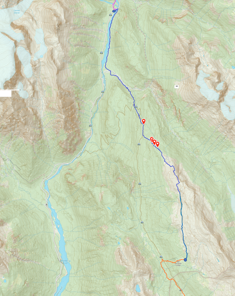
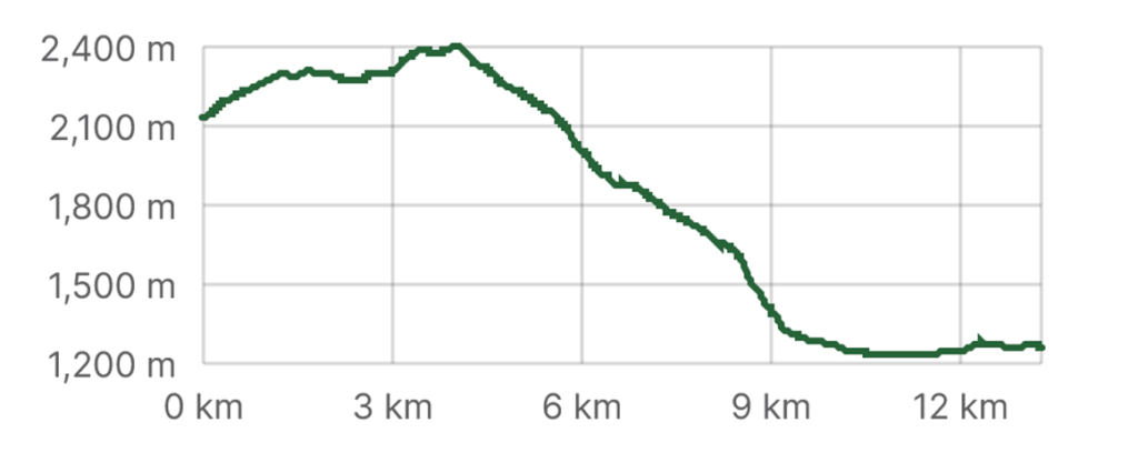
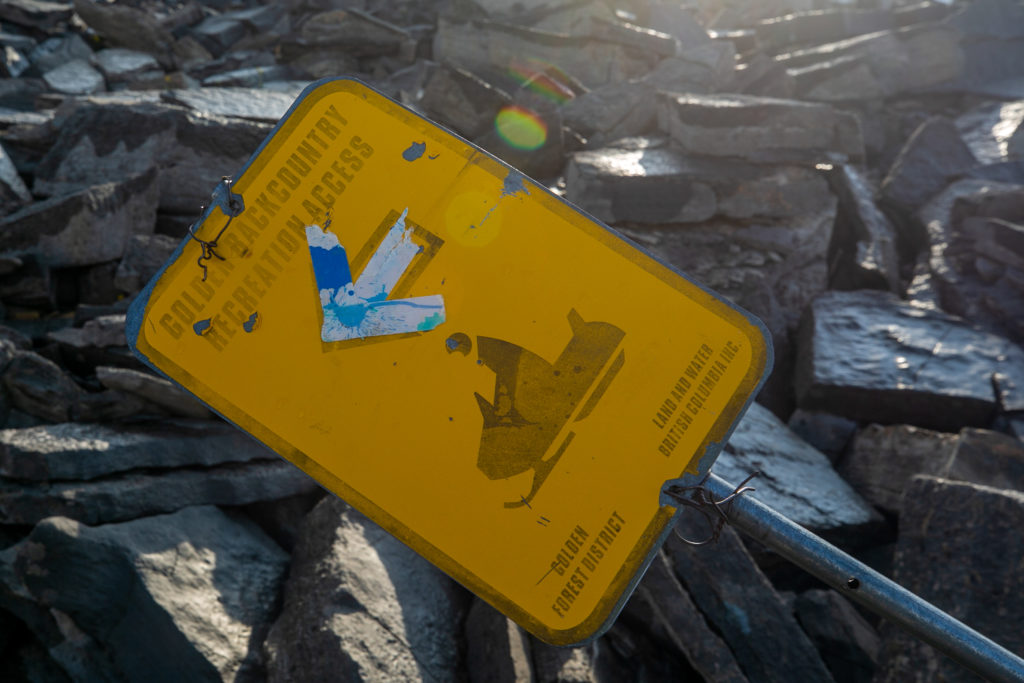
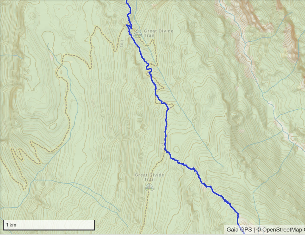
Day 4, August 11th, Meadow behind Amiskwi Lodge to Cairnes Creek Rec Site David Thompson TH, 15 km, 295 m elevation gain, 1270 m elevation loss, 8 hrs 50 min, Amiskwi Ridge Alternative (Segment 22).

Map, in blue, for Day 4.
Hike profile.

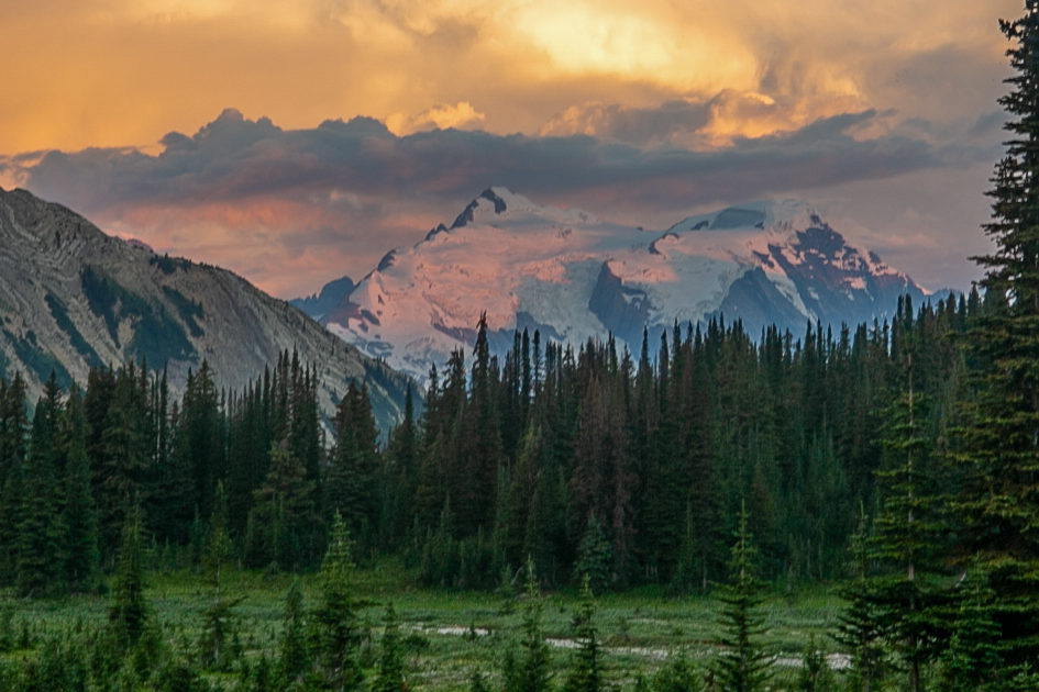
Was up and out of the tent at 6:20 am. It may have seemed a little early but it was a glorious morning with the soft morning sunshine lighting up the Mummery Glacier.

The view from the tent.
Close up of the pinks and orange on the Mummery Glacier.

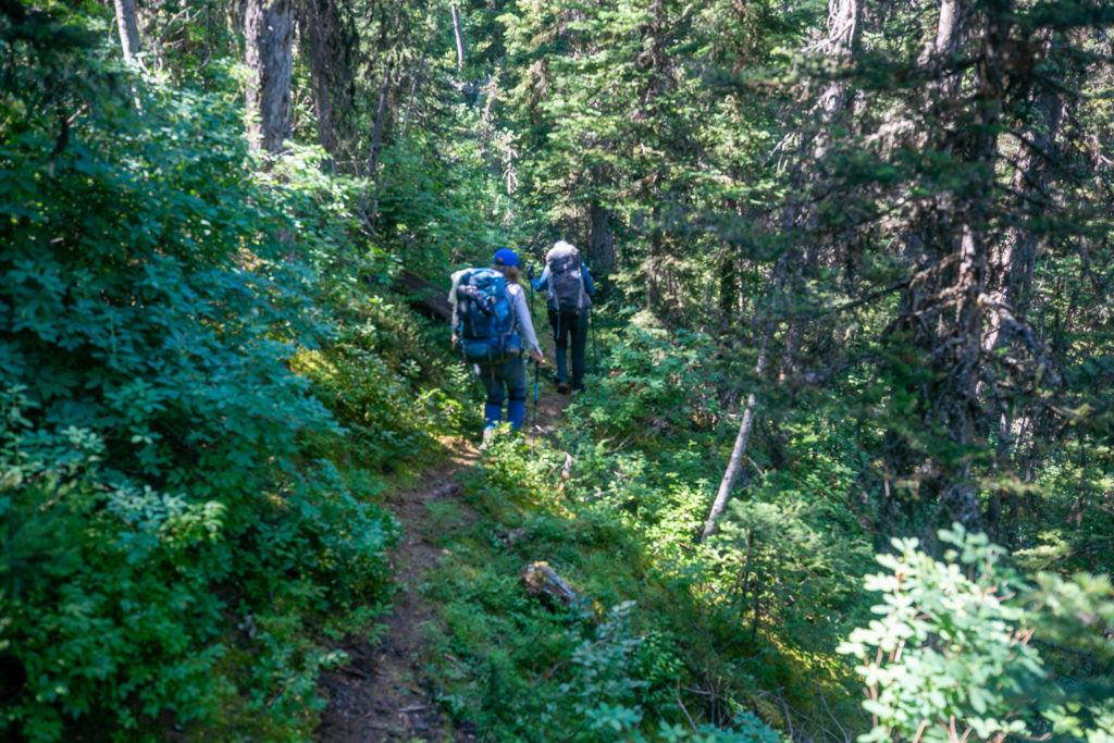
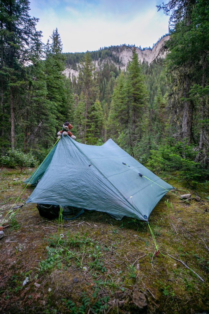
I took care of early morning business, had breakfast and was ready to go by 7:40 am. Our hike on this day only had small amount of elevation to gain before heading downhill for most of the day. I was quite relaxed as I was figuring this would be an easy day. By now I should have known better that no day on Section D is an easy day. We rolled out of camp just before 8 am. While our camping spot was gorgeous even in the early morning the mosquitos were fierce.

Camp all packed up.

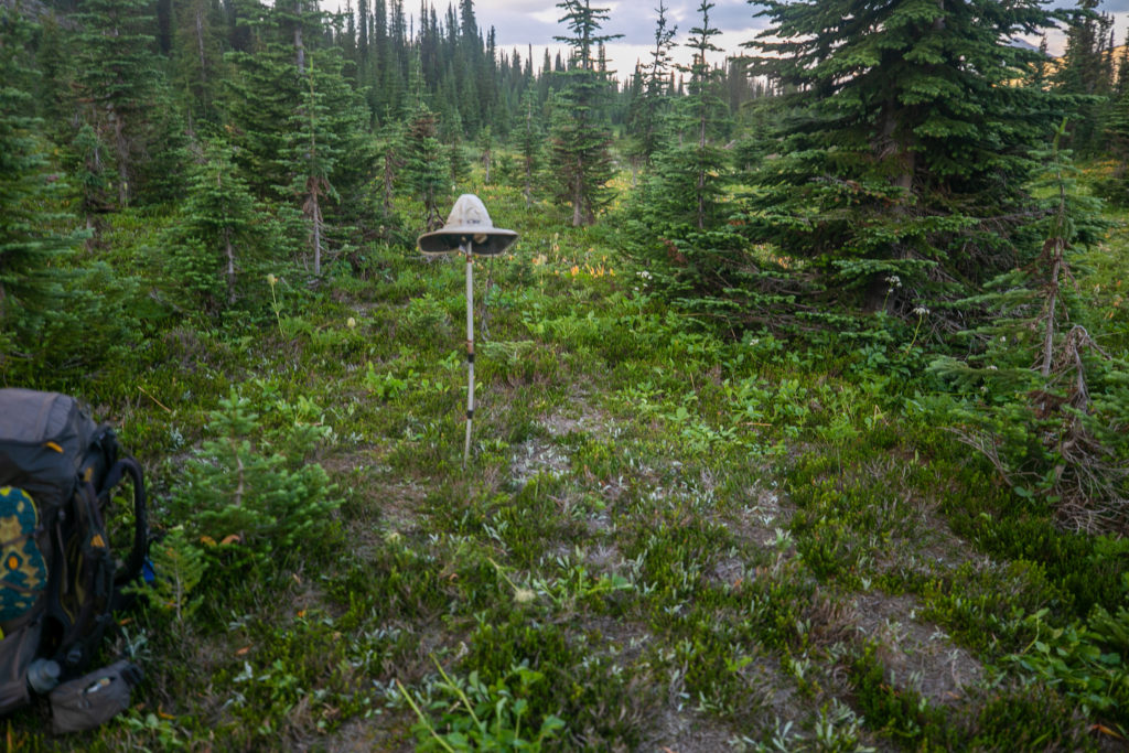
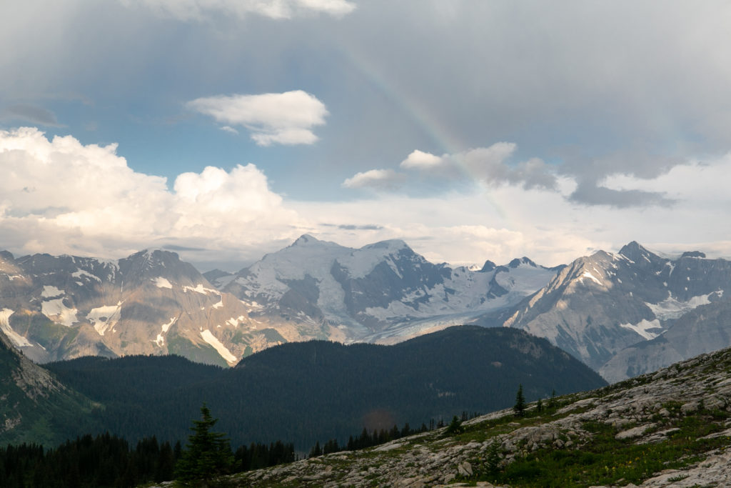
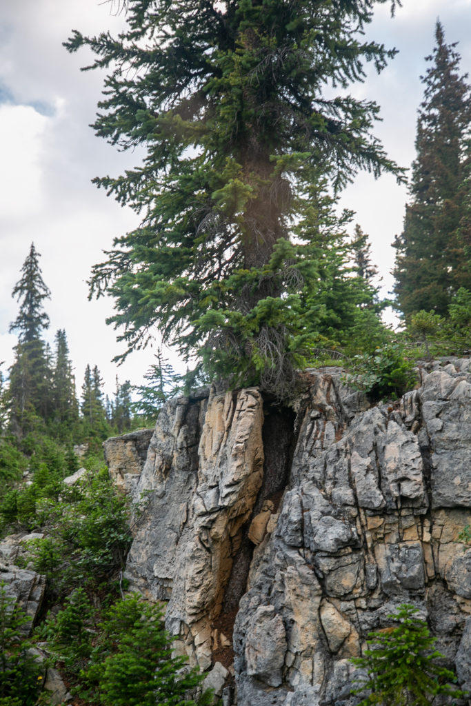
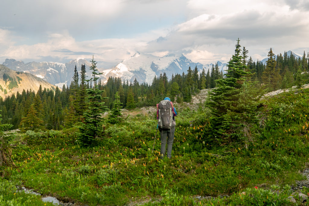
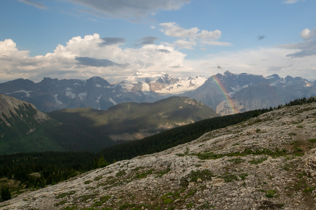
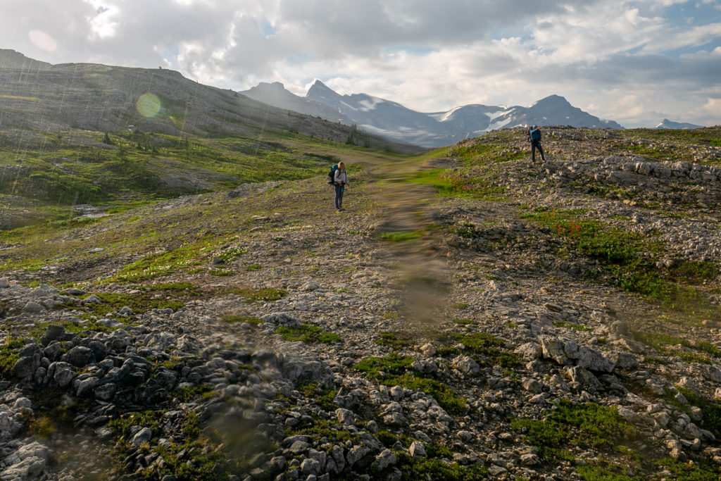
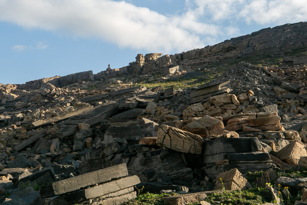
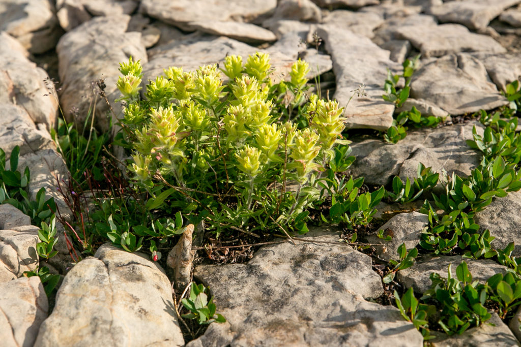
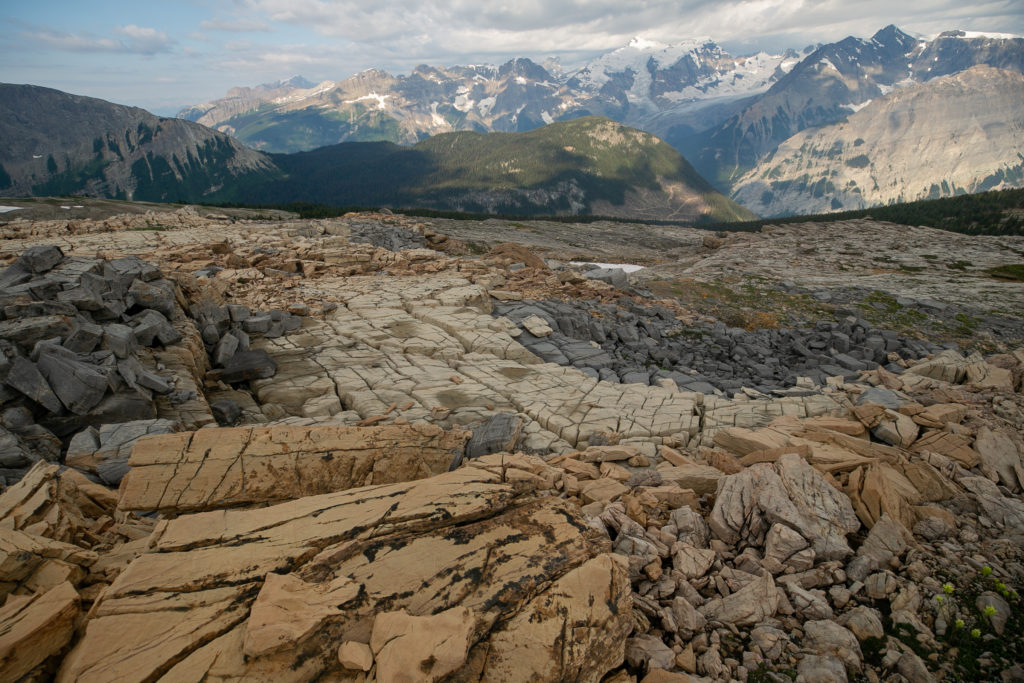
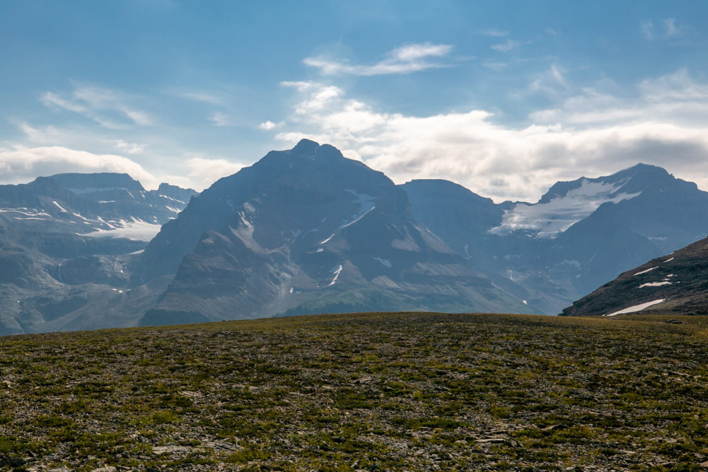
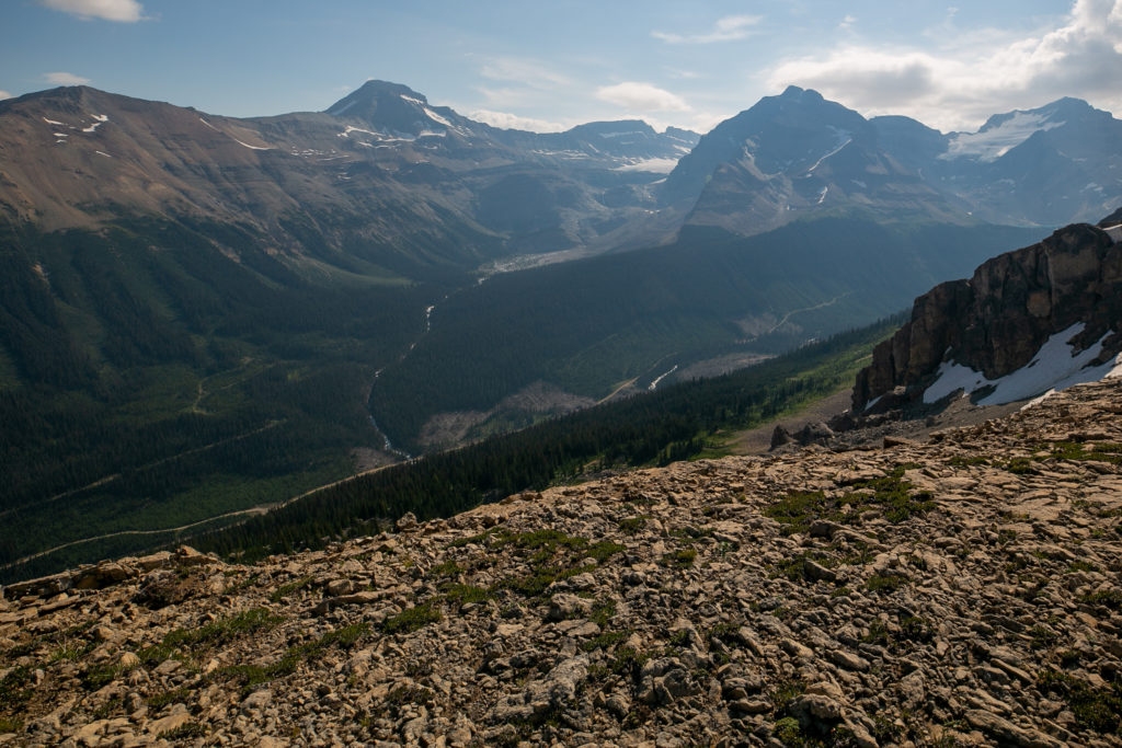
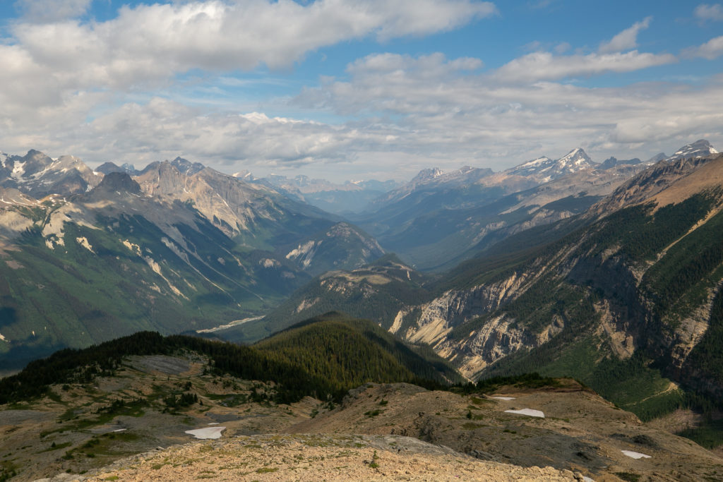
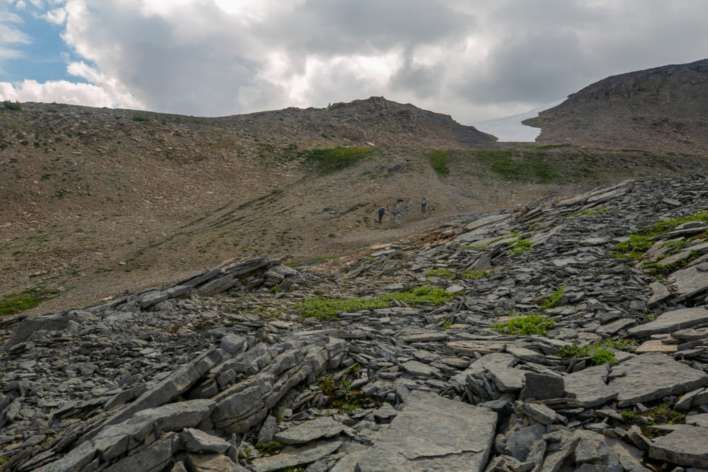
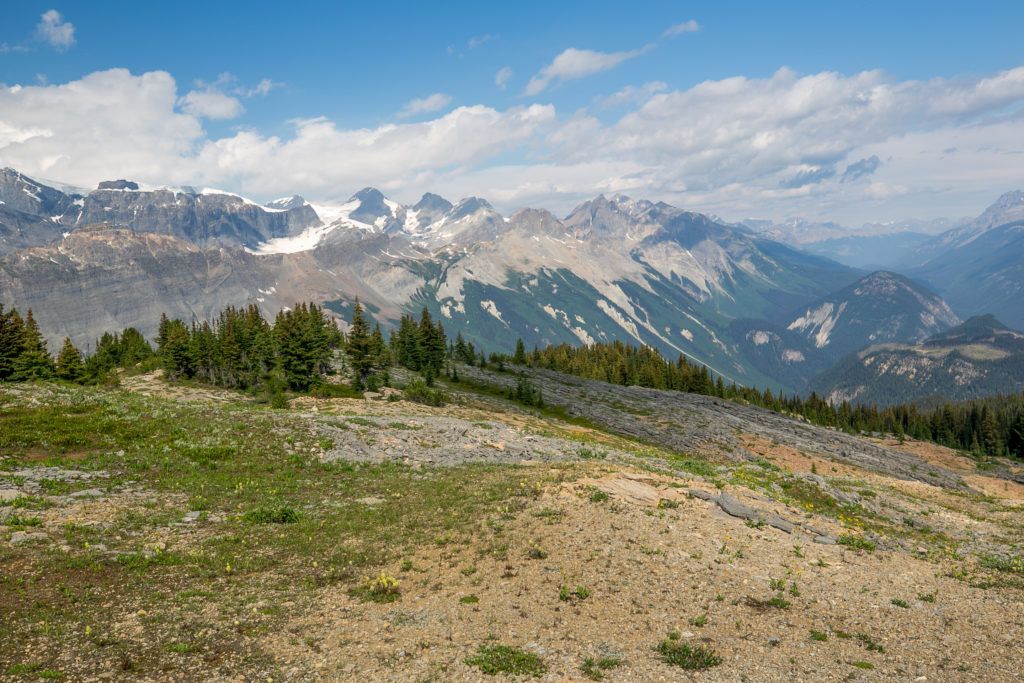
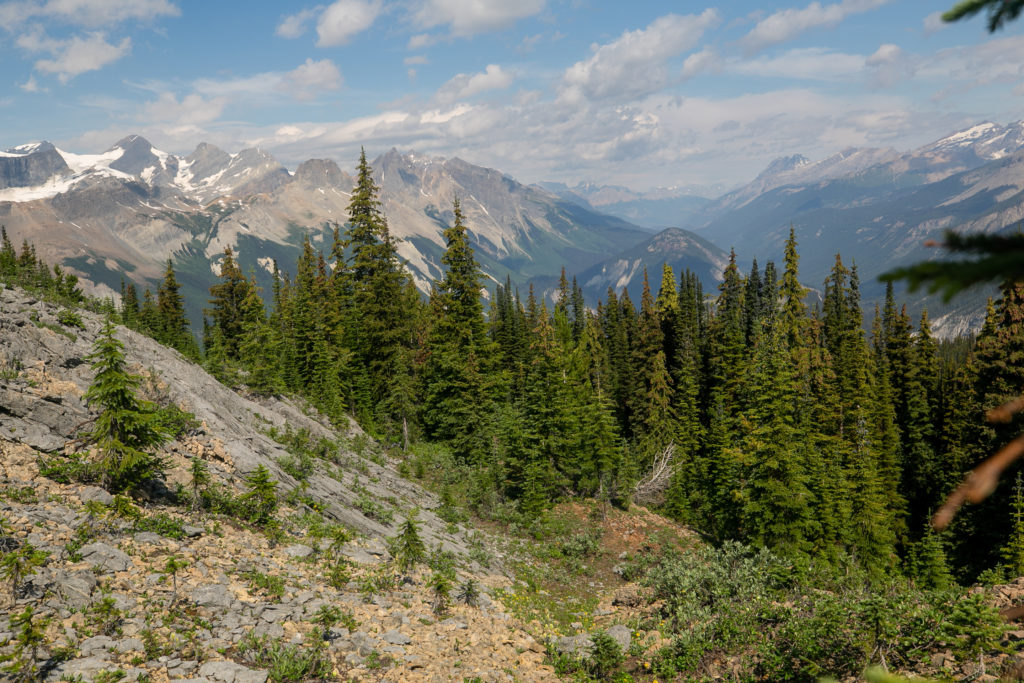
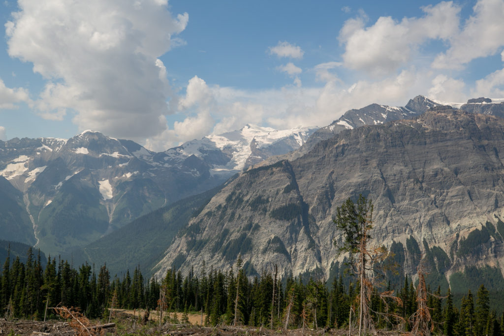
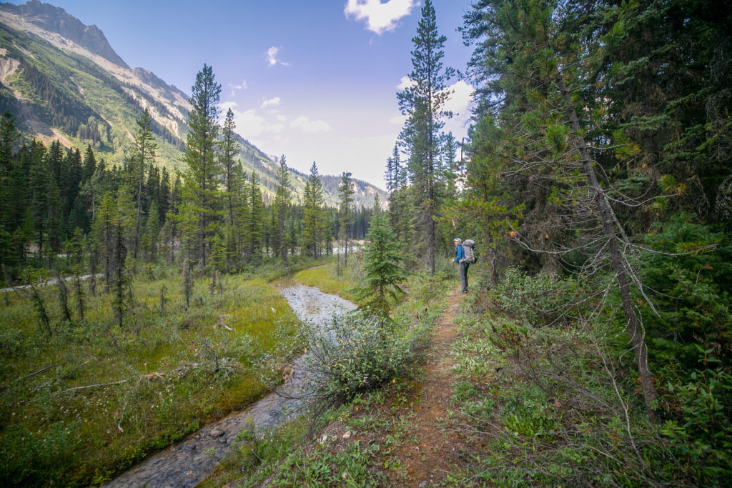
The day started with an easy climb up a drainage. Very quickly we rose up over the trees and the views were amazing in every direction. It was a bit of dawdling start but that was okay, the views were why we were there.

We have to cross our little creek. The trail stays on the left of the creek and angles up a different drainage.
Heading up a drainage. Some of the plants are already getting ready for winter.
I just love it when plants grow in tough places. This tree is doing a number on the cliff face.
Looking south down the Amiskwi Valley as Sara makes her way up.
Lillian stopping to take in the view of the Mummery Glacier. This would happen a lot.

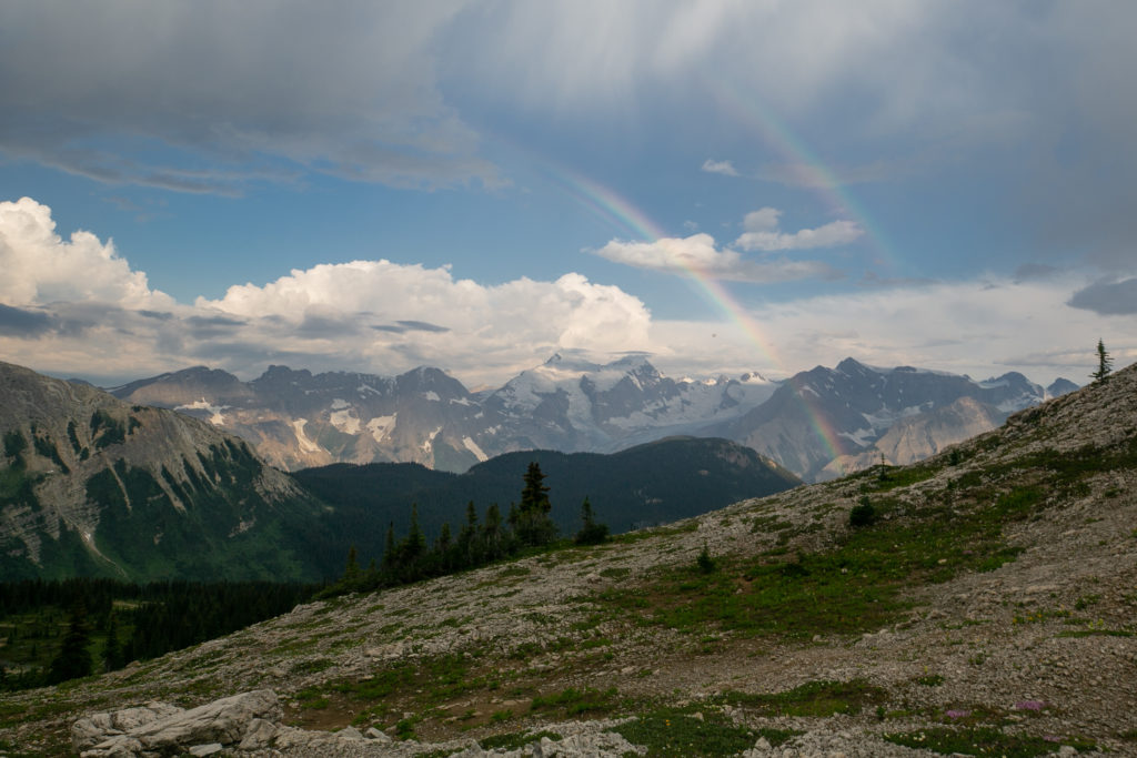
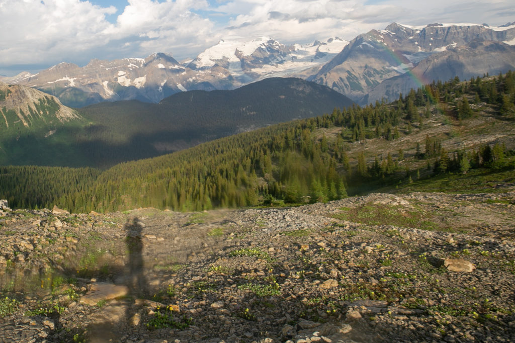
It was just a few minutes after this that the real morning light show started.

The first rainbow of the morning. It only got better.
Would not be a day in the alpine without some moss campion.
Some stunted but vibrant yellow paintbrushes. It is definitely a harsh growing climate.
Where we were headed.
Double rainbow.
Another shot of our morning view.

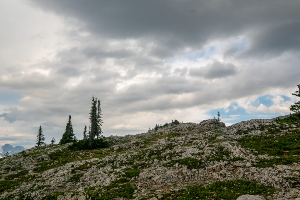
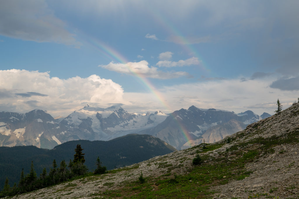
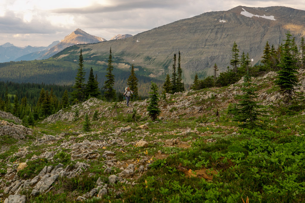
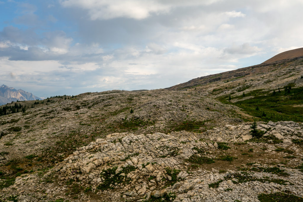
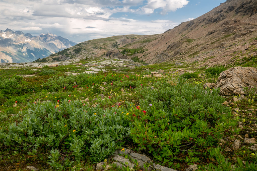
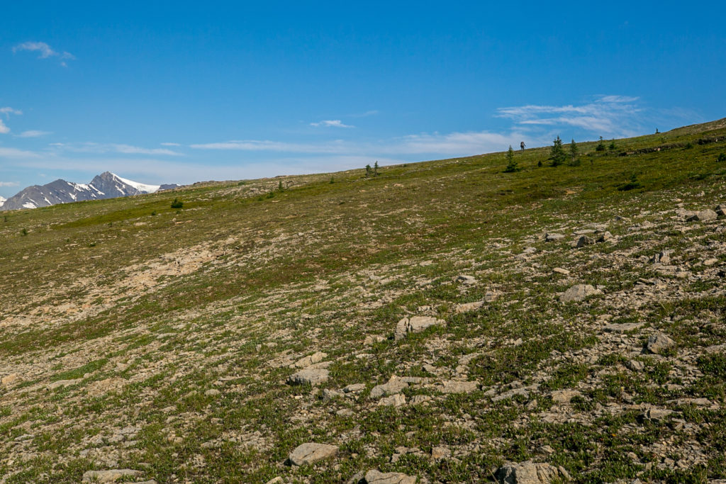
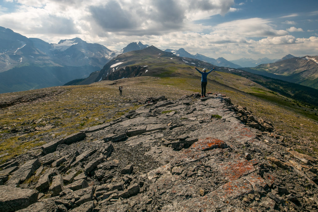
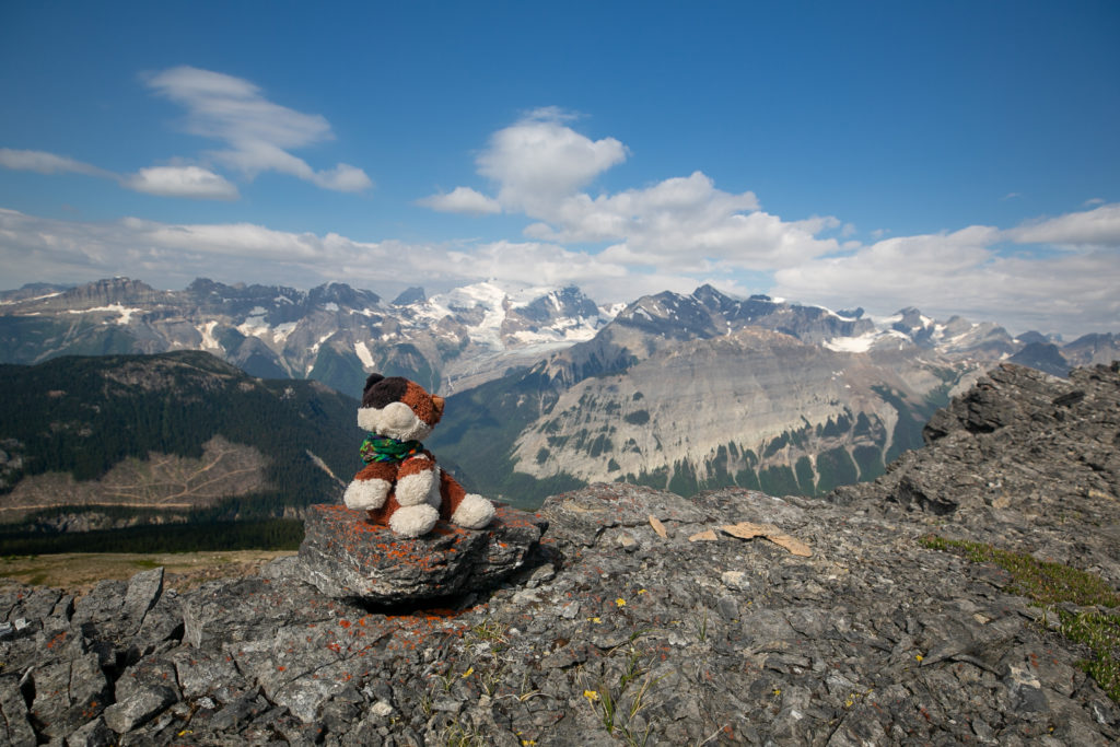
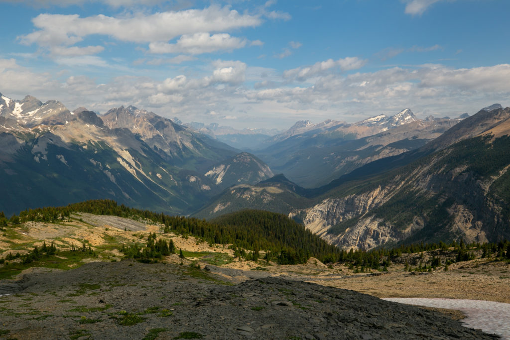
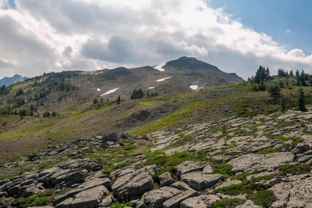
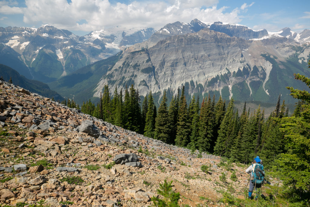
It was great to have a relatively short day while traversing Amiskwi Ridge. There is no trail on the ridge which gave us some freedom on where to hike and explore. We did try and not deviate too much from the where the GDT was marked on the FarOut App. I did have trouble staying on where the GDT was as it always seemed to higher up then where we were. The ridge was such a spectacular place it was great that we had the time to lingering and take it all in and were not under pressure to push on.

We would go up and then to the right to try and reconnect with the GDT.
Lost our double rainbow. Now just a single.
We would drop over the little hill into the valley then angle up to the right. There was a snowfield just over the other side of this little hill.
We had a brief rain shower. The blur in the centre of the photo is probably a rain drop on the camera lens.
The Mummery Glacier, a rainbow and me.
The flowers are out cheering us on as we climb up through a drainage.
For being off trail the hiking was very good.
Snowmobilers go that way.
Made aim for the large cairn at the top.
These rocks were not easy to cross. Almost like descending Kiwetinok Pass the rocks were loose and unstable in places.
Going to make for the grassy looking meadow at the centre of the photo.
Some yellow paintbrushes blooming in the high alpine.
The shattered rocks we just crossed. There appears to be three different rock types grey, brown and tan.
More flowers. We decided that we would drop over this hill into the little valley on the other side then hike up the slope in the distance.
Refilled our water supply in the this little valley. Nice little creek flowing in the bottom. It is 8:45 am.

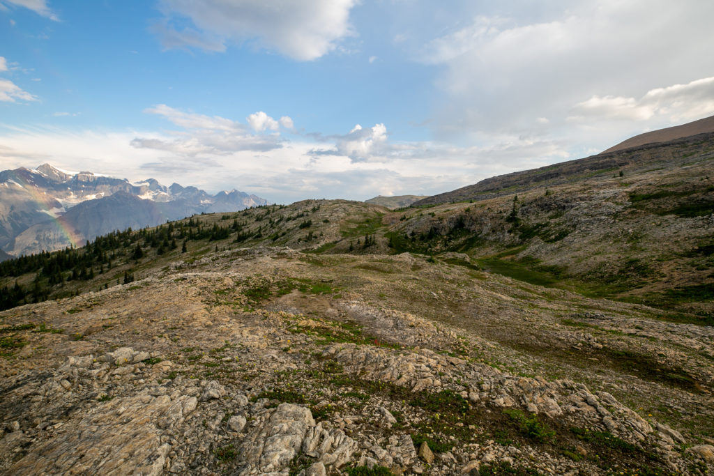
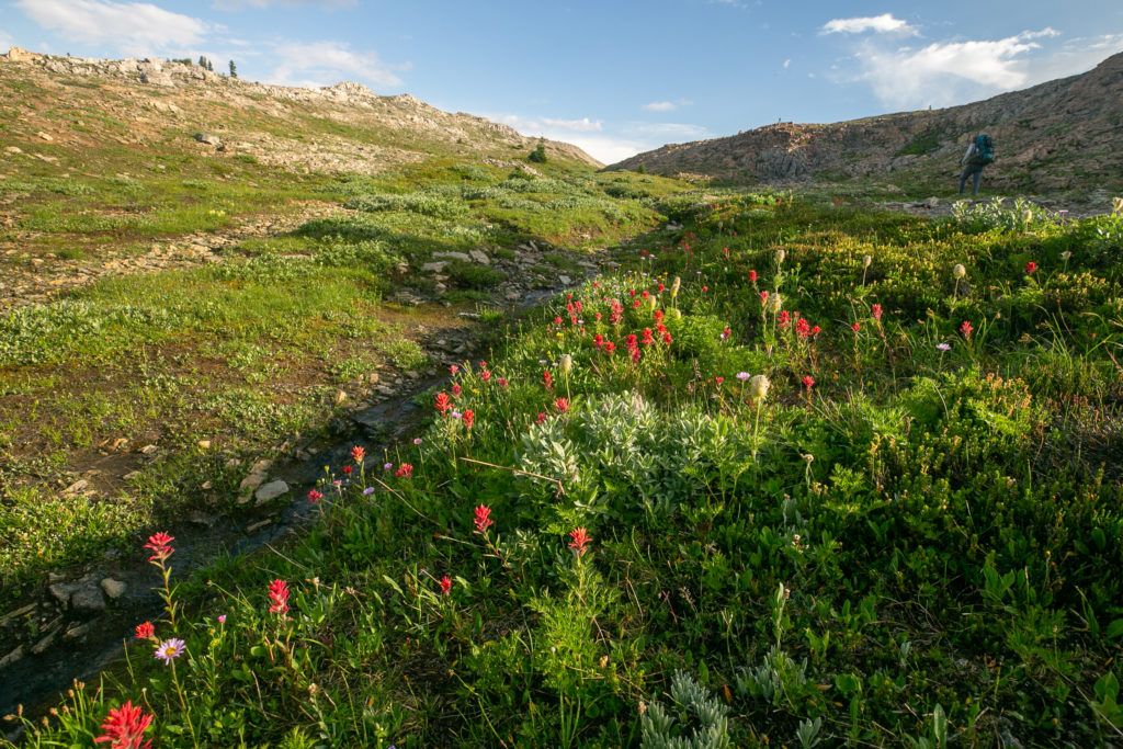
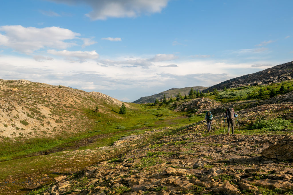
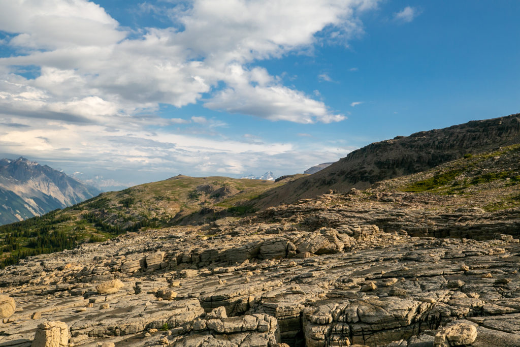
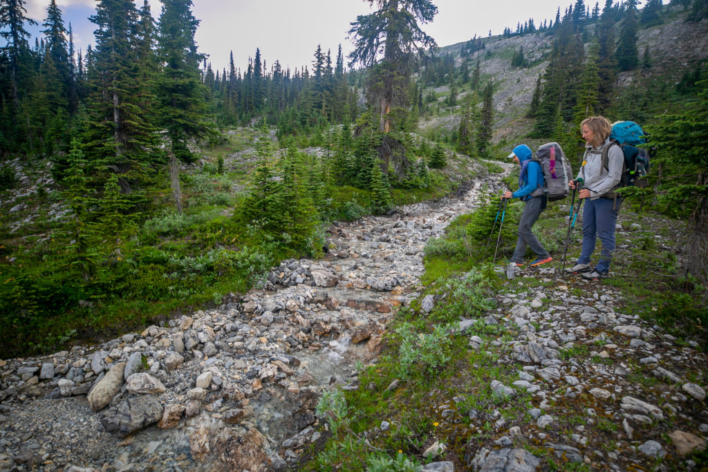
After we had refilled our water we gave up trying to get to the the GDT and decided to head for a point on a ridge in the distance. It did mean that we lost a little elevation before heading up a very pleasant grassy slope. We would reconnect with the GDT on a ridge overlooking Collie Creek at 10:30 am.

We would head right up the centre of the photo. We passed right by the orange sandstone outcrop at centre.
The orange sandstone outcrop. Mummery Glacier in the distance.
The Mummery Glacier is part of the much larger Freshfield Icefields.
One last little climb.
It was an easy walk to the ridge. Lillian is in the distance about the crest the ridge.
Looking north along the ridge. Our high point for the day is the rise in the distance.
Sara on her final approach to the ridge.
Looking like like some wilted red paintbrushes.
Looking south east from the ridge. The glacier on the right is part of the Yoho Glacier and the glacier sneaking around on the left is the Ayesha Glacier. Both glaciers are part of the Wapta Icefields. The mountain at centre is aptly named Ayesha Peak (3065 m)
Mt Ayesha at centre. On the right in the distance is Mt Collie (3116 m). On the left the lone peak is Mt Baker (3172 m). Following the ridge from Mt Baker just before the notch is Mt Habel (3072 m) and after the notch is Mt Rhondda (3062 m). Collie Creek flows in the valley just out of sight below us due to the cliff.
Easy walking along the ridge, our high point for the day will be at 2411 m. The tall peak to the right is Howse Peak (3290 m), the highest peak in the Waputik Mountains.

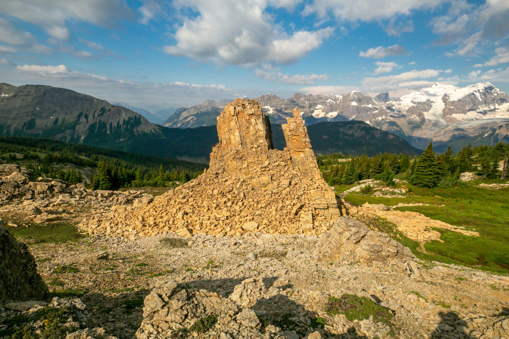
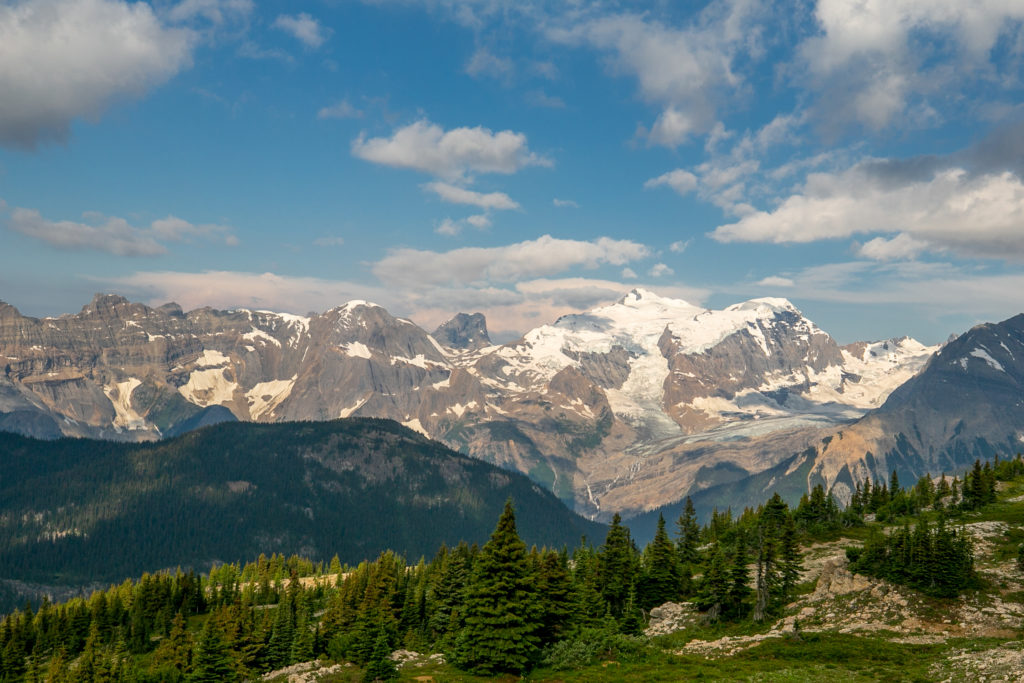
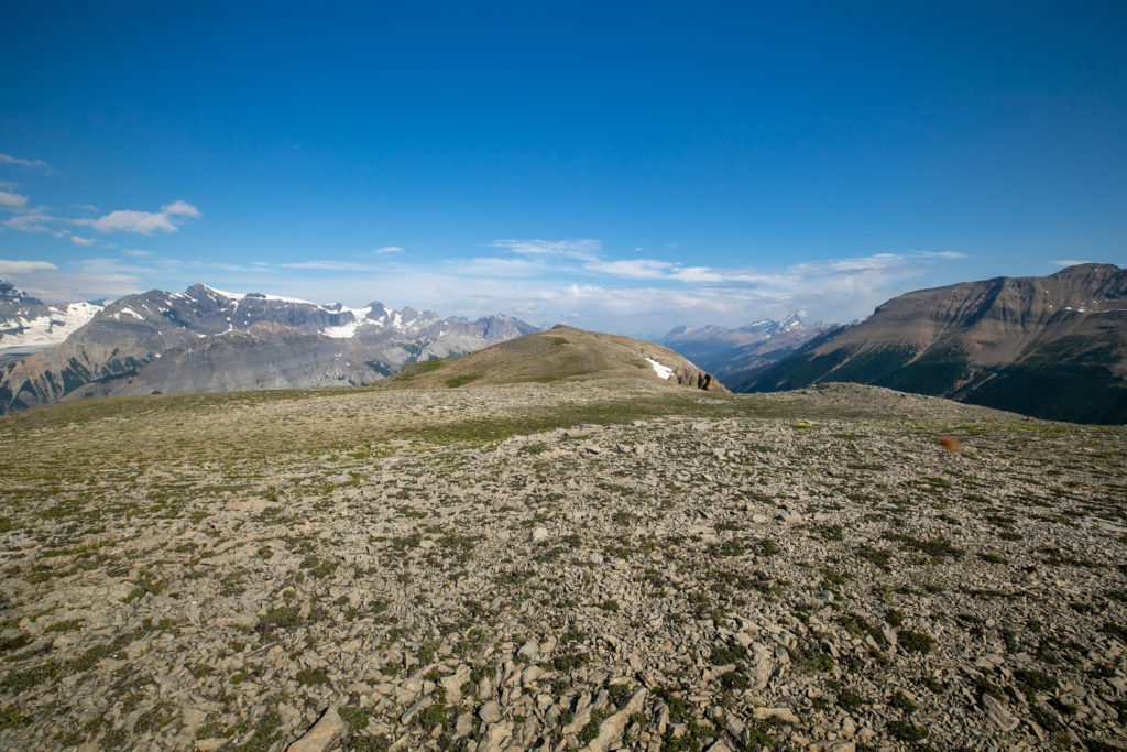
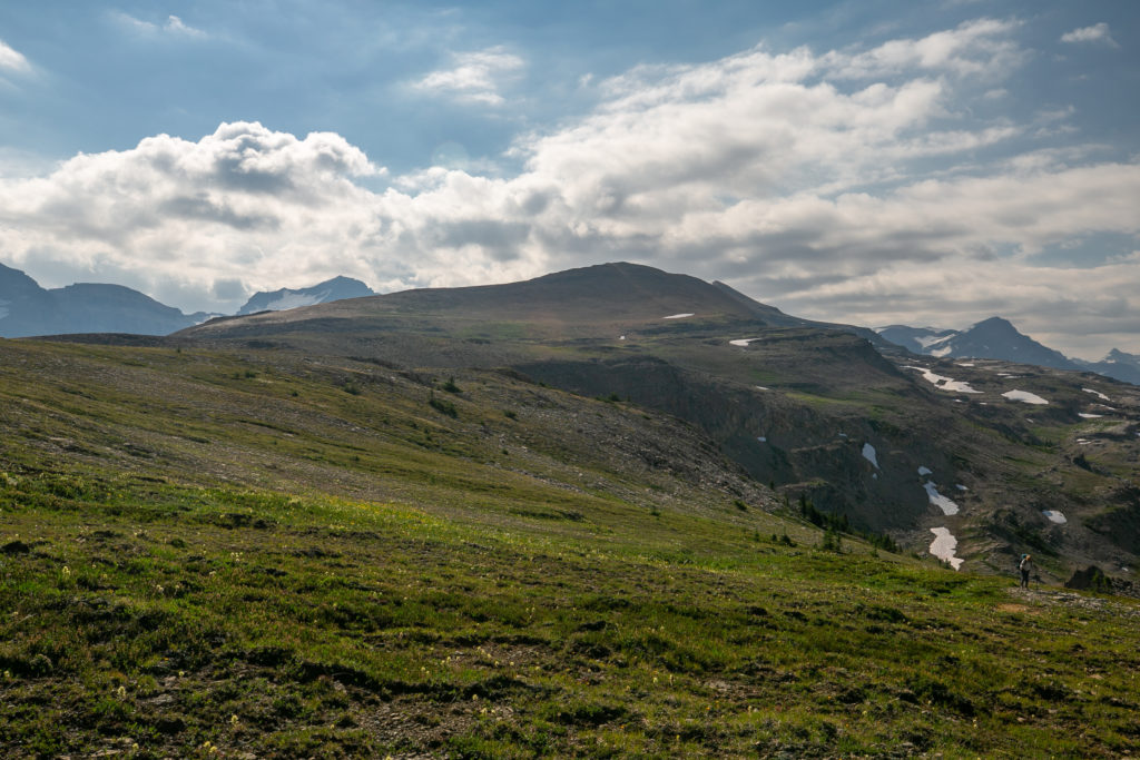
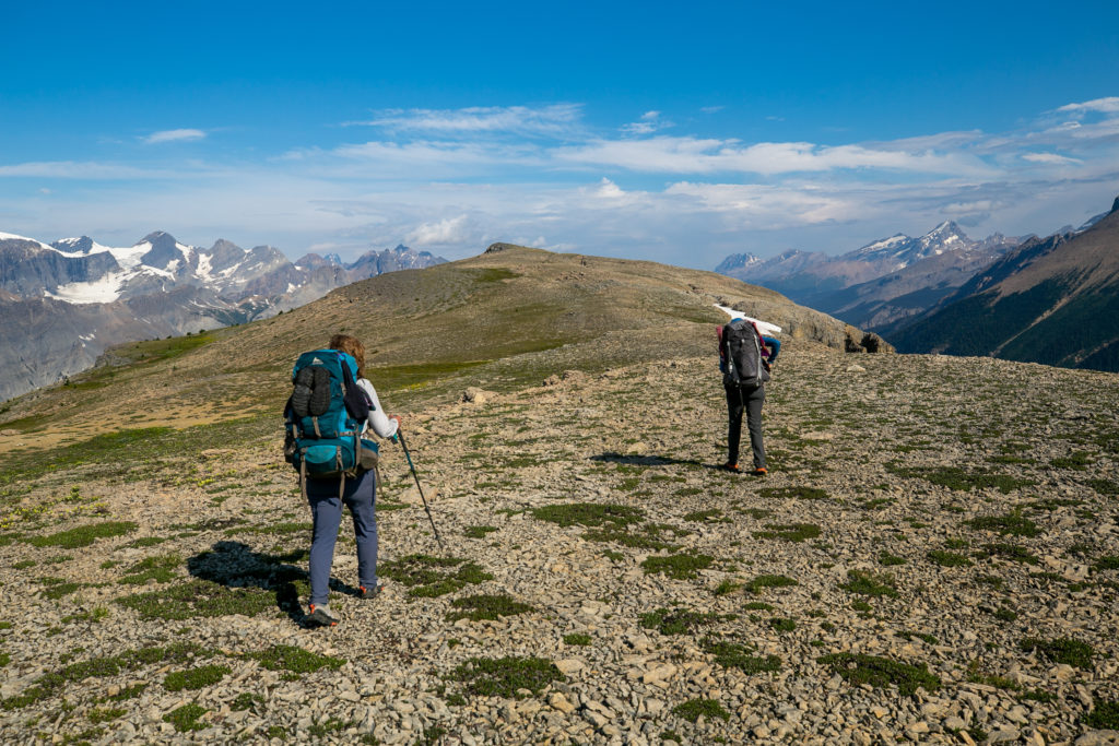
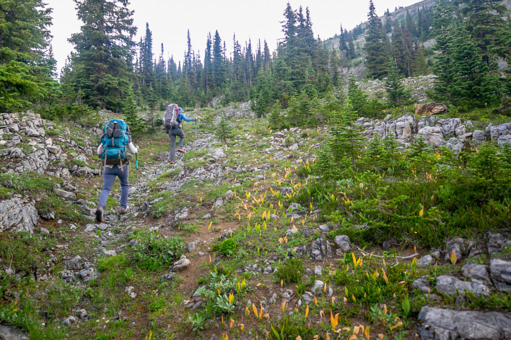
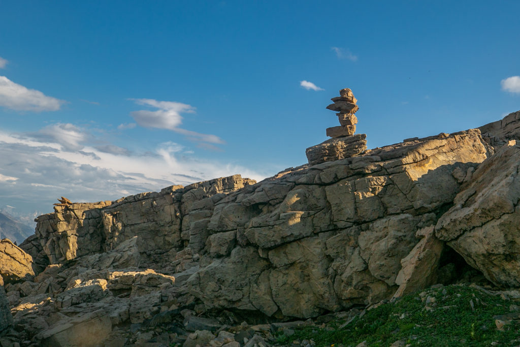
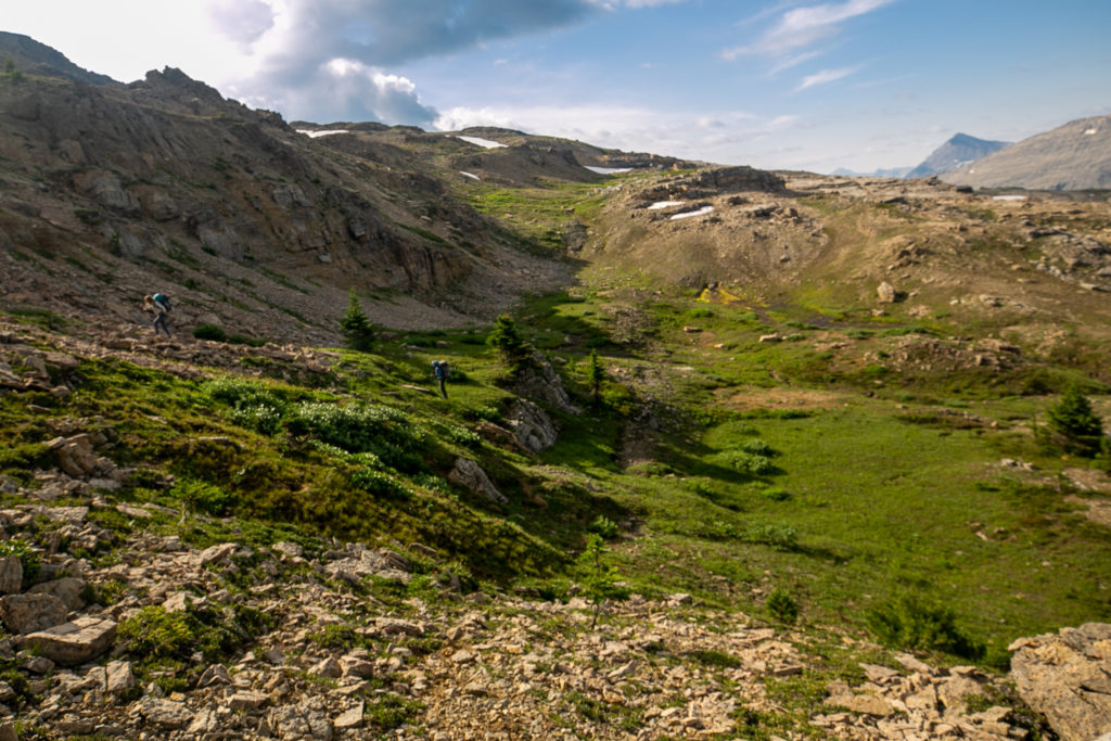
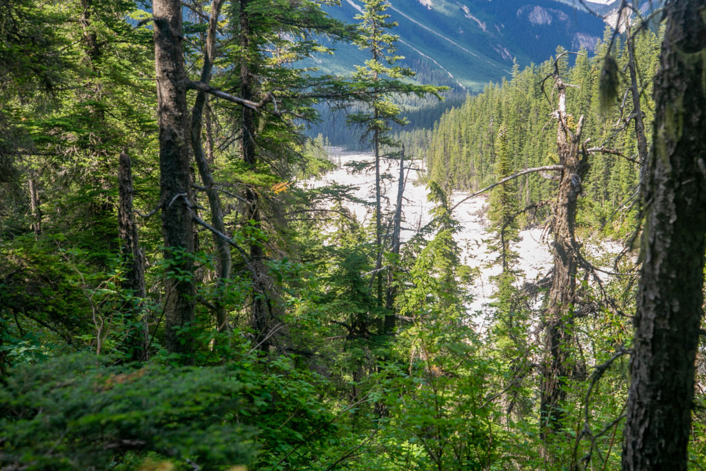
The ridge was easy walking and the sky was mostly clear. I am uneasy on ridges due to a close call with lightning back when Micah and I were hiking the GR20. In anything less than perfect weather I have trouble relaxing. I did admit to Lillian my discomfort with the ridge. We hung around the high point for a short break to have snacks and enjoy the view. We really should of had stayed longer as we would quickly be heading into the woods but after about 15 minutes we started our long descent to Collie Creek and then the Blaeberry River. We would lose over 1100 m of elevation over the next 6.5 km finishing with a relatively flat 4 km stretch to our campground.

Photo looking south of Lillian celebrating our arrival at our high point for the day.
Frosty Paws and the Mummery Glacier.
Looking down into the valley where we will be walking for the next few days.
A tiny bloom of sawwort a plant that I last saw on Kiwetinok Pass.

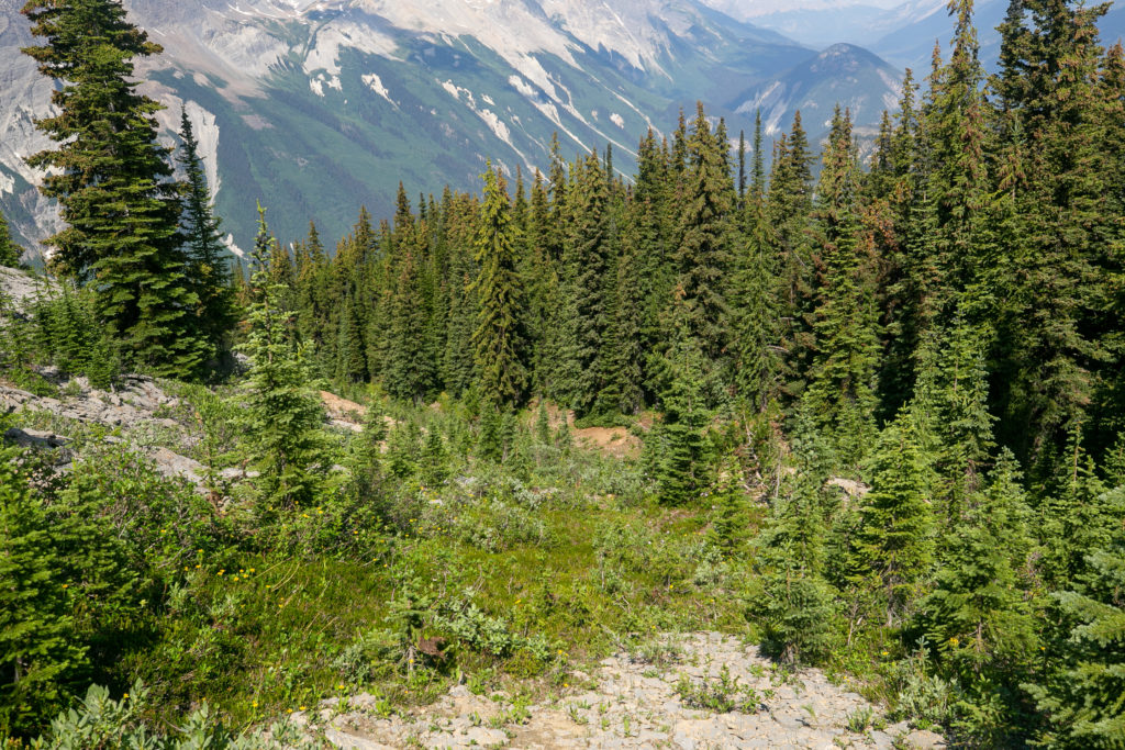
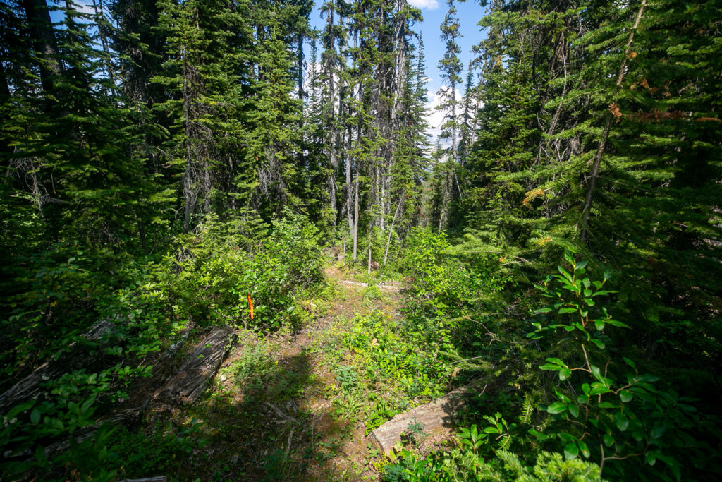
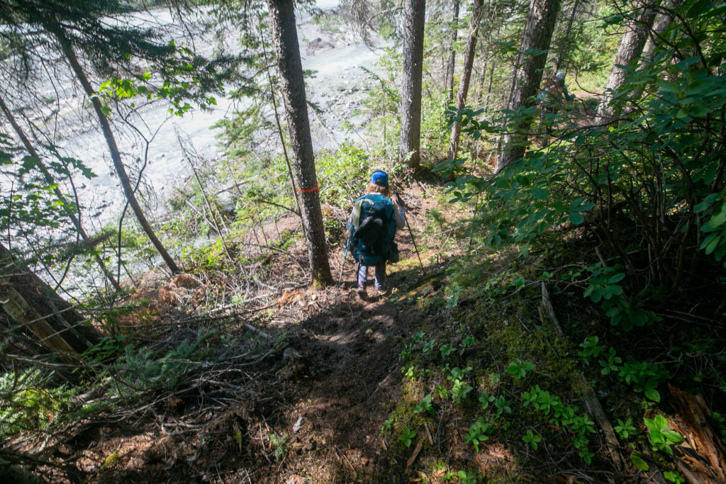
I led the initial descent. The main reason I was leading was that there was no defined trail and I keep my tablet with the FarOut App running in my cargo pant pocket so it is easy for me to check to make sure that we are on the trail. When hiking I frequently attempt to predict where the trail is going but I have discovered that my predictions are seldom correct. The initial descent was on scree but the rocks were fairly stable, nothing at all like descending off of Kiwetinok Pass.

Sara and Lillian descending the ridge.
I thought we would descend down the right hand valley but we stayed high and crossed the grey slab on the left (it is actually broken rock but looked like slab from here) before heading into the trees.
Small snowfield on the upper ridge.
Across the ever changing rocks and down into the trees.
One last look back at the ridge.
The walking was easy but you had to pay attention.
We would stay to the right and have lunch in the shade.
I was sure that the trail would head down the slope and into the trees. I was wrong.
Lunch time it was 11:54 am am. We had been hiking for just over an hour since leaving the high point on the ridge.

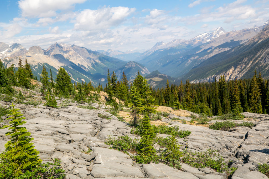
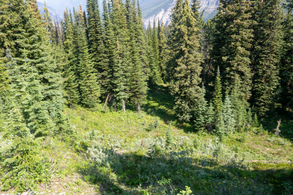
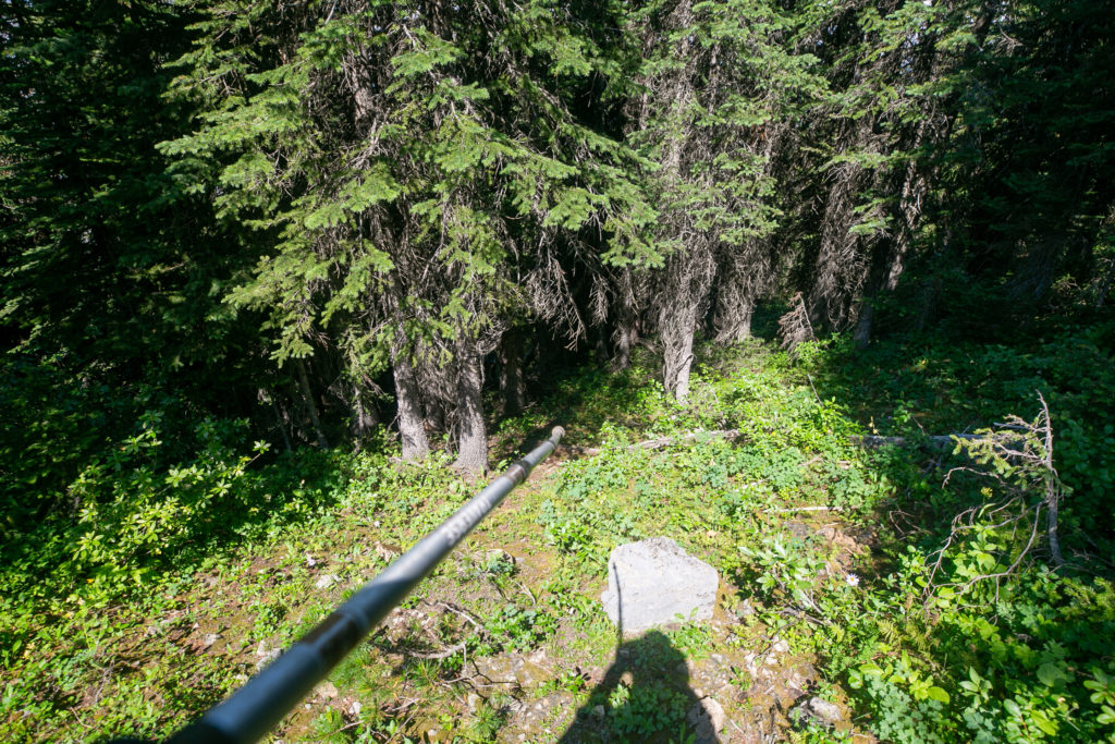
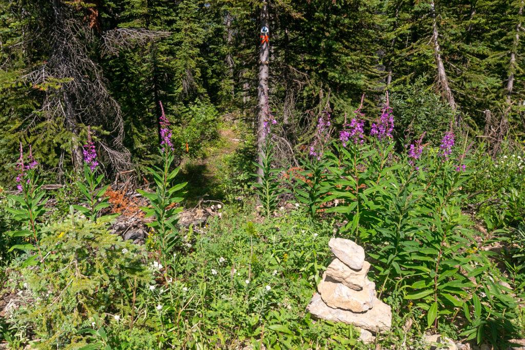
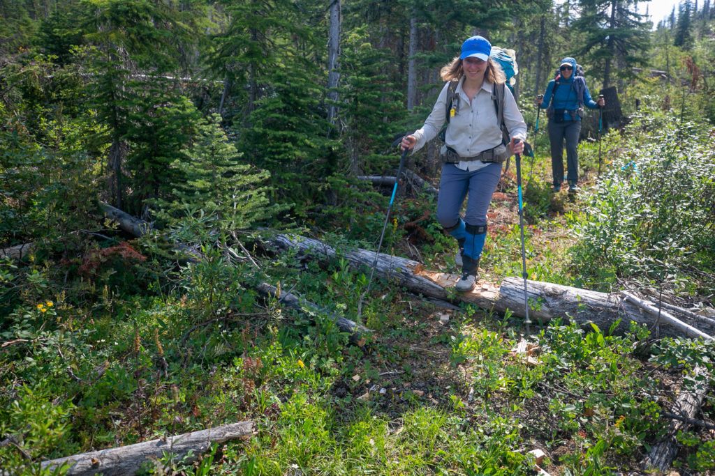
We had a relaxing lunch in the trees on a slope. The morning had been spectacular but we still had to find something resembling a trail. I had thought that we would be taking a 90 degree turn and heading straight down the hill as there was a natural break in the trees. I was not feeling very hungry so after eating one wrap I packed up my lunch and started exploring were we should go. Like usual I had guessed incorrectly. After pushing through some trees I discovered we would continue down slope following our previous direction. At the bottom of the next gully I had spied a piece of small orange flagging. We had found the GDT once again.

Above the brown patch at centre there is a small piece of flagging on the left hand side.
Flagging. Back on the GDT.

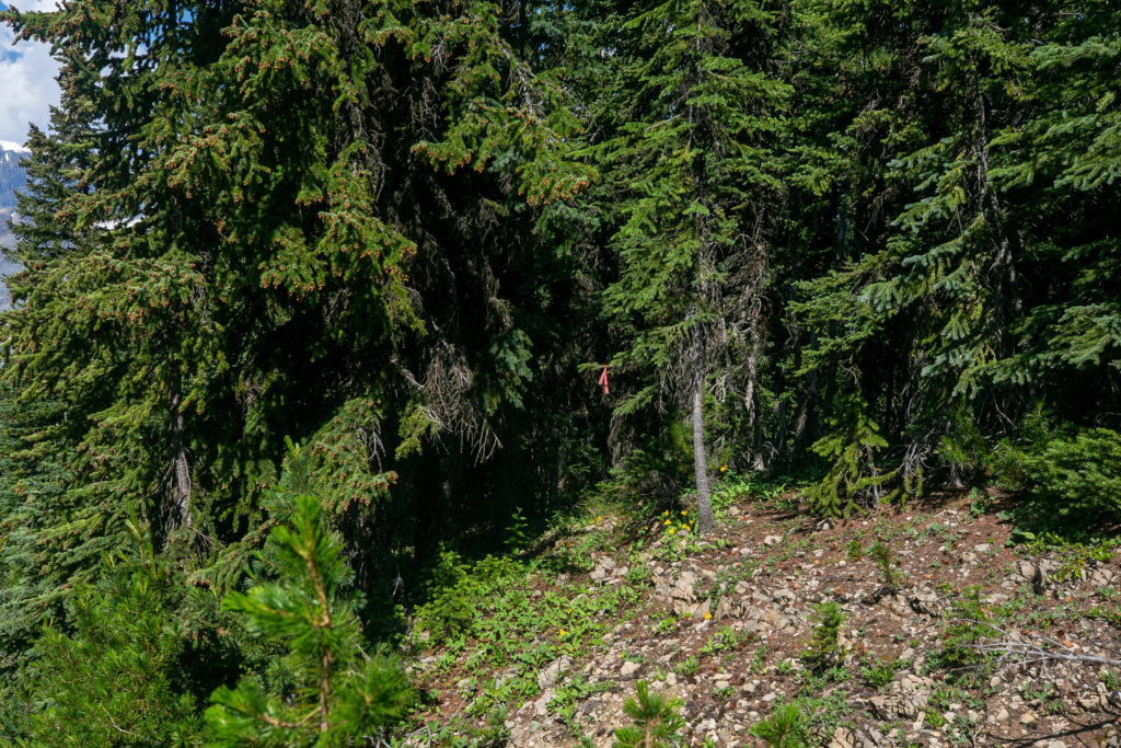
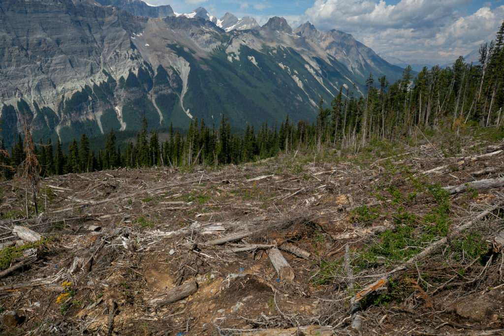
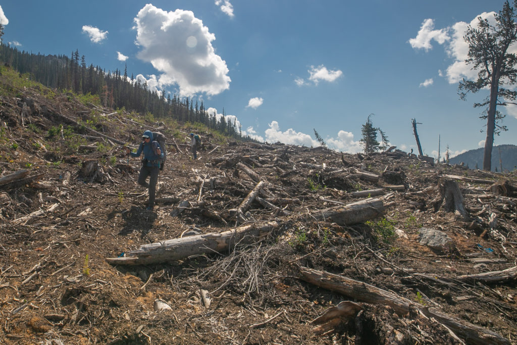
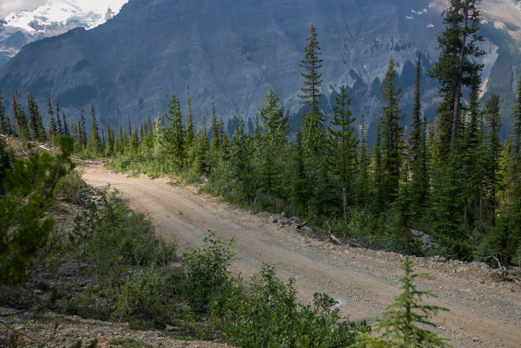
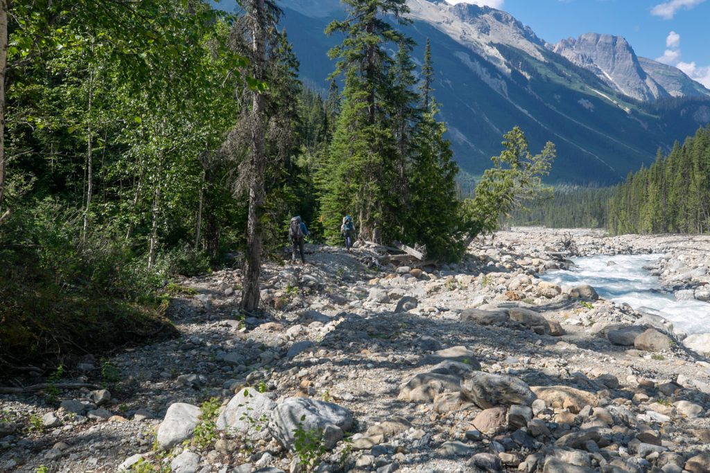
The trail would weave in and out of the woods steadily descending. After 25 minutes we exited the trees and entered a forestry cut block. Forestry cut block is a term I had never used before. I think it was Lillian who describe what a cut block was to me. A cut block is an area that the forestry company is allowed to harvest trees from. The machines do an efficient if quite messy job of cutting and removing the trees. Our path through the cut block was flagged and there was a rough trail to follow. I did fall once and got some minor scratches on my hand. Near the bottom of the cut block we could see the road which we thought we would be following until the Collie Creek Alternate so we left the GDT and just made for the road to escape the cut block.

Sara pausing to take in the view.
I guess I can see some fagging in the darkness.
Lillian entering the cut block.
The views are spectacular even from the cut block.
There is a vague trail through the chaos.
Lillian and Sara making their way down through the cut block.
The road where we thought we would be spending the next few kilometers.

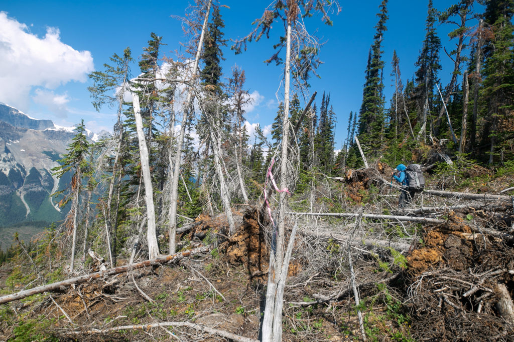
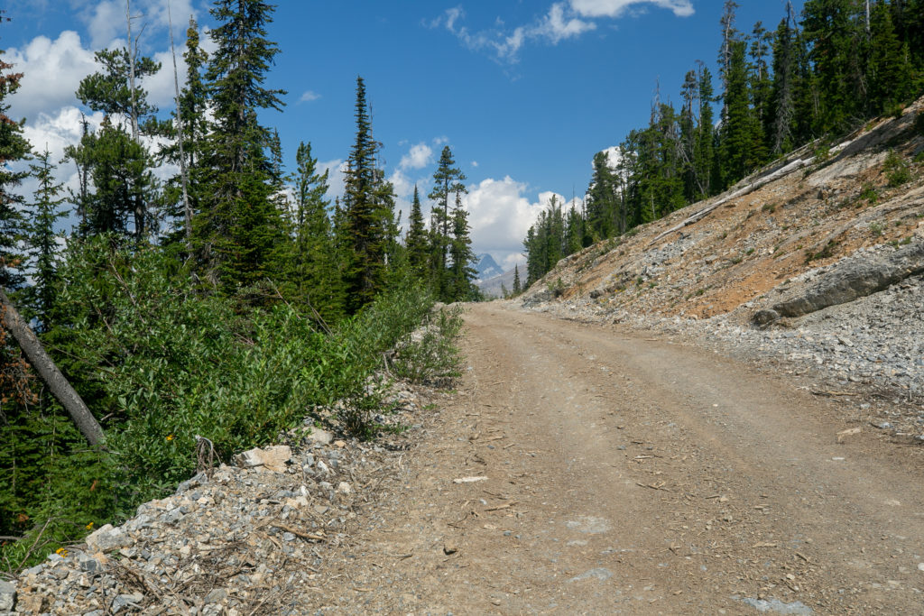
We joined the logging road from the cut block and expected several kilometres of road walking before taking the Collie Creek Alternate. We were very surprised when after just 10 minutes of road walking we discovered a flagged and marked trail with the GDT badge heading down into the trees away from the road.

Trail!?

The GDT Association had apparently been busy making a trail that would allow hikers to escape from the road and cut down the hill removing the necessity of walking all the switchbacks.

Our path in blue. You can see were we rejoined the GDT from the cut block. Then how our blue trail cuts across the road taking advantage of the new trails made during the summer’s trail building trip. At the top of the picture is where we left the road and headed down the Collie Creek Alternate.
Flagging and a trail. So much nicer walking in the woods than down the road.
Sara enjoying the trail.
As we exit one section we can see a tree across the road with a GDT badge on it indicting where the next section of trail is.
Trail walking has a smile on everyone’s face. The trail crew even notched the log for easier walking.

Just before we arrived at the Collie Creek Alternate we were passed by some side-by-side buggies (side by side describes the seating arrangement that has the two occupants sitting side by side). One of the buggies slowed down and we had a pleasant chat with the couple in the buggy. They asked were we had come from and where we were headed. The women in the passenger seat had a ventilator type masked on to filter out the dust and the buggies did kick up a lot of dust. After a few minutes we said our goodbyes and continued on our journeys.

Guessing this is the beginning of the Collie Creek Alternate.

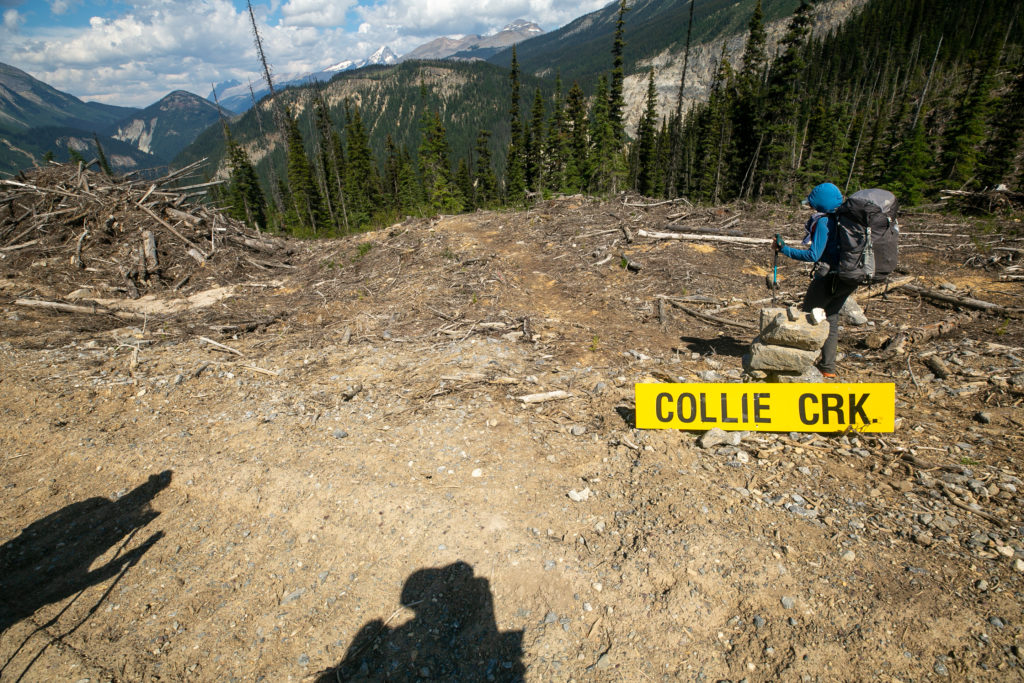
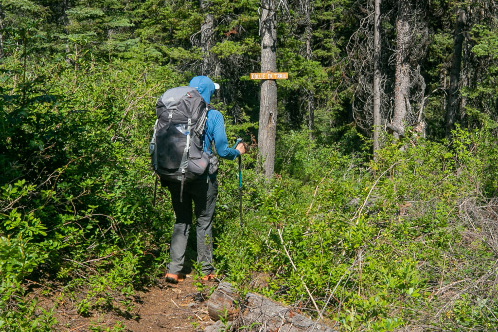
It took us about 30 minutes to walk the 1.7 km from where we exited the cut block to the beginning of the Collie Creek Alternate.

Lillian leading us into the woods.

Even in the shade it was quite warm on the trail. We were running a little low on water. I carry a large bladder and while I was low I had enough left to share knowing that we were not far from Collie Creek were we would be able to top up.

It was a lovely forested walk down to Collie Creek.

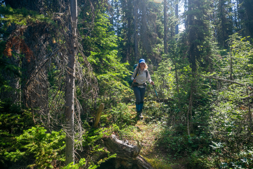
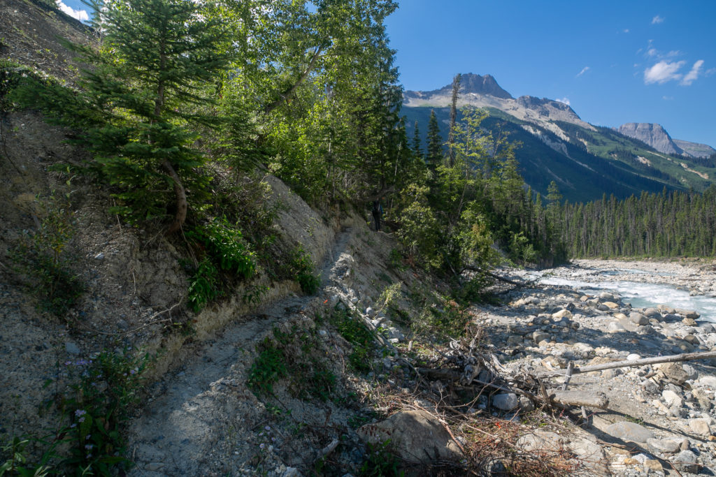
The hiking on the Collie Creek Alternate was very nice. I was starting to get tired and was falling behind a bit as we descended. While not hurting my knees were beginning to ache during the descent.

Great work by the GDT trail crew. The mushrooms taking advantage of the moist exposed wood.
First view of Collie Creek.
Weaving our way along the creek.

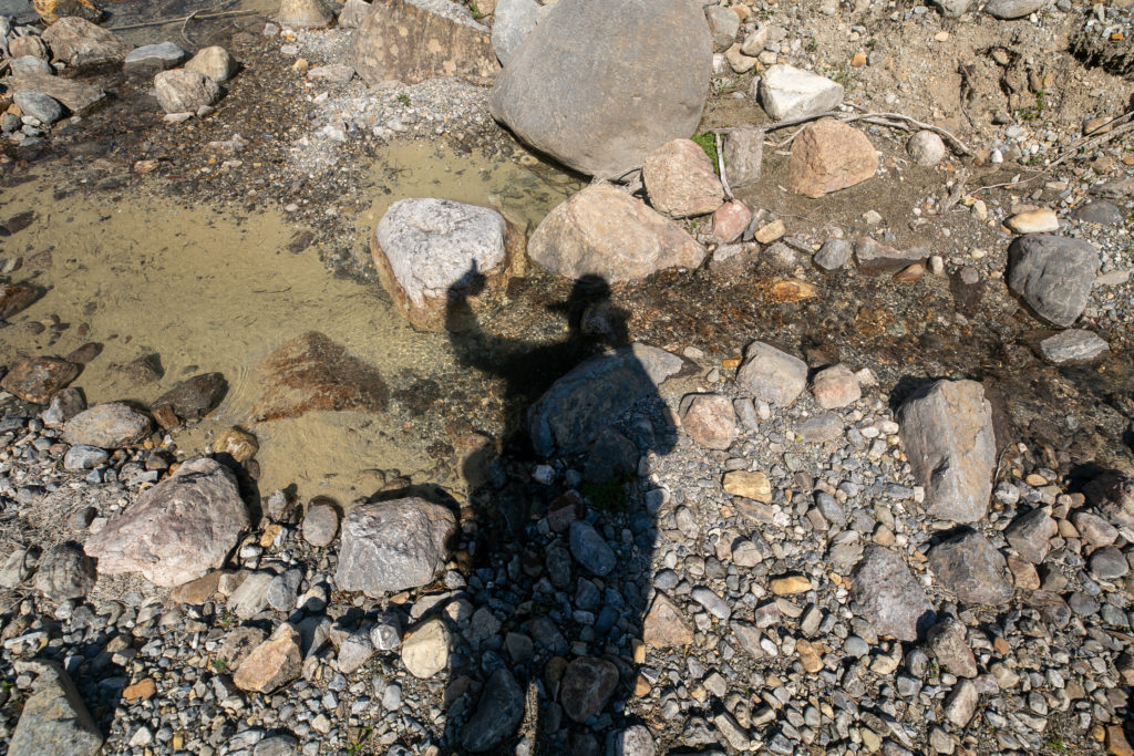
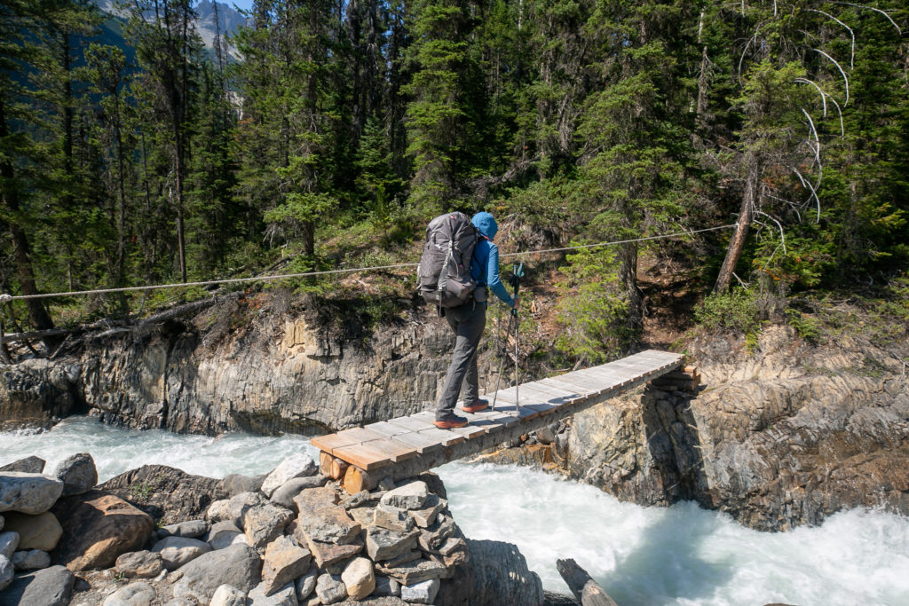
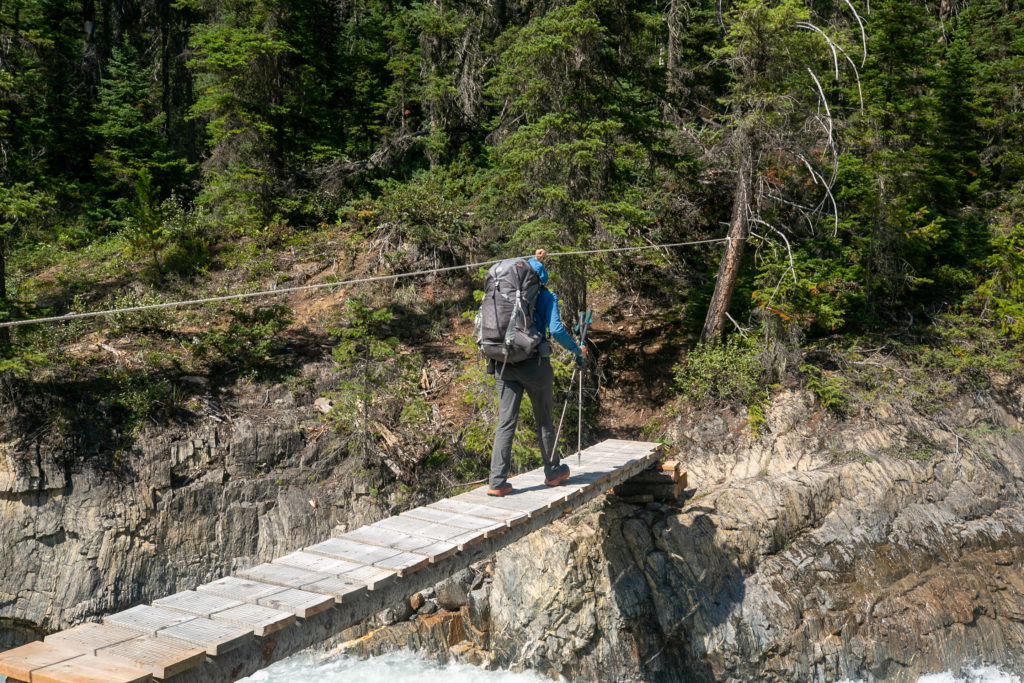
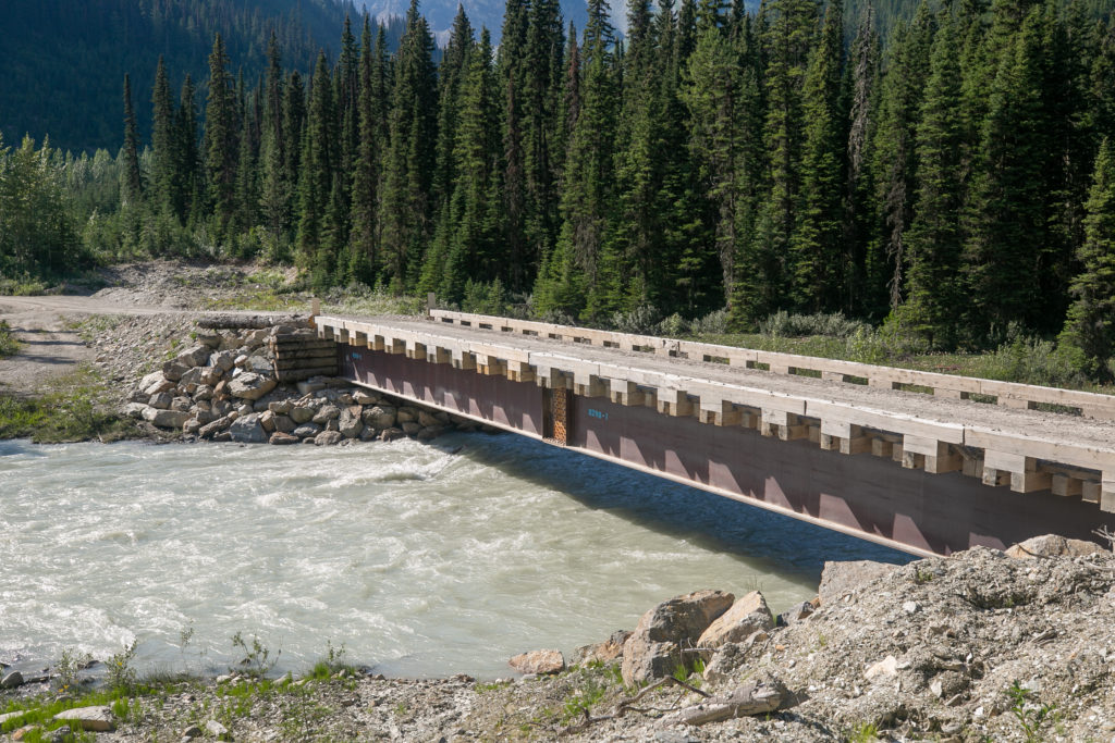
We arrived at Collie Creek just after 3 pm. It had taken us about an hour to make our way down the alternate but that did include a short break. We topped up with water from the creek. Unfortunately the the creek having its headwaters not far away in the glaciers we had seen earlier was very silty. I decided to not put the silty water through my filter but used tablets in my water bottle instead. Using tablets meant I had to wait 30 minutes but I did still have a small amount of water left in my bladder. The trail stayed on the south bank for about one kilometre before heading up a steep slope on away from the creek for a little ways before returning back to the creek. We all knew that the GDT had built a bridge across the creek but we could not see it anywhere as we walked. The creek was confined to quite a small channel and was flowing very fast. I really did not see any obvious way across the creek safely. I pushed myself to keep up with Lillian and Sara as we made our way down the creek and towards the Blaeberry River.

Despite being tired I felt great. It had been a fantastic day on the trail
Heading up and away from the creek.
The flagging, cairn and the row of dead branches is telling us to turn right and head back to the creek.

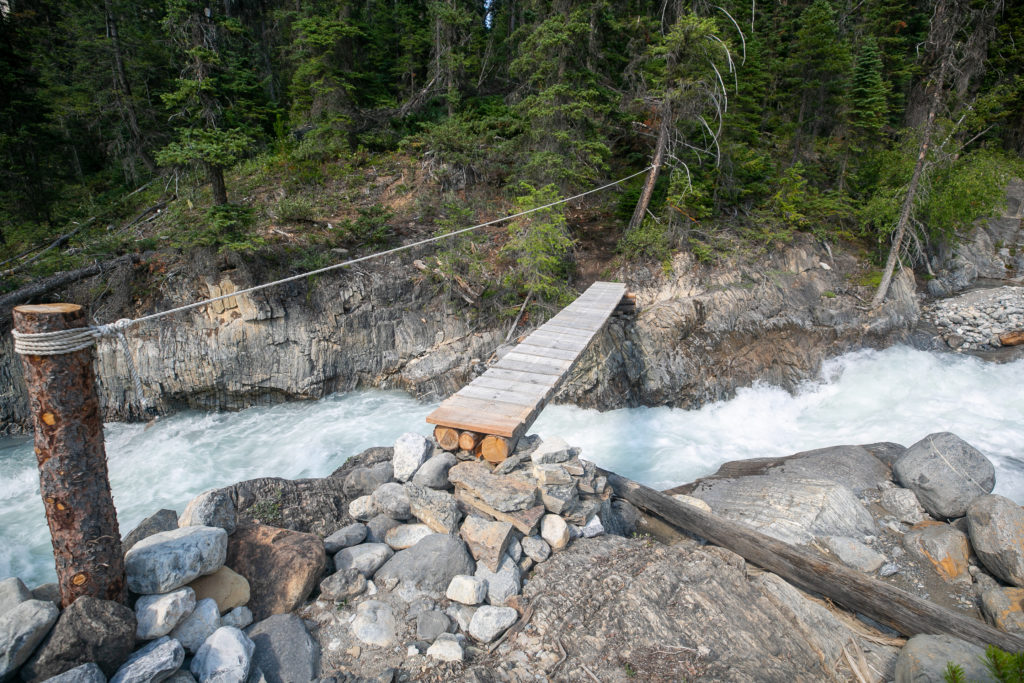
As we came out of the woods and back to the creek Lillian spotted the bridge on the far side. After hiking along Collie Creek I have no idea how you would be able to safely cross the creek without the bridge. I found the design of the bridge to be simple yet quite ingenious. The creek will change course every year during the high flow in spring. Therefore it would be difficult to have a permanent bridge that would be in the correct place unless you built a bridge over the entire span of the creek. The bridge that GDT built is movable so that as the creek changes position the bridge can be repositioned relatively easily, albeit with the aid of a helicopter.

The bridge is comprised of a walking platform, a pole and a guide rope. Worked great.
Lillian volunteered to go first and test out the bridge.
The rope was very effective in providing stability during the crossing. Falling into Collie Creek is not a great option.
Video of the bridge.
View from the other side.

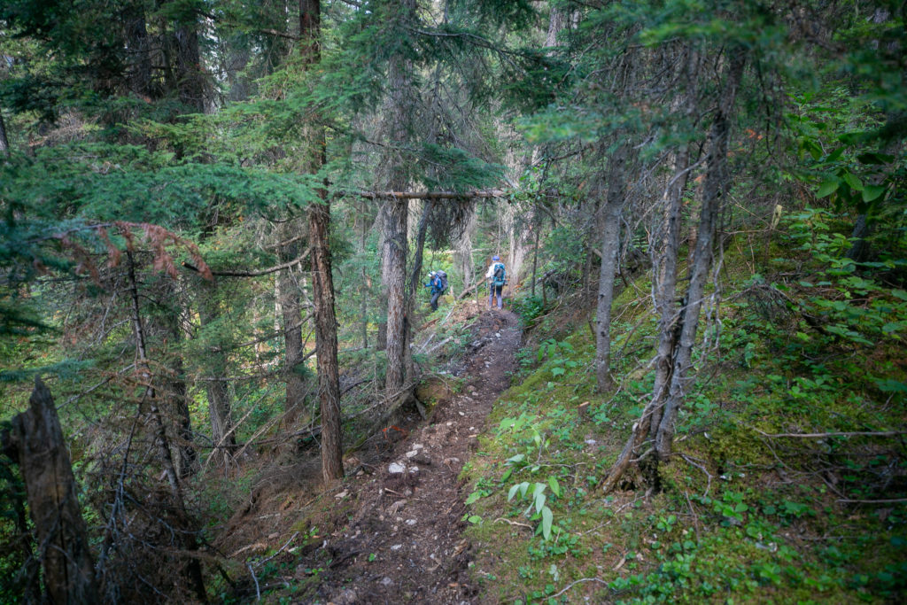
After crossing the bridge we enjoyed a nice forested walk for the remaining 3.5 km to our campsite. Along the way we spotted a very hefty axe that we assumed was left by the GDT trail crew. Lillian would put up a notice on the GDT Facebook page later with the location of the axe so that someone could retrieve it at some point. We had our one and only bear sighting for the trip when we spooked a small black bear. The bear scampered away so fast I was not able to get my camera out to take a photo before it had disappeared back into the trees. We made very good progress along the trail and arrived at the forestry bridge across the Blaeberry River in only 50 minutes. Our campground was located immediately downstream of the forestry bridge.

Wide and smooth path. Trying hard to keep up.
Lillian taking a moment to enjoy the views.
Sara on a quick little descent. Still lots of orange GDT flagging.
The forestry bridge, almost home for the evening.
Amazing bridge. We just needed to go across and turn left and we would arrive at our campsite.

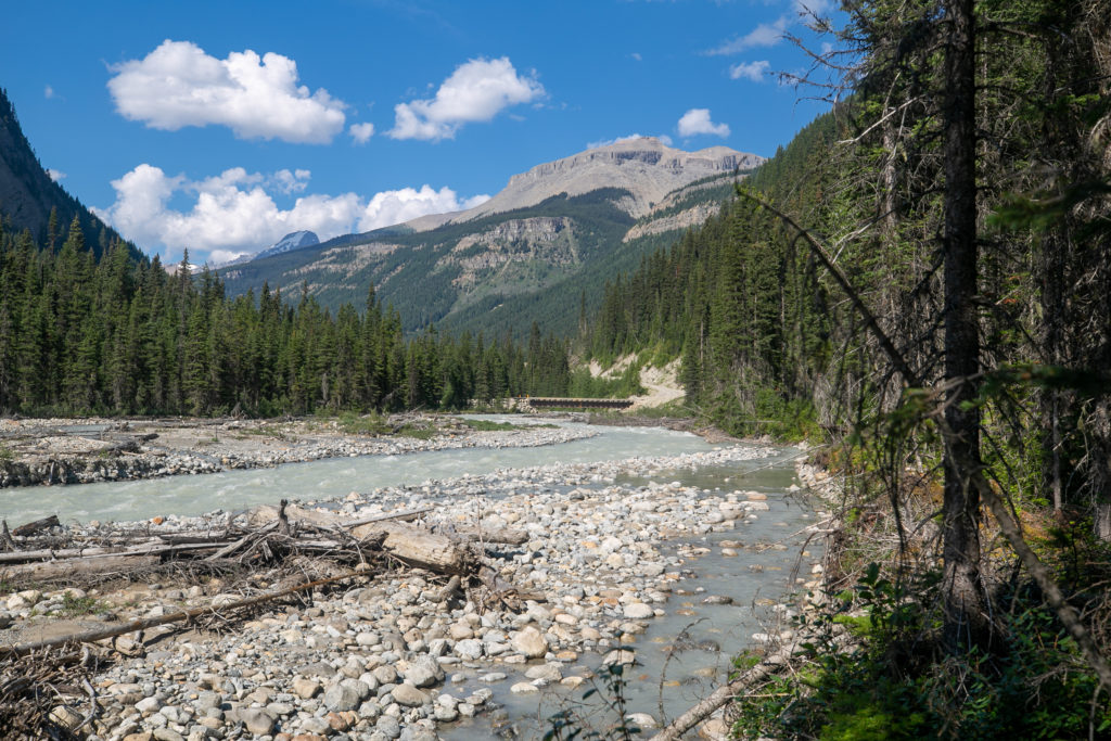
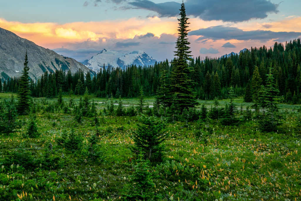
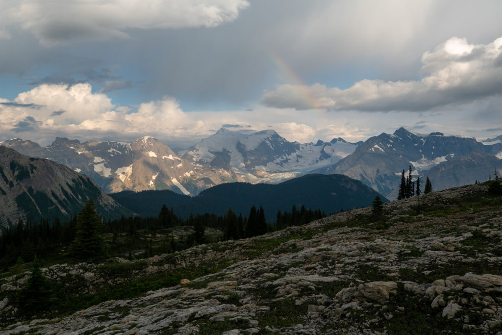
We arrived at the campground at 4:40 pm, 8 hours and 40 minutes after leaving the meadow behind the Amiskwi Lodge. This had been such a truly amazing day. The GDT can vary so much in such a short time. We went from the meadow, up a ridge with views of glaciers and rainbows, then off trail down through a forest to a creek, then down along a river valley ending at a campground with stellar views.

Just 20 minutes after arriving in camp I had my beer chillin in the river. Had to be careful it did not get washed away as the river was flowing quite fast.

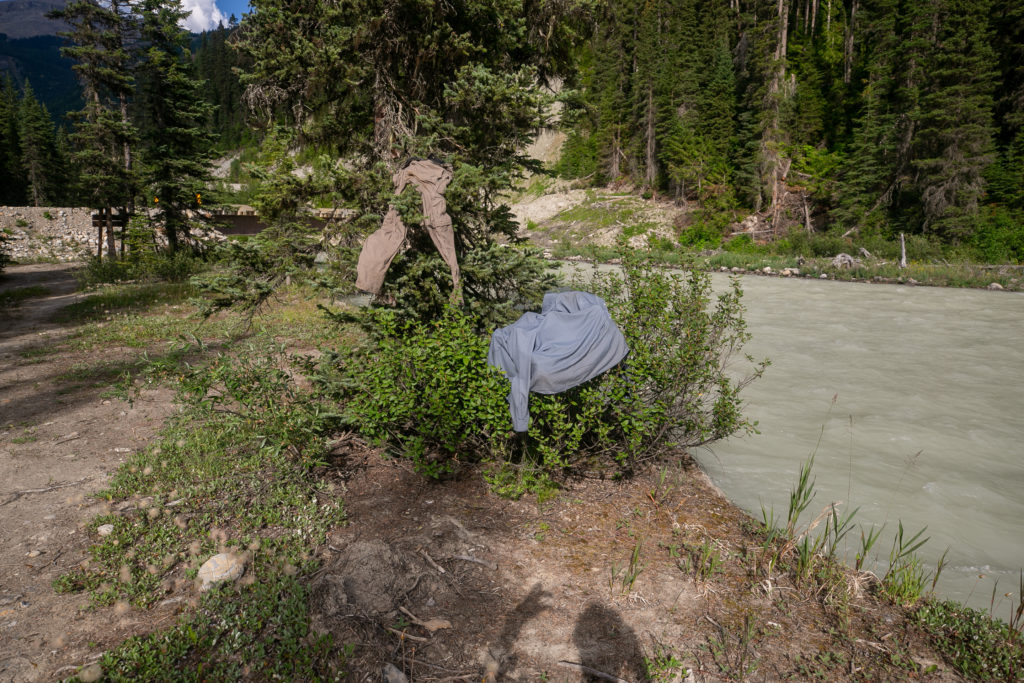
The campground was very rough. Soon after arriving I found bullet casings and used shot gun shells near where the prohibited fire ring was set up. For us the campground was just perfect. There were several campsites away from the eating area and there were almost no mosquitos. I did take advantage of our early arrival time to wash my shirt and pants. I hike with only one set of pants so I wore my homemade jammie pants with cartoons of animals camping on them around camp for the evening. The jammies were a big hit with both Sara and Lillian who laughed when I first appeared in them. Unfortunately for me my pants did not completely dry overnight resulting in them being somewhat damp when I put them on in the morning.

Soaking the feet felt great but the water was so cold.
I see a dog running. Blue skies for the early part of the evening.
It is sunny out but my pants did not dry. The river is an interesting shade of grey/green.
Peak Eats tortellini for dinner.
The beer has been chilling for 2 hours, now it is time to enjoy.

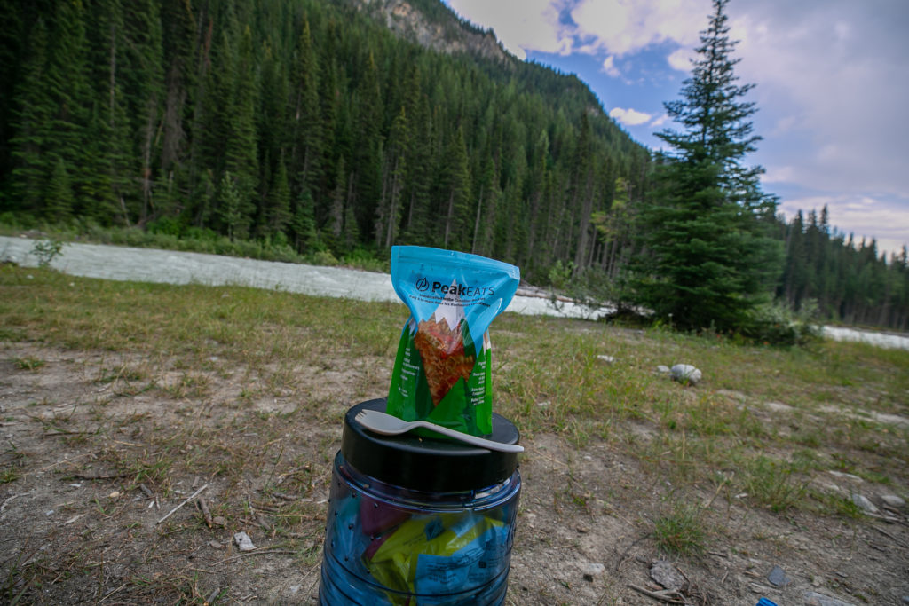
The skies darkened after dinner and in the distance we could hear thunder. It did try to rain, which did not help the drying process for my clothes, but the rain never did amount to much. The decision at dinner is that we would hike together for most of the day tomorrow but that Lillian and Sara would be stopping a littler earlier than me as they had an extra day in their itinerary. Interesting in my journal I wrote “Decided I don’t want to wilderness hike solo, ok in a National Park proper“. Since then I have gone on one three day solo hike and heading out soon for four days solo on the Arizona Trail.

My campsite for the night.

I also wrote in my journal about my confusion and frustration at being so tired.

“I am confused by why I am so tired. When I get to camp and drop my pack I feel very good. Nothing is sore, no muscles hurt. I move around camp like I just got out of bed. But put a pack on and I am so tired.”.

Shortly after the Section D trip I did a three day on the Rockwall in Kootenay NP with my daughter Siobhan and I was again feeling tired. I clearly remember on the last day looking forward to the end of the hike even though the day was only 12 km long. I did take the autumn off of hiking as I developed some tendonitis in my left knee. My knees hurt so much that I needed to use the hand rails to help myself up the stairs at school. I did not hike or run for two months. When I returned to running in late November it was the longest I had not run in many years. My physical preparation for my trip to Arizona after Christmas 2022 was only five weeks and the last two weeks had minimal hiking with the local area stuck in a deep freeze with daytime highs in the minus twenties. Despite the minimal preparation I did days with distances of 23, 16 and 24 km. The last day also had over 1000 m of elevation gain mostly off trail and I had felt great! While preparing the summary of this trip I came across an article on CBC about Canada’s premier male marathoner and how his performance in the marathon improved when he allowed himself to gain a little weight. Apparently middle distance runners are very weight conscious. After mentioning the article to Laura she did say that during my triathlon training it looked like I had lost weight. So maybe the reason why I was tired was that despite all the activity I did preparing for the triathlon and hiking I did not eat appropriately for my actively level and the result was lack of energy and strength. While I may never know exactly what went wrong with my fitness on the Section D hike I am feeling good and energetic as I get ready for my four day trip coming up on the Arizona trail. For those interested in the CBC article here is the link, How refining his marathon training made Cam Levins a ‘stronger, more mature runner’.

Trying to encourage my pants to dry overnight.

The river was flowing fast and loud and the with the clouds the temperature did drop making for cool sleeping conditions. With only two days to go I am very optimistic in making it to Mistaya Canyon. It was a great day on the trail with bears, rainbows and glaciers. Good night from the end of day four on the Blaeberry River.

GDT Section 2022 Section D Day 5

GDT Section 2022 Section D Home

bootwreckers

Day 3 of my New Years adventure in Arizona up on B Day 3 of my New Years adventure in Arizona up on Bootwreckers, see link in bio.

Hiked the Superstition Ridgeline Trail, 23 km of some very rough terrain.

The views from the ridge were spectacular. The trail is more of a route, then a trail. I got off trail a half a dozen times just on the ascent to the ridge. Sprinkled in for fun where several down climbs where I had to drop my poles before climbing down a small chimney or crack.

There is camping possibilities on the ridge and I do wish I would have camped just before Syphon Draw and enjoyed the sunset. Maybe next time.

This was a very challenging 10.5 hrs on the trail, one of my hardest days ever, but worth every drop of sweat.

Till next time Arizona.

#nationalparks, #slotcanyon, #hiking, #hikingadventures, #familytime, #camping, #campingadventures, #outdoors, #outside, #nature,  #FIndyourpark #landscape #landscapephotography #optoutside #nationalpark #desertphotography #grandcanyon #grandcanyonnationalpark #grandcanyonassociation #nationalparkweek #reichallenge #nationalparksweek #rightnow #nationalparktrust #goparks #aztrails
Even in the smoke, there is nothing like hiking in Even in the smoke, there is nothing like hiking in the Canadian Rockies.

On the way to Pinto Lake, going over Sunset Pass with Tuft Peak in the distance.

#parkscanada #parks #bcparks #trails #longdistancehike #longtrail #outdoors #outside #thruhike #hike #thruhiking #outside #backpacking #waterfalls #waterfall #naturephotography #naturephotography #nationalparks #alberta, #albertaparks
Day 2 of my New Years Arizona Adventure is posted, Day 2 of my New Years Arizona Adventure is posted, see link in bio.

Fun and easy day exploring the Superstitions with my four new friends. Lots of varied terrain and lots of breaks. Will make up for that on Day 3.

I did run out of superlatives to describe the scenery, in one word it was simply spectacular!

#nationalparks, #slotcanyon, #hiking, #hikingadventures, #familytime, #camping, #campingadventures, #outdoors, #outside, #nature,  #FIndyourpark #landscape #landscapephotography #optoutside #nationalpark #desertphotography #grandcanyon #grandcanyonnationalpark #grandcanyonassociation #nationalparkweek #reichallenge #nationalparksweek #rightnow #nationalparktrust #goparks #aztrails
Day 1 of a fun two day trip out to Pinto Lake over Day 1 of a fun two day trip out to Pinto Lake over Sunset Pass.

It was a little smokey but as you can see from the first photo the views were spectacular.....

The little dot in Photo 9 is a Common Loon, and entertained us for several minutes swimming across the lake and diving for fish.

Big thanks to @kbsymington , @sio.mellors , Kylie and Charlie for making it such an awesome trip.

#parkscanada #parks #bcparks #trails #longdistancehike #longtrail #outdoors #outside #thruhike #hike #thruhiking #outside #backpacking #waterfalls #waterfall #naturephotography #naturephotography #nationalparks #alberta, #albertaparks
Day 1 of my 2023 New Years Arizona Adventure is up Day 1 of my 2023 New Years Arizona Adventure is up on Bootwreckers,  see link in bio.

Day started off rainy, see photo 2, but the clouds cleared off by 8 am and I finally got my hike started.

The day wasn't without adversity as I slipped chasing my water bottle in a stream and fell in the water. My camera got flooded and stopped working so the rest of the photos were taken on my aging BlackBerry Key 2.

Met up with a group of 4 med students and hiked with them for two days.

Despite the ruined camera was a super fun day on the trail in a new place. 

#nationalparks, #slotcanyon, #hiking, #hikingadventures, #familytime, #camping, #campingadventures, #outdoors, #outside, #nature,  #FIndyourpark #landscape #landscapephotography #optoutside #nationalpark #desertphotography #grandcanyon #grandcanyonnationalpark #grandcanyonassociation #nationalparkweek #reichallenge #nationalparksweek #rightnow #nationalparktrust #goparks #aztrails
It took a while but finally posted the intro to my It took a while but finally posted the intro to my New Years trip to Arizona, see link in bio.

I was greater in Arizona to 18C weather followed quickly by near freezing temperatures and the most rain in the Phoenix area in one day since 1906!

My trip went from Plan A, 4 days on the Arizona Trail,  through Plans B, C and Finally D.

Was a fun if sometimes frustrating adventure.

#nationalparks, #slotcanyon, #hiking, #hikingadventures, #familytime, #camping, #campingadventures, #outdoors, #outside, #nature,  #FIndyourpark #landscape #landscapephotography #optoutside #nationalpark #desertphotography #grandcanyon #grandcanyonnationalpark #grandcanyonassociation #nationalparkweek #reichallenge #nationalparksweek #rightnow #nationalparktrust #goparks #aztrails
Day 3 of Rockwall 2022 is up on Bootwreckers, see Day 3 of Rockwall 2022 is up on Bootwreckers,  see link in bio.

Sweet little day up and over Tumbling Pass with and a long view of Tumbling Glacier. 

The weather cooperated with blue skies and no threat of rain so we were able to linger at The Glacier before heading down the long descent to the car.

While a straightforward day there were still some adventures to be had, but you have to read about them on the blog.

Big thanks to my amazing hiking partner, @sio.mellors

Looking forward to our 3 day adventure this summer, which will no doubt generate more stories to tell.

#parkscanada #parks #bcparks #trails #longdistancehike #longtrail #outdoors #outside #thruhike #hike #thruhiking #outside #backpacking #waterfalls #waterfall #naturephotography #naturephotography #nationalparks
Day 2 of our Rockwall 2022 trip is posted on Bootw Day 2 of our Rockwall 2022 trip is posted on Bootwreckers, see link in bio. With @sio.mellors

This day was Helmet Falls CG to Tumbling Creek CG.

Day started off beautiful with blue skies which turned to rain after lunch. Somehow through all the rain and thunder Siobhan  never lost her smile.

The day ended with beers and Siobhan giving butt rubs to the doggies in camp.

Photo 1 Siobhan taking in the Rockwall at lunch

Photo 2 Helmet Falls at Golden hour

Photo 3 me and my morning coffee waiting for Siobhan to wake up

Photo 4 on the way up Siobhan with Limestone Peak in th background 

Photo 5 Siobhan at Rockwall Pass (can you tell?)

Photo 6 Siobhan near Wolverine Pass with Rockwall Peak shrouded in clouds

Photo 7 Tumbling Glacier through the clouds

Photo 8 setting up camp

Photo 9 Dinner time

Photo 10 butt rubs

#parkscanada #parks #bcparks #trails #longdistancehike #longtrail #outdoors #outside #thruhike #hike #thruhiking #outside #backpacking #waterfalls #waterfall #naturephotography #naturephotography #nationalparks
New trip posted, three day trip in the Rockwall in New trip posted, three day trip in the Rockwall in Kootenay NP with @sio.mellors. Introduction and Day 1 up on Bootwreckers.

Trip was suppose to be hiking Northover Ridge in Kanananaskis but smoke had us change plans at the last minute.

This would be my third multi day trip on the Rockwall but the first for Siobhan.

Managed to get two camping sites on the Rockwall and instead of smoke we had to deal with the threat of rain.

We did get wet but we had a blast.

Day 1 is from Paint Pots TH to Helmet Falls CG, with a side trip to get up close the the falls. Pretty straightforward day but visiting Helmet Falls is always special.

#parkscanada #parks #bcparks #trails #longdistancehike #longtrail #outdoors #outside #thruhike #hike #thruhiking #outside #backpacking #waterfalls #waterfall #naturephotography #naturephotography #nationalparks
The sixth and final day of our 2022 GDT Section D The sixth and final day of our 2022 GDT Section D hike is up on Bootwreckers, see link in bio.

This day took us from a random camp on the Howse Floodplain to the Mustafa Canyon parking lot. This was an adventurous day with bushwhacking, stream crossings and dead fall but a simply glorious end to a wonderful hike on the GDT. 

Again thanks  to Sara (@sd_kuz) and Lillian (@waterlilizee) for sharing this adventure with me. I am sure we will meet again on a trail someday.

Photo 1 - Morning Colors

Photo 2 - tents on the floodplain

Photo 3 - bushwhacking to start the day

Photo 4 - fields of flowers going to seed

Photo 5 - looking south down the Howse River

Photo 6 - thigh deep water crossing

Photo 7 - big views

Photo 8 - Sara crossing some dead fall

Photo 9 -Mistaya Canyon

Photo 10 - picked up a thru hiker named Roy, enjoying beverages left by Natasha and Kyle from Backpacks and Bikeracks

#greatdivide #greatdividetrail #gdt #parkscanada #parks #bcparks #trails #longdistancehike #longtrail #outdoors #outside #thruhike #hike #thruhiking #outside #backpacking #waterfalls #waterfall #naturephotography #naturephotography #nationalparks #duplex #sectionhike #sectionhiker
Day 5 of our 2022 Great Divide Trail Section D hik Day 5 of our 2022 Great Divide Trail Section D hike is posted on Bootwreckers, see link in bio.

Truly epic day on the trail. Pass through the debris of two avalanches, had lunch by a waterfall, crawled over so much dead fall and hiked on the Howse Flood Plain.

The sunset on the flood plain was one of most magical I have seen.

As always a big thanks to Sara (@sd_kuz) and Lillian (@waterlilizee) for sharing this adventure with me. The Team totally rocked the trail.

#greatdivide #greatdividetrail #gdt #parkscanada #parks #bcparks #trails #longdistancehike #longtrail #outdoors #outside #thruhike #hike #thruhiking #outside #backpacking #waterfalls #waterfall #naturephotography #naturephotography #nationalparks #duplex #sectionhike #sectionhiker
Evening light on Picketpost Mt. #aztrail #aztasso Evening light on Picketpost Mt.

#aztrail #aztassociation  #nps, #nationalparks, #slotcanyon, #hiking, #hikingadventures, #familytime, #camping, #campingadventures, #outdoors, #outside, #nature,  #FIndyourpark #landscape #landscapephotography #optoutside #nationalpark #desertphotography #grandcanyon #grandcanyonnationalpark #grandcanyonassociation #nationalparkweek #reichallenge #nationalparksweek #rightnow #nationalparktrust #goparks #aztrails
Arizona Trail Passages 14 and 15. Some photos of Arizona Trail Passages 14 and 15.

Some photos of my recent hike down a couple of Passages of the Arizona Trail. 

The trail is so diverse, rolling terrain cut by shallow washes leads to the expanse of the desert then into rugged canyons and tall peaks, all in a space of 92 km (58 miles).

Had a great time, some blisters gave me some concerns but they seem to be doing fine now that they are out of my hiking shoes.

Got lucky with Trail Magic courtesy of Condiments who drove his 4x4 deep into an unarmed wash, was really in the middle of no where, and then again at the start of Passage 15, missed the Trail Angel's name, the wind was so loud.

Like to thank my Trail Angels, Carole for driving me to Oracle to start the trip, with side trip to a Hayden Az, a real ghost town and to Edith for leaving a water cache for me at Passage 15.

Included a video of my time at the high point for Passage 15. My kid likes it when you stop and enjoy the view you earned, thought they would appreciate my effort in the face of 1000 mph winds (ok maybe thats a bit of an exaggeration).

Thanks Arizona and the AZT for providing more memories.

I will be back

#aztrail #aztassociation  #nps, #nationalparks, #slotcanyon, #hiking, #hikingadventures, #familytime, #camping, #campingadventures, #outdoors, #outside, #nature,  #FIndyourpark #landscape #landscapephotography #optoutside #nationalpark #desertphotography #grandcanyon #grandcanyonnationalpark #grandcanyonassociation #nationalparkweek #reichallenge #nationalparksweek #rightnow #nationalparktrust #goparks #aztrails
That sunset says when I wake up it will be time to That sunset says when I wake up it will be time to start my hike on the Arizona Trail, Passages 14 and 15

Love my little motel in Superior, Az, Copper Mt Motel. Has murals painted on all the buildings

Spied the Grand Canyon from the plane 

Adventure awaits 

#aztrail #aztassociation  #nps, #nationalparks, #slotcanyon, #hiking, #hikingadventures, #familytime, #camping, #campingadventures, #outdoors, #outside, #nature,  #FIndyourpark #landscape #landscapephotography #optoutside #nationalpark #desertphotography #grandcanyon #grandcanyonnationalpark #grandcanyonassociation #nationalparkweek #reichallenge #nationalparksweek #rightnow #nationalparktrust #goparks #aztrails
Frosty Paws all packed and ready for an adventure. Frosty Paws all packed and ready for an adventure.

Arizona Trail Passages 14 and 15 starting Sunday

Off weekend gooooooo!

#aztrail #aztassociation  #nps, #nationalparks, #slotcanyon, #hiking, #hikingadventures, #familytime, #camping, #campingadventures, #outdoors, #outside, #nature,  #FIndyourpark #landscape #landscapephotography #optoutside #nationalpark #desertphotography #grandcanyon #grandcanyonnationalpark #grandcanyonassociation #nationalparkweek #reichallenge #nationalparksweek #rightnow #nationalparktrust #goparks #aztrails
Last weekend before heading to Arizona for a four Last weekend before heading to Arizona for a four day adventure on the Arizona Trail.

I wonder if hiking in the 15 cm of fresh snow will be good prepared for hiking the deserts of Passages 14 and 15?

#aztrail #aztassociation  #nps, #nationalparks, #slotcanyon, #hiking, #hikingadventures, #familytime, #camping, #campingadventures, #outdoors, #outside, #nature,  #FIndyourpark #landscape #landscapephotography #optoutside #nationalpark #desertphotography #grandcanyon #grandcanyonnationalpark #grandcanyonassociation #nationalparkweek #reichallenge #nationalparksweek #rightnow #nationalparktrust #goparks #aztrails
Day 4 of our 2022 GDT Section D hike is up on the Day 4 of our 2022 GDT Section D hike is up on the website, see link in bio.

This was a truly epic day spent on the Amiskwi and Collie Creek Alternates.

The weather cooperated starting with a spectacular sunrise on the Mummery Glacier, rainbows and blue skies on the ridge.

We had a brief encounter with a little black bear who scampered quickly away. 

Finished off the day with a cold beer, Grizzly Paw Rutting Elk Red, that I had carried with me and it tasted great.

Easily one of th best days on the trail ever.

Again big thanks to Sara (@sd_kuz) and Lillian (@waterlilizee) for sharing this adventure with me. The Team totally rocked the trail.

#greatdivide #greatdividetrail #gdt #parkscanada #parks #bcparks #trails #longdistancehike #longtrail #outdoors #outside #thruhike #hike #thruhiking #outside #backpacking #waterfalls #waterfall #naturephotography #naturephotography #nationalparks #duplex #sectionhike #sectionhiker
Day 3 of our 2022 Section D hike is posted, see li Day 3 of our 2022 Section D hike is posted, see link in bio.

This was a shorter day, only about 17 km but took us from the end of the Kiwetinok Alternate up to Amiskwi Pass and then a beautiful meadow at the the base of the Amiskwi Ridge.

Photo 1 - morning sky

Photo 2 - on the Kiwetinok Alternate

Photo 3 - Kiwetinok Alternate

Photo 4 - break time at a stream crossing, Frosty Paws hanging in there

Photo 5 - Fireweed with a view down the Amiskwi Valley,

Photo 6 - fields of flowers as we approached Amiskwi Pass

Photo 7 - Yellow Columbine on the way up to Amiskwi Lodge

Photo 8 - Our camp in the meadow

Photo 9 - Setting sun

Photo 10 - one of the best adventure stories ever! True story of how three prisoners of war escaped and climbed Mt Kenya

Again big thanks to Sara (@sd_kuz) and Lillian (@waterlilizee) for sharing this adventure with me. The Team totally rocked the trail.

#greatdivide #greatdividetrail #gdt #parkscanada #parks #bcparks #trails #longdistancehike #longtrail #outdoors #outside #thruhike #hike #thruhiking #outside #backpacking #waterfalls #waterfall #naturephotography #naturephotography #nationalparks #duplex #sectionhike #sectionhiker
First two days of my 2022 Great Divide Trail Secti First two days of my 2022 Great Divide Trail Section D adventure are up on the blog, see profile for link.

Day 1 was from Burgess Pass Trail head to Yoho Lake Campground. A relatively short day but a good warm up for the rest of the trip.

Big thanks to Sara (@sd_kuz) and Lillian (@waterlilizee) for sharing this adventure with me. The Team totally rocked the trail.

Photo 1 - at Burgess Pass looking at Mt Wapta

Photo 2 - Flowers, it was a great time to hike to see all the flowers in August bloom

Photo 3 - Emerald Lake from up high

Photo 4 - at Yoho Pass, did I mention the flowers

Photo 5 - Duplex tent all set up with Frosty Paws on guard, and oh ya, more flowers

Photo 6 - the north end of Wapta Mt as seen from Yoho Lake.

Super fun little day, the opening a grand adventure.

#greatdivide #greatdividetrail #gdt #parkscanada #parks #bcparks #trails #longdistancehike #longtrail #outdoors #outside #thruhike #hike #thruhiking #outside #backpacking #waterfalls #waterfall #naturephotography #naturephotography #nationalparks #duplex #sectionhike #sectionhiker
Sound On. Video clips from my hike along th Supe Sound On. 

Video clips from my hike along th Superstion Ridgeline.

Was an epic hike, 24km from my campsite at Miners Needle to First Water Trailhead where my car was.

Wouldn't recommend doing all in one day backpacking, as the final descent down Siphon Draw Wash is brutal, but I did it in 10hrs 45min

Would love to redo th hike at some point and actaull stop and camp along the ridge.

I had enough water to stop, but I was enticed by the prospects of a beer to finish.

#teamzpacks #zpacks #zpacksduplex #aztassociation #aztrail #aztrails #hike #loveazt #desertphotography #desert #hikingadventures #hikes #backpacking #camping #getoutside #familytime #traillife #aztassociation , #hiking, #hikingadventures, #familytime, #camping, #campingadventures, #outdoors, #outside, #nature,  #FIndyourpark #landscape #landscapephotography #optoutside  #rightnow #goparks #aztrails #aztrail #loveazt  #azt #arizonatrailassociation
Load More Follow on Instagram

For more photos of these and other Bootwreckers Adventures

© 2023 Boot Wreckers | Powered by Minimalist Blog WordPress Theme