Me and a shadow puppet at the Redwall Overlook. We had been down there and over to there. The view from this spot is simply fantastic.
Day 4 February 18, 2025, Tanner Rapids to Lipan Point, 12.3 km, 1539 m ascent, 104 m descent, 6 hrs 55 min.
Day 4 route in purple.
Speed/elevation graph for hike to Lipan Pt.
Micah hamming it up before we start our hike. Spirits appear to be high.
Not sure what time we got up but we were ready to head out of camp at 7:35 am so only a little later than yesterday. We knew that this was going to be a big day. I was tired but not sore. So it was a matter of remembering the advice we got when we hiked Mt Killimanjaro back 2015. Being at attitude the guides on our Killi trip told us not to rush the hike and just go “pole pole”, Swahili for “slow slow”. As long as we kept moving up towards our destination we would make it.
Micah looking happy. It was a bit of an overcast morning which was just fine for hiking. The composting biffy is just off to the left.
The flood plain near the river is quite sandy. We start heading uphill where the trail turns right in the photo.
Micah making their way up little cliff. The rock in the foreground is called conglomerate since it is made of many visible rocks that where turned into a single rock type, sort of like nature’s version of concrete.
Passing the junction with the Beamer Trail.
I didn’t think about while we were in the canyon but our campsite was right beside the Tanner Wash. We could have just walked up the wash which was the old Tanner Trail instead of following the trail on our phone. Following our app Gaia we went past the biffy, up a little rise and past the junction with the Beamer Trail before descending into the wash to rejoin the original trail. We could have avoided the little up and down and saved a little bit of energy. I like how my mapping app marks the toilet at Tanner Rapids. It is a nice toilet.
One last up close and personal photo with the Tanner Grabben. Not sure when I will be this way again. But I do plan on doing the Escalante Route at some point so I will be back. So dear Tanner Grabben, goodbye until we meet again.
To continue my thought from before. We are currently on the little ridge at right of photo and have to drop back to the wash on the left. Our campground was at the end of the wash. We could have walked straight up the wash to connect to the trail. That would have avoided going up the cliff band. Not actually a big deal.
Micah descending back to the wash. There are some rocks marking a pathway across the wash. We will have to get up over that little cliff just a 100 m past the wash to gain access to the slopes. The slope is where the real hiking for the day will start. Hope I am adequately warmed up.
Ohh, there is some serious geology going on here. Some steeply dipping rock is overlaid by some more shallow dipping rock. Just near the left edge of the photo there appears to be a fault. The rock is the Solomon Temple member of the Dox Formation of the Grand Canyon Supergroup. I do not have a description as to why the difference in dipping but I do know there is major fault running through the Tanner Grabben called the Butte Fault.
Gnarly looking tree. Not sure of the soil quality amid all that sandstone.
The unique wide valley landscape of the eastern Grand Canyon dominated near the river by the proterozoic aged (1.2 million to 800 thousand year) Grand Canyon Supergroup rocks.
Micah waiting patiently as I wheeze my way up the hill.
40 minutes into the hike. The trail has been very pleasant so far with an average grade of 100 m/km which is a nice steady ascent, nothing too nasty. For comparison the final climb out to Lipan Point is 525 m over 1.8 km or 290 m/km. That will be a very steep section of trail.
There are some ungulates, probably deer, around. We never did see any large wildlife.
Balloons! Helping to clean up the canyon. We found this birthday balloon so we packed it out.
The Sun is just touching the top of the canyon. 8:35 am.
Same spot as the last photo just looking uphill. Trail is about to get a little rougher.
Trail is getting rockier. The trails goes up steeply through some short switchbacks. According to the speed graph our speed took a serious nose dive at this point.
Just a couple minutes after the last photo. Maybe this is why our speed nose dived. But you cannot say it is a primitive or unmaintained trail. Someone had to put in some work to build these stairs.
Pungent Brickellbush (Brickellia arguta), maybe.
I tried really hard to identify the plant above. The challenge is that the flowers are at the end of their life cycle. I found an amazing website for flower identification, WildflowerSearch. You can input location, date, then anything you know about the flower, size, colour, leaf structure. It did not though come up with a solid match. My biggest challenge was the leaves. So after much sleuthing this is the best I could do, it could be a daisy or aster, so I am willing to be corrected.
At least we had some flowers on our hike in the middle of February.
This looks like some very nice trail. The large cliffs centre right are the base of the Redwall Overlook. We will contour around to the left before heading up on our next big climb of the day. All clear sailing until then.
Shadow pictures.
Making good time below the sandstone cliffs of the Tapeats Sandstone.
Guessing I have some elevation ahead of me to get to where Micah is.
Micah is the little dot in the distance.
Micah snapped a photo of me from their perch in the previous photo. I am near the bottom right corner. Desert View clearly sticking up above the horizon.
Ignore the time on the photo above, it is off by 2 hrs. The time is 10:10 am. We have been hiking for about 2 1/2 hrs. You can see in the photo we just finished traversing nice gentle slopes but our speed had dropped significantly. We have to traverse back before going straight up through the topo lines to the top of the Redwall Limestone. It will take us 40 minutes to complete the climb. Once up the Redwall Limestone cliff we will take a short break at the Redwall Overlook but it is too early for lunch.
10:50 am. Looks like a happy hiker. Only 6 km to go, how bad can that be? It was only a 10 minute break.
It took us 3 hrs 15 minutes to hike the 6 km from Tanner Rapid while gaining 900 m. We had about 6 km left to hike and just 550 m of elevation. Really it should not have been that challenging. But the accumulated work over the last few days would make the final climb seem to take eternity. But at this time it was all smiles. We have 4 km of the relatively flat Supai Traverse ahead of us.
Micah’s pack is definitely more stuffed than mine. But I have Frosty and two bandanas. The purple bandana was cosmic themed and belonged to our retired sled dog Volcano, the skull bandana belonged to Links. His nickname was the happy badass, because he was such a nice puppers. They have both left us but they hiked many miles with us and I like to be reminded of them on my trips. They both have their own bio in the “The Team” page of the blog.
Big view of the canyon below.
Basically the same shot with a bit more of the North Rim.
Micah peering over the edge.
Just saying goodbye to the Redwall Overlook.
Micah looking off into the distance. We cannot see our destination yet. We have to walk around the left side of Cardenas Butte and then we will be able to see up to Lipan Point
The trail is very good on this stretch. Looking a little warm out.
Looking up to Lipan Point. The lump on the right in Escalante Butte. This spot has definitely been used for camping.
Nice view of Escalante Butte. Lipan Point is on the left with the snow and the little cloud above it. We have to hike up to Escalante Butte stay on this side of the little drainage and curl back around off left side of the photo. We do not go over the little ridge that on the left.
Lunch. It was boarding on being hot on the trail and this was the first piece of shade we had passed so we quickly made the decision to stop for lunch. 11:30 am.
Looking like a pretty full wrap.
This was on the rock beside where I was sitting. Never saw the owner.
This is how hot we were feeling.
Micah being a red head with the matching pale skin needed to cover up from the sun and this was the best solution. Once we get inside the upper canyon I was expecting things to cool off. It would take us about 50 min to pass by Seventy Five Mile Canyon and enter the upper canyon.
Cardenas Butte.
Weaving our way around the shoulder of Escalante Butte. Another tiny patch of shade.
More of the cyanobacteria or living crust that we saw yesterday. More info here thanks to the National Parks Service.
This area gets less direct sun than the open slopes we hiked on earlier. As a result there is much more vegetation that is able to survive.
Just have to get up there. The climb has not started yet. We have not even made it to Seventy Five Mile Canyon.
We made excellent progress to Seventy Five Mile Canyon averaging almost 3.5 km/h. There was not a lot of respite from the sun but we were going to trade the heat and easy hiking for the cooler temperatures and the steep grind to the top.
Long view looking west down Seventy Five Mile Canyon.
From a little higher up.
Looking West from a little higher up again. The little pyramid on the very right of the photo on the horizon is Osiris Temple. Osiris Temple is located on the north side of the river directly across from Hermit Rapids where Micah and I camped back 2016.
Interesting little graphic. We averaged about 3.5 km/h along the Supai Traverse. On leaving Seventy Five Mile Canyon our, more specifically my, speed dropped to about 2 km/h then at times below 1 km/h before a strong finish at about 2 km/h. The climb out took us 1 hr 30 min to hike about 1.8 km.
Here we go. The trail looks more like a wall at this point.
I took pictures on the way down and now on the way up. Sandstone towers never fail to impress me.
Back to the snow. A nice change after the heat of the last couple of days
Looking back to where we were. The trail goes hard up to the left.
More stunning views.
Micah nicely waited for me. Still rocking the headgear. 1:40 pm, 50 minutes into the climb.
Deer print in the snow.
Amazing cross-bedded sandstone cliffs.
The top is just right there. Where is my teleporter? Would that be cheating? I think at this point I didn’t care. The trail goes up the centre then cuts off to the left. The trail was a little rough at this point.
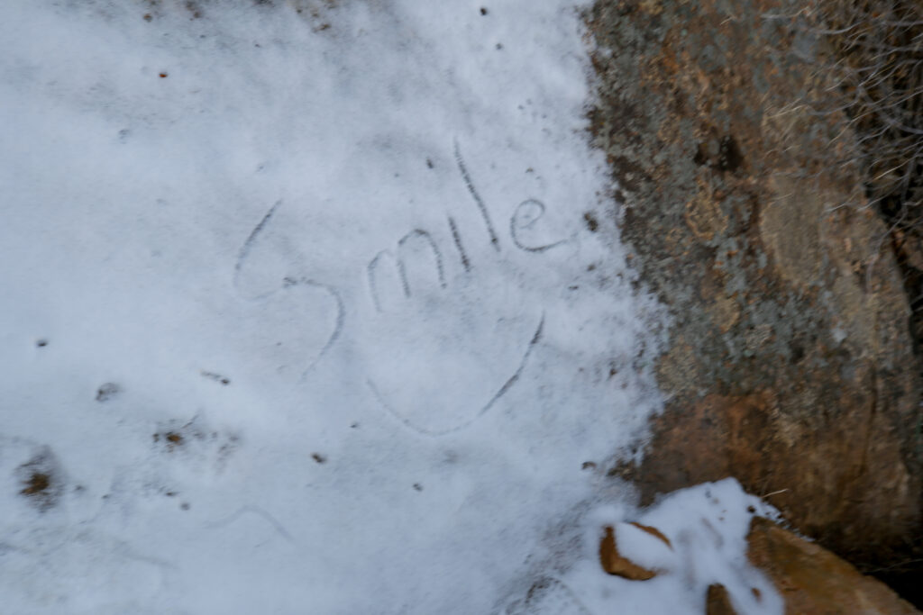
Day 1Day 4There has been some melting and the smile is fading but not gone.
A last view of the canyon from the trail.
I was trying to be artistic. Snow, dead log, rock, and living tree.There is a story here.
Looking up and wondering if it is getting any closer.
Micah had scooted ahead and dropped their pack at the trailhead and came back down to help me out of the canyon. They did offer to take my pack. I asked how long to the top and they said about 10 minutes so I declined their offer. I really should have given them my pack but I was honestly so tired I didn’t want to stop. I just wanted to keep moving. It was a poor decision. I get to own that forever.
Micah lightly mocking me.
At least I am smiling. 2:20 pm just 5 minutes to go.
Took a moment to photograph the sign board at the head of the trail which I did not do on Day 1.
Seems accurate.
We are OUT! 2:25 pm., and looking pretty pleased with ourselves. I still have my pack on.
It took us just shy of 7 hours to hike out to the rim. Once I had removed my pack I felt fine. The thing I found strange about the entire trip was that I never had sore muscles. I was obviously out of shape as evidence by my lack of pace but once free of the burden of the pack I felt great.
We spent a few minutes sight seeing at Lipan Point. We still had to head to Phoenix and then onto Superior AZ for our motel which was suppose to be about 4.5 hour drive. The motel carefully chosen so that we could squeeze in a quick scramble in the morning before having to drive to Phoenix for a early evening flight.
A sign board giving some details of the unique geology of the canyon as viewed from Lipan Pt.
Simple but informative.
Big view looking west.
There are a few people at Lipan Pt. Quite a few people have touques on to keep their heads warm. Just a couple of hours ago we were overheating on the Supai Traverse.
The steep walled gorge that most people associate with the Grand Canyon begins a few miles downstream of where we are.
First Nations People were living and farming in the Grand Canyon a thousand years ago.
The ridge in the foreground frames the east side of Seventy Five Mile Canyon. The two tan coloured peaks hide the Tanner Grabben from our view.
You can just see the Hance Rapids from Lipan Point. They are much more aggressive than the Tanner Rapids or Palisades Rapids we saw on our trip.
Hance rapids at the centre of photo. Hance Rapids mark the beginning of the Tonto Trail.
We headed out from Lipan Point at about 2:45 pm. With no delays we should have arrived at our hotel in Superior AZ at around 7:30 pm. We went out the west park exit then followed the highways through Flagstaff and onto Phoenix. We only stopped once for gas and a little snack. We watched with delight as the temperature outside went up even though the sun was quickly setting. We started driving at an elevation of 2200 m at Lipan Pt and ended at 450 m as we drove through Phoenix. This massive drop in elevation is why the temperature was so much warmer in Phoenix than at Lipan Pt.
As we approached Phoenix Micah amused themselves by taking some evening sky photos.
We arrived at our motel close to 8 pm. There were some traffic slow downs going through Phoenix. I have stayed at the motel, the Copper Mountain Motel, a number of times and have even had items shipped there. Needless to say I know the owner pretty well. On arrival I got a big hello and a hug. Not sure the last time I got a hug at check in at a hotel. One of the reasons I love the little motel is the personal service provided by the owner.
Before showering we headed up the road to grab a bite to eat before the local restaurant closed.
How we both celebrated our hike. After being out on trail nothing beats a burger and beer!
A tired and happy good night from the Copper Mt Motel in Superior AZ.