Skip to content
Boot Wreckers
Menu
  • Home Page
  • Hiking Day Trips
    • Angels Landing – 2015
    • Aylmer Lookout Banff NP
    • Mt Allan Traverse (Centennial Ridge)
    • Mt Nomad (almost) – Kanananaskis Country
  • Backpacking – Overnights
    • Baker Lake 2020 Banff NP
    • Exploring Waterfalls with Volcano – Yoho NP
    • Fish Lakes – Banff NP, Alberta
    • Floe Lake/Numa Creek, Kootenay NP, British Columbia
    • Floe Lake (Revisited 2019) – Kootenay NP
    • Grand Canyon Corridor Backpacking Trip
    • Hermit Trail to Hermit Meadows – Glacier NP, British Columbia
    • Howard-Douglas Lake – Banff NP (2017)
    • Leman Lake – Banff, NP
    • Mystic Lake – Banff NP
    • Ribbon Lake Kananaskis Prov. Park 2016 – Ribbon Creek Route
    • Ribbon Lake Kananaskis Prov. Park 2017 – South Buller Pass Route
    • Simpson and Healy Pass – Banff NP (2016)
    • Stenton Lake – Alberta Wildlands Prov. Park
  • Backpacking – Multi Day
    • Arizona Trail Passages 16 17
    • Brazeau Loop – Jasper National Park
    • Colorado River Float Trip 2015
    • Egypt Lake Epic – Banff NP
    • Egypt Lake Exploration 2021- Banff NP
    • Grand Canyon Hermit – South Kaibab
    • Grand Canyon – Tanner/Beamer Trail
    • GR20 – Corsica
    • Great Divide Trail Hike – Section C 2020
    • Great Divide Trail Hike – Section D 2022
    • Great Divide Trail Hike – Section E 2021
    • Green River Canoe Trip 2017
    • Iceline/Twin Falls – Yoho NP 2020
    • Kilimanjaro – Tanzania
    • Mt Assiniboine Lollipop – Banff NP
    • Rockwall North 2020 Kootenay NP
    • Rockwall 2022 – Paint Pots to Numa Creek, Kootenay NP
    • Sawback – Banff NP
  • The Team
  • Contact Us
Menu

Day 5 GDT Section C – 2020

Heading up Citadel Pass.

August 15th, Lake Magog CG to Howard-Douglas CG, 22 km, 785 m elevation gain, 689 m elevation loss, 7 hrs 50 min (all distances and elevation are as per the guide book), Section C Segment 17.

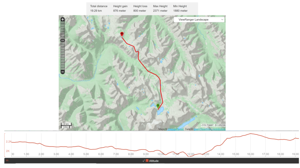
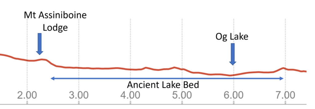
We have no Viewranger track for this segment as I was concerned about the battery usage of the SPOT X and our limited ability to recharge as I had brought only one battery charger that was rated for two full recharges for a standard phone. I decided that keeping the SPOT X charged was more important than the tracking our hike. Once back home I did do a manual track on Viewranger, called a ‘Route’ and was very surprised that even though the day finished off with a stiff hike up Citadel Pass gaining 450 m we finished at Howard-Douglas CG less than 100 m above where we started at Lake Magog CG. Checking the profile of the day it starts as a long continuous downhill hike steadily losing elevation until finally reaching the low point after 12 km. The elevation gain is limited to 3 km between km’s 13 and 16 with the hike finishing off downhill into Howard-Douglas CG. The net elevation gain for the day was about 80 m.

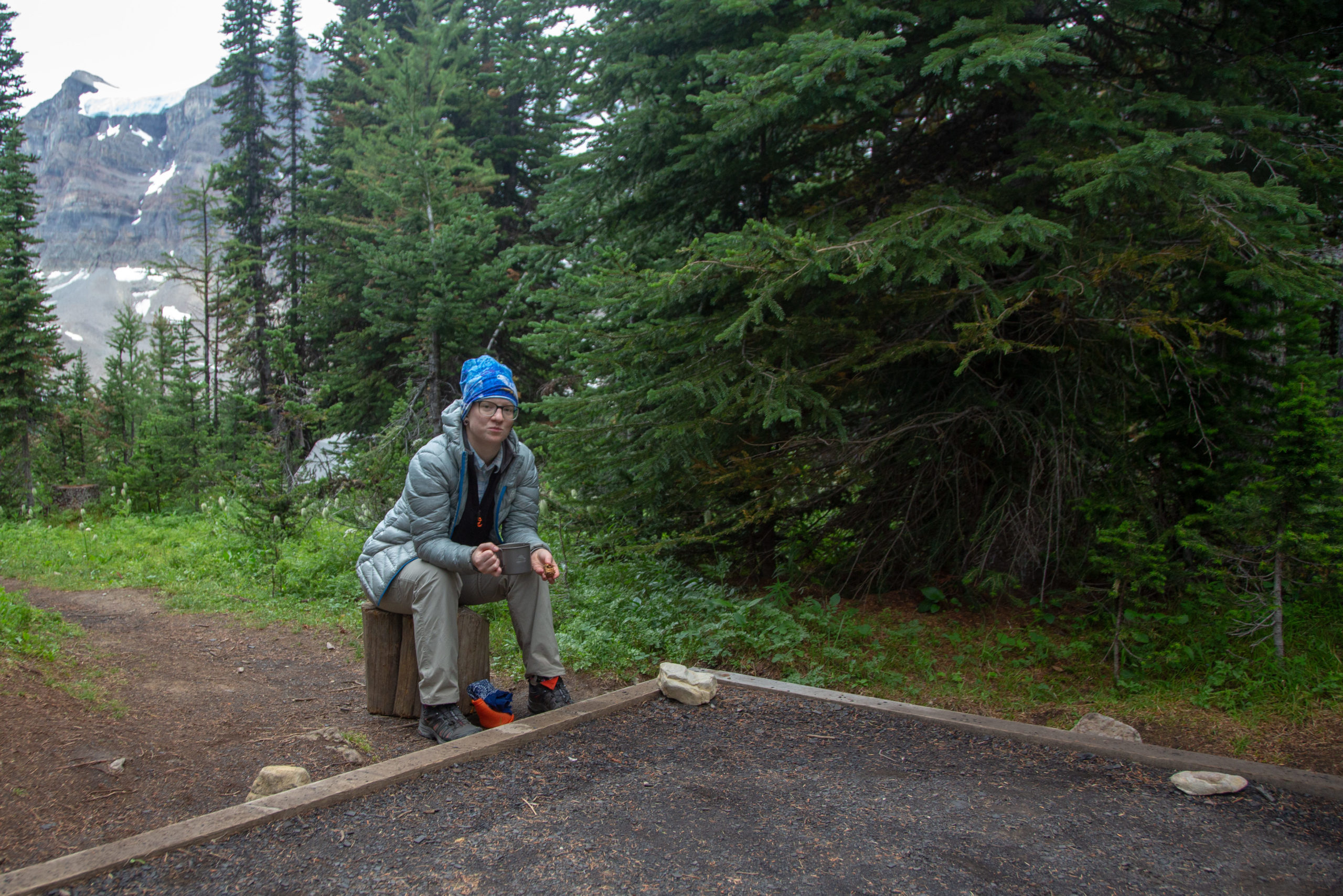
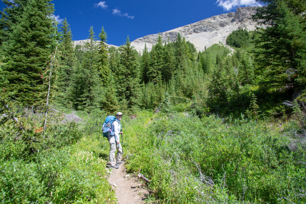
I was up and out of the tent around 7 am. Today was a moderate length day at around 22 km so we were not afforded the luxury of sleeping in but we were not in a big rush to get going either. I expertly boiled the water for coffee and we had our coffee and Logan Bread while packing up the campsite. We headed off down the trail at about 8:30 am. The day was overcast with heavy cloud. Micah started off the day with a lightweight fleece over top their hiking shirt.

Breakfast time.
Trail starts off in the forest that blankets the north west shore of Lake Magog.
Quickly exchange the forest for walking in an alpine meadow.
Not a great view of Mt Assiniboine.

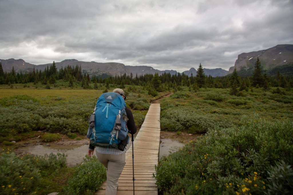
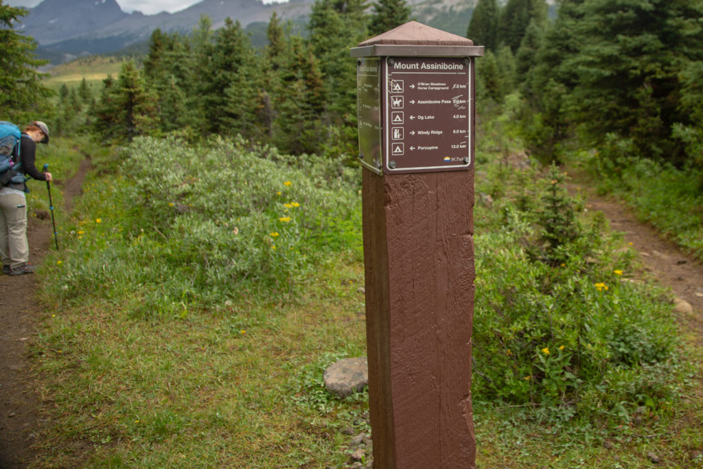
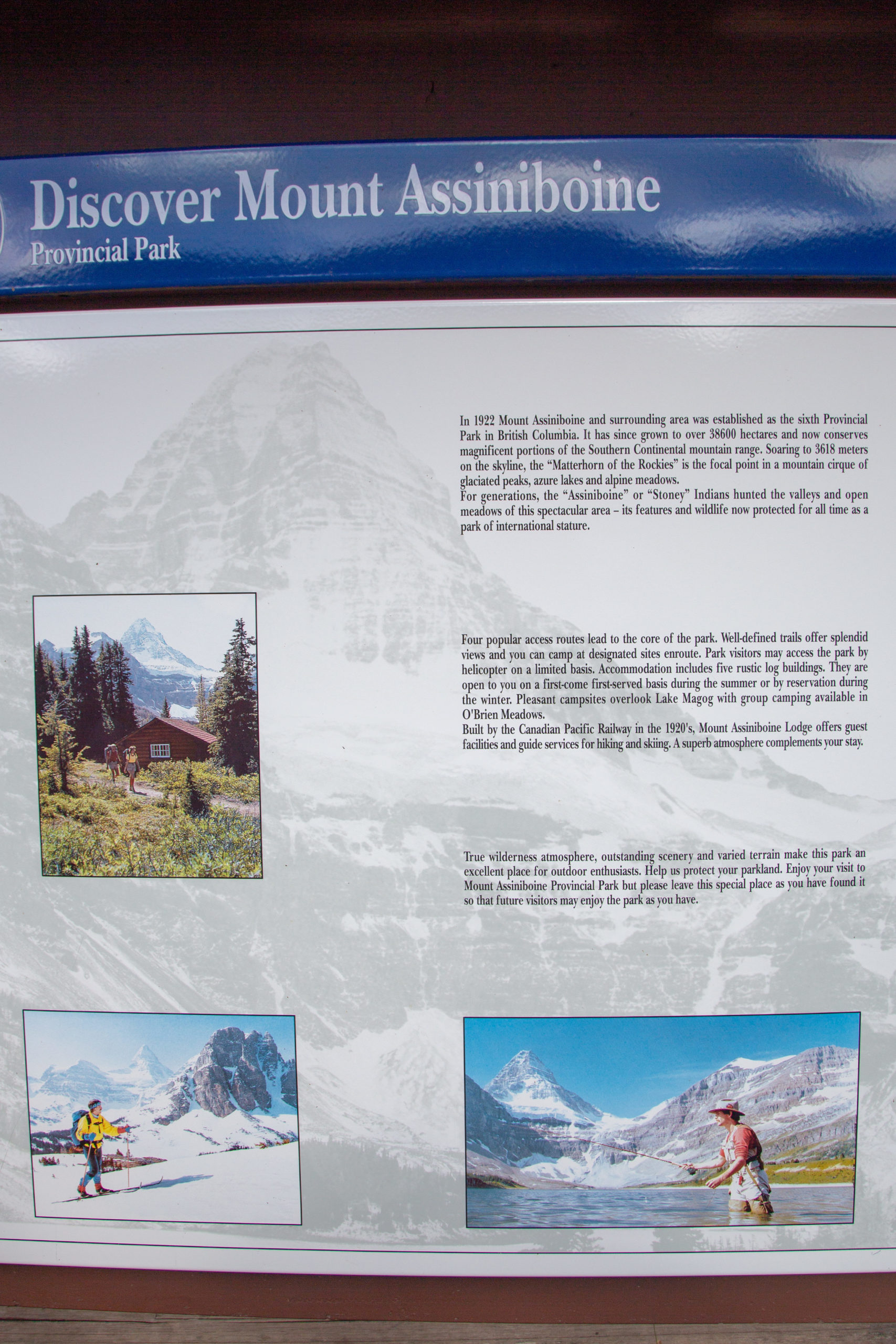
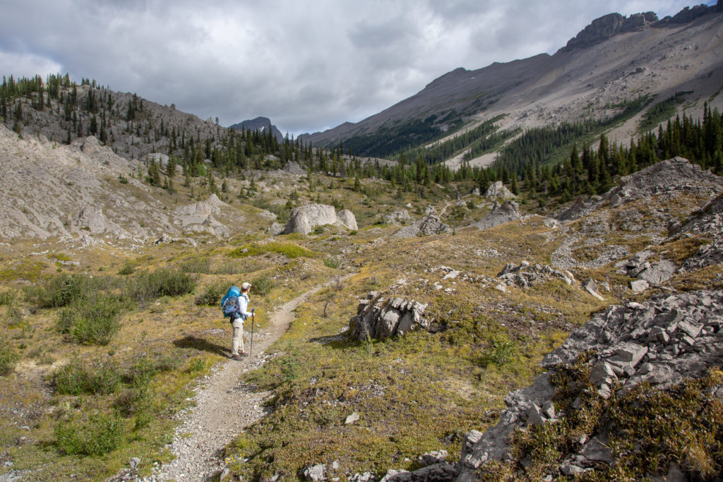
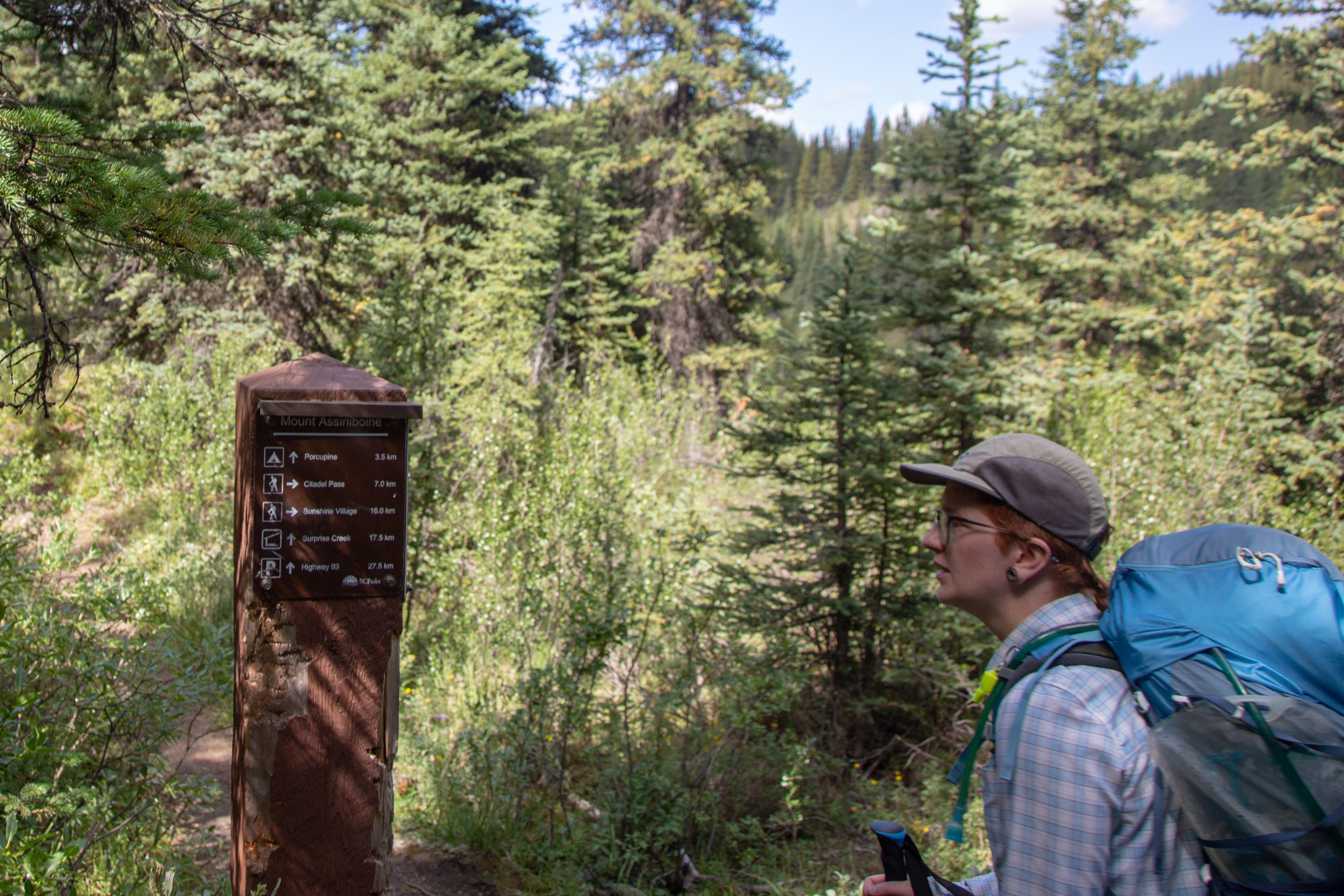
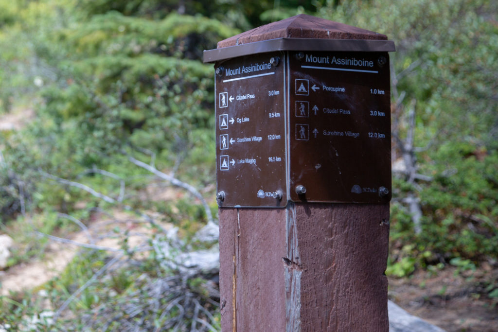
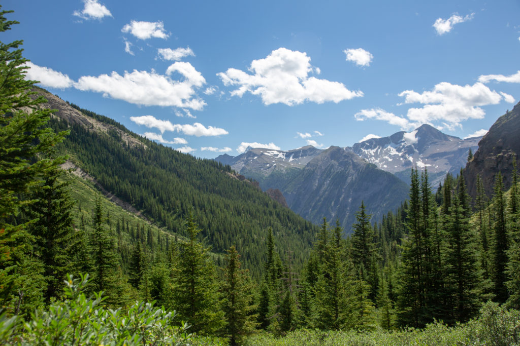
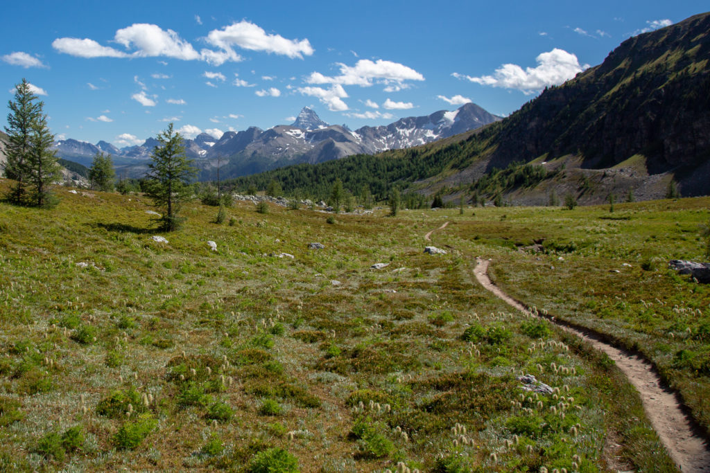
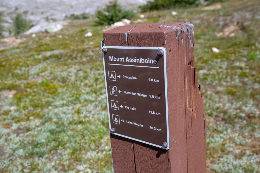
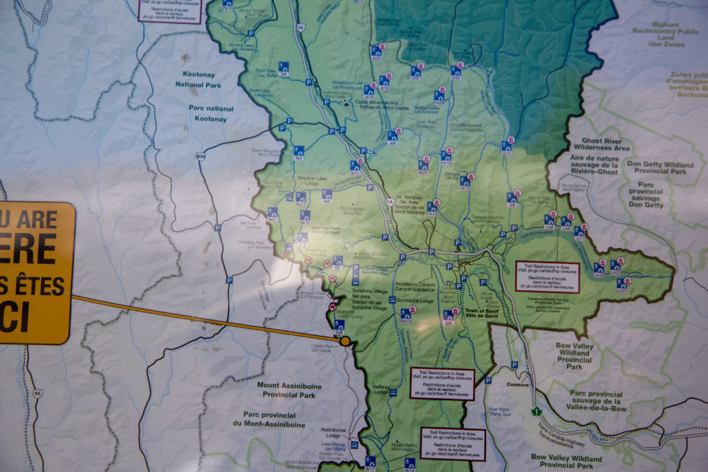
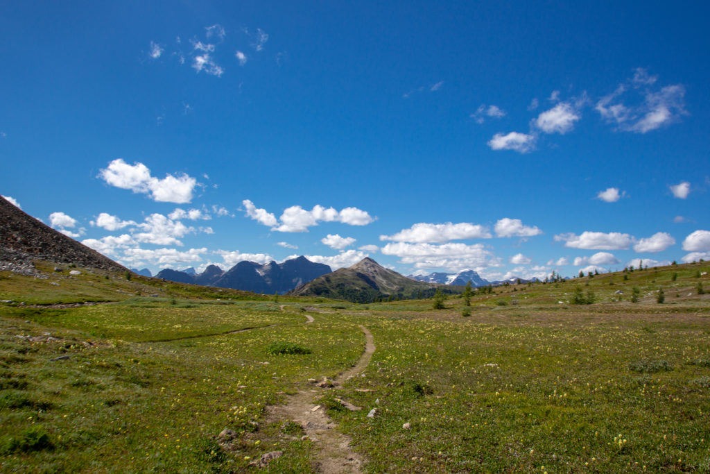
We made our way back to the Assiniboine Lodge and hung a left. We would spend most of the day hiking in Mt Assiniboine Provincial Park and the signage along the route was excellent. We dropped through a little canyon into a wide open meadow that stretched for miles in all directions. We would hike in the meadow all the way to Lake Og. It is thought that the meadow formed the basin of an ancient lake.

A little drop in elevation. A stream must have flowed here once to carve the little canyon.
Decision time.
The clouds are clearing.
I am on the trip. Micah has taken there fleece off. It is 9:10 am.
The view ahead of us.
The view behind us.
Micah rarely passes up an opportunity for a little climbing. The cliff behind Micah is Cascade Rock (2880 m) the high point of the ridge leading to the far right is Mt Cautley (2880 m). The centre peak has no name but is also at a height of 2880 m.

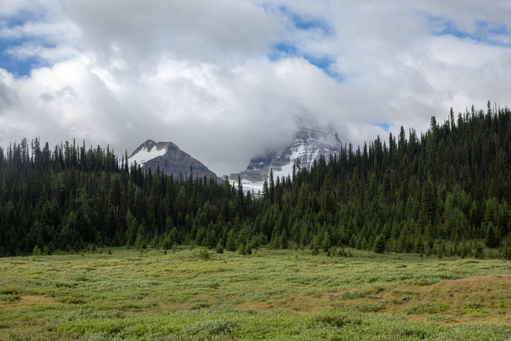
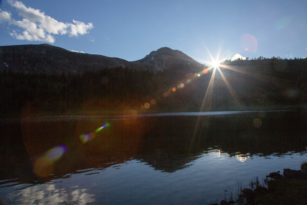
The sun started to come out behind us but it was still cloudy where we were heading. The elevation drop to Og Lake is only 70 m over the 4 km from the Assiniboine lodge. When you look at the profile, it is very apparent how this section is believed to have been a lake in the distant past. Over time the water has carved a path through the limestone and produced a clear steadily downhill route to Og Lake. Og Lake is a example of karst lake; it has no outlet, and instead the water drains through cracks in the limestone that forms the bottom of the lake.

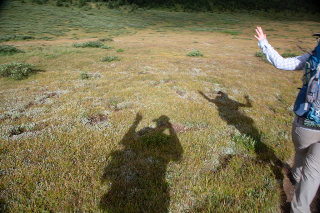
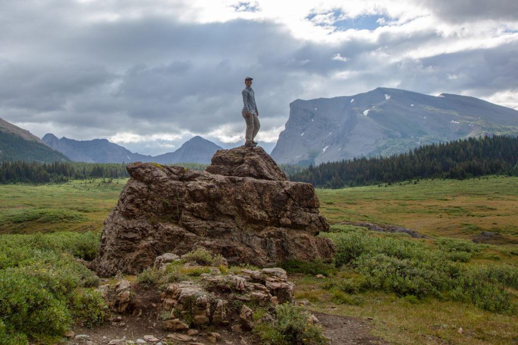
Micah’s Note: I like that boulder. That’s a nice boulder.

The segment marked as “Ancient Lake Bed” has an elevation drop of only 30 m over its 4.5 km length. Distances measured from Magog Lake CG.
Micah following the well graded trail down the Og Lake.
Limestone is a great place to find caves. Caves are produced by water flowing through the limestone. Is anyone living inside?
The trail leads that way to Og Lake. It is cloudy but the views are spectacular.

We arrived at Og Lake 55 minutes after Micah had stood on their pedestal. Og Lake has a pretty little campground. The tent sites are very open and not a lot of privacy or protection from the wind. The campground offers a great view of Mt Assiniboine, but for us the peak was still buried in the clouds. We dropped our packs to investigate the campground and to use the biffy. We made a small error in judgement at this time because we had neglected read the guidebook before we started the day. The guidebook states very clearly the next section from Og Lake to Citadel Pass is very dry with little to no water sources. Lacking this knowledge we did not take the opportunity ensure we had enough water for the hike to and over the pass. We did end up rationing our water as we climbed the pass in the afternoon sun. The next water source ended up to be about 10 km from Og Lake and consisted of a couple of small ponds just shy of the top of Citadel Pass.

Og Lake, the campground and Mt Assiniboine in the distance.
The information board at Lake Og. I feel the photos are a little dated.

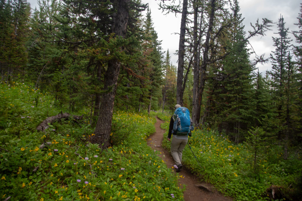
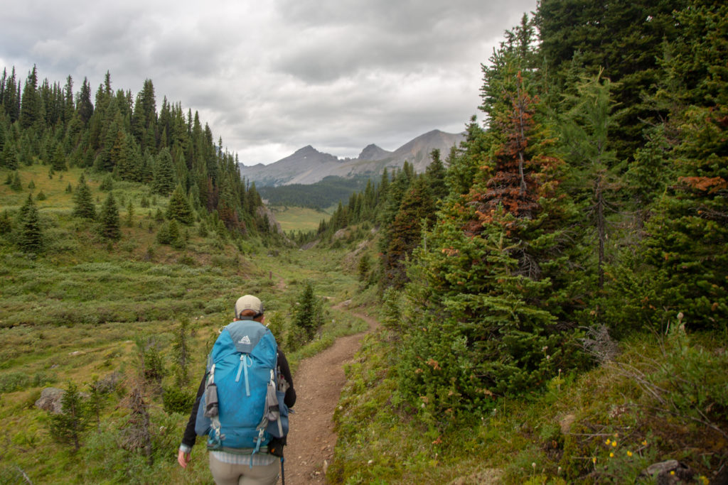
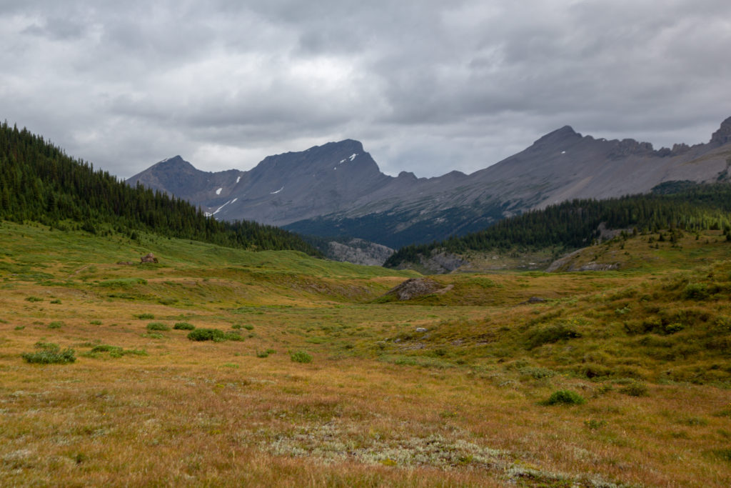
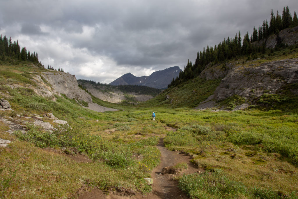
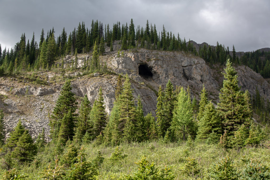
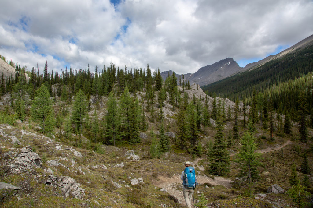
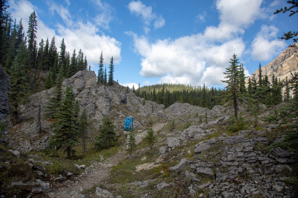
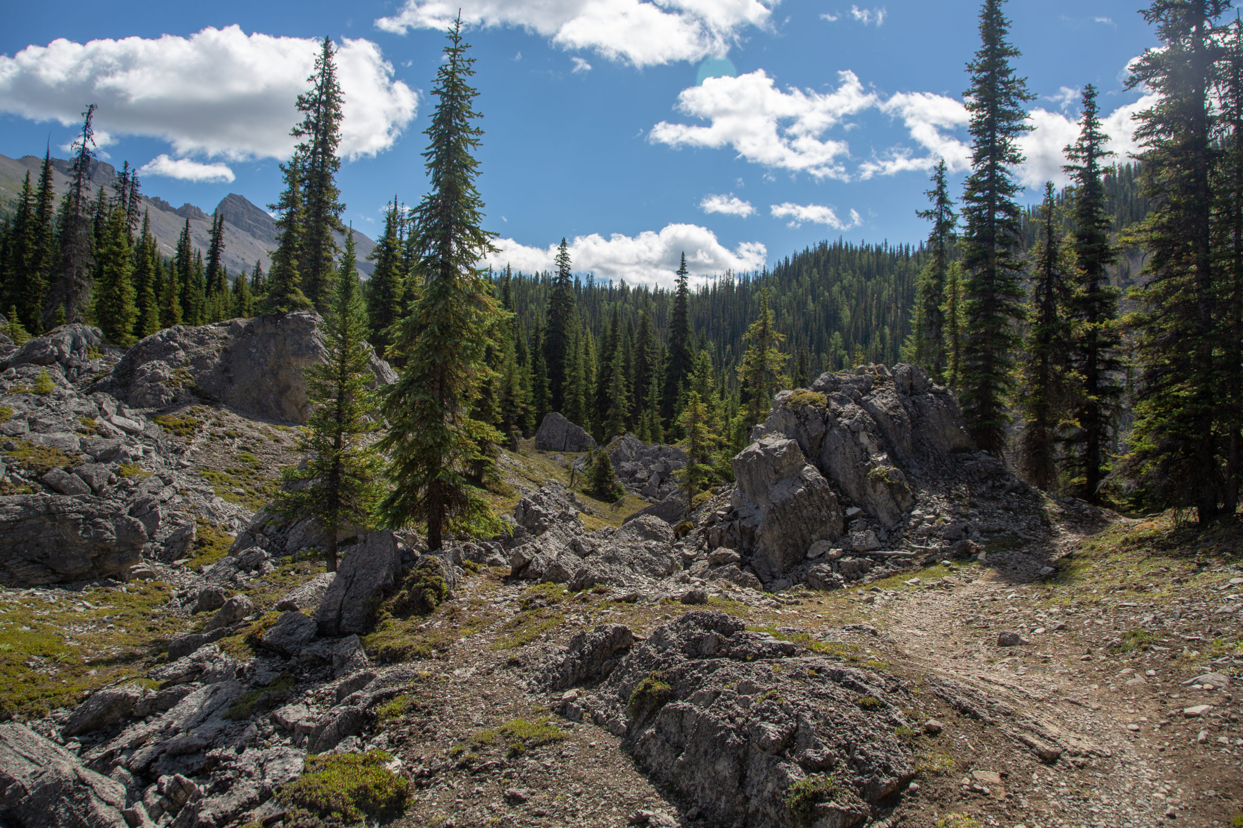
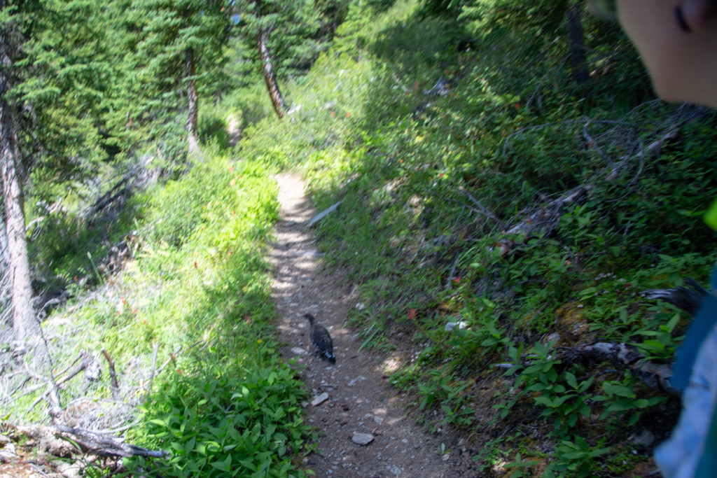
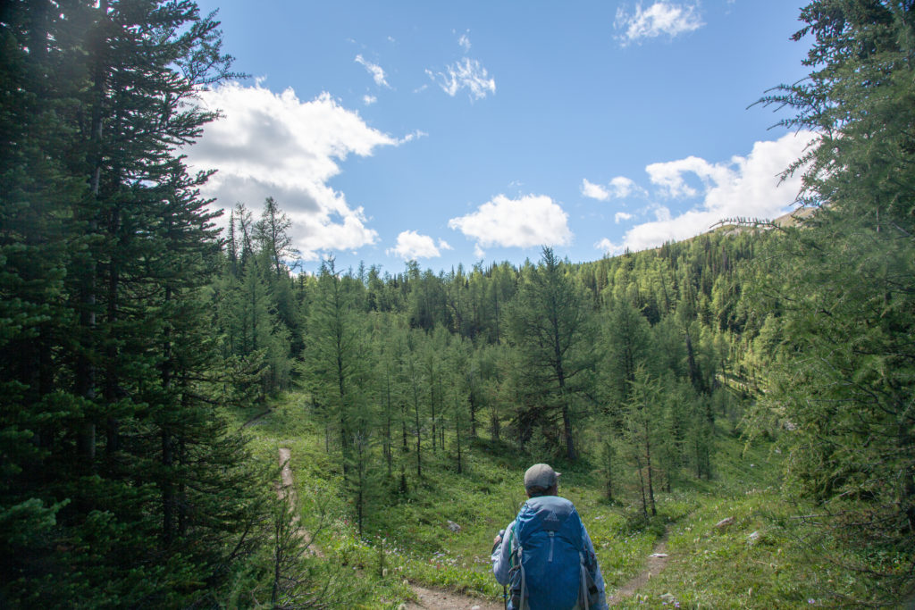
After a few minutes of relaxing we left Og Lake and headed on our way to Citadel Pass. The trail heads up a small rise then drops down a long valley towards the junction for Porcupine CG. This was a fun section of trail with many short ups and downs and little twists and turns. A stark contrast the long steady descent to Og Lake. We dubbed this the Rock Garden because of the many loose rocks that were scattered across the landscape. The official name is the Valley of the Rocks.

Micah surveying the path forward.
The winding trail.
A snapshot of the Valley of the Rocks. A winding trail, sparsely vegetated and has lots of limestone rubble.
A very zoomed in photo of a pika.
One of the many small ups along the way.

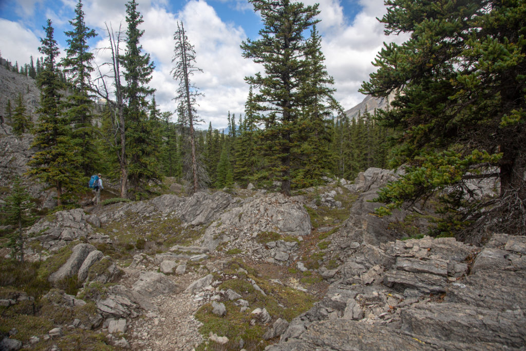
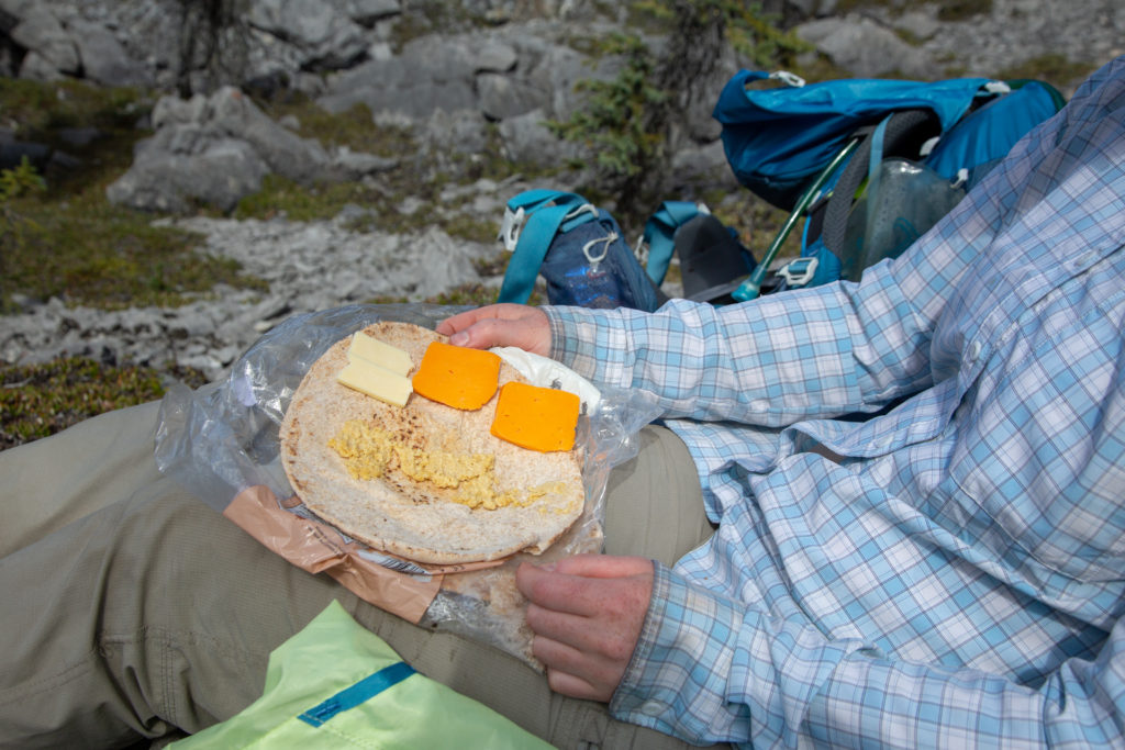
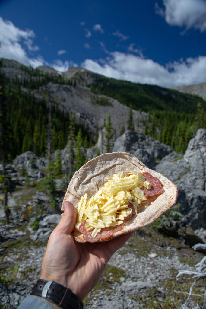
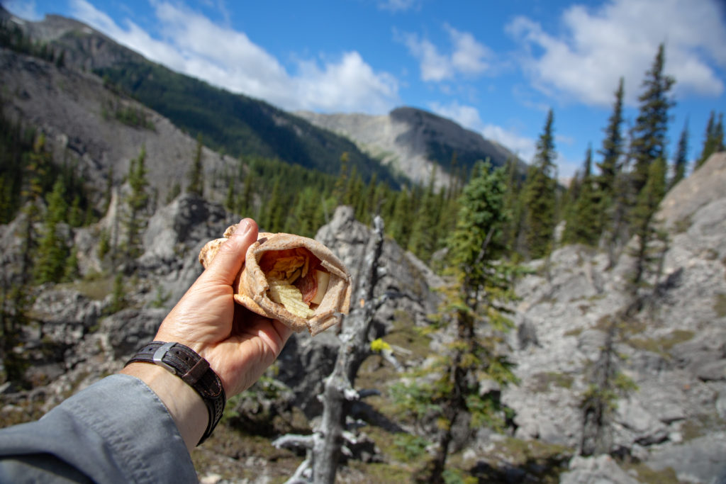
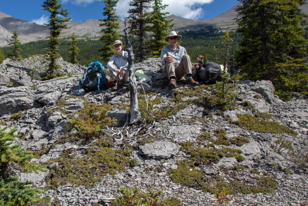
During our time in the Valley of the Rocks we ran into a couple of guys relaxing among the rocks. They had a week long trip planned from Sunshine Village to Mt Shark Parking lot. They were traveling about half our daily distance each day. Micah remarked that they were probably having a great time not being in a rush. We stopped for lunch at 11:45 am. It had been about 1 hr 20 min since we left Og Lake.

Micah’s Note: I like full hiking days, I do, but I also really see the appeal in taking a chill trip where you’re completely free to just amble along the trail and stop and swim or sit whenever you want to. One of these days I need to drag one of my non-backpacker friends out for a trip like that.

Wraps for lunch. On the left Micah has some dried hummus (I dried it for them). I am going with the sliced pepperoni.
End of lunch. Glad we had the butt pads, the rocks were very sharp.

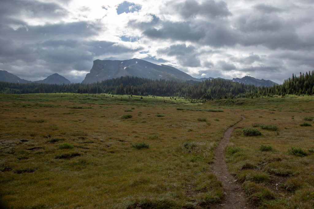
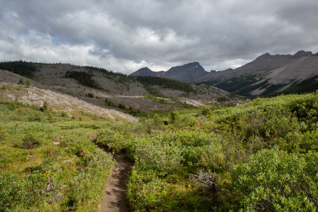
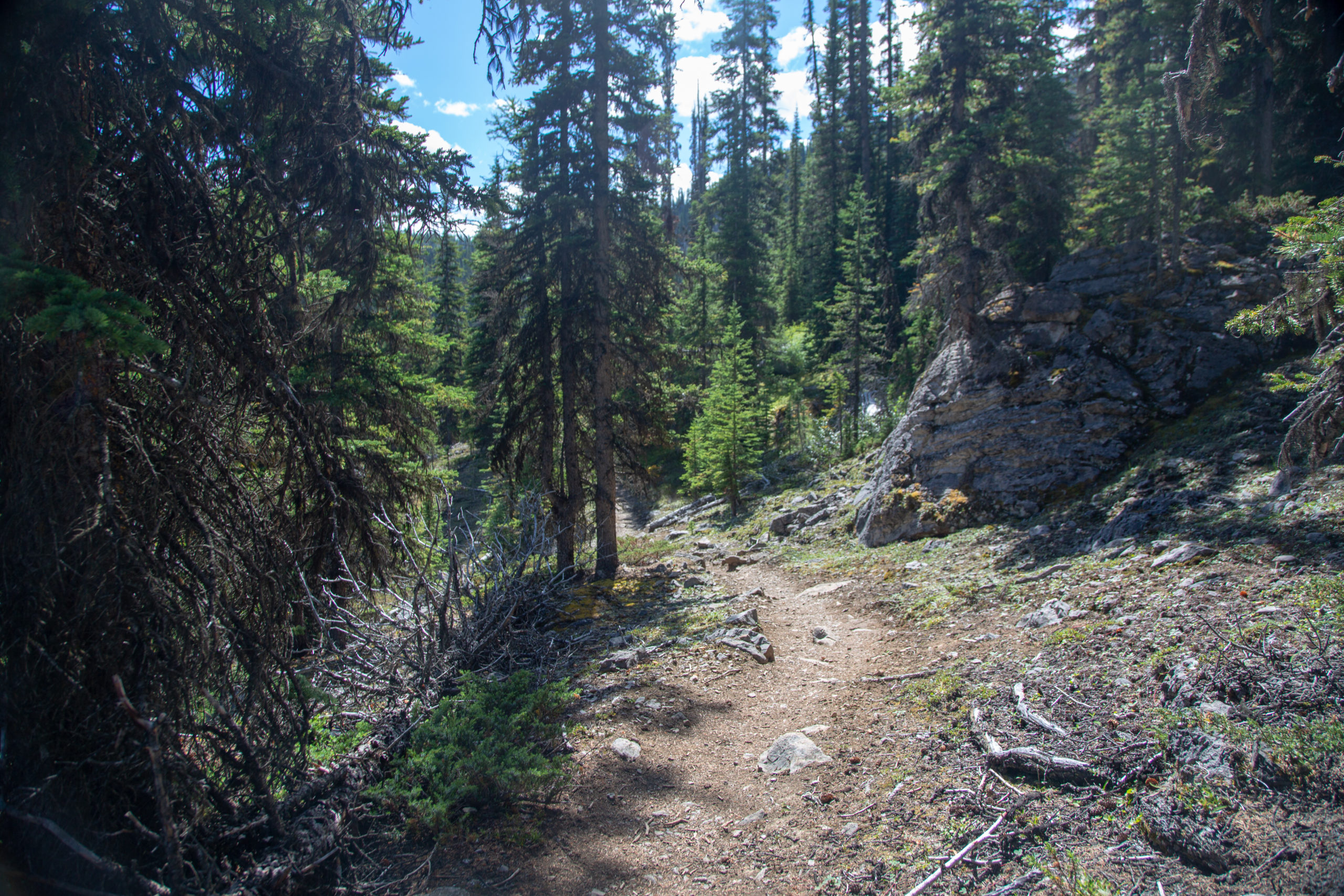
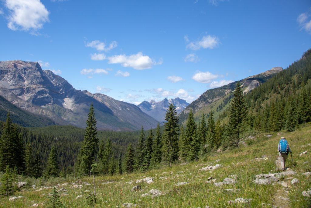
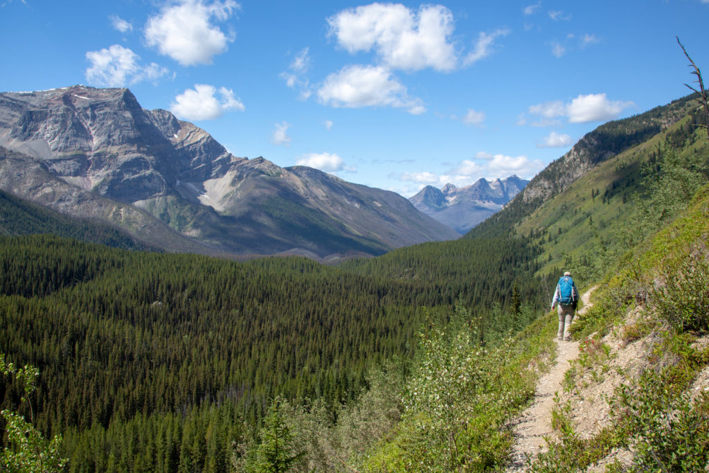
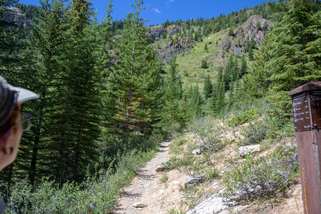
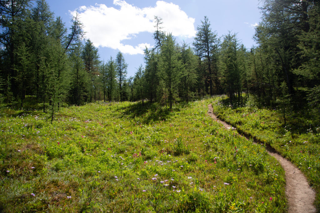
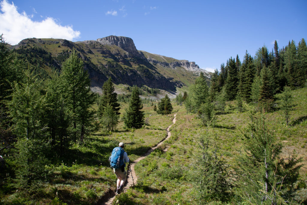
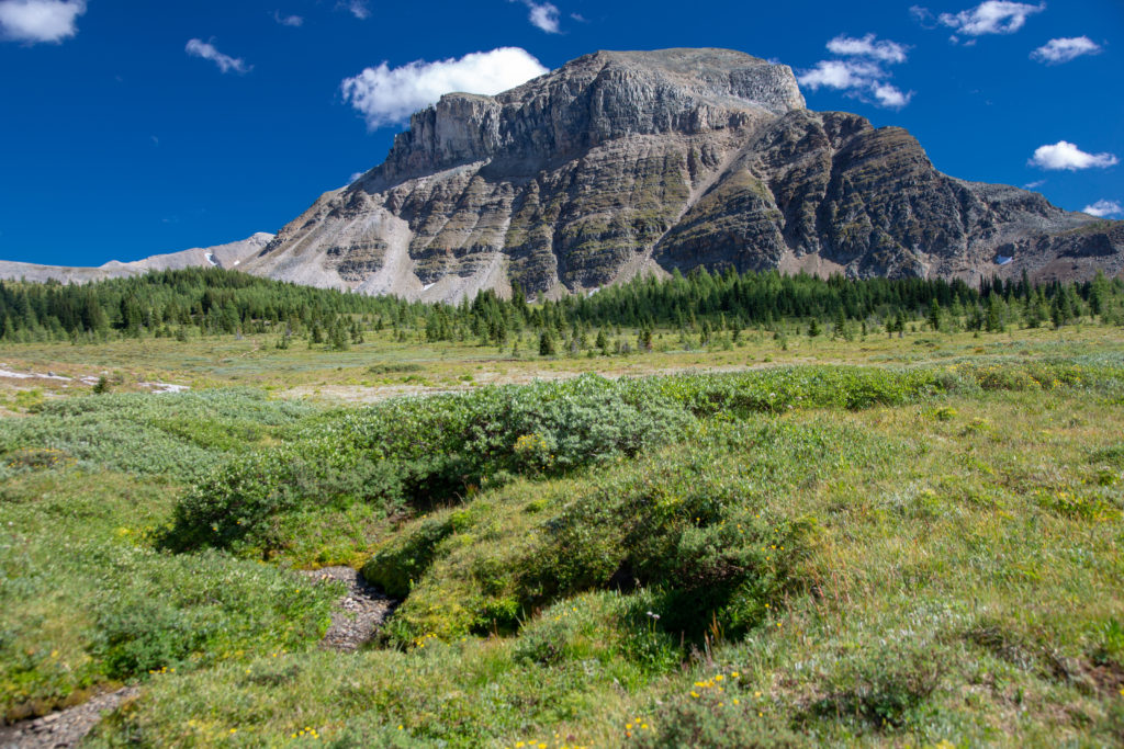
We got going again after lunch at 12:10 pm. The sun was shining, we had blue skies and our water supplies were dwindling. We came to the junction to Porcupine campground at 12:35 pm roughly 13 km since the start of our trip. The junction signaled the end of the Valley of the Rocks. We would lose a little more elevation before beginning our 7 km climb up Citadel Pass. The trail conditions changed drastically as we left the junction. The loose rocks that had been underfoot since Og Lake disappeared leaving us with a much softer trail with few rocks. The initial part of the hike to the pass was a long side slope along the lower flanks of Golden Mt. We lost whatever shade we had been enjoying and with the south facing slope slowly started to bake in the afternoon sun. We crossed many stream beds that were indicated on our map but they were all dry.

Not a lot of shade along our winding path.
The Valley of the Rocks is coming to an end.
Micah checking out the the signpost. What is interesting is that you can continue onto Porcupine CG and then follow the valley all the way to Hwy 93. We are going right. 7 km to Citadel Pass.
Grassy slopes softer tread under our feet.
High five. Go team.
Micah working their way along Golden Mt. Simpsons Ridge across the valley to our left.
It quite a steep slope Micah is hiking on. Do not want to tumble down the hill. The peaks at the end of the valley are The Monarch (2904 m) near Sunshine Village. This was only 10 minutes after the previous photo.
Trail is now stating to head up.

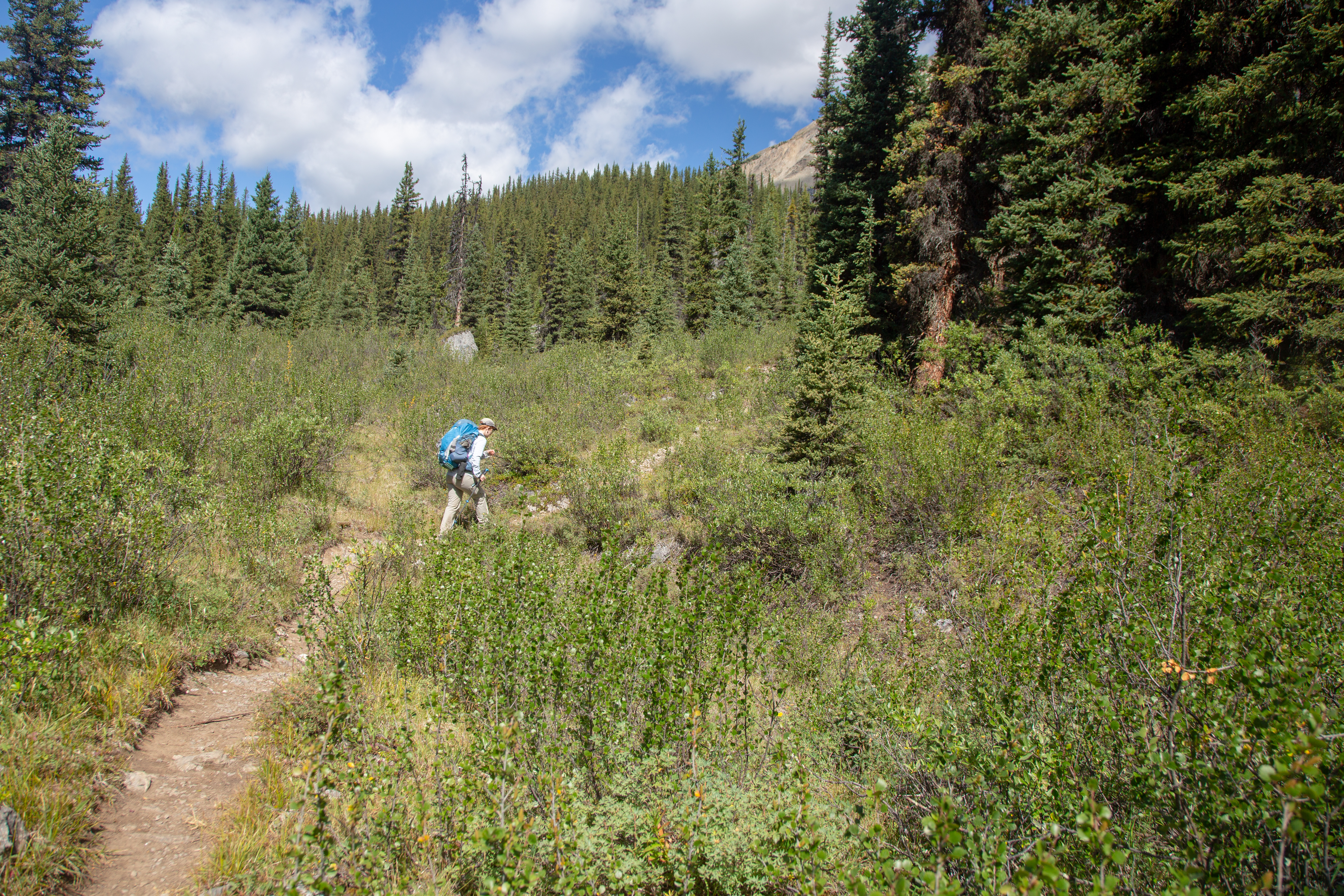
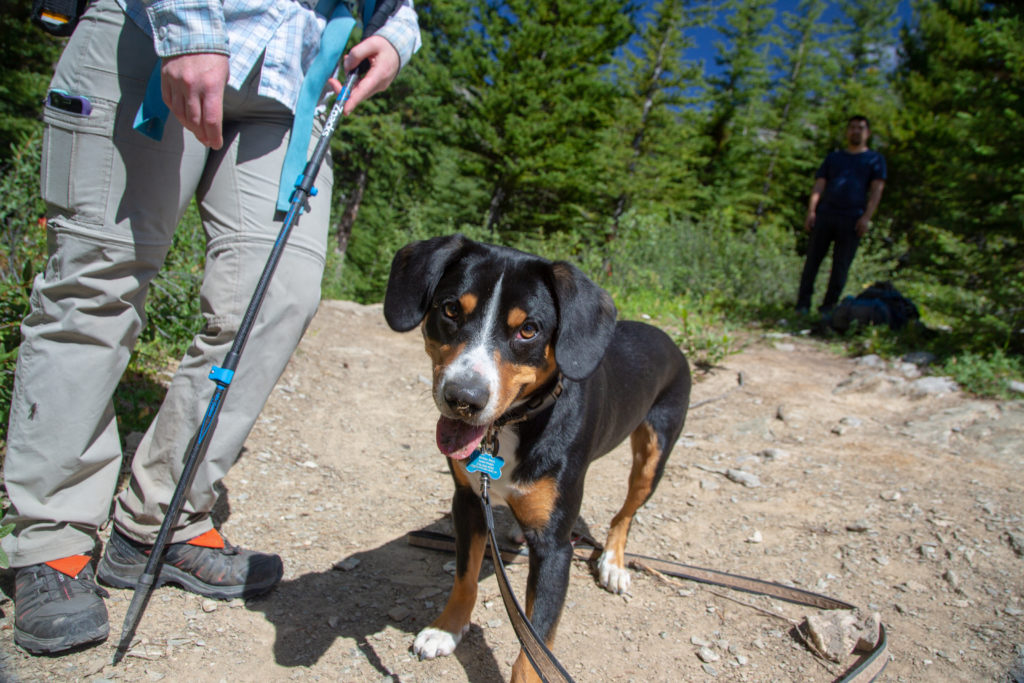
We arrived at the west junction for Porcupine CG at 2 pm a distance of 4 km from the east junction. The elevation change over the 4 km between the junctions was only 125 m. This left us with the bulk of the 480 m climb to Citadel Pass to be gained in the remaining 3 km. The trail kicked up steeply for just a km or so leaving a very moderate final 2 km to the pass. We had a little treat shortly after leaving the junction when we met a group coming the other way who had an adorable and friendly dog. I do not remember the dog’s name but it was very pleasant and amused us by chasing a small stick we tossed and bringing it back to us so we could toss it again. After a couple of minutes of doggie play time we said our goodbyes and headed back uphill. Our water situation was not great; I ran dry soon after we left the junction. There was two small ponds shown on the map at near the top of the pass just a short distance away, so I was not worried about dehydration but quite annoyed at myself by getting into the situation.

Aggressive wildlife.
Its only 3 km to Citadel Pass and then just over 3 km to Howard-Douglas CG. We have come 16.5 km from Lake Magog.
It is not really that far up the hill.
DOGGIE!

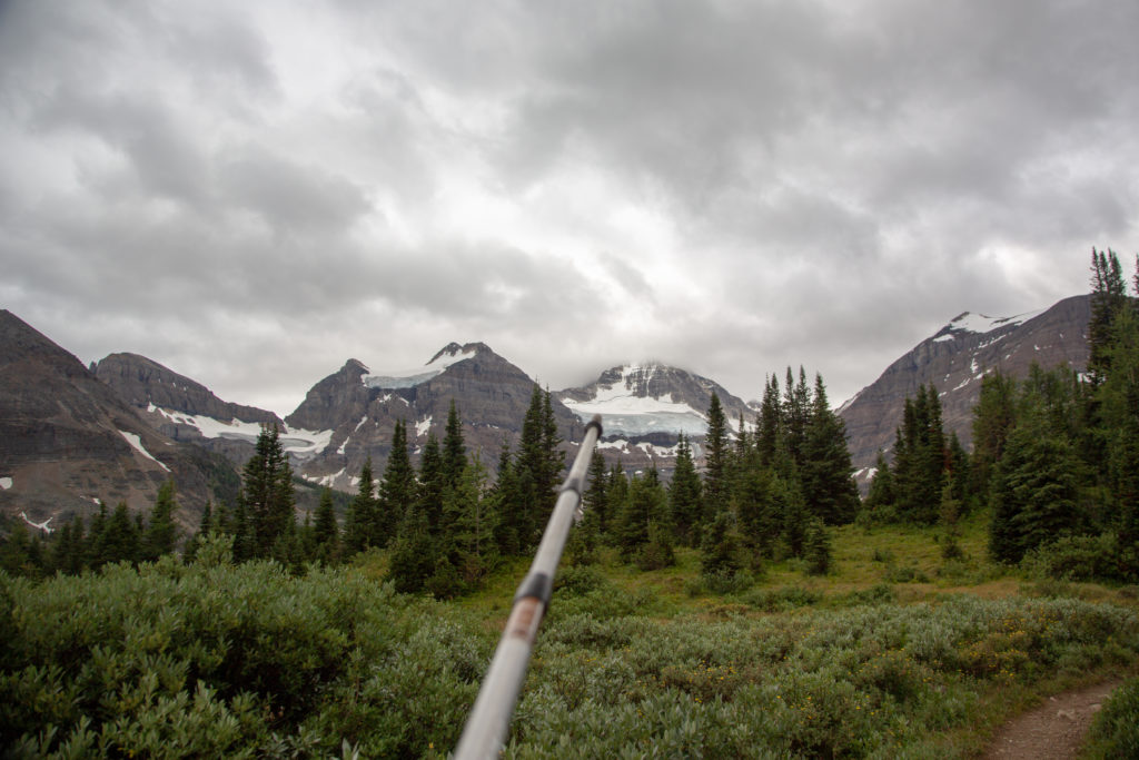
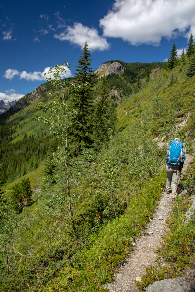
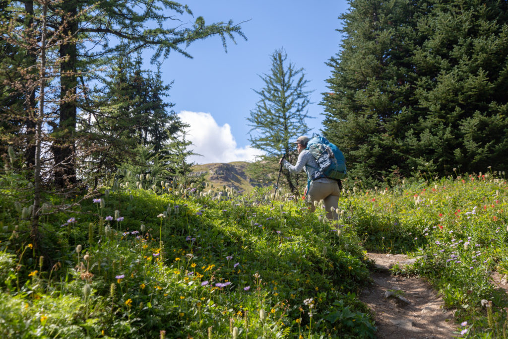
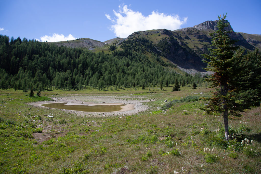
It was a quick, hot (for us) hike to the two small ponds at the top of the steep climb. The trail followed the drainage up with few switchbacks. The tall grasses had us on high alert for bears. Looking back Mt Assiniboine slowly climbed into view in the distance. We did not talk much, focusing our energies on getting to the next water source. We crested a rise and the trail split. We went to right, where we had a quick drop to what was left of the lower pond. At this time in the summer the pond was more of a slew than a pond. The colour of the water did not excite me very much but it was water. We finished off what little we had of Micah’s water and headed down to the pond to replenish our supply.

Mt Assiniboine coming into view just left of centre.
The trail stayed in the open exposed to the sun. It had been overcast when we started our hike at Lake Magog. Good bear territory.
The end of the hard part. The trail flattens out after this. The lower pond is just down to the right.
Main trail goes left so we went right to the water.
Hmmm water.

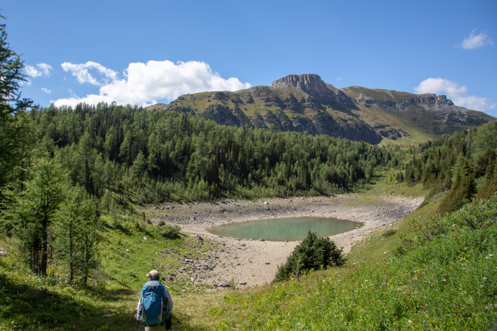
We carefully stood on some rocks to collect water as far away from shoreline as possible to minimize the sludge we might pick up. There water was definitely not high quality, with lots of little floaties in it. We dropped an extra iodine pill into each of our bottles and figured in half an hour we would be good to go. A couple came by as we were getting ready to leave. The were carrying one two-litre bottle for water. Their bottle was barely a quarter full so we asked them were they were headed. Og Lake was the reply. We suggested that they fill up here as there was no water until Og Lake. We were slightly horrified when they just dipped their bottle into the pond and took a drink. We offered up some pills since the water was not the best. They declined saying they never filtered or purified their water. After a short discussion they did accept our offer of a couple of pills. Not sure why people take the risk with water.

Micah’s Note: This was some of the more disgusting water I’ve drank on a trail. Not quite stagnant standing water, but going in that direction. I ended up pouring most of it out later, though I was glad to have it right then, since we were parched and it was boiling out. I nearly always purify my water, even if its from a crystal clear creek–you never know if there’s something dead just upstream–but standing water? Wouldn’t risk it.

Back on the trail heading to the pass.
Breaking out into the open. Citadel Peak (2610 m) looming in the background.
The second of the two ponds on our map. Not a stellar option.

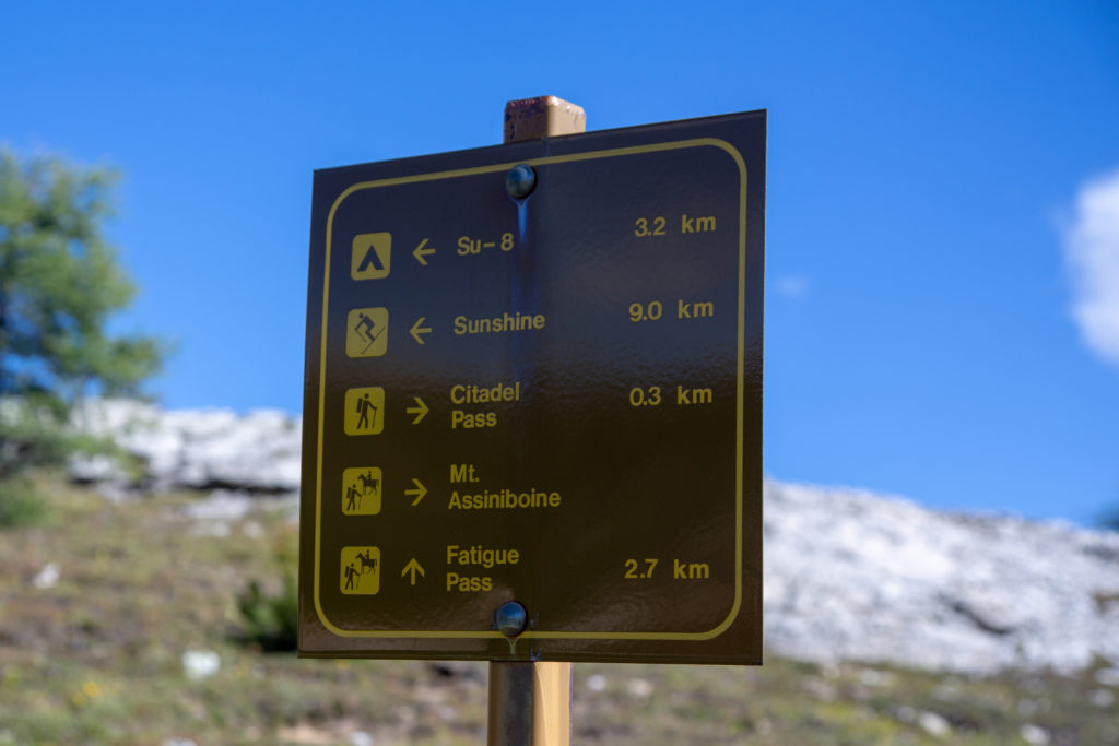
After a pleasant well graded approach we arrived at the pass at 3:30 pm. It had taken 2 hrs 50 min since we left the first junction at the end of the Valley of the Rocks, and about 25 minutes from our water source. With the hike up to Citadel Pass being on a south facing slope the afternoon sun had made it quite a warm hike. With the increase in elevation Mt Assiniboine came back into view. We would not lose sight of Mt Assiniboine for good until we left Sunshine Village Ski Resort tomorrow.

Micah’s Note: I can’t count how many times we “said a final goodbye to Mt Assiniboine,” only to spot it again the next afternoon.

Mt Assiniboine rises above the rest.
Taken us exactly 7 hrs to hike 19.5 km from Lake Magog CG.
Only 3.2 km to our campsite at Howard-Douglas CG. Fatigue Pass sounds intriguing.
Amazing map in the middle of the backcountry. Glad we are not lost.
Citadel Pass

Micah has a few unwritten rules when hiking and it is good not to violate them. After reaching the top of a climb Micah likes to take a few minutes to savour the view afforded by all the work it took to get there. I had already been to this exact spot on a previous backcountry trip with Siobhan and Links to Howard-Douglas. Knowing that the end of the hike was an easy 3 km downhill walk I pushed on as soon as we arrived at the pass. Micah followed but was not happy. It was not until we had been in camp for a while that Micah informed me that they were not pleased with leaving the pass so quickly. I did my best on the rest of the trip to wait and pause to take in the view before moving on.

Micah’s Note: “Not happy” he says, like I wasn’t trudging behind him plotting his grisly death by horse fly for 3km. I believe ‘hangry’ is the term. Luckily, we’re pretty good communicators, so we always manage to clear these things up pretty quickly. And to be fair, if we had stayed at the pass we probably would have been devoured by horse flies anyway. They were out in force that day.

We are headed to the mountain at centre, Quartz Hill (2580 m). The campground is nestled at the base of Quartz Hill.
Citadel Peak is more impressive from this side.
The flowers are out.
Final approach to the lake.

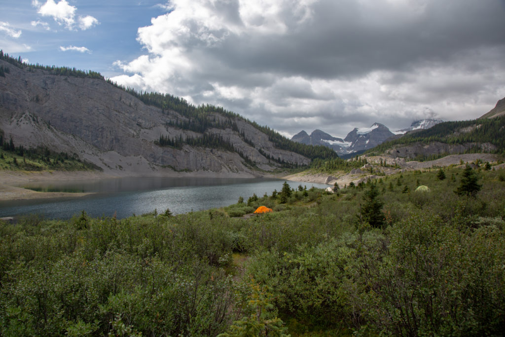
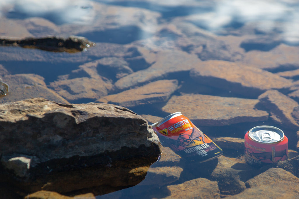
We threw our packs down at 4:25 pm, 7 hrs 50 min since leaving Lake Magog. Shortly after we arrived, the French couple from our first night arrived in camp. I have no idea where we passed them on the trail. The could have been at Porcupine CG. They did not have a permit for the campground and were asking Micah and I what to do. A voice from one of the tents yelled out that they should just find a spot off to the side and everyone would be happy. As it was a gorgeous day one of the first things I did was to put the beer that I had carried for four days into a creek to cool. It never did get very cold but it sure did taste great.

Well earned.

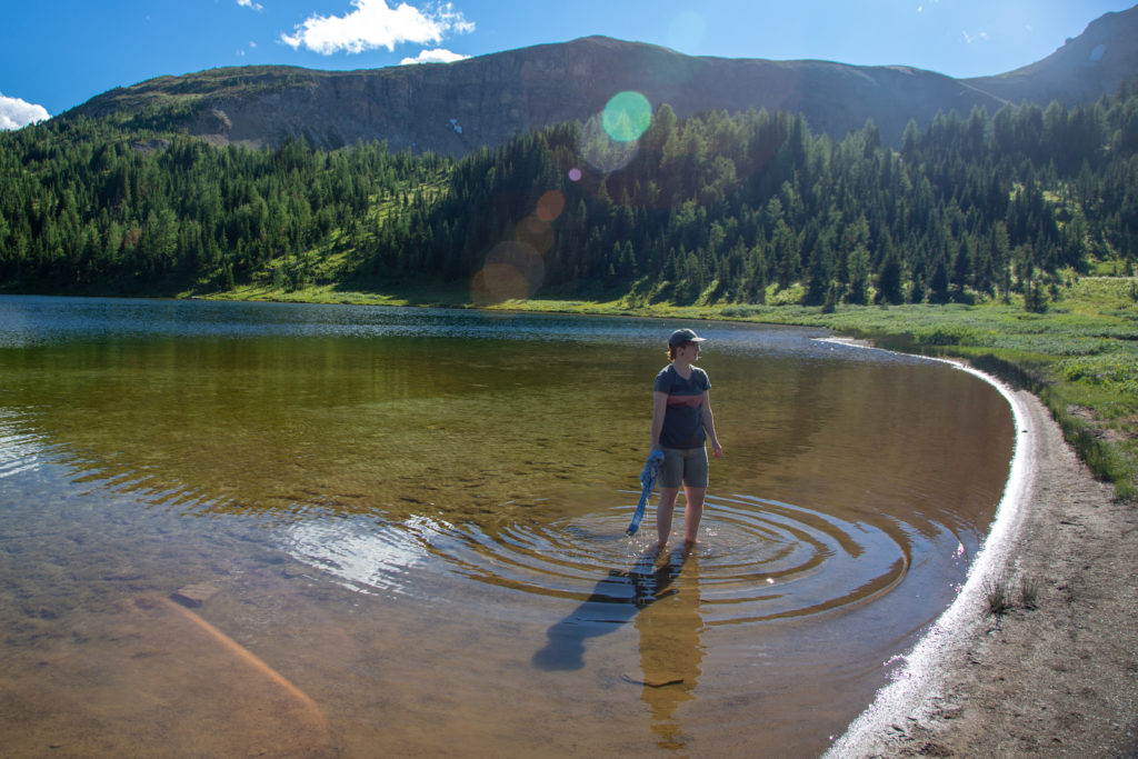
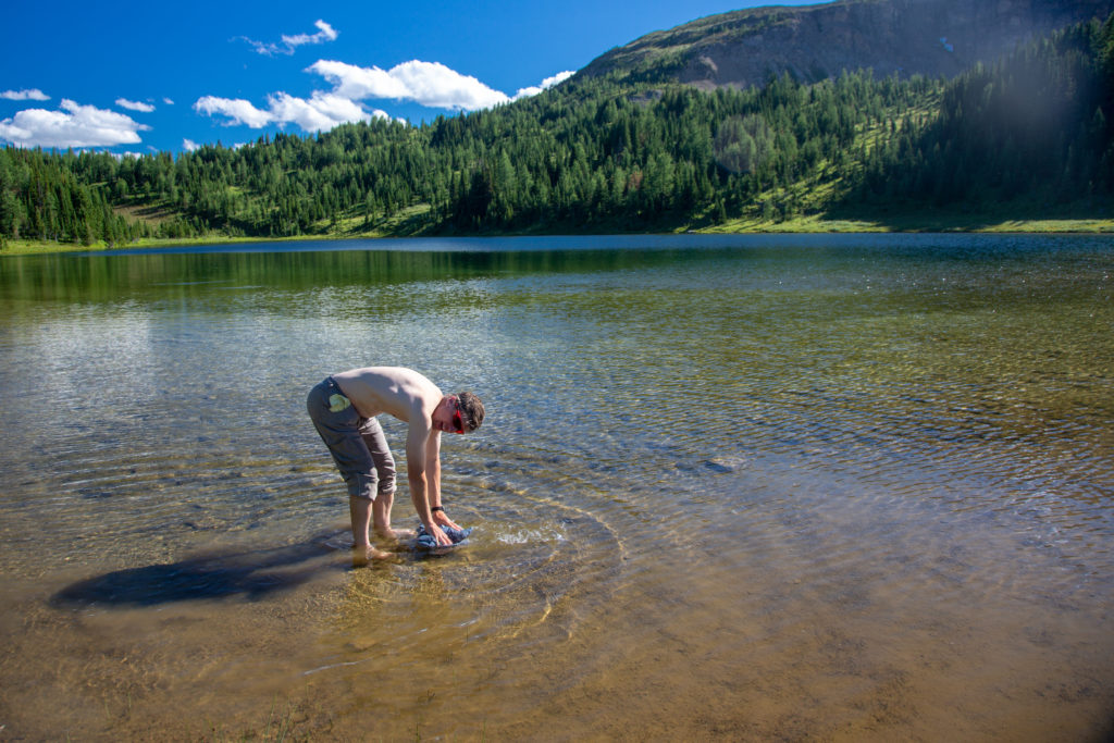
After setting up the tent we washed ourselves and our clothes in the lake. More a rinse really as we did not use any soap. It was very refreshing.

Micah’s note: When the horse flies weren’t attacking, that is.

Tent all set up. With the wood chips probably do not need the ground sheet.
Micah doing laundry.
Working on my tan.
Nothing more invigorating than a cold water wash.

Not sure if it is because it was among the smallest campgrounds we stayed at but we had a really lovely time all evening talking with the different campers. During dinner we chatted with an older group of three, two ladies and hubby. The hubby, for some reason, (Micah’s note: snoring) was banished to his own tent as the ladies shared one between them. They were a great group of people. While getting older and little slower they had some amazing stories of hiking across the northern tundra. The stories were super intense and provided Micah and I with food for thought on new places to explore. At some point, the hubby discovered a crack in his flask that was carrying his whiskey, so I had to help him drink the whiskey before it leaked out. The whiskey, combined with the beer that I had with dinner, made me feeling a little light-headed for part of the evening.

After dinner we all congregated near a log by the lake. We struck up a conversion with the other group at the campsite, a father/son duo. The son had been pretty silent all evening as the adults dominated the conversation so I purposely asked the son questions to bring him into the discussion. Turns out he was in university like Micah, and from there the conversation grew naturally as they discussed the different ways Covid had impacted their schools and university experiences.

Good night from Howard-Douglas CG.

Day 6 GDT Hike Section C 2020

GDT Section C 2020 Home

bootwreckers

New trip posted, three day trip in the Rockwall in New trip posted, three day trip in the Rockwall in Kootenay NP with @sio.mellors. Introduction and Day 1 up on Bootwreckers.

Trip was suppose to be hiking Northover Ridge in Kanananaskis but smoke had us change plans at the last minute.

This would be my third multi day trip on the Rockwall but the first for Siobhan.

Managed to get two camping sites on the Rockwall and instead of smoke we had to deal with the threat of rain.

We did get wet but we had a blast.

Day 1 is from Paint Pots TH to Helmet Falls CG, with a side trip to get up close the the falls. Pretty straightforward day but visiting Helmet Falls is always special.

#parkscanada #parks #bcparks #trails #longdistancehike #longtrail #outdoors #outside #thruhike #hike #thruhiking #outside #backpacking #waterfalls #waterfall #naturephotography #naturephotography #nationalparks
The sixth and final day of our 2022 GDT Section D The sixth and final day of our 2022 GDT Section D hike is up on Bootwreckers, see link in bio.

This day took us from a random camp on the Howse Floodplain to the Mustafa Canyon parking lot. This was an adventurous day with bushwhacking, stream crossings and dead fall but a simply glorious end to a wonderful hike on the GDT. 

Again thanks  to Sara (@sd_kuz) and Lillian (@waterlilizee) for sharing this adventure with me. I am sure we will meet again on a trail someday.

Photo 1 - Morning Colors

Photo 2 - tents on the floodplain

Photo 3 - bushwhacking to start the day

Photo 4 - fields of flowers going to seed

Photo 5 - looking south down the Howse River

Photo 6 - thigh deep water crossing

Photo 7 - big views

Photo 8 - Sara crossing some dead fall

Photo 9 -Mistaya Canyon

Photo 10 - picked up a thru hiker named Roy, enjoying beverages left by Natasha and Kyle from Backpacks and Bikeracks

#greatdivide #greatdividetrail #gdt #parkscanada #parks #bcparks #trails #longdistancehike #longtrail #outdoors #outside #thruhike #hike #thruhiking #outside #backpacking #waterfalls #waterfall #naturephotography #naturephotography #nationalparks #duplex #sectionhike #sectionhiker
Day 5 of our 2022 Great Divide Trail Section D hik Day 5 of our 2022 Great Divide Trail Section D hike is posted on Bootwreckers, see link in bio.

Truly epic day on the trail. Pass through the debris of two avalanches, had lunch by a waterfall, crawled over so much dead fall and hiked on the Howse Flood Plain.

The sunset on the flood plain was one of most magical I have seen.

As always a big thanks to Sara (@sd_kuz) and Lillian (@waterlilizee) for sharing this adventure with me. The Team totally rocked the trail.

#greatdivide #greatdividetrail #gdt #parkscanada #parks #bcparks #trails #longdistancehike #longtrail #outdoors #outside #thruhike #hike #thruhiking #outside #backpacking #waterfalls #waterfall #naturephotography #naturephotography #nationalparks #duplex #sectionhike #sectionhiker
Evening light on Picketpost Mt. #aztrail #aztasso Evening light on Picketpost Mt.

#aztrail #aztassociation  #nps, #nationalparks, #slotcanyon, #hiking, #hikingadventures, #familytime, #camping, #campingadventures, #outdoors, #outside, #nature,  #FIndyourpark #landscape #landscapephotography #optoutside #nationalpark #desertphotography #grandcanyon #grandcanyonnationalpark #grandcanyonassociation #nationalparkweek #reichallenge #nationalparksweek #rightnow #nationalparktrust #goparks #aztrails
Arizona Trail Passages 14 and 15. Some photos of Arizona Trail Passages 14 and 15.

Some photos of my recent hike down a couple of Passages of the Arizona Trail. 

The trail is so diverse, rolling terrain cut by shallow washes leads to the expanse of the desert then into rugged canyons and tall peaks, all in a space of 92 km (58 miles).

Had a great time, some blisters gave me some concerns but they seem to be doing fine now that they are out of my hiking shoes.

Got lucky with Trail Magic courtesy of Condiments who drove his 4x4 deep into an unarmed wash, was really in the middle of no where, and then again at the start of Passage 15, missed the Trail Angel's name, the wind was so loud.

Like to thank my Trail Angels, Carole for driving me to Oracle to start the trip, with side trip to a Hayden Az, a real ghost town and to Edith for leaving a water cache for me at Passage 15.

Included a video of my time at the high point for Passage 15. My kid likes it when you stop and enjoy the view you earned, thought they would appreciate my effort in the face of 1000 mph winds (ok maybe thats a bit of an exaggeration).

Thanks Arizona and the AZT for providing more memories.

I will be back

#aztrail #aztassociation  #nps, #nationalparks, #slotcanyon, #hiking, #hikingadventures, #familytime, #camping, #campingadventures, #outdoors, #outside, #nature,  #FIndyourpark #landscape #landscapephotography #optoutside #nationalpark #desertphotography #grandcanyon #grandcanyonnationalpark #grandcanyonassociation #nationalparkweek #reichallenge #nationalparksweek #rightnow #nationalparktrust #goparks #aztrails
That sunset says when I wake up it will be time to That sunset says when I wake up it will be time to start my hike on the Arizona Trail, Passages 14 and 15

Love my little motel in Superior, Az, Copper Mt Motel. Has murals painted on all the buildings

Spied the Grand Canyon from the plane 

Adventure awaits 

#aztrail #aztassociation  #nps, #nationalparks, #slotcanyon, #hiking, #hikingadventures, #familytime, #camping, #campingadventures, #outdoors, #outside, #nature,  #FIndyourpark #landscape #landscapephotography #optoutside #nationalpark #desertphotography #grandcanyon #grandcanyonnationalpark #grandcanyonassociation #nationalparkweek #reichallenge #nationalparksweek #rightnow #nationalparktrust #goparks #aztrails
Frosty Paws all packed and ready for an adventure. Frosty Paws all packed and ready for an adventure.

Arizona Trail Passages 14 and 15 starting Sunday

Off weekend gooooooo!

#aztrail #aztassociation  #nps, #nationalparks, #slotcanyon, #hiking, #hikingadventures, #familytime, #camping, #campingadventures, #outdoors, #outside, #nature,  #FIndyourpark #landscape #landscapephotography #optoutside #nationalpark #desertphotography #grandcanyon #grandcanyonnationalpark #grandcanyonassociation #nationalparkweek #reichallenge #nationalparksweek #rightnow #nationalparktrust #goparks #aztrails
Last weekend before heading to Arizona for a four Last weekend before heading to Arizona for a four day adventure on the Arizona Trail.

I wonder if hiking in the 15 cm of fresh snow will be good prepared for hiking the deserts of Passages 14 and 15?

#aztrail #aztassociation  #nps, #nationalparks, #slotcanyon, #hiking, #hikingadventures, #familytime, #camping, #campingadventures, #outdoors, #outside, #nature,  #FIndyourpark #landscape #landscapephotography #optoutside #nationalpark #desertphotography #grandcanyon #grandcanyonnationalpark #grandcanyonassociation #nationalparkweek #reichallenge #nationalparksweek #rightnow #nationalparktrust #goparks #aztrails
Day 4 of our 2022 GDT Section D hike is up on the Day 4 of our 2022 GDT Section D hike is up on the website, see link in bio.

This was a truly epic day spent on the Amiskwi and Collie Creek Alternates.

The weather cooperated starting with a spectacular sunrise on the Mummery Glacier, rainbows and blue skies on the ridge.

We had a brief encounter with a little black bear who scampered quickly away. 

Finished off the day with a cold beer, Grizzly Paw Rutting Elk Red, that I had carried with me and it tasted great.

Easily one of th best days on the trail ever.

Again big thanks to Sara (@sd_kuz) and Lillian (@waterlilizee) for sharing this adventure with me. The Team totally rocked the trail.

#greatdivide #greatdividetrail #gdt #parkscanada #parks #bcparks #trails #longdistancehike #longtrail #outdoors #outside #thruhike #hike #thruhiking #outside #backpacking #waterfalls #waterfall #naturephotography #naturephotography #nationalparks #duplex #sectionhike #sectionhiker
Day 3 of our 2022 Section D hike is posted, see li Day 3 of our 2022 Section D hike is posted, see link in bio.

This was a shorter day, only about 17 km but took us from the end of the Kiwetinok Alternate up to Amiskwi Pass and then a beautiful meadow at the the base of the Amiskwi Ridge.

Photo 1 - morning sky

Photo 2 - on the Kiwetinok Alternate

Photo 3 - Kiwetinok Alternate

Photo 4 - break time at a stream crossing, Frosty Paws hanging in there

Photo 5 - Fireweed with a view down the Amiskwi Valley,

Photo 6 - fields of flowers as we approached Amiskwi Pass

Photo 7 - Yellow Columbine on the way up to Amiskwi Lodge

Photo 8 - Our camp in the meadow

Photo 9 - Setting sun

Photo 10 - one of the best adventure stories ever! True story of how three prisoners of war escaped and climbed Mt Kenya

Again big thanks to Sara (@sd_kuz) and Lillian (@waterlilizee) for sharing this adventure with me. The Team totally rocked the trail.

#greatdivide #greatdividetrail #gdt #parkscanada #parks #bcparks #trails #longdistancehike #longtrail #outdoors #outside #thruhike #hike #thruhiking #outside #backpacking #waterfalls #waterfall #naturephotography #naturephotography #nationalparks #duplex #sectionhike #sectionhiker
First two days of my 2022 Great Divide Trail Secti First two days of my 2022 Great Divide Trail Section D adventure are up on the blog, see profile for link.

Day 1 was from Burgess Pass Trail head to Yoho Lake Campground. A relatively short day but a good warm up for the rest of the trip.

Big thanks to Sara (@sd_kuz) and Lillian (@waterlilizee) for sharing this adventure with me. The Team totally rocked the trail.

Photo 1 - at Burgess Pass looking at Mt Wapta

Photo 2 - Flowers, it was a great time to hike to see all the flowers in August bloom

Photo 3 - Emerald Lake from up high

Photo 4 - at Yoho Pass, did I mention the flowers

Photo 5 - Duplex tent all set up with Frosty Paws on guard, and oh ya, more flowers

Photo 6 - the north end of Wapta Mt as seen from Yoho Lake.

Super fun little day, the opening a grand adventure.

#greatdivide #greatdividetrail #gdt #parkscanada #parks #bcparks #trails #longdistancehike #longtrail #outdoors #outside #thruhike #hike #thruhiking #outside #backpacking #waterfalls #waterfall #naturephotography #naturephotography #nationalparks #duplex #sectionhike #sectionhiker
Sound On. Video clips from my hike along th Supe Sound On. 

Video clips from my hike along th Superstion Ridgeline.

Was an epic hike, 24km from my campsite at Miners Needle to First Water Trailhead where my car was.

Wouldn't recommend doing all in one day backpacking, as the final descent down Siphon Draw Wash is brutal, but I did it in 10hrs 45min

Would love to redo th hike at some point and actaull stop and camp along the ridge.

I had enough water to stop, but I was enticed by the prospects of a beer to finish.

#teamzpacks #zpacks #zpacksduplex #aztassociation #aztrail #aztrails #hike #loveazt #desertphotography #desert #hikingadventures #hikes #backpacking #camping #getoutside #familytime #traillife #aztassociation , #hiking, #hikingadventures, #familytime, #camping, #campingadventures, #outdoors, #outside, #nature,  #FIndyourpark #landscape #landscapephotography #optoutside  #rightnow #goparks #aztrails #aztrail #loveazt  #azt #arizonatrailassociation
Day 5 and 6 of our Green River Canoe trip from 201 Day 5 and 6 of our Green River Canoe trip from 2017 is up on Bootwreckers, see link in Bio.

The day started in the dark with a hike up to the Dollhouse to watch the sunrise.

After doing an bit of exploring including a short hike out to Beehive Arch we headed back to camp to pack up and catch the jet boat ride back to Moab.

No trip to Moab is complete without a stop at the Moab Brewery, I had a tall smooth Derailleur Ale to compliment my mushroom, Swiss bacon burger.

Once back home it was time for snuggles with the little fella who waited patently for us whole we were away. Doggie snuggles for the win!

Another epic adventure in the books.

#canyonlands, #canyonlandsnationalpark, #nationalpark, #nationalparks, #turkshead, #anasazi, #anasaziruins, #utah, #exploreutah, #coloradoriver, #canoeing, #redrocks, #hikingadventures, #camping, #hikingadventures #texriverways, #floatritp #canoe #familytime❤️ #outdoors #outside #outsidethebox #earthpix  #wildernessculture  #wildernessociety  #seeutah  #igsouthwest #discoverearth #earthofficial
Just some of my favorite photos from my New Year's Just some of my favorite photos from my New Year's Arizona trip to the Superstitions

#teamzpacks #zpacks #zpacksduplex #aztassociation #aztrail #aztrails #hike #loveazt #desertphotography #desert #hikingadventures #hikes #backpacking #camping #getoutside #familytime #traillife #aztassociation , #hiking, #hikingadventures, #familytime, #camping, #campingadventures, #outdoors, #outside, #nature,  #FIndyourpark #landscape #landscapephotography #optoutside  #rightnow #goparks #aztrails #aztrail #loveazt  #azt #arizonatrailassociation
Just a few photos from my epic 3 day hike through Just a few photos from my epic 3 day hike through Superstion Mts of Arizona. 

I think it was Plan D or maybe E. Saw photos of th Grand Canyon and many of th roads there were closed, so good choice not to go.

Day 1 - First Water TH over to Ther Battleship via many stream crossings and camp near Black Top Mesa. Due to the heavy rains, water was not an issue.

Day 2 - up past Weavers Needle and over to camp below Miners Needle

Day 3 - Epic 26 km day up on down the Superstions Ridge Trail and back to the car. This was probably the second hardest day I hav e had on trail. The trail is more "route" very ill defined for the first 2/3rds of the way. Also includes numerous down climbs, I frequently tossed my poles down 3m (10ft) of more. This is not an easy trail, and the final descent down Siphon Wash is absolutely intense. After leaving camp at 7:15am (sunrise at 7:30) I arrived at the car at 5;45pm.

Needless to say I didn't do much Friday.

Will write more later.

Thanks to my adopted trail team, James, John, Kevin and Patrick. Four Med students from UofM who allowed me to tag along as the caboose for the first two days.

Now, time to fly home.....

#teamzpacks #zpacks #zpacksduplex #aztassociation #aztrail #aztrails #hike #loveazt #desertphotography #desert #hikingadventures #hikes #backpacking #camping #getoutside #familytime #traillife #aztassociation , #hiking, #hikingadventures, #familytime, #camping, #campingadventures, #outdoors, #outside, #nature,  #FIndyourpark #landscape #landscapephotography #optoutside  #rightnow #goparks #aztrails #aztrail #loveazt  #azt #arizonatrailassociation
Sound On! About that hike.....it is not going to Sound On!

About that hike.....it is not going to happen this year.

A winter storm has come through, bringing rain, risk of flash floods and near freezing temperatures. At the prospect of hiking two or even three days in the rain, I kept hearing this voice in my head "You know, I'm not having any fun" , spoken by @kbsymington on day two of a four day hike, I could totally see that thought passing through my head if I went ahead with the hike.

I did meet my Trail Angel Bev the Kelvin TH and the scenery was just spectacular! I could hear the desert calling me. It was simply beautiful, but Bev didn't try to talk me into going and did say when I come back I was to contact her, can't wait.

My motel manger told me to go up Hwy 60 towards Globe, AZ, and check out the Queen River Canyon just after the tunnel.

It was a lot of fun to do a little exploring and it actually confirmed I made the right decision,  I got so cold in the few minutes I was out taking photos.

As I got back to the motel I was happy to see a ray of light at the horizon, maybe the rain is going to go away.

I also discovered my getting old hiking shoes leak.....

Planning on a 4 day trip around th Superstitions starting the day after tomorrow. 

Happy trails.

#aztsos #teamzpacks #zpacks #zpacksduplex #aztassociation #aztrail #aztrails #hike #loveazt #desertphotography #desert #hikingadventures #hikes #backpacking #camping #getoutside #familytime #traillife #aztassociation , #hiking, #hikingadventures, #familytime, #camping, #campingadventures, #outdoors, #outside, #nature,  #FIndyourpark #landscape #landscapephotography #optoutside  #rightnow #goparks #aztrails #aztrail
Happy New Year from Superior, Arizona. Getting re Happy New Year from Superior, Arizona.

Getting ready for 5 days on the Arizona Trail, passages 14 and 15, if the weather allows (could rain, hard, in the desert eh, who knew)

Now time for some sleep

#teamzpacks #zpacks #zpacksduplex #aztassociation #aztrail #aztrails #hike #loveazt #desertphotography #desert #hikingadventures #hikes #backpacking #camping #getoutside #familytime #traillife #aztassociation , #hiking, #hikingadventures, #familytime, #camping, #campingadventures, #outdoors, #outside, #nature,  #FIndyourpark #landscape #landscapephotography #optoutside  #rightnow #goparks #aztrails #aztrail
Day 4 on the Green River was another great day exp Day 4 on the Green River was another great day exploring canyons, hiking and of course paddling. Full summary on the website, see link in bio.

We started off the day exploring Jasper Canyon, found an amazing Anasazi house.

Then we hit the river and joined the Colorado River for the last couple of miles to our final desk at Spanish Bottom.

After dinner we took a quick hike up to Doll House, which we would revisit the next morning for sunrise.

A real mix of a day which made it a whole lotta fun.

#canyonlands, #canyonlandsnationalpark, #nationalpark, #nationalparks, #turkshead, #anasazi, #anasaziruins, #utah, #exploreutah, #coloradoriver, #canoeing, #redrocks, #hikingadventures, #camping, #hikingadventures #texriverways, #floatritp #canoe #familytime❤️ #outdoors #outside #outsidethebox #earthpix  #wildernessculture  #wildernessociety  #seeutah  #igsouthwest #discoverearth #earthofficial #river
Day 3 of our 2017 Green River Canoe trip up on Boo Day 3 of our 2017 Green River Canoe trip up on Bootwreckers, see link in bio.

15 mile paddle from Cabin Bottom to Jasper Canyon. 

Checked out Anasazi Petroglyphs at Cabin Bottom. Stopped to explore Turks Head Bottom where there were two sets of Anasazi dwellings. 

After a good day on the river enjoyed a beer given to us by some friendly boaters. 

Finished off th evening taking some fun night time photos of the stars and the tent.

Was an amazing trip with still one more day on the river and one day exploring.

#canyonlands, #canyonlandsnationalpark, #nationalpark, #nationalparks, #turkshead, #anasazi, #anasaziruins, #utah, #exploreutah, #coloradoriver, #canoeing, #redrocks, #hikingadventures, #camping, #hikingadventures #texriverways, #floatritp #canoe #familytime❤️ #outdoors #outside #outsidethebox #earthpix  #wildernessculture  #wildernessociety  #seeutah  #igsouthwest #discoverearth #earthofficial #river
On the river with Day of our 2017 trip down the Gr On the river with Day of our 2017 trip down the Green River, see link in bio for full summary.

Was a fantastic day with blue skies and warmer weather. We made two stops to explore Anderson Bottom and some Anasazi granaries that were located about 30ft up a cliff!

Stopped at Cabin Bottom where I dumped dinner in the sand but rescued it and got two free beers.

Finished the day off getting up at 3 am to take pictures of th Milky Way.

#canyonlands, #canyonlandsnationalpark, #nationalpark, #nationalparks, #turkshead, #anasazi, #anasaziruins, #utah, #exploreutah, #coloradoriver, #canoeing, #redrocks, #hikingadventures, #camping, #hikingadventures #texriverways, #floatritp #canoe #familytime❤️ #outdoors #outside #outsidethebox #earthpix  #wildernessculture  #wildernessociety  #seeutah  #igsouthwest #discoverearth #earthofficial

Always a great day being out on the river.
Load More Follow on Instagram

For more photos of these and other Bootwreckers Adventures

© 2023 Boot Wreckers | Powered by Minimalist Blog WordPress Theme