Skip to content
Boot Wreckers
Menu
  • Home Page
  • Hiking Day Trips
    • Angels Landing – 2015
    • Aylmer Lookout Banff NP
    • Mt Allan Traverse (Centennial Ridge)
    • Mt Nomad (almost) – Kanananaskis Country
  • Backpacking – Overnights
    • Baker Lake 2020 Banff NP
    • Exploring Waterfalls with Volcano – Yoho NP
    • Fish Lakes – Banff NP, Alberta
    • Floe Lake/Numa Creek, Kootenay NP, British Columbia
    • Floe Lake (Revisited 2019) – Kootenay NP
    • Grand Canyon Corridor Backpacking Trip
    • Hermit Trail to Hermit Meadows – Glacier NP, British Columbia
    • Howard-Douglas Lake – Banff NP (2017)
    • Leman Lake – Banff, NP
    • Mystic Lake – Banff NP
    • Ribbon Lake Kananaskis Prov. Park 2016 – Ribbon Creek Route
    • Ribbon Lake Kananaskis Prov. Park 2017 – South Buller Pass Route
    • Simpson and Healy Pass – Banff NP (2016)
    • Stenton Lake – Alberta Wildlands Prov. Park
  • Backpacking – Multi Day
    • Arizona Trail Passages 16 17
    • Brazeau Loop – Jasper National Park
    • Colorado River Float Trip 2015
    • Egypt Lake Epic – Banff NP
    • Egypt Lake Exploration 2021- Banff NP
    • Grand Canyon Hermit – South Kaibab
    • Grand Canyon – Tanner/Beamer Trail
    • GR20 – Corsica
    • Great Divide Trail Hike – Section C 2020
    • Great Divide Trail Hike – Section D 2022
    • Great Divide Trail Hike – Section E 2021
    • Green River Canoe Trip 2017
    • Iceline/Twin Falls – Yoho NP 2020
    • Kilimanjaro – Tanzania
    • Mt Assiniboine Lollipop – Banff NP
    • Rockwall North 2020 Kootenay NP
    • Rockwall 2022 – Paint Pots to Numa Creek, Kootenay NP
    • Sawback – Banff NP
  • The Team
  • Contact Us
Menu

Day 7 GDT Section C – 2020

Nighttime colours at Floe Lake.

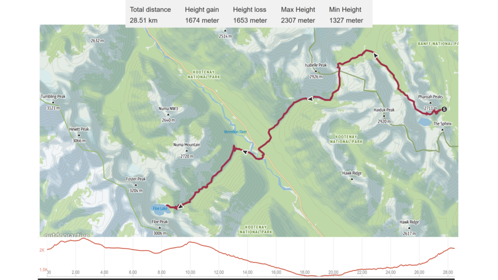
August 17th, Egypt Lake CG to Floe Lake Campground, 30.1 km, 1576 m elevation gain, 1538 m elevation loss, 12 hrs 5 min (all distances and elevation are as per the guide book), Section C Segment 18 and 19.

Route and Information for the hike from Egypt Lake CG to Floe Lake CG.

This was going to be a big day. Not only was it our longest day with the most elevation gain and loss, but we had a resupply in the middle of it. I think if I did the trip again I would split this day up by stopping at Balls Pass Junction CG. The Egypt Lake area is packed with lakes and peaks that could easily fill a half day of exploring leaving two much more balanced days. The original plan for our GDT hike was to actually spend two days at Egypt Lake CG. Moving forward we will do what we can to avoid days like this or at least have them surrounded by some shorter days to compensate. This day also violated Micah’s unwritten rule of 15 miles (24 km) maximum for a days hiking, making it the second time in less than 10 days we broke the rule.

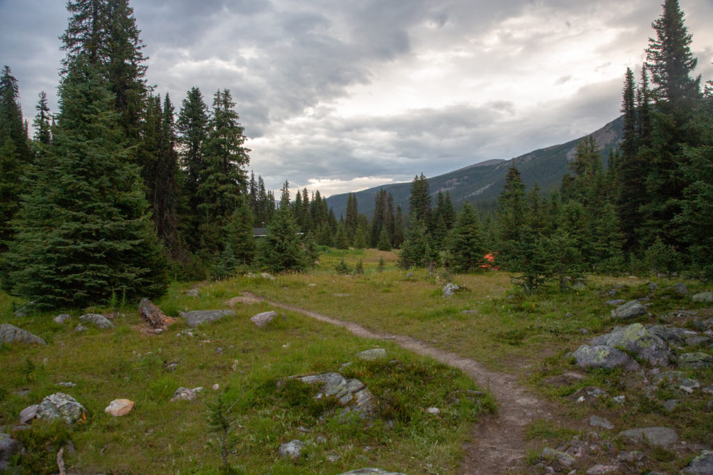
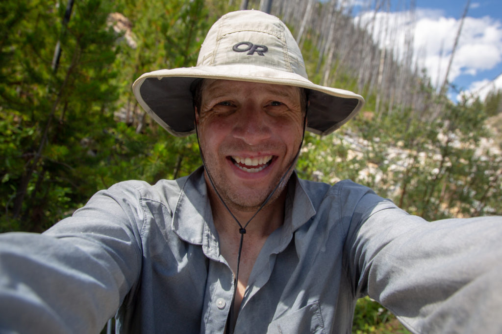
It was dark when we awoke. Our goal was to hit the trail by 7:15 am and we got going a little after 7:20 am. The focus of the day was our resupply with Laura at the Floe Lake parking lot. We had set a time of 3 pm for the resupply and I wanted to make sure that we arrived on time or a little early. We generally hike at about 3 km/hr when you include breaks and lunch, so 8:00 am had been the latest I wanted to leave. Leaving a little earlier would make it a more relaxed day. I went off to the cooking area, which at the campground was a bit of a hike, to boil the water for coffee while Micah packed up the tent. The campground was very quiet so we minimized our talking and tip toed out of camp without seeing anyone else.

7:15 am and all packed up.
Pharaoh Peak is an easy scramble from Whistling Pass and would have made a great little diversion.

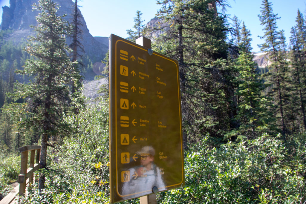
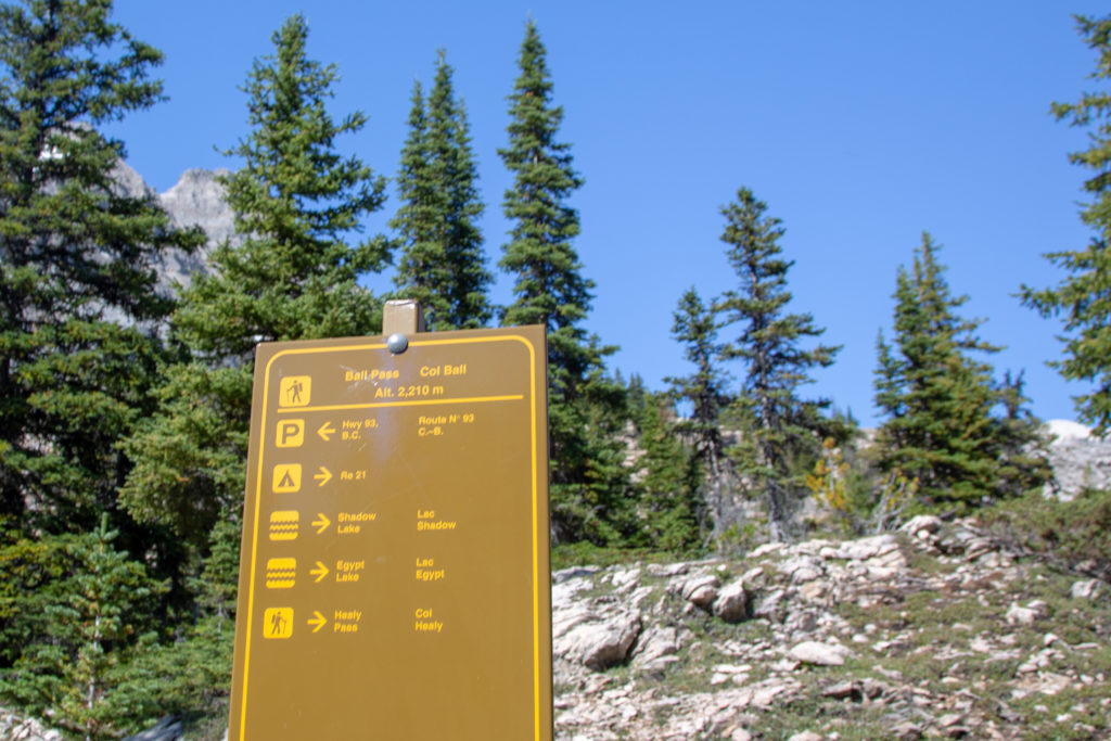
It is 3.3 km and 298 m of elevation gain all the way to Whistling Pass. Going over the headwall of the pass we would gain the bulk of the elevation 215 m in just 1.5 km of hiking. This would be a vigorous start to the day but the views from the headwall would be worth it.

Nice little bridge just outside of camp.
The area has many of these old signs. Two of the many lakes we skipped on our visit to the area.

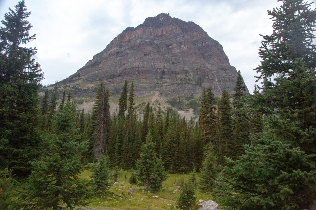
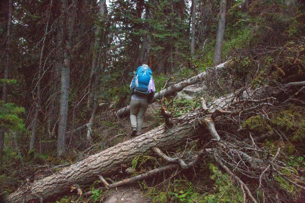
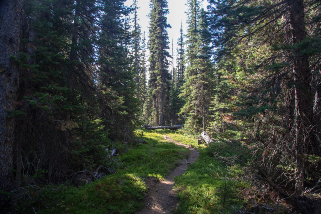
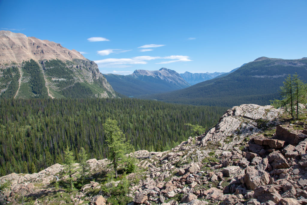
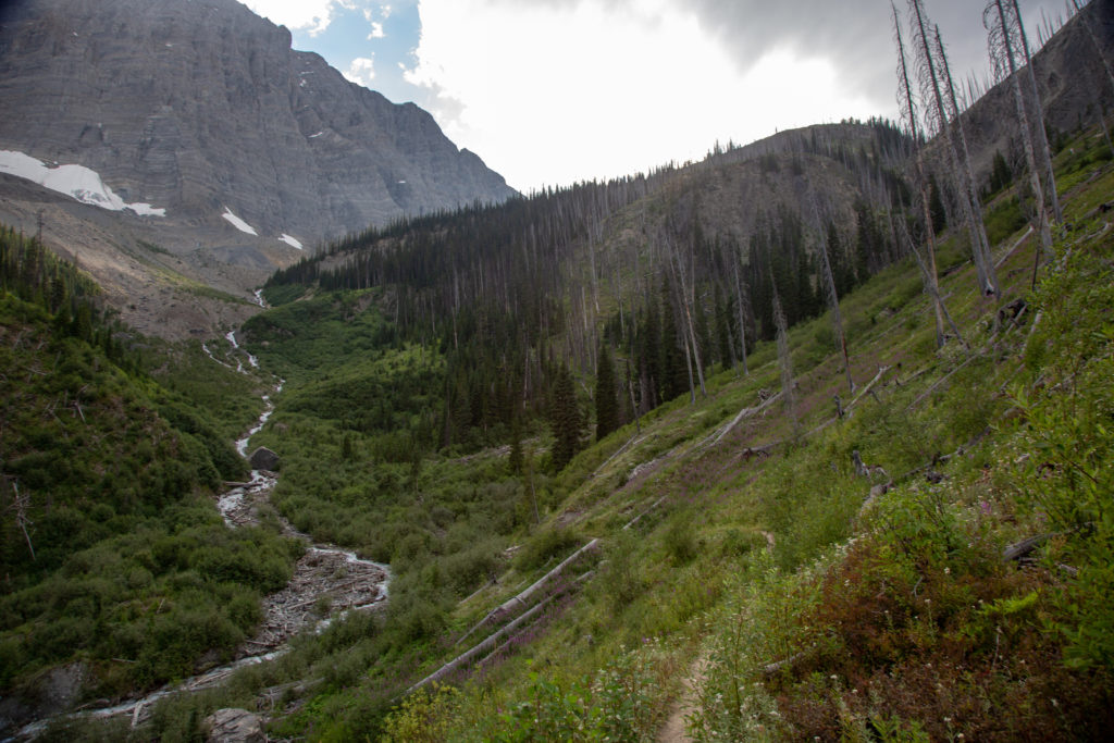
After a short warm up, we veered away from Egypt lake at the junction and headed uphill. The trail is very steep in places and there was some blowdown to negotiate. As had become the norm, Micah lead the way up the climb. The trail flattened out when we came up a slabby section of rock. This brought us to an amazing viewpoint with views across the valley including Healy Pass and Egypt Lake, plus we could make out some tents in the campground below. It had taken us about 35 min to hike up the first viewpoint, a distance of about 1 km. We stopped for a couple of minutes to catch our breath.

Got some trail obstacles.
Trail is a bit steep.
A sign that the trail is flattening out just before the viewpoint.
Pano of the area. the campground is identified by some orange tents left of centre. Egypt Lake on the right.
I am a little out of breath. The peak behind Egypt Lake is the Sphinx.

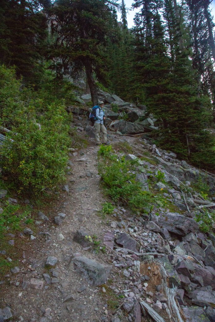
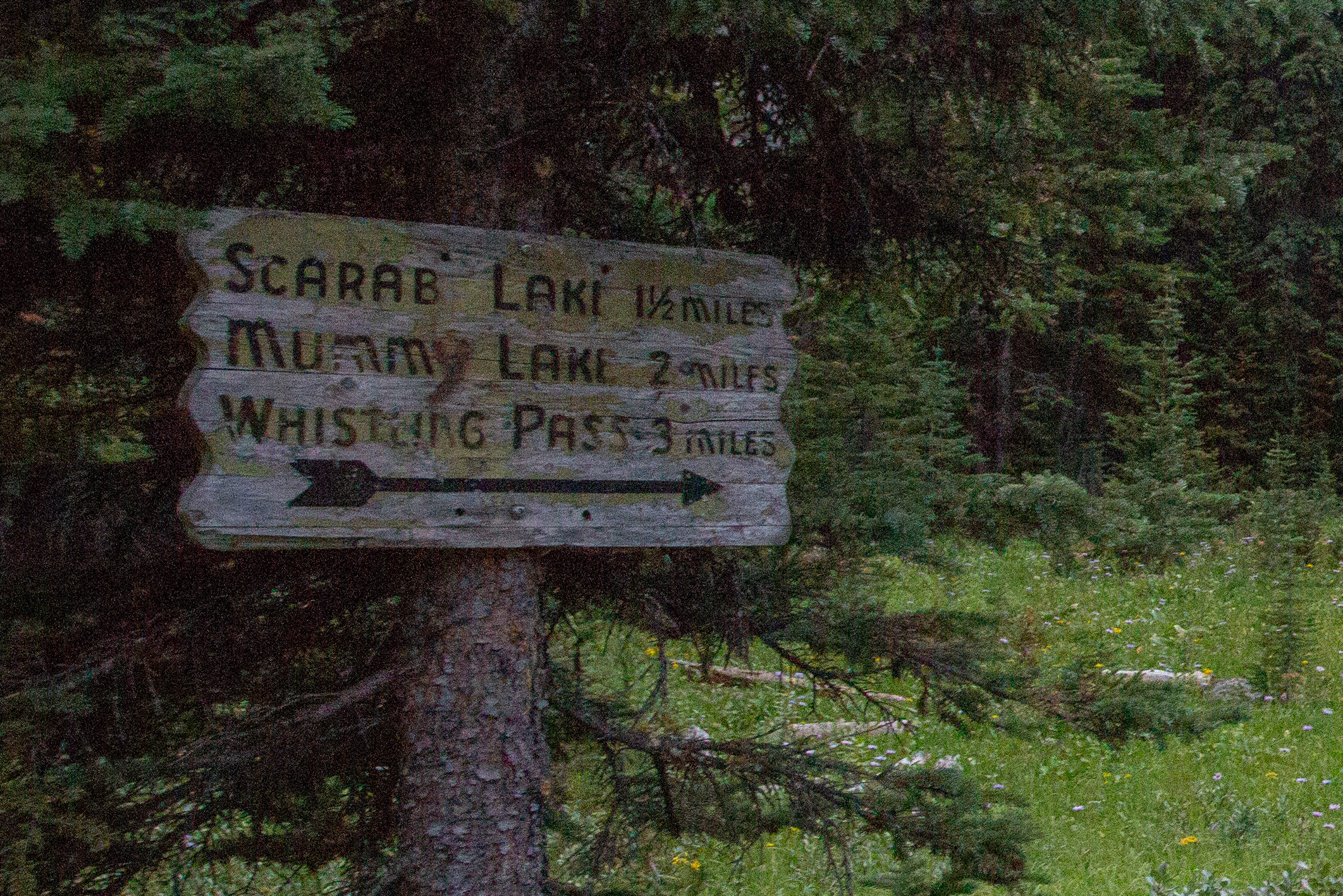
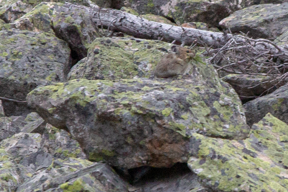
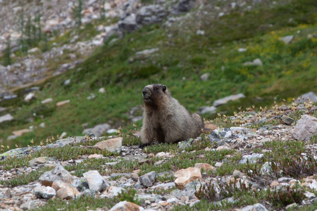
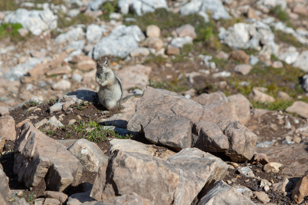
The the area below Pharaoh Peak was littered with small boulders and rocks and the trail had to twist and turn its way past all rocks. This made for a fun bit of hiking. As the trail emerged from the forest we were yelled at by a small pika. I did get a picture, but it was far away so I had the crop the photo quite a bit. We cruised passed the junction for Scarab and Mummy Lake. I really thought we were working hard but this was only 1.5 km from the campground and we had been hiking for 45 min.

A jumbly section of trail
Something has caught Micah’s eye.
Pika.
Nice sign, no distances.

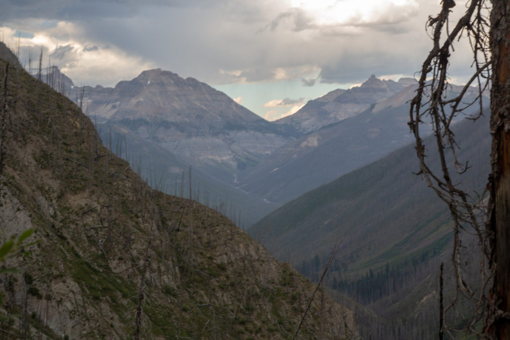
The trail underneath our feet became much softer as we left the headwall behind. A marmot whistled at us as we passed by. The marmots living at the pass is what gave the pass its name, Whistling Pass. As we entered the sub-alpine leading up to the pass, the cliffs of Haiduk Mt closed in on us from the left, sandwiching us against Pharaoh Peak. With the towering cliffs on both sides squeezing in on us I felt quite small.

Marmot.
Unnamed peak and one the lakes peeking out below.
Nice pleasant walk.
Whistling Pass.

We arrived at Whistling pass at 8:40 am, approximately 3.3 km from the campground. We of course paused to take in the view before dropping down into Whistling Valley.

The final approach to the pass.
Haiduk Lake in the foreground and Mt Ball and its glacier rising high in the distance.
Always under the watchful eye of a marmot when at Whistling Pass.
It is a steep descent down a moraine. Micah stops to take in the view.

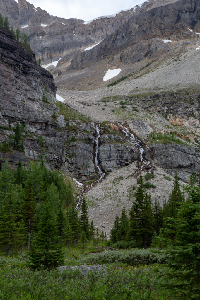
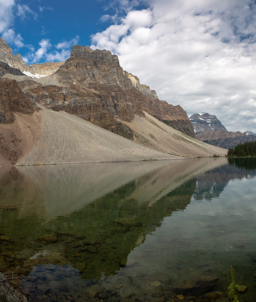
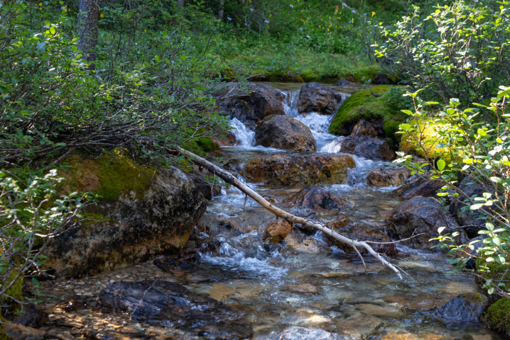
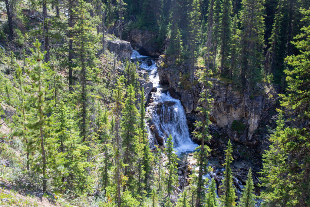
The steep rocky descent from the pass gave way to a wet and moist meadow. The meadow was criss-crossed by small streams, making it hard to keep your feet dry. Haiduk Lake is fed on this end by the streams draining the pass and water arriving from a twin water fall draining Haiduk Peak. We arrived at Haiduk Lake at 9:20 am, having covered approximately 4.5 km.

Micah’s Note: Do you feel like dad was a little preoccupied with distance? Because I feel like he was a little preoccupied with distance. (We DID have to make a resupply, but it does amuse me)

Small stream in the meadow.
Twin water falls draining Haiduk Peak
Haiduk Lake looking west with Mt Ball on the left. The peak just poking up in the distance is Storm Mt (3100 m).

The name Haiduk is a departure from the Egyptian names that dominate the area. When the survey came through the area to map and name the features they had decided that from above Scarab Lake had the outline of a scarab beetle from Egypt which lead to the naming of many of the local features with Egyptian names. Haiduk is a Polish word meaning a Balkan outlaw opposed to Turkish rule, or a Hungarian mercenary. There is no background for the reasoning to choose Haiduk as a name or for the departure from the Egyptian theme.

Reflections. The wind picked up soon after.

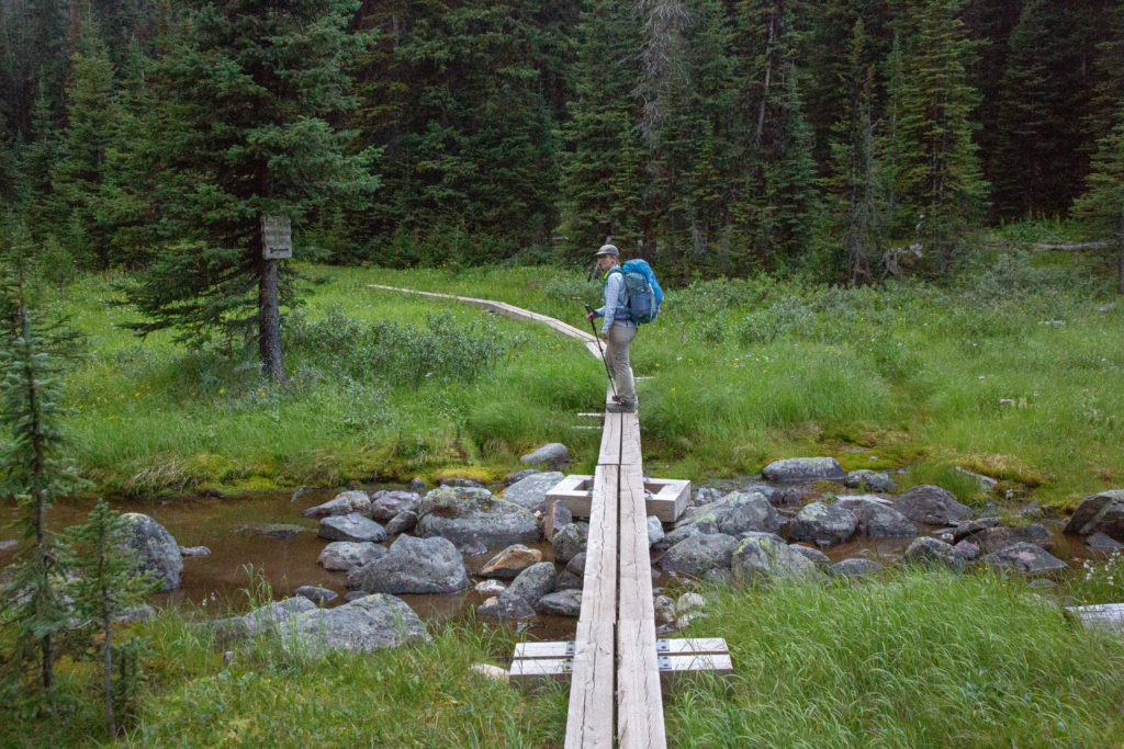
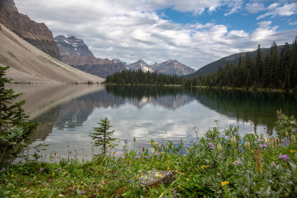
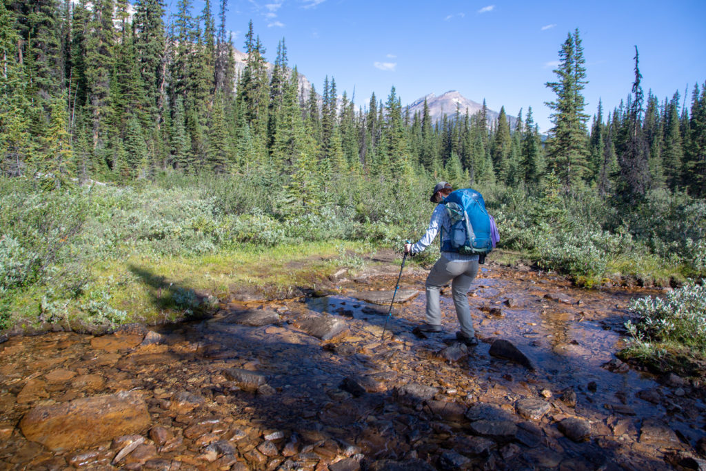
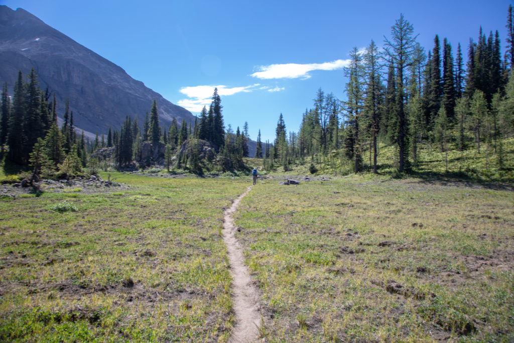
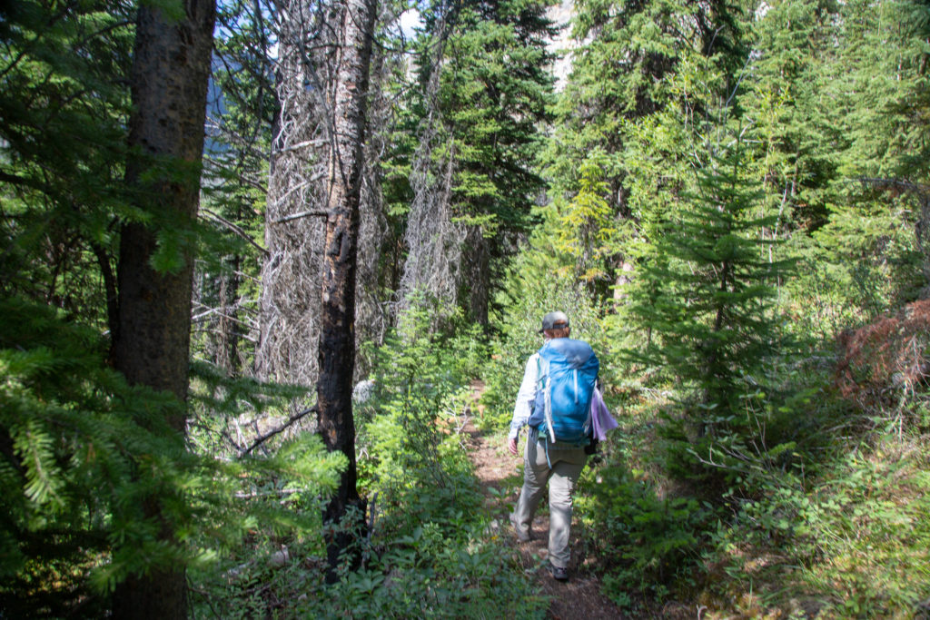
The walk along the length of Haiduk was quite easy with a very gentle downhill slope. The trail stayed near the shore at first then ventured away to walk in moist meadows. We avoided getting our feet wet for the most part but there were a couple of very minor creek crossings.

Lots of sunshine and water for the flowers. Can nicely see Storm Mt at centre.
It was a wetland, lots of water just off the trail.
Crossing Haiduk Creek. Micah trying to keep their feet dry.

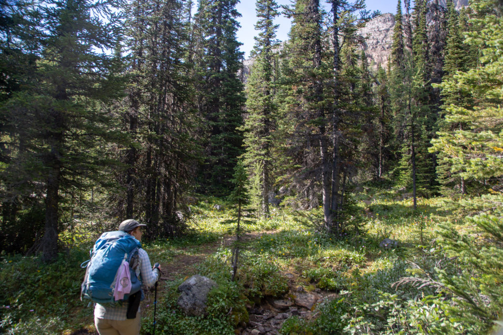
The trail moved away from the meadow and to more of a woodland walk as we approached Balls Pass Junction CG. We arrived at the campground at 10:25 am, three hours after starting out and having covered about 9 km. Balls Pass Junction CG was the low point for this leg of our day. It would be uphill until lunch, as we had to hike over Balls Pass. a distance of 2.7 km and a height gain of 220 m, much of which is saved for the very end.

Soft tread in the shade.
Haiduk Creek and the mountain that leads to Pharaoh Peak.
Balls Pass Junction CG. Looks nice.
Lots of choices, no distances. A bridge leading us onto to Balls Pass.

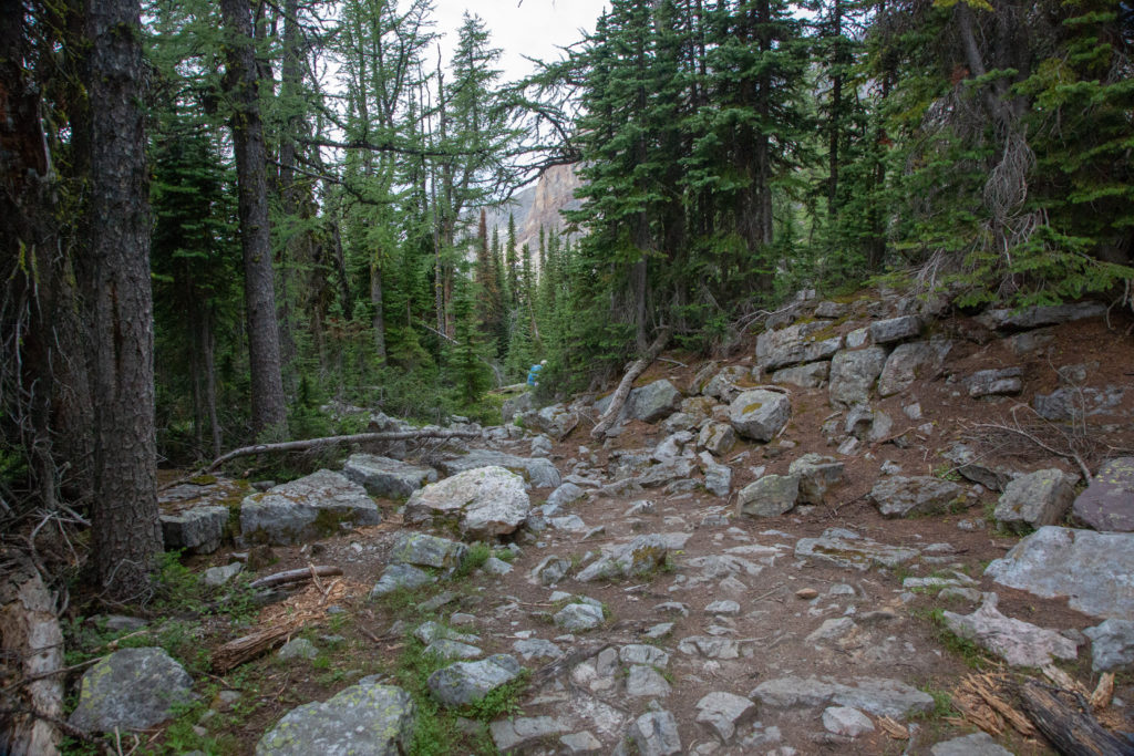
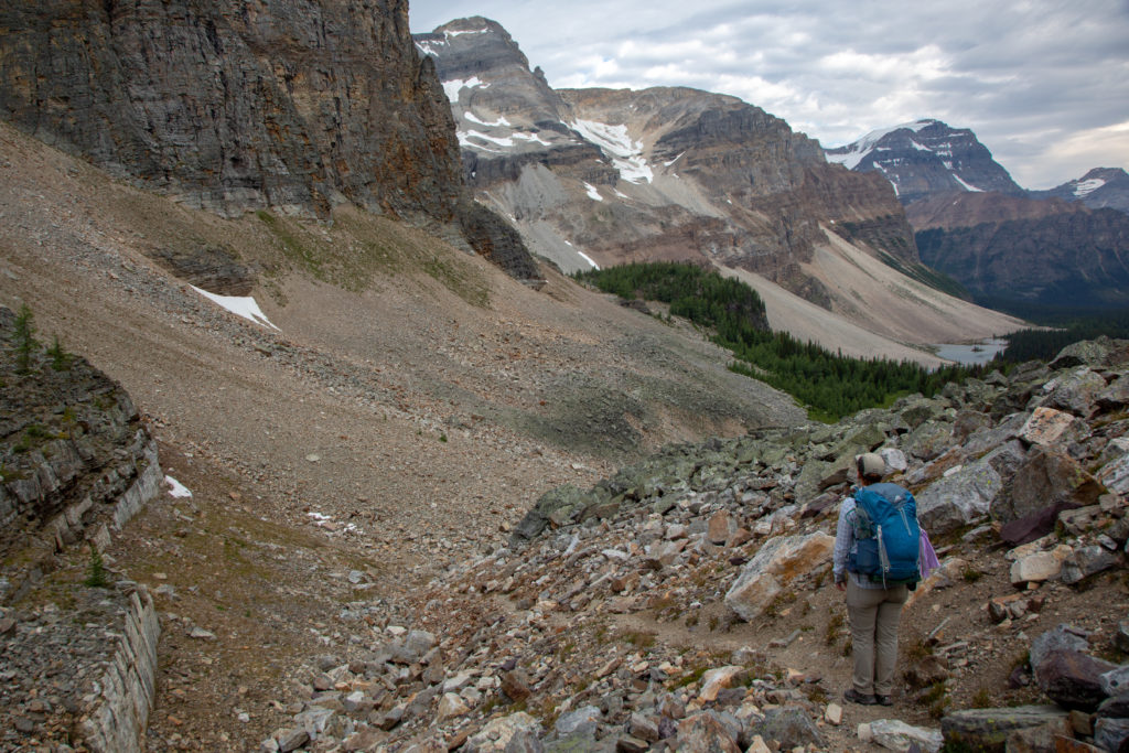
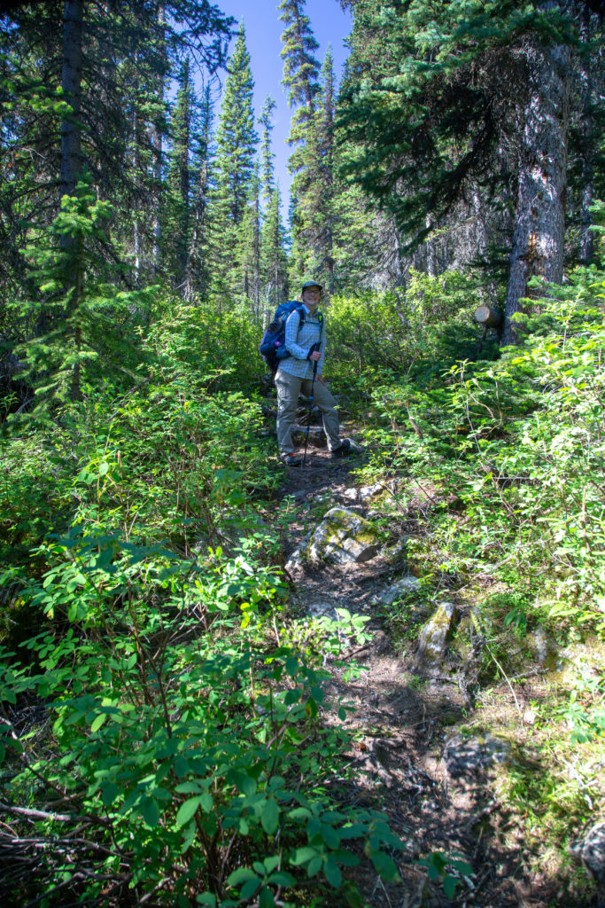
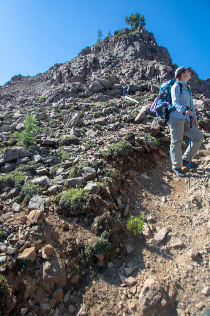
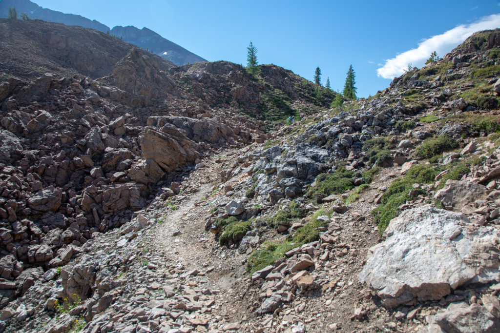
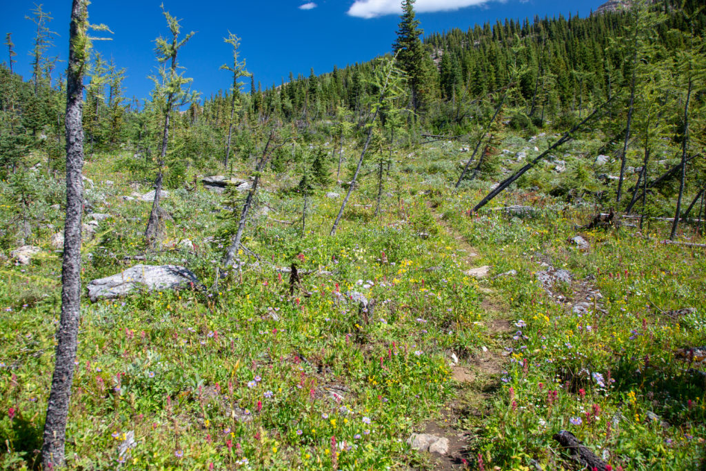
We did not pause at the campground but hiked right on through. The plan was to have lunch at top of Balls Pass to take in the view. It was very clear that the trail to Balls Pass is not heavily trafficked. The trail is much narrower than what we had been on since we entered Banff National Park on Day 2 and just a little rougher than what we have be accustomed to.

It is uphill but shady.
Nice creek draining the pass.

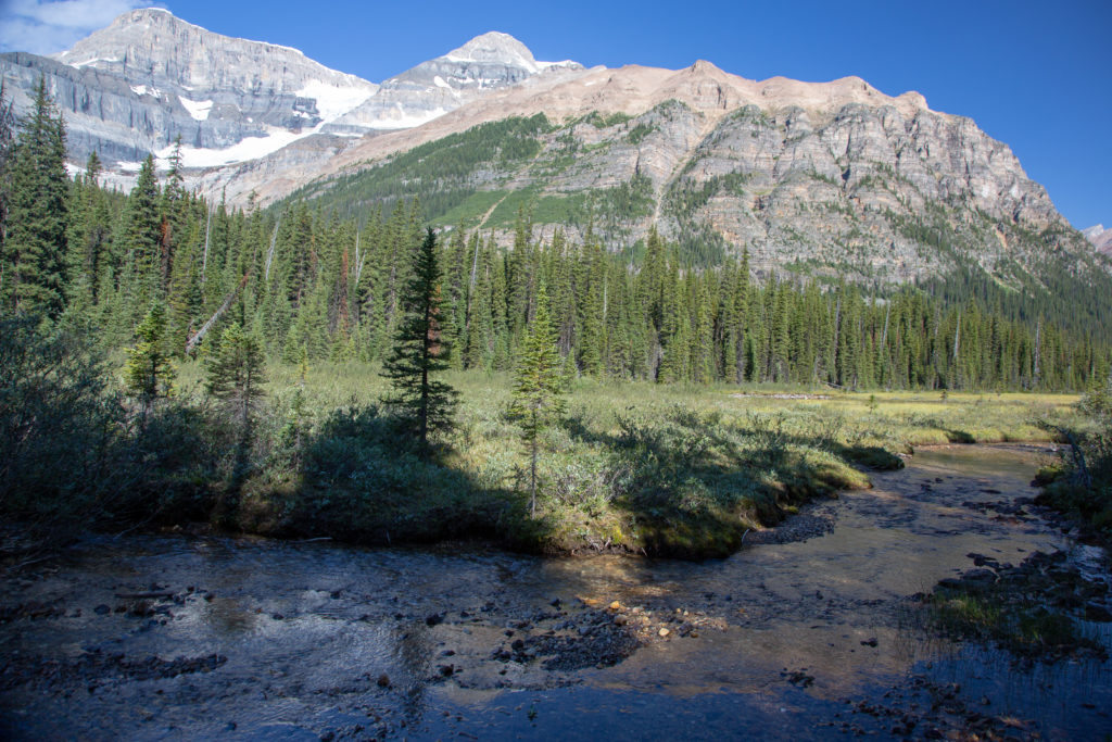
The trail flattened out as the forest thinned. This was just the trail playing with us. As we exited the forest we were faced with what looked like a sheer cliff up to the pass. A wonderful but steep trail has been cut up through the cliff which would take us up 120 m of elevation in just 500 m of distance.

Hey it’s flat, this is easy.
WOW! Look at that wall.
Micah looking at Mt Ball and its glacier.
This is very steep.

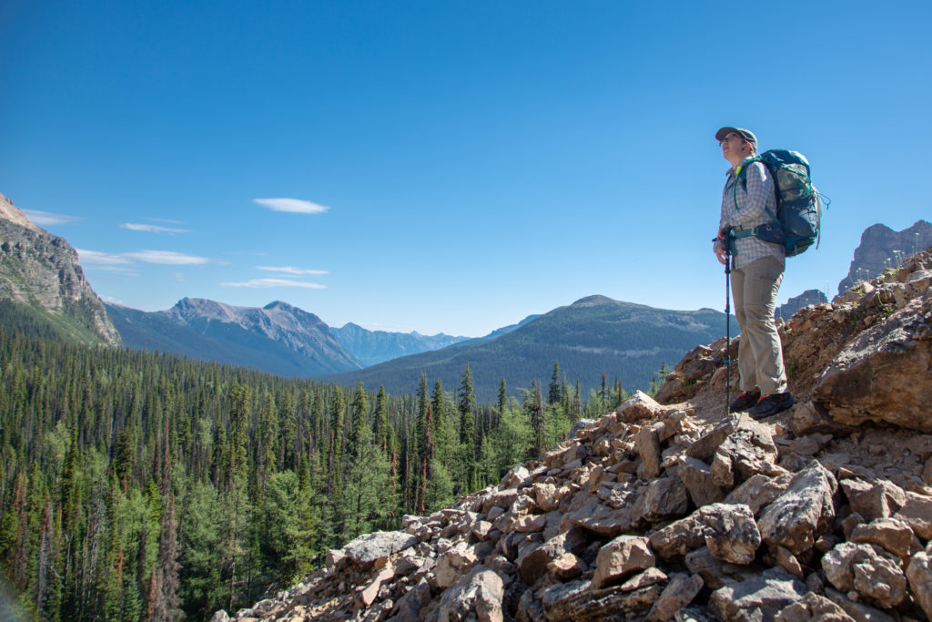
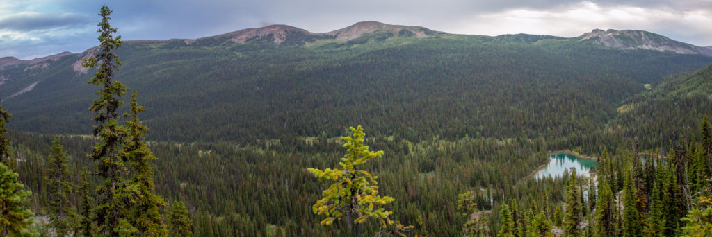
It took us 1 hr and 15 min to get to the top of the pass from Balls Pass CG and about 20 minutes to make our way up the final cliff. We were definitely delayed on the way up by constantly looking out over the valley at the amazing view on offer.

The view. Shadow Lake just coming into view around Mt Ball. Copper Mt (2795 m) dominates the centre. The tiny peak in the distance is Mt Ishbel (2908 m) which is on the other side of the Trans Canada just east of Johnston Canyon.
Still heading up.
Micah at the top of the pass. Mt Ball (3311 m) is behind Micah with Isabelle Peak (2926 m) to the left of centre.

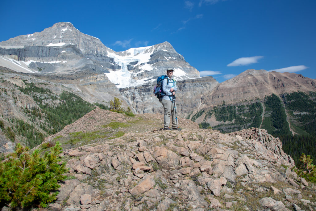
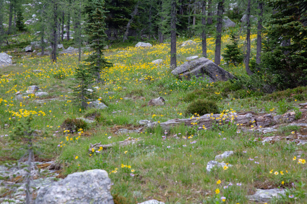
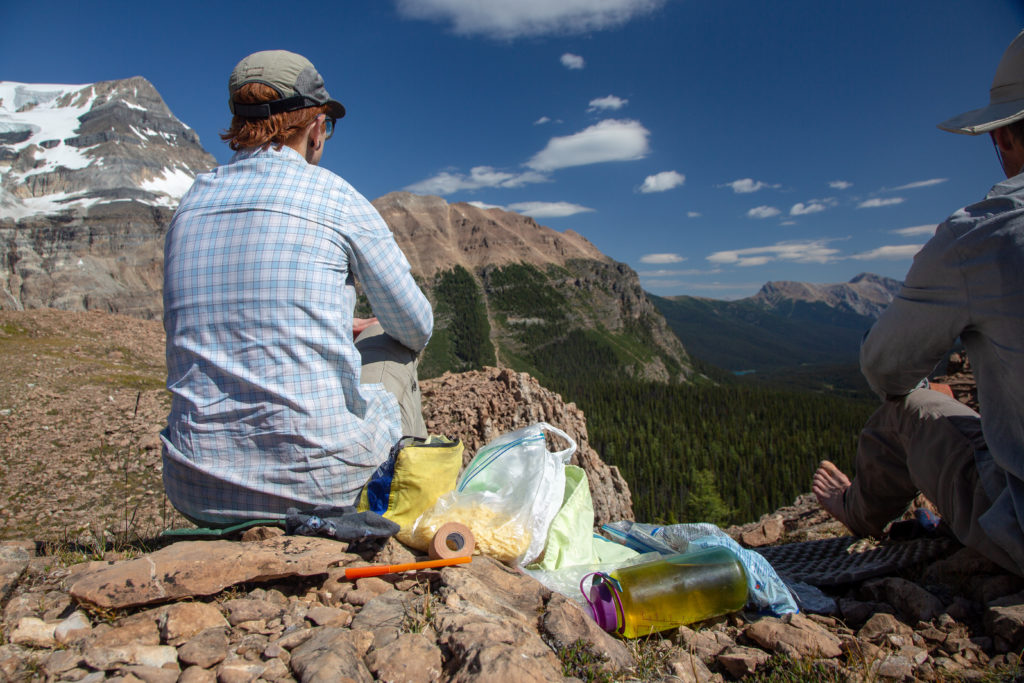
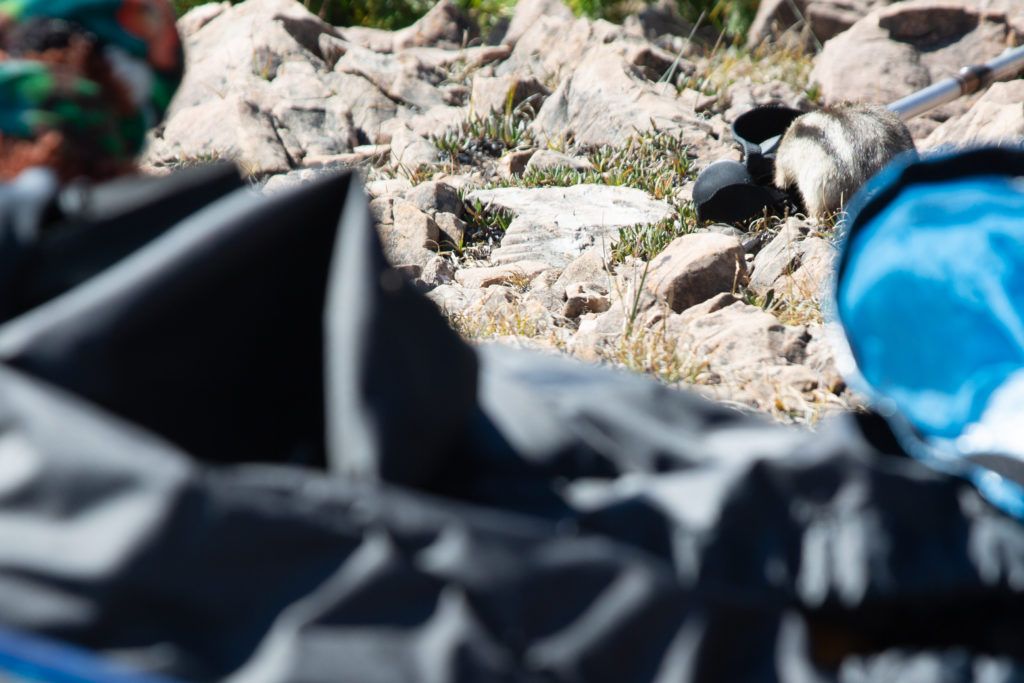
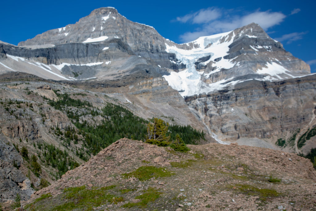
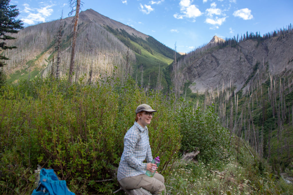
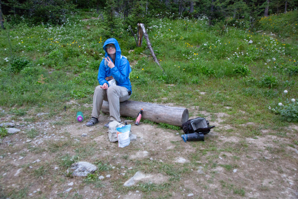
It was 11:25 am time for lunch. We had a 30 minutes lunch relaxing looking out over the valley in before us. We were entertained by a very bold and determined chipmunk. Obviously we were not the first hikers to enjoy lunch at this spot, as the chipmunk repeated came within a couple of feet of us before darting away. Just as we were about to leave the chipmunk did take a nibble at the grip on my hiking pole.

Micah’s Note: No snarky comment this time; this was one of my favourite spots on the trail. I could have sat there staring at the glacier for hours. Absolutely stunning.

Micah’s Note: Okay, one snarky comment. If I am identifying my rodents correctly, our little friend was actually a golden-mantled ground squirrel!

Lunch with a view. The blister tape is out. I am using my butt pad for my feet.
Aggressive wildlife.
Nibble, nibble, nibble.
One last look and it was time to say goodbye.

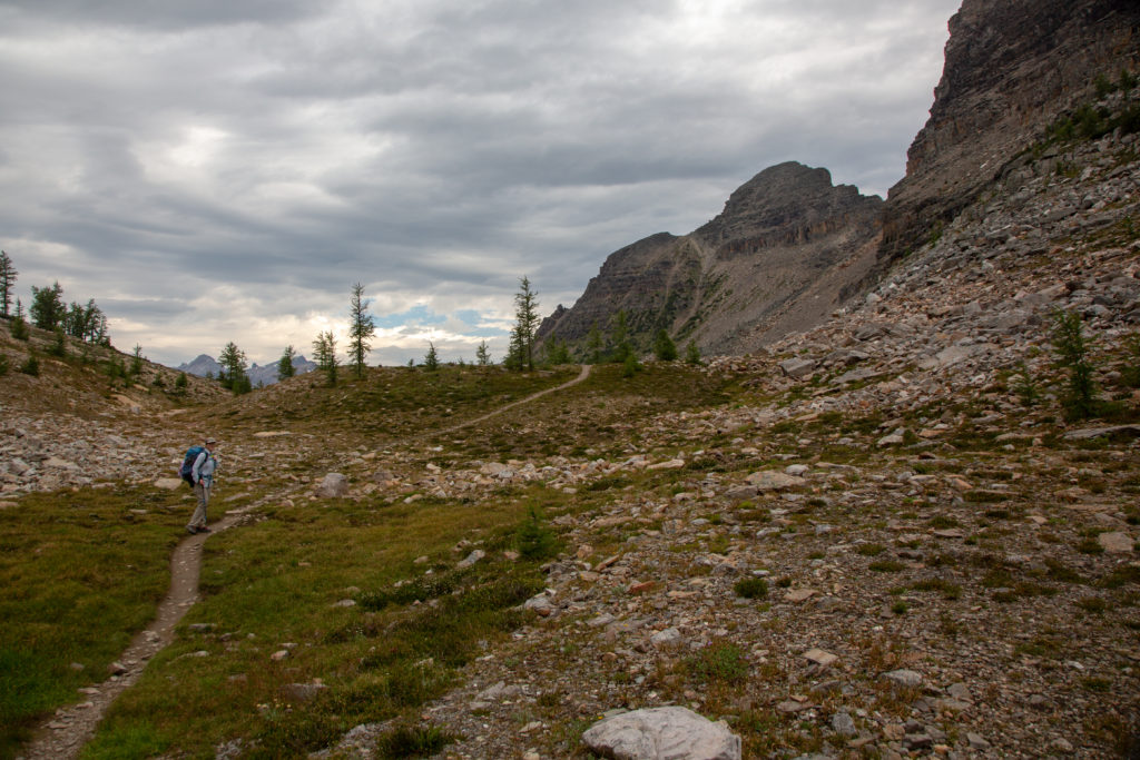
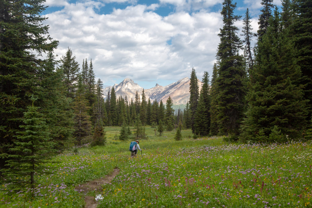
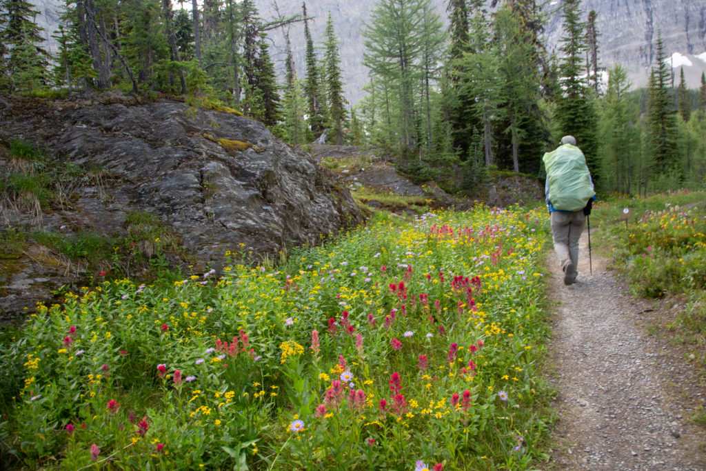
We headed off at 11:55 am. We had 9.7 km to go to get the Floe Lake parking lot and 3 hrs to get there. I was feeling pretty happy with our situation. The top of the pass is quite flat for a few hundred metres. We met a couple eating lunch in the middle of the pass who had hiked up Hawk Creek and were heading over the pass down to Shadow Lake. Just as we left the pass we met another couple who were just on the their way up to Balls Pass for a day hike.

Micah heading off across the pass. Not sure why parks place those plastic markers Micah is walking past. The trail is quite obvious and in the winter the marker must get buried in the snow.
So I guess we did not have lunch quite at the top of the pass.
Flat at the top.

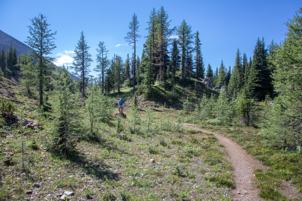
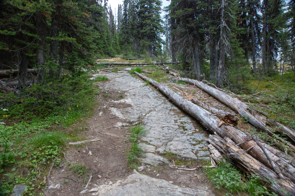
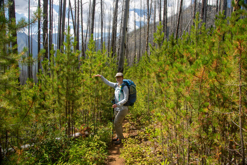
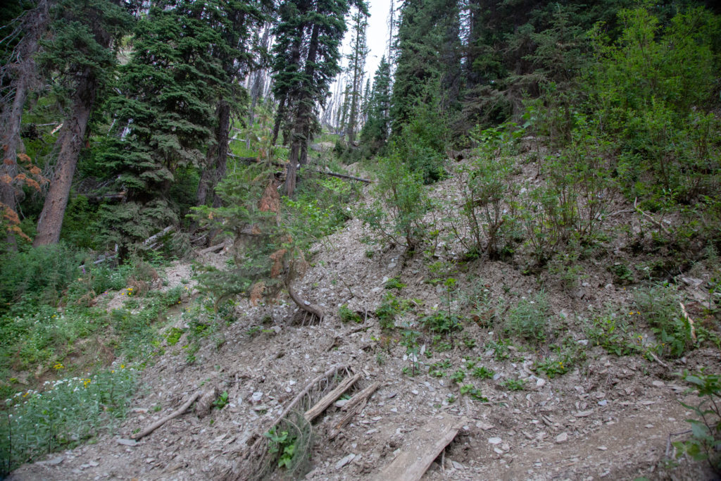
The trail down from the pass is called the Hawk Creek Trail and was the site of a major fire in 2003. While the trees are making a comeback, growth is slow in the Rockies. We headed down the trail with the afternoon sun on us and very little shade. This was a section of trail that we were focused on just getting through and it was not one of the more memorable few hours of hiking on this trip.

The trail is not well worn, not a lot of traffic.
Flowers were pretty.
Hawk Creek flowing over a nice waterfall.
Trail is a little rubbly at this point.
Last bit of forest walking before the fire zone.
The trees are not much taller than Micah.
Micah refilling their water.
Nothing like a refreshing dunk in a some cold mountain water to liven one up.

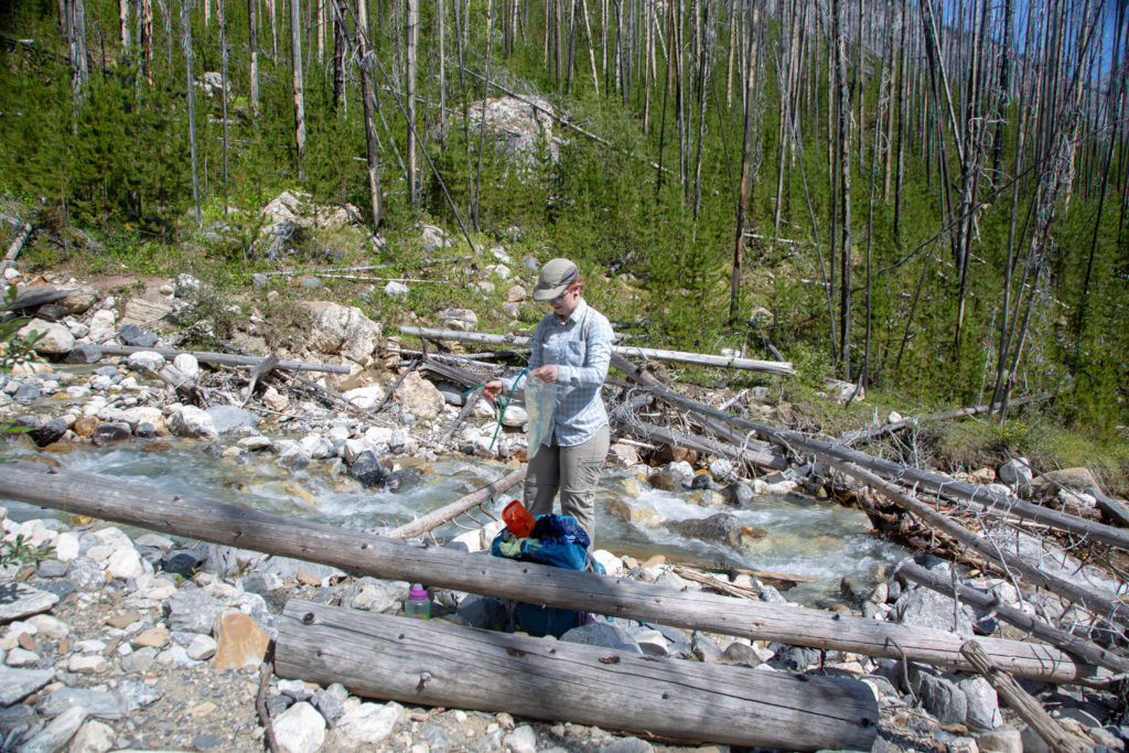
After a short but refreshing stop at a large creek we continued on our way. It was amazing how much better I felt after cooling down and washing some of the grime off in the creek. We figured we had only about an hour left to hike and would arrive well before our 3 pm meeting time with Laura. The trail was wide and well graded all the way to Hwy 93. There had been some recent trail maintenance which helped keep the pace and the mood high.

Nicely prepared trail.
Very wide between the trees but the trail is narrow and is not really well worn.
Welcome to the highway. Luckily it was a short walk.

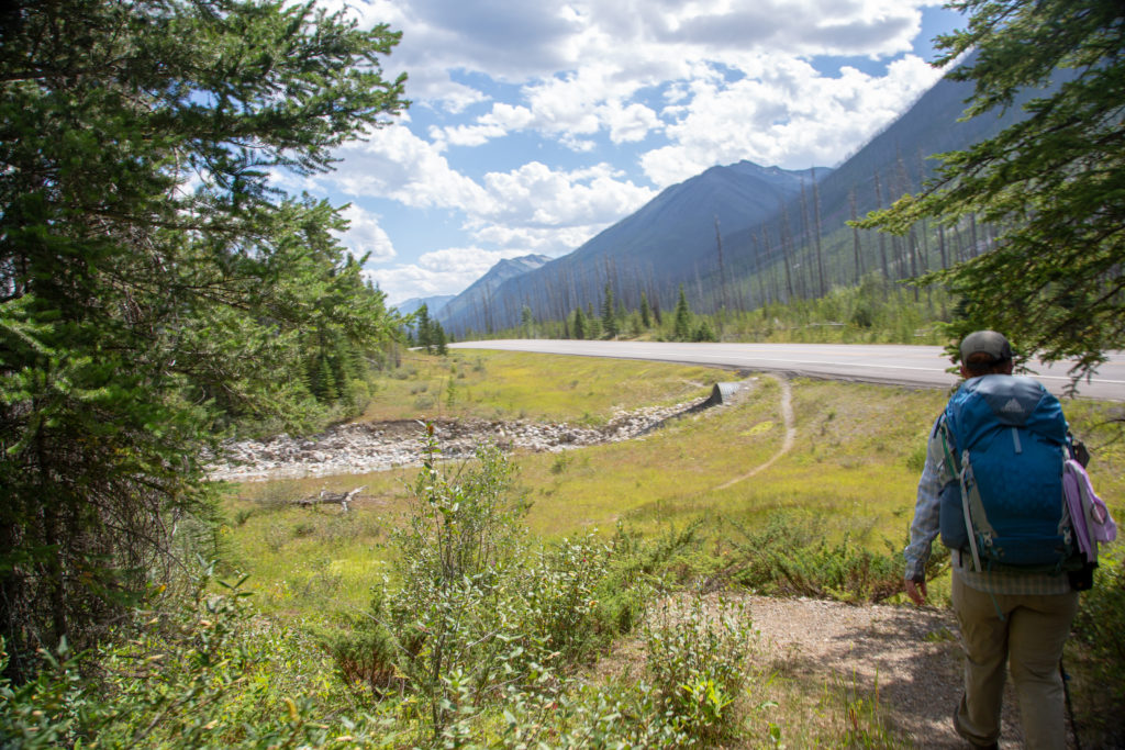
We arrived at Hwy 93 at 2:35 pm and rolled into the parking lot for Floe Lake a couple of minutes later. I cannot believe that we do not have any photos of Laura and our resupply. I have to say that the ice cold Coca-Cola that Laura brought must be the best tasting drink I have ever had. Micah passed on the Coke, so I carried their drink with me and treated myself to a refreshing after dinner drink at Floe Lake. I took the opportunity to switch back to my trusty Salomon hiking shoes and to trade my flip-flops for strapped sandals. I also picked up my red fleece. It is quite heavy at almost 22 oz, but I had been just a tad chilly on the first part of the trip. With the weather forecast being a mix of sun and cloud I decided on not taking my 15 mm F2.1 lens that I use for nighttime photography. It was too bad that I made this choice as the sky was beautiful and clear when we stayed at McArthur Creek CG a couple days later, but there was no way we could have known. With our next resupply set for just three days from now, it was possible to carry more gear as we would have less food.

This is right where we were headed. McArthur Creek Trail and Campground.
Oh dear! Area closed!

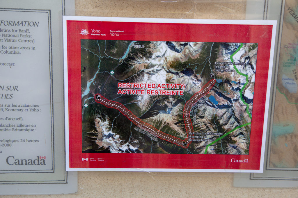
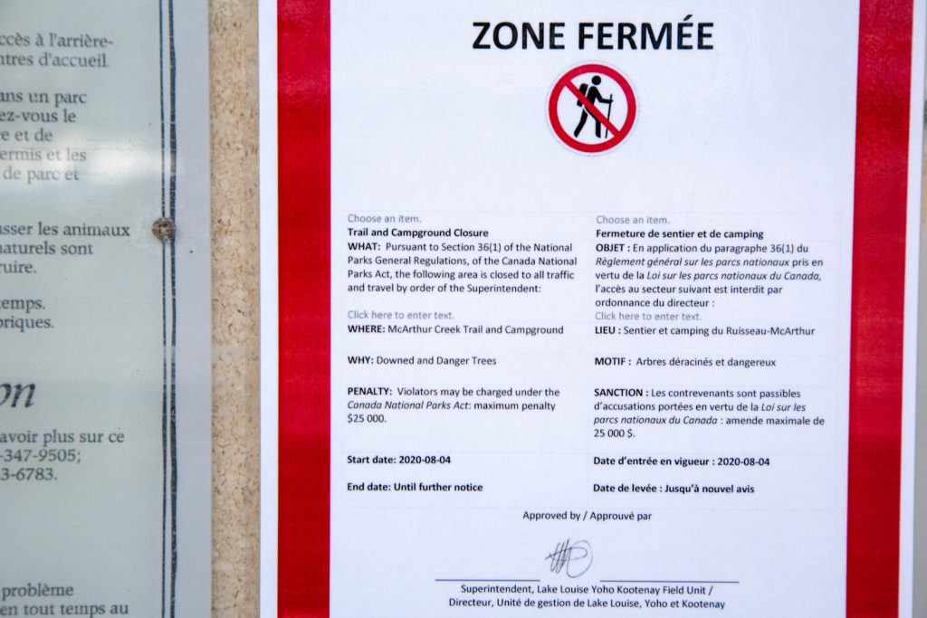
We got ready to head off at about 3:50 pm. A quick check of the notice board had us in a small panic. Apparently there had been a large wind storm at McArthur Creek and the trail was closed. We were intending on hiking out along the McArthur Creek Trail in three days so we needed some clarification and a plan. This was another instance of the SPOT X and two-way communication playing a role in keep us on track. We made a contingency plan to stay at Helmet Falls instead of McArthur Creek CG and hike out to the Paint Pots the next day if the trail was indeed closed. Laura and Kathleen made some inquiries the next day and were able to text us at Tumbling Creek CG that, while the trail had been closed, it was now open for travel.

Only 10.7 km to go.

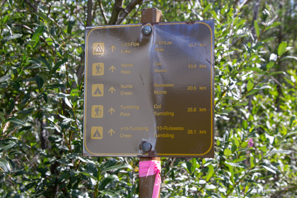
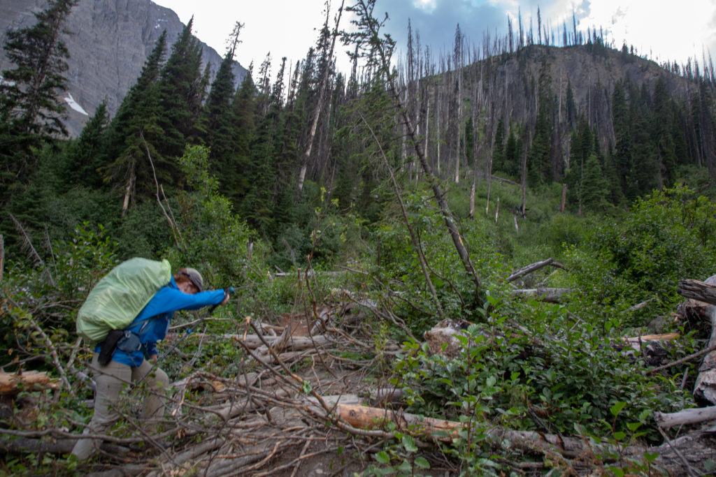
We said our goodbyes and set off down the trial. While the sign said it was only 10.7 km to Floe Lake CG, what it did not mention about was the elevation. There is about 720 m of elevation gain on the trail with the last 400 m up the headwall compressed into the last 2 km of the hike.

Micah heading for the bridge over the Vermilion River.

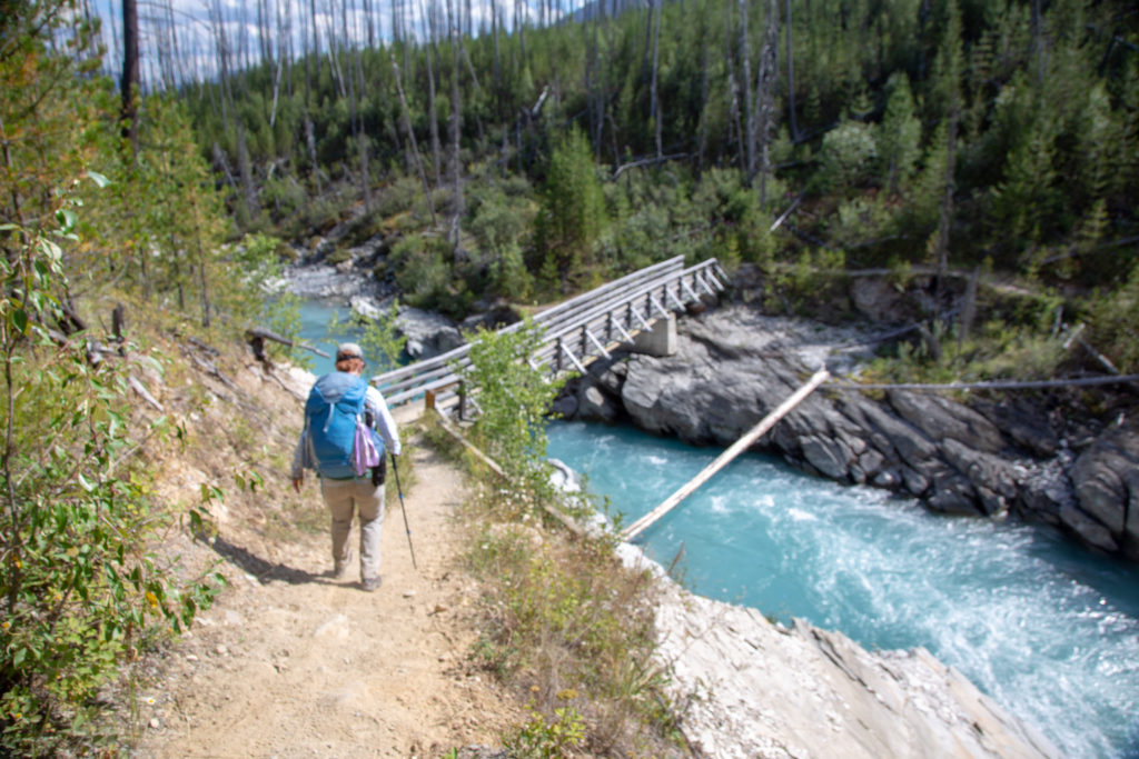
Shortly after crossing the bridge over the Vermilion River Micah called a time out due to stomach pains. We stopped for about 15 minutes at the side of the trail to let things settle down. Micah stated with a lack of conviction that they were ready to go. As we started off down the trail I let Micah lead so that they could set the pace. It was a quiet walk. When Micah is upset or annoyed they do not not say much.

Micah’s Note: In this case it wasn’t upset or annoyed so much as a little light-headed, which was not how I intended to start this section. Once I had a snack it calmed down a bit and my head felt less floaty, but I was definitely just focussed on walking and not conversing.

Micah taking the lead. Another area recovering from the same fire that burned Hawk Creek in 2003.
Pretty colours along the trail.

With Micah not feeling well I was worried about what time we would arrive at Floe Lake. Leaving the parking lot just before 4 pm I was figuring the best we could do would to arrive around between 6:30 and 7:00 pm. It took me a little while to realize that instead of hanging back to give Micah some space I was actually having difficulty in just keeping up. I guess I should not have been concerned about our pace.

Micah’s Note: I didn’t know this! Okay, that makes me feel a little better about my forced march.

The vegetation was thick in places.

As we approached the base of the headwall it was 6:15 pm and with dinner having to wait until we arrived at the campground, we decided we needed to eat a little something before tackling the final climb.

The headwall. Floe Lake is just over the rise 2.5 km and 400 m up.
Micah looking pleased. Blue skies.
Taking a breather. Looks like it was needed.

Just as we were about to head out when a small rain shower blew in. We quickly threw on our rain jackets (poncho for me) and headed off.

Micah working their way past some deadfall that has accumulated in a side drainage just before the trail heads up.
There was extensive damage to the slope from a massive mud slide earlier in the year.
View back to Hawk Valley. We had lunch out near the horizon. Feels like a long time ago.

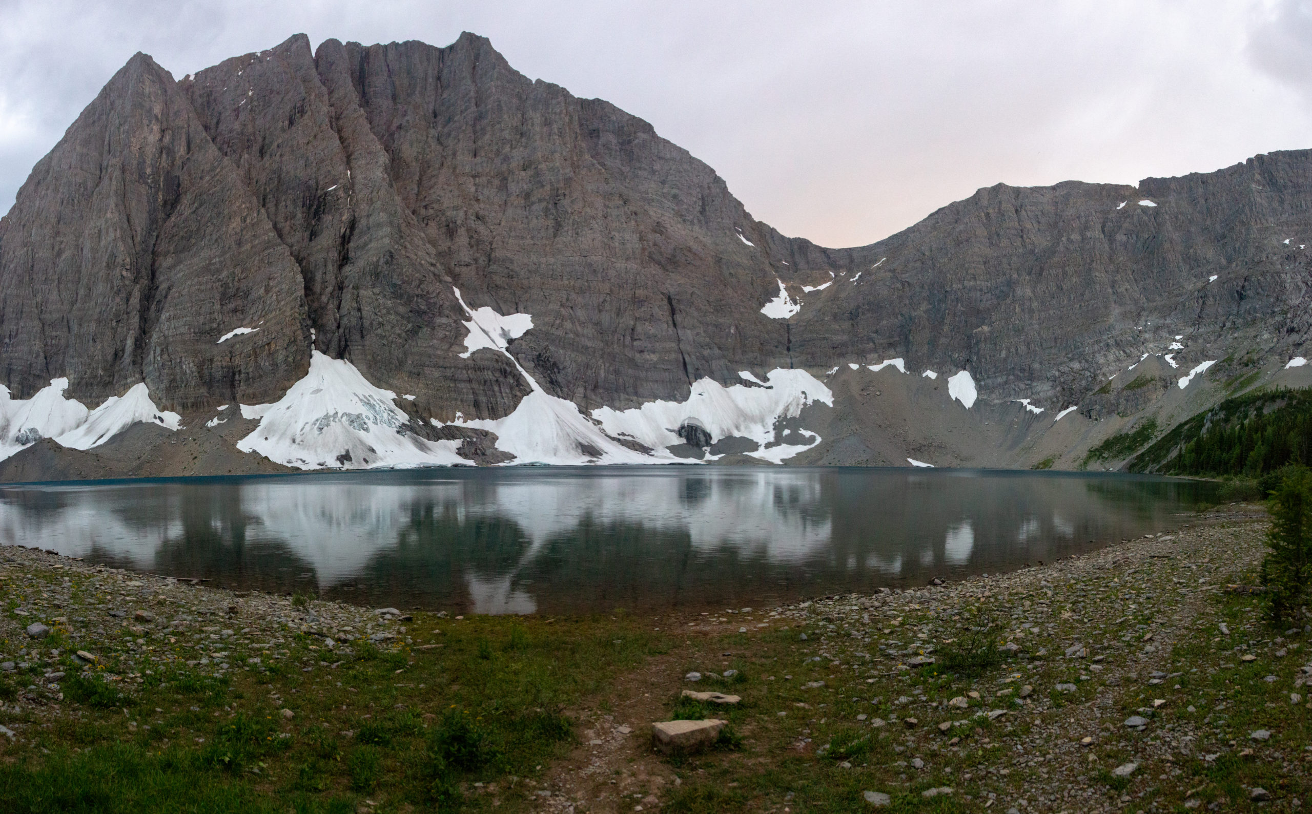
We crested the top of the headwall at 7:20 pm. It had been 1 hour since we had our snack. Floe Lake is just a few minute walk past a nice meadow, with a slightly downhill finish to the campground. We looked around for a campsite and there was only one spot left. The campsites at Floe Lake are pretty much all the same, as there is only one with a clear view of the lake. We got the tent set up quickly as we did not trust the weather. I headed off to make dinner while Micah organized the inside of the tent. I had dinner on the go by 7:45 pm.

Micah’s note: My journal through the headwall reads “Climb. Thought it would never end. Some parts washed out, mud and rocks all over underbrush. Climbed forever. Finally, the light thru the trees isn’t a scam and we crest the wall.”

The little meadow a the very top of the headwall. The lake is just down to the left.
Dinner. More re-hydrated food.
The view from the kitchen.

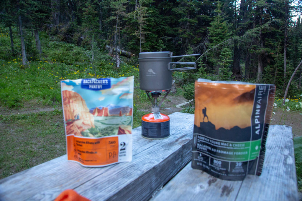
We ate down by the lake. It drizzled on and off during dinner. I had Micah’s Coke to wash down my dinner. Normally I would not want to drink something with caffeine so late in the day but after a 30 km day with 1500 m of elevation gain and loss I figured I would probably not have much difficulty in falling asleep. I was correct.

Micah staying positive.
View during dinner. Floe Peak (3006 m), Floe Lake and the Rockwall.

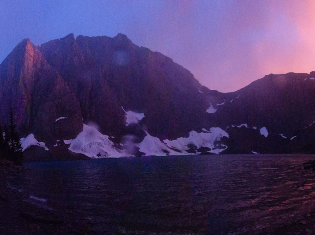
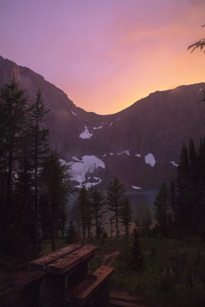
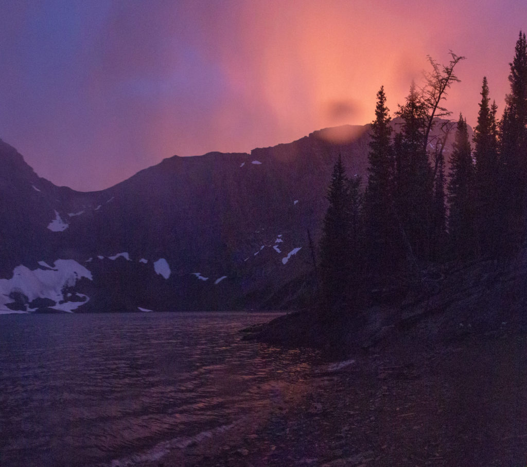
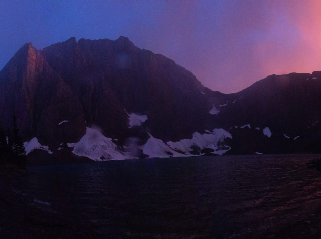
We got ready to head back to the tent. As I was getting ready to get into the tent it started to rain but with the sun setting low behind the Rockwall the sky lit up with an amazing orange colour. Micah poked theri head out of the tent and grunted. Evidently they were in need of some down time. I ran about the campground trying to keep my camera dry while attempting to capture the amazing colours being produced by the sun and the rain.

Golden light shining on Floe Peak.
Some purple colour appearing alongside the orange.
Purples and oranges.
Have some raindrops on the lens.
Short video of the sunset.

I crawled into the tent about 9:00 pm. We both went to sleep quickly as it had been a big day. Tomorrow we would only be hiking about 18 km to Tumbling Creek CG so we decided to we would have a lie in and not rush in the morning.

Day 8 GDT Hike Section C 2020

GDT Section C 2020 Home

bootwreckers

New trip posted, three day trip in the Rockwall in New trip posted, three day trip in the Rockwall in Kootenay NP with @sio.mellors. Introduction and Day 1 up on Bootwreckers.

Trip was suppose to be hiking Northover Ridge in Kanananaskis but smoke had us change plans at the last minute.

This would be my third multi day trip on the Rockwall but the first for Siobhan.

Managed to get two camping sites on the Rockwall and instead of smoke we had to deal with the threat of rain.

We did get wet but we had a blast.

Day 1 is from Paint Pots TH to Helmet Falls CG, with a side trip to get up close the the falls. Pretty straightforward day but visiting Helmet Falls is always special.

#parkscanada #parks #bcparks #trails #longdistancehike #longtrail #outdoors #outside #thruhike #hike #thruhiking #outside #backpacking #waterfalls #waterfall #naturephotography #naturephotography #nationalparks
The sixth and final day of our 2022 GDT Section D The sixth and final day of our 2022 GDT Section D hike is up on Bootwreckers, see link in bio.

This day took us from a random camp on the Howse Floodplain to the Mustafa Canyon parking lot. This was an adventurous day with bushwhacking, stream crossings and dead fall but a simply glorious end to a wonderful hike on the GDT. 

Again thanks  to Sara (@sd_kuz) and Lillian (@waterlilizee) for sharing this adventure with me. I am sure we will meet again on a trail someday.

Photo 1 - Morning Colors

Photo 2 - tents on the floodplain

Photo 3 - bushwhacking to start the day

Photo 4 - fields of flowers going to seed

Photo 5 - looking south down the Howse River

Photo 6 - thigh deep water crossing

Photo 7 - big views

Photo 8 - Sara crossing some dead fall

Photo 9 -Mistaya Canyon

Photo 10 - picked up a thru hiker named Roy, enjoying beverages left by Natasha and Kyle from Backpacks and Bikeracks

#greatdivide #greatdividetrail #gdt #parkscanada #parks #bcparks #trails #longdistancehike #longtrail #outdoors #outside #thruhike #hike #thruhiking #outside #backpacking #waterfalls #waterfall #naturephotography #naturephotography #nationalparks #duplex #sectionhike #sectionhiker
Day 5 of our 2022 Great Divide Trail Section D hik Day 5 of our 2022 Great Divide Trail Section D hike is posted on Bootwreckers, see link in bio.

Truly epic day on the trail. Pass through the debris of two avalanches, had lunch by a waterfall, crawled over so much dead fall and hiked on the Howse Flood Plain.

The sunset on the flood plain was one of most magical I have seen.

As always a big thanks to Sara (@sd_kuz) and Lillian (@waterlilizee) for sharing this adventure with me. The Team totally rocked the trail.

#greatdivide #greatdividetrail #gdt #parkscanada #parks #bcparks #trails #longdistancehike #longtrail #outdoors #outside #thruhike #hike #thruhiking #outside #backpacking #waterfalls #waterfall #naturephotography #naturephotography #nationalparks #duplex #sectionhike #sectionhiker
Evening light on Picketpost Mt. #aztrail #aztasso Evening light on Picketpost Mt.

#aztrail #aztassociation  #nps, #nationalparks, #slotcanyon, #hiking, #hikingadventures, #familytime, #camping, #campingadventures, #outdoors, #outside, #nature,  #FIndyourpark #landscape #landscapephotography #optoutside #nationalpark #desertphotography #grandcanyon #grandcanyonnationalpark #grandcanyonassociation #nationalparkweek #reichallenge #nationalparksweek #rightnow #nationalparktrust #goparks #aztrails
Arizona Trail Passages 14 and 15. Some photos of Arizona Trail Passages 14 and 15.

Some photos of my recent hike down a couple of Passages of the Arizona Trail. 

The trail is so diverse, rolling terrain cut by shallow washes leads to the expanse of the desert then into rugged canyons and tall peaks, all in a space of 92 km (58 miles).

Had a great time, some blisters gave me some concerns but they seem to be doing fine now that they are out of my hiking shoes.

Got lucky with Trail Magic courtesy of Condiments who drove his 4x4 deep into an unarmed wash, was really in the middle of no where, and then again at the start of Passage 15, missed the Trail Angel's name, the wind was so loud.

Like to thank my Trail Angels, Carole for driving me to Oracle to start the trip, with side trip to a Hayden Az, a real ghost town and to Edith for leaving a water cache for me at Passage 15.

Included a video of my time at the high point for Passage 15. My kid likes it when you stop and enjoy the view you earned, thought they would appreciate my effort in the face of 1000 mph winds (ok maybe thats a bit of an exaggeration).

Thanks Arizona and the AZT for providing more memories.

I will be back

#aztrail #aztassociation  #nps, #nationalparks, #slotcanyon, #hiking, #hikingadventures, #familytime, #camping, #campingadventures, #outdoors, #outside, #nature,  #FIndyourpark #landscape #landscapephotography #optoutside #nationalpark #desertphotography #grandcanyon #grandcanyonnationalpark #grandcanyonassociation #nationalparkweek #reichallenge #nationalparksweek #rightnow #nationalparktrust #goparks #aztrails
That sunset says when I wake up it will be time to That sunset says when I wake up it will be time to start my hike on the Arizona Trail, Passages 14 and 15

Love my little motel in Superior, Az, Copper Mt Motel. Has murals painted on all the buildings

Spied the Grand Canyon from the plane 

Adventure awaits 

#aztrail #aztassociation  #nps, #nationalparks, #slotcanyon, #hiking, #hikingadventures, #familytime, #camping, #campingadventures, #outdoors, #outside, #nature,  #FIndyourpark #landscape #landscapephotography #optoutside #nationalpark #desertphotography #grandcanyon #grandcanyonnationalpark #grandcanyonassociation #nationalparkweek #reichallenge #nationalparksweek #rightnow #nationalparktrust #goparks #aztrails
Frosty Paws all packed and ready for an adventure. Frosty Paws all packed and ready for an adventure.

Arizona Trail Passages 14 and 15 starting Sunday

Off weekend gooooooo!

#aztrail #aztassociation  #nps, #nationalparks, #slotcanyon, #hiking, #hikingadventures, #familytime, #camping, #campingadventures, #outdoors, #outside, #nature,  #FIndyourpark #landscape #landscapephotography #optoutside #nationalpark #desertphotography #grandcanyon #grandcanyonnationalpark #grandcanyonassociation #nationalparkweek #reichallenge #nationalparksweek #rightnow #nationalparktrust #goparks #aztrails
Last weekend before heading to Arizona for a four Last weekend before heading to Arizona for a four day adventure on the Arizona Trail.

I wonder if hiking in the 15 cm of fresh snow will be good prepared for hiking the deserts of Passages 14 and 15?

#aztrail #aztassociation  #nps, #nationalparks, #slotcanyon, #hiking, #hikingadventures, #familytime, #camping, #campingadventures, #outdoors, #outside, #nature,  #FIndyourpark #landscape #landscapephotography #optoutside #nationalpark #desertphotography #grandcanyon #grandcanyonnationalpark #grandcanyonassociation #nationalparkweek #reichallenge #nationalparksweek #rightnow #nationalparktrust #goparks #aztrails
Day 4 of our 2022 GDT Section D hike is up on the Day 4 of our 2022 GDT Section D hike is up on the website, see link in bio.

This was a truly epic day spent on the Amiskwi and Collie Creek Alternates.

The weather cooperated starting with a spectacular sunrise on the Mummery Glacier, rainbows and blue skies on the ridge.

We had a brief encounter with a little black bear who scampered quickly away. 

Finished off the day with a cold beer, Grizzly Paw Rutting Elk Red, that I had carried with me and it tasted great.

Easily one of th best days on the trail ever.

Again big thanks to Sara (@sd_kuz) and Lillian (@waterlilizee) for sharing this adventure with me. The Team totally rocked the trail.

#greatdivide #greatdividetrail #gdt #parkscanada #parks #bcparks #trails #longdistancehike #longtrail #outdoors #outside #thruhike #hike #thruhiking #outside #backpacking #waterfalls #waterfall #naturephotography #naturephotography #nationalparks #duplex #sectionhike #sectionhiker
Day 3 of our 2022 Section D hike is posted, see li Day 3 of our 2022 Section D hike is posted, see link in bio.

This was a shorter day, only about 17 km but took us from the end of the Kiwetinok Alternate up to Amiskwi Pass and then a beautiful meadow at the the base of the Amiskwi Ridge.

Photo 1 - morning sky

Photo 2 - on the Kiwetinok Alternate

Photo 3 - Kiwetinok Alternate

Photo 4 - break time at a stream crossing, Frosty Paws hanging in there

Photo 5 - Fireweed with a view down the Amiskwi Valley,

Photo 6 - fields of flowers as we approached Amiskwi Pass

Photo 7 - Yellow Columbine on the way up to Amiskwi Lodge

Photo 8 - Our camp in the meadow

Photo 9 - Setting sun

Photo 10 - one of the best adventure stories ever! True story of how three prisoners of war escaped and climbed Mt Kenya

Again big thanks to Sara (@sd_kuz) and Lillian (@waterlilizee) for sharing this adventure with me. The Team totally rocked the trail.

#greatdivide #greatdividetrail #gdt #parkscanada #parks #bcparks #trails #longdistancehike #longtrail #outdoors #outside #thruhike #hike #thruhiking #outside #backpacking #waterfalls #waterfall #naturephotography #naturephotography #nationalparks #duplex #sectionhike #sectionhiker
First two days of my 2022 Great Divide Trail Secti First two days of my 2022 Great Divide Trail Section D adventure are up on the blog, see profile for link.

Day 1 was from Burgess Pass Trail head to Yoho Lake Campground. A relatively short day but a good warm up for the rest of the trip.

Big thanks to Sara (@sd_kuz) and Lillian (@waterlilizee) for sharing this adventure with me. The Team totally rocked the trail.

Photo 1 - at Burgess Pass looking at Mt Wapta

Photo 2 - Flowers, it was a great time to hike to see all the flowers in August bloom

Photo 3 - Emerald Lake from up high

Photo 4 - at Yoho Pass, did I mention the flowers

Photo 5 - Duplex tent all set up with Frosty Paws on guard, and oh ya, more flowers

Photo 6 - the north end of Wapta Mt as seen from Yoho Lake.

Super fun little day, the opening a grand adventure.

#greatdivide #greatdividetrail #gdt #parkscanada #parks #bcparks #trails #longdistancehike #longtrail #outdoors #outside #thruhike #hike #thruhiking #outside #backpacking #waterfalls #waterfall #naturephotography #naturephotography #nationalparks #duplex #sectionhike #sectionhiker
Sound On. Video clips from my hike along th Supe Sound On. 

Video clips from my hike along th Superstion Ridgeline.

Was an epic hike, 24km from my campsite at Miners Needle to First Water Trailhead where my car was.

Wouldn't recommend doing all in one day backpacking, as the final descent down Siphon Draw Wash is brutal, but I did it in 10hrs 45min

Would love to redo th hike at some point and actaull stop and camp along the ridge.

I had enough water to stop, but I was enticed by the prospects of a beer to finish.

#teamzpacks #zpacks #zpacksduplex #aztassociation #aztrail #aztrails #hike #loveazt #desertphotography #desert #hikingadventures #hikes #backpacking #camping #getoutside #familytime #traillife #aztassociation , #hiking, #hikingadventures, #familytime, #camping, #campingadventures, #outdoors, #outside, #nature,  #FIndyourpark #landscape #landscapephotography #optoutside  #rightnow #goparks #aztrails #aztrail #loveazt  #azt #arizonatrailassociation
Day 5 and 6 of our Green River Canoe trip from 201 Day 5 and 6 of our Green River Canoe trip from 2017 is up on Bootwreckers, see link in Bio.

The day started in the dark with a hike up to the Dollhouse to watch the sunrise.

After doing an bit of exploring including a short hike out to Beehive Arch we headed back to camp to pack up and catch the jet boat ride back to Moab.

No trip to Moab is complete without a stop at the Moab Brewery, I had a tall smooth Derailleur Ale to compliment my mushroom, Swiss bacon burger.

Once back home it was time for snuggles with the little fella who waited patently for us whole we were away. Doggie snuggles for the win!

Another epic adventure in the books.

#canyonlands, #canyonlandsnationalpark, #nationalpark, #nationalparks, #turkshead, #anasazi, #anasaziruins, #utah, #exploreutah, #coloradoriver, #canoeing, #redrocks, #hikingadventures, #camping, #hikingadventures #texriverways, #floatritp #canoe #familytime❤️ #outdoors #outside #outsidethebox #earthpix  #wildernessculture  #wildernessociety  #seeutah  #igsouthwest #discoverearth #earthofficial
Just some of my favorite photos from my New Year's Just some of my favorite photos from my New Year's Arizona trip to the Superstitions

#teamzpacks #zpacks #zpacksduplex #aztassociation #aztrail #aztrails #hike #loveazt #desertphotography #desert #hikingadventures #hikes #backpacking #camping #getoutside #familytime #traillife #aztassociation , #hiking, #hikingadventures, #familytime, #camping, #campingadventures, #outdoors, #outside, #nature,  #FIndyourpark #landscape #landscapephotography #optoutside  #rightnow #goparks #aztrails #aztrail #loveazt  #azt #arizonatrailassociation
Just a few photos from my epic 3 day hike through Just a few photos from my epic 3 day hike through Superstion Mts of Arizona. 

I think it was Plan D or maybe E. Saw photos of th Grand Canyon and many of th roads there were closed, so good choice not to go.

Day 1 - First Water TH over to Ther Battleship via many stream crossings and camp near Black Top Mesa. Due to the heavy rains, water was not an issue.

Day 2 - up past Weavers Needle and over to camp below Miners Needle

Day 3 - Epic 26 km day up on down the Superstions Ridge Trail and back to the car. This was probably the second hardest day I hav e had on trail. The trail is more "route" very ill defined for the first 2/3rds of the way. Also includes numerous down climbs, I frequently tossed my poles down 3m (10ft) of more. This is not an easy trail, and the final descent down Siphon Wash is absolutely intense. After leaving camp at 7:15am (sunrise at 7:30) I arrived at the car at 5;45pm.

Needless to say I didn't do much Friday.

Will write more later.

Thanks to my adopted trail team, James, John, Kevin and Patrick. Four Med students from UofM who allowed me to tag along as the caboose for the first two days.

Now, time to fly home.....

#teamzpacks #zpacks #zpacksduplex #aztassociation #aztrail #aztrails #hike #loveazt #desertphotography #desert #hikingadventures #hikes #backpacking #camping #getoutside #familytime #traillife #aztassociation , #hiking, #hikingadventures, #familytime, #camping, #campingadventures, #outdoors, #outside, #nature,  #FIndyourpark #landscape #landscapephotography #optoutside  #rightnow #goparks #aztrails #aztrail #loveazt  #azt #arizonatrailassociation
Sound On! About that hike.....it is not going to Sound On!

About that hike.....it is not going to happen this year.

A winter storm has come through, bringing rain, risk of flash floods and near freezing temperatures. At the prospect of hiking two or even three days in the rain, I kept hearing this voice in my head "You know, I'm not having any fun" , spoken by @kbsymington on day two of a four day hike, I could totally see that thought passing through my head if I went ahead with the hike.

I did meet my Trail Angel Bev the Kelvin TH and the scenery was just spectacular! I could hear the desert calling me. It was simply beautiful, but Bev didn't try to talk me into going and did say when I come back I was to contact her, can't wait.

My motel manger told me to go up Hwy 60 towards Globe, AZ, and check out the Queen River Canyon just after the tunnel.

It was a lot of fun to do a little exploring and it actually confirmed I made the right decision,  I got so cold in the few minutes I was out taking photos.

As I got back to the motel I was happy to see a ray of light at the horizon, maybe the rain is going to go away.

I also discovered my getting old hiking shoes leak.....

Planning on a 4 day trip around th Superstitions starting the day after tomorrow. 

Happy trails.

#aztsos #teamzpacks #zpacks #zpacksduplex #aztassociation #aztrail #aztrails #hike #loveazt #desertphotography #desert #hikingadventures #hikes #backpacking #camping #getoutside #familytime #traillife #aztassociation , #hiking, #hikingadventures, #familytime, #camping, #campingadventures, #outdoors, #outside, #nature,  #FIndyourpark #landscape #landscapephotography #optoutside  #rightnow #goparks #aztrails #aztrail
Happy New Year from Superior, Arizona. Getting re Happy New Year from Superior, Arizona.

Getting ready for 5 days on the Arizona Trail, passages 14 and 15, if the weather allows (could rain, hard, in the desert eh, who knew)

Now time for some sleep

#teamzpacks #zpacks #zpacksduplex #aztassociation #aztrail #aztrails #hike #loveazt #desertphotography #desert #hikingadventures #hikes #backpacking #camping #getoutside #familytime #traillife #aztassociation , #hiking, #hikingadventures, #familytime, #camping, #campingadventures, #outdoors, #outside, #nature,  #FIndyourpark #landscape #landscapephotography #optoutside  #rightnow #goparks #aztrails #aztrail
Day 4 on the Green River was another great day exp Day 4 on the Green River was another great day exploring canyons, hiking and of course paddling. Full summary on the website, see link in bio.

We started off the day exploring Jasper Canyon, found an amazing Anasazi house.

Then we hit the river and joined the Colorado River for the last couple of miles to our final desk at Spanish Bottom.

After dinner we took a quick hike up to Doll House, which we would revisit the next morning for sunrise.

A real mix of a day which made it a whole lotta fun.

#canyonlands, #canyonlandsnationalpark, #nationalpark, #nationalparks, #turkshead, #anasazi, #anasaziruins, #utah, #exploreutah, #coloradoriver, #canoeing, #redrocks, #hikingadventures, #camping, #hikingadventures #texriverways, #floatritp #canoe #familytime❤️ #outdoors #outside #outsidethebox #earthpix  #wildernessculture  #wildernessociety  #seeutah  #igsouthwest #discoverearth #earthofficial #river
Day 3 of our 2017 Green River Canoe trip up on Boo Day 3 of our 2017 Green River Canoe trip up on Bootwreckers, see link in bio.

15 mile paddle from Cabin Bottom to Jasper Canyon. 

Checked out Anasazi Petroglyphs at Cabin Bottom. Stopped to explore Turks Head Bottom where there were two sets of Anasazi dwellings. 

After a good day on the river enjoyed a beer given to us by some friendly boaters. 

Finished off th evening taking some fun night time photos of the stars and the tent.

Was an amazing trip with still one more day on the river and one day exploring.

#canyonlands, #canyonlandsnationalpark, #nationalpark, #nationalparks, #turkshead, #anasazi, #anasaziruins, #utah, #exploreutah, #coloradoriver, #canoeing, #redrocks, #hikingadventures, #camping, #hikingadventures #texriverways, #floatritp #canoe #familytime❤️ #outdoors #outside #outsidethebox #earthpix  #wildernessculture  #wildernessociety  #seeutah  #igsouthwest #discoverearth #earthofficial #river
On the river with Day of our 2017 trip down the Gr On the river with Day of our 2017 trip down the Green River, see link in bio for full summary.

Was a fantastic day with blue skies and warmer weather. We made two stops to explore Anderson Bottom and some Anasazi granaries that were located about 30ft up a cliff!

Stopped at Cabin Bottom where I dumped dinner in the sand but rescued it and got two free beers.

Finished the day off getting up at 3 am to take pictures of th Milky Way.

#canyonlands, #canyonlandsnationalpark, #nationalpark, #nationalparks, #turkshead, #anasazi, #anasaziruins, #utah, #exploreutah, #coloradoriver, #canoeing, #redrocks, #hikingadventures, #camping, #hikingadventures #texriverways, #floatritp #canoe #familytime❤️ #outdoors #outside #outsidethebox #earthpix  #wildernessculture  #wildernessociety  #seeutah  #igsouthwest #discoverearth #earthofficial

Always a great day being out on the river.
Load More Follow on Instagram

For more photos of these and other Bootwreckers Adventures

© 2023 Boot Wreckers | Powered by Minimalist Blog WordPress Theme