Skip to content
Boot Wreckers
Menu
  • Home Page
  • Hiking Day Trips
    • Aylmer Lookout Banff NP
    • Mt Allan Traverse (Centennial Ridge)
    • Mt Nomad (almost) – Kanananaskis Country
  • Backpacking – Overnights
    • Baker Lake 2020 Banff NP
    • Exploring Waterfalls with Volcano – Yoho NP
    • Fish Lakes – Banff NP, Alberta
    • Floe Lake/Numa Creek, Kootenay NP, British Columbia
    • Floe Lake (Revisited 2019) – Kootenay NP
    • Grand Canyon Corridor Backpacking Trip
    • Hermit Trail to Hermit Meadows – Glacier NP, British Columbia
    • Howard-Douglas Lake – Banff NP (2017)
    • Leman Lake – Banff, NP
    • Mystic Lake – Banff NP
    • Ribbon Lake Kananaskis Prov. Park 2016 – Ribbon Creek Route
    • Ribbon Lake Kananaskis Prov. Park 2017 – South Buller Pass Route
    • Simpson and Healy Pass – Banff NP (2016)
    • Stenton Lake – Alberta Wildlands Prov. Park
  • Backpacking – Multi Day
    • Arizona Trail Passages 16/17
    • Brazeau Loop – Jasper National Park
    • Egypt Lake Epic – Banff NP
    • Egypt Lake Exploration 2021- Banff NP
    • Grand Canyon Hermit – South Kaibab
    • Grand Canyon – Tanner/Beamer Trail
    • GR20 – Corsica
    • Great Divide Trail Hike – Section C 2020
    • Great Divide Trail Hike – Section E 2021
    • Iceline/Twin Falls – Yoho NP
    • Kilimanjaro – Tanzania
    • Mt Assiniboine Lollipop – Banff NP
    • Rockwall North 2020 Kootenay NP
    • Sawback – Banff NP
  • The Team
  • Contact Us
Menu

Day 8 GDT Section C – 2020

Morning at Floe Lake.

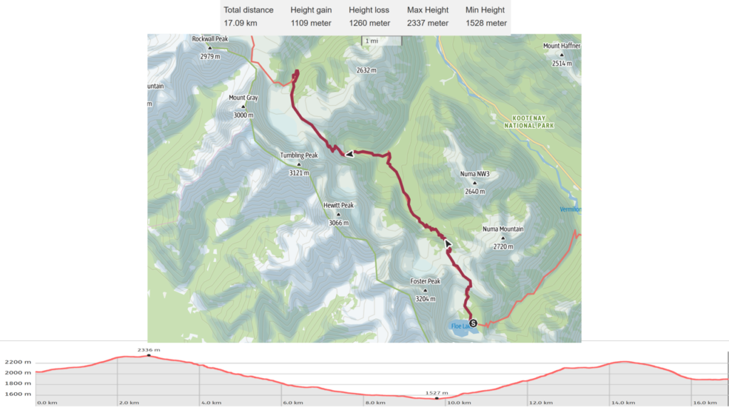
August 18th, Floe Lake Campground to Tumbling Creek CG, 17 km, 1042 m elevation gain, 1211 m elevation loss, 7 hrs 20 min (all distances and elevation are as per the guide book), Section C Segment 19.

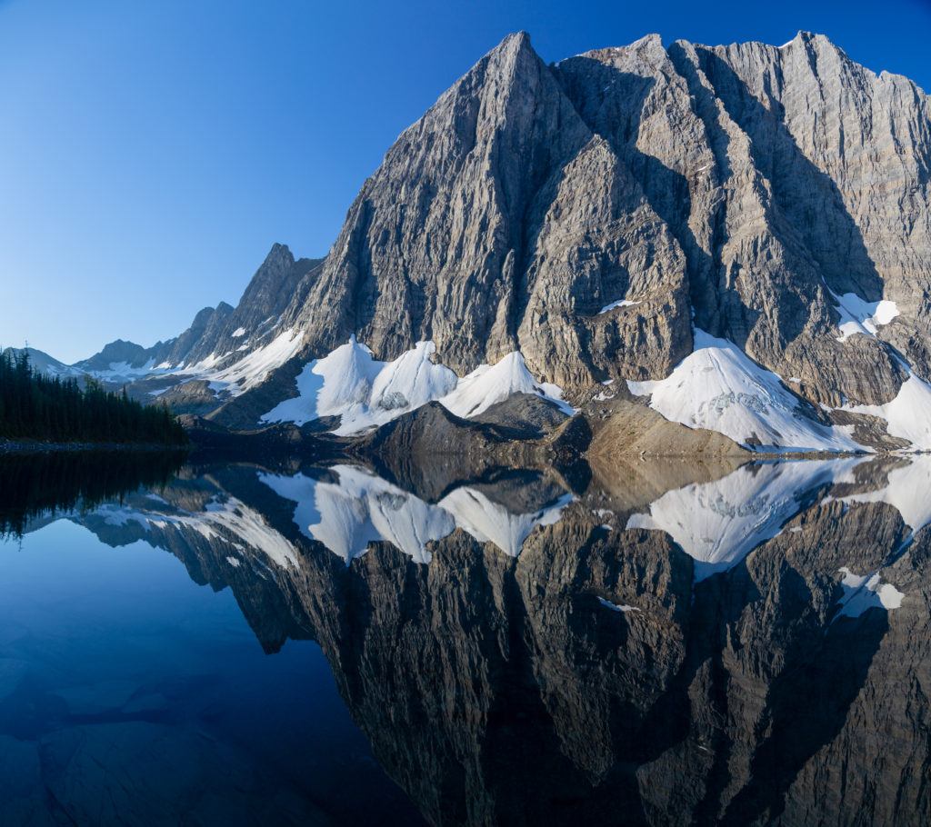
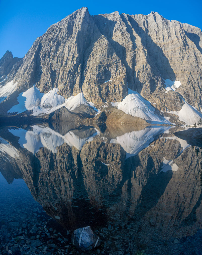
It rained heavily overnight but the day dawned bright and clear which found me down at the lake taking photos by 7:20 am. Not terribly early but yesterday had been a long day. It was still early enough that the wind had not picked up yet so the lake was mirror smooth. I was really wishing I had a wide angle lens to capture the full view of the landscape but I had to do with my 24-105 telephoto.
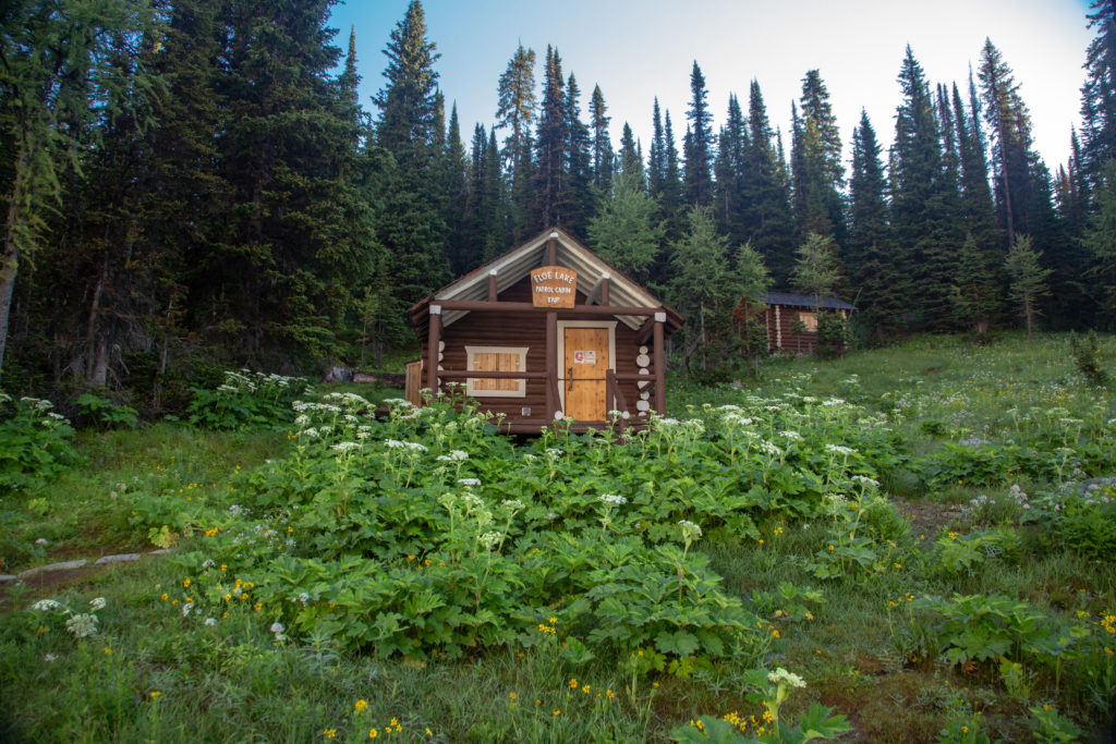
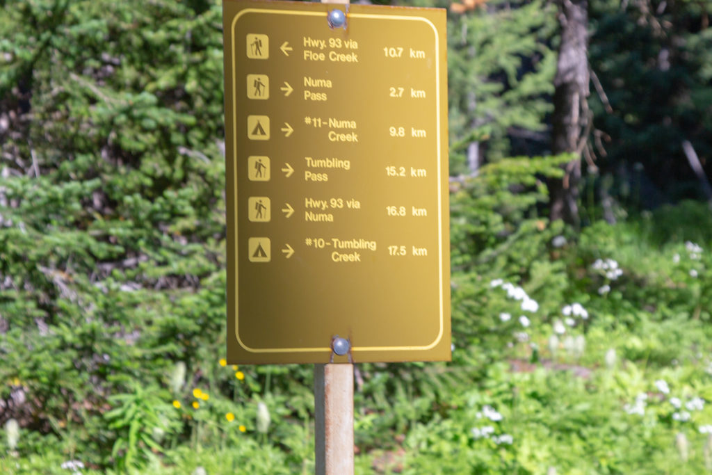
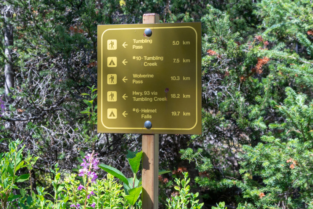
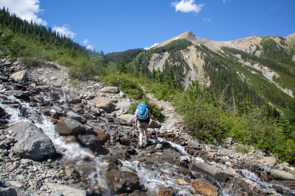
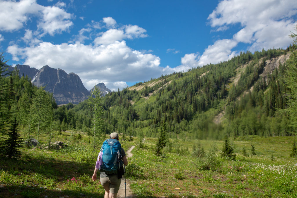
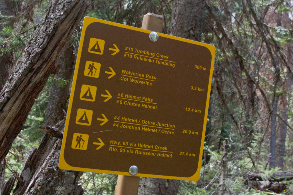
Floe Peak.
Looking north.
The Parks Canada Patrol Cabin. Wonder if it gets used much.
Long exposure shot of a stream draining Numa Pass.
The view looking east.

I was taking photos until 8:00 am. Emily took advantage of that and did not get up until I came back to the tent. I boiled the water and we had a lovely slow breakfast by the lake. I was quite impressed by many of the campers. The ones in our little area, about 5 tents, were headed to the Floe Lake parking lot and they were all gone shortly after 8:00 am for a 10 km hike. We started tearing down the tent at 9:00 am and had everything packed away by 9:35 am. We took one last trip down to the beach before we started our day. This would be a nice day. First off it was shorter than yesterday. We were heading to Tumbling Creek CG, only an 18 km hike. We would head up 300 m to Numa Pass followed by an 800 m elevation loss that would take us to Numa Creek CG, a total distance of 10 km. Then it would be back up 700 m to Tumbling Pass over 4.5 km before dropping back down to the campground.

It tears down pretty quick. It is the 7th morning; we should be good at this by now.
Nothing left behind
Good signage.
Emily taking one last look at Floe Lake.

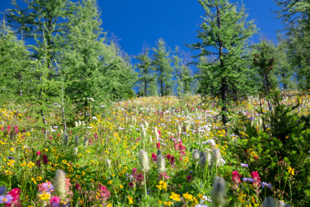
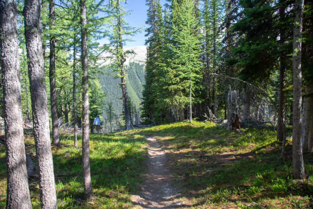
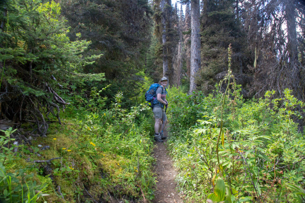
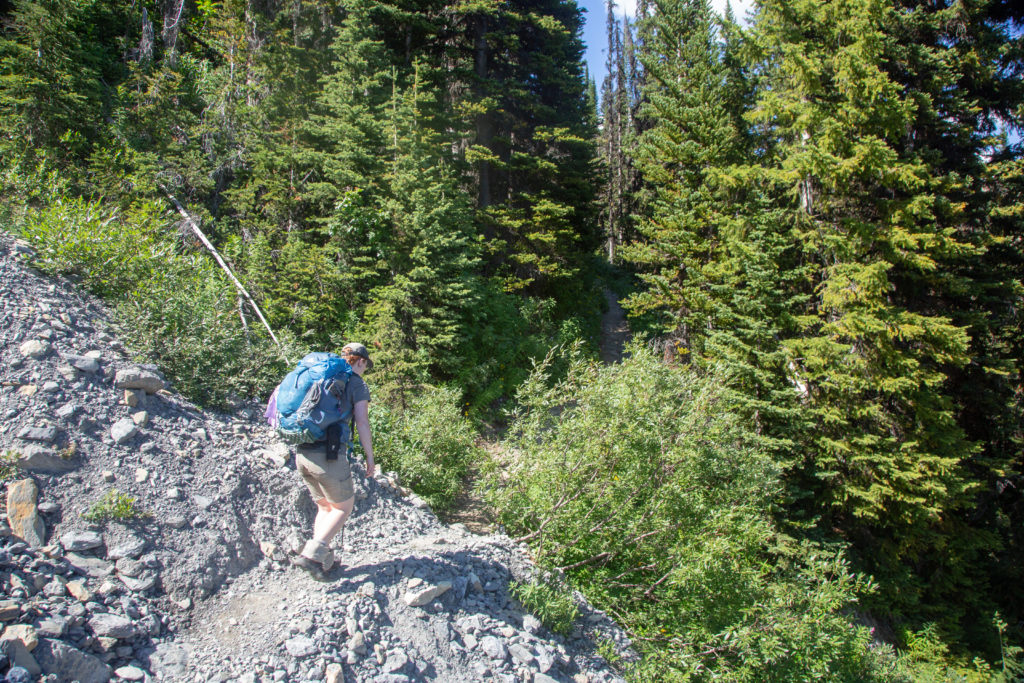
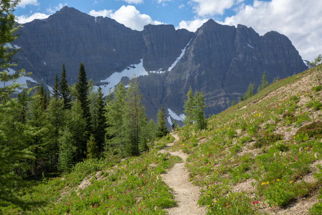
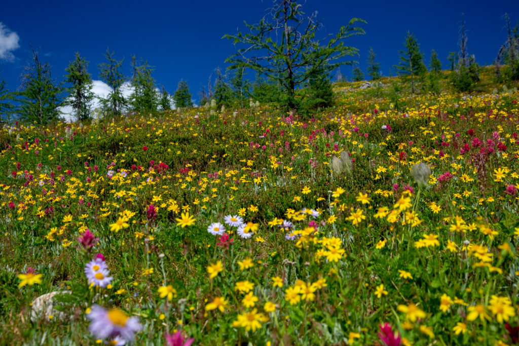
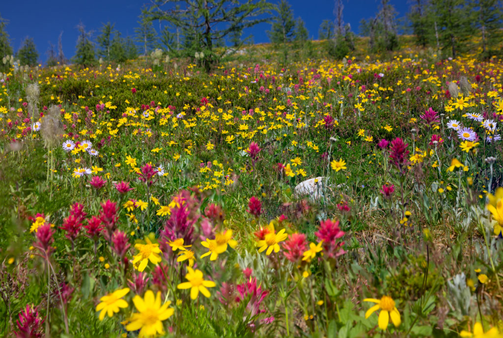
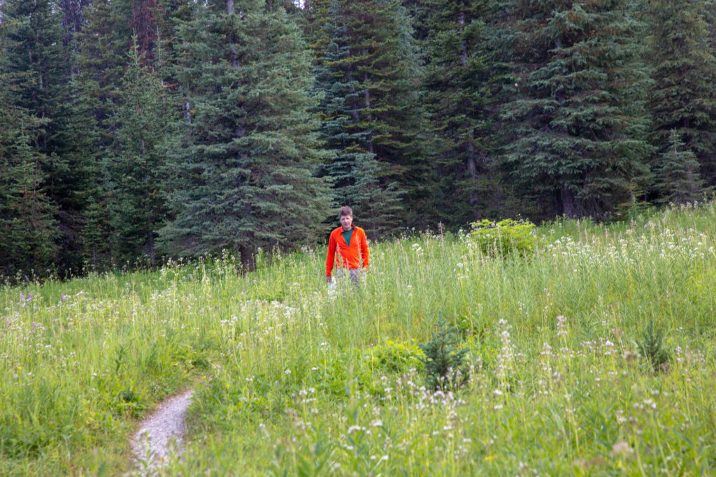
The hike out of the campground was very pleasant on a comfortably graded trail. One other group left just after us but we never saw them again. The flowers were out, adding a nice splash of colour to our hike.

Nice flat meadow. Lots of smiles this morning.
Lots of colour this morning.
Flower field.

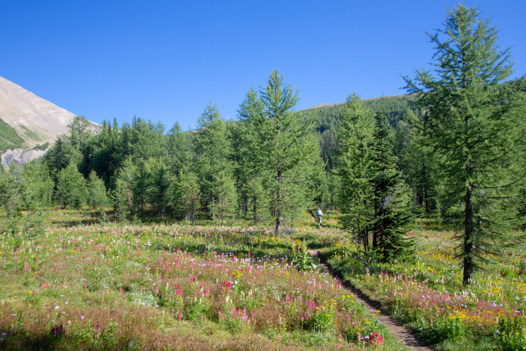
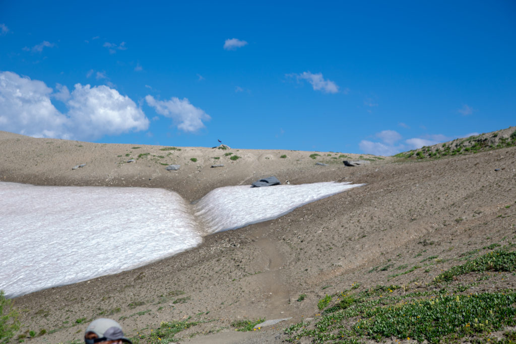
Looking back we had stunning views of Floe Peak and Floe Lake. As we approached the pass we lost view of the lake as the trail actually flattens out before reaching the pass. There were still some small snow fields clinging to little depressions but the trail was mostly dry underfoot. We arrived at Numa Pass 55 minutes after leaving Floe Lake.

Floe Peak and Floe Lake one last time.
Approaching treeline and the flowers are still with on a nice dry trail.
Tiny snowfield crossing.
  • Links 2011
  • Emily 2020
My first Rockies backpacking trip went over Numa Pass with Laura and Links (RIP we miss you), I think Links did a better job of going over the pass.

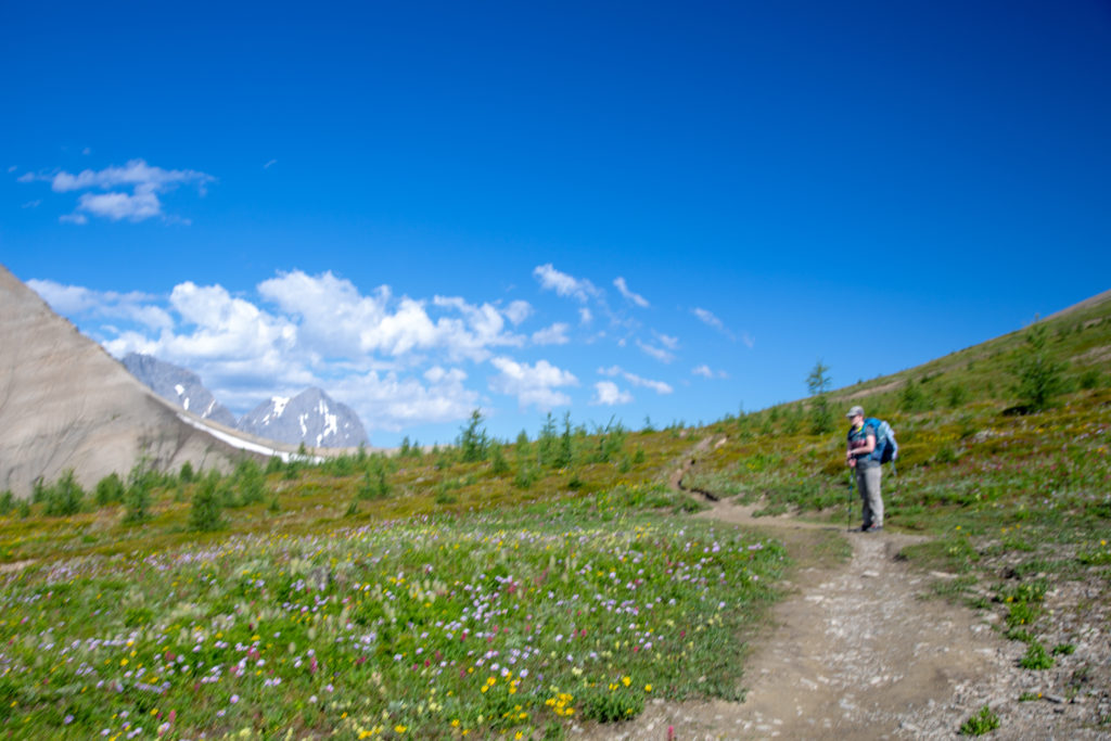
We stopped for a few minutes after cresting the pass not sure why but it probably had something to do with our feet. We met our first southbound hikers shortly after leaving the pass. It is an 800 m climb for the southbound hikers to the pass up a steep trail. Emily and I were both glad that we were headed downhill. I did not keep count but by the time we reached the bottom of the pass we must have seen over 20 southbound hikers grinding up the hill. Despite the hard work they were all in very high spirits. Many of the hikers were only headed to Floe Lake giving them the majority of the day to relax and enjoy the area.

Emily’s Note: Actual conversation we had going down the pass:
Uphill Hiker: Tell me we’re near the top
Dad: You Are Near The Top
Uphill Hiker: I love the sound of your sweet, sweet lies

The view looking north as we start to descend Numa Pass.
The trail is nicely shaded on this side. There were plenty of switchbacks to soften the grade but it was still steep.

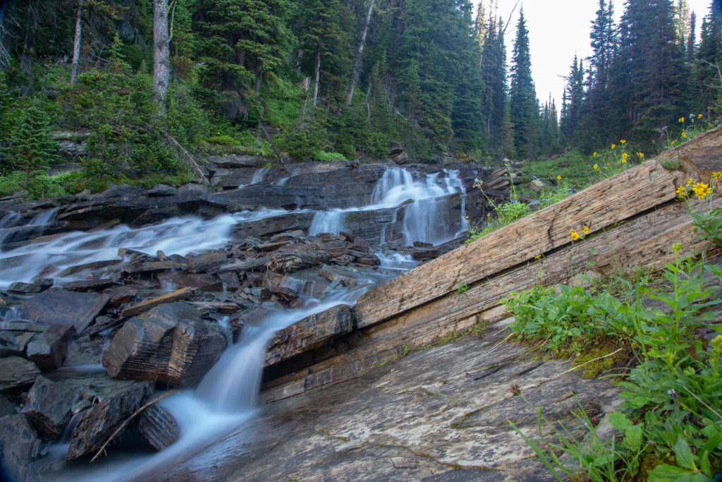
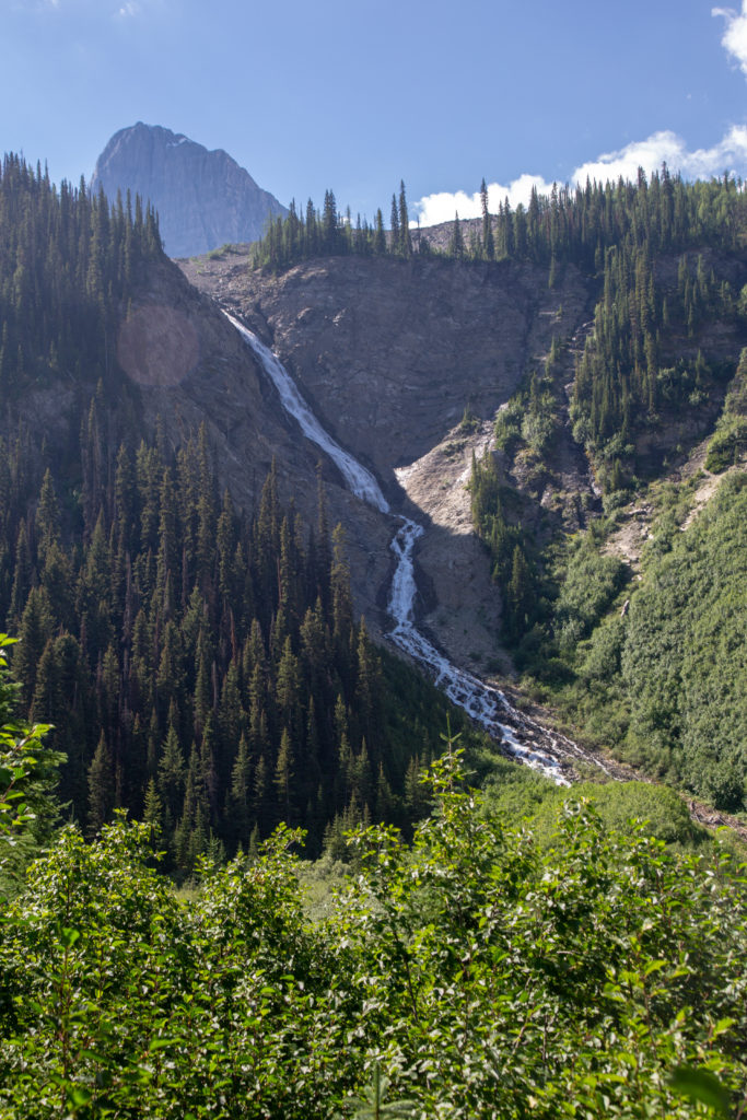
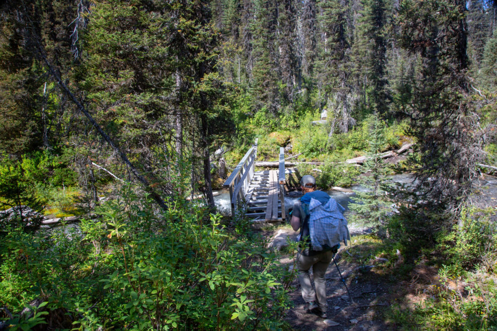
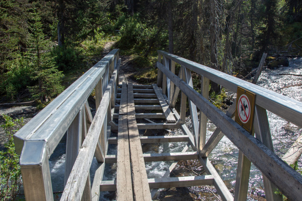
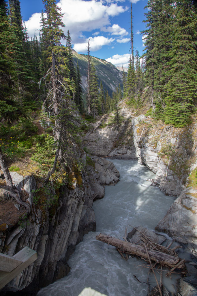
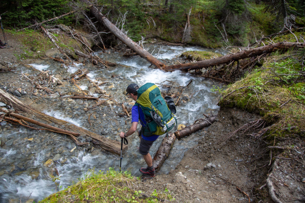
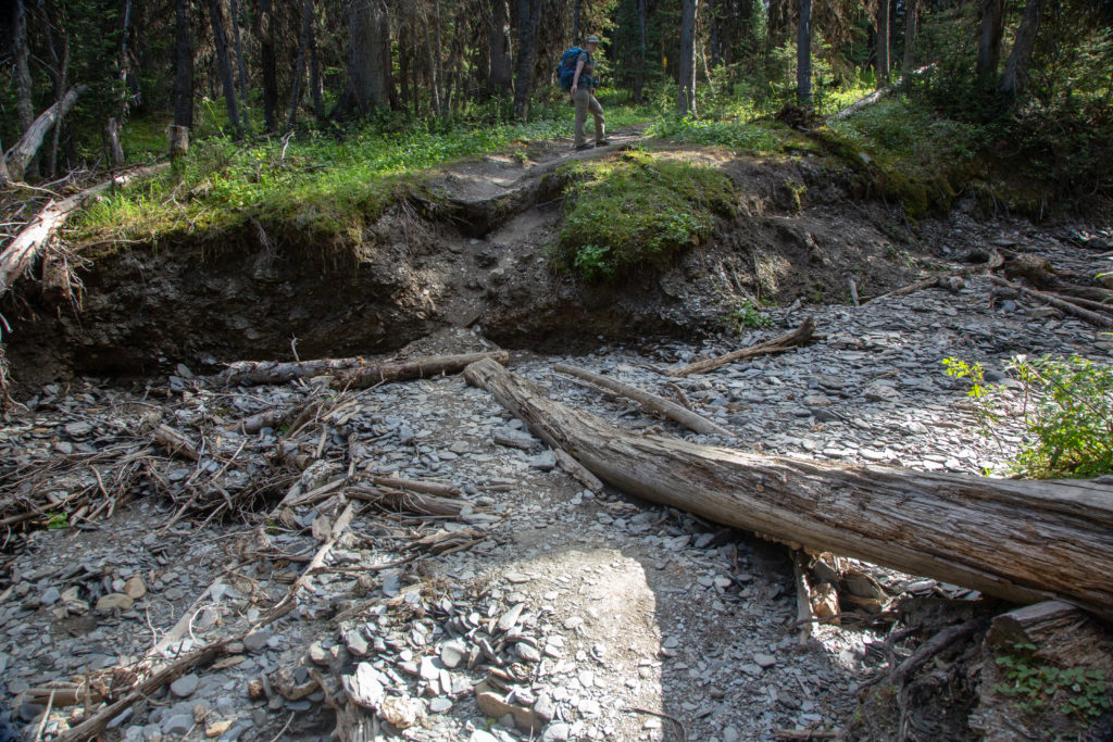
We came out of the trees at the base of a lovely waterfall. We had lost most of the elevation on the way Numa Creek CG but there was still 3.5 km to go before we would stop for lunch. From the base of the falls most of the walk was along a densely wooded trail. When I had come through here in 2011 there had been a lot of avalanche debris that we had to walk around slowing down our progress. Sometime in the intervening years Parks Canada had done a nice job of cutting a trail through the debris. We did cross over Numa Creek several times. While small the creek had cut quite a nice little canyon for us to walk along. We arrived at Numa Creek CG at 12:55pm. We could afford a long lunch as we only had 7.5 km left for the day.

Emily’s Note: I think we spent a good amount of this section of the hike talking about..mortgages? Not sure how that came up but my journal does not lie.

Waterfall draining Numa Pass with Foster Peak (3204 m) in the background.
Path through the avalanche debris.
It’s a wooded walk.
Approaching a nice bridge.
Great bridge but not sure what happened to the foot bead. Glad they do not allow horses as they may fall through.
Numa Creek.
Arrival at Numa Creek CG.

We tossed our packs down by a log beside Numa Creek and had a very relaxing lunch. Emily discovered that the biffy on the south side of the creek was brand new. The biffy still had that new fresh wood smell. Sometimes it is the little things that bring a smile to your face.

Lunch at Numa Creek.

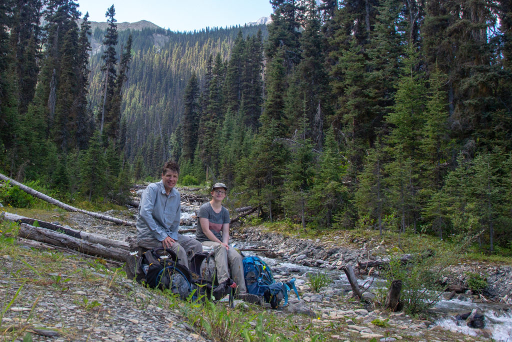
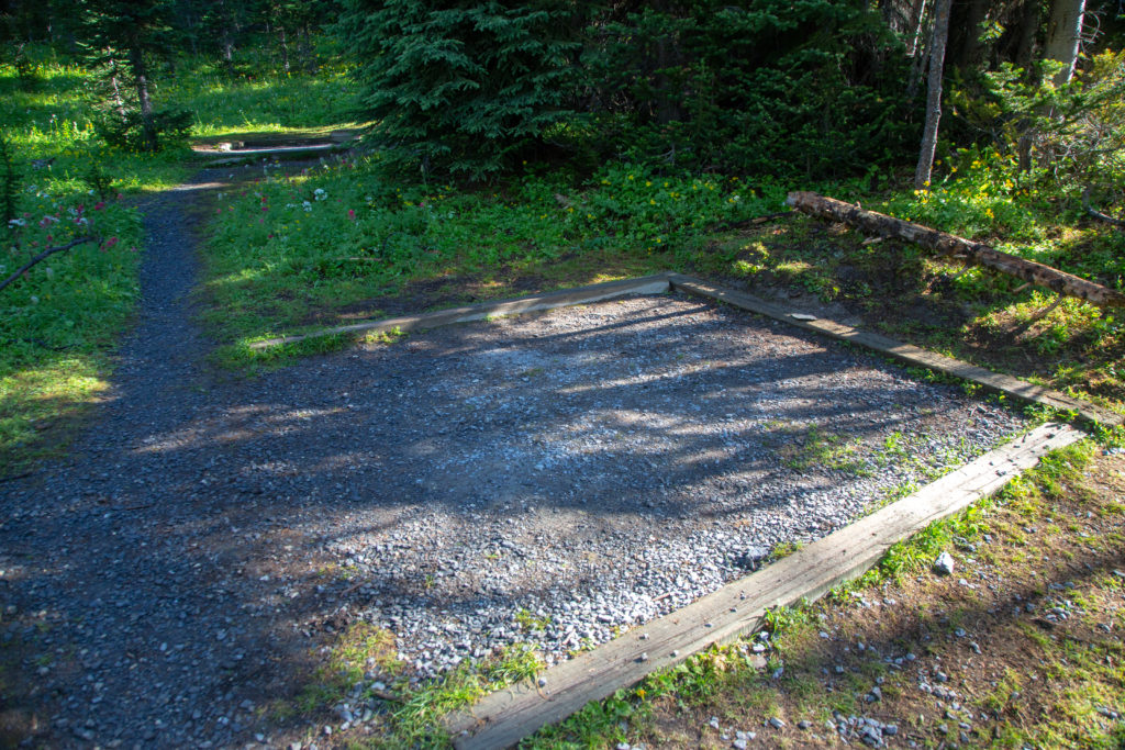
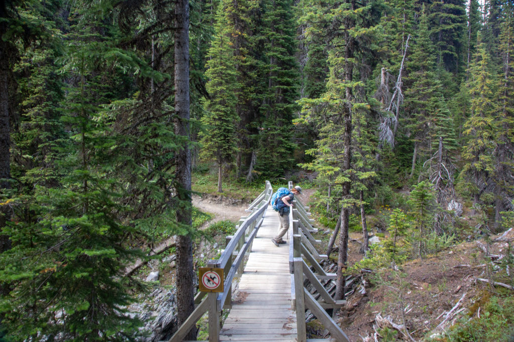
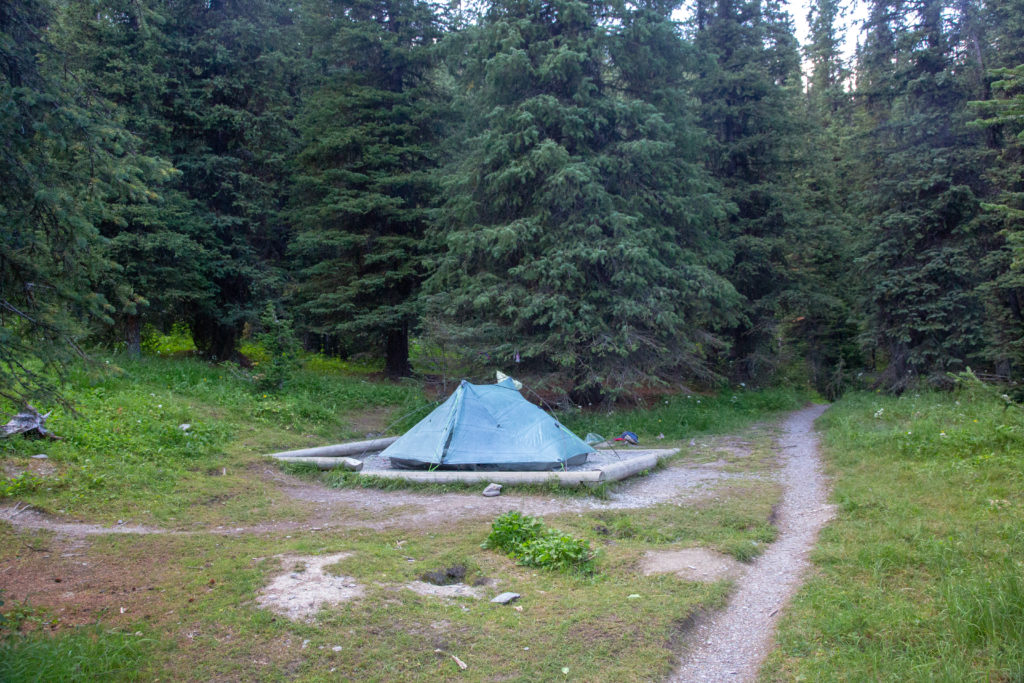
Numa Creek divides the campground into two sections. On the north side of the creek is the eating area and food storage while the tent pads are all located on the south side of the river. We packed up and headed out at 1:45 pm. We had 7.5 km to go to Tumbling Creek CG including 720 m of elevation gain. I was hopeful we could complete the hike in about 2.5 hrs. As we passed through the north side of the campground there were a couple of older gentlemen having lunch. When I hiked through Numa Creek CG in 2011 with Laura we exited back to the highway by following Numa Creek and crossing over the Vermilion River. Unfortunately the bridge over the river was destroyed by the floods of 2017 and despite reconstruction efforts the bridge was still not open. Projected opening is summer 2021.

Parks Canada would like you to know that the trail is closed.
Not far now.

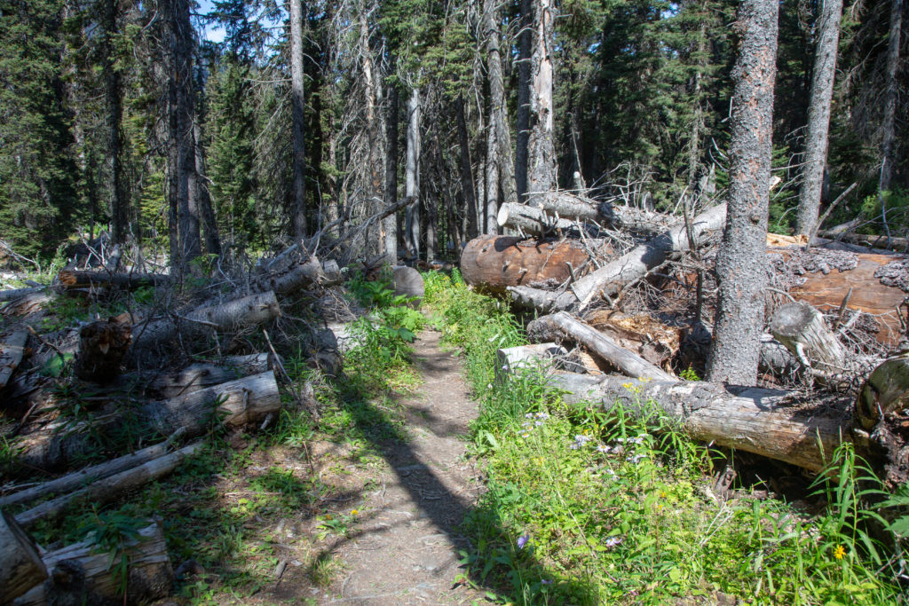
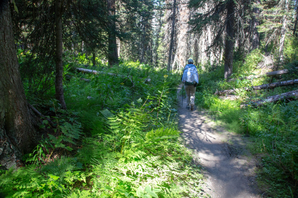
The trail headed uphill immediately upon leaving the campground. The plant life was so thick on the side of the trial in places I lost sight of Emily ahead of me. We met one large group coming down the trail. They were only headed to Numa Creek CG so their day was almost done. Later Emily would remark that she really liked this climb as it was just a steady up making it easy to get into a rhythm.

Emily’s Note: You can tell it was getting hot by the fact that I actually cut down to shorts–I never do that.
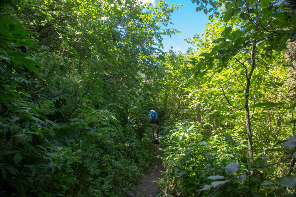
Happy hiker going uphill.
Losing sight of Emily in the forest.
The vegetation is starting to thin. Tumbling Peak (3121 m) in the background.
Cooling off.

While Emily may have liked the gradient it was still a hot climb. There was little chatter between us as we worked up way up towards the pass. As the trail broke into loosely vegetated slopes it became very rocky. Hiking poles were a big help on the loose footing.

Crossing a minor stream draining a snow field. It was actually quite steep and you really would not want to lose your footing.
Negotiating switchbacks as the sun beat down on us.

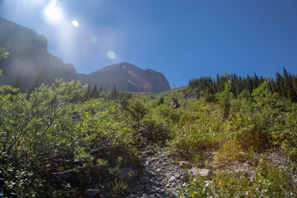
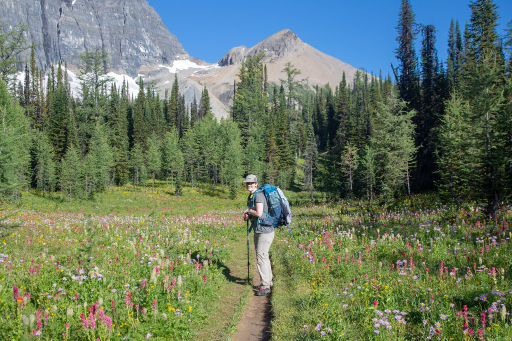
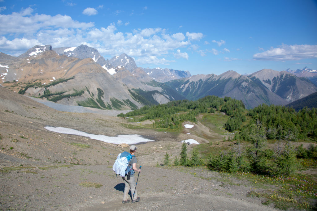
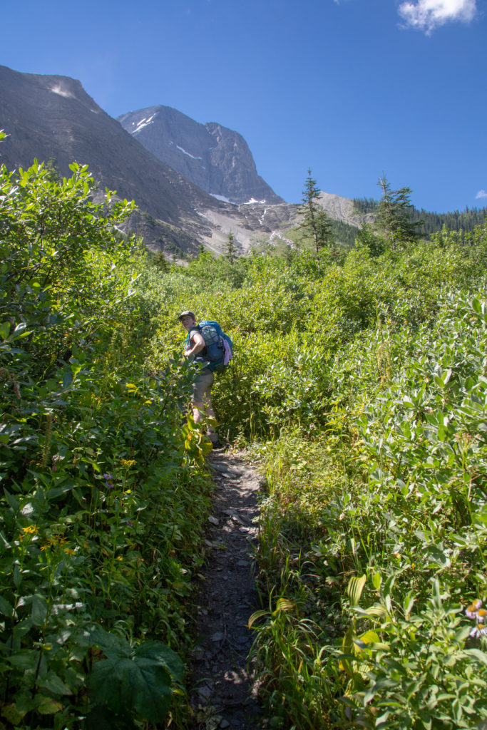
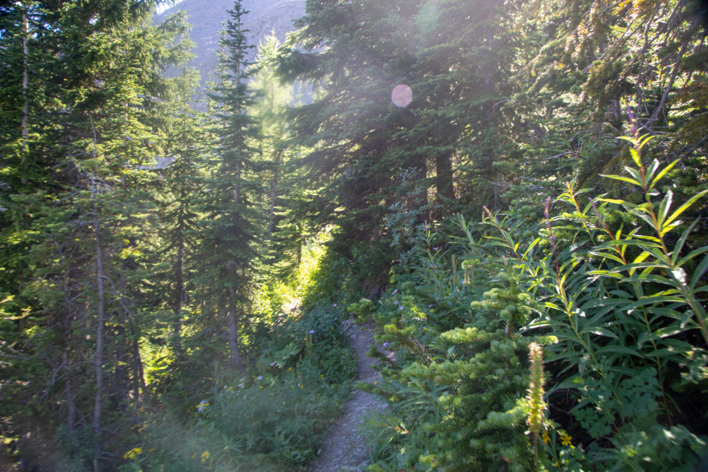
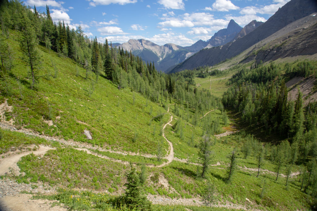
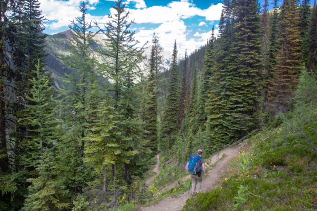
The trail flattened out briefly and headed into a small stand of trees which gave us some relief from the sun. The trail then went sharply uphill before dropping down into a large forest. With the change to the forest setting the trail underfoot become smooth and soft a welcome relief from the rocks. I was fooled for a moment when we exited the second forest I thought we were at Tumbling Pass but it was just a meadow leading to one last short climb to the pass.

Emily’s Note: When we reached this “false pass” I climbed onto a big rock and shouted to hear the echo. Bit of a premature move, since we still had our high point ahead of us, but it was the better spot for a shout anyway.

The first short treed section.
The short uphill to the larger forest.
Finished with the rocks.
At the pass? No. If you look at centre you can see the trail cutting up the side of the slope. Mt Gray (3000 m) in the distance.
Emily striding across the meadow.
Looking back as we climb the last hill before Tumbling Pass.

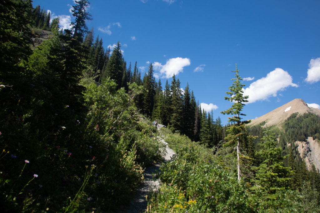
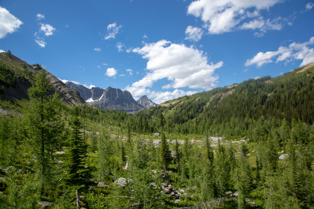
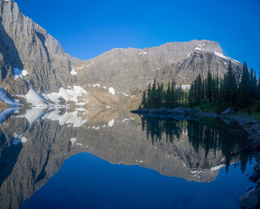
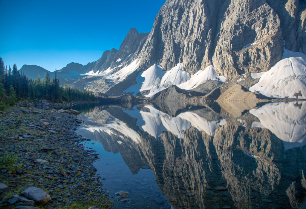
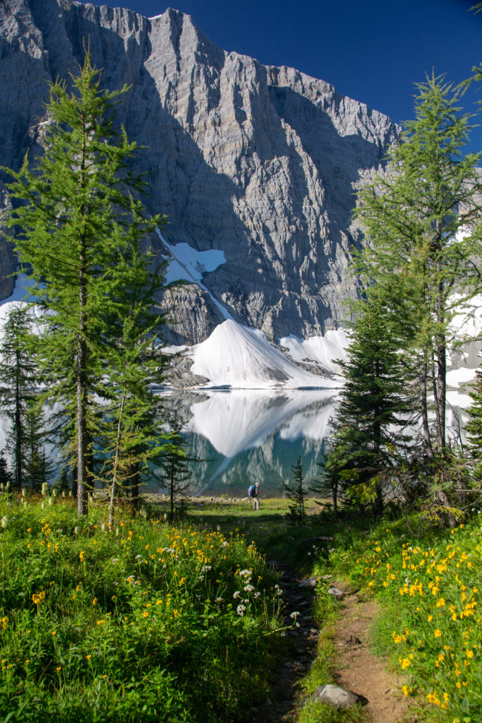
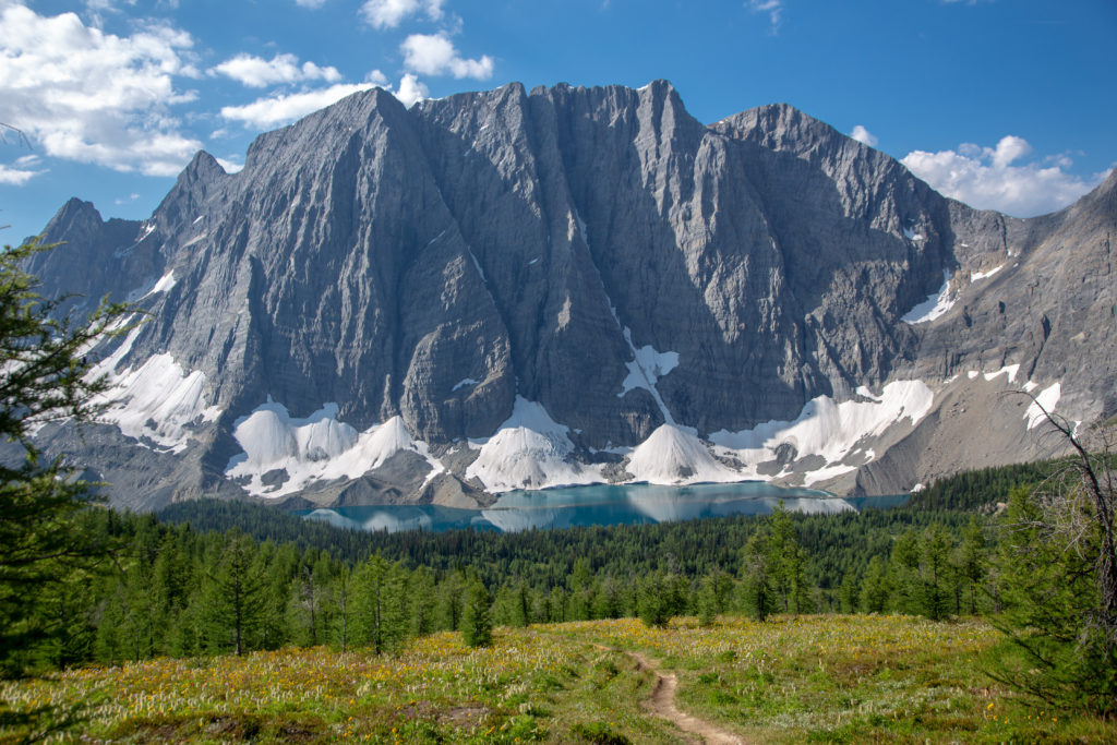
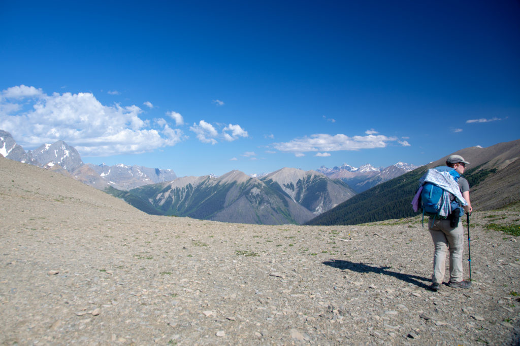
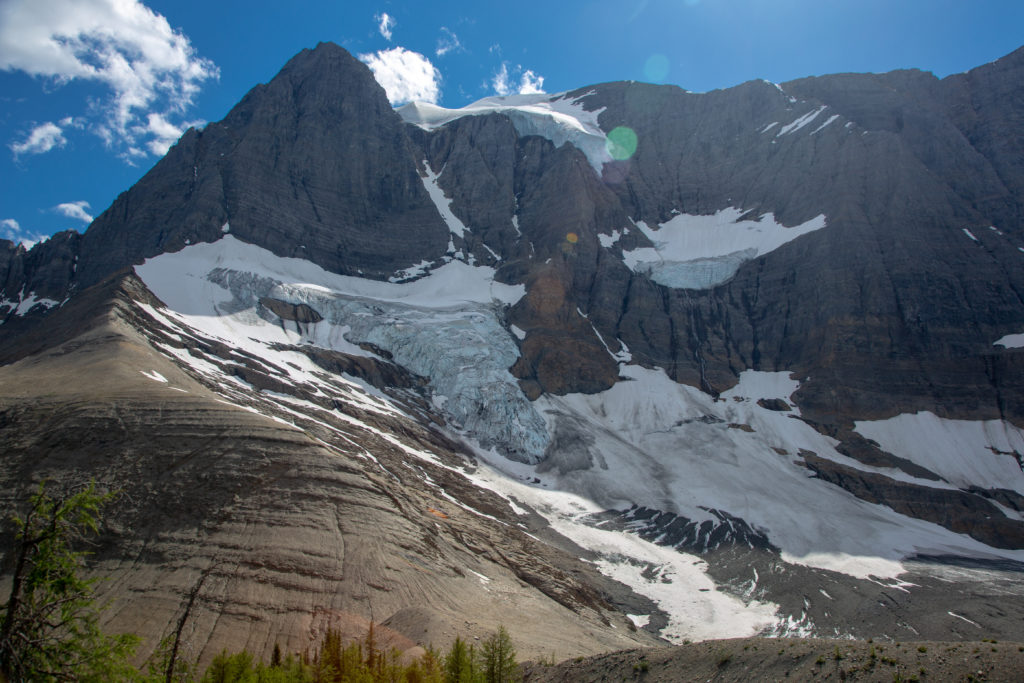
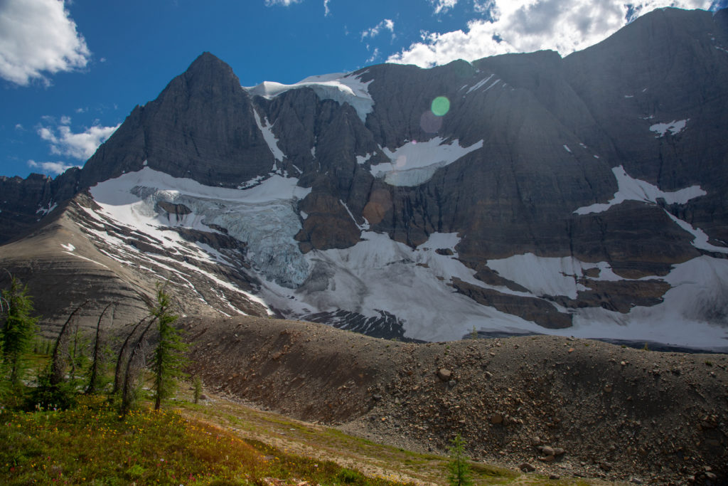
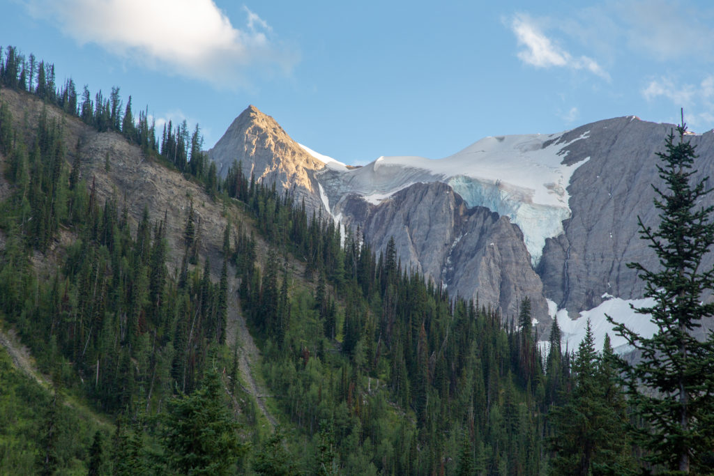
It took 30 minutes from when we left the forest until we arrived at the pass. By the time I joined Emily at the top of the pass she was already sitting down with her pack off. Guess we were going to spend a few minutes at the pass. It was worth it. To our left was Tumbling Peak complete with Tumbling Glacier. To our right was Mt Gray. The Rockwall itself rose over 900 m above us. A truly impressive sight.

On our way to Tumbling Pass.
We are stopping at the pass.
Tumbling Peak and Glacier.
Flowers.
The colours of the flowers was so bright and vivid.
Wider view of Tumbling Peak and a lateral moraine.

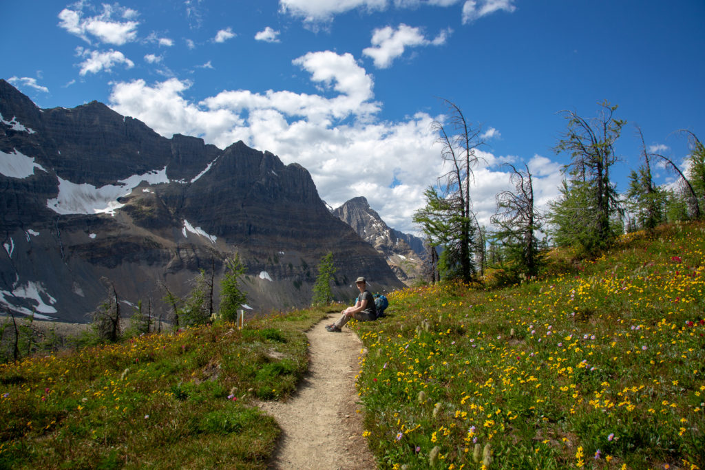
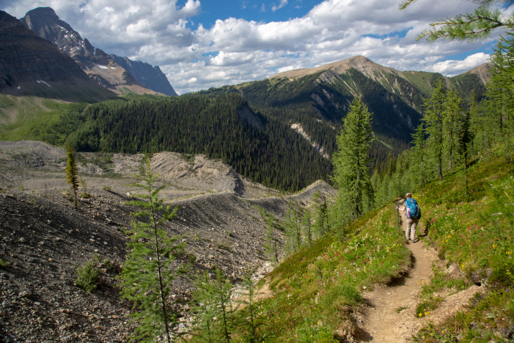
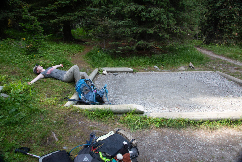
We hung around on the pass for 15 minutes before heading on. We had just 3.5 km to go and all downhill to the campground. The trail starts out quite flat as it leaves the pass then as it begins to descend it quickly gets steeper. Much of the elevation is lost through a series of switchbacks; we lost the majority of the 320 m of elevation in just 1.5 km. We are at this time on the south side of Tumbling Creek with the campground on the north side. The last 1.5 km is walking alongside Tumbling Creek to access a bridge to take us over to the north side and our home for the evening. We dropped our packs at 4:55 pm. It was a little later than I had hoped. It had taken us just over 3 hours since leaving Numa Creek and 45 minutes since leaving Numa Pass to arrive at the the campground. I am still not sure why but this was one of the best days I had on the hike. I just really enjoyed the section of trail and I felt great. This feeling of joy and optimism is what would make what happened tomorrow more difficult to deal with.

Emily’s Note: While I’m sure the reason for the stop was partially “I want a snack,” we also waited for a SPOT message here. There had been a sign at Floe trailhead that the McArthur trail was closed due to deadfall, so we’d asked people at home to check that for us in case we’d have to hike out the next day instead of continuing our actual route. It was open now, thankfully.

Leaving Tumbling Pass. Tomorrow the first thing we have to do is climb back up to this elevation on the other side to access Rockwall Pass.
Heading down the switchbacks.
Good to know we only have 300 m left to go.
Bridge over Tumbling Creek.
The little canyon Emily was looking at.
Made it to camp.

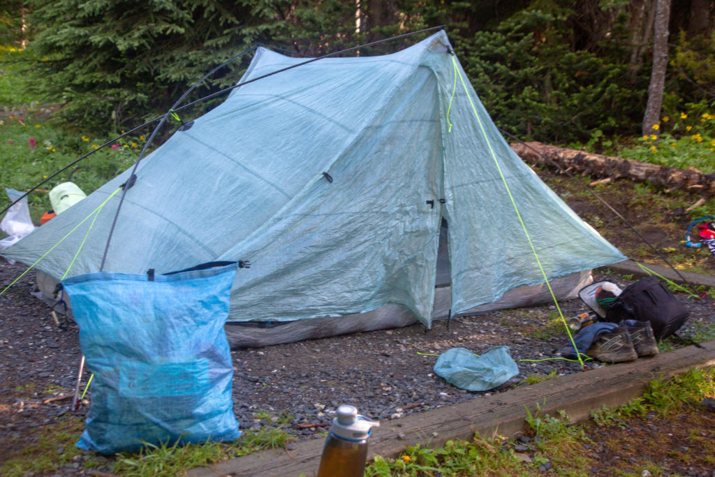
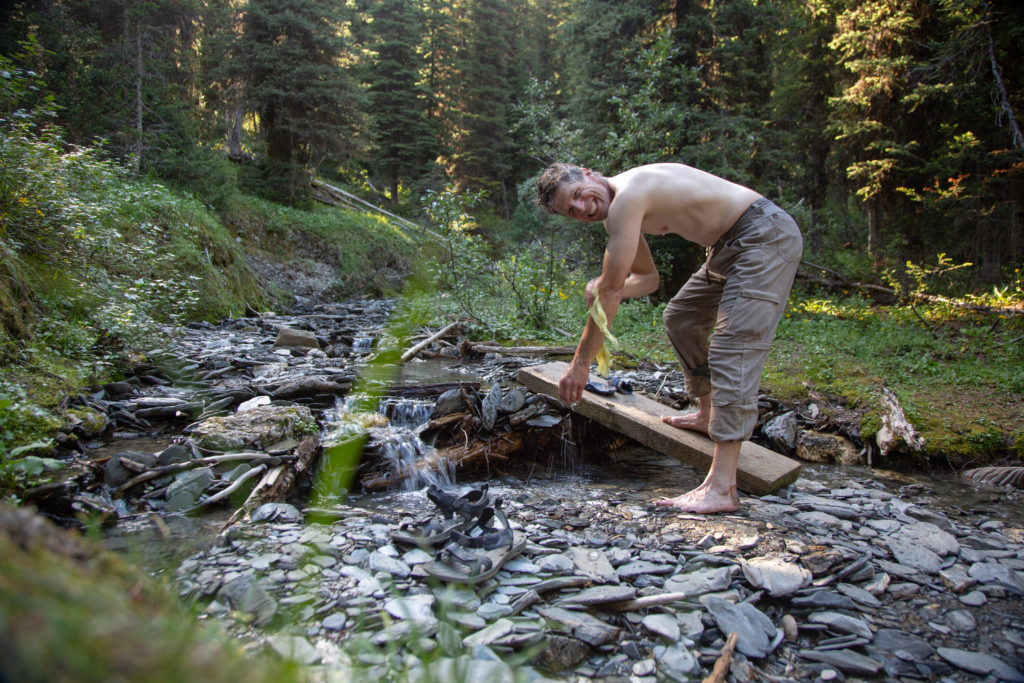
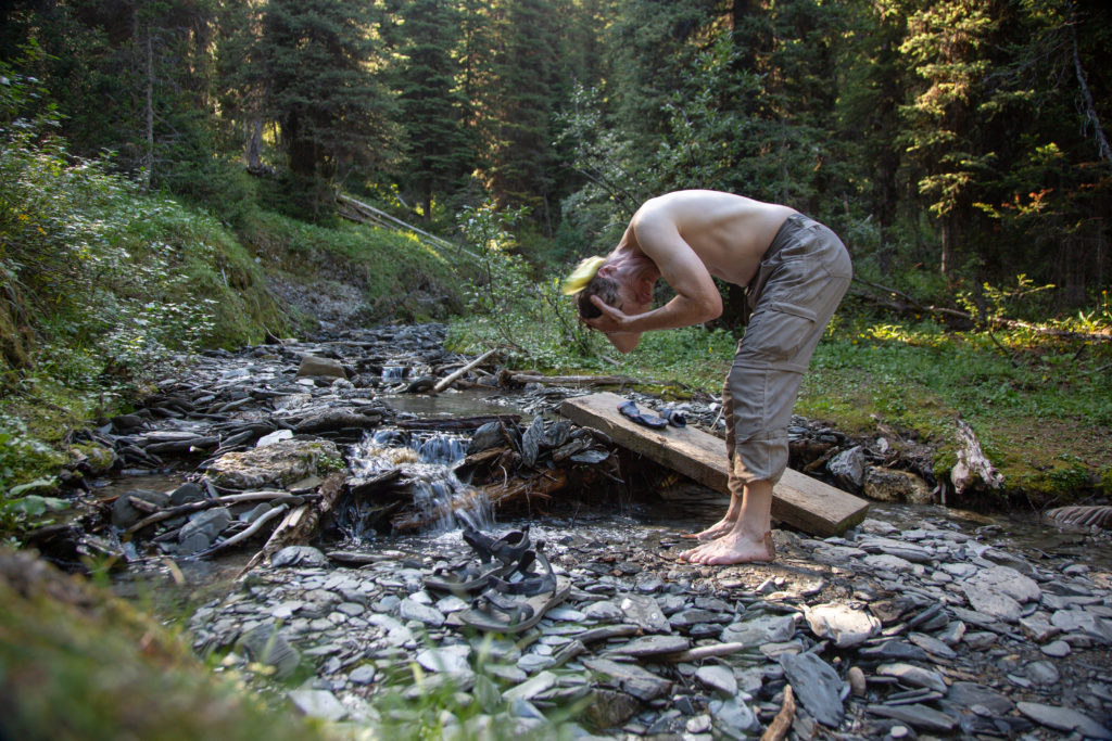
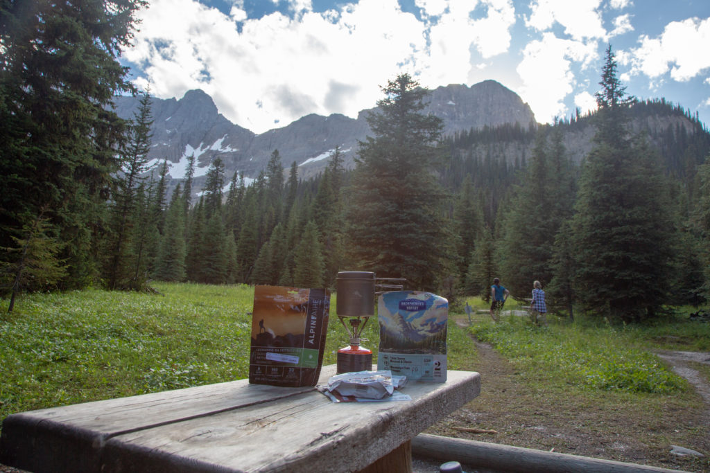
Our campsite was close by to a little creek. I took the opportunity to wash up in the creek since I had not had a wash since Howard-Douglas. We set up camp and I got dinner going just after 6 pm.

Full body wash.
Dinner with a view.

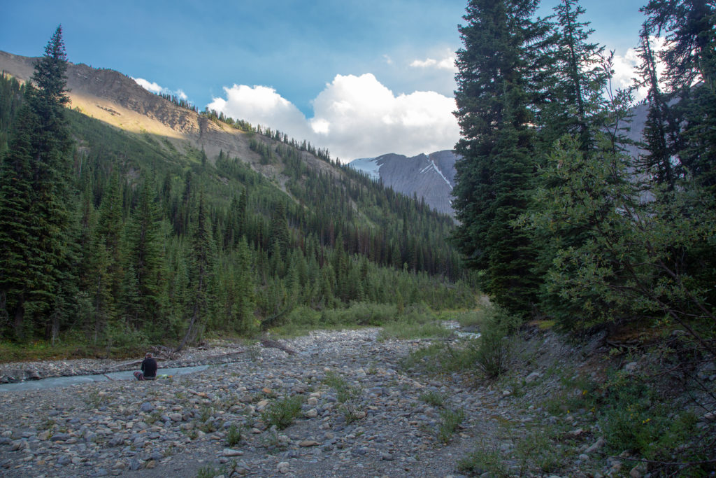
Tumbling Creek is only a short walk from the campground so after dinner Emily took some alone time to sit by the creek and write in her journal. I wandered around the campsite. I had been here just 6 weeks prior on a three day trip on the northern section of the Rockwall. On the previous trip there was still snow in the trees and all the minor creeks were flowing. It was interesting to see the difference a short time can make.

Emily quietly writing in her journal.
  • July 12th
  • August 18th
The July 12th photograph is taken from where Emily is standing.

Later we would take a wander around the campground together. The campground is designed in two distinct halves sort of an uptown and a downtown. Both halves have their own arrangement of tent pads, eating area, food storage and biffy. We were staying downtown which had only one drawback. Someone had a made a mess of the downtown biffy. This really was not a big deal as the uptown biffy was not that far away. Later in the evening when we were back at our tent we noticed a steady stream of people heading up the path to the little creek above our tent. Emily came to the conclusion that they were not going to wash up but were using the forest as a biffy.

Emily’s Note: I could smell it. They weren’t all digging cat holes. Thankfully once we settled down in the tent the smell didn’t reach me.

Our home.
Action shot of me walking through the grass.

In spite of Covid and everyone keeping their distance we did chat with a number of groups. We headed to bed about 8:00 pm. We read for a while making up for the previous evening.

Emily’s Note: We could also hear the periodic crashing and thunder of ice melting and breaking off the glacier–a very cool sound to sleep to.

Tumbling Peak and Tumbling Glacier.

Good night from Tumbling Creek CG.

Day 9 GDT Hike Section C 2020

GDT Section C 2020 Home

bootwreckers

Day 3 of our 2021 Labour Day Weekend trip through Day 3 of our 2021 Labour Day Weekend trip through the Egypt Lake area, Banff NP.

This day took us from the campground at Balls Pass Junction over Whistling Pass, with a detour up Pharaoh Peak, which wasn't without some drama.

Lunch was another side trip to Scarab Lake followed by an excursion to Egypt Lake.

Our final destination was Pharaoh Creek Campground. After a lovely evening the Milky Way came out to play.

Read the summary at www.Bootwreckers.com, link in bio.

Photo 1 - moody morning at Balls Pass Junction

Photo 2 - golden meadows as we approach Haiduk Lake

Photo 3 - making our way up Whistling Pass

Photo 4 - heading up Pharaoh Peak, and it really was this steep

Photo 5 - looking over Mummy and Scarab Lakes from the Pharaoh Peak.

Photo 6 - group shot on the way down

Photo 7 - at Egypt Lake

Photo 8 - Frosty Paws guarding the tent

Photo 9 - the Milky Way

Video - scree skiing down Pharaoh Peak

Another great day on the trail with @sio.mellors

#greatdivide #greatdividetrail #gdt #parkscanada #parks #bcparks #trails #longdistancehike #longtrail #outdoors #outside #thruhike #hike #thruhiking #outside #backpacking #waterfalls #waterfall #naturephotography #naturephotography #nationalparks #teamzpacks
Day 2 of our Labour Day weekend trip through the E Day 2 of our Labour Day weekend trip through the Egypt Lake area, Banff NP is up on Bootwreckers, see link in bio.

The day was sunny and the skies were blue, it was simply an amazing day to be on the trail.

Out day started out retracing our steps from th previous evening back to Shadow Lake.

After lingering to take in the stunning view at the lake we had an easy hike to our campsite at Balls Pass Junction.

After setting up the tent and having lunch we headed up the short but steep trail to Ball Pass. Ball Pass is in mu opinion one of th premier viewpoints in Banff NP. 

After exploring Ball Pass we returned back to the campground and enjoyed a well earned stream chilled beer and a nap.

Clouds rolled in later in the day but it only lightly rained.

Was not the biggest mileage day on the trail but was proof that a great day on the trail.
Photo 1 - Siobhan looking at Mt Ball and it's Glacier from Ball Pass
Photo 2 - Siobhan checking directions
Photo 3 - Shadow Lake and Mt Ball
Photo 4 - Siobhan on bridge crossing outlet of Shadow Lake
Photo 5 - dried  strawberries on the trail
Photo 6 - heading up Ball Pass
Photo 7 - Siobhan looking over the valley from Ball Pass
Photo 8 - heading down from Ball Pass
Photo 9 - our reward for a good day on the trail
Photo 10 - finding peace and tranquility in the backcountry 

#greatdivide #greatdividetrail #gdt #parkscanada #parks #bcparks #trails #longdistancehike #longtrail #outdoors #outside #thruhike #hike #thruhiking #outside #backpacking #waterfalls #waterfall #naturephotography #naturephotography #nationalparks
Day 1 of our amazing trip through the Egypt Lake a Day 1 of our amazing trip through the Egypt Lake area Labour Day Weekend, 2021 now posted up on our blog, link in bio. Another Grand adventure with one of my kids, @sio.mellors.

Our four day trip started at the Vista Lake Trailhead on Hwy 93 South. Up and over Gibbon Pass to camp at Shadow Lake Campground on day 1.

Day 2 was a short hike to Balls Pass Junction CG, then after a short break off to explore Ball Pass, in my opinion one of the best vistas anywhere.

Day 3 we hiked over Whistling Pass on the way to Pharaoh Creek CG, with a scramble up Pharaoh Peak, lunch at Scarab Lake, and a visit to Egypt Lake on the way.

Day 4 was hiking over Healy Pass and out to the Sunshine Village parking lot where our car had been moved to.

Lots of stories from this adventure,  was a lot of fun to revisit and write.

Photo 1 - evening as Shadow Lake

Photo 2 - pre-hike happy team photo

Photo 3 - Arnica Lake, where we had lunch

Photo 4 - the yellow of Larches starting to come in

Photo 5 - the golden meadows of th high alpine at Gibbon Pass

Photo 6 - view all the way to Mt Assiniboine from Gibbon Pass, about 70 km away

Photo 8 - mushrooms in the undergrowth as we approach Shadow Lake CG

Photo 9 - Frosty guarding our campsite

Photo 10 - still smiling at the end of th day at Shadow Lake

#parkscanada #parks
#shadowlake #banffalberta #banffnationalpark #banffcanada #banff #backpacking #camping #lake #egyptlake #Egyptlake  #backcountry #family #familytime #familytime❤️
The trip summaries for Days 10, 11 and 12 from ou The trip summaries  for Days 10, 11 and 12 from our 2021 GDT Section E hike is now up on www.Bootwreckers.com, see link in bio

We had a great end to the trip. Day 9 was a short day from our wild camp on the Bald Hills to Evelyn Crk Campground. Day 10 was a spectacular hike up over Little and Big Shovel Passes to the iconic Jasper Skyline Trail. Camping at Signal Campground. 

Day 11 was an easy walk into Jasper.

The trip was an amazing experience over 11 days, I met and hiked with many people but big props to my kid, who for some reason keeps hiking with me.

Photo 1 - end of hike, looking off into the distance, across th Athabasca River at Cairngorm Mt. 

Photo 2 - morning Bald Hills

Photo 3 - campsite Evelyn Crk CG

Photo 4 - Reading before bed

Photo 5 - fresh bear print on the trail

Photo 6 - Little Shovel Pass

Photo 7 - Snowbowl

Photo 8 - Last grind up to the Notch

Photo 9 - looking east from the Skyline down through Excelsior Creek

Photo 10 At campsite Signal Campground 

See trip reports on our blog, link in bio.

#greatdivide #greatdividetrail #gdt #parkscanada #parks #bcparks #trails #longdistancehike #longtrail #outdoors #outside #thruhike #hike #thruhiking #outside #backpacking #waterfalls #waterfall #naturephotography #naturephotography #nationalparks #teamzpacks #zpacks #duplex #sectionhike #sectionhiker
Day 7 and 8 on our GDT trip from last summer. Day Day 7 and 8 on our GDT trip from last summer.

Day 7 was from Waterfalls CG to a meadow in the Six Passes Route. Was a wet, moist day. Numerous creek crossings. Left the main GDT route at Maligne Pass and went off trail into the Six Passes. 

Spent the first night in an amazing meadow. With rain in the forecast we did 5 passes and the ridge walk in one day.

In one word the day was "Epic" . Was a spectacular journey. Huge day, 23 km and over 1500m up and down. So happy we did it, but we were so relieved to put in the tent somewhere flat.

Picture 1) the view of the Six Passes Route from the top of the first pass

Picture 2) me getting ready to leave Waterfalls CG

Picture 3) crossing a creek on a wet log

Picture 4) camping Six Passes

Picture 5) hiking Six Passes

Picture 6) sunrise pass # 2

Picture 7) it's a rocky climb

Picture 8) mmmm chocolate 

Picture 9) the final ascent on the ridge

Picture 10) happy to be home for the evening

See trip reports on our blog, link in bio.

#greatdivide #greatdividetrail #gdt #parkscanada #parks #bcparks #trails #longdistancehike #longtrail #outdoors #outside #thruhike #hike #thruhiking #outside #backpacking #waterfalls #waterfall #naturephotography #naturephotography #nationalparks #teamzpacks #zpacks #duplex #sectionhike #sectionhiker
First 5 days of my 11 day 2021 Great Divide Trail First 5 days of my 11 day 2021 Great Divide Trail Hike Section E is up on Bootwreckers, see link in bio.

Includes the 2 days I did on Section D but aborted due to smoke.

Picture 1) Camp on Owen Creek
Picture 2) Camp at Lower Michelle Lake
Picture 3) Pinto Pass
Picture 4) hiking up Cataract Creek
Picture 5) Smokey sunrise over the Brazeau River

#greatdivide #greatdividetrail #gdt #parkscanada #parks #bcparks #trails #longdistancehike #longtrail #outdoors #outside #thruhike #hike #thruhiking #outside #backpacking #waterfalls #waterfall #naturephotography #naturephotography #nationalparks #teamzpacks #zpacks #duplex #sectionhike #sectionhiker
Fun trip out to the Ink Pots in Banff NP on Decemb Fun trip out to the Ink Pots in Banff NP on December 31st.

Was very cold, -30C, but bluebird skies overhead.

Did a little snowshoeing in the meadow.

Saw almost no one above the upper falls at Johnson Canyon.

Fun adventure.

Happy New Year everyone.

#outside, #outsidethebox, #liveoutdoors, #liveoutsidethebox #naturephotography, #naturelovers,  #retiredhusky, #rescuer
#parkscanada #banffnationalpark #banffalberta #banffcanada
#sunstar #sun #lake #sunrise #alpin #scenery #reflectionphotography #reflections #sceneryphotography
Day 6 Section E Great Divide Trail Hike 2021 (Part Day 6 Section E Great Divide Trail Hike 2021 (Part 1)

Fun day on the trail heading from Four Points CG to Waterfalls CG. 

The day started dry but damp from the rainfall overnight. As we left the Brazeau River valley and headed up to Jonas Pass the storm clouds blew in forcing us to get our wet weather gear on. 

I discovered shortly after that it is great to have gloves for hiking, but that they should be accessible, not buried somewhere in the pack.

The storm was quite fierce but luckily brief. We arrived at Jonas pass and were able to put our rain gear away.

The clouds would remain with for the duration of the hike adding some mood to the hike.

This was my second time hiking over Jonas Pass and Jonas Shoulder and both times it has rained.

We arrived at Jonas Shoulder. We took some time to enjoy the view and let off some steam. The rest of the hike would be downhill.

Happy Friday

#greatdivide #greatdividetrail #gdt #parkscanada #parks #bcparks #trails #longdistancehike #longtrail #outdoors #outside #thruhike #hike #thruhiking #outside #backpacking #waterfalls #waterfall #naturephotography #naturephotography #nationalparks
Waterfall on Owen Creek, Day 1 GDT Section E. Req Waterfall on Owen Creek, Day 1 GDT Section E.

Required a fun bit of scrambling to access.

Happy Friday

#greatdivide #greatdividetrail #gdt #parkscanada #parks #bcparks #trails #longdistancehike #longtrail #outdoors #outside #thruhike #hike #thruhiking #outside #backpacking #waterfalls #waterfall #naturephotography #naturephotography #nationalparks
Day 5 GDT 2021 Section E. This day was memorable Day 5 GDT 2021 Section E.

This day was memorable for a few reasons. First waking up to more smoke.

First photo is the sun rising over the mountains at 8:30am, shouldn't really be that red.

Doing the extra distance on day 4 meant that this day I had a 3.1 km hike from Boulder Crk CG to Four Points CG.

I could not extend the day as Emily was joining me on this day coming in from the Nigel Pass trailhead and the next campground on our route would be to far to reach on this day.

When I arrived at Four Points it was just before 8am! Must be my shortest day ever.

I spent the day reading and waiting for Emily. I heard her bear calling down the trail about a minute before she arrived.

We spent the rest of the day relaxing. Met some some people from Calgary who I had a mutual friend with, he used to be their cross country ski coach.

We went to bed reasonably early as we had a decent day ahead of us tomorrow.

The smoke was lifting as we went to bed. 

The last photo is Links' Happy Badass Bandana. Still miss my little hiking partner.

#greatdivide #greatdividetrail #gdt #parkscanada #parks #bcparks #trails #longdistancehike #longtrail #outdoors #outside #thruhike #hike #thruhiking #outside #backpacking
Day 4 Great Divide Trail Section E. Pinto Lakes to Day 4 Great Divide Trail Section E. Pinto Lakes to Boulder Creek CG.

Super fun day full of adventure and a lot of smoke. This was a big day, 32 km over Cataract Pass into the upper reaches of Bourgeau Creek in Jasper NP.

After the clear skies of my astrophotography in the middle of the night I got up at 5am, jst 3 hours after I put the camera away, to join my trail companions Jason and Bent for the day. 

The terrain was suppose to be rugged and the trail a little iffy so I thought it would be good to have some companions. As it was we got took two wrong turns in the first 15 minutes.

After several steam crossings, some with suspect bridge work, finally had to cross a wide stream and get wet feet. I had sandals, but my companions ploughed through so I figured I had to keep up.

I found a rock with ancient Indigenous petroglyphs. It is just off trail, but a good day and a half hike from any road.

We passed from Banff NP to Alberta Parks Wilderness area. There is wild camping in the Wilderness area, but good camping spots are hard to find.

I was going to stop for the day short of Cataract Pass, but it was so smokey I thought I would continue on.

We had lunch at the base of Cataract Pass. I used Frosty Paws as a table for my lunch.

It was such a big day I will conclude the trip in another post.

#greatdivide #greatdividetrail #gdt #parkscanada #parks #bcparks #trails #longdistancehike #longtrail #outdoors #outside #thruhike #hike #thruhiking #outside #backpacking
Milky Way and the Persaids Meteor Shower. Pinto La Milky Way and the Persaids Meteor Shower. Pinto Lake

On the night of day 3 I got up at 2am to take photos of the night sky. I was hoping to catch the Milky Way and I knew that the Perseids was going on, so hoping to see both.

I must have seen a good couple of dozen meteors during the hour I was awake.

I went to sleep in my hiking clothes because I knew I was getting up at 2am to take photos then we had a big day ahead of us so the breakfast wake up call was 5am!

I got so lucky with the pictures as in the couple's hours between returning to bed and getting up to start Day 4, the smoke rolled in.

Photo 1 is the Milky Way but no meteor. There are meteors in the following three photos.

#greatdivide #greatdividetrail #gdt #parkscanada #parks #bcparks #trails #longdistancehike #longtrail #outdoors #outside #thruhike #hike #thruhiking #outside #backpacking #milkyway, #perseidmeteorshower #perseids #nightimephotography #astrophotography
Great Divide Trail Section E, Valley after first p Great Divide Trail Section E, Valley after first pass on the Six Passes route.

New post on www.Bootwreckers.com, preparation and plan for my GDT Section D and E hike for the summer of 2021 (see link in bio)

Learned a lot from last year,  still discovered some new things about hiking and camping.

First post has to do with all aspects of preparation:
- Gear
- Food
- Training
- Itinerary 

The GDT - Where everyday is an adventure.

#greatdivide #greatdividetrail #gdt #parkscanada #parks #bcparks #trails #longdistancehike #longtrail #outdoors #outside #thruhike #hike #thruhiking #outside #backpacking
Day 3 of my trip on Great Divide Trail Section E. Day 3 of my trip on Great Divide Trail Section E.

Relatively easy day from Michelle Lakes to Pinto Lake, only over two passes.

I started traveling with two guys I met actually at Yoho a week back, Jason and Bent.

Of course Frosty was on trip, enjoying the early morning at Michelle Lakes.

The first Lake is Upper Michelle Lake.

The photo of me at the pass is at the unofficial names Michelle Pass. Then it was up to Pinto Pass.

I took a one last picture back to Michelle Pass. Last picture is at Pinto Lake.

Great day, only got a little lost.

#greatdivide #greatdividetrail #gdt #parkscanada #parks #bcparks #trails #longdistancehike #longtrail #outdoors #outside #thruhike #hike #thruhiking #outside #backpacking #zpacks #teamzpacks
Jupiter and 4 little moons First try at astrophot Jupiter and 4 little moons

First try at astrophotography using my camera attached to a telescope, 8" Celeron

Pretty happy with results. Need to research settings for camera to get some colour on Jupiter, but for a first try pretty happy.

Taken from field near Two Jack Lake in Banff NP. Jupiter was over Mt Rundle.

#artofvisual #visualoflife #areyouawake  #earthfocus  #adventurethatislife #createscenery #earthexperience #primeshots #simplyadventure #goparks #wildernessculture #folkscenery #wondersofourplanet #amazingphotohunter #all2epic #milliondollarvisuals #sky_sultans #astrophotography #astronomy
Another photo of the waterfall at Michelle Lakes, Another photo of the waterfall at Michelle Lakes, Day 2 GDT Section E.

#greatdivide #greatdividetrail #gdt #parkscanada #parks #bcparks #trails #longdistancehike #longtrail #outdoors #outside #thruhike #hike #thruhiking #outside #backpacking #sunstar
#waterfall
#waterfalls
Campsite at Lower Michelle Lakes, Day 2 GDT Sectio Campsite at Lower Michelle Lakes, Day 2 GDT Section E.

Scored the best campsite on the trip at Lower Michelle Lakes. Had more own personal waterfall. Frosty as always had the best spot.

Spent the day relaxing, reading and watching the helicopter activity. 

Started the next day hiking with Jason and Bent who camped by Upper Michelle Lakes and did not know about the waterfall.

#greatdivide #greatdividetrail #gdt #parkscanada #parks #bcparks #trails #longdistancehike #longtrail #outdoors #outside #thruhike #hike #thruhiking #outside #backpacking #zpacks #teamzpacks
Morning at Ball Pass Junction, west end of Haiduk Morning at Ball Pass Junction, west end of Haiduk Peak.  Day 3 of our hike around the Egypt Lake area. Thrilled with the colours of the morning sky.

We had some rain overnight, but not much. The clouds lifted off later in the morning. 

Another great day on the trail with @sio.mellors

#parkscanada #parks #bcparks #trails #longdistancehike #longtrail #outdoors #outside #thruhike #hike #sunset #shadowlake #Egyptlake #banffalberta #banffnationalpark #banffcanada
Evening at Shadow Lake, Banff NP. Super fun 4 day Evening at Shadow Lake, Banff NP.

Super fun 4 day hike with @sio.mellors thought the trails around Egypt Lake area.

Shadow Lake was our first evening and was a lovely place to watch the sunset.

 #parkscanada #parks #bcparks #trails #longdistancehike #longtrail #outdoors #outside #thruhike #hike #sunset #shadowlake #Egyptlake #banffalberta #banffnationalpark #banffcanada #reflection #reflections
Day 1 Great Divide Trail Section E 2021, Saskatche Day 1 Great Divide Trail Section E 2021, Saskatchewan River Crossing to Upper Owens Creek.

First day of my 11 day hike from Sask River Crossing to Jasper. I was solo for the first 5 days before being joined my my daughter at Four Points CG.

This was only day I actuall slept on my own.

I left Sask River Crossing at 12:30pm followed an old road that intersected th GDT just past the park gates.

Hiked until about 6:30pm as I wanted to camp near tree line for a clear view of th nights sky. The sky was clear and the Perseids Meteor shower was on and did not disappoint 

Photo 1) my tent and the Milky Way

Photo 2) Me getting ready to  head out

Photo 3) view looking West along th north Saskatchewan River

Photo 4) water dropping into the canyon on Owens Creek

Photo 5) the slide that gave people grief earlier in the summer was passable at creek level

Photo 6) the confluence was a mess a hard going

Photo 7) nice waterfall after th confluence

Photo 8) little Canyon near upper reaches of th creek

Photo 9) dinner cooking in th kitchen

Photo 10) Frosty Paws, me and my tent

Was a great day out on th trail.

#greatdivide #greatdividetrail #gdt #parkscanada #parks #bcparks #trails #longdistancehike #longtrail #outdoors #outside #thruhike #hike #thruhiking #outside #backpacking
Load More Follow on Instagram

For more photos of these and other Bootwreckers Adventures

© 2022 Boot Wreckers | Powered by Minimalist Blog WordPress Theme