Skip to content
Boot Wreckers
Menu
  • Home Page
  • Hiking Day Trips
    • Angels Landing – 2015
    • Aylmer Lookout Banff NP
    • Mt Allan Traverse (Centennial Ridge)
    • Mt Nomad (almost) – Kanananaskis Country
  • Backpacking – Overnights
    • Baker Lake 2020 Banff NP
    • Exploring Waterfalls with Volcano – Yoho NP
    • Fish Lakes – Banff NP, Alberta
    • Floe Lake/Numa Creek, Kootenay NP, British Columbia
    • Floe Lake (Revisited 2019) – Kootenay NP
    • Grand Canyon Corridor Backpacking Trip
    • Hermit Trail to Hermit Meadows – Glacier NP, British Columbia
    • Howard-Douglas Lake – Banff NP (2017)
    • Leman Lake – Banff, NP
    • Mystic Lake – Banff NP
    • Ribbon Lake Kananaskis Prov. Park 2016 – Ribbon Creek Route
    • Ribbon Lake Kananaskis Prov. Park 2017 – South Buller Pass Route
    • Simpson and Healy Pass – Banff NP (2016)
    • Stenton Lake – Alberta Wildlands Prov. Park
  • Backpacking – Multi Day
    • Arizona Trail Passages 16 17
    • Brazeau Loop – Jasper National Park
    • Colorado River Float Trip 2015
    • Egypt Lake Epic – Banff NP
    • Egypt Lake Exploration 2021- Banff NP
    • Grand Canyon Hermit – South Kaibab
    • Grand Canyon – Tanner/Beamer Trail
    • GR20 – Corsica
    • Great Divide Trail Hike – Section C 2020
    • Great Divide Trail Hike – Section D 2022
    • Great Divide Trail Hike – Section E 2021
    • Green River Canoe Trip 2017
    • Iceline/Twin Falls – Yoho NP 2020
    • Kilimanjaro – Tanzania
    • Mt Assiniboine Lollipop – Banff NP
    • Rockwall North 2020 Kootenay NP
    • Rockwall 2022 – Paint Pots to Numa Creek, Kootenay NP
    • Sawback – Banff NP
  • The Team
  • Contact Us
Menu

Day 1 GDT 2021 – Section E

Waterfall after the confluence Owen Creek.

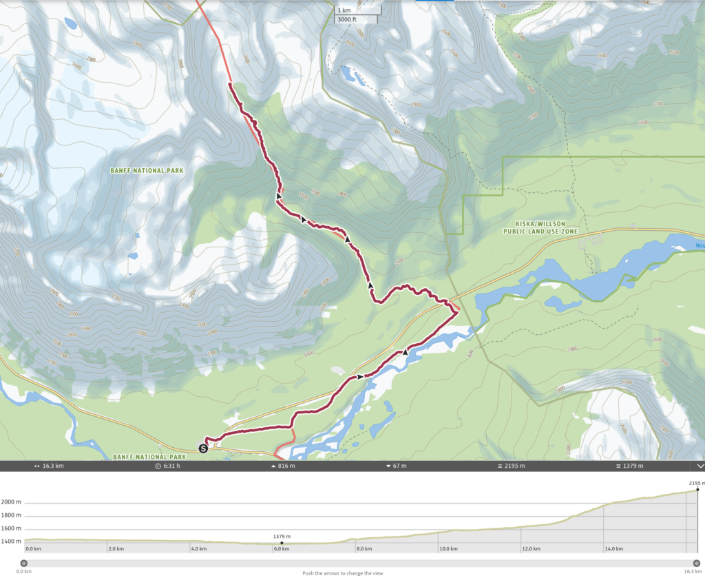
Day 1, August 11th, Saskatchewan River Crossing to Upper Reaches of Owen Creek. 16.5 km, 1000 m elevation gain, 100 m elevation loss, 6 hrs 30 min (Segment 24).

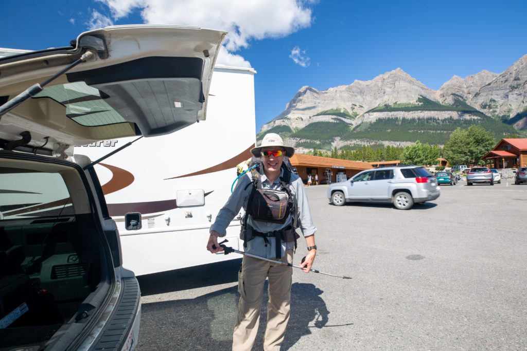
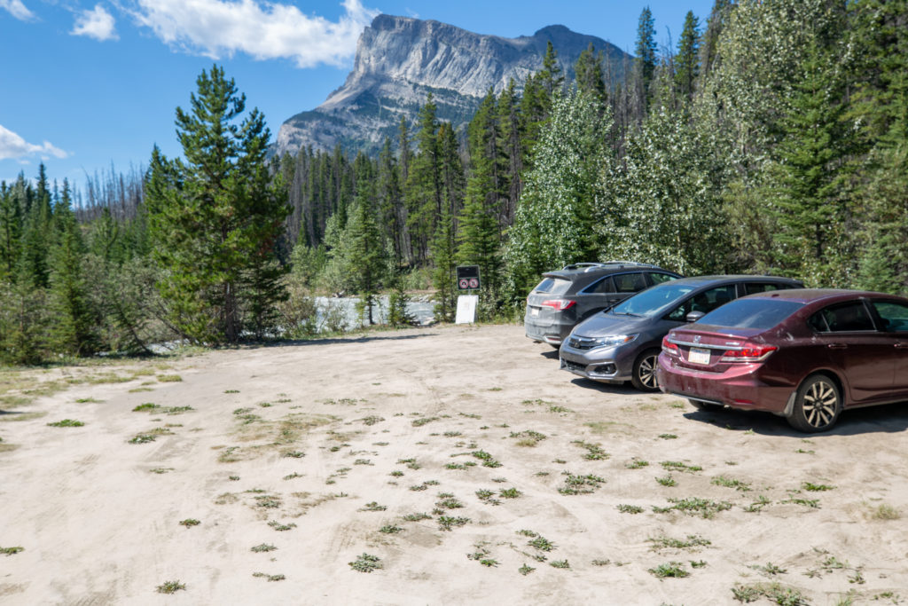
In my original itinerary the resupply at Saskatchewan River Crossing would have been at around 3 pm after hiking 20 plus kilometres earlier in the day. The plan was to have only a short hike afterward the resupply before setting up camp for the evening. Since this would now be my beginning of my trip leaving the Crossing much earlier than 4 pm would put me ahead of schedule. I did not feel I had to rush to get to the Crossing very early to have a good first day on the trail. Since it was a weekday Laura wanted to get some work done before driving out to the Crossing to drop me off. We left Canmore at about 10:30 am getting to the Crossing just after 12 pm. After eating lunch Laura took my photo and at 12:25 pm I was off.

Saskatchewan River Crossing, the start of the trip. Hiking pole is already a little bent.
Looking back to Saskatchewan River Crossing. Time to get my bearings on where to go.

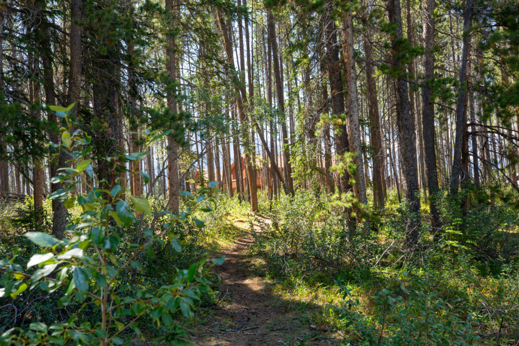
I headed out across the parking lot. I set a determined pace walking with purpose but I was actually quite unsure of where I should be exactly heading. After I the research I had done I had not looked at how to access the GDT from the Crossing. I tromped off into the trees behind the building on the east side of the parking lot and found a trail. Once I was out of sight of anyone I pulled out my tablet and checked my Viewranger App. The intrepid explorer I was needed some guidance just 200 m from the parking lot. The app showed a service road just up ahead that would lead directly to the GDT. Arriving at the road I decided that it did not look overly interesting opting instead for the trail that lead off to the west side.

The road to the left leads straight to the GDT so I took the trail to the right.

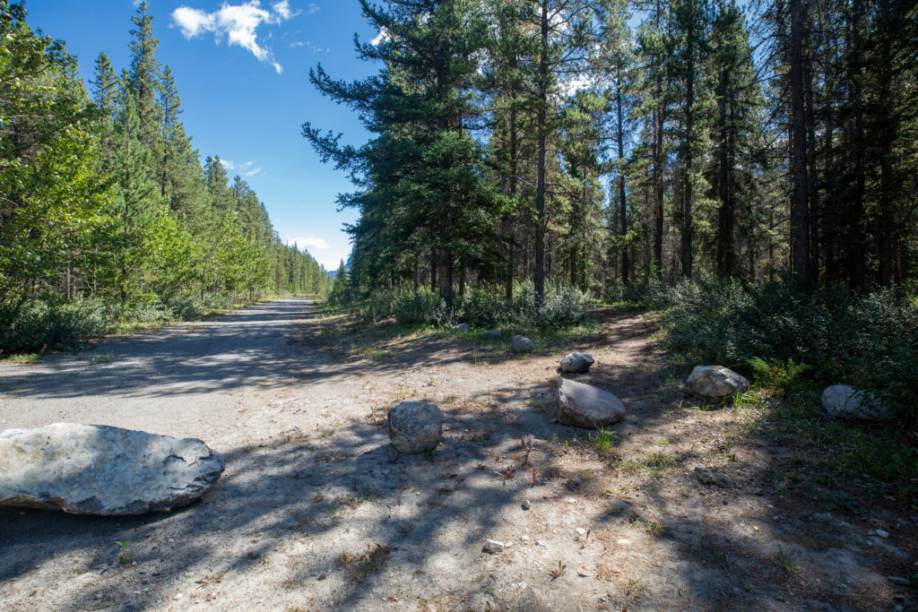
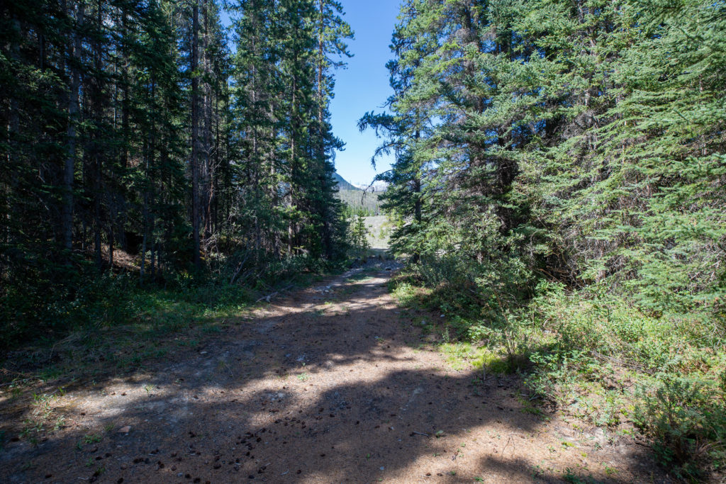
Ten minutes after leaving the car my trail ended at Hwy 11 right at the Parks Canada kiosk at the entrance to Banff National Park. I crossed over the highway and followed the side of the road until I met back up with the service road that I had avoided earlier. The service road was now less road like and more like a double track hiking trail. It was an uneventful 1.4 km to the junction with the GDT but now I felt that I was actually on my way and the feeling was great.

Where I came from.
Where I am headed
The old road that leads the GDT

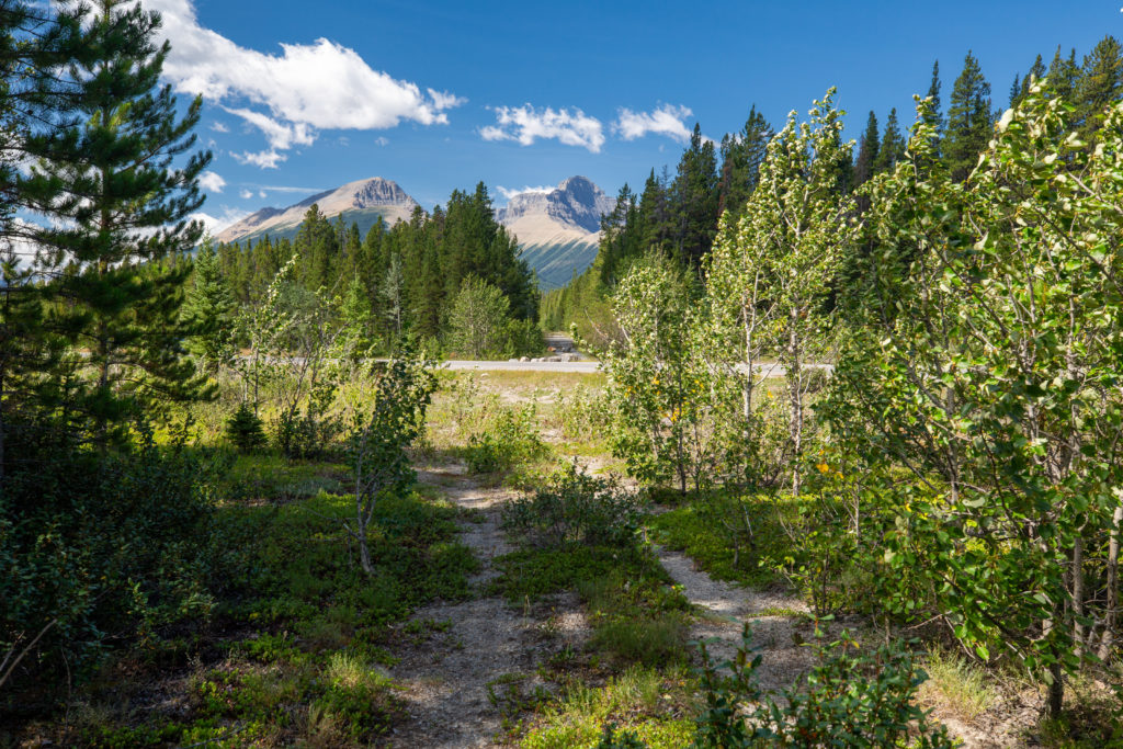
I arrived at the junction with the GDT after 30 minutes of flat, easy hiking covering 2.1 km. The junction was a slight let down as I was so excited to be getting back onto the GDT but the junction was quite nondescript.

Junction with the GDT

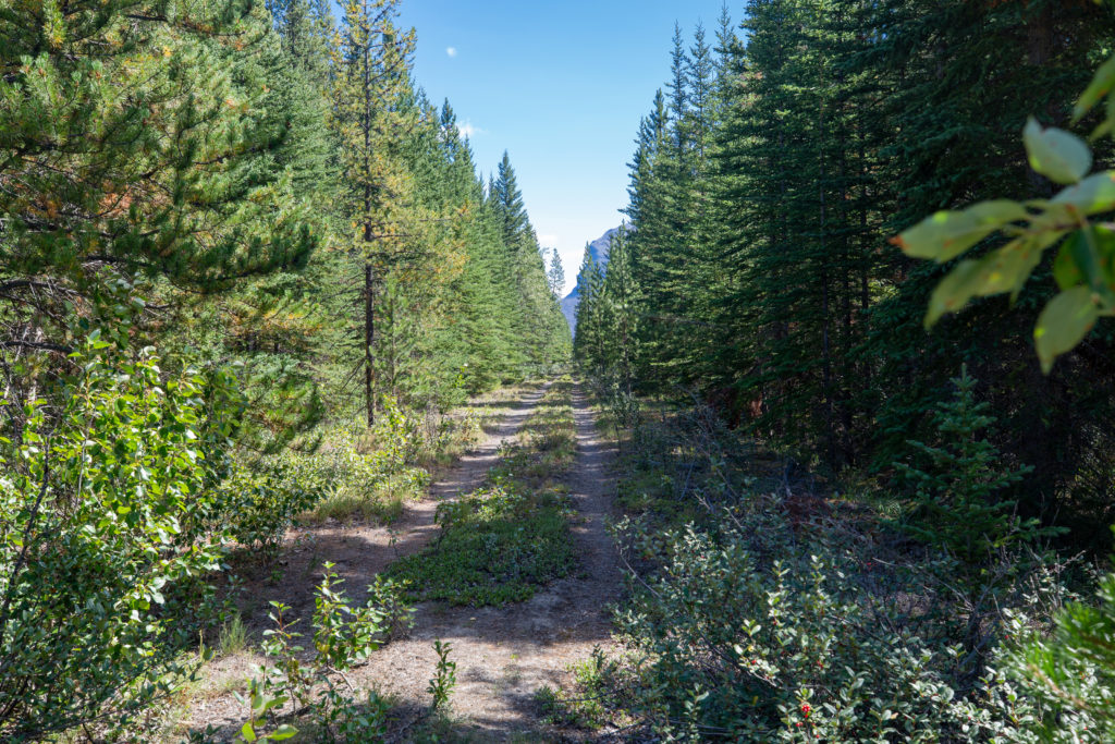
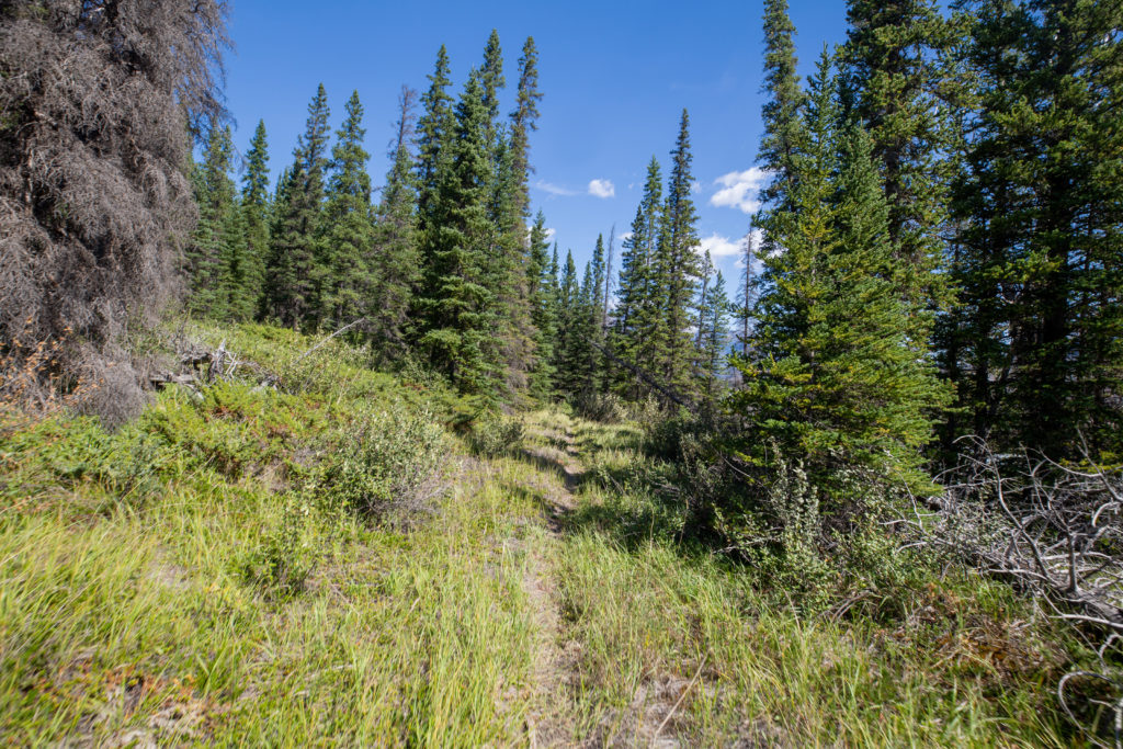
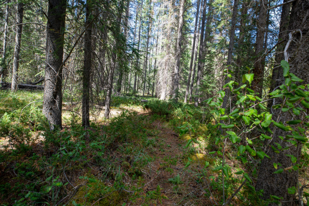
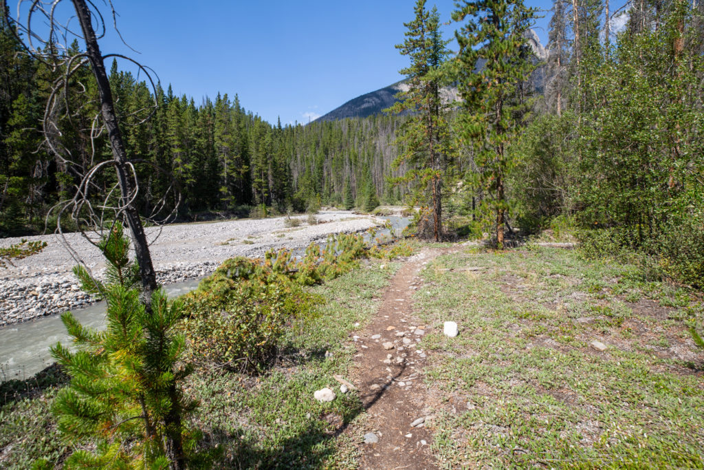
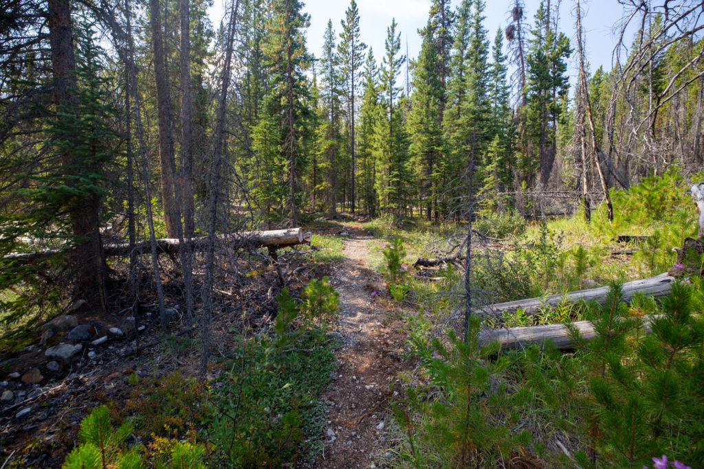
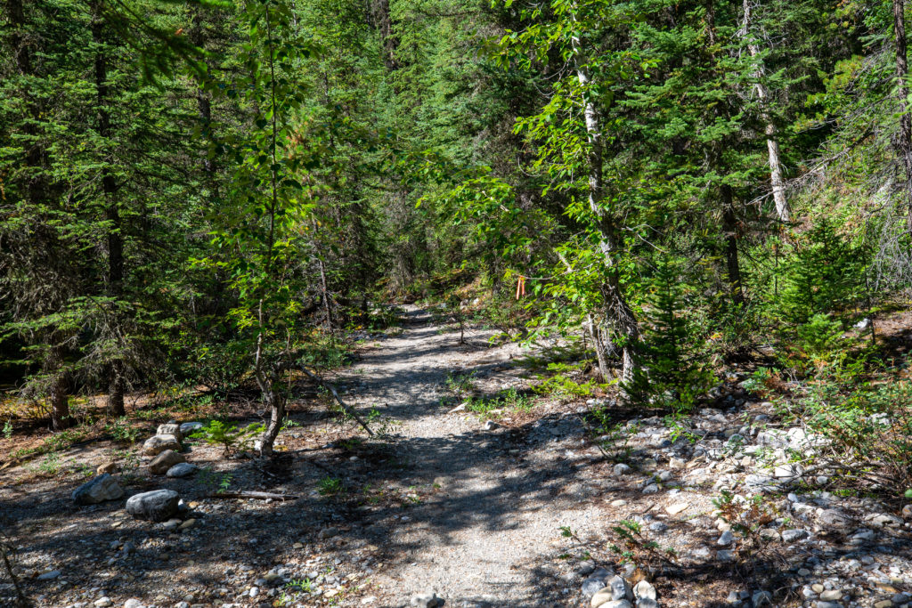
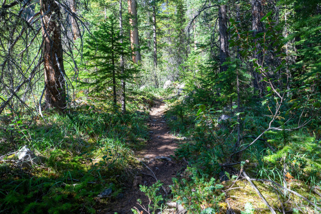
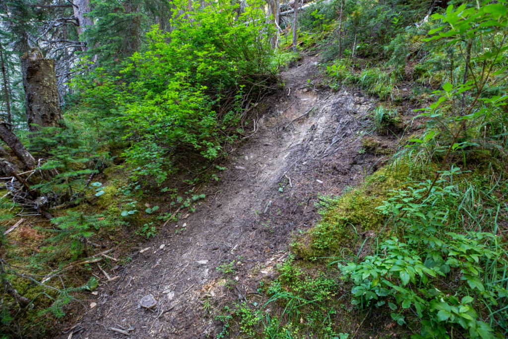
After shooting the video I headed off down the trail. It would be an easy 5 km walk to where I would cross Hwy 11 again and follow Owen Creek up and away from civilization. When compared to the long distance trails in the United States there is not a lot of traffic on the GDT. Typically there are only a handful of people moving down the trail on any given day. This difference was really driven home on this little section as the trail was very faint in parts and a couple of times disappeared altogether. The hike along the North Saskatchewan River was very pleasant and a good warm up to the elevation I would gain going up Owen Creek.

The slightly overgrown trail.
Momentarily back the road.
On a bluff above the North Saskatchewan River.
Flood plain of the North Saskatchewan River. Mt Sarbach (3150 m) in the distance, Mt Murchison (3333 m) across the river. The effects of the Spreading Creek Forest Fire of 2014 can be seen on the lower slopes of Mt Murchison.
The trail is easy to follow as it meanders back and forth away from the river.

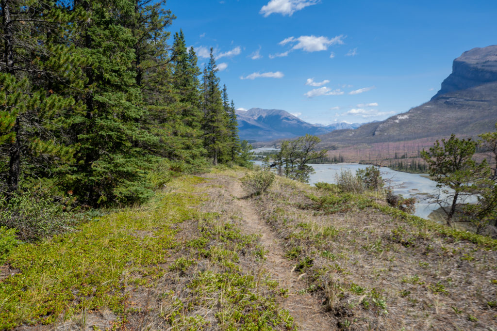
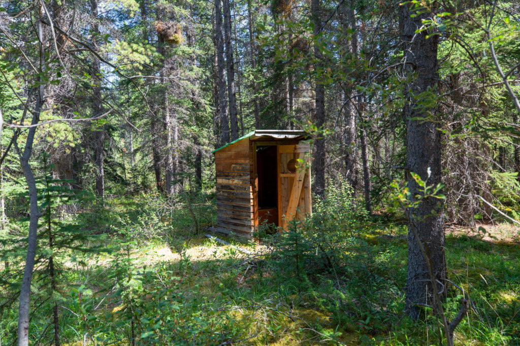
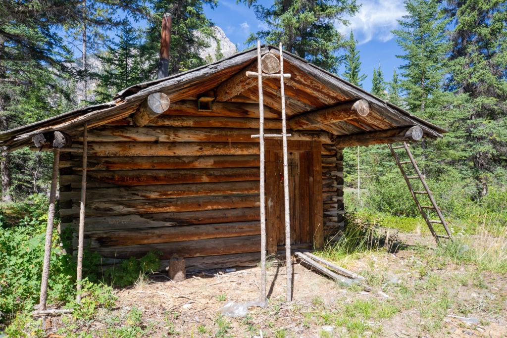
The arrival at Owen Creek was foreshadowed when I came across a random outhouse along the trail. Ten minutes later I arrived at Owen Creek and was greeted by a quite dilapidated old wooden cabin. The cabin had a lock on it but I explored around the outside. The area appeared to have been used recently as there was a fire pit that looked like it saw regular use. After snapping a few pictures I headed up Owen Creek which would be my constant companion for the rest of the day.

Random outhouse.
Cabin at Owen Creek. Looks a little rough.
Looking up Owen Creek.
Again the trail is quite faint.
Hwy 11 in the distance.

A few minutes after leaving the old cabin I came back to Hwy 11. I scampered up the embankment and crossed the highway for the second time. Heading down the embankment on the north side I came to the car park for the trail to Owen Pass. It was 2:05 pm I had covered a bit over 7 km in just 1 hr 40 min. I was pretty confident I would not be able to maintain that pace heading up the creek but it was a good start.

The parking lot on the north side of Hwy 11
One last flat section before starting the climb.

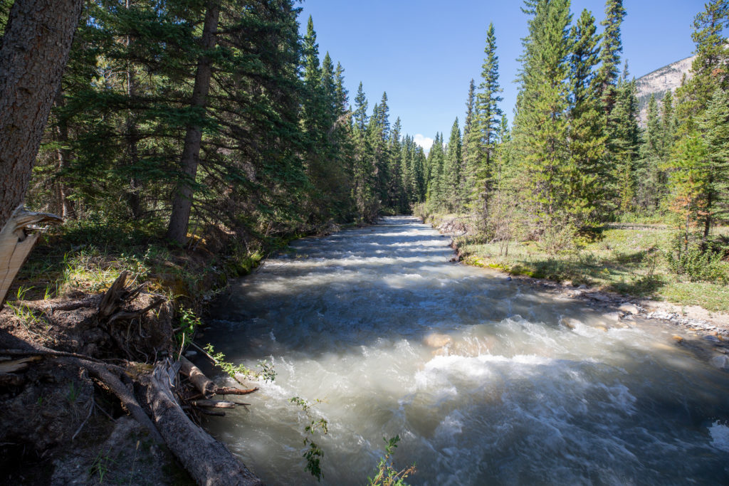
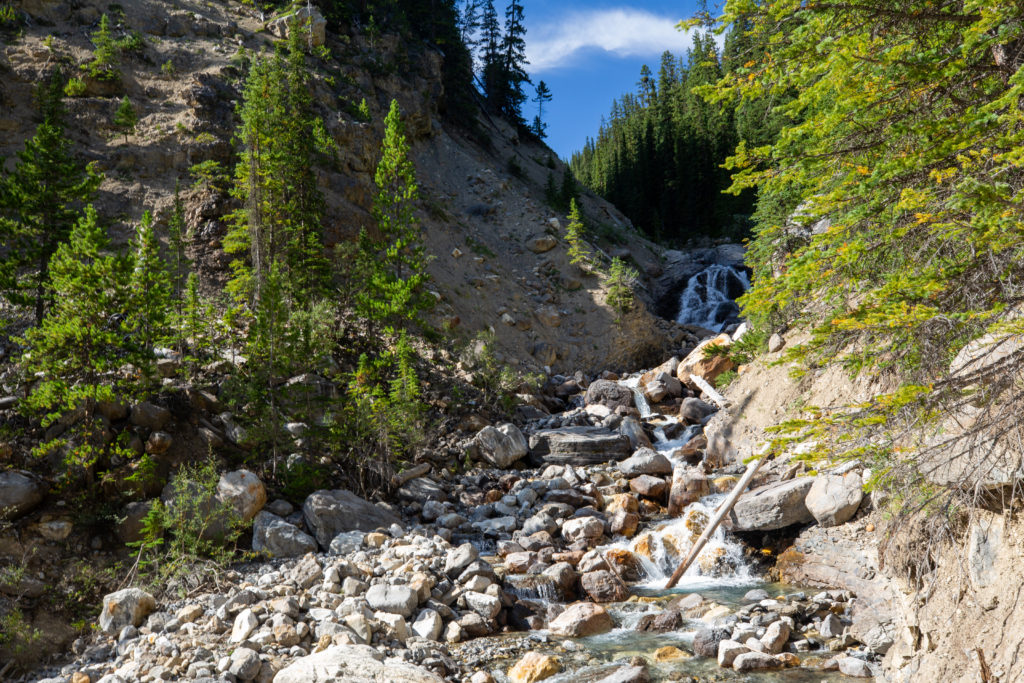
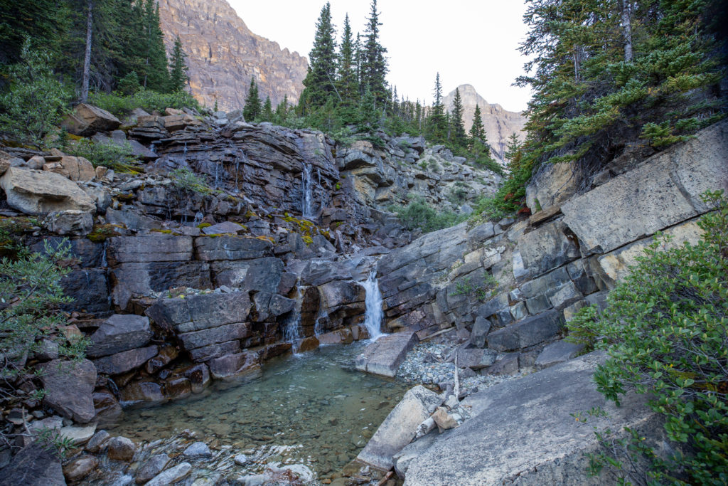
The initial hike up Owen Creek passed by a stunning gorge. There was a small climb that took me to the top of the gorge allowing for stunning if not hair raising views down to the creek far below. At the head of the gorge was a lovely little waterfall.

The end (or beginning) of the gorge.
Heading uphill.
Looking down.
Love the tree growing on the rock that is wedged into the gorge.
Looking way down.
That is a lot of erosion.
The waterfall at the head of the gorge.

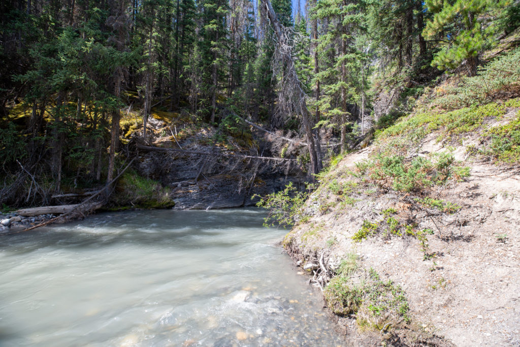
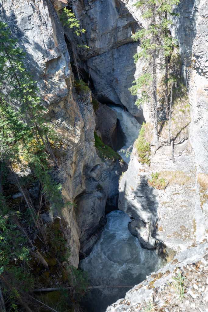
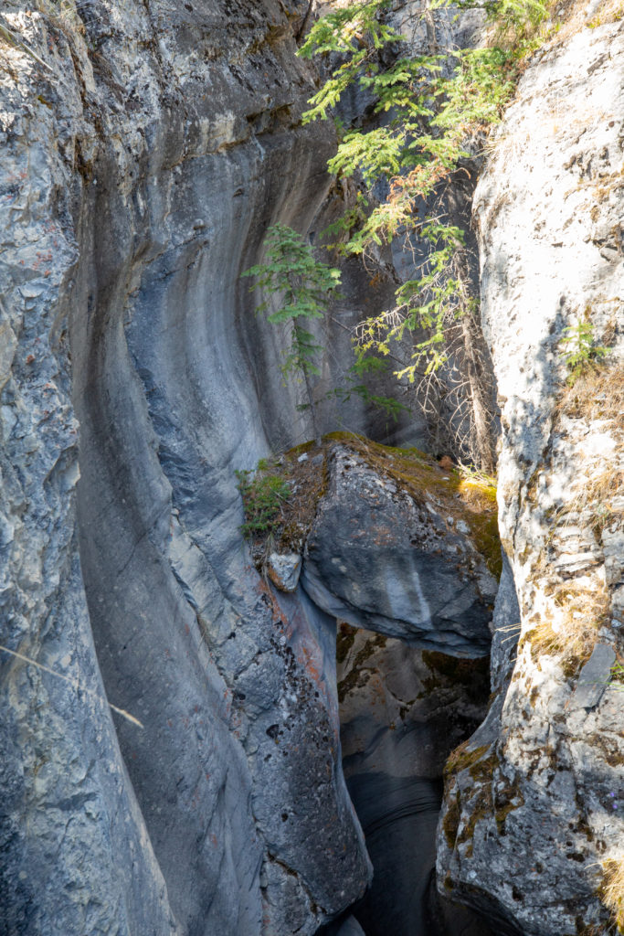
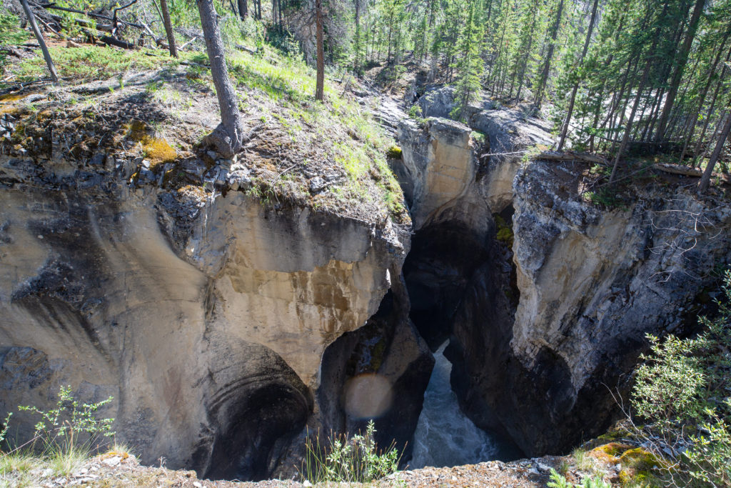
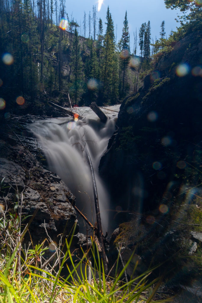
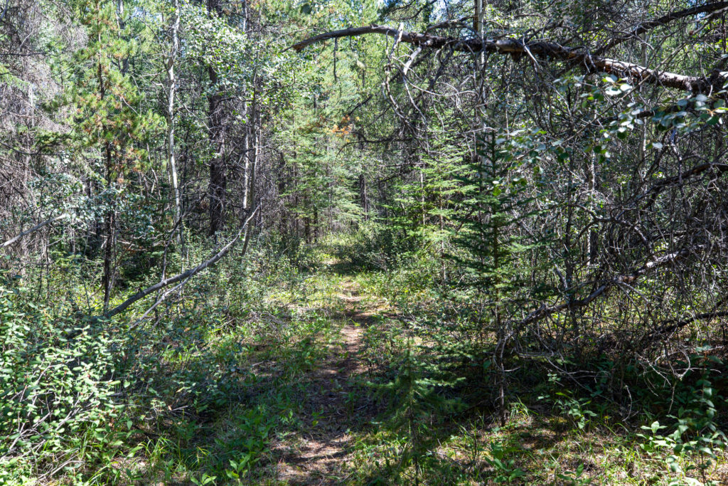
After the waterfall the trail flattened out and travel was easy. I came across another little canyon and rapids. I do enjoy the sound of tumbling water. Waterfalls may be loud but I find them peaceful.

Small canyon on Owen Creek.

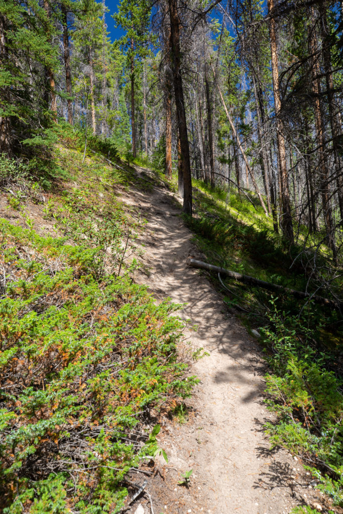
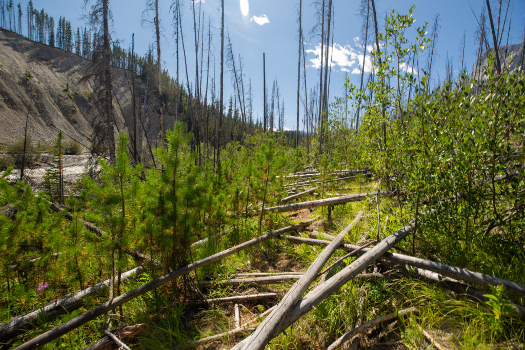
I only enjoyed a few minutes of the easy hiking before I came across a section dominated by blowdown of burnt trees. Not paying much attention I followed the trail into the heart of the blowdown. Negotiating all the downed trees was challenging so I decided that the best course of action was to return to the creek. Once back to the creek the hiking was much easier. I was somewhat annoyed at myself for getting off track.

A brief moment of excellent trail.
Does appear to be a trail through the blowdown, but it quickly got out of hand.
Just stay close to the creek to avoid the blowdown and a nice trail reappears.

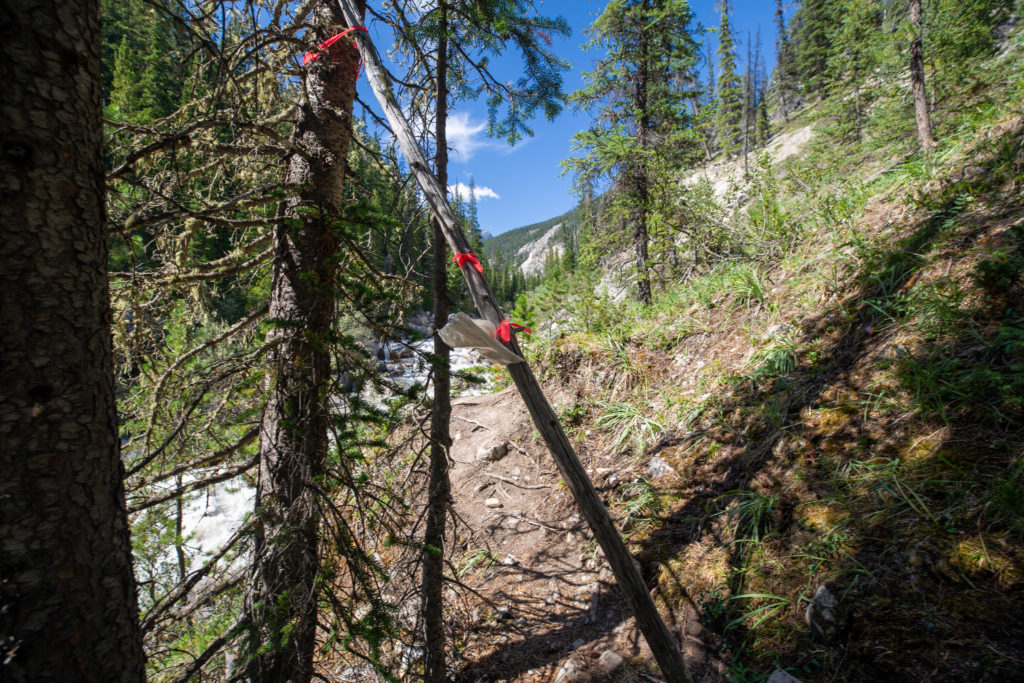
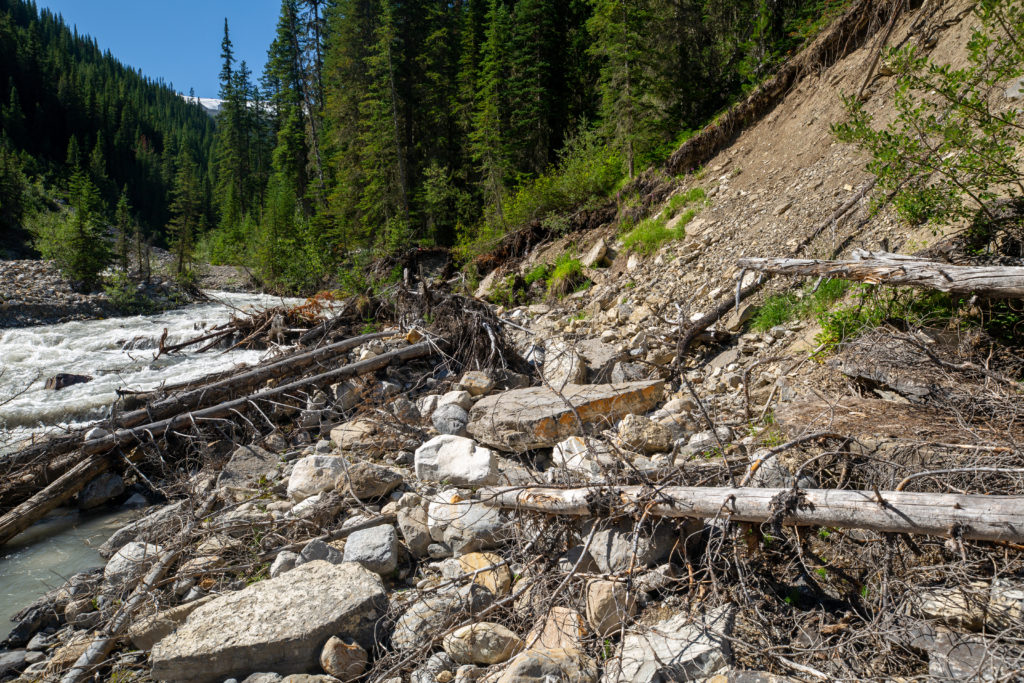
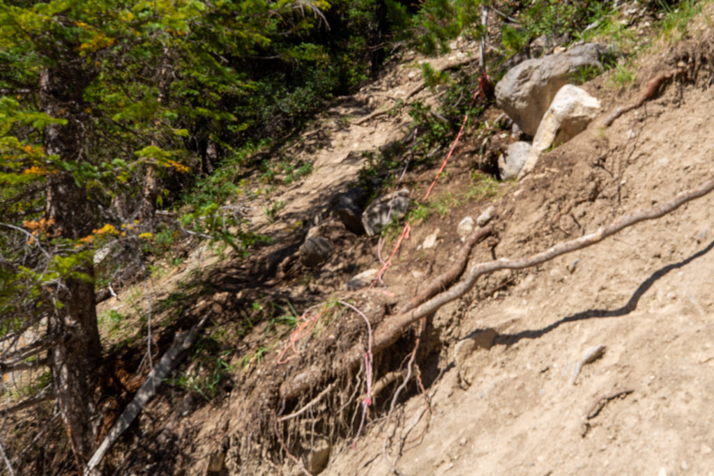
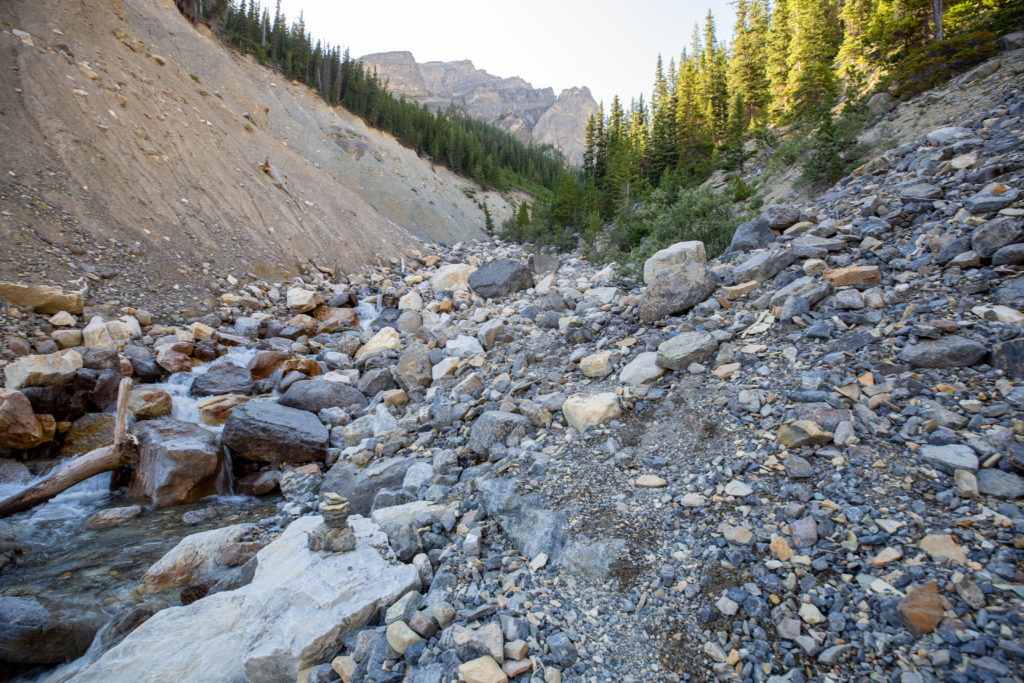
After some relatively easy hiking I entered an area where earlier in the hiking season people had challenges negotiating the trail due to high water flow, bank erosion and series of small land slides that had washed out the trail. I found a note left by couple of hikers who had taken the time to scout out and flag a route around a major wash out area. For me the water level was low enough that I was able to stay creek side and get passed the washout with little trouble.

Envelope with some friendly words of advice.
Amazing piece of trail intel. Was in an envelope at trail side and had survived quite a while.
Can understand how in high water flow this could be challenging.

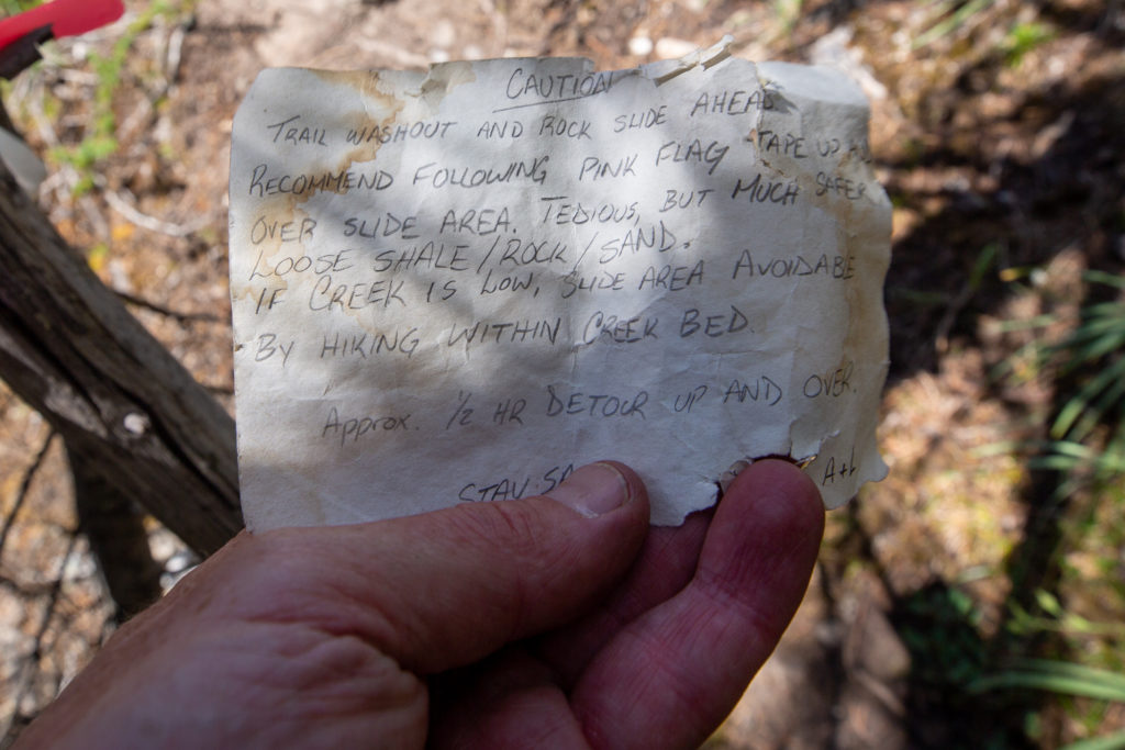
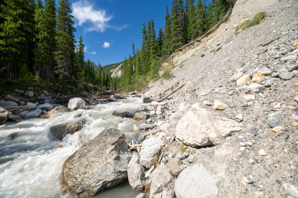
Despite the dire warning from the letter the water level in the creek was low enough that I had plenty of large boulders to step on. I worked carefully and slowly across the rock slide and made it to the other side without getting my feet wet.

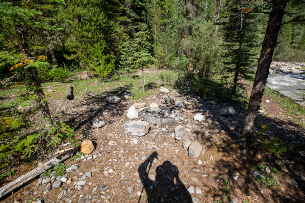
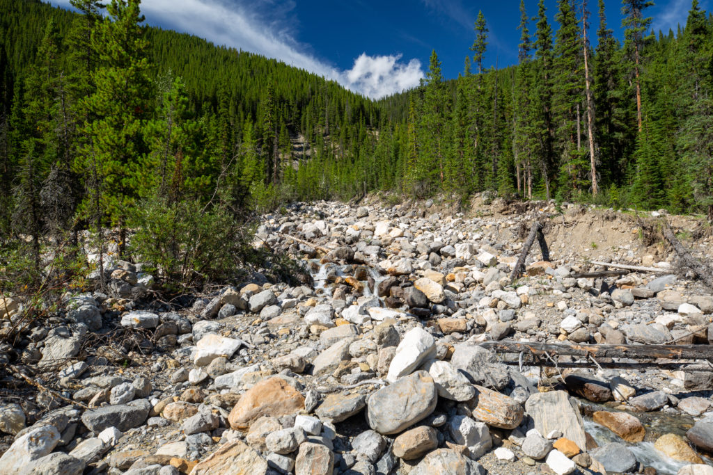
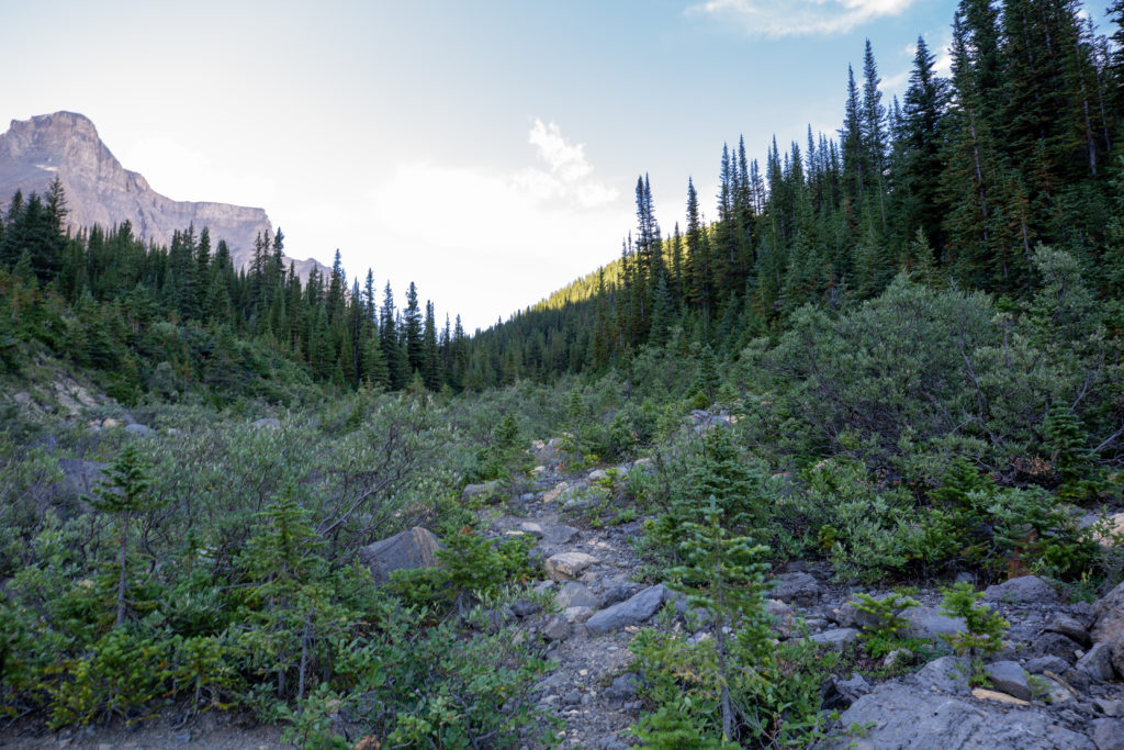
Progress was very good up to the confluence of the east and west fork of Owen Creek. I did come across a wild campsite just off the trail. Like every wild campsite that I would come across on the trip this one came complete with a fire ring.

Flat ground complete with fire ring.

A little while after the campsite I came across the orange flagging from the detour around the rock slide. It had taken me a little under 30 minutes to walk along the creek so I can only imagine how much time the detour would have added to the hike.

The flagging tape for the detour.
It was quite a detour.

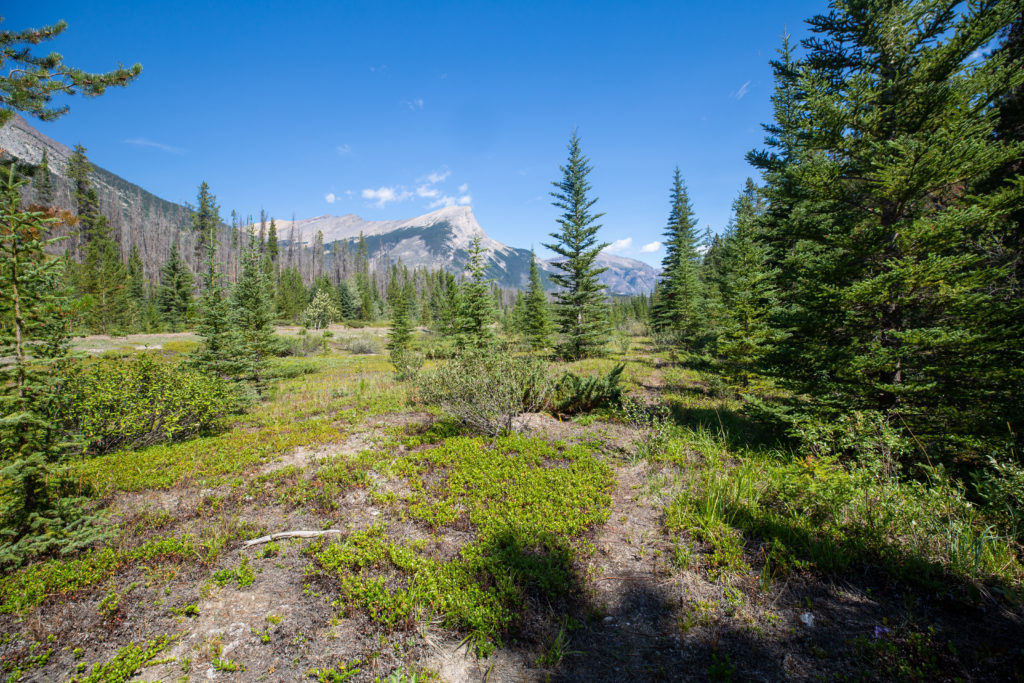
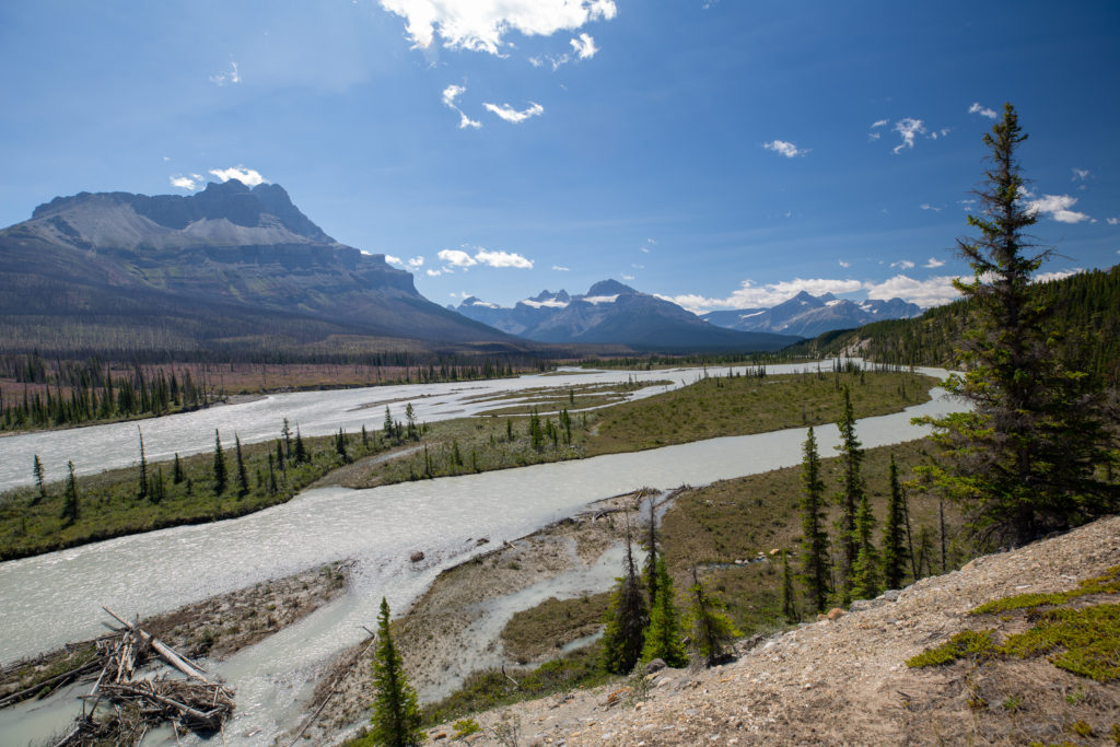
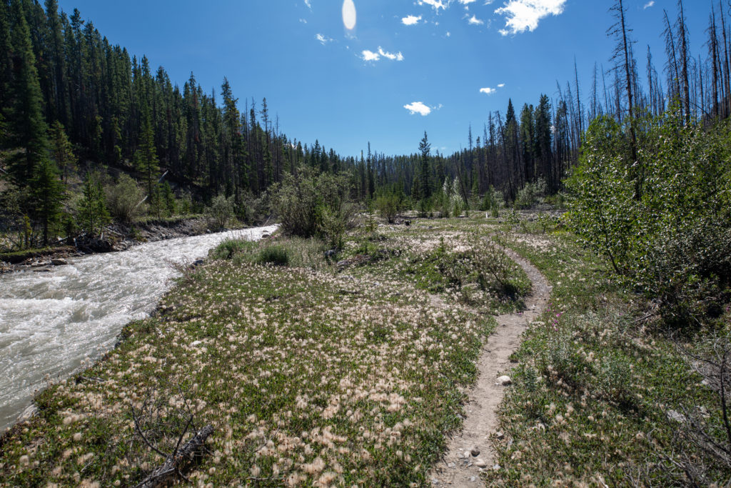
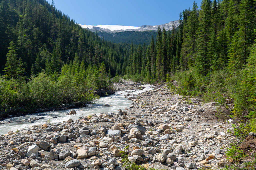
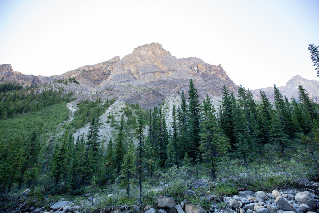
The approach to the confluence of the two upper creeks that combine to form Owen Creek provided a stunning view of Mt Wilson and the Wilson Icefield. The hiking trail was still a little hit and miss with small areas washed out but for the most part the going was easy.

Mt Wilson (3260 m) and the Wilson Icefield.
Not a lot of trail here but just stay on the right (east) bank and it was not too bad.

Just prior to arriving at the confluence I found a small side stream with clear water to refill my water bladder. Since I knew I would be hiking up a creek I had gone a little light on my water when I began the hike. I had figured there was no point in carrying extra weight when I could refill at any time. One flaw with that philosophy was that the creek was very silty. It took a while to find but I did find a side stream that lovely clear water. I was using a Platypus style water bladder that only had a very small opening for filling. This works great at home with a tap but it is challenging on the trail trying to get the water to flow into the small opening. I had discovered that you can purchase water bladders with a fully opening resealable top so I took the idea and modified my Platypus. I sliced the top of the Platypus off and affixed velcro to the opening so I could fold over the top and reseal. The modified bladder worked very well when refilling but it did not seal 100%. To avoid the bladder leaking all over my pack I just had to be careful how I put my pack down. I would call the experiment a win although the amount of benefit the open top provides is debatable. Later on during the trip Micah would just refill their identical bladder using their mug and it really was not a big deal.

Refilling my bladder from a small creek.

Arriving at the confluence I was greeted by an expansive debris field. The creek appeared to be about 100 m across but there was no water to be seen anywhere. I could not find the trail in the trees along what would be the shoreline so I just started rock hopping up the creek. Luckily for me after about 10 minutes of slogging up the creek I spied a trail off in the trees where the bank had been eroded away. The trail was quite good in the forest. There were a couple of washed out sections and a section of side slopping that would not be fun in the rain. At the end of one washed out section someone had attached a rope to aid in climbing up a short but steep section. I am not sure you should really trust a random rope tied to what you are not sure of but I did use the rope to help me up and back onto the trail.

The mess at the confluence. The scale of the rocks can be seen by comparing the trunks of trees lying across the creek.
A lovely forested trail.
The rope. It is a lot steeper than it looks.

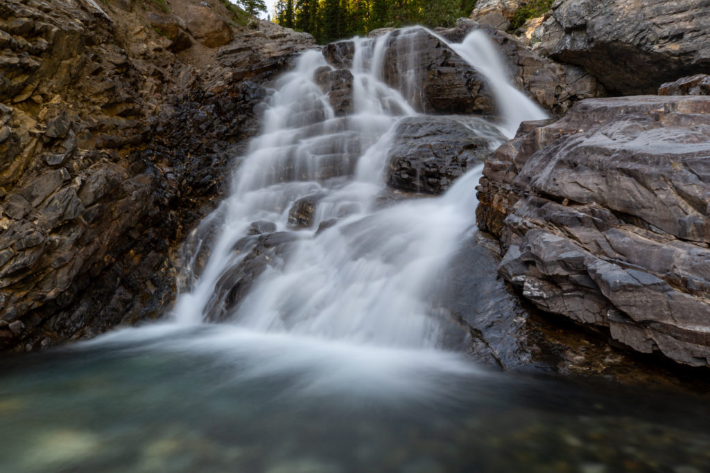
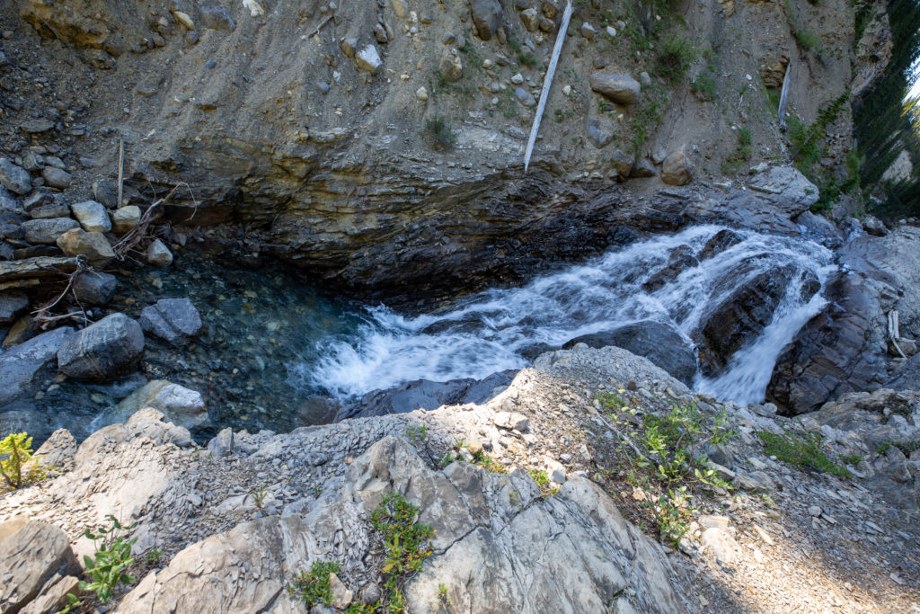
Just a few minutes after the rope section the creek runs up alongside a shoulder of Mt Wilson creating a valley and a little waterfall. As anyone who has hiked with me knows I love a good waterfall. Feeling good about my progress I stopped to take some long exposure pictures using my tripod. It would be about 15 minutes before I put my pack back on to resume my hike.

A waterfall in the shade. Great candidate for long exposure photos.
Waterfall upper reaches of Owen Creek.
Looking down at the waterfall from where I left my pack. I was smart enough to not try and climb up.

It was 5 pm when I left the waterfall. The first campground mentioned in guidebook was 400 m past the waterfall but I never found it. My hiking pace became much slower. The slope had grown much steeper and the trail quite rugged. The trail was tightly contained in a small drainage and passed over several small cliffs complete with waterfalls. It was starting to get a little late and my focus had switched from photography to finding a campsite. There was one very boggy section where water was seeping out from a bank. There was no dry way across so I headed into the mud and nearly fell over immediately. I stabbed my pole into the ground and held my balance but bent my pole almost into a J shape. Luckily I have aluminum poles so I just straightened it.

Back on the trail. This was quite steep.
More of a route than a trail at times but I was never in doubt on where to go.
The cliff above me would continue almost unbroken until Pinto Lakes. Dustin Lynx refers to the cliff in his guidebook and likens walking below it to the Rockwall in Kootenay NP.
The light is fading but there is no great place to pitch a tent.

I did meet one person on the trail a hunter hiking back down to the trailhead. We stopped and talked for a couple of minutes. He was hoping to make it passed the washout before dark. He also mentioned that that was a couple just a couple of kilometres ahead of me who were hoping to camp at a waterfall. He did not elaborate where the waterfall was. I did meet them the next day as they were leaving Michelle Lakes.

Pretty waterfall.

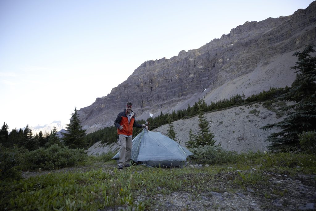
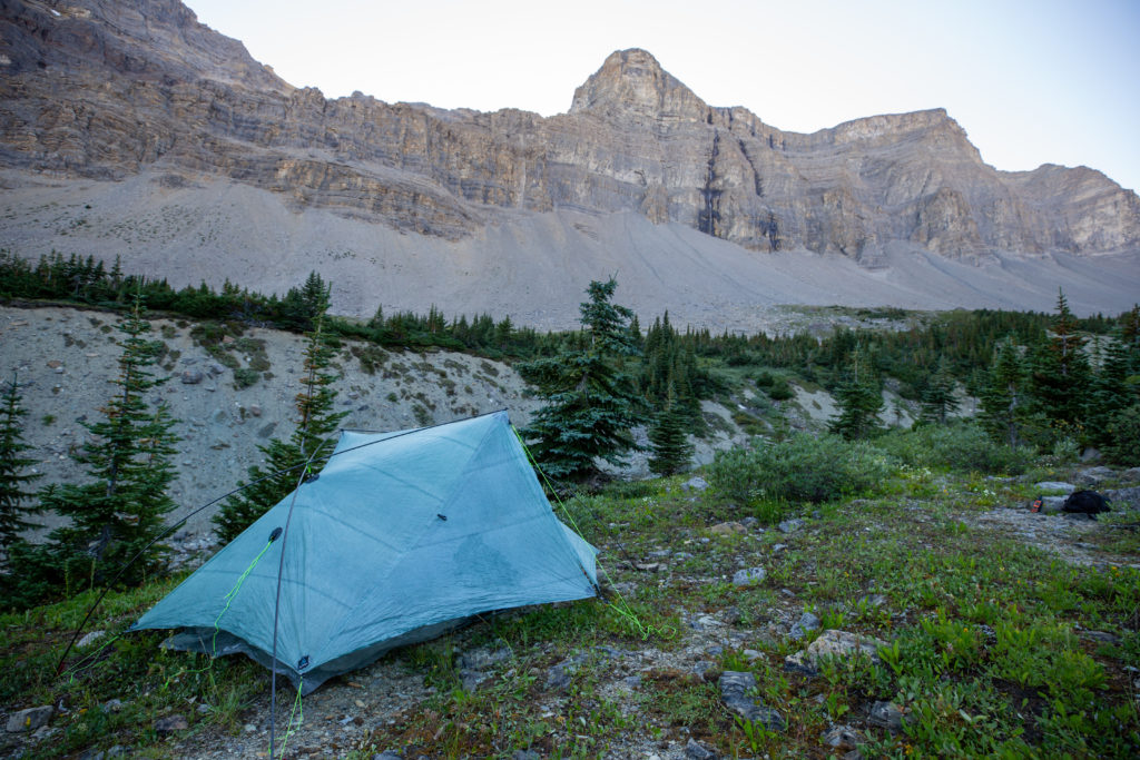
I found a campsite right beside the river about 2 km from the the original waterfall. I decided to not stay there as it was actually quite sheltered and I wanted a clear view of the sky to view the Perseid Meteor shower that would be on display over the next several nights. As I was approaching tree line I thought I would look for a a fairly open spot with a good view of the sky. The creek was now flowing in a small valley with a bench up a small embankment. I wandered up to the bench and started to look for a flat place to pitch my tent. At 6:55 pm I settled on a spot and declared I that was done for the day. In my video blog I did mention that I felt that the section above the confluence was one of the most challenging backpacking hikes I had done. It had taken me 2hrs 20 min to hike the 4.2 km from the confluence to where I set up camp. The daily total was 6.5 hrs to hike 16.2 km with about 900 m of elevation gain.

Home for the evening. Owen Creek is just down the slope from the tent.

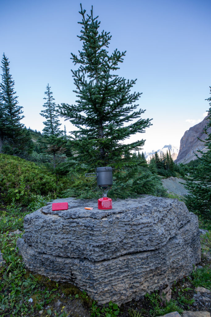
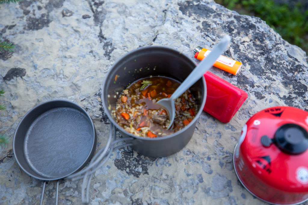
It took me a little while to get the tent set up and dinner on the go. The tent was set up by 7:30 pm and I was eating dinner by 7:45 pm.

My kitchen.
Dinner. Was really good.

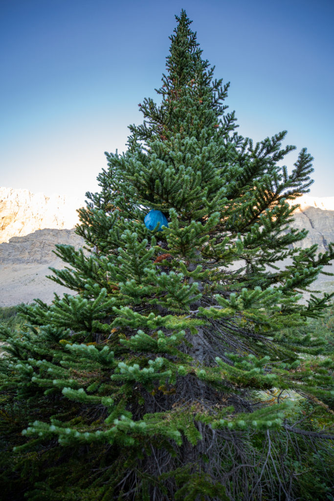
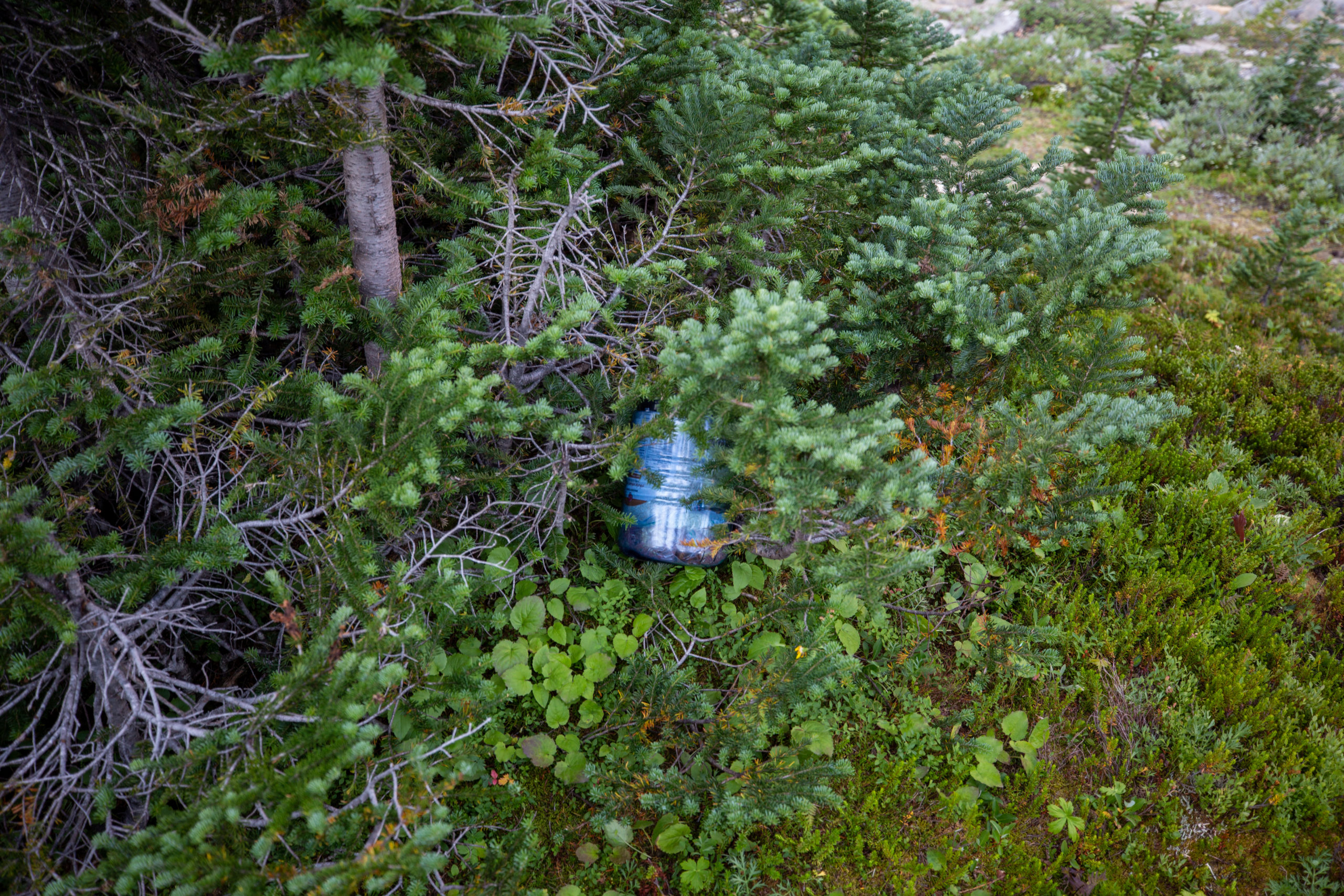
One drawback of camping near treeline was the lack of tall trees for my bear hang. I was carrying 11 days of food and supplies and the bear canister I had just could not hold all food and smellables. I supplemented the bear canister with a my Zpacks Bear Bag. I did find a somewhat suitable tree and hung my bear hang the best I could. The bear canister is so easy I just tossed it into the branches at the base of the tree.

Food storage.

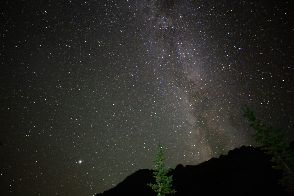
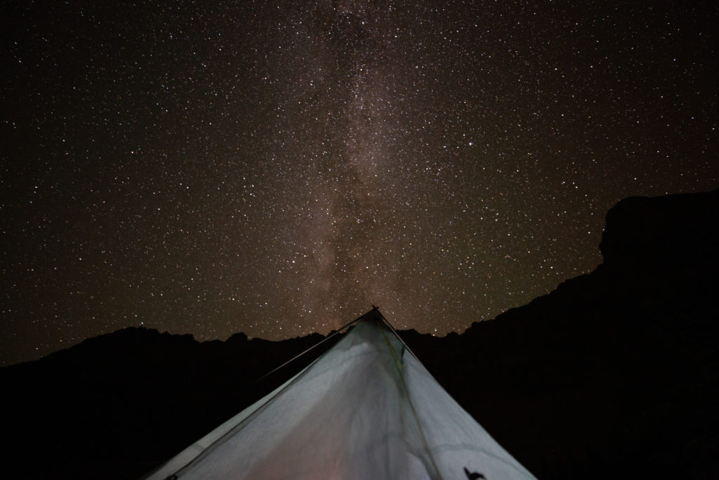
I crawled into the tent at about 8:30 pm. I only had a very short day tomorrow about 5 km. I did wake up and take some pictures of the night sky and mess around taking some pictures of the tent and the Milky Way. I did not get any meteor shots on this night but they did come by every couple of minutes. I will never tire of see the stars overhead. It is just an amazing feeling to see the universe lit up so clear away from the ambient light of home.

Summary of the day.
Time for me and Frosty to head to bed.
Milky Way.
My Tent and the Milky Way.

Day 2 GDT Section E 2021

GDT Section E 2021 (aborted Section D) Home

bootwreckers

Day 3 of my New Years adventure in Arizona up on B Day 3 of my New Years adventure in Arizona up on Bootwreckers, see link in bio.

Hiked the Superstition Ridgeline Trail, 23 km of some very rough terrain.

The views from the ridge were spectacular. The trail is more of a route, then a trail. I got off trail a half a dozen times just on the ascent to the ridge. Sprinkled in for fun where several down climbs where I had to drop my poles before climbing down a small chimney or crack.

There is camping possibilities on the ridge and I do wish I would have camped just before Syphon Draw and enjoyed the sunset. Maybe next time.

This was a very challenging 10.5 hrs on the trail, one of my hardest days ever, but worth every drop of sweat.

Till next time Arizona.

#nationalparks, #slotcanyon, #hiking, #hikingadventures, #familytime, #camping, #campingadventures, #outdoors, #outside, #nature,  #FIndyourpark #landscape #landscapephotography #optoutside #nationalpark #desertphotography #grandcanyon #grandcanyonnationalpark #grandcanyonassociation #nationalparkweek #reichallenge #nationalparksweek #rightnow #nationalparktrust #goparks #aztrails
Even in the smoke, there is nothing like hiking in Even in the smoke, there is nothing like hiking in the Canadian Rockies.

On the way to Pinto Lake, going over Sunset Pass with Tuft Peak in the distance.

#parkscanada #parks #bcparks #trails #longdistancehike #longtrail #outdoors #outside #thruhike #hike #thruhiking #outside #backpacking #waterfalls #waterfall #naturephotography #naturephotography #nationalparks #alberta, #albertaparks
Day 2 of my New Years Arizona Adventure is posted, Day 2 of my New Years Arizona Adventure is posted, see link in bio.

Fun and easy day exploring the Superstitions with my four new friends. Lots of varied terrain and lots of breaks. Will make up for that on Day 3.

I did run out of superlatives to describe the scenery, in one word it was simply spectacular!

#nationalparks, #slotcanyon, #hiking, #hikingadventures, #familytime, #camping, #campingadventures, #outdoors, #outside, #nature,  #FIndyourpark #landscape #landscapephotography #optoutside #nationalpark #desertphotography #grandcanyon #grandcanyonnationalpark #grandcanyonassociation #nationalparkweek #reichallenge #nationalparksweek #rightnow #nationalparktrust #goparks #aztrails
Day 1 of a fun two day trip out to Pinto Lake over Day 1 of a fun two day trip out to Pinto Lake over Sunset Pass.

It was a little smokey but as you can see from the first photo the views were spectacular.....

The little dot in Photo 9 is a Common Loon, and entertained us for several minutes swimming across the lake and diving for fish.

Big thanks to @kbsymington , @sio.mellors , Kylie and Charlie for making it such an awesome trip.

#parkscanada #parks #bcparks #trails #longdistancehike #longtrail #outdoors #outside #thruhike #hike #thruhiking #outside #backpacking #waterfalls #waterfall #naturephotography #naturephotography #nationalparks #alberta, #albertaparks
Day 1 of my 2023 New Years Arizona Adventure is up Day 1 of my 2023 New Years Arizona Adventure is up on Bootwreckers,  see link in bio.

Day started off rainy, see photo 2, but the clouds cleared off by 8 am and I finally got my hike started.

The day wasn't without adversity as I slipped chasing my water bottle in a stream and fell in the water. My camera got flooded and stopped working so the rest of the photos were taken on my aging BlackBerry Key 2.

Met up with a group of 4 med students and hiked with them for two days.

Despite the ruined camera was a super fun day on the trail in a new place. 

#nationalparks, #slotcanyon, #hiking, #hikingadventures, #familytime, #camping, #campingadventures, #outdoors, #outside, #nature,  #FIndyourpark #landscape #landscapephotography #optoutside #nationalpark #desertphotography #grandcanyon #grandcanyonnationalpark #grandcanyonassociation #nationalparkweek #reichallenge #nationalparksweek #rightnow #nationalparktrust #goparks #aztrails
It took a while but finally posted the intro to my It took a while but finally posted the intro to my New Years trip to Arizona, see link in bio.

I was greater in Arizona to 18C weather followed quickly by near freezing temperatures and the most rain in the Phoenix area in one day since 1906!

My trip went from Plan A, 4 days on the Arizona Trail,  through Plans B, C and Finally D.

Was a fun if sometimes frustrating adventure.

#nationalparks, #slotcanyon, #hiking, #hikingadventures, #familytime, #camping, #campingadventures, #outdoors, #outside, #nature,  #FIndyourpark #landscape #landscapephotography #optoutside #nationalpark #desertphotography #grandcanyon #grandcanyonnationalpark #grandcanyonassociation #nationalparkweek #reichallenge #nationalparksweek #rightnow #nationalparktrust #goparks #aztrails
Day 3 of Rockwall 2022 is up on Bootwreckers, see Day 3 of Rockwall 2022 is up on Bootwreckers,  see link in bio.

Sweet little day up and over Tumbling Pass with and a long view of Tumbling Glacier. 

The weather cooperated with blue skies and no threat of rain so we were able to linger at The Glacier before heading down the long descent to the car.

While a straightforward day there were still some adventures to be had, but you have to read about them on the blog.

Big thanks to my amazing hiking partner, @sio.mellors

Looking forward to our 3 day adventure this summer, which will no doubt generate more stories to tell.

#parkscanada #parks #bcparks #trails #longdistancehike #longtrail #outdoors #outside #thruhike #hike #thruhiking #outside #backpacking #waterfalls #waterfall #naturephotography #naturephotography #nationalparks
Day 2 of our Rockwall 2022 trip is posted on Bootw Day 2 of our Rockwall 2022 trip is posted on Bootwreckers, see link in bio. With @sio.mellors

This day was Helmet Falls CG to Tumbling Creek CG.

Day started off beautiful with blue skies which turned to rain after lunch. Somehow through all the rain and thunder Siobhan  never lost her smile.

The day ended with beers and Siobhan giving butt rubs to the doggies in camp.

Photo 1 Siobhan taking in the Rockwall at lunch

Photo 2 Helmet Falls at Golden hour

Photo 3 me and my morning coffee waiting for Siobhan to wake up

Photo 4 on the way up Siobhan with Limestone Peak in th background 

Photo 5 Siobhan at Rockwall Pass (can you tell?)

Photo 6 Siobhan near Wolverine Pass with Rockwall Peak shrouded in clouds

Photo 7 Tumbling Glacier through the clouds

Photo 8 setting up camp

Photo 9 Dinner time

Photo 10 butt rubs

#parkscanada #parks #bcparks #trails #longdistancehike #longtrail #outdoors #outside #thruhike #hike #thruhiking #outside #backpacking #waterfalls #waterfall #naturephotography #naturephotography #nationalparks
New trip posted, three day trip in the Rockwall in New trip posted, three day trip in the Rockwall in Kootenay NP with @sio.mellors. Introduction and Day 1 up on Bootwreckers.

Trip was suppose to be hiking Northover Ridge in Kanananaskis but smoke had us change plans at the last minute.

This would be my third multi day trip on the Rockwall but the first for Siobhan.

Managed to get two camping sites on the Rockwall and instead of smoke we had to deal with the threat of rain.

We did get wet but we had a blast.

Day 1 is from Paint Pots TH to Helmet Falls CG, with a side trip to get up close the the falls. Pretty straightforward day but visiting Helmet Falls is always special.

#parkscanada #parks #bcparks #trails #longdistancehike #longtrail #outdoors #outside #thruhike #hike #thruhiking #outside #backpacking #waterfalls #waterfall #naturephotography #naturephotography #nationalparks
The sixth and final day of our 2022 GDT Section D The sixth and final day of our 2022 GDT Section D hike is up on Bootwreckers, see link in bio.

This day took us from a random camp on the Howse Floodplain to the Mustafa Canyon parking lot. This was an adventurous day with bushwhacking, stream crossings and dead fall but a simply glorious end to a wonderful hike on the GDT. 

Again thanks  to Sara (@sd_kuz) and Lillian (@waterlilizee) for sharing this adventure with me. I am sure we will meet again on a trail someday.

Photo 1 - Morning Colors

Photo 2 - tents on the floodplain

Photo 3 - bushwhacking to start the day

Photo 4 - fields of flowers going to seed

Photo 5 - looking south down the Howse River

Photo 6 - thigh deep water crossing

Photo 7 - big views

Photo 8 - Sara crossing some dead fall

Photo 9 -Mistaya Canyon

Photo 10 - picked up a thru hiker named Roy, enjoying beverages left by Natasha and Kyle from Backpacks and Bikeracks

#greatdivide #greatdividetrail #gdt #parkscanada #parks #bcparks #trails #longdistancehike #longtrail #outdoors #outside #thruhike #hike #thruhiking #outside #backpacking #waterfalls #waterfall #naturephotography #naturephotography #nationalparks #duplex #sectionhike #sectionhiker
Day 5 of our 2022 Great Divide Trail Section D hik Day 5 of our 2022 Great Divide Trail Section D hike is posted on Bootwreckers, see link in bio.

Truly epic day on the trail. Pass through the debris of two avalanches, had lunch by a waterfall, crawled over so much dead fall and hiked on the Howse Flood Plain.

The sunset on the flood plain was one of most magical I have seen.

As always a big thanks to Sara (@sd_kuz) and Lillian (@waterlilizee) for sharing this adventure with me. The Team totally rocked the trail.

#greatdivide #greatdividetrail #gdt #parkscanada #parks #bcparks #trails #longdistancehike #longtrail #outdoors #outside #thruhike #hike #thruhiking #outside #backpacking #waterfalls #waterfall #naturephotography #naturephotography #nationalparks #duplex #sectionhike #sectionhiker
Evening light on Picketpost Mt. #aztrail #aztasso Evening light on Picketpost Mt.

#aztrail #aztassociation  #nps, #nationalparks, #slotcanyon, #hiking, #hikingadventures, #familytime, #camping, #campingadventures, #outdoors, #outside, #nature,  #FIndyourpark #landscape #landscapephotography #optoutside #nationalpark #desertphotography #grandcanyon #grandcanyonnationalpark #grandcanyonassociation #nationalparkweek #reichallenge #nationalparksweek #rightnow #nationalparktrust #goparks #aztrails
Arizona Trail Passages 14 and 15. Some photos of Arizona Trail Passages 14 and 15.

Some photos of my recent hike down a couple of Passages of the Arizona Trail. 

The trail is so diverse, rolling terrain cut by shallow washes leads to the expanse of the desert then into rugged canyons and tall peaks, all in a space of 92 km (58 miles).

Had a great time, some blisters gave me some concerns but they seem to be doing fine now that they are out of my hiking shoes.

Got lucky with Trail Magic courtesy of Condiments who drove his 4x4 deep into an unarmed wash, was really in the middle of no where, and then again at the start of Passage 15, missed the Trail Angel's name, the wind was so loud.

Like to thank my Trail Angels, Carole for driving me to Oracle to start the trip, with side trip to a Hayden Az, a real ghost town and to Edith for leaving a water cache for me at Passage 15.

Included a video of my time at the high point for Passage 15. My kid likes it when you stop and enjoy the view you earned, thought they would appreciate my effort in the face of 1000 mph winds (ok maybe thats a bit of an exaggeration).

Thanks Arizona and the AZT for providing more memories.

I will be back

#aztrail #aztassociation  #nps, #nationalparks, #slotcanyon, #hiking, #hikingadventures, #familytime, #camping, #campingadventures, #outdoors, #outside, #nature,  #FIndyourpark #landscape #landscapephotography #optoutside #nationalpark #desertphotography #grandcanyon #grandcanyonnationalpark #grandcanyonassociation #nationalparkweek #reichallenge #nationalparksweek #rightnow #nationalparktrust #goparks #aztrails
That sunset says when I wake up it will be time to That sunset says when I wake up it will be time to start my hike on the Arizona Trail, Passages 14 and 15

Love my little motel in Superior, Az, Copper Mt Motel. Has murals painted on all the buildings

Spied the Grand Canyon from the plane 

Adventure awaits 

#aztrail #aztassociation  #nps, #nationalparks, #slotcanyon, #hiking, #hikingadventures, #familytime, #camping, #campingadventures, #outdoors, #outside, #nature,  #FIndyourpark #landscape #landscapephotography #optoutside #nationalpark #desertphotography #grandcanyon #grandcanyonnationalpark #grandcanyonassociation #nationalparkweek #reichallenge #nationalparksweek #rightnow #nationalparktrust #goparks #aztrails
Frosty Paws all packed and ready for an adventure. Frosty Paws all packed and ready for an adventure.

Arizona Trail Passages 14 and 15 starting Sunday

Off weekend gooooooo!

#aztrail #aztassociation  #nps, #nationalparks, #slotcanyon, #hiking, #hikingadventures, #familytime, #camping, #campingadventures, #outdoors, #outside, #nature,  #FIndyourpark #landscape #landscapephotography #optoutside #nationalpark #desertphotography #grandcanyon #grandcanyonnationalpark #grandcanyonassociation #nationalparkweek #reichallenge #nationalparksweek #rightnow #nationalparktrust #goparks #aztrails
Last weekend before heading to Arizona for a four Last weekend before heading to Arizona for a four day adventure on the Arizona Trail.

I wonder if hiking in the 15 cm of fresh snow will be good prepared for hiking the deserts of Passages 14 and 15?

#aztrail #aztassociation  #nps, #nationalparks, #slotcanyon, #hiking, #hikingadventures, #familytime, #camping, #campingadventures, #outdoors, #outside, #nature,  #FIndyourpark #landscape #landscapephotography #optoutside #nationalpark #desertphotography #grandcanyon #grandcanyonnationalpark #grandcanyonassociation #nationalparkweek #reichallenge #nationalparksweek #rightnow #nationalparktrust #goparks #aztrails
Day 4 of our 2022 GDT Section D hike is up on the Day 4 of our 2022 GDT Section D hike is up on the website, see link in bio.

This was a truly epic day spent on the Amiskwi and Collie Creek Alternates.

The weather cooperated starting with a spectacular sunrise on the Mummery Glacier, rainbows and blue skies on the ridge.

We had a brief encounter with a little black bear who scampered quickly away. 

Finished off the day with a cold beer, Grizzly Paw Rutting Elk Red, that I had carried with me and it tasted great.

Easily one of th best days on the trail ever.

Again big thanks to Sara (@sd_kuz) and Lillian (@waterlilizee) for sharing this adventure with me. The Team totally rocked the trail.

#greatdivide #greatdividetrail #gdt #parkscanada #parks #bcparks #trails #longdistancehike #longtrail #outdoors #outside #thruhike #hike #thruhiking #outside #backpacking #waterfalls #waterfall #naturephotography #naturephotography #nationalparks #duplex #sectionhike #sectionhiker
Day 3 of our 2022 Section D hike is posted, see li Day 3 of our 2022 Section D hike is posted, see link in bio.

This was a shorter day, only about 17 km but took us from the end of the Kiwetinok Alternate up to Amiskwi Pass and then a beautiful meadow at the the base of the Amiskwi Ridge.

Photo 1 - morning sky

Photo 2 - on the Kiwetinok Alternate

Photo 3 - Kiwetinok Alternate

Photo 4 - break time at a stream crossing, Frosty Paws hanging in there

Photo 5 - Fireweed with a view down the Amiskwi Valley,

Photo 6 - fields of flowers as we approached Amiskwi Pass

Photo 7 - Yellow Columbine on the way up to Amiskwi Lodge

Photo 8 - Our camp in the meadow

Photo 9 - Setting sun

Photo 10 - one of the best adventure stories ever! True story of how three prisoners of war escaped and climbed Mt Kenya

Again big thanks to Sara (@sd_kuz) and Lillian (@waterlilizee) for sharing this adventure with me. The Team totally rocked the trail.

#greatdivide #greatdividetrail #gdt #parkscanada #parks #bcparks #trails #longdistancehike #longtrail #outdoors #outside #thruhike #hike #thruhiking #outside #backpacking #waterfalls #waterfall #naturephotography #naturephotography #nationalparks #duplex #sectionhike #sectionhiker
First two days of my 2022 Great Divide Trail Secti First two days of my 2022 Great Divide Trail Section D adventure are up on the blog, see profile for link.

Day 1 was from Burgess Pass Trail head to Yoho Lake Campground. A relatively short day but a good warm up for the rest of the trip.

Big thanks to Sara (@sd_kuz) and Lillian (@waterlilizee) for sharing this adventure with me. The Team totally rocked the trail.

Photo 1 - at Burgess Pass looking at Mt Wapta

Photo 2 - Flowers, it was a great time to hike to see all the flowers in August bloom

Photo 3 - Emerald Lake from up high

Photo 4 - at Yoho Pass, did I mention the flowers

Photo 5 - Duplex tent all set up with Frosty Paws on guard, and oh ya, more flowers

Photo 6 - the north end of Wapta Mt as seen from Yoho Lake.

Super fun little day, the opening a grand adventure.

#greatdivide #greatdividetrail #gdt #parkscanada #parks #bcparks #trails #longdistancehike #longtrail #outdoors #outside #thruhike #hike #thruhiking #outside #backpacking #waterfalls #waterfall #naturephotography #naturephotography #nationalparks #duplex #sectionhike #sectionhiker
Sound On. Video clips from my hike along th Supe Sound On. 

Video clips from my hike along th Superstion Ridgeline.

Was an epic hike, 24km from my campsite at Miners Needle to First Water Trailhead where my car was.

Wouldn't recommend doing all in one day backpacking, as the final descent down Siphon Draw Wash is brutal, but I did it in 10hrs 45min

Would love to redo th hike at some point and actaull stop and camp along the ridge.

I had enough water to stop, but I was enticed by the prospects of a beer to finish.

#teamzpacks #zpacks #zpacksduplex #aztassociation #aztrail #aztrails #hike #loveazt #desertphotography #desert #hikingadventures #hikes #backpacking #camping #getoutside #familytime #traillife #aztassociation , #hiking, #hikingadventures, #familytime, #camping, #campingadventures, #outdoors, #outside, #nature,  #FIndyourpark #landscape #landscapephotography #optoutside  #rightnow #goparks #aztrails #aztrail #loveazt  #azt #arizonatrailassociation
Load More Follow on Instagram

For more photos of these and other Bootwreckers Adventures

© 2023 Boot Wreckers | Powered by Minimalist Blog WordPress Theme