Skip to content
Boot Wreckers
Menu
  • Home Page
  • Hiking Day Trips
    • Angels Landing – 2015
    • Aylmer Lookout Banff NP
    • Mt Allan Traverse (Centennial Ridge)
    • Mt Nomad (almost) – Kanananaskis Country
  • Backpacking – Overnights
    • Baker Lake 2020 Banff NP
    • Exploring Waterfalls with Volcano – Yoho NP
    • Fish Lakes – Banff NP, Alberta
    • Floe Lake/Numa Creek, Kootenay NP, British Columbia
    • Floe Lake (Revisited 2019) – Kootenay NP
    • Grand Canyon Corridor Backpacking Trip
    • Hermit Trail to Hermit Meadows – Glacier NP, British Columbia
    • Howard-Douglas Lake – Banff NP (2017)
    • Leman Lake – Banff, NP
    • Mystic Lake – Banff NP
    • Ribbon Lake Kananaskis Prov. Park 2016 – Ribbon Creek Route
    • Ribbon Lake Kananaskis Prov. Park 2017 – South Buller Pass Route
    • Simpson and Healy Pass – Banff NP (2016)
    • Stenton Lake – Alberta Wildlands Prov. Park
  • Backpacking – Multi Day
    • Arizona Trail Passages 16 17
    • Brazeau Loop – Jasper National Park
    • Colorado River Float Trip 2015
    • Egypt Lake Epic – Banff NP
    • Egypt Lake Exploration 2021- Banff NP
    • Grand Canyon Hermit – South Kaibab
    • Grand Canyon – Tanner/Beamer Trail
    • GR20 – Corsica
    • Great Divide Trail Hike – Section C 2020
    • Great Divide Trail Hike – Section D 2022
    • Great Divide Trail Hike – Section E 2021
    • Green River Canoe Trip 2017
    • Iceline/Twin Falls – Yoho NP 2020
    • Kilimanjaro – Tanzania
    • Mt Assiniboine Lollipop – Banff NP
    • Rockwall North 2020 Kootenay NP
    • Rockwall 2022 – Paint Pots to Numa Creek, Kootenay NP
    • Sawback – Banff NP
  • The Team
  • Contact Us
Menu

Day 1 GDT Section C – 2020

Micah descending to Maude Lake at North Kananaskis Pass.

August 11th, North Interlakes Trail Head to Palliser Pass Wild Camp, 27.5 km, 1300 m elevation gain, 960 m elevation loss, 10 hrs 45 min (all distances and elevation are as per the guide book, Viewranger App will vary), Section C Segment 14 and start of 15.

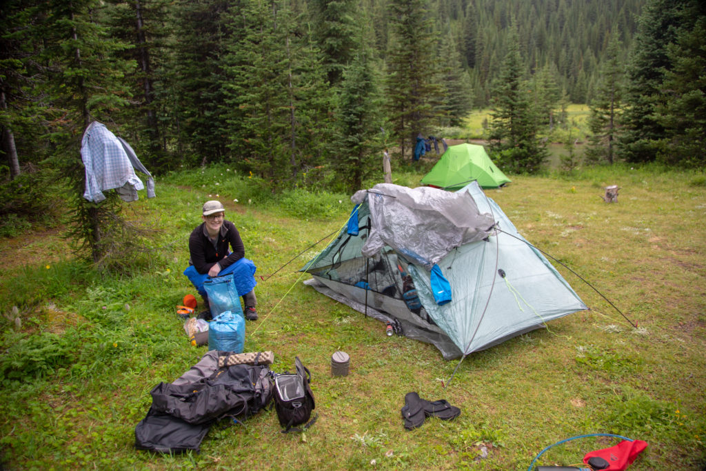
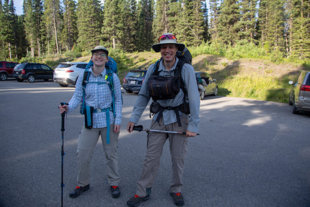
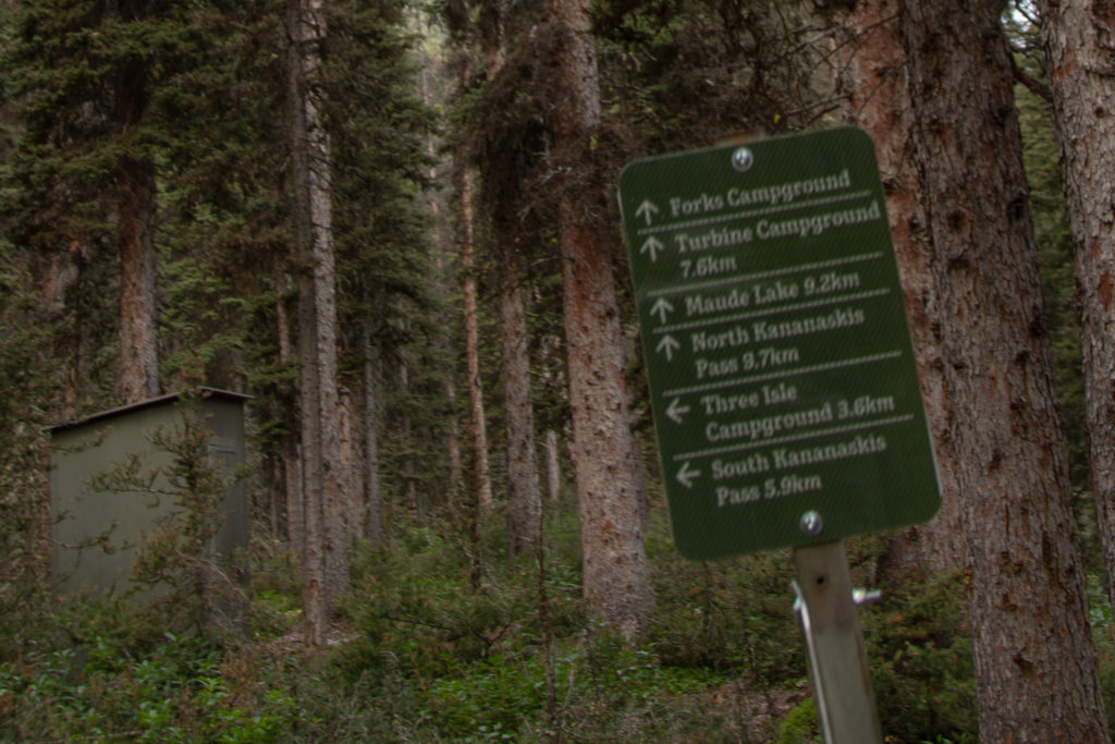
Laura got up early with us and drove with us to the North Interlakes Trail head at Upper Kananaskis Lake. We had everything organized the day before. I was pretty happy with our packing. My pack came in right around 45 lbs which included 13.5 lbs of food (the 2 lbs per day goal) and 7.5 lbs of camera gear. In hindsight this is definitely a day I would split into two. Either an afternoon hike to Forks CG (8 km) or a comfortable day to Turbine Canyon CG (15.6 km).

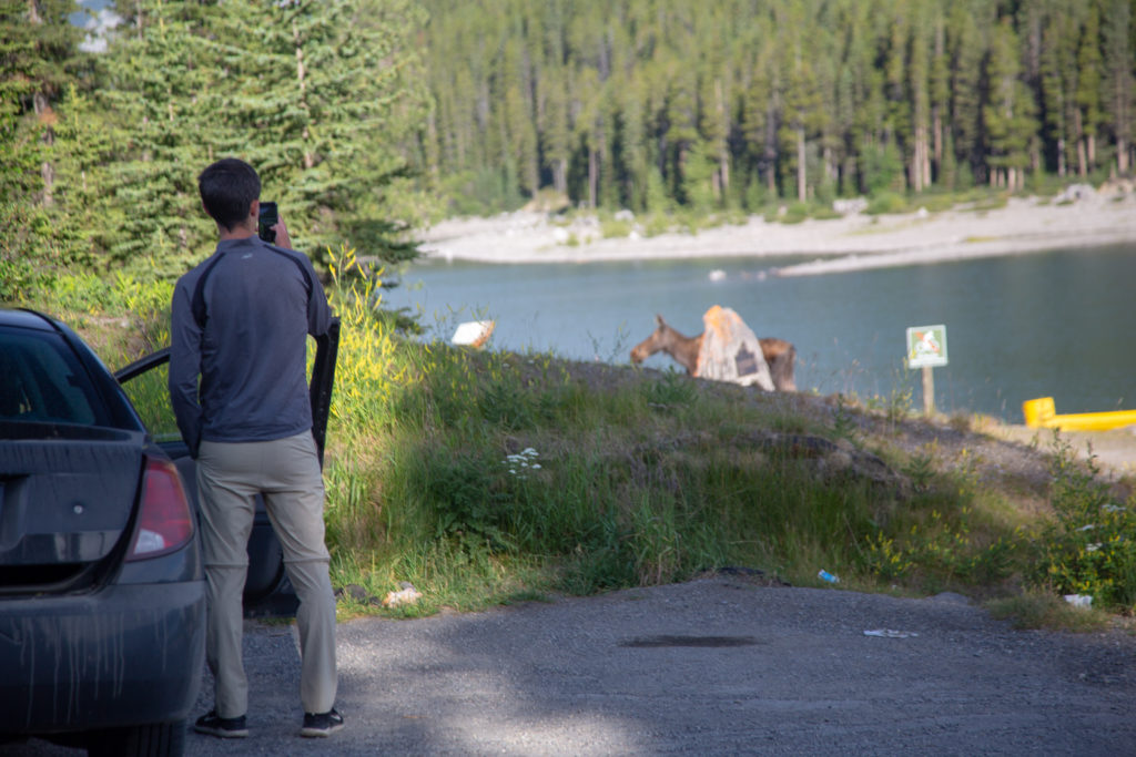
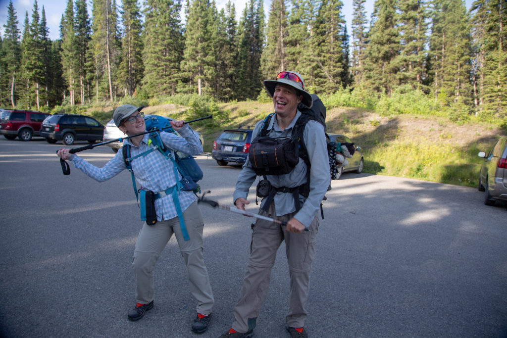
The trip got off on the wrong foot for Micah as a moose walked through the parking lot while they were in the biffy, harbinger of things to come. Just after 8:30 am we were on our way. Thanks Laura.

Moose.
Start of the hike. Spirits are high.

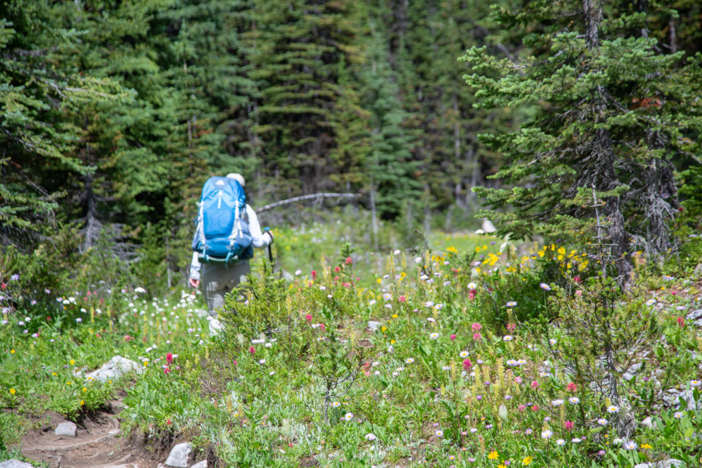
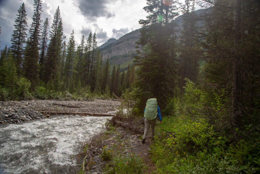
Our goal today was about 24 km to a wild camp at the confluence of the Palliser River and LeRoy Creek. The initial 8 km to Forks CG was very straightforward on excellent trail. We took the high route along Upper Kananasksis Lake and stayed straight at the junction to Points CG. No topic is off limits when Micah and I hike and we got right into the hot topics of the day which really helped pass the time along this initial stretch of the trail. We arrived at Forks CG at 10:30 am 2 hrs after we had left the trailhead. The campground had several families staying there and looked like a pleasant place to stay, but not today.

Micah note: What dad skims past here is that as we were exploring a creek at one point, I spectacularly rolled my ankle. I have very flexible joints and this took me by surprise as I’ve gone over on my ankles before without hurting myself, but this time it REALLY hurt. The pain faded once we got moving again, but it was not the last we’d hear of it. An auspicious start to the trip, for sure.

Of course there is a bear in the area. We always make lots of noise when we hike. Plus we had three cans of bear spray.
Upper Kananaskis Lake. Mt Lyautey (3082 m) at centre. We will be heading down the valley to the right of Mt Lyautey.
Upper Kananaskis Lake. The clouds are rather unsettled.
Stay right and head to Turbine Campground.
Micah hamming it up. Must still be early, excess energy.
Substantial bridge over an unnamed stream.

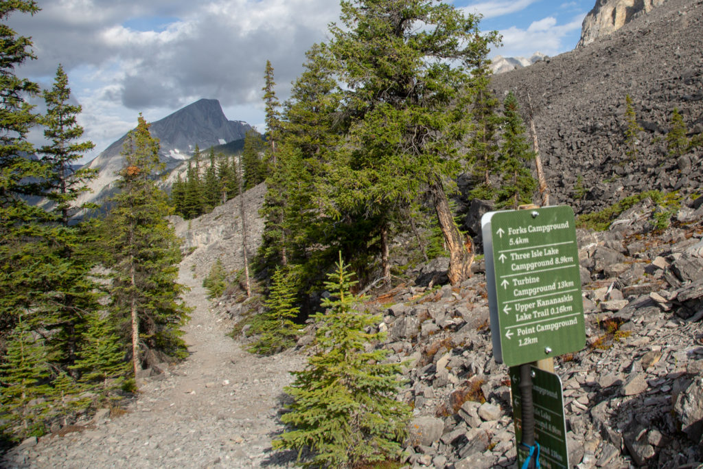
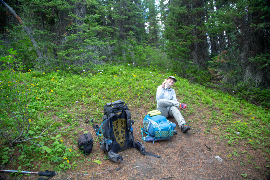
We walked through the campground and as we were about to leave we decided to rest and have snacks before the climb up to Turbine Canyon.

Our view during snack. The backside of Mt Lyautey and the Upper Kananaskis River.

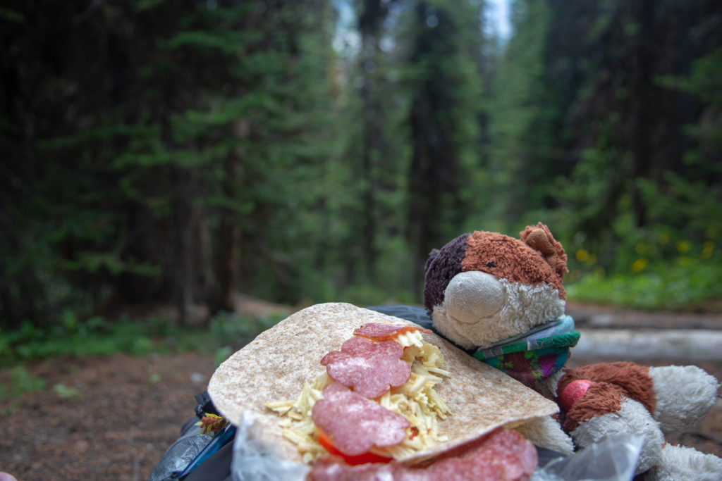
It was 7.5 km to Turbine Canyon which included about 500 m of elevation which we would gain over the first 4 km. It was quite a steep climb out of Forks CG which was quite a shock to the system after the easy undulating trail we had been on. Up this first climb of the trip it readily became evident that, despite all my physical preparation, Micah would be consistently outpacing me up the hills during the trip. At noon we found a pleasant place to set up lunch and enjoyed our first meal on the trail accompanied by an aggressive swarm of mosquitos.

Up hill we go. Micah is the blue dot at centre.
Small smattering of flowers along the trail.
Looking back at the entire mastiff that is Mt Lyautey which includes a small glacier at centre.
Frosty eyeing up my lunch.
Micah doctoring up her feet.

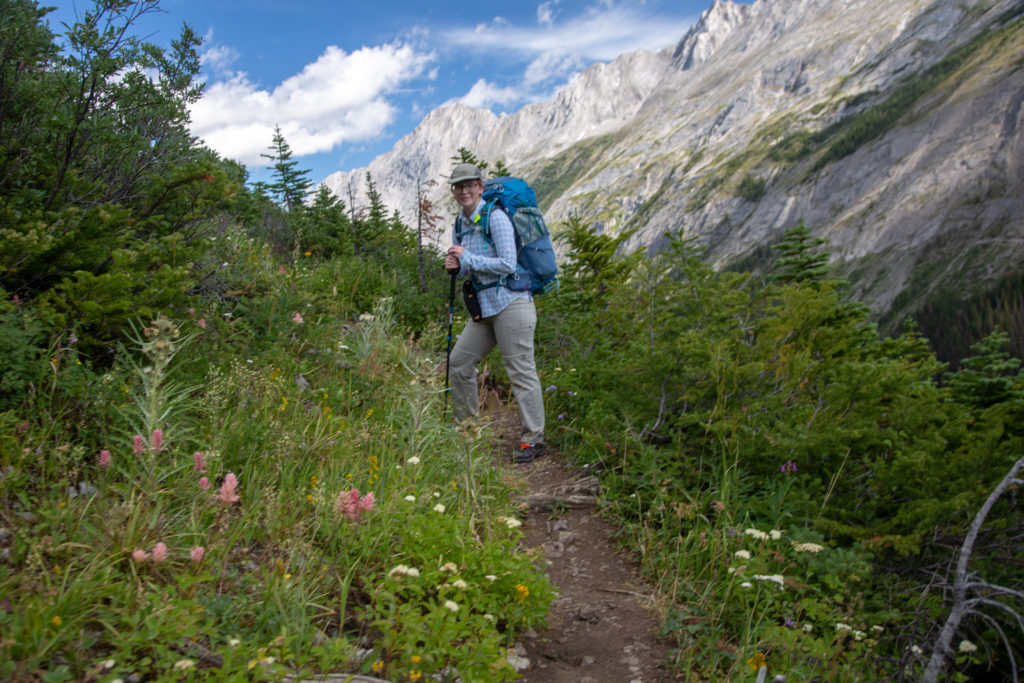
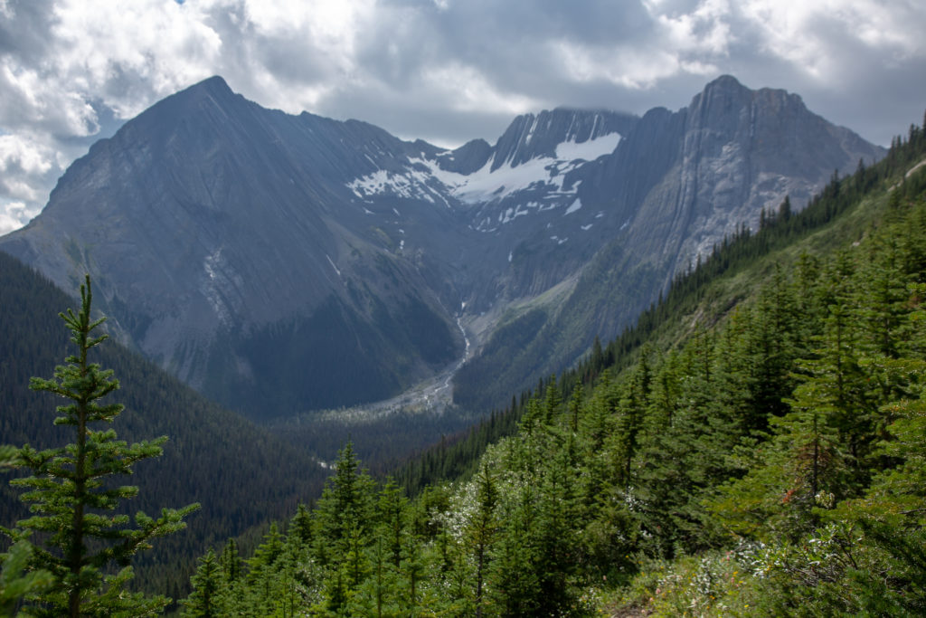
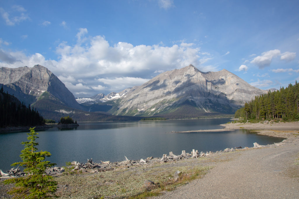
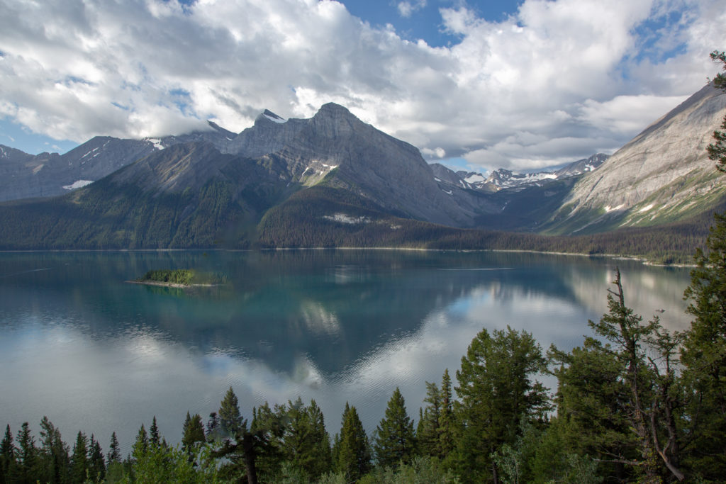
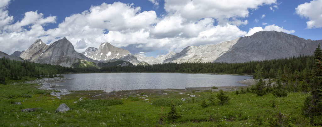
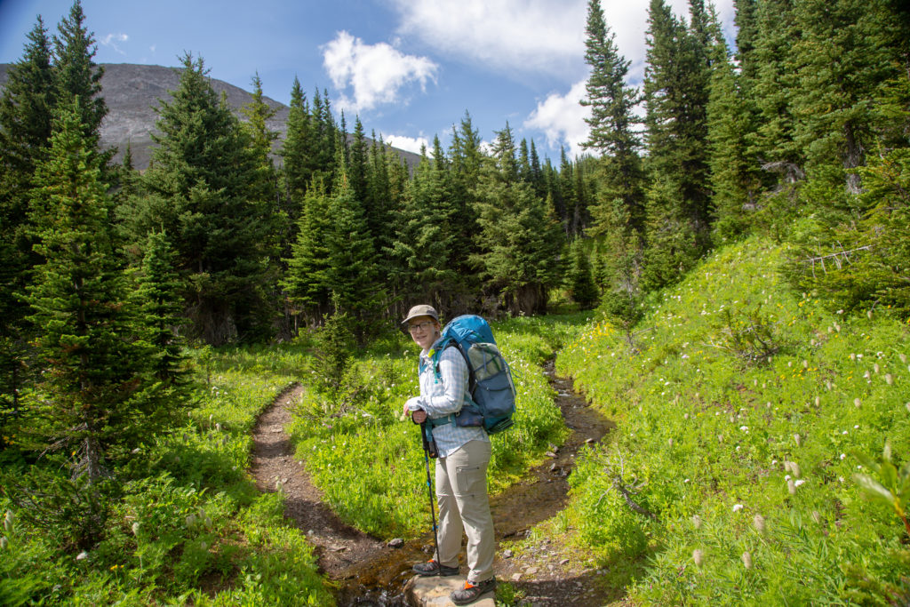
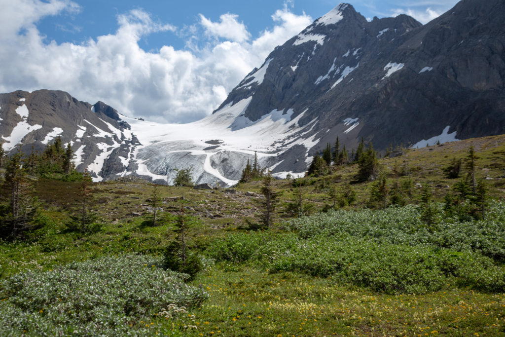
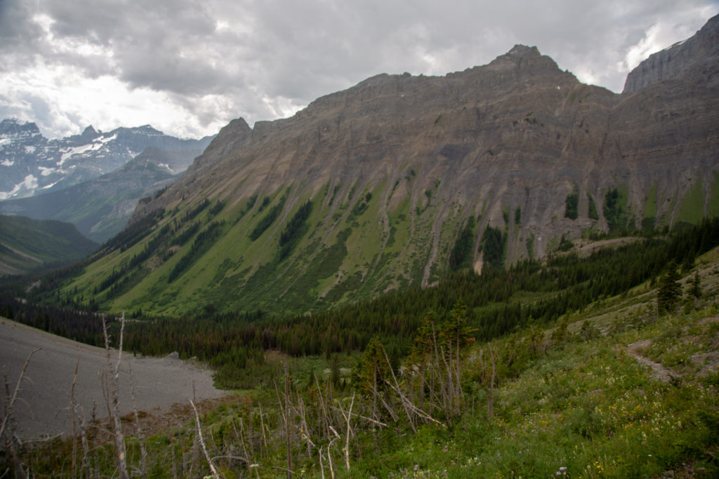
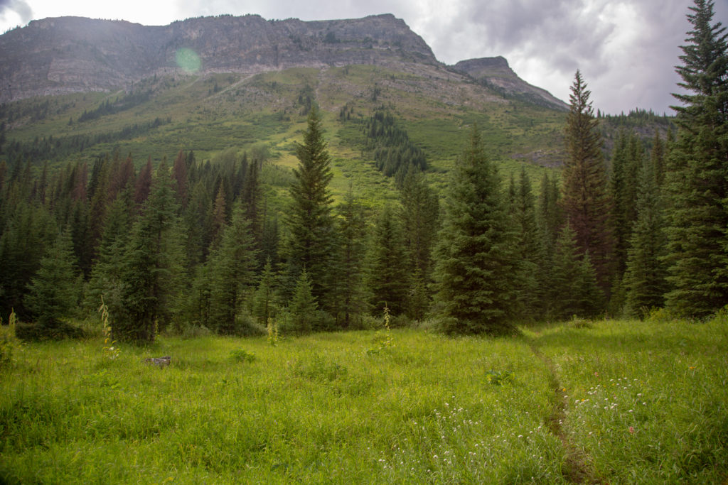
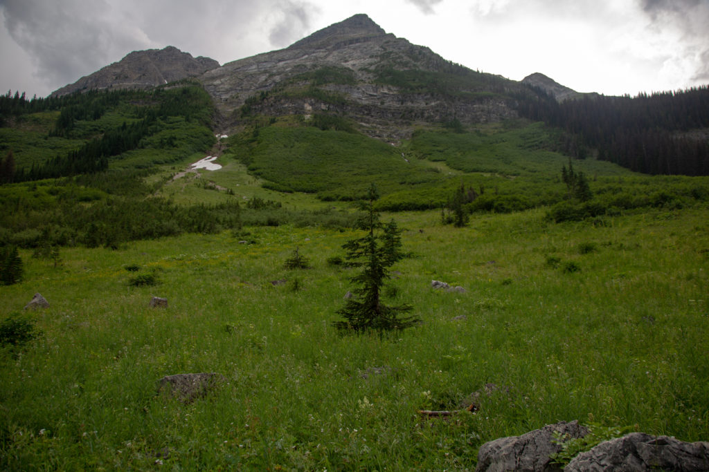
After lunch the trail became an easy stroll over rolling terrain as we slowly continued to gain elevation. A bonus of hiking in mid August was that we were provided with almost two weeks of flower fields. At 1 pm we popped over a small hill and came across a small pond known unofficially as Putnik’s Pond which signified our entry into the high alpine. As we made our way over to Lawson Lake I remarked to Micah while looking at the spectacular views all around us that “this is why I hike”.

Micah marching past the flowers.
“Putnik’s Pond” leading into the alpine. We are headed for Turbine Canyon CG at the base of Mt Maude (3042 m) left of centre.

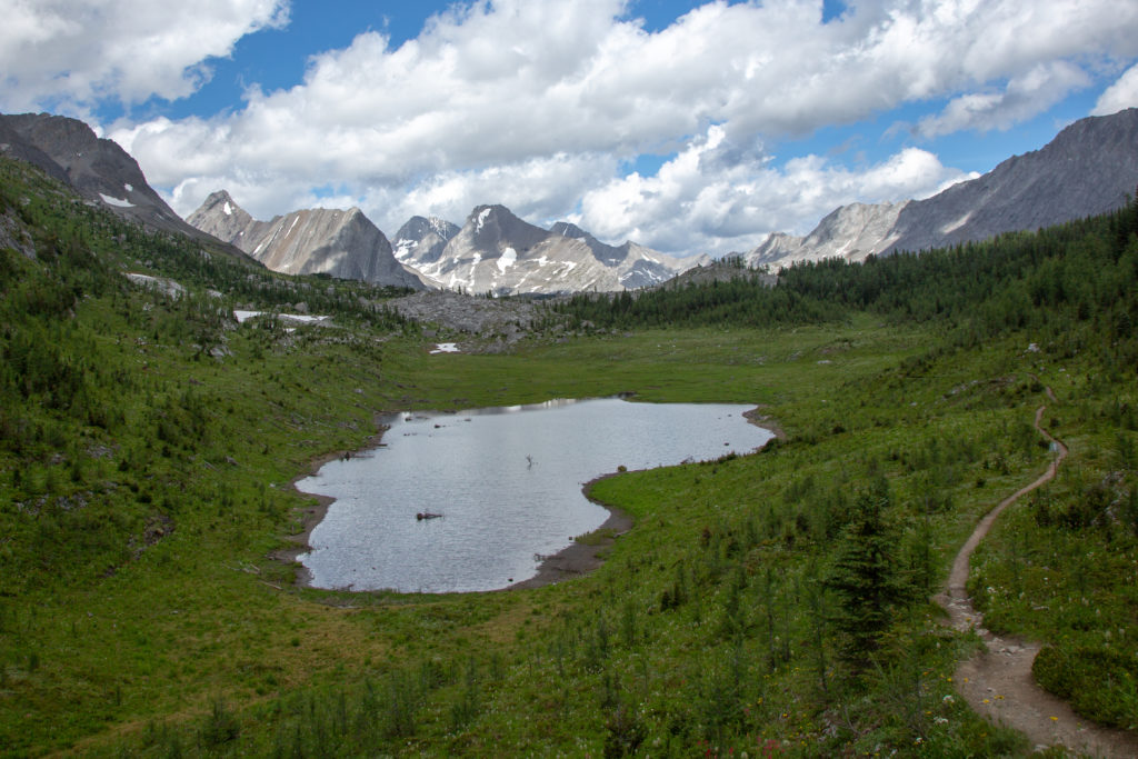
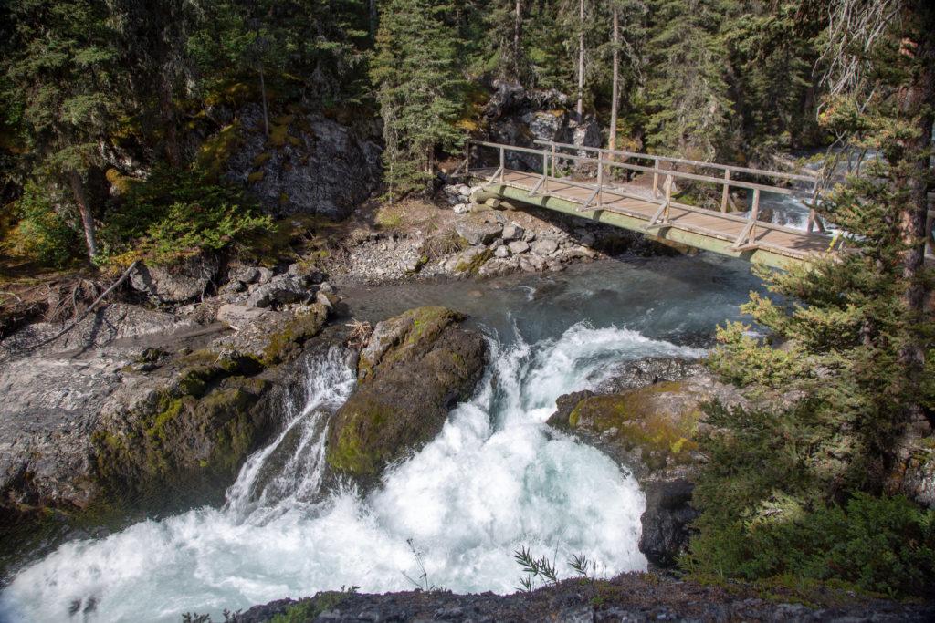
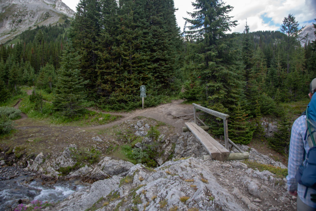
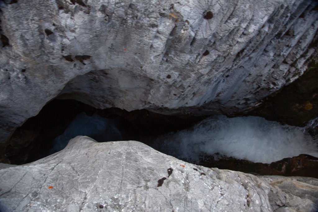
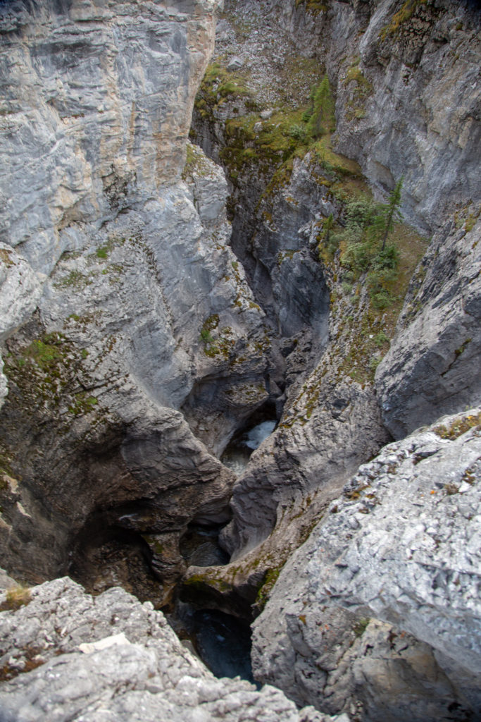
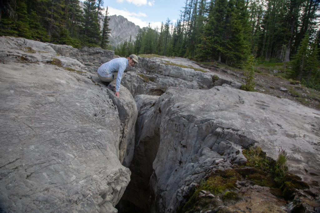
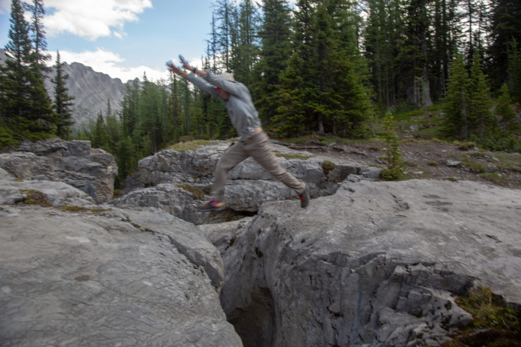
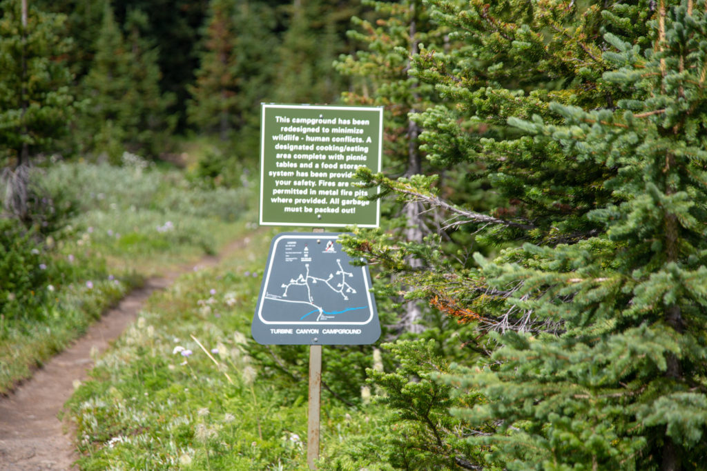
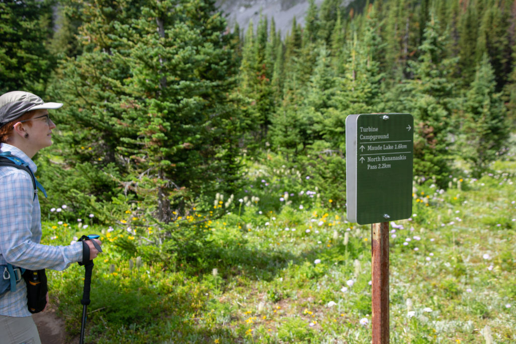
It took us another hour to hike the 3.5 km to Turbine Canyon CG. We stopped several times along the way to take in all the scenery. We would not always be above treeline so it did not hurt to linger a bit. We rolled into Turbine Canyon at 2 pm. We had been hiking for 5 1/2 hrs and covered 15.6 km. I was fairly happy with our progress as it was mostly downhill to our targeted campsite. We chatted with some campers when we arrived at the campground. We were eager to find Turbine Canyon as it is suppose to be a worthy side trip. The campers had no idea about the canyon but the guy wearing the Pittsburgh Penguins hat asked me about the results of the NHL draft lottery. Unfortunately for him I had not kept up to date on the draft lottery. It only took us a few minutes to find the canyon. We traced a small unassuming stream away from the campground to where the stream suddenly vanished from sight down a big hole! Turbine Canyon lived up to our expectations.

Lawson Lake.
Turbine Canyon CG. We would eventually go left to North Kananaskis Pass but first we went right to explore the campsite.
Micah peering into Turbine Canyon. Two small lazy streams have come together to cut the canyon.
It is quite the drop.
The canyon downstream of the little falls.
Temping fate.
Nice looking little campground. If I did this trip again this would be the end of day 1.
Only 2.5 km and then all downhill to our destination (or is it).

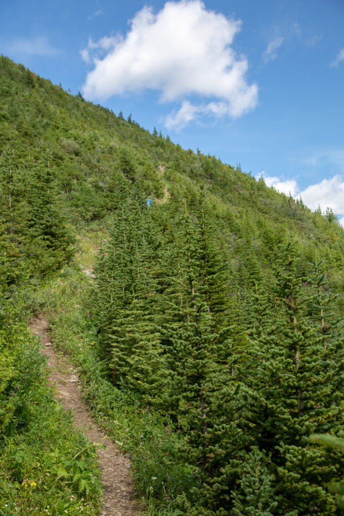
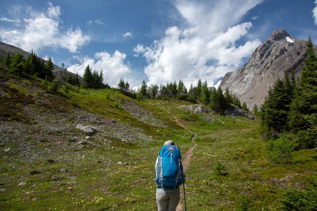
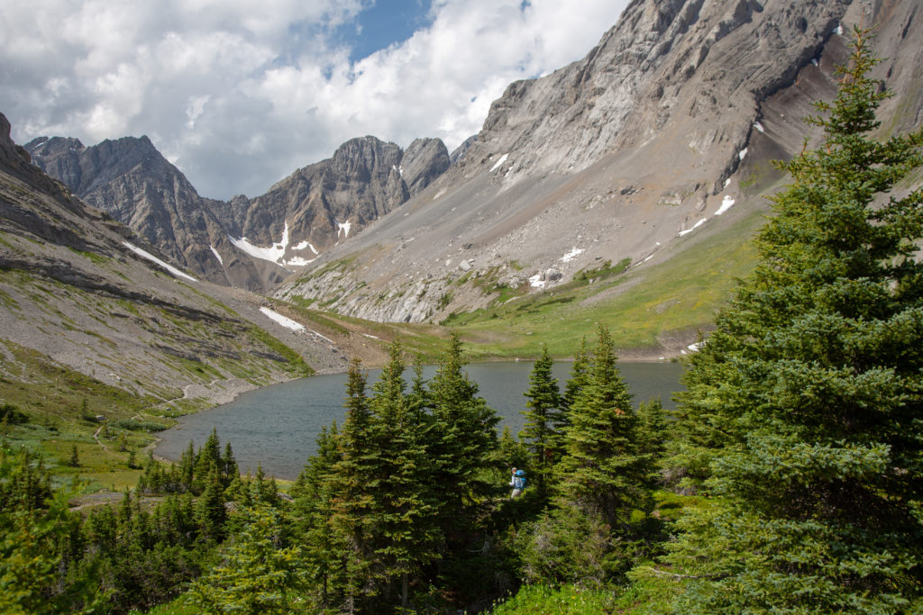
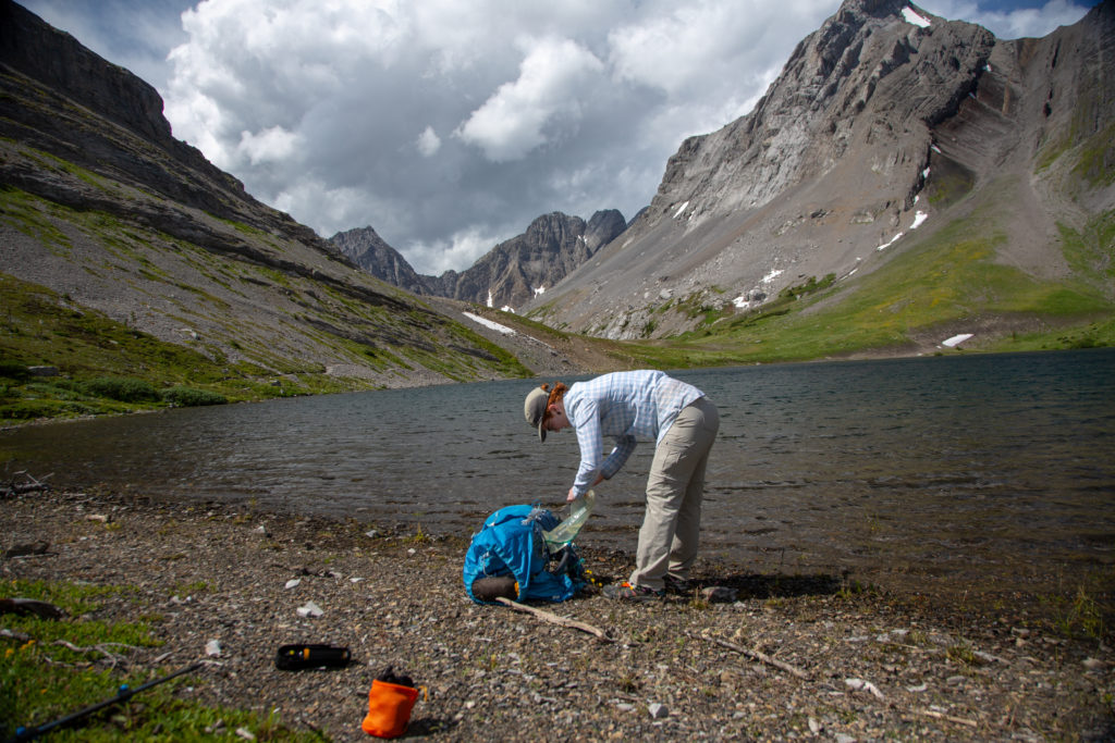
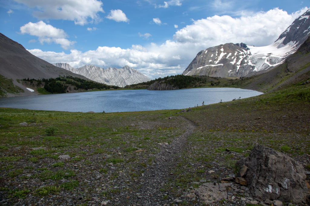
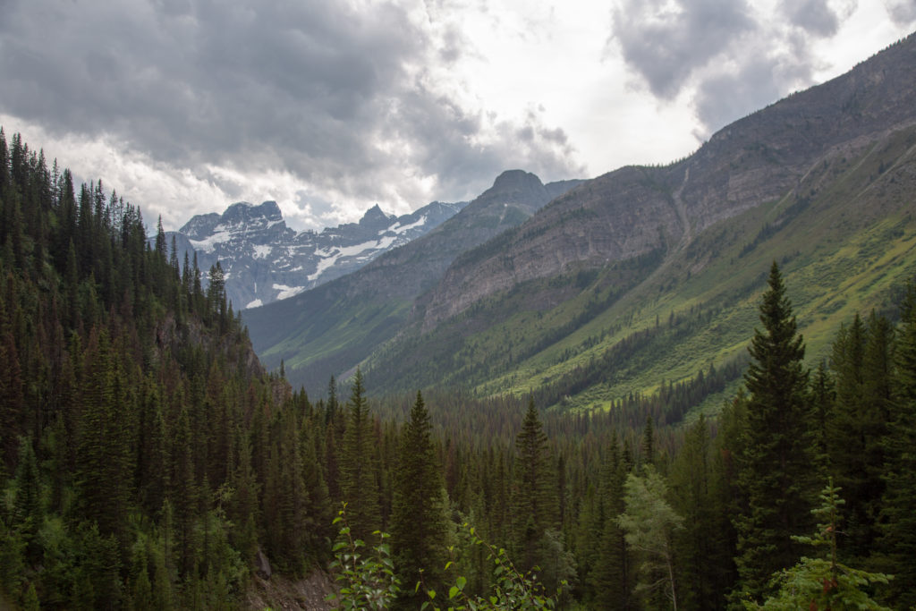
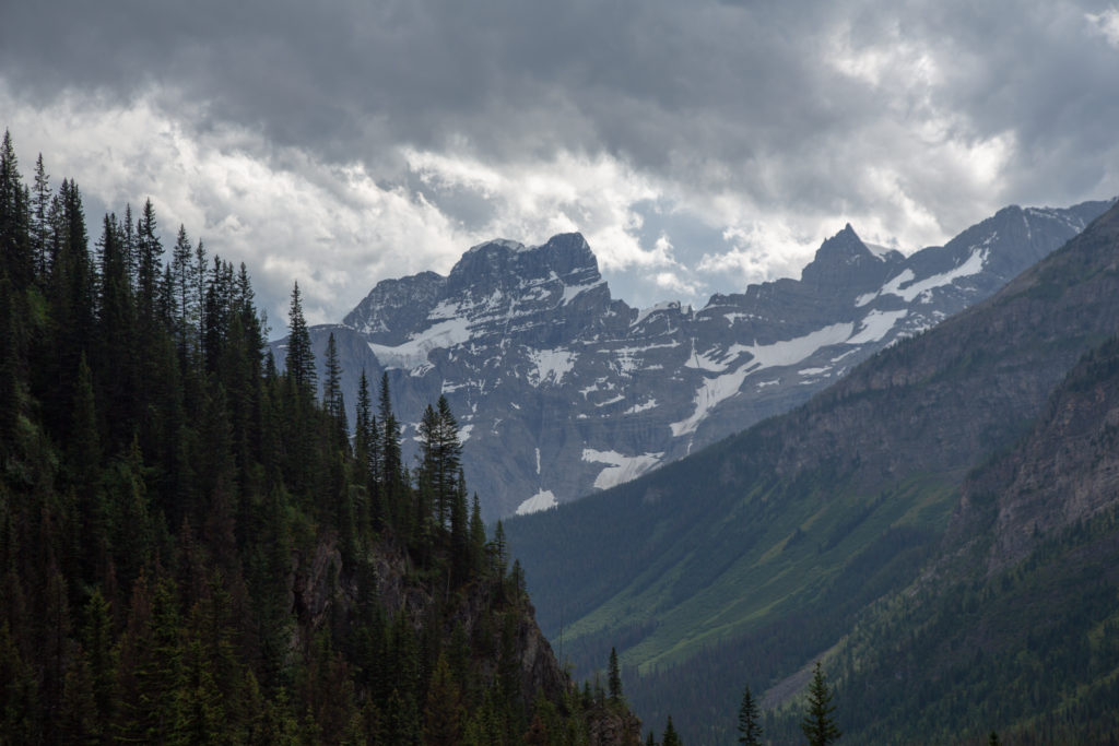
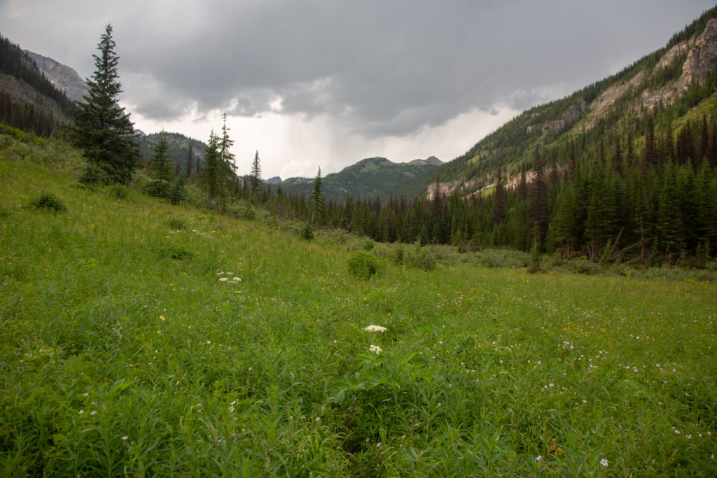
It was a pleasant hike from Turbine Canyon up to North Kananaskis Pass. It did go up 140 m but it was never very steep. As we left Turbine Canyon we met a group who had stayed over at the campground. They had just popped over to look at the pass and were heading out. Not sure if they had another campground or were aiming to get back to the trailhead. Upon arriving at Maude Lake just before the pass we were beset by very strong winds. We stopped at Maude Lake and quickly refilled our water. At 3:05 pm we said goodbye to Kananaskis Country and entered Heights of the Rockies Provincial Park.

Lots of trees leading up to the pass.
The final hill before Maude Lake and the pass.
Maude Lake, North Kananaskis Pass at centre.
Mt Beatty (2999 m) to the right with its glacier.
Refilling the water bladders.
Goodbye Kananaskis.
Maude Lake and North Kananaskis Pass

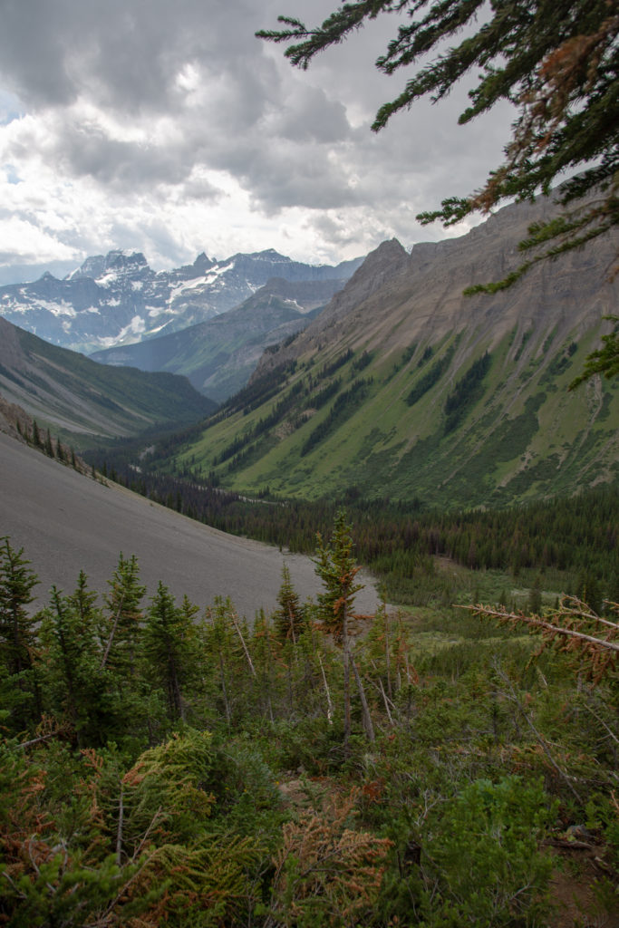
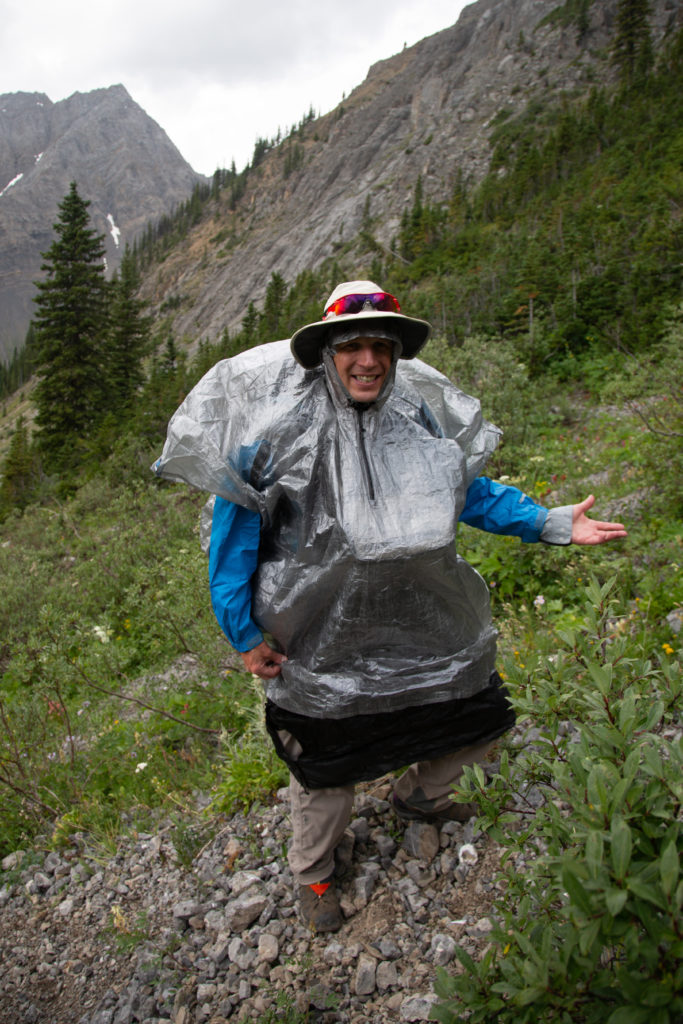
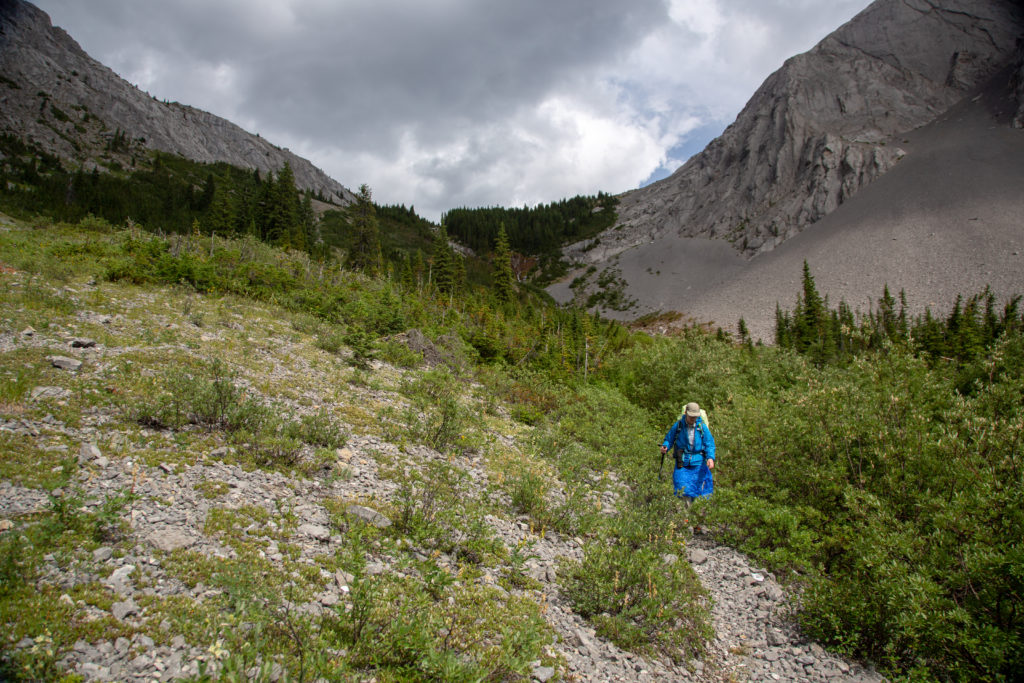
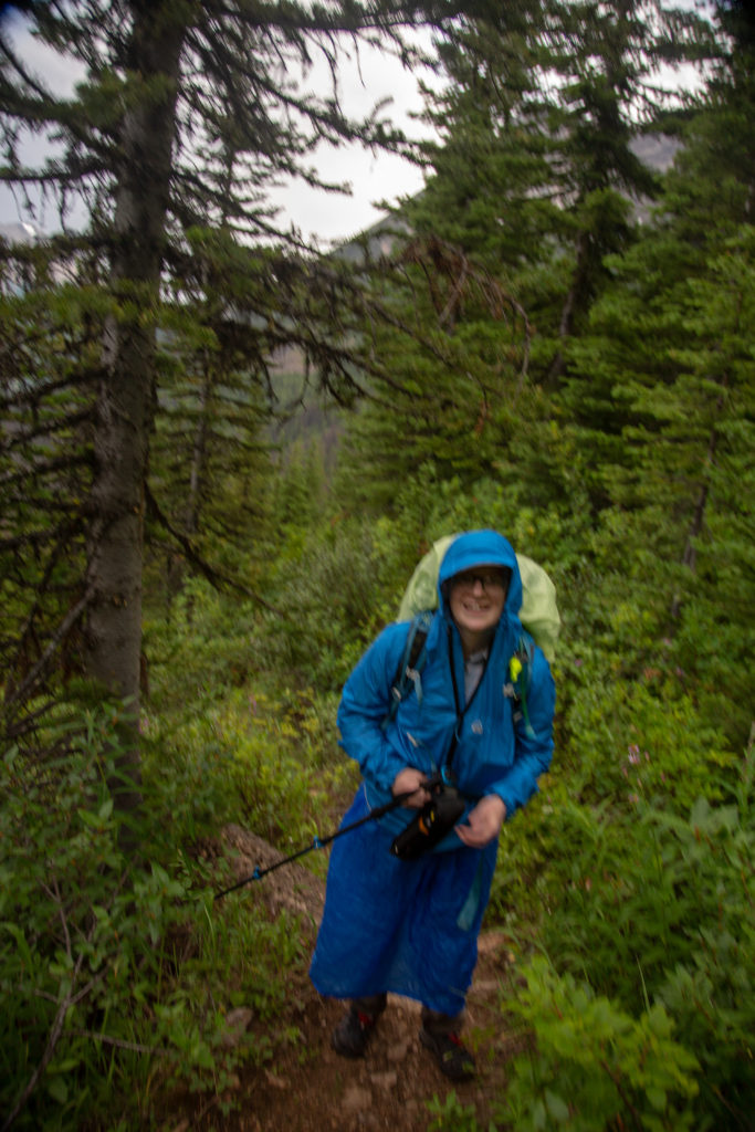
As we descended over the pass I recalled that the guidebook did not have much good to say about the trail down to the Palliser River. We had no trouble navigating the trail but it was very steep near the top. I was thinking how glad I was to be descending when we came across a group coming up. They were looking very tired and very happy to be nearing the top. Going down was aided by a bit of scree skiing in the loose rocks. A controlled descent was out of the question. We would lose 500 m of elevation in the first 2 km of the descent. Luckily the trail became more reasonable the rest of the way down. The clouds from the west that had been threatening us all day finally decided to give us a bit of rain on the downhill. We quickly donned our rain gear. I use a Zpacks poncho and rain skirt while Micah uses a Zpacks rain jacket and rain skirt. (Yes, we have a lot of gear from Zpacks, we’re a bit predictable.) The hill was so steep I had difficulty staying still while putting on my gear. The rain did not last long but it made the many downed trees we would come across slippery to negotiate.

Our route down. The photo does not show how steep the trail is. Mt LeFroy to our right and the Royal Range in the distance. The high peak in the distance is Mt King George (3422 m)
Mt LeFroy (2907 m)
Our rain gear.
Looking up towards North Kananaskis Pass.
Trail obstacles.

Our plans got upended when we met a women coming up the pass and she informed us that there was a bear feeding at the meadow which we were planning on camping at. Like us, she had planned to camp at the confluence of the Palliser River and LeFroy Creek but she decided to hike up to the pass and camp at North Kananaskis Pass. She was going to stay on the Heights of the Rockies side as she did not have a permit for any campgrounds in K-Country. We thanked her for letting us know about the bear and started trying to figure out our options and making much more noise.

Micah’s note: As we were barrelling down this section at high speeds shouting for the bear, I turned my ankle twice more. If I’d hoped that injury would go away, I’d probably just set those hopes on fire.

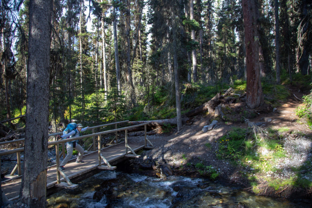
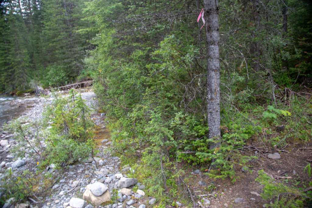
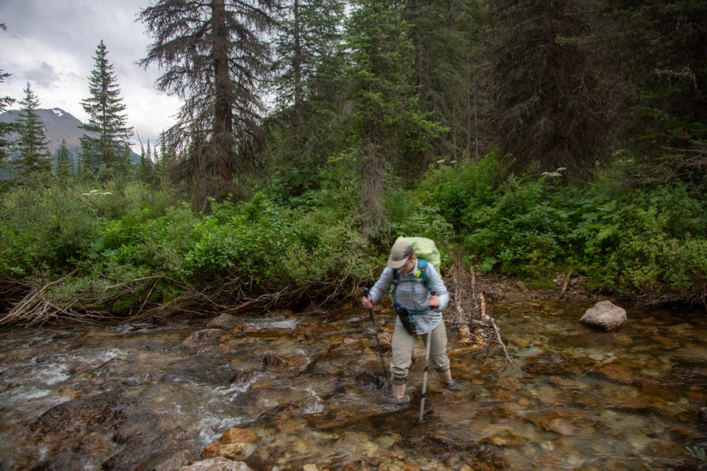
I had scanned all the pages from the guidebook into a PDF document and loaded it onto my tablet for viewing on the trail. I had reread the description of today’s hike in the morning so I knew that there was a campsite 4.5 km beyond the confluence. This would lengthen our distance from just over 14 miles to just over 17 miles. After having a couple of long distance hikes (Micah had hiked the JMT and sectioned hiked the Te Araroa in New Zealand) Micah had determined that they do not enjoy hiking more than 15 miles in a day. I was dismayed that we were going to go over her magic number on the first day of our trip. We had to cross over LeFroy Creek via a fun simple stream crossing. Once across careful scanning the bank found a single piece of orange flagging tape marking the entrance to the trail.

Micah’s note: I’ve had several occasions to hike 30km+ days (18miles) and while I expect when I scale up to longer adventures like the PCT I’ll toughen up to them, on shorter trips I just can’t enjoy them. I can’t spend as much time soaking in the trail and I often feel ragged the next day from overwalking. While longer days are possible and sometimes unavoidable, sticking to more modest numbers means I feel consistently stronger and I get to see more because I’m not heads-down plowing my way through the last few kilometers to the campsite.

Orange flagging tape marks the trail.
Stream crossing

Micah’s note: Obviously this is a bit overkill for such a small stream, but this is the technique I learned on the TA, when stream crossings were sometimes close to hip-deep.

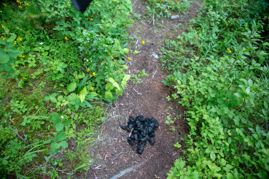
It was not long after reaching the other side that we saw evidence of large furry animals. We increased the noise level and decided that we would definitely be pushing on past the confluence.

Fresh scat
Our route would take us to the end of the brown cliff to our right then turn right up the valley.
Guessing the names of the peaks Mt Prince Albert (3209 m) on the left, Mt Prince Edward (3200 m) on the right and the tallest peak is in behind Albert, Mt King George (3422 m).
Coming up to the confluence.
Pink tape directing us off to the right as we approach the Palliser River.

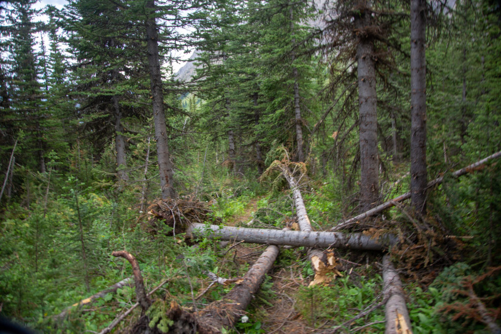
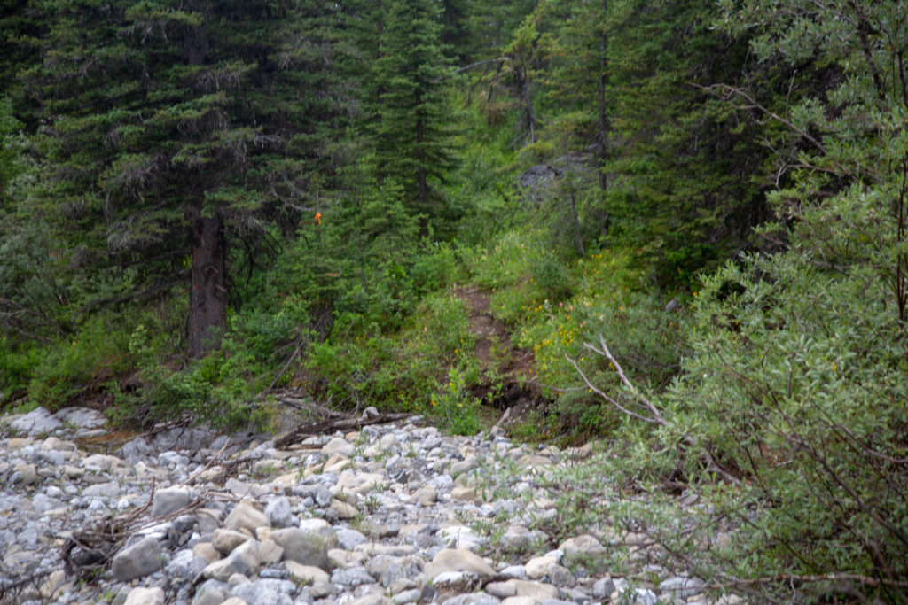
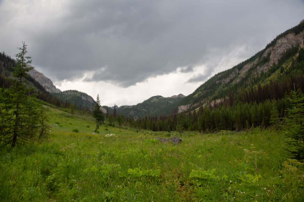
It was 5:20 pm when we arrived at our initial destination, the meadow at the confluence. We had already decided to continue to the next campsite. So, despite seeing no sign of bear activity, we marched on through. The quality of the trail took a turn for the worse. While we were never in any doubt as to where the trail was, the trail was faint and overgrown in many places.

This is the meadow at the confluence. Would have been a great campground. Has some trees for shelter, easy access to water and pretty flat.
Yes, there is a trail through the grass.

I had a new toy on this trip: the SPOT X two way GPS communication emergency beacon. I had used a SPOT II satellite GPS device for about 6 years. I have never used my SPOT device for an emergency but people back home appreciate a little bit of communication from the Check In feature that everything is going OK. Since this was going to be a longer trip I thought it would be nice if we could exchange a bit more than the Check In message with those back home. I chose the SPOT X over the Garmin because the SPOT X is a stand alone device. The Garmin needs to be paired with your phone to enable texting. Here is a link to my full review of the SPOT X. There are some definite shortcomings with the SPOT X that are not very well explained.

Despite the shortcomings the SPOT X was instrumental in saving our trip. We used the texting feature for the first time during a break after leaving the meadow to let Laura and Kathleen (Micah’s mom) know that we were OK but continuing on to another campsite. We found an open slope so I could send the text. Sometime during our hike to the campsite I received return text messages indicating that everything worked as it should.

Beautiful green grassy slope.
Yes there is a trail somewhere. The weather in the direction we are traveling does not look promising.

We kept our eyes open for spots to camp but despite the fact that it was wild camping there was nowhere to camp. We came to a stream crossing, as detailed in the guidebook, which took us back to east side of the river. Still nowhere to camp.

I did not think it was possible but the vegetation got thicker and taller. The trail was well defined but you basically just had to look down at your feet. It was getting close to 7 pm and we had not had dinner only snacks, but somehow neither of us were grumpy. I knew that we were getting close to the campsite when not only did the trail get steeper but it started to rain. We quickly threw our rain gear on and kept working as hard as we could up the hill. Micah still gets testy when they remember the description in the guidebook about the approach to the campsite, “the trail ascends moderately”. Micah disagrees strongly that the trail was doing anything “moderately” as we pushed up that final hill. The trail flattened out and suddenly we ran into a person. The campsite detailed in the guidebook was only another 30 seconds away. Two other tents were set up in a small and not very level meadow by a small pond.

Micah’s note: He’s not exaggerating about my testiness. I don’t mind steep trails, but I do mind expecting a moderate one and getting a steep one. I was lied to.

Rain gear on for the second time. Still smiling despite the conditions and the time.

Arriving at 7:15 pm with a storm approaching was not ideal. We set up our tent as quick as we could and made dinner. I had brought two beers to celebrate our first day on the trail but there was really no time to enjoy them. The beers would travel in my backpack for several more days before we found the “right time”. The evenings entertainment was not over, as we had to hang our food from the branches of some trees. I had purchased two Zpacks Bear Bagging Kits (as I said before, we have a lot of Zpacks gear) and we set off into the forest to hang the food. I had read in both Chris Townsend’s book and in an online blog I used extensively for gathering information about the trail, Walking With Wired, how challenging it is to hang food in the Canadian Rockies. The trees are simply not designed correctly. The branches bend down as they leave the trunk of the tree. This makes it hard to just toss the rock bag over as the cord slides down the branch towards the ground. I do not know how long we spent trying to hang the food. But it was very dark and had started to rain by the time we were satisfied we had done the best we could. It probably would have been graded a Meeting Minus (C-, if you’re note familiar with the updated school division grading scheme) by an Outdoor Ed instructor. Despite being a long day we were both happy to be on the trail but tired. Sleep came very quickly, followed by several thunderstorms.

Micah’s note: I think I ended up climbing a tree barefoot at one point trying to get our rope through a split in the branches so we could string the bag between two trees. It was not my finest moment, but hey. The bears didn’t eat our food. That’s good enough in my books.

Before the rain

Day 2 GDT Section C 2020

GDT Section C 2020 Home

bootwreckers

Day 3 of my New Years adventure in Arizona up on B Day 3 of my New Years adventure in Arizona up on Bootwreckers, see link in bio.

Hiked the Superstition Ridgeline Trail, 23 km of some very rough terrain.

The views from the ridge were spectacular. The trail is more of a route, then a trail. I got off trail a half a dozen times just on the ascent to the ridge. Sprinkled in for fun where several down climbs where I had to drop my poles before climbing down a small chimney or crack.

There is camping possibilities on the ridge and I do wish I would have camped just before Syphon Draw and enjoyed the sunset. Maybe next time.

This was a very challenging 10.5 hrs on the trail, one of my hardest days ever, but worth every drop of sweat.

Till next time Arizona.

#nationalparks, #slotcanyon, #hiking, #hikingadventures, #familytime, #camping, #campingadventures, #outdoors, #outside, #nature,  #FIndyourpark #landscape #landscapephotography #optoutside #nationalpark #desertphotography #grandcanyon #grandcanyonnationalpark #grandcanyonassociation #nationalparkweek #reichallenge #nationalparksweek #rightnow #nationalparktrust #goparks #aztrails
Even in the smoke, there is nothing like hiking in Even in the smoke, there is nothing like hiking in the Canadian Rockies.

On the way to Pinto Lake, going over Sunset Pass with Tuft Peak in the distance.

#parkscanada #parks #bcparks #trails #longdistancehike #longtrail #outdoors #outside #thruhike #hike #thruhiking #outside #backpacking #waterfalls #waterfall #naturephotography #naturephotography #nationalparks #alberta, #albertaparks
Day 2 of my New Years Arizona Adventure is posted, Day 2 of my New Years Arizona Adventure is posted, see link in bio.

Fun and easy day exploring the Superstitions with my four new friends. Lots of varied terrain and lots of breaks. Will make up for that on Day 3.

I did run out of superlatives to describe the scenery, in one word it was simply spectacular!

#nationalparks, #slotcanyon, #hiking, #hikingadventures, #familytime, #camping, #campingadventures, #outdoors, #outside, #nature,  #FIndyourpark #landscape #landscapephotography #optoutside #nationalpark #desertphotography #grandcanyon #grandcanyonnationalpark #grandcanyonassociation #nationalparkweek #reichallenge #nationalparksweek #rightnow #nationalparktrust #goparks #aztrails
Day 1 of a fun two day trip out to Pinto Lake over Day 1 of a fun two day trip out to Pinto Lake over Sunset Pass.

It was a little smokey but as you can see from the first photo the views were spectacular.....

The little dot in Photo 9 is a Common Loon, and entertained us for several minutes swimming across the lake and diving for fish.

Big thanks to @kbsymington , @sio.mellors , Kylie and Charlie for making it such an awesome trip.

#parkscanada #parks #bcparks #trails #longdistancehike #longtrail #outdoors #outside #thruhike #hike #thruhiking #outside #backpacking #waterfalls #waterfall #naturephotography #naturephotography #nationalparks #alberta, #albertaparks
Day 1 of my 2023 New Years Arizona Adventure is up Day 1 of my 2023 New Years Arizona Adventure is up on Bootwreckers,  see link in bio.

Day started off rainy, see photo 2, but the clouds cleared off by 8 am and I finally got my hike started.

The day wasn't without adversity as I slipped chasing my water bottle in a stream and fell in the water. My camera got flooded and stopped working so the rest of the photos were taken on my aging BlackBerry Key 2.

Met up with a group of 4 med students and hiked with them for two days.

Despite the ruined camera was a super fun day on the trail in a new place. 

#nationalparks, #slotcanyon, #hiking, #hikingadventures, #familytime, #camping, #campingadventures, #outdoors, #outside, #nature,  #FIndyourpark #landscape #landscapephotography #optoutside #nationalpark #desertphotography #grandcanyon #grandcanyonnationalpark #grandcanyonassociation #nationalparkweek #reichallenge #nationalparksweek #rightnow #nationalparktrust #goparks #aztrails
It took a while but finally posted the intro to my It took a while but finally posted the intro to my New Years trip to Arizona, see link in bio.

I was greater in Arizona to 18C weather followed quickly by near freezing temperatures and the most rain in the Phoenix area in one day since 1906!

My trip went from Plan A, 4 days on the Arizona Trail,  through Plans B, C and Finally D.

Was a fun if sometimes frustrating adventure.

#nationalparks, #slotcanyon, #hiking, #hikingadventures, #familytime, #camping, #campingadventures, #outdoors, #outside, #nature,  #FIndyourpark #landscape #landscapephotography #optoutside #nationalpark #desertphotography #grandcanyon #grandcanyonnationalpark #grandcanyonassociation #nationalparkweek #reichallenge #nationalparksweek #rightnow #nationalparktrust #goparks #aztrails
Day 3 of Rockwall 2022 is up on Bootwreckers, see Day 3 of Rockwall 2022 is up on Bootwreckers,  see link in bio.

Sweet little day up and over Tumbling Pass with and a long view of Tumbling Glacier. 

The weather cooperated with blue skies and no threat of rain so we were able to linger at The Glacier before heading down the long descent to the car.

While a straightforward day there were still some adventures to be had, but you have to read about them on the blog.

Big thanks to my amazing hiking partner, @sio.mellors

Looking forward to our 3 day adventure this summer, which will no doubt generate more stories to tell.

#parkscanada #parks #bcparks #trails #longdistancehike #longtrail #outdoors #outside #thruhike #hike #thruhiking #outside #backpacking #waterfalls #waterfall #naturephotography #naturephotography #nationalparks
Day 2 of our Rockwall 2022 trip is posted on Bootw Day 2 of our Rockwall 2022 trip is posted on Bootwreckers, see link in bio. With @sio.mellors

This day was Helmet Falls CG to Tumbling Creek CG.

Day started off beautiful with blue skies which turned to rain after lunch. Somehow through all the rain and thunder Siobhan  never lost her smile.

The day ended with beers and Siobhan giving butt rubs to the doggies in camp.

Photo 1 Siobhan taking in the Rockwall at lunch

Photo 2 Helmet Falls at Golden hour

Photo 3 me and my morning coffee waiting for Siobhan to wake up

Photo 4 on the way up Siobhan with Limestone Peak in th background 

Photo 5 Siobhan at Rockwall Pass (can you tell?)

Photo 6 Siobhan near Wolverine Pass with Rockwall Peak shrouded in clouds

Photo 7 Tumbling Glacier through the clouds

Photo 8 setting up camp

Photo 9 Dinner time

Photo 10 butt rubs

#parkscanada #parks #bcparks #trails #longdistancehike #longtrail #outdoors #outside #thruhike #hike #thruhiking #outside #backpacking #waterfalls #waterfall #naturephotography #naturephotography #nationalparks
New trip posted, three day trip in the Rockwall in New trip posted, three day trip in the Rockwall in Kootenay NP with @sio.mellors. Introduction and Day 1 up on Bootwreckers.

Trip was suppose to be hiking Northover Ridge in Kanananaskis but smoke had us change plans at the last minute.

This would be my third multi day trip on the Rockwall but the first for Siobhan.

Managed to get two camping sites on the Rockwall and instead of smoke we had to deal with the threat of rain.

We did get wet but we had a blast.

Day 1 is from Paint Pots TH to Helmet Falls CG, with a side trip to get up close the the falls. Pretty straightforward day but visiting Helmet Falls is always special.

#parkscanada #parks #bcparks #trails #longdistancehike #longtrail #outdoors #outside #thruhike #hike #thruhiking #outside #backpacking #waterfalls #waterfall #naturephotography #naturephotography #nationalparks
The sixth and final day of our 2022 GDT Section D The sixth and final day of our 2022 GDT Section D hike is up on Bootwreckers, see link in bio.

This day took us from a random camp on the Howse Floodplain to the Mustafa Canyon parking lot. This was an adventurous day with bushwhacking, stream crossings and dead fall but a simply glorious end to a wonderful hike on the GDT. 

Again thanks  to Sara (@sd_kuz) and Lillian (@waterlilizee) for sharing this adventure with me. I am sure we will meet again on a trail someday.

Photo 1 - Morning Colors

Photo 2 - tents on the floodplain

Photo 3 - bushwhacking to start the day

Photo 4 - fields of flowers going to seed

Photo 5 - looking south down the Howse River

Photo 6 - thigh deep water crossing

Photo 7 - big views

Photo 8 - Sara crossing some dead fall

Photo 9 -Mistaya Canyon

Photo 10 - picked up a thru hiker named Roy, enjoying beverages left by Natasha and Kyle from Backpacks and Bikeracks

#greatdivide #greatdividetrail #gdt #parkscanada #parks #bcparks #trails #longdistancehike #longtrail #outdoors #outside #thruhike #hike #thruhiking #outside #backpacking #waterfalls #waterfall #naturephotography #naturephotography #nationalparks #duplex #sectionhike #sectionhiker
Day 5 of our 2022 Great Divide Trail Section D hik Day 5 of our 2022 Great Divide Trail Section D hike is posted on Bootwreckers, see link in bio.

Truly epic day on the trail. Pass through the debris of two avalanches, had lunch by a waterfall, crawled over so much dead fall and hiked on the Howse Flood Plain.

The sunset on the flood plain was one of most magical I have seen.

As always a big thanks to Sara (@sd_kuz) and Lillian (@waterlilizee) for sharing this adventure with me. The Team totally rocked the trail.

#greatdivide #greatdividetrail #gdt #parkscanada #parks #bcparks #trails #longdistancehike #longtrail #outdoors #outside #thruhike #hike #thruhiking #outside #backpacking #waterfalls #waterfall #naturephotography #naturephotography #nationalparks #duplex #sectionhike #sectionhiker
Evening light on Picketpost Mt. #aztrail #aztasso Evening light on Picketpost Mt.

#aztrail #aztassociation  #nps, #nationalparks, #slotcanyon, #hiking, #hikingadventures, #familytime, #camping, #campingadventures, #outdoors, #outside, #nature,  #FIndyourpark #landscape #landscapephotography #optoutside #nationalpark #desertphotography #grandcanyon #grandcanyonnationalpark #grandcanyonassociation #nationalparkweek #reichallenge #nationalparksweek #rightnow #nationalparktrust #goparks #aztrails
Arizona Trail Passages 14 and 15. Some photos of Arizona Trail Passages 14 and 15.

Some photos of my recent hike down a couple of Passages of the Arizona Trail. 

The trail is so diverse, rolling terrain cut by shallow washes leads to the expanse of the desert then into rugged canyons and tall peaks, all in a space of 92 km (58 miles).

Had a great time, some blisters gave me some concerns but they seem to be doing fine now that they are out of my hiking shoes.

Got lucky with Trail Magic courtesy of Condiments who drove his 4x4 deep into an unarmed wash, was really in the middle of no where, and then again at the start of Passage 15, missed the Trail Angel's name, the wind was so loud.

Like to thank my Trail Angels, Carole for driving me to Oracle to start the trip, with side trip to a Hayden Az, a real ghost town and to Edith for leaving a water cache for me at Passage 15.

Included a video of my time at the high point for Passage 15. My kid likes it when you stop and enjoy the view you earned, thought they would appreciate my effort in the face of 1000 mph winds (ok maybe thats a bit of an exaggeration).

Thanks Arizona and the AZT for providing more memories.

I will be back

#aztrail #aztassociation  #nps, #nationalparks, #slotcanyon, #hiking, #hikingadventures, #familytime, #camping, #campingadventures, #outdoors, #outside, #nature,  #FIndyourpark #landscape #landscapephotography #optoutside #nationalpark #desertphotography #grandcanyon #grandcanyonnationalpark #grandcanyonassociation #nationalparkweek #reichallenge #nationalparksweek #rightnow #nationalparktrust #goparks #aztrails
That sunset says when I wake up it will be time to That sunset says when I wake up it will be time to start my hike on the Arizona Trail, Passages 14 and 15

Love my little motel in Superior, Az, Copper Mt Motel. Has murals painted on all the buildings

Spied the Grand Canyon from the plane 

Adventure awaits 

#aztrail #aztassociation  #nps, #nationalparks, #slotcanyon, #hiking, #hikingadventures, #familytime, #camping, #campingadventures, #outdoors, #outside, #nature,  #FIndyourpark #landscape #landscapephotography #optoutside #nationalpark #desertphotography #grandcanyon #grandcanyonnationalpark #grandcanyonassociation #nationalparkweek #reichallenge #nationalparksweek #rightnow #nationalparktrust #goparks #aztrails
Frosty Paws all packed and ready for an adventure. Frosty Paws all packed and ready for an adventure.

Arizona Trail Passages 14 and 15 starting Sunday

Off weekend gooooooo!

#aztrail #aztassociation  #nps, #nationalparks, #slotcanyon, #hiking, #hikingadventures, #familytime, #camping, #campingadventures, #outdoors, #outside, #nature,  #FIndyourpark #landscape #landscapephotography #optoutside #nationalpark #desertphotography #grandcanyon #grandcanyonnationalpark #grandcanyonassociation #nationalparkweek #reichallenge #nationalparksweek #rightnow #nationalparktrust #goparks #aztrails
Last weekend before heading to Arizona for a four Last weekend before heading to Arizona for a four day adventure on the Arizona Trail.

I wonder if hiking in the 15 cm of fresh snow will be good prepared for hiking the deserts of Passages 14 and 15?

#aztrail #aztassociation  #nps, #nationalparks, #slotcanyon, #hiking, #hikingadventures, #familytime, #camping, #campingadventures, #outdoors, #outside, #nature,  #FIndyourpark #landscape #landscapephotography #optoutside #nationalpark #desertphotography #grandcanyon #grandcanyonnationalpark #grandcanyonassociation #nationalparkweek #reichallenge #nationalparksweek #rightnow #nationalparktrust #goparks #aztrails
Day 4 of our 2022 GDT Section D hike is up on the Day 4 of our 2022 GDT Section D hike is up on the website, see link in bio.

This was a truly epic day spent on the Amiskwi and Collie Creek Alternates.

The weather cooperated starting with a spectacular sunrise on the Mummery Glacier, rainbows and blue skies on the ridge.

We had a brief encounter with a little black bear who scampered quickly away. 

Finished off the day with a cold beer, Grizzly Paw Rutting Elk Red, that I had carried with me and it tasted great.

Easily one of th best days on the trail ever.

Again big thanks to Sara (@sd_kuz) and Lillian (@waterlilizee) for sharing this adventure with me. The Team totally rocked the trail.

#greatdivide #greatdividetrail #gdt #parkscanada #parks #bcparks #trails #longdistancehike #longtrail #outdoors #outside #thruhike #hike #thruhiking #outside #backpacking #waterfalls #waterfall #naturephotography #naturephotography #nationalparks #duplex #sectionhike #sectionhiker
Day 3 of our 2022 Section D hike is posted, see li Day 3 of our 2022 Section D hike is posted, see link in bio.

This was a shorter day, only about 17 km but took us from the end of the Kiwetinok Alternate up to Amiskwi Pass and then a beautiful meadow at the the base of the Amiskwi Ridge.

Photo 1 - morning sky

Photo 2 - on the Kiwetinok Alternate

Photo 3 - Kiwetinok Alternate

Photo 4 - break time at a stream crossing, Frosty Paws hanging in there

Photo 5 - Fireweed with a view down the Amiskwi Valley,

Photo 6 - fields of flowers as we approached Amiskwi Pass

Photo 7 - Yellow Columbine on the way up to Amiskwi Lodge

Photo 8 - Our camp in the meadow

Photo 9 - Setting sun

Photo 10 - one of the best adventure stories ever! True story of how three prisoners of war escaped and climbed Mt Kenya

Again big thanks to Sara (@sd_kuz) and Lillian (@waterlilizee) for sharing this adventure with me. The Team totally rocked the trail.

#greatdivide #greatdividetrail #gdt #parkscanada #parks #bcparks #trails #longdistancehike #longtrail #outdoors #outside #thruhike #hike #thruhiking #outside #backpacking #waterfalls #waterfall #naturephotography #naturephotography #nationalparks #duplex #sectionhike #sectionhiker
First two days of my 2022 Great Divide Trail Secti First two days of my 2022 Great Divide Trail Section D adventure are up on the blog, see profile for link.

Day 1 was from Burgess Pass Trail head to Yoho Lake Campground. A relatively short day but a good warm up for the rest of the trip.

Big thanks to Sara (@sd_kuz) and Lillian (@waterlilizee) for sharing this adventure with me. The Team totally rocked the trail.

Photo 1 - at Burgess Pass looking at Mt Wapta

Photo 2 - Flowers, it was a great time to hike to see all the flowers in August bloom

Photo 3 - Emerald Lake from up high

Photo 4 - at Yoho Pass, did I mention the flowers

Photo 5 - Duplex tent all set up with Frosty Paws on guard, and oh ya, more flowers

Photo 6 - the north end of Wapta Mt as seen from Yoho Lake.

Super fun little day, the opening a grand adventure.

#greatdivide #greatdividetrail #gdt #parkscanada #parks #bcparks #trails #longdistancehike #longtrail #outdoors #outside #thruhike #hike #thruhiking #outside #backpacking #waterfalls #waterfall #naturephotography #naturephotography #nationalparks #duplex #sectionhike #sectionhiker
Sound On. Video clips from my hike along th Supe Sound On. 

Video clips from my hike along th Superstion Ridgeline.

Was an epic hike, 24km from my campsite at Miners Needle to First Water Trailhead where my car was.

Wouldn't recommend doing all in one day backpacking, as the final descent down Siphon Draw Wash is brutal, but I did it in 10hrs 45min

Would love to redo th hike at some point and actaull stop and camp along the ridge.

I had enough water to stop, but I was enticed by the prospects of a beer to finish.

#teamzpacks #zpacks #zpacksduplex #aztassociation #aztrail #aztrails #hike #loveazt #desertphotography #desert #hikingadventures #hikes #backpacking #camping #getoutside #familytime #traillife #aztassociation , #hiking, #hikingadventures, #familytime, #camping, #campingadventures, #outdoors, #outside, #nature,  #FIndyourpark #landscape #landscapephotography #optoutside  #rightnow #goparks #aztrails #aztrail #loveazt  #azt #arizonatrailassociation
Load More Follow on Instagram

For more photos of these and other Bootwreckers Adventures

© 2023 Boot Wreckers | Powered by Minimalist Blog WordPress Theme