Skip to content
Boot Wreckers
Menu
  • Home Page
  • Hiking Day Trips
    • Angels Landing – 2015
    • Aylmer Lookout Banff NP
    • Mt Allan Traverse (Centennial Ridge)
    • Mt Nomad (almost) – Kanananaskis Country
  • Backpacking – Overnights
    • Baker Lake 2020 Banff NP
    • Exploring Waterfalls with Volcano – Yoho NP
    • Fish Lakes – Banff NP, Alberta
    • Floe Lake/Numa Creek, Kootenay NP, British Columbia
    • Floe Lake (Revisited 2019) – Kootenay NP
    • Grand Canyon Corridor Backpacking Trip
    • Hermit Trail to Hermit Meadows – Glacier NP, British Columbia
    • Howard-Douglas Lake – Banff NP (2017)
    • Leman Lake – Banff, NP
    • Mystic Lake – Banff NP
    • Ribbon Lake Kananaskis Prov. Park 2016 – Ribbon Creek Route
    • Ribbon Lake Kananaskis Prov. Park 2017 – South Buller Pass Route
    • Simpson and Healy Pass – Banff NP (2016)
    • Stenton Lake – Alberta Wildlands Prov. Park
  • Backpacking – Multi Day
    • Arizona Trail Passages 16 17
    • Brazeau Loop – Jasper National Park
    • Colorado River Float Trip 2015
    • Egypt Lake Epic – Banff NP
    • Egypt Lake Exploration 2021- Banff NP
    • Grand Canyon Hermit – South Kaibab
    • Grand Canyon – Tanner/Beamer Trail
    • GR20 – Corsica
    • Great Divide Trail Hike – Section C 2020
    • Great Divide Trail Hike – Section D 2022
    • Great Divide Trail Hike – Section E 2021
    • Green River Canoe Trip 2017
    • Iceline/Twin Falls – Yoho NP 2020
    • Kilimanjaro – Tanzania
    • Mt Assiniboine Lollipop – Banff NP
    • Rockwall North 2020 Kootenay NP
    • Rockwall 2022 – Paint Pots to Numa Creek, Kootenay NP
    • Sawback – Banff NP
  • The Team
  • Contact Us
Menu

Day 2 Arizona Trail Passages 16 17

The feature Micah affectionately called The Thumb.

Wild Camp on Gila River (-111.10906, 33.10830) to Wild Camp on Ridge (-111.13407, 33.19439), 22.5 km, 1070 m Elevation Gain, 448 m Elevation Loss, 8 hrs 25 min, Passage 16 and 17.
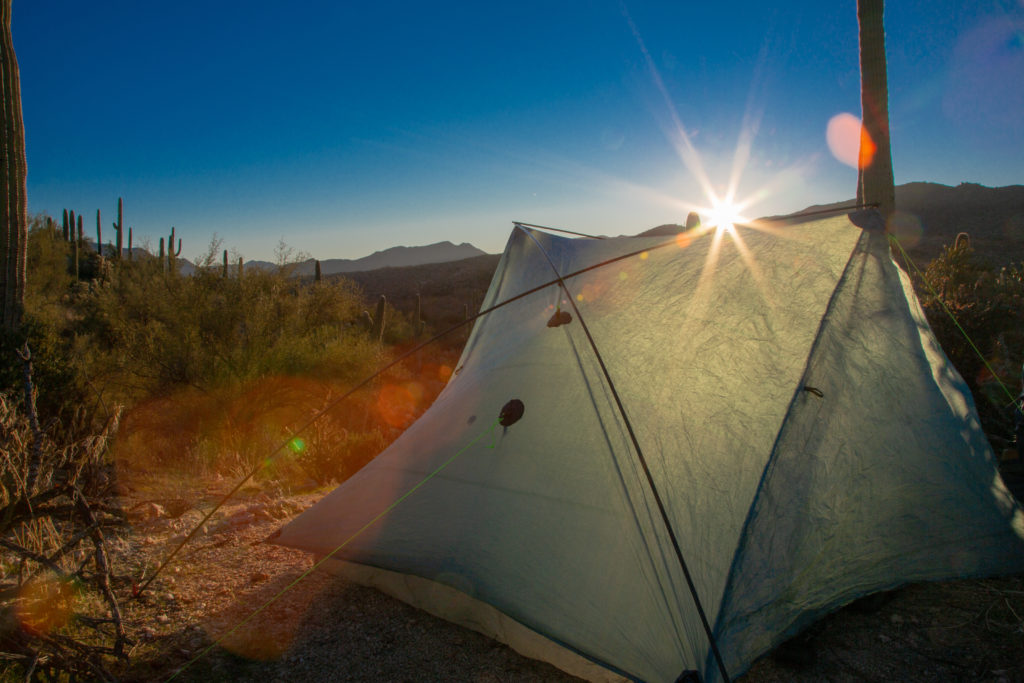
\

After getting up in the middle of the night to view the stars we slept in a bit. I crawled out of the tent at 7:30 am. Our morning routine is the opposite of the evening. Micah works packing up the tent and everything inside while I make coffee and retrieve our blocks of Logan Bread that we have for breakfast. It was an amazing sunrise and a lovely morning to be on the trail. Being the first morning on the trail we were a little rusty and it took us 1 hr and 15 min to pack up camp. Micah pointed out that I need a better packing system to be more efficient. I carry the tent and I like to have the tent in the bottom of my pack so it has to go in first. But the tent is the last thing to be taken down. So all my stuff is on the ground waiting to be packed until finally the tent is ready. Luckily I have all my stuff in bags so it does not really take too long to pack up but I could probably be more efficient.

Good morning sun.
The sun filling the tent filling the tent with early morning light.
Our campsite snuggled in among the trees and cacti.
Micah and our stuff, little disorganized. You can see some rocks in a ring. No signs of fire but people have camped here before.
All tidied up 8:45 am.

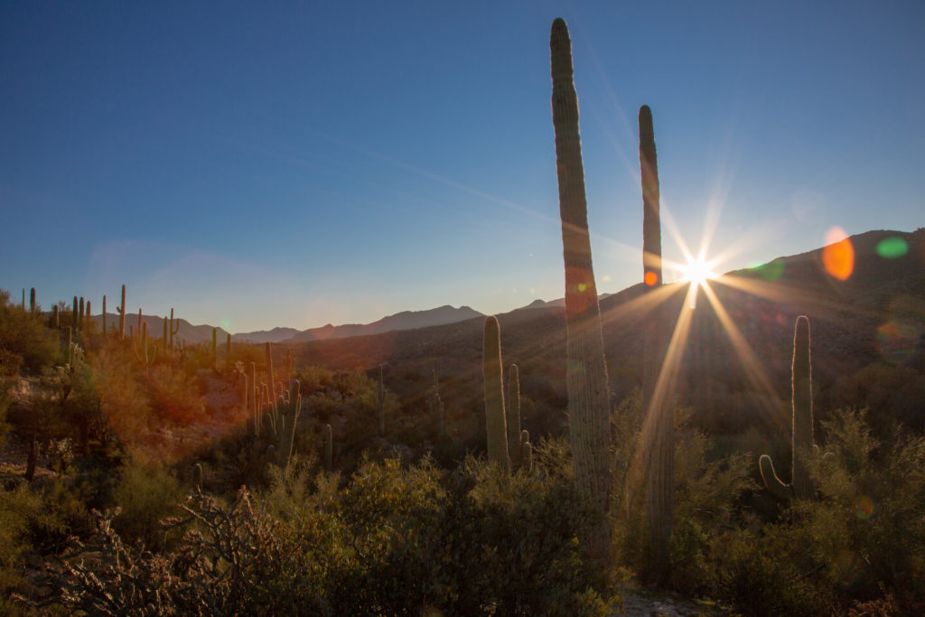
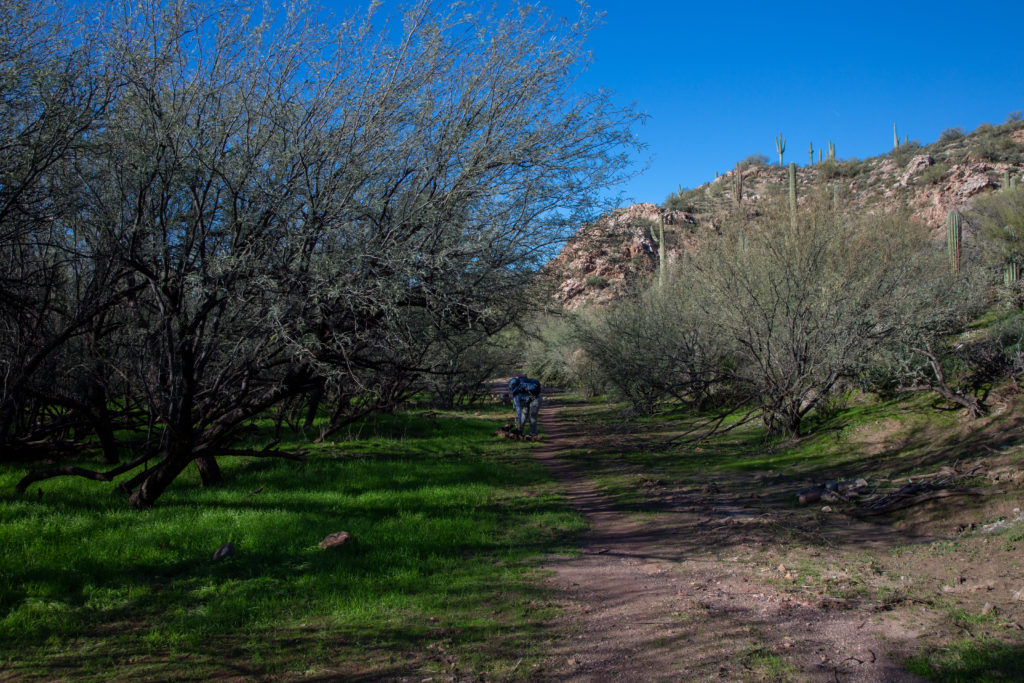
We descend the ridge and hike along in a shaded valley for a few minutes. We climbed up a small bank into brilliant morning sunshine. The sun will be with us all day but never gets hot, just a nice hiking temperature.

Shady start.
In small canyon.
Into the sunshine.
Classic desert scenery.
Cacti and blue skies. Going to be a good day.

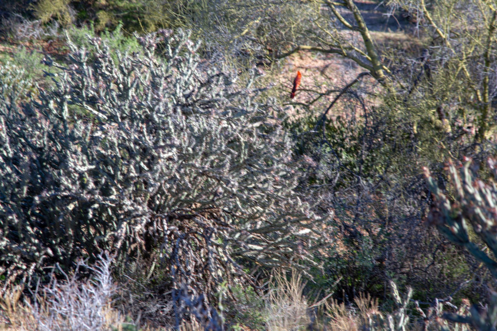
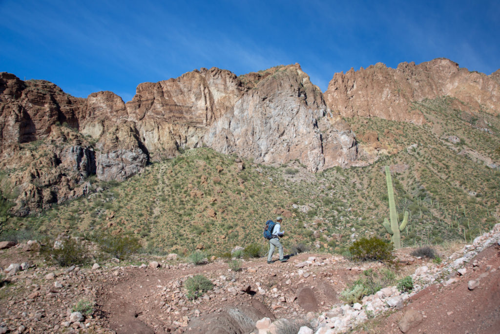
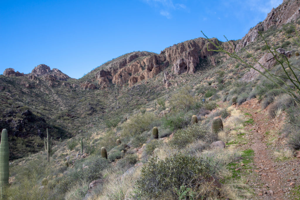
The trail is almost pancake flat for the first 4.7 km as we hike along the Gila River. There are small ups and downs but only a few metres each way just enough to keep things fun. We came across a cardinal flying from bush to bush. I chased carefully after it trying to get a good picture. The sun was back lighting the cardinal making it just a dark splotch but I did manage to get one good picture.

Micah off down the trial. Well graded and smooth.
Best picture of the cardinal.

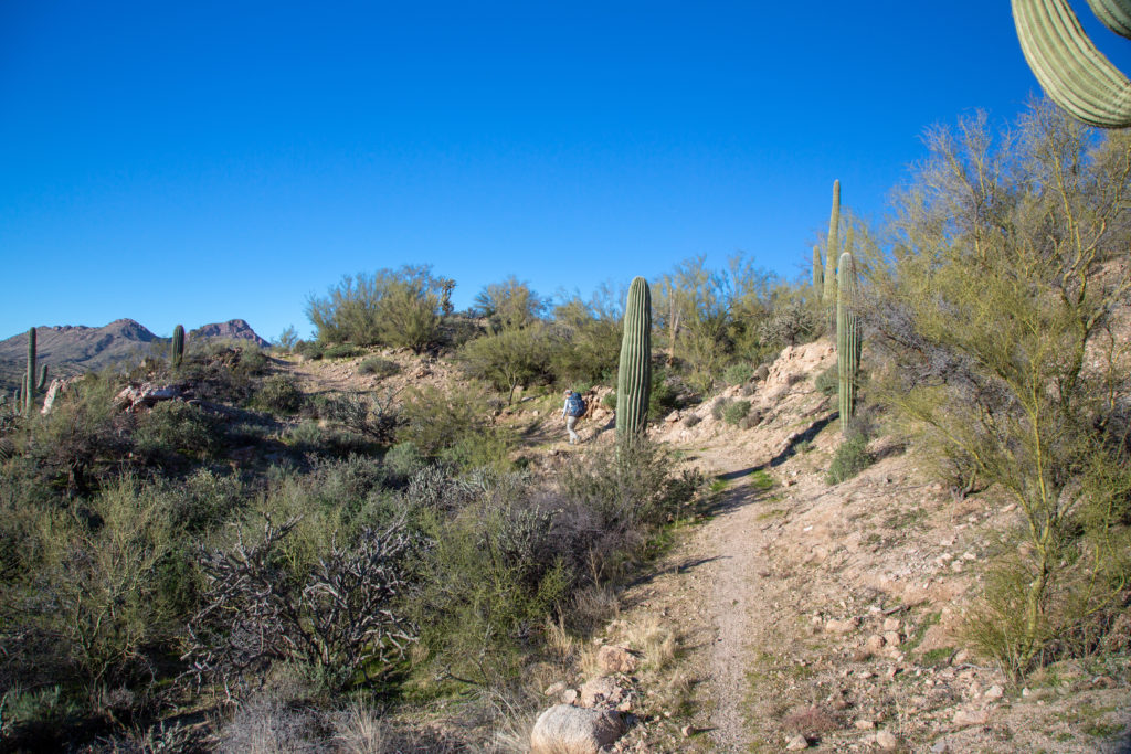
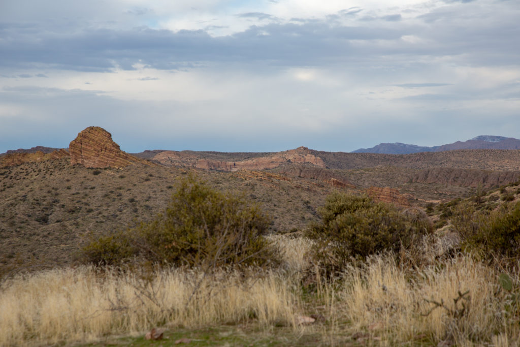
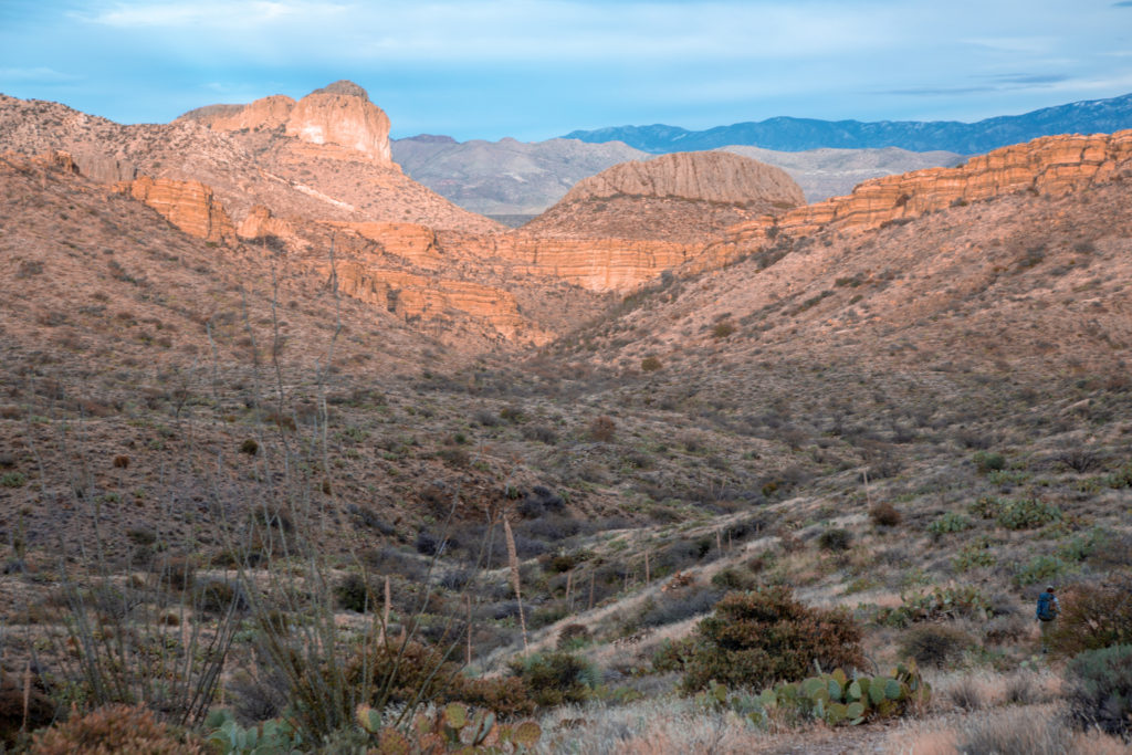
You can see that the trail has had a lot of thought put into it during the building process. The trail never climbs very steeply. To avoid the steep inclines the trail weaves in and out of the little valleys that come to the river in an attempt to find a nice gradient to climb up the other side. As opposed to taking a more direct approach that would result in steeper climbs. This practice of finding nice inclines increases the length of the trail. At one point I had measured the distance that we had traveled in a straight line to be 9 km, but my Viewranger app had said we had hiked 14 km!

A well graded trail.

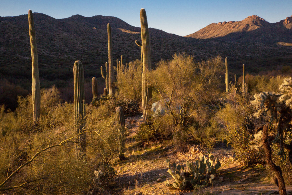
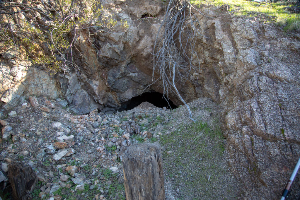
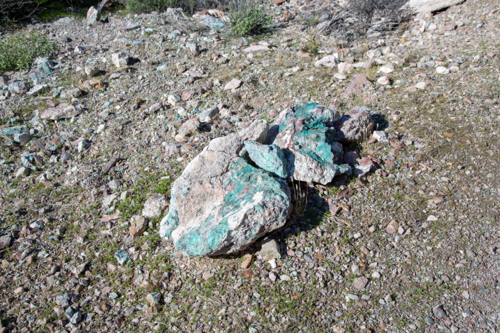
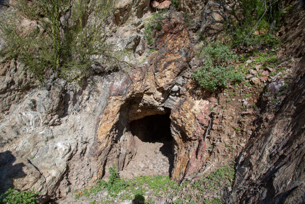
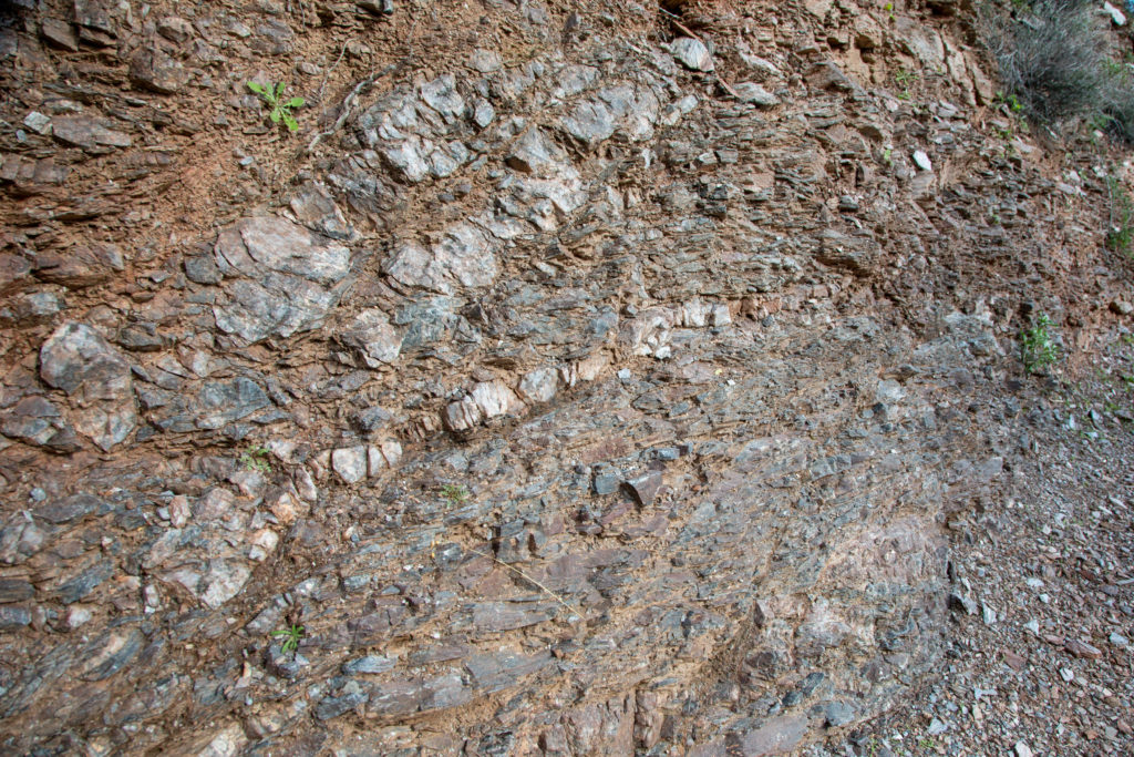
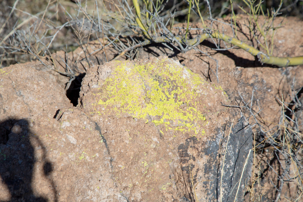
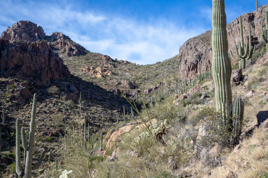
There is a lot of mining activity in Arizona and we can lots of evidence along the trail. There were numerous holes dug into the ground and into the side of hills. We also lots of green rocks caused by oxidized copper.

Good morning desert. The hole in the foreground appears to have been dug out by someone. It was very round and about 5 feet deep.
Closed off tunnel.
Copper.
Another tunnel.

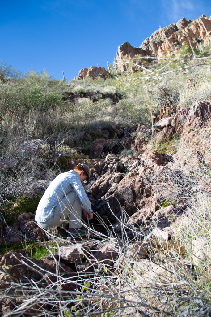
We stopped for a few minutes for Micah to attend to her feet. Micah’s shoes were quite worn out and the lack of cushioning was bruising the back of her heels.

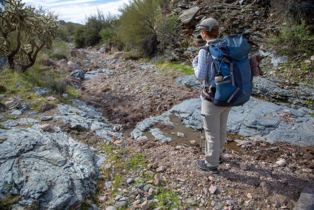
We continued hiking along the river but never coming down to the river itself. The valley becomes quit wide and the area beside the river has been fenced off for the cows keeping us up and away from the river.

Looking east, double sun star.
The valley has widened. Micah is dropping down to walk in the trees.
One final time in the grass before turning north towards the canyons.

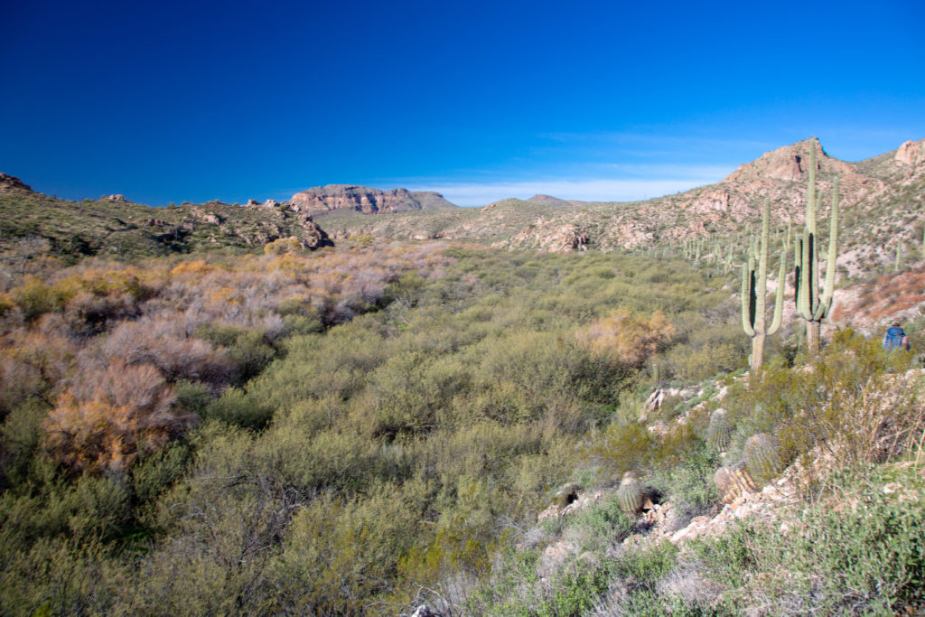
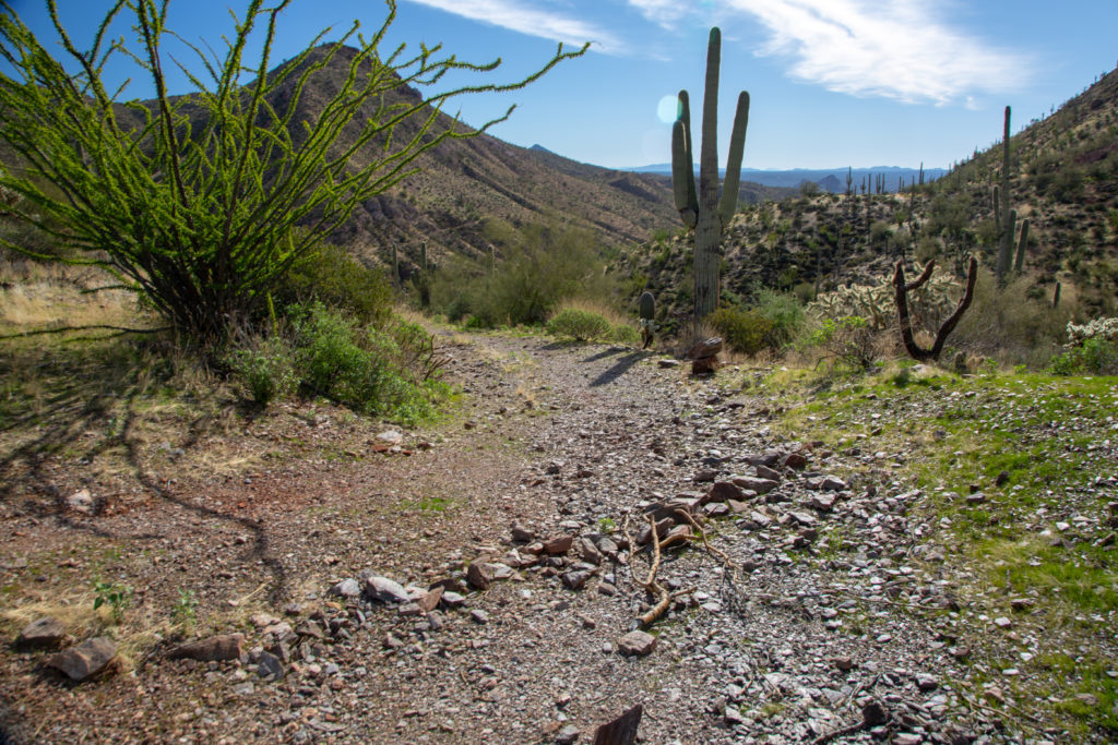
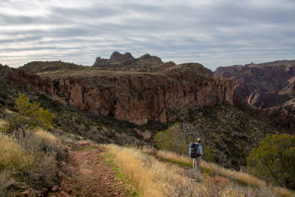
After 90 minutes of hiking and 4.75 km we come to the junction where we leave the Gila River to head north into the canyons.

Trail junction, turn right.
Heading up a jeep track. We will be cutting across the slope to our right. More elevation in our future.
Looking back from where we have come.

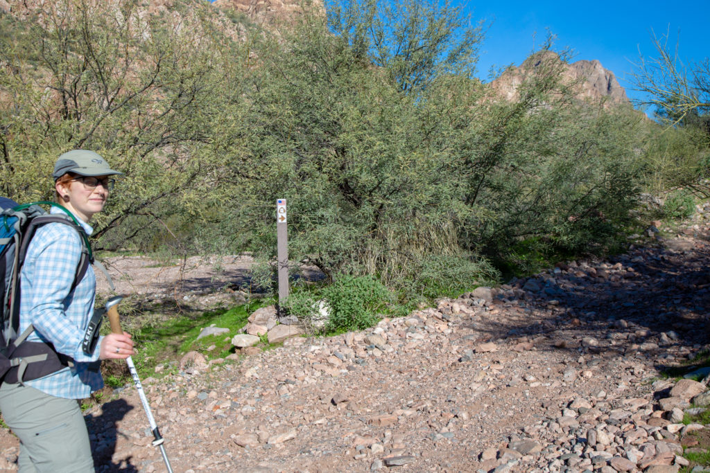
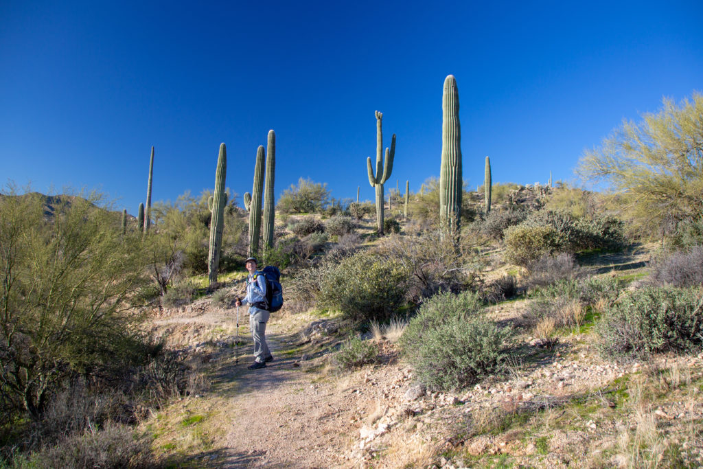
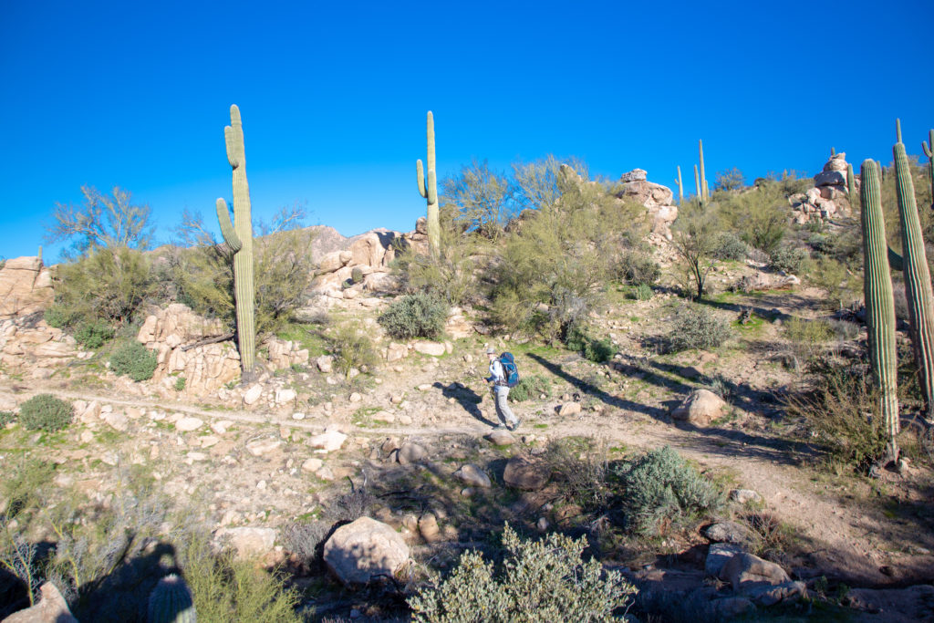
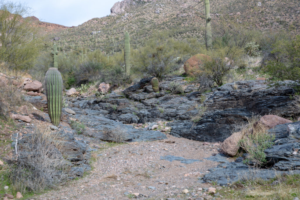
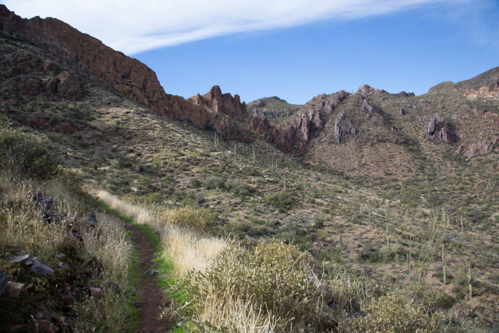
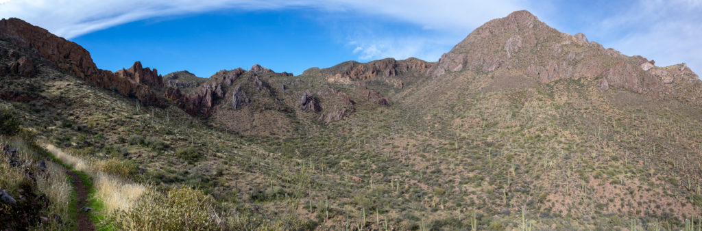
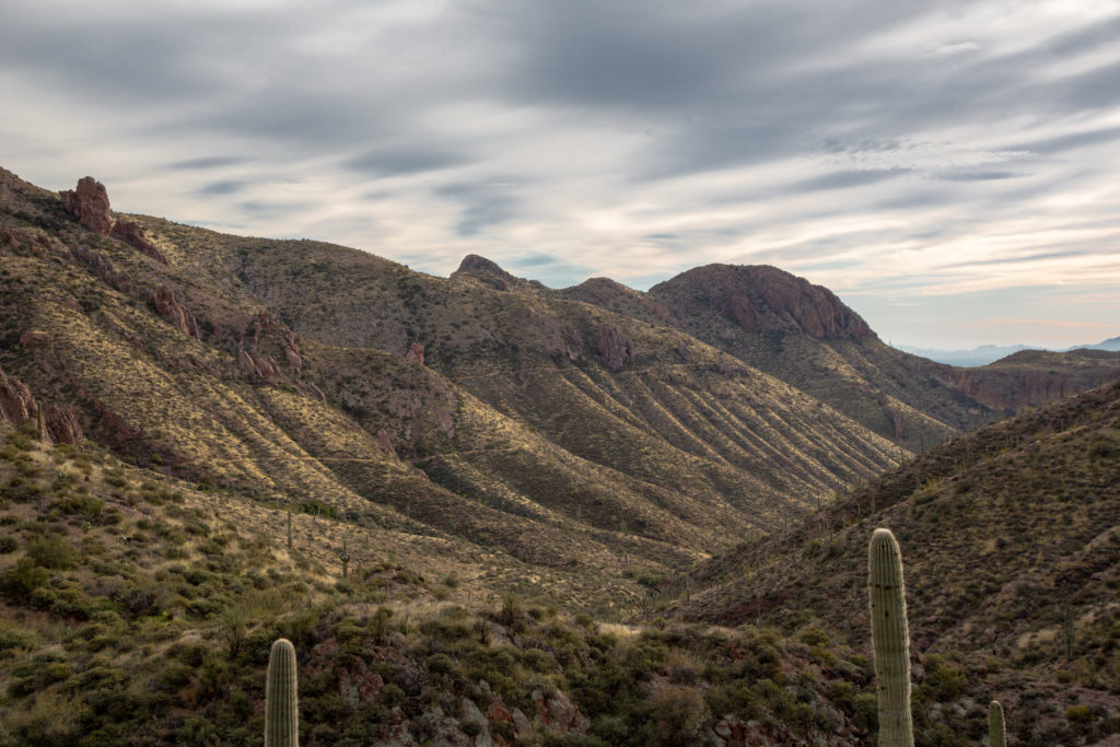
The trail is continually uphill for the next 4 km only rising 200 m, so a very pleasant 50 m/km grade. After less than 10 minutes we come to our first junction. Staying to the left we left the jeep road follow a trail around the side of slope and up a small valley. We are entering a canyon and have tall cliffs to our west and high hill to the east (right).

Looks like a good camping or lunch spot.
Cliffs of volcanic rock capped by classic red sedimentary layers.
Off down the trail.

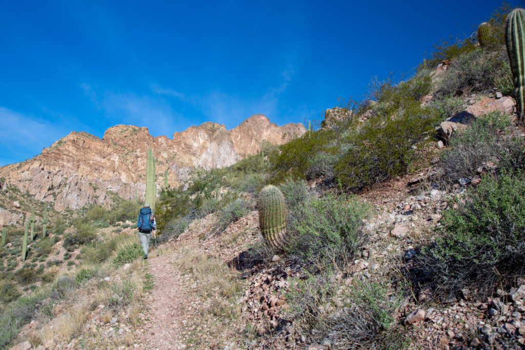
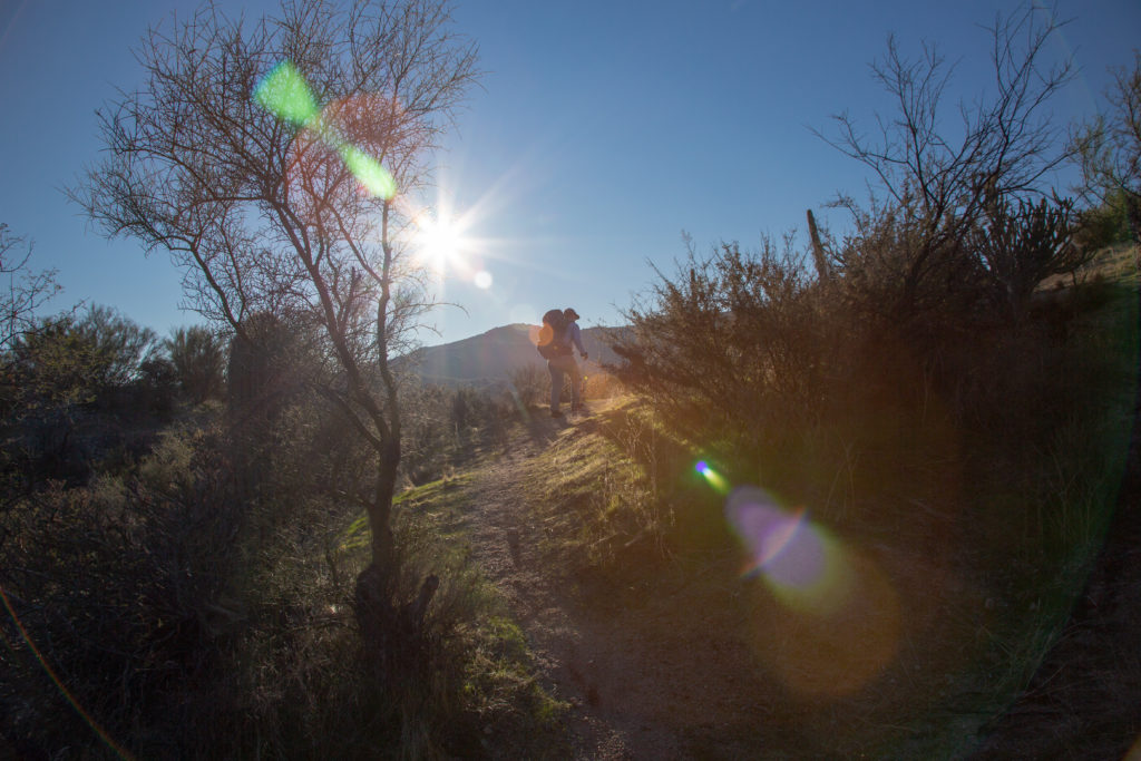
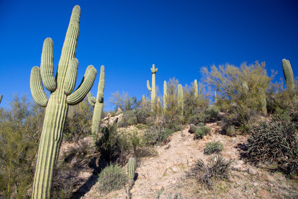
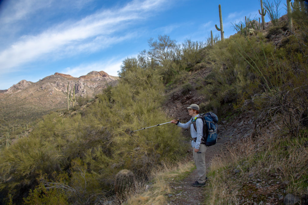
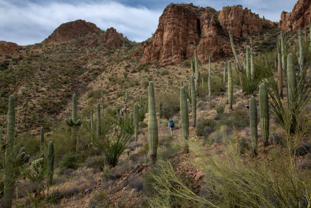
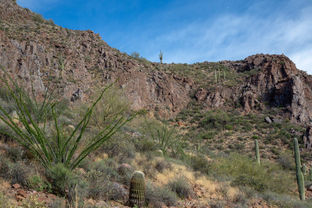
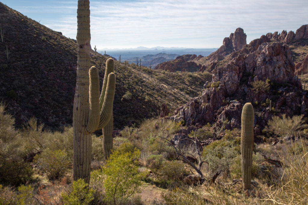
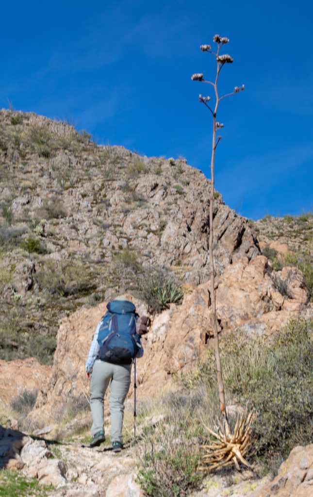
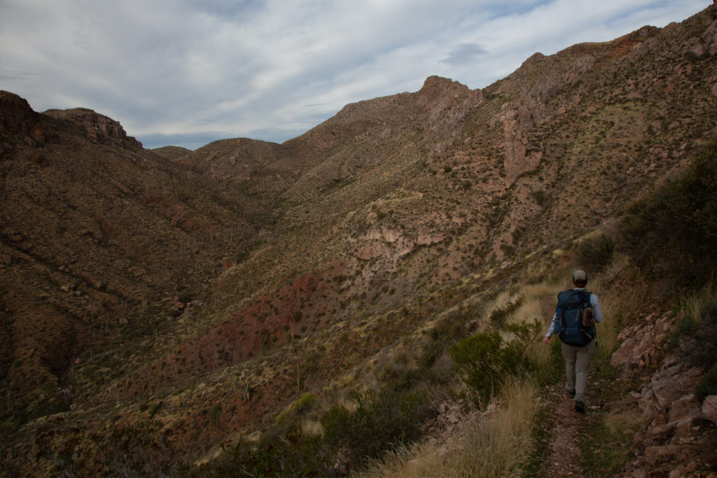
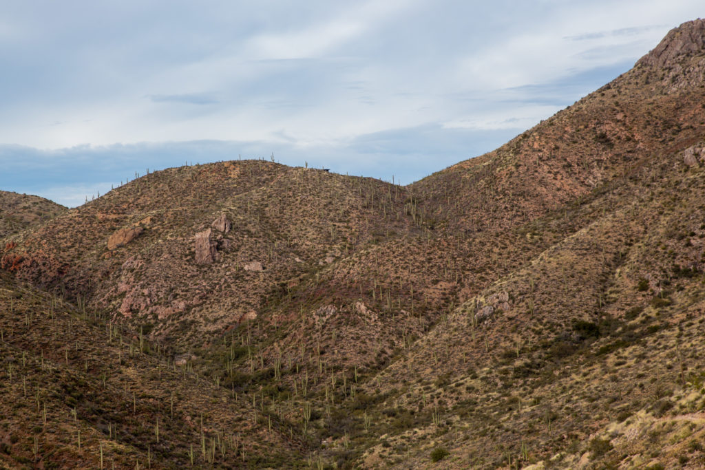
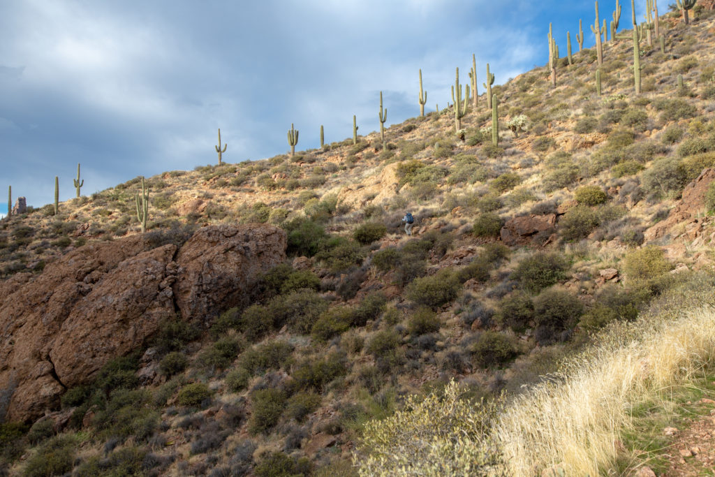
I am still lagging behind as we hike. Taking pictures as the desert landscape continually changes. The trail does undulate a little but we continue to gain elevation. The temperature is warming up but only ever gets to a very comfortable hiking temperature.

Nothing like low morning sun.
We are rising steadily on excellent trail.
Does hiking get any better?
Micah called this “The Thumb”
Well, we still have some hiking to get to The Thumb.
Looking back. There are large mountains on the distant horizon.

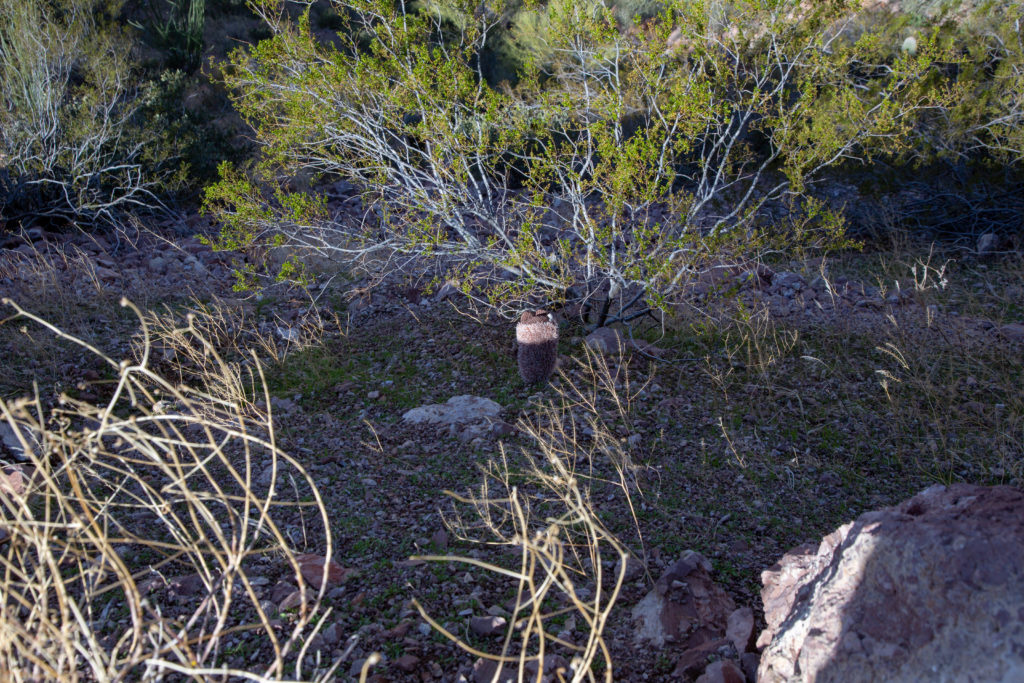
We took a break on a north facing slope after 2 hrs 20 min and 7 km of hiking. While we enjoyed the view I had some fun taking photos of our hiking mascots, Horace the Hedgehog (Micah) and Frosty Paws (me). The mascots are great at holding still while I photograph them but Horace did have an adventurous tumble down a very steep slope from which Micah made me do the rescue.

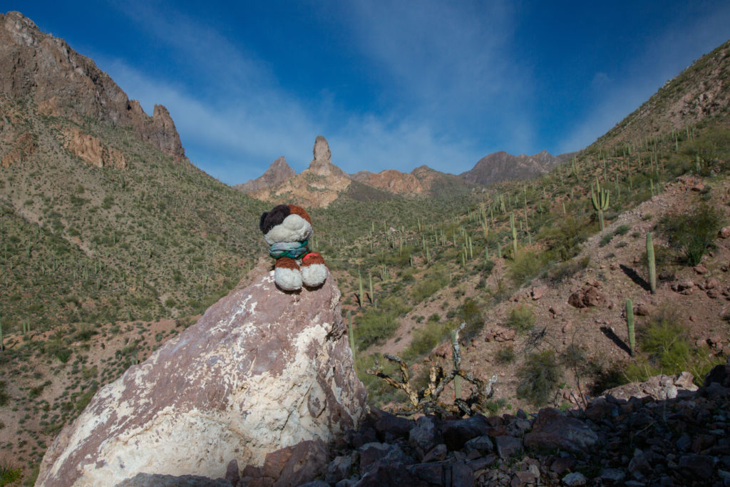
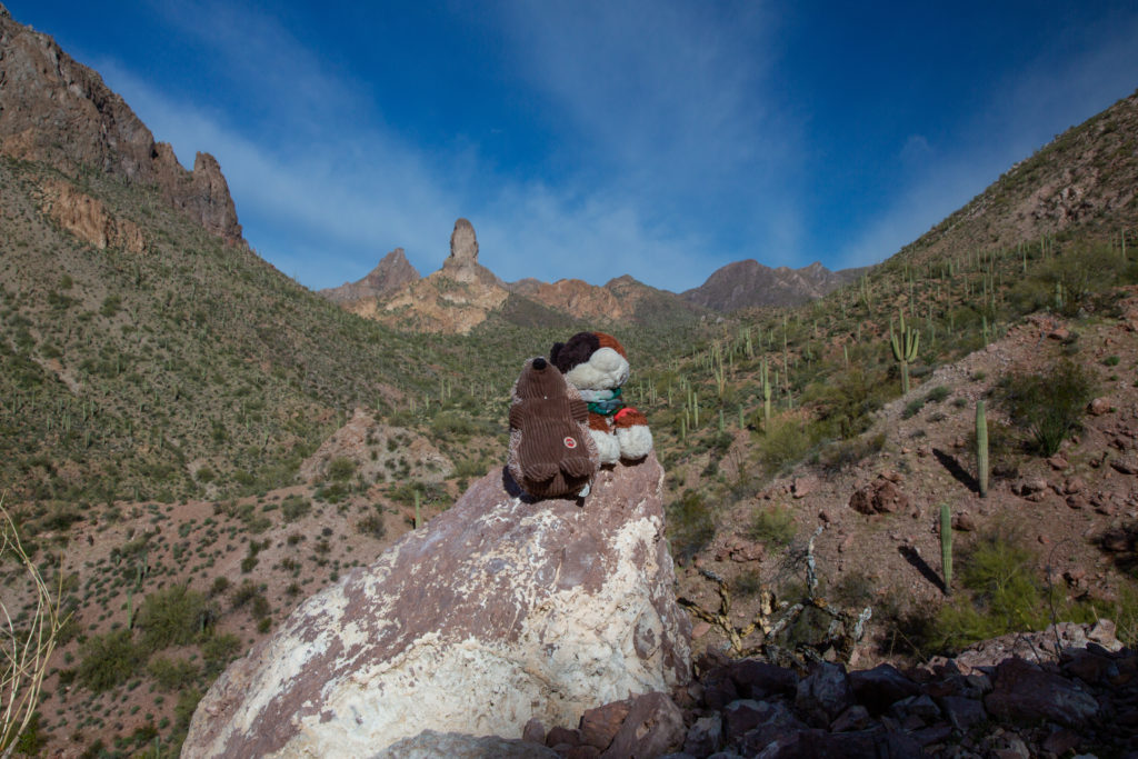
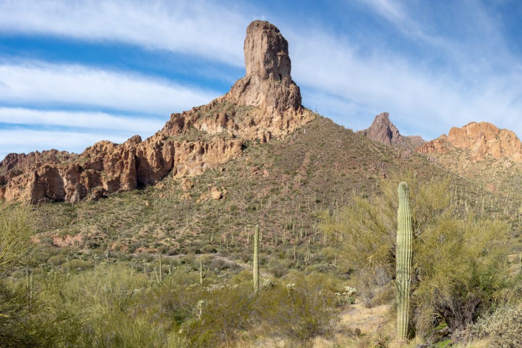
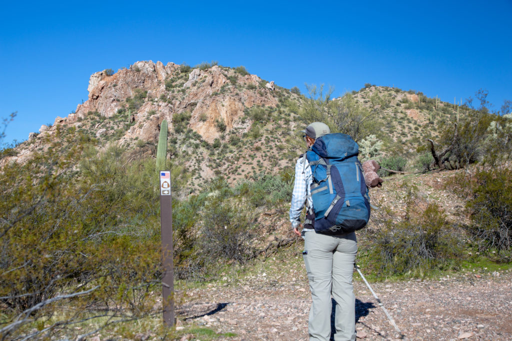
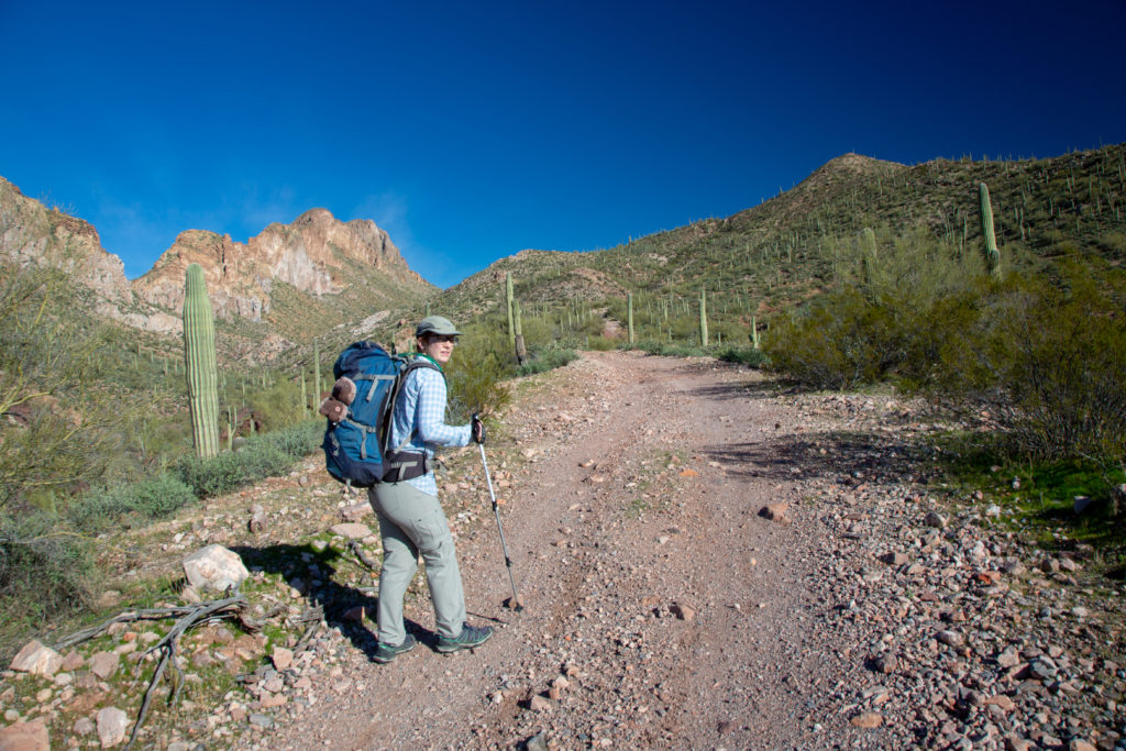
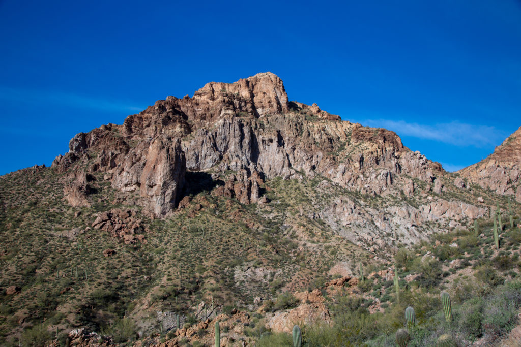
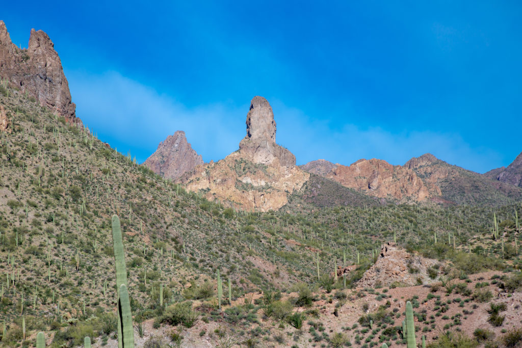
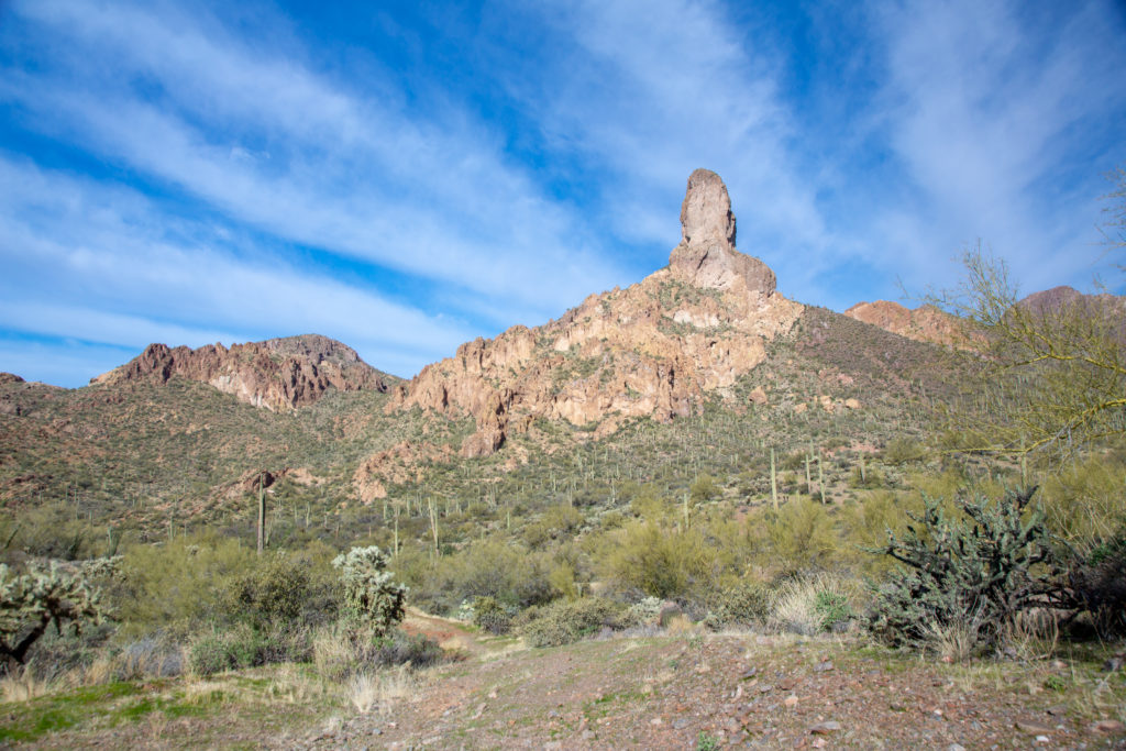
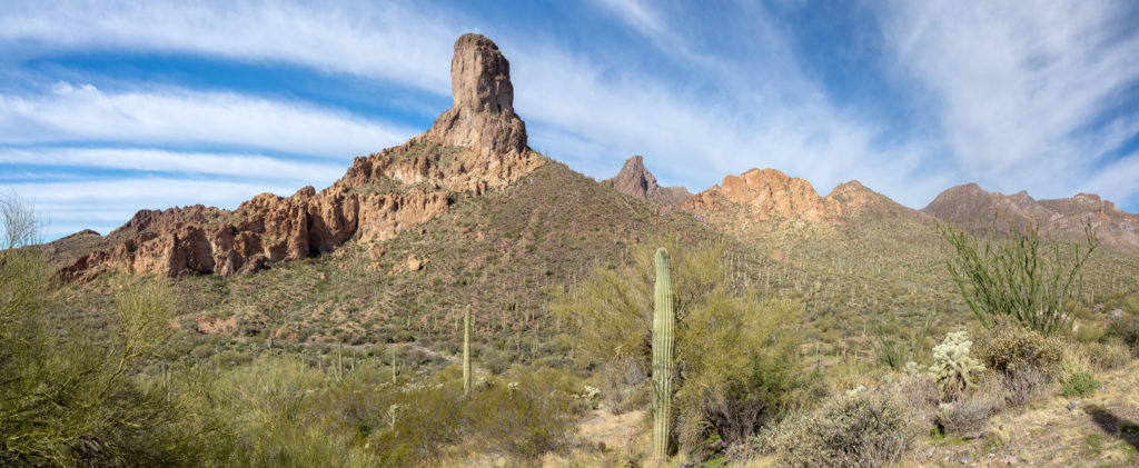
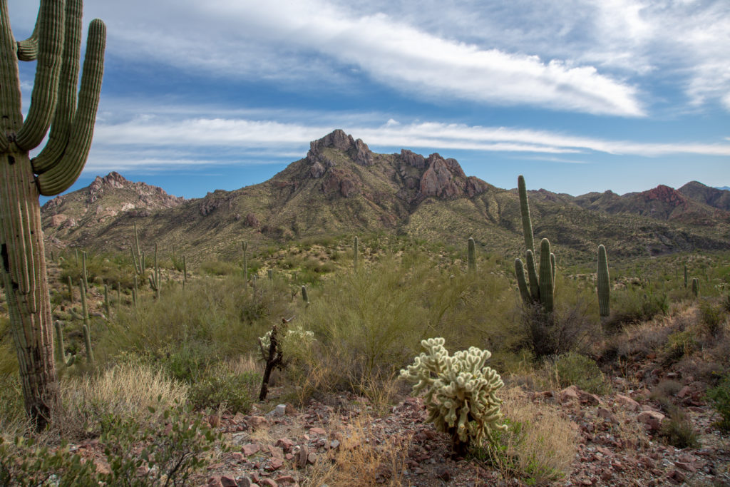
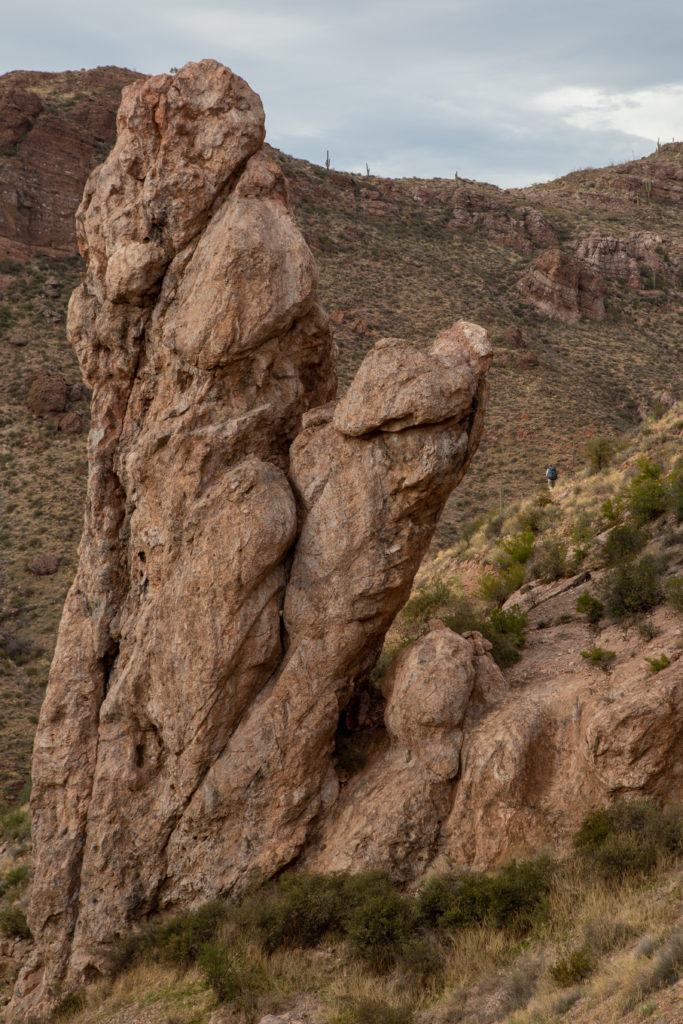
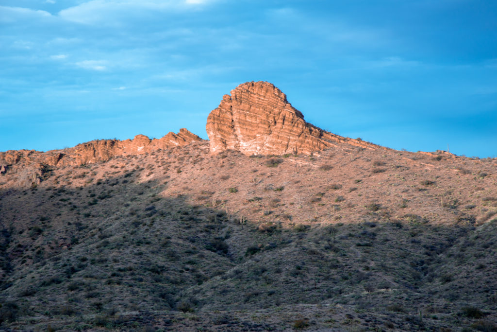
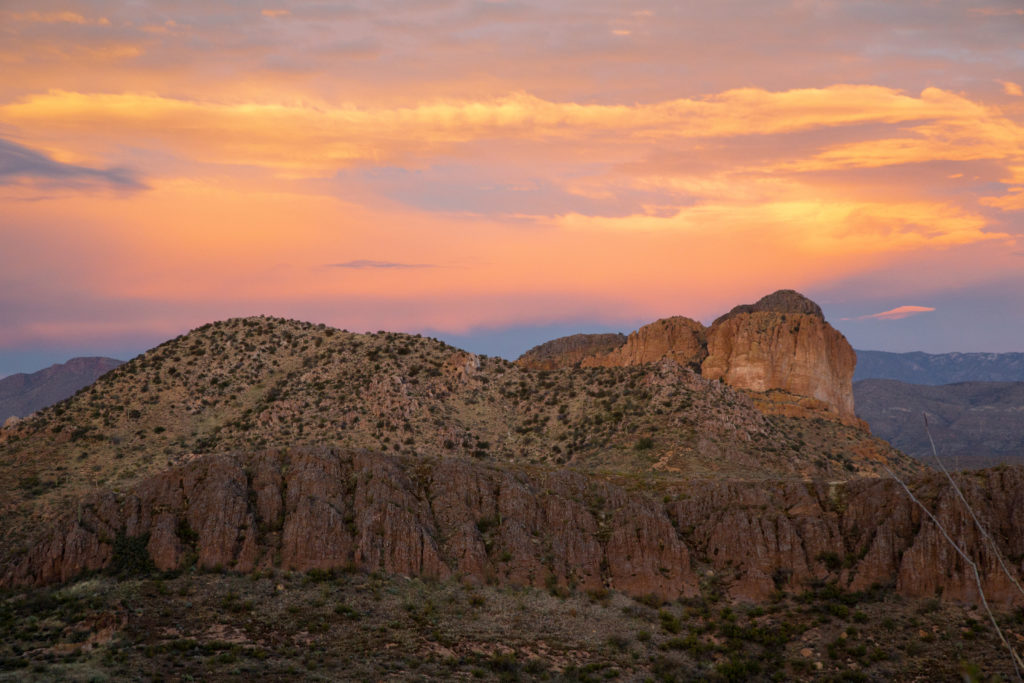
We started off again heading towards the Thumb. In a straight line The Thumb is 1.9 km away but it will take us 2.3 km of hiking to get to our closest point which will be still 500 m away.

As we start hiking The Thumb is 1.9 km away. Photo shot with a 47mm focal length.
Zooming in with a 70mm focal length The Thumb appears much closer but was only 5 minutes since the last photo. Note the hill and trail in front of The Thumb.

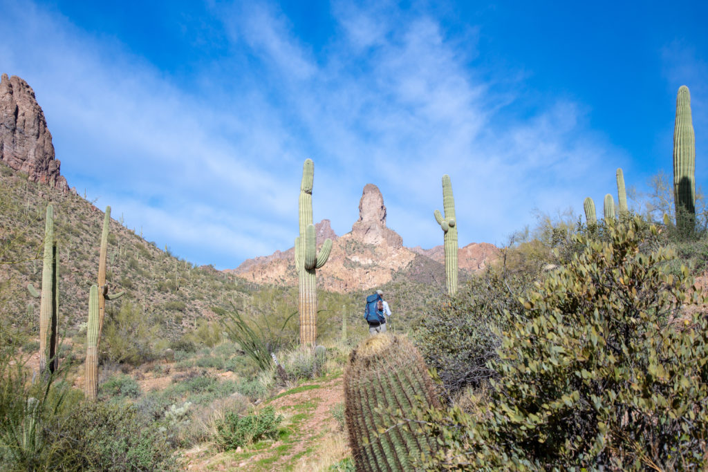
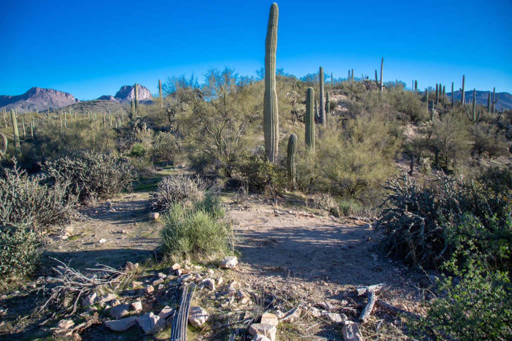
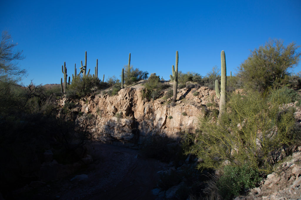
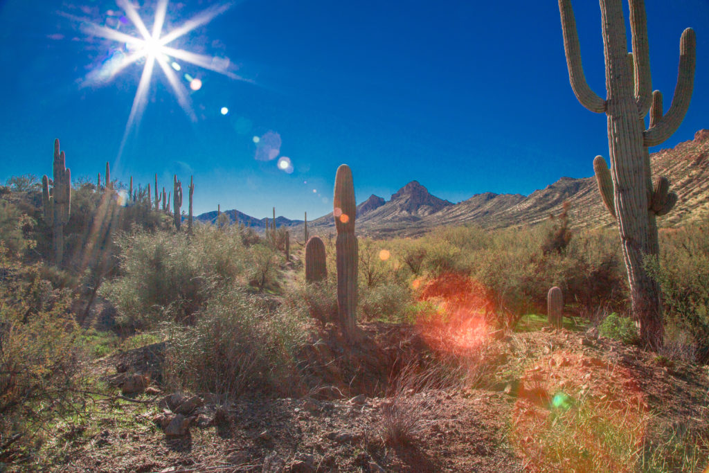
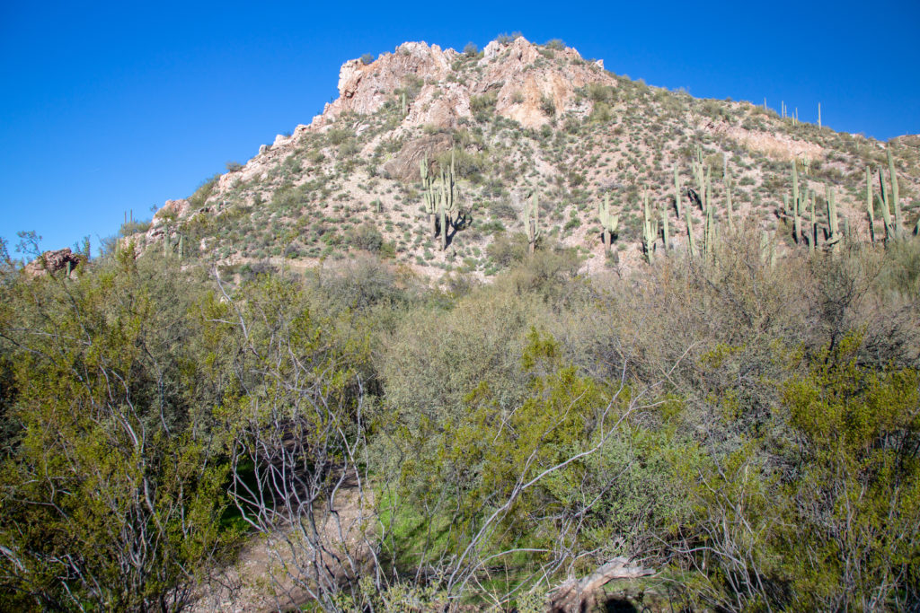
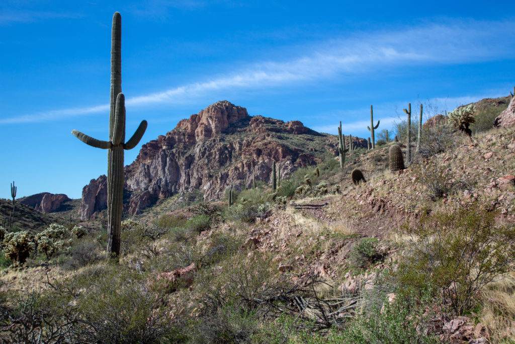
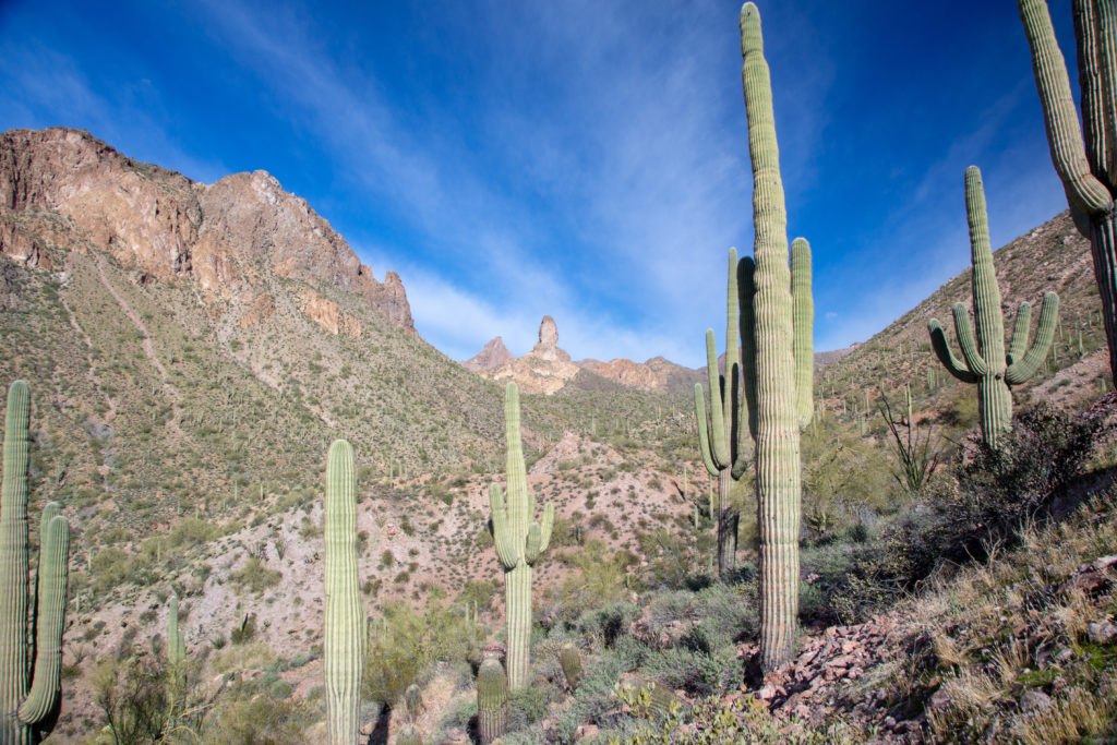
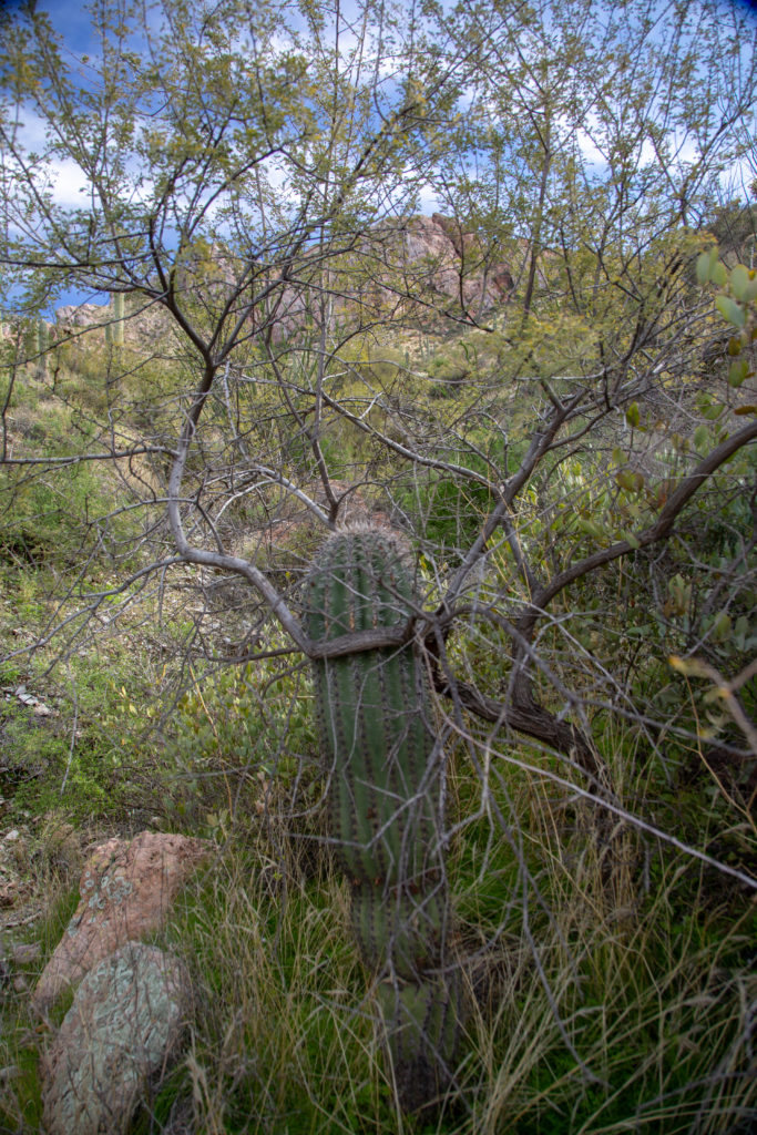
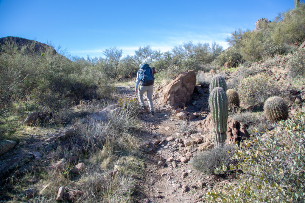
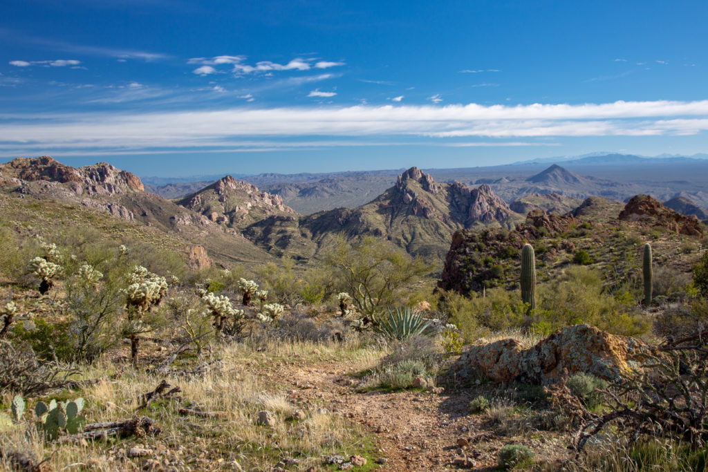
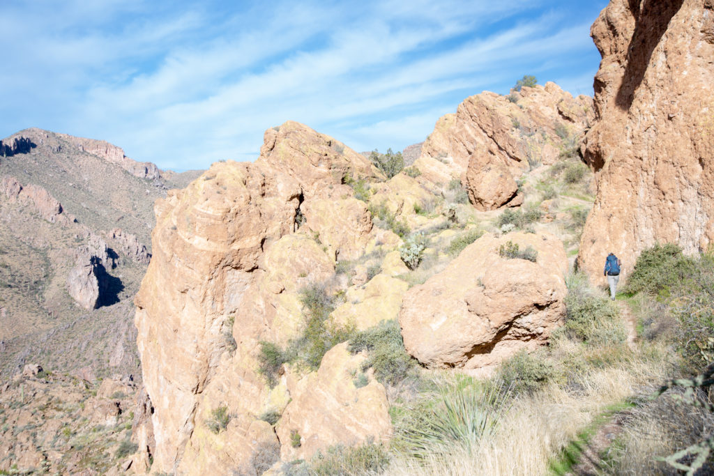
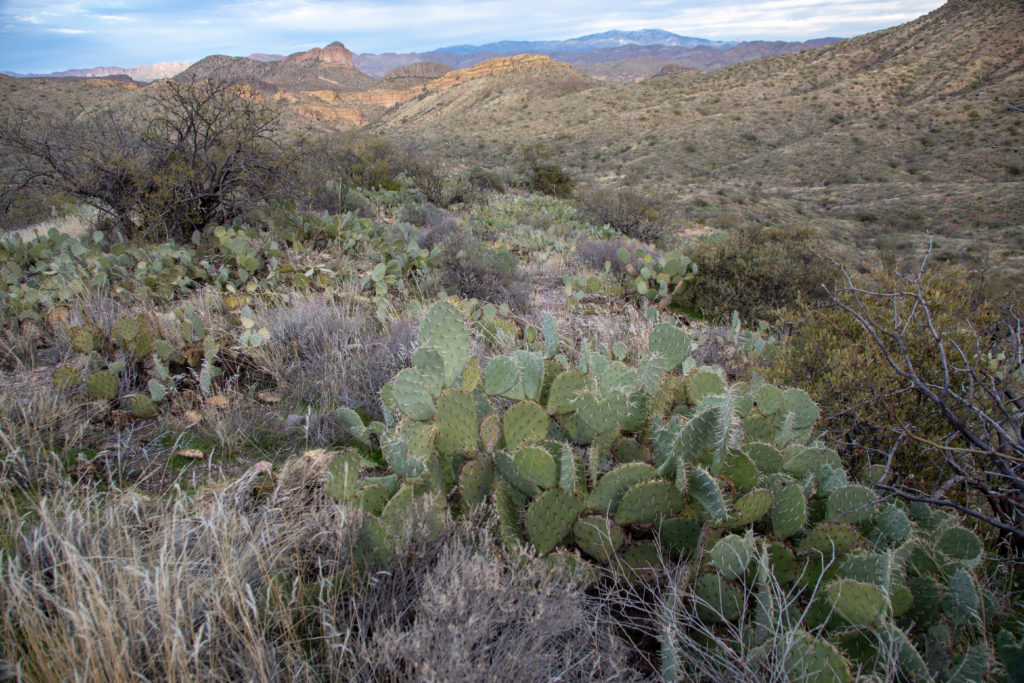
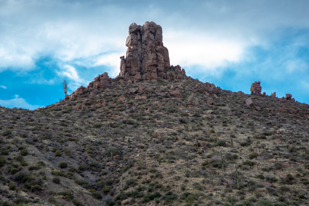
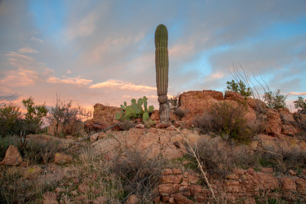
As we continue hiking we come across more blocks of quartz. We follow a jeep path for a short way. Where the trail leaves the jeep path there is a large camping area with an amazing view of The Thumb (-111.14410, 33.13623).

Well used camping location.
View north of the camping location of The Thumb.
View south of the camping location.
Panorama of The Thumb.

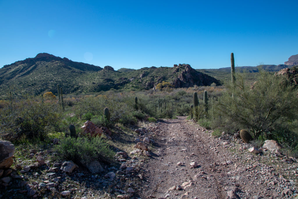
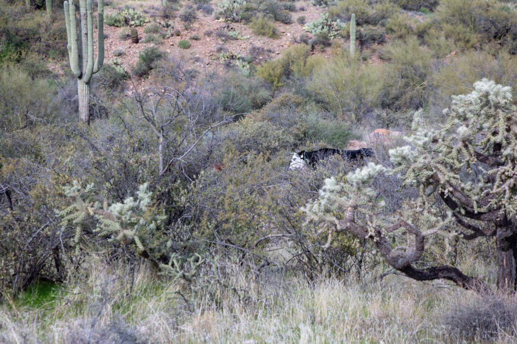
As we pass by The Thumb is is noon and the trails flattens out for a couple of km’s. We have been hiking primarily on the west side of the valley. We have been trying to guess what ridgeline we are going to hike over and as usual we got it wrong. Just before crossing the valley Micah spies some more cows. Back home we have to make noise on the trail to alert any bears in the area. So we continue the practice of making noise to alert wildlife but now the wildlife is cows. As we yell the cows did hesitantly run out of the way. I am not generally afraid of cows but they are large animals and if one was to run at you serious injury could result.

Micah spies a cow.
Cow
The tree is the giving the golden pincushion an hug.

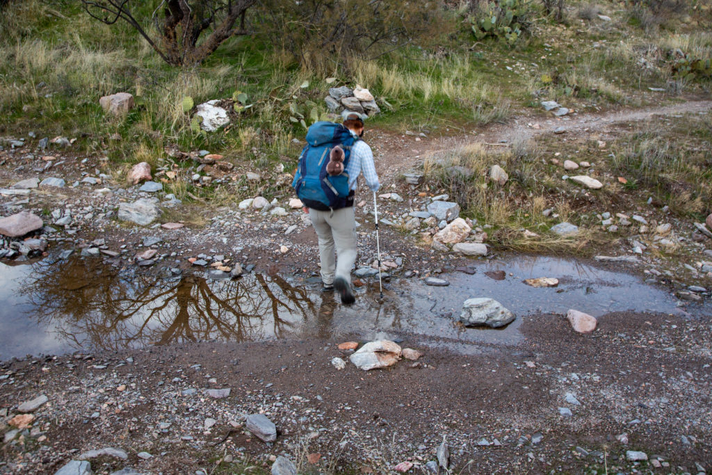
We head across the valley while carefully dodging the cows. The stream at the centre of the valley contains a small trickle of water. With all the cows walking through it we decided it not worth filtering to top up our water supplies. The rocks the stream is cutting through where a dark green and very different from the other rocks in the area.

Cutting across the valley bottom.
A very small flow of water.
Such a dark, deep green.

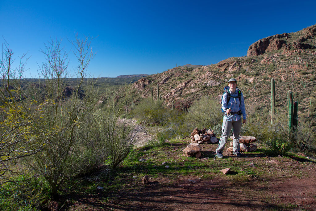
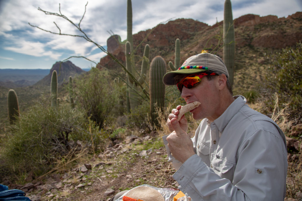
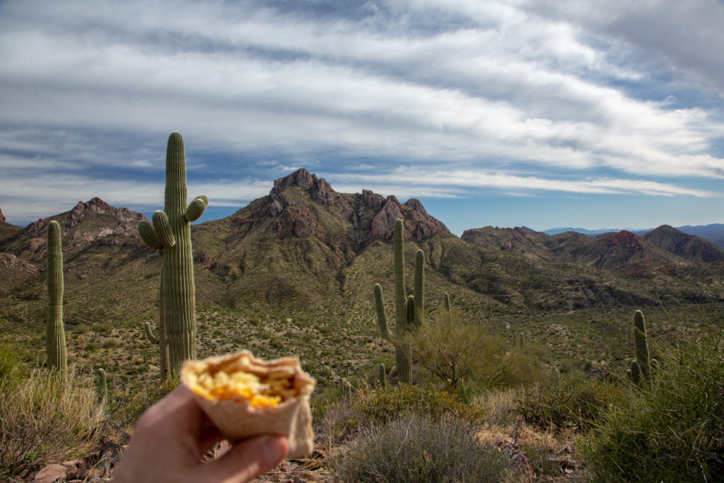
Once across the stream we head up. This was about the steepest section of trail as we rose 100 m in 1.4 km. We switchbacked up the hillside. As we come around the corner of a ridge we are afforded an expansive view of the valley and Micah decides that this is a good place to have lunch. It was just before 1 pm. We had been hiking for 4 hrs 15 min and covered 12.2 km.

Micah passing through a forest of teddy bear cholla.
The view across the valley looking east.
The saguaro have returned.

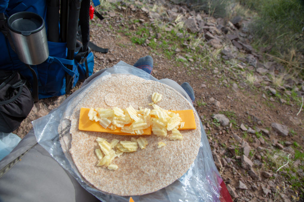
Lunch was the same as yesterday minus the tomato. I had two tortillas and Micah just one. We added some sweetness by having some chocolate Aero Bubbles for desert.

Lunch day 2.
It tasted delicious!
Our view at lunch.
More green rock interlaced with the red sandstone.

We spent just a bit less than 30 minutes on our lunch break. Micah took the time to tend to her heels which were sore. As we started up again we followed a contour running along the slope on the west side of the valley not gaining much elevation. We could see a trail in the distance cutting up alongside a slope at much the same elevation we are at. We are not sure if the trail in the distance is our trail but it was. It took us about 30 minutes to arrive at the trail and it was there that we started to climb out of the valley.

You can just make out our trail on the brown slopes in the distance.
Panorama of our view as we start to head upwards and out of the valley.

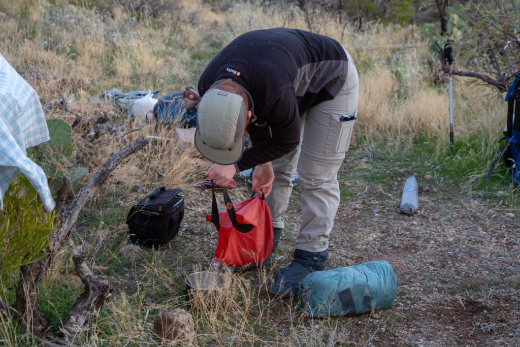
Once arriving at the trail we spied in the distance we started to head upwards towards a pass. After a few minutes we came to a flowing stream. Micah suggested we stop and fill a water bottle since we were not entirely sure of where the rainwater collector was located.

Desert scenery.
We are now headed up. We cut across the centre and around the little outcropping on the left of the picture.
Filtering some water.

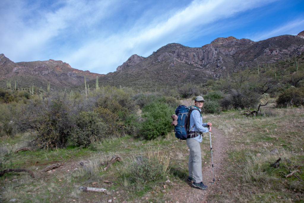
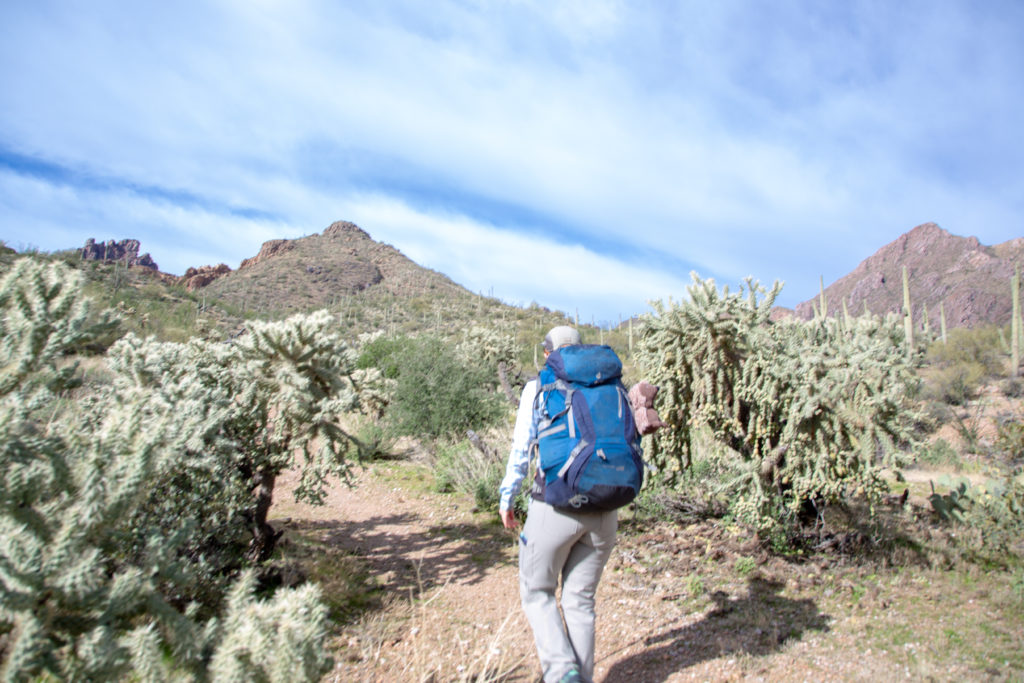
After filling one bottle we continued hiking. As we turned right around a rocky outcrop there was a flat section of ground that provided a view point of the entire valley. I snapped a picture of Micah looking back over the valley. It is my new favourite photo of her.

Micah surveying where we had come from.

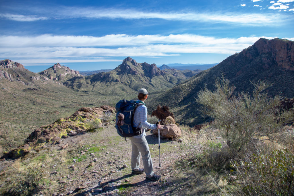
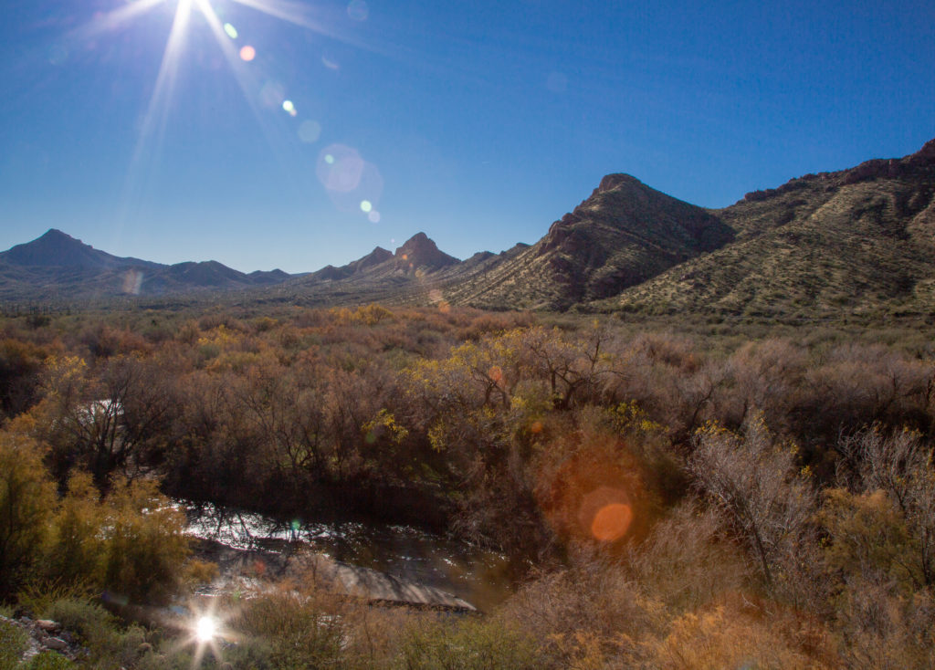
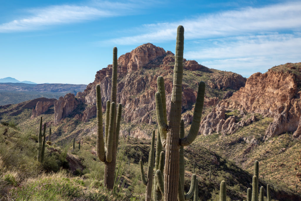
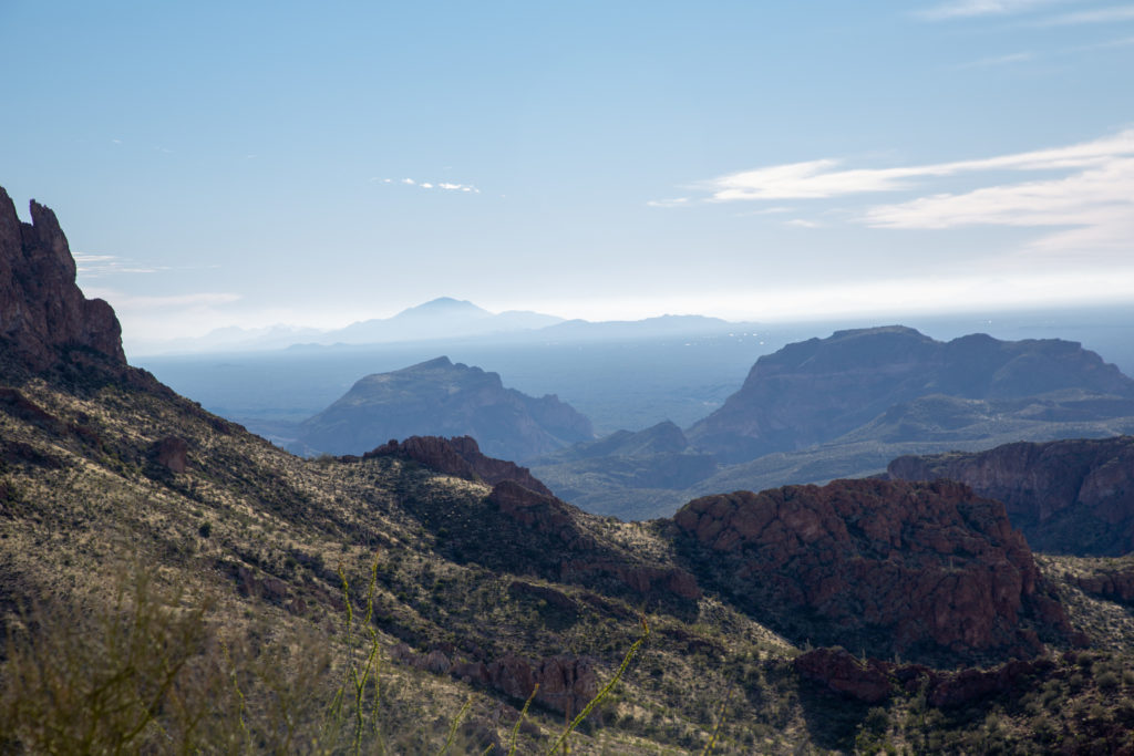
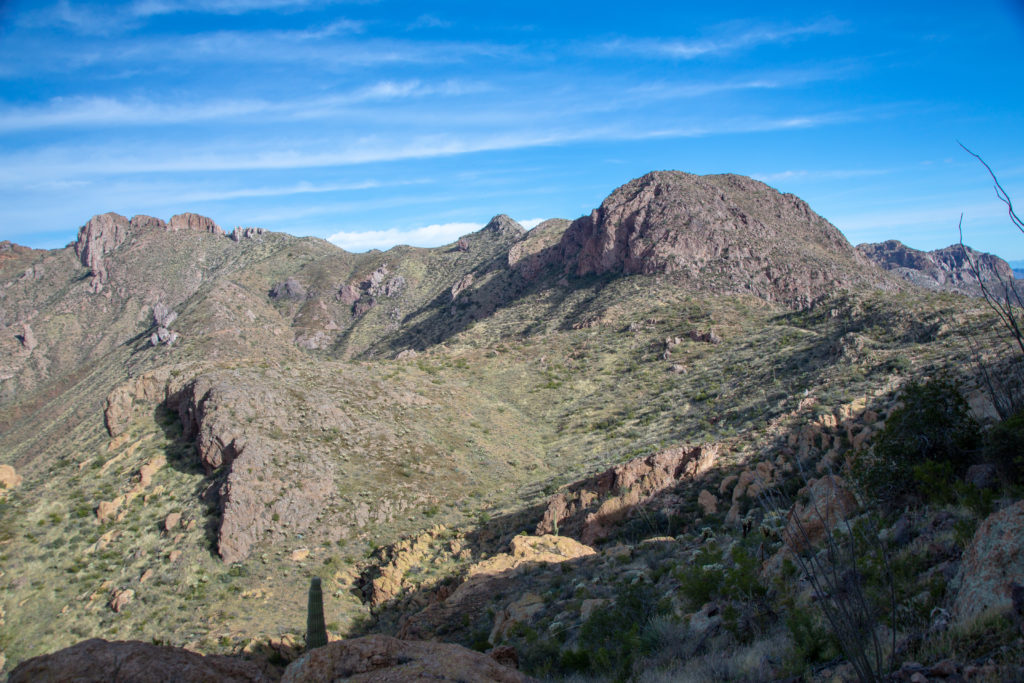
We continued on up. We crossed over to the other side of the pass and could see out to the flatlands of Arizona through a new valley. We stopped for a few minutes to enjoy the view. As we traveled clockwise around the peak of our pass and could see that the trail headed up very similar to earlier trail had sidesloping up to a south facing slope to a new high point.

Heading up to our first high point of the day.
View to the south west. I believe that the mountains on the horizon are the Table Top mountains due south of Phoenix, about 100 km away.
An indication of the low rate of erosion is the ever present lichen on the rocks.

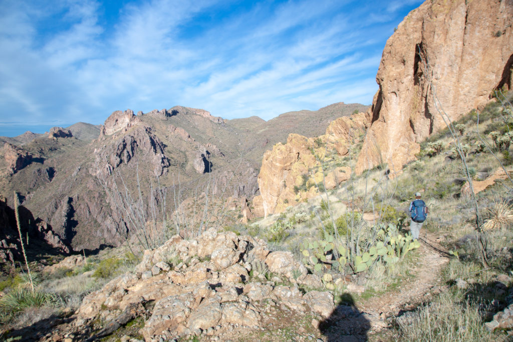
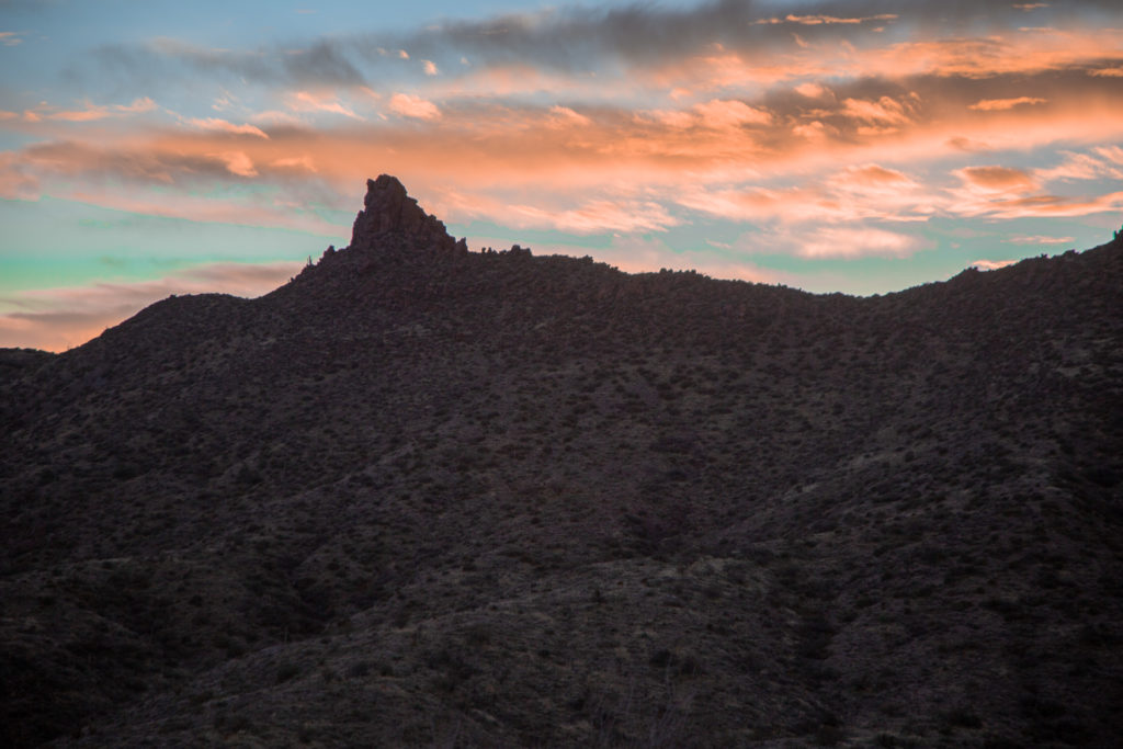
We follow the trail around and up the sideslope. It appears that we should head up and over the grassy pass but the trail takes a hard turn left across the slope. Later we would find why we could not just head over the pass as there is a large cliff on the other side.

Micah hiking past a new plant, very tall.
Plants fighting to survive.
We thought we should head up and over the pass at the centre. You can see the trail cutting across the bottom to the left. We would go around the large peak on the left. There is a large cliff on the other side of the pass that we will pass under a little later.

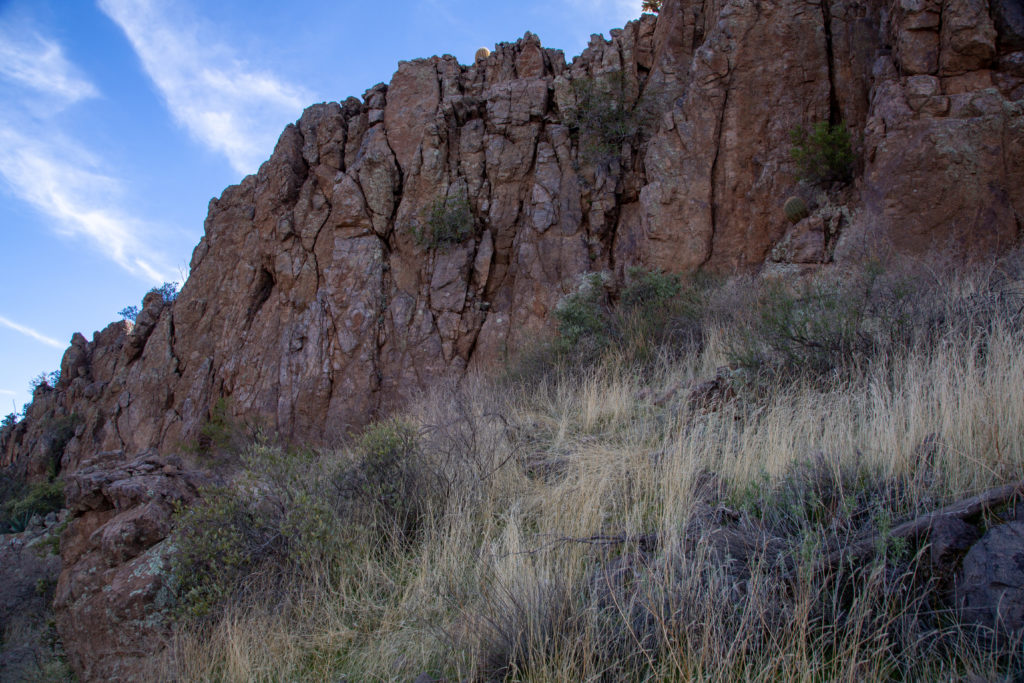
We hiked up and between two peaks. The area at the top was a pleasant little plateau. As we head around the other side we hug the cliff on our right. We wrapped right around the cliff turning a complete 180 degrees.

View looking south east. I believe that is Sombrero Butte(1688 m) on the horizon about 80 km away. Our elevation was 1050 m.
The plateau at the pass.
Heading over and into a new valley.
Stay close to the left. A little skinny here.

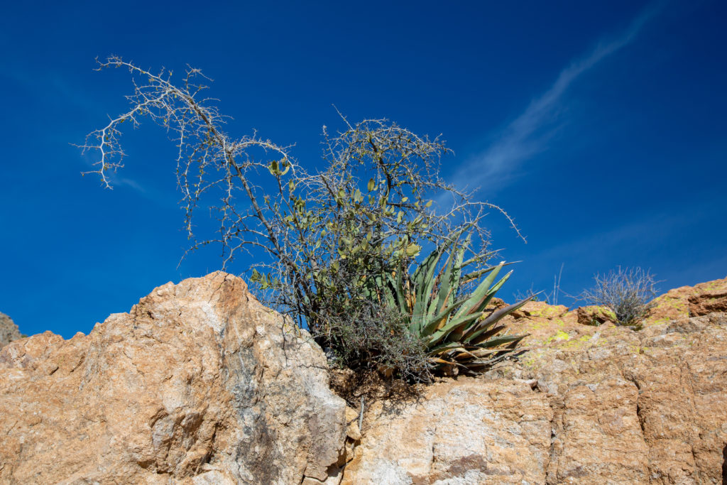
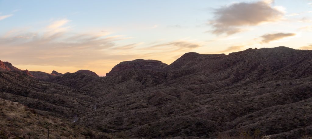
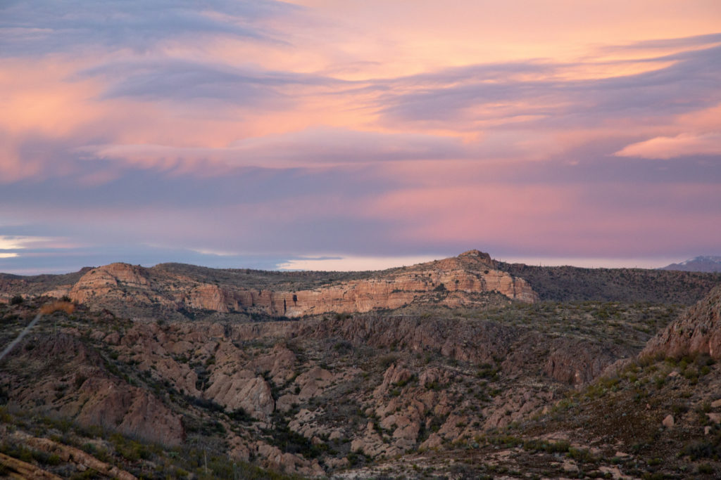
The trail through the next valley stays close to our cliff before swinging left and heading up the valley. There was very little elevation change as we are already quite high. The valley has some interesting rock outcrops, remnants of volcanic activity. We make very good time through the valley. We are still not sure where the rainwater collector is and the day is starting to get late so similar to day 1 it is time to find water and a flat place to camp.

Our trail starts on the right and cuts across the far slopes staying high all the way to the end of the valley.
The cliff that was on the other side of the grassy pass. It was a good plan to hike around. This would have been an exciting scramble with packs on.
We momentarily come to a low point where we had a view of the first valley we had hiked up. We had been hiking on the trail at centre about 90 minutes previously.
Micah checks out the cliff we walked over. The cliff we walked beside is on top, if you zoom in you can see the trail. The cliff Micah is looking at is a few hundred feet high.
Up the valley we go.
The rainwater collector is just coming into view at centre of photo. Now we know where the water supply is.
This was an amazing piece of rock, and for scale can you find Micah right of centre.
To me it looks like a cat sitting.

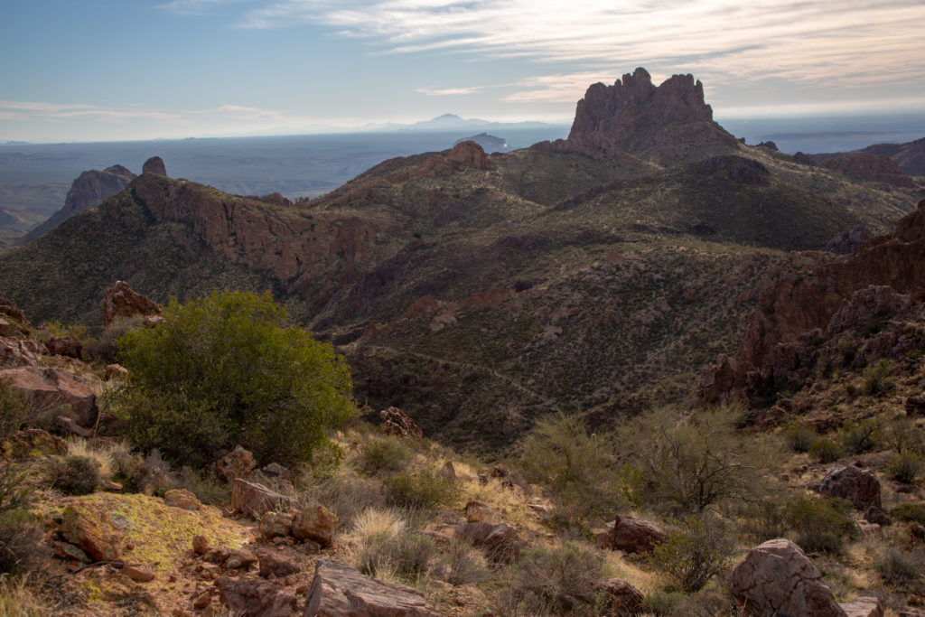
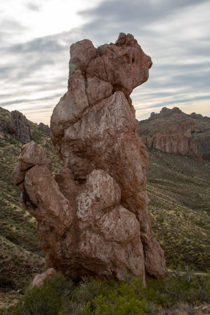
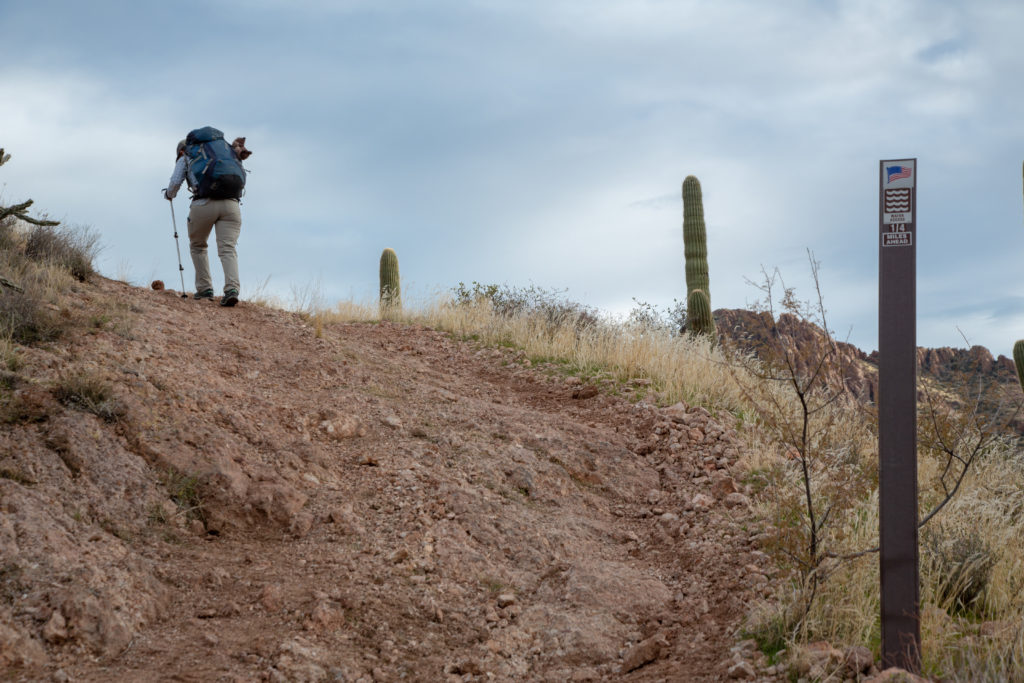
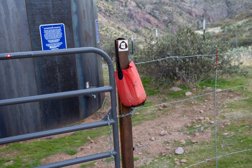
Between the Cat rock and the upcoming pond is the boundary for the Tonto National Forest. On the AZT Passage 16 ends at boundary for the forest.

There is a large pond at the base of the hill leading to the rainwater collector. I am going to find out why it is not listed a as water source.
Looking back down the valley we have just hiked. You can follow our trail back. In the middle it moves up underneath the cliffs. I took 1 hr 10 min to walk down the valley.
Micah heading up and out of this valley.
A steep 4WD trail leads to the rainwater collector. Good signage from the AZT Association.

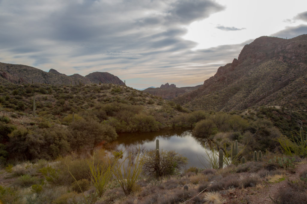
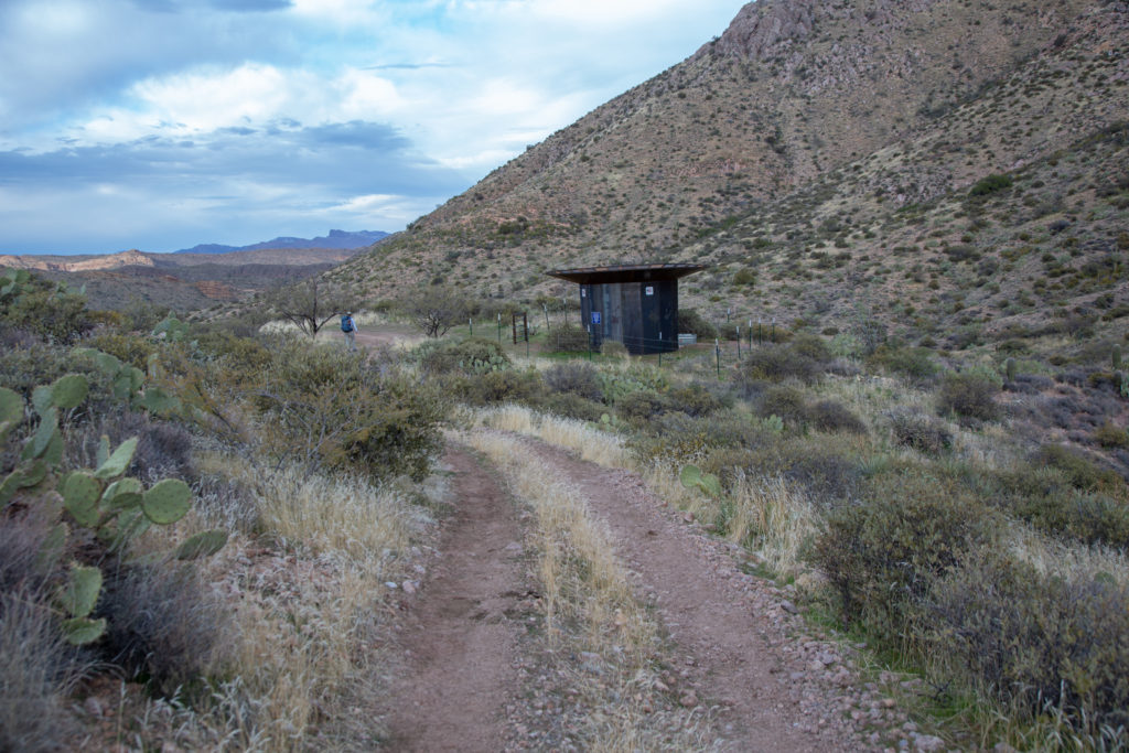
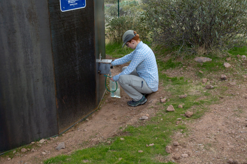
We arrive at the rainwater collector at 4:00 pm, 5 hrs 45 min and 14.9 km since we left the Gila River at GPS coordinates (-111.13617, 33.17957). The rainwater collector is located just 400 m north of the boundary for the Tonto National Forest. Had we been using the AZT Trail App the collector would have been clearly marked.

The newly constructed AZT Rainwater Collector
Appreciate all the hard work of the AZT Assoc. We always treat our water.

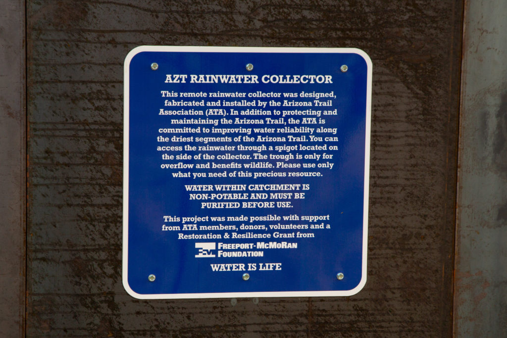
We refilled all of our water which included our water bladders (3L each) and water bottles (1L each). We did not want to stop for the day yet and needed to use some water for both dinner and breakfast. We decided to fill our collapsible 10L bucket with 3L of water. The water in the bucket would be used for cooking, coffee and replenish any water we would drink in the next hour or so of hiking.

Micah filling her water bladder.
Water bucket with 3L of water.
Took this photo from beside the rainwater collector. Did not know it, but we ended up camping just to the right of the rock feature left of centre.

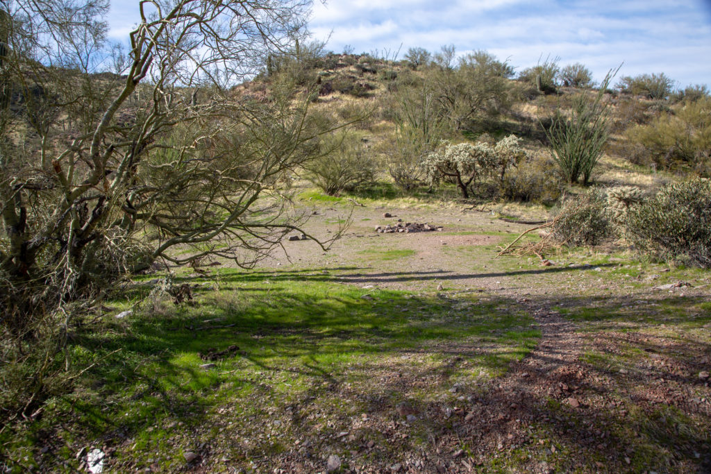
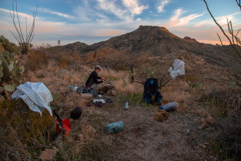
The trail headed up a short ways before dropping steadily losing 90 m over the next 1.2 km. The sun was setting fast and as we climbed up a small slope we started looking for a flat spot to pitch the tent. Micah decided that she would like to make it up to the ridge beside the large rock outcrop. As we came past the rock outcrop the trail crossed over the small pass and took a hard left. There was a distinctive trail leading along the ridge to the west that brought us to a lightly used campsite complete with fire pit (-111.13407, 33.19439). It took us 35 minutes to cover the 2.8 km from the rainwater collector.

Prickly Pears were the dominant cacti in the area.
A lonely saguaro.
The golden glow of the setting sun.
You can locate our campsite as it is beside the saguaro cactus on the right.
A water crossing on the AZT.

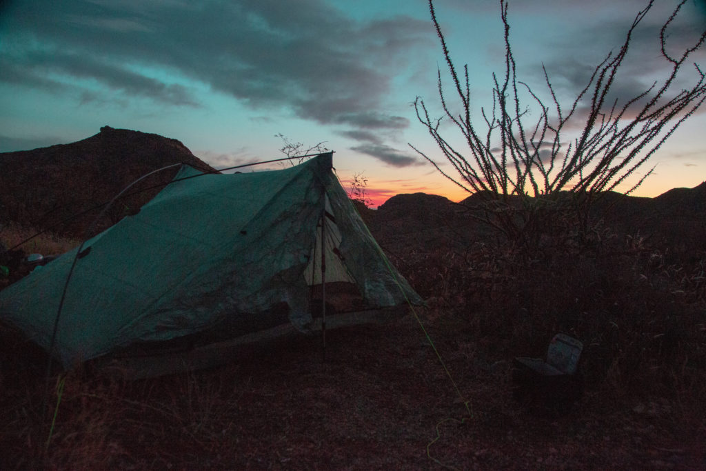
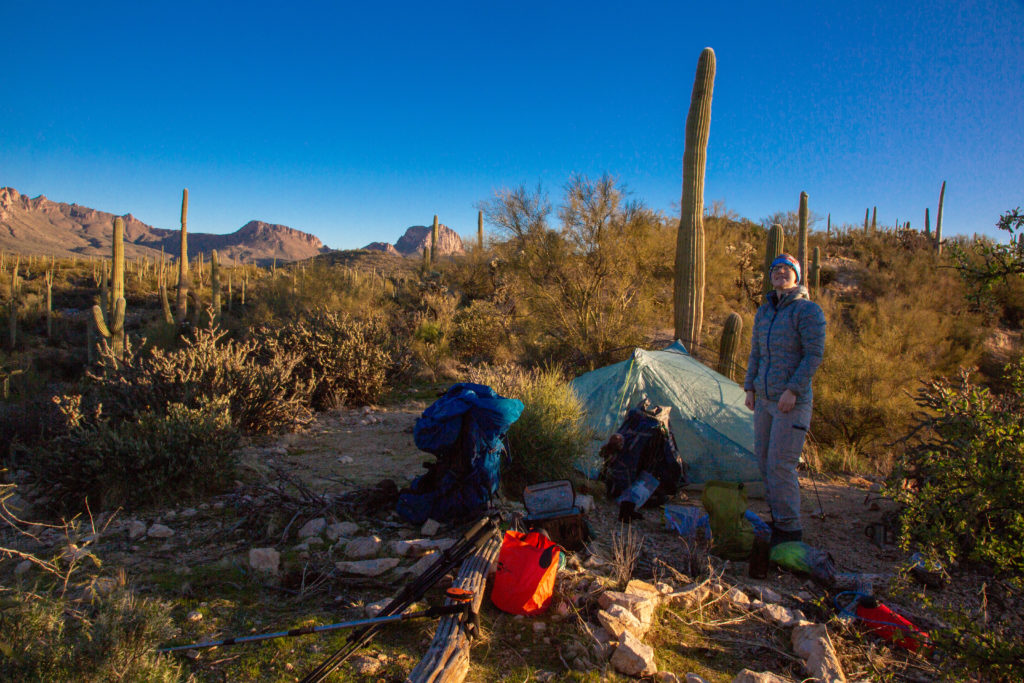
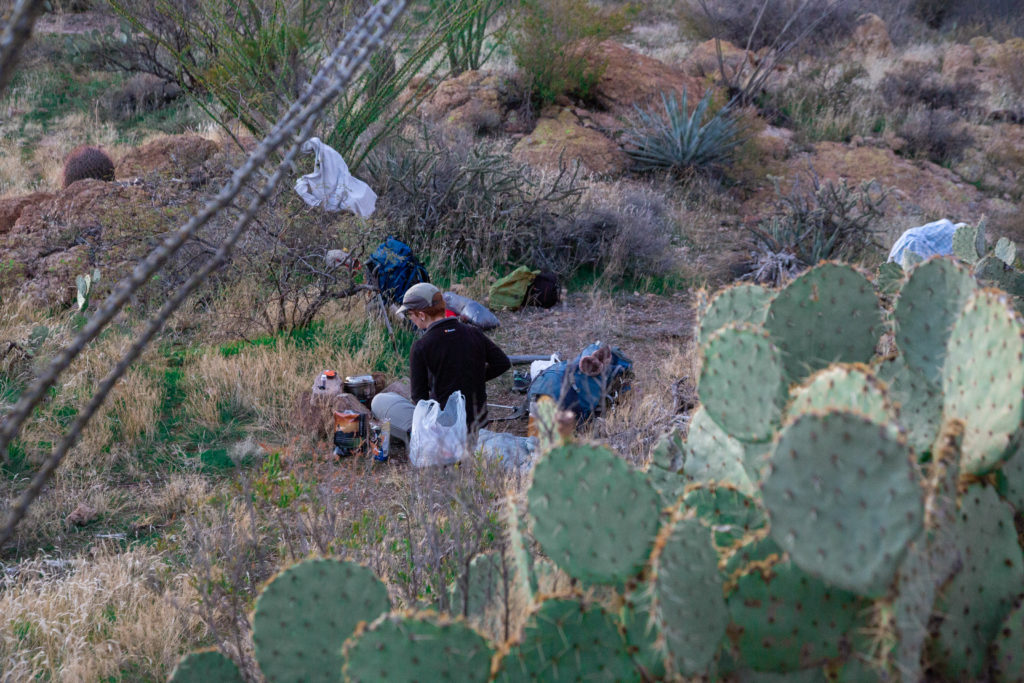
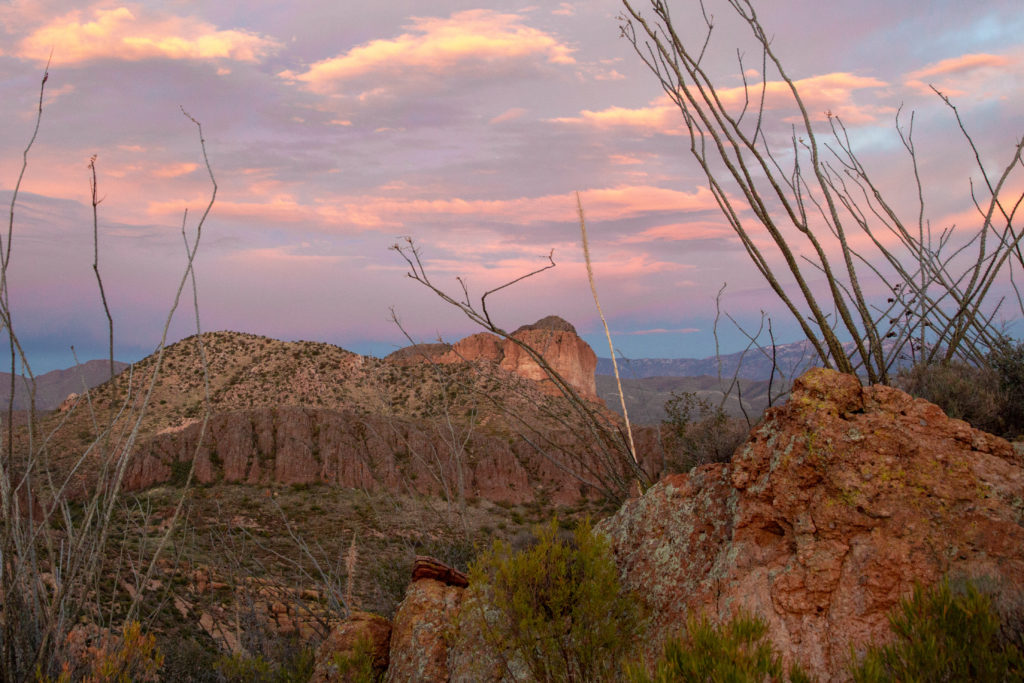
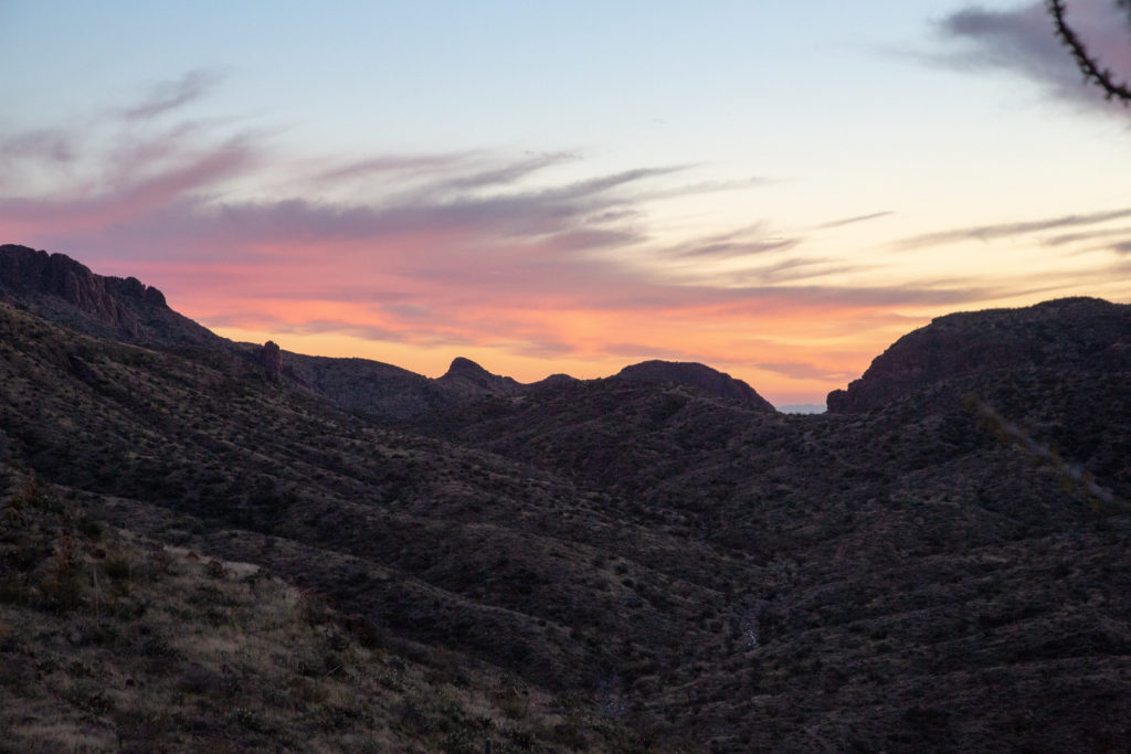
We set up camp. Micah got busy making dinner which required boiling water and adding it to our freeze dried food. I took pictures then set up the tent. The sun was setting quickly but provided us with a colourful and brilliant sky as we set up camp.

Micah set up the kitchen to use the fingering as a wind block.
Utilizing the cooking water.
Panorama looking south to where the rainwater collector was.
Night sky.
The lonely saguaro we could see from the rainwater collector.
The brilliance of the sunset sky.
Amazing pinks and blues.
Micah cooking dinner.
Evening sky.

One of our traditions on hikes is that we read out loud at bedtime. It is mostly me doing the reading but on this trip Micah and I took turns doing the reading. Our book was Chris Townsend’s “High Summer: Backpacking the Canadian Rockies”. It is a retelling of Chris Townsend hiking the length of the Canadian Rockies from Montana to almost the North West Territories in 1987. Prior to leaving for Arizona I had scanned the first 55 pages into a PDF file and saved it on my tablet. The story is very well written and captivating from the beginning. Chris Townsend is an accomplised hiker and great storyteller. We called it a night at about 8:30 pm. Another fantastic day on the AZT.

Good night .

AZT Passages 16/17 Day 3

AZT Passages 16/17 Home

bootwreckers

New trip posted, three day trip in the Rockwall in New trip posted, three day trip in the Rockwall in Kootenay NP with @sio.mellors. Introduction and Day 1 up on Bootwreckers.

Trip was suppose to be hiking Northover Ridge in Kanananaskis but smoke had us change plans at the last minute.

This would be my third multi day trip on the Rockwall but the first for Siobhan.

Managed to get two camping sites on the Rockwall and instead of smoke we had to deal with the threat of rain.

We did get wet but we had a blast.

Day 1 is from Paint Pots TH to Helmet Falls CG, with a side trip to get up close the the falls. Pretty straightforward day but visiting Helmet Falls is always special.

#parkscanada #parks #bcparks #trails #longdistancehike #longtrail #outdoors #outside #thruhike #hike #thruhiking #outside #backpacking #waterfalls #waterfall #naturephotography #naturephotography #nationalparks
The sixth and final day of our 2022 GDT Section D The sixth and final day of our 2022 GDT Section D hike is up on Bootwreckers, see link in bio.

This day took us from a random camp on the Howse Floodplain to the Mustafa Canyon parking lot. This was an adventurous day with bushwhacking, stream crossings and dead fall but a simply glorious end to a wonderful hike on the GDT. 

Again thanks  to Sara (@sd_kuz) and Lillian (@waterlilizee) for sharing this adventure with me. I am sure we will meet again on a trail someday.

Photo 1 - Morning Colors

Photo 2 - tents on the floodplain

Photo 3 - bushwhacking to start the day

Photo 4 - fields of flowers going to seed

Photo 5 - looking south down the Howse River

Photo 6 - thigh deep water crossing

Photo 7 - big views

Photo 8 - Sara crossing some dead fall

Photo 9 -Mistaya Canyon

Photo 10 - picked up a thru hiker named Roy, enjoying beverages left by Natasha and Kyle from Backpacks and Bikeracks

#greatdivide #greatdividetrail #gdt #parkscanada #parks #bcparks #trails #longdistancehike #longtrail #outdoors #outside #thruhike #hike #thruhiking #outside #backpacking #waterfalls #waterfall #naturephotography #naturephotography #nationalparks #duplex #sectionhike #sectionhiker
Day 5 of our 2022 Great Divide Trail Section D hik Day 5 of our 2022 Great Divide Trail Section D hike is posted on Bootwreckers, see link in bio.

Truly epic day on the trail. Pass through the debris of two avalanches, had lunch by a waterfall, crawled over so much dead fall and hiked on the Howse Flood Plain.

The sunset on the flood plain was one of most magical I have seen.

As always a big thanks to Sara (@sd_kuz) and Lillian (@waterlilizee) for sharing this adventure with me. The Team totally rocked the trail.

#greatdivide #greatdividetrail #gdt #parkscanada #parks #bcparks #trails #longdistancehike #longtrail #outdoors #outside #thruhike #hike #thruhiking #outside #backpacking #waterfalls #waterfall #naturephotography #naturephotography #nationalparks #duplex #sectionhike #sectionhiker
Evening light on Picketpost Mt. #aztrail #aztasso Evening light on Picketpost Mt.

#aztrail #aztassociation  #nps, #nationalparks, #slotcanyon, #hiking, #hikingadventures, #familytime, #camping, #campingadventures, #outdoors, #outside, #nature,  #FIndyourpark #landscape #landscapephotography #optoutside #nationalpark #desertphotography #grandcanyon #grandcanyonnationalpark #grandcanyonassociation #nationalparkweek #reichallenge #nationalparksweek #rightnow #nationalparktrust #goparks #aztrails
Arizona Trail Passages 14 and 15. Some photos of Arizona Trail Passages 14 and 15.

Some photos of my recent hike down a couple of Passages of the Arizona Trail. 

The trail is so diverse, rolling terrain cut by shallow washes leads to the expanse of the desert then into rugged canyons and tall peaks, all in a space of 92 km (58 miles).

Had a great time, some blisters gave me some concerns but they seem to be doing fine now that they are out of my hiking shoes.

Got lucky with Trail Magic courtesy of Condiments who drove his 4x4 deep into an unarmed wash, was really in the middle of no where, and then again at the start of Passage 15, missed the Trail Angel's name, the wind was so loud.

Like to thank my Trail Angels, Carole for driving me to Oracle to start the trip, with side trip to a Hayden Az, a real ghost town and to Edith for leaving a water cache for me at Passage 15.

Included a video of my time at the high point for Passage 15. My kid likes it when you stop and enjoy the view you earned, thought they would appreciate my effort in the face of 1000 mph winds (ok maybe thats a bit of an exaggeration).

Thanks Arizona and the AZT for providing more memories.

I will be back

#aztrail #aztassociation  #nps, #nationalparks, #slotcanyon, #hiking, #hikingadventures, #familytime, #camping, #campingadventures, #outdoors, #outside, #nature,  #FIndyourpark #landscape #landscapephotography #optoutside #nationalpark #desertphotography #grandcanyon #grandcanyonnationalpark #grandcanyonassociation #nationalparkweek #reichallenge #nationalparksweek #rightnow #nationalparktrust #goparks #aztrails
That sunset says when I wake up it will be time to That sunset says when I wake up it will be time to start my hike on the Arizona Trail, Passages 14 and 15

Love my little motel in Superior, Az, Copper Mt Motel. Has murals painted on all the buildings

Spied the Grand Canyon from the plane 

Adventure awaits 

#aztrail #aztassociation  #nps, #nationalparks, #slotcanyon, #hiking, #hikingadventures, #familytime, #camping, #campingadventures, #outdoors, #outside, #nature,  #FIndyourpark #landscape #landscapephotography #optoutside #nationalpark #desertphotography #grandcanyon #grandcanyonnationalpark #grandcanyonassociation #nationalparkweek #reichallenge #nationalparksweek #rightnow #nationalparktrust #goparks #aztrails
Frosty Paws all packed and ready for an adventure. Frosty Paws all packed and ready for an adventure.

Arizona Trail Passages 14 and 15 starting Sunday

Off weekend gooooooo!

#aztrail #aztassociation  #nps, #nationalparks, #slotcanyon, #hiking, #hikingadventures, #familytime, #camping, #campingadventures, #outdoors, #outside, #nature,  #FIndyourpark #landscape #landscapephotography #optoutside #nationalpark #desertphotography #grandcanyon #grandcanyonnationalpark #grandcanyonassociation #nationalparkweek #reichallenge #nationalparksweek #rightnow #nationalparktrust #goparks #aztrails
Last weekend before heading to Arizona for a four Last weekend before heading to Arizona for a four day adventure on the Arizona Trail.

I wonder if hiking in the 15 cm of fresh snow will be good prepared for hiking the deserts of Passages 14 and 15?

#aztrail #aztassociation  #nps, #nationalparks, #slotcanyon, #hiking, #hikingadventures, #familytime, #camping, #campingadventures, #outdoors, #outside, #nature,  #FIndyourpark #landscape #landscapephotography #optoutside #nationalpark #desertphotography #grandcanyon #grandcanyonnationalpark #grandcanyonassociation #nationalparkweek #reichallenge #nationalparksweek #rightnow #nationalparktrust #goparks #aztrails
Day 4 of our 2022 GDT Section D hike is up on the Day 4 of our 2022 GDT Section D hike is up on the website, see link in bio.

This was a truly epic day spent on the Amiskwi and Collie Creek Alternates.

The weather cooperated starting with a spectacular sunrise on the Mummery Glacier, rainbows and blue skies on the ridge.

We had a brief encounter with a little black bear who scampered quickly away. 

Finished off the day with a cold beer, Grizzly Paw Rutting Elk Red, that I had carried with me and it tasted great.

Easily one of th best days on the trail ever.

Again big thanks to Sara (@sd_kuz) and Lillian (@waterlilizee) for sharing this adventure with me. The Team totally rocked the trail.

#greatdivide #greatdividetrail #gdt #parkscanada #parks #bcparks #trails #longdistancehike #longtrail #outdoors #outside #thruhike #hike #thruhiking #outside #backpacking #waterfalls #waterfall #naturephotography #naturephotography #nationalparks #duplex #sectionhike #sectionhiker
Day 3 of our 2022 Section D hike is posted, see li Day 3 of our 2022 Section D hike is posted, see link in bio.

This was a shorter day, only about 17 km but took us from the end of the Kiwetinok Alternate up to Amiskwi Pass and then a beautiful meadow at the the base of the Amiskwi Ridge.

Photo 1 - morning sky

Photo 2 - on the Kiwetinok Alternate

Photo 3 - Kiwetinok Alternate

Photo 4 - break time at a stream crossing, Frosty Paws hanging in there

Photo 5 - Fireweed with a view down the Amiskwi Valley,

Photo 6 - fields of flowers as we approached Amiskwi Pass

Photo 7 - Yellow Columbine on the way up to Amiskwi Lodge

Photo 8 - Our camp in the meadow

Photo 9 - Setting sun

Photo 10 - one of the best adventure stories ever! True story of how three prisoners of war escaped and climbed Mt Kenya

Again big thanks to Sara (@sd_kuz) and Lillian (@waterlilizee) for sharing this adventure with me. The Team totally rocked the trail.

#greatdivide #greatdividetrail #gdt #parkscanada #parks #bcparks #trails #longdistancehike #longtrail #outdoors #outside #thruhike #hike #thruhiking #outside #backpacking #waterfalls #waterfall #naturephotography #naturephotography #nationalparks #duplex #sectionhike #sectionhiker
First two days of my 2022 Great Divide Trail Secti First two days of my 2022 Great Divide Trail Section D adventure are up on the blog, see profile for link.

Day 1 was from Burgess Pass Trail head to Yoho Lake Campground. A relatively short day but a good warm up for the rest of the trip.

Big thanks to Sara (@sd_kuz) and Lillian (@waterlilizee) for sharing this adventure with me. The Team totally rocked the trail.

Photo 1 - at Burgess Pass looking at Mt Wapta

Photo 2 - Flowers, it was a great time to hike to see all the flowers in August bloom

Photo 3 - Emerald Lake from up high

Photo 4 - at Yoho Pass, did I mention the flowers

Photo 5 - Duplex tent all set up with Frosty Paws on guard, and oh ya, more flowers

Photo 6 - the north end of Wapta Mt as seen from Yoho Lake.

Super fun little day, the opening a grand adventure.

#greatdivide #greatdividetrail #gdt #parkscanada #parks #bcparks #trails #longdistancehike #longtrail #outdoors #outside #thruhike #hike #thruhiking #outside #backpacking #waterfalls #waterfall #naturephotography #naturephotography #nationalparks #duplex #sectionhike #sectionhiker
Sound On. Video clips from my hike along th Supe Sound On. 

Video clips from my hike along th Superstion Ridgeline.

Was an epic hike, 24km from my campsite at Miners Needle to First Water Trailhead where my car was.

Wouldn't recommend doing all in one day backpacking, as the final descent down Siphon Draw Wash is brutal, but I did it in 10hrs 45min

Would love to redo th hike at some point and actaull stop and camp along the ridge.

I had enough water to stop, but I was enticed by the prospects of a beer to finish.

#teamzpacks #zpacks #zpacksduplex #aztassociation #aztrail #aztrails #hike #loveazt #desertphotography #desert #hikingadventures #hikes #backpacking #camping #getoutside #familytime #traillife #aztassociation , #hiking, #hikingadventures, #familytime, #camping, #campingadventures, #outdoors, #outside, #nature,  #FIndyourpark #landscape #landscapephotography #optoutside  #rightnow #goparks #aztrails #aztrail #loveazt  #azt #arizonatrailassociation
Day 5 and 6 of our Green River Canoe trip from 201 Day 5 and 6 of our Green River Canoe trip from 2017 is up on Bootwreckers, see link in Bio.

The day started in the dark with a hike up to the Dollhouse to watch the sunrise.

After doing an bit of exploring including a short hike out to Beehive Arch we headed back to camp to pack up and catch the jet boat ride back to Moab.

No trip to Moab is complete without a stop at the Moab Brewery, I had a tall smooth Derailleur Ale to compliment my mushroom, Swiss bacon burger.

Once back home it was time for snuggles with the little fella who waited patently for us whole we were away. Doggie snuggles for the win!

Another epic adventure in the books.

#canyonlands, #canyonlandsnationalpark, #nationalpark, #nationalparks, #turkshead, #anasazi, #anasaziruins, #utah, #exploreutah, #coloradoriver, #canoeing, #redrocks, #hikingadventures, #camping, #hikingadventures #texriverways, #floatritp #canoe #familytime❤️ #outdoors #outside #outsidethebox #earthpix  #wildernessculture  #wildernessociety  #seeutah  #igsouthwest #discoverearth #earthofficial
Just some of my favorite photos from my New Year's Just some of my favorite photos from my New Year's Arizona trip to the Superstitions

#teamzpacks #zpacks #zpacksduplex #aztassociation #aztrail #aztrails #hike #loveazt #desertphotography #desert #hikingadventures #hikes #backpacking #camping #getoutside #familytime #traillife #aztassociation , #hiking, #hikingadventures, #familytime, #camping, #campingadventures, #outdoors, #outside, #nature,  #FIndyourpark #landscape #landscapephotography #optoutside  #rightnow #goparks #aztrails #aztrail #loveazt  #azt #arizonatrailassociation
Just a few photos from my epic 3 day hike through Just a few photos from my epic 3 day hike through Superstion Mts of Arizona. 

I think it was Plan D or maybe E. Saw photos of th Grand Canyon and many of th roads there were closed, so good choice not to go.

Day 1 - First Water TH over to Ther Battleship via many stream crossings and camp near Black Top Mesa. Due to the heavy rains, water was not an issue.

Day 2 - up past Weavers Needle and over to camp below Miners Needle

Day 3 - Epic 26 km day up on down the Superstions Ridge Trail and back to the car. This was probably the second hardest day I hav e had on trail. The trail is more "route" very ill defined for the first 2/3rds of the way. Also includes numerous down climbs, I frequently tossed my poles down 3m (10ft) of more. This is not an easy trail, and the final descent down Siphon Wash is absolutely intense. After leaving camp at 7:15am (sunrise at 7:30) I arrived at the car at 5;45pm.

Needless to say I didn't do much Friday.

Will write more later.

Thanks to my adopted trail team, James, John, Kevin and Patrick. Four Med students from UofM who allowed me to tag along as the caboose for the first two days.

Now, time to fly home.....

#teamzpacks #zpacks #zpacksduplex #aztassociation #aztrail #aztrails #hike #loveazt #desertphotography #desert #hikingadventures #hikes #backpacking #camping #getoutside #familytime #traillife #aztassociation , #hiking, #hikingadventures, #familytime, #camping, #campingadventures, #outdoors, #outside, #nature,  #FIndyourpark #landscape #landscapephotography #optoutside  #rightnow #goparks #aztrails #aztrail #loveazt  #azt #arizonatrailassociation
Sound On! About that hike.....it is not going to Sound On!

About that hike.....it is not going to happen this year.

A winter storm has come through, bringing rain, risk of flash floods and near freezing temperatures. At the prospect of hiking two or even three days in the rain, I kept hearing this voice in my head "You know, I'm not having any fun" , spoken by @kbsymington on day two of a four day hike, I could totally see that thought passing through my head if I went ahead with the hike.

I did meet my Trail Angel Bev the Kelvin TH and the scenery was just spectacular! I could hear the desert calling me. It was simply beautiful, but Bev didn't try to talk me into going and did say when I come back I was to contact her, can't wait.

My motel manger told me to go up Hwy 60 towards Globe, AZ, and check out the Queen River Canyon just after the tunnel.

It was a lot of fun to do a little exploring and it actually confirmed I made the right decision,  I got so cold in the few minutes I was out taking photos.

As I got back to the motel I was happy to see a ray of light at the horizon, maybe the rain is going to go away.

I also discovered my getting old hiking shoes leak.....

Planning on a 4 day trip around th Superstitions starting the day after tomorrow. 

Happy trails.

#aztsos #teamzpacks #zpacks #zpacksduplex #aztassociation #aztrail #aztrails #hike #loveazt #desertphotography #desert #hikingadventures #hikes #backpacking #camping #getoutside #familytime #traillife #aztassociation , #hiking, #hikingadventures, #familytime, #camping, #campingadventures, #outdoors, #outside, #nature,  #FIndyourpark #landscape #landscapephotography #optoutside  #rightnow #goparks #aztrails #aztrail
Happy New Year from Superior, Arizona. Getting re Happy New Year from Superior, Arizona.

Getting ready for 5 days on the Arizona Trail, passages 14 and 15, if the weather allows (could rain, hard, in the desert eh, who knew)

Now time for some sleep

#teamzpacks #zpacks #zpacksduplex #aztassociation #aztrail #aztrails #hike #loveazt #desertphotography #desert #hikingadventures #hikes #backpacking #camping #getoutside #familytime #traillife #aztassociation , #hiking, #hikingadventures, #familytime, #camping, #campingadventures, #outdoors, #outside, #nature,  #FIndyourpark #landscape #landscapephotography #optoutside  #rightnow #goparks #aztrails #aztrail
Day 4 on the Green River was another great day exp Day 4 on the Green River was another great day exploring canyons, hiking and of course paddling. Full summary on the website, see link in bio.

We started off the day exploring Jasper Canyon, found an amazing Anasazi house.

Then we hit the river and joined the Colorado River for the last couple of miles to our final desk at Spanish Bottom.

After dinner we took a quick hike up to Doll House, which we would revisit the next morning for sunrise.

A real mix of a day which made it a whole lotta fun.

#canyonlands, #canyonlandsnationalpark, #nationalpark, #nationalparks, #turkshead, #anasazi, #anasaziruins, #utah, #exploreutah, #coloradoriver, #canoeing, #redrocks, #hikingadventures, #camping, #hikingadventures #texriverways, #floatritp #canoe #familytime❤️ #outdoors #outside #outsidethebox #earthpix  #wildernessculture  #wildernessociety  #seeutah  #igsouthwest #discoverearth #earthofficial #river
Day 3 of our 2017 Green River Canoe trip up on Boo Day 3 of our 2017 Green River Canoe trip up on Bootwreckers, see link in bio.

15 mile paddle from Cabin Bottom to Jasper Canyon. 

Checked out Anasazi Petroglyphs at Cabin Bottom. Stopped to explore Turks Head Bottom where there were two sets of Anasazi dwellings. 

After a good day on the river enjoyed a beer given to us by some friendly boaters. 

Finished off th evening taking some fun night time photos of the stars and the tent.

Was an amazing trip with still one more day on the river and one day exploring.

#canyonlands, #canyonlandsnationalpark, #nationalpark, #nationalparks, #turkshead, #anasazi, #anasaziruins, #utah, #exploreutah, #coloradoriver, #canoeing, #redrocks, #hikingadventures, #camping, #hikingadventures #texriverways, #floatritp #canoe #familytime❤️ #outdoors #outside #outsidethebox #earthpix  #wildernessculture  #wildernessociety  #seeutah  #igsouthwest #discoverearth #earthofficial #river
On the river with Day of our 2017 trip down the Gr On the river with Day of our 2017 trip down the Green River, see link in bio for full summary.

Was a fantastic day with blue skies and warmer weather. We made two stops to explore Anderson Bottom and some Anasazi granaries that were located about 30ft up a cliff!

Stopped at Cabin Bottom where I dumped dinner in the sand but rescued it and got two free beers.

Finished the day off getting up at 3 am to take pictures of th Milky Way.

#canyonlands, #canyonlandsnationalpark, #nationalpark, #nationalparks, #turkshead, #anasazi, #anasaziruins, #utah, #exploreutah, #coloradoriver, #canoeing, #redrocks, #hikingadventures, #camping, #hikingadventures #texriverways, #floatritp #canoe #familytime❤️ #outdoors #outside #outsidethebox #earthpix  #wildernessculture  #wildernessociety  #seeutah  #igsouthwest #discoverearth #earthofficial

Always a great day being out on the river.
Load More Follow on Instagram

For more photos of these and other Bootwreckers Adventures

© 2023 Boot Wreckers | Powered by Minimalist Blog WordPress Theme