Skip to content
Boot Wreckers
Menu
  • Home Page
  • Hiking Day Trips
    • Aylmer Lookout Banff NP
    • Mt Allan Traverse (Centennial Ridge)
    • Mt Nomad (almost) – Kanananaskis Country
  • Backpacking – Overnights
    • Baker Lake 2020 Banff NP
    • Exploring Waterfalls with Volcano – Yoho NP
    • Fish Lakes – Banff NP, Alberta
    • Floe Lake/Numa Creek, Kootenay NP, British Columbia
    • Floe Lake (Revisited 2019) – Kootenay NP
    • Grand Canyon Corridor Backpacking Trip
    • Hermit Trail to Hermit Meadows – Glacier NP, British Columbia
    • Howard-Douglas Lake – Banff NP (2017)
    • Leman Lake – Banff, NP
    • Mystic Lake – Banff NP
    • Ribbon Lake Kananaskis Prov. Park 2016 – Ribbon Creek Route
    • Ribbon Lake Kananaskis Prov. Park 2017 – South Buller Pass Route
    • Simpson and Healy Pass – Banff NP (2016)
    • Stenton Lake – Alberta Wildlands Prov. Park
  • Backpacking – Multi Day
    • Arizona Trail Passages 16/17
    • Brazeau Loop – Jasper National Park
    • Egypt Lake Epic – Banff NP
    • Egypt Lake Exploration 2021- Banff NP
    • Grand Canyon Hermit – South Kaibab
    • Grand Canyon – Tanner/Beamer Trail
    • GR20 – Corsica
    • Great Divide Trail Hike – Section C 2020
    • Great Divide Trail Hike – Section E 2021
    • Iceline/Twin Falls – Yoho NP
    • Kilimanjaro – Tanzania
    • Mt Assiniboine Lollipop – Banff NP
    • Rockwall North 2020 Kootenay NP
    • Sawback – Banff NP
  • The Team
  • Contact Us
Menu

Day 4 GDT 2021 – Section E

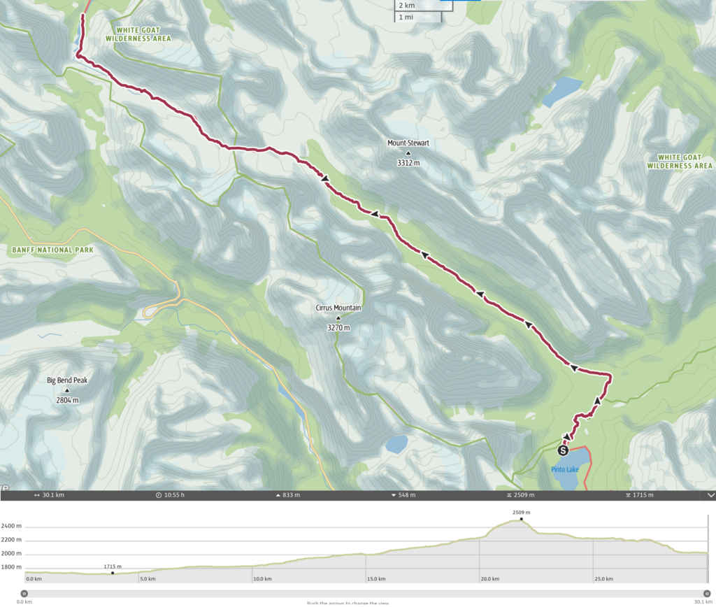
Day 4, August 14th, North Pinto Lake to Boulder Creek CG. 30 km, 910 m elevation gain, 620 m elevation loss, 10 hrs 55 min (Segment 25, Segment 26).

This was the first day on the trip I used an alarm and I am glad I did, as 5:15 am came very quickly after being up taking photos in the middle of the night. I packed up the tent as quickly and as quietly as I could and headed over to retrieve my food for breakfast. It may have been an early start but I still wanted a hot coffee to start my day. Jason and Bent were already eating their breakfast so I hustled as quick as I could so as not to delay the start of the hike. I threw my pack on and said goodbye to my camping spot at 6:07 am. This would be the earliest start to a day on my trip.

It is a dark breakfast.
Amazing how the light can change in just 30 minutes. All packed up and time to go.

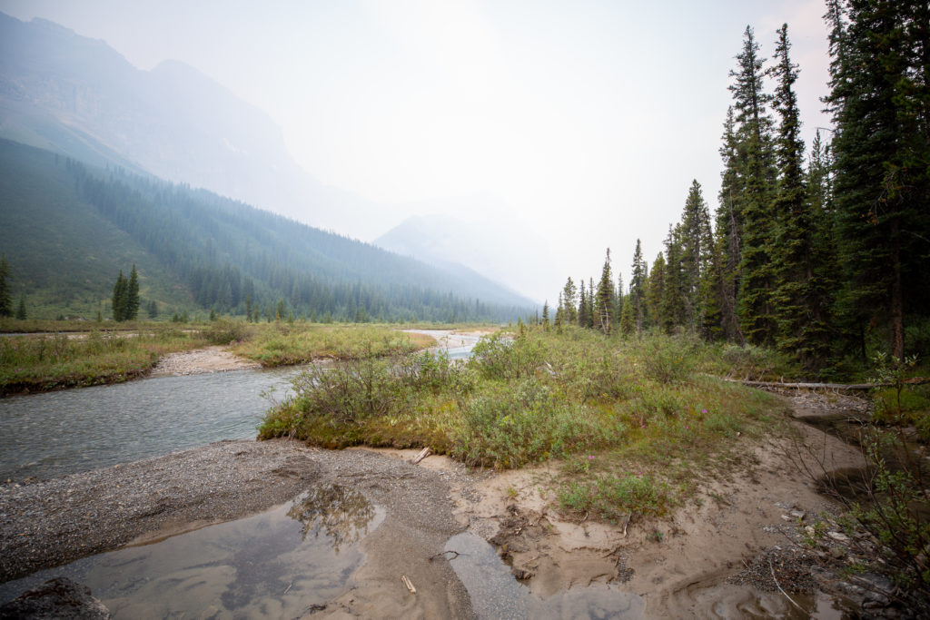
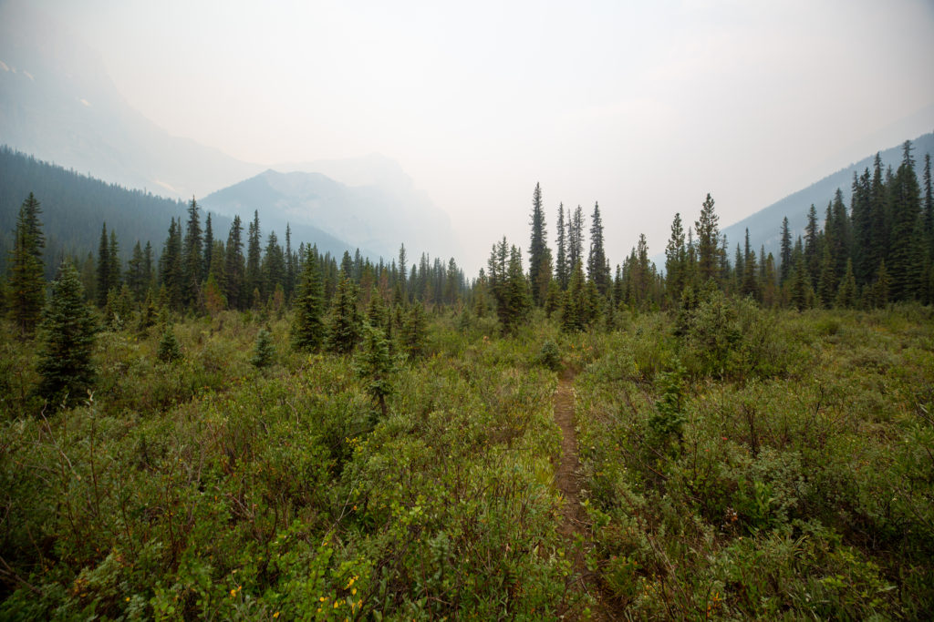
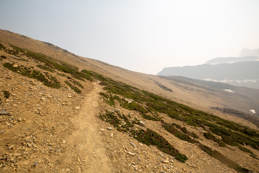
We set off at a good pace out of camp. No one else was up yet. The first view of the morning sky was gloomy as the smoke had returned. It was hard to believe just 4 hours earlier I was taking photos of a clear night sky and now I could barely make out the tops of the mountains. Our first misadventure came after just 10 minutes when we turned left at a junction and headed up the trail to Sunset Pass. I was following blindly but after a few minutes of not hiking beside a stream we all stopped to check our location on our devices. We quickly turned around and were soon back on the GDT.

There will be a few log crossings on this day.
Red gloomy sky
Nice boardwalk but too bad it was on the Sunset Pass Trail.

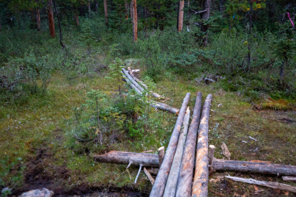
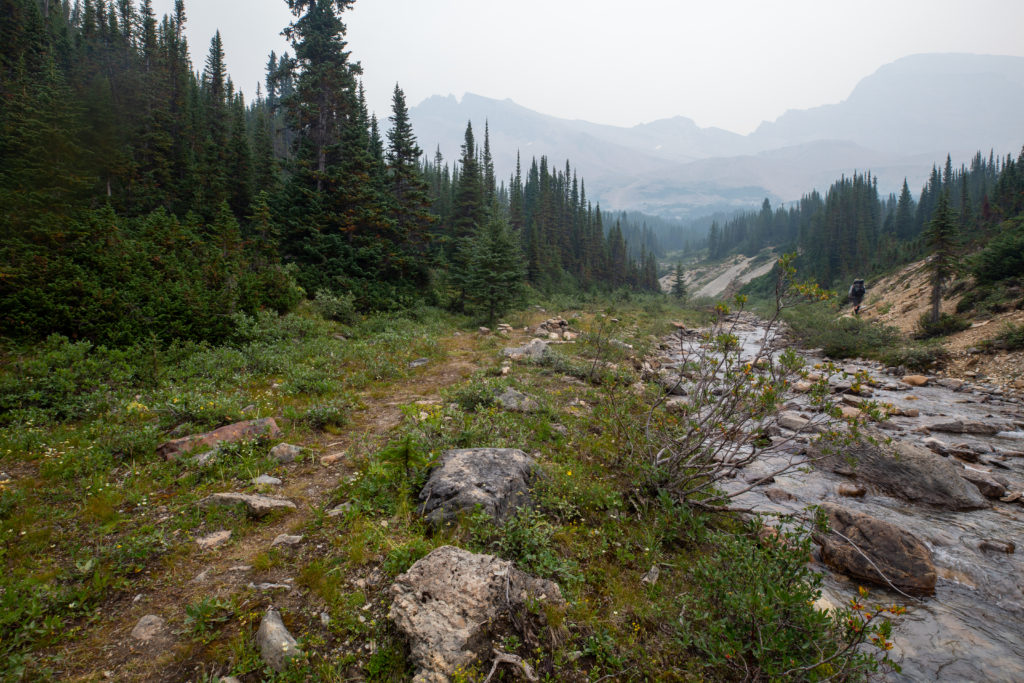
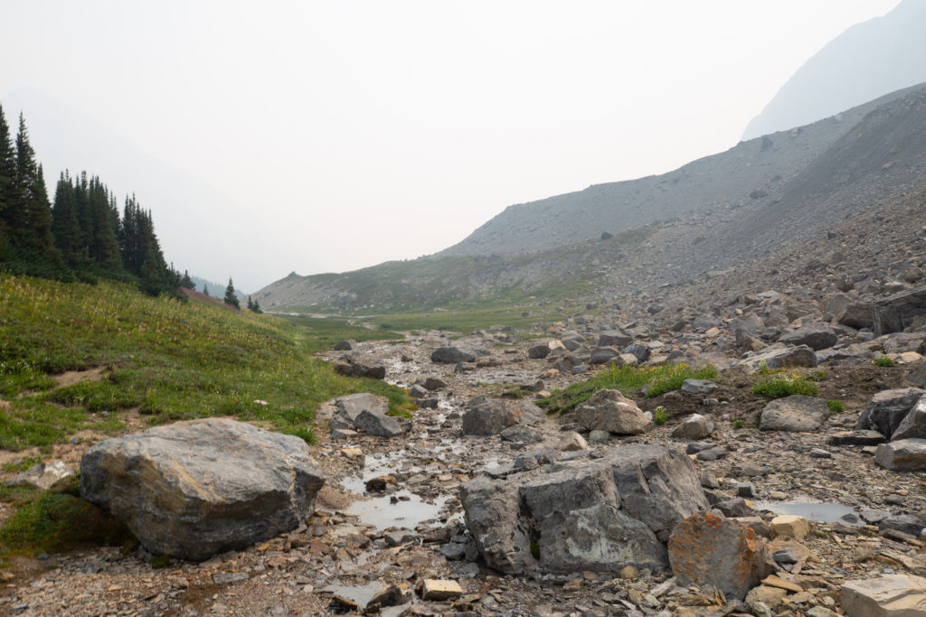
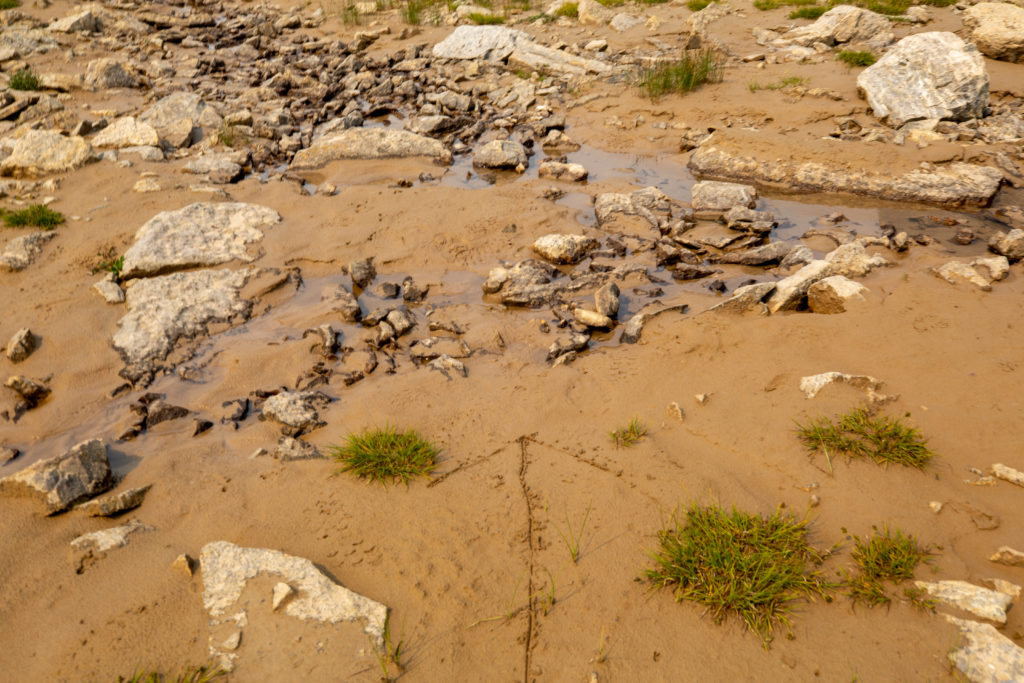
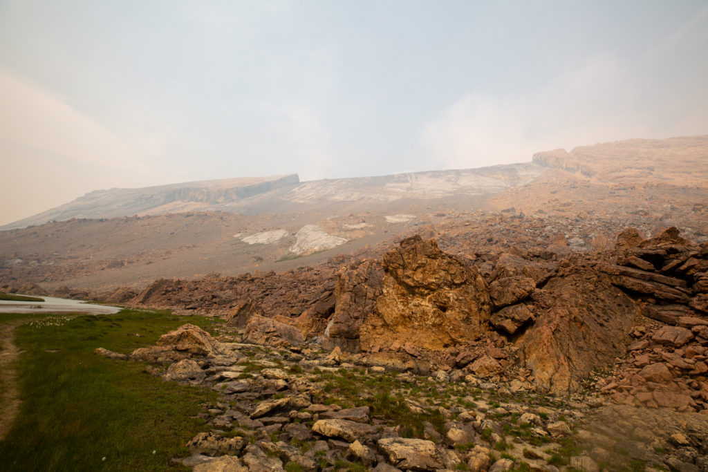
The ground in the area around the confluence of the Cline River and Cataract Creek was quite soft and boggy. In a few places side streams occupied wide areas, making for shallow but muddy crossings.

Little stream but no dry way across

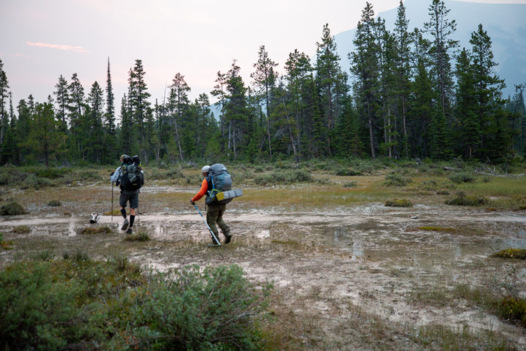
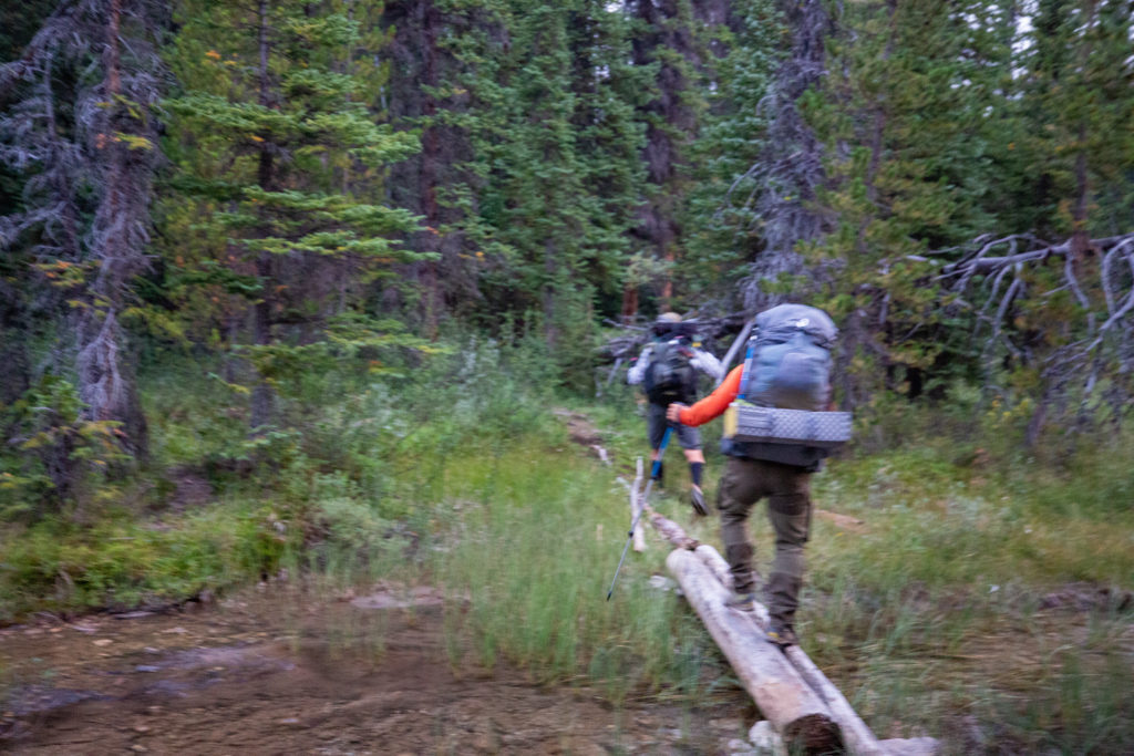
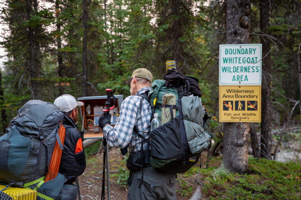
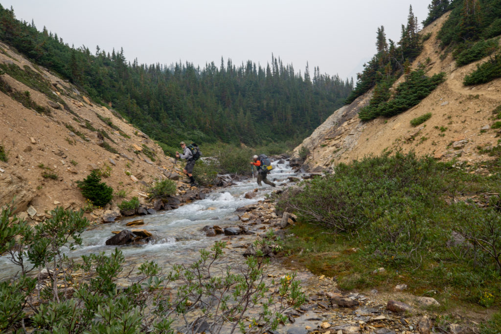
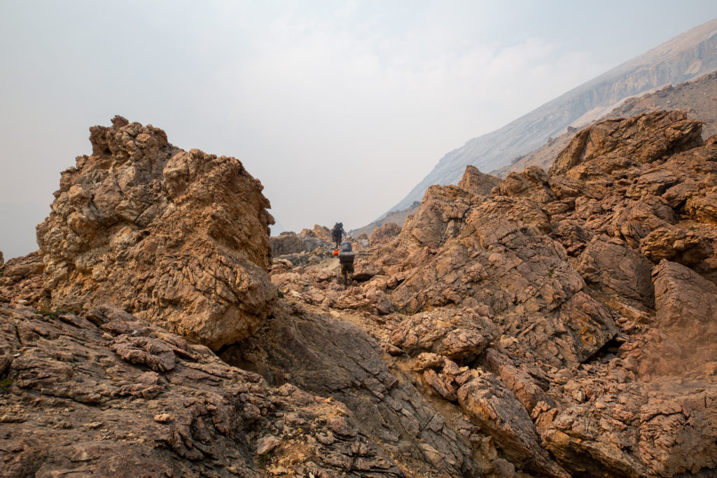
After 40 minutes of hiking we left Banff NP and entered the Whitegoat Wilderness Area. Where Huntington Creek joined the Cline we once again did a bit of wandering as we tried to find a dry way across. Huntington Creek was probably one of the more perilous crossings on the hike. The creek was quite deep and some downed trees provided a very suspect bridge that could be used to cross. Depending on which side you fell off the logs, the penalty for falling ranged from wet feet to complete submersion in the creek.

There is an info box as you enter the Whitegoat. Nothing of interest for us.
The trail is faint and rough.
Jason crossing Huntington Creek
Bent trying to keep the feet dry

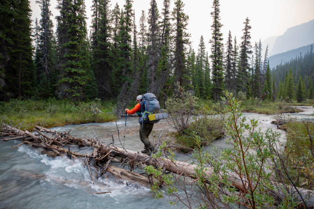
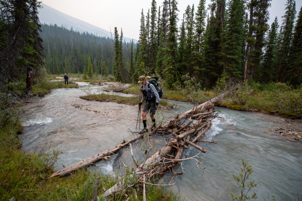
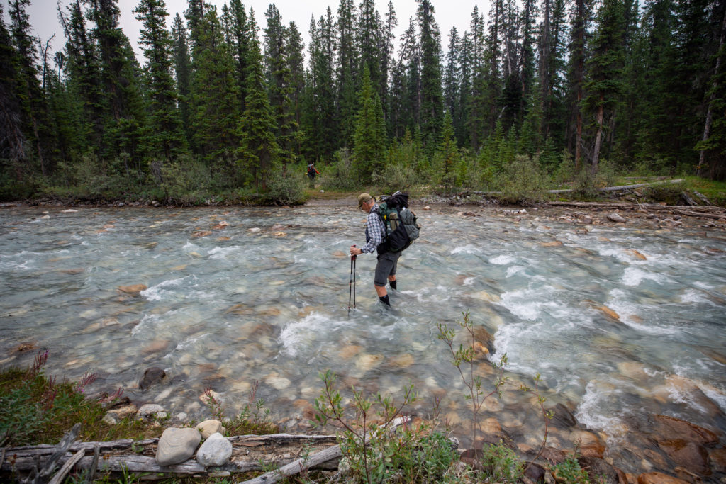
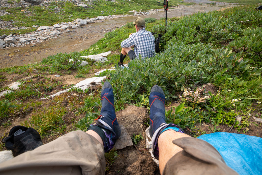
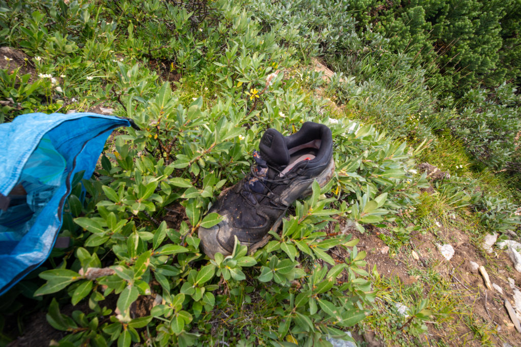
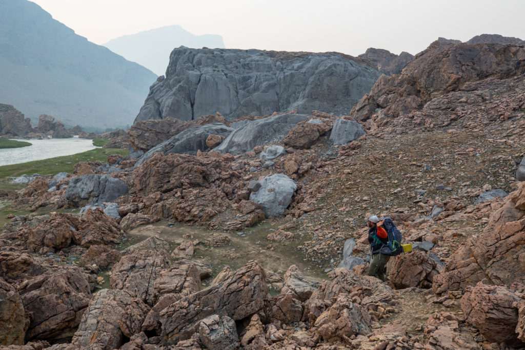
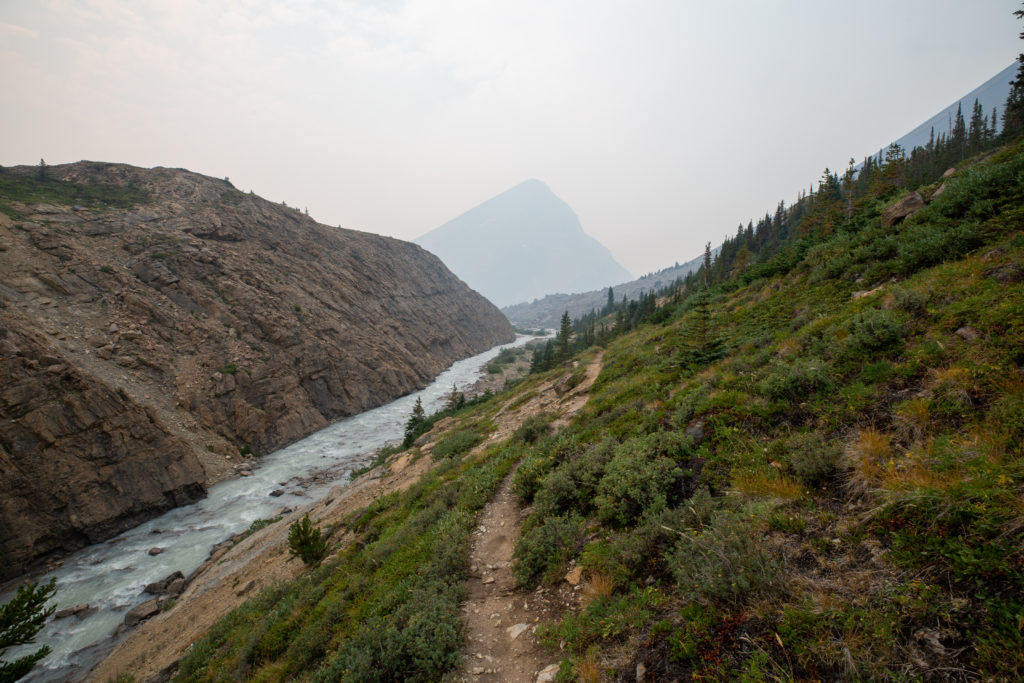
We hiked along the north shore of the Cline River for a short while before the Cline turned right and away from the trail. We soon came to Cataract Creek and were faced with an easy but long crossing. I was contemplating switching to my sandals to keep my shoes dry when Jason charged across the stream, almost falling twice. Bent then took his turn, recording the crossing on his phone. It was already very evident that I was the slowest hiker in the group, which was compounded by my repeated stopping to take photographs. So I decided to not delay and switch to my sandals and headed across after Bent. The Salomon shoes I had on were Gore-tex, which meant I would be hiking in wet feet for the rest of the day. I do not think my shoes dried out completely until after I had completed the Skyline seven days later.

Coming up to the crossing of Cataract Creek, not much of a trail
Bent getting ready for his crossing, Jason disappearing into the distance
The crossing was not that challenging but it is always good to practice using good technique.

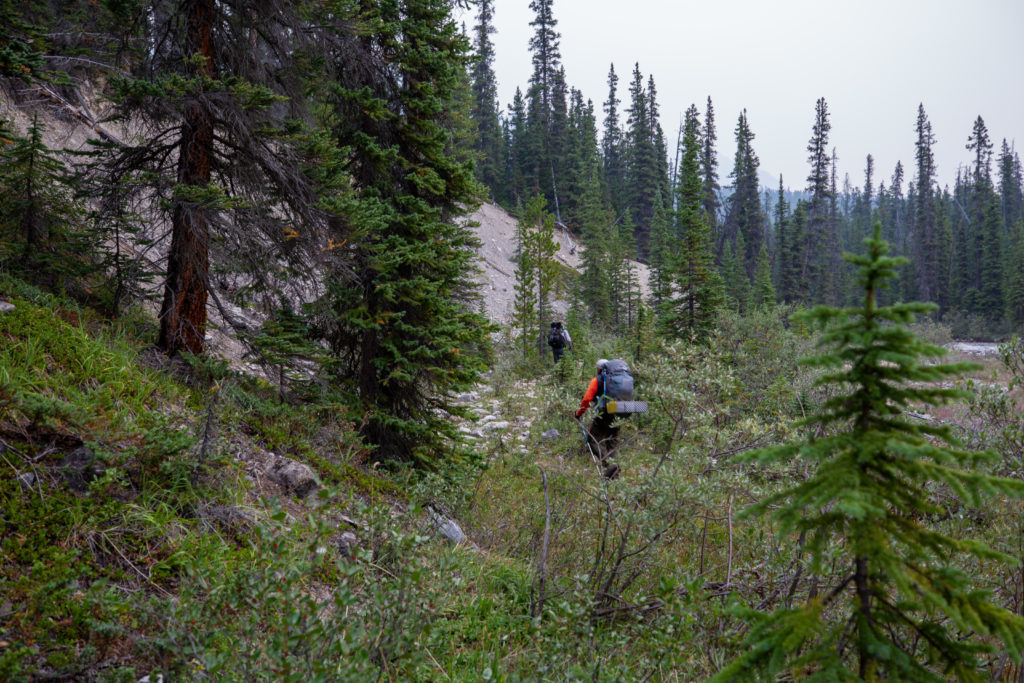
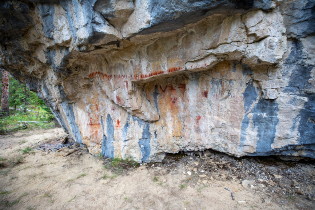
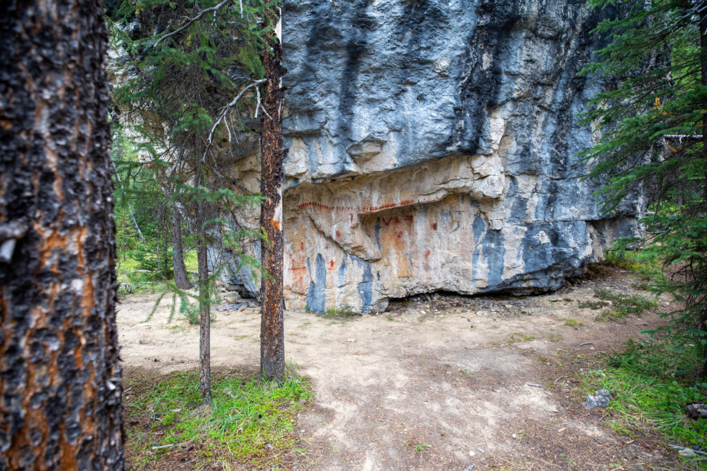
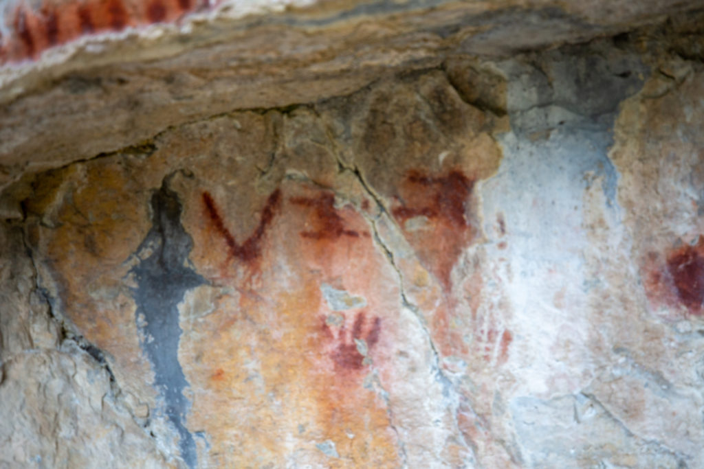
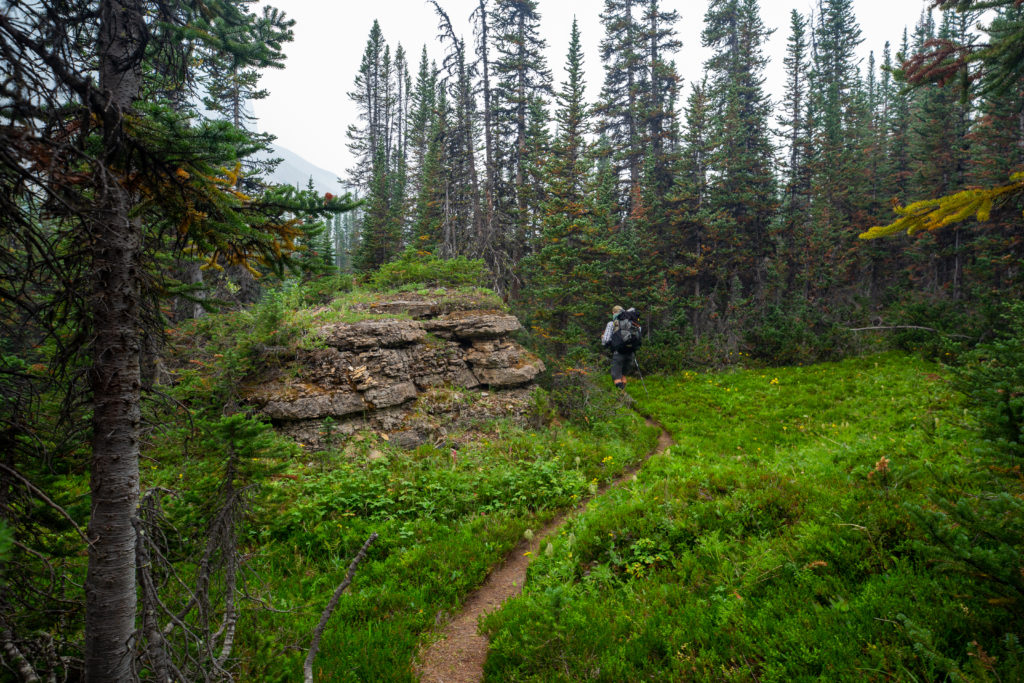
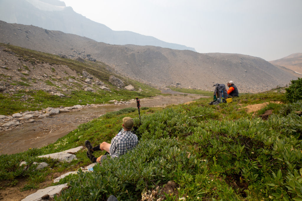
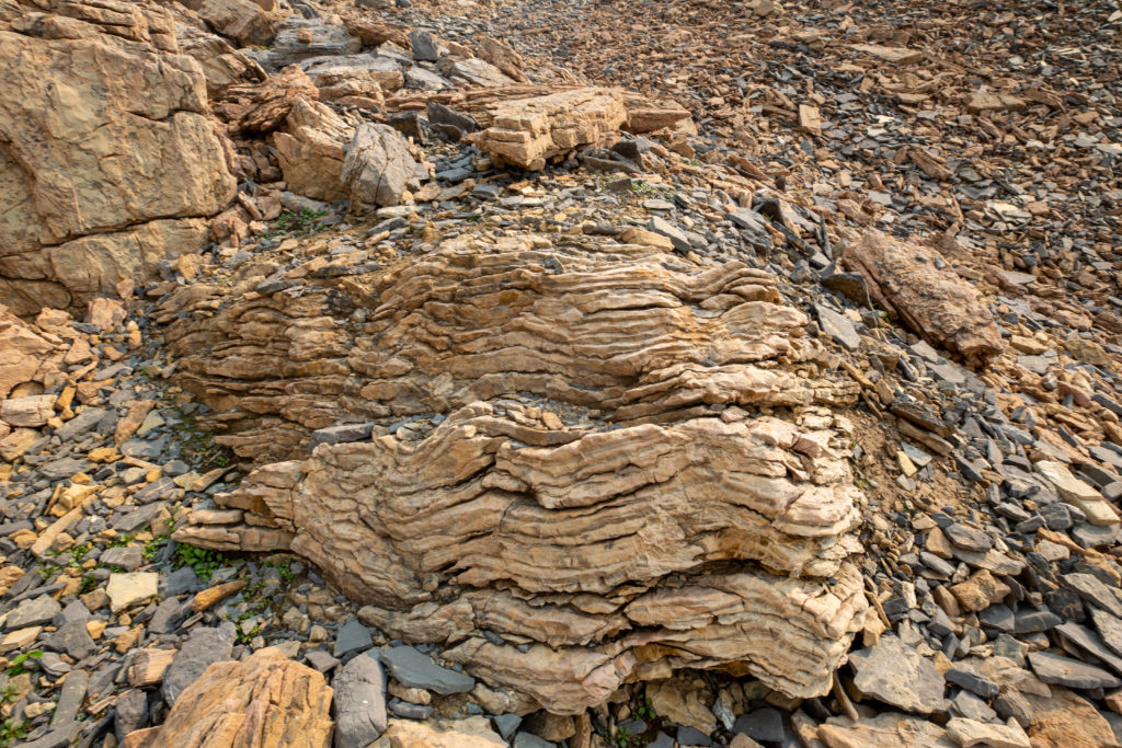
We stayed on the north side of the Cataract river for the next four hours, so we did not have very many route-finding challenges. I was having some trouble keeping up. Bent was leading with Jason second. Every so often Jason would yell back to me to make sure I was still coming. About 30 minutes after crossing the Cataract I spied a side trail that would take me to some First Nations pictographs painted in ochre on a rock. I yelled back up the trail to Bent and Jason, who both came back to view the pictographs. When I got home I did some research on the pictographs. The Alberta government had done some research but it had been removed from the public and sealed. The stories behind the pictographs are for the First Nations people to share.

Common view for me: Jason disappearing into the distance
Pictographs
View of the Cataract Creek from the where the pictographs are

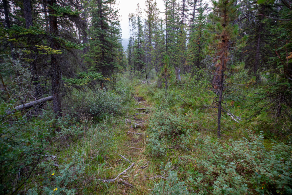
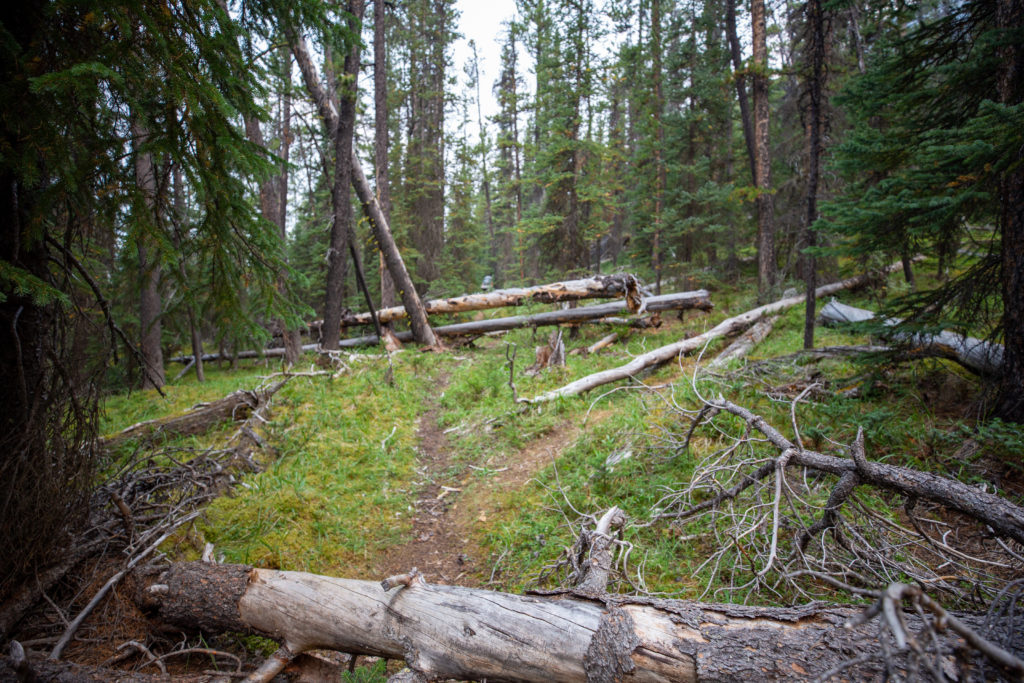
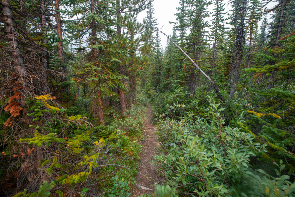
The trail was very well defined in this section but was it was difficult to keep a good pace with all the downed trees. Despite the obstacles Bent kept us at a good 4 km/h average until lunch.

Even the detour is partially blocked.
I can see both Bent and Jason — must have been shortly after they stopped to let me catch up.

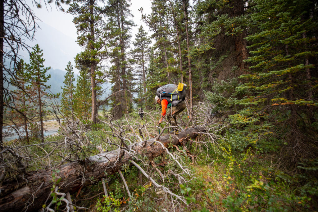
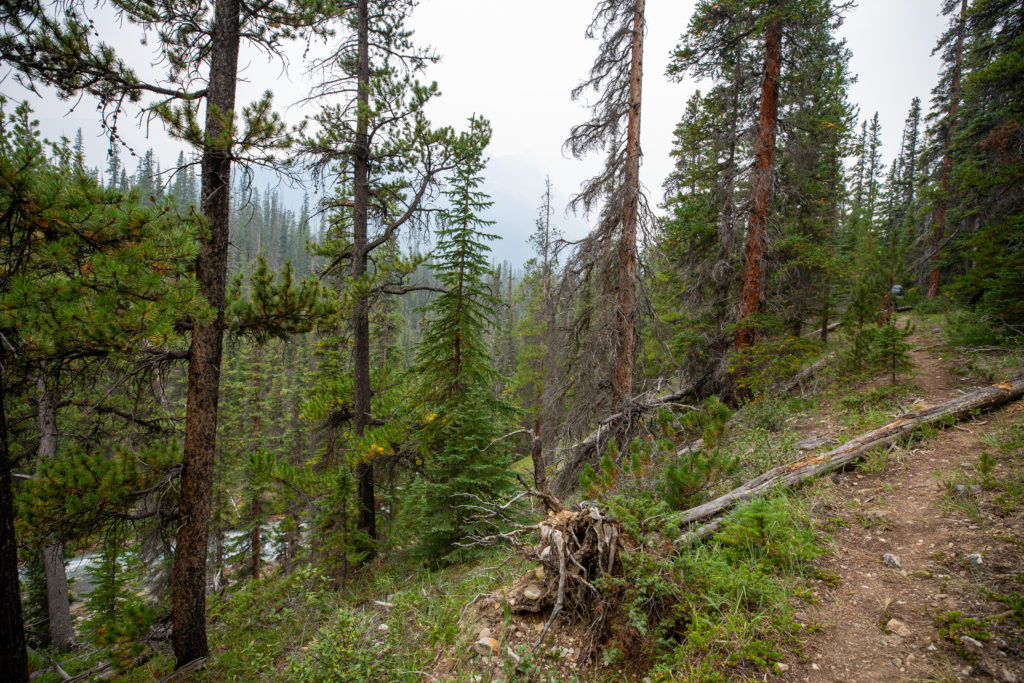
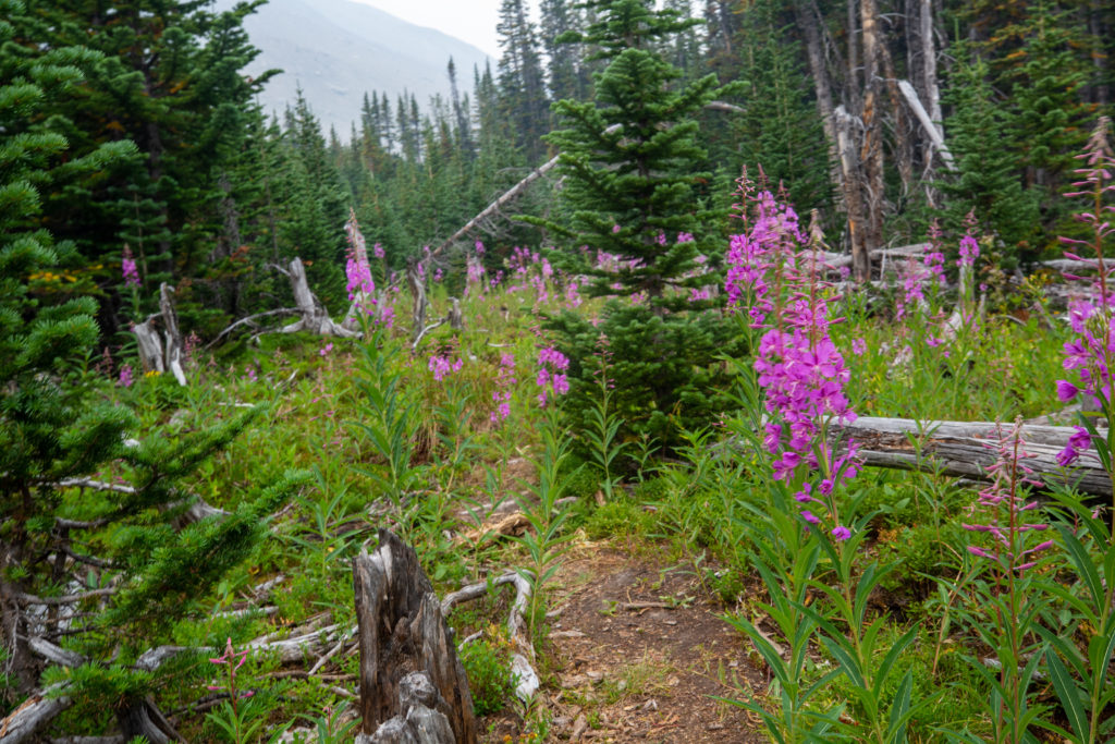
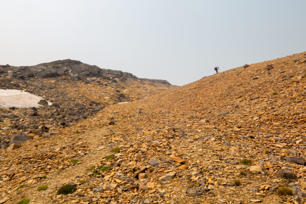
I don’t remember much about this section except hustling hard to keep up and whenever we came out from the trees the views were obscured by smoke.

Smoke settling in
The trail was pretty good out of the trees.
High heat and lack of moisture results in some fall colours in August as the plants shows signs of stress.
Campsite, about 14 km from Pinto Lake
Mt Stewart (3312 m)

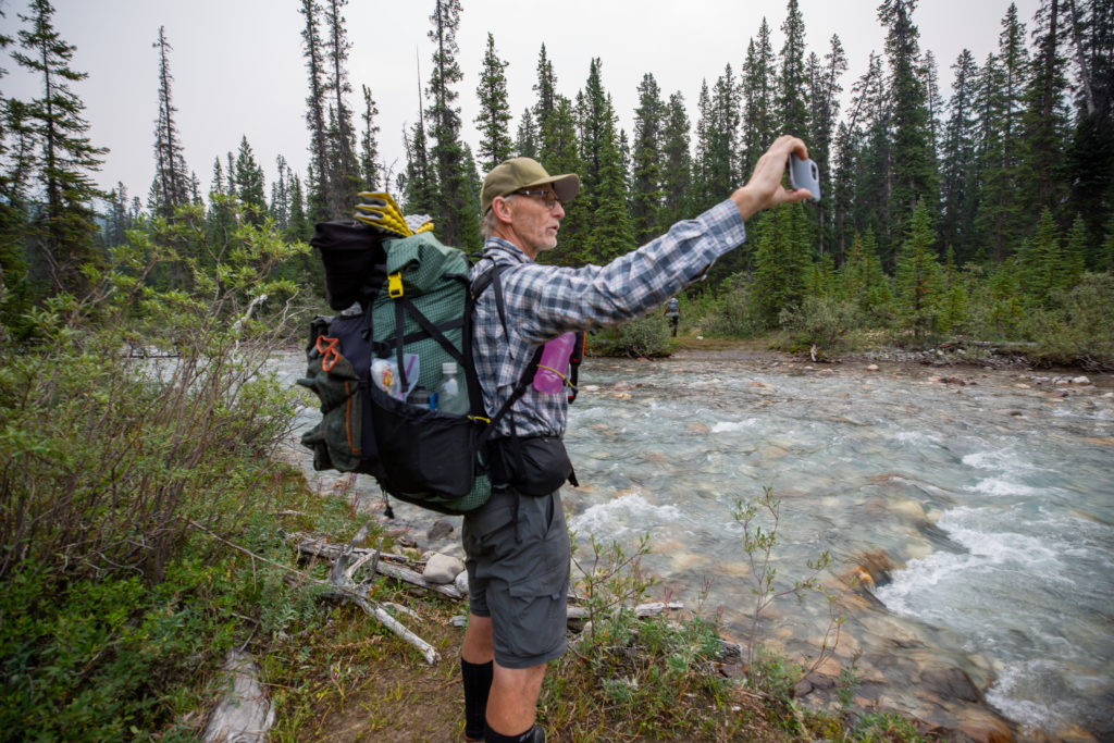
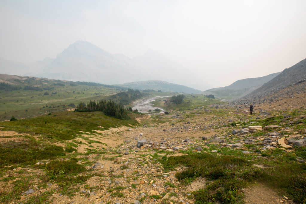
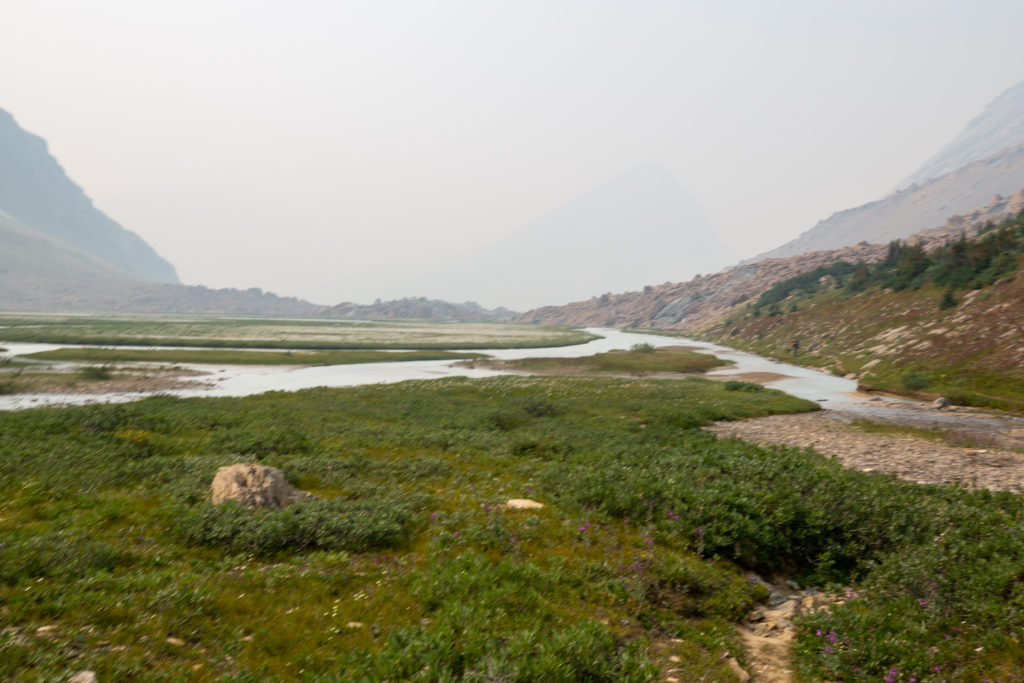
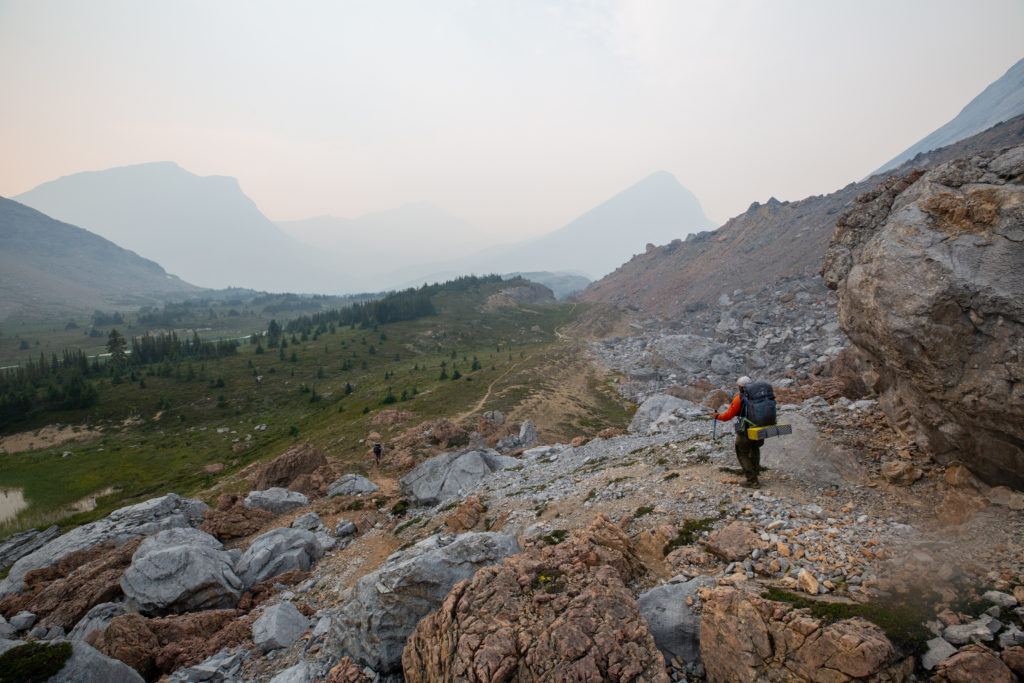
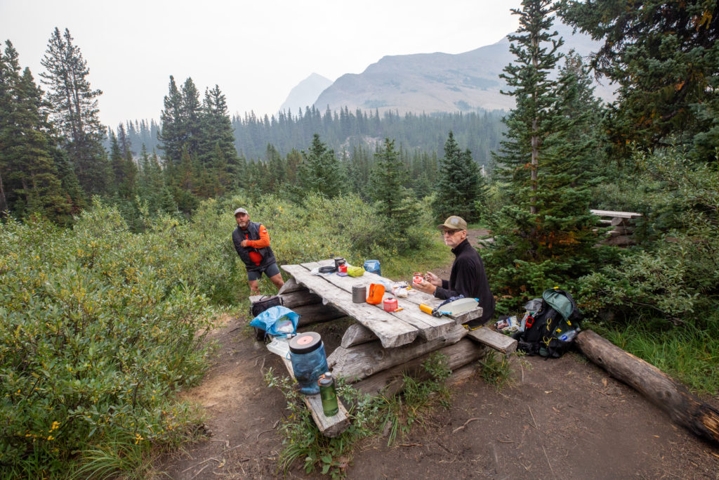
We stopped for an extended break in a field below Mt Stewart. We had hiked just shy of 15 km in 4 hours. This was supposed to be my finish point for the day. According to the GDT App there was camping here. We had passed a little campsite just 15 minutes prior but I really did not see any camping at this location. As we stopped and relaxed I decided that there was no good reason to stop here and set up my tent to spend the rest of the day by myself. So when it was time to leave I grabbed my pack and told Bent and Jason that I would join them all the way to Boulder Creek CG. This meant that tomorrow I would only have a 3.2 km day to Four Points CG, where I would meet up with Emily, who would be hiking in from the Nigel Pass Trailhead to join me for the rest of the hike.

Someone big and furry was digging around here.
Nice little rocky outcrop on the trail
Some colour for a very bland day

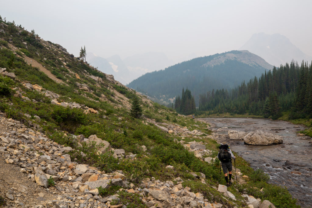
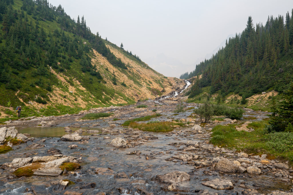
The valley we had been hiking in forks into two smaller valleys as you approach the bottom of Cataract Pass. The GDT follows the left fork. The trail got a little confusing as we approached the junction and we ended up a fair way from the creek. The easiest way to navigate this section is just stay close to the creek and go to the left. We came out of the trees high on a bank above the creek draining the right (east) fork of the valley. A large cairn marked our way back down to Cataract Creek and the upper valley we wanted to follow.

Bent surveying where we are to go
The trail is not well defined here.
Large cairn on the other side. Going to the left would take us back to Cataract Creek.

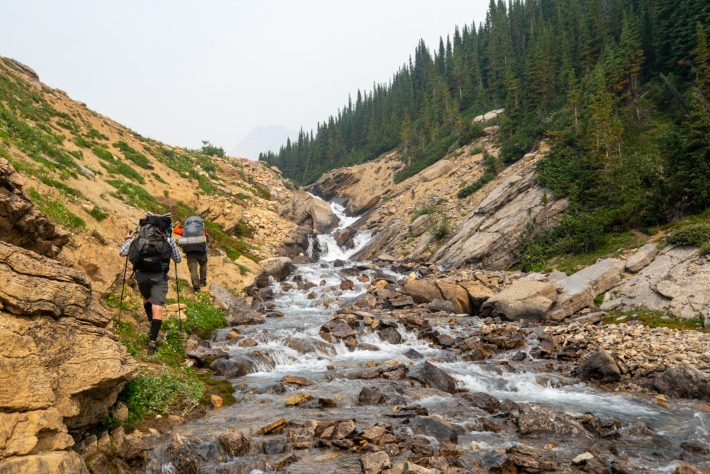
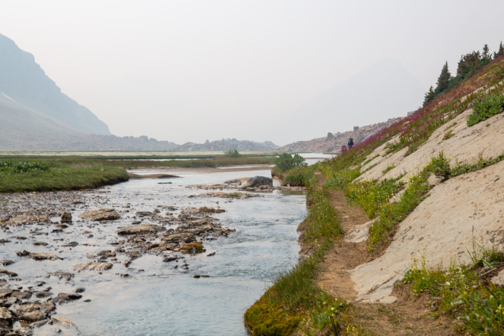
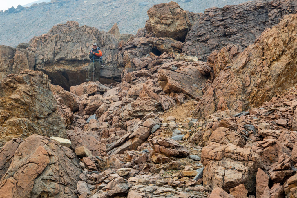
The valley dramatically narrows as we head into the alpine. We had another little challenge route-finding, as there was a trail going up the side of the valley embankment. I let Bent and Jason explore the trail, which disappeared very quickly, forcing them to retreat back down the trail. I have no idea why the trail is there and I am guessing many people go up it just to come right back down. The route was up along the left (west) side of the the creek so we had another little stream crossing.

Heading back to Cataract Creek
Jason and Bent heading up the dead-end trail
Another creek crossing
There’s not much of a trail – Just stay beside the creek.

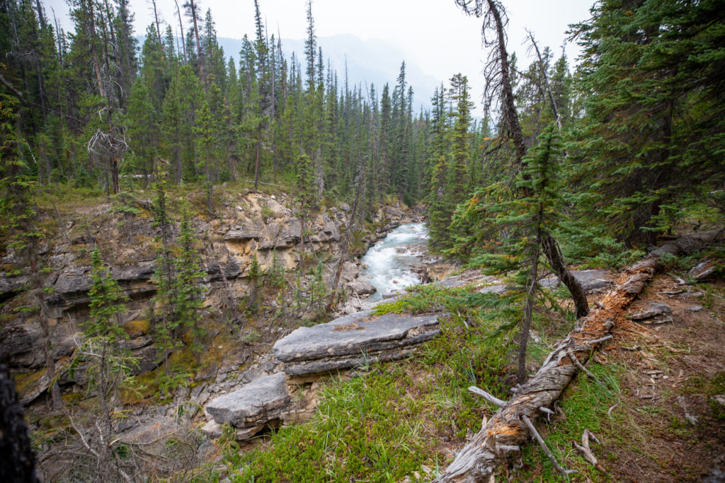
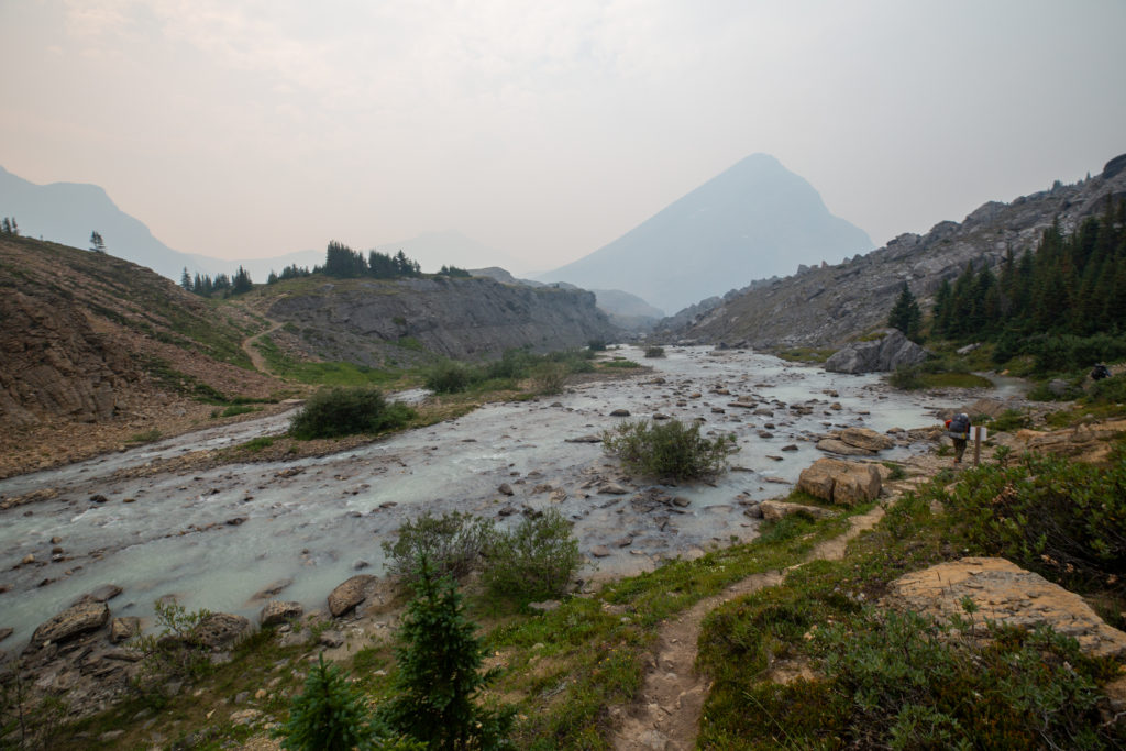
Staying creek-side made route-finding simple, but I do remember a few little scrambles that we had to do to get around little waterfalls. The going was much slower than before. We passed by several narrow sets of rapids before arriving at a little plateau that would take us to the base of Cataract Pass.

Sticking to the left side of a pleasant meandering creek
Great little set of waterfalls, trail is just picking your way up the left side.
Another flat section to catch your breath before one last set of rapids
Picking our way through the rocks with Jason leading
That’s it, it’s pretty flat to the bottom of the pass.
Cataract pass is the up over the low point, centre left.

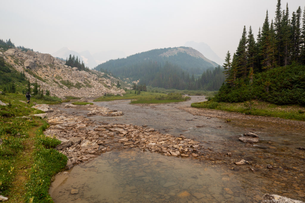
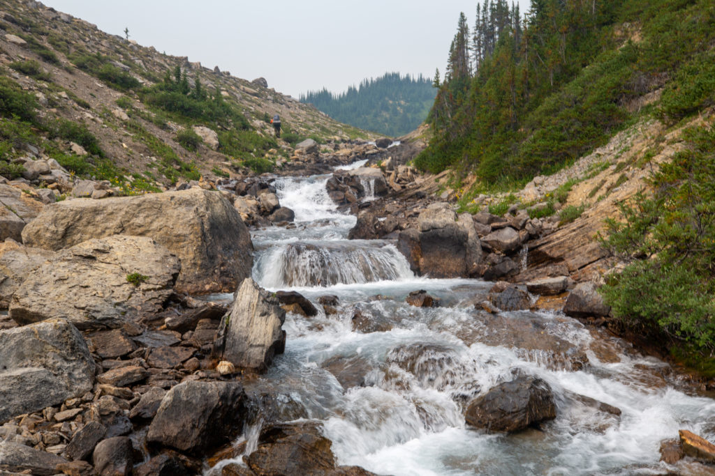
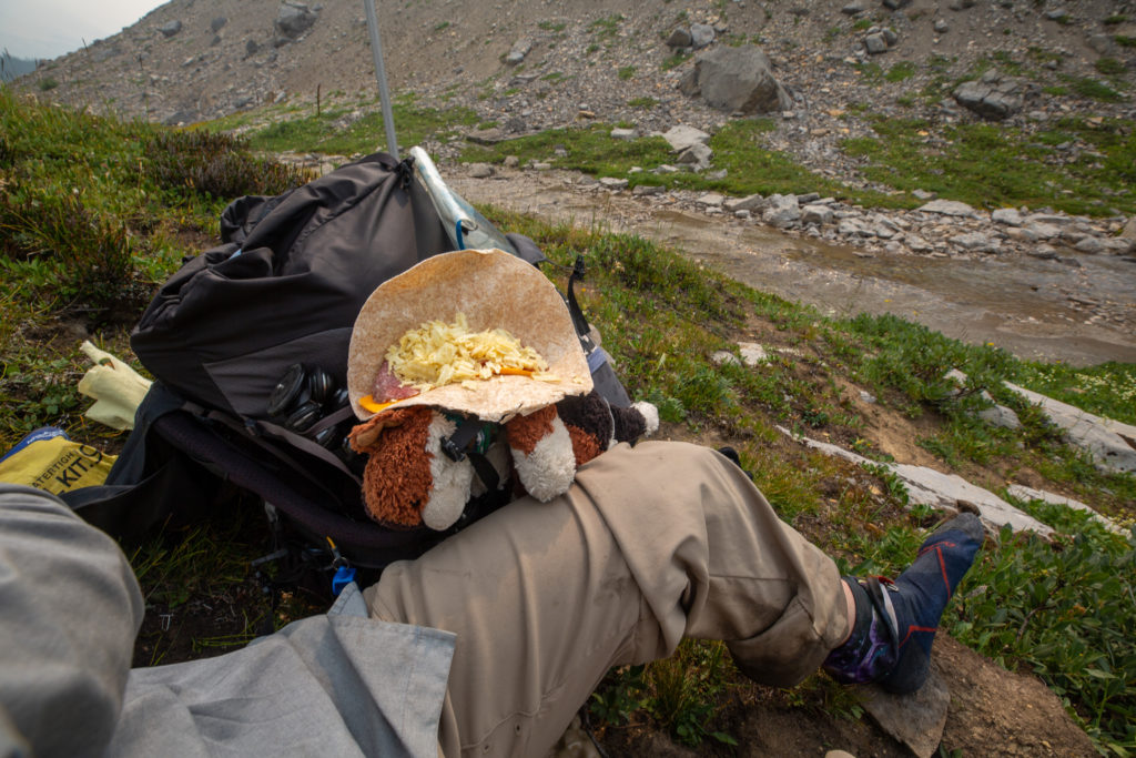
We stopped for lunch on a little bank above the tiny stream that was Cataract Creek at 12:45 pm, we had been hiking for 6 hrs 40 min and covered 19.6 km.

My wet feet
My poor wet shoes
Frosty being useful helping make lunch
Bent and Jason relaxing and taking in the smoky views

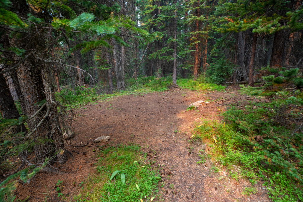
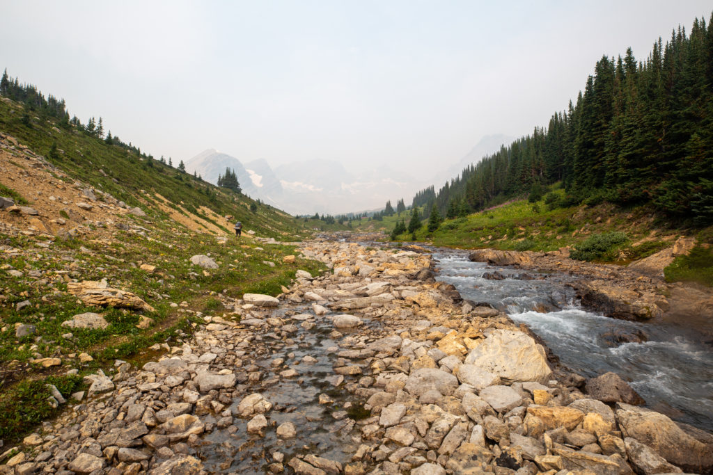
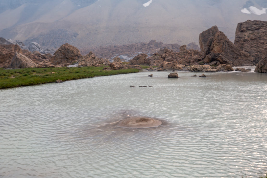
The little plateau area where we had lunch would be a great place to camp. Later I talked to some backpackers coming southbound over Cataract Pass who said that in good weather you would see 20 or more tents scattered around the area where we had lunch. Since Cataract Valley is an Alberta Wilderness Area you do not need a permit to camp, unlike in Jasper NP, which was just on the north side of Cataract Pass.

The headwaters of this branch of Cataract Creek
Bent and Jason heading off into the distance, I need to catch up.
Looking back down at Cataract Valley, Bent doing some video work

A drawback of letting someone else guide you along is that you can become unaware of the route ahead. For some unknown reason I thought where we had lunch was the top of Cataract Pass. All I had to do was check my Viewranger to see that the trail went up a few hundred metres more to the pass. It was a bit of shock to the system when we started working our way up the slope that would take us to Cataract Pass.

Jason already making his way up Cataract Pass

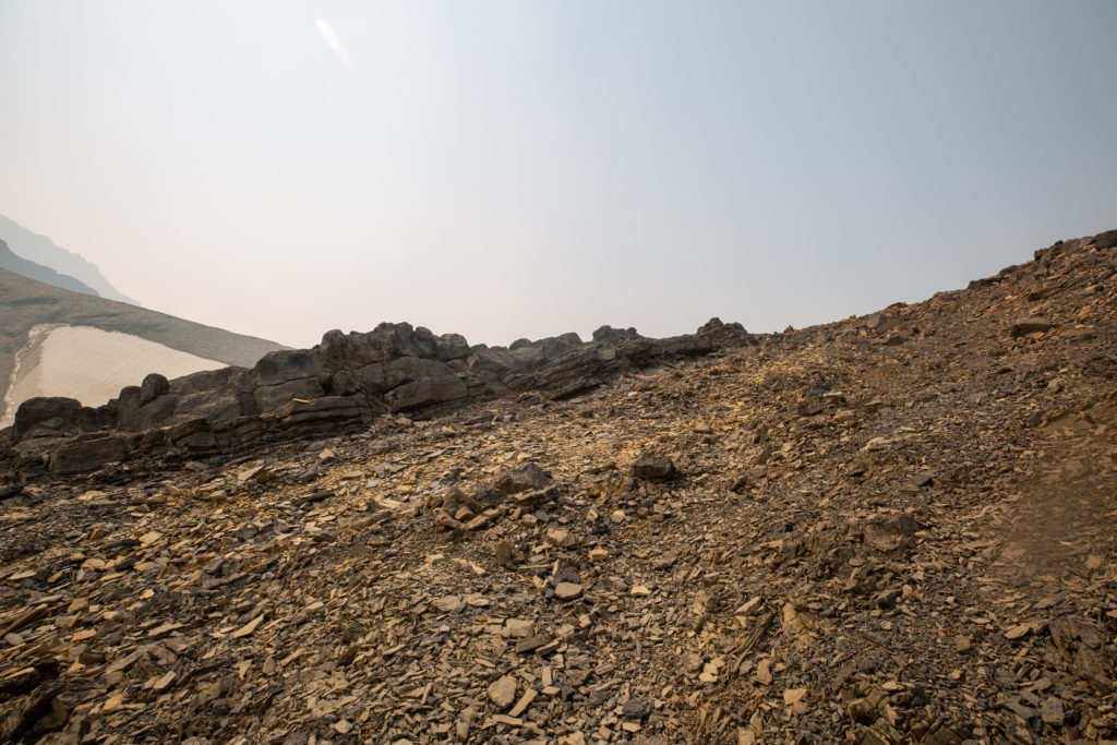
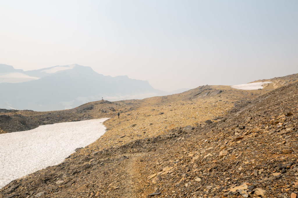
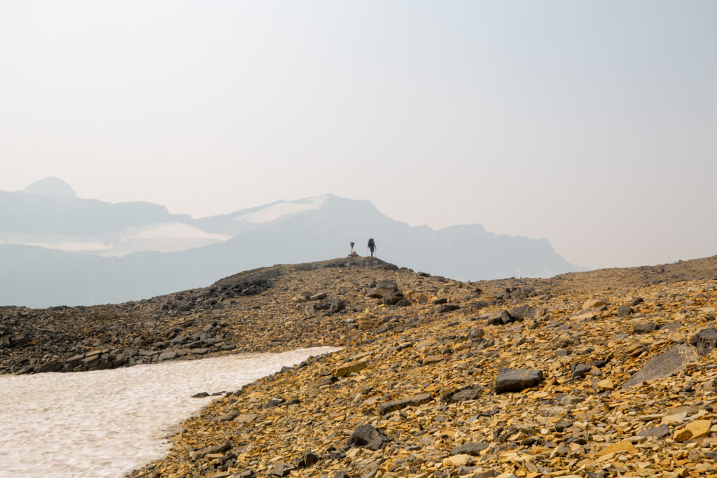
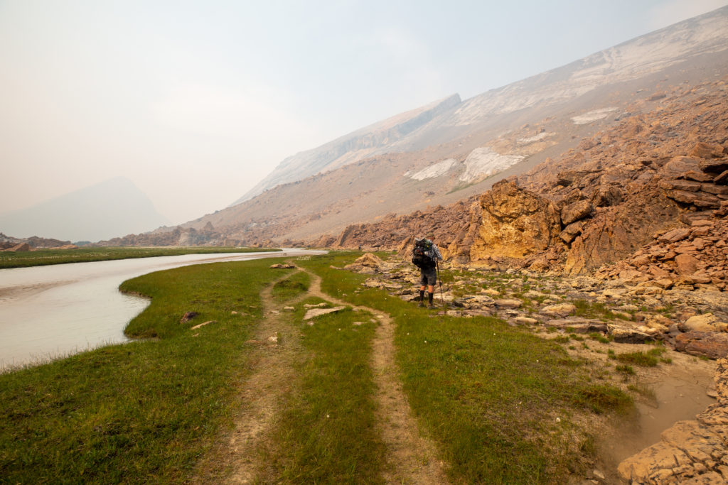
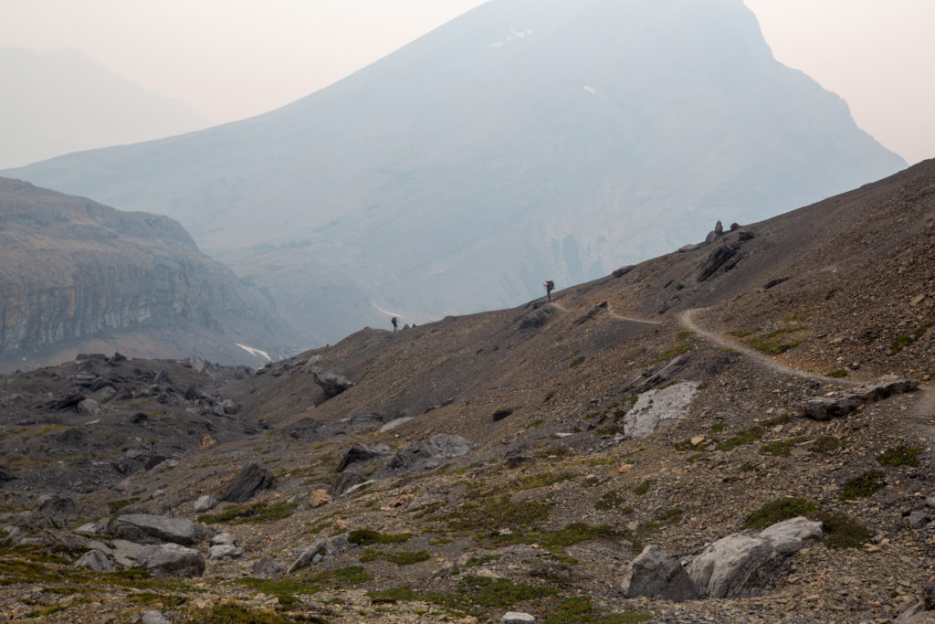
Cataract Pass is not the longest (2 km and 50 minutes), biggest (270 m) or highest (2500 m) pass that I had done on the GDT Sections C, E and part of D, but I found it to be the most challenging. The pass may have been more difficult than others, as it came 20 km into a tough day. Despite the difficulty I still feel the pass was a fun and exhilarating experience. In my view, one of the reasons Cataract Pass was so tough was that you could never see the top of the pass. The trail to the pass works its way clockwise around the mountain, never giving a view of the pass until you are just a few minutes away. Many times I thought I was approaching the top just to find another ridge line appear in the distance.

Looking down to the plateau: In good weather it would be dotted with tents.
Bent approaching a ridge that was not the top
Flowers give a nice splash of colour to climb.
More fun geology as two rock types meet
Quite the little cliff
Bent approaching the top
Bent arriving at a sign post on the boundary between Jasper NP and the Whitegoat Wilderness Area, it is not quite the high point.
Video summarizing my climb up Cataract Pass

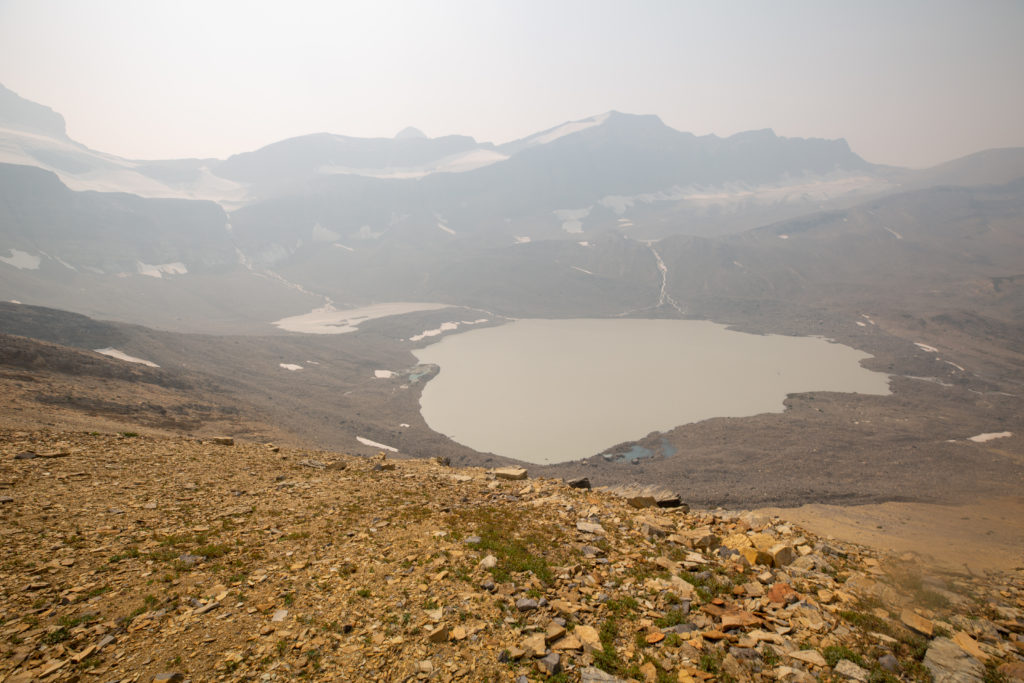
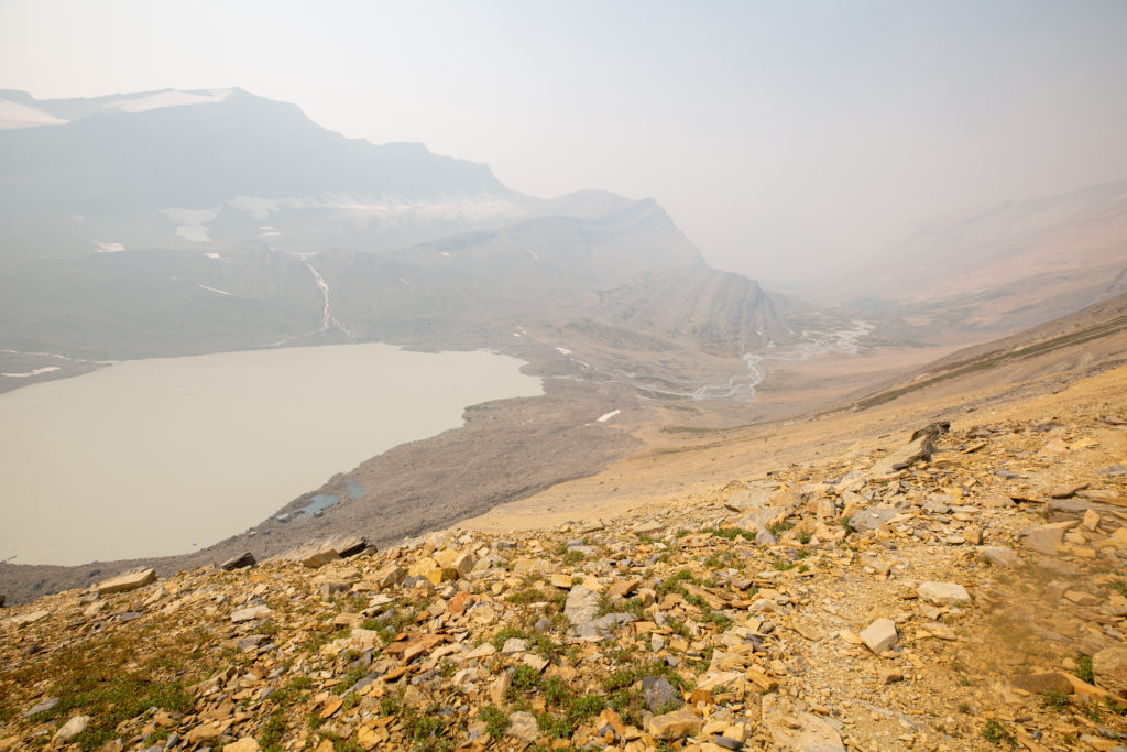
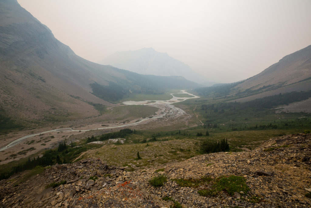
The way down off the pass was steep but easy on a well marked trail. I had hiked in the Brazeau back in 2017 but had come over Nigel Pass. It was very interesting to hike through the headwaters of the Brazeau to see where the river and the valley begin.

Bent with Jason in the distance working their way down the pass
The lake that feeds the Brazeau River
Can almost trace the trail down
Wave ripples frozen in time and rock: Evidence that the rocks, while now at about 2300 m above sea level, were formed below sea level
It is actually a good trail down.
Almost down but there is still another 8 km to go.
Some helpful hiker making sure we did not get lost

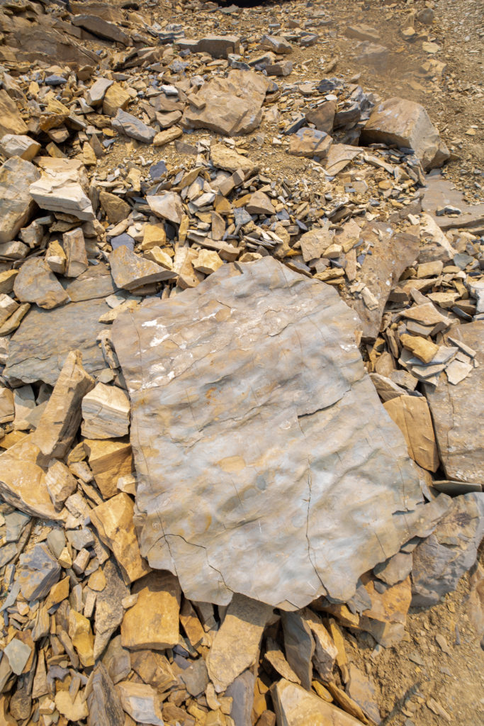
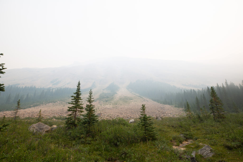
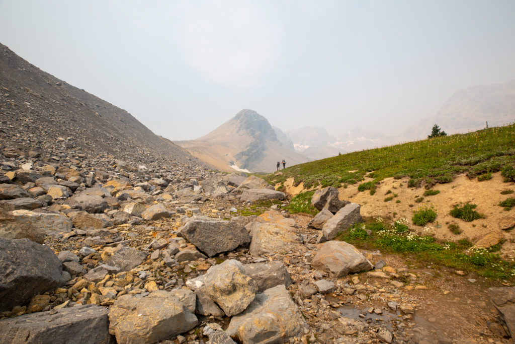
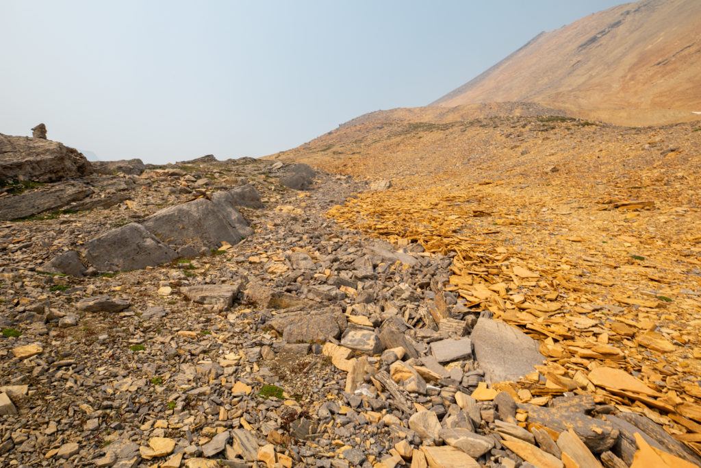
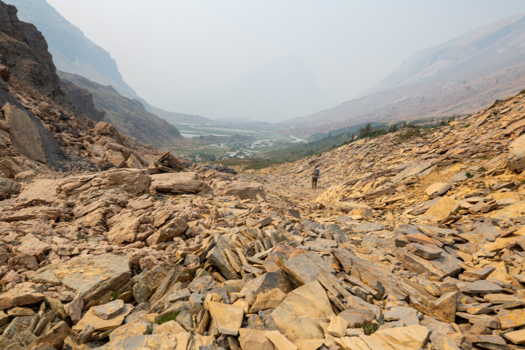
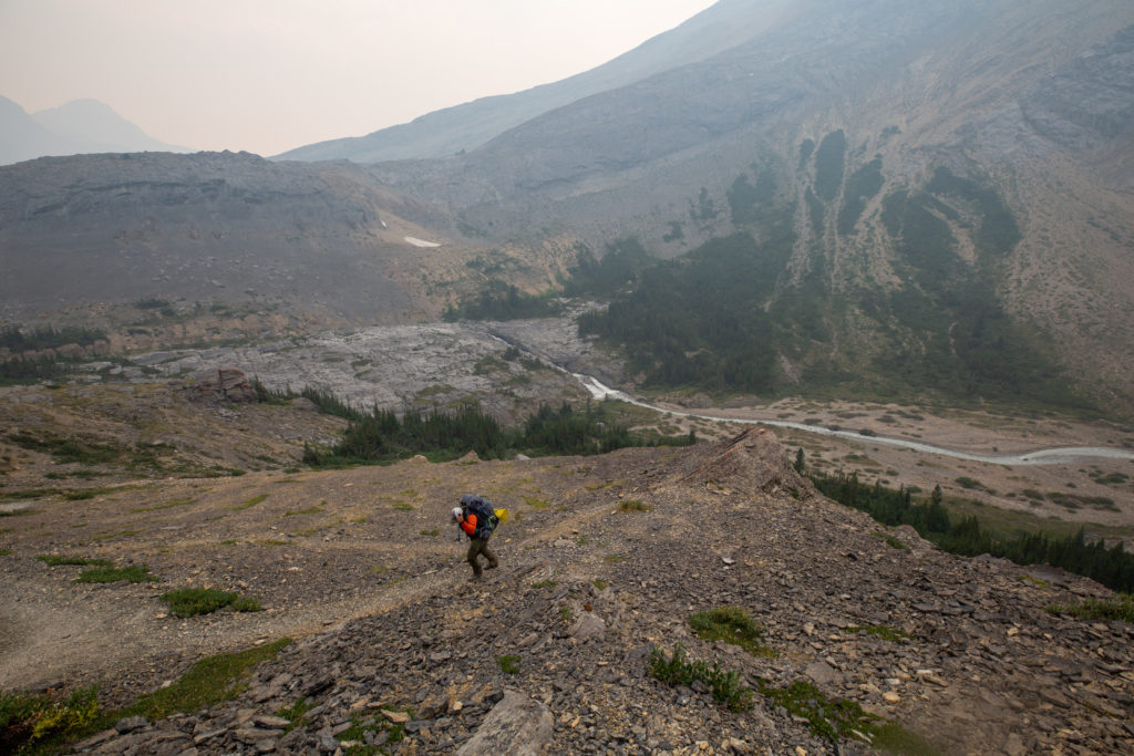
The trail to Nigel Pass is dominated by an ancient rock slide that deposited enough rock to fill the valley between Cataract and Nigel Pass. There is a reasonably clear route through the rocks. Bent and I spent a few minutes looking up at the ridge from where all the rock had slid. The hiking was fun, with little ups and downs through the rubble, if a little slow.

Jason making his way through the first little drop over some unstable rocks
Some compressed and deformed sandstone
A little reprieve before tackling the big slide
Nice trail alongside the stream
Bent looking up at the rock slide
A nice, if smoky, view of the section of rock that slid to fill the valley
Jason in amongst the debris
Close-up of Jason
Jason finishes this section. You can see where the rubble from the slide mixes in with the limestone that forms the base of the valley.
Family of ducks
Heading back into the rubble
The end of the rubble, Nigel Pass is not far.

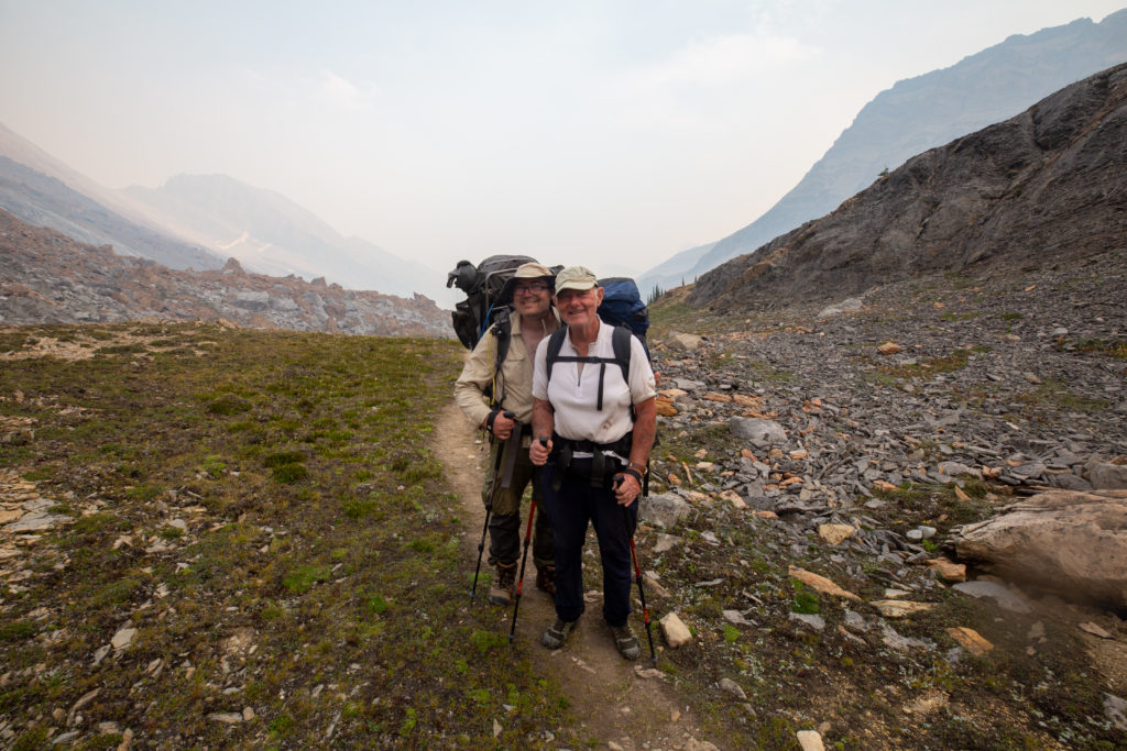
Just as we finished passing through the rubble, we came across a pair of northbound hikers. I stopped to talk for a bit as they were very interesting. It was a father/son duo and the father must have been in his 70s; they had hiked in from Owen Creek. They were finishing on this day, heading out over Nigel Pass. The father was from Parksville on Vancouver Island, just about 15 minutes from where my own father lives in Qualicum Beach. Small world.

Father and son duo

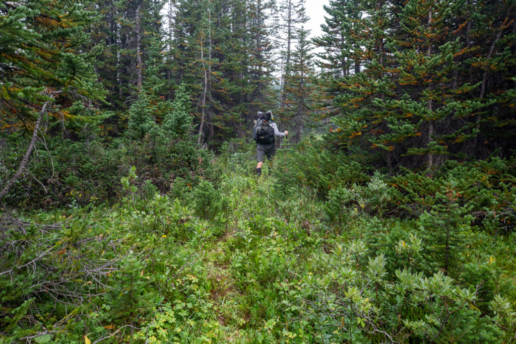
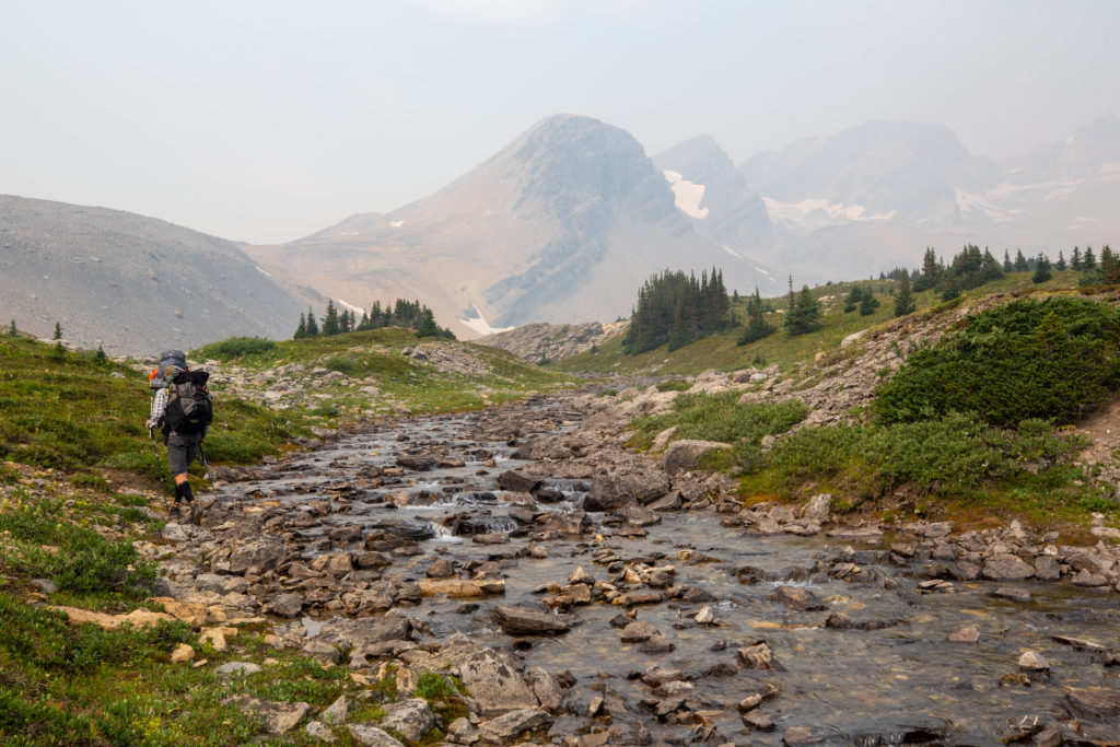
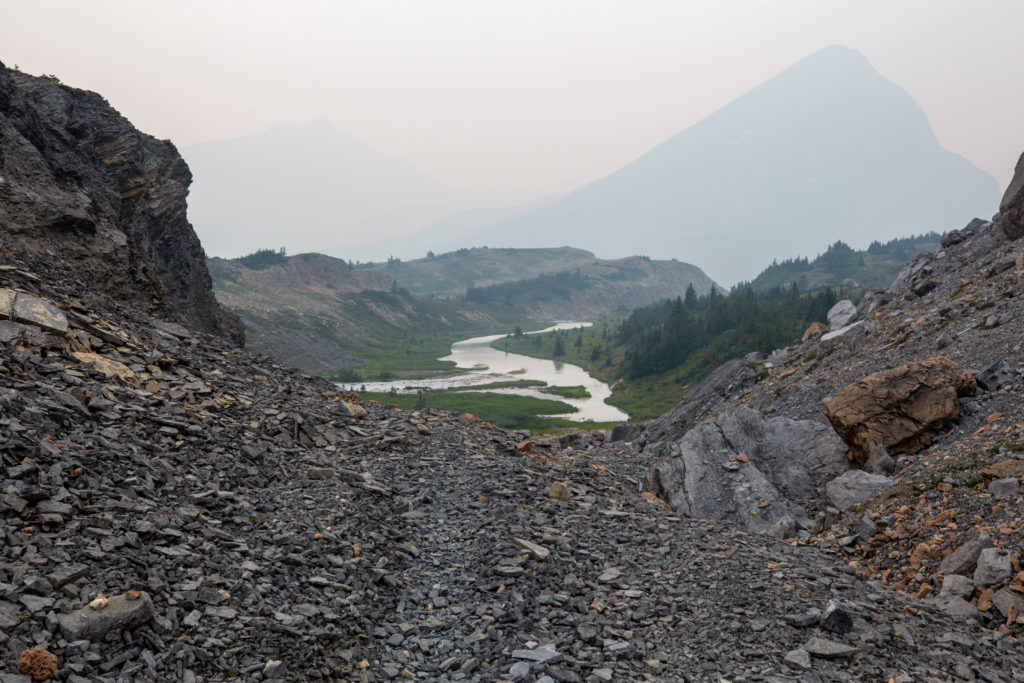
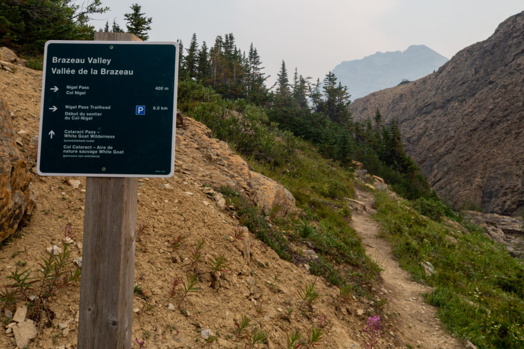
Shortly after leaving the father/son duo we arrived at Nigel Pass and back onto Parks Canada Trails. Nigel Pass marks the end of Segment 25 and the beginning of Segment 26 of the GDT. It was now only 3 km to our campsite at Boulder Creek CG. I was feeling very tired and having a great deal of difficulty in keeping up with Jason and Bent. I am quite sure that Jason slowed up to shepherd me to the end of the hike. It was appreciated. There was not a lot of talking going on during this section. With the smoke obscuring the views and it being the end of a long day, the goal was to finish and get to camp. I still did stop at an overlook to take some photos of the Brazeau Valley. Never too tired to take pictures!

The trail softens, switching from rock to dirt underfoot.
Hiking alongside a growing Brazeau River
Nigel Pass to the left
Parks Canada signage
Bent and Jason heading down to the valley. There is a 200 m drop from Nigel Pass to the campground.
A smoky Brazeau Valley. It was smoky when I was here in 2017.
We have to go down to the left and around this little outcrop to get the valley below.
Just 200 m to go

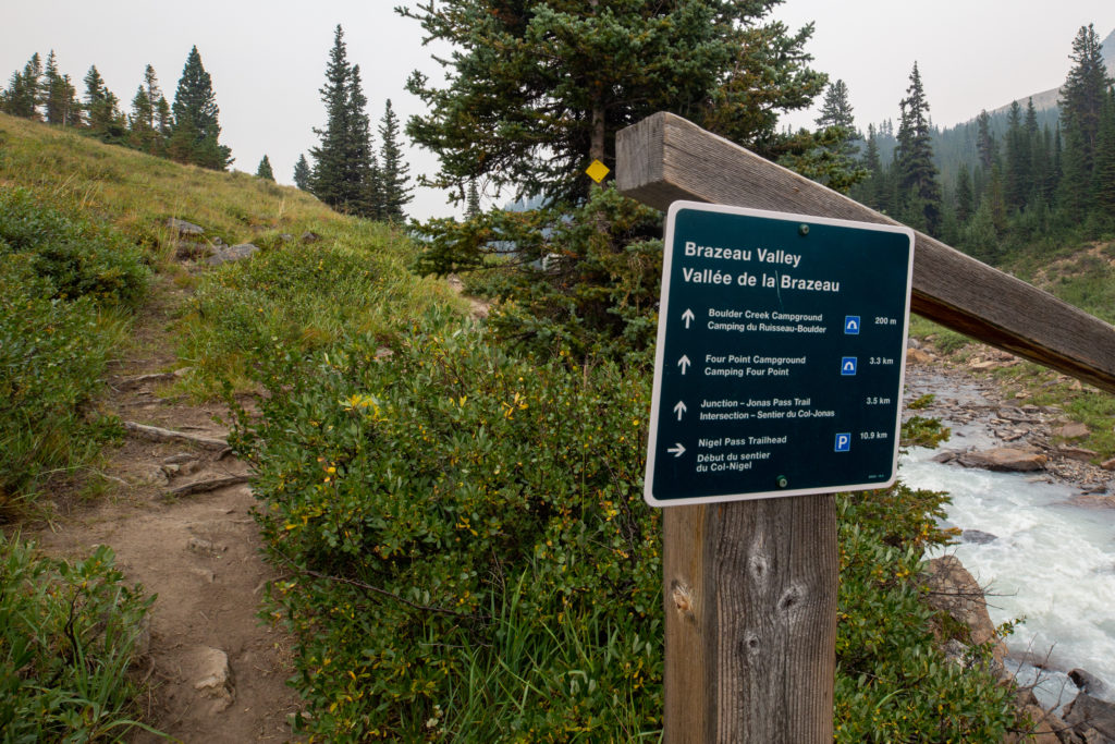
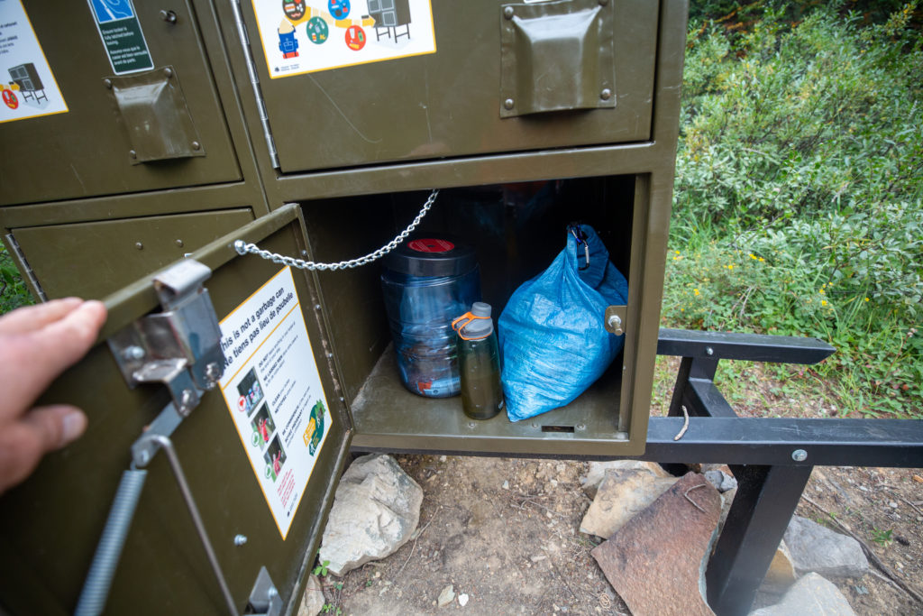
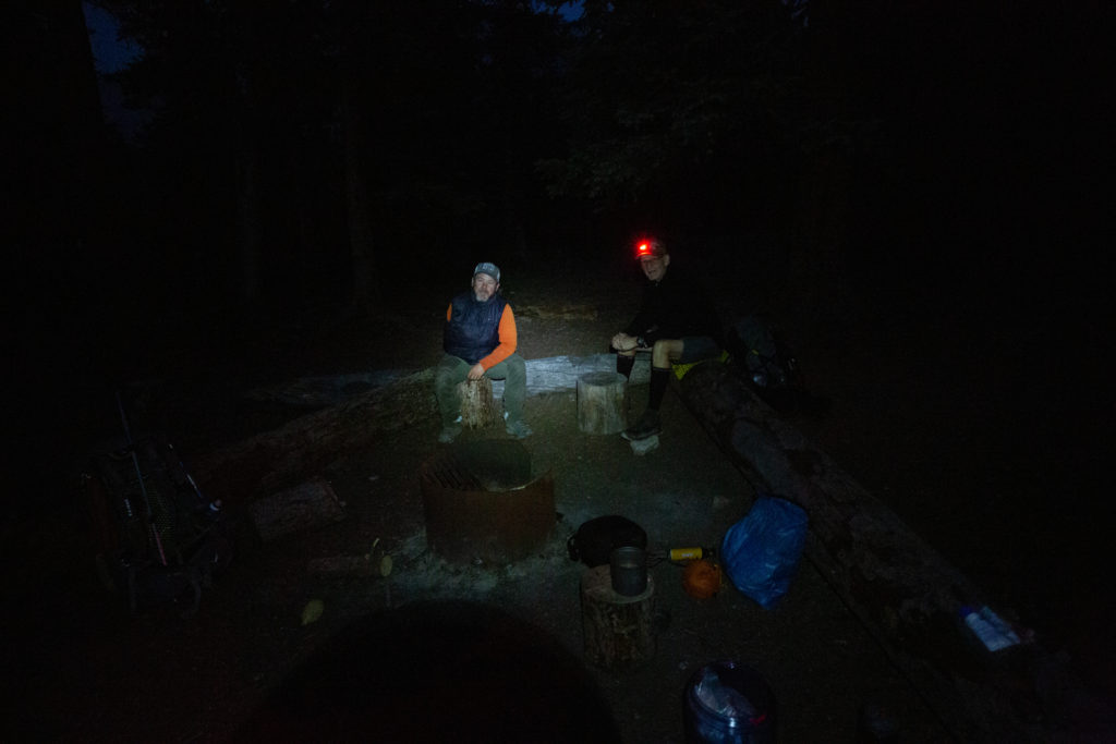
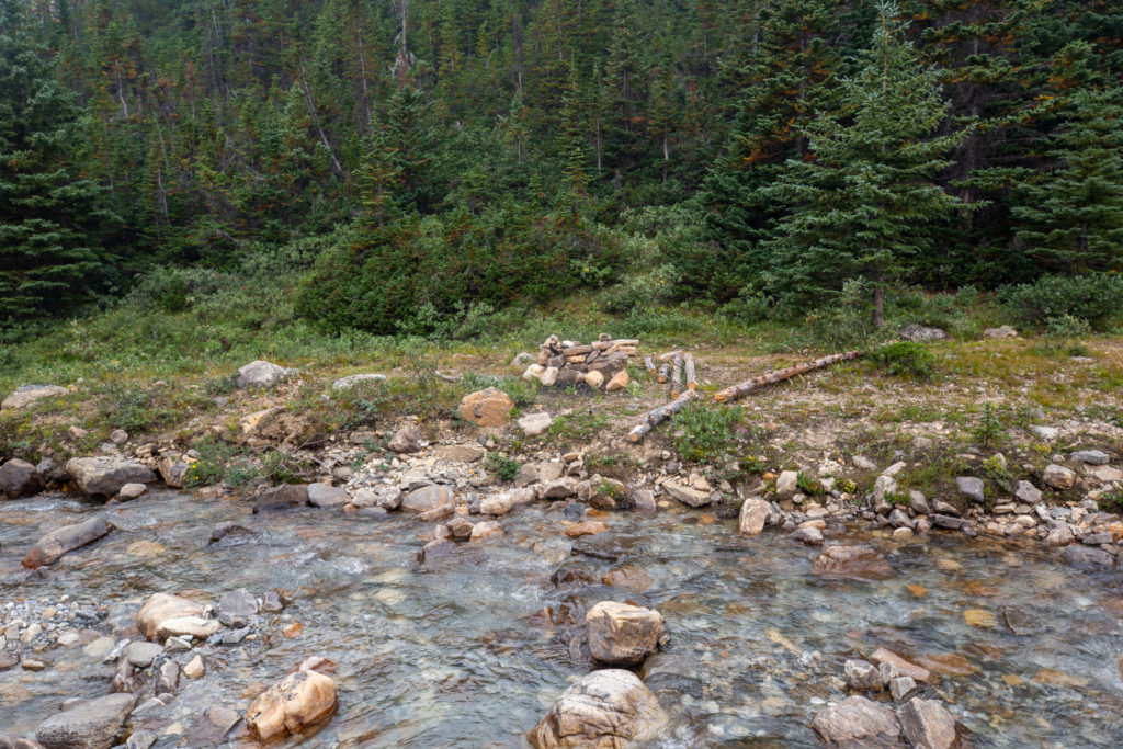
I arrived in camp at 4:55 pm. I was a bit worried about camping at Boulder Creek as I did not have a permit. I need not have worried, as no other campers would arrive. Boulder Creek CG is a functional if unexciting campground. It straddles the trail with campsites on one side and the dining area and food storage on the other. My campsite was a mere 10 feet from the trail. I took the time to have a bit of a wash in the river before dinner. It was a chilly little experience. I hung my shirt and pants to dry on some trees. Luckily both my pants and shirt dry quickly, because there was little in the way of sunshine or a breeze to aid the drying process.

Dinner time
Trusty Pocket Rocket

Dinner was very relaxed, with everyone in a good mood. We all headed to bed at about 8 pm. I only had 3.2 km to hike the next day to Four Points CG while Jason and Bent would be heading all the way to Waterfalls CG. We delayed our goodbyes until the morning since I felt it would be best to get up and see them off on their day, after spending a couple of great days on the trail with the two of them.

Parks Canada Bear Lockers: Done for the day

Day 5 GDT Section E 2021

GDT Section E 2021 (aborted Section D) Home

bootwreckers

Day 3 of our 2021 Labour Day Weekend trip through Day 3 of our 2021 Labour Day Weekend trip through the Egypt Lake area, Banff NP.

This day took us from the campground at Balls Pass Junction over Whistling Pass, with a detour up Pharaoh Peak, which wasn't without some drama.

Lunch was another side trip to Scarab Lake followed by an excursion to Egypt Lake.

Our final destination was Pharaoh Creek Campground. After a lovely evening the Milky Way came out to play.

Read the summary at www.Bootwreckers.com, link in bio.

Photo 1 - moody morning at Balls Pass Junction

Photo 2 - golden meadows as we approach Haiduk Lake

Photo 3 - making our way up Whistling Pass

Photo 4 - heading up Pharaoh Peak, and it really was this steep

Photo 5 - looking over Mummy and Scarab Lakes from the Pharaoh Peak.

Photo 6 - group shot on the way down

Photo 7 - at Egypt Lake

Photo 8 - Frosty Paws guarding the tent

Photo 9 - the Milky Way

Video - scree skiing down Pharaoh Peak

Another great day on the trail with @sio.mellors

#greatdivide #greatdividetrail #gdt #parkscanada #parks #bcparks #trails #longdistancehike #longtrail #outdoors #outside #thruhike #hike #thruhiking #outside #backpacking #waterfalls #waterfall #naturephotography #naturephotography #nationalparks #teamzpacks
Day 2 of our Labour Day weekend trip through the E Day 2 of our Labour Day weekend trip through the Egypt Lake area, Banff NP is up on Bootwreckers, see link in bio.

The day was sunny and the skies were blue, it was simply an amazing day to be on the trail.

Out day started out retracing our steps from th previous evening back to Shadow Lake.

After lingering to take in the stunning view at the lake we had an easy hike to our campsite at Balls Pass Junction.

After setting up the tent and having lunch we headed up the short but steep trail to Ball Pass. Ball Pass is in mu opinion one of th premier viewpoints in Banff NP. 

After exploring Ball Pass we returned back to the campground and enjoyed a well earned stream chilled beer and a nap.

Clouds rolled in later in the day but it only lightly rained.

Was not the biggest mileage day on the trail but was proof that a great day on the trail.
Photo 1 - Siobhan looking at Mt Ball and it's Glacier from Ball Pass
Photo 2 - Siobhan checking directions
Photo 3 - Shadow Lake and Mt Ball
Photo 4 - Siobhan on bridge crossing outlet of Shadow Lake
Photo 5 - dried  strawberries on the trail
Photo 6 - heading up Ball Pass
Photo 7 - Siobhan looking over the valley from Ball Pass
Photo 8 - heading down from Ball Pass
Photo 9 - our reward for a good day on the trail
Photo 10 - finding peace and tranquility in the backcountry 

#greatdivide #greatdividetrail #gdt #parkscanada #parks #bcparks #trails #longdistancehike #longtrail #outdoors #outside #thruhike #hike #thruhiking #outside #backpacking #waterfalls #waterfall #naturephotography #naturephotography #nationalparks
Day 1 of our amazing trip through the Egypt Lake a Day 1 of our amazing trip through the Egypt Lake area Labour Day Weekend, 2021 now posted up on our blog, link in bio. Another Grand adventure with one of my kids, @sio.mellors.

Our four day trip started at the Vista Lake Trailhead on Hwy 93 South. Up and over Gibbon Pass to camp at Shadow Lake Campground on day 1.

Day 2 was a short hike to Balls Pass Junction CG, then after a short break off to explore Ball Pass, in my opinion one of the best vistas anywhere.

Day 3 we hiked over Whistling Pass on the way to Pharaoh Creek CG, with a scramble up Pharaoh Peak, lunch at Scarab Lake, and a visit to Egypt Lake on the way.

Day 4 was hiking over Healy Pass and out to the Sunshine Village parking lot where our car had been moved to.

Lots of stories from this adventure,  was a lot of fun to revisit and write.

Photo 1 - evening as Shadow Lake

Photo 2 - pre-hike happy team photo

Photo 3 - Arnica Lake, where we had lunch

Photo 4 - the yellow of Larches starting to come in

Photo 5 - the golden meadows of th high alpine at Gibbon Pass

Photo 6 - view all the way to Mt Assiniboine from Gibbon Pass, about 70 km away

Photo 8 - mushrooms in the undergrowth as we approach Shadow Lake CG

Photo 9 - Frosty guarding our campsite

Photo 10 - still smiling at the end of th day at Shadow Lake

#parkscanada #parks
#shadowlake #banffalberta #banffnationalpark #banffcanada #banff #backpacking #camping #lake #egyptlake #Egyptlake  #backcountry #family #familytime #familytime❤️
The trip summaries for Days 10, 11 and 12 from ou The trip summaries  for Days 10, 11 and 12 from our 2021 GDT Section E hike is now up on www.Bootwreckers.com, see link in bio

We had a great end to the trip. Day 9 was a short day from our wild camp on the Bald Hills to Evelyn Crk Campground. Day 10 was a spectacular hike up over Little and Big Shovel Passes to the iconic Jasper Skyline Trail. Camping at Signal Campground. 

Day 11 was an easy walk into Jasper.

The trip was an amazing experience over 11 days, I met and hiked with many people but big props to my kid, who for some reason keeps hiking with me.

Photo 1 - end of hike, looking off into the distance, across th Athabasca River at Cairngorm Mt. 

Photo 2 - morning Bald Hills

Photo 3 - campsite Evelyn Crk CG

Photo 4 - Reading before bed

Photo 5 - fresh bear print on the trail

Photo 6 - Little Shovel Pass

Photo 7 - Snowbowl

Photo 8 - Last grind up to the Notch

Photo 9 - looking east from the Skyline down through Excelsior Creek

Photo 10 At campsite Signal Campground 

See trip reports on our blog, link in bio.

#greatdivide #greatdividetrail #gdt #parkscanada #parks #bcparks #trails #longdistancehike #longtrail #outdoors #outside #thruhike #hike #thruhiking #outside #backpacking #waterfalls #waterfall #naturephotography #naturephotography #nationalparks #teamzpacks #zpacks #duplex #sectionhike #sectionhiker
Day 7 and 8 on our GDT trip from last summer. Day Day 7 and 8 on our GDT trip from last summer.

Day 7 was from Waterfalls CG to a meadow in the Six Passes Route. Was a wet, moist day. Numerous creek crossings. Left the main GDT route at Maligne Pass and went off trail into the Six Passes. 

Spent the first night in an amazing meadow. With rain in the forecast we did 5 passes and the ridge walk in one day.

In one word the day was "Epic" . Was a spectacular journey. Huge day, 23 km and over 1500m up and down. So happy we did it, but we were so relieved to put in the tent somewhere flat.

Picture 1) the view of the Six Passes Route from the top of the first pass

Picture 2) me getting ready to leave Waterfalls CG

Picture 3) crossing a creek on a wet log

Picture 4) camping Six Passes

Picture 5) hiking Six Passes

Picture 6) sunrise pass # 2

Picture 7) it's a rocky climb

Picture 8) mmmm chocolate 

Picture 9) the final ascent on the ridge

Picture 10) happy to be home for the evening

See trip reports on our blog, link in bio.

#greatdivide #greatdividetrail #gdt #parkscanada #parks #bcparks #trails #longdistancehike #longtrail #outdoors #outside #thruhike #hike #thruhiking #outside #backpacking #waterfalls #waterfall #naturephotography #naturephotography #nationalparks #teamzpacks #zpacks #duplex #sectionhike #sectionhiker
First 5 days of my 11 day 2021 Great Divide Trail First 5 days of my 11 day 2021 Great Divide Trail Hike Section E is up on Bootwreckers, see link in bio.

Includes the 2 days I did on Section D but aborted due to smoke.

Picture 1) Camp on Owen Creek
Picture 2) Camp at Lower Michelle Lake
Picture 3) Pinto Pass
Picture 4) hiking up Cataract Creek
Picture 5) Smokey sunrise over the Brazeau River

#greatdivide #greatdividetrail #gdt #parkscanada #parks #bcparks #trails #longdistancehike #longtrail #outdoors #outside #thruhike #hike #thruhiking #outside #backpacking #waterfalls #waterfall #naturephotography #naturephotography #nationalparks #teamzpacks #zpacks #duplex #sectionhike #sectionhiker
Fun trip out to the Ink Pots in Banff NP on Decemb Fun trip out to the Ink Pots in Banff NP on December 31st.

Was very cold, -30C, but bluebird skies overhead.

Did a little snowshoeing in the meadow.

Saw almost no one above the upper falls at Johnson Canyon.

Fun adventure.

Happy New Year everyone.

#outside, #outsidethebox, #liveoutdoors, #liveoutsidethebox #naturephotography, #naturelovers,  #retiredhusky, #rescuer
#parkscanada #banffnationalpark #banffalberta #banffcanada
#sunstar #sun #lake #sunrise #alpin #scenery #reflectionphotography #reflections #sceneryphotography
Day 6 Section E Great Divide Trail Hike 2021 (Part Day 6 Section E Great Divide Trail Hike 2021 (Part 1)

Fun day on the trail heading from Four Points CG to Waterfalls CG. 

The day started dry but damp from the rainfall overnight. As we left the Brazeau River valley and headed up to Jonas Pass the storm clouds blew in forcing us to get our wet weather gear on. 

I discovered shortly after that it is great to have gloves for hiking, but that they should be accessible, not buried somewhere in the pack.

The storm was quite fierce but luckily brief. We arrived at Jonas pass and were able to put our rain gear away.

The clouds would remain with for the duration of the hike adding some mood to the hike.

This was my second time hiking over Jonas Pass and Jonas Shoulder and both times it has rained.

We arrived at Jonas Shoulder. We took some time to enjoy the view and let off some steam. The rest of the hike would be downhill.

Happy Friday

#greatdivide #greatdividetrail #gdt #parkscanada #parks #bcparks #trails #longdistancehike #longtrail #outdoors #outside #thruhike #hike #thruhiking #outside #backpacking #waterfalls #waterfall #naturephotography #naturephotography #nationalparks
Waterfall on Owen Creek, Day 1 GDT Section E. Req Waterfall on Owen Creek, Day 1 GDT Section E.

Required a fun bit of scrambling to access.

Happy Friday

#greatdivide #greatdividetrail #gdt #parkscanada #parks #bcparks #trails #longdistancehike #longtrail #outdoors #outside #thruhike #hike #thruhiking #outside #backpacking #waterfalls #waterfall #naturephotography #naturephotography #nationalparks
Day 5 GDT 2021 Section E. This day was memorable Day 5 GDT 2021 Section E.

This day was memorable for a few reasons. First waking up to more smoke.

First photo is the sun rising over the mountains at 8:30am, shouldn't really be that red.

Doing the extra distance on day 4 meant that this day I had a 3.1 km hike from Boulder Crk CG to Four Points CG.

I could not extend the day as Emily was joining me on this day coming in from the Nigel Pass trailhead and the next campground on our route would be to far to reach on this day.

When I arrived at Four Points it was just before 8am! Must be my shortest day ever.

I spent the day reading and waiting for Emily. I heard her bear calling down the trail about a minute before she arrived.

We spent the rest of the day relaxing. Met some some people from Calgary who I had a mutual friend with, he used to be their cross country ski coach.

We went to bed reasonably early as we had a decent day ahead of us tomorrow.

The smoke was lifting as we went to bed. 

The last photo is Links' Happy Badass Bandana. Still miss my little hiking partner.

#greatdivide #greatdividetrail #gdt #parkscanada #parks #bcparks #trails #longdistancehike #longtrail #outdoors #outside #thruhike #hike #thruhiking #outside #backpacking
Day 4 Great Divide Trail Section E. Pinto Lakes to Day 4 Great Divide Trail Section E. Pinto Lakes to Boulder Creek CG.

Super fun day full of adventure and a lot of smoke. This was a big day, 32 km over Cataract Pass into the upper reaches of Bourgeau Creek in Jasper NP.

After the clear skies of my astrophotography in the middle of the night I got up at 5am, jst 3 hours after I put the camera away, to join my trail companions Jason and Bent for the day. 

The terrain was suppose to be rugged and the trail a little iffy so I thought it would be good to have some companions. As it was we got took two wrong turns in the first 15 minutes.

After several steam crossings, some with suspect bridge work, finally had to cross a wide stream and get wet feet. I had sandals, but my companions ploughed through so I figured I had to keep up.

I found a rock with ancient Indigenous petroglyphs. It is just off trail, but a good day and a half hike from any road.

We passed from Banff NP to Alberta Parks Wilderness area. There is wild camping in the Wilderness area, but good camping spots are hard to find.

I was going to stop for the day short of Cataract Pass, but it was so smokey I thought I would continue on.

We had lunch at the base of Cataract Pass. I used Frosty Paws as a table for my lunch.

It was such a big day I will conclude the trip in another post.

#greatdivide #greatdividetrail #gdt #parkscanada #parks #bcparks #trails #longdistancehike #longtrail #outdoors #outside #thruhike #hike #thruhiking #outside #backpacking
Milky Way and the Persaids Meteor Shower. Pinto La Milky Way and the Persaids Meteor Shower. Pinto Lake

On the night of day 3 I got up at 2am to take photos of the night sky. I was hoping to catch the Milky Way and I knew that the Perseids was going on, so hoping to see both.

I must have seen a good couple of dozen meteors during the hour I was awake.

I went to sleep in my hiking clothes because I knew I was getting up at 2am to take photos then we had a big day ahead of us so the breakfast wake up call was 5am!

I got so lucky with the pictures as in the couple's hours between returning to bed and getting up to start Day 4, the smoke rolled in.

Photo 1 is the Milky Way but no meteor. There are meteors in the following three photos.

#greatdivide #greatdividetrail #gdt #parkscanada #parks #bcparks #trails #longdistancehike #longtrail #outdoors #outside #thruhike #hike #thruhiking #outside #backpacking #milkyway, #perseidmeteorshower #perseids #nightimephotography #astrophotography
Great Divide Trail Section E, Valley after first p Great Divide Trail Section E, Valley after first pass on the Six Passes route.

New post on www.Bootwreckers.com, preparation and plan for my GDT Section D and E hike for the summer of 2021 (see link in bio)

Learned a lot from last year,  still discovered some new things about hiking and camping.

First post has to do with all aspects of preparation:
- Gear
- Food
- Training
- Itinerary 

The GDT - Where everyday is an adventure.

#greatdivide #greatdividetrail #gdt #parkscanada #parks #bcparks #trails #longdistancehike #longtrail #outdoors #outside #thruhike #hike #thruhiking #outside #backpacking
Day 3 of my trip on Great Divide Trail Section E. Day 3 of my trip on Great Divide Trail Section E.

Relatively easy day from Michelle Lakes to Pinto Lake, only over two passes.

I started traveling with two guys I met actually at Yoho a week back, Jason and Bent.

Of course Frosty was on trip, enjoying the early morning at Michelle Lakes.

The first Lake is Upper Michelle Lake.

The photo of me at the pass is at the unofficial names Michelle Pass. Then it was up to Pinto Pass.

I took a one last picture back to Michelle Pass. Last picture is at Pinto Lake.

Great day, only got a little lost.

#greatdivide #greatdividetrail #gdt #parkscanada #parks #bcparks #trails #longdistancehike #longtrail #outdoors #outside #thruhike #hike #thruhiking #outside #backpacking #zpacks #teamzpacks
Jupiter and 4 little moons First try at astrophot Jupiter and 4 little moons

First try at astrophotography using my camera attached to a telescope, 8" Celeron

Pretty happy with results. Need to research settings for camera to get some colour on Jupiter, but for a first try pretty happy.

Taken from field near Two Jack Lake in Banff NP. Jupiter was over Mt Rundle.

#artofvisual #visualoflife #areyouawake  #earthfocus  #adventurethatislife #createscenery #earthexperience #primeshots #simplyadventure #goparks #wildernessculture #folkscenery #wondersofourplanet #amazingphotohunter #all2epic #milliondollarvisuals #sky_sultans #astrophotography #astronomy
Another photo of the waterfall at Michelle Lakes, Another photo of the waterfall at Michelle Lakes, Day 2 GDT Section E.

#greatdivide #greatdividetrail #gdt #parkscanada #parks #bcparks #trails #longdistancehike #longtrail #outdoors #outside #thruhike #hike #thruhiking #outside #backpacking #sunstar
#waterfall
#waterfalls
Campsite at Lower Michelle Lakes, Day 2 GDT Sectio Campsite at Lower Michelle Lakes, Day 2 GDT Section E.

Scored the best campsite on the trip at Lower Michelle Lakes. Had more own personal waterfall. Frosty as always had the best spot.

Spent the day relaxing, reading and watching the helicopter activity. 

Started the next day hiking with Jason and Bent who camped by Upper Michelle Lakes and did not know about the waterfall.

#greatdivide #greatdividetrail #gdt #parkscanada #parks #bcparks #trails #longdistancehike #longtrail #outdoors #outside #thruhike #hike #thruhiking #outside #backpacking #zpacks #teamzpacks
Morning at Ball Pass Junction, west end of Haiduk Morning at Ball Pass Junction, west end of Haiduk Peak.  Day 3 of our hike around the Egypt Lake area. Thrilled with the colours of the morning sky.

We had some rain overnight, but not much. The clouds lifted off later in the morning. 

Another great day on the trail with @sio.mellors

#parkscanada #parks #bcparks #trails #longdistancehike #longtrail #outdoors #outside #thruhike #hike #sunset #shadowlake #Egyptlake #banffalberta #banffnationalpark #banffcanada
Evening at Shadow Lake, Banff NP. Super fun 4 day Evening at Shadow Lake, Banff NP.

Super fun 4 day hike with @sio.mellors thought the trails around Egypt Lake area.

Shadow Lake was our first evening and was a lovely place to watch the sunset.

 #parkscanada #parks #bcparks #trails #longdistancehike #longtrail #outdoors #outside #thruhike #hike #sunset #shadowlake #Egyptlake #banffalberta #banffnationalpark #banffcanada #reflection #reflections
Day 1 Great Divide Trail Section E 2021, Saskatche Day 1 Great Divide Trail Section E 2021, Saskatchewan River Crossing to Upper Owens Creek.

First day of my 11 day hike from Sask River Crossing to Jasper. I was solo for the first 5 days before being joined my my daughter at Four Points CG.

This was only day I actuall slept on my own.

I left Sask River Crossing at 12:30pm followed an old road that intersected th GDT just past the park gates.

Hiked until about 6:30pm as I wanted to camp near tree line for a clear view of th nights sky. The sky was clear and the Perseids Meteor shower was on and did not disappoint 

Photo 1) my tent and the Milky Way

Photo 2) Me getting ready to  head out

Photo 3) view looking West along th north Saskatchewan River

Photo 4) water dropping into the canyon on Owens Creek

Photo 5) the slide that gave people grief earlier in the summer was passable at creek level

Photo 6) the confluence was a mess a hard going

Photo 7) nice waterfall after th confluence

Photo 8) little Canyon near upper reaches of th creek

Photo 9) dinner cooking in th kitchen

Photo 10) Frosty Paws, me and my tent

Was a great day out on th trail.

#greatdivide #greatdividetrail #gdt #parkscanada #parks #bcparks #trails #longdistancehike #longtrail #outdoors #outside #thruhike #hike #thruhiking #outside #backpacking
Load More Follow on Instagram

For more photos of these and other Bootwreckers Adventures

© 2022 Boot Wreckers | Powered by Minimalist Blog WordPress Theme